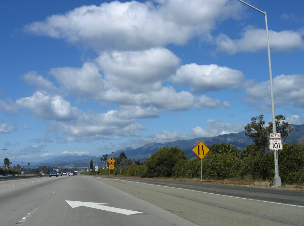
Continuing within sight of the Pacific Ocean, U.S. 101 hugs the coast as it leaves Ventura County and enters Santa Barbara County. The segment of freeway passing through downtown Santa Barbara was constructed in the late 1980s, and there are several instances where the freeway reverts to expressway status in the county. At Gaviota, U.S. 101 leaves the coast, turning due north toward Santa Maria and San Luis Obispo, two major Central California cities. Passing alongside the coast and mountains, traversing old bridges and passing through a tunnel, this segment of U.S. 101 is truly a crown jewel in California's freeway system.
| U.S. 101 (El Camino Real) and California 1 north |
|
|
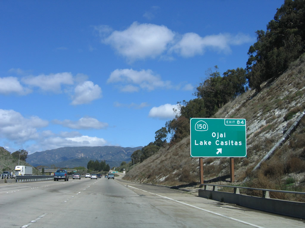
After the Bates Road interchange, northbound U.S. 101 and California 1 approach Exit 84, California 150/Rincon Road east to Casitas Pass and Ojai. When the exit sign was replaced, the entire landscaped hedge in the median was removed. Photos taken 09/29/07 and 03/18/06. |
|
The next four exits all serve the city of Carpinteria. Photo taken 09/29/07. |
|
Northbound U.S. 101 and California 1 reach Exit 84, California 150 east to Ojai. Use California 150 east to California 192 west. California 192 serves as an alternate route following local roads between California 150 and California 154 in Carpinteria and Santa Barbara. Photo taken 09/29/07. |
|
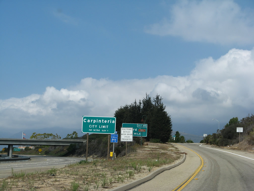
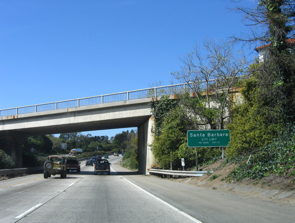
U.S. 101 and California 1 enter the city of Carpinteria (view of city limits sign taken from off-ramp). The city of Carpinteria is the last city along U.S. 101 in Santa Barbara County. The population is 14,194 as of the 2000 Census. Annually, the city hosts an Avocado Festival. Photo taken 09/29/07. |
|
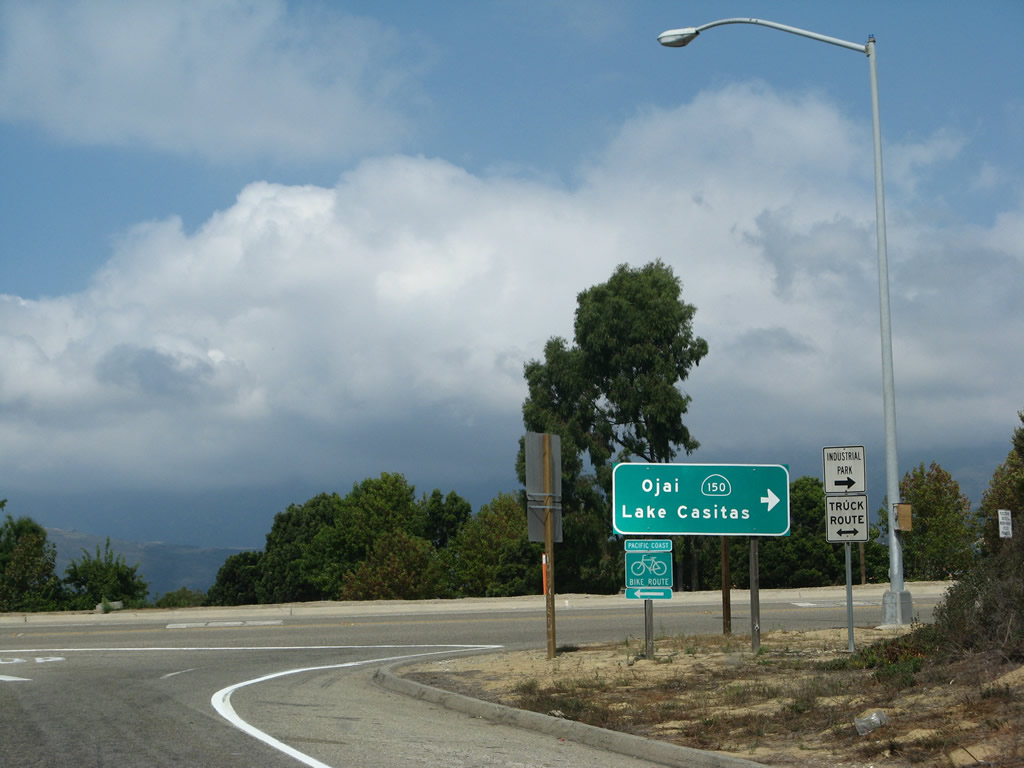
Now on the off-ramp, turn right to follow California 150 east to California 192, Casitas Pass, Lake Casitas, and Ojai. Turn left to follow Old U.S. 101 north (west) through Carpinteria along Carpinteria Avenue. Photo taken 09/29/07. |
|
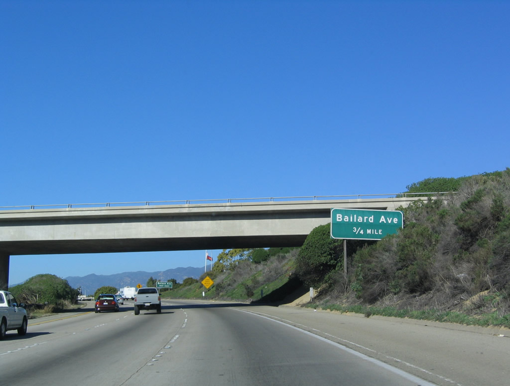
Passing under the Carpinteria Avenue and California 150 overpass, the next exit along U.S. 101 and California 1 north is Exit 85, Bailard Avenue. This sign has been replaced with an exit number sign. Photo taken 12/23/04. |
|
Bailard Avenue serves the city of Carpinteria. Photo taken 12/23/04. |
|
A U.S. 101 reassurance shield is posted after the on-ramp from California 150 and Carpinteria Avenue. There is no acknowledgement of California 1, which is the standard for signage of the shared alignment until the two routes divide near Gaviota. Photo taken 03/18/06. |
|
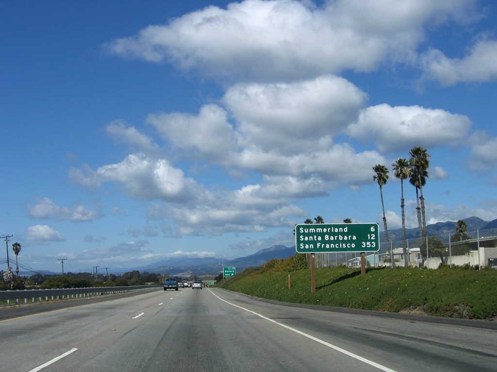
This mileage sign provides the distance to Summerland (six miles), Santa Barbara (12 miles), and the control city of San Francisco (353 miles). Photo taken 03/18/06. |
|
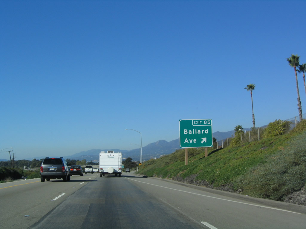
Northbound U.S. 101 and California 1 reach Exit 85, Bailard Avenue. Photo taken 12/23/04. |
|
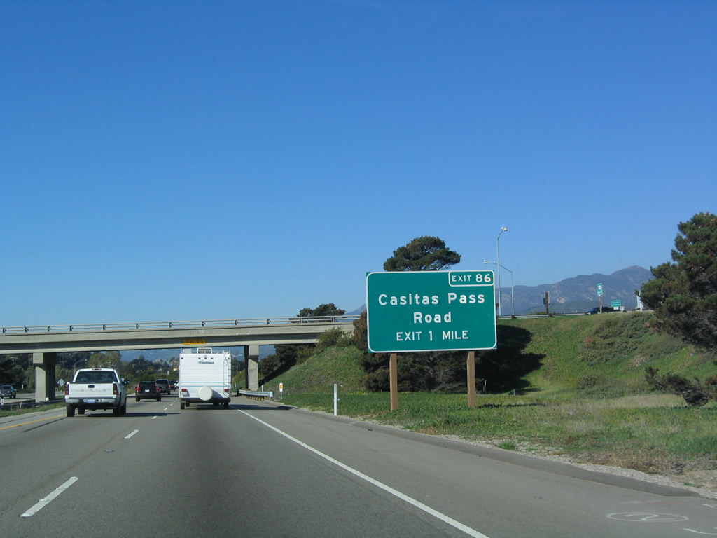
The next exit along U.S. 101 and California 1 north is Exit 86, Casitas Pass Road (one mile). Photo taken 12/23/04. |
|
Use Casitas Pass Road south to downtown Carpinteria and north to California 192/Foothill Road. Photo taken 12/23/04. |
|
Northbound U.S. 101 and California 1 reach Exit 86, Casitas Pass Road. This was known as California 224 between 1963 and 1996, when the route was decommissioned and shifted to local maintenance. The state route used to begin at California 192/Foothill Road and travel southwest along Casitas Pass Road to Carpinteria Avenue (old U.S. 101). Turning northwest briefly on Carpinteria Avenue, California 224 used to turn west on Palm Avenue to Carpinteria State Beach, ending at the entrance to the state beach. No residual shields for this route remain as of 2009. Photo taken 03/18/06. |
|
The next exit along U.S. 101 (El Camino Real) and California 1 is Exit 87, Santa Monica Road (0.75 mile). Photo taken 03/18/06. |
|
Santa Monica Road also serves the city of Carpinteria. Photo taken 12/23/04. |
|
Northbound U.S. 101 (El Camino Real) and California 1 reach Exit 87, Santa Monica Road. Photo taken 12/23/04. |
|
The off-ramp to Exit 87, Santa Monica Road is located after the Santa Ynez Avenue overpass. This is the last Carpinteria exit. Photo taken 03/18/06. |
|
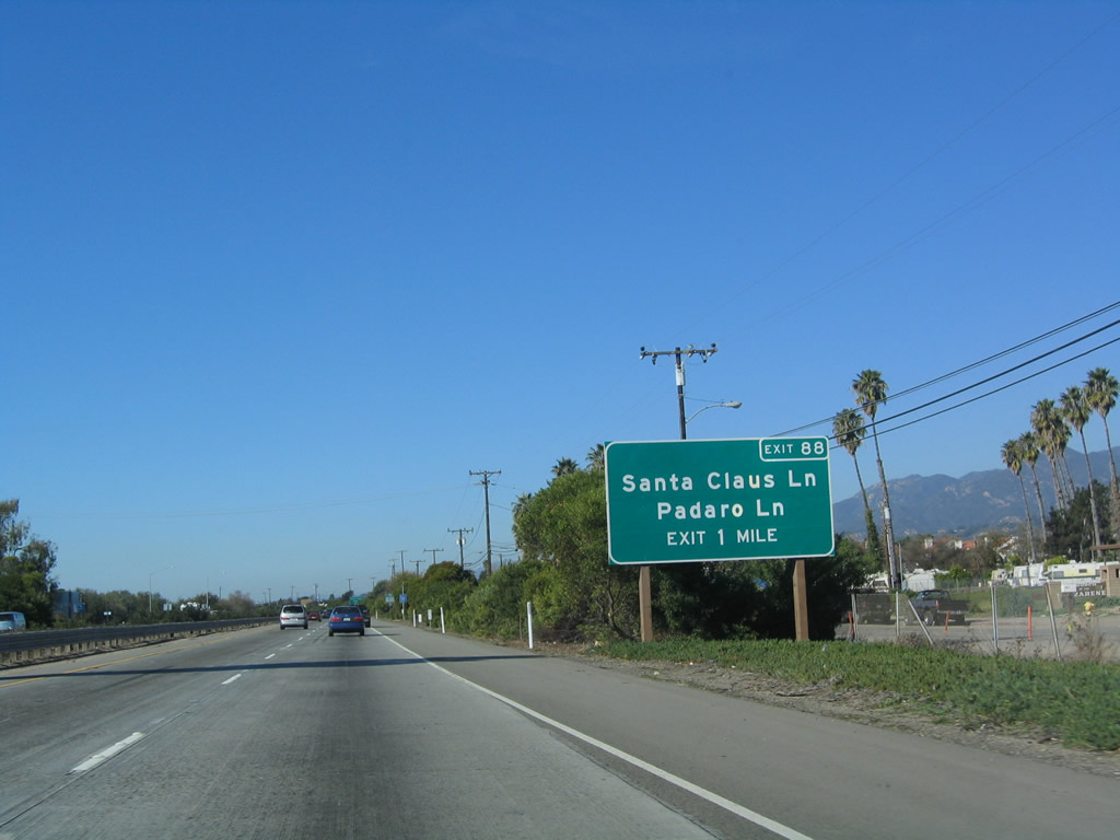
The next exit along U.S. 101 (El Camino Real) and California 1 is Exit 88, Santa Claus Lane and South Padaro Lane (one mile). Santa Claus Lane is so named due to the prior presence of a Santa Claus statue that was found along Santa Claus Lane from 1950 until around 2000. Photo taken 12/23/04. |
|
Santa Claus Lane is the frontage road on the south side of U.S. 101. The interchange is actually with South Padaro Lane, a short connecting road between Santa Claus Lane on the south and Via Real, which is the frontage road on the north side of the freeway. Photo taken 12/23/04. |
|
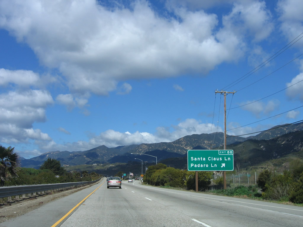
Northbound U.S. 101 (El Camino Real) and California 1 reach Exit 88, Santa Claus Lane and South Padaro Lane. Photo taken 03/18/06. |
|
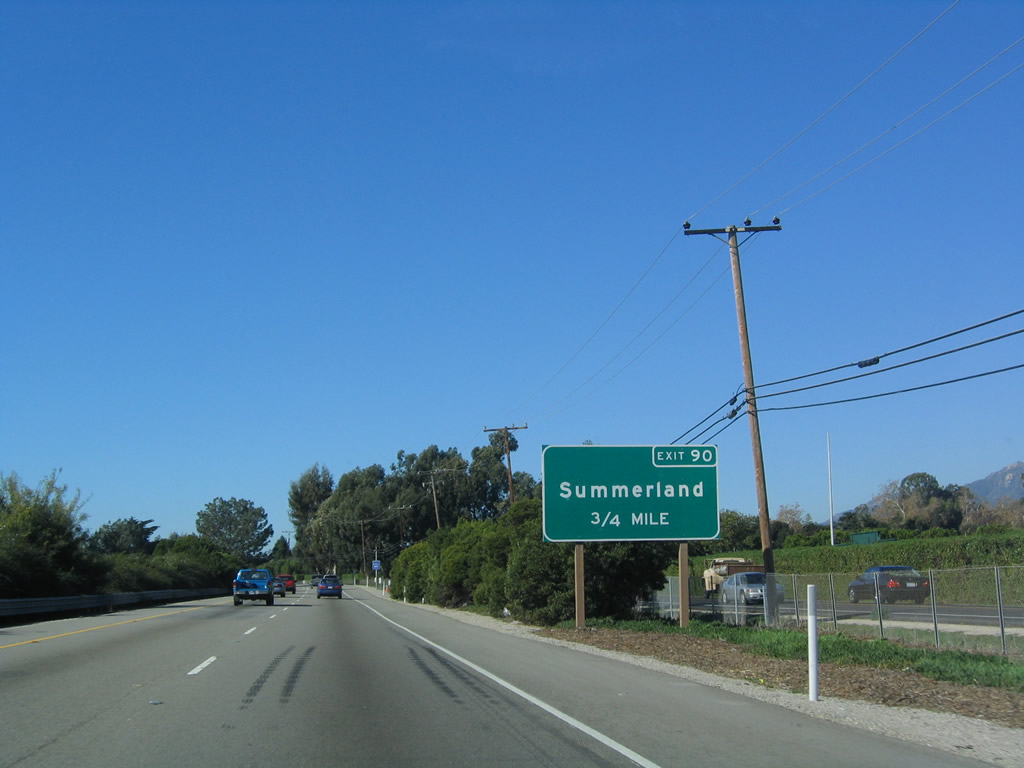
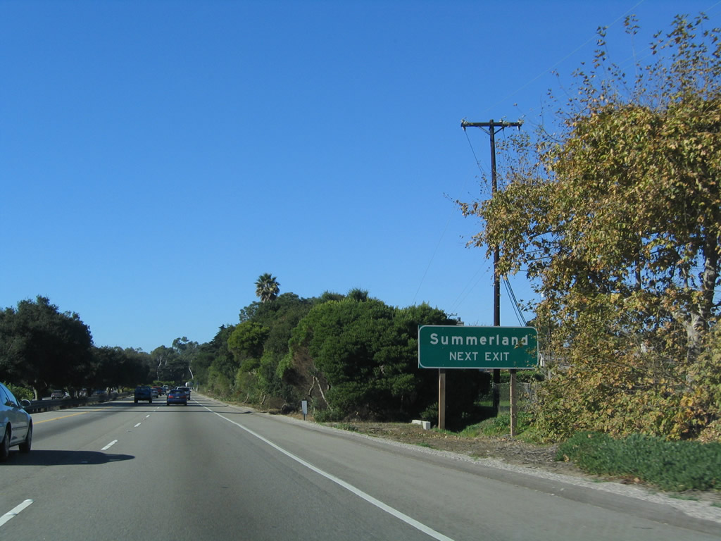
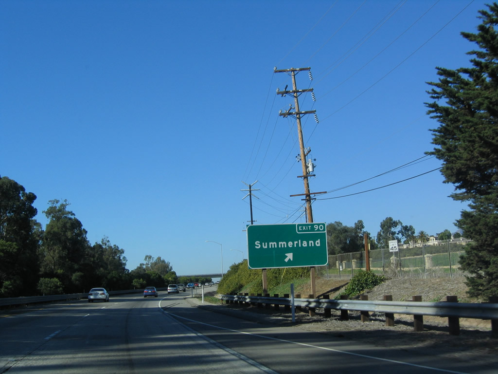
The next exit along U.S. 101 (El Camino Real) and California 1 is Exit 90, North Padaro Lane to Summerland (0.75 mile). Photo taken 12/23/04. |
|
Summerland is an unincorporated community in Santa Barbara County. The population of Summerland was 1,545 people as of the 2000 Census. Historically, this area was a major oil field, including some offshore oil derricks. An oil spill that fouled the waters of the Pacific Ocean in 1969 originated near Summerland. While offshore oil drilling continues, Summerland features residential areas. Photo taken 12/23/04. |
|
Northbound (westbound) U.S. 101 (El Camino Real) and California 1 reach Exit 90, North Padaro Lane to Summerland. Photo taken 12/23/04. |
|
The next exit along U.S. 101 (El Camino Real) and California 1 is Exit 91, Evans Avenue (one mile). Photo taken 03/18/06. |
|
After the on-ramp from North Padaro Lane is this U.S. 101 north reassurance shield. Photo taken 03/18/06. |
|
Exit 91 connects to Via Real, the north frontage road along U.S. 101. Turn west on Via Real to Evans Avenue and downtown Summerland. Photo taken 12/23/04. |
|
The Pacific Ocean remains in view to the south of the U.S. 101 freeway in Summerland. Photo taken 12/23/04. |
|
Northbound (westbound) U.S. 101 (El Camino Real) and California 1 reach Exit 91, Evans Avenue. Photo taken 12/23/04. |
|
The next exit along U.S. 101 (El Camino Real) and California 1 is Exit 92, Sheffield Drive (0.75 mile). Photo taken 12/23/04. |
|
The next three exits (Exit 92, Sheffield Drive; Exit 93, San Ysidro Road; and Exit 94A, Olive Mill Road and Coast Village Road) all serve the unincorporated community of Montecito. As of the 2000 Census, 10,000 people called Montecito home. The area was devastated in November 2008 due to the Tea Fire, which destroyed 80 homes. A wealthy community, many rich and famous celebrities live in Montecito. Photo taken 03/18/06. |
|
Northbound U.S. 101 (El Camino Real) and California 1 reach Exit 92, Sheffield Drive in Montecito. Photo taken 12/23/04. |
|
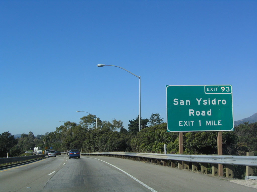
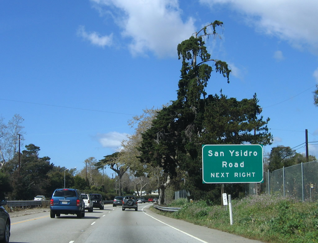
The next exit along U.S. 101 (El Camino Real) and California 1 is Exit 93, San Ysidro Road (one mile). Photo taken 12/23/04. |
|
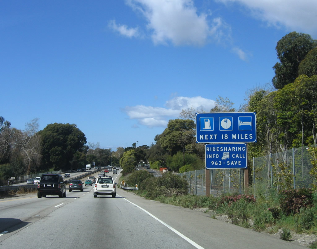
The next 18 exits along U.S. 101 (El Camino Real) and California 1 have motorist facilities, including food, gas, and lodging. U.S. 101 will pass directly through downtown Santa Barbara. Photo taken 03/18/06. |
|
This unique bridge rail design is found only along this section of U.S. 101 through Montecito and eastern Santa Barbara. Photo taken 03/18/06. |
|
San Ysidro Road travels north to Manning Park and Montecito Village shopping center at the intersection with California 192/East Valley Road. Photo taken 03/18/06. |
|
|
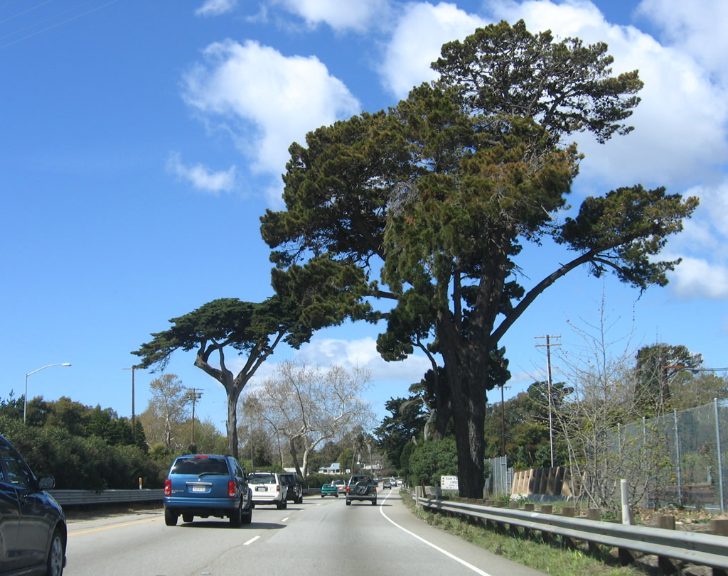
Towering trees frame the two northbound lanes of U.S. 101 (El Camino Real) through Montecito. Photos taken 03/18/06 and 12/23/04. |
|
Northbound U.S. 101 (El Camino Real) and California 1 reach Exit 93, San Ysidro Road. Photo taken 03/18/06. |
|
Due to heavy foliage and advance sign placement, the gore point and off-ramp for Exit 93, San Ysidro Road are not visible until a bit further after the last guide sign. Photo taken 03/18/06. |
|
The next exit along U.S. 101 (El Camino Real) and California 1 is Exit 94A, Olive Mill Road and Coast Village Road to Montecito. U.S. 101 will pass under San Ysidro Road at this bridge. Photo taken 12/23/04. |
|
Northbound U.S. 101 (El Camino Real) and California 1 reaches Exit 94A, Olive Mill Road and Coast Village Road to Montecito. Upon exiting, turn right to Olive Mill Road north and continue straight ahead to Coast Village Road. Photo taken 03/18/06. |
|
The off-ramp for Exit 94A, Olive Mill Road and Coast Village Road is situated a bit past the last advance guide sign. Photo taken 12/23/04. |
|
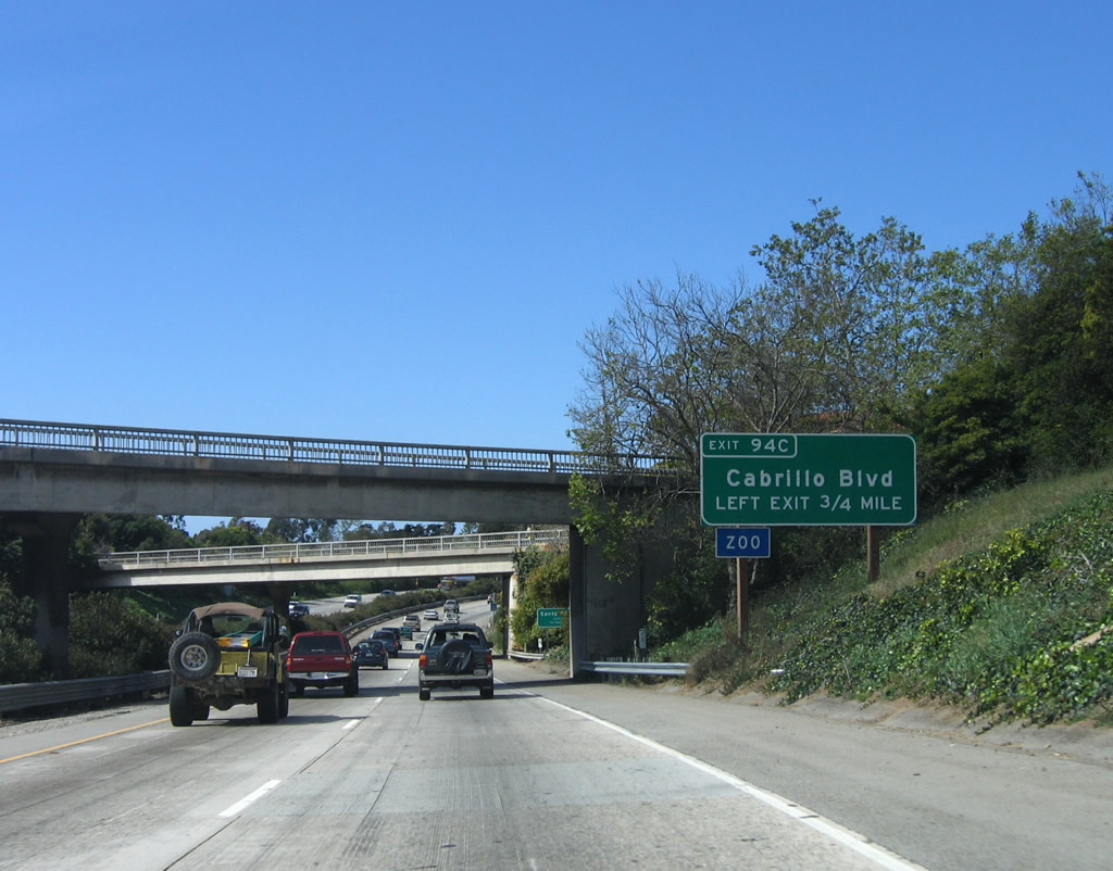
The next two exits along U.S. 101 (El Camino Real) and California 1 are Exit 94B, Hermosillo Road north to Hot Springs Road (0.50 mile) and Exit 94C, Cabrillo Boulevard (LEFT EXIT) to the Santa Barbara Zoo (0.75 mile). Only Exit 94C is referenced on this sign. Photo taken 12/23/04. |
|
U.S. 101 leaves Montecito and enters the city of Santa Barbara, the seat of Santa Barbara County. As of the Census of 2000, the city had a population of 92,325. The city consists of 19 square miles (land) and 41.4 square miles (land and water). Santa Barbara incorporated on April 9, 1850. Like many cities along the El Camino Real corridor, Santa Barbara has a heritage dating to the missionary period. Father Junipero Serra visited Santa Barbara in 1769. Mission Santa Barbara was dedicated December 4, 1786, but it was destroyed by a devastating tsunami in 1812 (along with significant sections of town). A new mission was built in grander style in 1820, and this mission remains to this day (although damages occurred due to the June 29, 1925 earthquake that damaged significant sections of town). Mission Santa Barbara is found northwest of downtown Santa Barbara along Los Olivos Street at Laguna Street (use the Mission Street exit to the mission). The city of Santa Barbara is also home to the University of California at Santa Barbara west of town. Photo taken 03/18/06. |
|
Use Exit 94C (Cabrillo Boulevard, a left exit) to the Santa Barbara Zoological Gardens. The zoo is located on the north side of Cabrillo Boulevard north of the beach and west of the Santa Barbara Cemetery. Photo taken 12/23/04. |
|
The next 12 exits along U.S. 101 (El Camino Real) and California 1 serve the city of Santa Barbara. For a while through the 1980s, three traffic signals marked the southernmost signals along U.S. 101. Those signals have since been replaced with freeway, making U.S. 101 non-stop through the downtown area. Photo taken 12/23/04. |
|
In addition to the zoo, Cabrillo Boulevard travels west along the beach shore to East Beach, Chase Palm Park, Stearns Wharf, West Beach, Santa Barbara Yacht Club, and Point Castillo. U.S. 101 followed a variety of routes through Santa Barbara, but surprisingly, State Street (which could easily look like a former alignment of U.S. 101) was not a through road as it is today. As a result, U.S. 101 followed other alignments during its history. A Penfield and Smith map of Santa Barbara from 1930 showed U.S. 101 following Cabrillo Boulevard west, State Street and De La Vina Street northwest (likely a one-way couplet), Mission Street west, and Hollister Avenue (now State Street) northwest. This changed later that decade. The official California state map from 1938, U.S. 101 followed a combination of Milpas Street northwest, Gutierrez Street southwest, Rancheria Street northwest, and Greenwell Street northwest. Today, portions of Montecito Street, Rancheria Street, and Greenwell Street create the current alignment of U.S. 101 freeway through and heading northwest from downtown Santa Barbara. Photo taken 03/18/06. |
|
|
Northbound U.S. 101 (El Camino Real) and California 1 reach Exit 94B, Hermosillo Road north to Hot Springs Road. This exit also connects to Coast Village Road, the northern frontage road. The guide sign was changed between 2004 and 2006. Note that this is the only guide sign for Exit 94B. Photos taken 03/18/06 and 12/23/04. |
|
The off-ramp to Exit 94B is again a bit further past the only advance sign. Photo taken 03/18/06. |
|
The next exit along U.S. 101 (El Camino Real) and California 1 north is Exit 94C, Cabrillo Boulevard west to Santa Barbara coastal areas and beaches. Photo taken 03/18/06. |
|
Northbound U.S. 101 (El Camino Real) and California 1 reach Exit 94C, Cabrillo Boulevard (old U.S. 101) west (left exit). A U.S. 101 trailblazer is posted for the right two lanes, which continue west (north) on U.S. 101. Photo taken 03/18/06. |
|
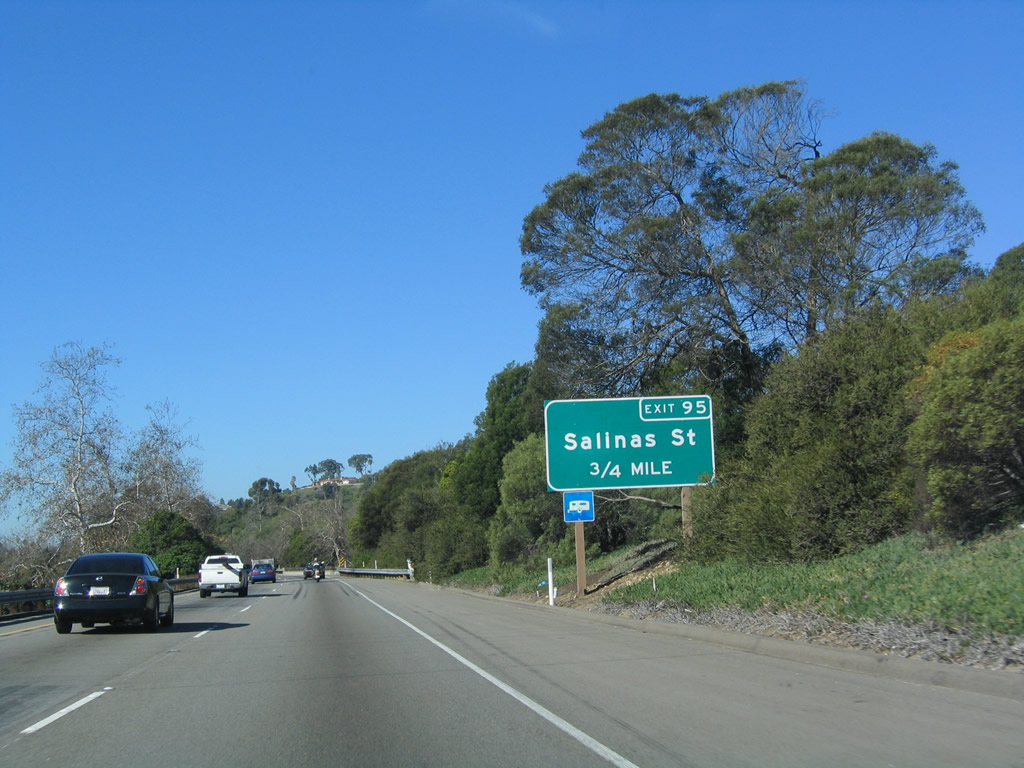
The next exit along U.S. 101 (El Camino Real) and California 1 north is Exit 95, Salinas Street (0.75 mile). Photo taken 12/23/04. |
|
U.S. 101 passes over Cabrillo Boulevard on this bridge and will next pass between the Andre Clark Bird Refuge on the south side of the freeway and Montecito Country Club on the north side of the freeway. Photo taken 03/18/06. |
|
This U.S. 101 reassurance shield is posted after the on-ramp from Cabrillo Boulevard. Photo taken 03/18/06. |
|
Northbound U.S. 101 (El Camino Real) and California 1 reach Exit 95, Salinas Street. Photo taken 03/18/06. |
|
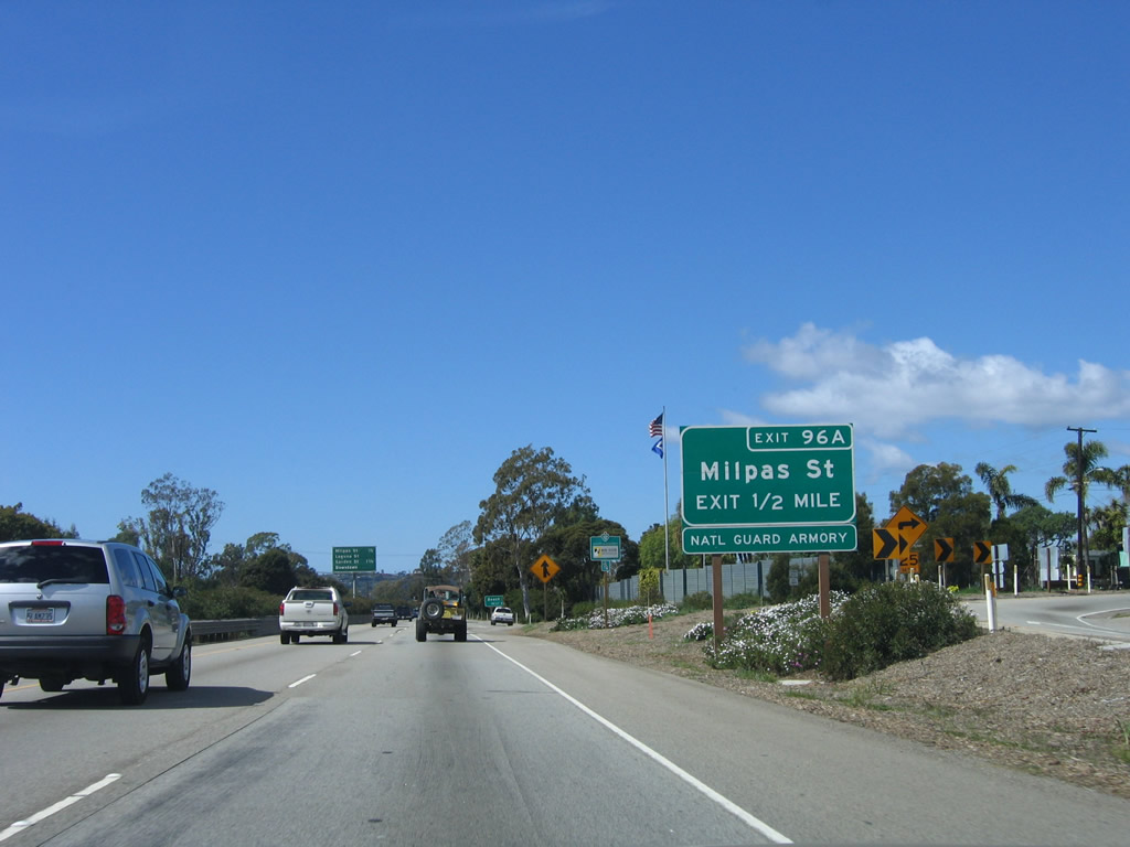
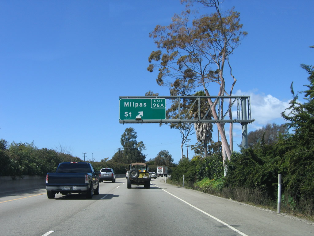
The next exit along U.S. 101 (El Camino Real) and California 1 is Exit 96A, California 144/Milpas Road (one-half mile). Photo taken 03/18/06. |
|
This mileage sign provides the distance to the next two exits along U.S. 101 (El Camino Real) and California 1: Exit 96A, Milpas Road and Exit 96B, Laguna Street and Garden Street to downtown Santa Barbara. Photo taken 03/18/06. |
|
Northbound (westbound) U.S. 101 (El Camino Real) and California 1 reach Exit 96A, California 144/Milpas Road. This sign was replaced after California 144 was decommissioned along Milpas Street, Mason Street, and Salinas Street in Santa Barbara after legislative action in June 2000. The section of California 144 along Sycamore Canyon Road (between Alameda Padre Serra and California 192) is still signed as California 144. A bridge was out on a crossing of Sycamore Creek as of 2006. Photo taken 03/18/06. |
|
At the base of the off-ramp from U.S. 101 to Milpas Street is a roundabout (traffic circle), so exiting traffic must yield to vehicles already within the circle. Photo taken 03/18/06. |
|
A tourist information center is located at the intersection of Garden Street and Cabrillo Boulevard just south of the freeway near the beach and close to Stearns Wharf. Use Exit 96B to Garden Street south to the visitors center. Photo taken 03/18/06. |
|
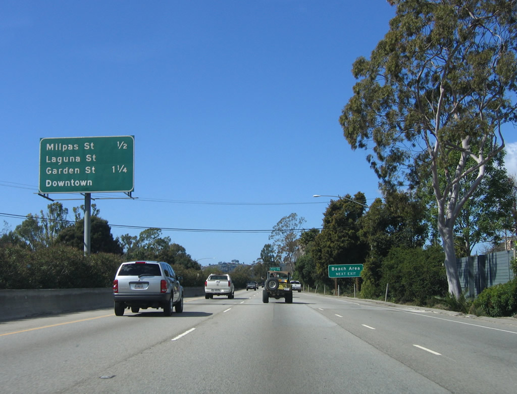
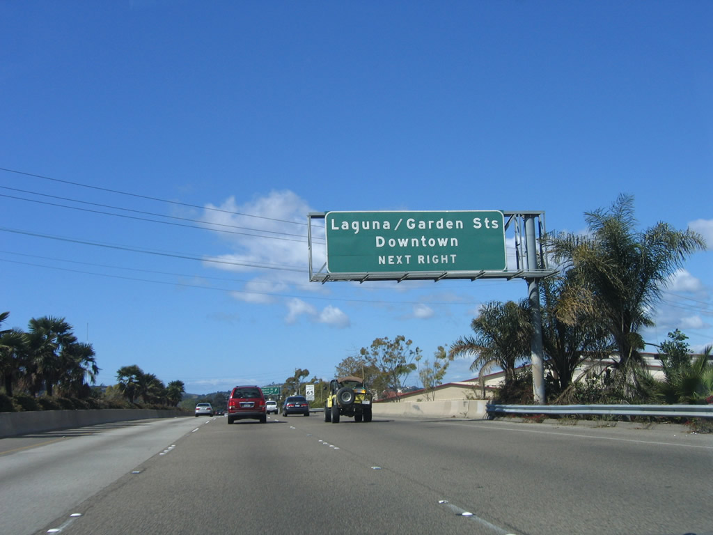
The next exit along U.S. 101 (El Camino Real) and California 1 is Exit 96B, Laguna Street and Garden Street to downtown Santa Barbara, Stearns Wharf, and the beach. Photo taken 03/18/06. |
|
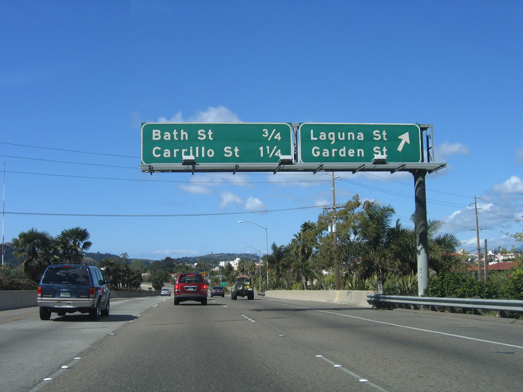
Northbound U.S. 101 (El Camino Real) and California 1 reach Exit 96B, Laguna Street and Garden Street. The dynamic of the freeway changes from a freeway enclosed by trees and foliage to one on an elevated viaduct that has three lanes in each direction. Downtown Santa Barbara spreads out below the freeway on both sides. Until the late 1980s, the U.S. 101 freeway ended here, and a series of traffic signals greeted northbound motorists passing th rough downtown. The next two exits along U.S. 101 are Exit 97, Bath Street and Exit 98A, Carrillo Street. Photo taken 03/18/06. |
|
As the U.S. 101 freeway banks to the left (southwest), an overhead sign on the off-ramp to Exit 96B offers directions to Laguna Street (right exit) or Garden Street (straight ahead on the off-ramp). Photo taken 03/18/06. |
|
Palm trees line the median as U.S. 101 continues southwest briefly; at Exit 97, the freeway will again turn northwest. Photo taken 03/18/06. |
|
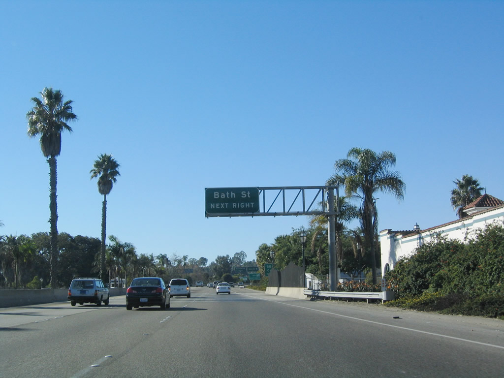
The next exit along U.S. 101 (El Camino Real) north is Exit 97, Bath Street to California 225/Castillo Street south to California 225/Cliff Drive west to Santa Barbara City College, Elings Park, and Arroyo Burro Beach County Park. California 225 rejoins U.S. 101 at the Las Positas Road interchange (Exit 100). Bath Street travels northwest and connects to Paseo Nuevo and downtown Santa Barbara via De La Guerra Street. Photo taken 03/18/06. |
|
(The off-ramp to Exit 97, Bath Street is not photographed.) The next exit along U.S. 101 (El Camino Real) and California 1 is Exit 98A, Carrillo Street to downtown Santa Barbara. U.S. 101 loops around downtown by staying to the south and west of downtown (hence the earlier brief detour to the southwest along northbound U.S. 101). Photo taken 03/18/06. |
|
El Presidio de Santa Barbara State Historic Park is located at the intersection of Canon Perdido Street and Santa Barbara Street. Follow Carrillo Street (Exit 98A) northeast to Santa Barbara Street, then turn right (southeast). The park is a military fortess constructed during mission times by the Spanish (other presidios were constructed in San Diego, Monterey, and San Francisco for the purpose of defending the newly colonized areas in Alta California). Photo taken 03/18/06. |
|
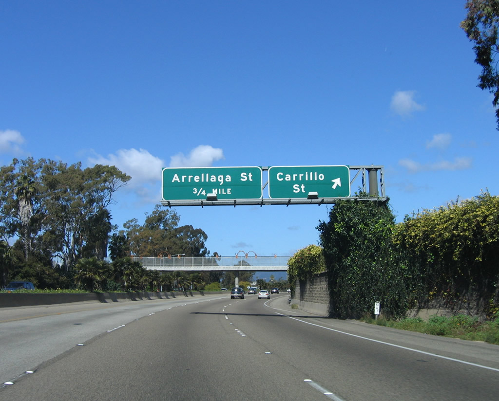
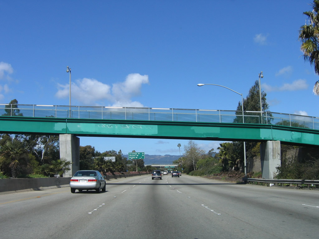
Northbound U.S. 101 (El Camino Real) and California 1 reach Exit 98A, Carrillo Street to downtown Santa Barbara. The next exit is Exit 98B, Arrellaga Street (0.75 mile). Photo taken 03/18/06. |
|
|
The off-ramp to Exit 98A, Carrillo Street is located after a pedestrian bridge. Decorative touches were added to the pedestrian bridge in 2005 or 2006. Photo taken 03/18/06. |
|
Another pedestrian bridge crosses the freeway after the Carrillo Street interchange. Photo taken 03/18/06. |
|
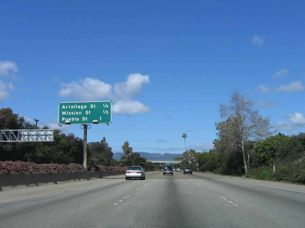
This mileage sign provides the distance to the next three exits along U.S. 101 and California 1 north: Exit 98B, Arrellaga Street; Exit 99A, Mission Street; and Exit 99B, Pueblo Street. Photo taken 03/18/06. |
|
Northbound U.S. 101 reaches Exit 98B, Arrellaga Street. This off-ramp only connects to Arrellaga Street northeast. Photo taken 03/18/06. |
|
Immediately thereafter, northbound U.S. 101 and California 1 reach Exit 99A, Mission Street. The next exit is Exit 99B, Pueblo Street. Photo taken 03/18/06. |
|
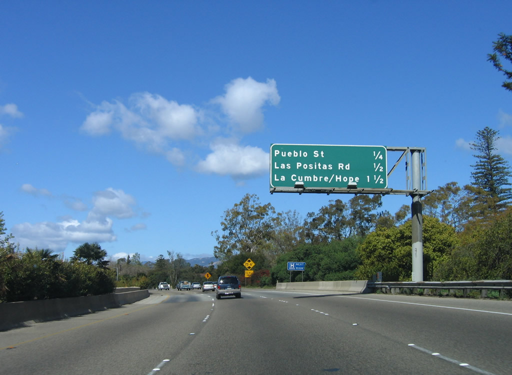
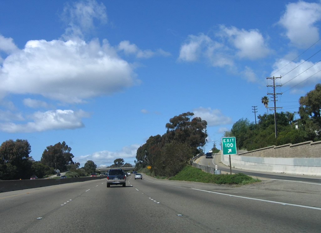
The next exit along U.S. 101 north is Exit 99B, Pueblo Street, followed Exit 100, California 225/Las Positas Road south and Exit 101A, Hope Avenue to La Cumbre Road. Photo taken 03/18/06. |
|
Northbound U.S. 101 and California 1 reach Exit 99B, Pueblo Street. The next exit is Exit 100, California 225/Las Positas Road south to Arroyo Burro Beach. California 225 then travels east toward Stearns Wharf, rejoining U.S. 101 at Exit 97. Photo taken 03/18/06. |
|
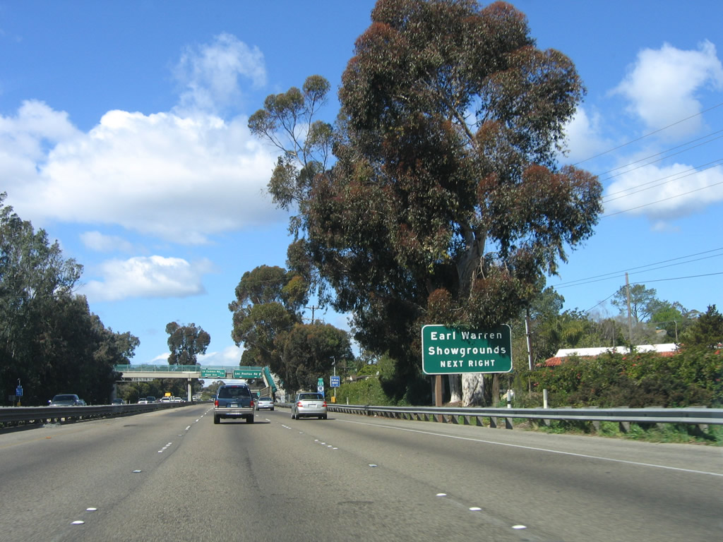
Use Las Positas Road north to the Earl Warren Showgrounds. Photo taken 03/18/06. |
|
A California 225 trailblazer is posted prior to the off-ramp for Exit 100. Trucks are permitted on the state route. Photo taken 03/18/06. |
|
Northbound U.S. 101 (El Camino Real) reaches Exit 100, California 225/Las Positas Road. This interchange serves as the western terminus of California 225, a route that perhaps could have been another extant section of California 1 given its role connecting two ends of U.S. 101 on an alignment that partially follows the coast. Photo taken 03/18/06. |
|
The gore point sign has the exit number, unlike the preceding signs in sequence. Photo taken 03/18/06. |
|
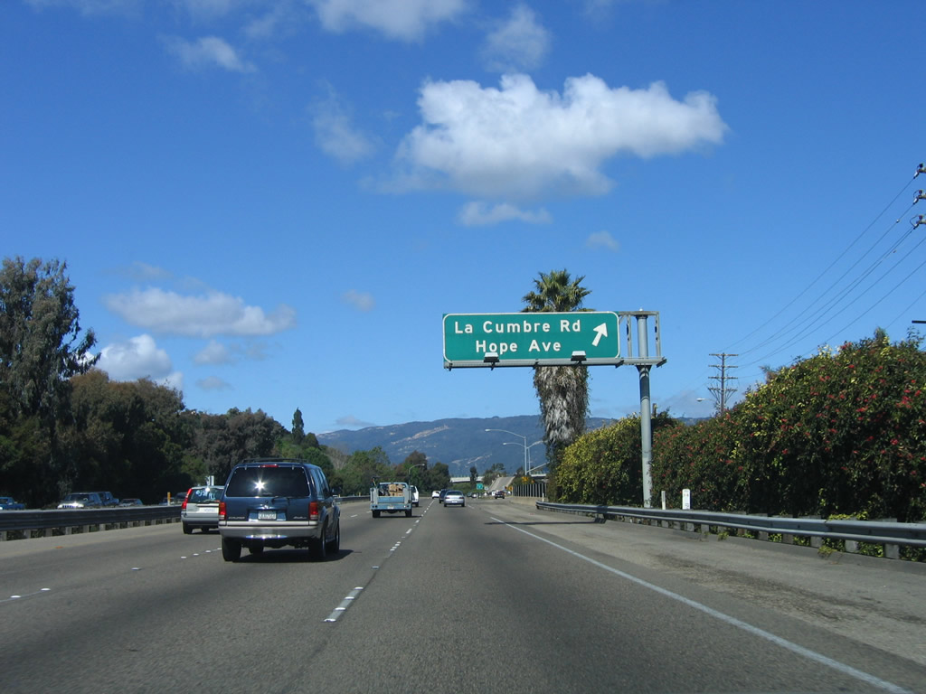
The next two exits along U.S. 101 (El Camino Real) and California 1 are Exit 101A, Hope Avenue to La Cumbre Road and Exit 101B, California 154/San Marcos Pass Road north to Lake Cachuma and State Street (old U.S. 101/Hollister Avenue) east to downtown Santa Barbara and west to Hollister Avenue and Goleta. Photo taken 03/18/06. |
|
Northbound (westbound) U.S. 101 (El Camino Real) and California 1 reach Exit 101A, Hope Avenue to La Cumbre Road. The next exit is Exit 101B, California 154/San Marcos Pass Road north to Lake Cachuma and State Street (old U.S. 101/Hollister Avenue). Photo taken 03/18/06. |
|
An exit number sign is posted for Exit 101B, State Street to California 154/San Marcos Pass Road north to Lake Cachuma. The old alignment of U.S. 101 follows State Street (former Hollister Avenue) from this interchange southeast into downtown Santa Barbara (linking to De La Vina Street) and west along Hollister Avenue into Goleta. Photo taken 03/18/06. |
|
Northbound U.S. 101 (El Camino Real) and California 1 reach Exit 101B, California 154/San Marcos Pass Road north to Lake Cachuma and State Street east to downtown Santa Barbara and west to Hollister Avenue and Goleta. California 154 leads northwest from this interchange, providing an inland alternative to U.S. 101 between Exits 101B and 146 via Cold Springs, Lake Cachuma, Santa Ynez, and Los Olivos. Photo taken 03/18/06. |
|
An older style bridge carries State Street across U.S. 101. Photo taken 03/18/06. |
|
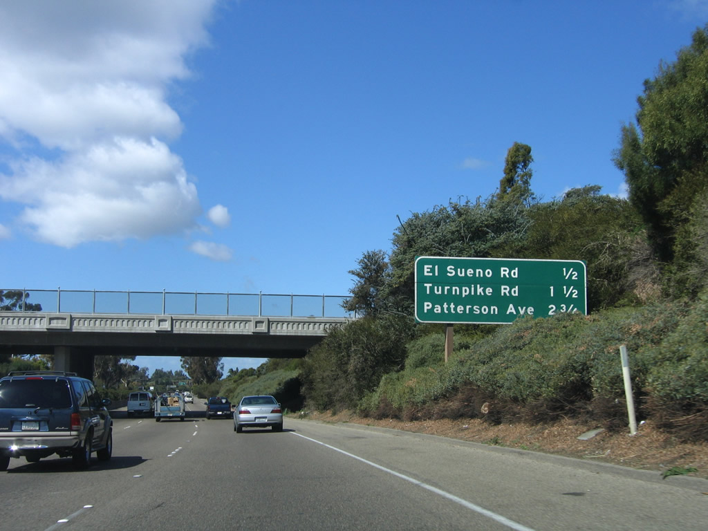
The next three exits along U.S. 101 north are Exit 102, El Sueno Road; Exit 103, Turnpike Road; and Exit 104A, Patterson Avenue. Photo taken 03/18/06. |
|
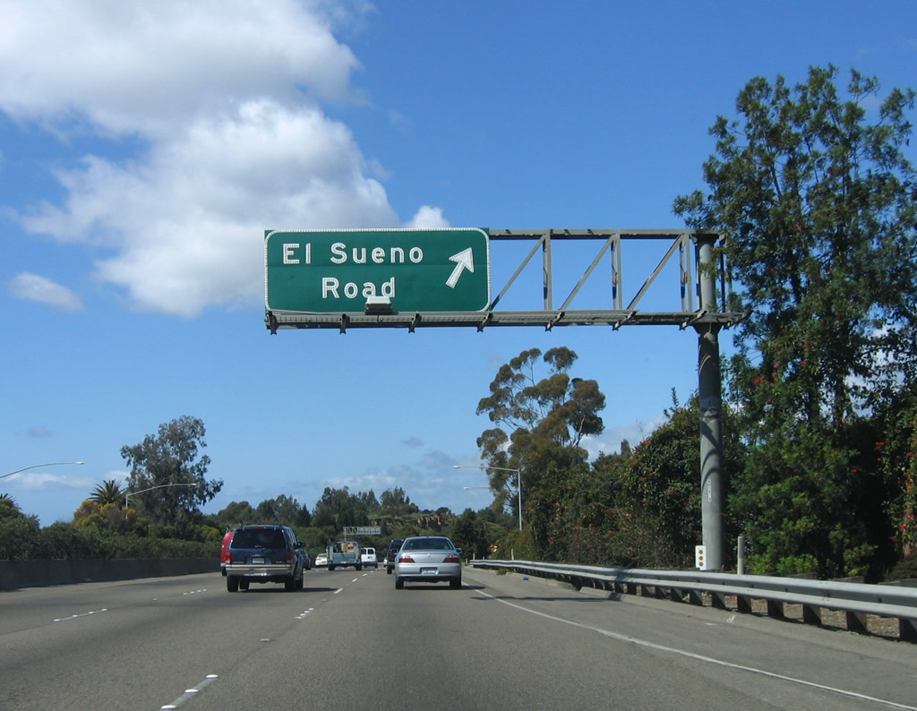
Northbound U.S. 101 (El Camino Real) reaches Exit 102, El Sueno Road. This exit also connects to the frontage road on the north side of the freeway (Calle Real). Photo taken 03/18/06. |
|
The exit to El Sueno Road requires a sharp turn to the north as the freeway proceeds west. Photo taken 03/18/06. |
|
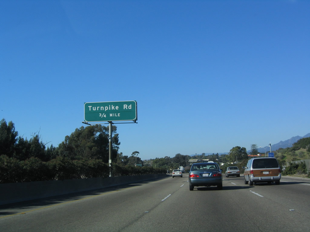
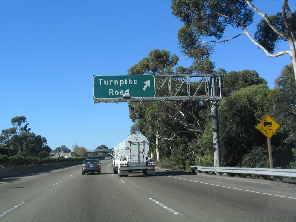
The next exit along U.S. 101 (El Camino Real) and California 1 is Exit 103, Turnpike Road (0.75 mile). Photo taken 12/23/04. |
|
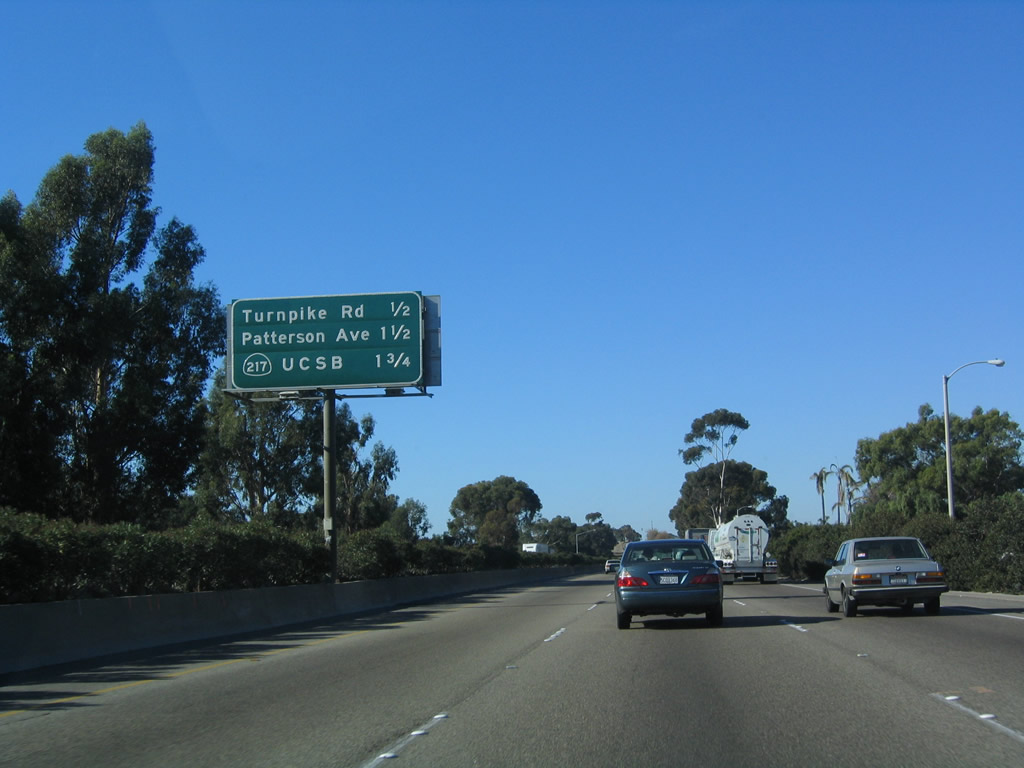
This mileage sign provides the distance to the next three exits along U.S. 101 (El Camino Real) and California 1: Exit 103, Turnpike Road; Exit 104A, Patterson Avenue; and Exit 104B, California 217/Clarence C. Ward Memorial Boulevard southwest to the University of California at Santa Barbara. Photo taken 12/23/04. |
|
Northbound (westbound) U.S. 101 (El Camino Real) and California 1 reach Exit 103, Turnpike Road. Having left the city limits of Santa Barbara, this exit serves communities on either side of the freeway that are in unincorporated Santa Barbara County. The Santa Barbara Municipal Airport and University of California at Santa Barbara are part of the city of Santa Barbara but are not connected by land. The city limits of Santa Barbara includes a strip over water between the main city and the university and airport. Photo taken 12/23/04. |
|
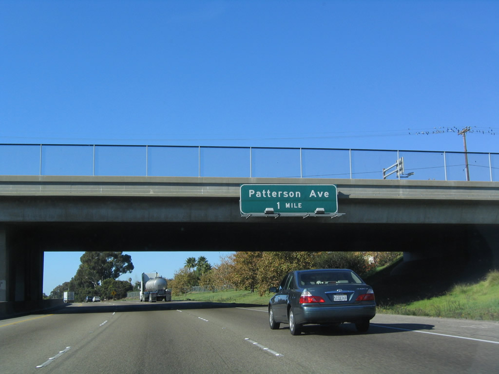
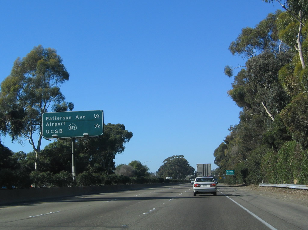
The next exit along U.S. 101 (El Camino Real) and California 1 north is Exit 104A, Patterson Avenue. Photo taken 12/23/04. |
|
A single interchange complex connects U.S. 101 with Exit 104A to north-south Patterson Road and Exit 104B to California 217 southwest to the University of California at Santa Barbara (UCSB). The ramp to California 217 is a direct connect freeway-to-freeway ramp located after the ramp to Patterson Avenue. Photo taken 12/23/04. |
|
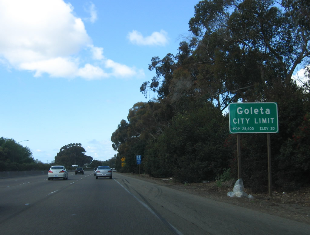
Leaving the unincorporated area, U.S. 101 enters the city of Goleta, which surrounds the university, airport, and unincorporated Isla Vista on all sides (west, north, and east). Photo taken 03/18/06. |
|
Northbound U.S. 101 (El Camino Real) and California 1 reaches Exit 104A, Patterson Avenue. Photo taken 12/23/04. |
|
Immediately after the off-ramp to Patterson Avenue, northbound U.S. 101 (El Camino Real) and California 1 meet Exit 104B, California 217 (Clarence Ward Memorial Boulevard) southwest to the University of California at Santa Barbara (UCSB), Santa Barbara Airport, and Isla Vista. Most of this spur freeway is located within the city of Goleta before connecting to the university. Photo taken 12/23/01. |
|
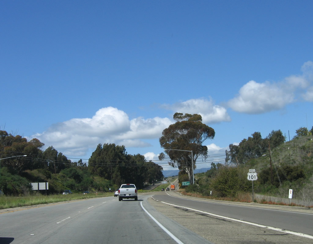
This mileage sign provides the distance to Buellton (36 miles), Santa Maria (69 miles), and San Francisco (330 miles). California 217's westbound lanes fly over the mainline U.S. 101 freeway. Photo taken 02/02/08. |
|
The next exit along U.S. 101 north is Exit 105, Fairview Avenue (next right). Photo taken 12/23/04. |
|
Northbound U.S. 101 reaches Exit 105, Fairview Avenue in the city of Goleta. Photo taken 12/23/04. |
|
|
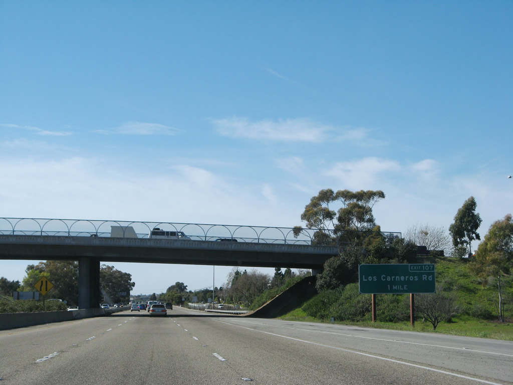
The next exit along U.S. 101 north is Exit 107, Los Carneros Road (one mile). Use Los Carneros Road south to western city of Goleta and the unincorporated community of Isla Vista. The exit number sign was installed sometime between 2006 and 2008. Photos taken 02/02/08 and 12/23/04. |
|
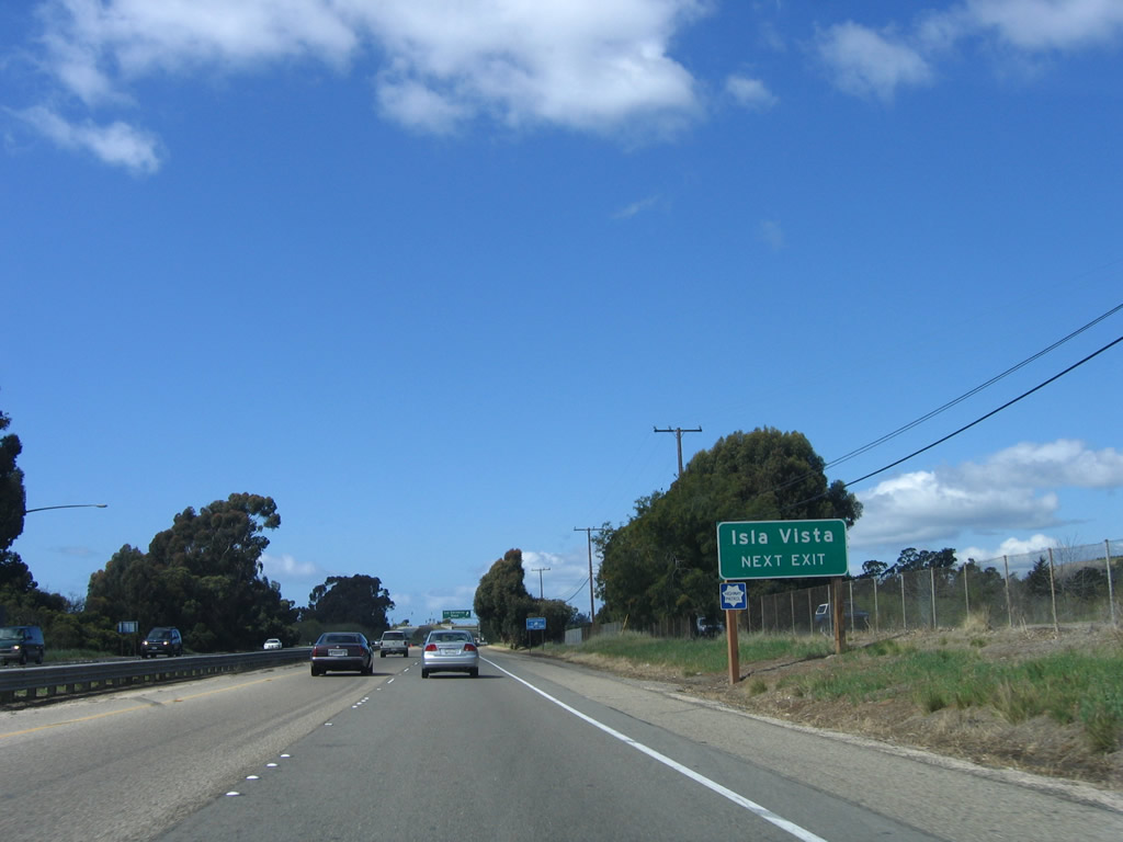
Use Los Carneros Road south to Isla Vista, an unincorporated community located west of the University of California at Santa Barbara (UCSB). Photo taken 03/18/06. |
|
Northbound U.S. 101 and California 1 reach Exit 107, Los Carneros Road in Goleta. Photo taken 03/18/06. |
|
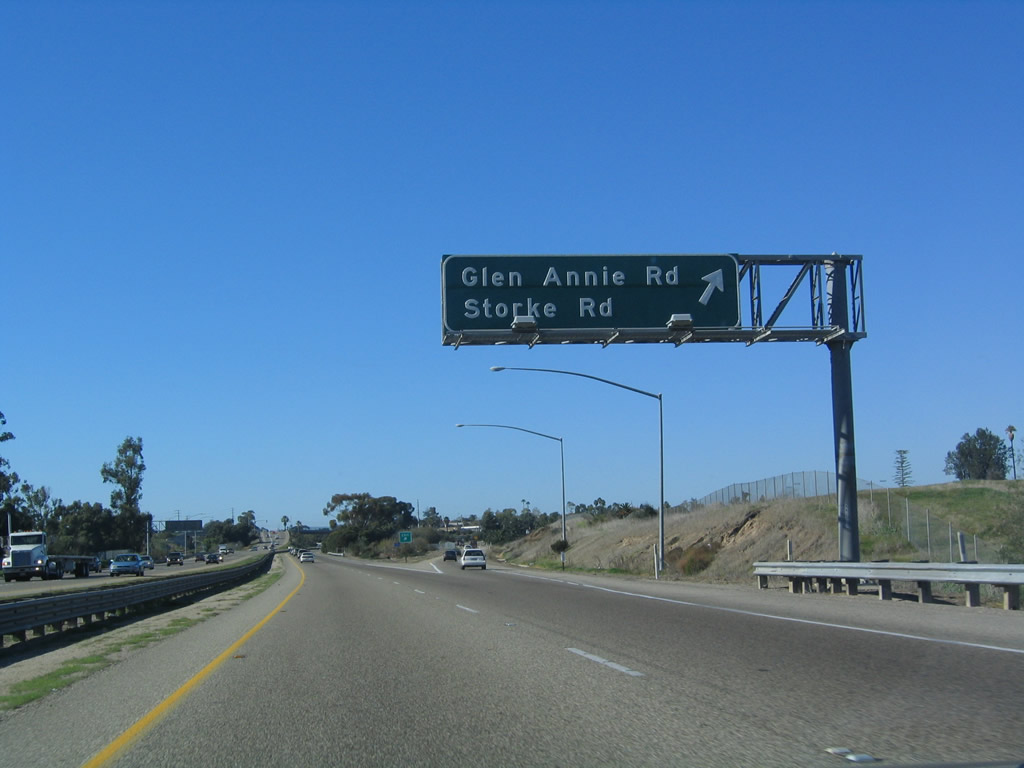
The next exit along U.S. 101 north is Exit 108, Glen Annie Road north and Storke Road south (one-half mile). Photo taken 12/23/04. |
|
Northbound U.S. 101 reaches Exit 108, Glen Annie Road north and Storke Road south. Photo taken 12/23/04. |
|
This U.S. 101 reassurance shield is posted after the off-ramp to Exit 108. The Glen Annie Road/Storke Road overpass is just ahead. Photo taken 03/18/06. |
|
The next exit along U.S. 101 and California 1 north is Exit 110, Winchester Canyon Road and Calle Real to Cathedral Oaks Road and Hollister Avenue. Use Winchester Canyon Road north to Cathedral Oaks Road, which then travels northeast and then east to connect with California 192. Use Calle Real (frontage road) west to Hollister Avenue south and then east along the old U.S. 101 alignment back to downtown Goleta. Photo taken 03/18/06. |
|
Motorist services are available at Exit 110. This is the final exit with services for 30 miles (until Exit 140A, California 246 in Buellton). Photo taken 03/18/06. |
|
Coastal access points are located along U.S. 101 between Goleta and Gaviota State Beach, a distance of about twenty miles. One such coastal access point is located via Exit 110 at Bacara Resort's beach. This exit also connects to the Sandpipe Golf Course and Ellwood, a community within the city of Goleta. Photo taken 03/18/06. |
|
Northbound U.S. 101 and California 1 reach Exit 110, Winchester Canyon Road and Calle Real to Cathedral Oaks Road and Hollister Avenue. This is the last exit to serve the city of Goleta and the last with services for 30 miles. Photo taken 03/18/06. |
|
This U.S. 101 north reassurance shield is posted after the on-ramp from Calle Real. Photo taken 03/18/06. |
|
A mileage sign provides the distance to Buellton (30 miles), San Luis Obispo (93 miles), and San Francisco (325 miles). Photo taken 12/23/04. |
|
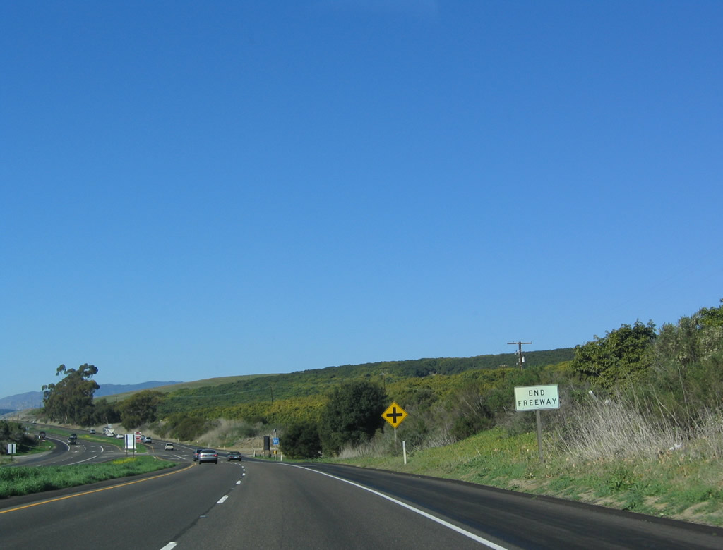
Having left Goleta, U.S. 101 reverts to an expressway configuration. Cross traffic is present for the next two miles with two at-grade intersections. Photo taken 03/18/06. |
|
The U.S. 101 freeway ends temporarily at this point. Photo taken 02/02/08. |
|
The next two right turns connect U.S. 101 north with Calle Real, the frontage road on the north side of the freeway. Use the next right turn to Farren Road north. (The link to Farren Road would be Exit 111 if constructed.) Photo taken 03/18/06. |
|
Rural beauty abounds as U.S. 101 finds itself away from the city for the first time on its northbound journey. Photo taken 03/18/06. |
|
A second and final at-grade intersection provides access to the west end of Calle Real. Photo taken 03/18/06. |
|
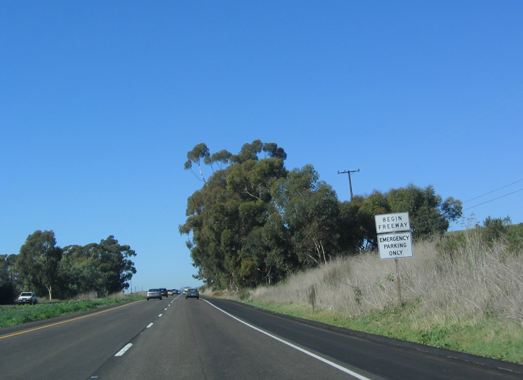
This U.S. 101 north reassurance shield is posted after the Calle Real intersection. Photo taken 03/18/06. |
|
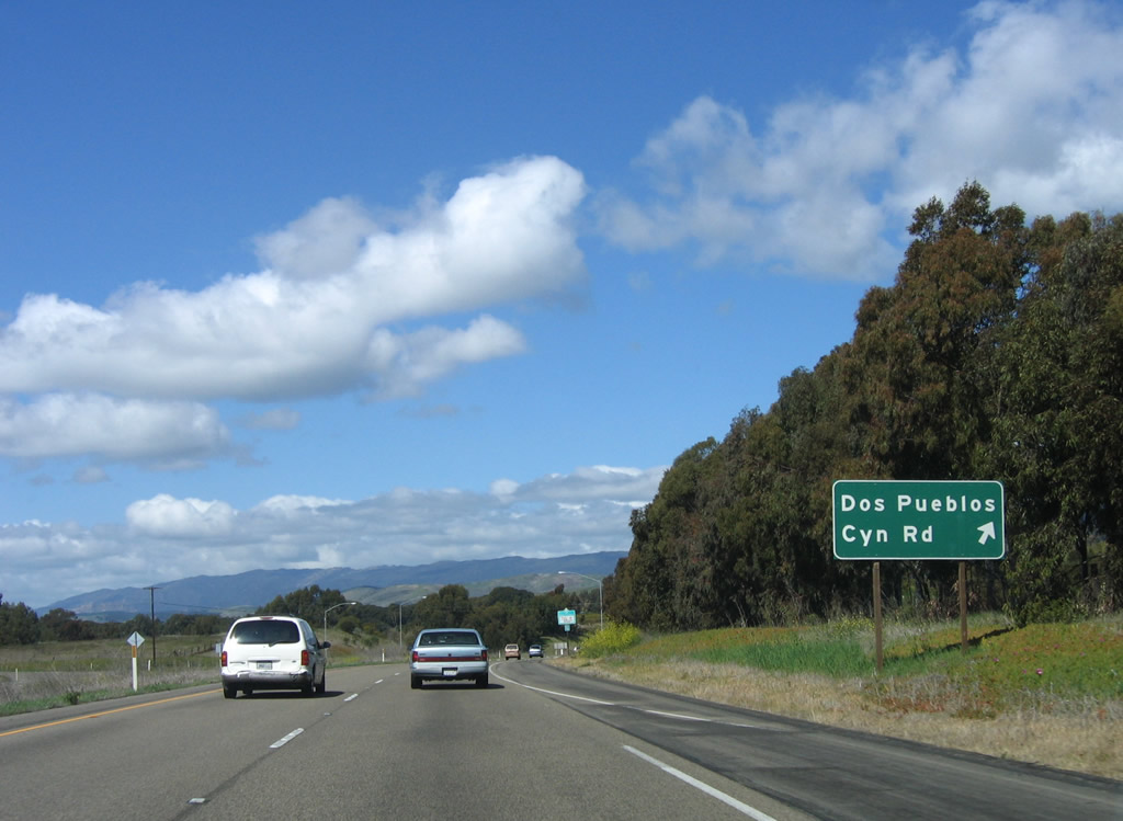
A begin freeway sign is posted after the Calle Real intersection. The next exit along northbound is Exit 113, Dos Pueblos Canyon Road. Photo taken 12/23/04. |
|
Northbound U.S. 101 and California 1 reach Exit 113, Dos Pueblos Canyon Road to the unincorporated community of Naples. Photo taken 03/18/06. |
|
The gore point for the Dos Pueblos Canyon Road exit is not labeled with an exit number. Photo taken 12/23/04. |
|
The U.S. 101 freeway again reverts to expressway, with an at-grade intersection ahead for Exit 114, Las Varas Canyon Road (next right). Photo taken 12/23/04. |
|
Northbound U.S. 101 and California 1 reach Exit 114, Las Varas Canyon Road (at-grade intersection). Photo taken 03/18/06. |
|
The U.S. 101 expressway shifts back to freeway, as the next several exits are interchanges (Exit 116, El Capitan Ranch Road; Exit 117, El Capitan State Beach; and Exit 120, Refugio Road to Refugio State Beach). Photo taken 12/23/04. |
|
|
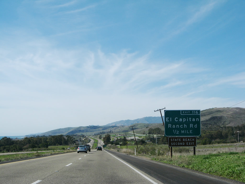
The next exit along U.S. 101 (El Camino Real) and California 1 north is Exit 116, El Capitan Ranch Road (one-half mile). New exit number signs were installed between 2006 and 2008. Photos taken 02/02/08 and 03/18/06. |
|
|
Northbound U.S. 101 and California 1 meet Exit 116, El Capitan Ranch Road. Photos taken 02/02/08 and 03/18/06. |
|
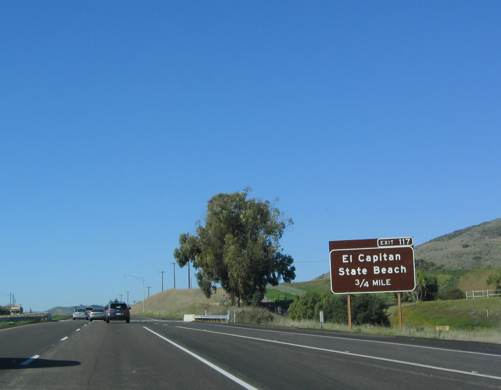
The next exit along U.S. 101 north (west) is Exit 117, El Capitan State Beach. U.S. 101 closely follows the Pacific Ocean shoreline, and the next two exits serve state beaches. The freeway stays close to the surf for another few miles, but it will soon curve inland. Ocean views from U.S. 101 will not be seen again until ascending onto the Golden Gate Bridge. Photo taken 12/23/04. |
|
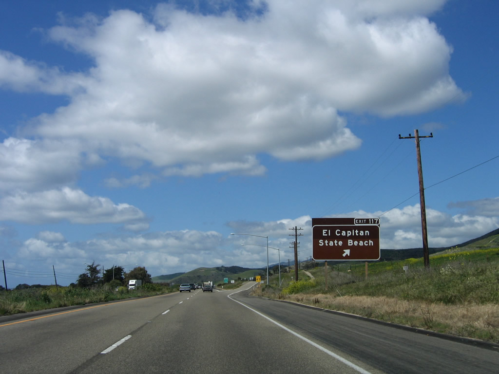
Northbound U.S. 101 (El Camino Real) and California 1 reach Exit 117, El Capitan State Beach. The exit ramps lead directly into the beach parking lot. Photo taken 03/18/06. |
|
The gore point exit number sign is the only green approach sign for Exit 117; the others are all brown recreational guide signs. Photo taken 03/18/06. |
|
A U.S. 101 north reassurance shield is posted after the on-ramp from Exit 117. Photo taken 12/23/04. |
|
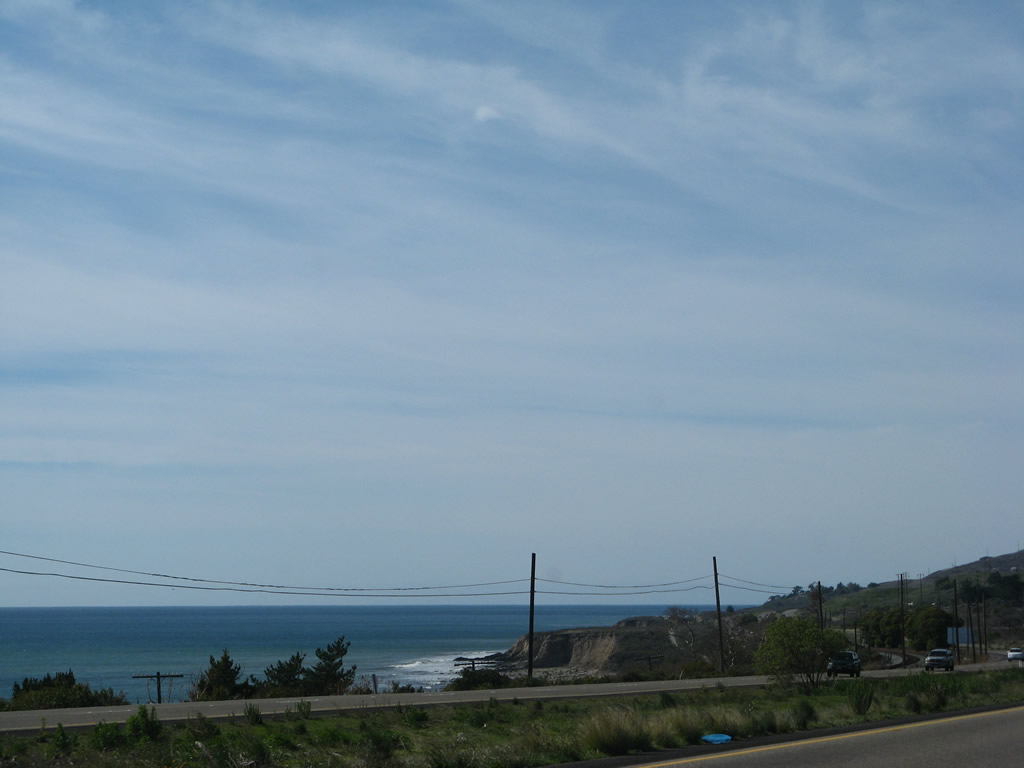
High clouds offer a contrast again the blue Pacific Ocean. Photo taken 02/02/08. |
|
Beautiful green hills and the white clouds offer a wonderful contrast to the passing freeway along U.S. 101 north (west). Photo taken 03/18/06. |
|
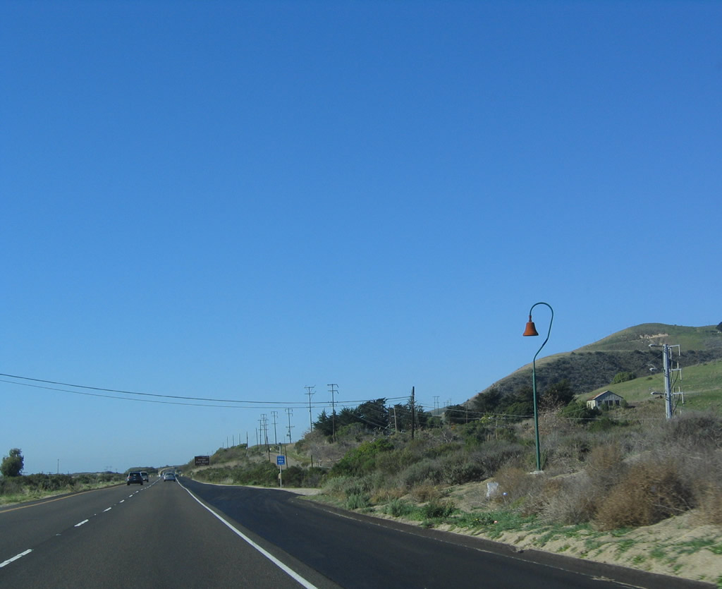
An El Camino Real mission bell replica is posted along U.S. 101 along this rural stretch of freeway. Photo taken 12/23/04. |
|
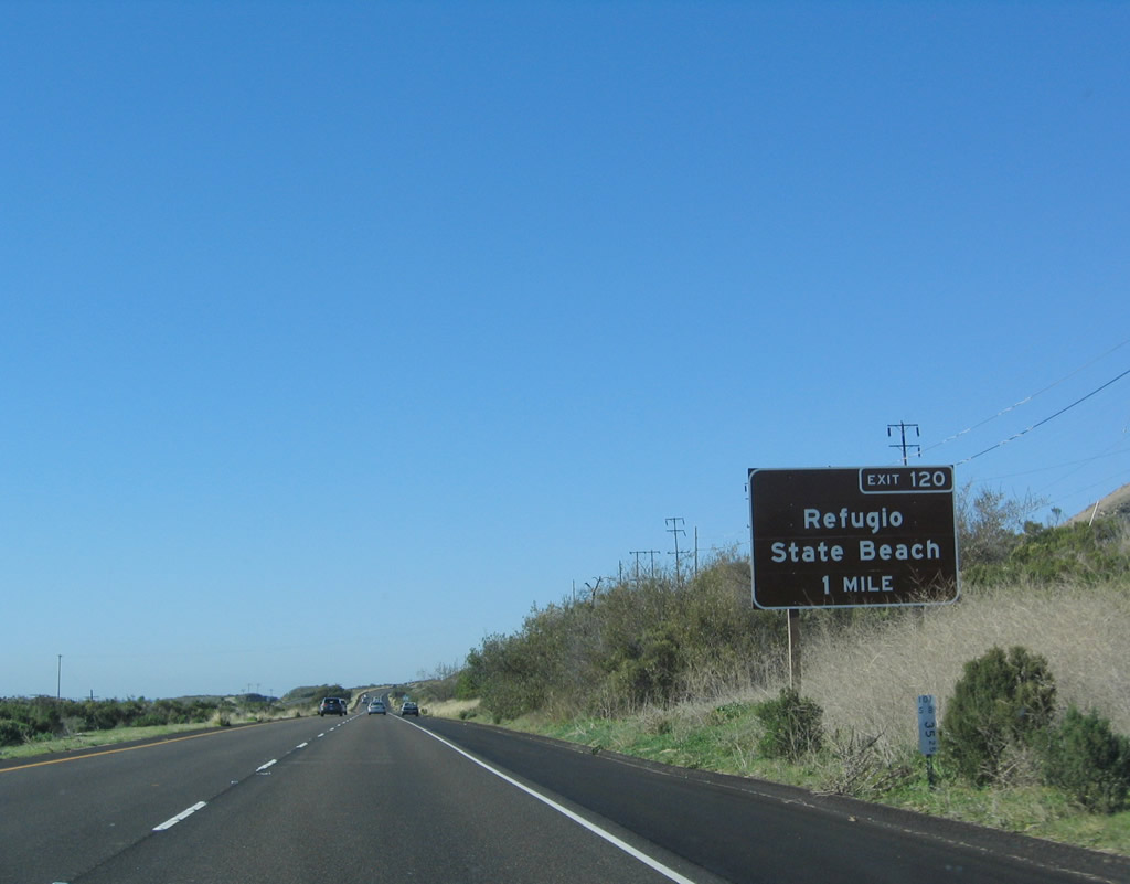
The next exit along U.S. 101 and California 1 north is Exit 120, Refugio Road to Refugio State Beach. From this interchange, Refugio Road travels north into Los Padres National Forest and the Santa Ynez Mountains. Photo taken 12/23/04. |
|
Refugio State Beach is located south of U.S. 101 and is accessible via Exit 120. Photo taken 03/18/06. |
|
Northbound U.S. 101 (El Camino Real) and California 1 approach Exit 120, Refugio Road to Refugio State Beach. Photo taken 12/23/04. |
|
An exit number tab was affixed to the reflective exit sign for Exit 120, Refugio Road to Refugio State Beach. Continue straight ahead to follow U.S. 101 and California 1 west to Gaviota and then north to Buellton and San Francisco. Photo taken 02/02/08. |
|
Northbound U.S. 101 and California 1 meet Exit 120, Refugio Road to Refugio State Beach. The freeway briefly has a third lane for climbing that ends quickly. Ahead, U.S. 101 and California 1 turn inland and curve northward near Gaviota and proceed toward a split. U.S. 101 will stay inland, tracking toward Salinas, while California 1 will parallel the coast while avoiding off-limits Vandenberg Air Force Base. Photo taken 02/02/08. |
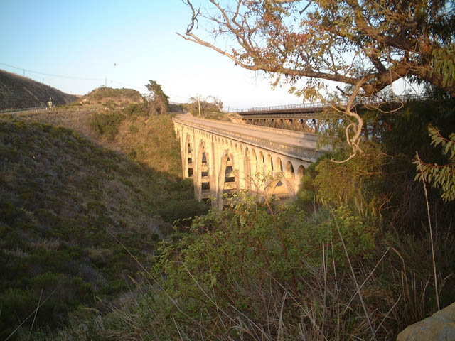
| U.S. 101: Abandoned Arroyo Hondo Bridge |
|
View of the abandoned Arroyo Hondo Bridge parallel to the U.S. 101 freeway just northwest of a rest area north of Santa Barbara. This picture shows the original bridge between the new U.S. 101 freeway, which is situated on a fill, and a railroad bridge to the south (since U.S. 101 runs west-east through here). Photo taken 06/02/02. |
|
Another late-day view of the abandoned Arroyo Hondo Bridge, this time looking south at it. A rest area is situated at the east (south) end of the bridge, making access fairly easy from the freeway. Photo taken 06/02/02. |
|
|
These pictures provide a view of the deck of the Arroyo Hondo Bridge looking southbound (east), toward the rest area. Photos taken 06/01/02 and 2004 by Ellery Price. |
|
And this picture shows the deck of the bridge looking northbound (west) along the Arroyo Hondo Bridge. Photo taken by Ellery Price, 2004. |
|
This view of the concrete deck arch Arroyo Hondo Bridge is seen from the nearby railroad bridge, looking northeast. The U.S. 101 freeway is visible in the background. Photo taken 06/02/02. |
Page Updated February 26, 2015.