|
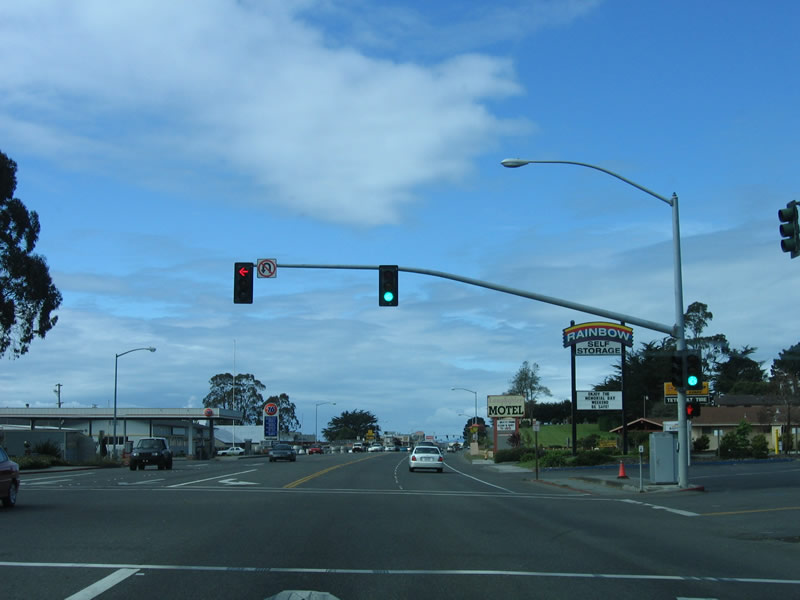
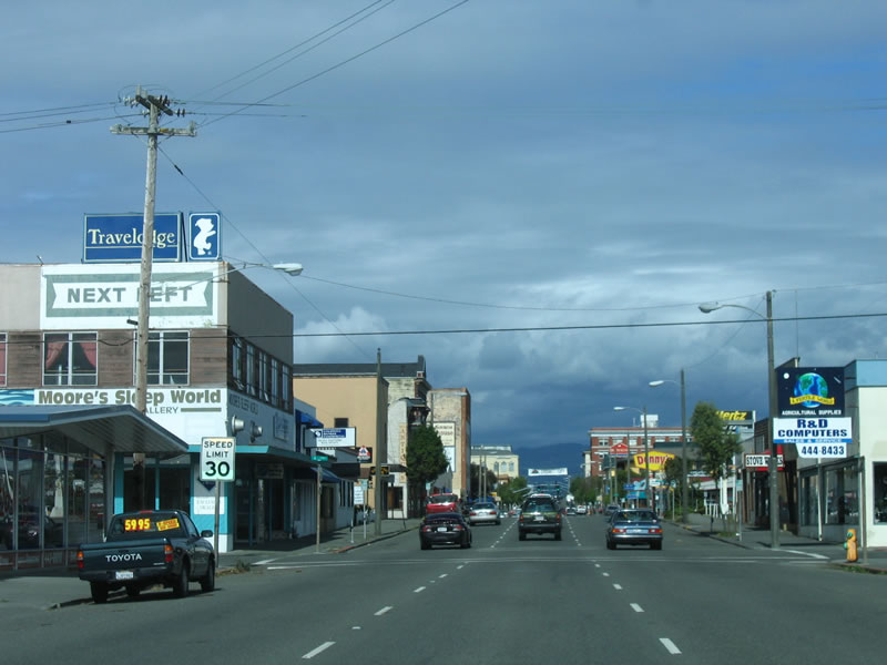
The rural character of U.S. 101 radically changes as U.S. 101 (Redwood Highway) enters the city of Eureka. A variety of strip malls, motels, and restaurants line the street. With two through lanes, a middle turn lane, and driveways intersecting U.S. 101, the speed limit drops to 40 miles per hour. Photo taken 05/26/06. |
|
Northbound U.S. 101 meets Sunset Street at this intersection. The Oceanview Cemetery sits on the hill to the right of the Redwood Highway (visible in the distance). Photo taken 05/26/06. |
|
The Oceanview Cemetery sits to the east of U.S. 101 (Redwood Highway), while strip malls and restaurants line the highway on the west side. Not visible but very close to the highway is Humboldt Bay. Photo taken 05/26/06. |
|
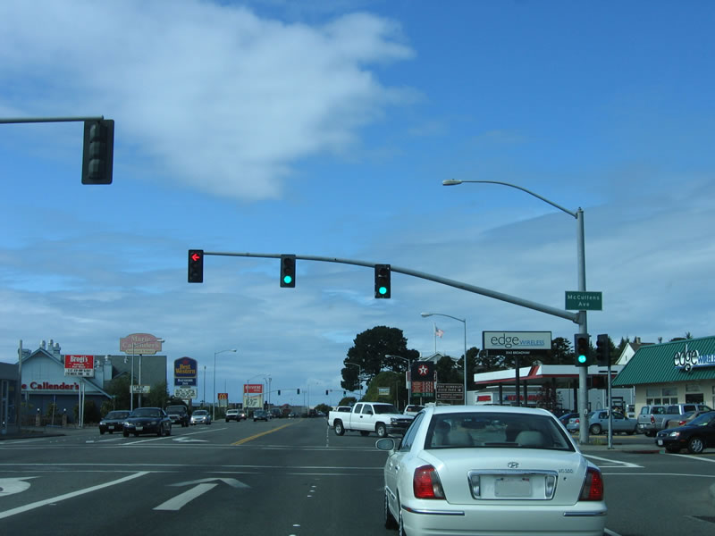
The next signalized intersection along northbound U.S. 101 (locally known as Broadway Street along this stretch) is with McCullen Avenue. More restaurants, malls, and motels line the busy commercial strip. Photo taken 05/26/06. |
|
A brown guide sign points the way to Fort Humboldt State Historic Park via Highland Avenue east to Fort Street north. Established in 1853, Fort Humboldt was active as a military installation until 1870; it provided frontier security during the gold rush and skirmishes with Native Americans. Today, only the hospital remains, but it has been converted into a museum. Photo taken 05/26/06. |
|
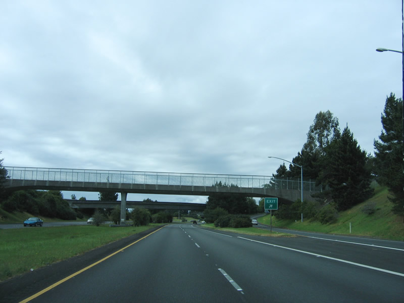
Northbound U.S. 101 meets West Harris Street at this intersection. Through this area, U.S. 101 passes between the state park and the Bayshore Mall as it continues northeast toward downtown Eureka. Photo taken 05/26/06. |
|
A national forest information center is located along the left side of the roadway. Photo taken 05/26/06. |
|
A tourist information center is also located on the left side ... could it be the same as the national forest information center? Photo taken 05/26/06. |
|
Continuing northeast, U.S. 101 approaches a five-way intersection with Wabash Avenue (east-west) and Fairfield Street (incoming from the south). Photo taken 05/26/06. |
|
The next traffic signal connects U.S. 101/Broadway Street with 14th Street, a major east-west arterial. From here, Eureka is laid out in a grid street pattern, which causes U.S. 101 to again travel due north for several blocks. Photo taken 05/26/06. |
|
U.S. 101 splits into a one-way couplet at 5th Street and 4th Street. Northbound U.S. 101 turns east onto 5th Street, while southbound U.S. 101 uses 4th Street through downtown Eureka. Photo taken 05/26/06. |
|
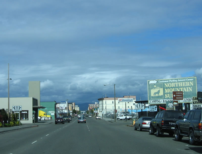
Three lanes carry northbound U.S. 101 east along 5th Street into downtown Eureka. The word "Eureka" means "I have found it!"; this is also the slogan of the state of California. Eureka is the seat of Humboldt County and is a regional center of commerce from around Humboldt, Del Norte, and Trinity Counties. Photo taken 05/26/06. |
|
Historic downtown Eureka lies ahead on 5th Street. Unlike Crescent City to the north, many of its historic buildings have survived and thrived, including some from the late 1800s. Founded in 1850, much of the oldest architecture in downtown Eureka features Victorian Style homes and buildings. In fact, the downtown area is a state historic landmark due to the unchanged nature of its downtown. Look for the Carson Mansion (built in 1885) as a classic example of the Victorian architecture to be found in downtown Eureka. Photo taken 05/26/06. |
|
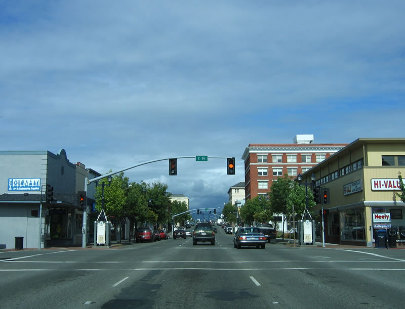
The downtown Eureka skyline is visible ahead as U.S. 101/5th Street meet Commercial Street. Photo taken 05/26/06. |
|
Despite the prevalence of historic structures, instances of modern architecture can be found alongside the older buildings. U.S. 101 passes through this area at a slow pace (30 miles per hour), but a walk through downtown is a much better way to enjoy the architecture, restaurants, and shops of Eureka. Photo taken 05/26/06. |
|
Turn left (north) on D Street to historic downtown Eureka. This is a highly recommended stop on any U.S. 101 tour. Eureka is situated next to Humboldt Bay and has a great deal of history in logging, mining, and now tourist. (Not to mention the fact that Eureka has the distinction of being one of the few U.S. 101 cities to keep U.S. 101 on its original alignment through downtown, which is an uncommon feat for nearly any city along U.S. 101's path within California.) Photo taken 05/26/06. |
|
A series of traffic signals along eastbound 5th Street (northbound U.S. 101 (Redwood Highway)) begins at the E Street intersection. A series of unique shops and restaurants line 5th Street and its companion 4th Street through downtown Eureka. Photo taken 05/26/06. |
|
Eastbound 5th Street reaches F Street at this intersection. Photo taken 05/26/06. |
|
G Street is up next; U.S. 101 north continues east via 5th Street. Photo taken 05/26/06. |
|
... And then we reach H Street, a one-way street traveling south. Photo taken 05/26/06. |
|
I Street is the following block; it travels north as part of a couplet with H Street. Photo taken 05/26/06. |
|
Approaching M Street, a pull-through sign for U.S. 101 north is posted. The grid pattern changes at Q Street, where Myrtle Avenue turns southwest and U.S. 101/Fifth Street meets California 255/R Street. Myrtle Avenue connects to Old Arcata Road, which follows the oldest route between Eureka and Arcata. It is unclear if old U.S. 101 ever traveled on Old Arcata Road. Photo taken 05/26/06. |
|
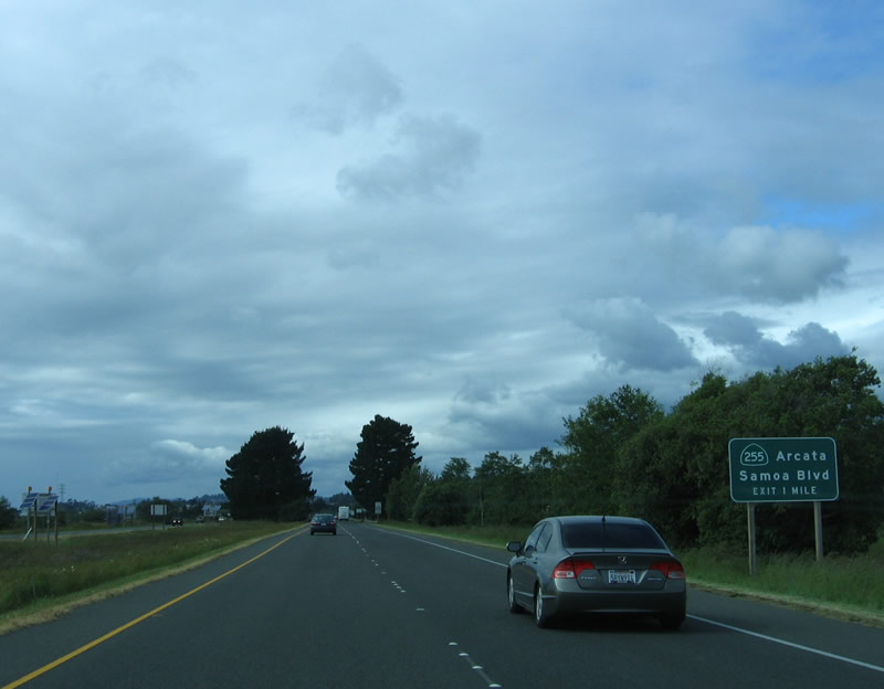
California 255 travels west across Humboldt Bay to Samoa, then turns north and east to rejoin U.S. 101 north of Arcata. For a longer alternative to U.S. 101 en route to Arcata and for coastal access, use California 255. Through traffic should remain on U.S. 101 north. Photo taken 05/26/06. |
|
Northbound U.S. 101/Fifth Street reaches California 255 west to Samoa at the R Street intersection. U.S. 101 leaves historic downtown Eureka. This marks the eastern (southern) terminus of California 255. Photo taken 05/26/06. |
|
Nearly exhausting the supply of alphabetic street names, northbound U.S. 101 (eastbound 5th Street) meets V Street. After this intersection, U.S. 101 changes from an urban alignment to an expressway routing. The section from here east to Arcata is known as the Burns Freeway, crossing mud flats and wetlands that follow Humboldt Bay. Photo taken 05/26/06. |
|
Leaving Eureka, the Michael J. Burns Freeway was completed in 1955 as an expressway, with at-grade intersections. State Senator Burns was an advocate of freeways and state routes. Burns was co-author of the landmark Collier Burns Act, which was passed in 1947 by the California State Legislature to upgrade deteriorating infrastructure in the aftermath of World War II. The Collier-Burns Act is based on recommendations of the Major Highway Development Committee (MDHC),1 raised the gas tax and vehicle license fees. One of the major goals of the legislation was to alter the allocation of vehicle license fees and gas tax to cities, counties, and special districts across the state. The act "reduced the proportion of spending the north received to 45 percent and increasing the southern share to 55 percent. The legislature also altered the rationale for the division of funds, basing the revised apportionments on the population in the two parts of the state rather than on the highway mileage."2 (The geographic allocation formula was amended again in 1970 to 60 percent to the southern part of the state and 40 percent to the northern part of the state, which stands true today [2006].) Photo taken 05/26/06. |
|
The Burns Freeway is a safety corridor as well as an expressway alignment. The four-lane highway features a 50 mile per hour speed limit. In addition to changing the allocation formula of gas tax, the Collier-Burns Act were an endorsement of freeway construction. Freeways that might not have been affordable under prior funding strategies were constructed under the new formula. Inventory of highway mileage is also contemplated by the Collier-Burns Act. According to the Collier Burns Act, "the Department of Public Works shall certify...the total maintained mileage of County roads in unincorporated territory..."3 This action consolidated county roads administration for unincorporated areas to a single department in each county. Finally, the Act also added more highways to the state highway system, including some urban mileage. Photo taken 05/26/06. |
|
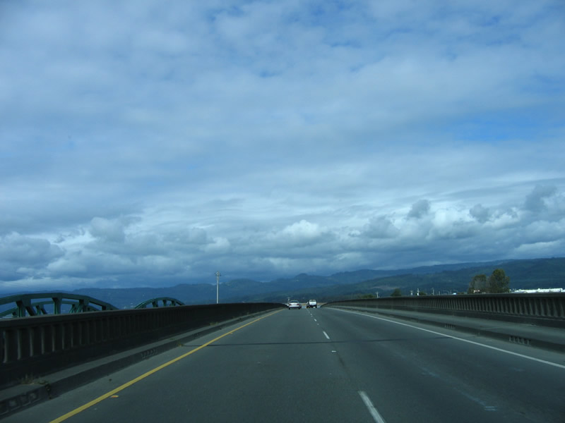
Northbound U.S. 101 crosses the Eureka Slough on this 1956 bridge. Note the original concrete guardrail. The bridge on the southbound direction is even older (from 1943) and was widened in 2001. Photo taken 05/26/06. |
|
The through steel truss bridge for southbound U.S. 101 traffic on the 1943 bridge is visible to the left of the Eureka Slough bridge. The 1956 bridge, which rises taller than the 1943 bridge, is not Interstate Standard as it has no shoulders and limited sight distance. Photo taken 05/26/06. |
|
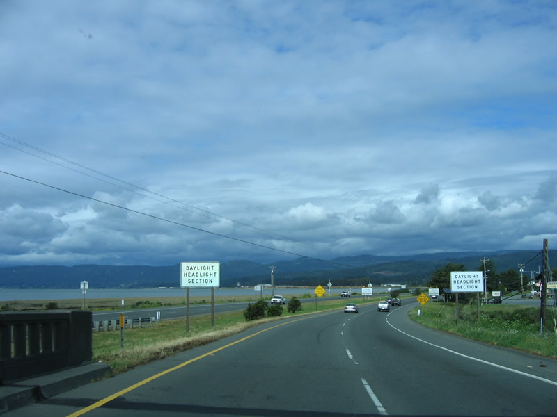
Coming off the Eureka Slough bridge, Humboldt Bay comes into view as the expressway continues east, parallel to the shoreline. This section of the U.S. 101 expressway is a safety corridor, and headlights are required for all traffic. Photo taken 05/26/06. |
|
Jacobs Avenue is the first intersection along the U.S. 101 expressway east of Eureka. Jacobs Avenue follows the expressway on the south side as a frontage road, connecting to Murray Field. Photo taken 05/26/06. |
|
After passing Murray Field, northeastbound U.S. 101 (Redwood Highway) approaches the Indianola Cutoff. Indianola Cutoff travels southeast to Myrtle Avenue (Old Arcata Road). Photo taken 05/26/06. |
|
The next intersection along U.S. 101 is KOA Drive/Bayside Cutoff. U.S. 101 again turns north along with the shoreline. Photo taken 05/26/06. |
|
Bayside Cutoff travels due east to Old Arcata Road. The railroad lies along the expressway to the west of U.S. 101. Photo taken 05/26/06. |
|
Finally assuming a true freeway configuration, northbound U.S. 101/Burns Freeway/Redwood Highway approaches the city of Arcata, leaving the mudflats and wetlands behind. The expressway ends and the freeway begins. Note that there is no access to G Street, which is old U.S. 101, from northbound U.S. 101. Photo taken 05/26/06. |
|
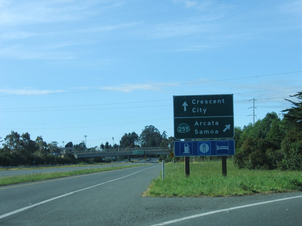
Continuing north on U.S. 101/Burns Freeway, the first exit on the freeway segment is Exit 713, California 255 (Samoa Boulevard) west to Arcata and Samoa. This is the northern end of the state highway that loops across Humboldt Bay, offering a coastal alternate to U.S. 101. Photo taken 05/26/06. |
|
A Pacific Gas and Electric (PG&E) power line passes overhead as U.S. 101 north approaches Exit 713, California 255. This modified cloverleaf interchange marks the northern terminus of California 255; to the east, Samoa Boulevard aims southeast, transitioning onto Old Arcata Road (which provides an alternative to U.S. 101 between Eureka and Arcata). Photo taken 05/26/06. |
|
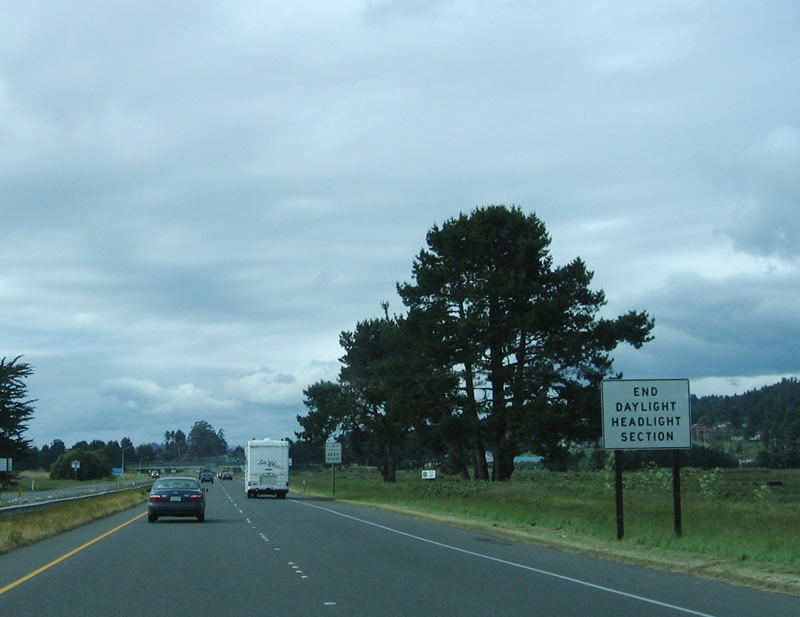
The daytime headlights section finally ends prior to the California 255 interchange. Photo taken 05/26/06. |
|
Northbound U.S. 101 (Redwood Highway/Burns Freeway) reaches Exit 713, California 255 west to Arcata and Samoa. The city of Arcata is home to 16,651 people per the 2000 Census. Incorporated in 1858, Arcata is a college town, with Humboldt State University (a campus of the California State University system) located northeast of downtown Arcata. Other focal points in the community include Arcata Marsh and Arcata's Community Forest (over 622 acres of timberland). Photo taken 05/26/06. |
|
Now on the collector distributor lane for the California 255 interchange and after crossing under the Samoa Boulevard bridge, this sign is posted at the exit from U.S. 101 north to California 255 (Samoa Boulevard) westbound (southbound). You can see this sign from the mainline in the next photobox. Photo taken 05/26/06. |
|
This bridge carries California 255 (Samoa Boulevard) over U.S. 101. The next exit on northbound U.S. 101 (Redwood Highway) (Burns Freeway) is Exit 714A, 14th Street and Lake Wood Boulevard to Arcata and Humboldt State University. Approximately 7,550 students attend the university, and it was founded in 1913. Photo taken 05/26/06. |
|
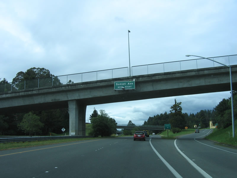
A mileage sign is posted on the 7th Street overpass for the next two exits: Exit 714A, 14th Street/Lake Wood Boulevard and Exit 714B, Sunset Avenue. Photo taken 05/26/06. |
|
An auxiliary lane from the California 255 interchange becomes exit only for Exit 714A, 14th Street and Lake Wood Boulevard to Humboldt State University. Photo taken 05/26/06. |
|
Passing under 11th Street, the next exit to serve Arcata is Exit 714B, 14th Street. This section of freeway (from California 255 to California 299) was built in 1976. Photo taken 05/26/06. |
|
Northbound U.S. 101/Burns Freeway reaches Exit 714B, 14th Street. The next exit is about two miles north of here. Photo taken 05/26/06. |
|
The next exit on northbound U.S. 101 (Redwood Highway) is Exit 716A, California 299. Like California 20 and California 36, California 299 offers an east-west connection across the Coast Range interchange to Interstate 5. Formerly designated as U.S. 299, the east-west highway was downgraded to a state highway designation in 1964. California 299 is generally a two-lane highway with some freeway sections between Arcata and Redding. It is also the best route between U.S. 101 and Interstate 5 from Eureka-Arcata and points east. (California 36 is generally a slower route and less reliable during winter months.) Photo taken 05/26/06. |
|
Use Exit 716B (Giuntoli Road and Janes Road) to a California Welcome Center. The welcome center features tourist information, restrooms, and related motorist facilities. The welcome center is not on California 299, so don't use Exit 716A. Photo taken 05/26/06. |
|
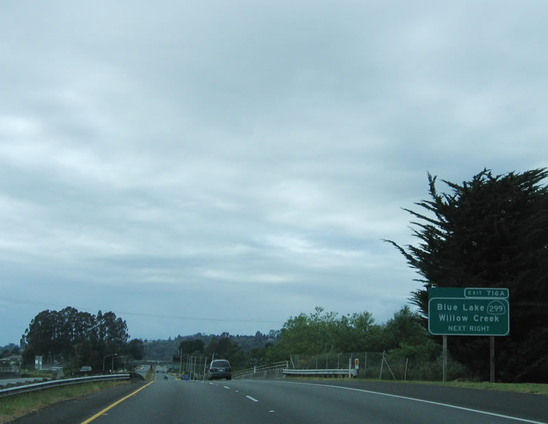
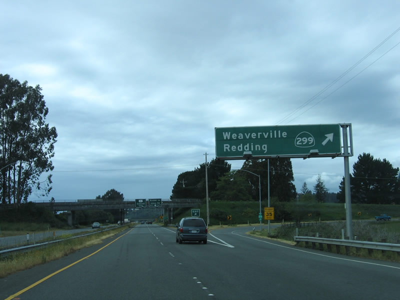
Northbound U.S. 101 (Redwood Highway) reaches Exit 716A, California 299 east. This trumpet interchange (built in 1956) marks the terminus of California 299. From 1934 through 1964, this route was signed as U.S. 299 from Arcata to Redding to Alturas, ending at U.S. 395. The section of California 299 east of U.S. 395 was never part of U.S. 299. When most U.S. highways in California were eliminated, U.S. 299 was removed because it was less than 300 miles and wholly located within one state. Even today, when California 299 reaches the Nevada state line, it reverts to an unpaved road (Nevada 8A). Use California 299 east to Weaverville, Redding, Blue Lake, and Willow Creek. California 299 serves Trinity County, a remote area between the coast and the well-traveled Interstate 5/U.S. 99 corridor. It also connects to California 3, a scenic north-south route to Yreka. Photo taken 05/26/06. |
|
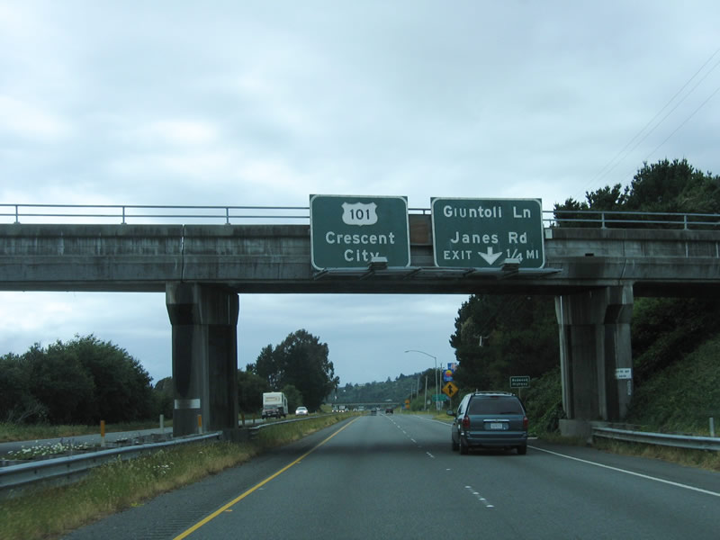
The next exit along northbound U.S. 101 (Redwood Highway) is Exit 716B, Giuntoli Road and Janes Road. For the first time, U.S. 101 north is signed with Crescent City as a control city. Crescent City, the seat of Del Norte County, is still over an hour's drive north of here, and significant portions of the highway is two lanes. Photo taken 05/26/06. |
|
Northbound U.S. 101 (Redwood Highway) reaches Exit 716B, Giuntoli Road and Janes Road. Giuntoli Road travels east to meet California 299, while Janes Road travels west and then south back toward Arcata. Photo taken 05/26/06. |
|
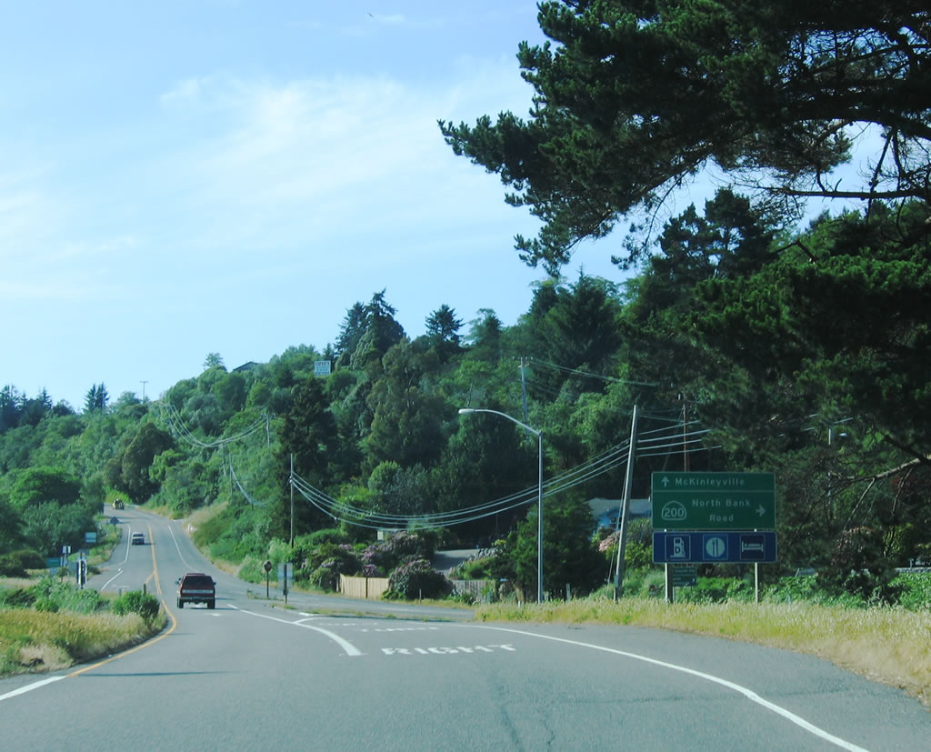
Leaving the city of Arcata, northbound U.S. 101 enters the vicinity of McKinleyville. Named after President McKinley, this unincorporated area of Humboldt County (not a city) is home to 13,599 people as of the 2000 Census and contains 20.9 square miles of land and 1.92 square miles of water. It was briefly known as Dows Prairie and Minorville as it was settled and increased in size between 1850 and 1900; after McKinley's assassination in 1901, McKinleyville regained its named permanently in honor of the president. Photo taken 05/26/06. |
|
The next exit is Exit 718, California 200 east to California 299 and U.S. 101 Business/Central Avenue north to McKinleyville. California 200 follows North Bank Road along the Mad River corridor, connecting with California 299 at a trumpet interchange just east of the California 299 bridge over the Mad River. Photo taken 05/26/06. |
|
A rare "Route 101 Freeway/Business" sign is posted on northbound U.S. 101 (Redwood Highway). The business loop follows Central Avenue north into McKinleyville on the old alignment of U.S. 101. This is the first officially recognized business route on U.S. 101 since leaving Cloverdale (the old U.S. 101 alignment along State Street in Ukiah in not recognized as a business route). At the time this photo was taken, there was no other signage for this exit, which is now signed (with exit number) as California 200. Photo taken 05/28/06. |
|
Now on the off-ramp to Exit 716, continue straight ahead to follow U.S. 101 Business (Central Avenue) north into McKinleyville and turn right onto California 200, North Bank Road. Photo taken 05/28/06. |
|
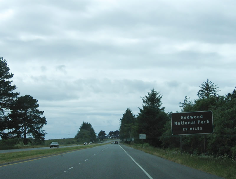
After the California 200 interchange, this roadside sign provides the distance to Redwood National Park (29 miles). This is a major stand of redwoods in addition to those found in the redwood groves of Humboldt Redwoods State Park. Photo taken 05/26/06. |
|
This mileage sign provides the distance to Trinidad (11 miles), Crescent City (69 miles), and Portland, Oregon (397 miles). The Portland mileage is calculated by taking U.S. 101 north to U.S. 199 north to Interstate 5 north (along the Redwood Highway corridor to Grants Pass, then old U.S. 99 from there northward). Photo taken 05/26/06. |
|
The next three exits are Exit 719, School Road; Exit 721, Murray Road; and Exit 722, Airport Road. Photo taken 05/26/06. |
|
A small roadside sign advises of Exit 719, School Road. Use School Road east to U.S. 101 Business/Central Avenue in McKinleyville. Photo taken 05/26/06. |
|
Northbound U.S. 101 (Redwood Highway) reaches Exit 719, School Road. The section of U.S. 101 between Exit 718 (California 200) and Exit 726A, Westhaven Drive, was built in 1964 (excepting the Little River bridge, which was built in 1945/northbound and 1964/southbound). Photo taken 05/26/06. |
|
The next exit along northbound is Exit 721, Murray Road. Motorist services (gas, food, and lodging) are available at this exit. Photo taken 05/26/06. |
|
A single exit number sign is posted next along northbound U.S. 101 for Exit 721, Murray Road. Photo taken 05/26/06. |
|
Northbound U.S. 101 (Redwood Highway) reaches Exit 721, Murray Road. Photo taken 05/26/06. |
|
The next exit along northbound U.S. 101 is Exit 722, Airport Road to Arcata Airport. Photo taken 05/26/06. |
|
Northbound U.S. 101 (Redwood Highway) reaches Exit 722, Airport Road to Arcata Airport. Use Airport Road east to the airport and to U.S. 101 Business/Central Avenue. Photo taken 05/26/06. |
|
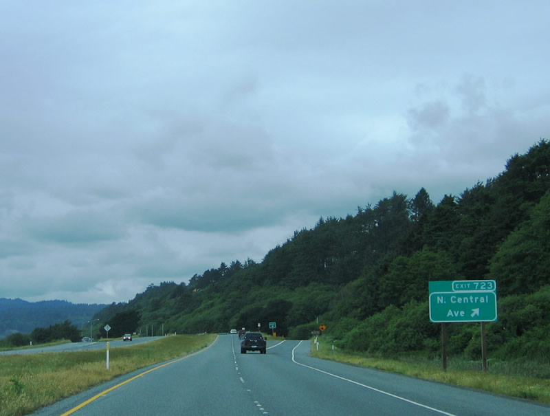
Northbound U.S. 101 (Redwood Highway) reaches Exit 723, U.S. 101 Business/Central Avenue south to McKinleyville. From here, U.S. 101 follows close to its original alignment; frontage road parallel the freeway between Exits 723 and 725. Clam Beach County Park and Little River State Beach are to the left (west) of the U.S. 101 freeway. Photo taken 05/26/06. |
|
Continuing north, the next exit along U.S. 101 is Exit 725, Crannell Road. Use the eastern frontage road south to Crannell Road east. Photo taken 05/26/06. |
|
The next exit along northbound U.S. 101 (Redwood Highway) is Exit 726A, Westhaven Drive. Exit here, then turn left to connect to Scenic Drive north. Scenic Drive is an old alignment of U.S. 101 and provides a scenic alternate to the freeway, which no longer has a center divide. However, the freeway retains four lanes. Photo taken 05/26/06. |
|
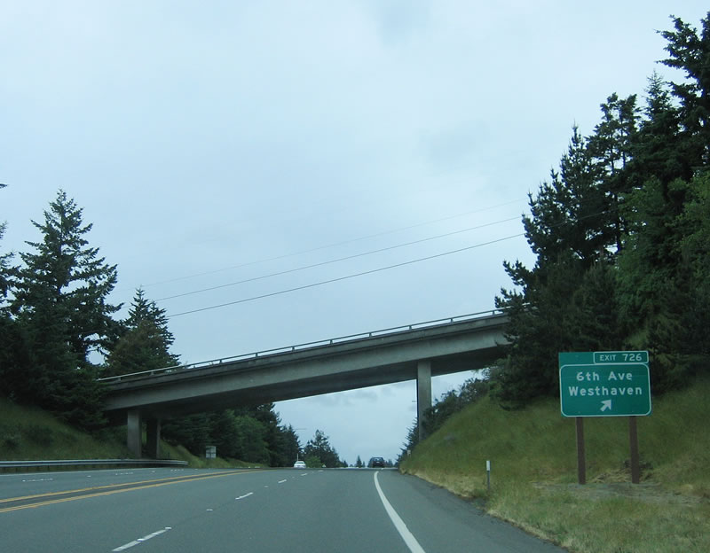
The next exit along northbound U.S. 101 is Exit 726B, Kahlstrom Avenue to 6th Avenue and Westhaven. Sixth Avenue travels east-west through Kahlstrom Avenue. Photo taken 05/26/06. |
|
Sixth Avenue crosses over U.S. 101 as the northbound Redwood Highway reaches Exit 726B, 6th Avenue to Westhaven. Photo taken 05/26/06. |
|
A reassurance shield for U.S. 101 north is posted after Exit 726B. Photo taken 05/26/06. |
|
The next exit along northbound U.S. 101/Redwood (William Z. Hegy Memorial) Highway is Exit 728, Main Street/Westhaven Drive to Trinidad. Scenic Drive (old U.S. 101) becomes the western frontage road for the freeway, then turns into Patricks Point Drive north. This old section of U.S. 101 follows along the coastline and rejoins U.S. 101 at Exit 734. This six-mile scenic alternative to U.S. 101 freeway is well worth the trip. Meanwhile, the current section of U.S. 101 freeway still has no center divide/median. Photo taken 05/26/06. |
|
The Marine Laboratory for Humboldt State University is accessible via Exit 728. Photo taken 05/26/06. |
|
To scenic Trinidad State Beach, use Exit 728 and follow Main Street west into town. Through this stretch of U.S. 101 in Trinidad, the freeway was constructed in 1960 (as far north as Exit 731, Seawood Drive). Photo taken 05/26/06. |
|
While most services are available in Trinidad, no services are available on U.S. 101 for the next 20 miles. Gas, food, and lodging are available here. Visitors may wish to rest here and see the rugged coastline and beautiful fishing village and lighthouse. Photo taken 05/26/06. |
|
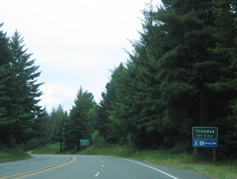
Northbound U.S. 101 (Redwood Highway) reaches Exit 728, Main Street/Westhaven Drive to the city of Trinidad. This city is home to only 311 people as of the 2000 Census, which makes it one of the smallest incorporated cities in the entire state of California. Trinidad, which was incorporated in 1870, is also home to the well-known lighthouse and a quaint fishing village. Photo taken 05/26/06. |
|
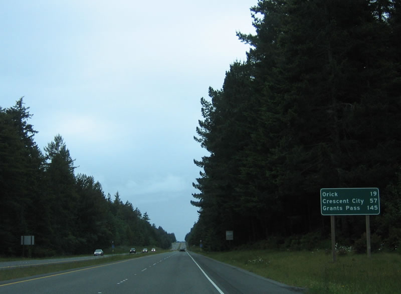
This mileage sign provides the distance to Orick (19 miles), Crescent City (57 miles), and Grants Pass, Oregon via U.S. 199 north (145 miles). Photo taken 05/26/06. |
|
The next exit along northbound U.S. 101 (Redwood Highway) is Exit 731, Seawood Drive. Photo taken 05/26/06. |
|
Northbound U.S. 101/Redwood Drive reaches Exit 731, Seawood Drive. To the west, Seawood Drive connects to Patricks Point Drive (old U.S. 101). Photo taken 05/26/06. |
|
The next exit along northbound U.S. 101 (Redwood Highway) is Exit 733, Rest Area, followed by Exit 734, Patricks Point Drive. The U.S. 101 freeway was constructed in 1970 between Exit 731 and Exit 734. Photo taken 05/26/06. |
|
The rest area is the next off-ramp, at Exit 733. Restrooms, drinking water, and pet walking areas are available here. Photo taken 05/26/06. |
|
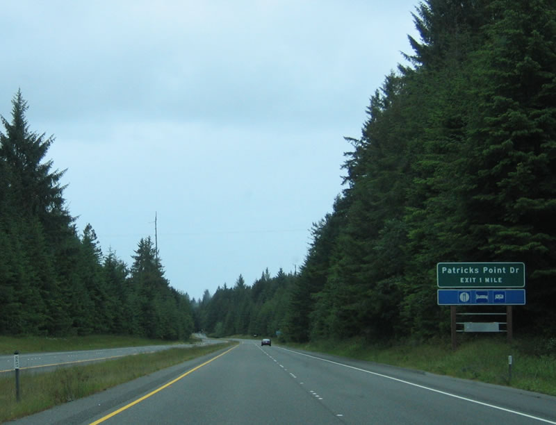
Northbound U.S. 101 (Redwood Highway) reaches Exit 734, Patricks Point Drive, which provides access to Patricks Point State Park on the beach west of U.S. 101. Patricks Point Drive travels south from here along old U.S. 101 south along a route close to the ocean. Photo taken 05/26/06. |
|
The freeway section again ends as U.S. 101 reverts to a four-lane expressway alignment (without the median barrier) after the Patricks Point Drive segment returns to U.S. 101. A left turn is required to Big Lagoon Park Road. Photo taken 05/26/06. |
|
The Big Lagoon Bridge was built in 1958 and carries four lanes of U.S. 101 traffic over the Big Lagoon. Photo taken 05/26/06. |
|
This centerline view shows U.S. 101 north after the Big Lagoon bridge. Photo taken 05/28/06. |
|
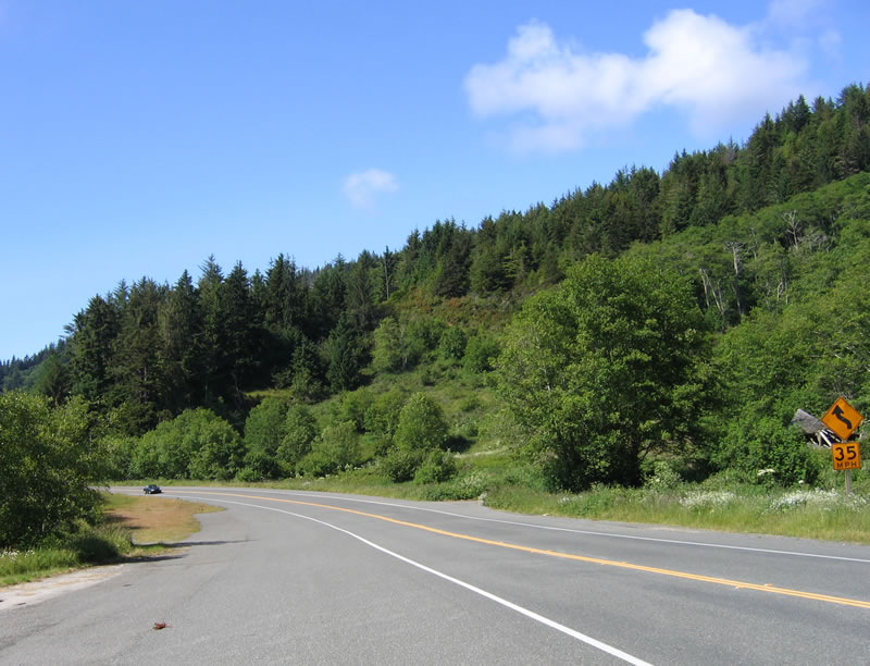
Immediately after Big Lagoon, U.S. 101 narrows to two lanes. There is no bypass of this section. Photo taken 05/26/06. |
|
The two-lane Redwood Highway climbs out of the Big Lagoon basin and will next approach Dry Lagoon. Photo taken 05/28/06. |
|
Continuing north, a left turn is required to connect to Humboldt Lagoons State Park (Dry Lagoon). Photo taken 05/26/06. |
|
Northbound U.S. 101 (Redwood Highway) approaches Humboldt Lagoons State Park Visitors Center (the main building of the visitors center was a restaurant-motel known as the Little Red Hen until 1979). Photo taken 05/26/06. |
|
This view of U.S. 101 (Redwood Highway) north is afforded from the parking lot of Humboldt Lagoons State Park Visitors Center. Photo taken 05/28/06. |
|
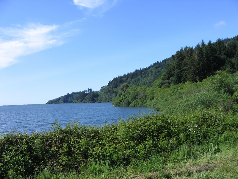
In addition, this view shows Stone Lagoon from the parking lot at Humboldt Lagoons State Park Visitors Center. Photo taken 05/28/06. |
|
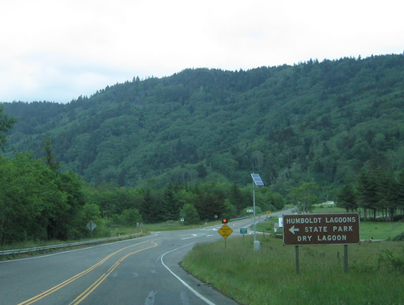
Shortly thereafter, Stone Lagoon comes into view on U.S. 101 north within Humboldt Lagoons State Park. The four lagoons along this stretch of U.S. 101 (from south to north) are: Big Lagoon, Dry Lagoon, Stone Lagoon, and Freshwater Lagoon. The first three lagoons have been breached and are saline, while Freshwater Lagoon is still fresh (as the ocean has not yet breached the spit of land between it and the ocean). Dry Lagoon was drained by farmers, but growing conditions proved less than optimal. Photo taken 05/26/06. |
|
Continuing north, U.S. 101 passes by Old State Highway, then follows a two-lane alignment toward Freshwater Lagoon. Photo taken 05/28/06. |
|
A reassurance shield for U.S. 101 north is posted as the highway crests and enters Humboldt Lagoons State Park. The ocean can be seen to the west of the highway as we approach Freshwater Lagoon. Photo taken 05/28/06. |
|
Leaving the Freshwater Lagoon area, an information booth is located to the west of U.S. 101. Photo taken 05/26/06. |
|
The next community along northbound U.S. 101 is Orick, some 20 miles north of the city of Trinidad. Photo taken 05/26/06. |
|
Orick, an unincorporated community, used to be surrounded by redwood trees, but with the clear cutting of those redwood groves, the entire area is now more like a meadow. The zip code here is 95555. Photo taken 05/26/06. |
|
Leaving Orick, this mileage sign provides the distance to Klamath (18 miles), Crescent City (40 miles), and Portland (366 miles). Now U.S. 101 north will pass through scenic Redwood National Park. U.S. 101 provides access to most of the developed portions of the national park, and there is no entrance fee to the park. Photo taken 05/26/06. |
|
U.S. 101 remains two lanes as it enters Redwood National Park. Established in October 1968 and expanded in 1978 and again in 2005, Redwood National Park contains several state parks within its boundaries: Prairie Creek Redwoods State Park (established August 13, 1923), Del Norte Coast Redwoods State Park (established October 26, 1925), and Jedediah Smith Redwoods State Park (established June 3, 1929). Of the nearly 132,000 acres of parkland (excluding the 2005 annexation of the Mill Creek watershed), approximately 38,982 acres are "old growth" redwood forest. Looking north on U.S. 101, use Bald Hill Road to the Lady Bird Johnson grove of redwood trees. Photo taken 05/26/06. |
|
A left turn here connects to Davison Road west to Elk Meadow, Gold Bluffs Beach, and Fern Canyon. A notable change in the area is the emergence of ferns below the tree canopy. This groundcover, which is all but absent south of Mendocino County, becomes much more common along the North Coast. Photo taken 05/26/06. |
|
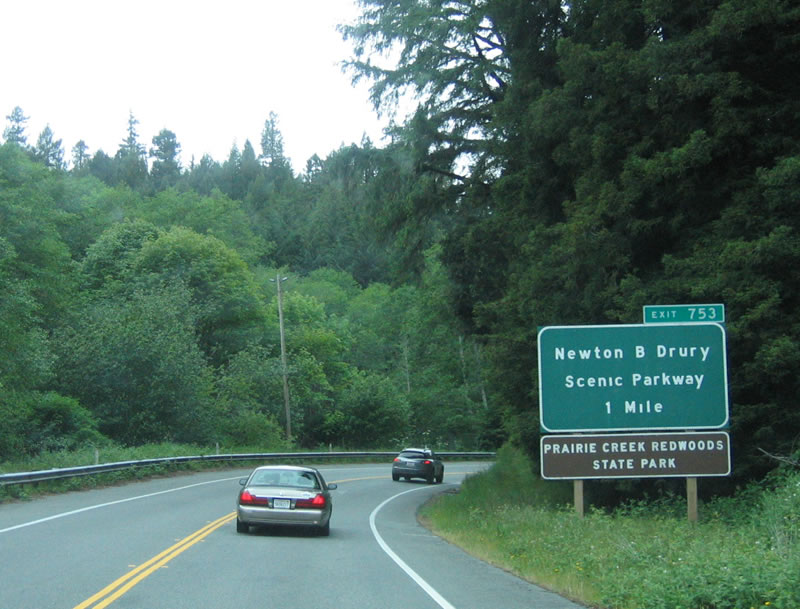
The next exit along northbound U.S. 101 is Exit 753, Newton B. Drury Scenic Parkway. The scenic parkway is the old alignment of U.S. 101. Photo taken 05/26/06. |
|
A sharp turn is found on northbound U.S. 101 as the two-lane highway winds it way through the undeveloped areas in and around Redwood National Park. Gorgeous! Photo taken 05/26/06. |
|
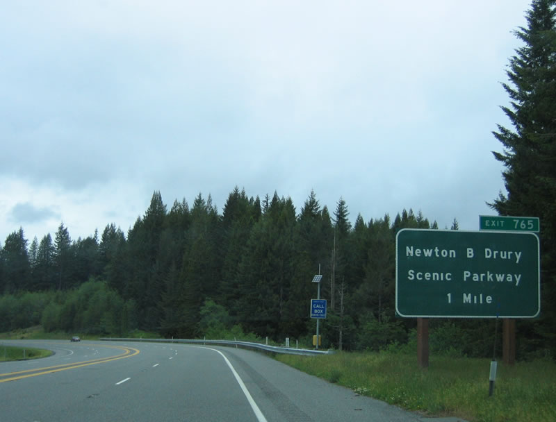
Use Exit 753, Newton B. Drury Scenic Parkway, to Prairie Creek Redwoods State Park. "Scenic Alternate" is designated since the parkway allows motorists to follow old U.S. 101 between Exits 753 and 765. Photo taken 05/26/06. |
|
Northbound U.S. 101 (Redwood Highway) reaches Exit 753, Newton B. Drury Scenic Parkway. Between August 20, 1940, and March 31, 1951, Mr. Drury was a director of the National Park Service and is known for helping to establish the California State Parks Commission in 1928 and for working with the Save the Redwoods League of California. Between 1951 and 1959, Mr. Drury served as director of the California State Division of Beaches and Parks, then worked with the league during his retirement. Creating Redwood National Park was one of his goals. Today the scenic route of U.S. 101 is named for him; ironically, other bypasses like the one that lies ahead were opposed by Mr. Drury, as the state parks division and highway department routinely fought over highway alignments within state parkland. Photo taken 05/26/06. |
|
Now on the bypass alignment, U.S. 101 north again widens to four lanes (undivided). The bypass was built and opened in the 1980s. A mileage sign provides the distance to Klamath and Crescent City in Del Norte County as well as Portland, Oregon (via U.S. 199). Photo taken 05/26/06. |
Page Updated August 3, 2007.