| U.S. 101 south |
|
U.S. 101 leaves the Beaver State of Oregon and enters the Golden State of California. A welcome sign stands next to a pull out for photo opportunities. Photo taken 05/28/06. |
|
The first southbound mileage sign on U.S. 101 is located just south of the welcome sign and provides the distance to Smith River (six miles), U.S. 199 (16 miles), and Crescent City (19 miles). Photo taken 05/28/06. |
|
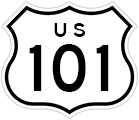
This is the first U.S. 101 shield on southbound in California, and it features the standard cutout U.S. shield that is common on U.S. highways in California but all but extinct on U.S. highways in other states. A couple of shields like this one can still be found elsewhere, including a few in Colorado and perhaps in other locations. Photo taken 05/28/06. |
|
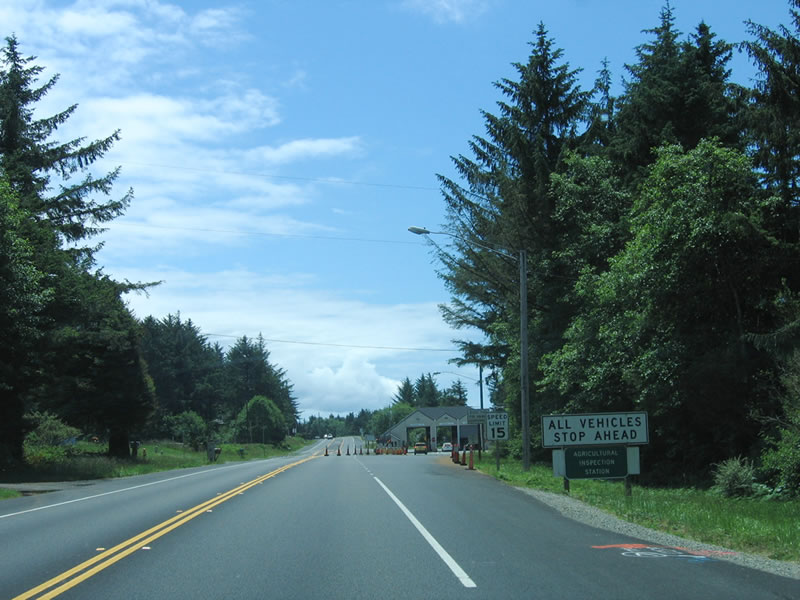
All vehicles must stop at the California Agricultural Inspection Station, which also serves as a weigh station. Unlike the agricultural inspection stations in the southern part of the state, this station does not double as a U.S. Border Patrol checkpoint. Photo taken 05/28/06. |
|
After exiting the agricultural inspection station and weigh station, a small Del Norte County welcome sign is posted: "Welcome to Del Norte County, the Redwood Gate to the Golden State." A similar sign is posted on southbound U.S. 199 (Redwood Highway) when it crosses from Oregon into California. Photo taken 05/28/06. |
|
Continuing south, the first major intersection along U.S. 101 in California is with Del Norte County D-5 (Ocean View Drive). Use Ocean View Drive south as a parallel route to U.S. 101. Photo taken 05/28/06. |
|
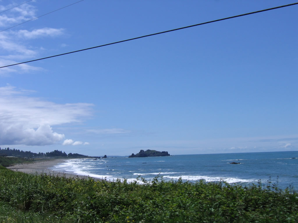
The picturesque Pacific Ocean comes into view along U.S. 101 south. Photo taken 05/28/06. |
|
Southbound U.S. 101 crosses Gilbert Creek on this low-level, 1953 bridge. Photo taken 05/28/06. |
|
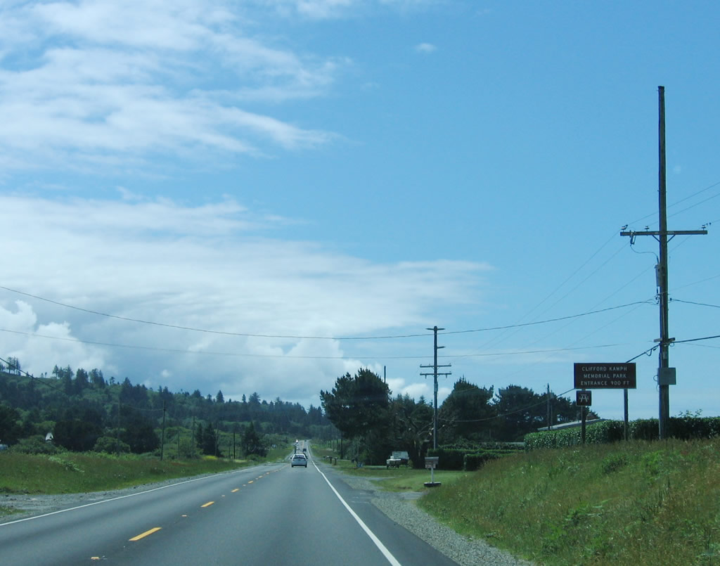
Entering the Smith River Rancheria, southbound U.S. 101 approaches the turnoff for Clifford Kamph Memorial Park, which is operated by Del Norte County. The park is a small camping and beach access area located north of Smith River and south of the Oregon state line. Some picnicking, hiking, and related activities are available here. Photo taken 05/28/06. |
|
Leaving Smith River Rancheria, U.S. 101 south swings inland away from the ocean. The highway remains two lanes until it connects with U.S. 199 (Redwood Highway). Photo taken 05/28/06. |
|
This view shows a straight section of U.S. 101 as it turns a bit inland from the ocean. Photo taken 05/28/06. |
|
Southbound U.S. 101 again meets Del Norte County D-5 (Ocean View Drive) north as well as Sarina Road south. Shortly after this intersection, U.S. 101 enters the town of Smith River. Photo taken 05/28/06. |
|
Entering the town of Smith River, U.S. 101 approaches Beckstead Avenue. Photo taken 05/28/06. |
|
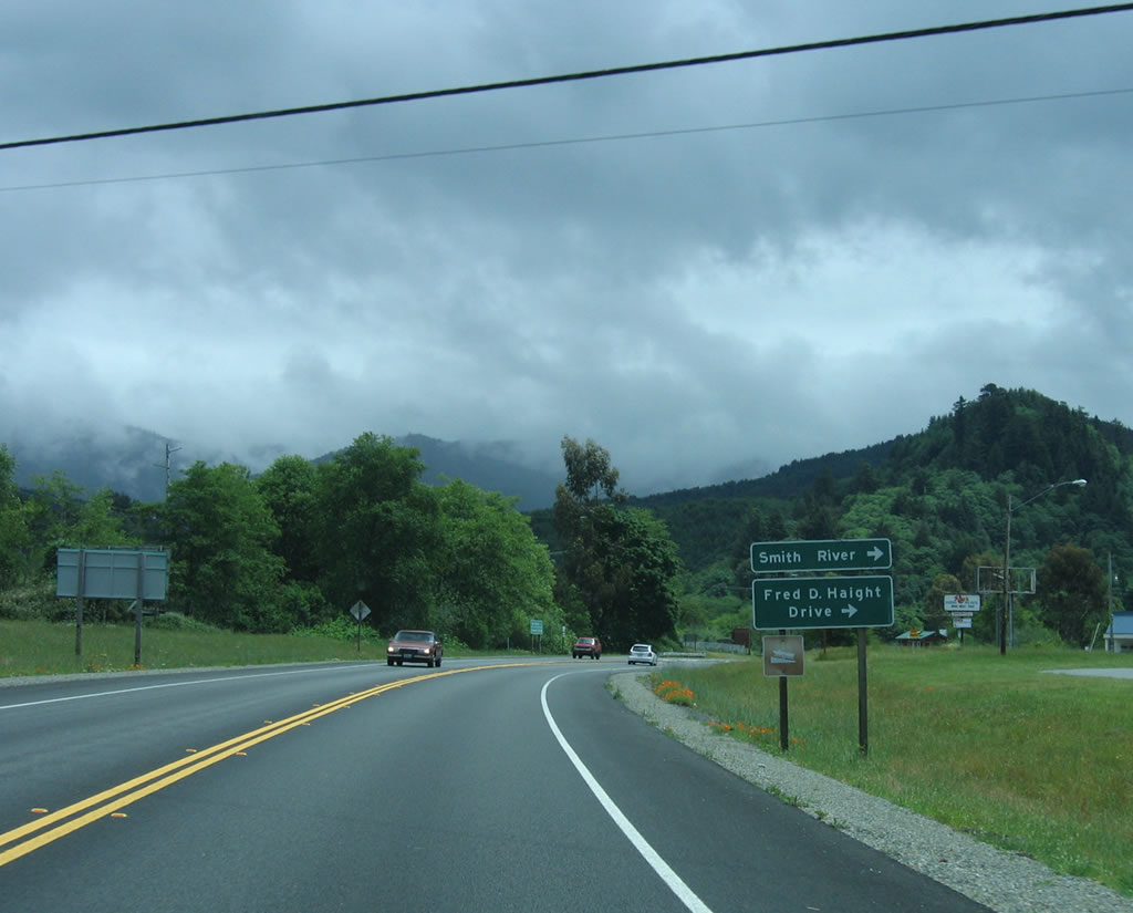
Southbound U.S. 101 meets Del Norte County D-4 (Fred D. Haight Drive) in downtown Smith River. Fred D. Haight Drive is old U.S. 101 and parallels the current alignment until reaching the Smith River bridge. Photo taken 05/28/06. |
|
Leaving Smith River, U.S. 101 south approaches Rowdy Creek Road. Shortly thereafter is a mileage sign for Crescent City (13 miles), Eureka (92 miles), and distant San Francisco (361 miles). Photo taken 05/28/06. |
|
U.S. 101 crosses over Rowdy Creek on this bridge. To the west of the highway is the Smith River, which parallels U.S. 101 from the town of Smith River until the California 197 intersection. Photo taken 05/28/06. |
|
After crossing Rowdy Creek, this sign advises of elk crossings in the next two miles. Although we did not see any elk on our drive along U.S. 101, they are still found along the route fairly commonly. Photo taken 05/28/06. |
|
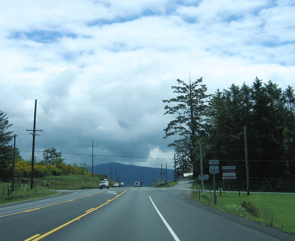
Southbound U.S. 101 approaches California 197, North Bank Road. Use California 197 east to Jedediah Smith State Park and Smith River National Recreation Area. California 197 ends at U.S. 199 (Redwood Highway) and is part of the route from Brookings, Oregon, east to Grants Pass, Oregon, via U.S. 101, California 197, and U.S. 199. There is no connection to U.S. 199 north at the interchange, so use California 197 as a short cut to U.S. 199 north. Photo taken 05/28/06. |
|
California 197 is a short connection from U.S. 101 to U.S. 199 via North Bank Road. The route parallels the Smith River on the north bank, hence the naming of the road. Photo taken 05/28/06. |
|
Southbound U.S. 101 meets California 197 (North Bank Road) at this intersection. From here, U.S. 101 prepares to cross over the Smith River. Photo taken 05/28/06. |
|
|
|
U.S. 101 crosses the Smith River via the Dr. Ernest M. Fine Memorial Bridge. Built in 1940, the Dr. Ernest M. Fine Bridge carries two lanes of U.S. 101 via a steel deck girder bridge; the girders are painted green. The bridge also crosses the overflow channel for the Smith River, which can flood especially during winter months. Photos taken 05/28/06. |
|
Southbound U.S. 101 meets Del Norte County D-3 (Lake Earl Drive) at this intersection. Use Lake Earl Drive west to Pelican Bay State Prison. Photo taken 05/28/06. |
|
After crossing the Smith River and meeting Del Norte County D-3 (Lake Earl Drive), this mileage sign provides the distance to the junction with U.S. 199 (Redwood Highway) north (4 miles), Crescent City (8 miles), and Eureka (88 miles). Photo taken 05/28/06. |
|
The next major intersection along southbound U.S. 101 is with Kings Valley Road. Use Kings Valley Road west to Fort Dick. Photo taken 05/28/06. |
|
Continuing south after the Kings Valley Road intersection is this "Divided Road Ahead Three Miles" sign. A brief freeway section carries U.S. 101 past the U.S. 199 interchange before entering downtown Crescent City. Photo taken 05/28/06. |
|
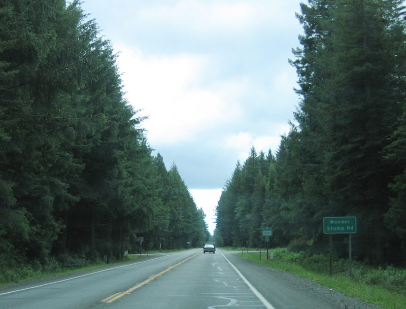
Another major intersection on U.S. 101 is with Wonder Stump Road. This section of U.S. 101 is relatively undeveloped and features tall trees on both sides of the two-lane highway. However, a freeway segment lurks ahead. Photo taken 05/28/06. |
|
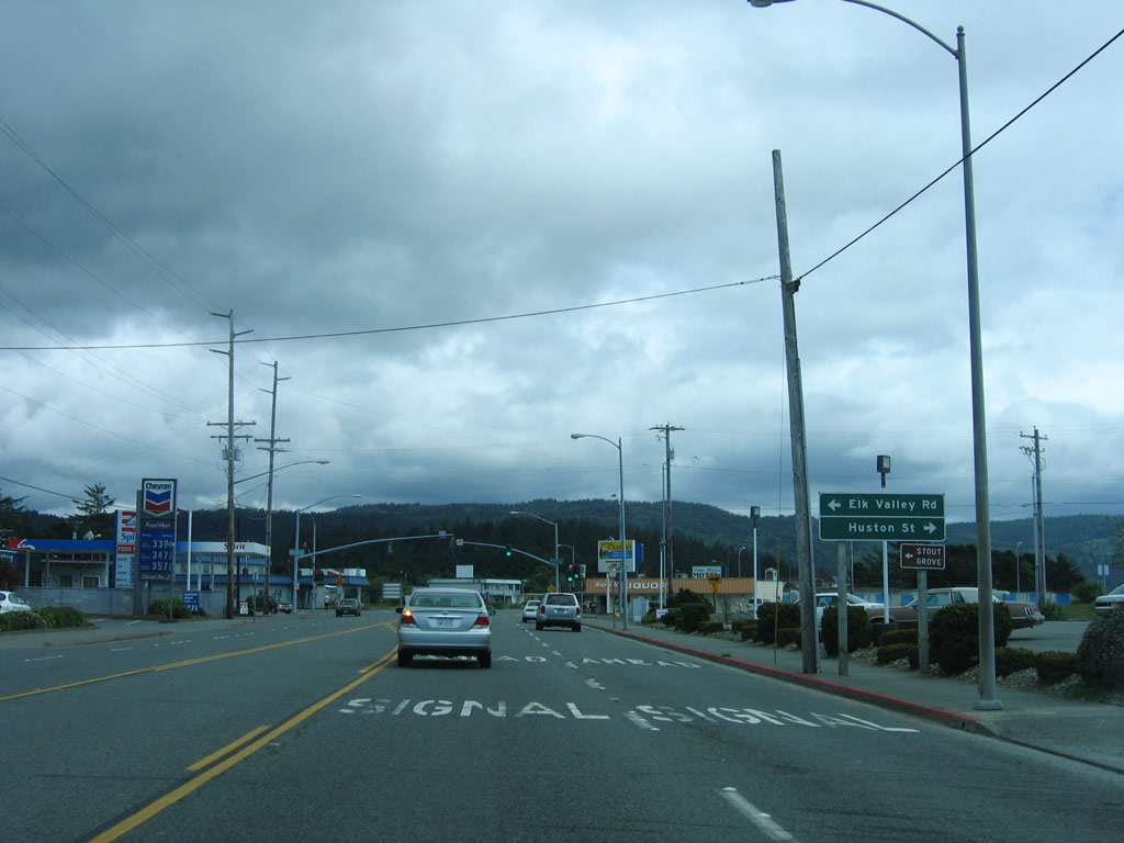
Southbound U.S. 101 approaches Elk Valley Cross Road, which connects to U.S. 199 (Redwood Highway) north. There is no direct connection from U.S. 101 south to U.S. 199 north. The control city on this relatively new reflective guide sign is Grants Pass, Oregon, which is the northern terminus of U.S. 199 and the Redwood Highway. Photo taken 05/28/06. |
|
U.S. 101 widens to three lanes, with two southbound lanes. Traffic connecting to U.S. 199 (Redwood Highway) north should use the left lane to turn onto Elk Valley Cross Road. Photo taken 05/28/06. |
|
A roadside sign advises of the connections: turn left to U.S. 199 north to Grants Pass or use either lane for the continuation of U.S. 101 to Crescent City. Believe it or not, this is the first and only time where U.S. 101 meets another U.S. highway within the state of California. Due to the mass decommissioning of U.S. highways in California beginning in 1964, no U.S. highways other than U.S. 199 connect to U.S. 101 ... and U.S. 199 itself does not intersect with any other U.S. Highways - it ends at Interstate 5 in Grants Pass. Photo taken 05/28/06. |
|
A small roadside sign advises that the U.S. 199 connection is afforded via Elk Valley Cross Road. Turn east to the U.S. 199 intersection or turn west to Florence Keller Park. Photo taken 05/28/06. |
|
After the Elk Valley Cross Road intersection, the northernmost segment of U.S. 101 freeway in California begins. In the distance, the ramp that carries U.S. 199 south onto U.S. 101 south can be seen. Photo taken 05/28/06. |
|
Built in 1971, the U.S. 199/101 separation allows for a freeway directional interchange. Traffic connections are provided from U.S. 101 north to U.S. 199 north and U.S. 199 south to U.S. 101 south. All other connections are afforded via Elk Valley Cross Road. After this ramp joins U.S. 101 south, U.S. 101 will follow the Redwood Highway all the way south to the Golden Gate Bridge and San Francisco, some 355 miles south of here. Photo taken 05/28/06. |
|
This reassurance shield is posted after traffic from U.S. 199 south merges onto U.S. 101 south. The Redwood Highway follows U.S. 101 from here all the way to San Francisco. Photo taken 05/28/06. |
|
A mileage sign for destinations along U.S. 101 south is posted after the previous reassurance shield. Crescent City is only three miles ahead, while Eureka is 83 miles and San Francisco is 354 miles south of here. Photo taken 05/28/06. |
|
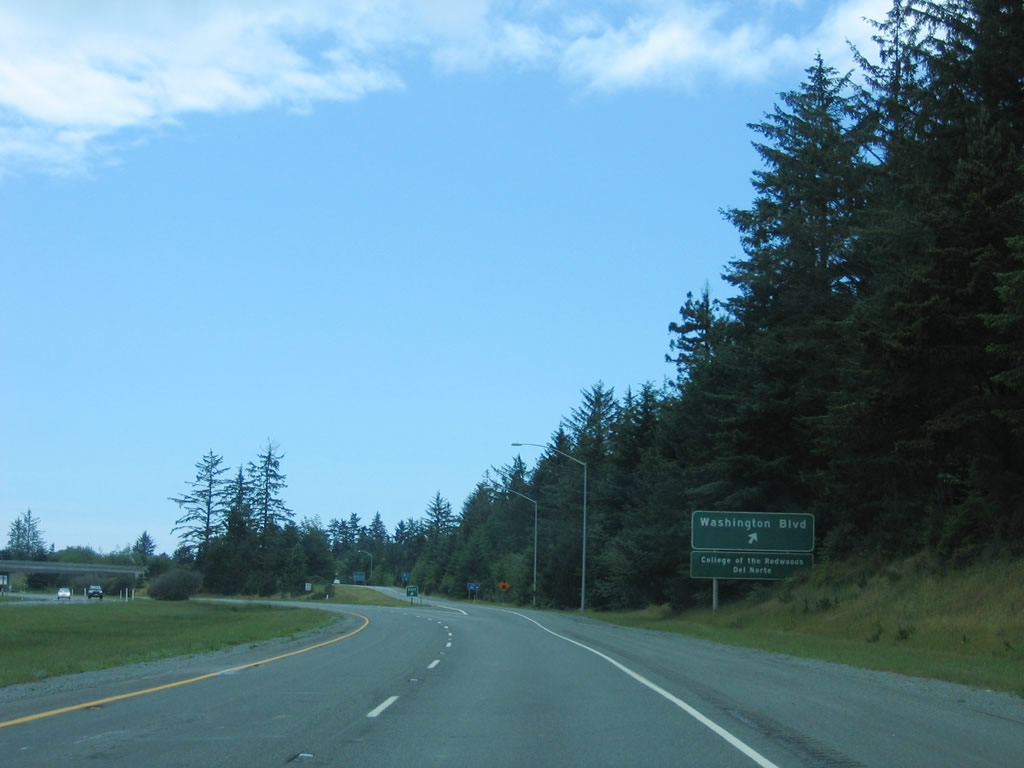
The only exit on this section of U.S. 101 freeway is Exit 791, Del Norte County D-1 (Washington Boulevard). Use Washington Boulevard west to Sutter Coast Hospital and Jack McNamara Field (CEC). After passing by the airport, Washington Boulevard meets the Pacific coast and ends at Pebble Beach Drive. Photo taken 05/28/06. |
|
Exit 791 is a half-diamond interchange, with access from U.S. 101 south to Washington Boulevard and from either direction of Washington Boulevard to U.S. 101 north. Photo taken 05/28/06. |
|
Passing under Railroad Avenue (no access), the freeway will end in a half mile immediately after Exit 791, Washington Boulevard. Photo taken 05/28/06. |
|
Southbound U.S. 101 (Redwood Highway) reaches Exit 791, Del Norte County D-1 (Washington Boulevard). Like most county routes in Del Norte County, the pentagon shields normally used to sign the county routes are rare if not gone. However, most maps show the county routes as if they were signed. Photo taken 05/28/06. |
|
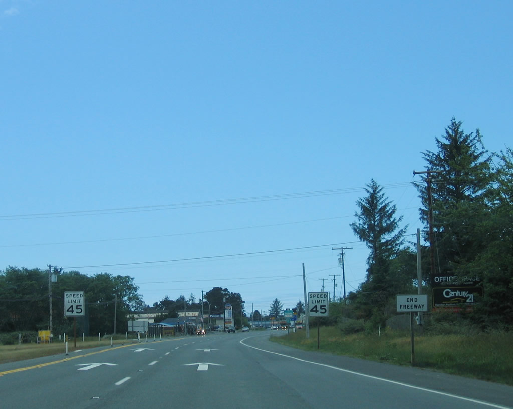
After Exit 791, the freeway ends and the speed limit drops to 45 miles per hour. The first intersection after the short freeway segment is with Parkway Drive. Photo taken 05/28/06. |
|
A reassurance shield for U.S. 101 south is posted after the freeway segment ends. The highway prepares to enter Crescent City. Photo taken 05/28/06. |
|
Entering the city of Crescent City, U.S. 101 assumes an urban feel for the first time since entering the state of California. Crescent City has nearly 75 inches of rainfall annually and was struck by a tsunami in 1964 (the same year of the massive river floods along the Eel River and Klamath River) caused by the Good Friday Earthquake in Alaska. Most of the city had to be rebuilt after the tsunami, which resulted in development that was common at that time and far fewer historic buildings. A tsunami in November 2006 resulting from an earthquake at Kuril Islands (located between Russia and Japan) caused damage to the harbor area. Incorporated in 1854, Crescent City was home to 6,670 people (per the 2016 Census estimate). Photo taken 05/28/06. |
|
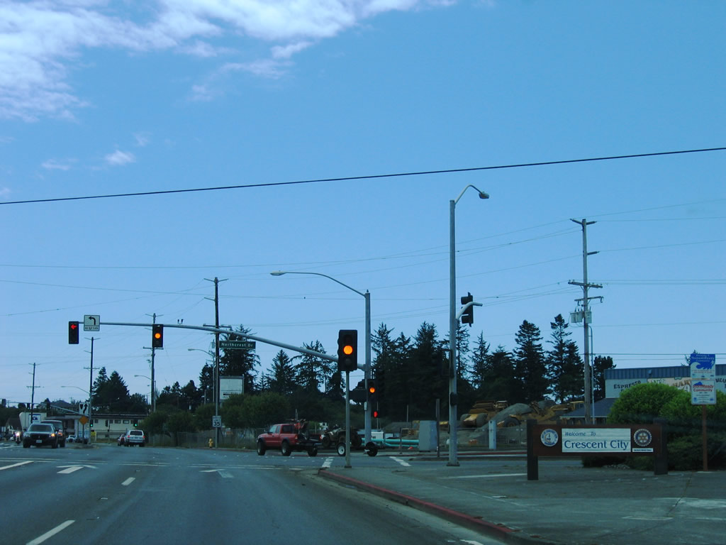
The first traffic signal on southbound U.S. 101 in Crescent City is with Del Norte County D-3. Like many signed county routes elsewhere in the state of California, signage for the county routes in Del Norte County is spotty from the state route system and is not particularly common on the county route itself. A welcome to Crescent City sits in the right of way to the right of the highway. Photo taken 05/28/06. |
|
Southbound U.S. 101 approaches Cooper Avenue. This intersection is located near the Del Norte County fairgrounds in Crescent City. Photo taken 05/28/06. |
|
The two directions of U.S. 101 will separate onto two city streets. U.S. 101 (Redwood Highway) south follows L Street through downtown Crescent City, while U.S. 101 north follows M Street. Despite the fact that downtown Crescent City was devastated by the 1964 tsunami (tidal wave) generated by the Good Friday Earthquake, the city sits on a bluff that overlooks the scenic ocean. Even with an elevation well above sea level, the city was still impacted by a huge wave. It is shocking to look down off the bluff to the ocean below and think that a wave could have become that tall! Photo taken 05/28/06. |
|
|
After the highway splits, U.S. 101 angles southwest for one block, and then the highway turns south onto L Street. This reassurance shield advises of the curve in the road. Photos taken 05/28/06. |
|
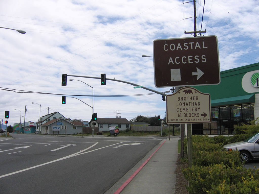
The right lane becomes a turn only lane from northbound L Street to westbound 9th Street. The left two lanes continue south on U.S. 101. Use 9th Street to the Pacific coast (at Pebble Beach Drive) and Brother Jonathan Cemetery. Photo taken 05/28/06. |
|
After making the turn, southbound U.S. 101 follows L Street past the 8th Street intersection. Historically, U.S. 199 and U.S. 101 used to continue together to Crescent City; by 1964, U.S. 199 was retracted to its current southern terminus. Photo taken 05/28/06. |
|
U.S. 101 is very well-signed through Crescent City, as evidenced by this trio of signs at 7th Street. Photo taken 05/28/06. |
|
The next traffic signal along southbound U.S. 101 (L Street) is with 5th Street. Photo taken 05/28/06. |
|
At 4th Street, signage for a visitors information center and the Crescent City central business district are posted. Use 3rd Street to downtown and Front Street to the visitors information center. Photo taken 05/28/06. |
|
Turn right on 3rd Street to the central business district of Crescent City. Most of the city was rebuilt after the 1964 tsunami, so much of the construction is like that common from that era, including strip malls and fast food restaurants. Most of the older parts of town are located west of here ... use any of the numbered streets west to that part of downtown Crescent City. The Battery Point Lighthouse is located near downtown on a bluff overlooking the ocean. Photo taken 05/28/06. |
|
Southbound U.S. 101 (L Street) meets Front Street at this signalized intersection. Turn right to the visitors information center. From here, U.S. 101 south will merge back with U.S. 101 north. Photo taken 05/28/06. |
|
Merging together again, U.S. 101 leaves downtown Crescent City and approaches Del Norte County D-2 (Elk Valley Road), which serves Elk Valley Rancheria to the east. Photo taken 05/28/06. |
|
A series of strip malls and roadside attractions line U.S. 101 as the highway continues south on its way out of Crescent City. Photo taken 05/28/06. |
|
Southbound U.S. 101 approaches Del Norte County D-2 (Elk Valley Road) and Huston Road. Photo taken 05/28/06. |
|
Continuing south, U.S. 101 approaches Citizens Dock Road. Photo taken 05/28/06. |
|
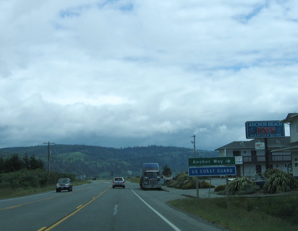
Passing by Anchor Way and the U.S. Coast Guard Station, U.S. 101 leaves the greater Crescent City area and prepares to reenter rural Del Norte County as the highway makes its way south toward Eureka. Photo taken 05/28/06. |
|
The road between Crescent City and Eureka has several winding sections with difficult grades. Trucks are restricted beyond a certain length. Photo taken 05/28/06. |
|
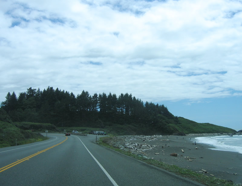
Turning a bit to the south, the Pacific Ocean and Crescent Beach come into view. This mileage sign provides the distance to Klamath (19 miles), Eureka (78 miles), and San Francisco (347 miles). Photo taken 05/28/06. |
|
U.S. 101 passes by Crescent Beach and a small motel as the U.S. highway follows the Pacific Ocean shoreline. Photo taken 05/28/06. |
|
At postmile 24.50, U.S. 101 approaches Sand Mine Road. Photo taken 05/28/06. |
|
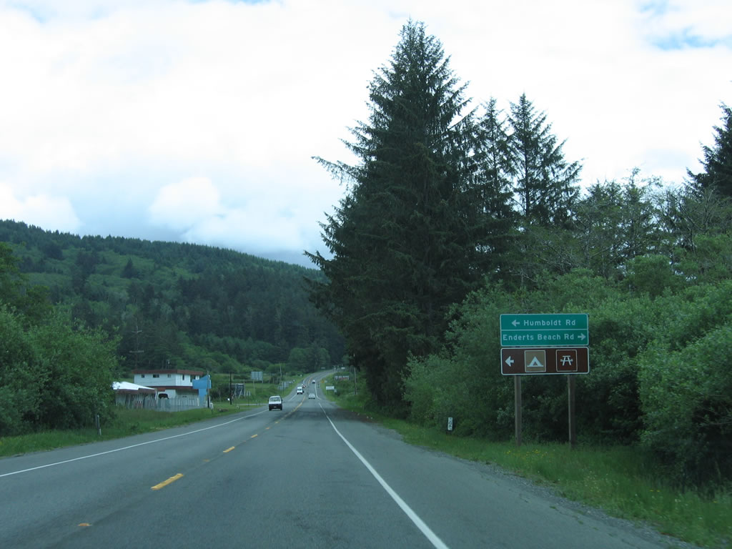
Soon thereafter, southbound U.S. 101 approaches Humboldt Road east and Enderts Beach Road west. Use Enderts Beach Road to the Crescent Beach Coastal Trail, which is part of the Redwood National Park system. From here, U.S. 101 (Redwood Highway) enters Redwood National Park. Photo taken 05/28/06. |
|
A reassurance shield for U.S. 101 is posted after the Humboldt Road and Enderts Beach Road intersection. From here, U.S. 101 south enters a daytime headlights required section due to the volume of accidents on this hilly, winding, two-lane highway. Photo taken 05/28/06. |
|
Traveling uphill from Crescent Beach, U.S. 101 widens to three lanes. Two lanes travel south as the highway continues uphill, while one lane travels north. The headlights section will continue for another eight miles from this point. Photo taken 05/28/06. |
|
A vista point is located on top of the hill. Crescent City, Crescent Beach, and Crescent Bay are to the north, while Enderts Beach lies below the vista point. Photo taken 05/28/06. |
|
Now looking south from the vista point parking lot is this sign for Redwood National and State Parks, along with a series of interpretive signs. Photo taken 05/28/06. |
|
Continuing south, this timber wall helps keep the adjacent hillside from sliding onto the scenic road. Photo taken 05/28/06. |
|
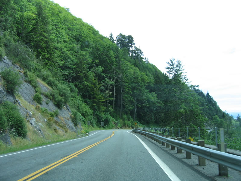
U.S. 101 is a winding, curving route through here, which warrant the truck restrictions and the daytime headlight section. Photo taken 05/28/06. |
|
A sidehill viaduct helps U.S. 101 make this turn at the top of the grade in Redwood National Park. Photo taken 05/28/06. |
|
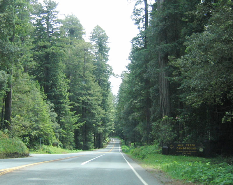
The three-lane highway reverts to two lanes as U.S. 101 approaches the Mill Creek turnoff. Photo taken 05/28/06. |
|
Turn left here to the Mill Creek Campground from southbound U.S. 101 (Redwood Highway) in Redwood National Park. The campground is operated as part of Del Norte Coast Redwoods State Park. Photo taken 05/28/06. |
|
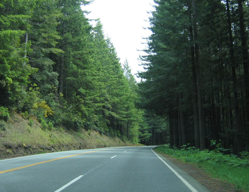
Southbound U.S. 101 widens out to two lanes again after the Mill Creek Campground turnoff. Photo taken 05/28/06. |
|
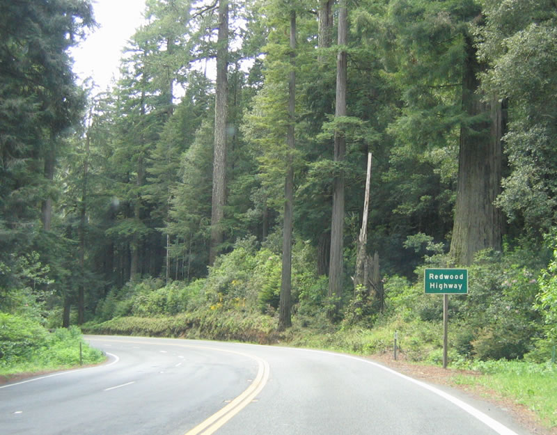
A Redwood Highway reassurance marker is posted on southbound U.S. 101 shortly thereafter. Photo taken 05/28/06. |
|
|
|
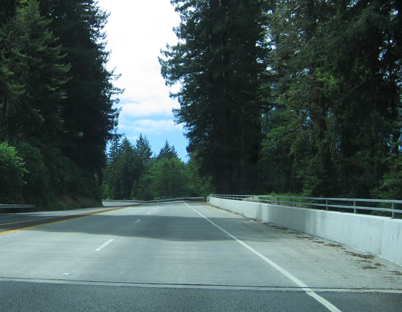
This suite of photos shows U.S. 101 (Redwood Highway) through Redwood National Park. Photos taken 05/28/06. |
|
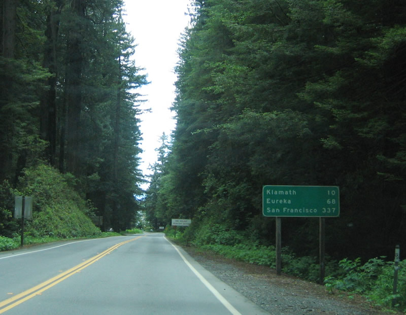
This mileage sign along U.S. 101 (Redwood Highway) south provides the distance to Klamath (10 miles), Eureka (68 miles), and San Francisco (337 miles). The daytime headlight section ends here. Photo taken 05/28/06. |
|
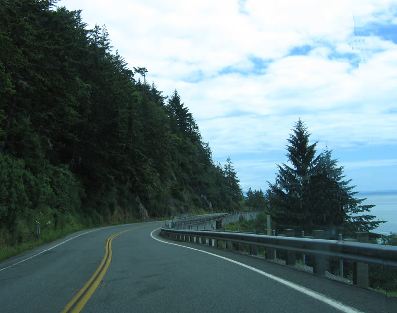
The Pacific Ocean comes into view again as U.S. 101 (Redwood Highway) passes high above the beach. Photo taken 05/28/06. |
|
After this winding section above False Klamath Cove, U.S. 101 will return to near sea level and enter the town of Klamath before crossing the Klamath River. Photo taken 05/28/06. |
|
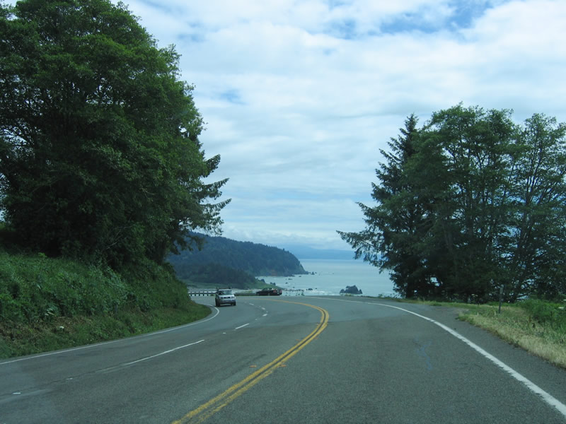
Several turnouts are located along U.S. 101 as it hugs the cliff top above the Pacific Ocean and approaches Klamath. Photo taken 05/28/06. |
|
|
|
Several sharp curves, including these, can be found on the descent. Check out the sidehill viaduct that supports U.S. 101 as it descends. Photos taken 05/28/06. |
|
|
|
Another view area with even more sweeping views of the ocean is located on the descent to the Klamath River. This is arguably one of the most scenic and remote sections of U.S. 101 in the state of California. Photos taken 05/28/06. |
|
Nearing the bottom of the grade, U.S. 101 south approaches Wilson Creek Road after a brief divided section. The Wilson Creek Bridge (see white guardrail in the distance) was built in 1957. Photo taken 05/28/06. |
|
Nearing the bottom of the grade, U.S. 101 south approaches Wilson Creek Road after a brief divided section. The Wilson Creek Bridge (see white guardrail in the distance) was built in 1957. Photo taken 05/28/06. |
|
|
Waves from the ocean nearly lap up onto the roadway now that U.S. 101 has finished its descent. To the west is False Klamath Cove and Wilson Creek Beach. Photo taken 05/28/06. |
|
An official California scenic route shield is posted as U.S. 101 (Redwood Highway) approach the "Trees of Mystery." A sign welcoming travelers to Klamath is posted after this scenic shield. Photo taken 05/28/06. |
|
The entrance to the Trees of Mystery and End of the Trail Museum is located on the east side of the highway. Photo taken 05/28/06. |
|
Continuing south into Klamath, southbound U.S. 101 approaches Hunter Creek Road. The 1951 concrete slab bridge over Hunter Creek is just ahead. Photo taken 05/28/06. |
|
Southbound U.S. 101 (Redwood Highway) approaches Requa Road, which travels west to the Klamath Overlook Coastal Trail, which is part of the Redwood National Park system. Photo taken 05/28/06. |
|
The next major intersection is with Requa Road west and Minot Creek Road east. The Minot Creek bridge was built in 1957 and widened in 1993. Photo taken 05/28/06. |
|
Continuing south, U.S. 101 passes through a small roadside business area near the town of Requa. Photo taken 05/28/06. |
|
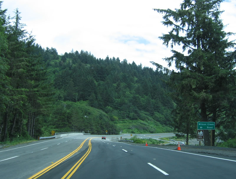
After passing by the roadside businesses, U.S. 101 becomes a two-lane expressway with limited access. The next turnoff connects to the downtown of Klamath. Photo taken 05/28/06. |
|
Turn left here for the connection to the town of Klamath. Photo taken 05/28/06. |
|
U.S. 101 becomes a two-lane freeway after this intersection. Photo taken 05/28/06. |
|
Exit 769 is the connection from the two-lane U.S. 101 freeway to California 169 en route to Klamath and Klamath Glen. The state route follows the north bank of the Klamath River, then comes to an end in Klamath Glen. Photo taken 05/28/06. |
|
Southbound U.S. 101 (Redwood Highway) approaches Exit 769, California 169 to Klamath and Klamath Glen. Photo taken 05/28/06. |
|
A ramp leads from two-lane U.S. 101 south to California 169 east to Klamath Glen. After this interchange, U.S. 101 prepares to cross the mighty Klamath River, which flows from interior Oregon southwest to the coast. The floods of 1964 caused major damage along the Klamath River corridor, and the original U.S. 101 bridge over the river was destroyed during that event. Photo taken 05/28/06. |
|
The interchange between U.S. 101 and California 169 is signed as the Route 101/169 Separation. Photo taken 05/28/06. |
|
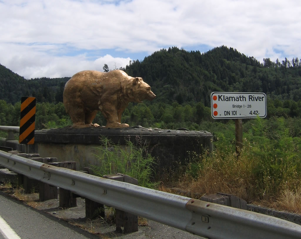
The golden bears that guard the 1965 U.S. 101 bridge over the Klamath River are located on either side of two-lane U.S. 101. These bears guard the south approach to the Klamath River bridge, which was under construction at this time. Photo taken 05/28/06. |
|
These bears are made of concrete and were formerly posted sentry on the old bridge over the river. They were mysteriously painted gold starting in the late 1950s or early 1960s, but as soon as the highway department removed the paint, the bears were repainted gold again by the local Golden Bear Booster Club, made up of local businessmen. After the Flood of 1964 and the movement of the bears to the north and south approaches to the current U.S. 101 bridge, Caltrans has taken over maintenance of the bears and keeps them painted gold. Photo taken 05/28/06. |
|
The two-lane bridge is narrow (no shoulders) and is undergoing reconstruction when these photos were taken. Photo taken 05/28/06. |
|
At the south end of the bridge is another set of golden bears. Photo taken 05/28/06. |
|
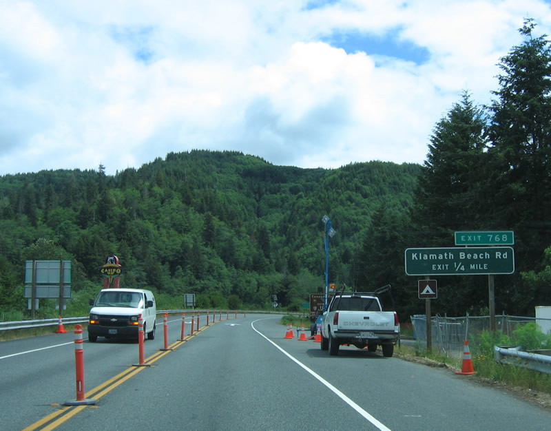
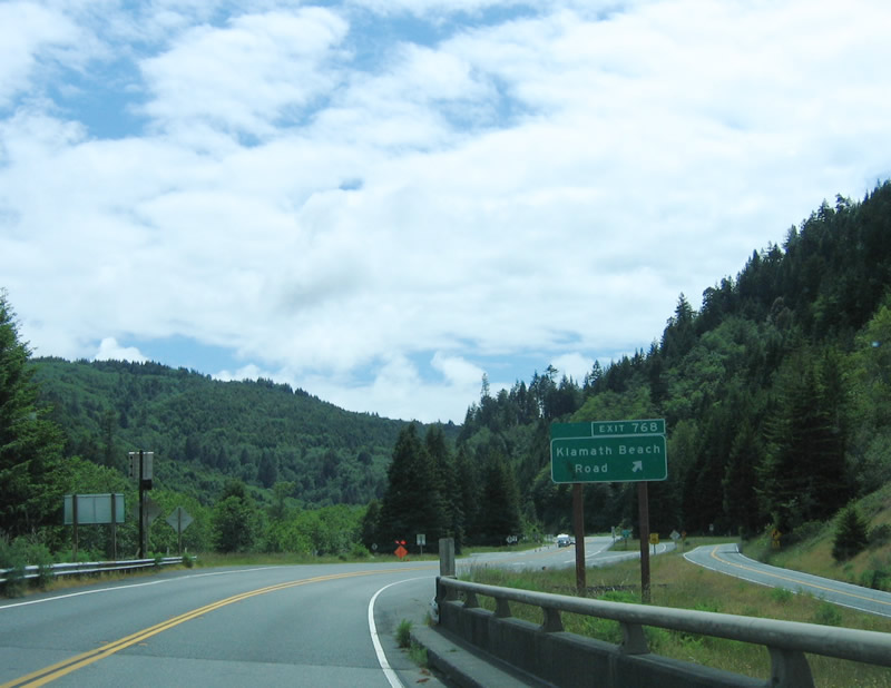
The next exit along southbound U.S. 101 (Redwood Highway) is Exit 768, Del Norte County D-8/Klamath Beach Road west. Photo taken 05/28/06. |
|
Use Klamath Beach Road west to the southern end of the old U.S. 101 bridge that was destroyed in the 1964 flood and to the Coastal Drive, which follows Old U.S. 101 south closer to the coast. Photo taken 05/28/06. |
|
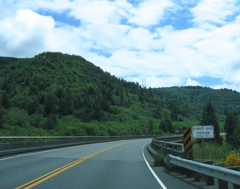
Another bridge carries U.S. 101 across the overflow channel for the Klamath River. This bridge was also built in 1965 and continues the Super Two freeway configuration. Photo taken 05/28/06. |
|
Southbound U.S. 101 (Redwood Highway) reaches Exit 768, Del Norte County D-8/Klamath Beach Road west. Use this exit to Historic U.S. 101 south along the Coast Route. Photo taken 05/28/06. |
Page Updated April 28, 2007.