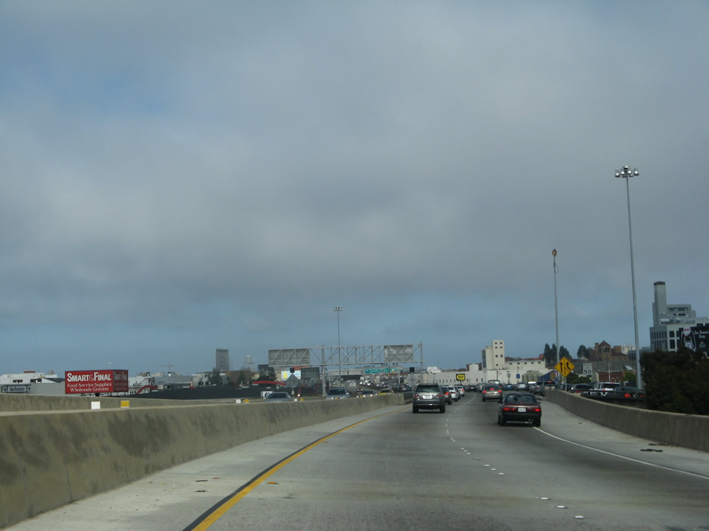
U.S. 101 has a variety of identities as it passes through the city and county of San Francisco. Entering the city as a freeway, it quickly becomes a city street, since no freeways cross the city from south to north. U.S. 101 follows the remnants of the Central Freeway (portions were irreparably damaged as a result of the 1989 Loma Prieta Earthquake), Van Ness Avenue, and Lombard Street.
Avoiding most of the tourist attractions such as the Embarcadero, Pier 39, Ghiradelli Square, downtown San Francisco, Ocean Beach, and Golden Gate Park, the highway does pass through some very neat sections of the city. Look for Tommy's Joynt on the west side of Van Ness Avenue - it is a famous restaurant and hang out for a multitude of famous San Franciscans. In addition, U.S. 101 enters the scenic Presidio, now part of Golden Gate National Park. But the most picturesque section of U.S. 101 is still ahead, straddling San Francisco and Marin Counties: the Golden Gate Bridge. This bridge is a well-known fixture, visible on many movies that are filmed in San Francisco. Unlike many similar bridges, pedestrians may walk along the Golden Gate Bridge, which any visitor should walk at least once.
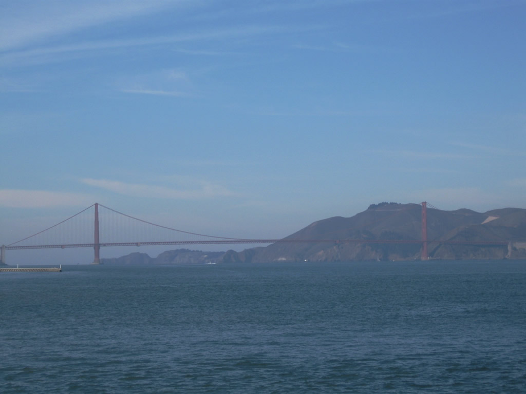
| U.S. 101 & California 1 - Golden Gate Bridge south |
|
|
Traveling south on U.S. 101 & California 1 over the Golden Gate Bridge, the first (north) tower is the county line between Marin and San Francisco counties. A small sign advises of the jurisdictional change. The city of San Francisco is the only city-county combined jurisdiction in the state of California. Due to its location on a peninsula surrounded by the Pacific Ocean, Golden Gate, and San Francisco Bay, fog is common especially in summer months when colder oceanic area collides with hot dry air from inland (Central Valley). The city also sits near the San Andreas Fault, which spans the state of California and is capable of producing a large-scale earthquake. San Francisco was founded in 1776 and incorporated on April 15, 1850. The city is home to a large minority population (including immigrants) and is likely the most densely populated city in California. As of the 2000 Census, San Francisco was home to 776,733 people, but that figure has dropped per 2006 estimates (744,041 people per State & County QuickFacts for San Francisco City / County. As for U.S. 101 and California 1, the freeway continues over the Golden Gate, passing under the south tower before approaching the toll plaza. Photos taken 05/25/06. |
|
|
|
|
|
All traffic must stop and pay the toll, which is $5 for cars. A large clock rests on top of the toll plaza canopy. Electronic toll collection (Fastrak) is available as well as cash payments. Use the right lanes for Exit 439, 25th Avenue. Photo taken 05/25/06. |
|
After the toll plaza, a hard right turn is required for Exit 439, 25th Avenue. The next exit is Exit 438, California 1 (19th Avenue) south. Photo taken 05/25/06. |
|
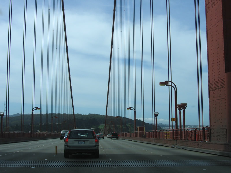
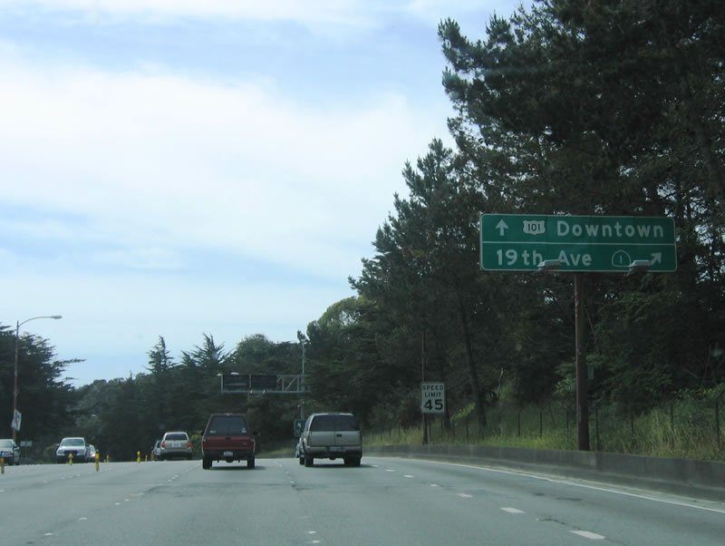
U.S. 101 south and California 1 south prepare to split at Exit 438. The left three lanes connect to U.S. 101 south, while the right lane connects to California 1 (19th Avenue) south. These two routes will remain split until they rejoin near San Luis Obispo. Photo taken 05/25/06. |
|
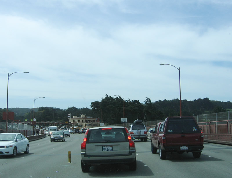
For through traffic, California 1 is a better route south. It generally has three through lanes (excluding the section through the MacArthur Tunnel) and restricts left turning, which allows for a more measured traffic flow. U.S. 101 follows Van Ness Avenue through San Francisco, and while it is only about three miles of surface street driving, traffic is nearly always thick. To San Francisco International Airport, use California 1 south to Interstate 280 south, then connect to the airport via Interstate 380 east. Photo taken 05/25/06. |
|
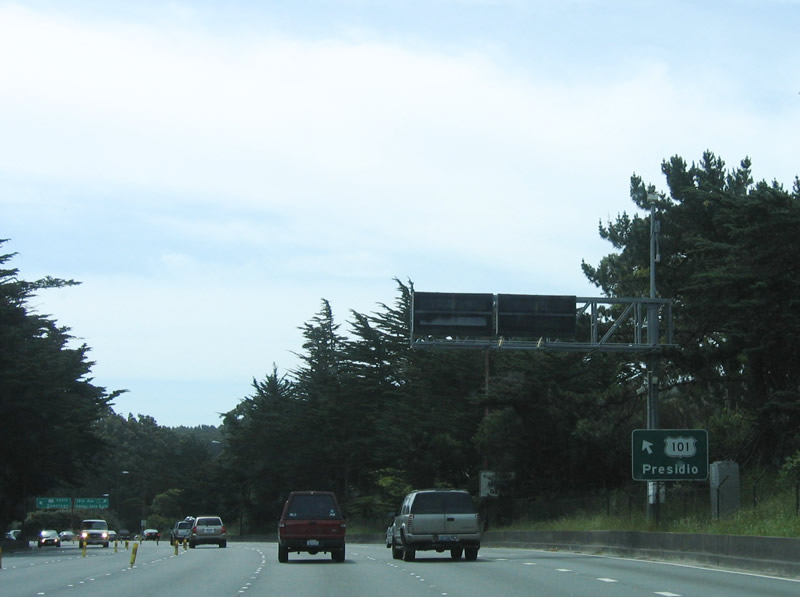
To the Presidio (part of Golden Gate National Recreation Area), use U.S. 101 south. Photo taken 05/25/06. |
|
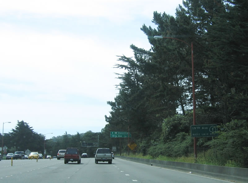
U.S. 101 south and California 1 south split here at Exit 438. The left three lanes follow U.S. 101 south to downtown (via Lombard Street and Van Ness Avenue), while the right lane connects to California 1 (19th Avenue) south to Golden Gate Park. Photo taken 05/25/06. |
| U.S. 101/Doyle Drive (Future Presidio Parkway) south |
|
After the split with California 1, a viaduct gradually carries U.S. 101 east toward downtown San Francisco. The Doyle Drive viaduct between the Golden Gate Bridge and Richardson Avenue/Lombard Street is scheduled for extensive reconstruction between 2009 and 2015. Doyle Drive, which has been in service as the U.S. 101 departure from the Golden Gate Bridge to Richardson Avenue/Lombard Street since 1936, is scheduled for complete replacement. A project between 2009 and 2015 will replace Doyle Drive with the new Presidio Parkway. A temporary alignment of the Presidio Parkway will be in service in early 2012. We hope to return to this area to document the changes in the future. The 1936 viaduct itself will be removed due to its vulnerability in a major earthquake. Photo taken 05/25/06. |
|
Continuing east, signs such as this one advise motorists to use U.S. 101 south (east) to tourist destinations such as Fisherman's Wharf and Pier 39 (which is the location of a California Welcome Center). Photo taken 05/25/06. |
|
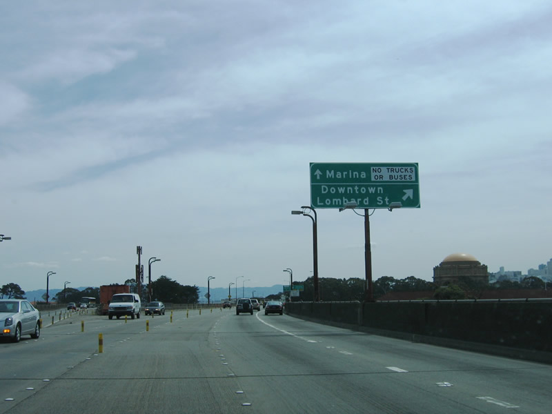
U.S. 101 exits onto Lombard Street eastbound, while the left two lanes continue into the Marina District as part of Exit 437. Much of this area will look significantly different as a result of the ongoing Presidio Parkway project. Photo taken 05/25/06. |
|
Southbound U.S. 101 reaches Exit 437, Marina Boulevard (left exit). From here, southbound U.S. 101 follows Richardson Avenue and Lombard Street east, then turns south again on Van Ness Avenue. The Exploratorium is visible in the background of the right lane continuation of U.S. 101 south. Photo taken 05/25/06. |
|
|
The two-lane left exit (from Exit 437) descends toward Crissy Field near Fort Point, and the freeway comes to an end. This is not a part of U.S. 101, but it is the end of the "exit" to Marina Boulevard. Photos taken 05/25/06. |
| U.S. 101 south/Richardson Avenue southeast |
| U.S. 101 south/Lombard Street east |
|
After U.S. 101 departs Doyle Drive and shifts southeast via Richardson Avenue, U.S. 101 south merges onto eastbound Lombard Street for a distance of approximately 12 blocks. The first traffic signal along this segment is with Broderick Street. Photo taken 04/06/09. |
|
Six lanes carry U.S. 101 along Lombard Street between Richardson Avenue and Van Ness Avenue, with on-street parking and turn lanes. At this traffic signal, southbound U.S. 101/Lombard Street meets Divisadero Street. Photo taken 04/06/09. |
|
Eastbound Lombard Street (southbound U.S. 101) meets Scott Street one block later. Photo taken 04/06/09. |
|
|
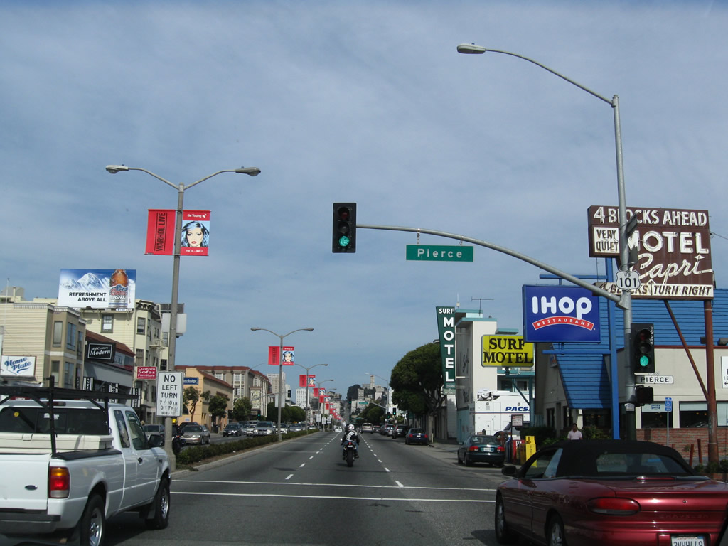
Continuing east, southbound U.S. 101/Lombard Street meets Pierce Street one block later. A U.S. 101 shield is posted on the traffic signal arm in front of an old motel marquee. Photos taken 04/06/09. |
|
Eastbound Lombard Street (southbound U.S. 101) meets Steiner Street. An Andy Warhol art exhibit (at DeYoung in Golden Gate Park) was being advertised on banners in the center median at the time this picture was taken. Photo taken 04/06/09. |
|
Continuing east along southbound U.S. 101/Lombard Street, the next traffic signal is with Fillmore Street. Note that each intersection has left turn restrictions during rush hours, so right turns might be necessary to proceed north into the Marina District. Photo taken 04/06/09. |
|
The next intersection along U.S. 101 south is with Webster Street. Photo taken 04/06/09. |
|
This sign advises of the "Lombard Street Greening" project in the median. Photo taken 04/06/09. |
|
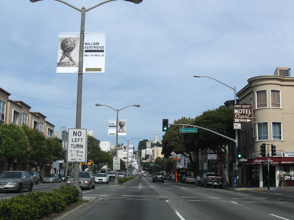
The next intersection along U.S. 101 south/Lombard Street east is with Buchanan Street. Photo taken 04/06/09. |
|
Continuing east along southbound U.S. 101/Lombard Street, the next traffic signal is with Laguna Street. Photo taken 04/06/09. |
|
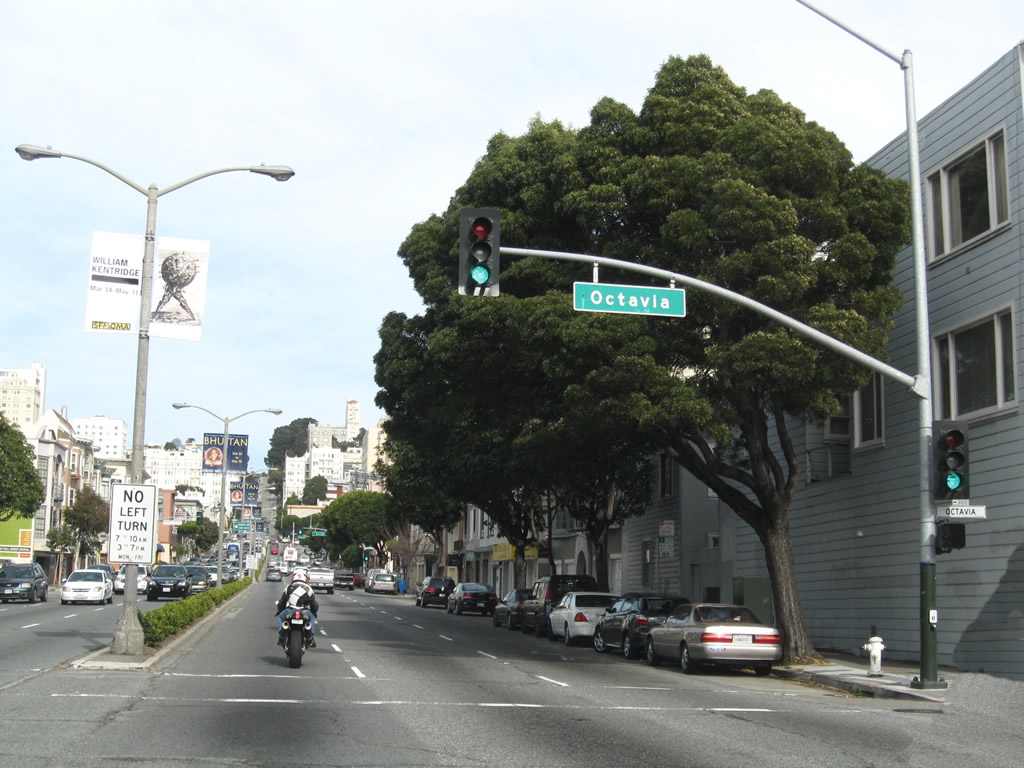
The next intersection along southbound U.S. 101/eastbound Lombard Street is with Octavia Street. Photo taken 04/06/09. |
|
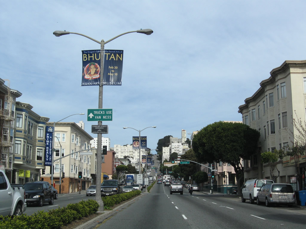
Trucks are advised to use Van Ness Avenue south (mainline U.S. 101 south) through San Francisco. Photo taken 04/06/09. |
|
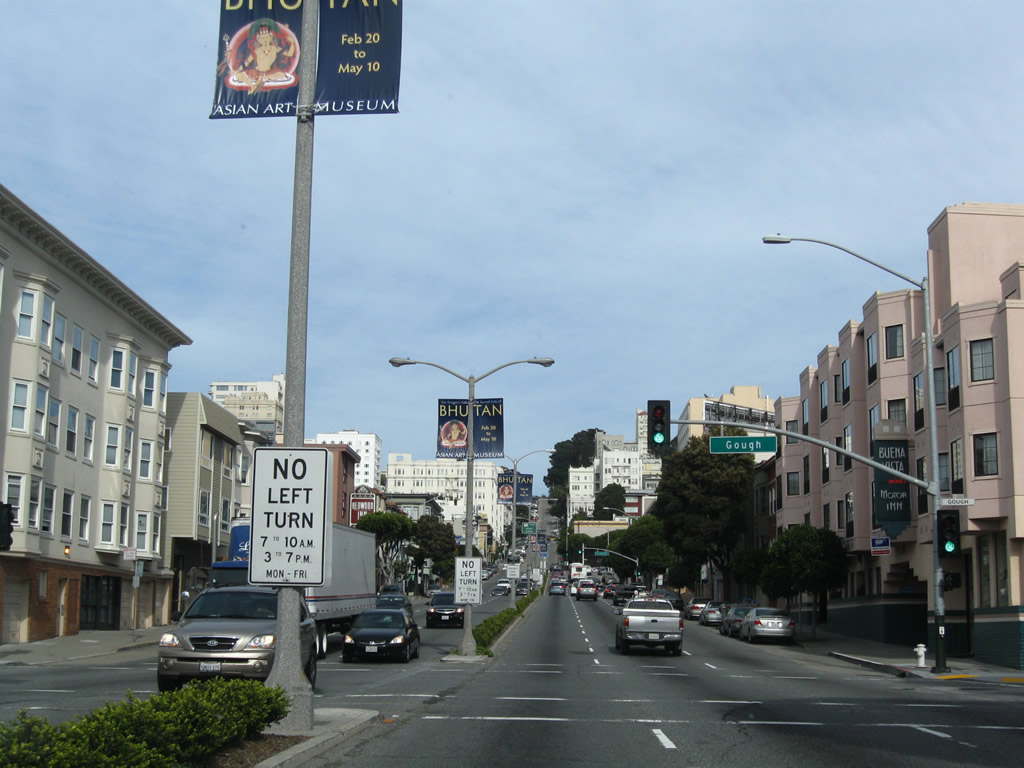
The next intersection along U.S. 101 south/Lombard Street east is with Gough Street. Photo taken 04/06/09. |
|
Through traffic on U.S. 101 south is advised to shift to the right two lanes to connect to Van Ness Avenue southbound (this sign is posted after Gough Street and before Franklin Street). The left lane will connect to Van Ness Avenue north and Lombard Street east. Photo taken 04/06/09. |
|
Continuing east along southbound U.S. 101/Lombard Street, the next traffic signal is with Franklin Street. Photo taken 04/06/09. |
|
Approaching Van Ness Avenue, all through traffic on U.S. 101 south must use the right two lanes to turn south onto Van Ness Avenue. The California Welcome Center referenced on this sign is for the one on Pier 39 at Fisherman's Wharf. Photo taken 04/06/09. |
|
|
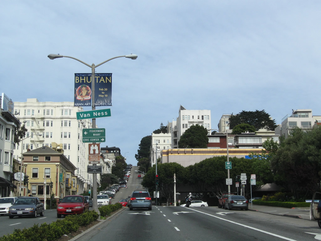
Continuing east along southbound U.S. 101/Lombard Street, the next traffic signal is with Van Ness Avenue. A left turn is permitted here for the best route to Fisherman's Wharf and the Embarcadero, a popular tourist attraction -- follow Van Ness Avenue north to Bay Street east to the Embarcadero ... four lanes all the way. Photos taken 04/06/09 and 10/16/00. |
|
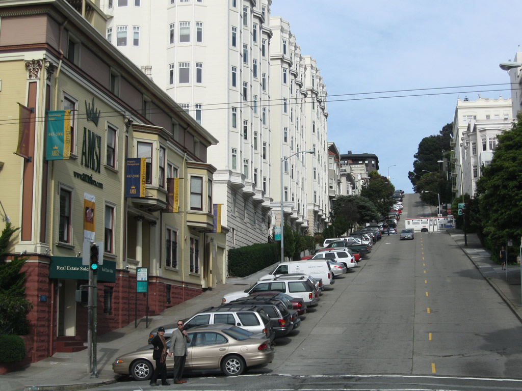
Meanwhile, U.S. 101 travels east along Lombard Street until it turns south onto Van Ness Avenue. U.S. 101 turns right onto Van Ness Avenue here. Continuing straight ahead on Lombard leads onto what is widely considered to be the world's most crooked street -- Lombard Street carefully snakes down a very steep grade on the other side of the hill visible in this picture. Photo taken 04/06/09. |
|
After the Van Ness Avenue traffic signal, Lombard Street continues east up Russian Hill, then will proceed downhill on the "crookedest street." Photo taken 04/06/09. |
| U.S. 101/Van Ness Avenue south |
|
We have no coverage of U.S. 101/Van Ness Avenue south until near the Central Freeway segment. These trailblazers along southbound Van Ness Avenue point the way to the short portion of the Central Freeway still used for U.S. 101. Through traffic for U.S. 101 must take this exit to reach the freeway portion of U.S. 101. As shown by the shields, the first exit once U.S. 101 is on the elevated freeway is for eastbound Interstate 80. This picture was taken in heavy traffic. Photo taken 10/16/00. |
| Octavia Boulevard south |
|
In the early 2000s, Octavia Boulevard was being constructed in place of the demolished northernmost segment of Central Freeway. Traveling south on Octavia Boulevard through the new parkway section, a pair of trailblazers are posted for Interstate 80 and U.S. 101 after Haight Street and prior to Market Street. Photo taken 07/06/07. |
|
Southbound Octavia Boulevard transitions directly onto the Central Freeway after passing the Market Street intersection. The Central Freeway travels south briefly on its own, then picks up U.S. 101 south. Photo taken 07/06/07. |
|
The incoming lanes from the right are U.S. 101 south. U.S. 101 (Central Freeway) travels south to connect with Interstate 80. Photo taken 07/06/07. |
| U.S. 101 (Central Freeway) south |
|
|
U.S. 101 freeway stub eastbound approaching Interstate 80 eastbound. U.S. 101 turns back to the south at this interchange, overtaking Interstate 80 as the James Lick Freeway. The highway is an important corridor for the West Bay communities of San Bruno, San Mateo, Menlo Park, and Palo Alto. The Central Freeway was conceived to provide a north-south freeway through the heart of San Francisco, but that freeway plan was abandoned years ago. Photos taken 07/06/07 and 10/15/00. |
|
|
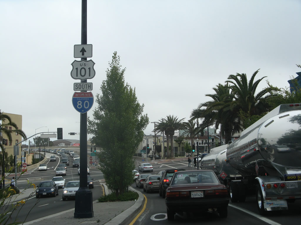
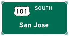
Traffic on the U.S. 101 freeway stub splits between Interstate 80 east and U.S. 101 south in this photograph. There are two Interstate 80 eastbound exits before the freeway ascends to the San Francisco-Oakland Bay Bridge into Alameda County. The off-ramps are located at 7th and 4th Streets. Two miles to the south, another important Interstate connection of U.S. 101 occurs at Interstate 280, the eventual Junipero Serra Freeway southward towards San Jose. The city of Oakland is an eight mile drive to the east across the Bay Bridge. Fortunately tolls are only posted in the westbound direction of that bridge. Interstate 80 heads east to cross the San Francisco Bay via the Bay Bridge, and U.S. 101 continues south along the Bayshore Freeway to serve the peninsula cities and to connect San Francisco with San Jose. Photos taken 07/06/07 and 10/15/00. |
| U.S. 101 (James Lick Freeway) south |
|
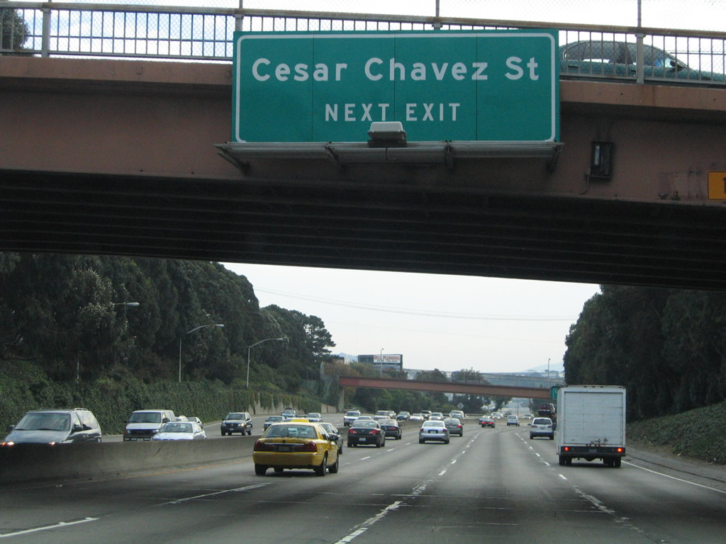
After merging with traffic from Interstate 80 west, this reassurance shield is the first along southbound James Lick Freeway. Now U.S. 101 assumes the role of a multi-lane, heavily traveled freeway, a role is will take for much of the remainder of its route all the way Los Angeles. The first exit on this eight-lane freeway will be Exit 432, Cesar Chavez Street. Photo taken 11/26/04. |
|
This mileage sign on U.S. 101 (James Lick Freeway) south provides the distance to the next three interchanges: Exit 432, Cesar Chavez Street (Army Street); Exit 431, Interstate 280 (John F. Foran Freeway); and Exit 430B, Silver Avenue. Photo taken 11/26/04. |
|
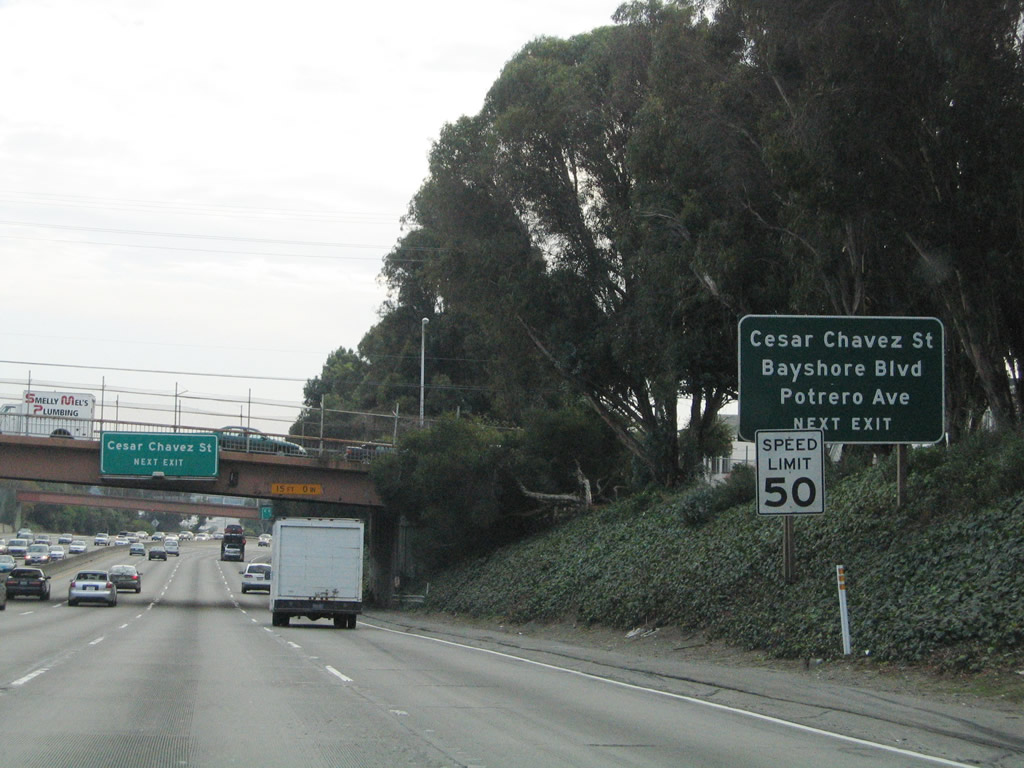
Use Exit 432 to Cesar Chavez Street east to the Port of San Francisco/North Container Terminal/Army Pier and west toward the Mission District. This exit also connects to Potrero Avenue north toward San Francisco General Hospital. To the south, this exit serves Bayshore Boulevard south, which closely follows the U.S. 101 (Bayshore Freeway) corridor and thus offers a local access route. Photo taken 11/26/04. |
|
Many of the overhead signs along this stretch of U.S. 101 were replaced in the early 2000s, before exit numbers were added to the new reflective signs. Cesar Chavez Street was created in 1995 after a successful referendum to rename Army Street through the Noe Valley and Potrero Hill districts of the city of San Francisco. Photo taken 11/26/04. |
|
Southbound U.S. 101 reaches Exit 432, Cesar Chavez Street, which connects to Bayshore Boulevard and Potrero Avenue. Photo taken 11/26/04. |
|
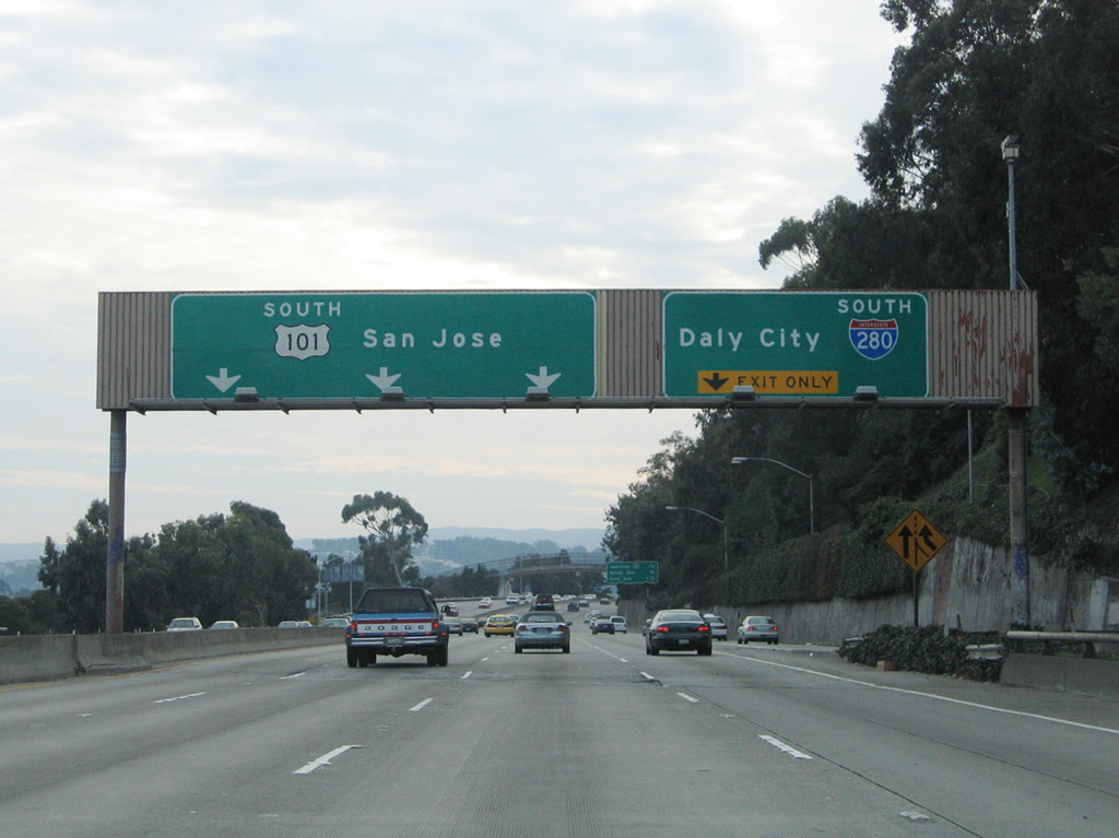
The next exit along U.S. 101 (James Lick Freeway) is Exit 431, Interstate 280 (John F. Foran Freeway) (Southern Freeway) south to Daly City, Pacifica, and San Jose via the Junipero Serra Freeway. Since Interstate 280 avoids most of the cities located along the Bayshore Freeway corridor, it can be a faster route to the South Bay cities of San Jose, Cupertino, and Sunnyvale. Photo taken 11/26/04. |
|
This mileage sign provides the distance to the next three exits on southbound U.S. 101 (James Lick Freeway): Exit 431, Interstate 280 (John F. Foran Freeway); Exit 430B, Silver Avenue; and Exit 430A, Paul Avenue. Photo taken 11/26/04. |
|
The left three lanes will continue south on U.S. 101 (James Lick Freeway), while the right two lanes become exit only to Exit 431, Interstate 280 (John F. Foran Freeway) south to Daly City and San Jose. There is no access to Interstate 280 north because it is an illogical connection. However, those who wish to connect to Interstate 280/Foran Freeway north should use the Cesar Chavez Avenue exit, following Cesar Chavez Avenue east to Indiana Street north, which has an on-ramp onto northbound Interstate 280. Despite its numerical designation, Interstate 280 never touches or connects with Interstate 80, despite original plans for such a connection. Interstate 280 ends about five blocks shy of Interstate 80, ending at Fifth Street near AT&T Park (home of Major League Baseball's San Francisco Giants). Photo taken 11/26/04. |
|
Southbound U.S. 101 (Lick Freeway) reaches Exit 431, Interstate 280 (John F. Foran Freeway) south. There is no connection to northbound Interstate 280. The next exit is Exit 430B, Silver Avenue. Photo taken 11/26/04. |
|
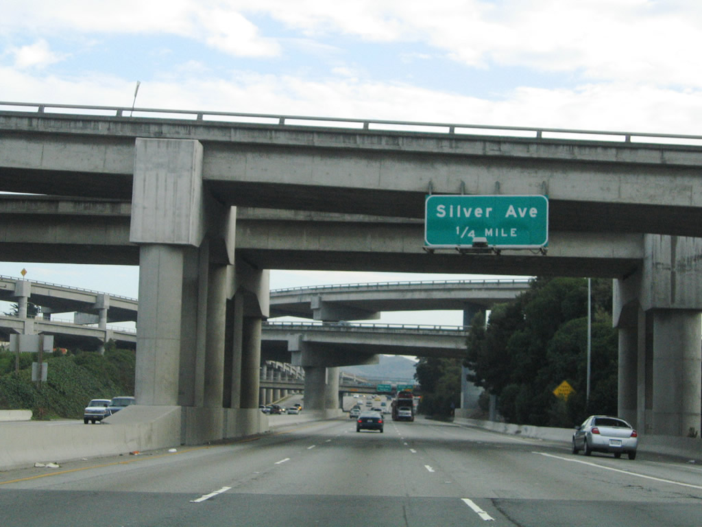
Passing through the massive interchange with Interstate 280 (which is a double-deck freeway northeast of this interchange), the next exit along U.S. 101 (Lick Freeway) south is Exit 430B, Silver Avenue. This exit provides residential and commercial access in the Silver Terrace district of the city of San Francisco. Photo taken 11/26/04. |
|
Southbound U.S. 101 (Lick Freeway) south reaches Exit 430B, Silver Avenue. Upon exiting, the ramp connects directly onto Silliman Street. To Silver Avenue, turn right onto San Bruno Avenue to Silver Avenue. The next exit is Exit 430A, Paul Avenue. The double-deck ramp to the left of the freeway offers the connection from U.S. 101 north to Interstate 280 north to the Mission Bay District of San Francisco and Interstate 280 south to Daly City and Pacifica. Photo taken 11/26/04. |
|
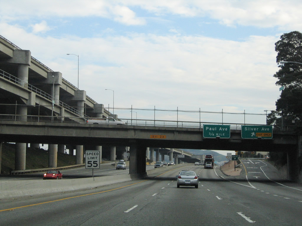
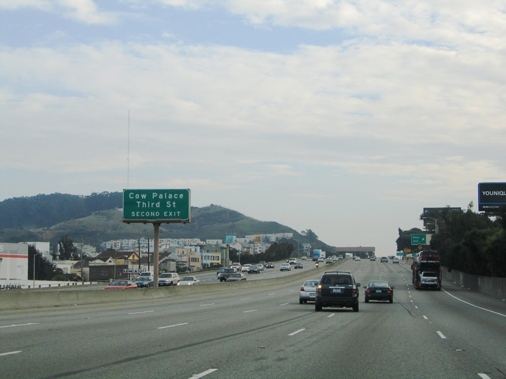
Prior to reaching Exit 430A/Paul Avenue, this sign advises of the pending interchange with Exit 429B, Third Street to the Cow Palace. Photo taken 11/26/04. |
|
Southbound U.S. 101 (James Lick Freeway) reaches Exit 430A, Paul Avenue. The next exit is Exit 429B, Third Street to the Cow Palace. Photo taken 11/26/04. |
|
Shortly thereafter, southbound U.S. 101 (James Lick Freeway) reaches Exit 429B, Third Street to the Cow Palace. The next exit is Exit 429A, Beatty Road/Alanna Way/Tunnel Avenue to Monster Park. Photo taken 11/26/04. |
|
The next three exits along U.S. 101 south are Exit 429A, Beatty Road/Alanna Way/Tunnel Avenue to Monster Park; Exit 426, Sierra Point Parkway to Brisbane; and Exit 425C, Bayshore Boulevard to South San Francisco. Photo taken 11/26/04. |
|
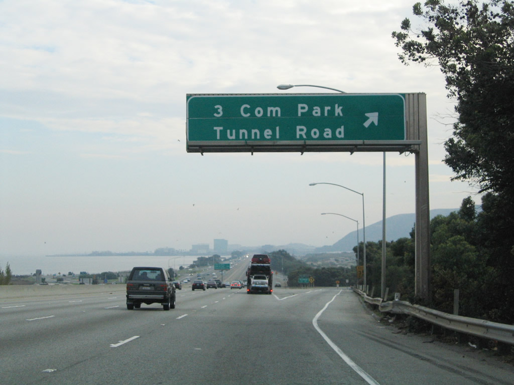
Southbound U.S. 101 reaches its final exit in San Francisco city / county: Exit 429A to Tunnel Avenue and Alanna Way to Monster Park (home of the National Football League San Francisco 49ers, Monster Park was formerly known as 3Com Park and was famously known as Candlestick Park before then). After this off-ramp, U.S. 101 leaves the city and county of San Francisco and enters the city of Brisbane in San Mateo County. Photo taken 11/26/04. |
Page Updated January 15, 2012.