Interstate 4 Florida - West
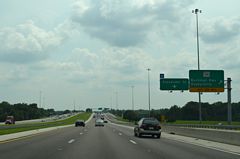
Florida 39 followed Paul Buchman Highway northward and Wheeler Street southbound into Downtown Plant City until December 23, 2013. When the Alexander Street extension opened, old SR 39 through Plant City was redesignated CR 39, necessitating a replacement of these overheads. As of Fall 2017 SR 39A formally replaced CR 39 between I-4 and the north end of the Alexander Street extension (SR 39). 06/15/13
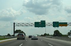
The new overhead for Florida 39 at Alexander Street replaced the one pictured here. The I-4 west Tampa pull through panel for the c/d roadway was removed during that installation. 06/15/13
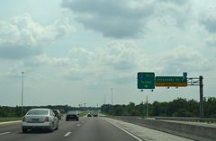
The Alexander Street overheads for Exit 21 never displayed SR 39A, the previous designation for the arterial south until SR 39 was realigned. 06/15/13
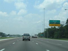
Truck weigh stations were located in both directions of Interstate 4 near milepost 18 until new facilities opened further west in 2009. 05/27/05
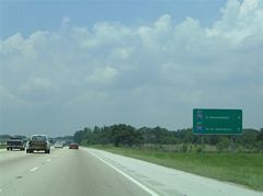
The last in a series of mileage signs posted since Orlando listed the distance to I-75 and I-275 on Interstate 4 west. This sign was later replaced with a new assembly one mile further west. 05/27/05
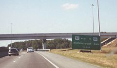
An early era guide sign for U.S. 92 west and U.S. 301 posted along Interstate 4 west ahead of Exit 7. 12/21/00
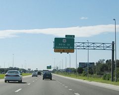
Sound walls were added in conjunction with the Interstate 4 widening project preceding U.S. 41. This photo looks at the former lane drop for Exit 3 along westbound. 12/28/03
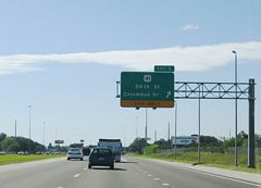
The number three lane of I-4 west defaulted onto Exit 3 for U.S. 41 (50th Street) until expansion of the freeway to six overall lanes was completed. A new overhead assembly replaced the sign pictured here. 12/28/03
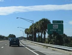
Originally a diamond interchange (Exit 2) joined Interstate 4 with Florida 569 (40th Street). Widening and reconstruction of the freeway between Exit 5 and the western terminus resulted in the removal of the Exit 2 ramps to accommodate the expanded right-of-way. Pictured here is the one-mile guide sign for SR 569, a short route joining SR 60 (Adamo Drive) with U.S. 41 (Melbourne Boulevard). 12/28/03
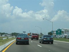
Historical look at I-4 west at former Exit 2 / SR 569. Florida 569 meets Columbus Drive just north of Interstate 4 and CR 574 (7th Avenue) to the south. Columbus Drive now provides the connection to SR 569 to I-4. 05/27/05
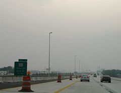
Amid a smoky evening caused by the May 2007 Bugaboo Fires, Interstate 4 entered its newest stretch of freeway, the six-lane section from former Exit 2 to I-275. Pictured here was the older 0.75-mile guide sign for Florida 585 (21st & 22nd Streets). The sign once sat to the right of the original westbound two-lane carriageway (see next photo). Interstate 4 now travels sleek three-lane elevated carriageways in both directions. 05/11/07
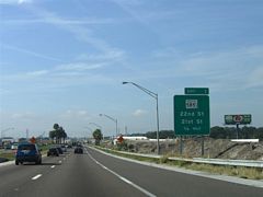
A previous look at the 0.75-mile guide sign for Exit 1 (SR 585). SR 585 traveled a one-way street couplet (21st Street south / 22nd Street north) through the Ybor City section of east Tampa. The state road was decommissioned in 2014. 01/01/06
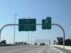
Guide signs for Florida 585 were replaced by 2014 to reflect the turning back of 22nd and 21st Streets from state maintenance to the city of Tampa. 11/10/07
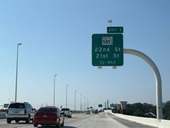
Guide signs for Florida 585 were replaced by 2014 to reflect the turning back of 22nd and 21st Streets from state maintenance to the city of Tampa. 11/10/07
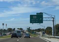
Pre-construction look at the split diamond interchange (Exit 1) with Florida 585 on Interstate 4 west. 12/28/03
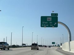
Widening of Interstate 4 overtook a number of buildings and frontage street roadways from U.S. 41 (50th Street) west to the Downtown Interchange with I-275. New lanes of Interstate 4 now travel over the location of the original Exit 1 on and off-ramps; a grassy median represents the original four-lane freeway otherwise. 11/10/07
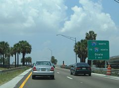
Looking at an older guide sign for Interstate 275 on Interstate 4 west during road work. The western terminus of I-4 was the site of construction for over four years, where a new flyover was added for Downtown interests, ramps between I-4 and 275 south were expanded to two lanes and the southbound I-275 to eastbound I-4 flyover shifted from a left-hand merge to the right. 05/27/05
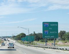
A view of Interstate 4 early during construction. Note the demolition of buildings along the adjacent frontage street. Rather then building inward to accommodate additional lanes, FDOT acquired adjacent frontage to expanded the freeway outward, thus creating a much wider median to allow for future expansion or perhaps light rail. This series of guide signs directed drivers onto Interstate 275 north to Interstate 75 for Ocala and Interstate 275 south to the downtown exits (Ashley Drive and Jefferson Street). 12/28/03
Photos by AARoads
Page Updated Friday March 28, 2025.


