
Interstate 10 Florida – East

12/30/13

What was the first in a series of signs for the diamond interchange (Exit 360) with McDuff Avenue on I-10 east. 09/08/10

A new sign bridge was installed in 2010 in place of this ground level sign. 07/22/04

Changes made to the interchange identification sign at the half diamond interchange (Exit 359) with Luna Street reordered Interstate 95 and Stockton Street. 07/22/04

The first in a series of diagrammatic signs for I-95 precedes SR 129 (McDuff Avenue). The expanded exchange includes four through lanes for Interstate 95 north to Savannah and Downtown. 12/30/13

Replaced interchange identification sign posted at the Nelson Street under pass on I-10 east. 07/22/04

The final shield for I-10 east stood between the entrance ramp at Exit 359 and Exit 360. 07/22/04

SR 129 was originally acknowledged at the diamond interchange (Exit 360) with McDuff Avenue on I-10. SR 129 lines the boulevard south to U.S. 17/SR 228. 07/22/04

Diagrammatic sign for I-95 added during the Big I construction project. 12/30/13
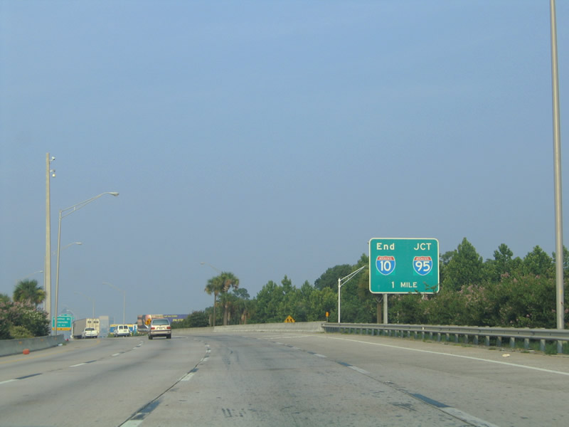
This end sign for I-10 was posted within the wye interchange with U.S. 17 (Roosevelt Expressway). 07/22/04
Removed sign bridge for the east end of Interstate 10. 12/30/13

A weaving traffic pattern occurred with merging traffic from U.S. 17/SR 228 north and Exit 362 to Stockton Street. U.S. 17/SR 228 were relocated onto I-10 in 2006. 07/22/04

The previous sharp loop ramp for Stockton Street via Rosselle Street west. Stockton Street intersects former U.S. 17 (College / Post Streets) five blocks to the south. 07/22/04

Stockton Street leads north from Exit 362 to U.S. 90 (Beaver Street). 06/14/08

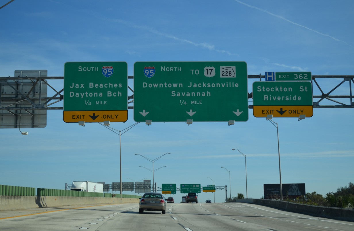
Two lanes were allocated for each direction of Interstate 95. Initial control points included International Airport and Jacksonville Beaches. Savannah and St. Augustine appeared on I-95 pull-through panels nearby. 07/22/04

The original interchange at I-10/95 was compact with left exit ramps. The Big I reconstruction of the exchange started in February 2005. Costing $154 million, the project was completed with a ribbon cutting ceremony held on September 17, 2011. The greenout for Downtown originally displayed "Riverfront". 07/22/04

Interstate 10 concludes a 2,460-mile route through eight states and five major cities. The original end sign posted at the roadway partition was removed ahead of this date. 07/22/04

The southbound off-ramp to I-95 merges onto a viaduct ahead of the Fuller Warren Bridge over the St. Johns River. A reassurance shield remains in place at the southbound ramp end from when I-10 traffic merged on the left and this was the I-95 mainline. 07/22/04

An end Interstate 10 shield assembly was posted at the ramp split to Interstate 95. This was not retained in the Big I reconstruction.<br /> Similarly, the western terminus of I-10 in Santa Monica is devoid of an end shield. 07/22/04
Photos by AARoads
Page Updated Friday January 24, 2025.