
I am not new to the GIS world, but have been out of practice for quite some time. First worked with GIS as a researcher and cartographer for Mapsource, Inc. out of St. Petersburg, Florida. Later worked for Universal Map Group, LLC out of DeLand, using GIS exclusively as part of my job as map researcher. Followed those jobs by joining GIS Cartography and Publishing Services, LLC, where I aided in the conversion of raw GIS data into a stylized map product (mostly Zoomify maps for client’s websites).
I cofounded AARoads.com, this website covering roads and highways throughout the United States, in 2000. AARoads led me to my first cartography job in 2006. I eventually incorporated some maps made with GIS onto the site, and developed some personal Geodatabases so that I could update them as desired.
Grew up having a love of road maps, drawing them in childhood and eventually collecting them. Several historical map scans found throughout AARoads are from the over 2,500 fold maps and 100 plus atlases in my collection. Gousha Maps were my favorite, and with digital mapping I tried emulating some of the styles used from the long gone map company. This was a map I made in 2011 for the Mid Bay Bridge Connector, a toll road built around Niceville, Florida:

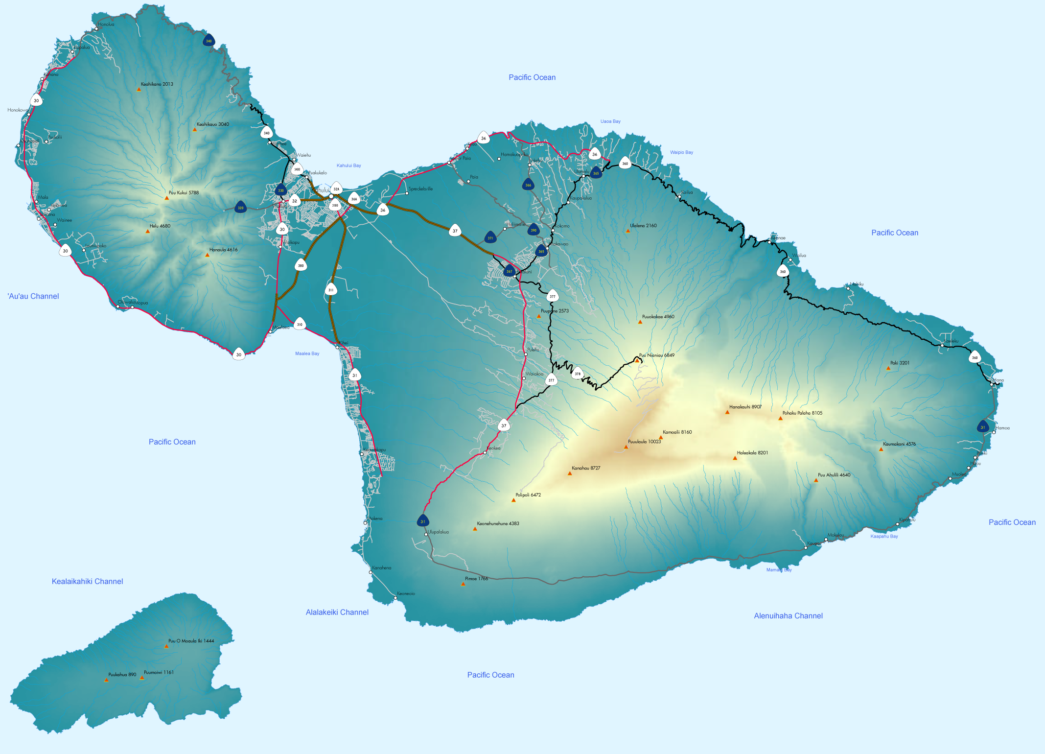
I also started implementing some digital elevation model graphics into maps of Western U.S. cities and states. Having recently gained access to ArcGIS Pro as part of my classes and wanting to get some familiarity, I sifted through one of my external hard drives and found my old GIS files. I imported the geodatabase I made for Hawaii back in 2011 and exported the map I made of Maui. While the fonts did not carry over from the original annotation, the symbology mostly did! I extracted the PDF into Illustrator and made a PNG out of it:


