
Let’s take a quickie look at SR 146 from Providence, RI up to Worcester Mass. The pictures are from last weekend, when the New England spring was in full swing with budding dogwoods and hordes of people moving to Vermont.

Route 146 leaves Providence as a fairly major freeway. The six lanes give way to four just as the northern suburbs are at their peak.
Route 146 has the distinction of being Rhode Island’s first divided highway, and was originally constructed way back in the 1940s. In RI, the ROW is fairly dense with the carriageways often separated by a simple guardrail.
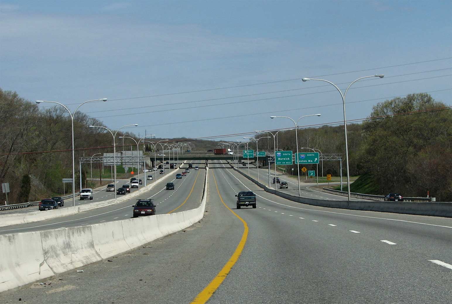
The first major freeway intersection north of Providence is with I-295. This is a fairly new interchange and is positively giant by New England standards. RI 146 is positioned between two very long C/D lanes.

Almost immediately the freeway enters the town of North Smithfield. The town’s main drag here is punctuated by a traffic light and very close in retail. The speed limit drops to 35 at one point.

The newer freeway branches off and begins its hilly climb into Mass. north of the light. Rhode Island numbers older routes with an A, and the older business route branches off to serve downtown Woonsocket.

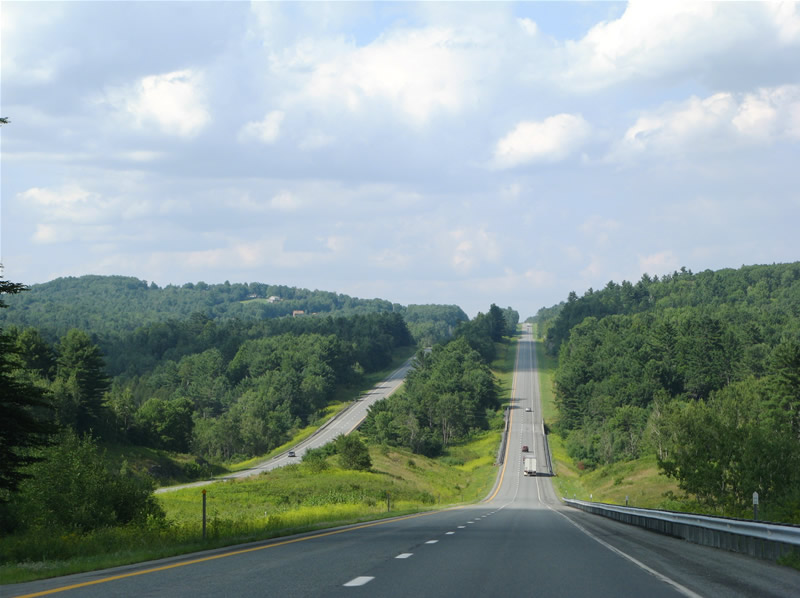
Route 146 enters Massachusetts as a hilly freeway. The main area the freeway runs through is called the Blackstone Valley. Granite outcroppings and hills are common here. The original roadway was two lanes with a center turn lane. Plans were roused as early as 1964 to make the route a freeway but updating did not occur until the 80s. As such, parts of the freeway have a very narrow median.

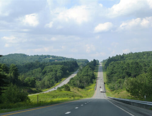
A typical view in rural Mass. is forested hills with a few houses here and there. The freeway is fairly devoid of any services between Providence and Worcester. Traffic counts through here remain pretty low, as well, and its got a great rural feel. This might be the northeast urban corridor but it’s no I-95.

As the freeway nears Worcester, the median gradually disappears, and the rural feel goes away.
As a Texan, i’m always surprised by the seemingly ridiculously low distances between things in New England. I’m used to the next big city being 240 miles away…

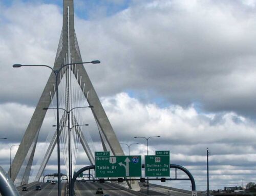
The road becomes a freeway again as we hit the Mass Pike.
I love the Pilgrim Hat. Construction of this interchange took place from 1996 to 1998, and cost about $100 million. The freeway’s design touches through here are pretty nice. The lights evoke thoughts of the industrial 19th century past of the region, in my opinion.

In any case, as Route 146 gets closer to Worcester it gets newer and newer. It used to dump traffic onto a minor city street here but has been slowly upgraded to expressway standards.
I’m not one to complain about highway markings that often but come on. Arguably the most historic state in the nation with the richest and most progressive culture out there and a square?
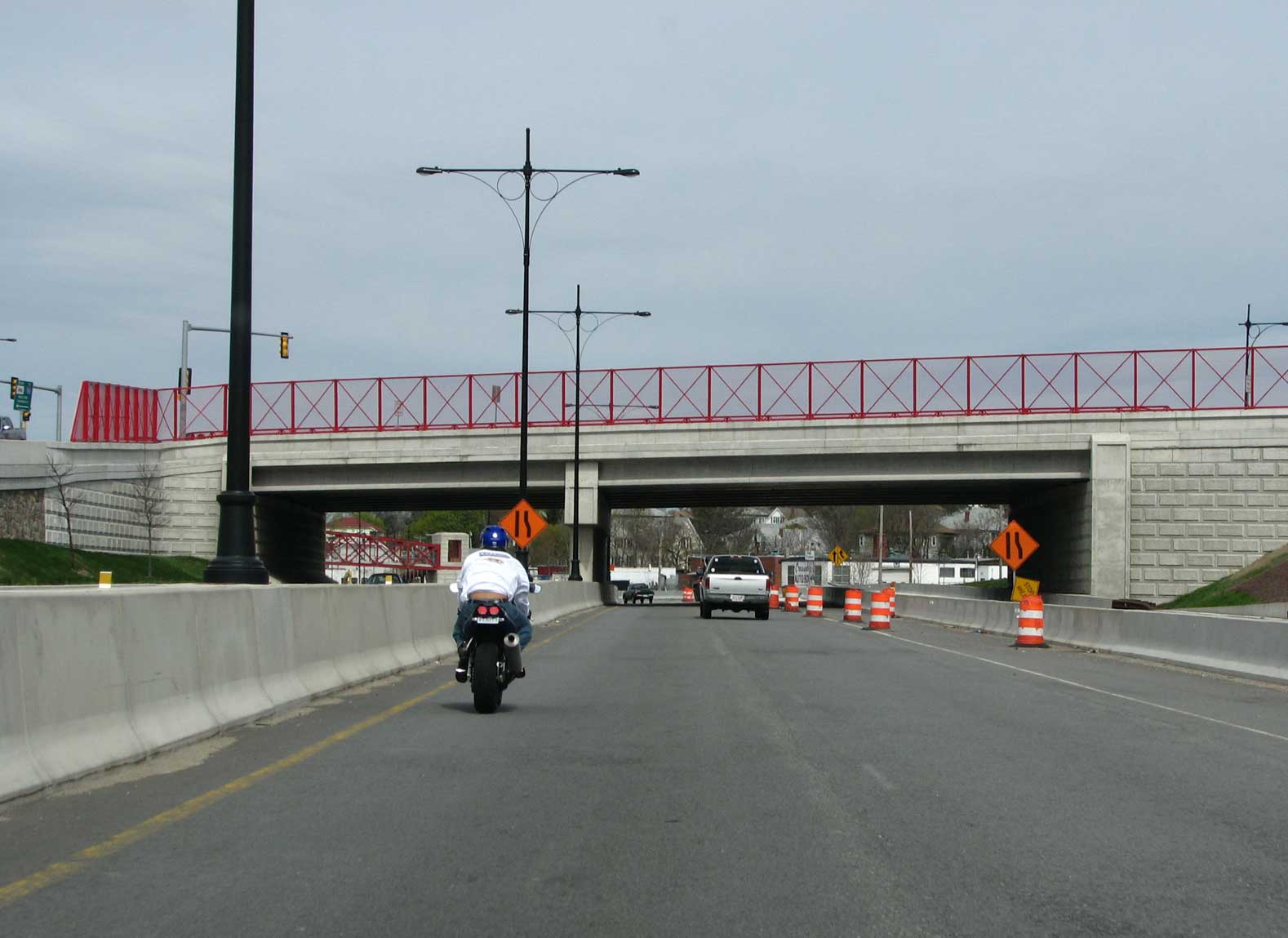
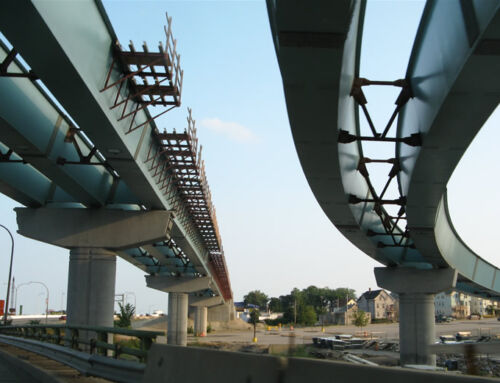
The bridges throughout the newer freeway section are colored rather brightly. Teal and Blue accents are common and noticeable, as are these red accents on bridges, lights, and fencing.
Construction is ongoing in Worcester to upgrade the road. Traffic is relegated to the future southbound lanes as the northbound lanes are completed. Interestingly, the signage is already up – completion is expected by the end of this year. When the freeway is completed from Providence all the way though to Worcester, it would be a great candidate for an extension of I-190 southward (Also handy would be an actual connection to its parent)…

Route 146 north construction

Route 146 north at I-290.

>As Route 146 ends at I-290, the freeway goes down to one lane in each direction, just like the old days. There is still a single pedestrian crossing as well.
The bridges here are fuschia, which is a color I cant say I’ve ever seen used much on freeways before. It’s better than plain concrete, though – and thats what makes Route 146 unique.

I haven taken MA/RI 146 a number of times. Improvements to MA 146 between I-90 and I-290 have been going on since at least 2004.