
the second day of my Alaska trip, and (in my humble opinion) the best – some unbelievable atmospheric effects, in air and in space. Don’t mind the long post, and enjoy photo upon photo.
Now 35% less bear feces.
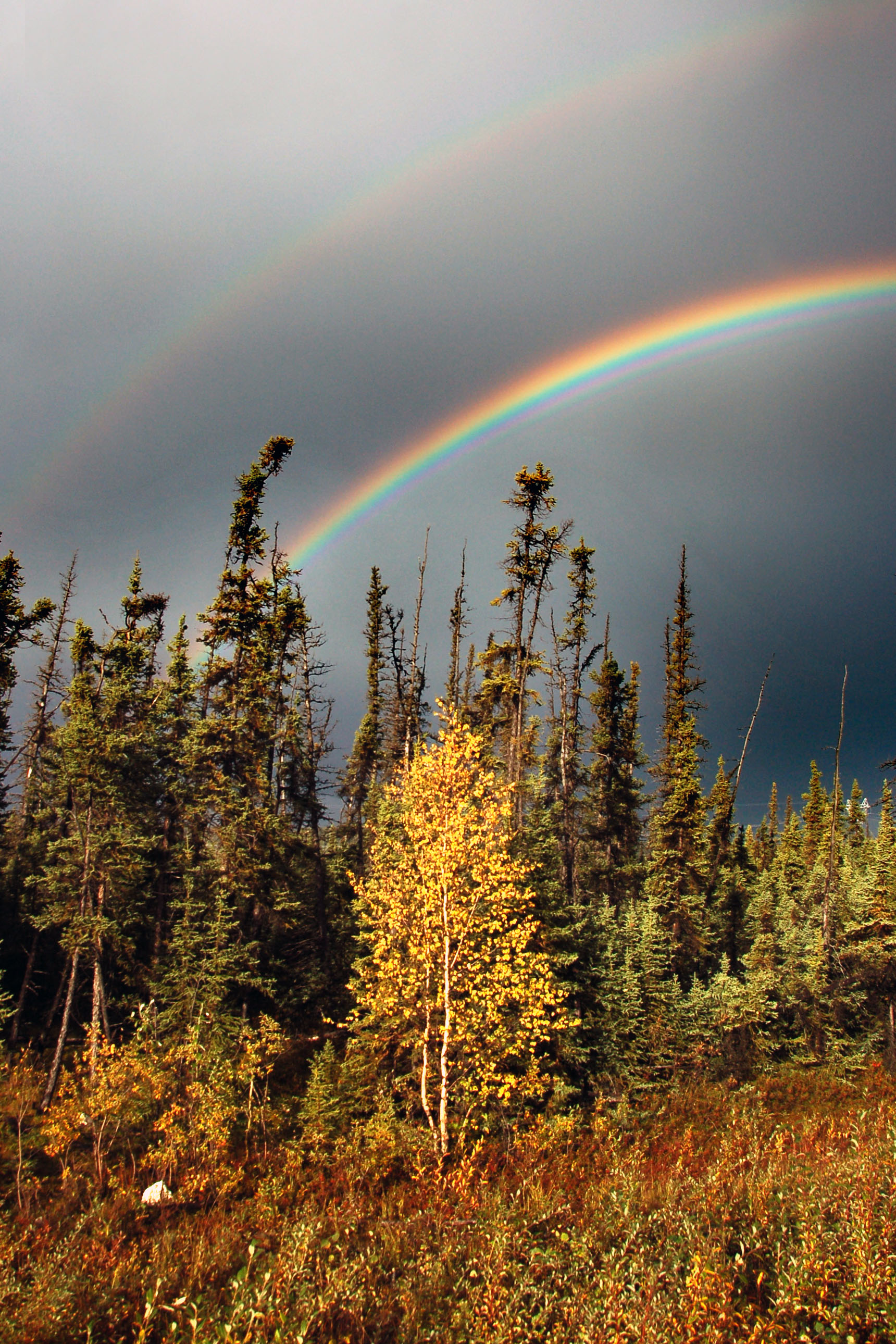
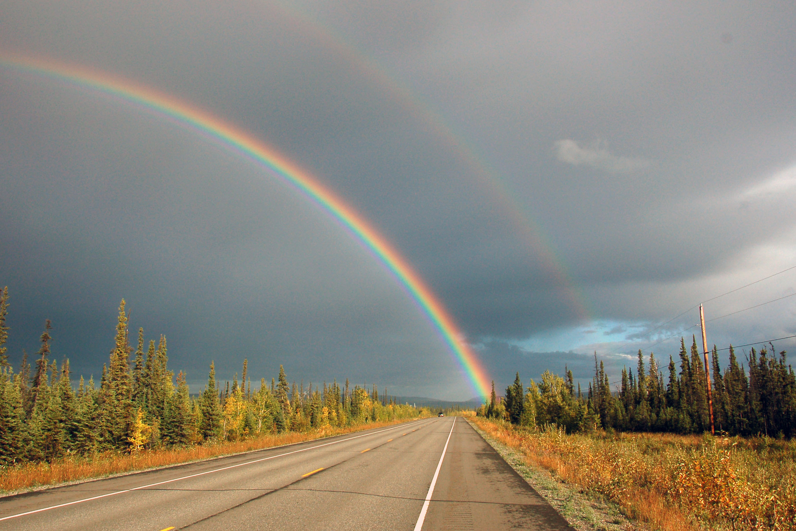
Double rainbow! Actually, we can see at least four rainbows (and maybe a fifth if one jacks up the contrast a bunch). Look inside the inner rainbow – note the repeating red bands; I count two in addition to the primary.

16×16 shield that dates to 1962… Alaska is ripe for the old signs!

Well, that about establishes the absolute lower bound, doesn’t it? Along state highway 2 is this … veritable metropolis, teeming with life. Note the 1970s white signage; for all we know, the population may have, since that time, taken the final decrement towards the ultimate goal of occupancy.

Alaska Highway at sunset.

Tok. One of my favorite sign photos I’ve ever taken – just because the setting sun illuminated this sign perfectly!
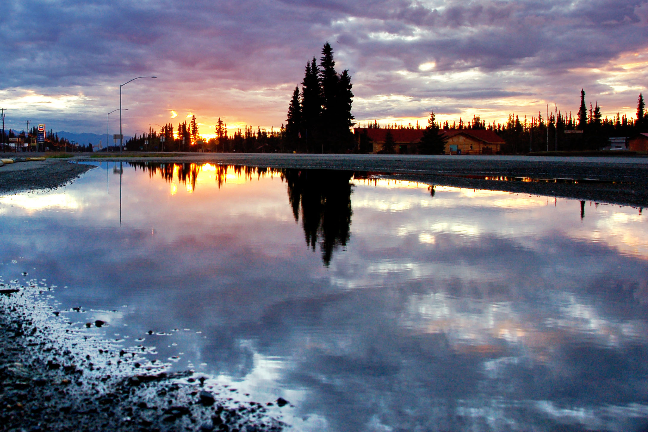
Sunset. I took this one across the waters of the most majestic lake I could find: a mud puddle next to Tok’s main drag. Note the light posts. I think my camera was at most five inches above the water.
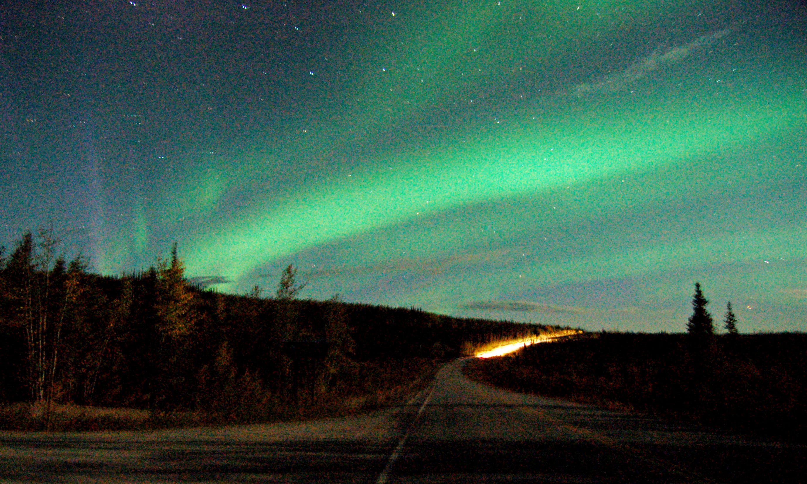
The northern lights, over the town of Chicken. Most notable in this photo is the purple jet on the left side. Green aurora are the most common, and purple is far more rare.
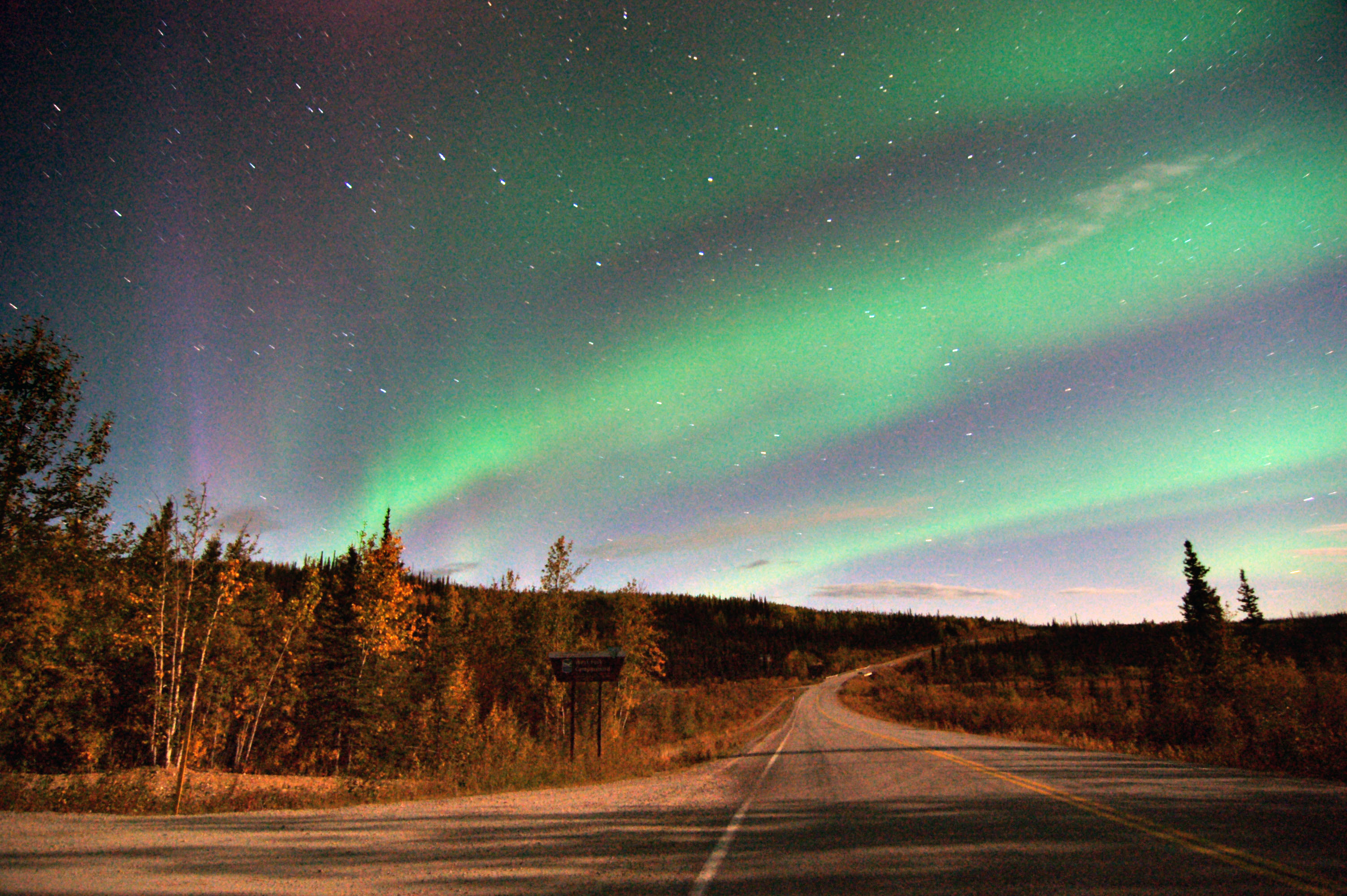
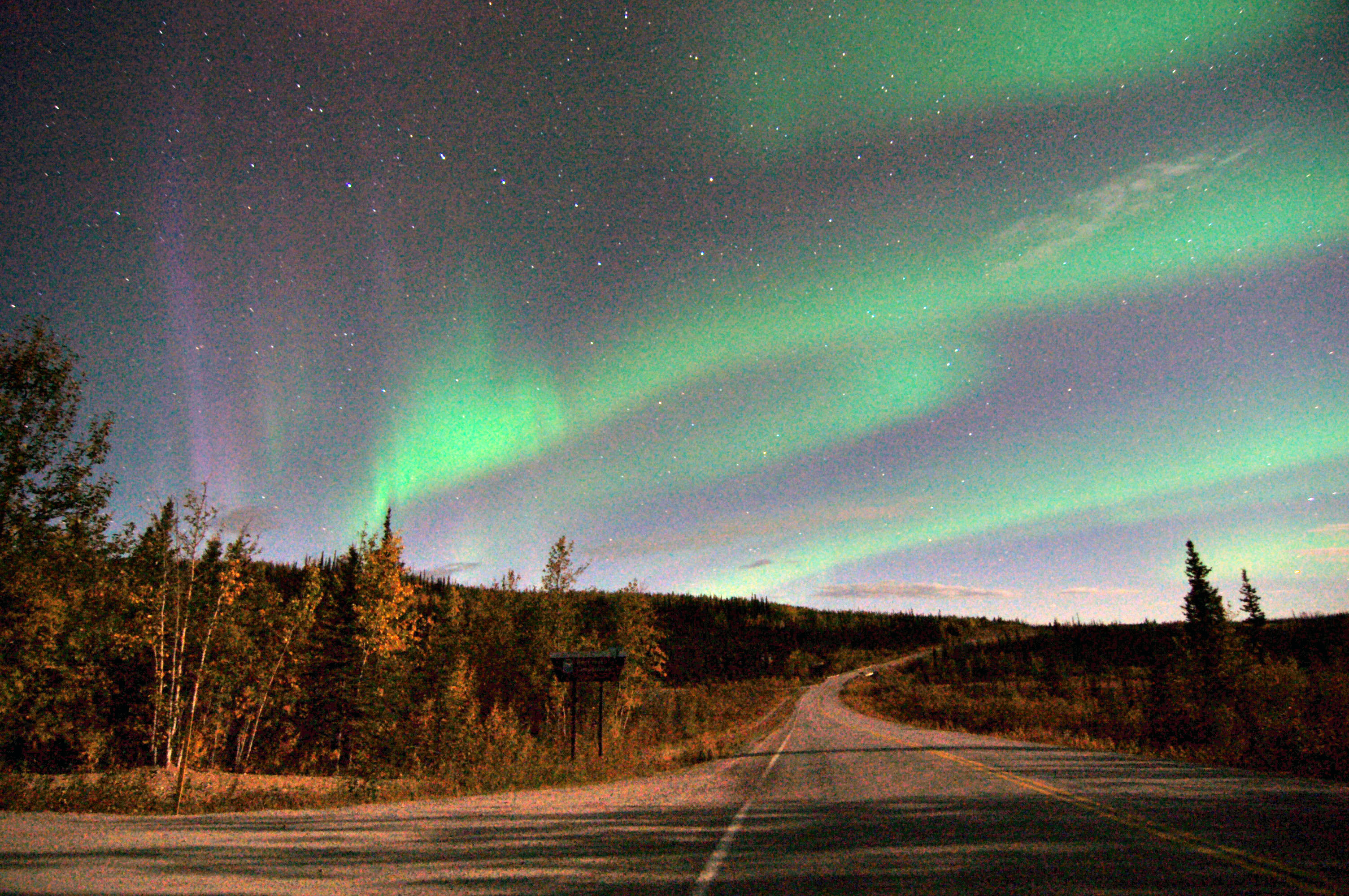
One more northern lights – my absolute favorite of the bunch. There is the one aspect of the northern lights that no photos can capture: their motion – they really do dance across the sky, and seeing them in person is something else. September 3rd and March 15th are the aurora peaks, due to the Earth’s position in its orbit, relative to the solar wind, which releases the particles that (upon impact with the upper atmosphere) cause the lights. These photos are from September 2nd, 2007 – so just about the fall peak, and I certainly got an impressive display.

Our first photo of the dawn. This is what the bears drink to mitigate their existential crises. It’s about 3.30 in the morning, after having gone to sleep at 1 the night before. Sleep, what is sleep? I can do that at home – while I’m on vacation I will explore!

Someday I’ll take the airplane tour of Mt. McKinley. But not this time, when I pass by it at 4 in the morning.

The early dawn alternates between overcast fog, and these scattered high clouds.
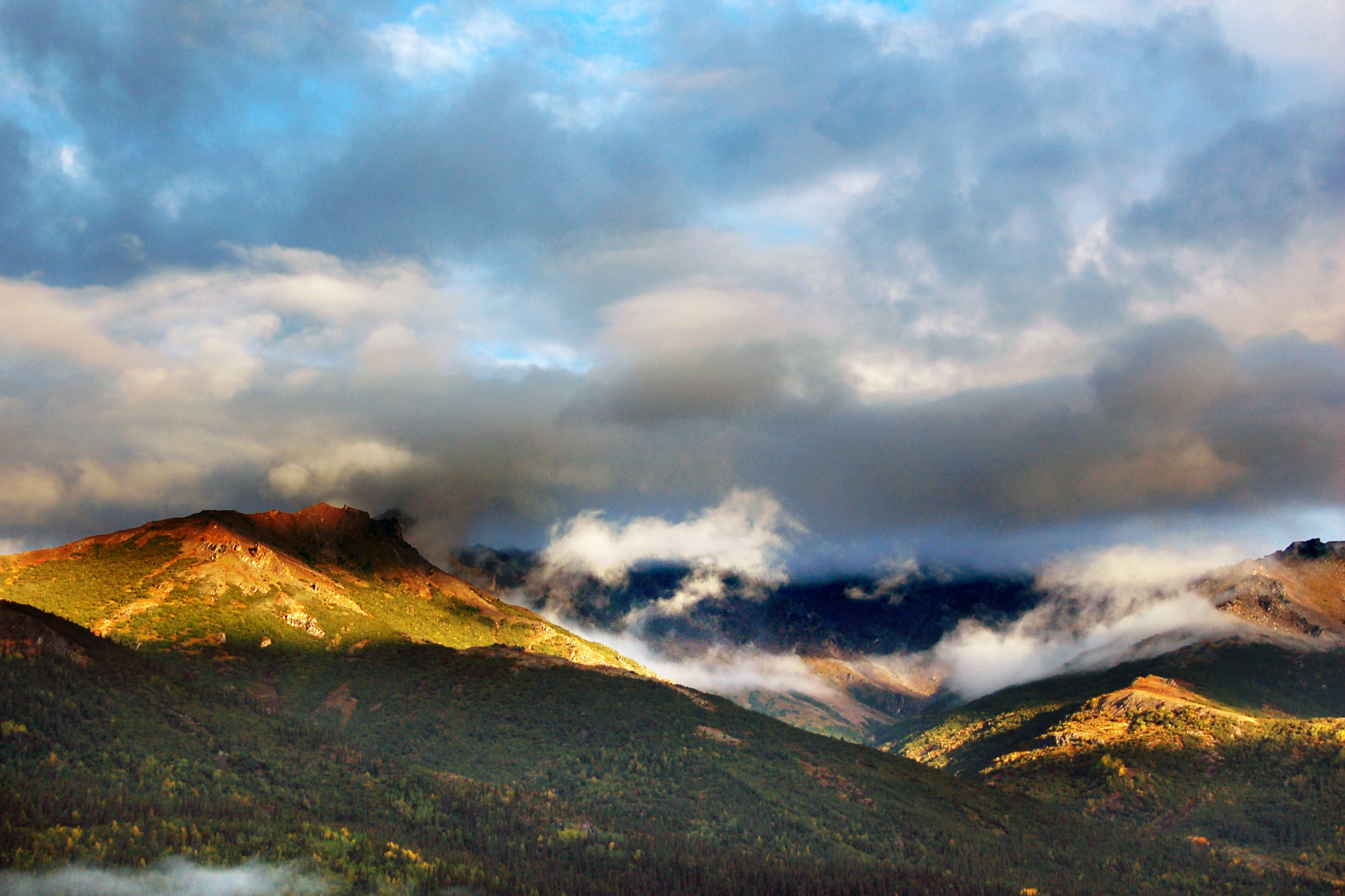
Everpresent low clouds, as the sun barely starts to break over the horizon and illuminate the peaks.
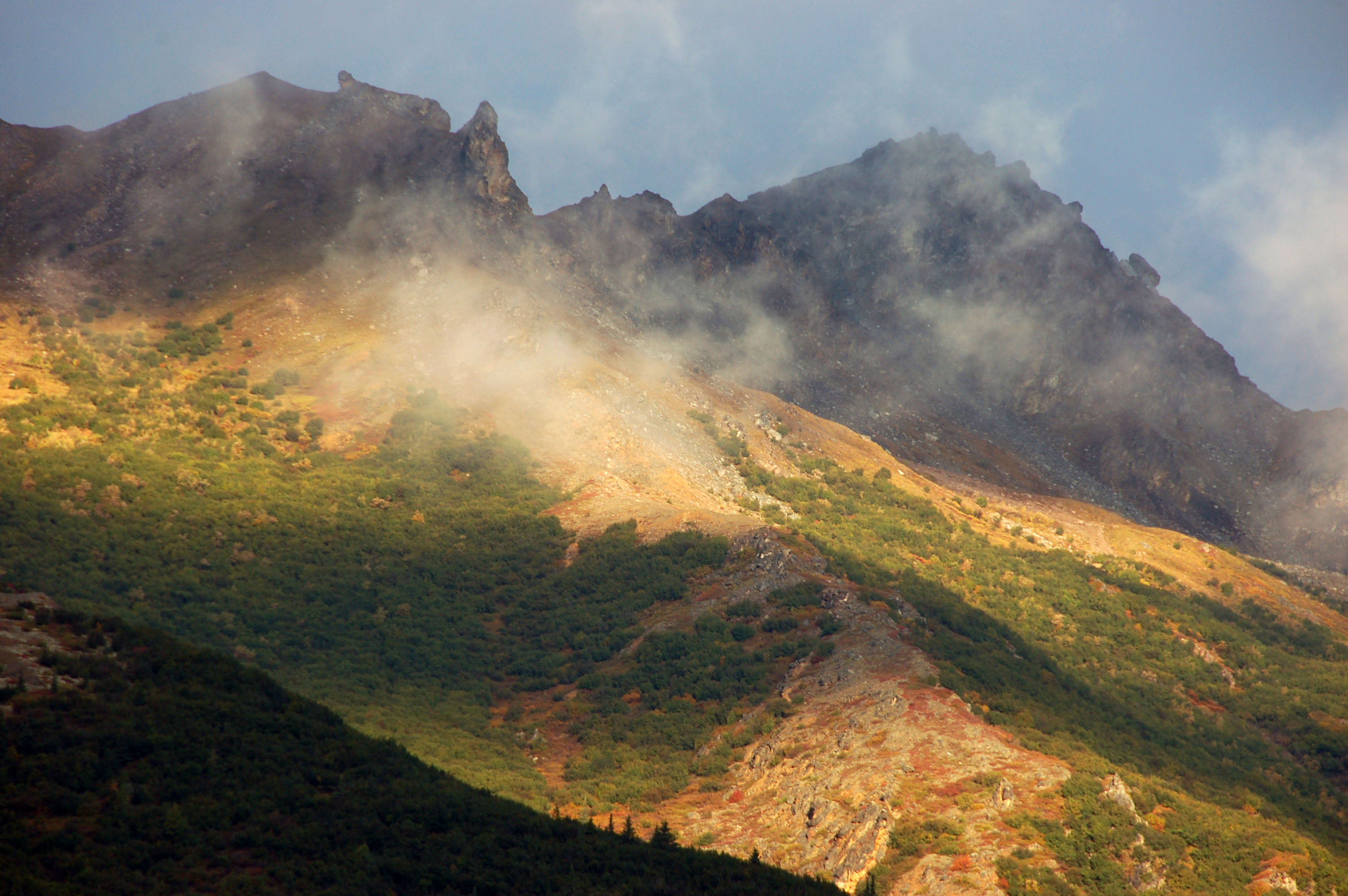
Tall mountains. Wispy fog.
Aaaaaand one more from the same general space and time. Crazy light – Alaska, everybody!

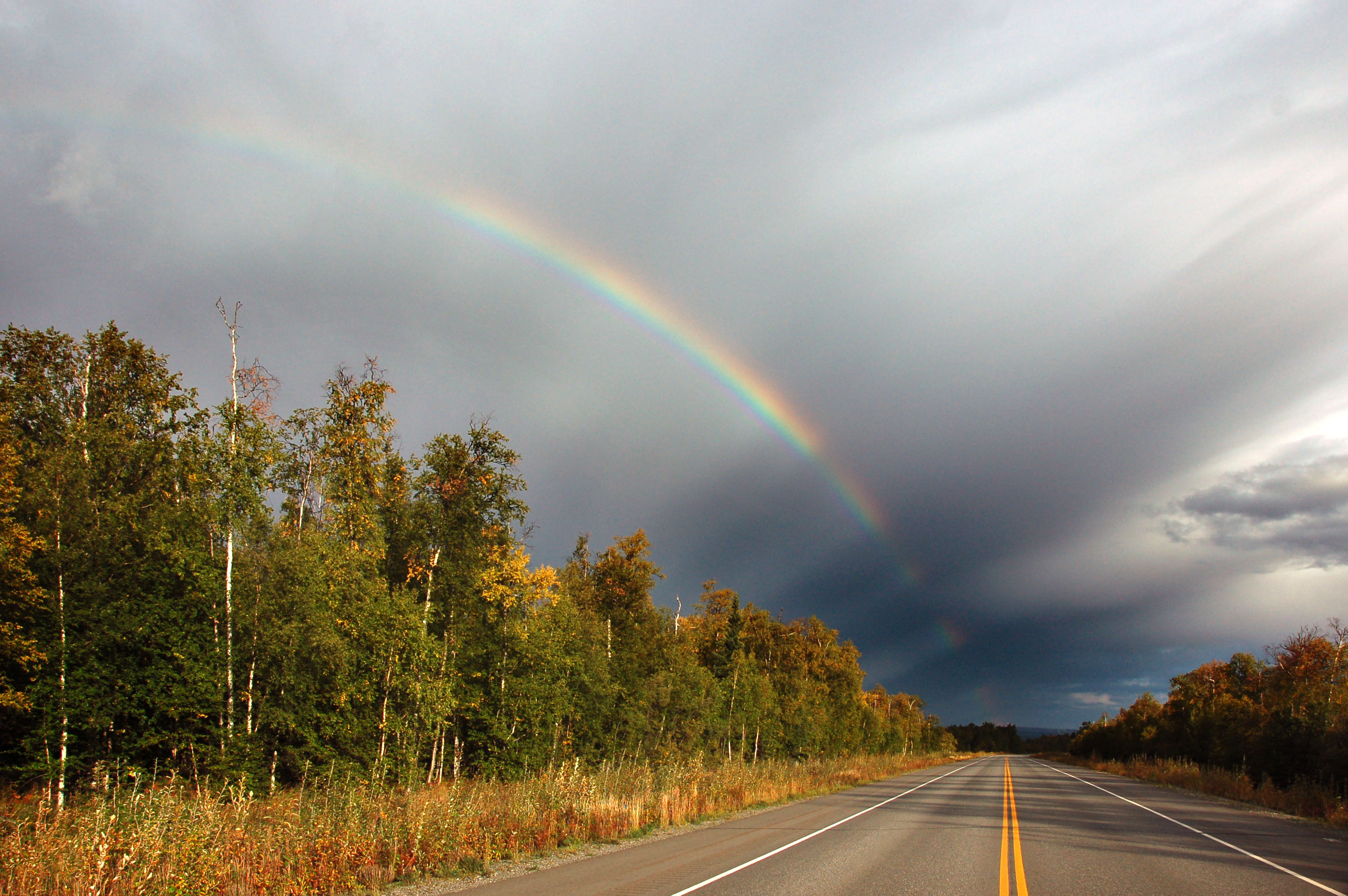
Just a little rainbow… a harbinger of things to come.

A rainbow spoke! The same brief glimmer of sunlight that causes an arc-minute or six of rainbow to appear results in the ray of light extending from it to the point exactly opposite the sun.

The road to the mountains.

A rainbow… or two! Note the subtle second rainbow inside the primary band. That is caused by interference of waves, that was not explicable by the Newtonian physics that correctly described the primary band (a refraction of the light wave within the individual raindrops)… for many centuries people wondered how the extra inner rainbows happened, until a new understanding of light as a wave explained in the 1810s.
Highway 3 and the trees of Central Alaska, and the rainbow of course.

This has to be the brightest rainbow ever seen.
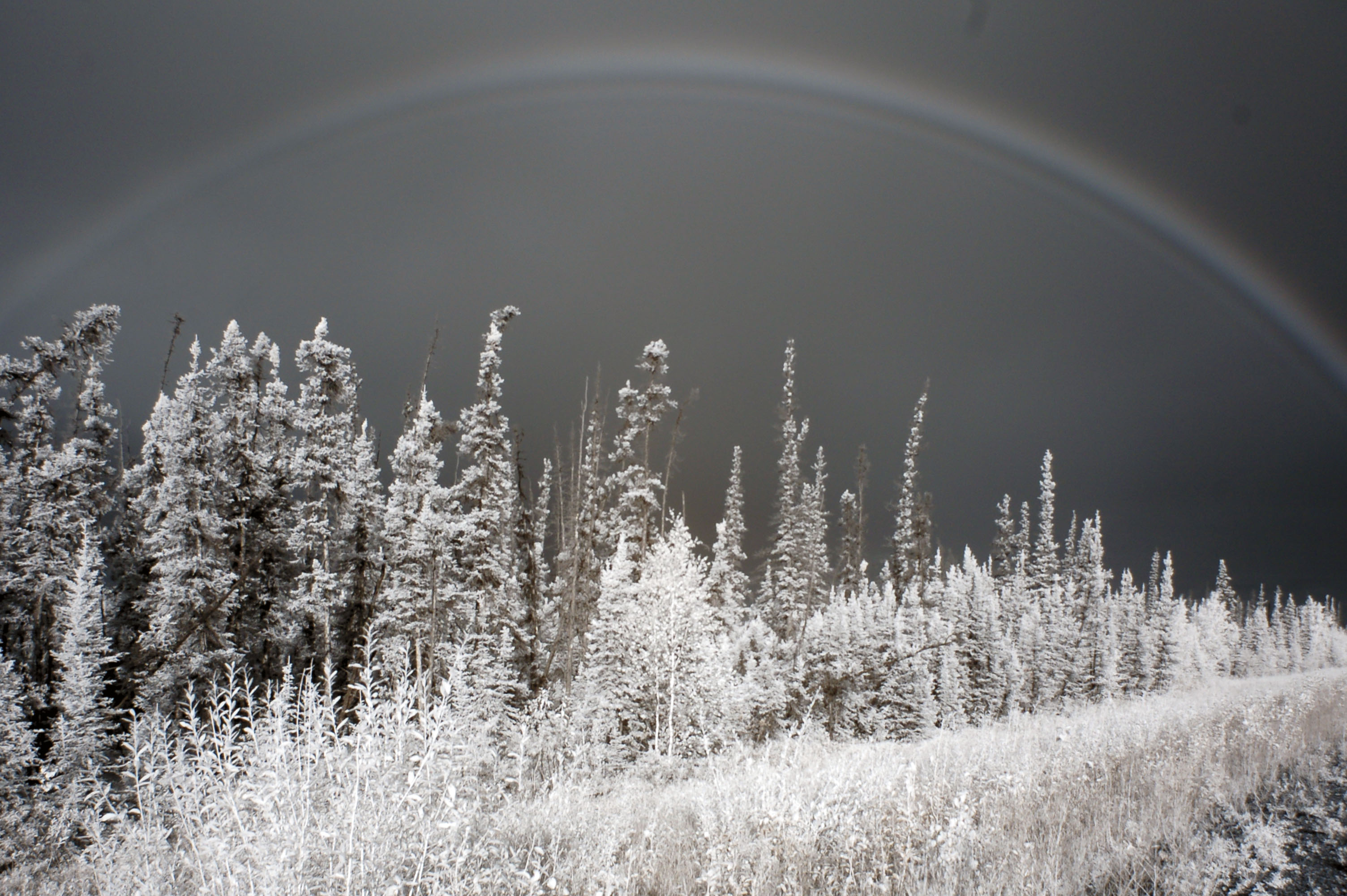
Yes, rainbows show up in infrared. The main IR band is where you’d expect to be: just within the red. Note the multiples of this rainbow … quick, let’s blow up the contrast to see how many there are.

Why, here are five of them! Infrared again, so we get single white bands, which makes the diffraction easier to see… and of course I blew up the contrast in Photoshop by a whole lot, just so we can see all five bands.
Now for some high ninja rocket science. There are two different phenomena at work to generate a sequence of rainbows. The first is the number of reflections within an individual droplet of water, which is called n=1, n=2, etc. One reflection? n=1. Two? n=2. And so on. So when you see a double rainbow (as in the photo I led off with), you see the n=1 and n=2 bands – and they are the easiest to see, because as the number of reflections increases, the brightness fades away…
The third rainbow, n=3, is – thanks to various mathematics that I desire to omit – in a place that you’d never dream to look: on the same side of the sky as the sun, only 43 degrees away, as opposed to the 139 and 153 of our customary first two rainbows. It takes until n=6 (five iterations fainter than the primary!) to get back to the same general area of sky, which is why one never, ever, ever witnesses a true triple rainbow, unless they are in a laboratory… or snacking casually on the radical fungus, as the case may be.
However! – and this is stuff that was so mystical that Newton and Cassini and the rest could never explain it – each band of the rainbow, the #1 and the #2 and the rest, generated multiple prismatic arcs. What was the explanation behind the fact that the #1 arc broke into multiples, each subsequent iteration appearing inside of the previous, three degrees in and half as faint?
No one could understand until Thomas Young, in 1801, applied the newfangled wave theory and realized that the light was interfering with itself. Thus, these new rainbow bands were declared to be a new phenomenon and labelled 1a, 1b, 1c… 1a is the primary one, then 1b is the first inner band as a result of in-band interference, and then 1c and 1d and so forth, all the way down the geometric sequence.
The photo I show above features the 1a, 1b, 1c, 1d, and (barely) 1e bands… how about that!
Another view over highway three. And now we know the science, and can identify the two primary bands as 1a and 2a (and can see the interference-based bands within 1: 1b and maybe 1c if you squint real close.)

What’s at the end of the rainbow? Well, here it is a green guide sign!

To this day (two years after I took these photos!) I have no idea what this sign means. But it is bright green, so it must be important.

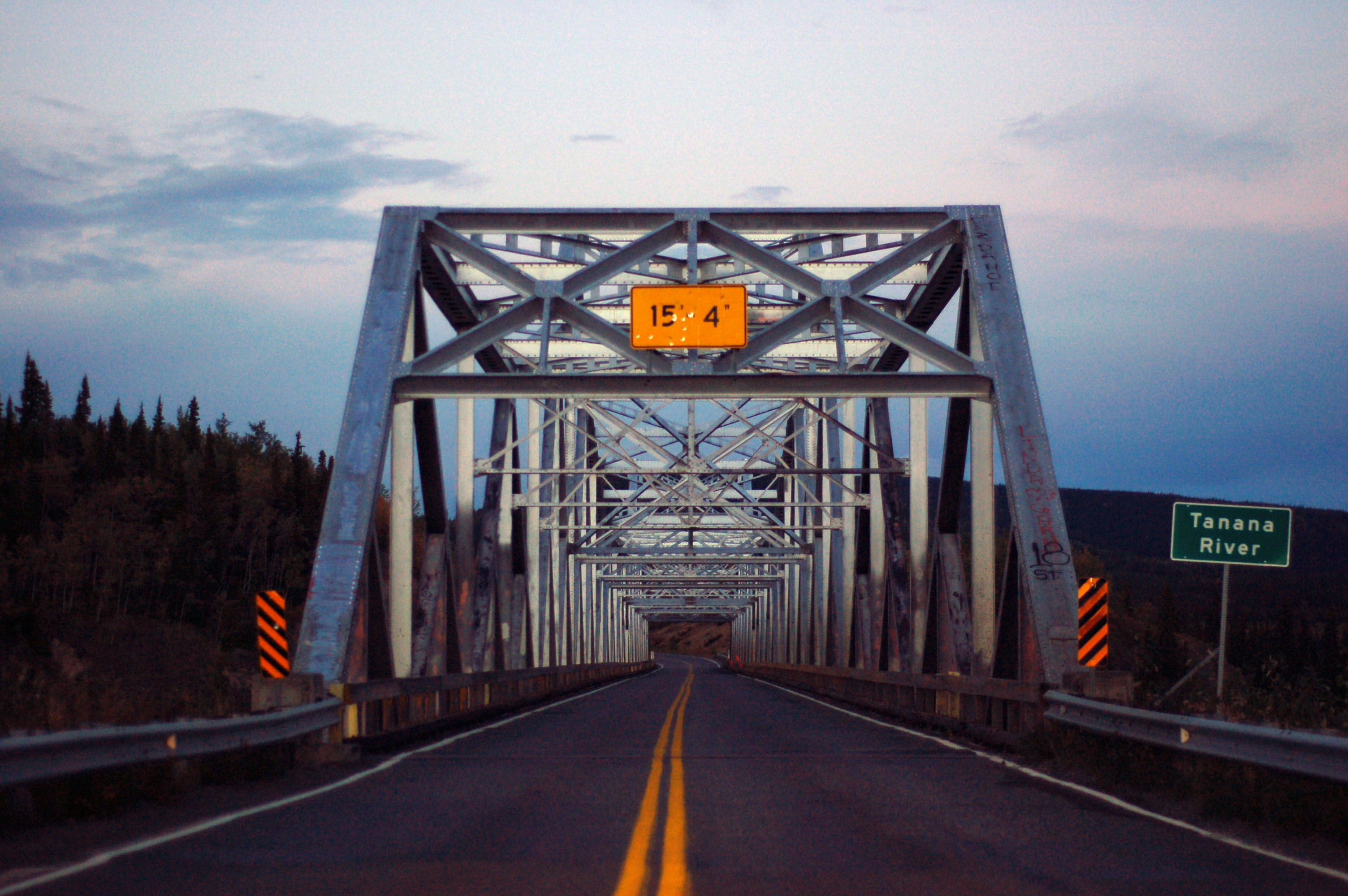
A reflective lake in the town of Nenana.

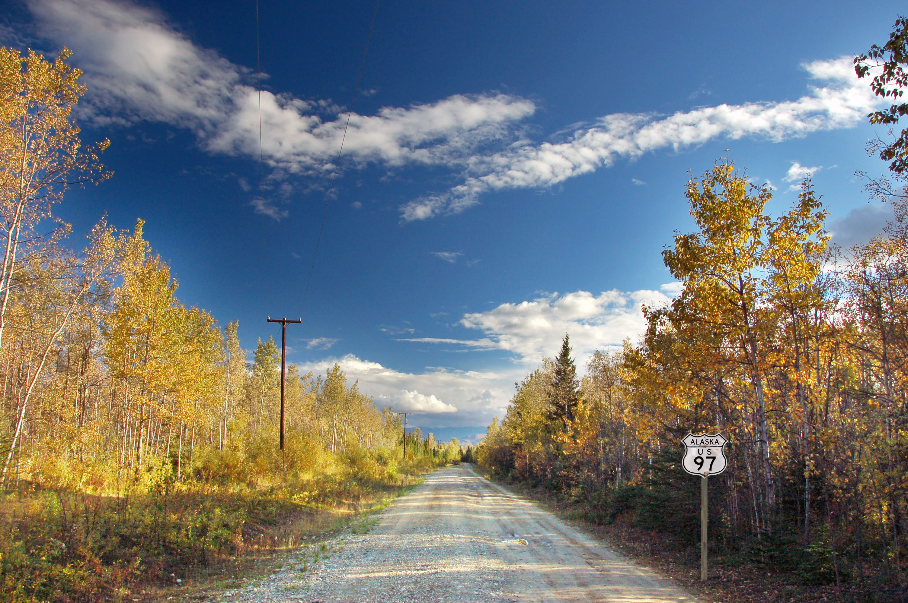
The bridge to Nenana. From Fairbanks, along highway 3…

What’s the ancient Eskimo of saying that there is no way through? Nooutlet. Place the space where you feel necessary. An old alignment of Alaska 3, where a bridge has been knocked down. Nooutlet indeed.
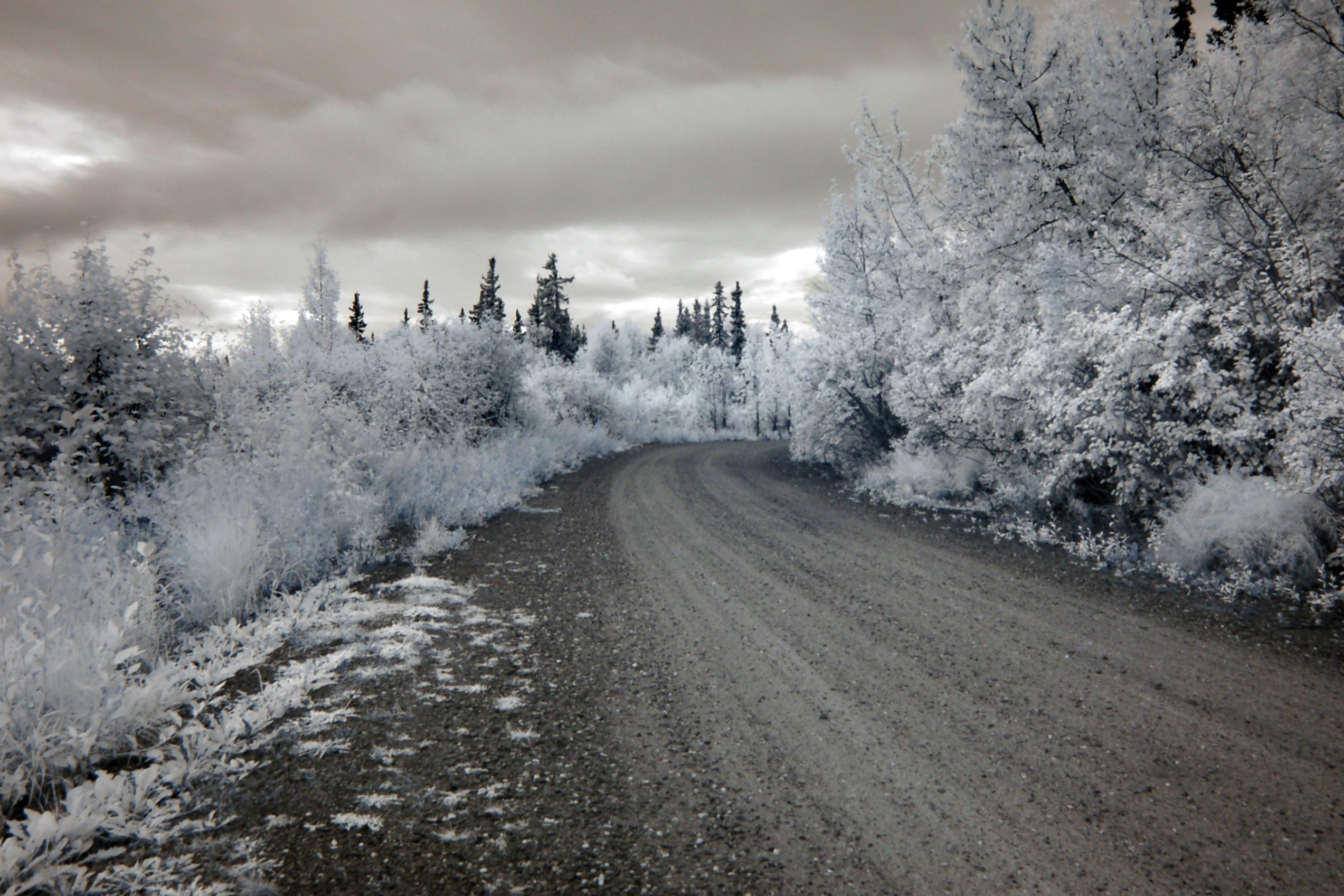
An old alignment of state route 3. Dirt, of course… the roads weren’t fully paved until the 1980s, and in some cases the 1990s, and in some cases, not yet, even.
<img “Alaska state route 3, Alaska US 97″ src=”https://www.aaroads.com/blog/wp-content/uploads/blog_images/jake/photos/031533.jpg”>
Flowers. In front of the Museum of History, at the University of Alaska, Fairbanks. The Museum of History was a disappointment… the reason I went there was to find an Alaska US 97 shield, but it had been long removed. Note: you may have to massage that link to get it to work: copy and paste the URL into your browser and then hit GO, and the second time around it’ll miraculously work. Alas, the old embossed Alaska US 97 shield was gone by the time I got there, retired to the archives… may I have permission to see it? No, no I may not. Archives and research material is closed on Labor Day Weekend. Well, fudge! I arrived at precisely the wrong time. Oops.
<img “Alaska state route 3, Alaska US 97″ src=”https://www.aaroads.com/blog/wp-content/uploads/blog_images/jake/photos/031564.jpg”>
More flowers in front of the museum.

Button copy! In Alaska! The only examples I found were here, around the Chena Hot Springs exit off of highway 2. Must be a contractor getting all crazy with the Cheez Whiz. We are on the way to the Daltonlands now, for sure… the Dalton Highway branches off highway 2 a few tens of miles off in the future, and heads near-due north, along a frightfully decrepit dirt road, four hundred miles to the town of Dead Horse. It is my ambition to, some day, get a vehicle of sufficient capability and drive the Dalton Highway. For now we’re just going to approach the foot of it, acknowledge that its beginnings exist, and then turn around and run away bravely.

The Dalton Highway, the symbol of all that is barren, forsaken, forbidden, and necessary to take steps before inevitably exploring. 430 miles to Dead Horse (what a name!) along the northern shore of Alaska. Alas, it is nearly all dirt and my rental contract forbids me to attempt it at this time. So let’s just go only a half-mile or so.

416 miles. An impressively long distance to be delineated by a single sign.
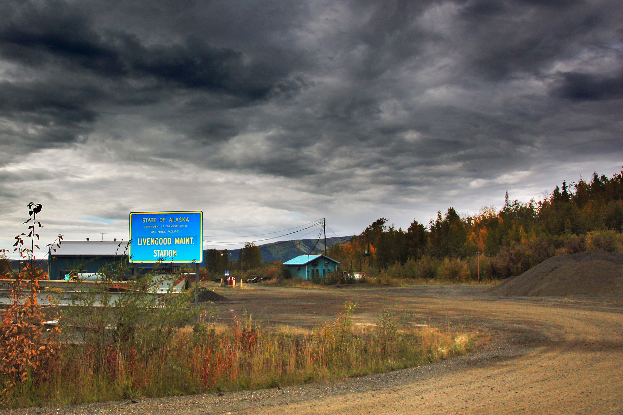
Livengood Maintenance Station. Probably not the absolute most remote maintenance station in the history of all highway departments (I’m quite sure that the one at Dead Horse, which surely must exist, is far less accessible), but definitely the most obscure I’ve seen with my own two eyes. Four miles up the Dalton, then two miles down a dirt road with no name, no face, no government, no style… an anonymous town, a population rivalling legendary Olnes in obscurity… just a guy with a satellite dish and a plow truck. Maintenance station yeah!

The Trans-Alaska Pipeline. Yeap, the main reason that the Dalton Highway was built was to service this gas pipeline, as it comes in from the reserves of Prudhoe Bay and other northern farparts. Here it is, streaking its way down to Valdez, where ships named Exxon screw up the process and run aground and fudge the environment. Damn pipeline!

We’re back on the main triangle, after going far to snag a few Dalton signs. Anchorage, 440? Yes, there are two officially recognized ways to get to Anchorage from Fairbanks… the shortest one is the occasionally closed highway 3 that we took this morning, built around 1962; the other is the newer, highway 2 to highway 4 to highway 1 route, that is more likely to be plowed and free of humongousbears of doom. Thus, the sign. It’s really 280 to Anchorage, but that road may be closed. Keep on going forward like it’s 1959.
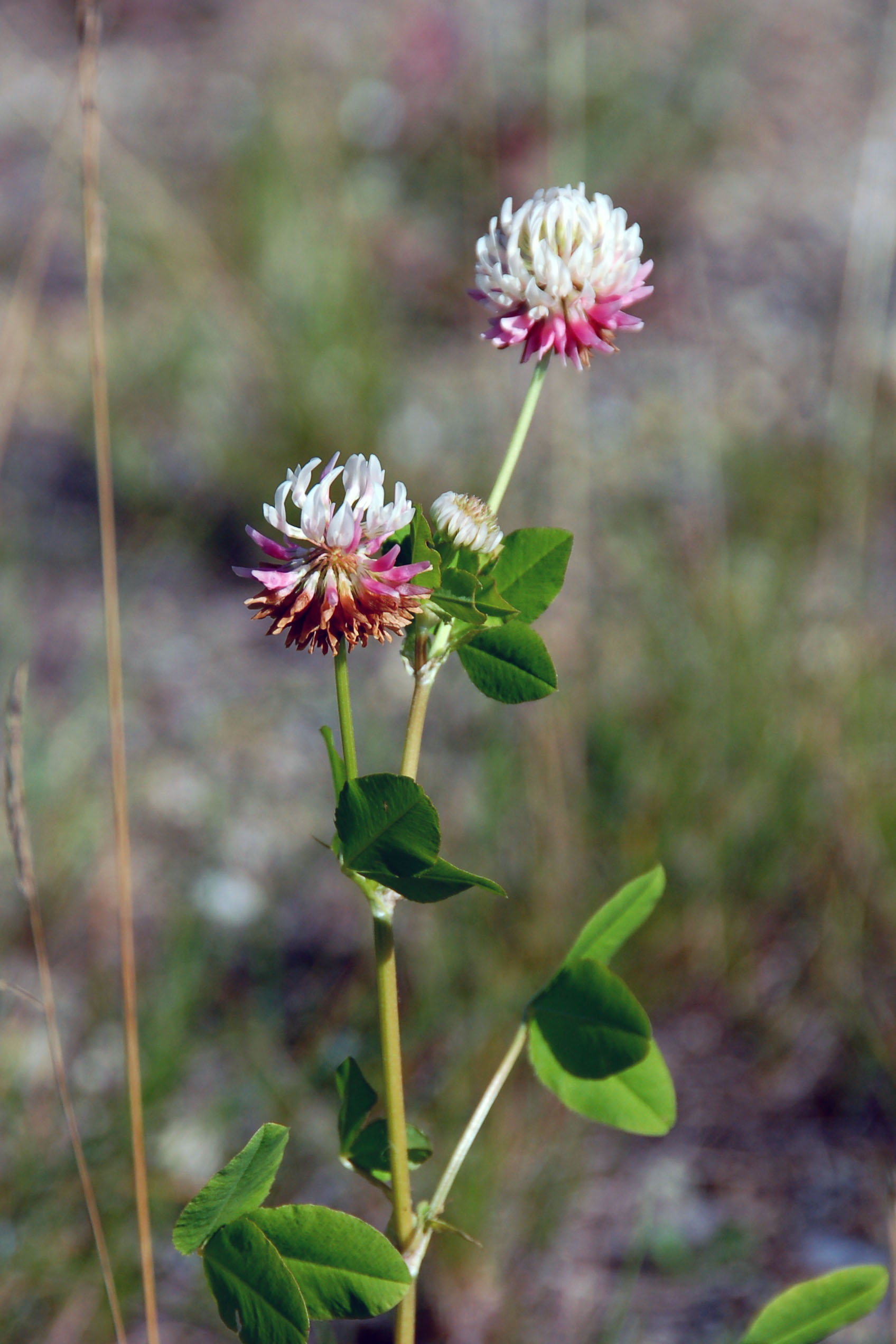
Pretty flowers. Just outside of Fairbanks along highway 2.

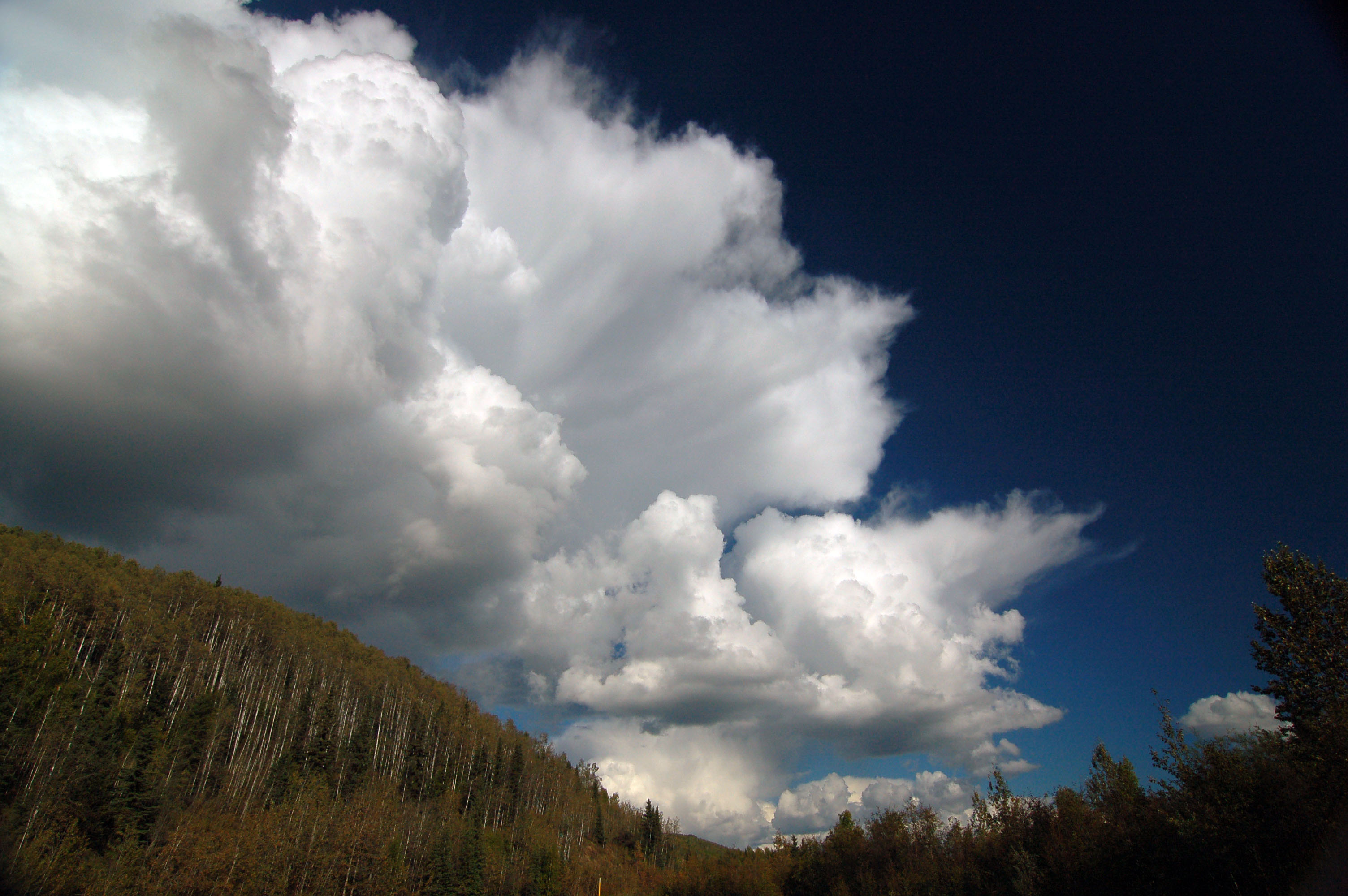
Fun with cumulus clouds.

Seriously, fun with cumulus clouds… who says you can’t shoot nearly straight into the sun?
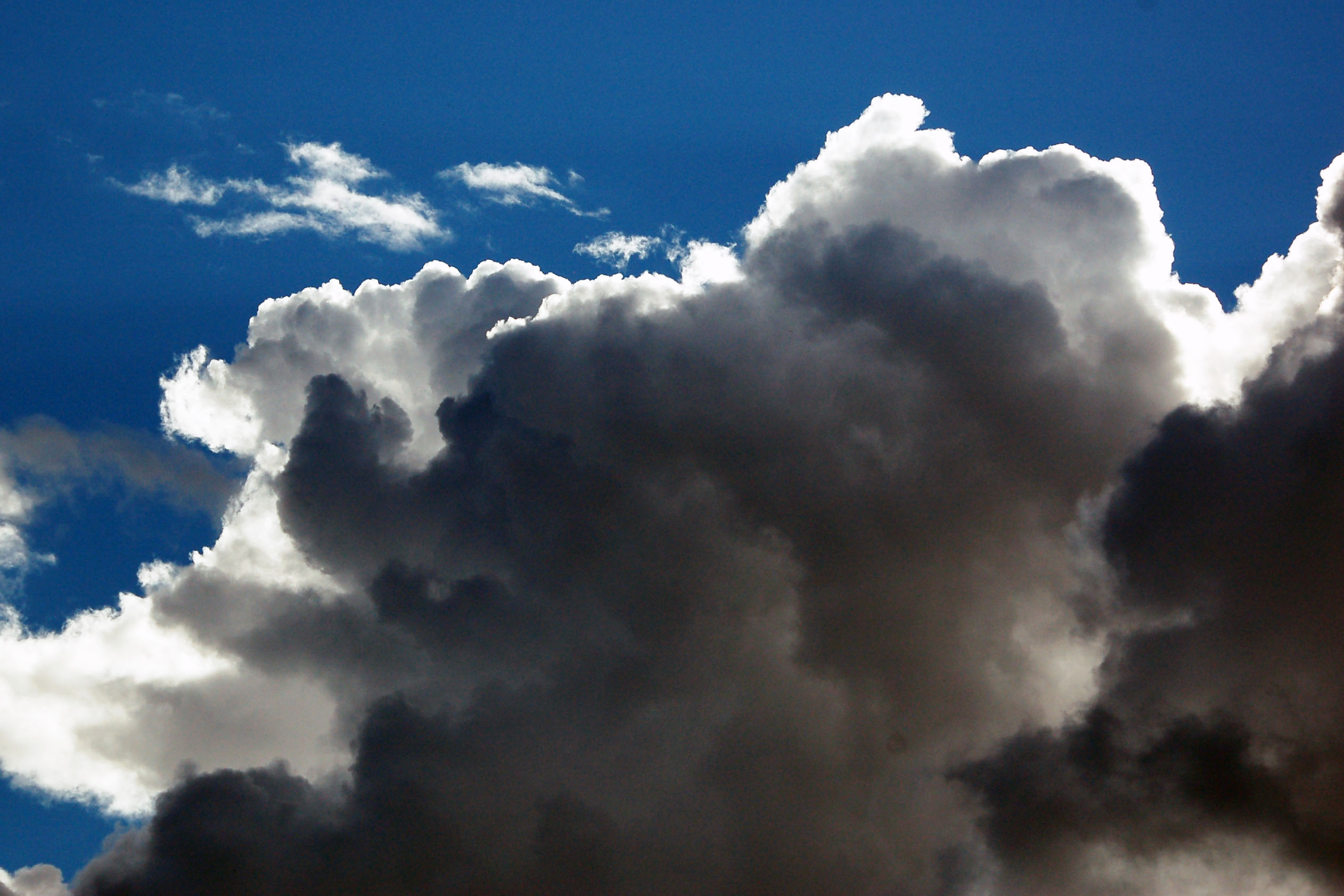
Expansive megacumulus.

Now this is a random rainbow. Where’s the rain? Directly overhead, and that’s it. Just a patch of it about to fall on my head… and the resulting rainbow against the generally unthreatening cumulus clouds.
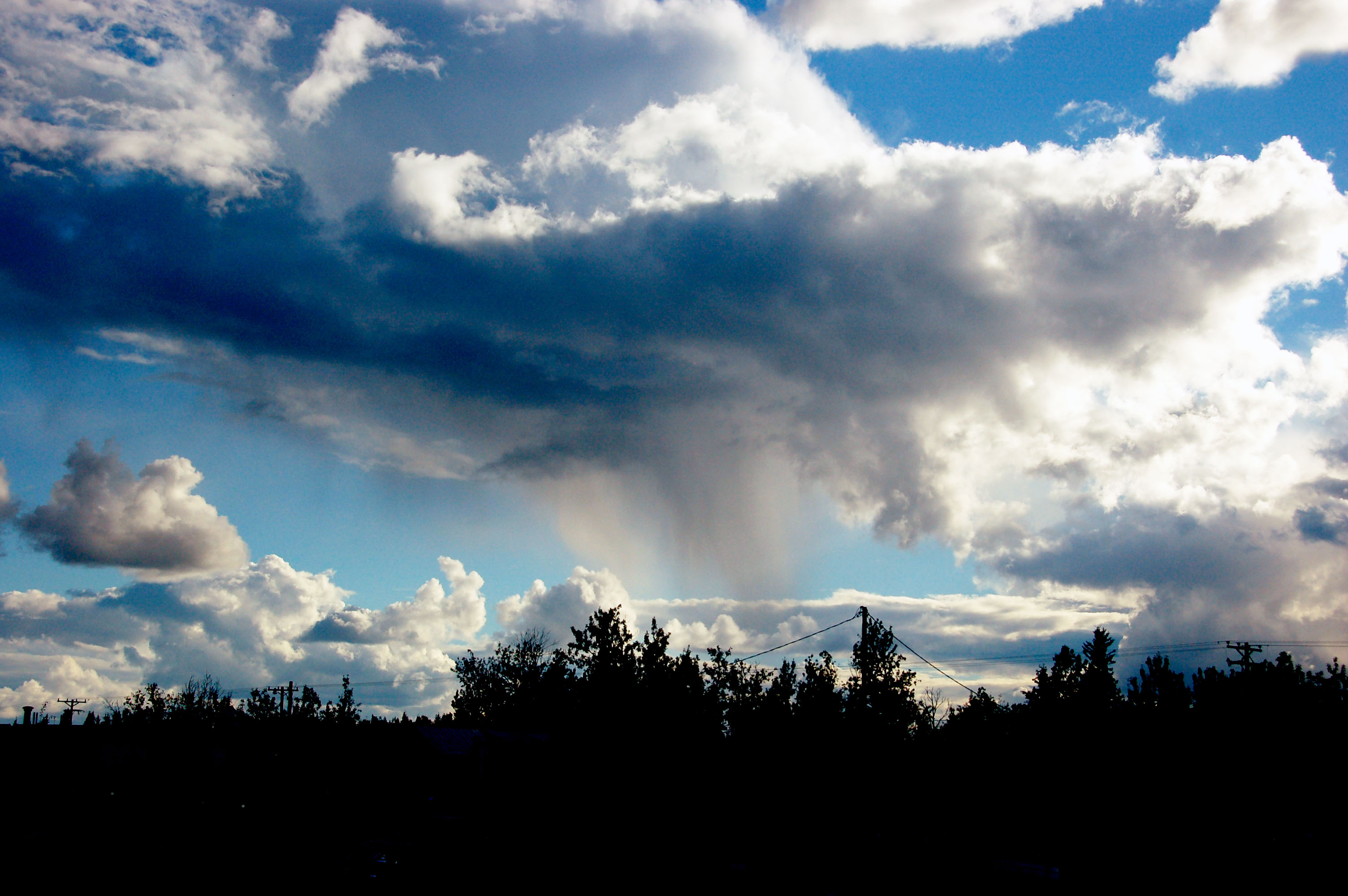
These are some mighty clouds – for all I know, they developed into a thunderstorm… but I was blazing eastward, and passed them by.

Danger: High Pressure Pipeline Crossing. Remember that pipeline? Going from Dead Horse to Valdez? Well, it goes through this point; crossing under the road at Delta Junction somewhere around there. And yes, that sign has gotta date to the 50s.
One Hell of a rain cloud. Somewhere around Delta Junction. Just a few miles to the south of me – but nearly nowhere else! – it was raining up a flood!

The Alaska Highway ends here, at Delta Junction. It starts in Dawson Creek, British Columbia (home of some random TV show from the late 90s), and past here one can take either highway 4 to Anchorage, or highway 2 to Fairbanks, but neither of those routes are officially The Alaska Highway.

We’re only going a little past Tok Junction – not nearly as far as the Canada border. Yep, that leaves one very significant portion of Alaskan paved road unexplored: the Alaska Highway. Well, folks, that is why there’s a thing called next time.
Old sign? Not so much. Photoshop to the rescue. The image of the old, dusty road is real… and it is even an old alignment of the Alaska Highway… but the US-97 shield is not present these days. Around 1956 or so, they really did sign the Alaska Highway as US-97, and I’ve seen a photo of a bullet-ridden US-97 shield, in somebody’s collection, as evidence… but, alas, as far as I can tell, no more of those signs remain in the wild, so I had to make do with my own creation.
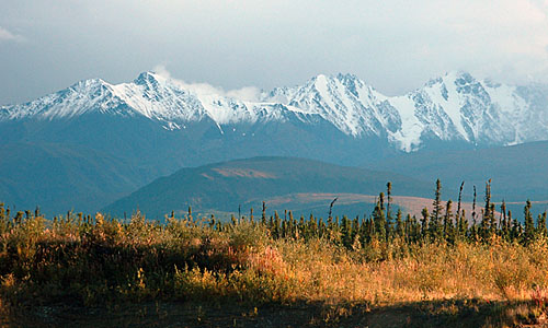
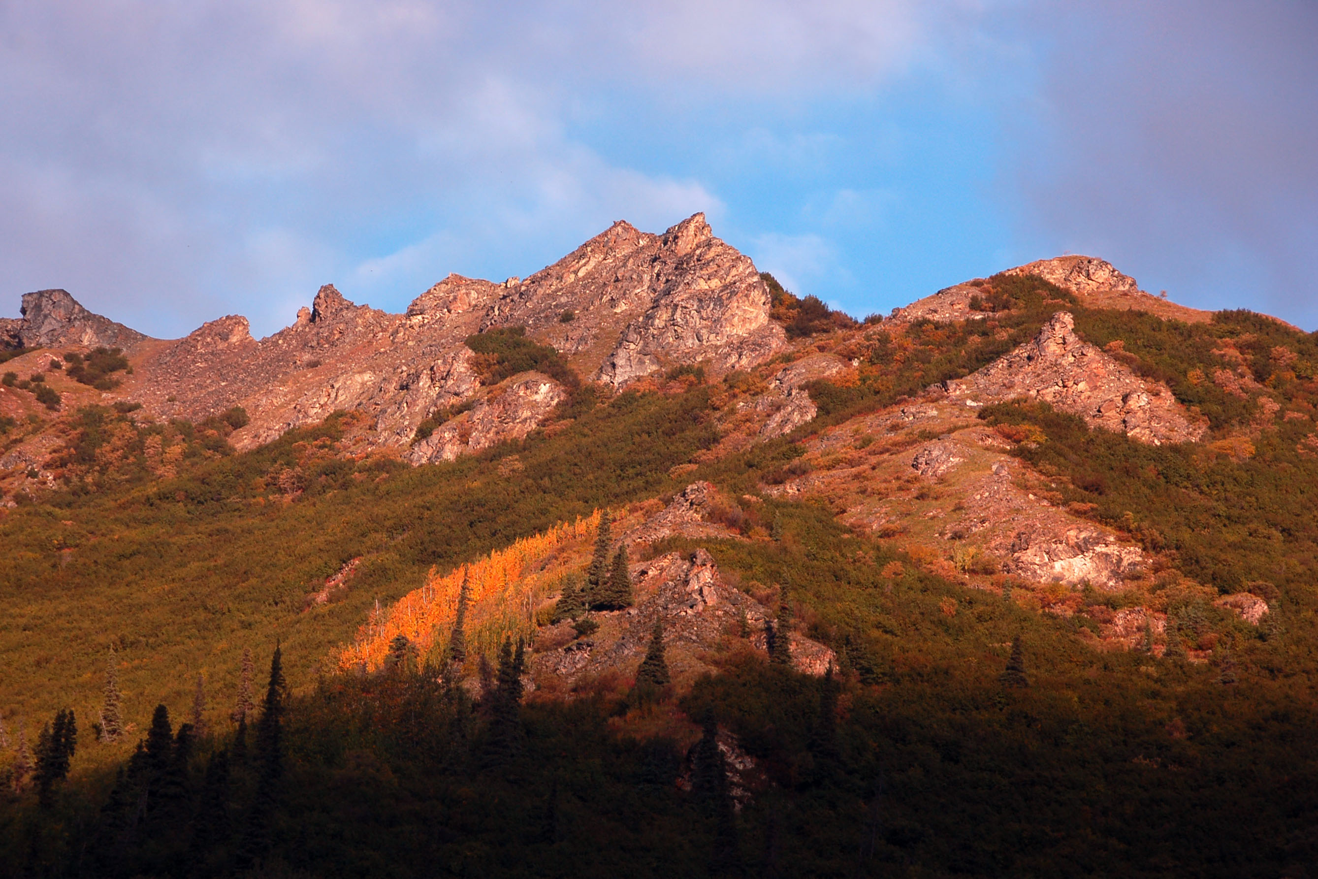
Faraway mountains. Visible from the northern road – if the weather cooperates and the distance isn’t too much – is Mount Blackburn, at over 16,000 feet tall. It’s the leftmost peak of these three.

Old bridge on the Alaska Highway. There are a good, solid sequence of them… the rivers must be crossed, the highway must be built, so here they are in the mid-1940s style, when the original Alaska Highway was built as a defense route – a joint US/Canada project, between 1942 and 1944 or so; nearly all dirt, a tank path from Spokane to Anchorage.

Alaska Highway going dead straight for a while.

Every hax0r’s dream sign!

I have no explanation for this one. It’s clearly some sort of a rainbow, but I’m not sure what. It didn’t appear in the right position with respect to the sun to be a traditional rainbow (and besides, red should be on the bottom). Certainly not a circumhorizontal arc, as those occur only around high noon and in this photo the sun was almost set. Not an iridescent cloud, as those would be on the same side of the sky as the sun. Your guess is as good as mine.

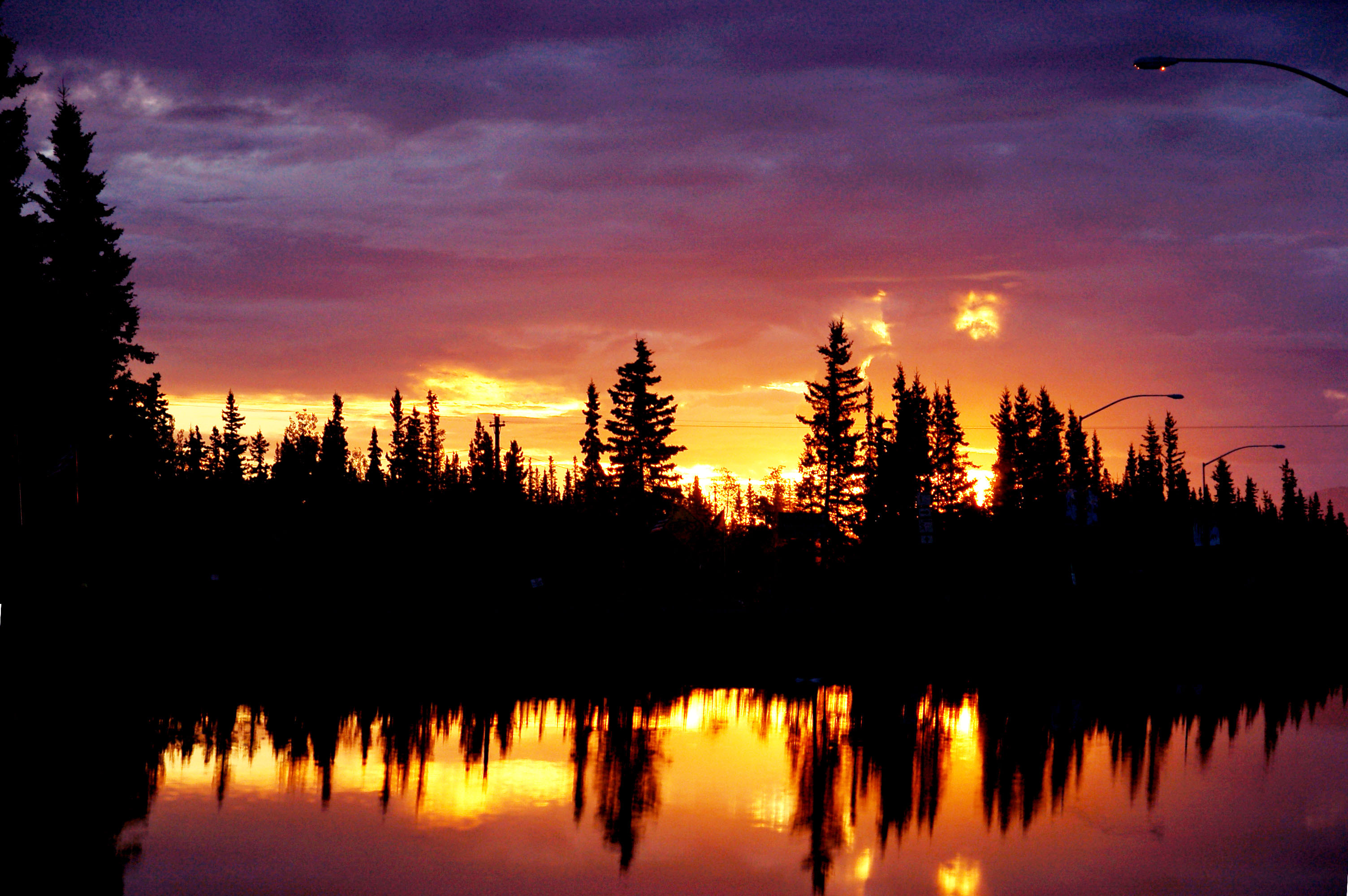
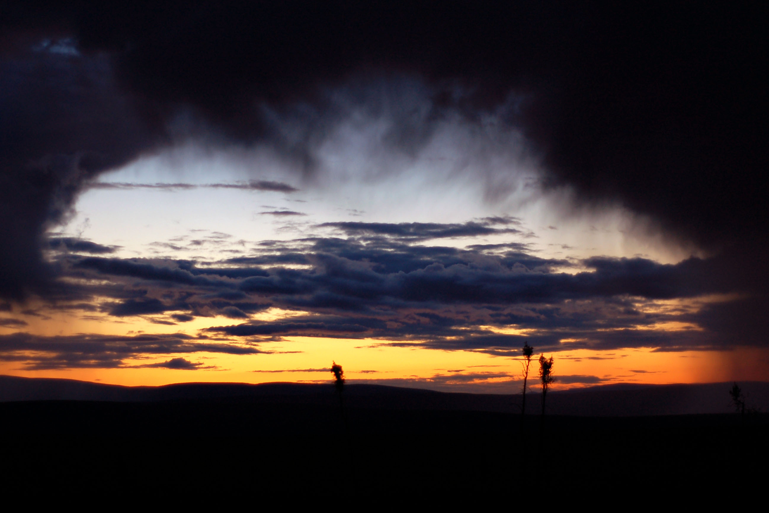
Sunset over the trees.

There’s always interesting clouds in Alaska, especially around sunset. Oh, did I mention that sunset lasts six hours??

The best part about having a sunset that’s essentially six hours long (well, beside the fact that you get twelve hours a day in enhanced lighting – and you wonder why I never slept!) is that you get to carefully observe it glint off each and every last object. Here, it is the power lines that glow orange for a minute or two.
Municipal puddle, for the win.
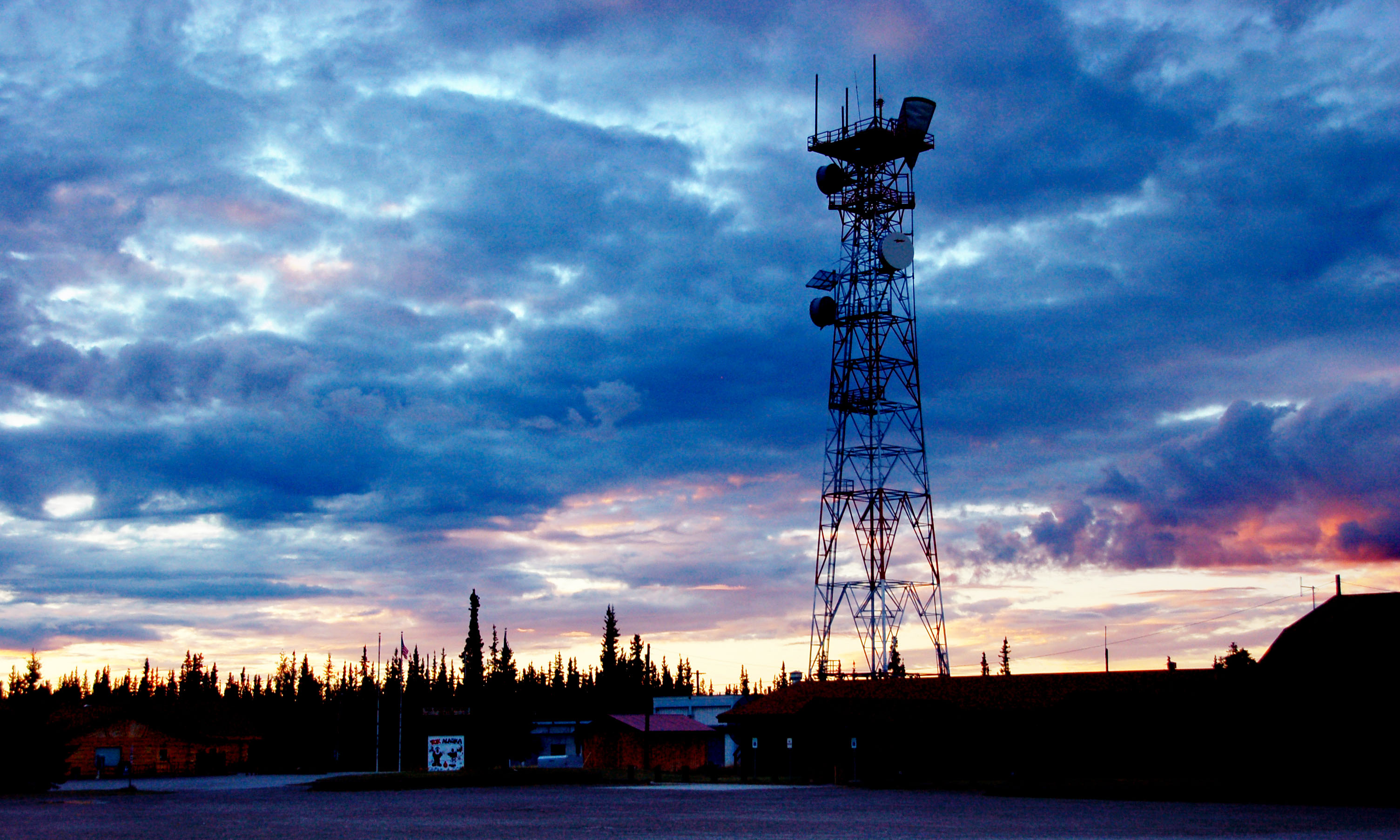
The Tok communications tower at dusk.

but it’s so pretty in the sunset, I can’t help but notice it!
A bridge, past Tok and past sunset.

Going to Chicken on route 5. That is a Yukon 9 trailblazer up there… when the 5 crosses the border, it turns into Yukon highway 9. Yukon is badass and color-codes its routes.

The road to Chicken. There aren’t many people on it, especially at this time of night. Did I mention that the sunset is six hours?? It is still twilight, at 10pm!
About eleven at night; the last of the sunset. Yes, that is a huge rain cloud overhead.
A thousand little sunsets.

Still on the way to Chicken.

Chicken is part of Alaska’s interior region… it is rather different from what people imagine when they think “Alaska”. Namely, the area is occupied neither by tall, snow-covered peaks, nor by polar bears. Still, though, it is the coldest part of Alaska, with temperatures dropping to -75 in the winter. Many patches feature only various and sundry grasses, none higher than four feet.

We have arrived! And yes, the road dirted out… you don’t tell the rental car company, and neither will I.

And we’ve even got ourselves an old white milepost. 66 miles back to Tetlin Junction, where we split off from the Alaska Highway.

Definitely the most remote post office I’ve ever been to.

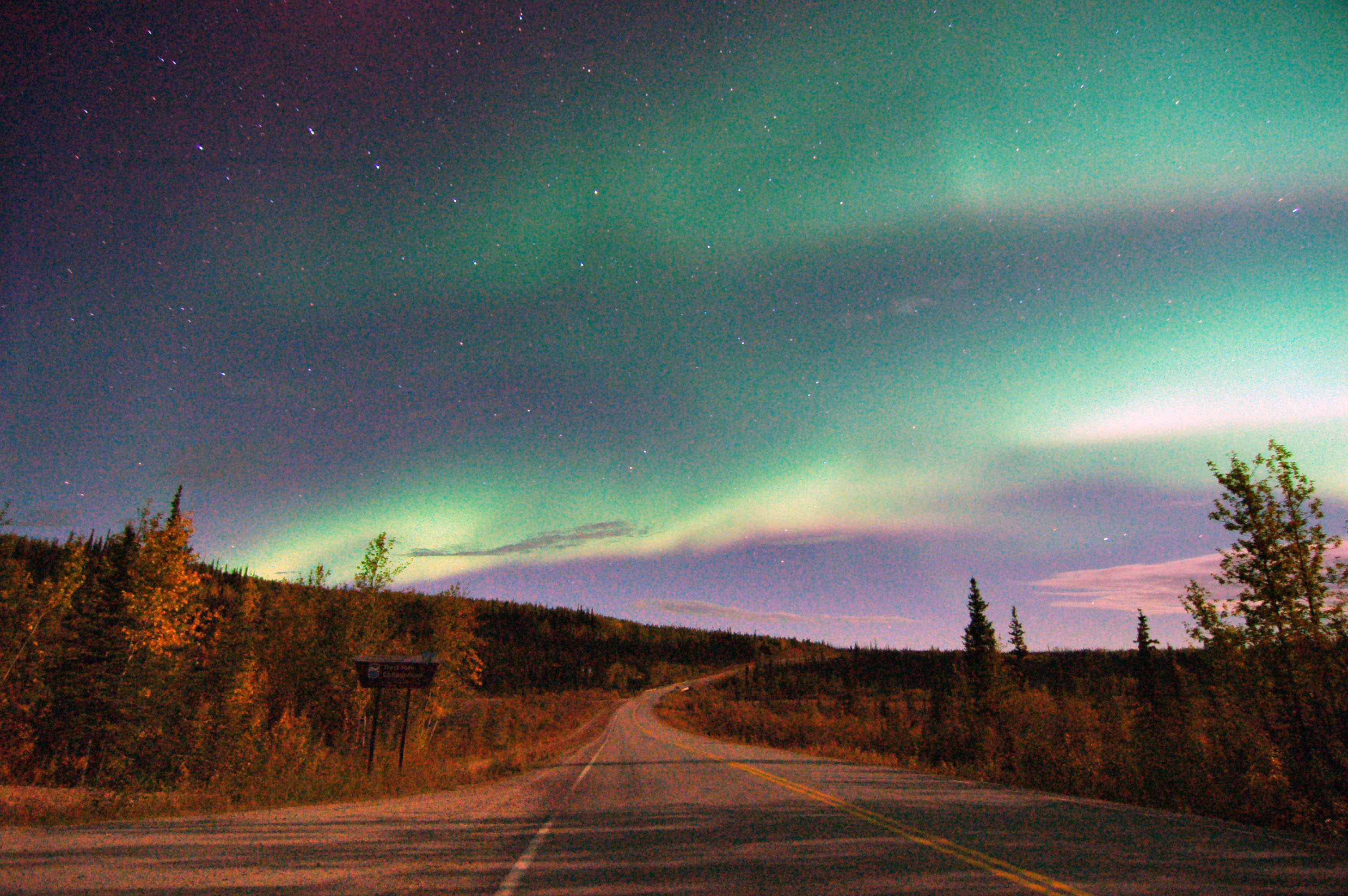
Our first northern light. Not immensely impressive; you can barely see it coming out of the cloud at left, pointing towards 1 o’clock. The sky on the bottom side of that cloud is suspiciously green-tinged too, but it is still too light out for a real show.
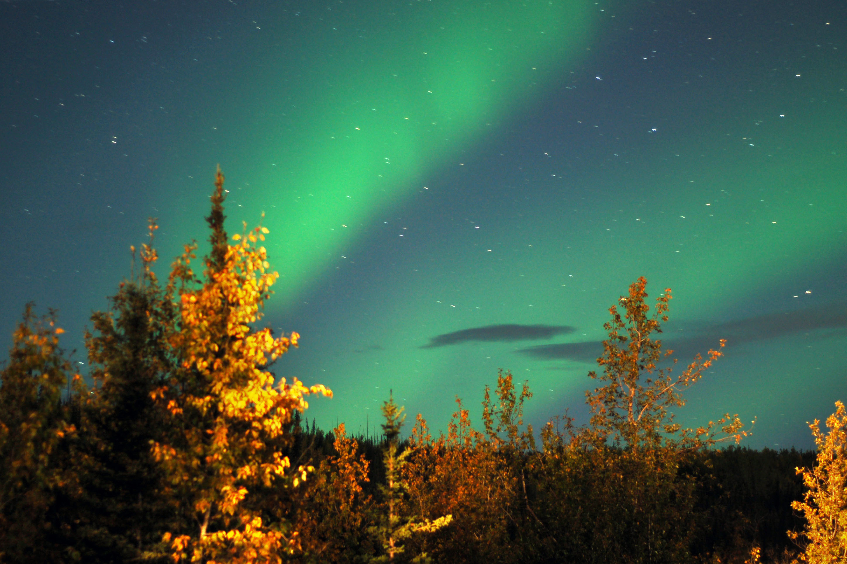
The northern lights!
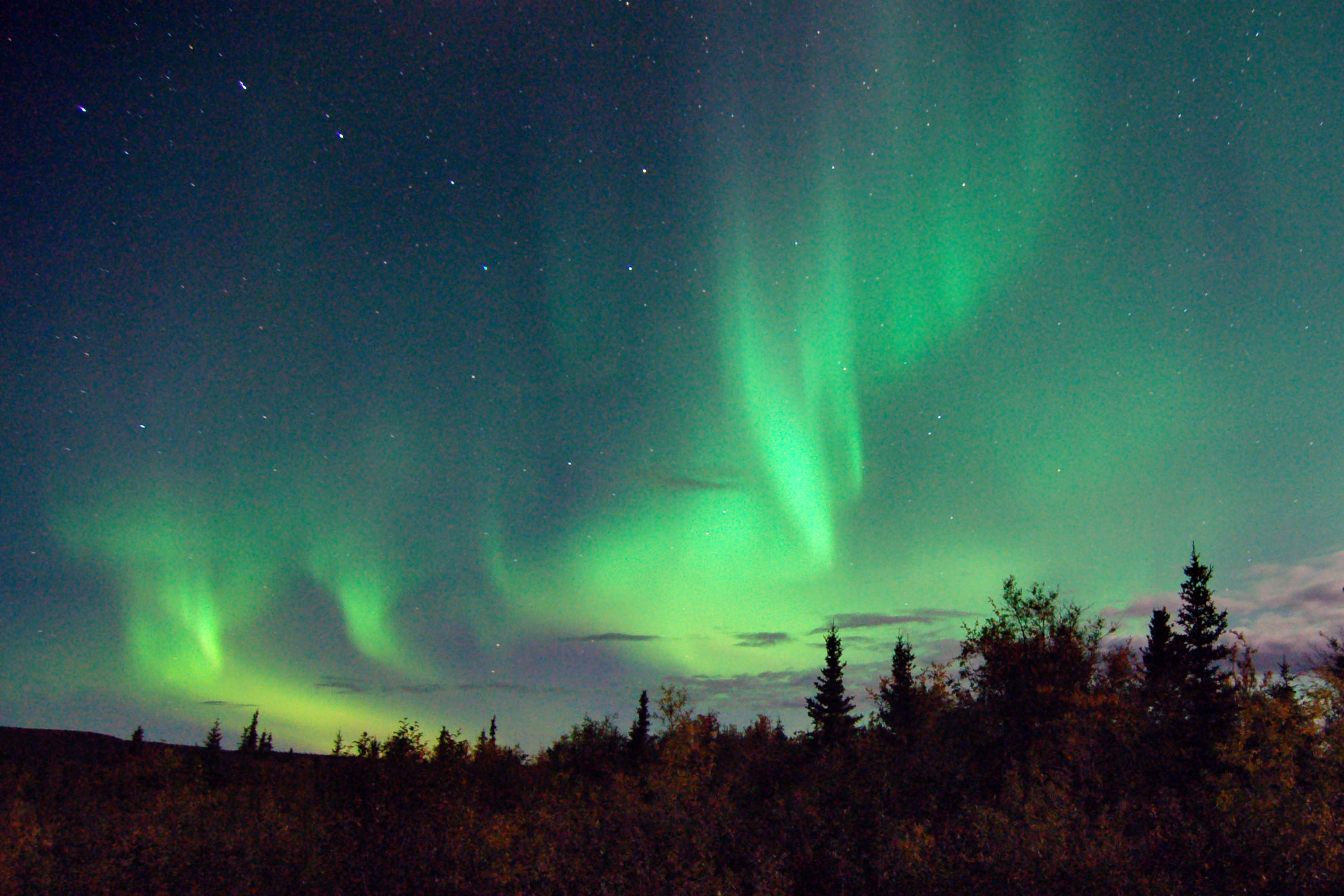
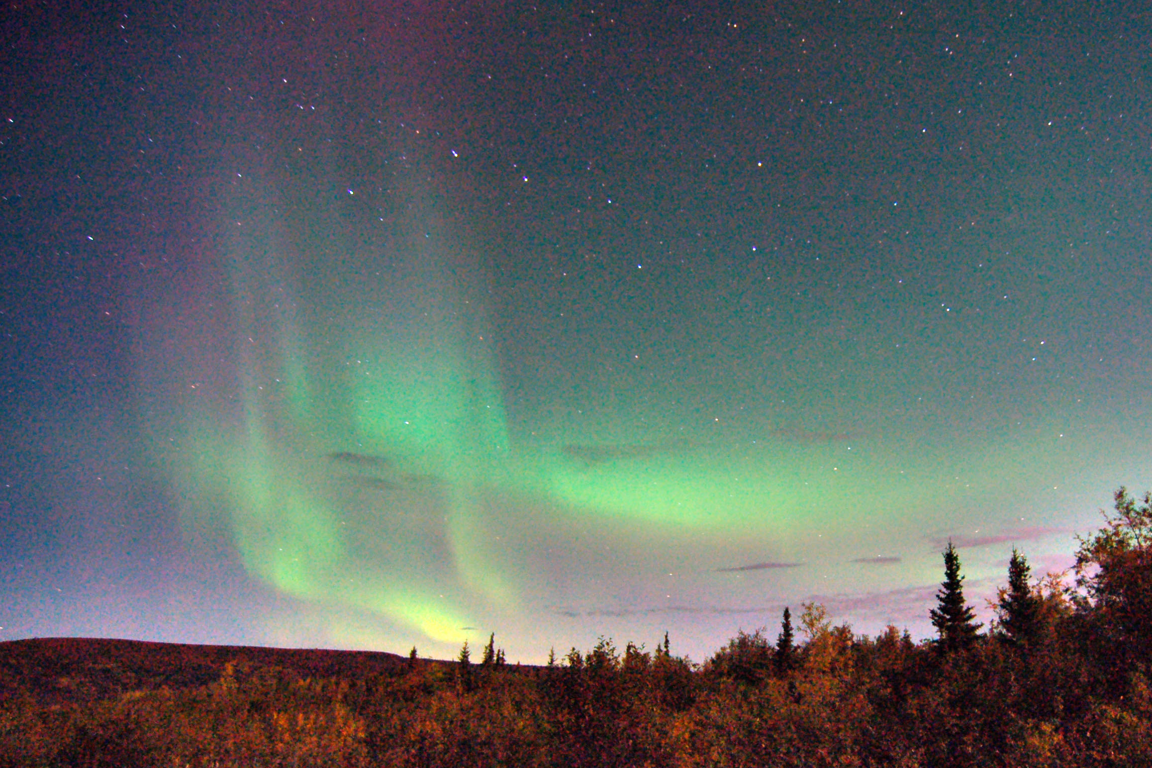
Two purple jets visible in this photo. The left edge, parallel to each other, with the left one much brighter than the right one. Oh, and there are green arcs. Plenty of green arcs. Amazing.

The aurora in green, and the last of the sunset in purple.
I’m just posting all the photos I took in one spectacular hour and twenty minutes … between about midnight and 1.20am; 25 degrees outside and the northern lights exploding overhead.

One long jet across the sky.
Sometimes they get incredibly bright. Note the red fringe at the bottom of the green. When they get really bright, they do that – the green is due to a hydrogen atom, provided by the solar wind, hitting the upper atmosphere and releasing some of its energy in the form of a green photon (light particle). The red? If the hydrogen is sufficiently energetic, it releases two photons: the green, and then the red, which is why the red tends to appear below the green. The purple, by the way, is due to an oxygen atom releasing some of its energy – and if you get some really energetic oxygen, you get yellow mixed with the purple. You don’t see that here; yellow is very, very rare. Purple is uncommon enough!
One last one, with the last purple fringes of sunset, still visible at 1am – or is that sunrise by then?? Gotta love the northern latitudes!
And that does it for day two. Next up: day three! Day one was the wild creatures; day two, the atmospheric effects. Day three will be all about the mountains.


The strange rainbow clouds are due to sunlight refracting through frozen, unusually cold water vapor very high in the atmosphere. It only happens when conditions are just right. Lovely photos!
and now I know! wow, I’ve been wondering about that for two years :)
Thanks for the spectacular pictures! I will probably never have the chance to travel to Alaska but your pictures really help!
Can only say WOW – great photography. Thanks for sharing