
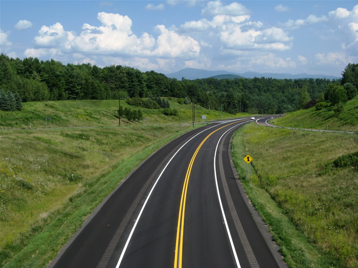
Spent Day 7 driving around the Lake Champlain Islands and then down a combination of U.S. 7 and Interstate 89 among other routes to Burlington and back.
U.S. 2 travels north-south through the Lake Champlain Islands, passing through small towns such as South Hero, Grand Isle, and North Hero. The roadway carries only two lanes with the exception of a brief four-lane section just northwest of the Sandbar at South Hero. A pair of state highways stem from U.S. 2 in the islands. Vermont 314 loops west to the Plattsburgh, New York bound ferry launch. This route was originally designated Vermont F3 but renumbered to Vermont 314 to coincide with New York 314. Further north, Vermont 129 spurs west to Alburg and Isle La Motte.
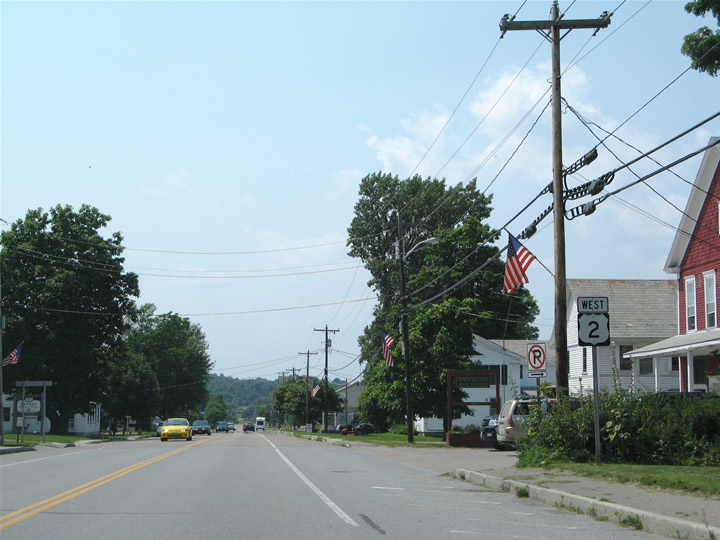
Passing through the town of South Hero along U.S. 2 west (north). South Hero and other locales within the Lake Champlain islands survive off of a mixture of agricultural and tourist based economies. Many summertime-only eateries and gift shops exist along U.S. 2 through Grand Isle County.
U.S. 2 links the Lake Champlain Islands with Rouses Point and Champlain, New York via U.S. 11 south (west). The highway ends just west of the state line and provides the only fixed bridge across Lake Champlain for 100 miles leading south of the Canadian border. Vermont 225 also provides a connection northward from U.S. 2 to Quebec 225. Eastward, Vermont 78 continues the U.S. 2 east-west trajectory from Rouses Point to Swanton across Missisquoi Bay.
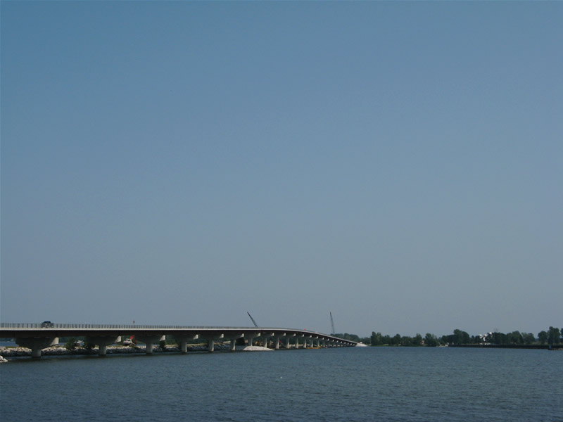
Peering eastward at the new Vermont 78 Missisquoi Bay Bridge from East Alburgh.
A project recently completed (May 30, 2007) replaced the original 1938-Missisquoi Bay Bridge of Vermont 78 with this new fixed high-level bridge. The bridge ended prematurely in 2005 as environmental concerns halted construction due to the nearby habitat of an endangered tortoise. Fortunately work was able to resume and complete the needed span. Vermont 78 in conjunction with U.S. 2 provides a primary truck and through route between Interstates 87 and 89. See the http://www.aot.state.vt.us/progdev/sections/structures/MBB/Index.htm for more on the bridge.
Traveling south along the east shore of Lake Champlain from Swanton is Vermont 36, and older and seemingly forgotten state route between Vermont 78 and U.S. 7 in St. Albans. Once outside of both Swanton and St. Albans, the state highway is sparsely signed or signed with very old signs.
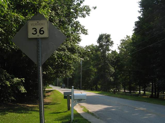
A 16″ or so square shield for Vermont 36 south resides on the backside of a northbound regulatory sign. We found three instances of these shields on the north-south stretch parallel to the lake shore. A final shield was also square but shocked with large series C font and no border or “VERMONT”.
The original U.S. 7 embossed cutout in St. Albans is long gone, but some sign relics still remain such as this sign bridge along U.S. 7 northbound at the west end of the Interstate Access road.
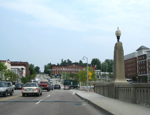
St. Albans otherwise is growing with the influx of new residents associated with a series of company relocations from the Montreal area south into upstate Vermont. Suburban sprawl has appeared in the form of new subdivisions along Vermont 104 (Fairfax Road).
Shifting back south to Burlington again, we decided to revisit the dead portion of Interstate 189, a section of pavement we walked back in 2000. The pavement is pretty much still in tact, although more graffiti and a skate ramp were added in the intervening years. We parked the car at the west end and walked in 93 degree heat to the interchange with U.S. 7.
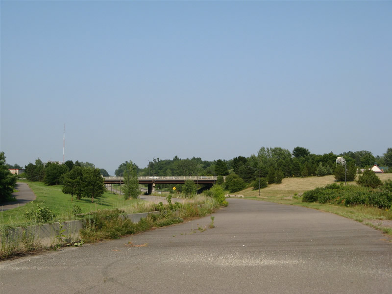
Looking east at the partial-cloverleaf interchange of Interstate 189 and U.S. 7. Three of the six ramps originally built for the junction remain unused.
Later on during our trip we visited the library at the University of Vermont and discovered a bevy of information on the unconstructed Burlington Belt Line freeway. As it turns out, the abandoned segment of Interstate 189 is not an original element but rather a construction project from 1980 that never opened. Dubbed the Champlain Parkway, Interstate 189 was rescinded from a planned west end at the Burlington Belt Line and redesigned to turned northward along Pine Street. That project also never reached fruition with the exception of the abandoned four-lane parkway due to the findings of toxic chemicals leftover from a former coal gasification in the planned right-of-way. This Superfund site continues to be a problem and is why the Champlain Parkway was never completed and why a revised at-grade parkway now planned http://www.ci.burlington.vt.us/mayor/letters/mayor_letter_20060804.php for the route cannot be built as of yet. We will update web pages and go into a deeper discussion about unconstructed Interstate 189, the Champlain Parkway, and the Burlington Belt Line at a later date…
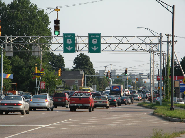
Today’s commuter and tourist based traffic slows along busy U.S. 7 at the Interstate 189 interchange with no plans for improvement (by the city of Burlington at least).
The Burlington Belt Line was to continue south of Interstate 189 along U.S. 7 toward Shelbourne. Traffic projects in the 1960s already warranted discussion of limited access highways and other corridor improvements, yet nothing was done to alleviate the growing congestion along the highway.
Another element of the Burlington Belt Line was the building of the Vermont 127 expressway leading through Burlington’s North Shore. The state highway exists as two-lane controlled access parkway from Park Street north to Heinburg Drive and as a two-lane almost residential route from there northeast to junction U.S. 2 & 7 at Colchester. Future plans may see more use in the expressway portion of roadway if the Chittenden County Circumferential Highway is every fully built…
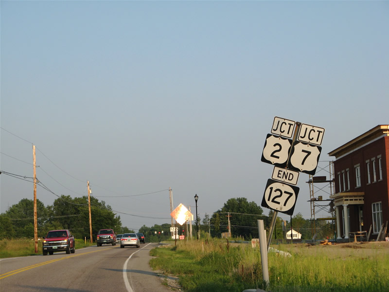
Vermont 127’s northern terminus and end shield posted in Colchester. Suburban sprawl is arising in Colchester too, as new development is now underway at the southwest corner of U.S. 2 & 7 and Vermont 127.