
the second day of my Utah/Nevada/California trip – this time focusing almost exclusively on Nevada, except for at the end of the day, where we cross into California, and are nearly buried alive in snow. On this day, we cover US-50 in Nevada (the Lincoln Highway), and on the next day we head to California and drive down I-5 through the Central Valley.
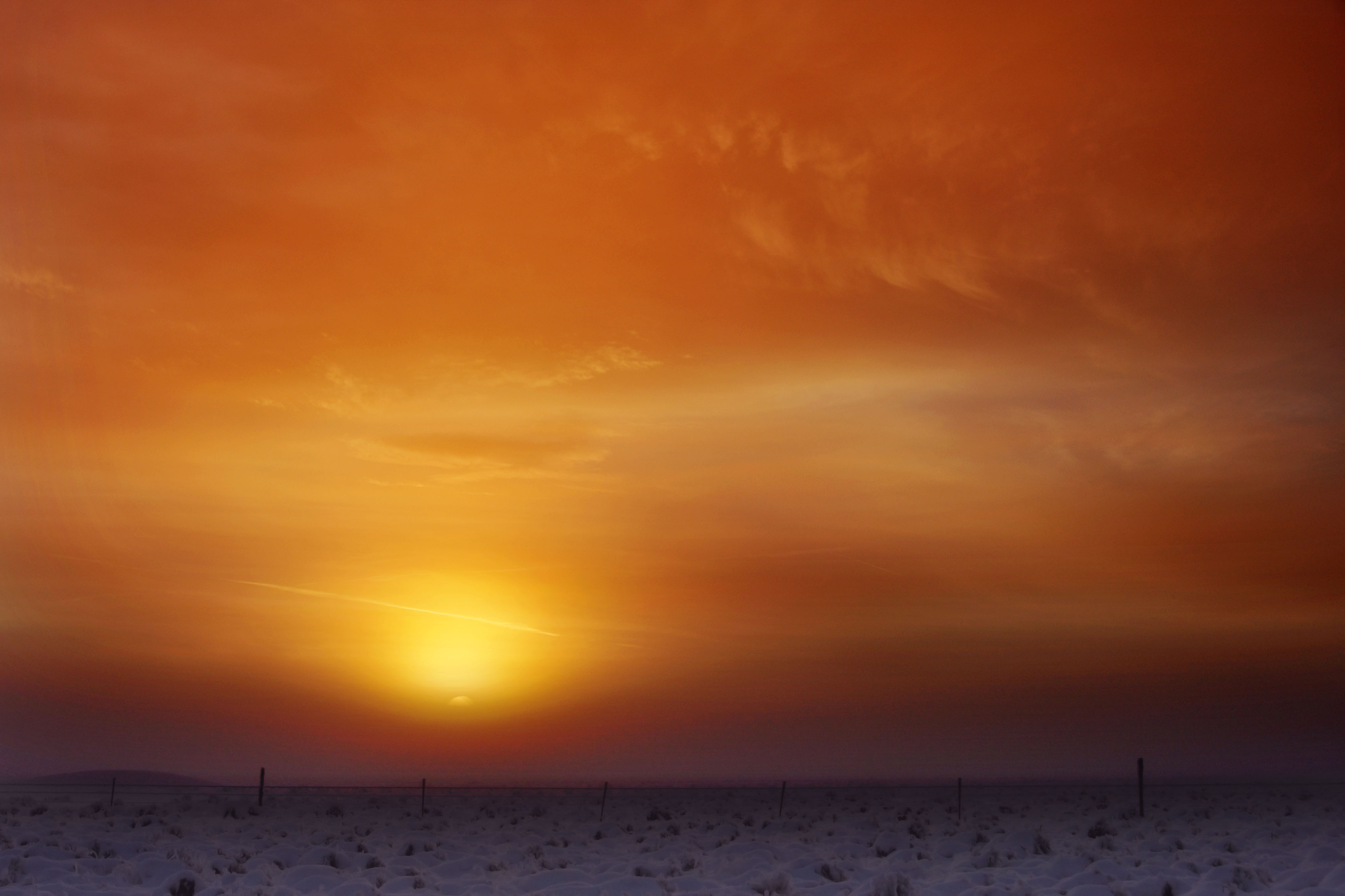
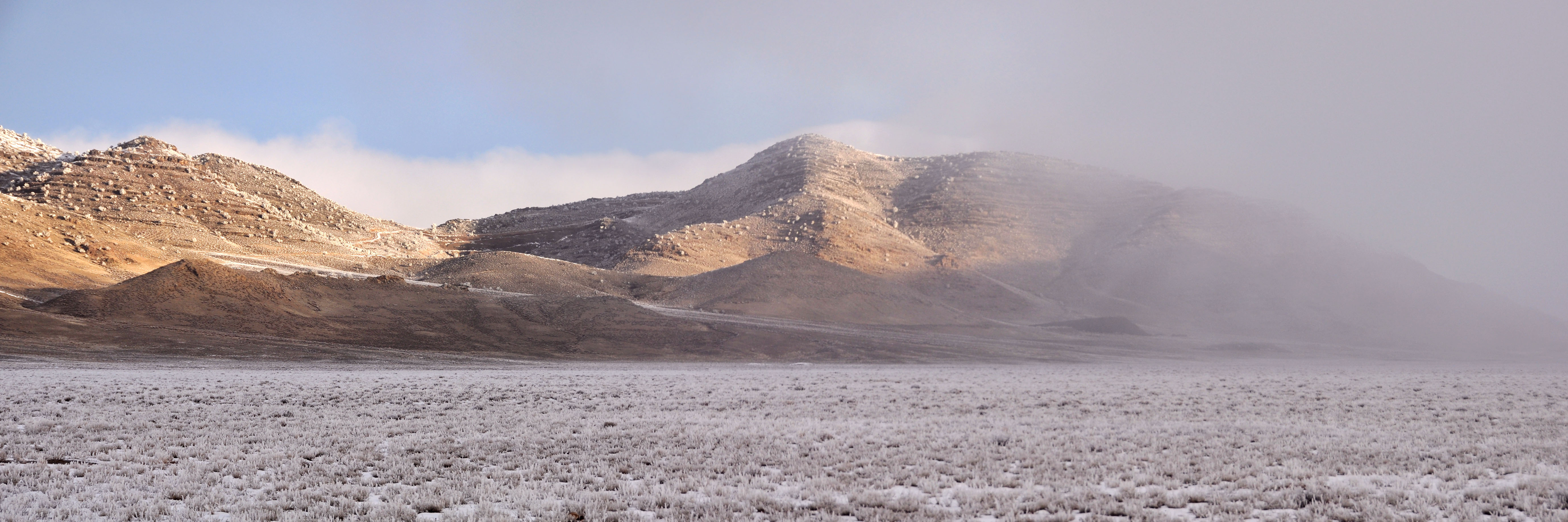
About 30 miles west of Ely, Nevada – a fishy sunrise. I took two photos with my fisheye lens, and converted to rectilinear and stitched them together, resulting in what is about a 165 degree field of view! The large version of this image is nearly 11000 pixels wide.
(by the way, to convert the 10.5mm Nikon DX fisheye to rectilinear, use 142 degrees horizontal and 98 degrees vertical coverage. I use Panotools to do the remapping, which lets me enter these two constants directly – your methods may vary.)
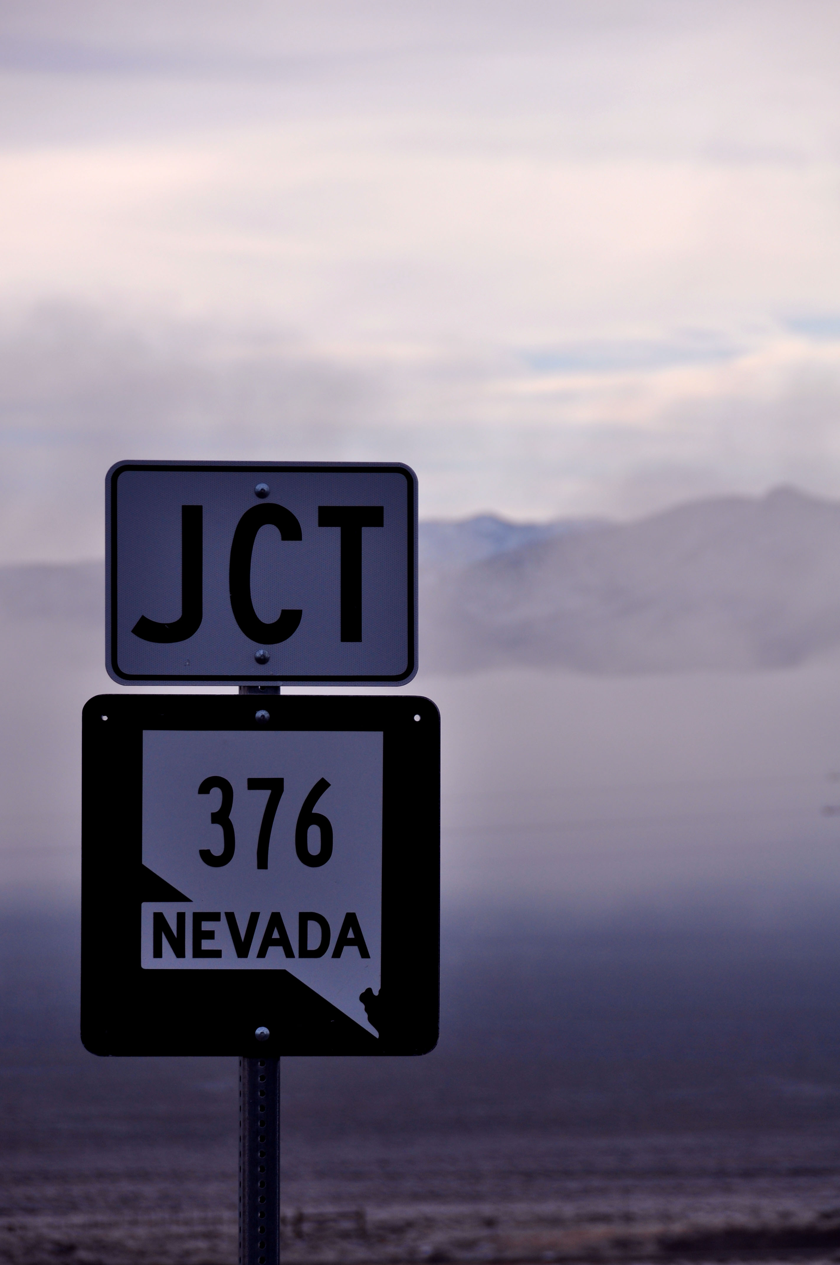
There are, as far as I found, seven Lincoln Highway concrete posts in the state of Nevada. They were all put up in 1928. This is the only one that, as far as I can tell, is in its original location, as opposed to being moved by the state of Nevada in the intervening years.
Based on some new information I just received – this Lincoln post was put up in the mid-1980s. There are subtle differences between the original 1928s and a bunch that were made in the 80s when the highway’s revival began. I alas was not looking for these differences, so I do not know if any of the 7 posts I found were 1928s.
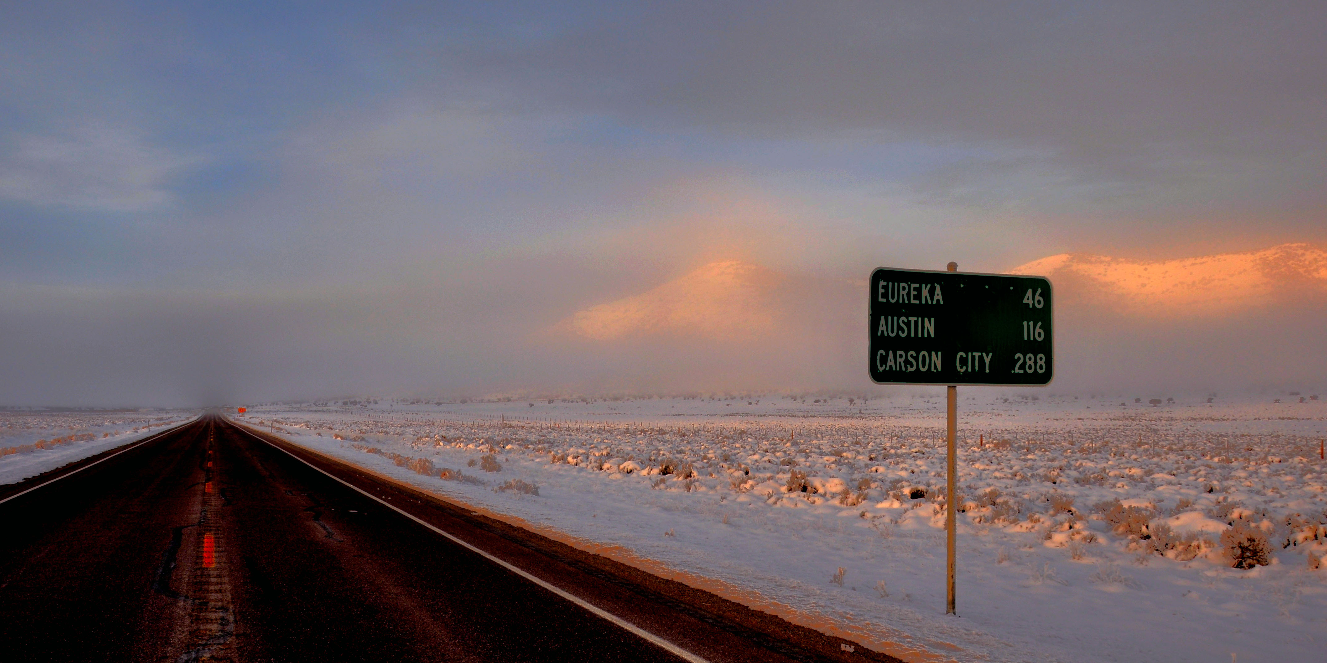
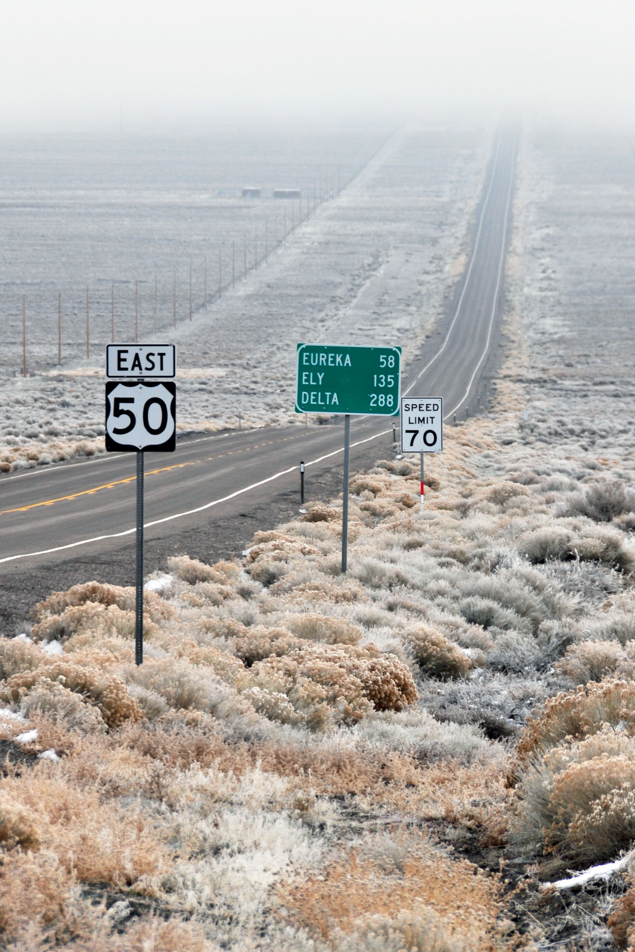
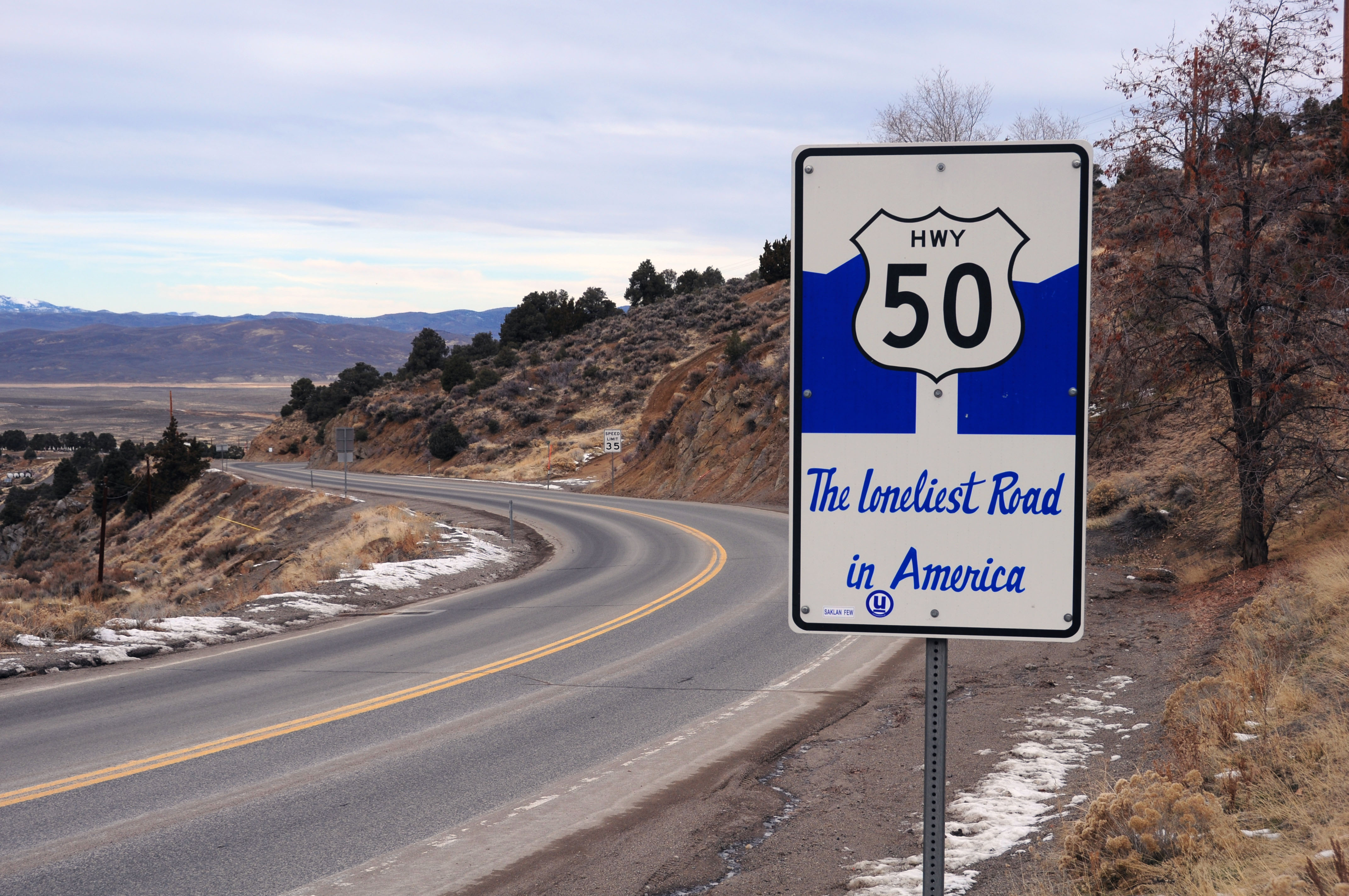
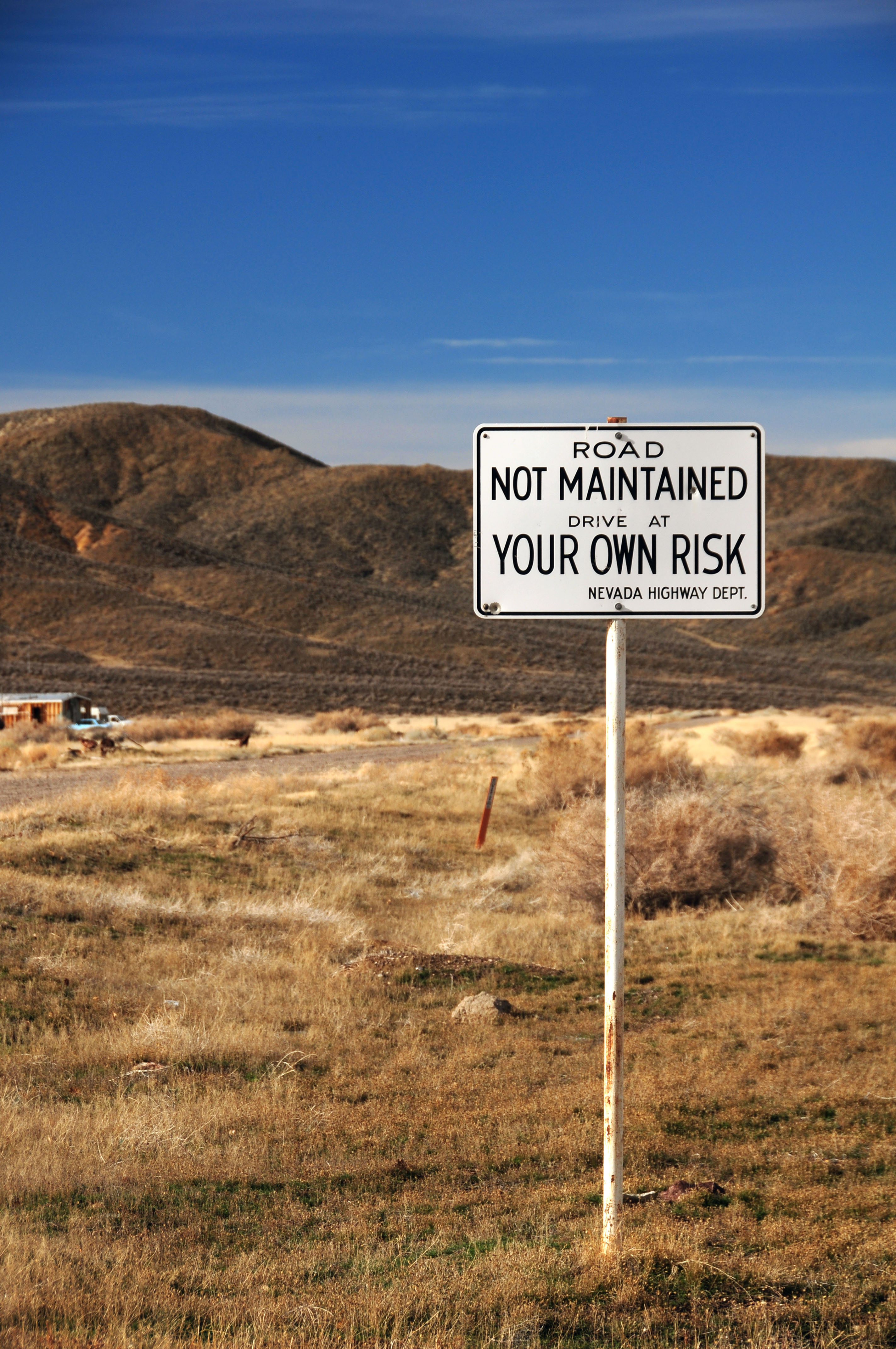
We start our day in Ely, and this sign greets us on the outskirts of town. Nevada declared US-50 to be the Loneliest Road in America in 1986. Not quite true – Nevada’s own US-6 is far less traveled – but it led to some great signage. Unfortunately, the signs have been disappearing without replacement since the original signage, and now there are only two left!
Early, early dawn – just west of Ely.
Moon setting as the sun starts to think about rising.
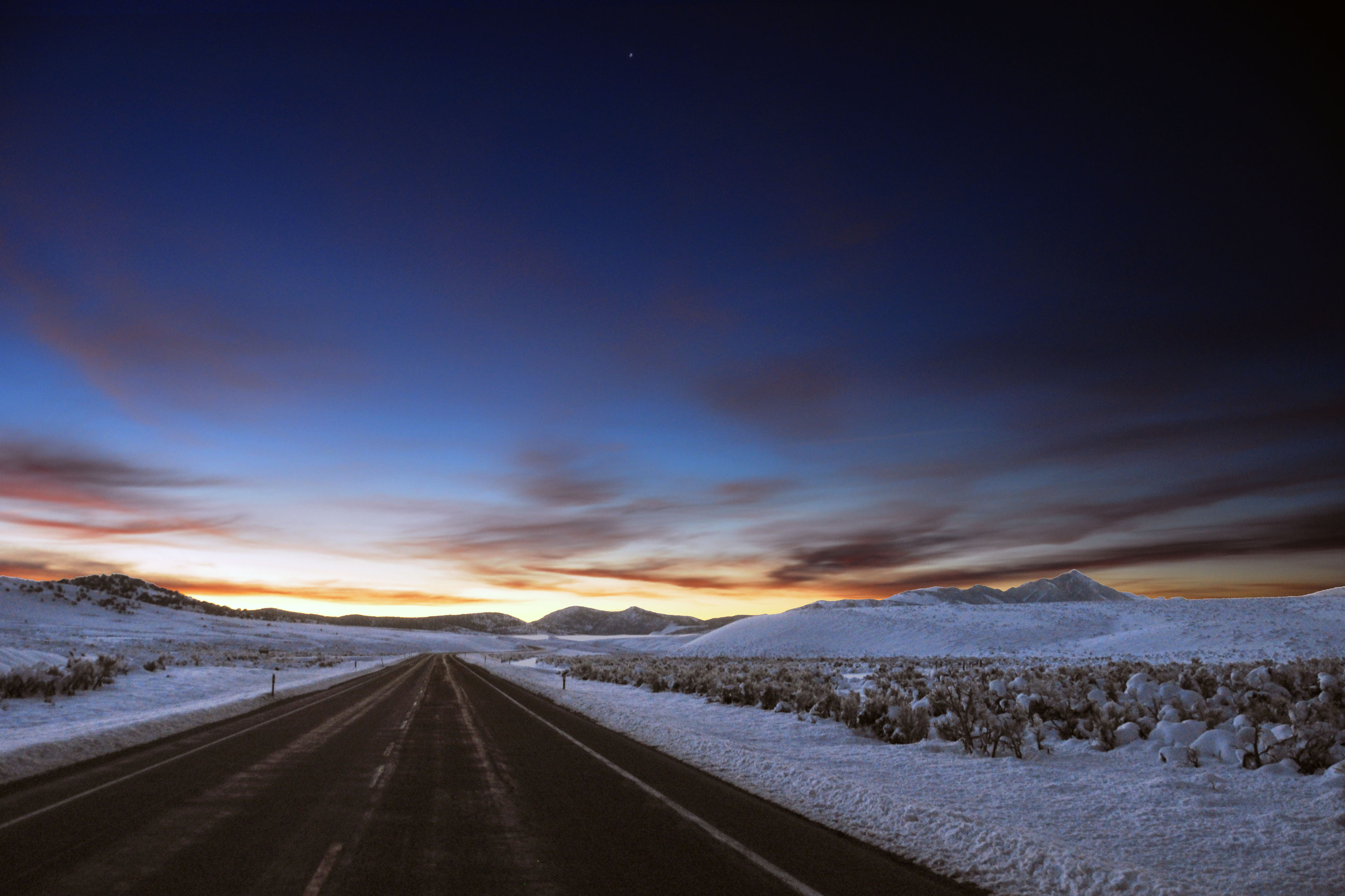
Sun about to rise, as we look east.

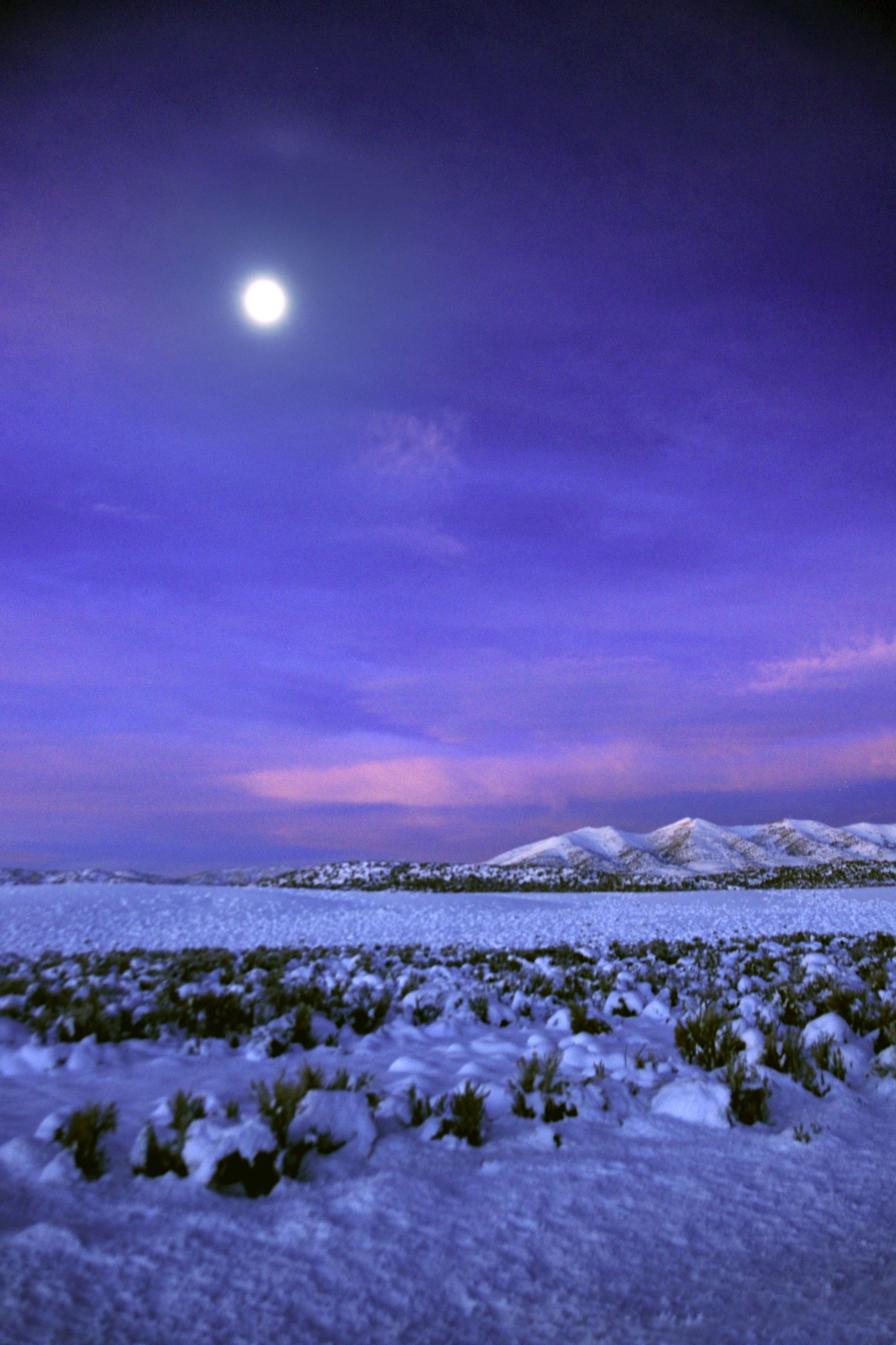
Some serious purple on the horizon.
The view to the south.
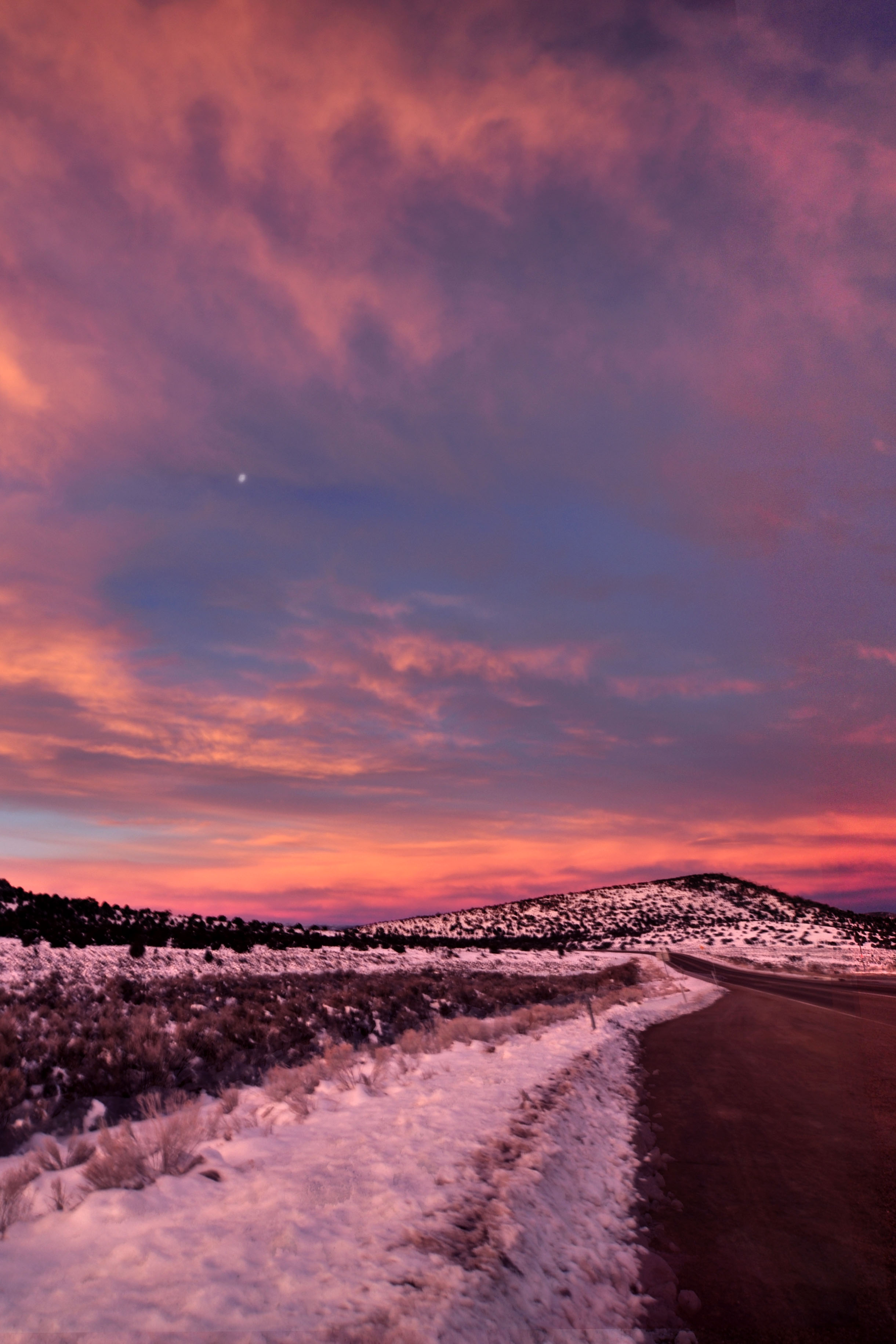
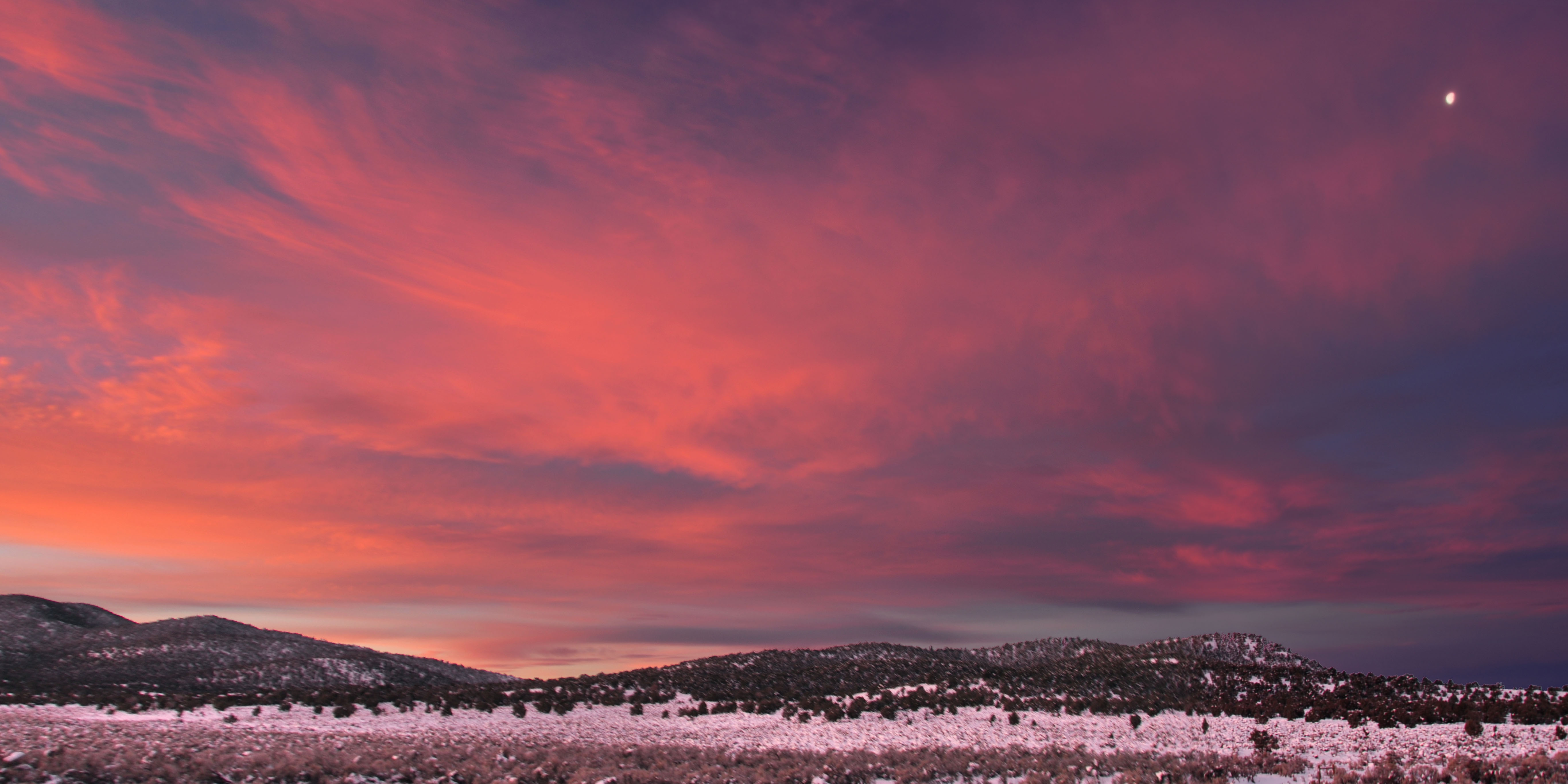
Did I mention this turned into a great sunrise??
The sun appears! Between the previous batch of photos and this one, I drove forward into a bank of fog, and thus we get extremely diffuse lighting and clouds.
Did I mention the fog? It gives us intermittent views of the mountains to come.

The last of our morning alpenglow on the mountains.
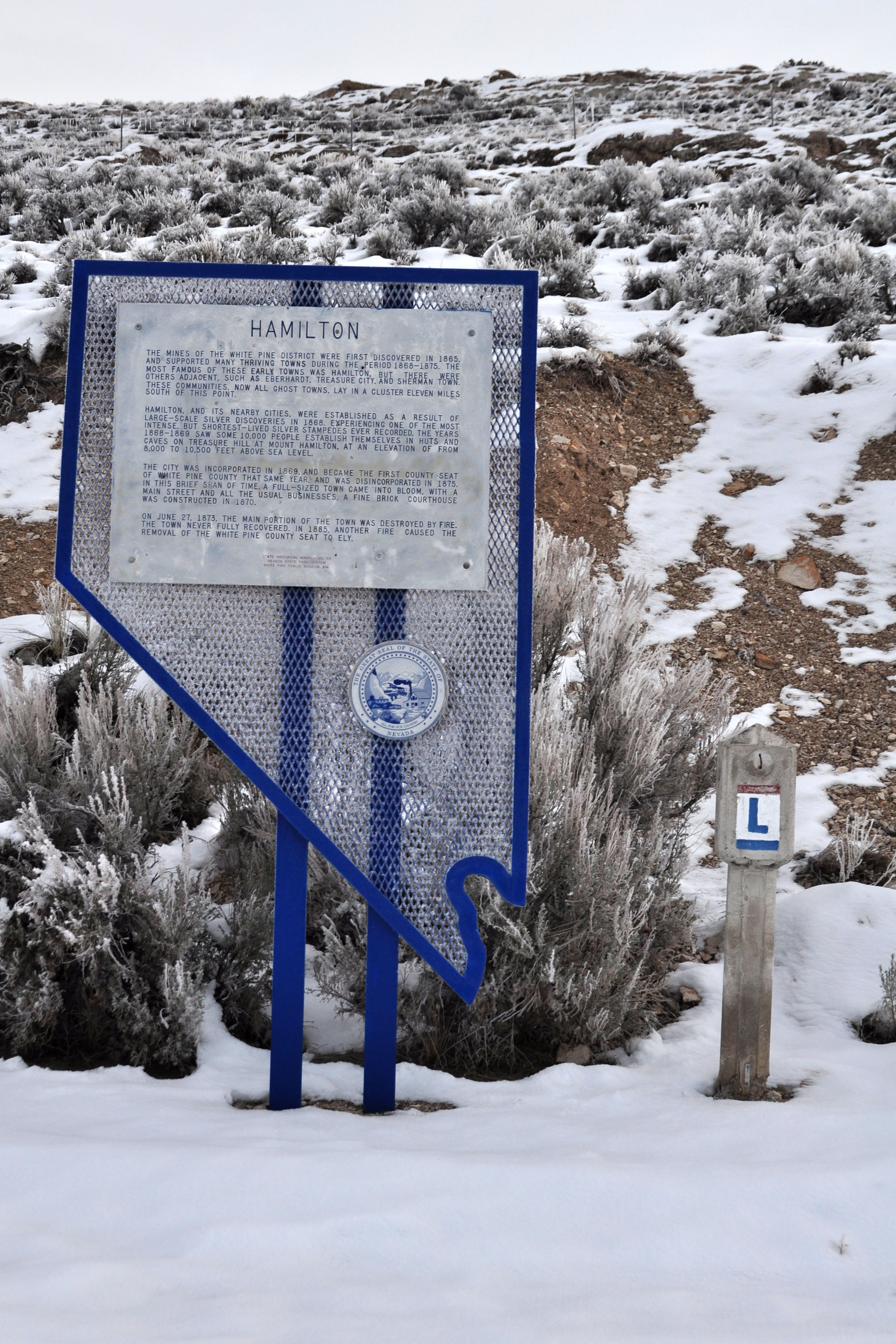
An example of a Lincoln Highway post associated with a historic marker. Five of the seven markers I saw were clearly moved by the state, around 1984, to be near historic markers. As mentioned above – they were made around 1984, at the same time as the historic markers.
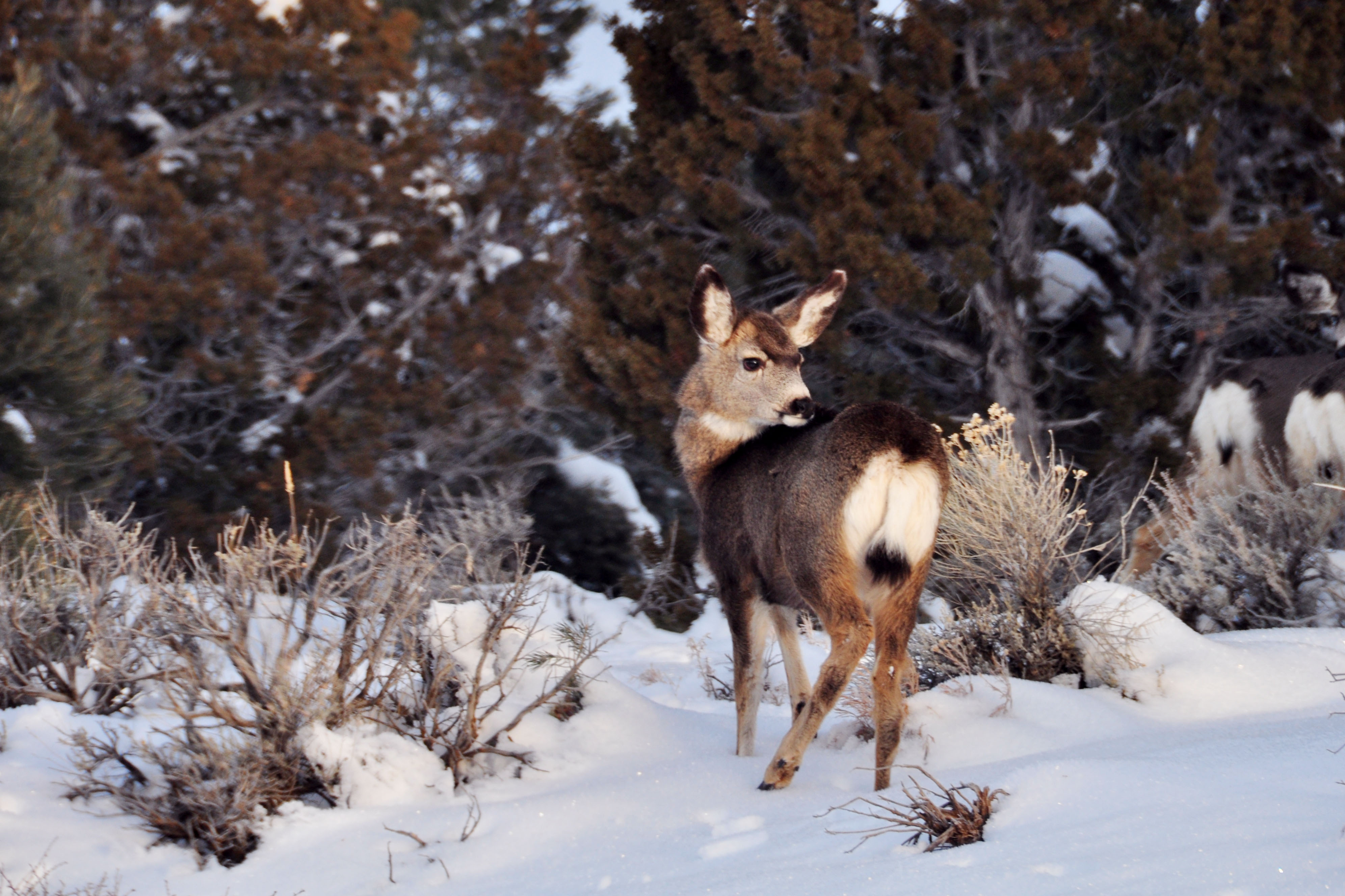
Heavy deer crossing. This doe – out of maybe 20 does and bucks that I observed in the same cluster, crossing the highway at the same time – has decided to look back to see just what she survived.
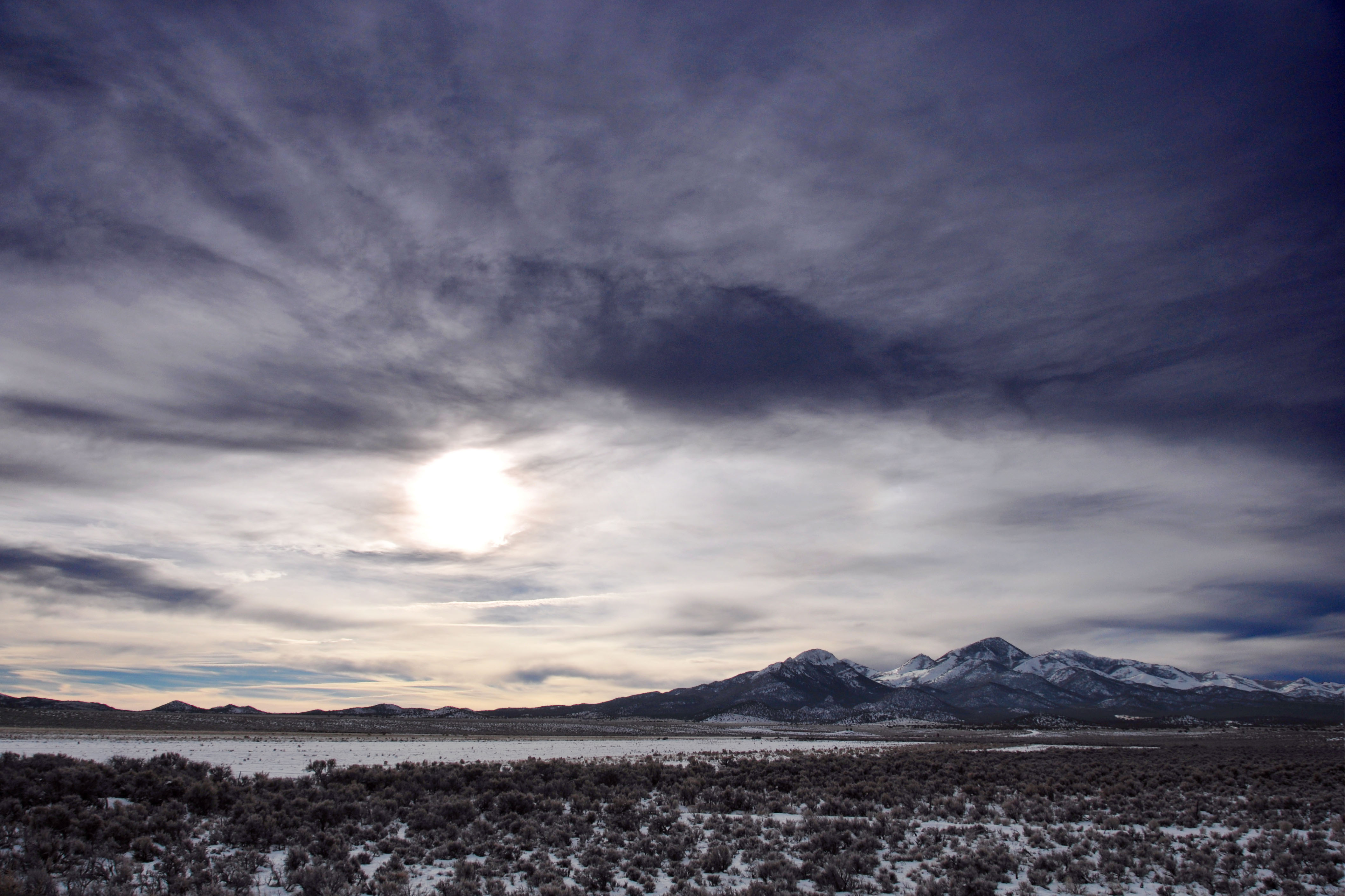
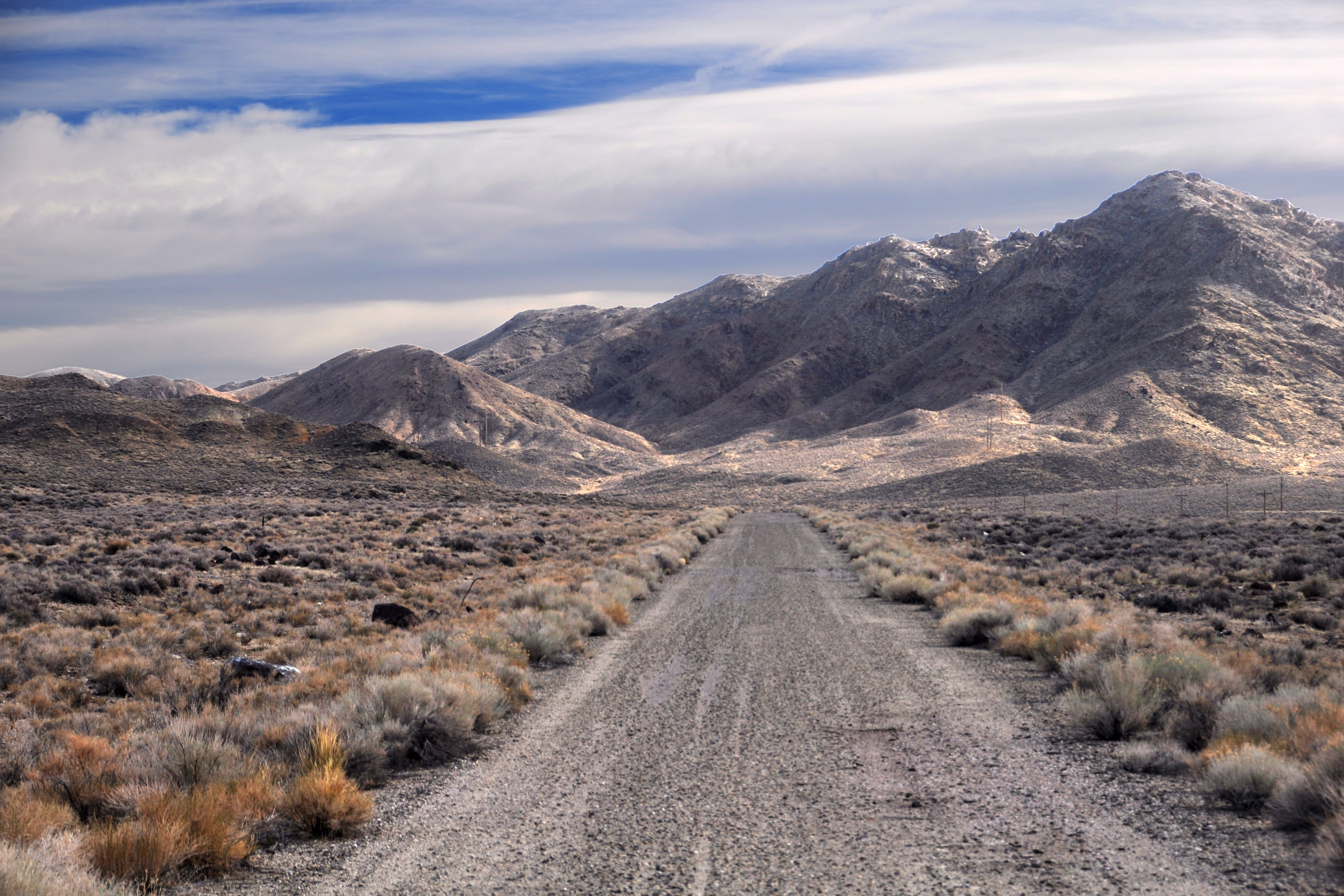
A mountain range about to disappear into fog.
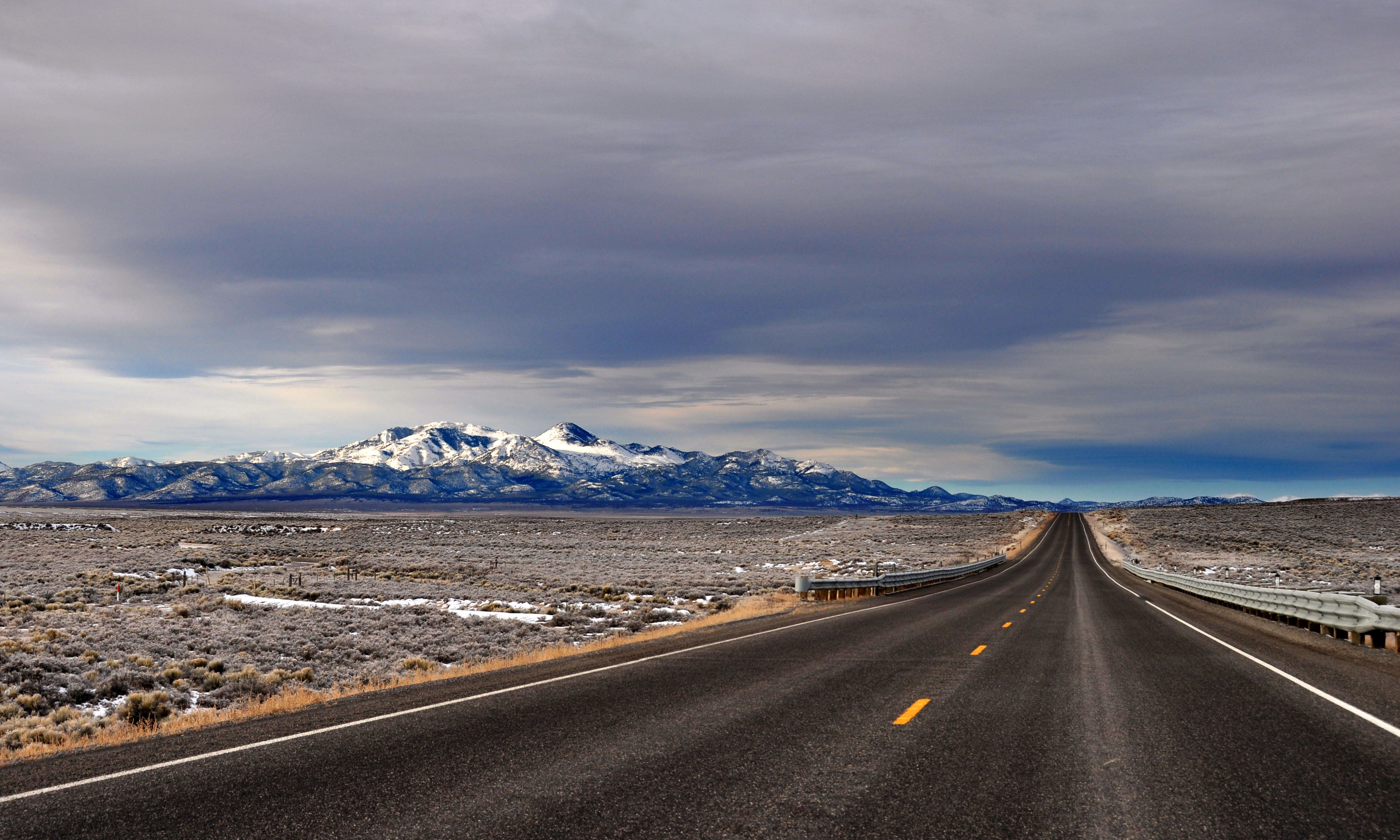
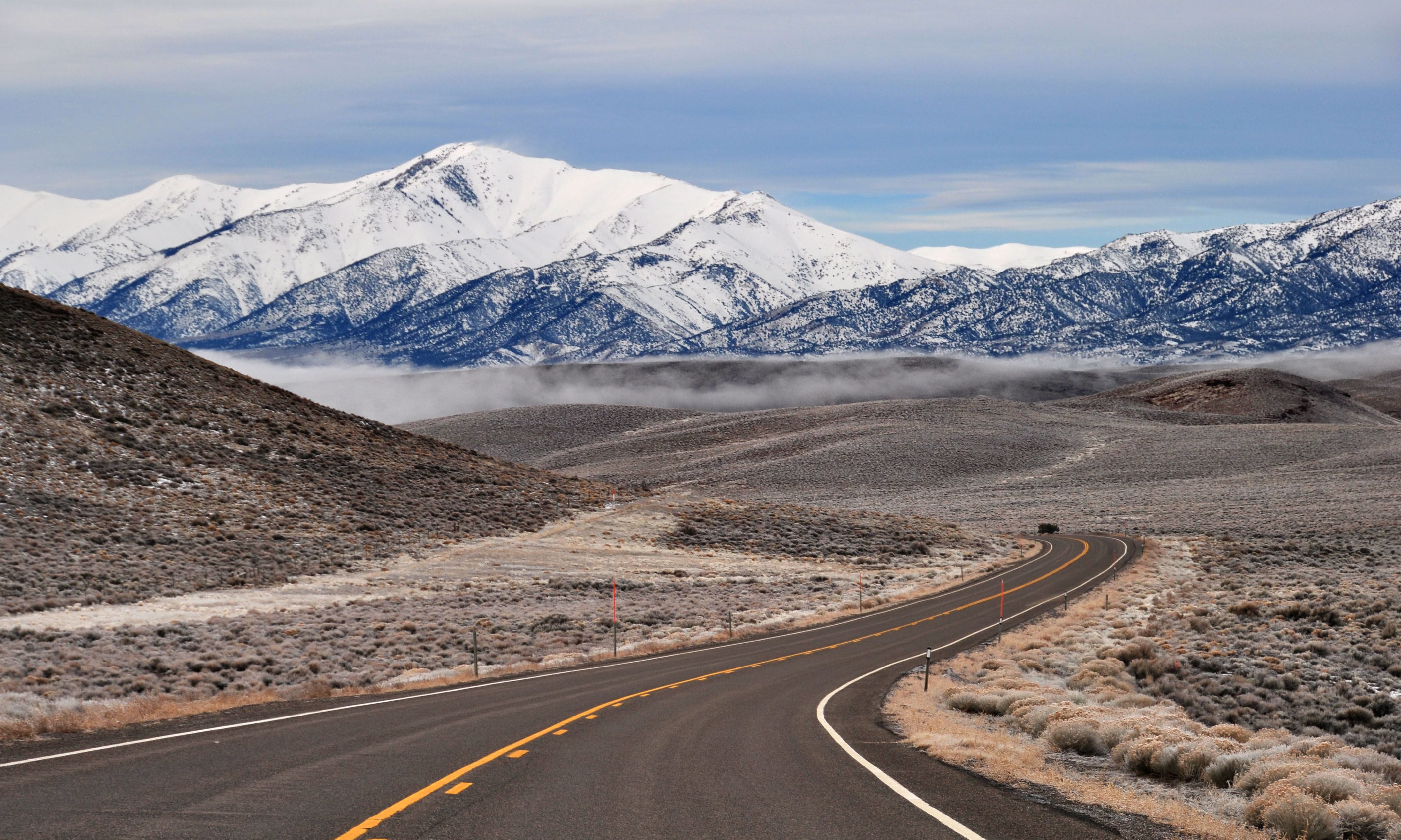
Okay, fair enough, the road is plenty lonely. Nothing but silver mountains and observer.
Spot the halo. It’s faint, but it is there, intersecting the land at the perfect spot just between the mountains.
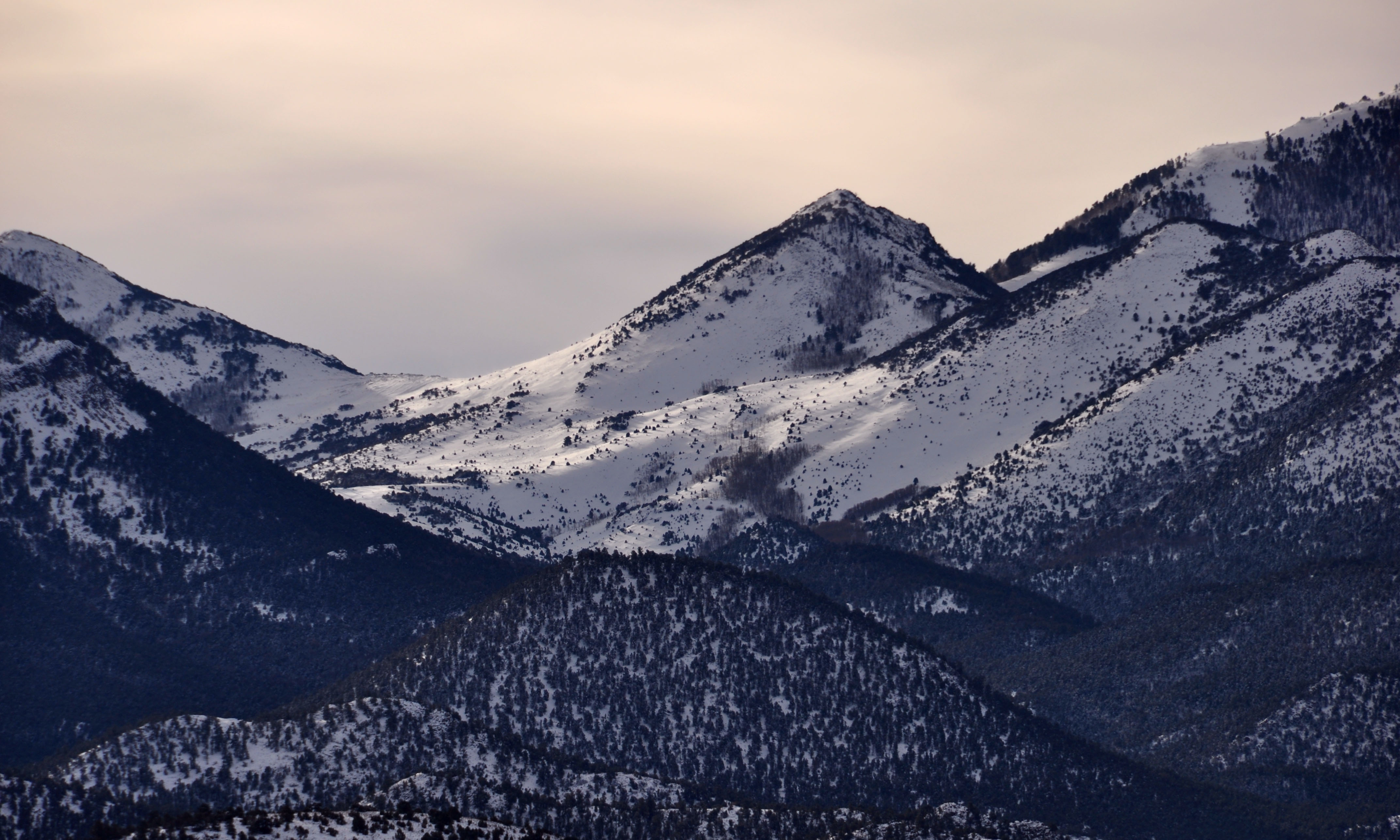
Super-extra-close-up of the distant mountains.
Approaching Austin. Fog in the lowlands.
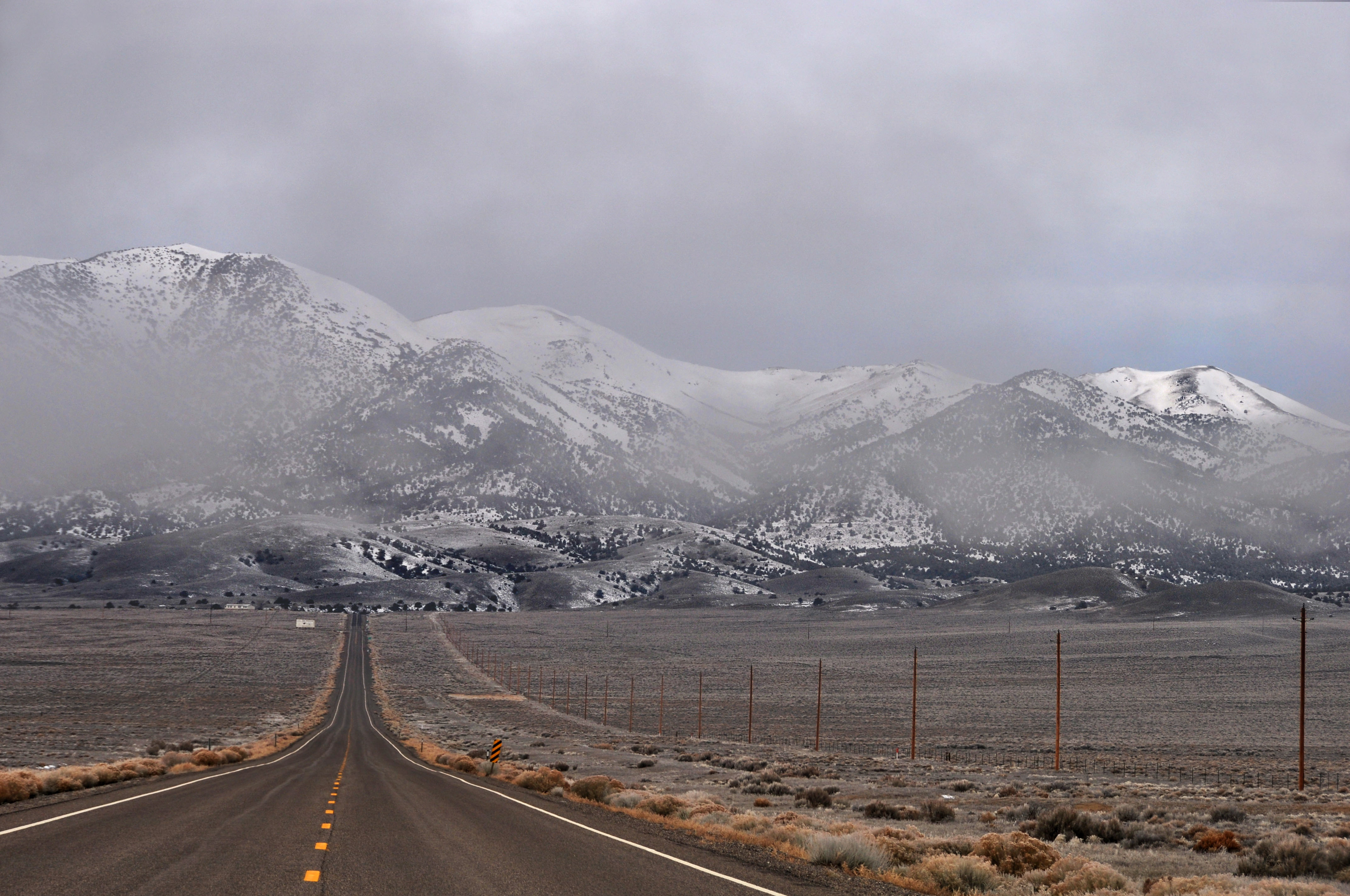
Descending into said fog.
Older gantry. Alas, I did not find any 1961-spec shields in Nevada. A lot of signs were replaced during the great renumbering of 1975-1982 – even though the US routes kept their numbers, it was an excuse to update the signs.
We just came from that bank of fog.
Certainly a sign that dates to 1982 at the latest… and a mountain range in the fog behind it.
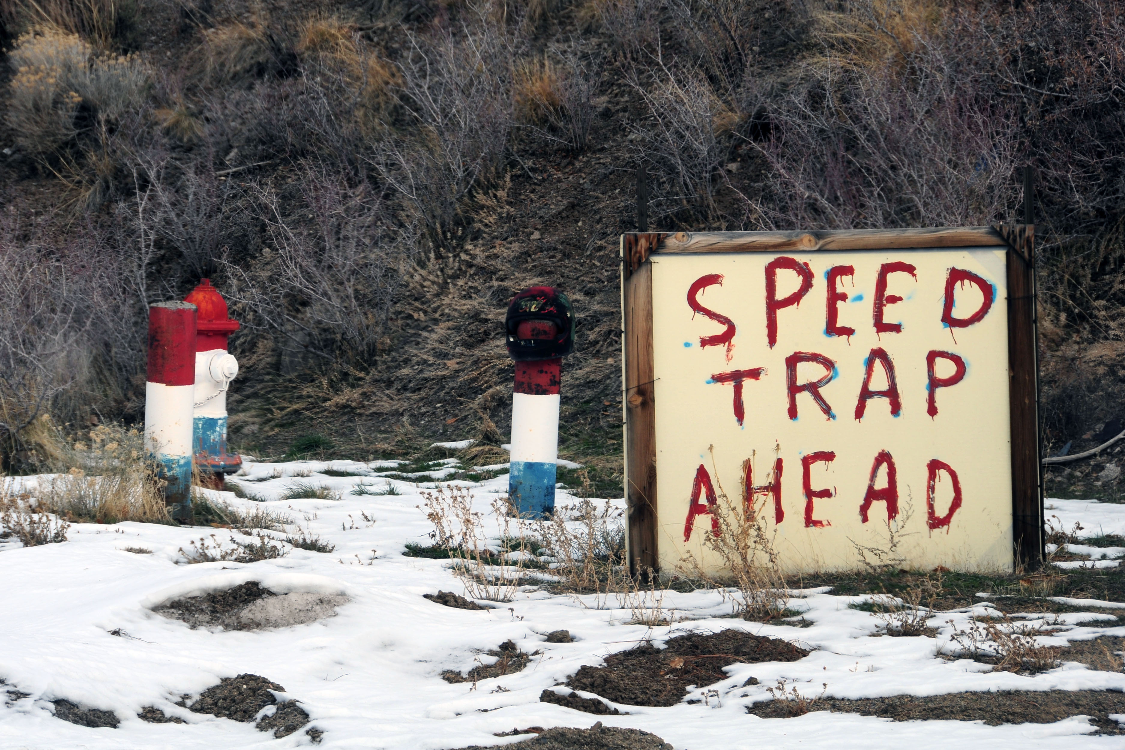
Useful billboard. Around the bend, approaching the town of Austin, is invariably the Nevada Highway Patrol. At least, they were out on Christmas morning! The hydrant and posts in the background were painted for the bicentennial in 1976, and have stayed that way.

Yellow and yellow. 1950s sign, 1950s farm equipment.
The other survivor. This one is on the outskirts of Austin, heading east.
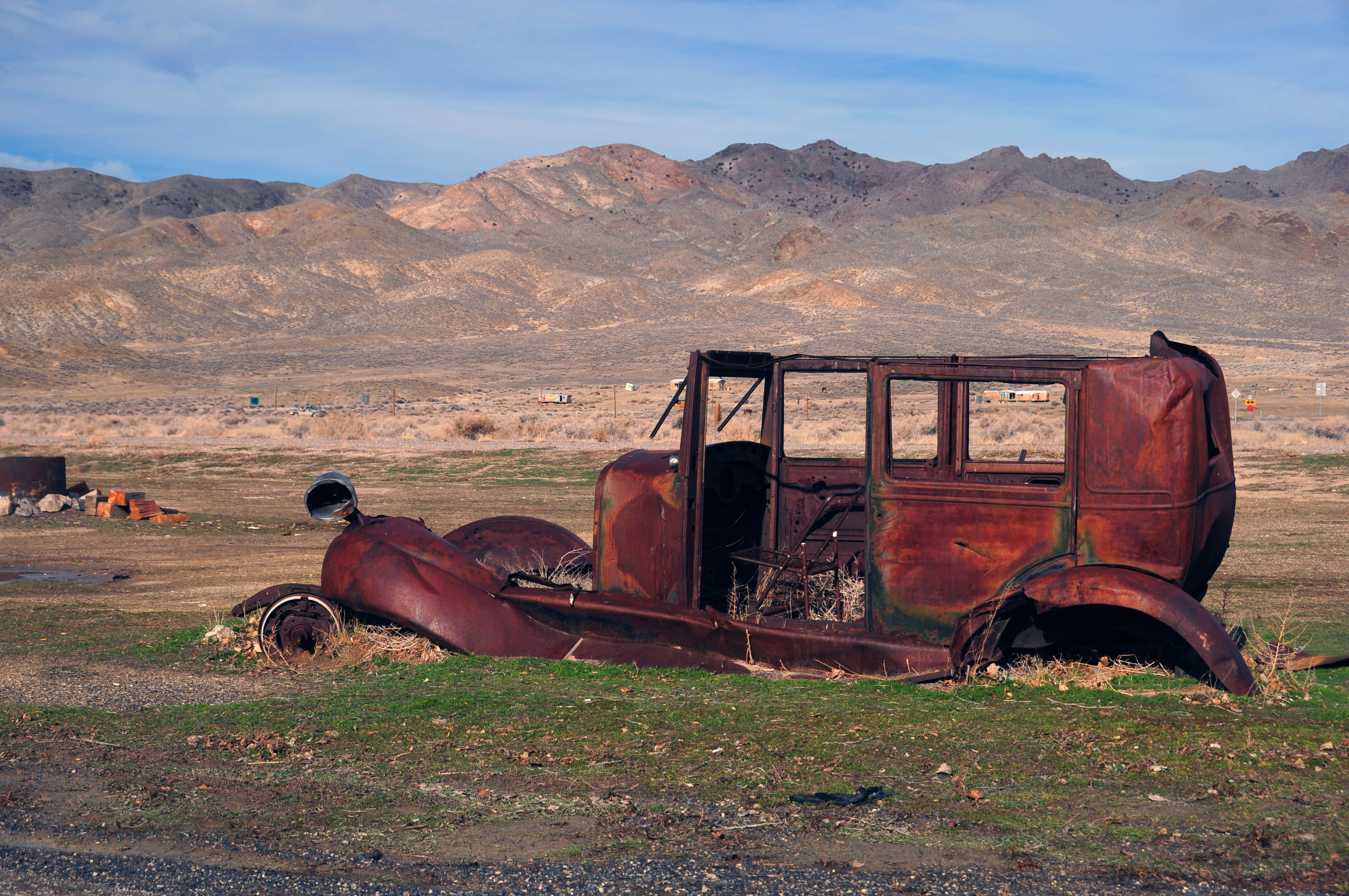
Middlegate Junction. This car must’ve gotten stuck and stayed another 80 years and counting.
Old alignment of US-50 heading out of Middlegate Junction.

I do not remember the name of this mountain, but there is a green guide sign that points it out.
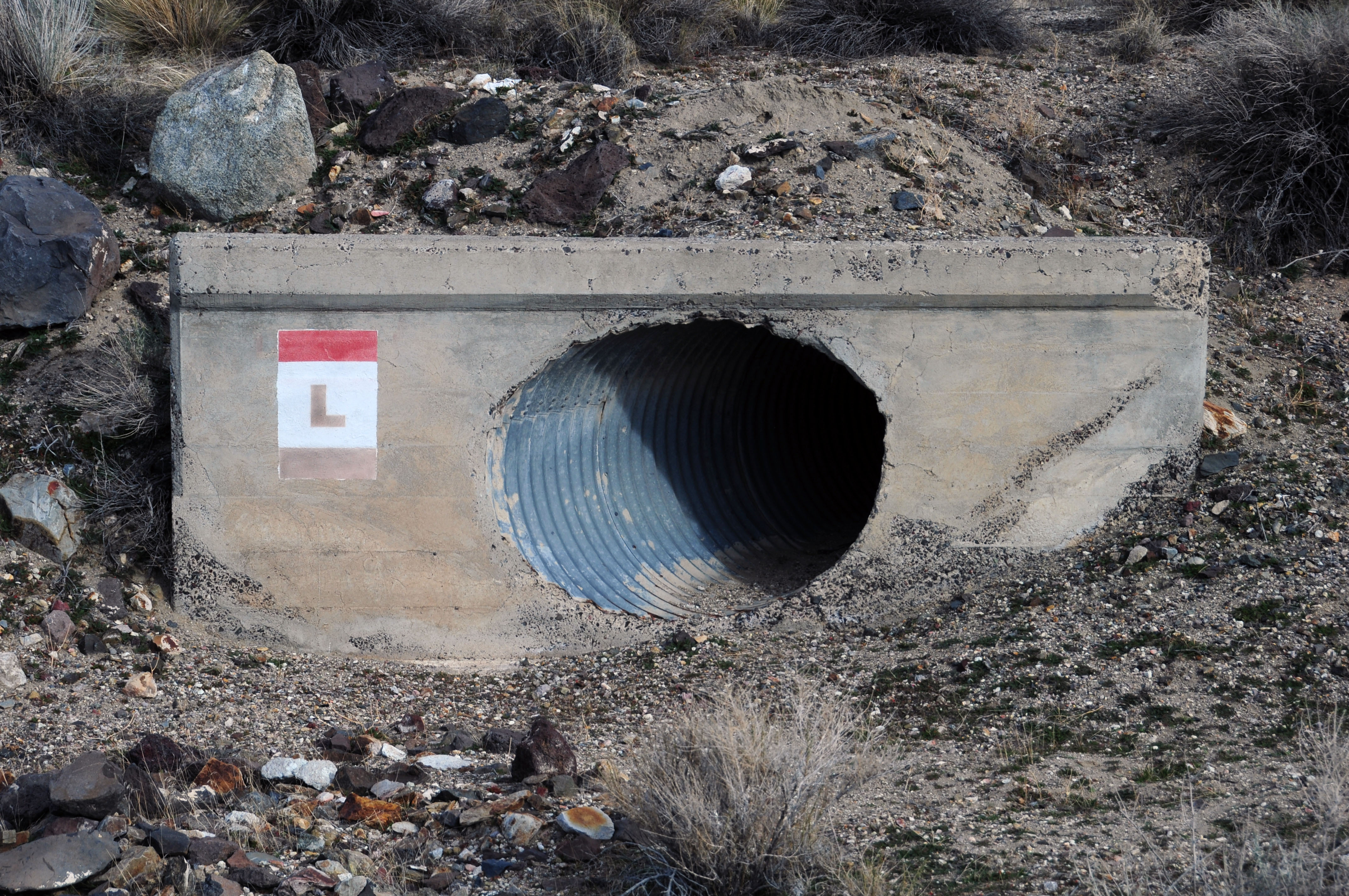
Old culvert, old painted marker. Original to the 1920s? That I do not know – but it sure is old.
Standing atop the culvert, and looking east along the old road: US-50 and the Lincoln Highway.
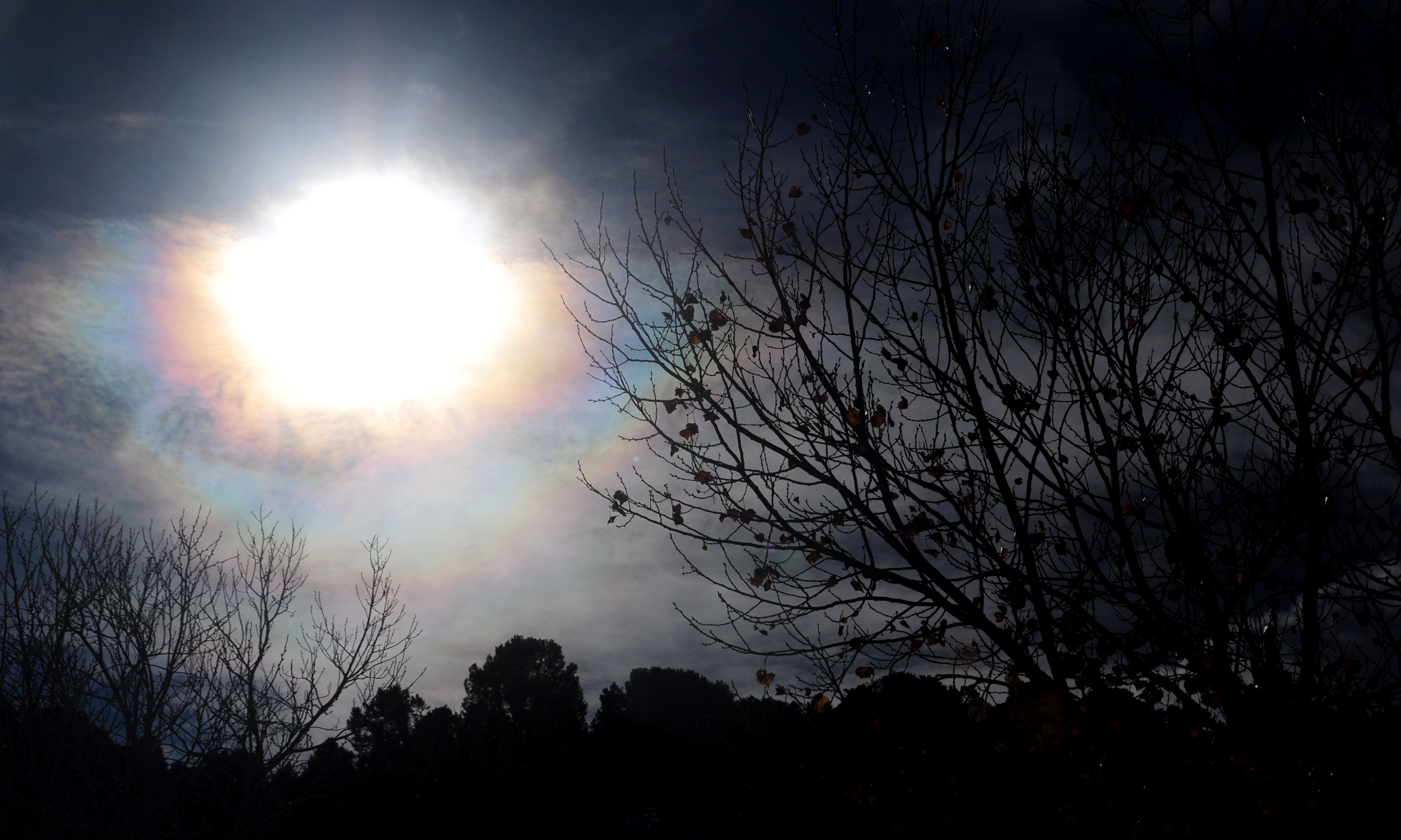
How’s this for concentric halos around the sun? It must’ve hidden itself behind some ice clouds, resulting in this view.

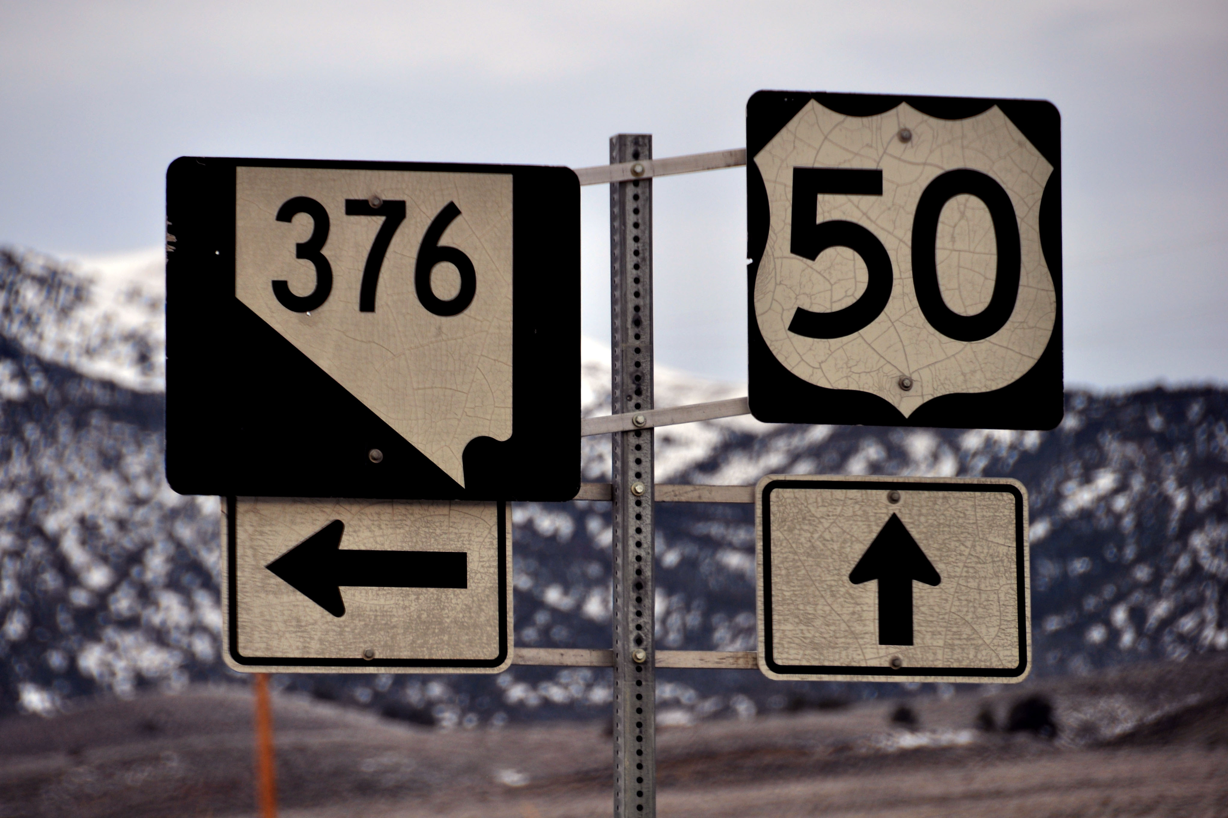
Turning off US-50 past Fallon; we are now heading up old state highway 79 towards Virginia City.
New Geiger Grade, 1936. The old Geiger Grade was a major route connecting the mines of Virginia City to civilization, as early as the 1860s when the Comstock Lode was discovered. This was the first major silver deposit found in Nevada, and it meant that Virginia City was, in 1880, the second-largest city in Nevada: just behind Carson City, and ahead of Goldfield. Las Vegas? Barely existed at the time!
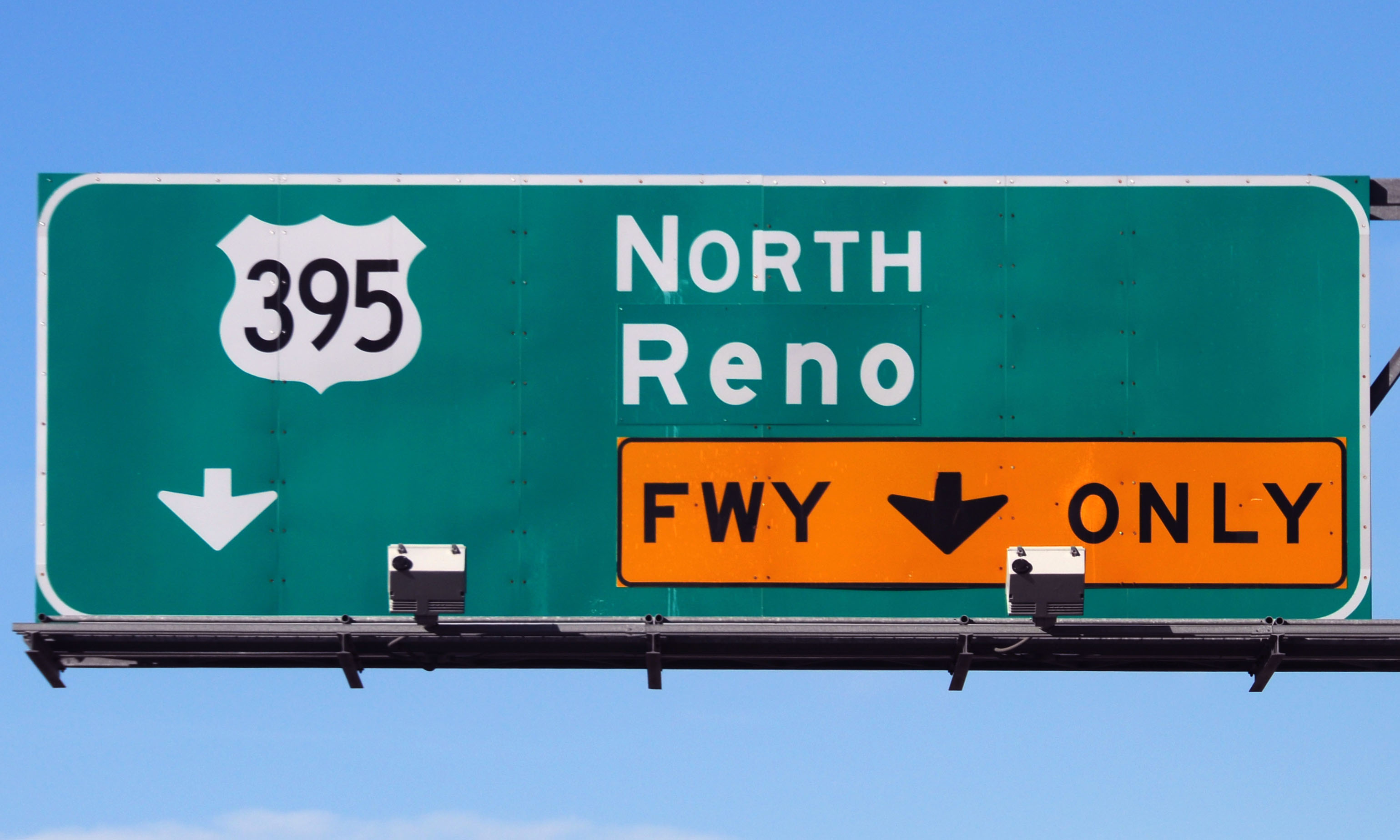
What’s this, a ’61 spec shield? Indeed, this is ’61 green guide sign specification, and this sign is at the NV-341 (Geiger Grade/Virginia City) junction with the new 395 freeway bypass.

Why yes, that is an orange interstate shield. Interstate 580 (aka the just-mentioned US-395 bypass freeway in Reno and Carson City) is undergoing heavy rebuilding, especially around the junction with I-80.
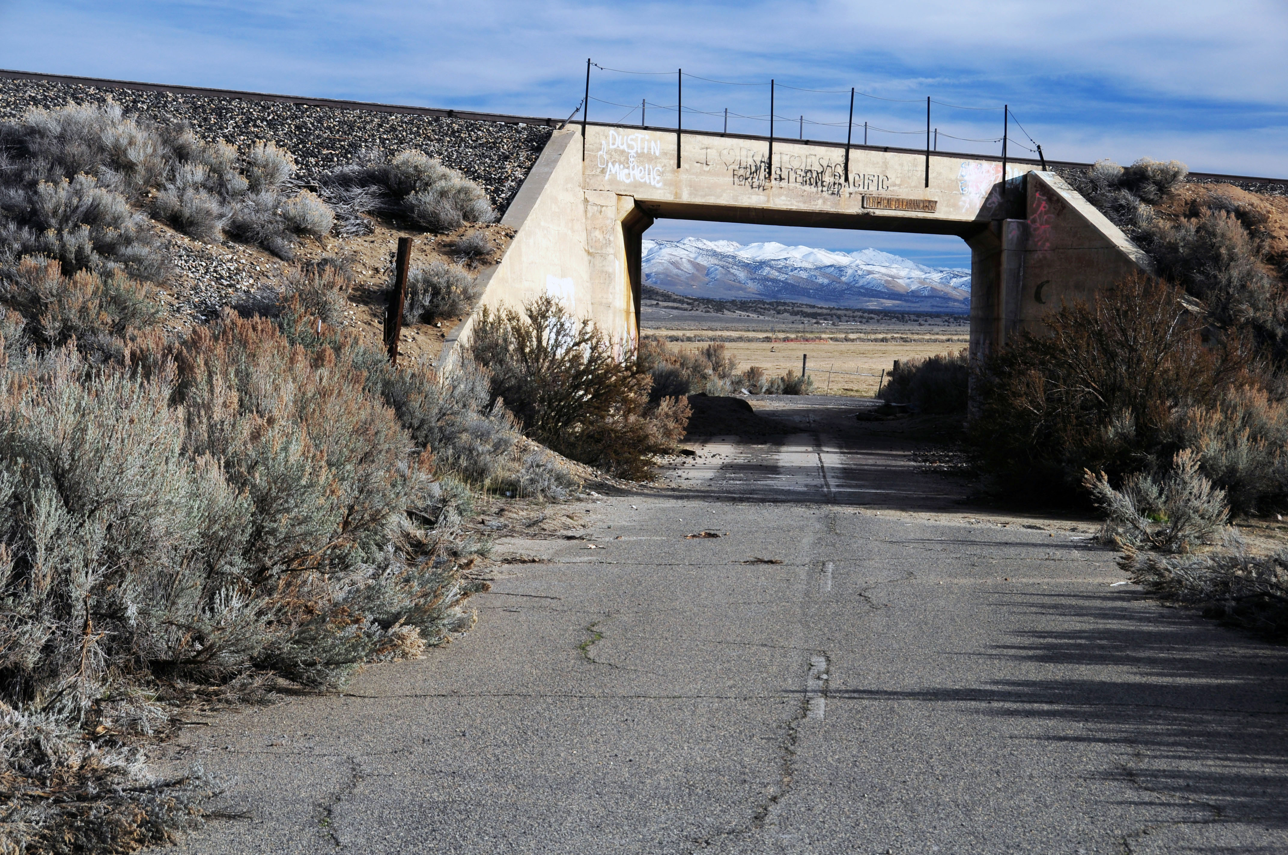
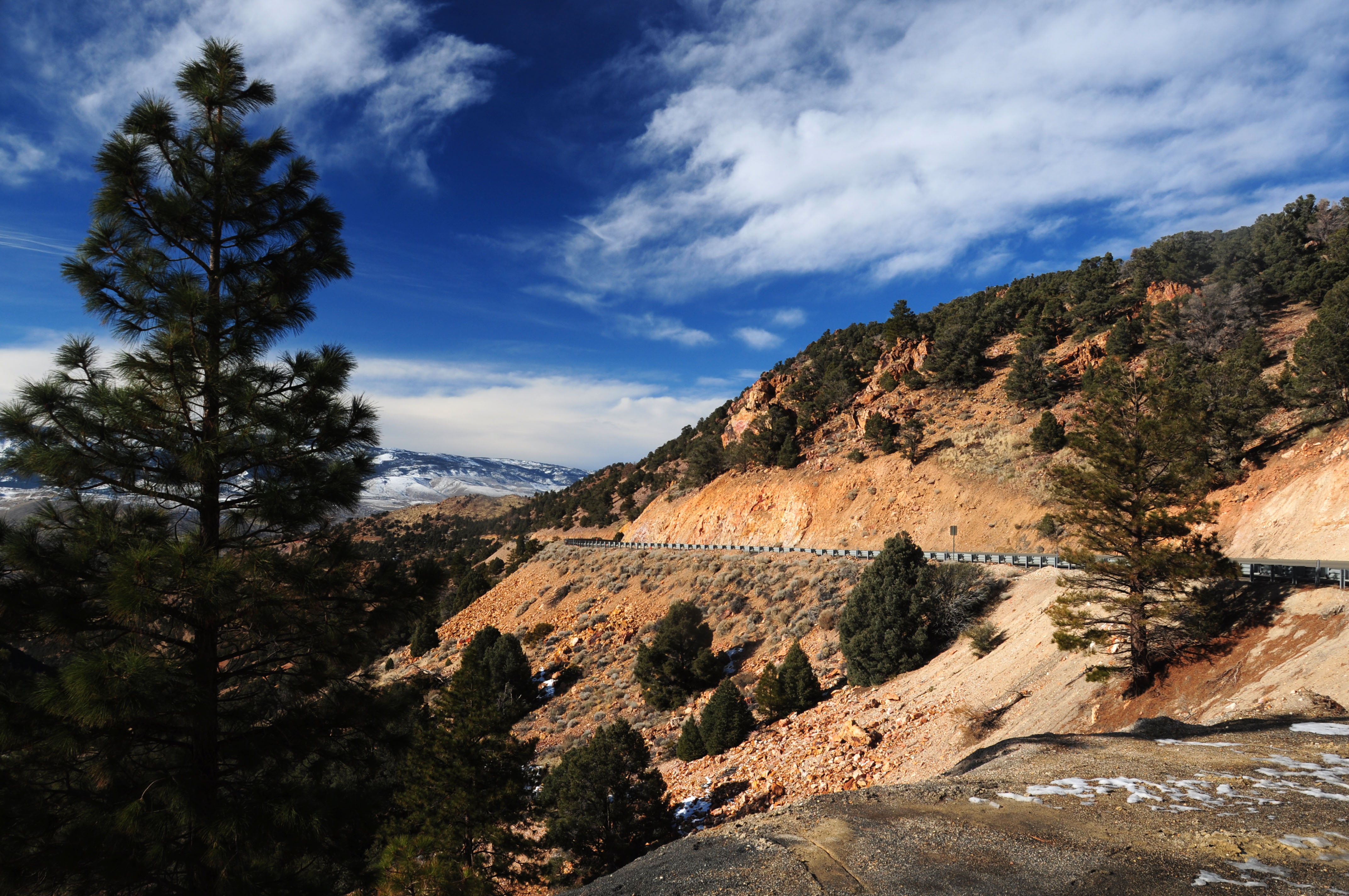
Finished with Nevada, and back in California. An old US-395 alignment, a railroad underpass… and mountains in the distance.
Yep, that is a 395 paddle!
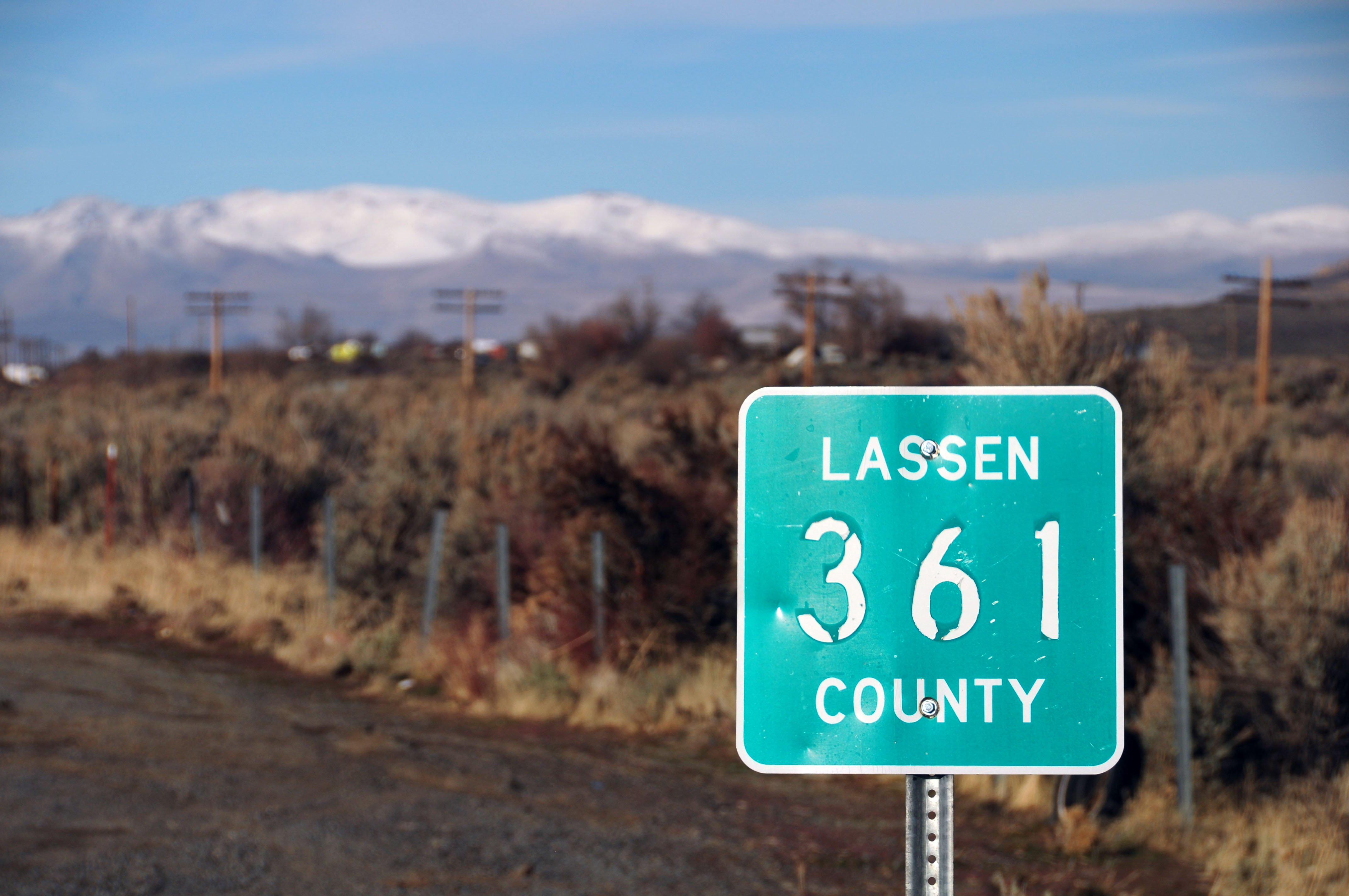
Lassen County uses these green squares to mark their county routes – and sometimes they use the blue pentagons too.
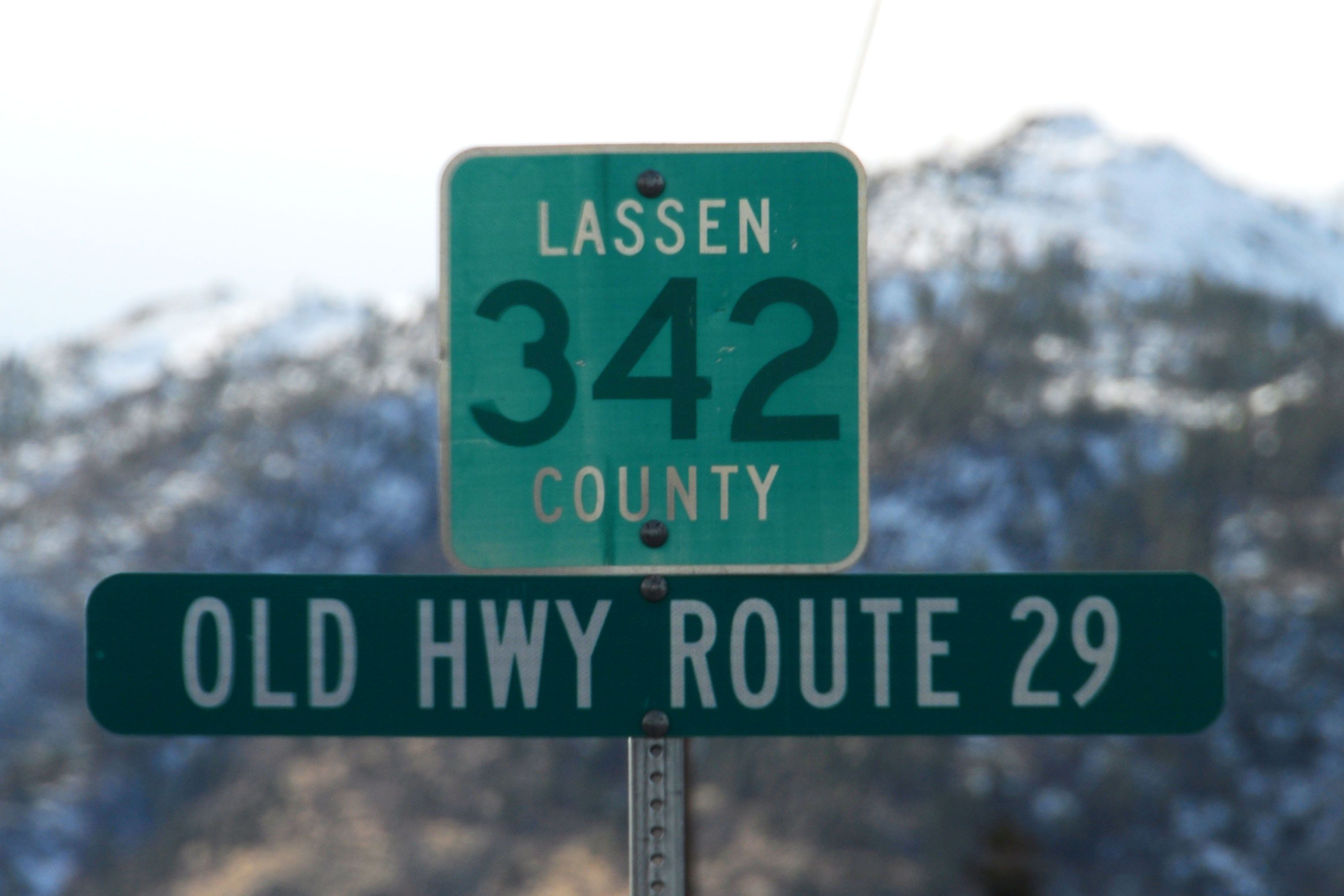
Route 29… wait, what?? Really, route 29? That is a reference to the 1909 legislative route definition of various highways around the state. The routes were not signed until 1928 (US highways) and 1934 (state routes), and upon signing they got a set of different numbers. So California has existed in this weird state of limbo, with two different sets of numbers – one legislatively defined, and one signed – and here is a very, very rare example of a legislative route number being actually posted on a sign.
Route 29 was defined in 1909, and was signed as state route 7 in 1934-1935 until US-395 was extended south from Washington and took over the routing.
This may be the only example of a 1909 legislative route being signed in the state. I have a photo from the 1920s of legislative route 64 (US-60/70, as signed) but that picture is from the 20s. This is an example that stands as of last week!
By the way, yes, this is an old alignment of bear route 7 and US-395.
Back on a modern alignment of 29/7/395.
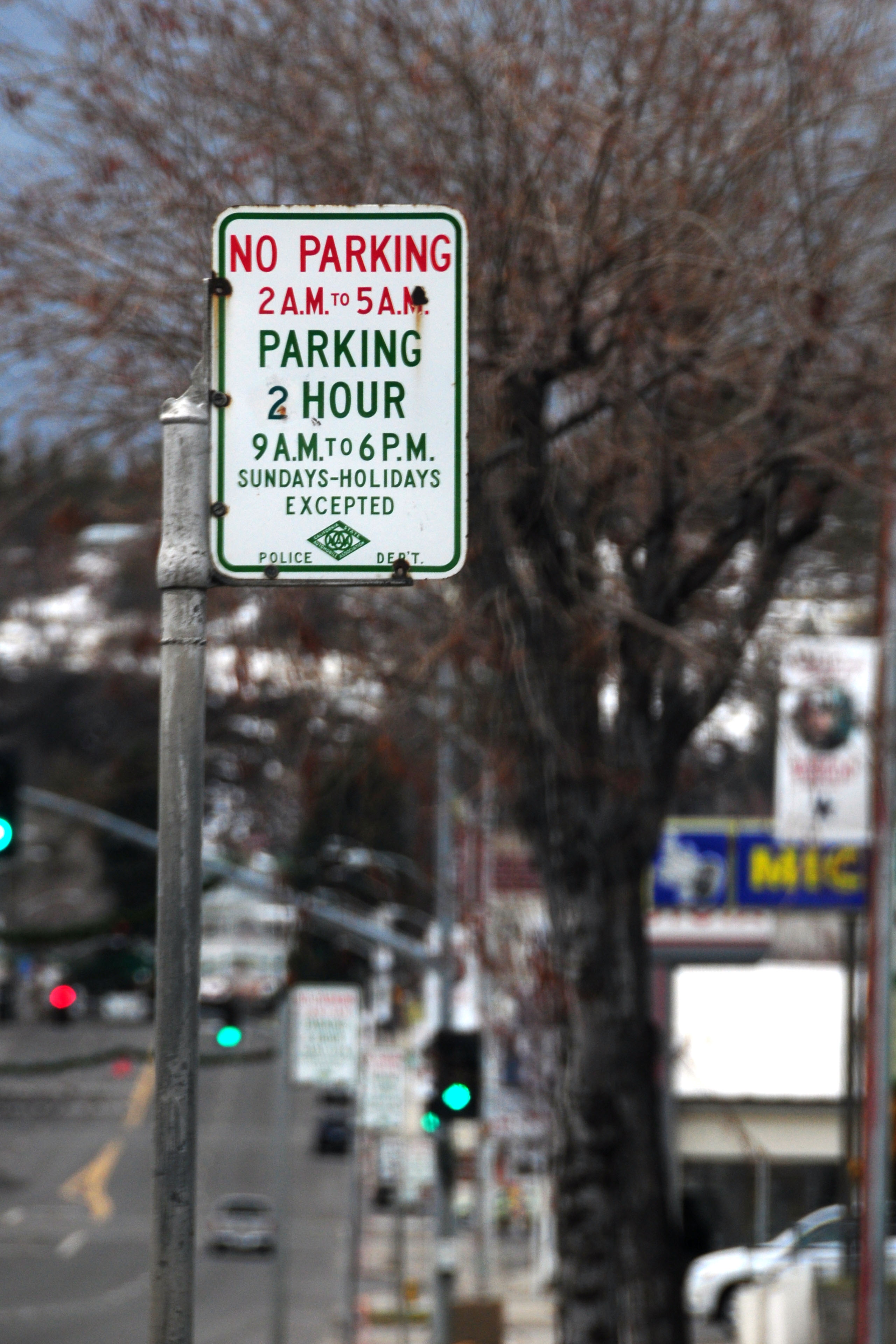
Susanville is the capital of surviving CSAA signs. I counted at least 50, and that was just by driving the main drag and occasionally looking down the side streets. There may be more CSAA signs in Susanville than in every other town in California combined!
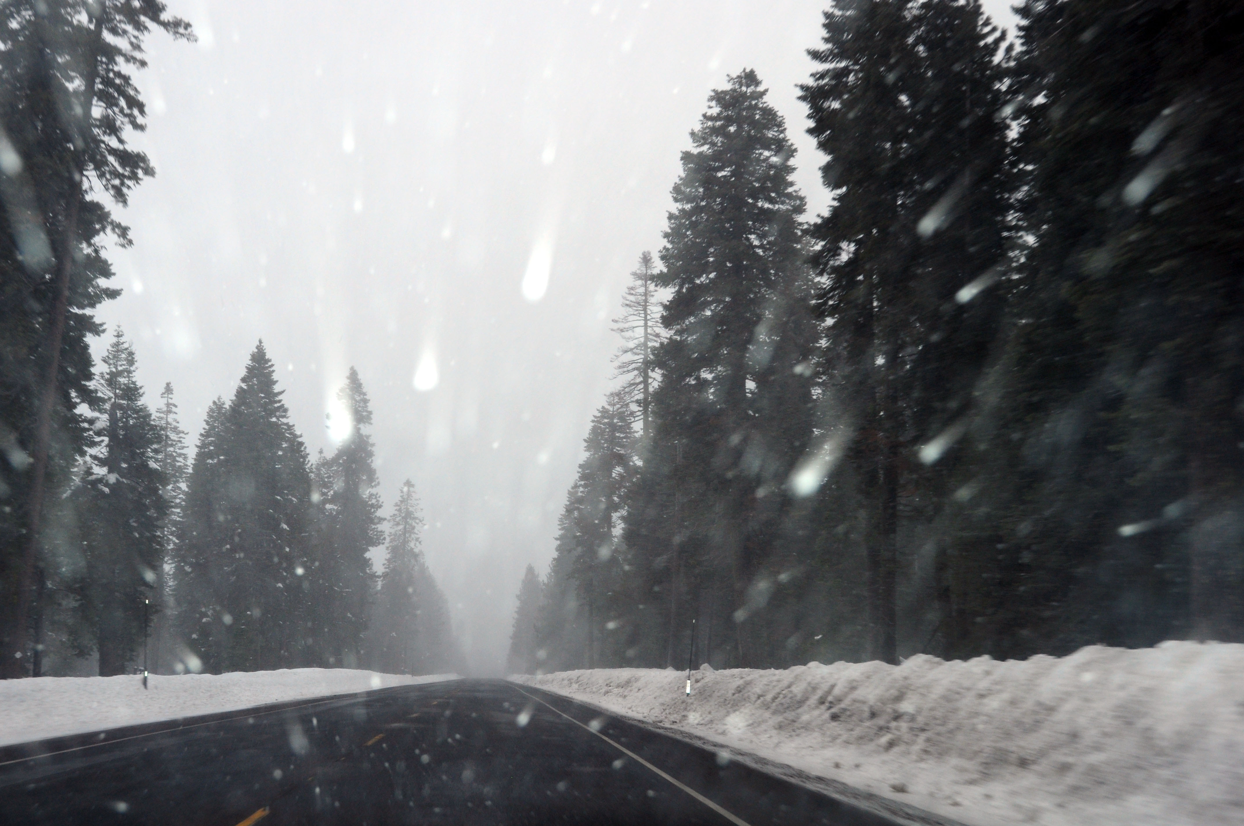
What is this sudden influx of snow? We’re taking highway 44 from Susanville across the mountains… and the precipitation is increasing.

It alternates between rain and snow.
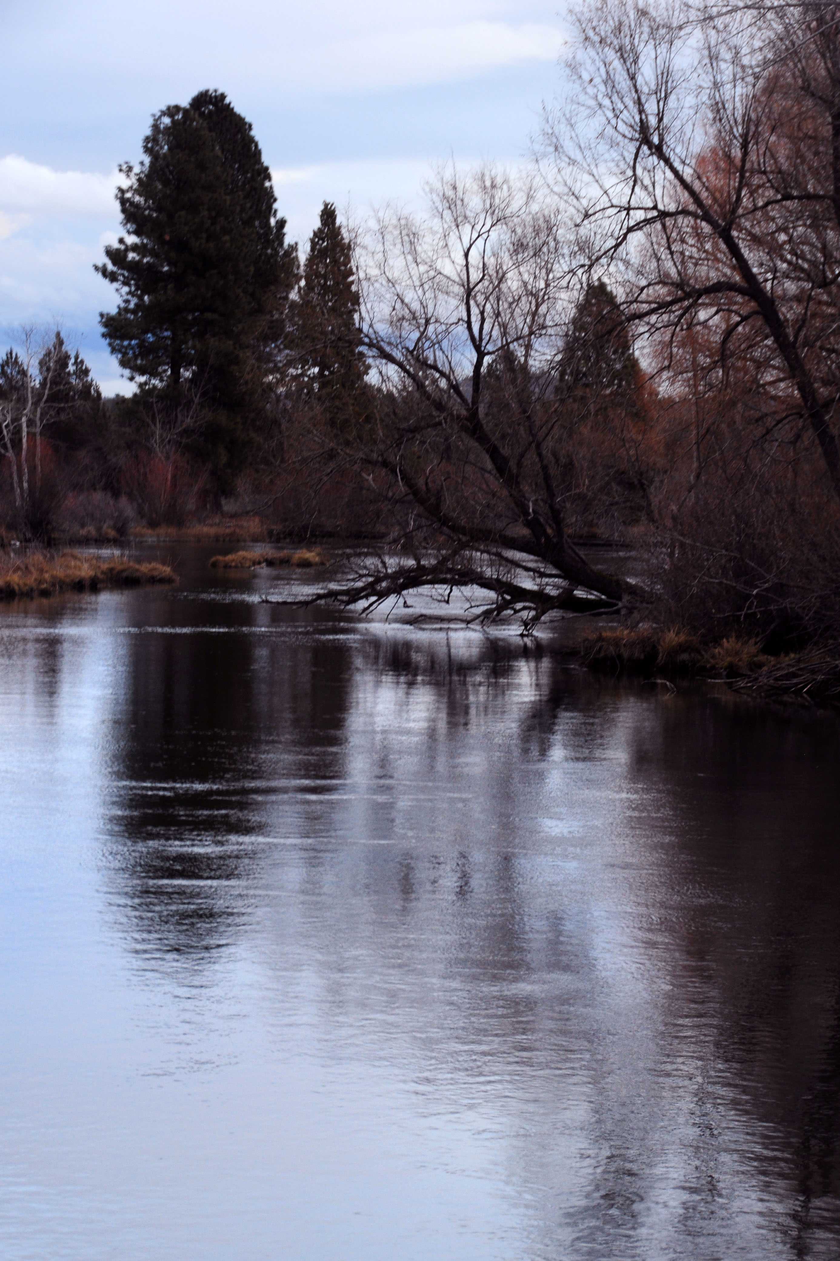
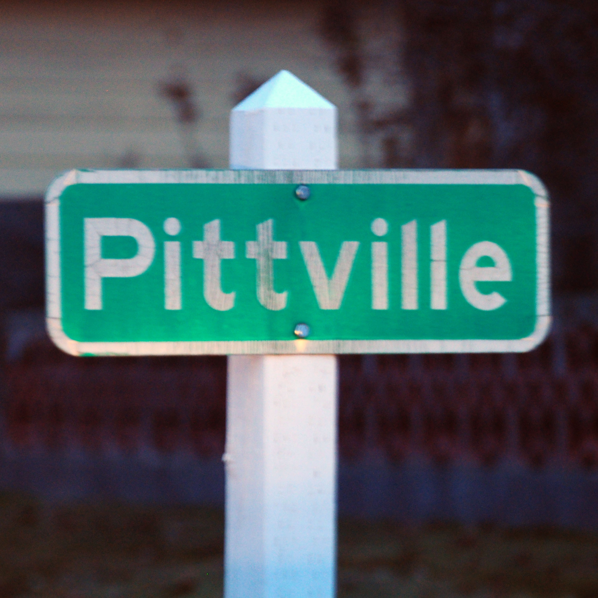
The Pitt River, as we approach sunset.
As darkness arrives… one more town to explore, looking for old signs. Well, that is a 1930s picket, but the sign affixed to it is clearly much newer.
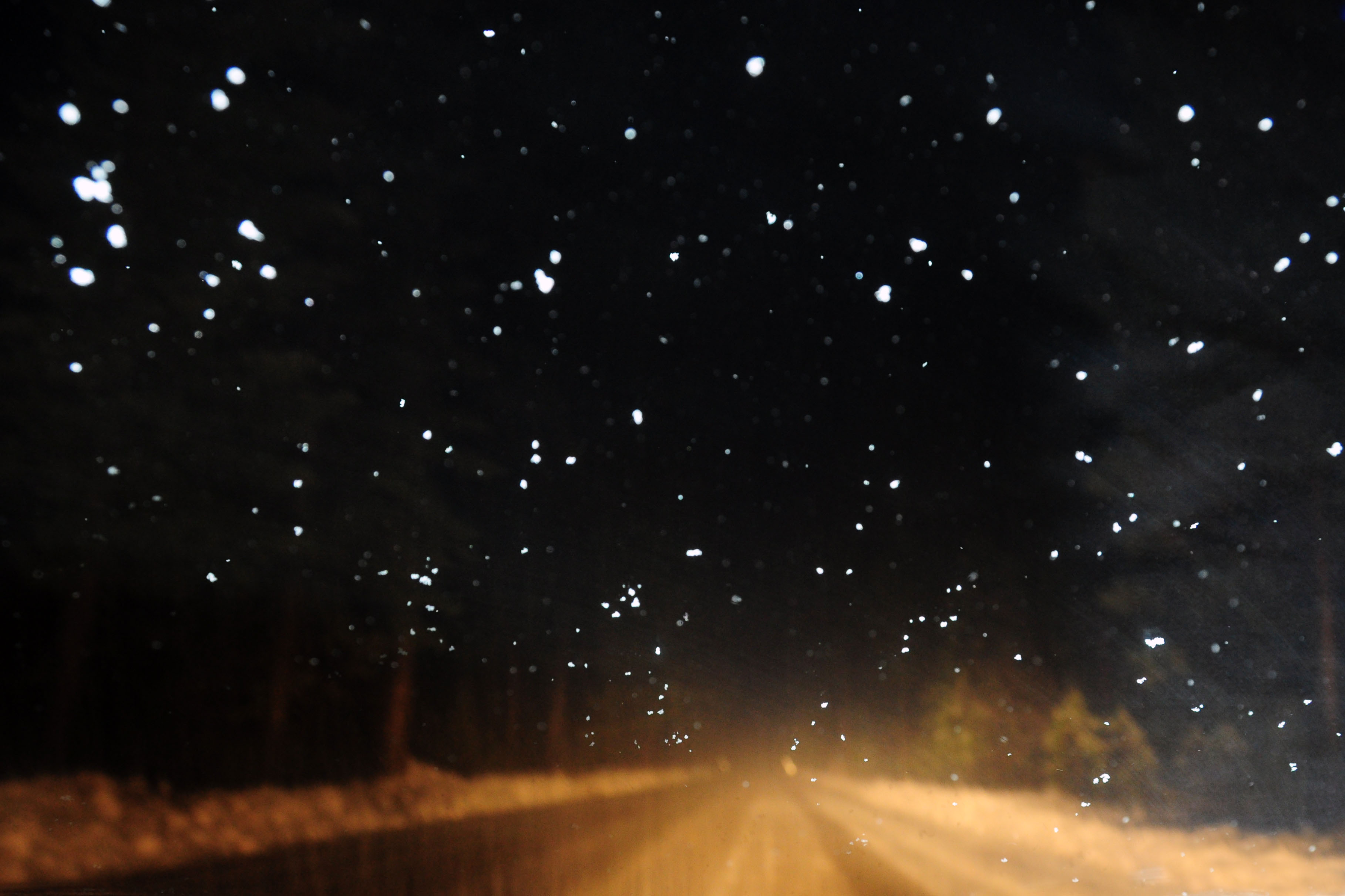
Dark. Temperature falls. Can you say “oh shit”? Gotta cross the mountains, with the snow falling … well, let’s just say that I made it. No snow tires, no chains, but I knew that I was past the top of the pass when this scene presented itself – so my task was to keep going forward and try to keep the car on the road.
Did that. Took me an hour and a half to do the last 38 miles to interstate highway 5, but hey, better late than stranded, right?
Next time: less snow!


I am massively jealous of this trip! (Except for your snowy drive on I-5 at the end. You can keep that.) You got some great sign and old-alignment photos and I really like the “Approaching Austin” photo.
I would love to do US 50 out West one day. I did it across my home state of Indiana this summer and had a great time — lots of old alignments — but the views don’t compare.
50 is quite the incredible drive. Starting from Pueblo, Colorado and heading west, it’s a thousand miles of scenery!
About the ’61 spec US 395 sign: What is the ‘Reno’ greenout covering?
Great pics! That Lincoln Highway marker is a replica that was put up with others in
eastern NV a few years ago. I have records to show where some of the original markers
went. The only one I can think of, off the top of my head, is at the mint in Carson City – still there as far I as I know.
Oh – I see you have pics of two LH markers.
The 2nd one is a repro too.
Great story and photos! I’ll give it a mention on my LH News site. About the markers, others will know the details but the two shown look to be reproductions; ie, the 1928 originals had actual colored concrete for the logo and arrows. Some of these have been touched up with paint, but the repros are all painted.
On the first, the indented arrow and lack of color beneath the painted logo indicates a repro (though granted the location seems original – could the bracket near the ground be attaching it to an old base?) The Hamilton one with poor concrete shaping and poor logo likewise must be a repro.
I have no idea – but my guess is it’s just blank underneath. the sign looks okay (if not great) with the omitted control city, so I think that was its original layout.
Brian and Russell – do either of you have some photos of the original 1928s? I had thought that there were so many 28s around (and they were so hard to steal) that the originals were moved around officially.
the one east of Eureka standing in the middle of nowhere is not original either? Dang! I had thought that one for sure was in the original location as placed in 1928, as it sure doesn’t match up with a state historic marker or a town – it’s just kinda leaning in a hillside.
any more info is greatly appreciated on the 1928s and their reproductions.
Really, really beautiful pictures of Nevada, one of my favorite states. All silver and purple at sunrise. Thank God, you have none from Vegas. Ycch. I used to live in Northern Nevada in the 60’s, it was the least populated state back then, your pictures prove it. Thanks.
Awesome sunrise pictures!!
Jake,
I have alot of info on the LH markers, and have even corresponded with the Nevada State Highway Dept regarding these. I’d be happy to call you to discuss this further.
Please e-mail me your phone number if you like.
Regards and happy new year,
Russell aka ypsi-slim
Russell,
I may be found at 858 228 7782.
Jake
Hello Jake! I’m the publications specialist for the Nevada Legislature’s Research Division. I design the GUIDE of the Nevada Legislature every 2 years. I would like to use the photo with the caption “Some serious purple on the horizon” on the cover of the 2011 GUIDE. Since we are the government, this is a public document without charge. I’m asking permission from you to use it and how you want your name displayed on the photo credits page. My direct line is (775) 684-6481. As an example of the publication, a link to the 2009 GUIDE is at: http://leg.state.nv.us/Division/Research/Publications/Guide/Guide2009.pdf
We will print 50,000 copies of the 2011-2012 GUIDE.
for everyone inquiring: you may use my photos free of charge for non-commercial purposes, like the Nevada Legislature guide referenced above. All I’d like is to be appropriately credited, and a copy of the publication if it is printed.
for commercial use, contact me and we can figure something out!
Jake – good conversation this a.m., but one more item, credits. I think you might have a different title in mind than:
Photo “Some serious purple on the horizon,” by your name (withheld in this post, although I know it).
Thanks again for your assistance and photography skills.
I’ve never titled my pictures. I refer to that one as ‘101352’!
if you can think of a title, great, if not, then just “Photo by so-and-so, December 2010” is perfectly sufficient.
Jake
WOW ROAD SIGNS!!!