
Norway, day two on the ground.
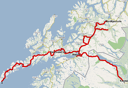
We pick up from Day 1 near Nordkjosbotn, and dash south in the middle of the night on highway E-6, to where it hits E-10. E-10 west, across the Tjeldsund bridge, all the way to the village of Å, and then back along the same road, because northern Norway is – like Alaska – very sparsely connected. E-10 all the way east to… well, almost to Kiruna, Sweden, because there is a big snowstorm blocking our path! Retreat again, down to Narvik to get gas, then up again on E-6 – almost back to Nordkjosbotn, actually, but we’re branching off on a slightly different route. The good thing is that even though I covered the same spots over again, there was different light and weather each time, making it highly interesting.

The same northern lights as the previous night – still visible, as the sky gets brighter with dawn. The village of Steiro is on the other side of the fjord.
Typical view in the Lofoten islands.
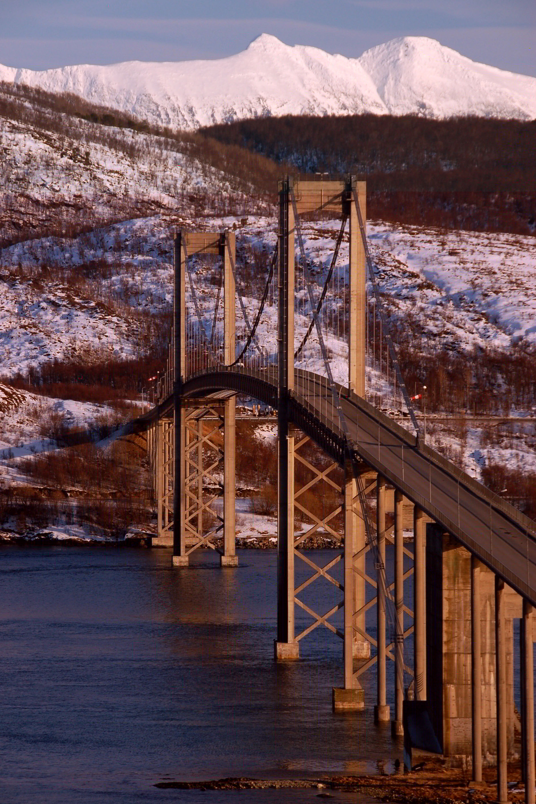
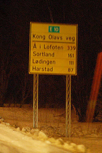
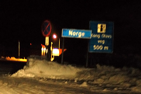
The Tjeldsund bridge, in late afternoon. E-10 is Kong Olavs veg (“King Olav’s road”), whose modern incarnation was built in 1967 over an old Viking trail from Luleå, Sweden to Å.

Don’t be fooled: this isn’t a sunset in Norway. It’s actually in Sweden, as we look back westward on the way to Kiruna. Originally the plan was to go through Kiruna and into Finland, but then nature intervened.
Heading west, to the village of Å. Yep, that’s the entirety of its name. “i Lofoten” means simply “in the Lofoten region”, to differentiate it from all the other villages named Å! (Seriously. I know of at least four.)

The Tjeldsund bridge, at night. We will revisit it several times, because it’s a pinch point: from here, several roads diverge. E10 continues to the Lofoten islands, while other roads branch off to the islands of Langøya and Andøya (home of, respectively, Å i Langøya and Å i Andøya – no kidding!). This bridge was just about the last portion of King Olav’s Road to be finished.
I’ll have plenty more photos of this bridge from other days… both day and night. This photo is from the roadside information station that tells about the bridge and the road. Clearly, the trees have been trimmed to provide a view. In Norway, they’re proud of their architectural achievements, and (in stark contrast to the Verrazano Bridge), they encourage people to take photos.
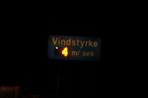
Wind speed: 4 meters/second, as we cross the bridge.

The northern lights are still present, but not particularly active at this time. 49 kilometers west of the bridge now. You can read the sign in the bigger version of the photo. More interestingly, there’s a comet in the sky – something I didn’t notice until I was looking through the pictures! In the foreground, Norway’s famous glowing trees.
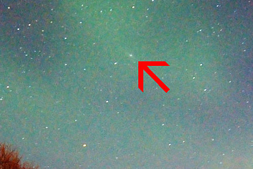
(Zoom in from the previous photo.) I believe that that’s Comet 17P/Holmes – the exploding comet of November, 2007.
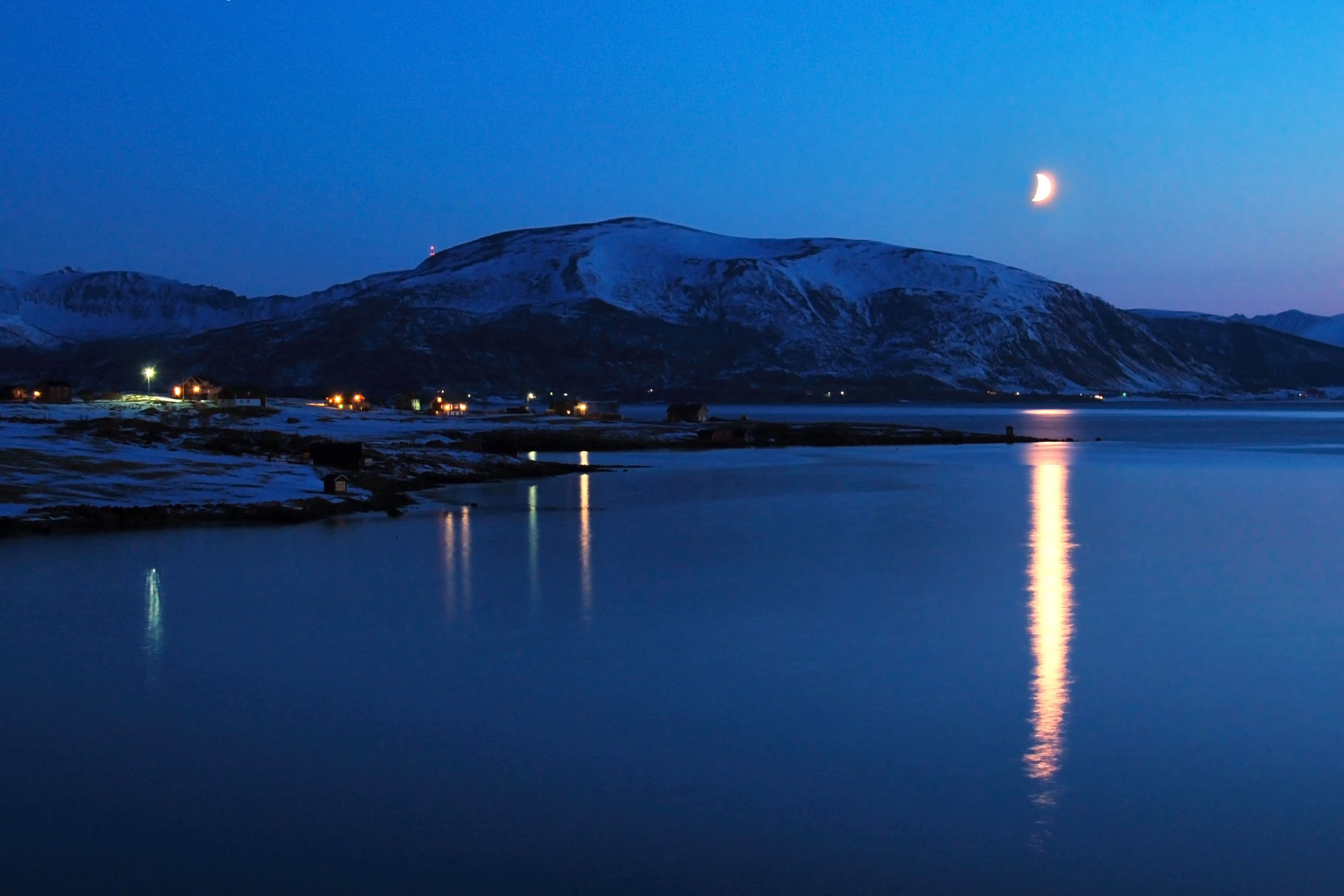
The moon over the village of Fiskebøl. I’m tempted to say it means “Fish Bowl” in Norwegian, but it very likely does not.
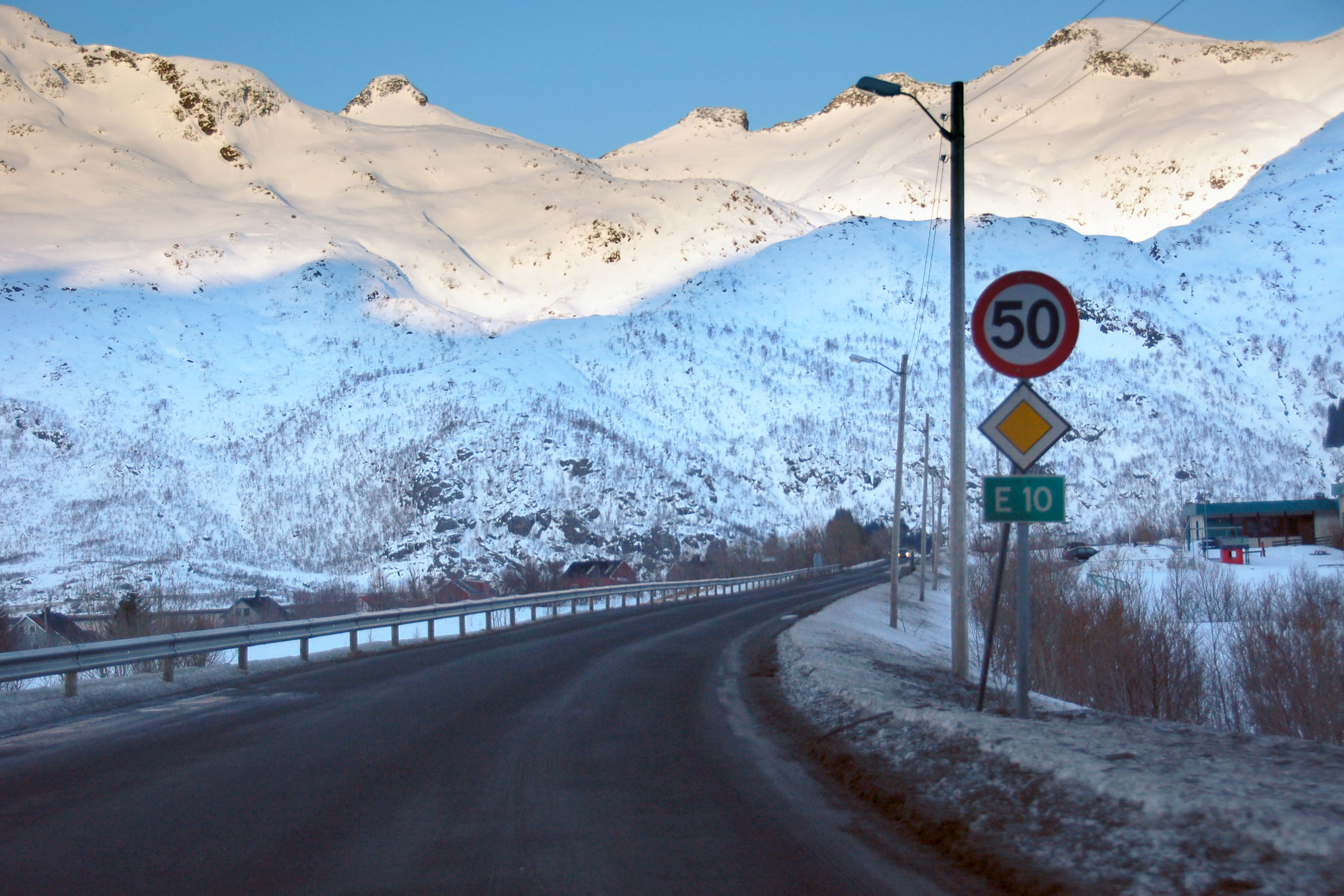
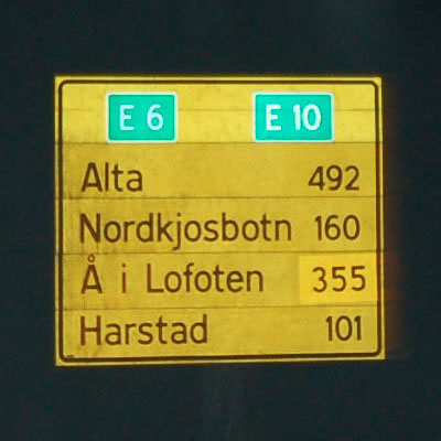
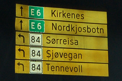
The E highways form a large grid all over Europe. They keep the same number through national boundaries all across Europe and are signed in green.

Look at that, I found the one tree in the area.

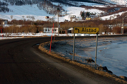
We’re in the Lofoten Islands now – here, they don’t feel the need to differentiate their Å from all the other Ås.
Old sign!

Resistance is futile.
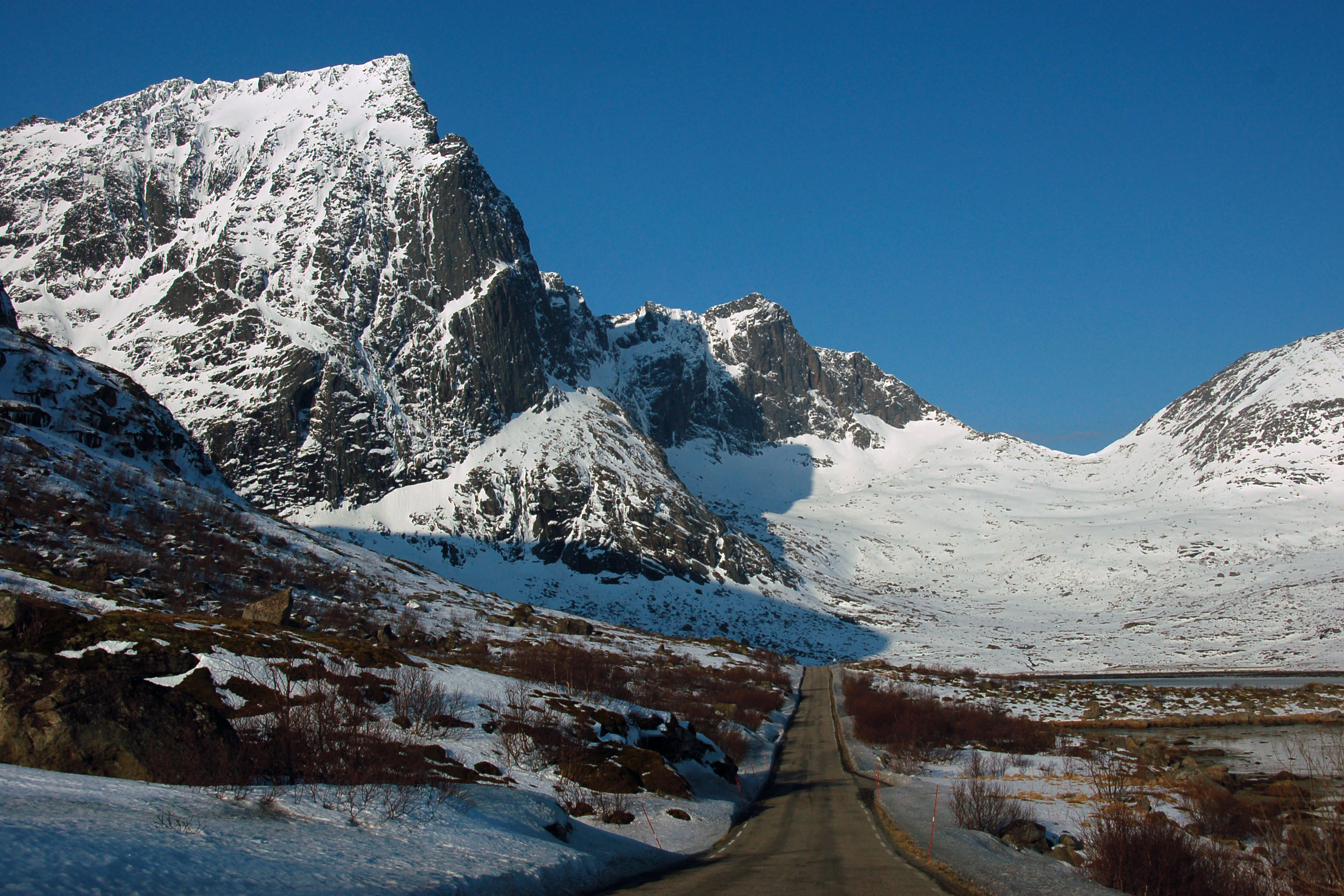
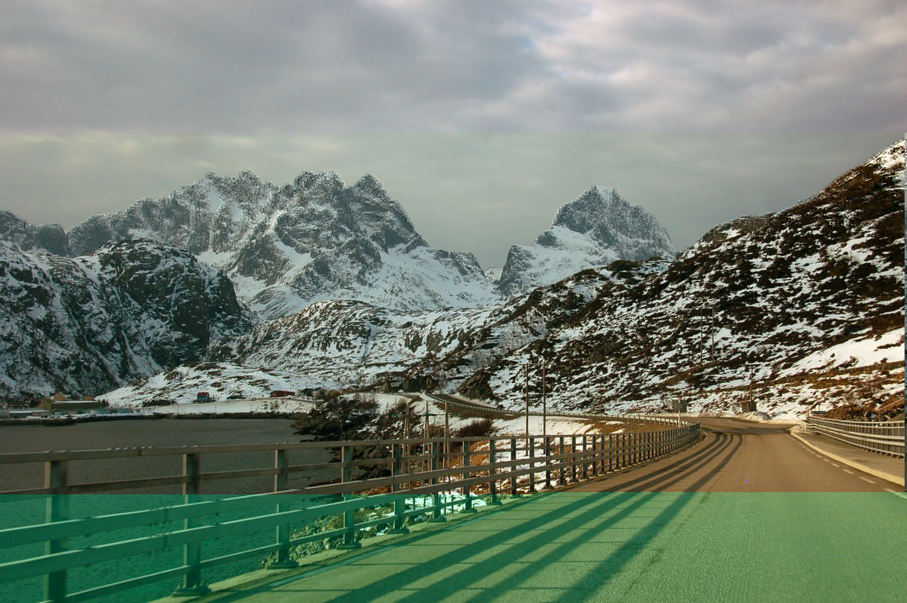
Mountains, mountains, everywhere. Norway’s mountains aren’t tall – namely, they do not reach as far from sea level as, say, the Rockies. This peak is “only” about 5000 feet high, for instance. They appear much taller for two reasons: one – the surrounding lands are very close to sea level, and two – they are extremely sharp, rising to jagged peaks that emphasise their starkness.

The cute little fishing village of Bø. Yep, those Norwegians sure do love their short place names.

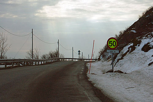
Note that the road is getting progressively narrower and more winding. E-10 starts out as a major trans-Scandinavian freight route, but as one reaches more and more remote villages, the construction quality starts getting iffier and iffier. Norway, in general, has incredibly good roads. When one takes into account both the construction (large mountains to navigate around, over, or through) and the maintenance (did I mention we’re north of the Arctic circle??), the fact that the roads are paved, and driveable year-round, is a magnificent accomplishment.

Before the blue-and-white town boundary signs, Norway had white-and-black ones. They switched over after realising “oh yeah … snow”.
Construction zones feature neon-green instead of white on their signs, for extra visibility.
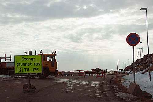
End of the line. We’re in the village of Å – just barely. This is actually the official end of E-10: the section that is under construction is a town-maintained road. More than anything else, the barricade is to keep cars out because Å is heavily pedestrian, bike, and boat-oriented. There’s a parking lot just barely on the correct side of the gate: it just happens that, at this time, the suggestion is being made vehemently. Call “175” if you object.
Ålas, I did not get a photo of the “Å” sign. I was kinda hedging my bets that Å i Andøya or Å i Langøya had one too, and I wouldn’t have to walk a kilometer and a half or so to the official boundary of incorporation. Guess we’ll have to behold photos from a later batch to determine if my bet paid off!

Another view of Å, as we turn around. Back we go – all the way back on E-10, past the Tjeldsund Bridge, back to the E-10/E-6 junction from whence we came – but then we continue onwards on E-10 into Sweden.
A white-tailed eagle. This bird is the North American bald eagle’s nearest cousin, and is Norway’s largest consumer of fish. Seriously – it has a wingspan of seven feet! I barely got this photo as I was driving past the cliff – about one-half a second after it started taking off as seen here, by golly it indeed took off.

Narvik is the largest city in the area. It has a population of an impressive 18,000.

Clear skies: enjoy them while you can!

Austnesfjorden (“the Eastern Fjord”) under infrared.
Reflecting mountains. I took this one while barreling down a hill at a whopping 44 miles an hour (Norway’s speed limits aren’t exactly colossal). No shoulders on this road, and this was before I realized that if I wanted to stop and get a photo, I could just park in the lane. All the zero cars that would come by could figure out how to go around me.

Norway has the occasional tree.

It’s Norway. Two feet of snow doesn’t stop people from having a picnic.
Back in Troms county.
Norwegians love their red houses. Another “through the window” shot.
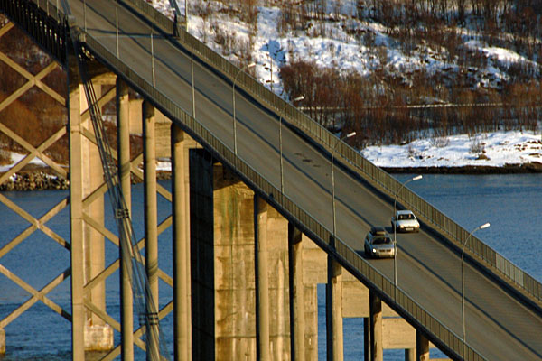
Back at the Tjeldsund bridge. Identify the car that didn’t notice the “no passing on the bridge” sign.

The informational sign at the Tjelsund bridge. The information is given in Norwegian, Finnish, English, and German. No Swedish, even though that’s the most likely native language of foreign visitors. Swedes are expected to read the Norwegian – the two languages are pretty similar – or the English!
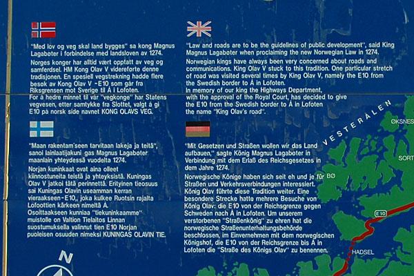
Here, let’s all learn some new languages. That Magnus Lagaboter: smart guy!
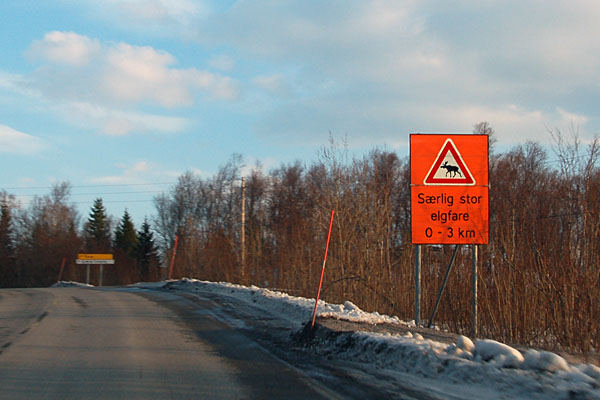
Heavy elk moose crossing. What we call the moose, Europeans call the elk. There are no North American elk in Europe – the closest thing is the red deer.

Luleå and Kiruna are in Sweden. That is where we’re going. Well, only to Kiruna. In fact, not there either.

Near dark, as we start crossing the mountain pass that leads into Sweden.
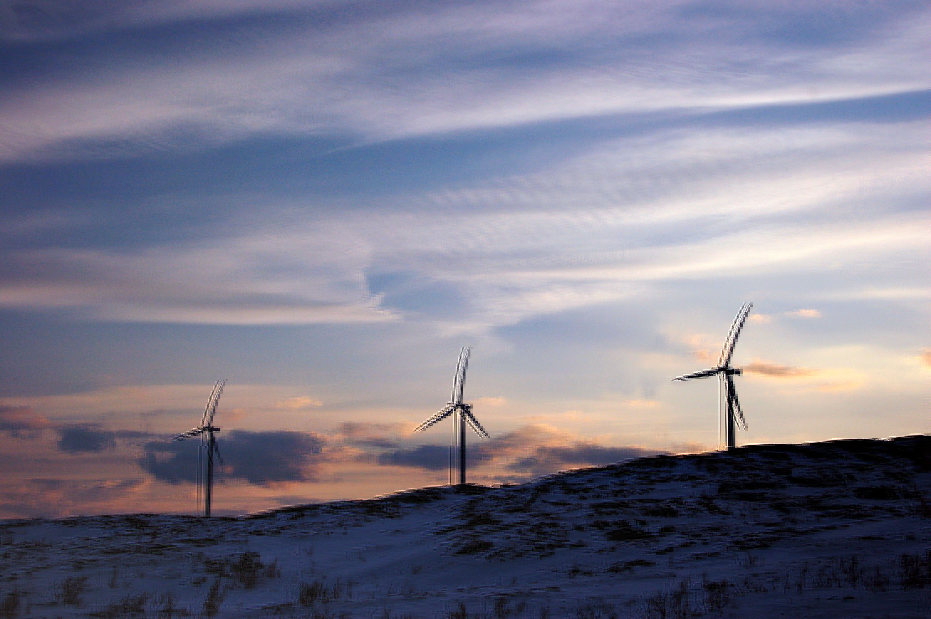
Windmills in the mountains.

High clouds at sunset.

Sweden’s just around the bend. A little further down is what appears to be one Hell of a snowstorm. The reason it looks like that from over here is because it is, indeed, one Hell of a snowstorm.
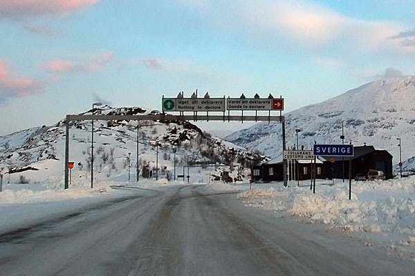
Sweden. Don’t have anything to declare? Just float on through! Good luck seeing an international border like that in North America any time soon.
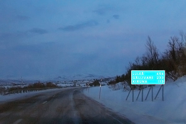
Sweden prefers blue for its guide signs.
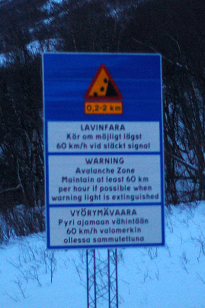
“That word. I do not think it means, what you think it means.”

Bigfoot-quality moose photo. Hey, it’s the first actual moose I saw on this trip! In fact, the only one! Plenty of reindeer (see: Day 6, especially) but only one moose.

Narvik? Why are we going towards Narvik; isn’t that where we came from? Some time has passed since the last photo, and I definitely ran into the edge of that snowstorm, that’s why. When Kiruna’s eleven kilometers away and I can’t see the lights in the haze of the flakes, that’s when I know it’s all systems retreat. Especially when I see that it’s heading west…
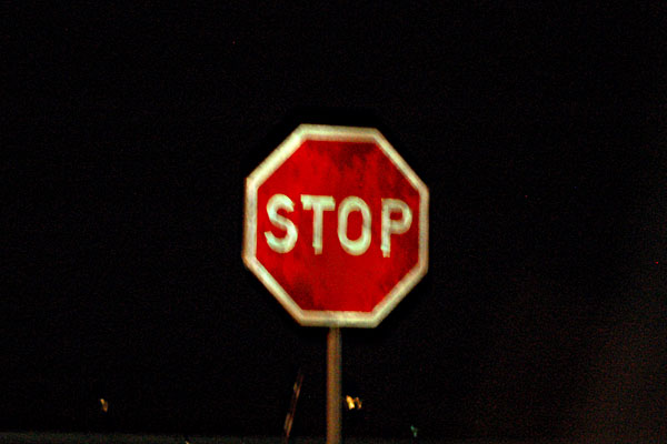
A stop sign. Hey, they’re plenty rare in Scandinavia. Nearly every intersection is marked with a “yield”. Why stop when there isn’t a car for twenty kilometers? It just wears out your clutch. I dunno why this intersection (a side street to the E-10) earned a stop sign: there wasn’t a car for twenty kilometers.
Back to Norway. Thus ends the little Swedish experiment… until the next day, that is.
Narvik, or thereabouts. Home of gas stations. 850+ kilometers on a tank of gas is excellent – but not infinite!
Our first mention of Kirkenes: the easternmost town in Norway. Over a thousand kilometers away – we will visit it on Day 4.

Had I noticed them, I’d have stuck around! Note the northern lights on the right side, behind the mountain. The town of Soløy. Not Soløy i Lofoten, with the white sign from this morning, but rather Soløy i Tverrfjellet – oh, those crazy Norwegians and their unique town names! I only discovered the aurora in this photo when editing them.
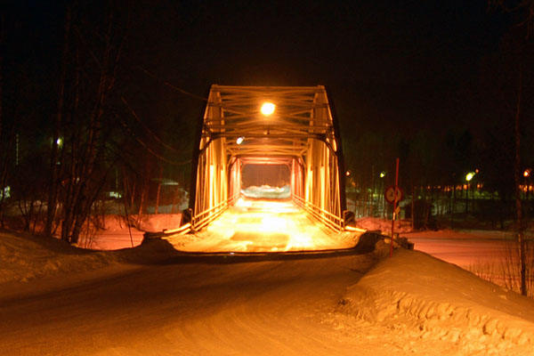
A 1940s old truss bridge. This is the first one we run across, but there will be plenty more. They were built well, and they continue to serve their purpose.
And that is it for day two, simply because here I caught an entire hour of sleep, before proceeding onward.
Nice stuff, Jake. I really enjoy the Scandinavian stuff.
Hi,
I really loved your pics and your short and informative comments! We are attracted by similar views of nature and ‘weather’.
I plan to go from Lulea to Narvik by boat (on a low loader…;-))and am wondering whether you can remeber or better know whether there are any physical height restrictions on the E10 towards Kiruna and from there into Norway on E10 with about 20km on the E6 to Narvik?