
Let us behold day 6.

We head out to the outer islands of Langøya and Andøya, and then head back to the airport with remarkably little time to spare.

The shortest place name on Earth. Å. This is why I wasn’t too worried when I didn’t get a photo of the sign for Å i Lofoten – because here is Å i Andøya.

And here is the å for which the town is named. “å” is Norwegian for “small stream”.

A halo, somewhere over the island of Langøya.

The road to Hovden, just around sunset.
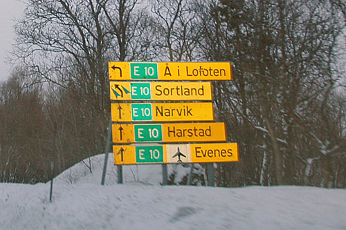
What’s with all the E-10s, you may wonder. They realigned the road in 2006 – and they left the signs for the old alignment as E-10 as well!
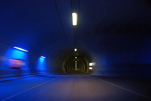
Not the entire tunnel is lit up blue like this – just the sections in which emergency call boxes can be found. Call boxes are a good idea, even if the tunnel doesn’t have non-cooperative doors at the beginning and end. This tunnel is about 6.1 kilometers long, and is the reason that E-10 got realigned: building it under a particular channel reduces the distance to the Lofoten islands by about 20 kilometers.

On the way to the Lofoten Islands – again. This time, however, it is overcast, and the waters are completely smooth.

Not long after dawn. Fishing boats in the Austnesfjord, by the side of highway E-10.

The fishbowl. Fiskebøl again, as seen a few days ago. (The large image is 6000×2000 pixels!)

A pair of reindeer. Just past Sortland, on the way to Andøya.

Same two reindeer as above, and two more that wandered into the frame.

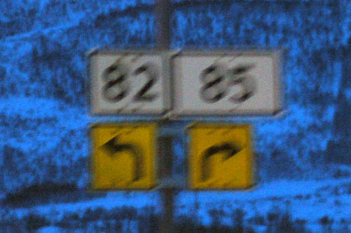
Highway 82 to the island of Andøya. Yep, that small white spot is the sun.

Hey look at that, the sun’s out … kinda.

Older, faded curve advisory sign.

A pair of white-tailed eagles. Too bad I couldn’t get any closer. It wasn’t the snow as much as the fence that stopped me.

A llama. If they can survive in the Andes, I suppose they can survive here too.

The road going up the west side of Andøya. There is an east coast and a west coast road. I took one up, and the other down.

The road to Å cuts across the island, as Å is on the east coast. And yes, this is Å i Andøya – not to be confused with Å i Lofoten!

Swans in the North Sea.

And one final incident of: mmm… pointy.
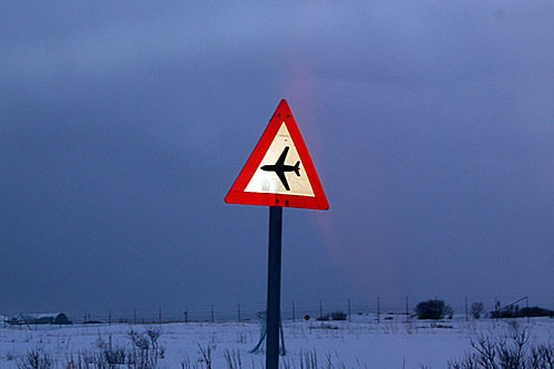
I may or may not have been permitted to take a photo of this sign. This doesn’t mean “airport”; it means “low flying planes” – because there’s a Norwegian Air Force base right here. We’re in Andenes, the northernmost town on the island of Andøya.

Hey look, everyone, it’s a secret Norwegian radar installation. And mountains in the background, of which I couldn’t get a better photo because the road curves away from them… by the time one is through the military site, the mountains are at the wrong angle.
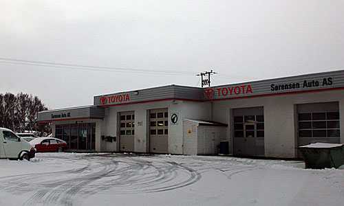
This has to be the world’s most remote Toyota dealer. Not the northernmost – we’re south of Tromsø, and I am sure they have a Toyota dealer – but this one is out at the tip of an island that’s nowhere near much anything else.

All glory to the Octochurch.

The island of Senja (which we visited on Day 5), as seen from the east side of Andøya. Note the ship at left.

Our favorite å; just a slightly different view.

Snow clouds overdo the landing by a bit. We’re almost at the south end of Andøya.

Risøysundet – the channel that separates Andøya from mainland.

820 takes us across the bridge at Sortland, to the island of Langøya. A sign old enough to use black Scotchlite (black sheeting that reflects white against a non-reflective background), which was discontinued in the 1960s.

The beginning of a halo.

We’re on the island of Langøya now.

Only half a halo here, due to some intervening low clouds.

The end of highway 820. No, really. It actually loops around and ends at itself! In order to replace some confusion with other confusion, all 820s are signed in dashed outlines, meaning “to highway 820”. Yep, all three of these roads lead to 820 – in fact, they all are 820!

And that’s the last of the sun, as it sorta fades out behind ever-thickening low clouds.
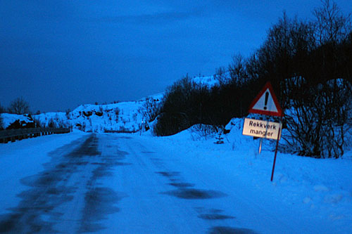
One last mangler, as we turn around and make tracks for Tromsø. Plane takes off at seven in the morning.

Approaching the bridge at Sortland, returning from Langøya.
The only gantry like this I saw. Highway splits are otherwise always done with yellow signs. It’s on the Sortland bridge.

Going fast, aiming for to Tromsø, which is many hours away – with almost exactly that many hours in which to catch a plane!
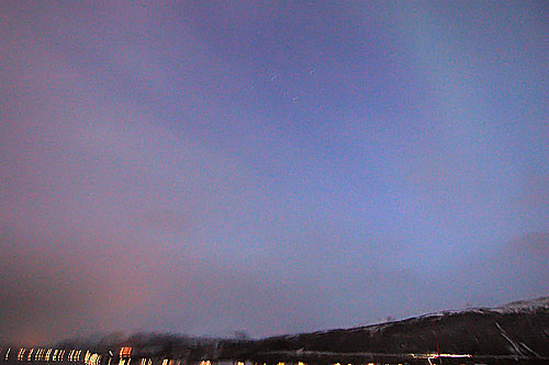
Northern lights. Just barely there, around dawn, between two intervals of clouds. I took this photo doing 90 kilometers an hour, needing to get back to the airport real soon now. There were northern lights every single night in Norway.
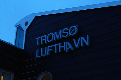
Made it, to be greeted by this, ahem, confidence-inspiring sight.
And with that, we say farewell to Norway. No photos on the flight back – two beers in Copenhagen and I was out like a light!
Clicked on AAA to find road conditions on Interstate Highway 70 between Breezewood & Pittsburgh PA and ended up in Norway! Would that I could skip over the ocean! Been to Norway, BTW. Gorgeous, esp the train ride from Oslo to Bergen. HELLO NORWAY!