
I know that there are many of us road enthusiasts out there who also consider themselves weather junkies. Personally for me, I know several road people that are either meteorologists, studying weather in college, or are about as obsessive about the weather as they are roads. I fall under the category of road junkie who loves weather, though I did study it in college.
So what happens when the two interests come together, such as roadding and thunderstorms, or taking road photos during a snowstorm? Well, part of what happens for me is the excitement of the weather commingled with the excitement of exploring new roads. The other part that happens is, oh crap, my photos are not gonna turn out with all of this rain. Either way there is a level of enjoyment and perhaps a level of frustration to encounter. How can you enjoy the weather if you are stuck in a car during gridlock for instance?
With this in mind, here is a suite of photos showing what sometimes happens or what thoughts cross my mind when mother nature downpours during a day of roadding…
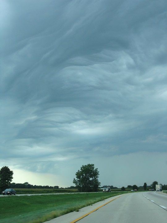
Some days your driving on an otherwise sunny day when clouds arise along the horizon, it gets dark, and then you are on the fringe of a thunderstorm canopy. This particular scene was taken on I-80 westbound near milepost 55 in Illinois. Sure enough storms rained upon our approach to the Quad Cities.
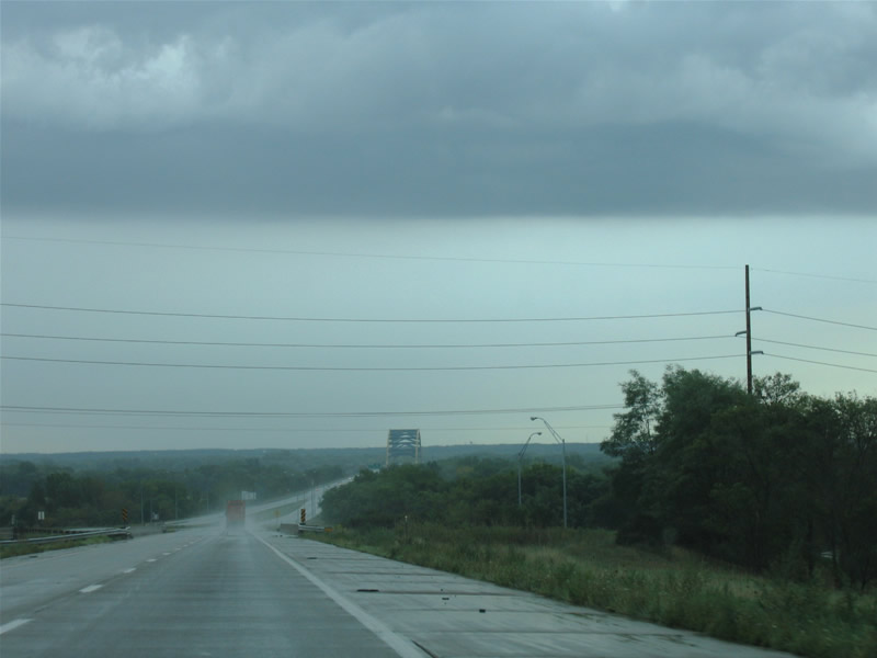
While riding around the Quad Cities in an effort to clinch I-280 and to see the various bridges, rain was intermittent with the cluster of thunderstorms overhead. This makes highway photography dicey, between rain drops on the windshield and dim light during midday. Here we approach the I-280 Mississippi River bridge on eastbound.
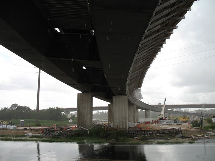
Then you have occurrances where a storm or shower pops up at the most opportune time, such as during the Orlando Road Meeting of July 29, 2006. One stop during the meet was at the future I-4/Florida 429 toll stack interchange. At that same time, a pair of lightning strikes came down to herald the arrival of heavy rain…
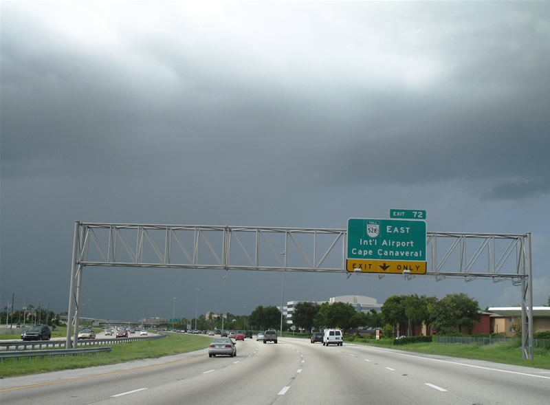
When we thought the fun was over with thunderstorms, a new one appeared south of downtown Orlando. I personally love the contrast between a sun lit foreground and a dark purple sky.
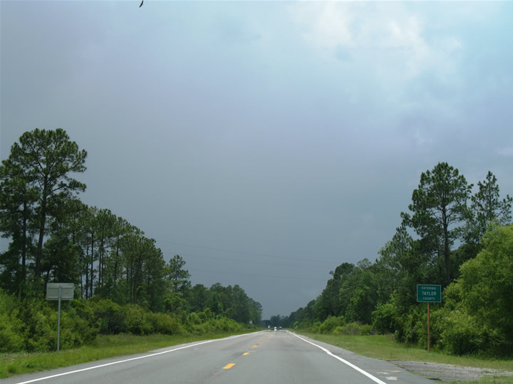
Sometimes the horizon beckons you with “I want to see what the weather is like ahead”. That’s the beauty of travel, we can change our individual weather by just driving further. Here we look at rural U.S. 27 northbound (westbound) at the Taylor County line in north Florida. The storm ahead was brief, but was apart of about six that I encountered in a 500-mile drive that day.
My brother and I did some roadding around the Burlington, Vermont area for the better part of the morning and early afternoon in late July of 2005. There was this large cumulo-nimbus that towered to our north during the latter part of that excursion. Before we knew it, and just as we entered downtown Burlington, the storm engulfed us with heavy rain. It put an end to my roadding for two hours, but also put on a heck of a show for us, especially considering how far north we were. The aftermath gave us a wet landscape that required several swipes of the windshield wiper, but also a nice sky contrast versus the greenery and road below.
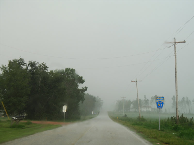
Other times it is fun to try to snap images, even while in motion, during the height of a massive thunderstorm. One such storm, pictured here, happened to me in late July of 2006 near Robertsdale, Alabama. This storm led me in and out of horizontal and torrential rains with lulls long enough for me to attempt snaps. Taking at look at this scene, you see a Baldwin County 83 marker ahead of a rain shaft. The trees in the shaft itself are blowing hard due to the high winds associated with the storm.
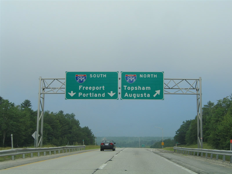
Other times it is the sutble in weather that adds to the day of roadding. Take this scene for instance, on the U.S. 1 connector westbound at Interstate 295 in Maine. What was a bright and sunny morning quickly became dim with low clouds and fog. The fog was not thick, providing a nice contrast between thin grey clouds with blue sky overhead.