
The second day of our Baja trip. We leave San Felipe and head back to the United States, making stops in San Luis Rio Colorado, and Tecate.

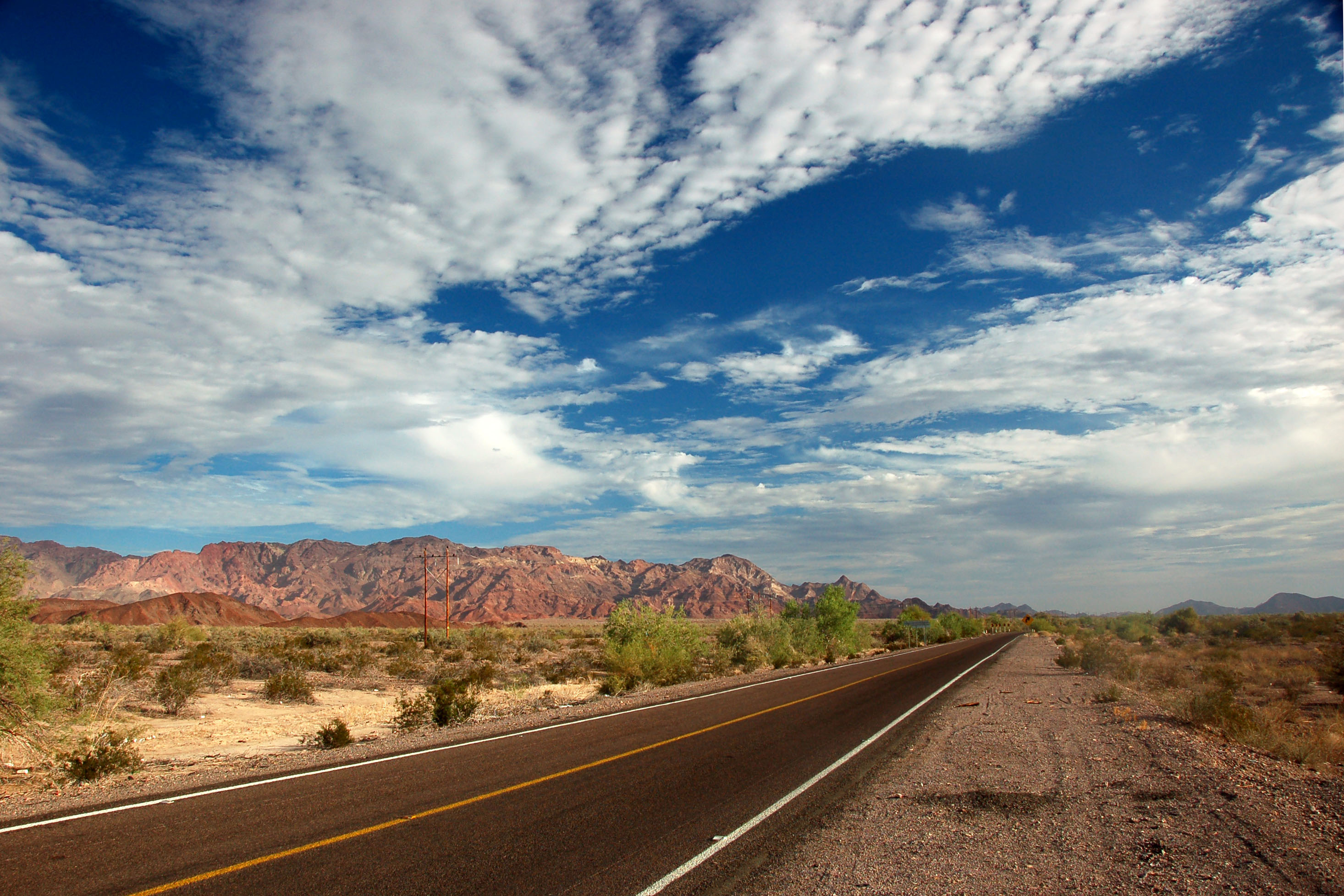
Highway 5, between the 3 turnoff and the desert just south of Mexicali, features this spectacular red-rock canyon.
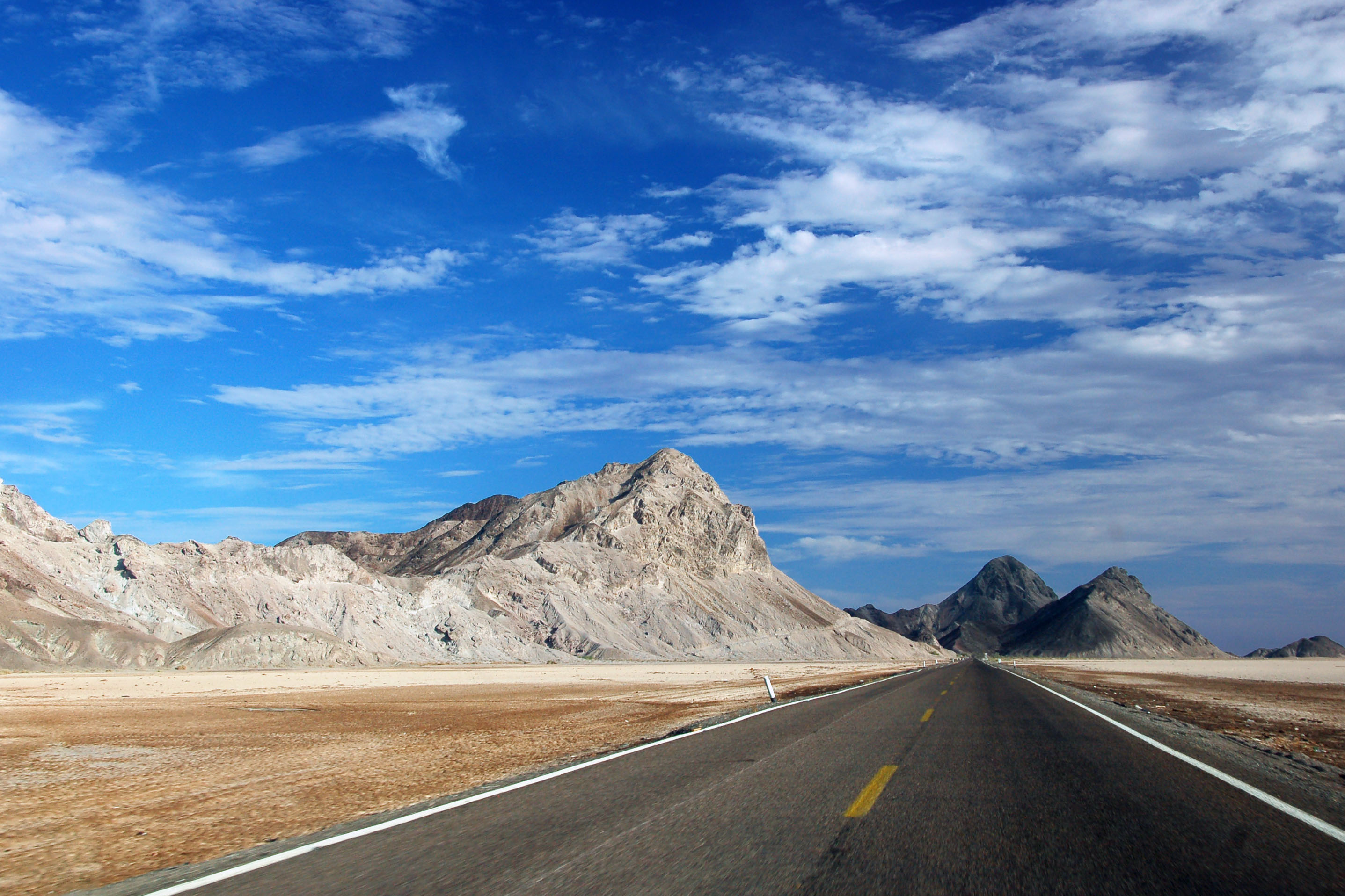
North of that canyon is another one, in the middle of a salt flat. The entire view is very similar to Death Valley.
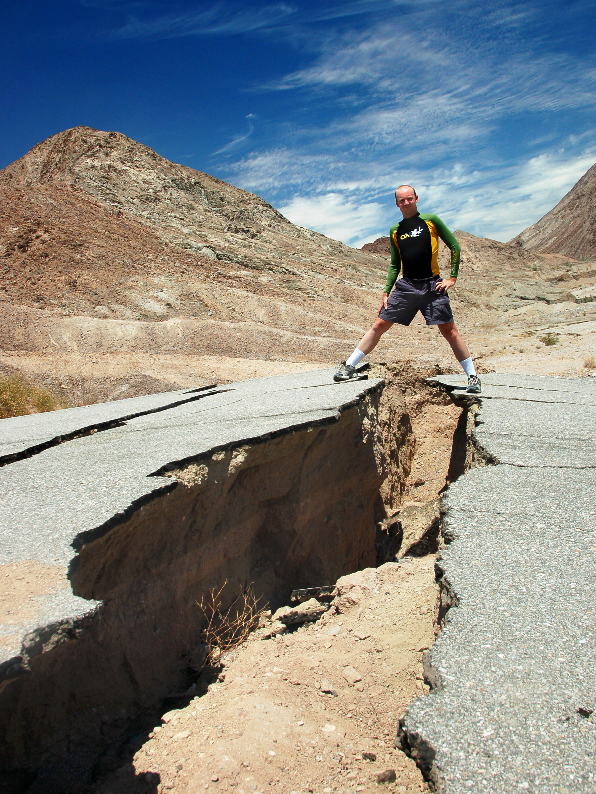
The fault. Mike stands astride an old alignment of highway 2 that was torn in half by the April, 2010 Mexicali earthquake.

Sunrise. Same beach as the night before.

San Felipe at early dawn, as seen from the beaches to the south.

Pelicans take off and head east.

Looking through a highway 5 bridge over a tide pool.
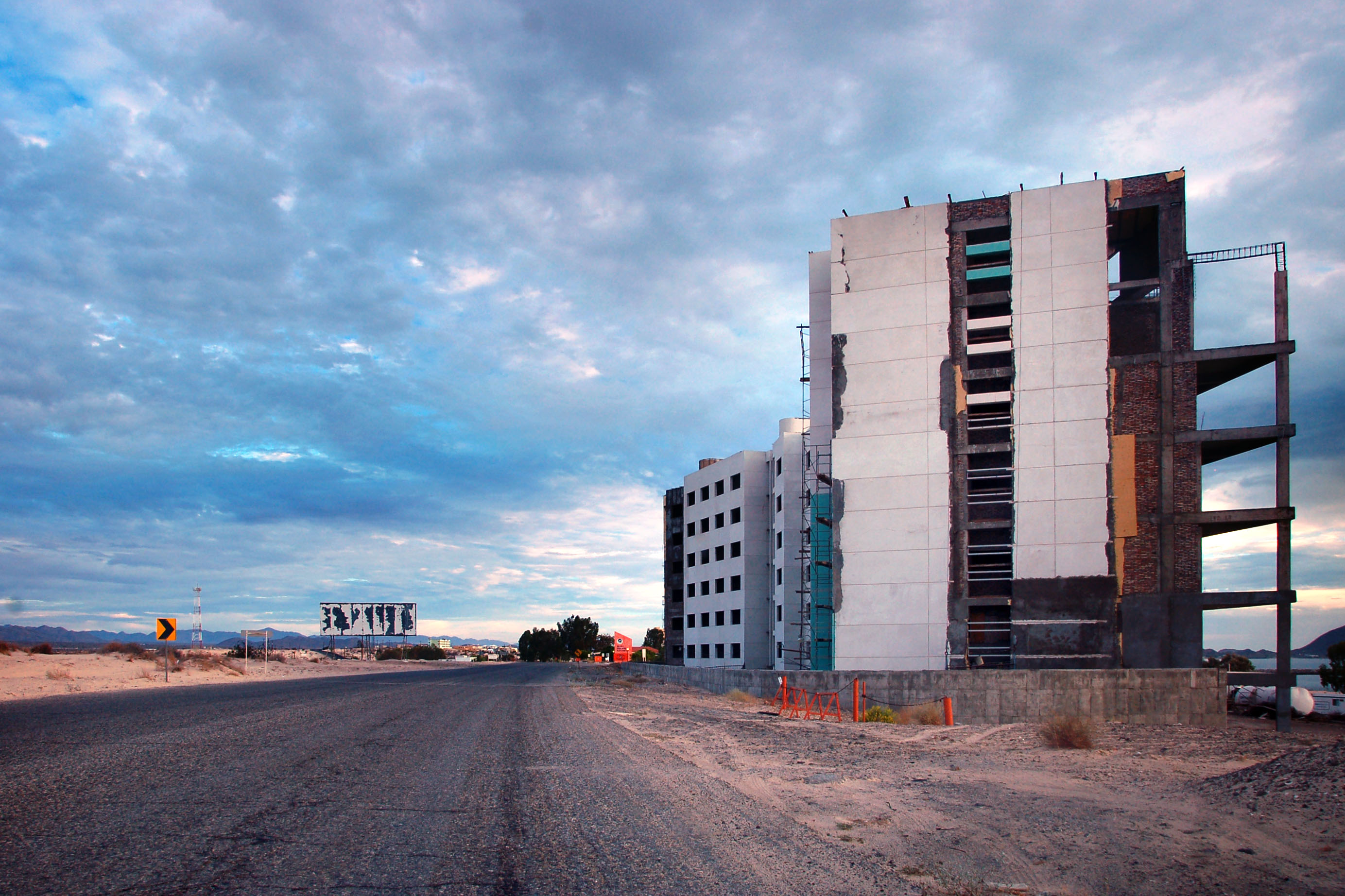
San Felipe – the last frontier of the real estate bubble. And one day the US economy crashed, and the yuppies stopped coming, and the buildings no longer got built.

Mountains to the west, as we approach downtown from the beach.

This older kilometer posts still stands, off to the side from the modern four-lane expressway.

View of Picacho del Diablo to the west.

Probably the most ironic of all the bubble-yuppie billboards.
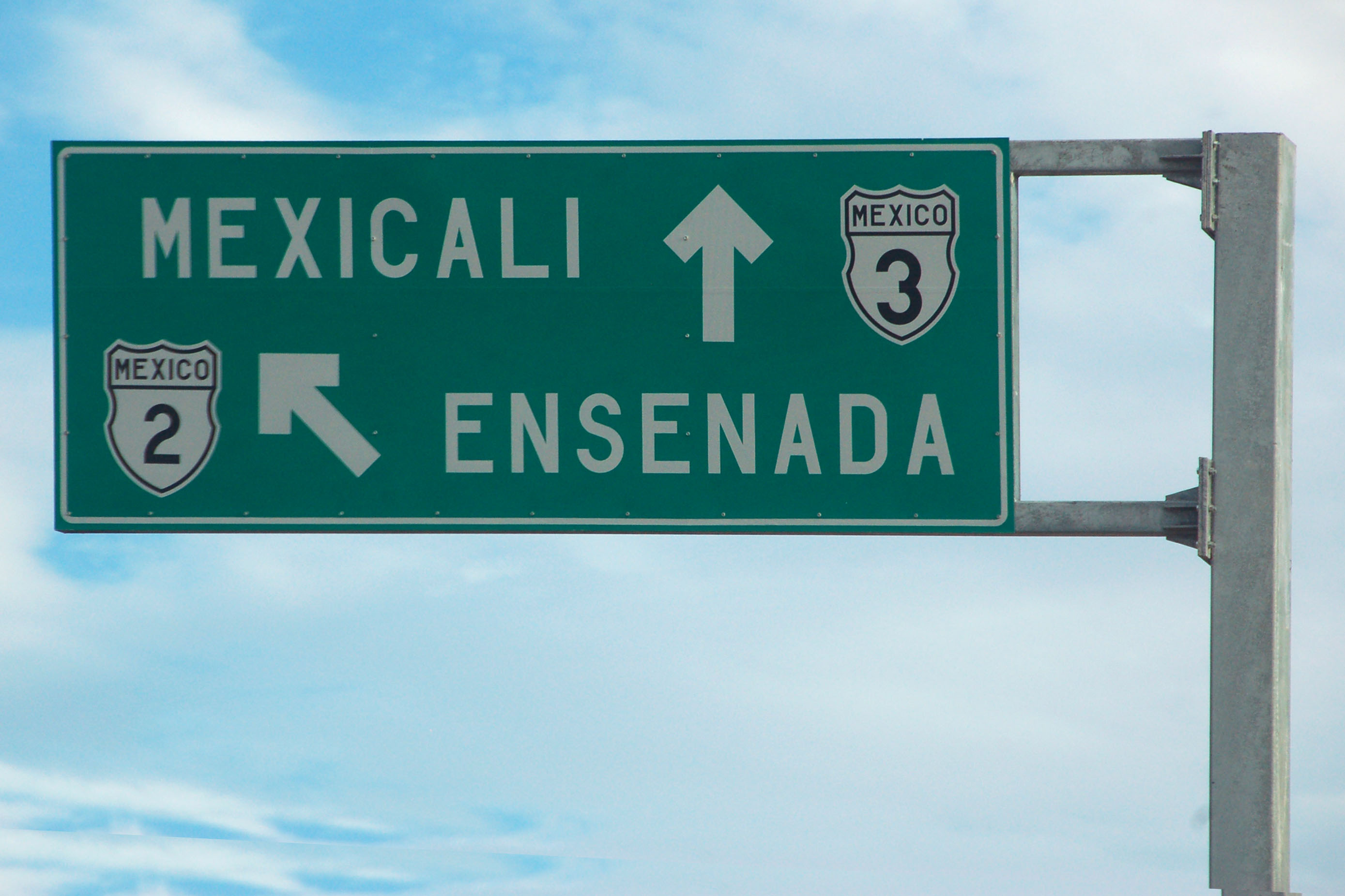
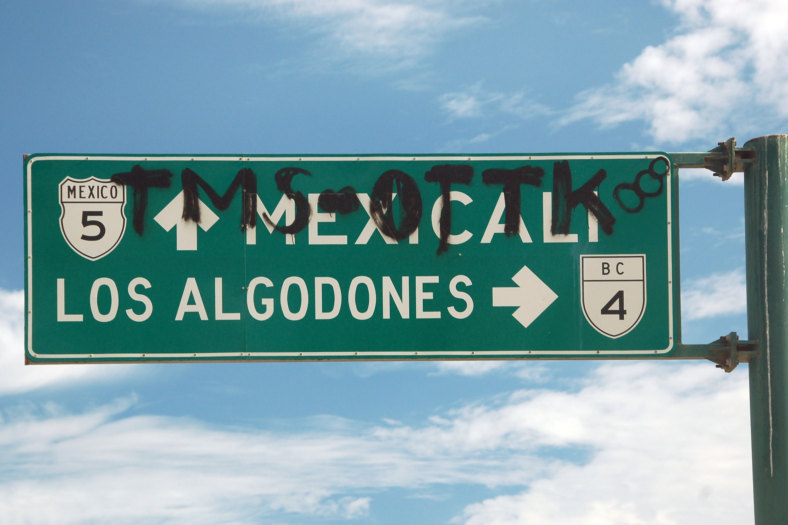
This sign just just flat out wrong! 3 does go through this intersection, but it is 5 that goes to Mexicali. As for Ensenada – that’s where 3 goes. 2 neither exists at this intersection, nor goes to Ensenada!

Yep, those are real vultures on top of the pole. They had been standing still when I got there, so I thought they were just scarecrows. Then they took off.
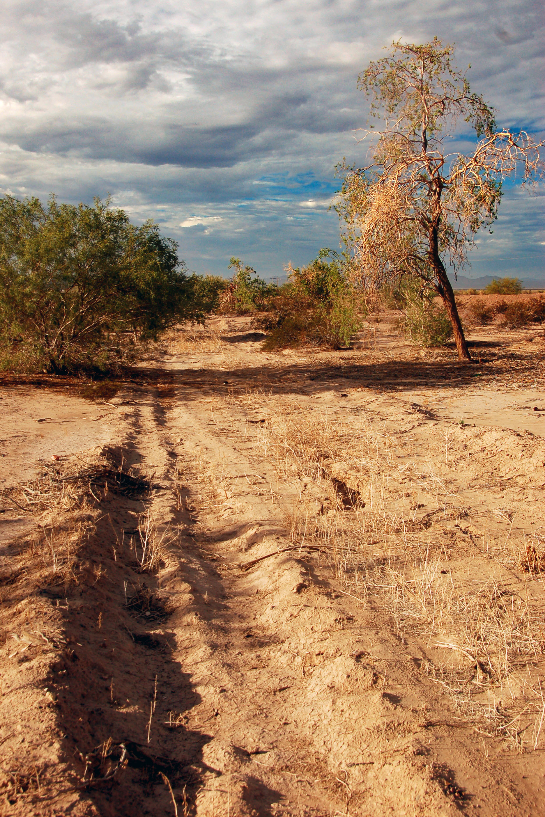
An old dirt trail runs parallel to highway 5.
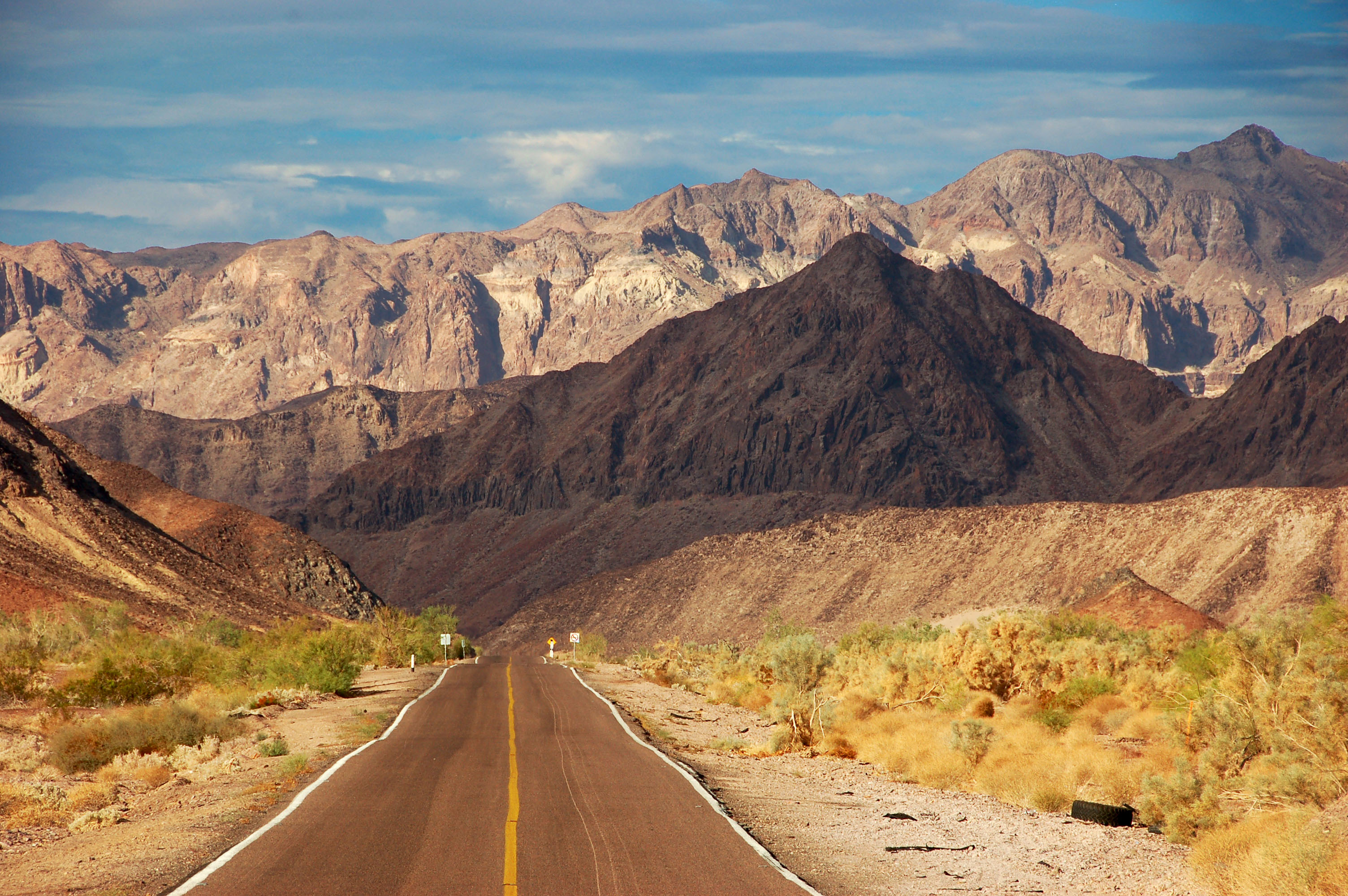
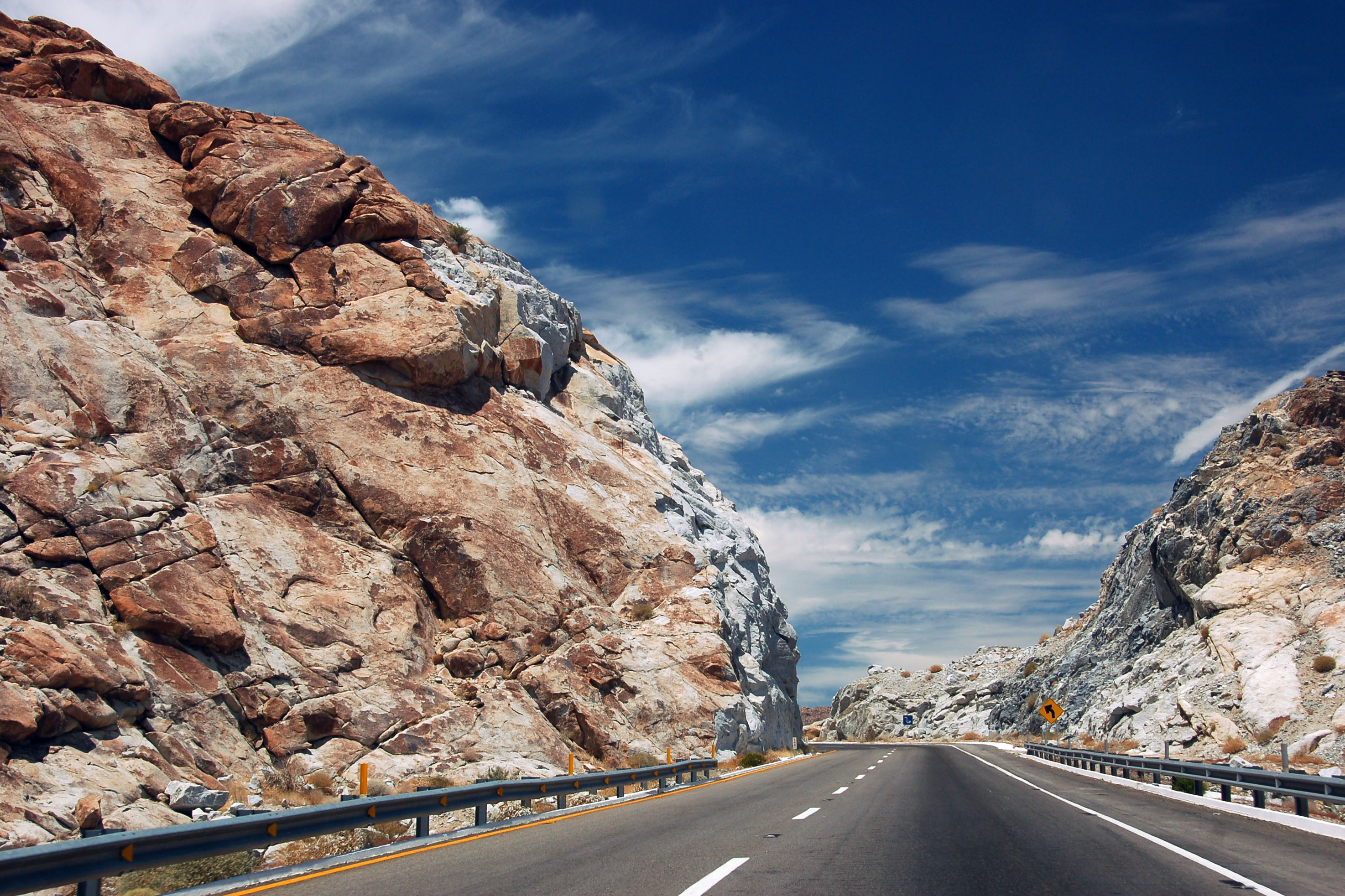
5 consists of a number of long straight sections. Connecting the two will be a canyon that goes through these red rocks.

Red rocks to our west.

All these red rocks were completely unexpected. The map labels a dry salt lake, and shows a straight section going through there, so we figured this other straight section would be similar. Nope, entirely different!
Here we see why the road isn’t going to go straight for much longer.
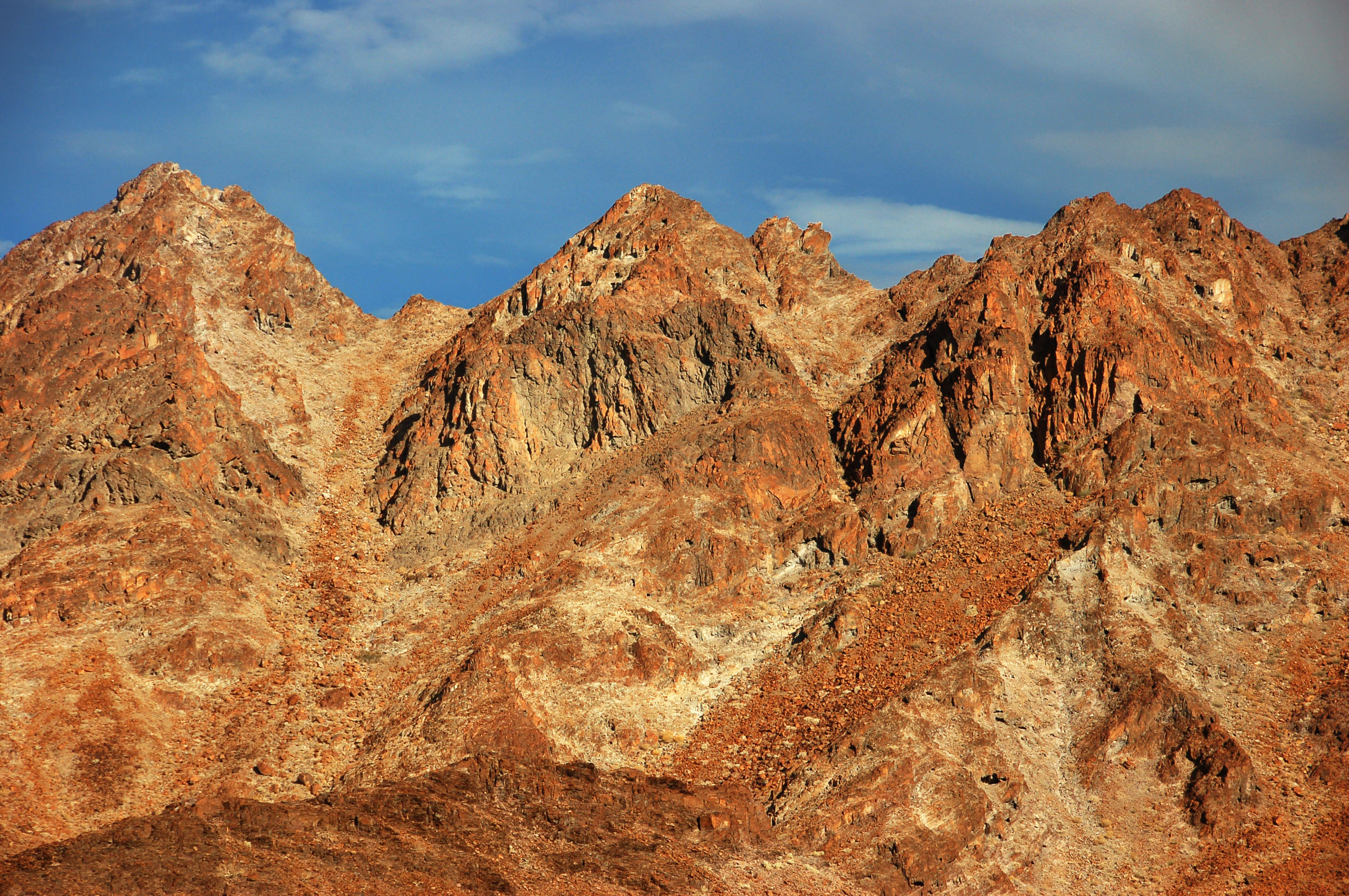
Yep, one more view of red rocks.

Mmm… winding. And pointy.

This is what happens when one shoots directly into the sun – every smudge on the lens flares out!
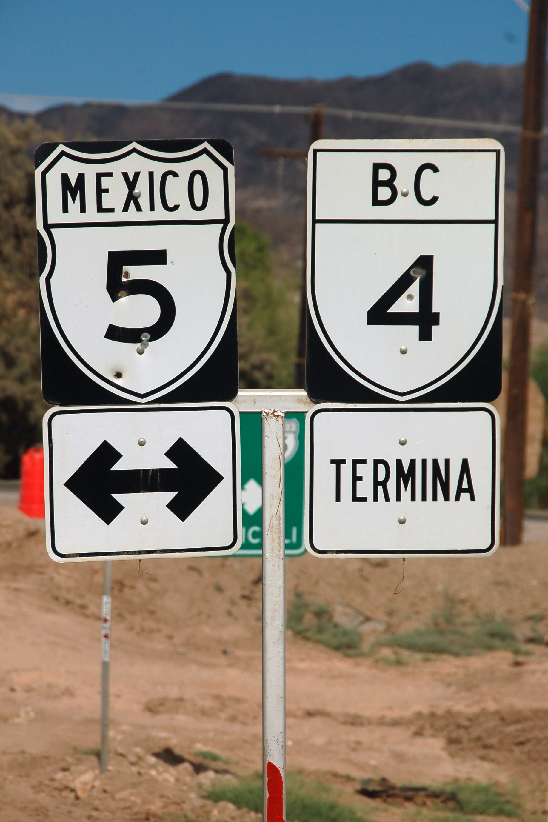
What’s this, a state route shield? They are impossible to find in the western part of Baja California, but here, they suddenly become quite common.
And here’s some stand-alone shields on a gantry, including an END marker! I knew these sorts of things existed in Mexico’s MUTCD but this is the first time I’d seen them used in the field.

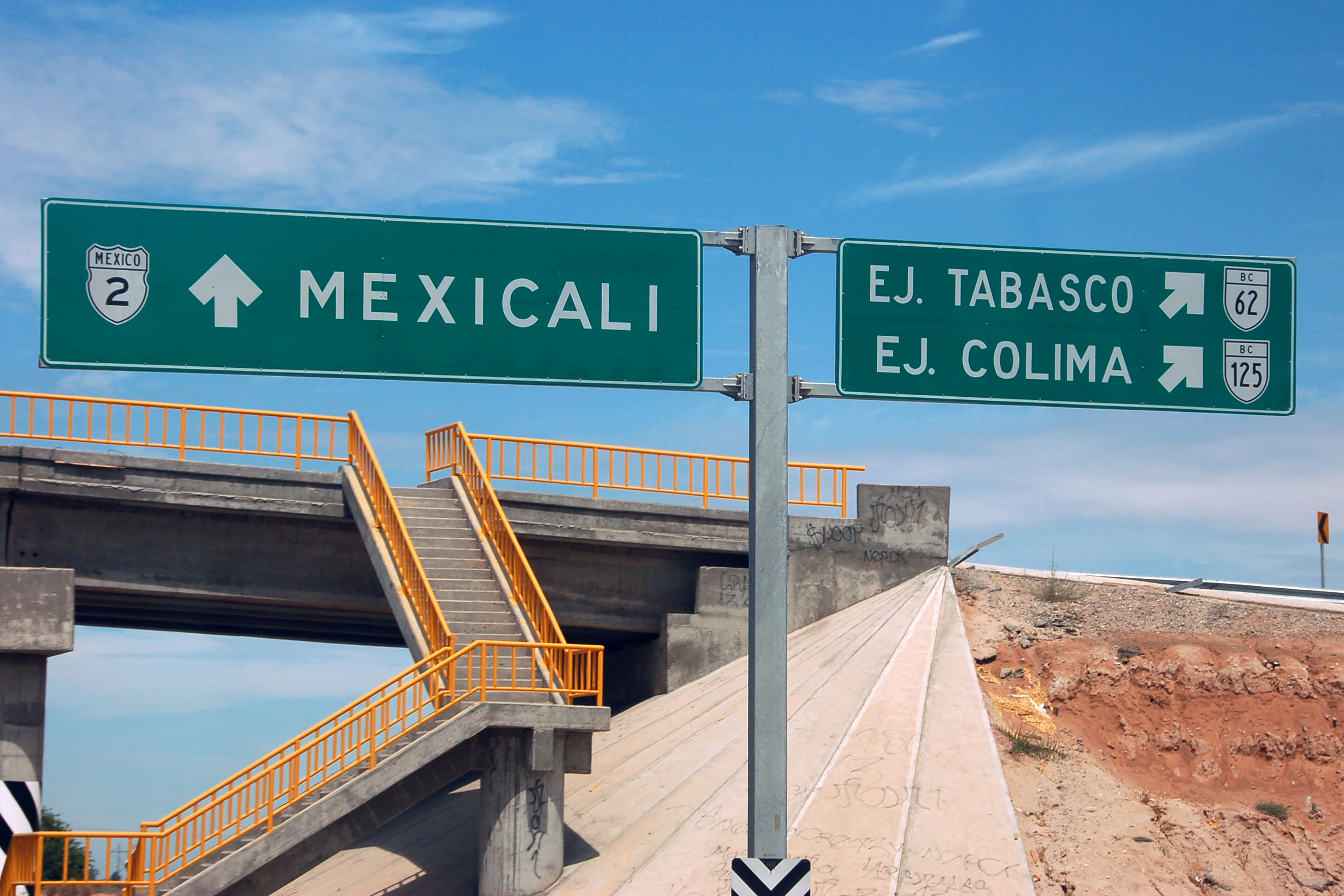
And even a BEGIN assembly! Here’s where we turn off of highway 5 to head to Sonora.

Michigan Left, because the entire intersection is being rebuilt. A lot of highway 5 is under construction due to it getting damaged by the earthquake.
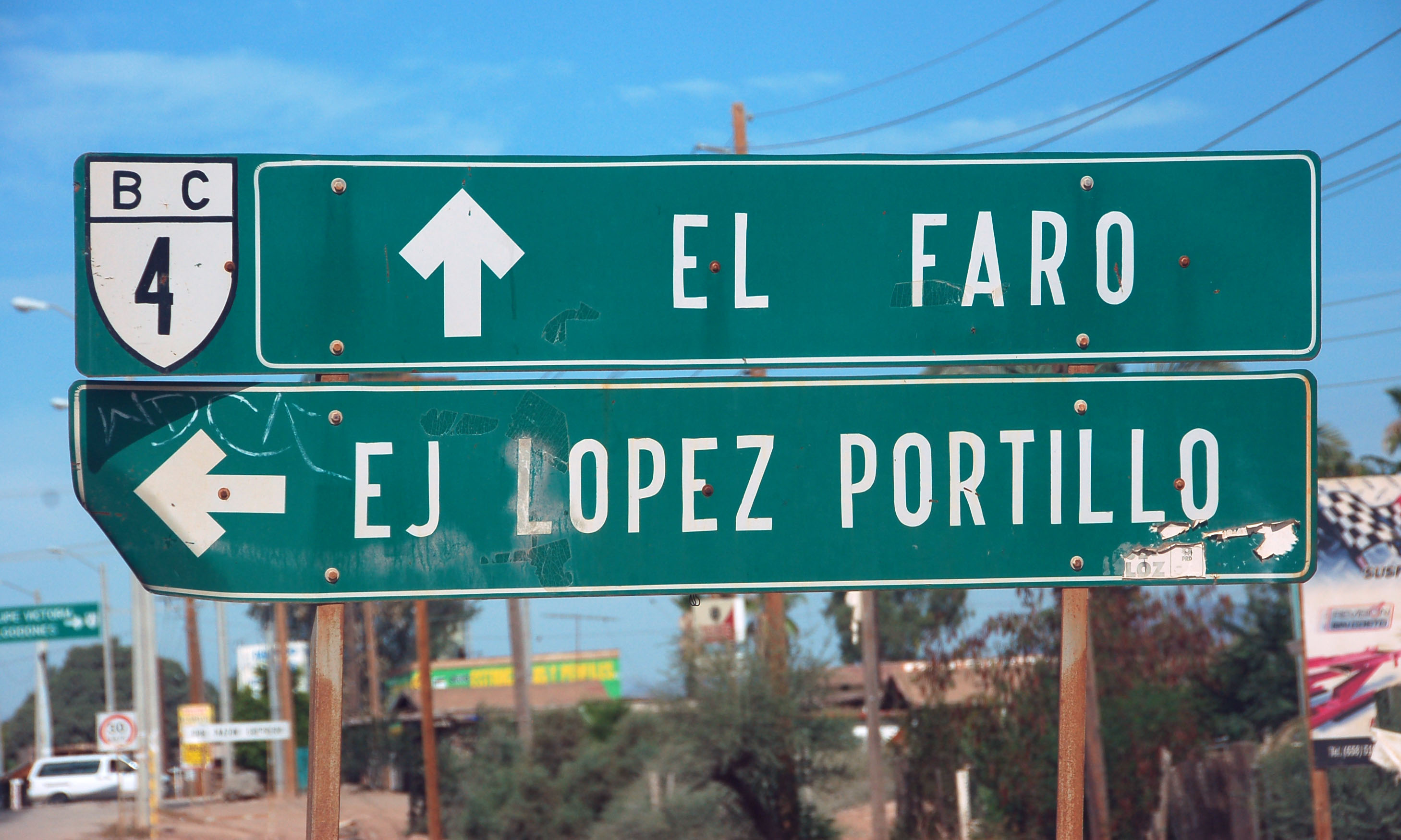
Older signs in one of the farming towns along BC-4.

We almost missed this sign, because it was not at a Colorado River crossing. The state line between Baja California and Sonora was the original path of the river, but it has been channeled and rediverted so many times, that now this gantry is in the middle of a town that is split between the two states.

Sonora really likes putting the zeroes in front.
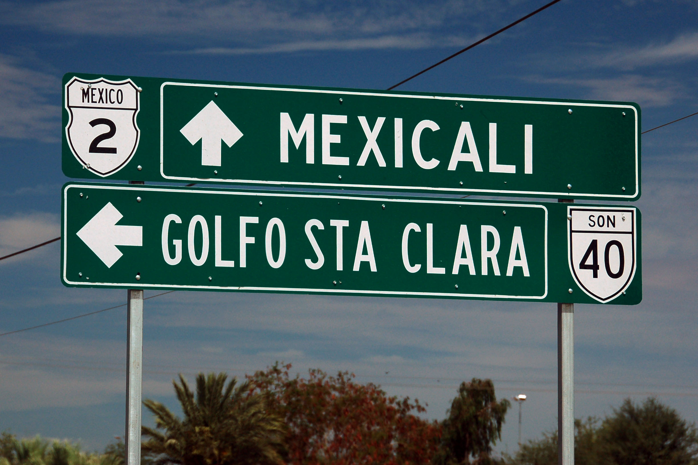
Golfo de Santa Clara is also a popular tourist destination, as is Puerto Penasco, which is just beyond on the same highway. It is rumored that this connecting highway exists and is open, but I cannot verify this fact! Google Maps does not show it to exist – but Google Maps also shows no road past San Felipe down to Puertecitos.
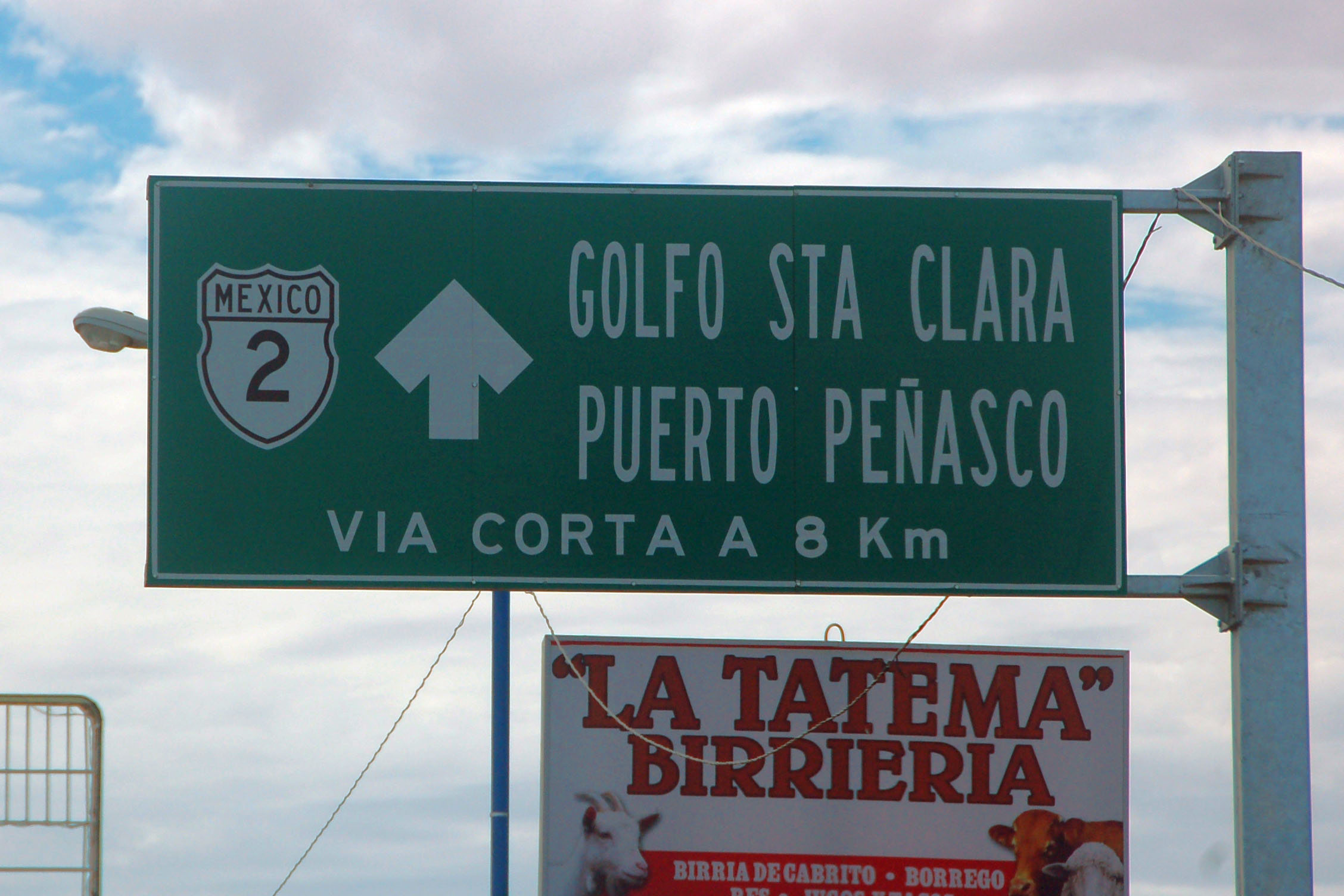
This sign is ambiguous. Two distinct roads branch off 2 – one to Golfo de Santa Clara (and Puerto Penasco?) and another, further down, to Puerto Penasco directly. But the fact that this sign mentions a “shortcut” implies a single road. Maybe.

And here, after a quick pit stop in San Luis Rio Colorado, we return to Baja California.

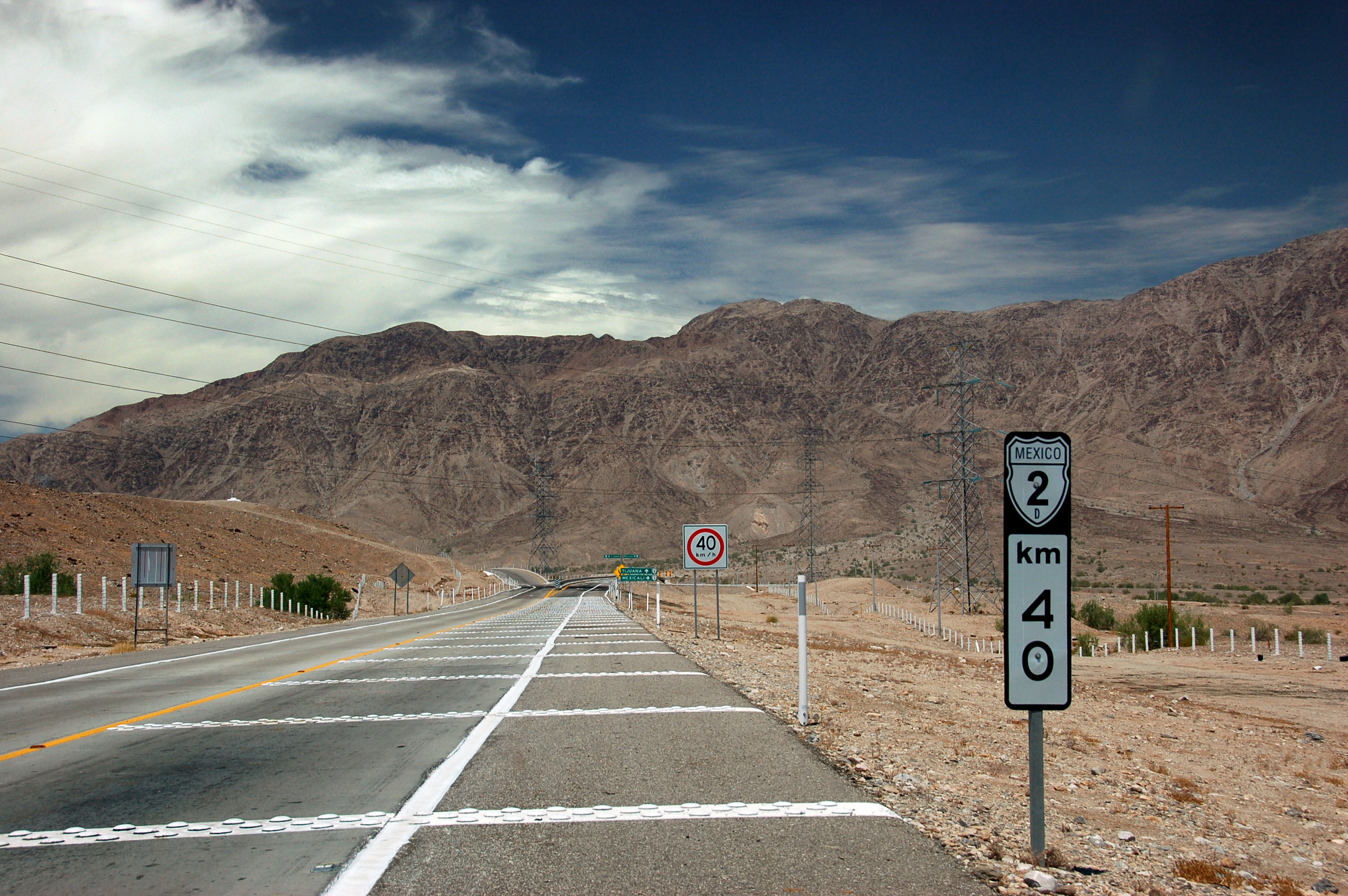
These shields have a green legend. The signs are all brand new, as highway 2 has only recently been upgraded to a four-lane expressway.
Technically, pedestrians are supposed to cross only along the specially built overpasses, but we saw more than a few people hopping the Jersey barrier and running for glory.
Algodones is a crossing to the US.

If you can parse this sign correctly, you win a prize. Hint: the left turn to get to Tijuana or San Luis Rio Colorado is not a separate ramp – it is the southbound lanes, off of which two ramps exit to get to highway 2D.
Here is where 2D, the Mexicali toll bypass, rejoins the free road through town. Note the extremely slow advisory on the curve – it’s actually perfectly well-built to handle traffic up to 100 km/h or so.
Our first view of the fault. It’s best seen just below the green signs.

Mike studies how the fence moved during the earthquake. Note the patching of the freeway – they fixed that within a couple of days.

The old alignment was left unrepaired. As it is behind a fence, no one actually uses it.

The fence was, at one point, straight.
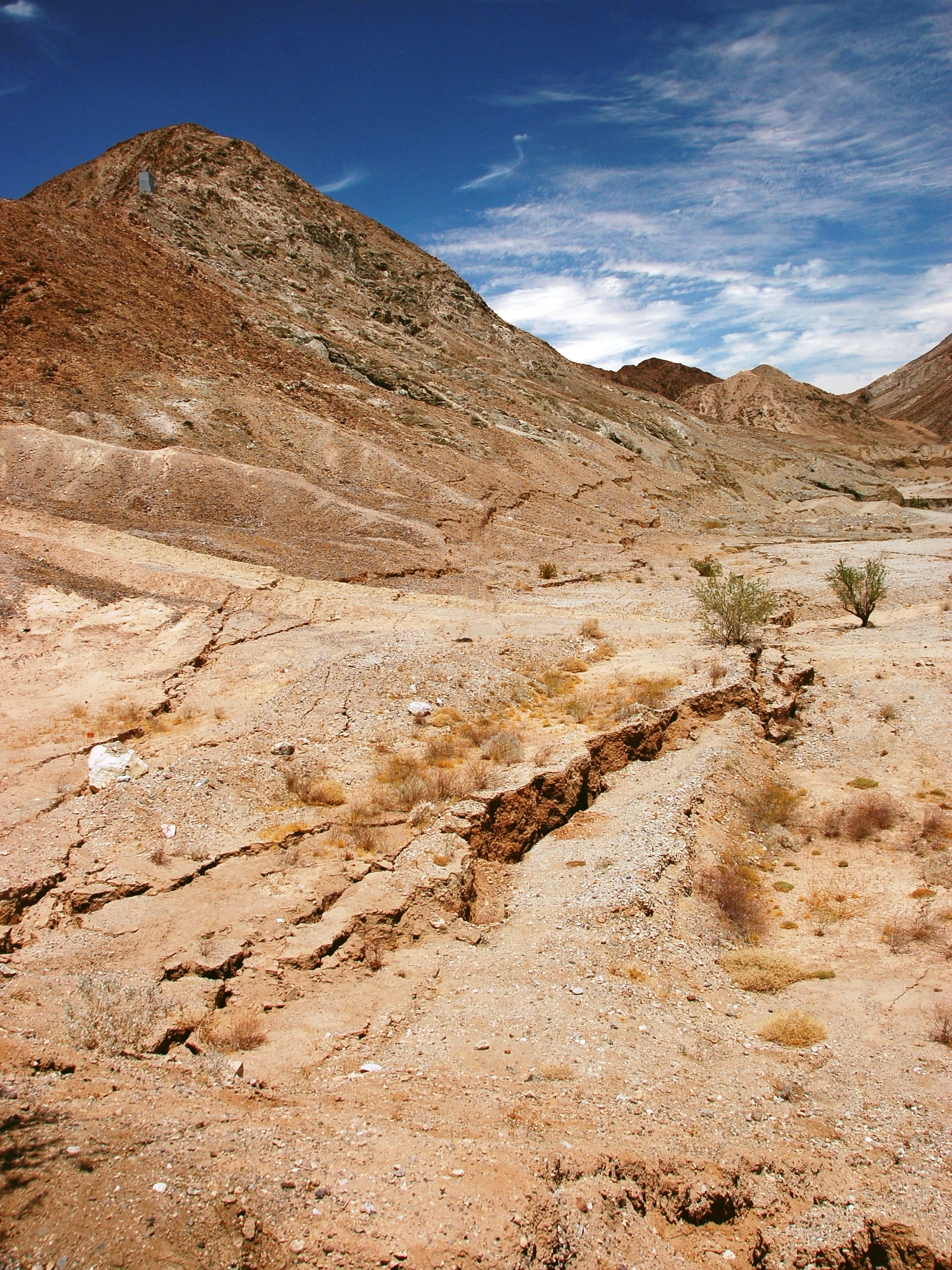
One more photo of the fault before we head west.

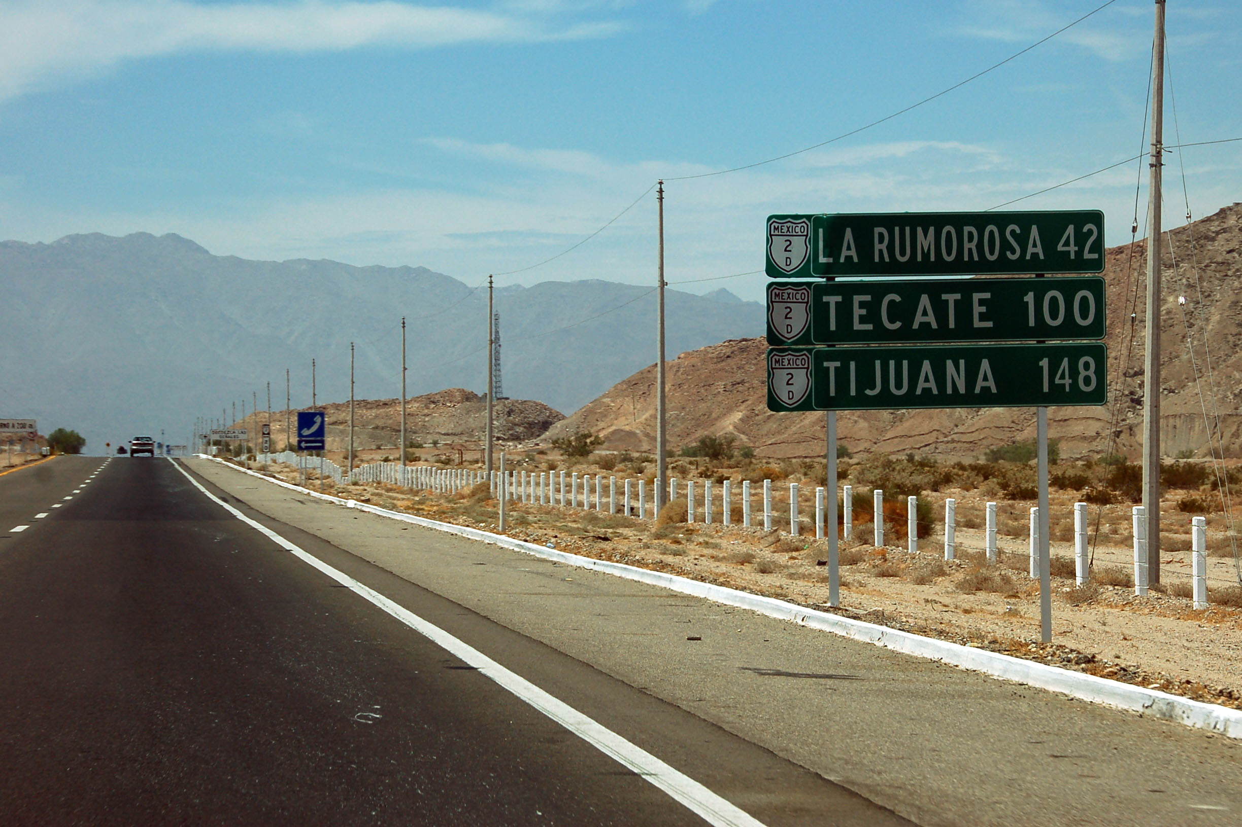
La Rumorosa is the pass off in the distance.

Our final military checkpoint. This is a built-up permanent installation, and its location is well-known. That said, we still saw someone pull up short, turn around, and in the median toss something out his window!

Up we go.
The original road is the eastbound lanes. The westbound lanes, which we are taking, were added in 1996, to create a four-lane freeway.
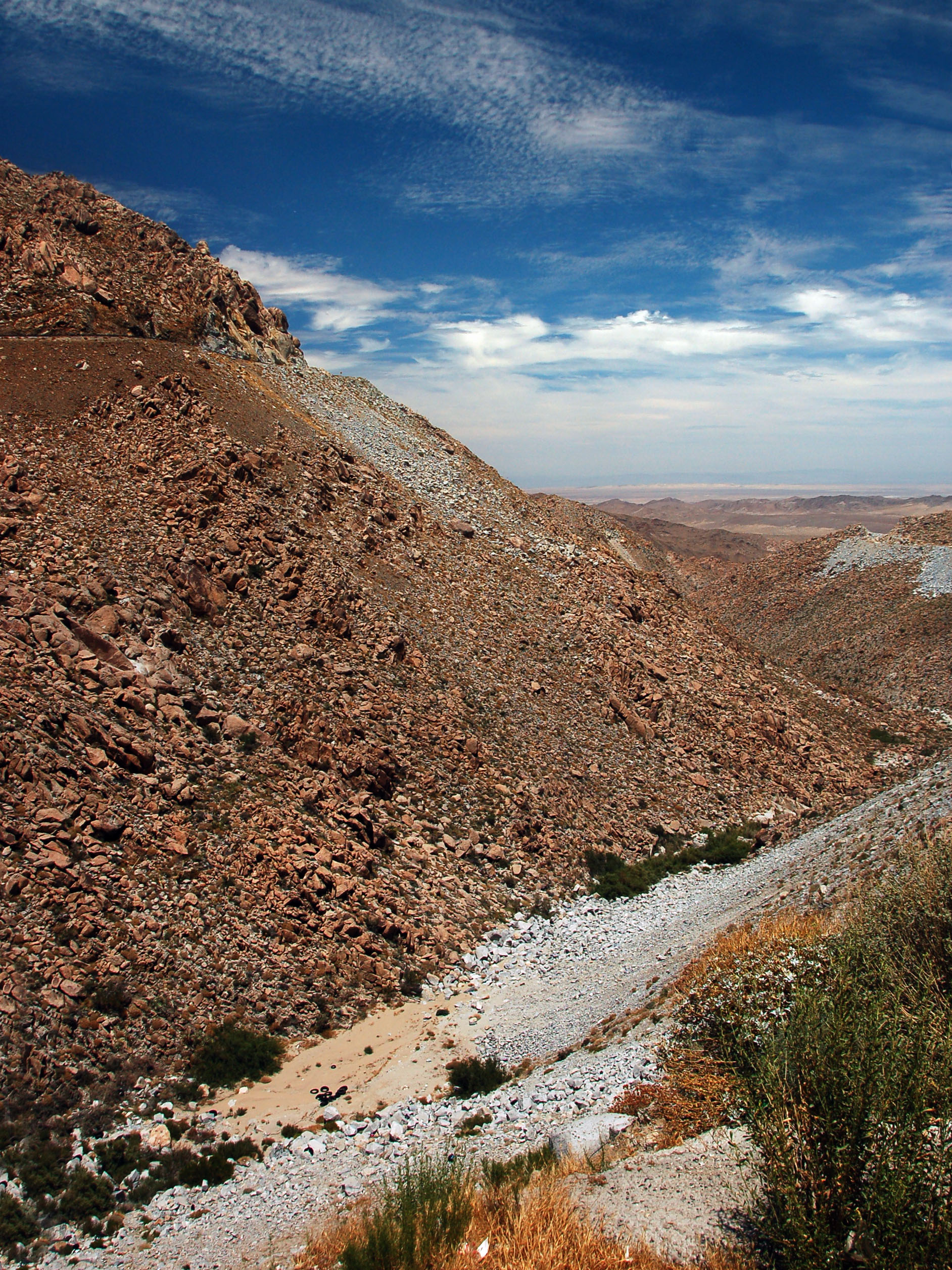
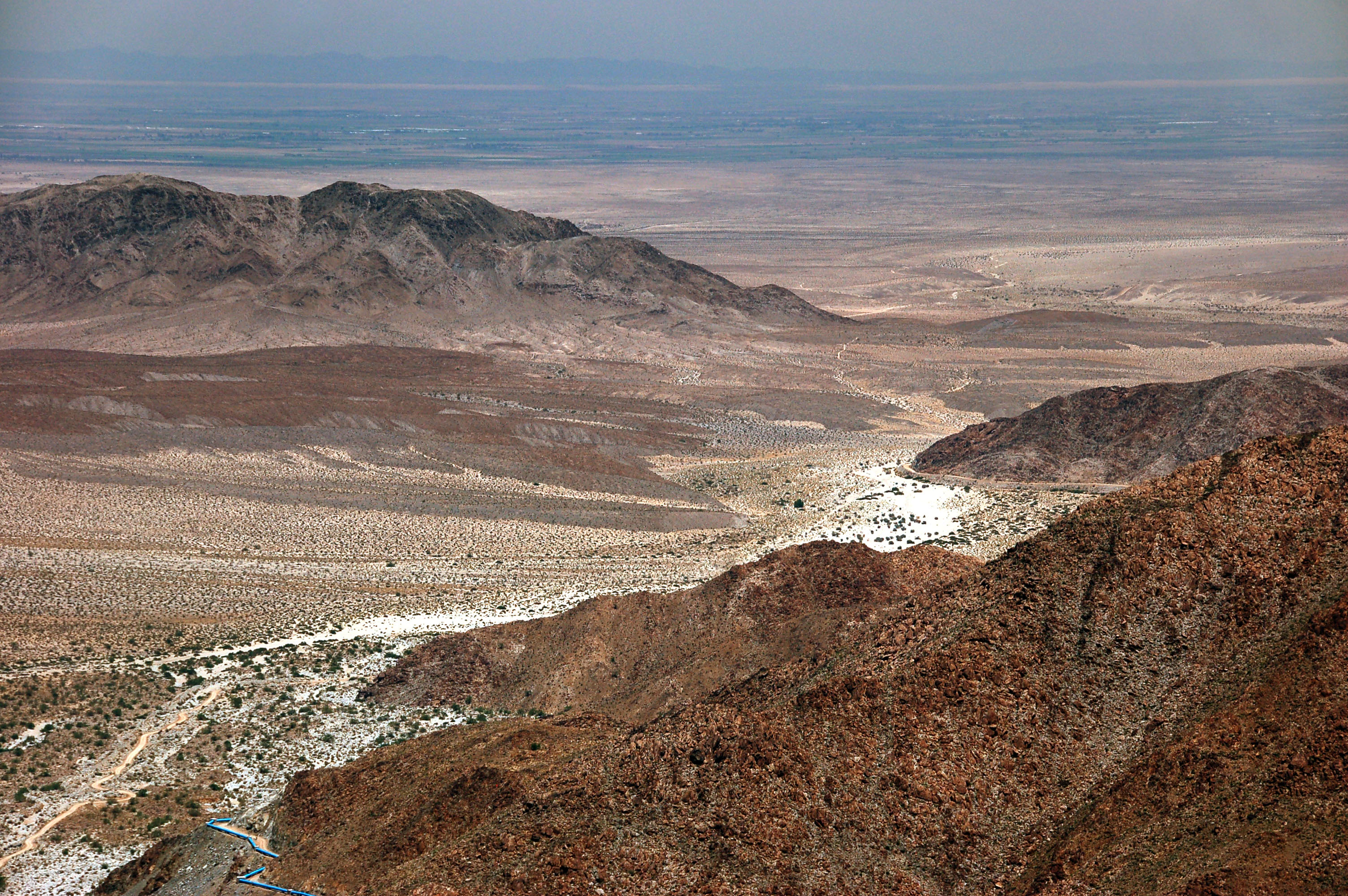
There are plenty of stopping points on the massive uphill grade. Here is the view from one of them, looking north. In the distance, one can see the Imperial Valley of California. Also note that we are nowhere near the top of the grade yet.
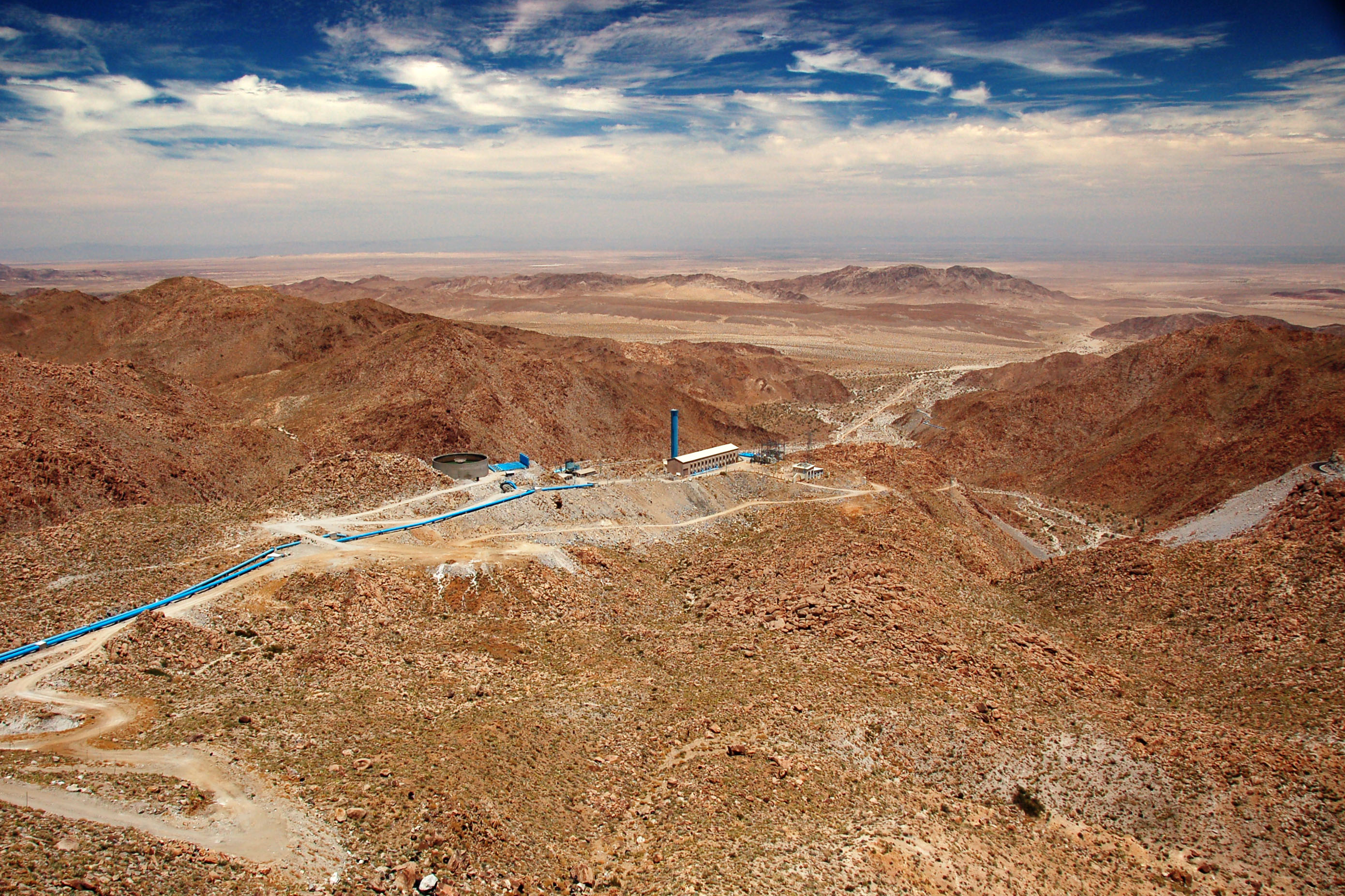
But we’ve certainly climbed a lot of hill. The blue pipes appear to be some sort of aqueduct that carries water over the mountains.
A significantly zoomed-in view. If you look really carefully, you can see Plaster City on old US-80 in the distance, just behind the black hills on the left.

Top of the pass. 3861 feet, which compares favorably to interstate 8’s 4140 foot Devil’s Canyon climb.
After the climb, the road to Tecate is quite uneventful. This sign is somewhere on the Tecate business loop.
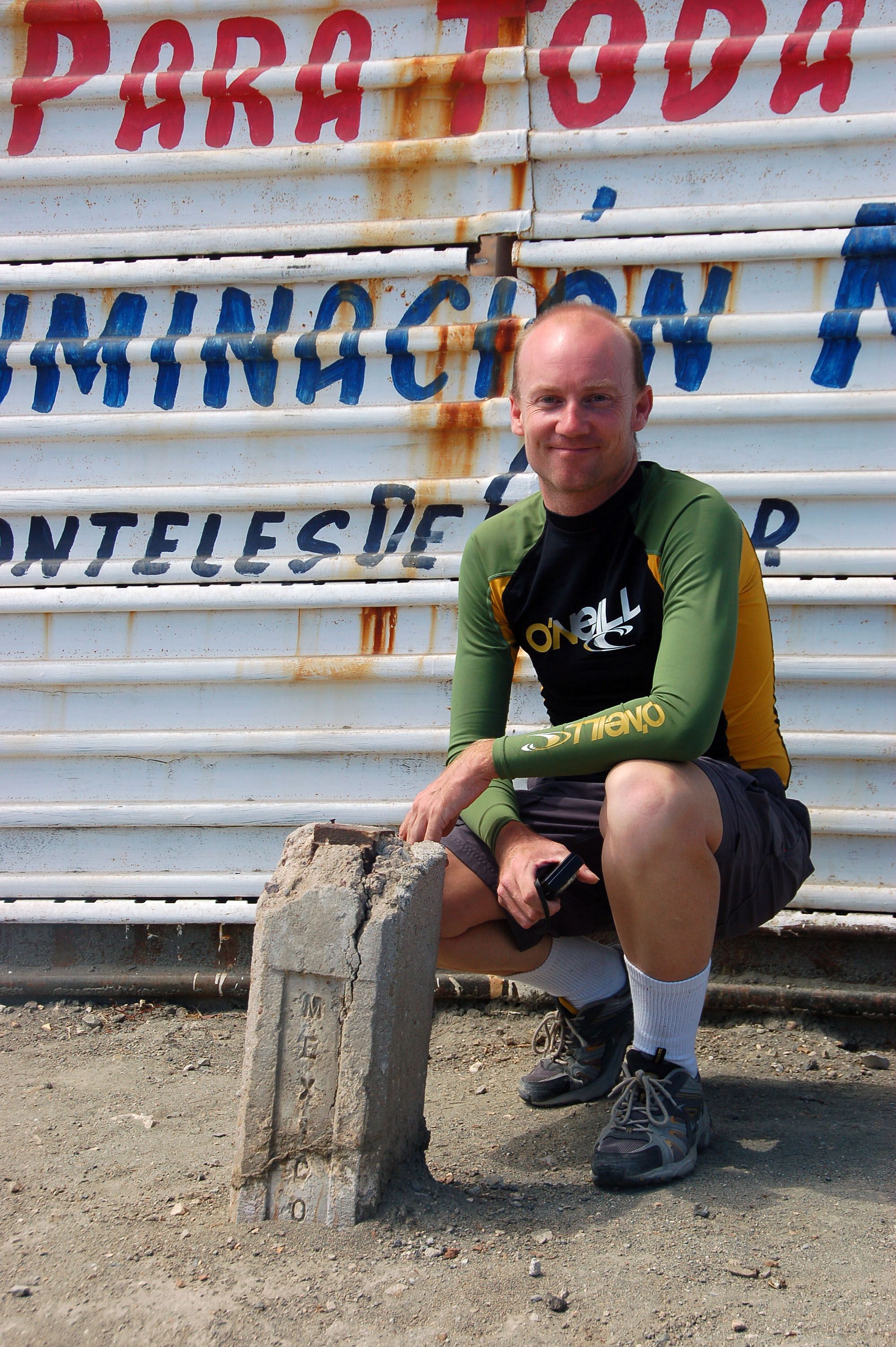
Here, Mike has crossed into the United States, without all that hassle of the border patrol. Too bad there’s a fence behind him – a fence covered in Mexican advertisements, it should be noted. The US government has effectively ceded control of a two-foot-wide strip of land at the border to Mexico without any sort of a struggle. And to think how protective of it they claim to be.
The crossing into the US was uneventful, but the border patrol could not answer our question about whether we needed to surrender the FMM card upon our return. (Well, Mexican immigration law really isn’t their area of concern, so it’s not surprising that they don’t know the answer.) Turns out, we probably did have to give back the card.
So now I have an FMM card that’s valid for about five and a half more months, but who knows how much hassle I’ll get the next time I return without an official exit stamp on my passport. I get the distinct idea that my dollars, and my willingness to spend them, will go a long way towards reducing the complexity of the process!
Thanks for posting these pictures :) Some of these landscapes would had been perfect for filming western movies.
Any plans to cover the area of Monterrey or even Mexico City?
plans, yeah absolutely; I really like Mexico and would love to do more exploring, but I am not sure when I will get to deep into the inland. My next major Mexico trip will be a week-long excursion all the way down the Baja peninsula to Cabo San Lucas and back.
Hello!
This is an amazing collection of photos! I’ve written a novel about a father-son desert road trip, and the picture at the top would be a perfect book cover. The caption:
“Highway 5, between the 3 turnoff and the desert just south of Mexicali, features this spectacular red-rock canyon.”
I’d like permission to use this photo. Please let me know if you have any conditions or if you simply deny.
Thank you!
Todd
Hi Todd! Glad to see that you are still writing. I miss you very much and love you. Your big sis, Vicki