
why look, some actual content!
These are some photos taken by Lou Corsaro and me on a trip to Baja California, on August 11th of this year. We took federal highway 1 south from Tijuana to Ensenada, and a bit past that to the turnoff to La Bufadora, and then back to Ensenada and up highway 3 to Tecate and back to the United States.
Obligatory teaser picture:

La Bufadora, just south of Ensenada. Waves crash against a rock formation that reflects them straight upwards.
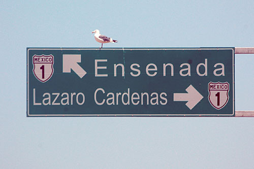
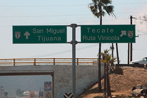
Obligatory teaser picture, highway sign division:
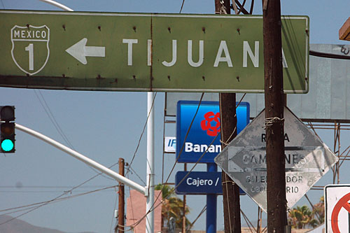
Two old signs to be found here: the green guide sign with the outline shield dates back to the 1960s. The diamond “ruta camiones” (truck route) is similarly old, and is patterned on a 1910s Auto Club of Southern California diamond-shaped sign that very likely hung there for 50 years before getting replaced by a copy that was almost identical, but reflective.

Our first photo of the morning, in Tijuana. Brand new signs point the way to the toll road to Rosarito, and points further south. Alas, the sign is wrong: 1 is the old free road, while the new toll road is numbered 1D.
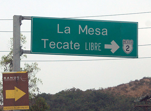
This sign correctly shows route 2 as going to Tecate; and also demonstrates Mexico’s use of Arial on their signs in recent years.
The toll road and the free route are very close together, and frequent sets of ramps connect them. Here is one possible entrance to the toll road northbound, with the option of continuing south without charge. The sign goes back to when the toll road was opened in the 1980s.
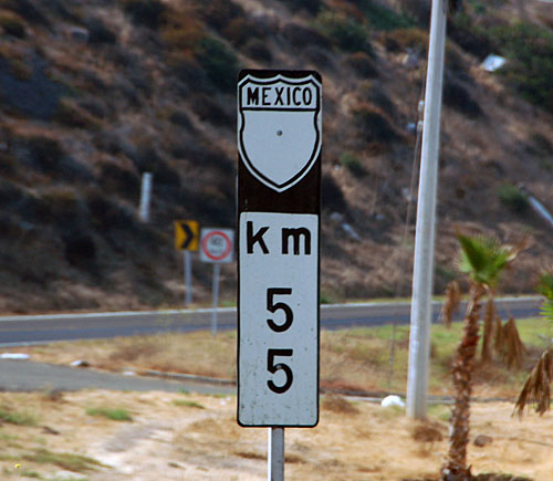
Mexico uses kilometer posts as reassurance shields. Stand-alone shields are very hard to find, having been replaced by these one-piece assemblies starting in the 1970s. On occasion, the route number is omitted. This happens to be on route 1.
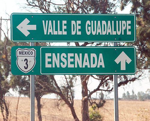
At the junction of current route 1, and old route 3. 3 and 1 are multiplexed southward from here to Ensenada, but the route is usually signed just as 1. Here, it is signed just as 3, despite not being the current 3 alignment.
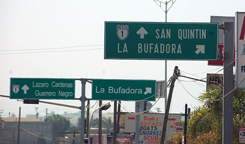
Here is the turnoff to La Bufadora. The access road is Baja California state highway 1, but no signs for it survive. In order to continue south beyond this access road, one must have a tourist pass. There is a checkpoint well before San Quintin (80 miles south). Tourist passes may be obtained at border towns both in the US and in Mexico.
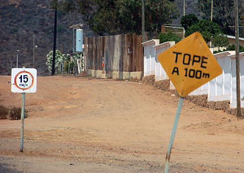
A tope is a particularly vicious form of speed bump, capable of separating man from transmission if crossed at more than about 5 miles per hour.
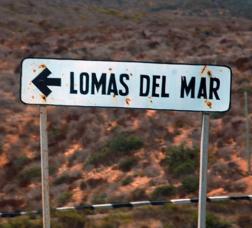
Hand-painted white guide signs for small villages abound on the access road.
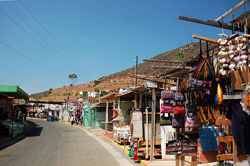
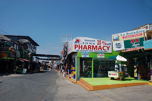
Here, the access road becomes pedestrian-only, and in order to walk down to the water, one must pass through all of these shops.
Get your Cuban rum here!
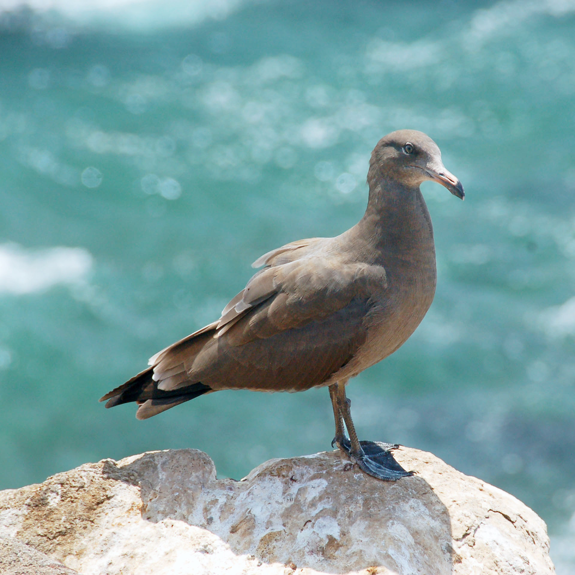
A seagull watches the proceedings.
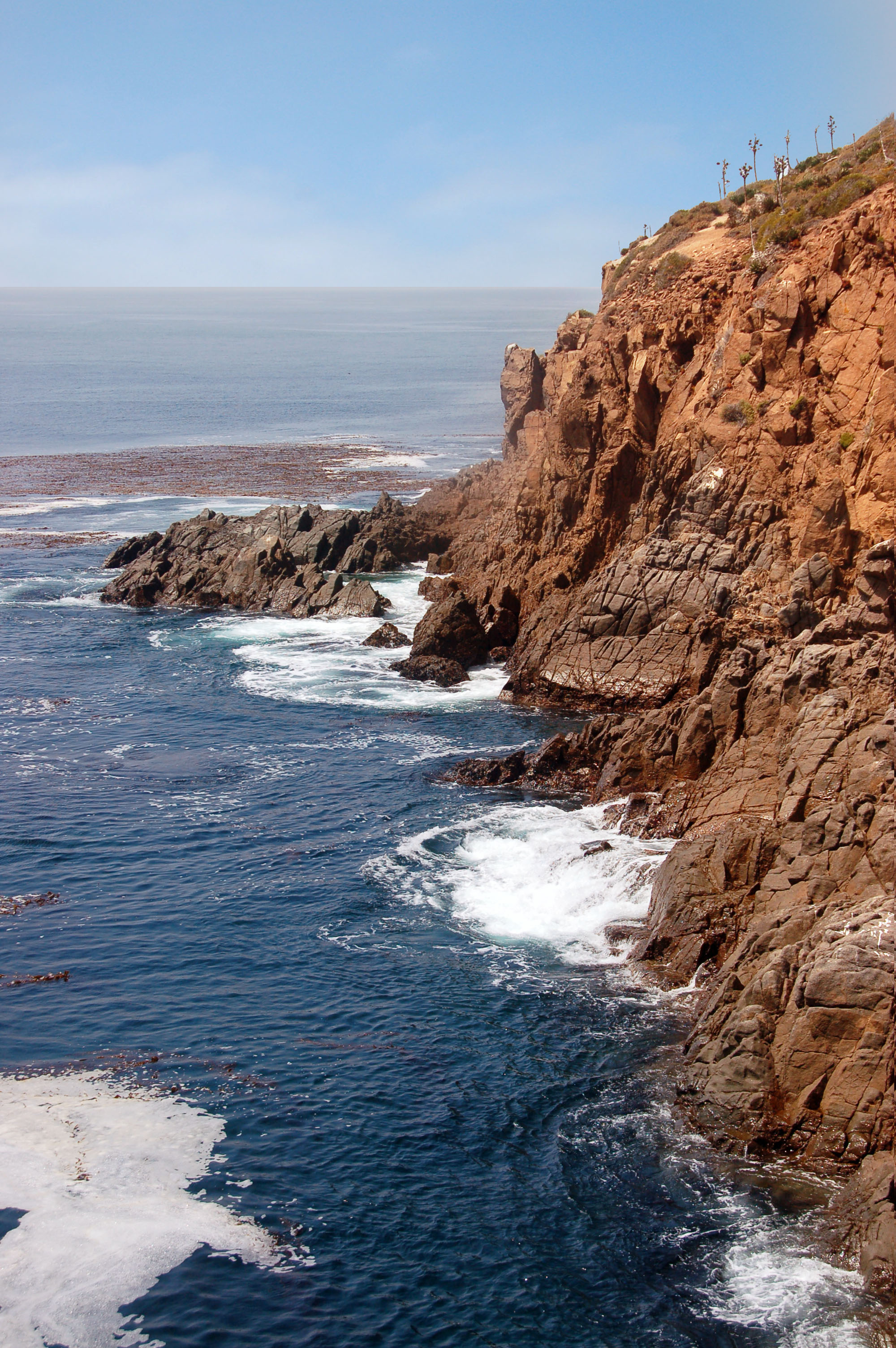
Here is the shore, once one gets past all of the shops. A bit further inland (towards the viewer), the shoreline jogs to the right and that inlet features the blowhole.
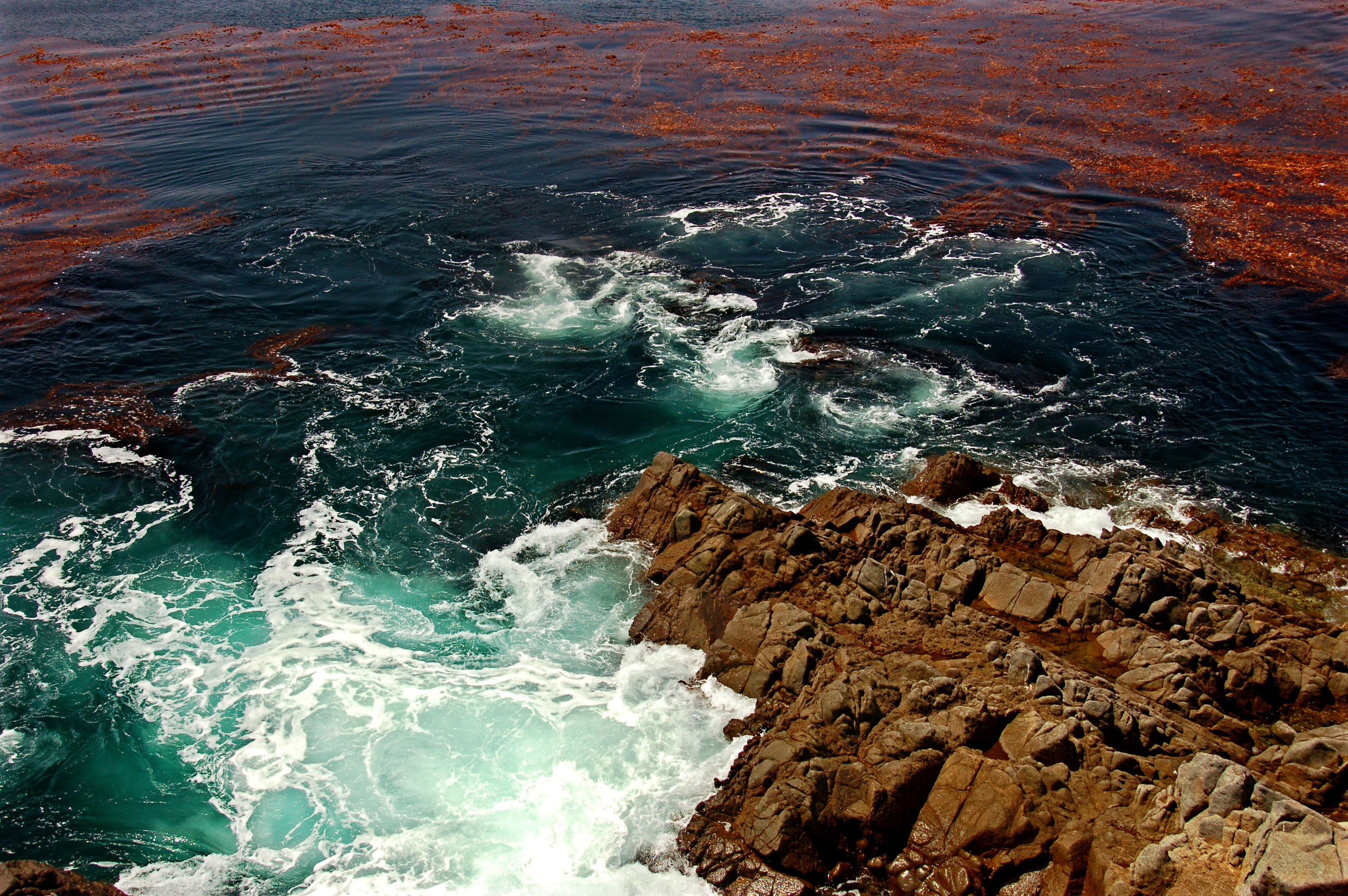
Red tide and green plankton.
Here, we return from La Bufadora to federal route 1.
More un-numbered shields along federal highway 1.
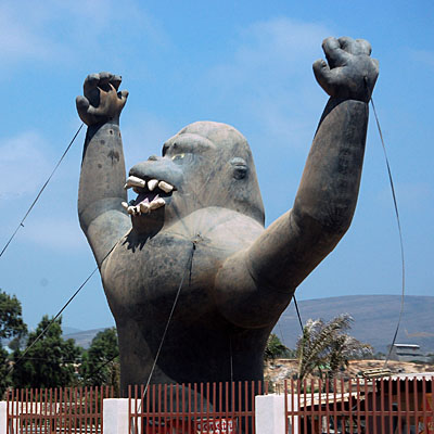
Nothing to see here. Just a big, murderous ape.

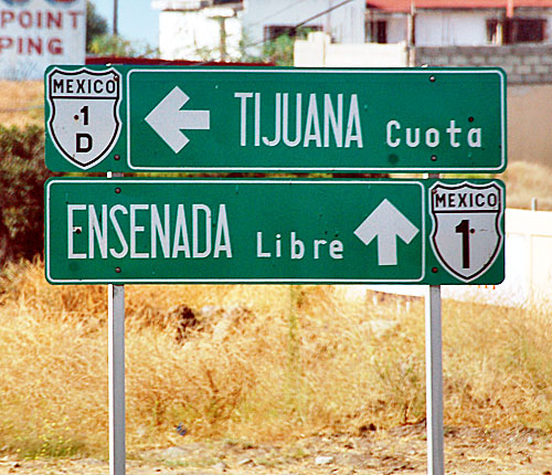
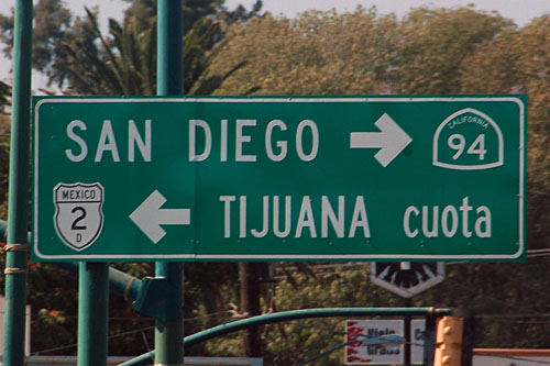
The south end of the 1/3 multiplex. Here, 3 turns southeast and heads towards route 5, which then goes to San Felipe along the Bay of California shore. 1D is incorrect: the toll road does not begin until north of Ensenada, whereas this sign is in the southern part of the city.
The old split between 1 and 3, before the “tourist route” seen above was signed. This is now the truck route for 1, and the old split is denoted with some very old green guide signs in all directions.
White guide signs with shields on them are plenty hard to find. This one is on the truck route (old 1) in Ensenada.
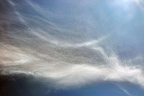
A parhelic circle – the arc-shaped halo passing through the sun is a result of ice crystals in the upper atmosphere. It is similar to the standard halo around the sun, but caused by a different shape and orientation of crystal.
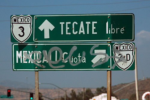
The north end of the 1/3 multiplex. We take 3 inland to Tecate, instead of returning along 1 to Tijuana.
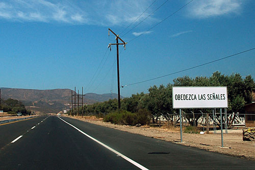
This sign literally says “obey the signs”.
The new 3 alignment is a four-lane expressway from Ensenada until its junction with the old 3.
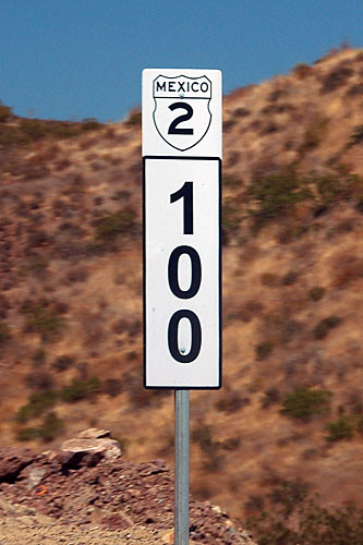
This very nice new kilometer post not only conforms to an older standard (white background behind the shield), but is also incorrect: we are on route 3, not 2.
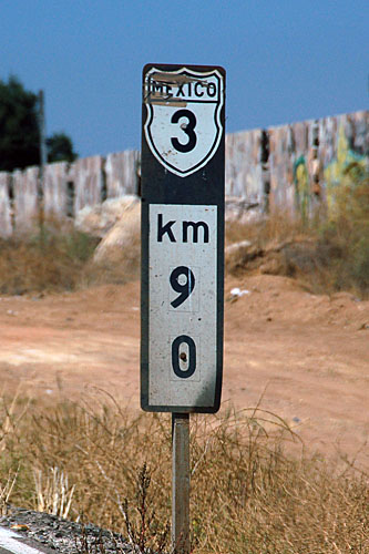
This one is correct. The 90 has been patched over another number.

After the new and old alignments rejoin, we pass through this rock cut.
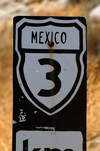
This kilometer post appears to have had its legend cut out from vinyl by hand.
The 2D toll road connects Tijuana to Mexicali, and features a bypass of Tecate. Here we are approaching the bypass, on the south side of Tecate. The northern end of the town is right up against the US border.
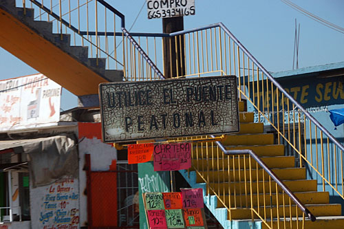
The decrepit white guide sign urges pedestrians to use the bridge, instead of attempting to cross six-lane route 3 on a dash.
Several of the cross streets lead to 2D, so they are all trailblazed as such. The old border crossing was straight ahead, but now 3 takes a jog to the east by a block to allow for a new, larger facility on the United States side. Route 3 connects to California state highway 188, which is only about a mile long before it runs into California state highway 94.
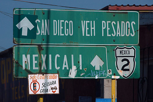
This old guide sign gantry has been patched to show the new way to go. Both cars and trucks (“vehiculos pesados”, heavy vehicles) use the same expanded crossing.

A blue California 94 trailblazer. Someone in Mexico must’ve gotten the specs wrong.
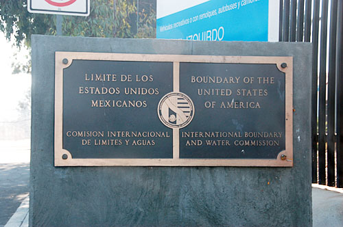
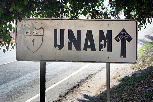
The last sign in Mexico.