
State Route 80 / Historic U.S. 80


Arizona 80 follows original U.S. 80 between Benson and the Arizona-New Mexico State Line near Rodeo, New Mexico, via Tombstone, Bisbee, and Douglas. This historical route is rife with tradition and folklore, including the haunted hotels at Tombstone and the Lavender Pit at Bisbee. U.S. 80 was removed from this route in 1989, as much of the rest of the route was replaced by Interstates 8 and 10 west of El Paso.
Arizona 80 Guides
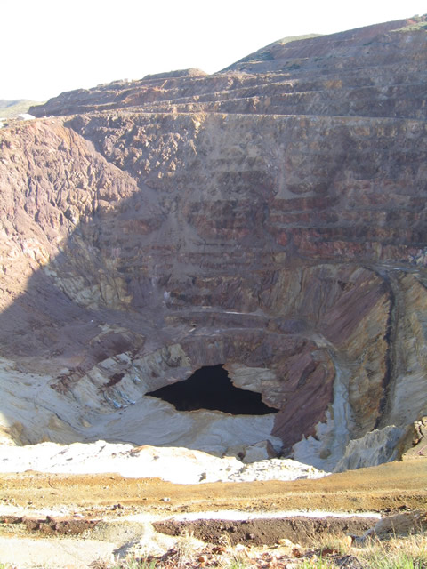
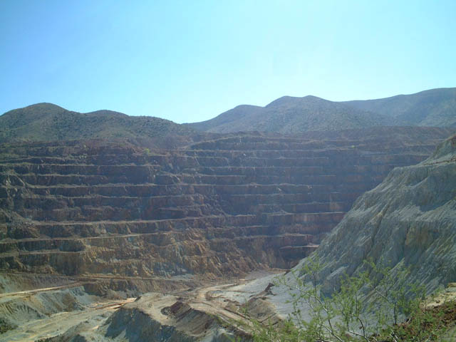
This photo shows the massive Lavender Pit, which was last mined in 1975 by the company Phelps Dodge. Some have suggested that additional mining could occur here, but it would require expansion of the pit, including the bench on which the highway now sits. Therefore, any additional mining activity here would require relocation of SR 80. Since mining is not the focal point of the city, Bisbee now hosts a variety of retirees and artists who have changed the town significantly since its mining heyday in the early 1900s-1910s.
03/26/04
Many of the signs proclaiming the history of the Lavender Pit are laced with graffiti, including some in Spanish that shames the Americans for creating such a large sore on the earth and not taking into account the beauty of the land. Any expansion of the Lavender Pit will require a great deal of environmental review, but to many, the damage caused by the pit is already wrought. It will be interesting to see if additional mining could be allowed here.
03/26/04
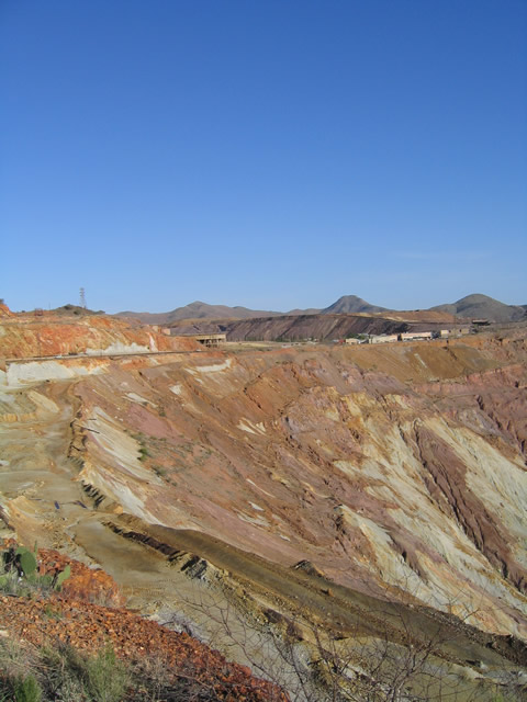
The Lavender Pit spreads out front the parking area adjacent to SR 80. The sight of this pit to the uninitiated is nothing short of dramatic, especially for those travelers heading east along SR 80 and passing through the tight confines of old Bisbee.
05/24/03
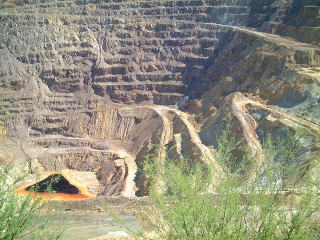
This is another view of the Lavender Pit as seen through a fence in Bisbee just west of four lane SR 80. Words cannot describe the vastness of this pit, or the history that it espouses. Men dug this pit for many years, and this is the result of that herculean effort, still visible many years after the closure of the mine.
05/24/03
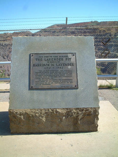
This marker, located at the parking area on the west side of SR 80 in Bisbee, identifies the huge open pit as the Lavender Pit.
05/24/03
Photo Credits:
- Andy Field: 05/24/03, 03/26/04
Connect with:
Page Updated Sunday August 23, 2009.