
State Route 57
California 57 is the Orange Freeway. Starting at the Orange Crush interchange (Interstate 5 and California 22) at the corner of Santa Ana, Orange, and Anaheim, the California 57 freeway travels almost due north past Fullerton on its way to Diamond Bar and Pomona, passing through the Kellogg Interchange (Interstate 10 and California 71), ending at Interstate 210 (Foothill Freeway) in San Dimas and Glendora.
Originally, the path of California 57 was Pomona Avenue and Brea Canyon Road. The freeway was constructed in phases to connect Anaheim with Pomona. In the early 2000s, California 57 was extended north past the Kellogg Interchange to end at Interstate 210 due to the extension of that freeway east to Rancho Cucamonga.
Key Opening Dates of California 57 freeway sections:
- Interstate 5 to Chapman Avenue - March 24, 1976
- Chapman Avenue to Katella Avenue - March 24, 1976 (widened November 4, 1992)
- Katella Avenue to California 91 - November 14, 1974 (widened November 4, 1992)
- California 91 to Nutwood Avenue - June 2, 1969 (widened November 4, 1992)
- Nutwood Avenue to California 90 - June 3, 1970 (widened November 4, 1992)
- California 90 to Birch Street - September 20, 1971 (widened November 4, 1992)
- Birch Street to Tonner Canyon - September 20, 1971 (widened December 24, 1997)
- Tonner Canyon to North of Pathfinder Road - March 13, 1972 (widened December 24, 1997)
- North of Pathfinder Road to California 60 West Separation - March 13, 1972
- California 60 West Separation to California 60 East Separation - May 5, 1970 (widened March 9, 1998)
- California 60 East Separation to Temple Avenue - December 9, 1970
- Temple Avenue to Raging Waters Drive - May 1, 1972
- Raging Waters Drive to Interstate 210 - June 21, 1971
Many thanks to C.J. Moon for his assistance in providing this historical chronology.
Legislatively, California 57 is proposed for extension south through Santa Ana to a terminus at Interstate 405 in Fountain Valley. Discussions in the considered constructing the freeway as a toll road, perhaps by traveling on top of or alongside the Santa Ana River. An Orange County Register article from April 2009 stated, "Two of the alternatives to be studied call for digging up the Santa Ana River and putting in freeway lanes beneath the channel, allowing for it to continue to be used for flood control. One alternative calls for a double-bore underground tunnel, though one not necessarily following the alignment of the river. A final alternative calls for an arterial road to be built above the river, at the level of the 14 existing bridges that carry surface streets along the waterway." 2
Four alternatives for a California 57 south extension were studied in mid 2009. All four were labeled "D" as part of a possible five-part strategy for reducing congestion within the central area of Orange County. The five strategies included several strategies, including intelligent transportation systems, improvements to the existing freeway network, interchange improvements, bus rapid transit, arterial improvements, and HOT lanes. One of the possible alternatives studied was the extension of California 57, which could have taken the following forms:3
- D3: Freeway cut and cover tunnel
- D4: Freeway in dual bore tunnel
- D7: Freeway tunnel unconstrained alignment
- D8: Bridge level arterial with intersections
A study from October 2009 determined that the tunnel and arterial options were not feasible given cost, rights of way, and environmental concerns. The tunnel option in particular would be a very expensive proposition. Given these concerns, the proposed extension of California 57 is not imminent although may be studied further in the future.3, 4
The proposed extension of California 57 is very controversial. Environmental impacts with the Santa Ana River are significant, as are cost impacts due to the elevated nature of the proposed freeway. The city of Fountain Valley is opposed to the extension for fear of impacts to already congested traffic during commuting hours on Interstate 405. Other improvements to existing roadways are planned to facilitate traffic management in central Orange County rather than focusing on this new highway proposal.2
Additional lanes and related improvements were scheduled for California 57 north. Between Fall 2010 and 2014, construction was anticipated along two segments to add lanes and improve interchanges. Segment 1 was from north of California 91 near Orangethorpe Avenue in Placentia to Lambert Road in Brea. Segment 2, which is slated to start in Summer 2011, brought improvements to California 57 between Katella Avenue and Lincoln Avenue in Anaheim.5
Improvements were also underway in Diamond Bar at the California 57 and California 60 merge, including the direct connection ramp for High Occupancy Vehicle (Carpool) traffic. Specific improvements included development of collector distributor lanes, traffic separation for the connections to Grand Avenue that eliminate weaving and merging across multiple lanes, and expanding the number of lanes. The project (planning, environmental review, design, and construction) was expected to continue from 2009 through 2016.6
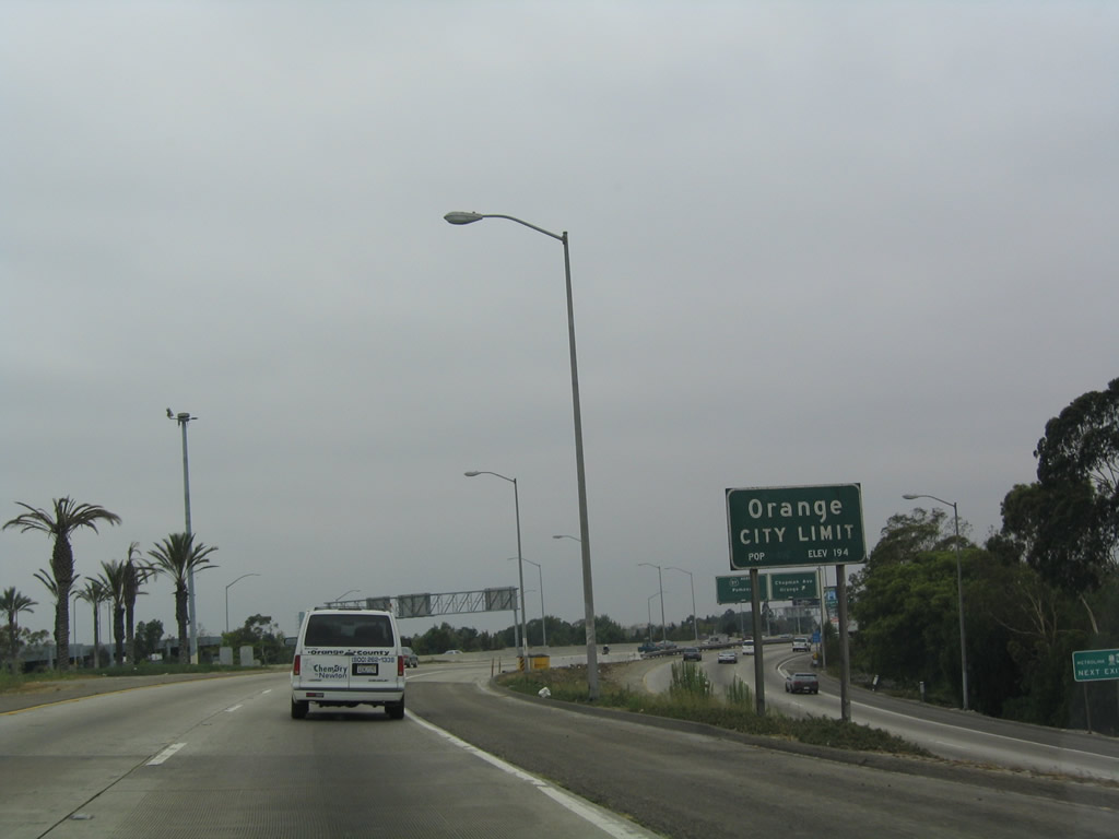
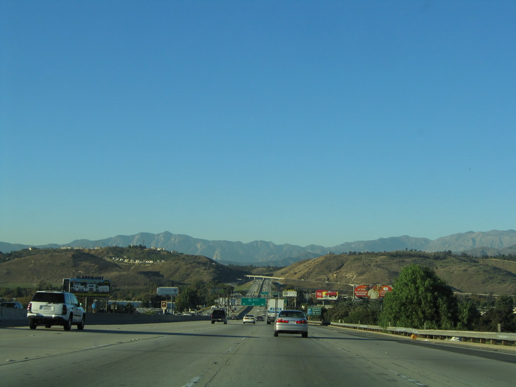
California 57 begins at the Orange Crush interchange, which is the confluence of Interstate 5 (Santa Ana Freeway), California 22 (Garden Grove Freeway), and California 57 (Orange Freeway). Ramps from Interstate 5 and California 22 merge to form the nascent freeway, which begins its journey north through Orange, Fullerton, Brea, Diamond Bar, and San Dimas before ending at Interstate 210/California 210 at the southeastern corner of Glendora. California 57 enters the city of Orange, population 128,821 as of the 2000 Census. As an alternative to Interstate 5, motorists may use California 57 north to Interstate 210 west. Although longer, the route avoids most Los Angeles-area bottlenecks and is not as heavily traveled as Interstate 405 (San Diego Freeway).
07/03/04
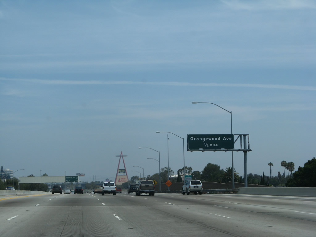
The first exit along northbound California 57 (Orange Freeway) is Exit 1A, Orange County S-25 (Chapman Avenue), followed by Exit 1B, Orangewood Avenue. On the ramp connecting northbound Interstate 5 to northbound California 57, there is no access afforded to Exit 1A.
03/25/05
Use either Exit 1B, Orangewood Avenue or Exit 2, Katella Avenue to Angel Stadium.
11/19/05
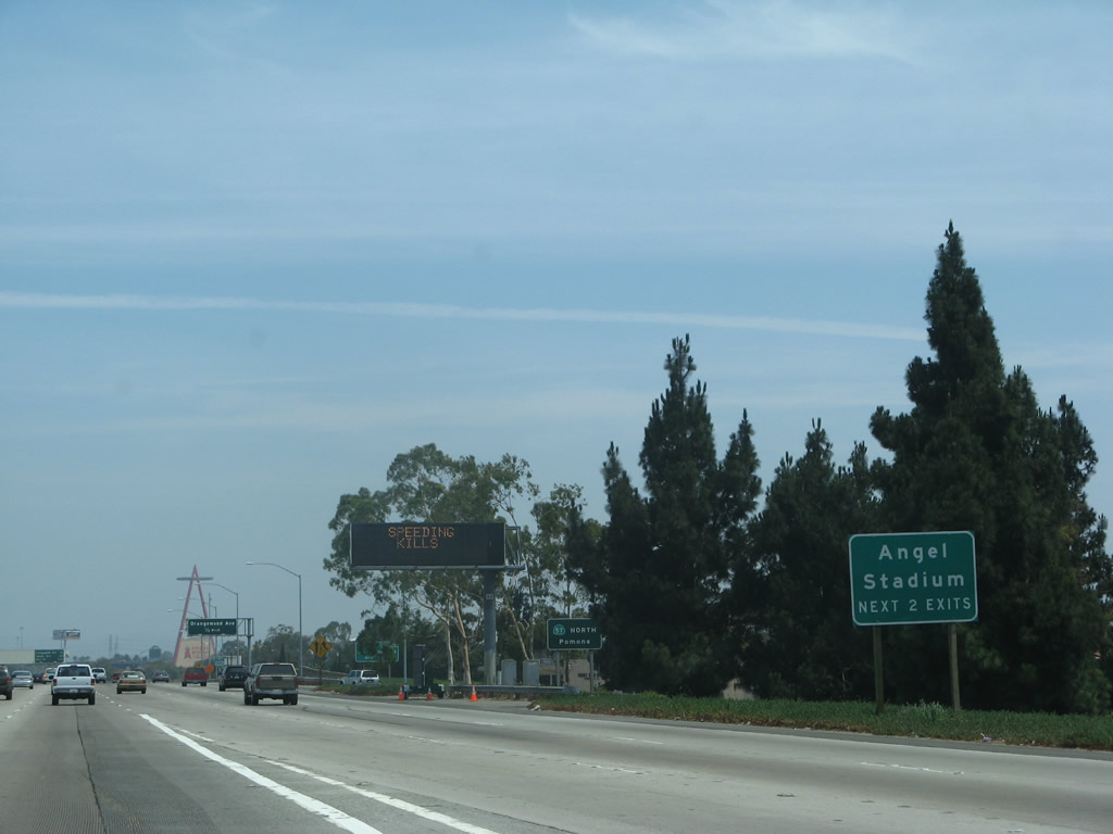
The next two exits serve Angel Stadium.
07/04/07
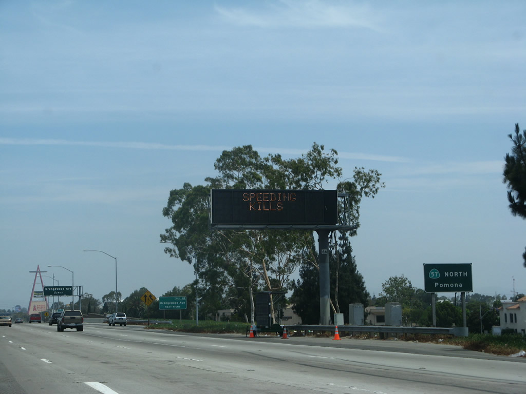
This roadside sign acts as a reassurance marker for California 57 north to Pomona.
07/04/07

A roadside sign identifies Exit 1B with an exit number. Signs such as this were added along northbound California 57 in 2004.
03/25/05
Angel Stadium, with its distinctive Red "A" visible from California 57, is visible to the left of the freeway in the distance.
07/04/07
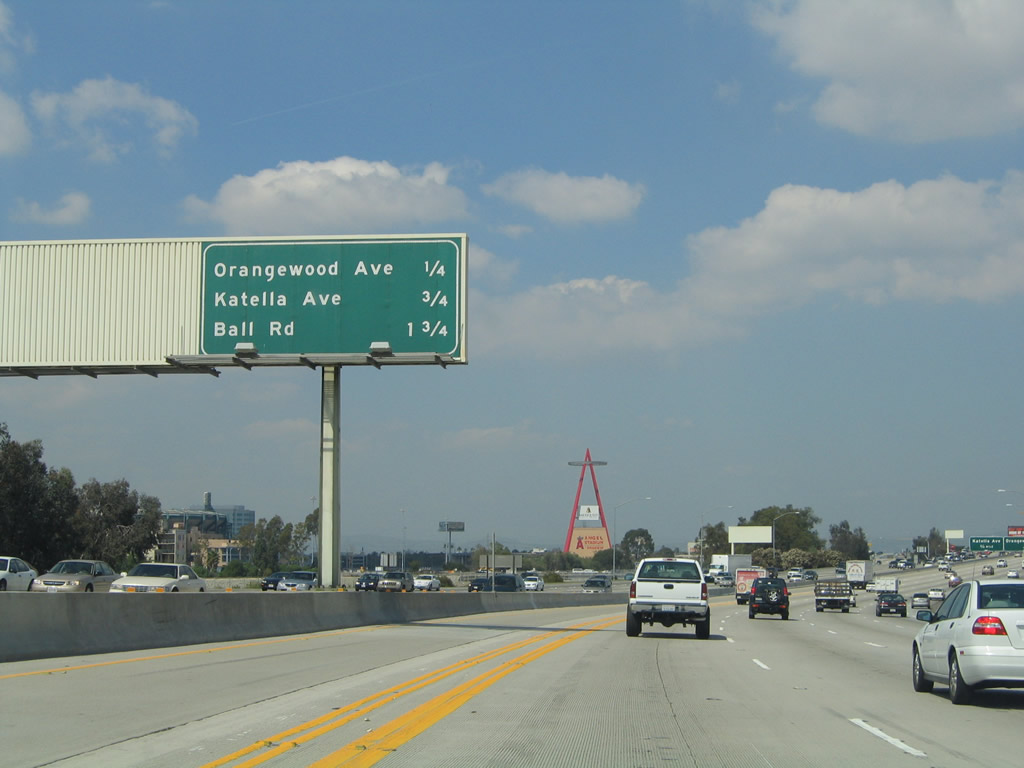
This mileage sign provides the distance to the next three exits on California 57 (Orange Freeway) north: Exit 1B, Orangewood Avenue; Exit 2, Katella Avenue; and Exit 3, Ball Road.
03/25/05
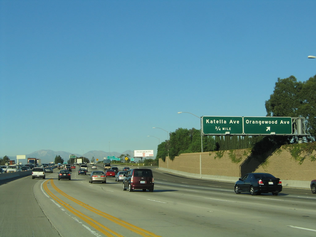
Northbound California 57 (Orange Freeway) reaches Exit 1B, Orangewood Avenue; the next exit is Exit 2, Katella Avenue.
11/19/05
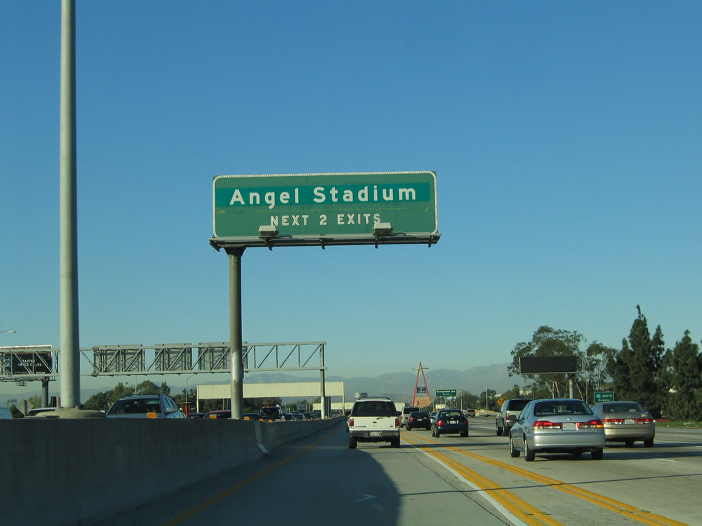
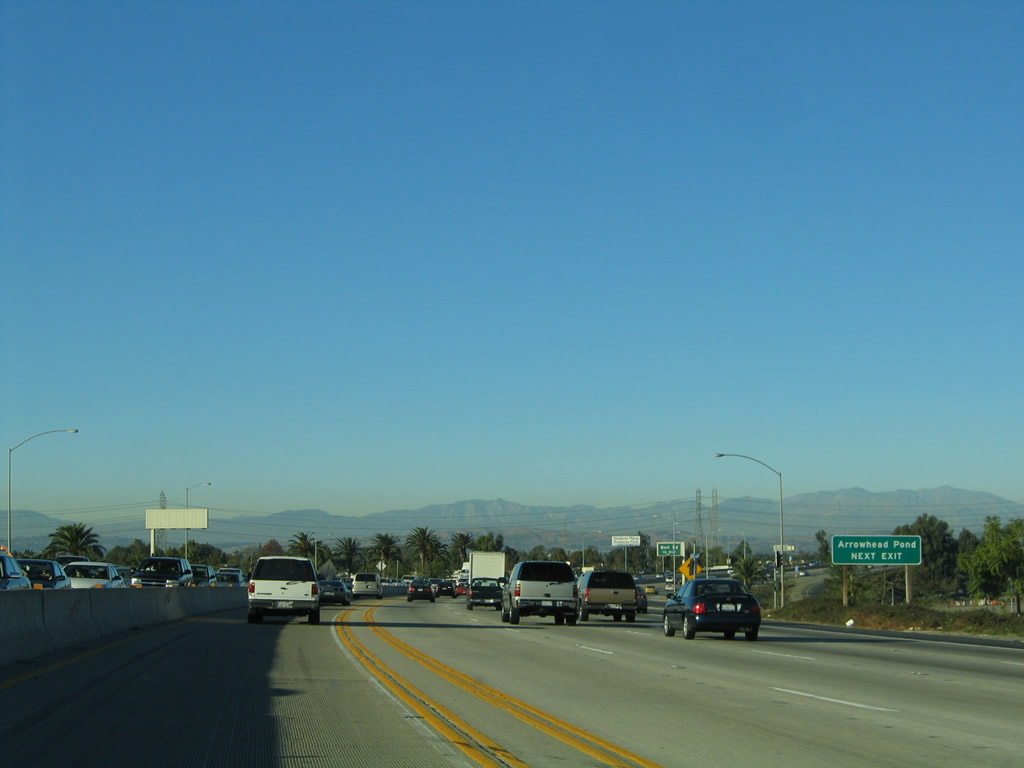
The next exit along California 57 north is Exit 2, Katella Avenue, which provides access to both Angels Stadium (home of the Anaheim Angels Major League Baseball team) to the west and Arrowhead Pond (home of the Anaheim Mighty Ducks National Hockey League team) to the east.
03/25/05
The next three exits along northbound California 57 (Orange Freeway) are Exit 2, Katella Avenue; Exit 3, Ball Road; and Exit 4, Lincoln Avenue.
03/25/05
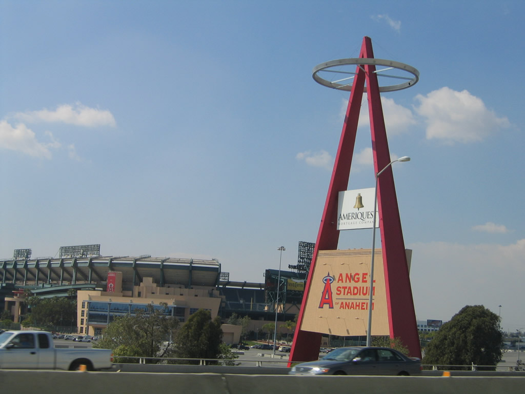
Looking west from the 57 freeway is this view of Angel Stadium.
03/25/05
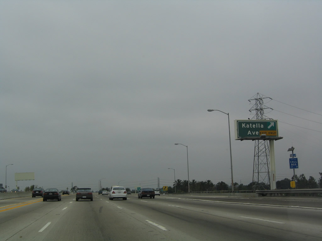
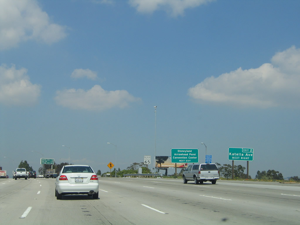
Northbound California 57 (Orange Freeway) reaches Exit 2, Katella Avenue.
07/03/04
Use Exit 3 (Ball Road) to Arrowhead Pond.
11/19/05
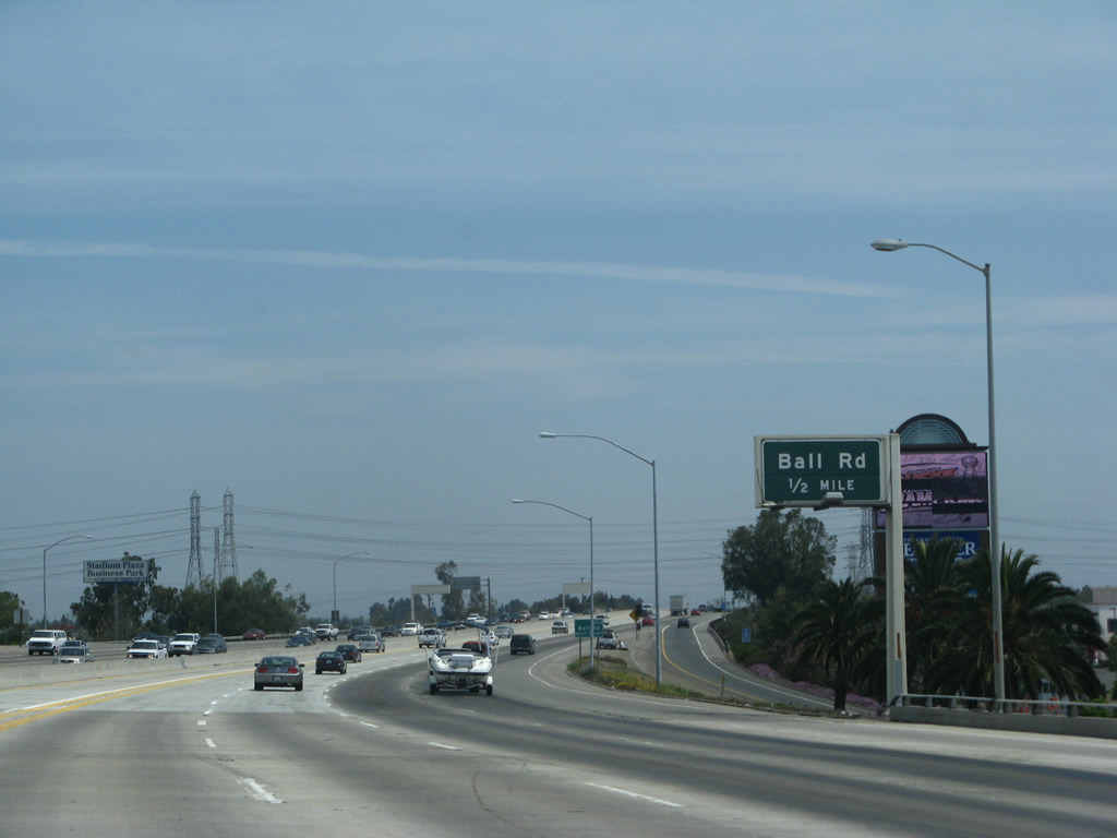
The next exit along California 57 (Orange Freeway) north is Exit 3, Ball Road. Use Ball Road to Arrowhead Pond.
07/04/07
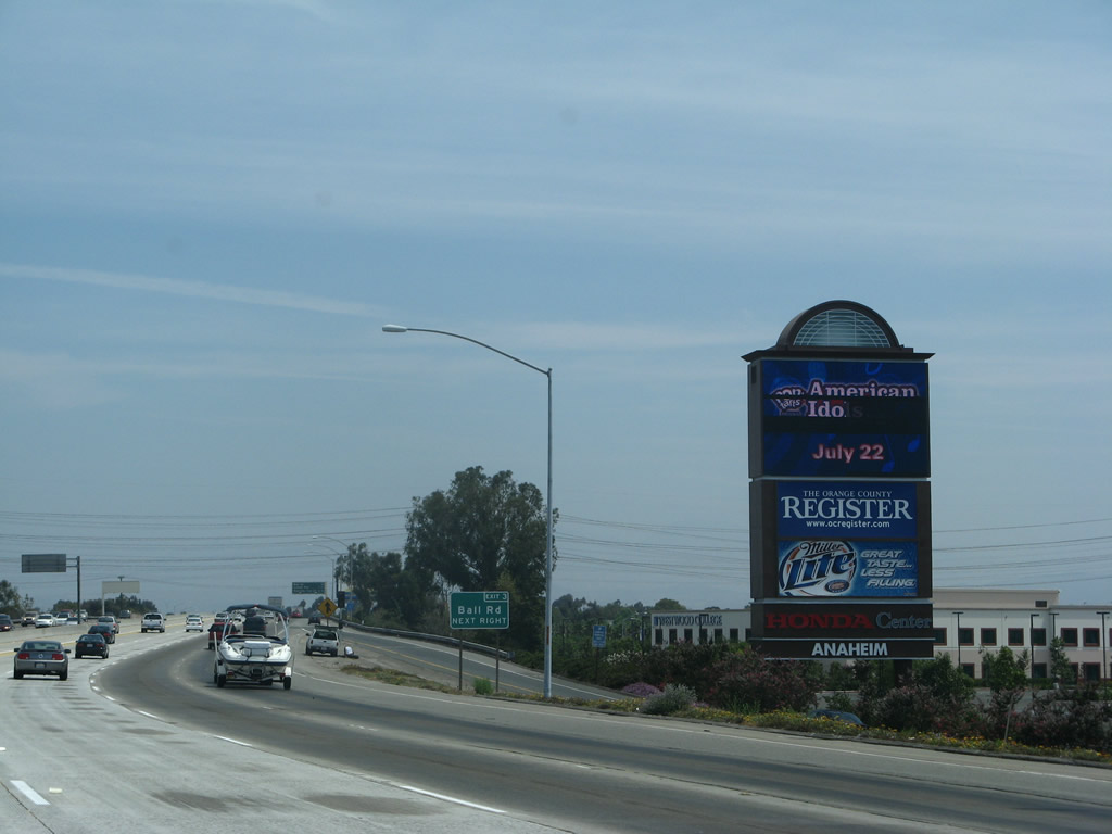
Exit 3 is identified with a single roadside sign located next to a towering marquee with a list of events at the Pond.
07/04/07
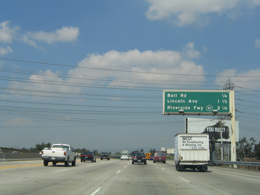
The next three exits along northbound California 57 (Orange Freeway) are Exit 3, Ball Road; Exit 4, Lincoln Avenue; and Exit 5, California 91 (Riverside Freeway).
03/25/05
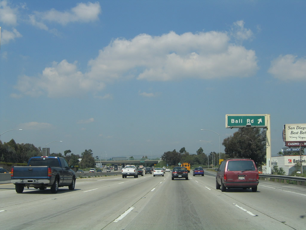
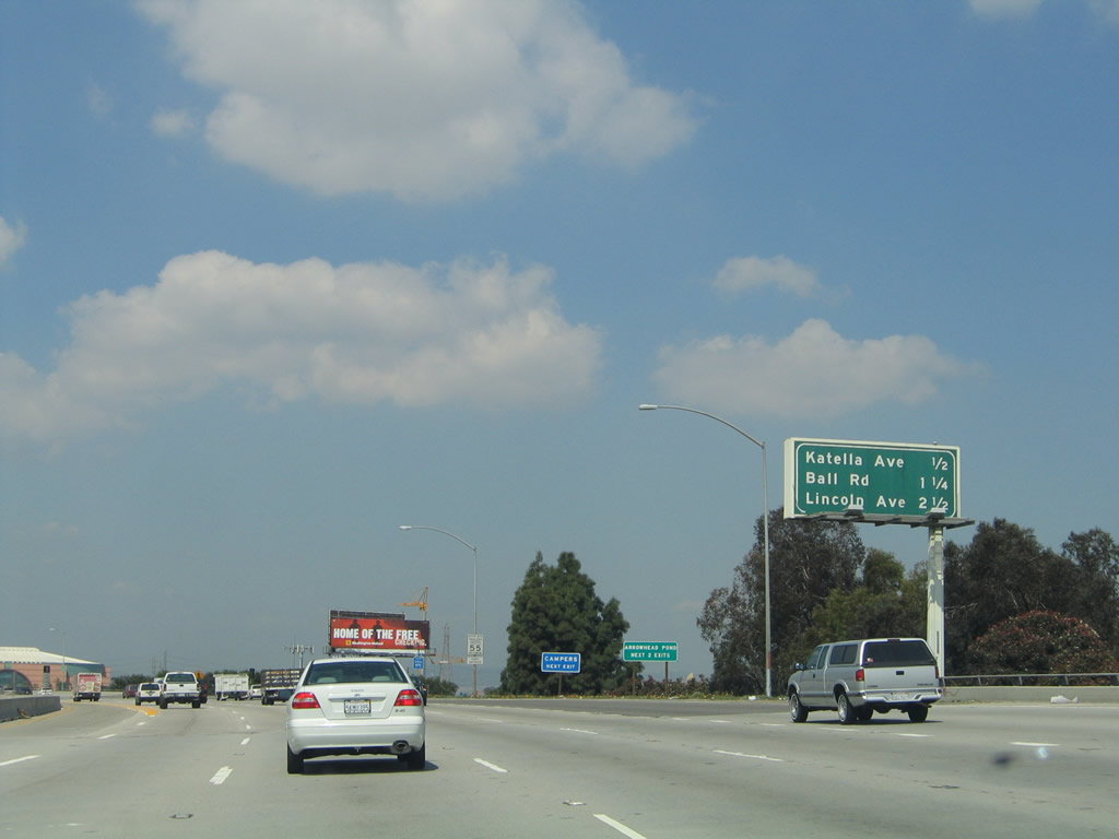
Northbound California 57 reaches Exit 3, Ball Road. To the east, Ball Road and Katella Avenue merge together, and they form Orange County S-18 at the California 55 interchange to the east near Villa Park.
03/25/05
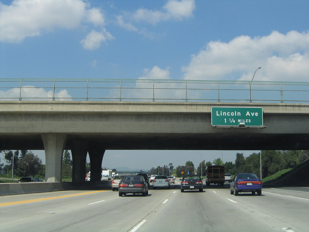
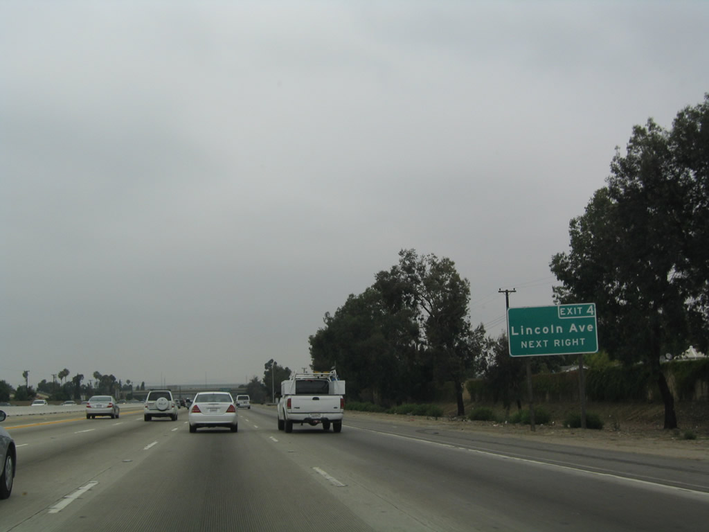
The next exit along California 57 (Orange Freeway) north is Exit 4, Lincoln Avenue, 1.25 miles.
03/25/05
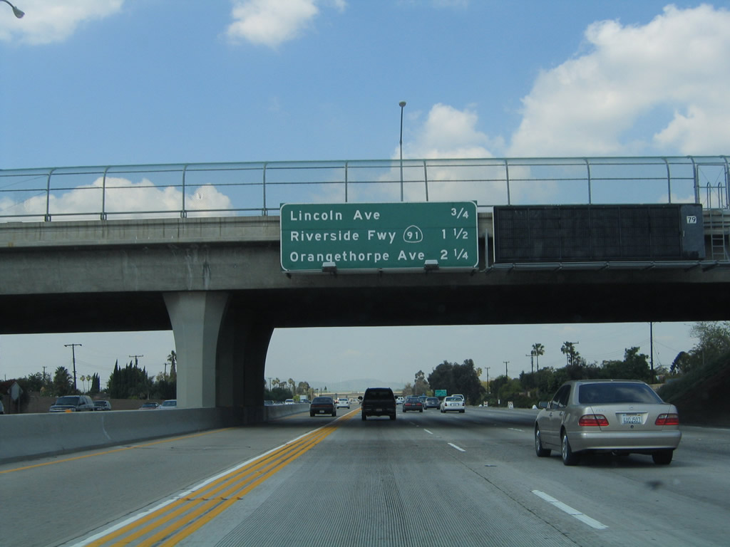
The next three exits along northbound California 57 are Exit 4, Lincoln Avenue; Exit 5, California 91 (Riverside Freeway); and Exit 6, Orangethorpe Avenue. A variable message sign was also installed on this overpass.
03/25/05
During the spring/summer of 2004, several roadside exit number signs were posted along northbound California 57 within Orange County.
07/03/04
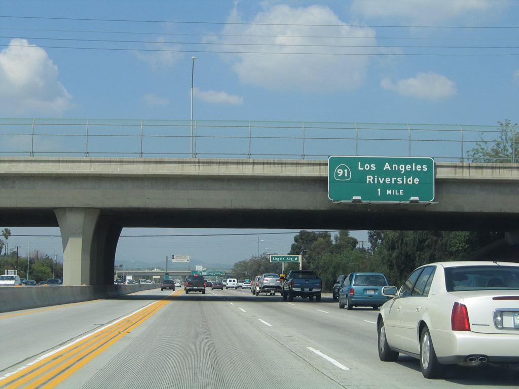
The next exit along northbound California 57 (Orange Freeway) is Exits 5A-B, California 91 (Riverside Freeway), one mile.
03/25/05
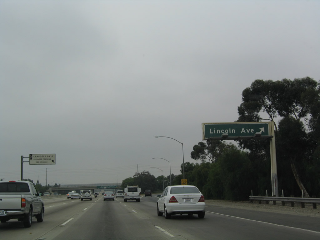
Northbound California 57 reaches Exit 4, Lincoln Avenue.
07/03/04
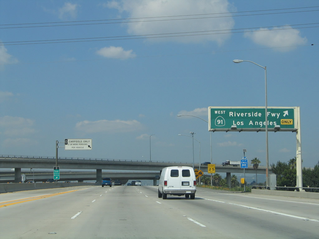
The next exit along northbound California 57 (Orange Freeway) is Exits 5A-B, California 91 (Riverside Freeway). The two right lanes exit onto California 91. Use California 91 east to Riverside and San Bernardino. The section of California 91 between California 55 and California 71 is one of the more congested freeways in Orange County, and high occupancy vehicle/toll lanes were installed privately to accommodate the additional traffic volume. Since that time, Orange County has taken over management of those toll lanes.
03/25/05
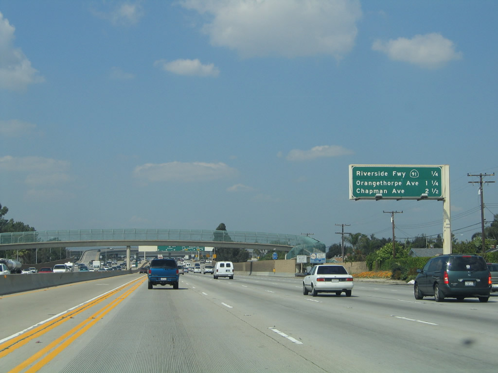
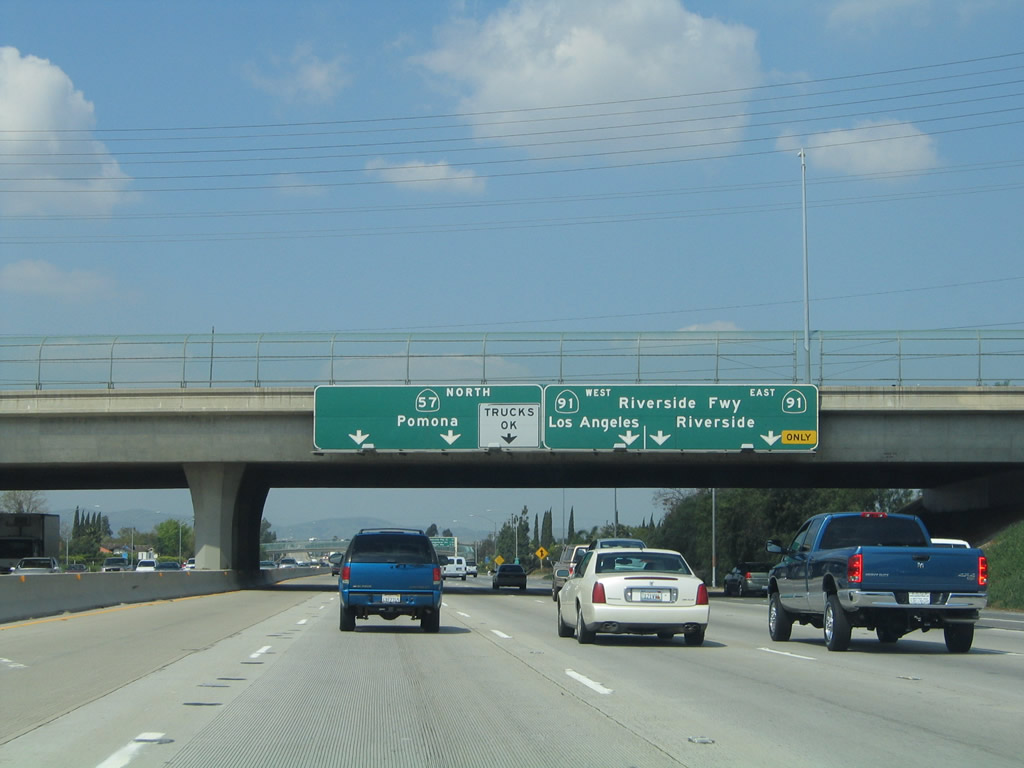
The next three exits along northbound California 57 (Orange Freeway) are Exits 5A-B, California 91 (Riverside Freeway); Exit 6A, Orangethorpe Avenue; and Exit 6B, Chapman Avenue.
03/25/05
Northbound California 57 (Orange Freeway) reaches the off-ramp for Exit 5A, California 91 (Riverside Freeway) east to Riverside and San Bernardino. The next ramp is for Exit 5B, California 91 west to Redondo Beach.
03/25/05
As part of the stack interchange, northbound California 57 reaches Exit 5B, the ramp to westbound California 91 (Riverside Freeway). Note that the control city is Los Angeles, which can be considered true in the sense that California 91 enters Los Angeles when it crosses Interstate 110. In addition, California 91 enters Los Angeles County after departing La Palma and entering Cerritos west of Interstate 5. In the vicinity of the county line, the California 91 freeway name changes to the Artesia Freeway.
03/25/05
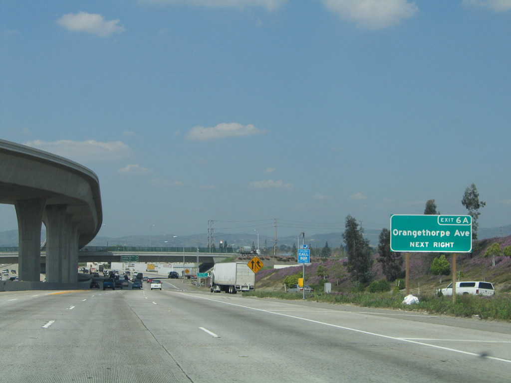
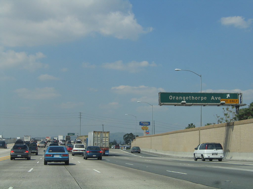
The next exit along northbound California 57 (Orange Freeway) is Exit 6A, Orangethorpe Avenue.
03/25/05
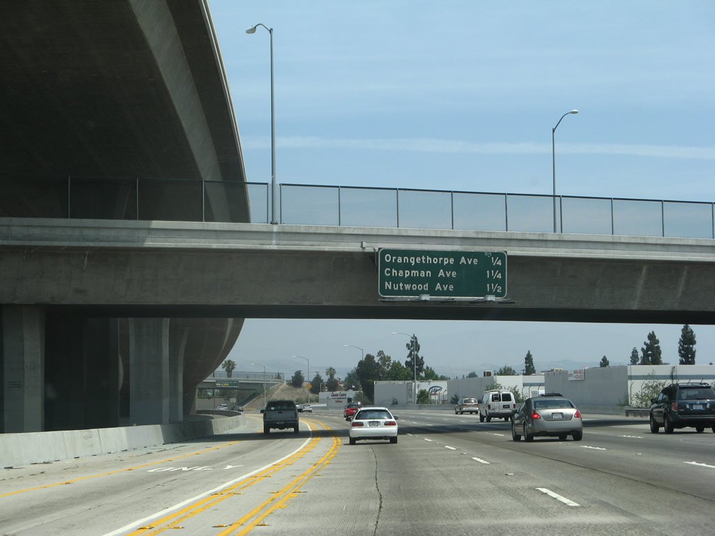
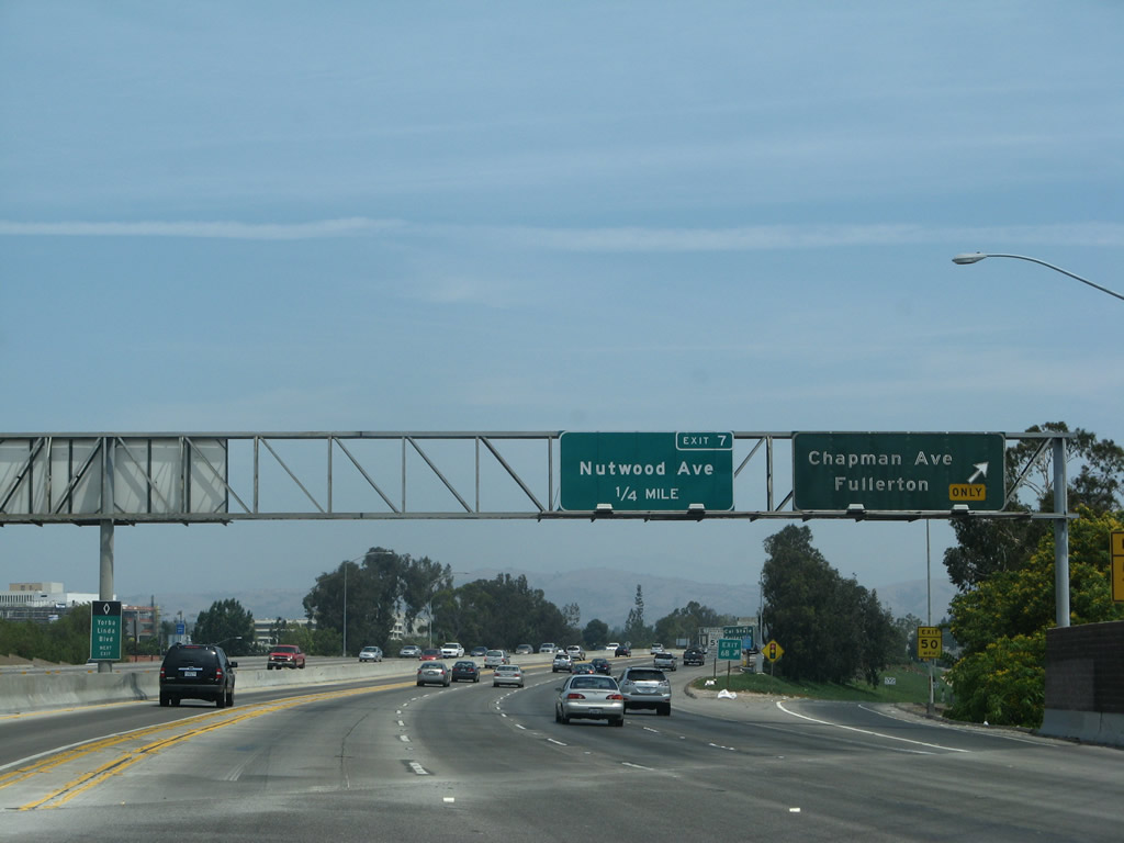
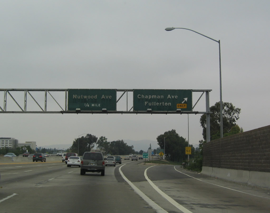
This mileage sign provides the distance along SR 57 north for the next three exits: Exit 6A, Orangethorpe Avenue; Exit 6B, Chapman Avenue; and Exit 7, Nutwood Avenue.
07/04/07
Orangethorpe Avenue parallels California 91 through Orange and Fullerton. Fullerton sits to the west of California 57, while California 57 passes through Orange.
03/25/05
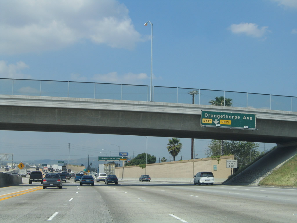
Northbound California 57 (Orange Freeway) reaches Exit 6A, Orangethorpe Avenue.
03/25/05
The next exit along northbound California 57 is Exit 6B, Chapman Avenue, which heads east to Placentia and west into Fullerton.
03/25/05
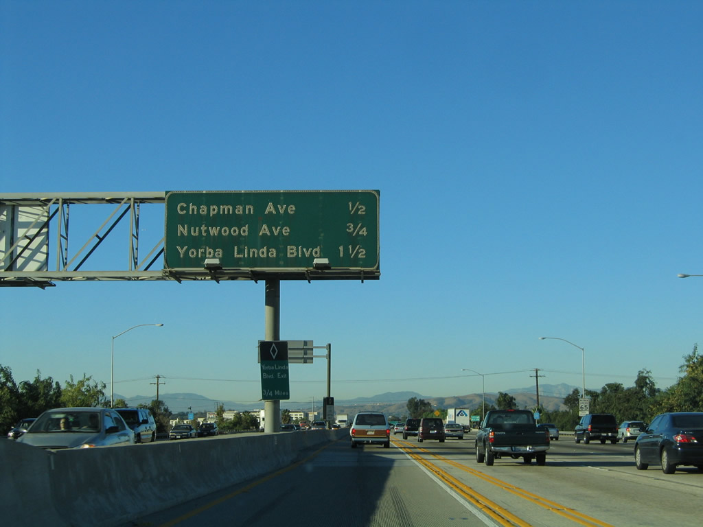
The next three exits along northbound California 57 are Exit 6B, Chapman Avenue; Exit 7, Nutwood Avenue; and Exit 8, Yorba Linda Boulevard.
11/19/05
Another relatively new exit number sign is posted along northbound California 57, this time for Exit 6B, Chapman Avenue.
07/03/04
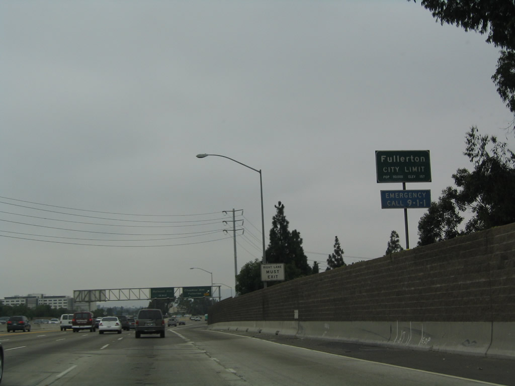
California 57 departs the city of Orange and enters the city of Fullerton, "The Education Community." Fullerton is home to 126,003 people as of the 2000 Census and was incorporated on February 15, 1904.
07/03/04
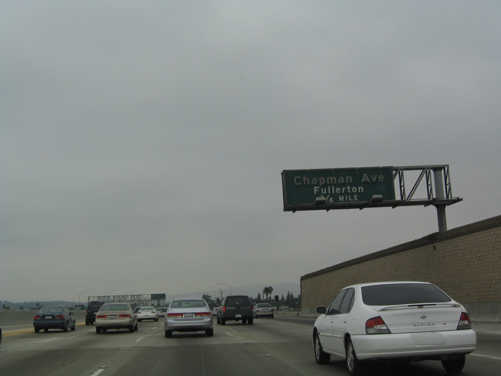
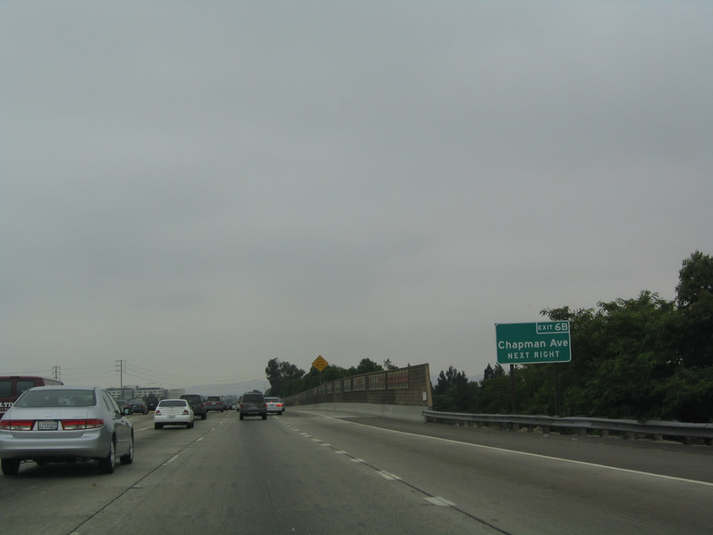
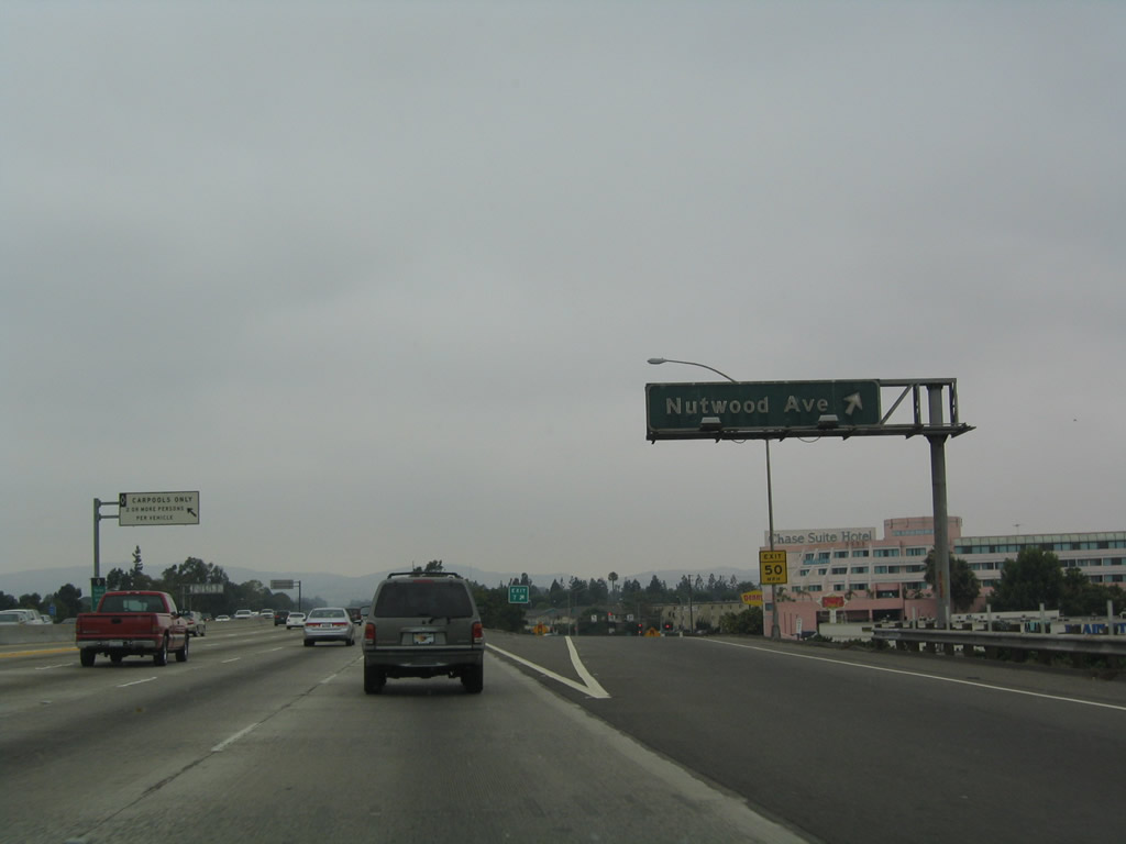
Northbound California 57 reaches Exit 6B, Chapman Avenue in Fullerton. The next exit is Exit 7, Nutwood Avenue. The guide sign for Exit 7 was replaced between 2004 and 2005.
07/04/04
07/03/04
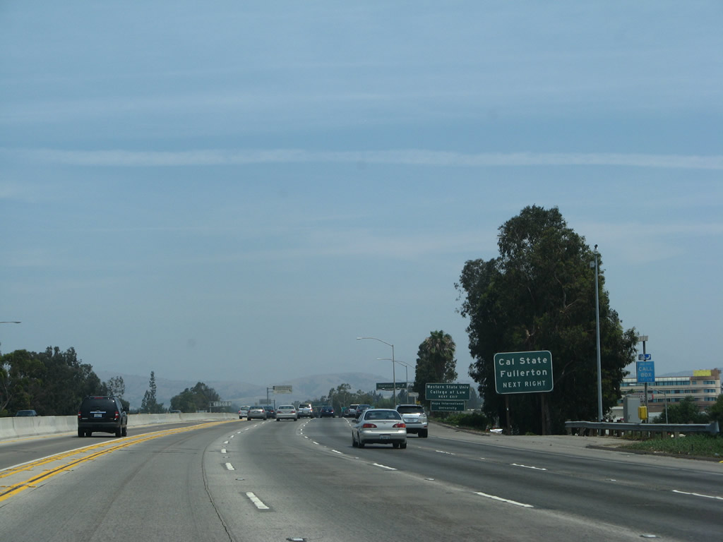
Use Exit 7/Nutwood Avenue west to reach California State University at Fullerton.
07/04/07
Northbound California 57 (Orange Freeway) reaches Exit 7, Nutwood Avenue. Some of the highway signs along California 57 between Fullerton and Pomona date back to the original construction of the freeway, and these signs really show their age. This particular sign, which is found along northbound as it reaches Exit 7/Nutwood Avenue, is an example of that older generation of sign. The sign is fairly dirty and has not been cleaned in some time.
07/03/04
The next exit along northbound California 57 is Exit 8, Yorba Linda Boulevard. Use Yorba Linda Boulevard east to the city of Yorba Linda, home to the Richard M. Nixon Presidential Library.
07/04/07
An older overhead sign is posted after the newer exit number sign as northbound California 57 approaches Exit 8, Yorba Linda Boulevard.
03/25/05
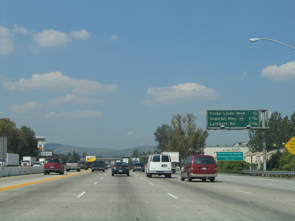
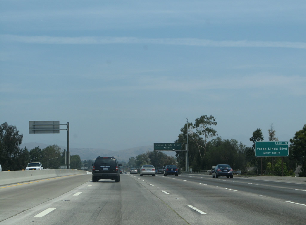
The next three exits along northbound California 57 are Exit 8, Yorba Linda Boulevard; Exit 9, California 90 (Imperial Highway); and Exit 10, Lambert Road.
03/25/05
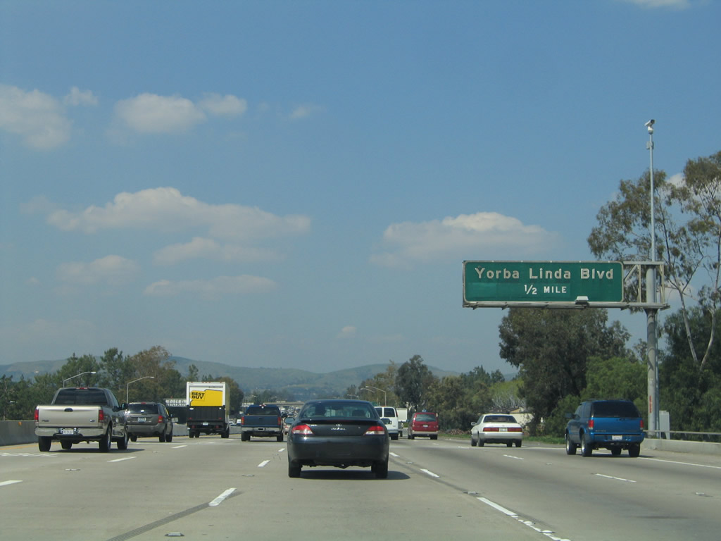
Northbound California 57 reaches Exit 8, Yorba Linda Boulevard.
11/19/05
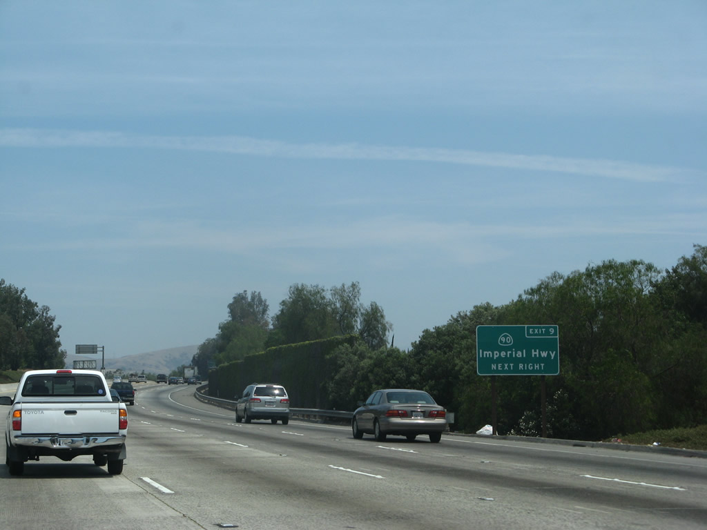
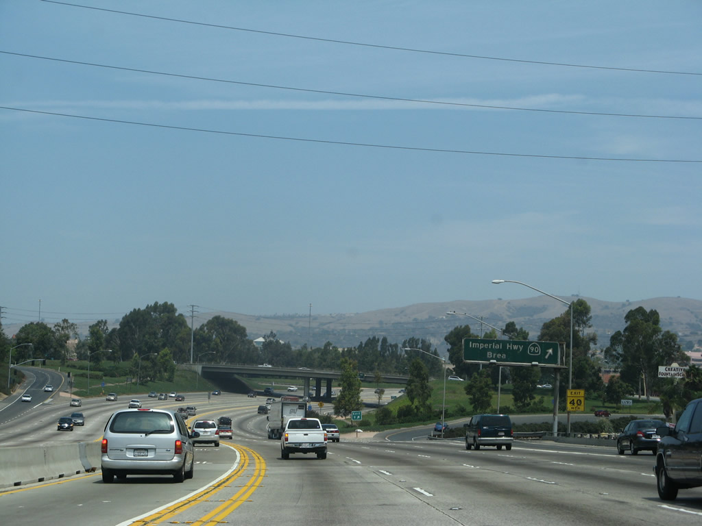
The next exit along northbound California 57 is Exit 9, California 90 (Imperial Highway). California 90 leads southeast from here, partially as a freeway through Yorba Linda (the Richard M. Nixon Freeway), to culminate its journey at California 91. California 90 also heads west as far as California 39 in La Habra.
03/25/05
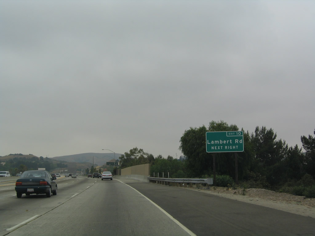
The next three exits along California 57 (Orange Freeway) north are Exit 9, California 90 (Imperial Highway); Exit 10, Lambert Road; and Exit 11, Tonner Canyon Road. This is another sign along California 57 that dates back to the original freeway construction, and it also looks that old.
03/25/05
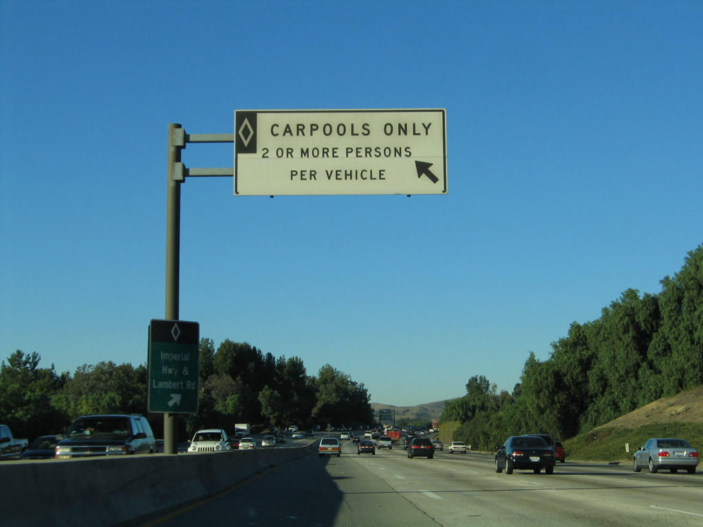
A carpool lane entrance/exit is located prior to the Imperial Highway interchange.
11/19/05
Northbound California 57 approaches Exit 9, California 90 (Imperial Highway), next right.
07/04/07
California 57 connects to the eastern branch of California 90; another segment exists along the Marina Freeway in Los Angeles near Interstate 405 and Los Angeles International Airport. A freeway was once planned to connect the two segments, but such a road will likely never be constructed.
03/25/05
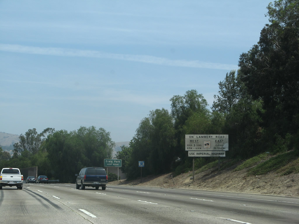
Since trucks are restricted on Lambert Road, those vehicles should instead use Imperial Highway.
07/04/07
Northbound California 57 (Orange Freeway) reaches Exit 9, California 90 (Imperial Highway).
07/04/07
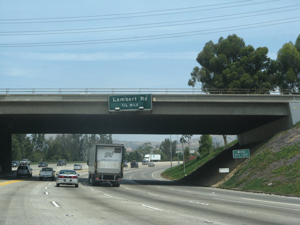
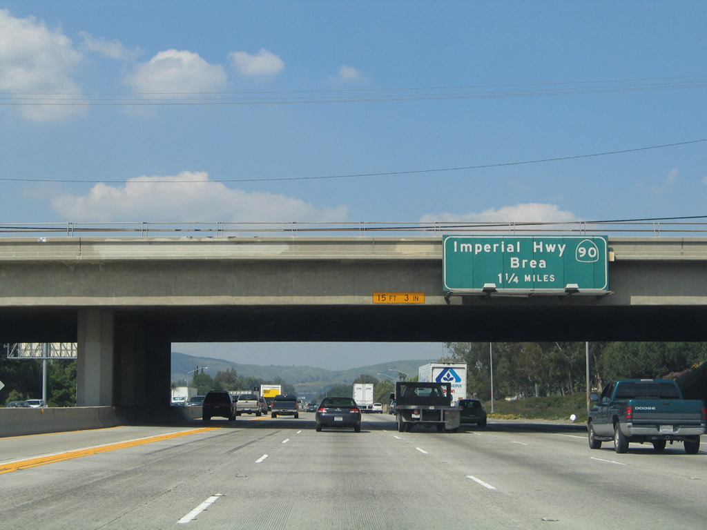
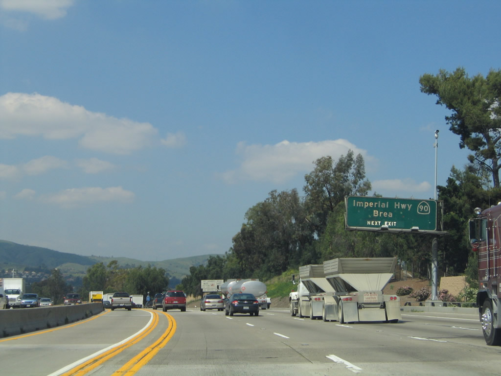
Upon passing under California 90, northbound California 57 (Orange Freeway) departs the city of Fullerton and enters the city of Brea. The next exit along northbound is Exit 10, Lambert Road. The city of Brea was incorporated on February 23, 1917.
07/04/07
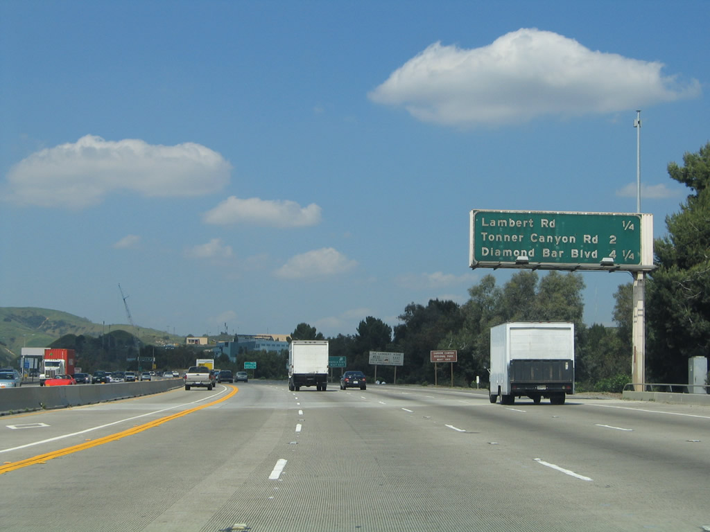
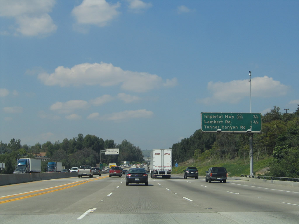
The next three exits along northbound are Exit 10, Lambert Road; Exit 11, Tonner Canyon Road; and Exit 14, Diamond Bar Boulevard in Los Angeles County. Note that this sign bridge is of a different design than those south of Exit 10; this is because the section of California 57 north through Puente Hills was constructed at a different time than the freeway south of California 90 (Imperial Highway).
03/25/05
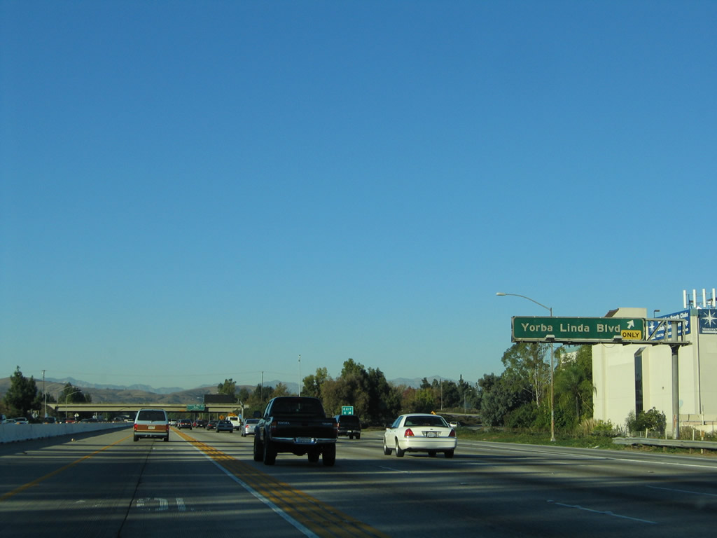
Another new, roadside exit number sign is found in advance of Lambert Road. Use Lambert Road east to reach Carbon Canyon Road/California 142. California 142 passes through Carbon Canyon en route to Sleepy Hollow before reaching Chino Hills in San Bernardino County.
07/03/04
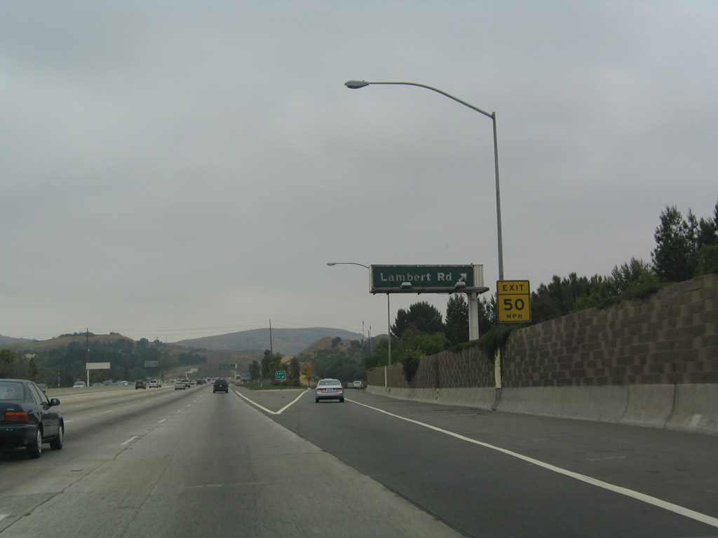
Northbound California 57 (Orange Freeway) reaches Exit 10, Lambert Road. Westbound Lambert Road leads into Brea, where it meets Brea Boulevard.
07/03/04
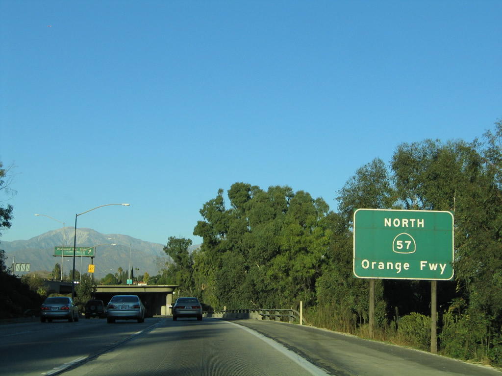
The next exit along northbound California 57 is Exit 11, Tonner Canyon Road, one mile. California 57 passes through the undeveloped Puente Hills and Brea Canyon, reemerging in civilization at Diamond Bar in Los Angeles County.
07/03/04
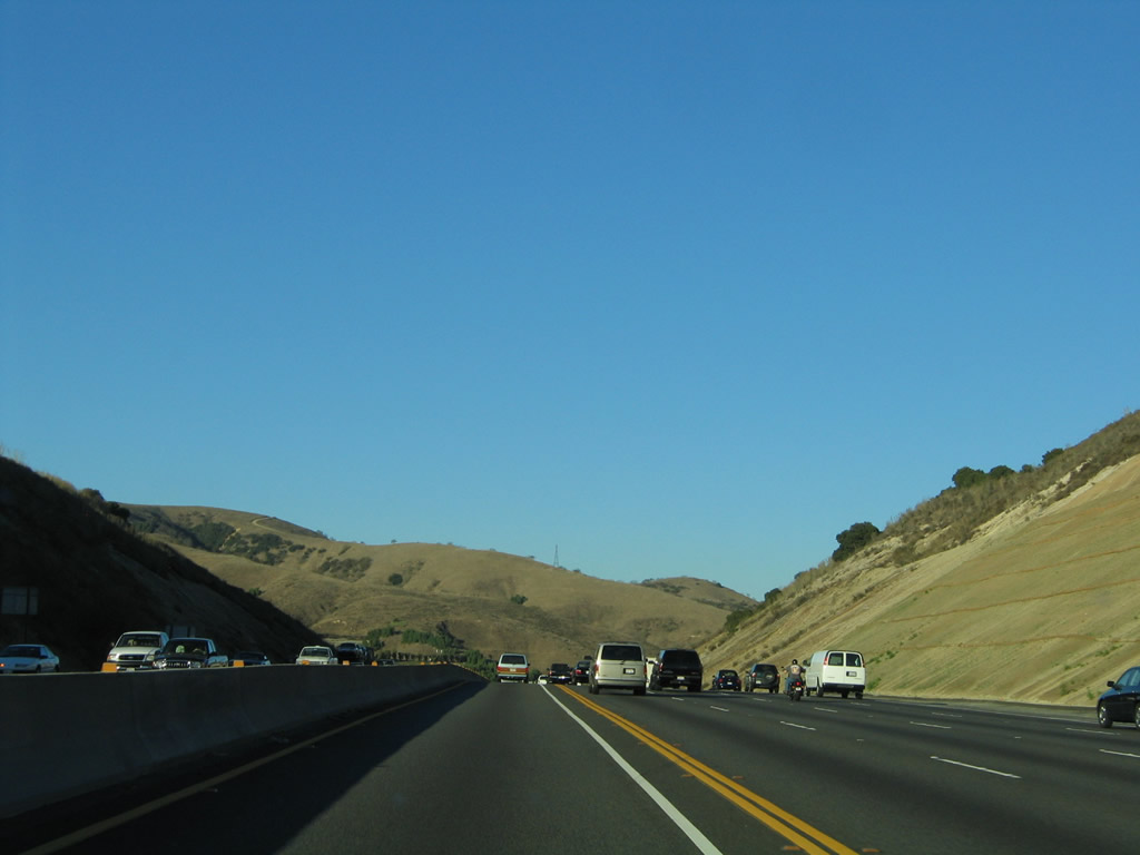
California 57 enters the Puente Hills and Brea Canyon.
11/19/05
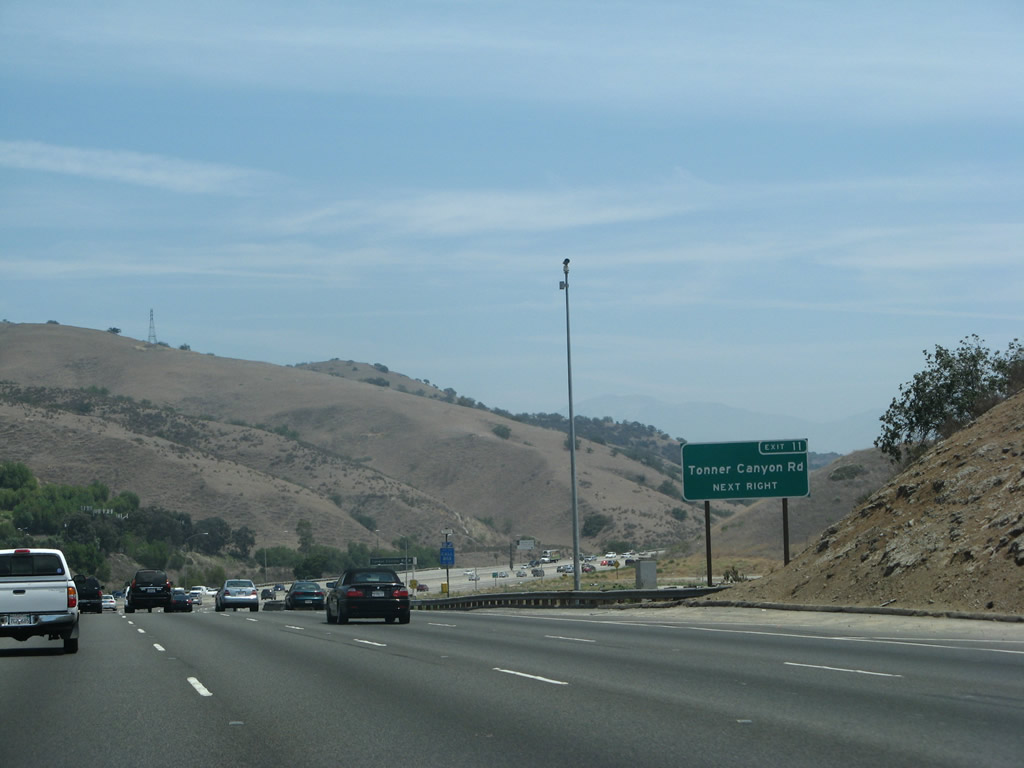
Northbound California 57 approaches Exit 11, Tonner Canyon Road. Note how open this area is compared to the rest of the California 57 freeway south of here.
07/04/07
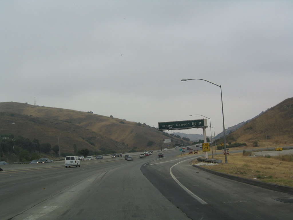
Northbound California 57 (Orange Freeway) reaches Exit 11, Tonner Canyon Road.
07/03/04
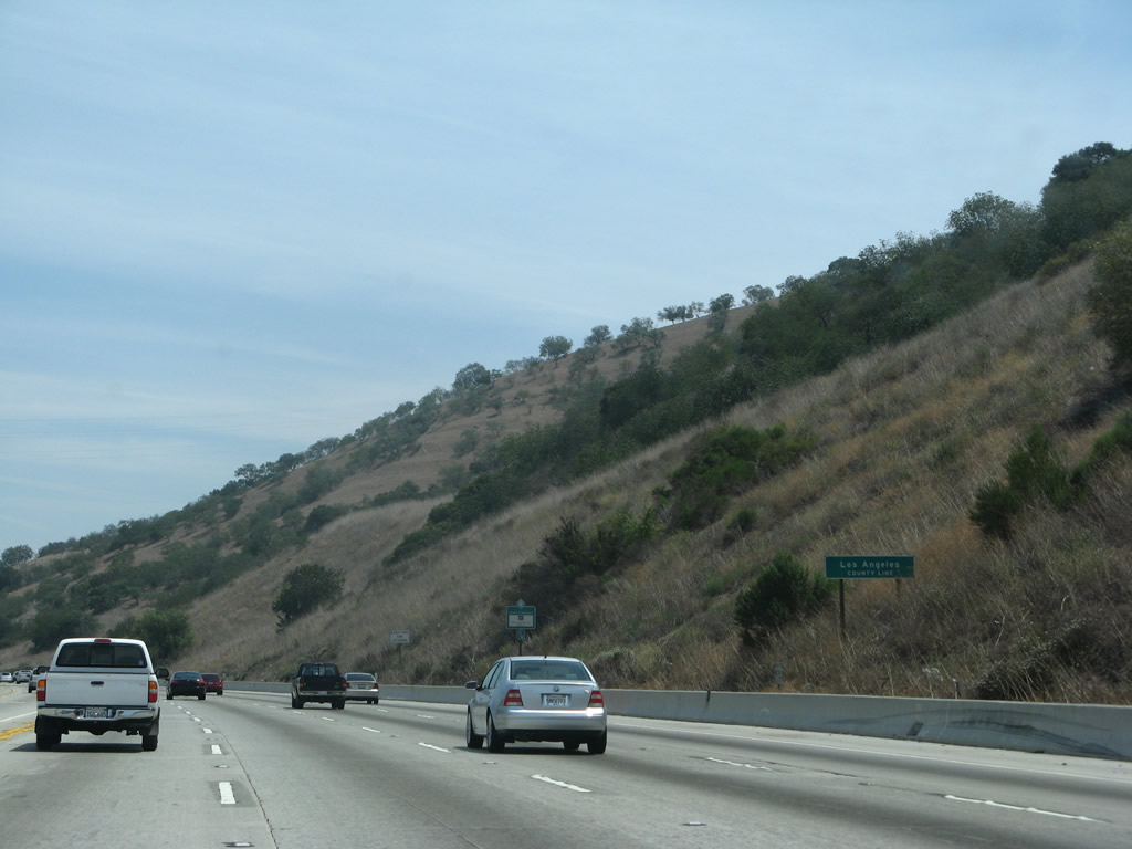
In the midst of Puente Hills/Brea Canyon, California 57 departs Orange County and enters Los Angeles County. The county line cuts east-west through the Puente Hills. To the west, the county line separates La Habra (south) from La Habra Heights (north).
07/04/07
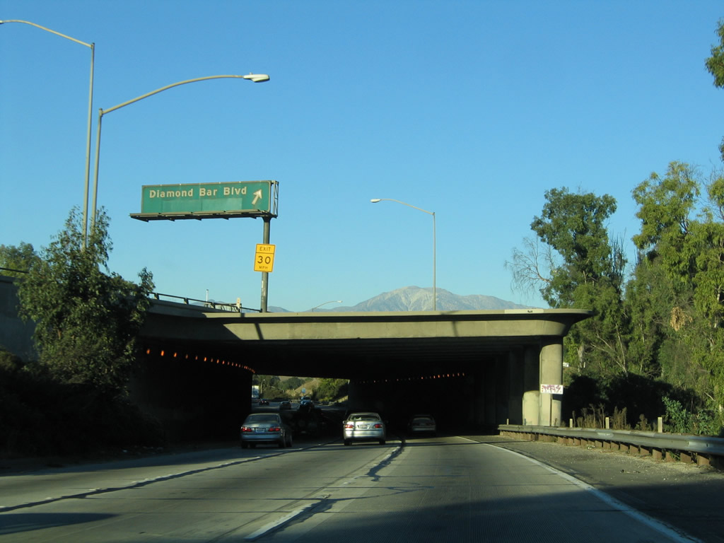
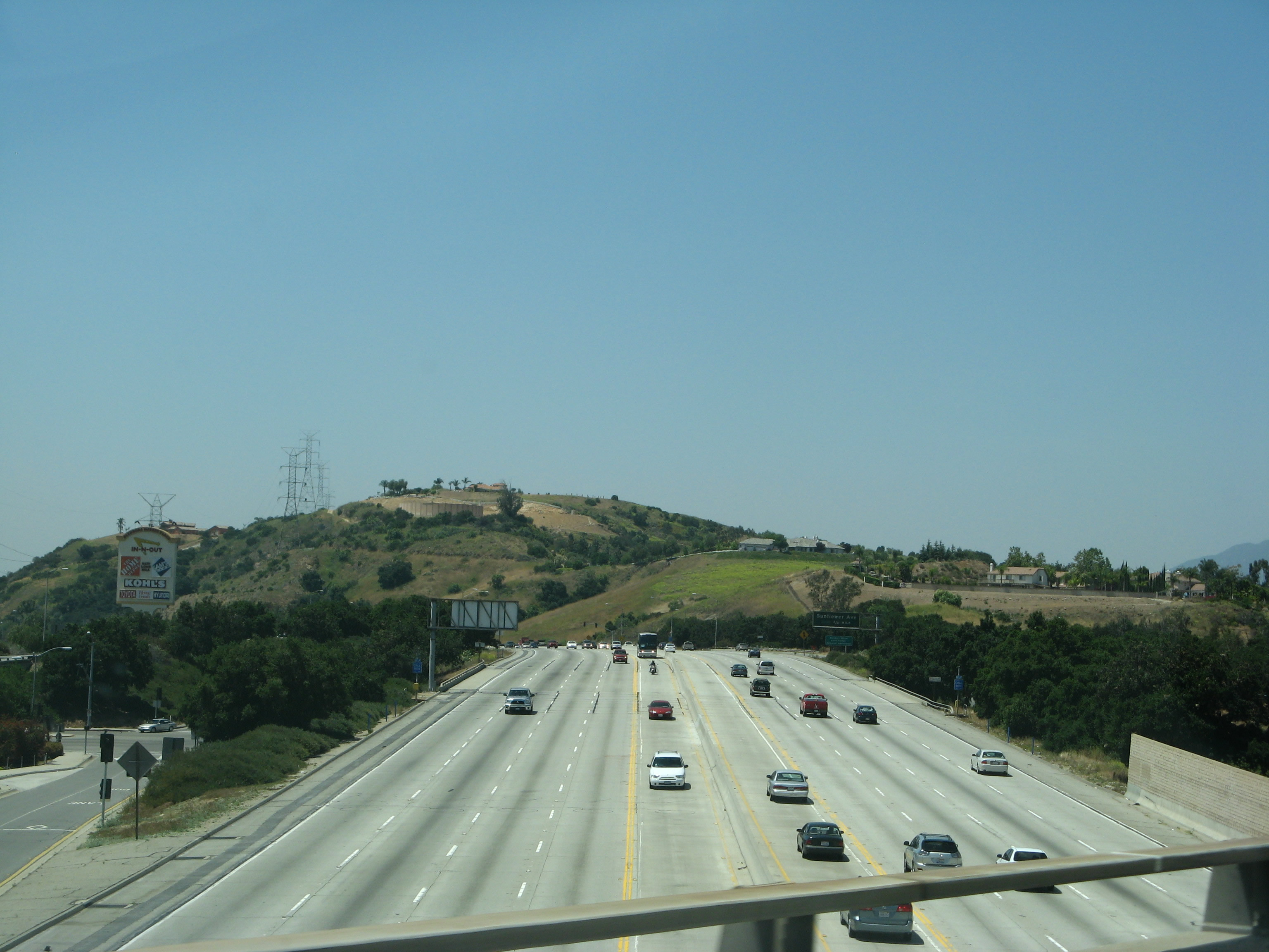
The first exit within Los Angeles County along northbound California 57 is Exit 14, Diamond Bar Boulevard, three-quarters of a mile. California 57 enters the city of Diamond Bar. A former cattle ranch (Diamond Bar Ranch), much of the city was master planned and developed through the 1960s, 1970s, and 1980s. Population increased as the Pomona Freeway opened, and Diamond Bar incorporated as a city on April 18, 1989. The population of Diamond Bar was 56,287 as of the 2000 Census.
11/19/05
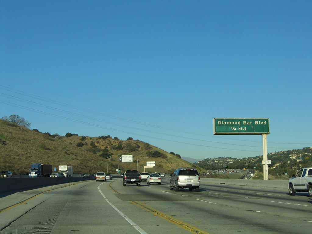
This mileage sign provides the distance to the next three exits along California 57 (Orange Freeway) north: Exit 14, Diamond Bar Boulevard; Exit 15, Pathfinder Road, and Exit 16, California 60 (Pomona Freeway) west to Los Angeles. (To California 60 east to Pomona and Riverside, continue along California 57 north as the two routes share alignment for a couple miles through Diamond Bar.) Exit 14 is the first exit upon exiting Brea Canyon.
11/19/05
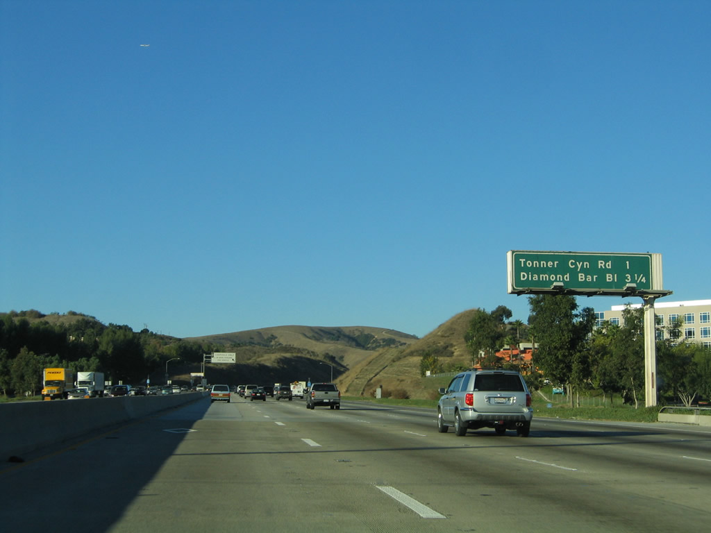
The next five exits along California 57 (Orange Freeway) north all serve the city of Diamond Bar: Exit 14, Diamond Bar Boulevard; Exit 15, Pathfinder Road, Exit 16, California 60 (Pomona Freeway) west (to Brea Canyon Road); Exit 24B, Grand Avenue; and Exit 24A, which is where California 57 and California 60 split (take California 60 east to Diamond Bar Boulevard).
11/19/05
Northbound California 57 reaches Exit 14, Diamond Bar Boulevard. Use Diamond Bar Boulevard northeast into Diamond Bar. Diamond Bar Road reconnects with California 57 and California 60 (at California 60's Exit 25), so this can be an alternate route during times of congestion on the freeways.
11/19/05
The next exit along northbound California 57 is Exit 15, Pathfinder Road (one mile).
11/19/05
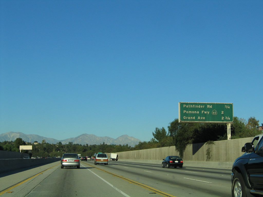
The two exits along northbound California 57 (Orange Freeway) are Exit 15, Pathfinder Road and Exit 16, California 60 (Pomona Freeway) west to Los Angeles. After that exit, California 57 north and California 60 east merge, and they have a shared exit at Grand Avenue. California 60 is the superior route, so Grand Avenue is Exit 24B based on that route's mileage.
11/19/05
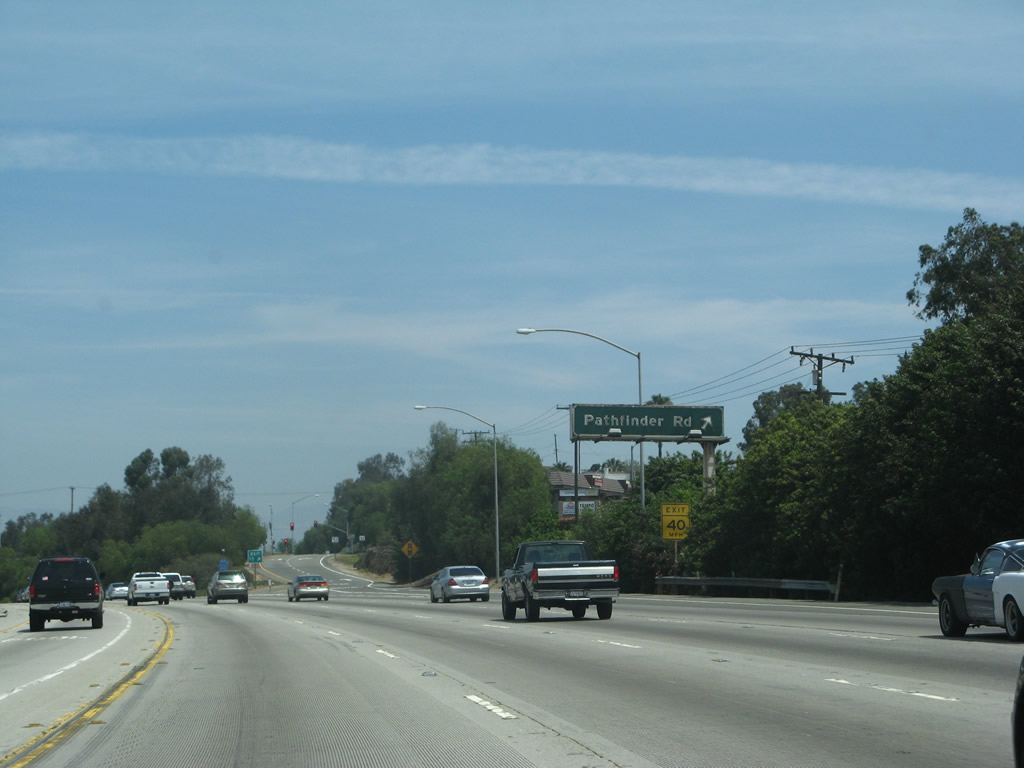
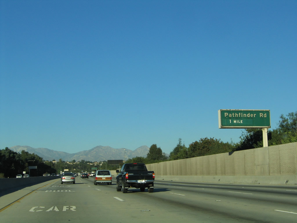
Northbound California 57 (Orange Freeway) reaches Exit 15, Pathfinder Road. Pathfinder Road heads west along the bottom of the Puente Hills, connecting to Fullerton Road near Rowland Heights. Looking east, Pathfinder Road connects with Diamond Bar Boulevard.
07/04/07
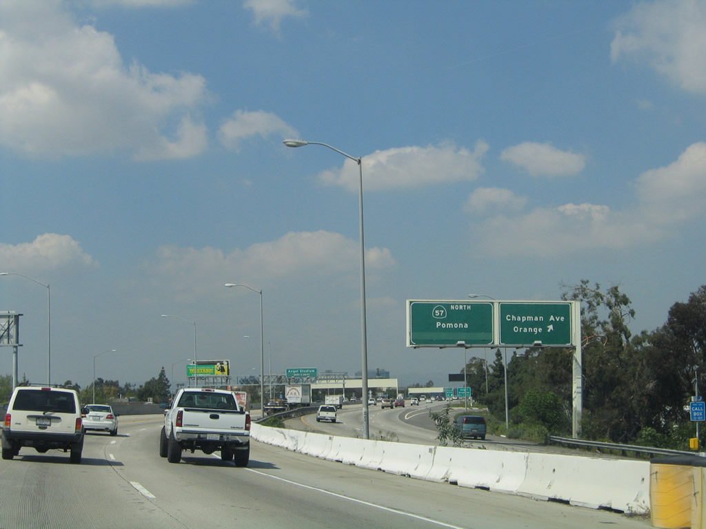
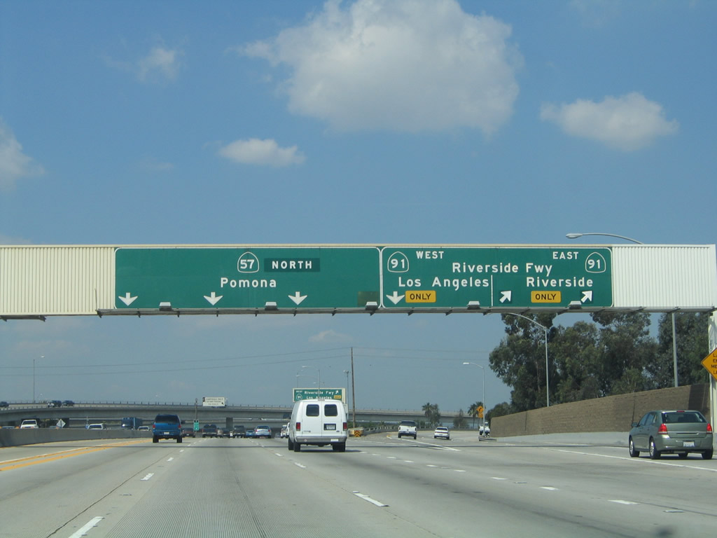
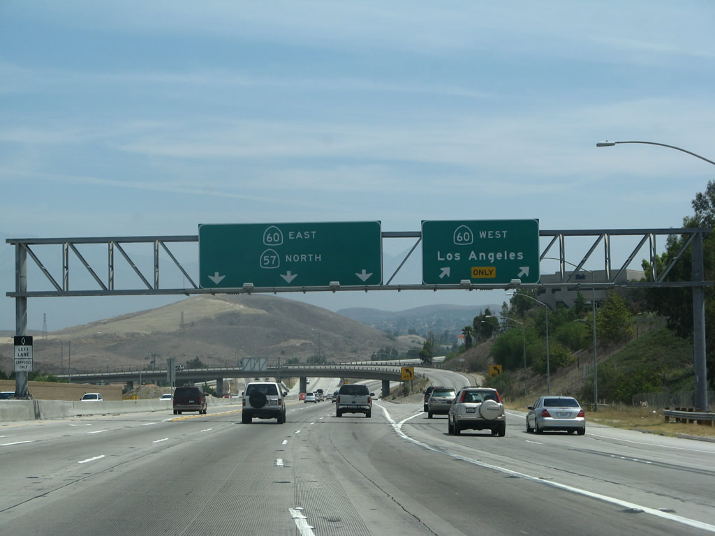
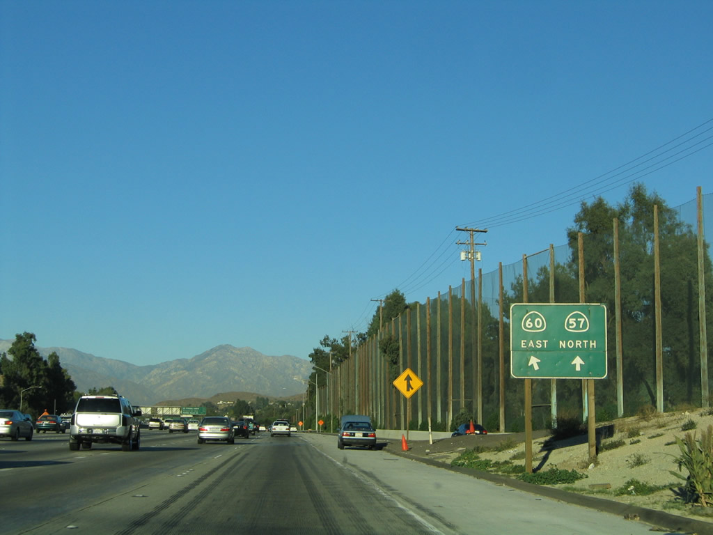
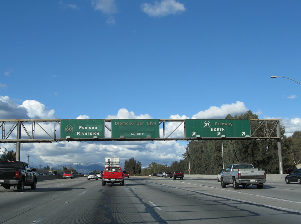
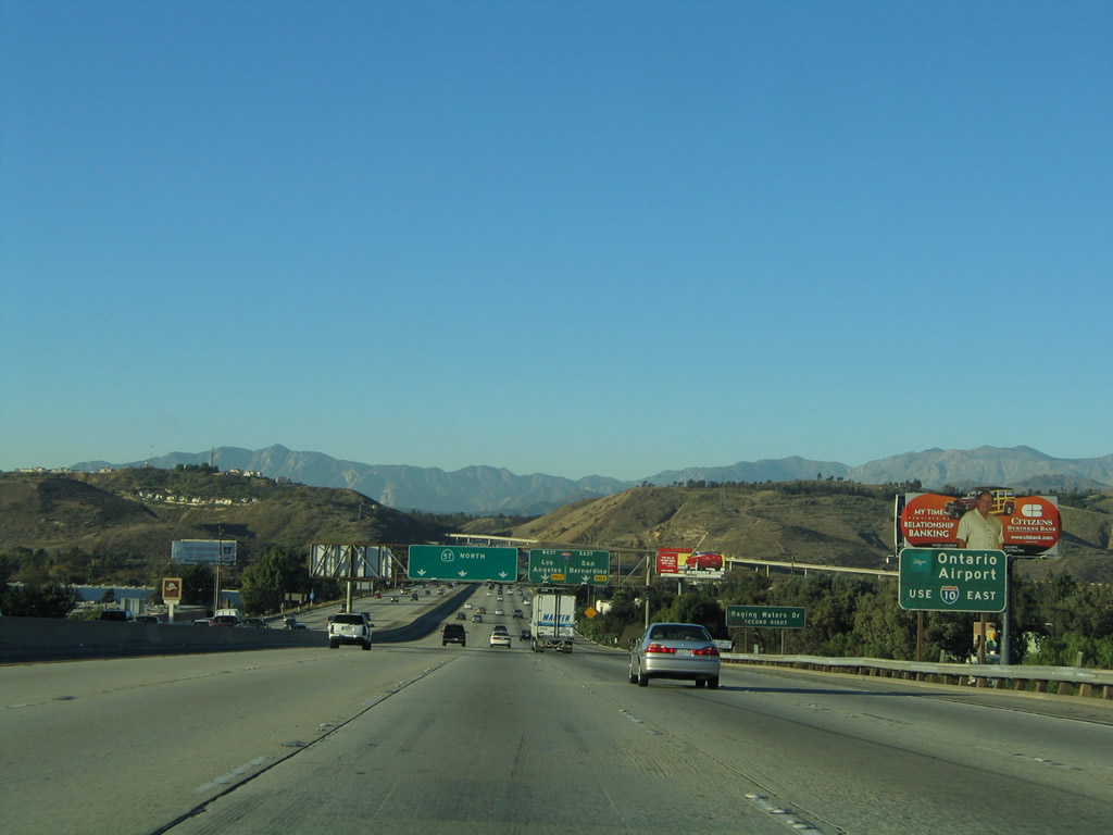
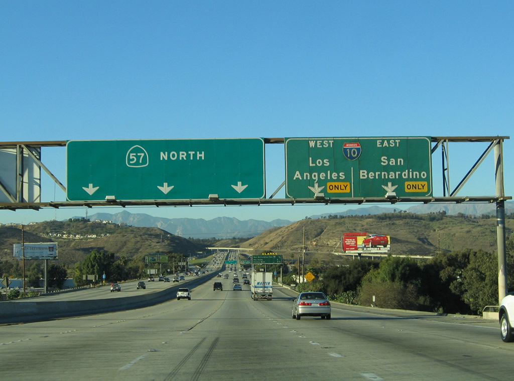
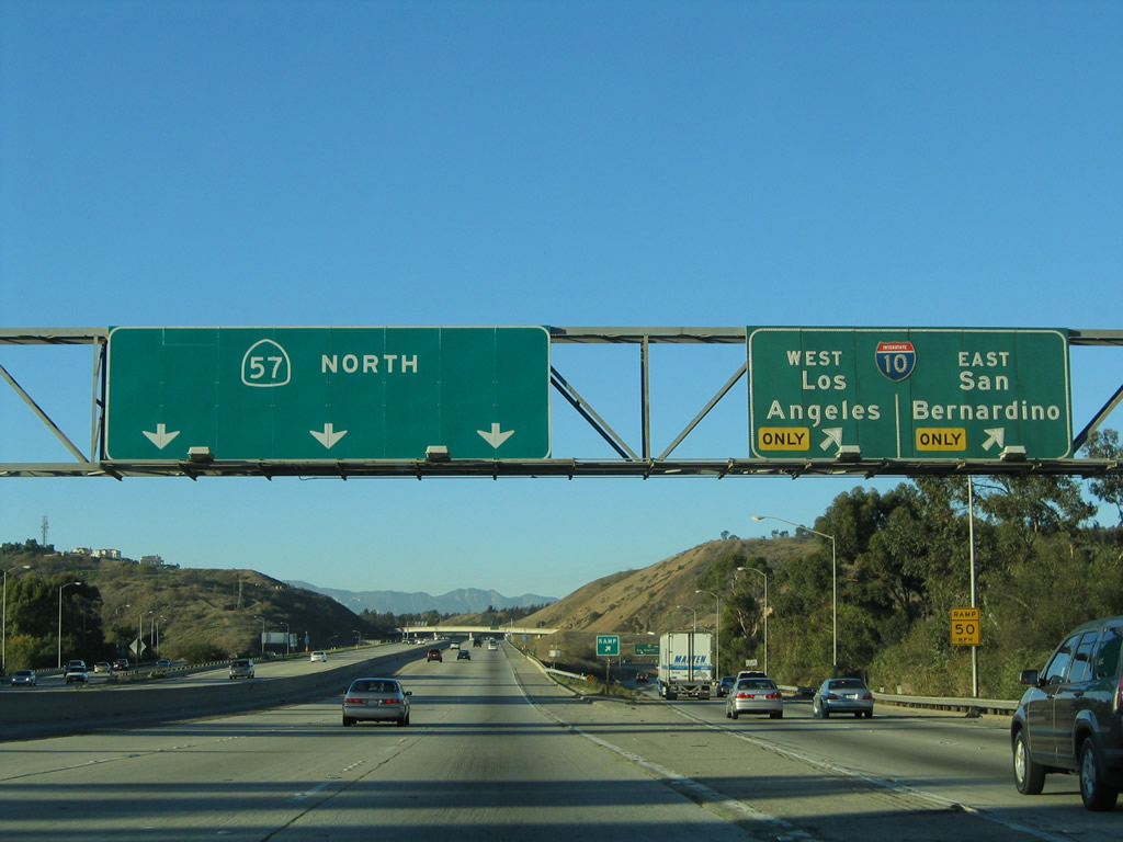
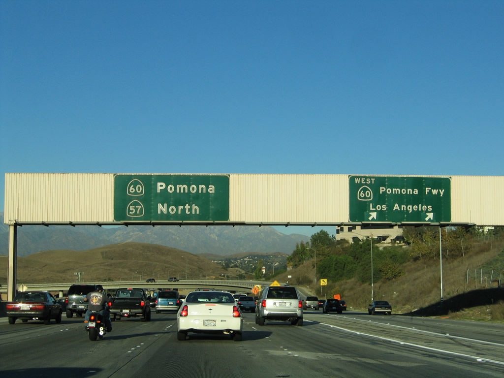
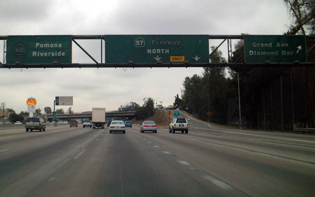
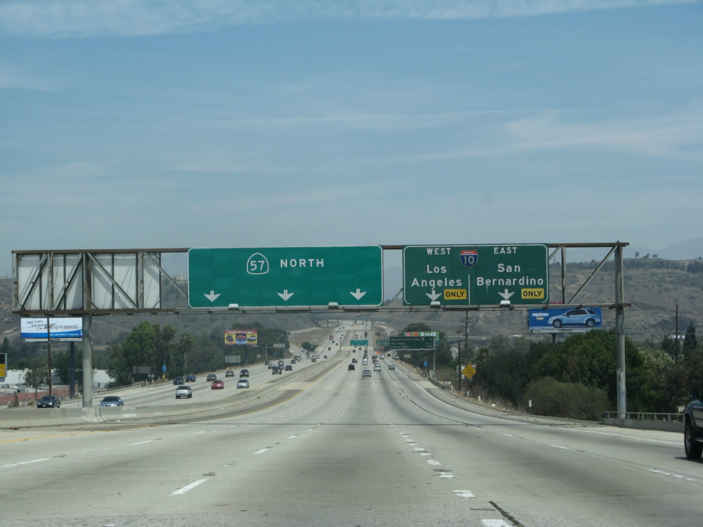
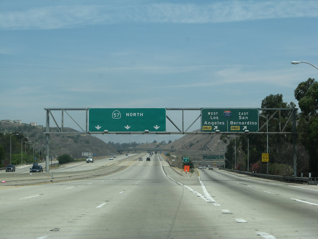
The next exit along northbound California 57 is Exit 16, California 60 (Pomona Freeway) west to Los Angeles, one mile. Northbound California 57 and eastbound California 60 merge for a couple miles after this interchange. Through traffic should remain in the left lanes; the right lanes connect to California 60 west.
07/04/07
This mileage sign along California 57 (Orange Freeway) north provides the distance to Exit 16, California 60 (Pomona Freeway) west and Exit 24B, Grand Avenue. This sign still shows California 60 as the "Pomona Freeway." Even though several signs that include the freeway name been removed, replaced, or covered, many still remain in use, especially in Los Angeles County.
07/04/07
A temporary orange construction sign advises that traffic for Exit 16 (California 60 west) should use the right two lanes. With the extension of carpool lanes and new direct connectors, signage through the Diamond Bar area has changed.
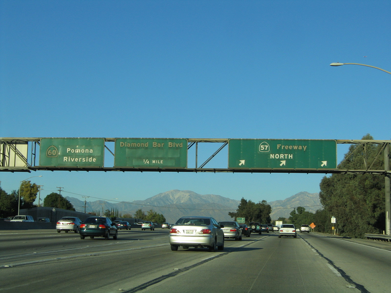
11/19/05
Shortly thereafter, northbound California 57 meets Exit 16, California 60 west. The pull through sign advises that the left lanes continue as California 57 north and California 60 east. The original porcelain enamel sign was replaced between 2005 and 2007; it was altered to include the direct connection for carpool traffic (left lane). Through traffic on California 57 is advised to take the main lanes rather than the carpool lanes, since the carpool lanes only connect to California 60 east (as of 2007).
07/04/07
11/19/05
This series of pictures follows California 57 north as it merges with California 60 east. The first picture shows the link to California 60 west (Exit 16), while the second picture shows the carpool lane separation from California 57 north. In the third picture, traffic from California 60 east merges from the left with California 57 north.
07/04/04
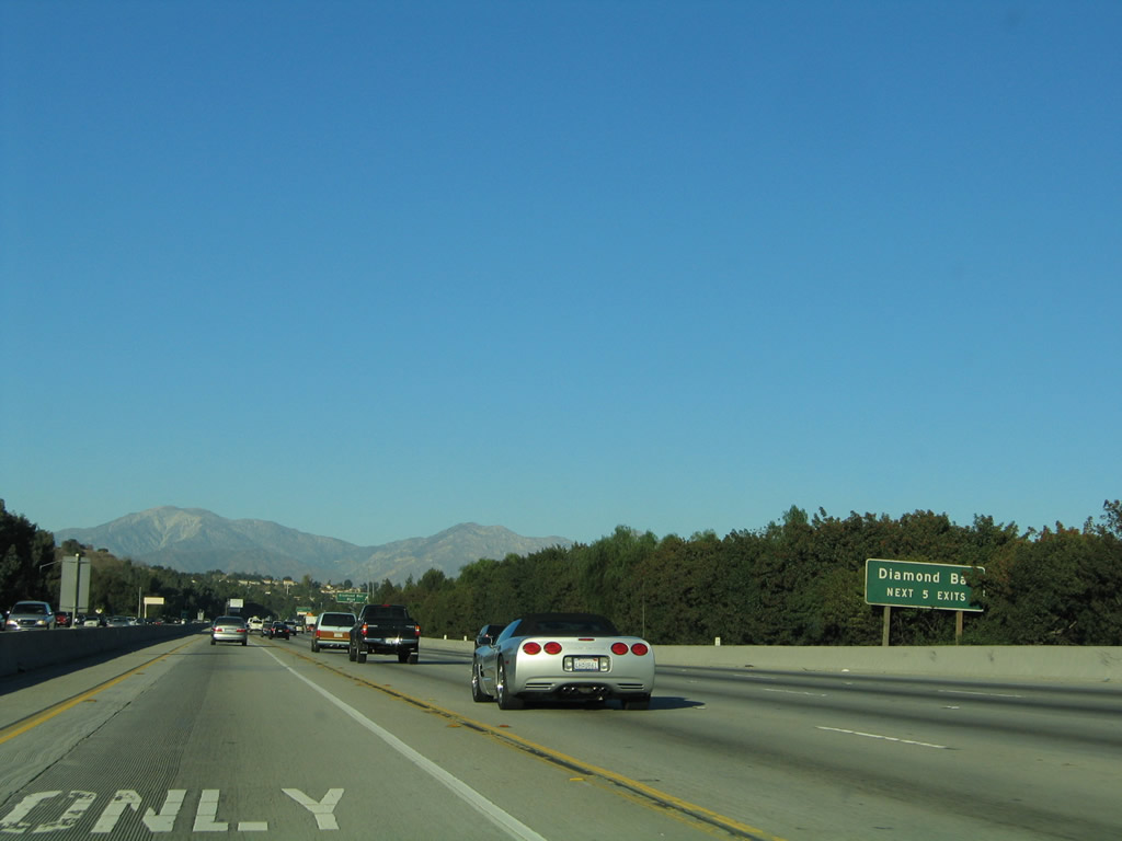
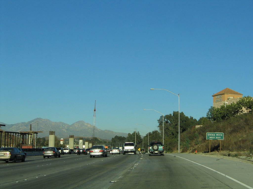
A roadside sign advising of using Exit 24B (Grand Avenue) for Chino Hills is posted. Back in 2005, the elevated carpool lanes were still under construction (including the direct connection from California 57 north to California 60 east); they were done by 2007.
02/26/11
11/19/05
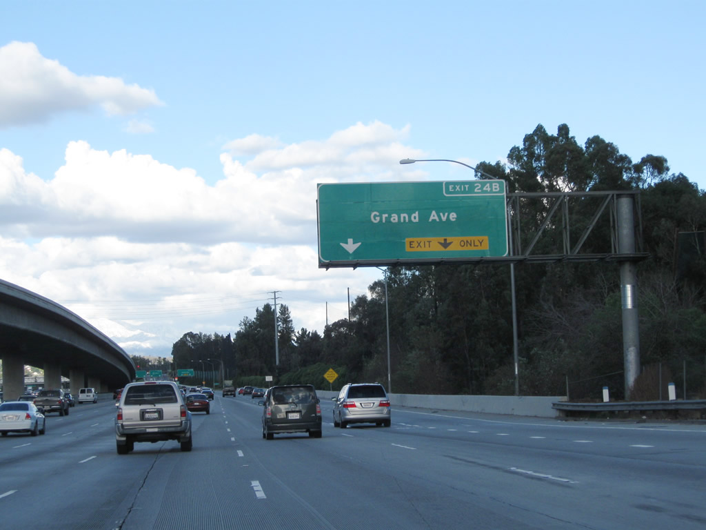
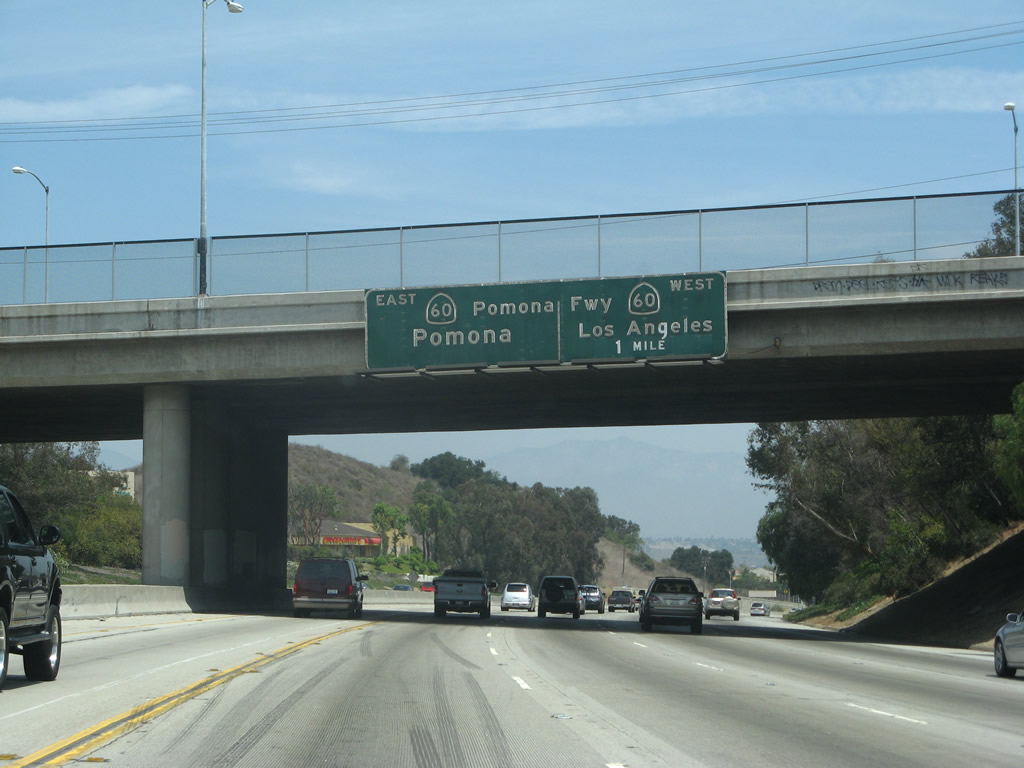
Traffic from California 57 (Orange Freeway) merges onto California 60 (Pomona Freeway) east from the right. The two routes briefly share alignment, with one mutual interchange at Exit 24B, Grand Avenue.
02/26/11
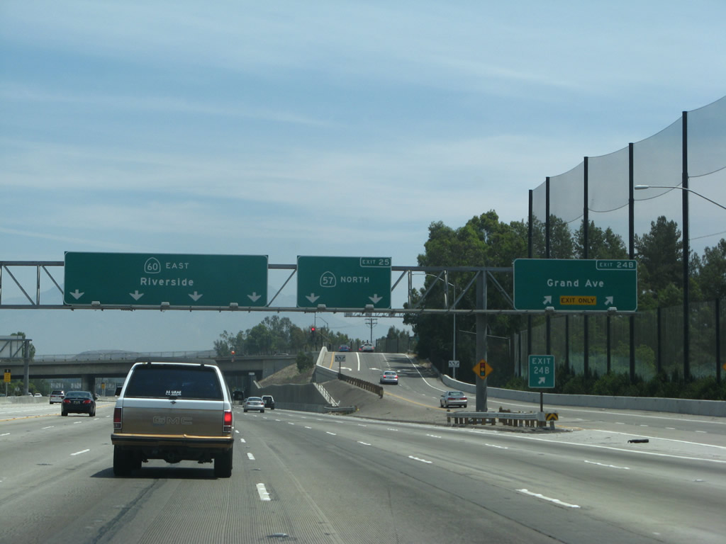
Eastbound California 60 and northbound California 57 meet Exit 24B, Grand Avenue in Diamond Bar. With the addition of a carpool lane and direct HOV connector between California 57 and California 60, this interchange underwent construction between 2002 and 2007. New signs were in place by summer 2007.
07/04/04
09/28/02
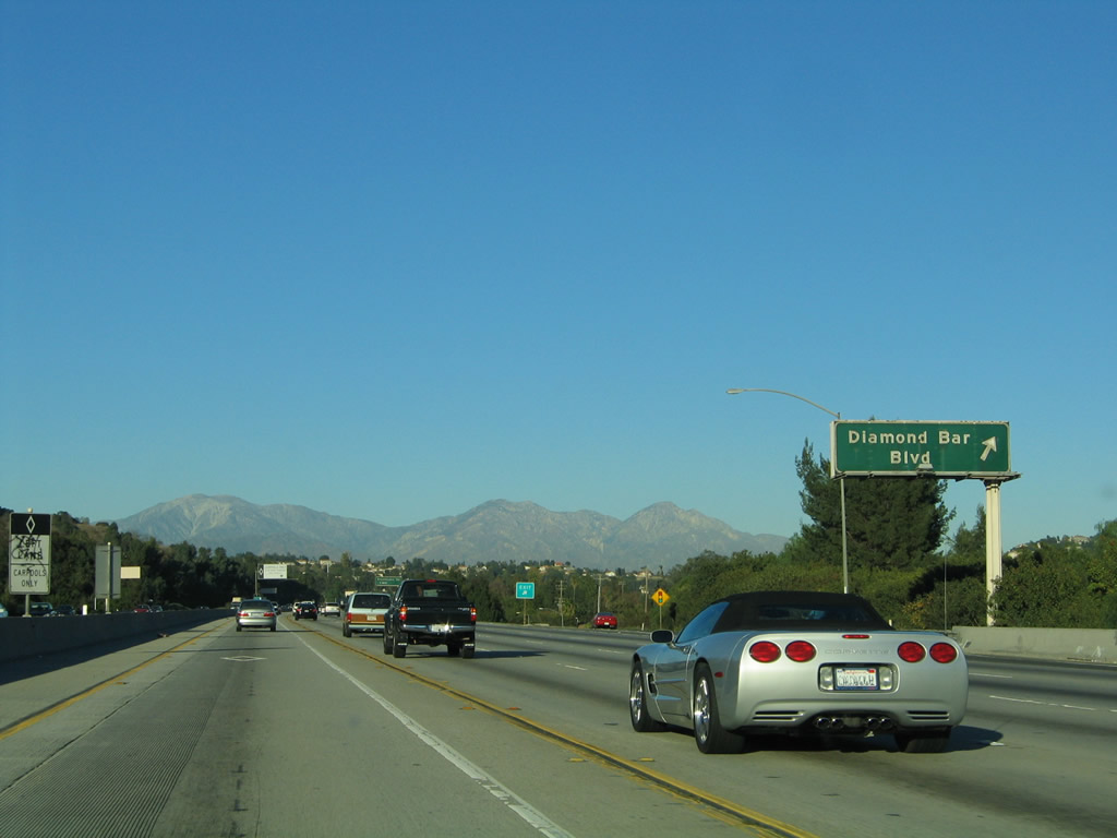
Now on the off-ramp to Grand Avenue, turn right for the connection to Diamond Bar and Chino Hills.
02/26/11
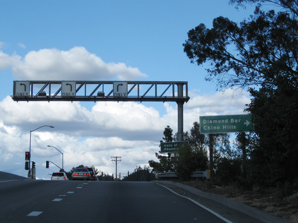
A roadside sign (posted after the Grand Avenue off-ramp) advises that California 60 east and California 57 north will split at Exit 25. California 57 proceeds north to San Dimas and Interstate 210, while California 60 leads east into Pomona and Ontario.
11/19/05
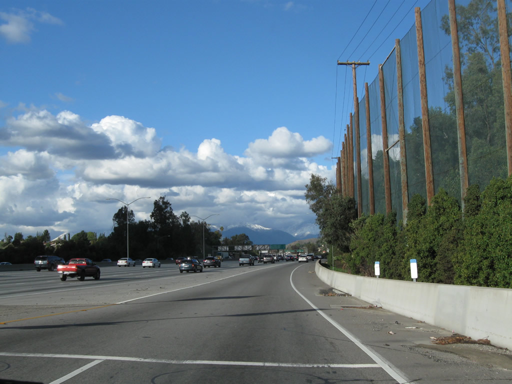
This view shows California 57 north and California 60 east as seen from the Grand Avenue on-ramp. A golf course is located on the southeast side of the freeway, hence the tall wooden poles and fence.
02/26/11
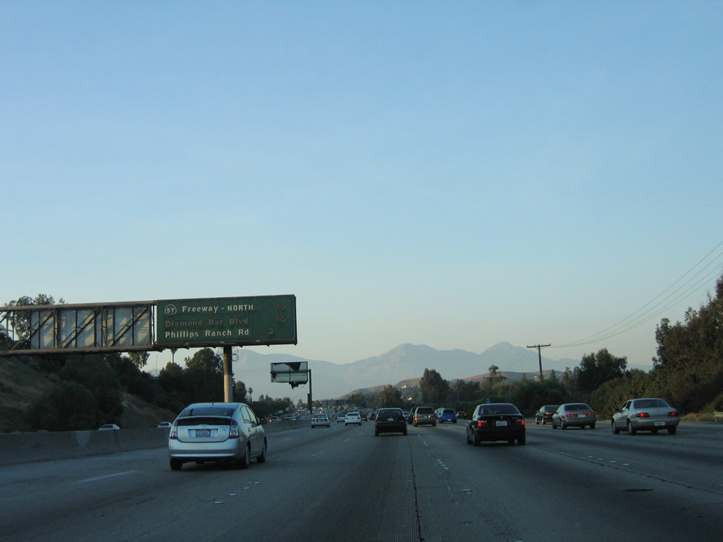
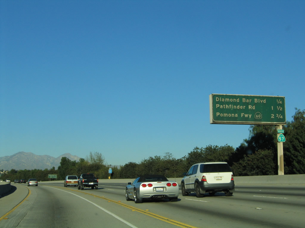
This mileage sign provides the distance for the next three exits on California 60 east only: Exit 25, California 57 (Orange Freeway) north; Exit 26, Diamond Bar Boulevard; and Exit 28, Phillips Ranch Road.
07/15/06
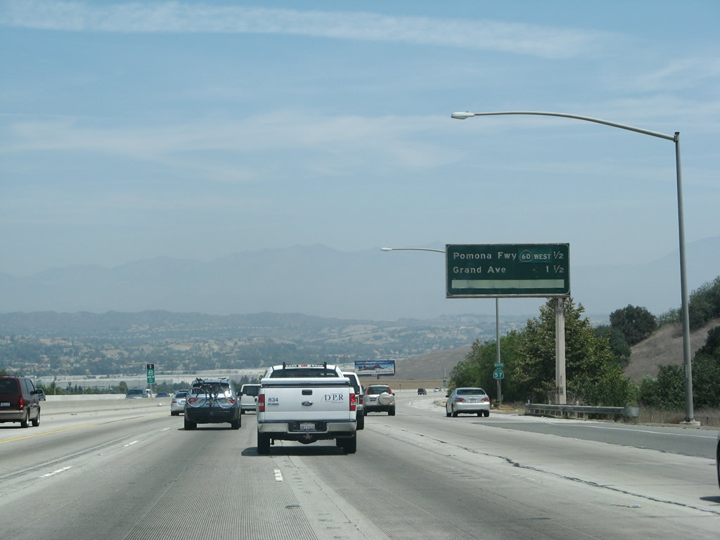
Eastbound California 60 and northbound California 57 split at Exit 25. Use the right three lanes to exit onto California 57 (Orange Freeway) north (Exit 25); the left four lanes continue east along California 60 (Pomona Freeway). The next exit along California 60 east is Exit 26, Diamond Bar Boulevard.
02/26/11
11/19/05
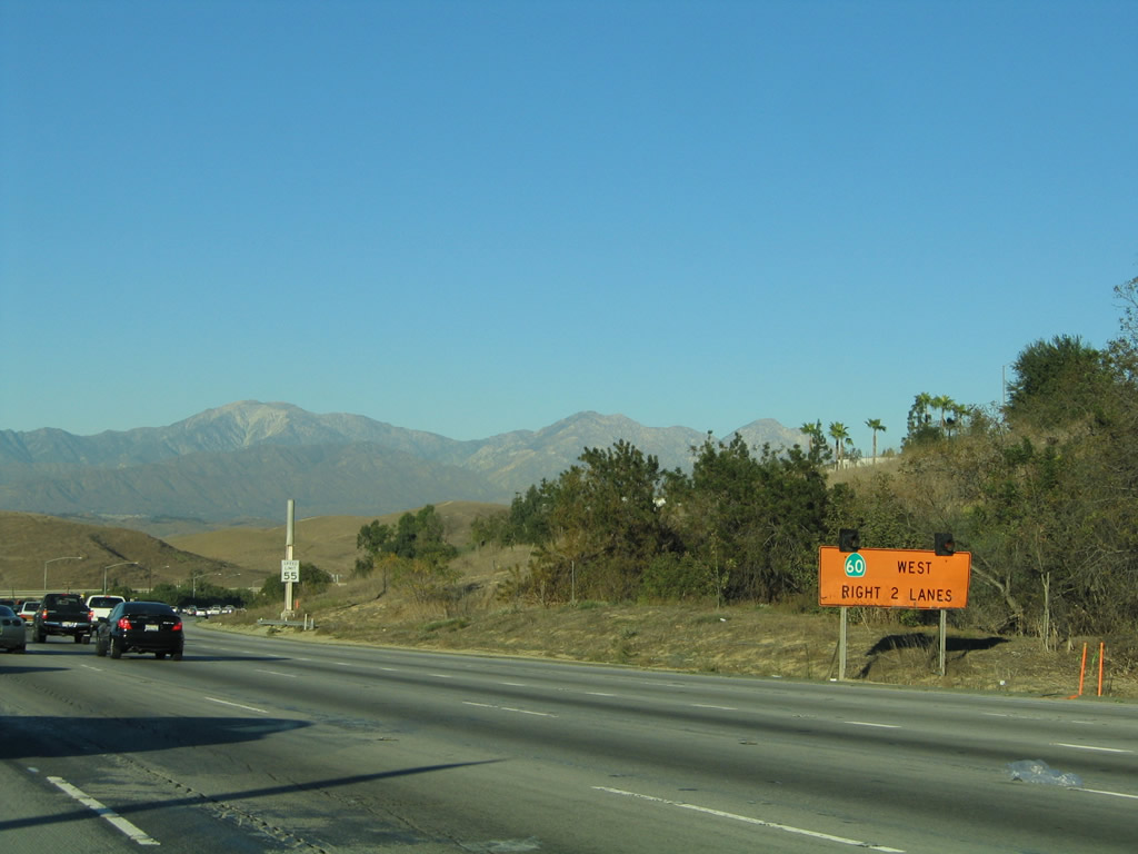
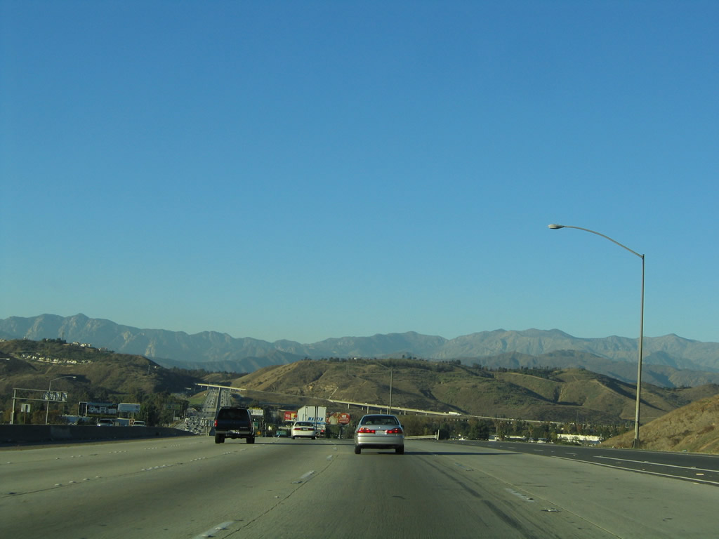
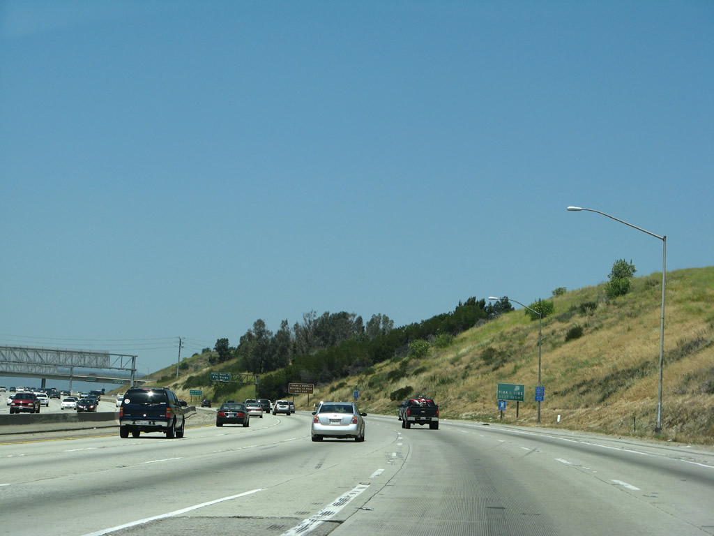
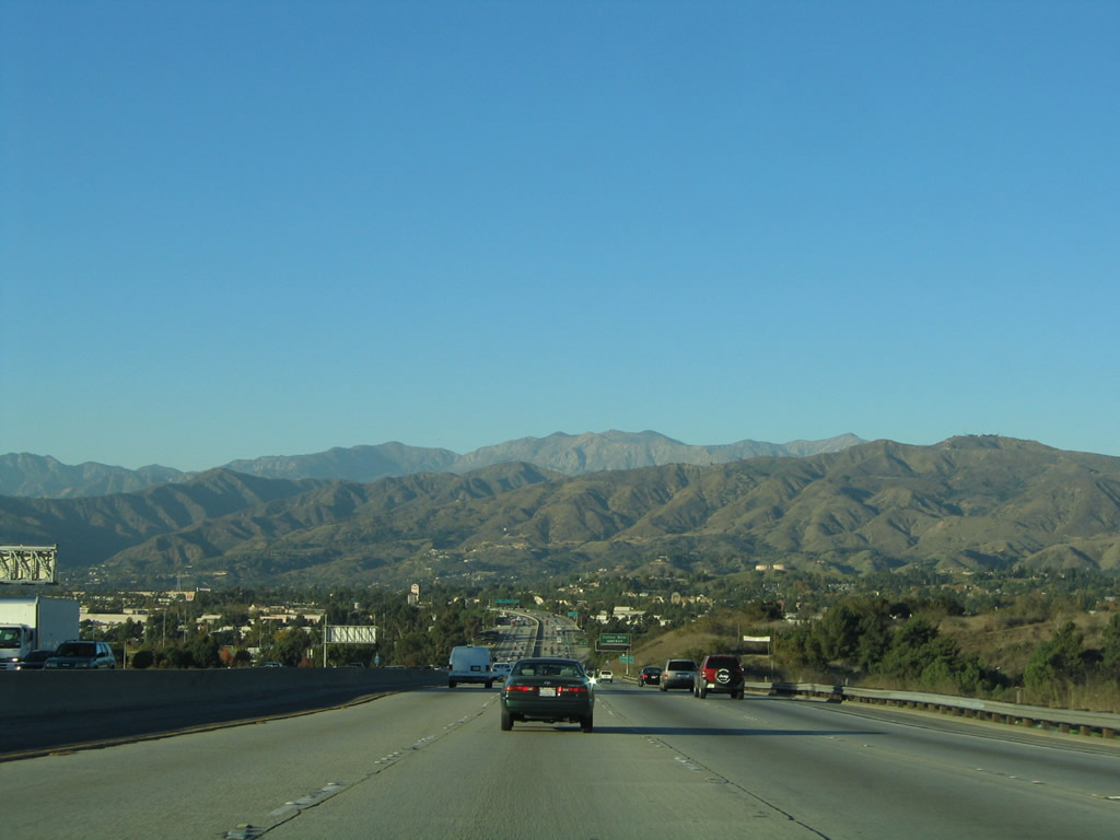
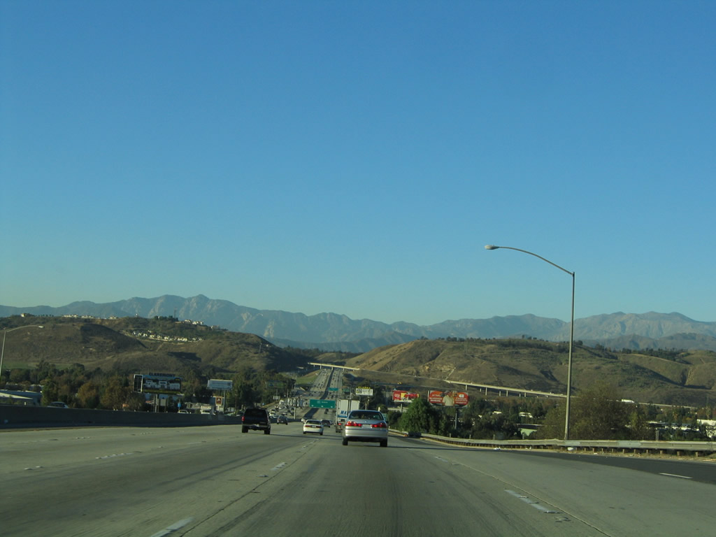
California 57 resumes its northerly course as the Orange Freeway after splitting from California 60 (Pomona Freeway). The freeway continues from here past northern Diamond Bar and Spadra before meeting Interstate 10 and entering San Dimas.
11/19/05
As California 60 passes overhead, northbound California 57 enters a brief tunnel to pass under the Pomona Freeway.
11/19/05
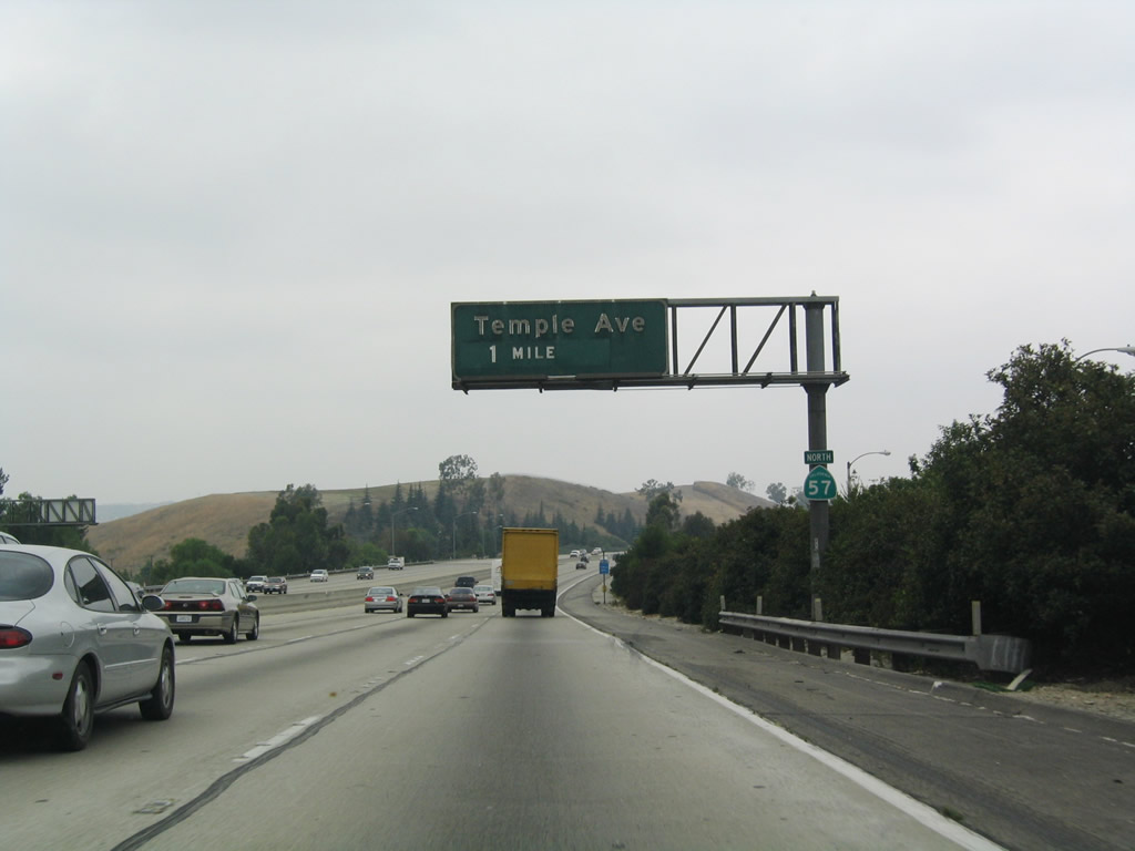
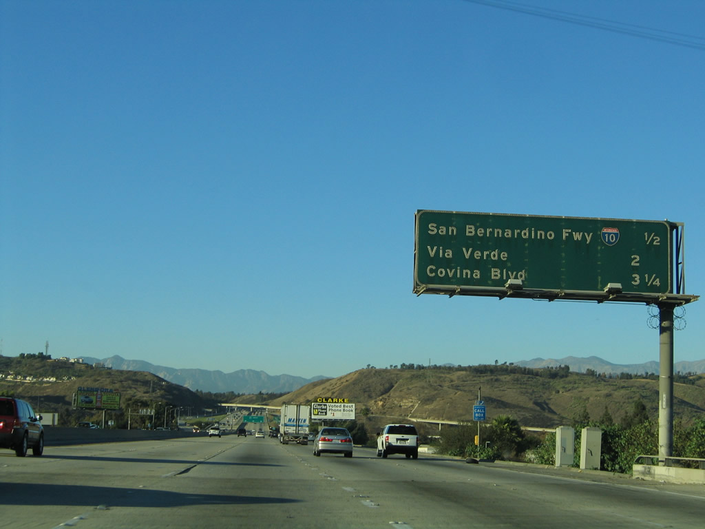
The first exit along California 57 after it splits from California 60 is Exit 20, Temple Avenue, one mile. Note that the sign bridges revert to the same model used south of California 90 (Imperial Highway).
07/03/04
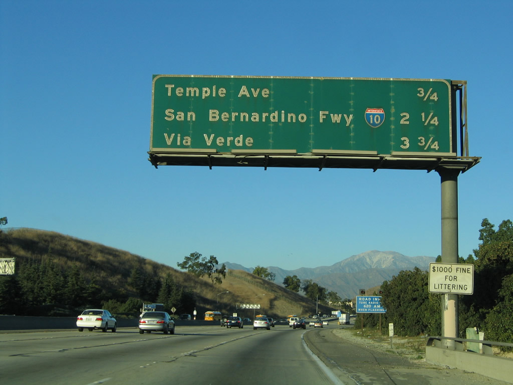
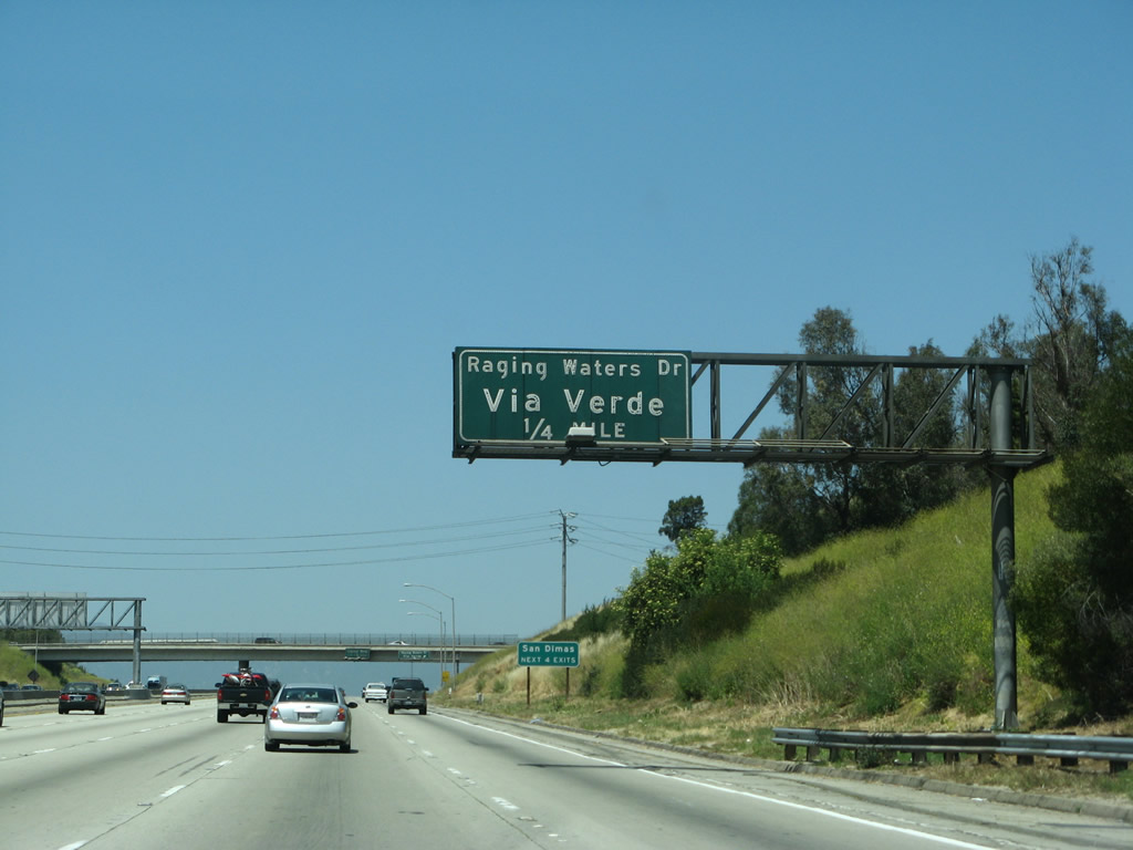
The next three exits along northbound are Exit 20, Temple Avenue; Exit 21, Interstate 10 (San Bernardino Freeway); and Exit 22, Via Verde/Raging Waters.
11/19/05
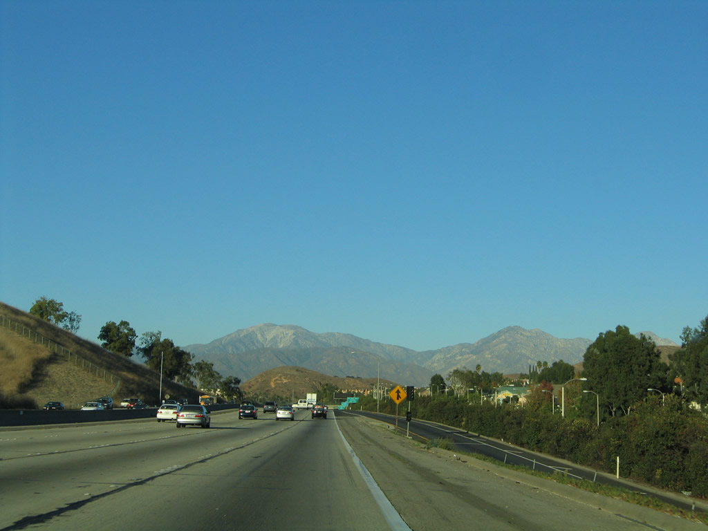
The San Gabriel Mountains loom in the distance ahead.
11/19/05
Use Exit 20 (Temple Avenue) to California Polytechnic University at Pomona.
11/19/05
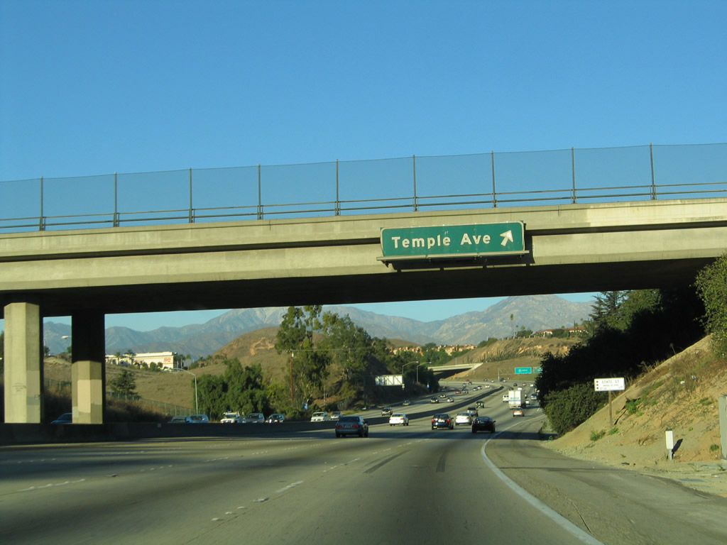
Northbound California 57 (Orange Freeway) meets Exit 20, Temple Avenue. Use Temple Avenue east to Diamond Bar and west to Spadra, with connections to Holt Avenue/Valley Boulevard. There is no interchange between California 57 and Holt Avenue.
11/19/05
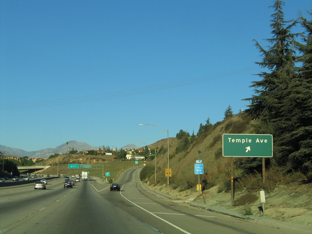
Due to limited sight distance between the last sign and the off-ramp, a roadside sign for Exit 20 is also posted.
11/19/05
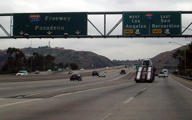
The forthcoming Kellogg Interchange joins SR 57 with I-10 (San Bernardino Freeway) and SR 71 (Chino Hills Freeway). Until 2002, SR 57 ended at this interchange, and I-210 took over the Orange Freeway from here to former SR 30. With the extension of SR 210 east to San Bernardino, SR 57 was extended for approximately four miles to I-210/SR 210 (Foothill Freeway).
11/19/05
Although no longer signed as I-210, the four mile stretch of SR 57 north to the Foothill Freeway is technically still considered part of the Interstate Highway System.
07/04/04
The Kellogg Interchange, built in 1972, is the point where California 57 (Orange Freeway), Interstate 10 (San Bernardino Freeway), and California 71 (Chino Valley Freeway) come together. This interchange is named for the old Kellogg Ranch, which predates the construction of the freeway interchange and the nearby residential and commercial development. After passing under Temple Avenue, California 57 curves north to pass on the top level of this symmetrical stack interchange. Direct access, high-speed ramps connect California 57 with both directions of Interstate 10, but no access is provided to California 71 south as it is considered to be an illogical connection.
11/19/05
Interstate 10 east connects travelers to LA/Ontario International Airport in Rancho Cucamonga. This airport sees dozens of flights daily from several major airlines. Exit 22 servers Raging Waters Drive, which is the second exit after the I-10 off-ramp.
11/19/05
The left three lanes of California 57 are for through traffic north to San Dimas, while the right two lanes prepare for exit onto Interstate 10 (Exit 21). Interstate 10 east leads to the city of San Bernardino, passing into San Bernardino County afters Exit 47 (Indian Hill Boulevard) and 48 (Monte Vista Avenue). Heading west, Interstate 10 aims toward Downtown Los Angeles where it swings to the southwest with I-5, then resumes west to Santa Monica.
11/19/05
07/04/04
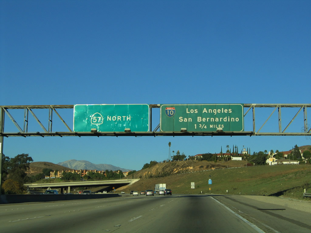
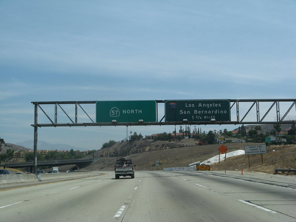
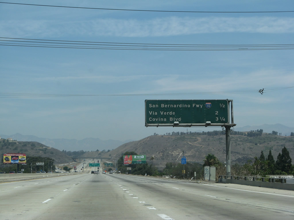
This mileage sign provides the distance to the next three exits along northbound California 57: Exit 21, Interstate 10; Exit 22, Via Verde/Raging Waters; and Exit 24A, Covina Boulevard. The latter two exits are along what used to be Interstate 210.
11/19/05
07/04/04
Northbound California 57 (Orange Freeway) meets Exit 21, Interstate 10 (San Bernardino Freeway). The maze of ramps associated with the massive Kellogg Interchange is not as noticeable on northbound California 57, since the Orange Freeway serves as the top deck in the symmetrical stack interchange. However, the view of this interchange from the lowest level (Interstate 10) betrays the severe height difference between these two intersecting freeways. In addition, California 71 (which is not mentioned along northbound California 57) enters the Kellogg Interchange from the southwest, adding more ramps to the stack.
11/19/05
07/04/04
Back in 2002, Exit 21 was signed with a pull-through destination of Interstate 210 freeway west to Pasadena. The new sign in the previous photobox does not mention Interstate 210 or its control city of Pasadena.
05/03/02
The off-ramp to Exit 21 splits, with the left lane connecting to Interstate 10 west to downtown Los Angeles and the right two lanes connecting to Interstate 10 east to San Bernardino. This porcelain enamel sign dates back to the original construction of the Kellogg Interchange.
11/19/05
A white bridge identification sign still refers to this interchange as the joining of Routes 10, 57, and 210. This sign could be changed to reflects only Routes 10 and 57, since 210 does not terminate here (since 2002).
07/04/07
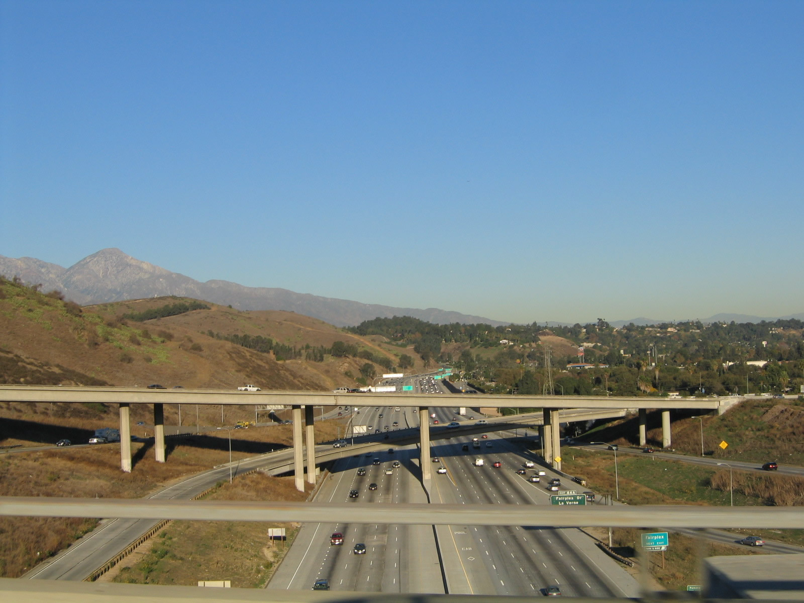
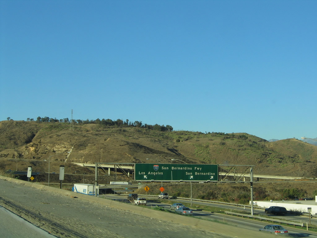
This view looks from the California 57 overpass east toward Pomona on Interstate 10, which rides the floor of the valley and is well below the grade of California 57.
11/19/05
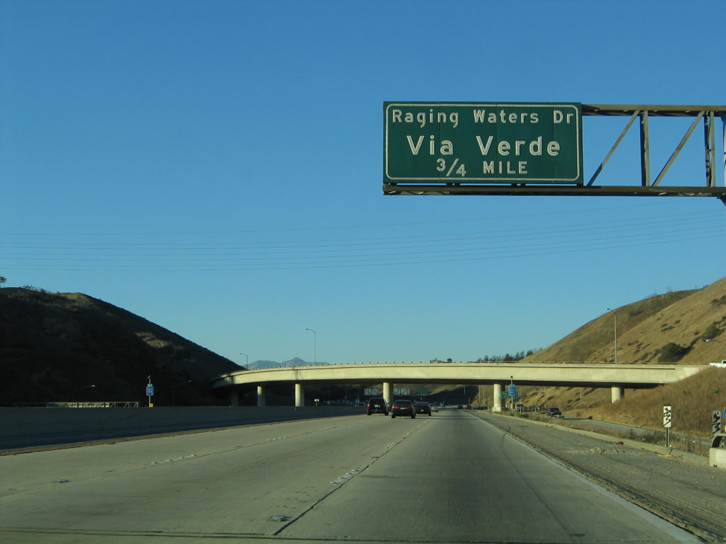
Before leaving the Kellogg Interchange, this sign identifies the next exit from California 57 (Orange Freeway) north as Exit 22, Via Verde and Raging Waters, 0.75 mile. This is the first exit to serve the city of San Dimas. Ahead, traffic from Interstate 10 west merges onto California 57 north. This ramp was closed for a time on April 25, 2010, after a landslide brought rocks and mud onto the transition ramp. This ramp used to bring traffic from Interstate 10 west to Interstate 210 west before 210 was rerouted.1
11/19/05
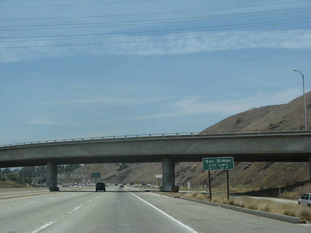
California 57 leaves the city of Pomona and enters the city of San Dimas, its northern terminus. San Dimas had a population of 34,980 as of the 2000 Census and was incorporated on August 4, 1960.
07/04/07
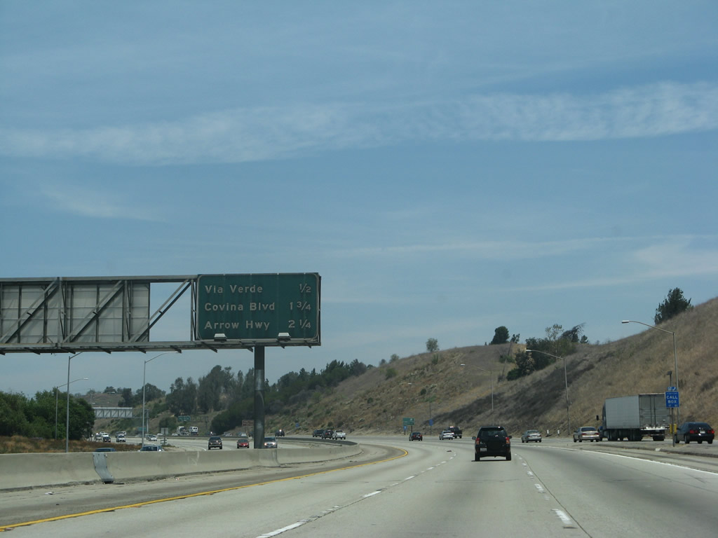
As California 71 merges onto northbound California 57 to the right, this mileage sign provides the distance to the next three exits: Exit 22, Via Verde/Raging Waters; Exit 24A, Covina Boulevard; and Exit 24B, Arrow Highway. The latest Interstate Highway Route Log and Finder List from the Federal Highway Administration (from 2002) still acknowledges the segment of California 57 between Interstate 10 and California 210 as being part of Interstate 210. Since this short segment was built with Interstate Highway funds, it is not clear if the updated route log will reassign those miles to the proposed new Interstate 210 that is currently designated as California 210.
07/04/07
Two new lanes from California 71 north join the mainline of California 57 north.
04/26/08
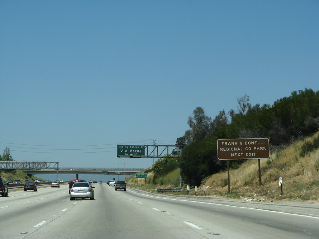
Use Exit 22 to Frank G. Bonelli Regional County Park.
04/26/08
California 57 heads uphill to meet Via Verde and Raging Waters at Exit 22; afterward, the freeway begins to descend toward Exit 24A, Covina Boulevard and Exit 24B, Arrow Highway. As the name implies, Via Verde and Raging Waters provides access to the theme park Raging Waters as well as Bonelli Regional Park and Puddingstone Reservoir.
04/26/08
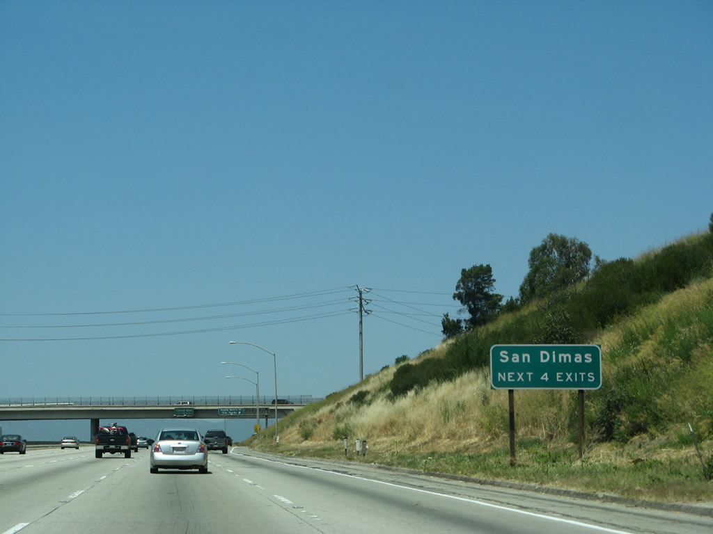
The next four exits along California 57 (Orange Freeway) north (former Interstate 210 west) serve the city of San Dimas: Exit 22, Raging Waters Drive and Via Verde; Exit 24A, Covina Boulevard; Exit 24B, Arrow Highway; and Exit 25A, Allen Avenue/Auto Centre Drive.
04/26/08
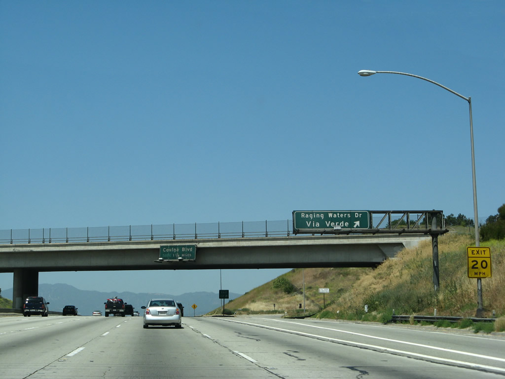
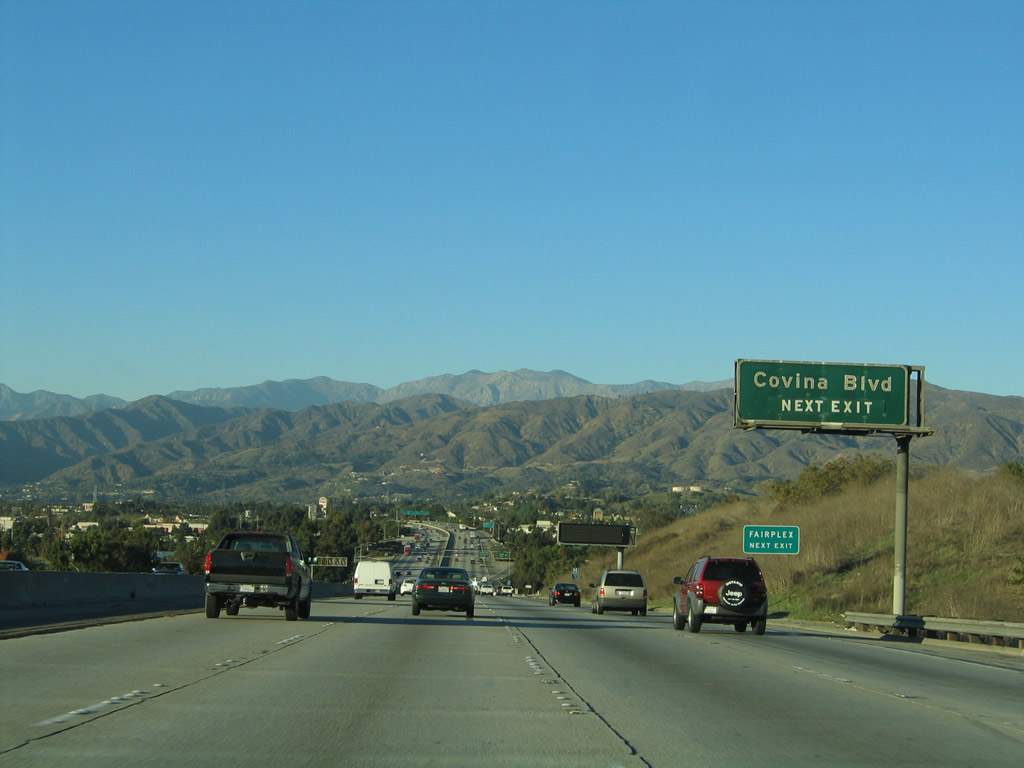
Northbound California 57 (Orange Freeway) reaches Exit 22, Raging Waters Drive and Via Verde. The next exit along northbound is Exit 24A, Covina Boulevard.
04/26/08
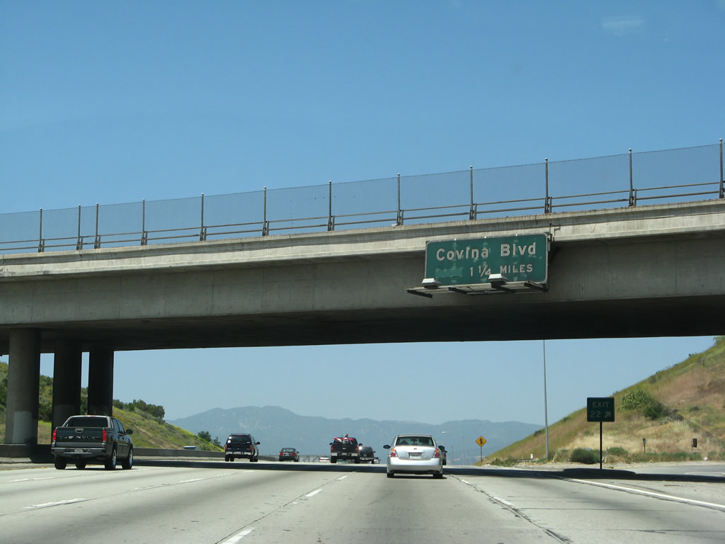
This porcelain enamel sign is the first to advise travelers on California 57 north (former Interstate 210 west) for the next interchange: Exit 24A, Covina Boulevard.
04/26/08
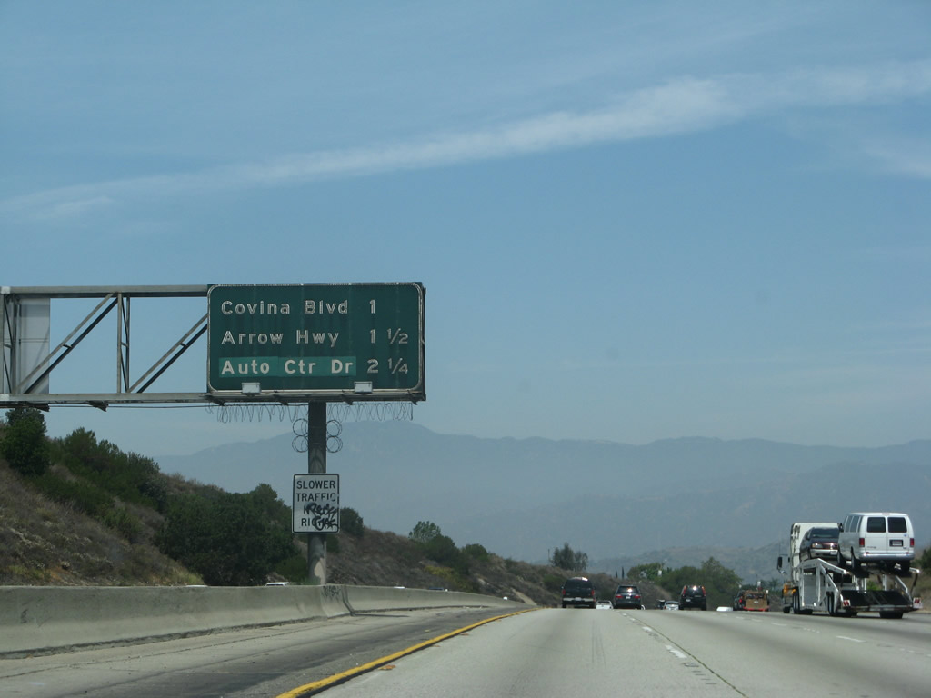
The next three exits along northbound California 57 (former Interstate 210) are Exit 24A, Covina Boulevard; Exit 24B, Arrow Highway; and Exit 25A, Allen Avenue/Auto Centre Drive.
07/04/07
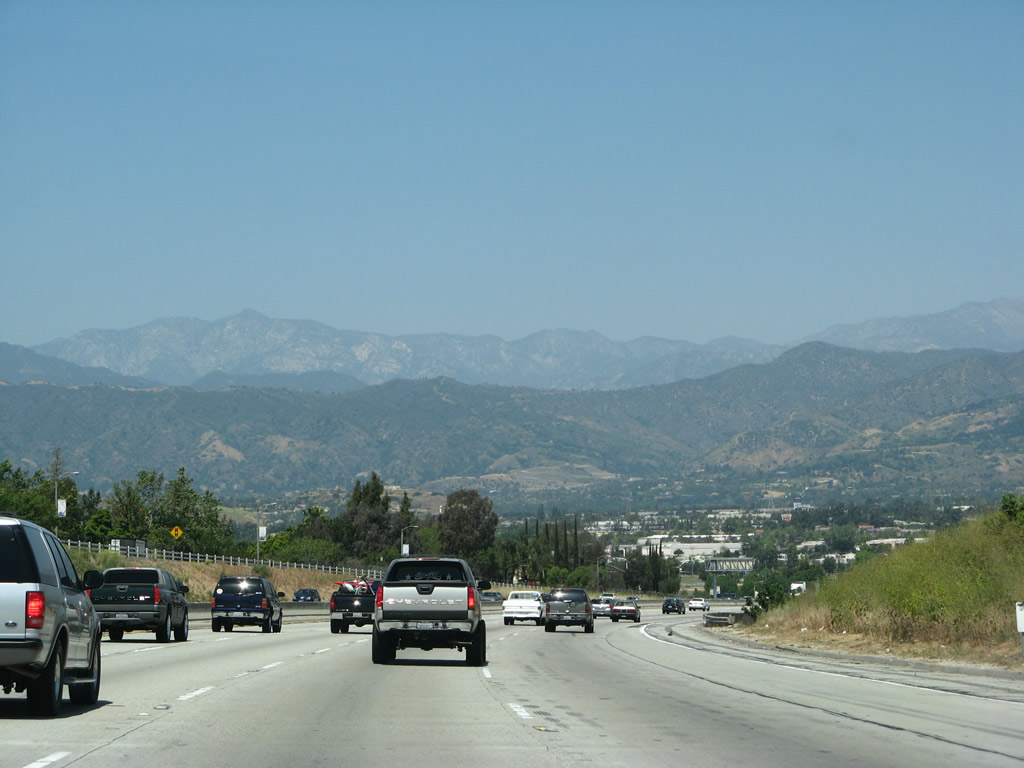
The San Gabriel Mountains come into view as California 57 begins to descend downhill.
04/26/08
These mountains are an effective barrier to keep any further development north of San Dimas. Inversion layers keep fog and smog from reaching the top of the mountains, leaving somewhat obscured visibility on days with high pollution.
11/19/05
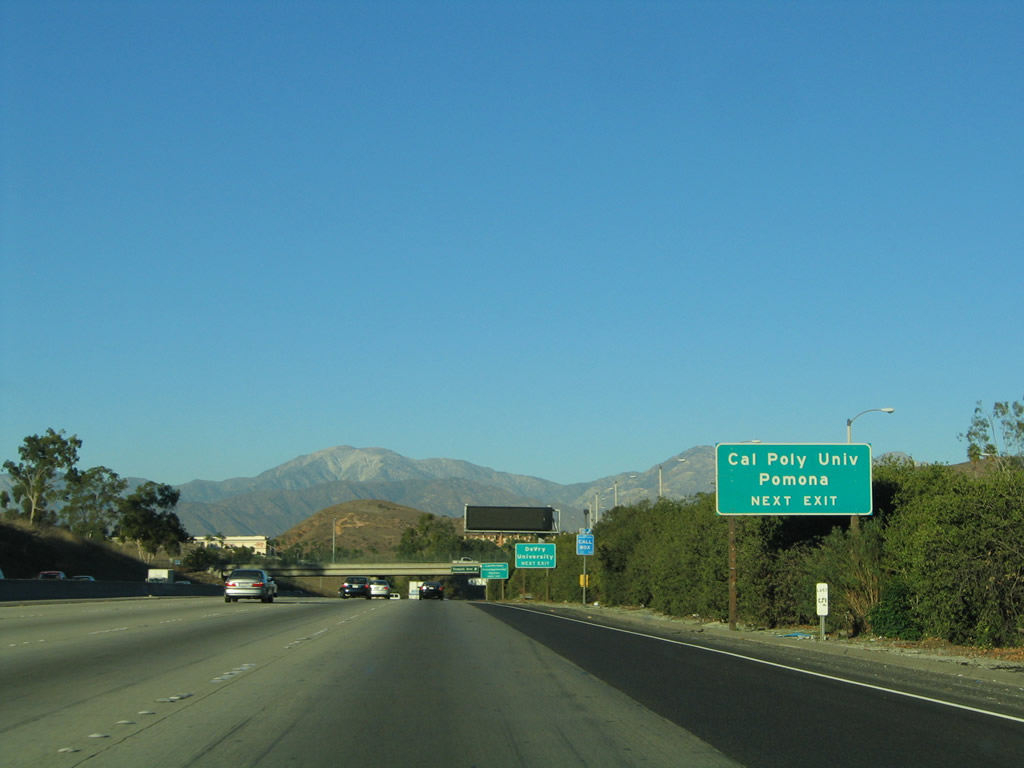
Use Exit 24A, Covina Boulevard east to reach the Los Angeles County Fairplex.
11/19/05
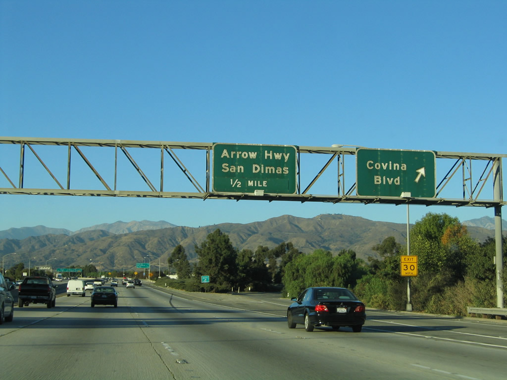
Northbound California 57 (Orange Freeway) reaches Exit 24A, Covina Boulevard; the following exit is Exit 24B, Arrow Highway.
11/19/05
The next four exits along northbound California 57 (Orange Freeway) are Exit 24B, Arrow Highway; Exit 25A, Auto Centre Drive/Allen Avenue; Exit 25B, California 210 east; and Exit 25C, Interstate 210 west. The Interstate shield is omitted from this mileage sign because the exit to the state route freeway occurs prior to the transition ramp onto westbound Interstate 210.
11/19/05
Northbound California 57 (Orange Freeway) reaches Exit 24B, Arrow Highway into downtown San Dimas. The next two exits are for the Foothill Freeway east (California 210) and west (Interstate 210).
11/19/05
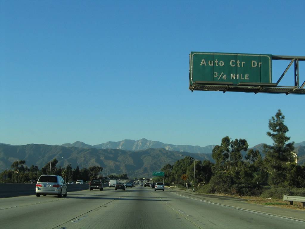
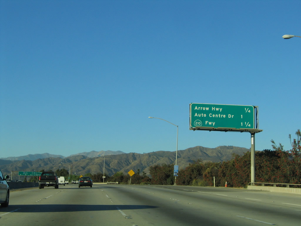
The next exit along northbound is Exit 25A, Auto Centre Drive/Allen Avenue, three-quarters of a mile.
11/19/05
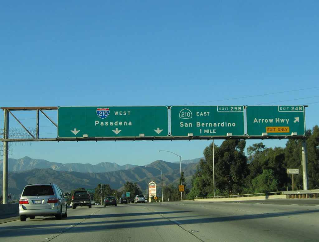
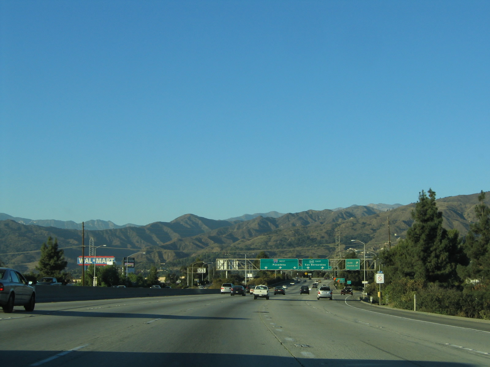
California 57 approaches its northern terminus as it contemplates its final two exits: Exit 25A to eastbound California 210 and westbound Interstate 210 to Pasadena and Sylmar. The interchange between California 57 and Interstate 210 is sometimes called the Glendora Curve, a name that harkens back to when Interstate 210 curved south to meet Interstate 10 in San Dimas. Interstate 210 takes over as the eastern bypass route for Interstate 5 between the Orange Crush Interchange (California 22/California 57) and the Sylmar Interchange (Interstate 210/California 14).
11/19/05
A final California 57 north reassurance shield is posted just after the mileage sign in the prior photobox.
07/15/07
This view looks north at the pending interchange with Interstate 210.
11/19/05
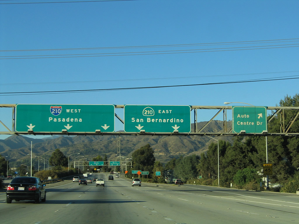
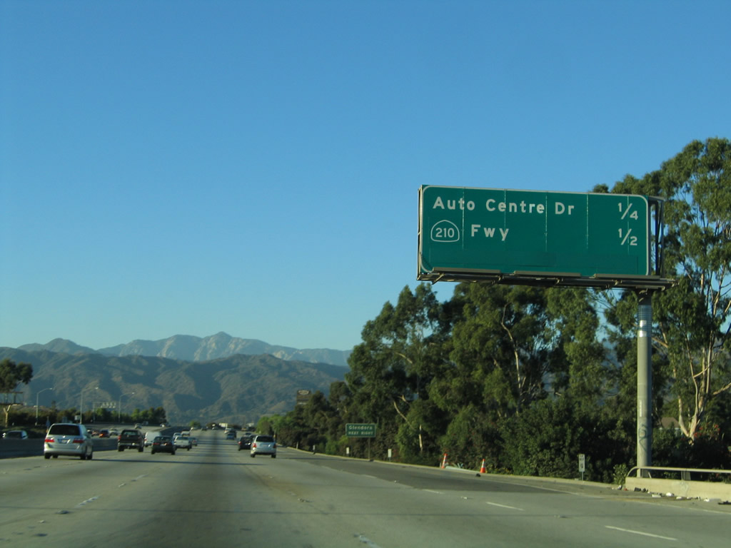
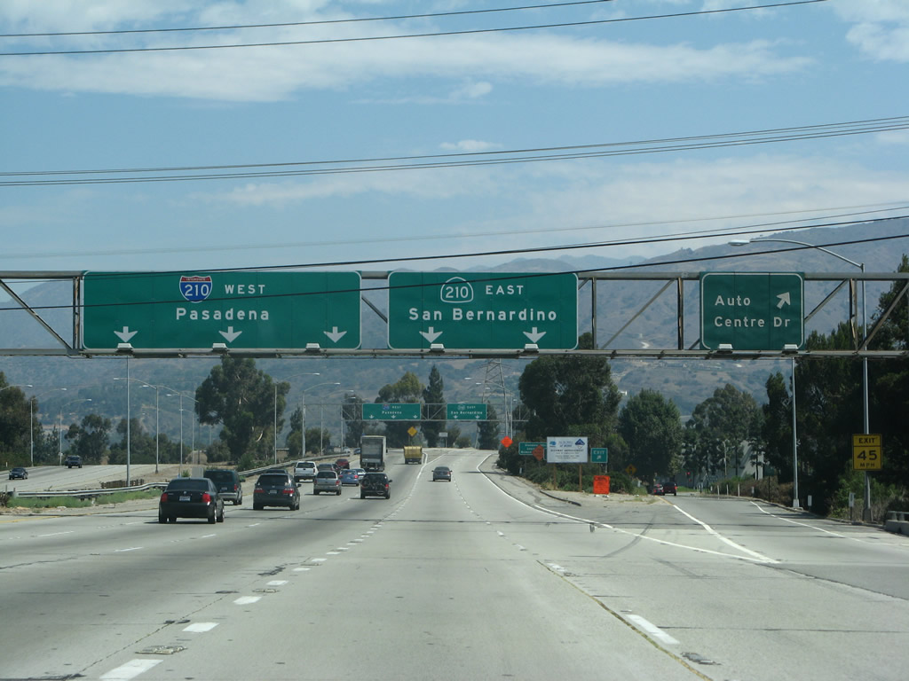
Northbound California 57 (Orange Freeway) reaches Exit 25A, Auto Centre Drive. As for through traffic, the left lanes default onto westbound Interstate 210, while the right lanes head east along California 210. Wires can partially obscure the legibility of the sign.
11/19/05
07/15/07
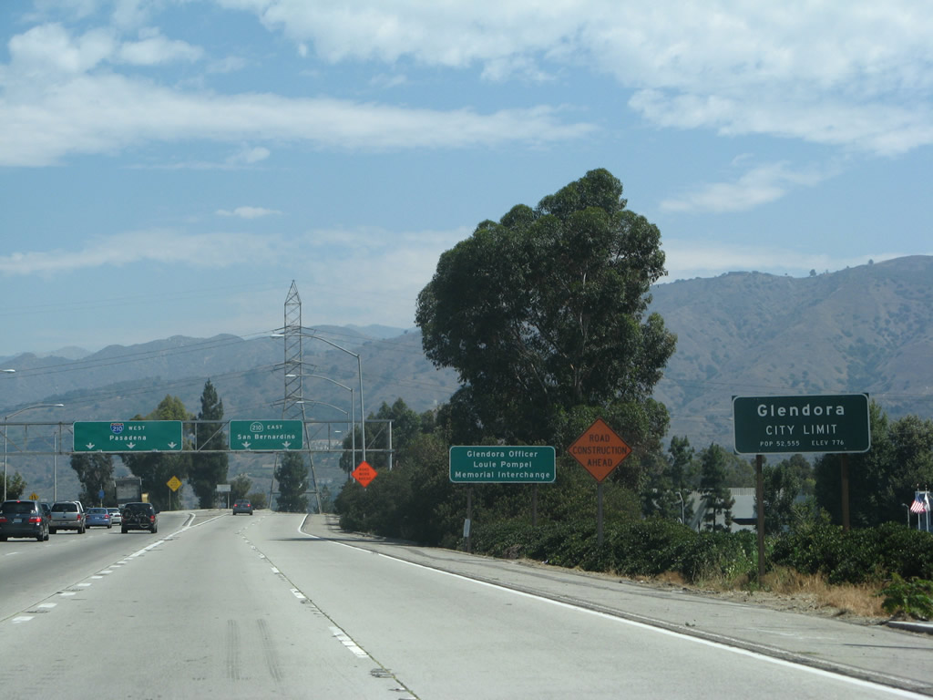
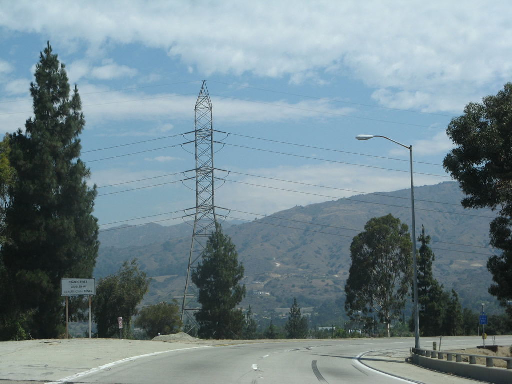
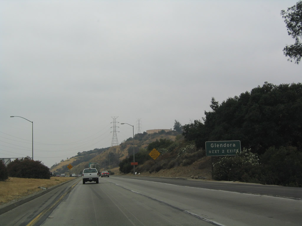
California 57 departs San Dimas and enters the city of Glendora just as the freeway approaches its northern terminus with California 210.
07/15/07
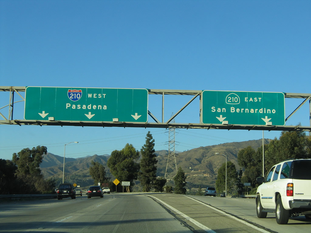
California 57 splits into westbound Interstate 210 and eastbound California 210. California 30 was eliminated here in 2002, the same year Interstate 210 was realigned to end at this interchange. The Glendora Curve Interchange (California 57 and California 210) marks the northern terminus of California 57 (Orange Freeway).
11/19/05
This view shows the ramp from California 57 north to California 210 east. A tall Los Angeles Department of Water and Power transmission line tower is visible as the ramp curves east.
07/15/07
Now on the transition ramp from California 57 north to Interstate 210 west, this view looks west on the main lanes of Interstate 210.
04/26/08
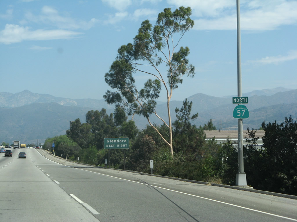
Once on the transition ramp from northbound California 57 onto westbound Interstate 210, this sign indicates that the next two exits from Interstate 210 serve the city of Glendora.
07/03/04
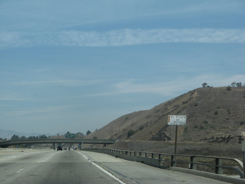
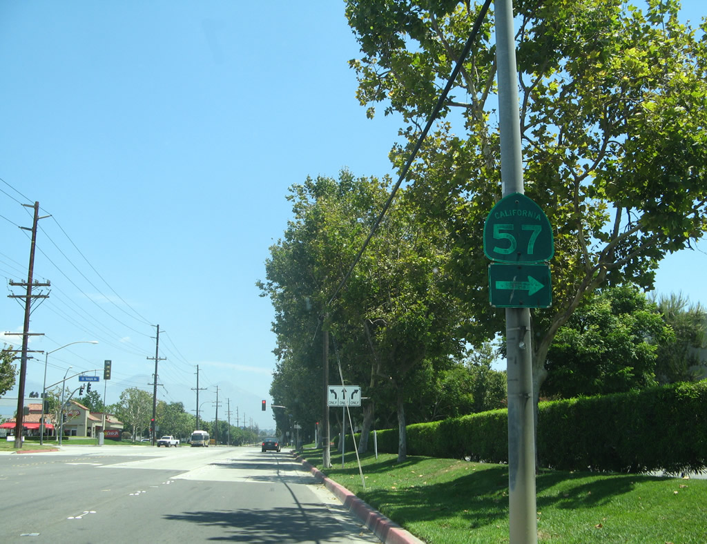
A SR 57 trailblazer appears on northbound Pomona Boulevard between the separation with Valley Boulevard and intersection with Temple Avenue. Temple Avenue links with SR 57 at Exit 20.
07/15/07
References:
- Landslide forces closure of Interstate 10 road: The connection from the westbound 10 Freeway to northbound California 57 is shut after a 100-foot section of a hillside slides in San Dimas -- The morning commute will be affected, the CHP says, April 25, 2010, by Ruben Vives, Los Angeles Times. http://articles.latimes.com/2010/apr/25/local/me-freeway-closure
- 57 freeway may get long-awaited extension, Orange County Register, April 01, 2009, by Michael Mello. http://articles.ocregister.com/2009-04-01/cities/24667067_1_freeway-lanes-congestion-orange-crush
- Central County Corridor - Major Investment Study - Reduced Set of Alternative Strategies from the Orange Country Transportation Authority (OCTA) Board of Directors Meeting on October 9, 2009. http://www.octa.net/pdf/100909/central.pdf
- Weekly Update of Orange County Transportation by Will Kempton of OCTA on June 21, 2010. The article "Staff Shares Progress of Central County Study to Fountain Valley" states that the "City Council, which had adopted a resolution in opposition to extending the SR-57 down the Santa Ana River Channel, also reconfirmed with staff that the freeway extension concept was no longer under consideration and would not be part of a locally preferred strategy." That statement was confirmed by OCTA staff and reported in the weekly update. http://www.octa.net/weeklyupdate/weekly_update_062110.html
- SR-57 Northbound Widening Project Orangethorpe Avenue to Lambert Road Fast Facts: Improving Travel on the Orange (SR-57) Freeway - This project is divided into two sections: Segment 1 - from north of California 91 near Orangethorpe Avenue in Placentia to Lambert Road in Brea and Segment 2 - Katella Avenue to Lincoln Avenue in Anaheim between 2010 and 2014. http://www.octa.net/uploadedfiles/Files/pdf/sr57.pdf "Improvements to this five-mile stretch include the addition of one general purpose lane along with merging lanes and reconfiguration of certain on-ramps and off-ramps. Relocation of some existing soundwalls and construction of new soundwalls also will occur within the project corridor."
- 57/60 Confluence Project web page. http://www.freetheway.org/
Photo Credits:
- Andy Field: 05/03/02, 09/28/02, 07/03/04, 07/04/04, 03/25/05, 11/19/05, 07/15/06, 07/04/07, 07/15/07, 04/26/08, 02/26/11
Connect with:
Page Updated Sunday February 27, 2011.