
State Route 99 North - Wheeler Ridge to Bakersfield
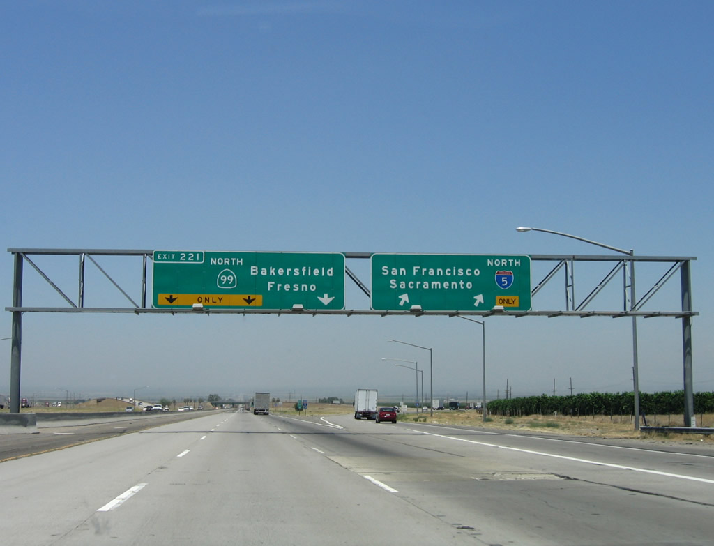
Interstate 5 and California 99 split at Wheeler Ridge, and the two freeways diverge: Interstate 5 heads northwest, while California 99 continues north toward Bakersfield. Stay left for Exit 221, which connects from Interstate 5 north to the main lanes of California 99 north. The right two lanes continue as Interstate 5 by sweeping to the right and then flying over California 99.
06/28/06
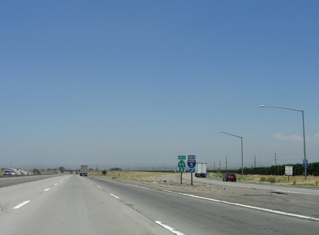
The main lanes of California 99 continue straight ahead, while the lanes carrying Interstate 5 sweep to the right and then over California 99. A pair of trailblazers, one for Interstate 5 and the other for California 99, is posted at the gore point for Exit 221. By 2011, these route markers had been replaced, with the new Interstate 5 sign neutered. If designated as an Interstate, this split would be the southern terminus of Interstate 7 or 9.
06/28/06
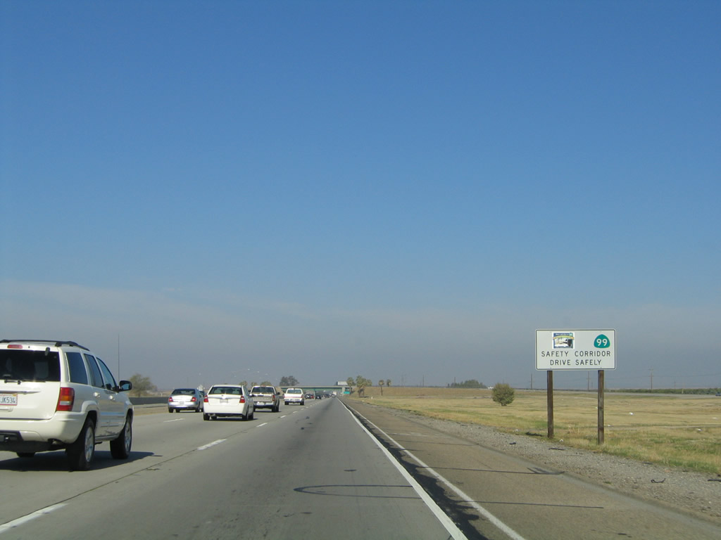
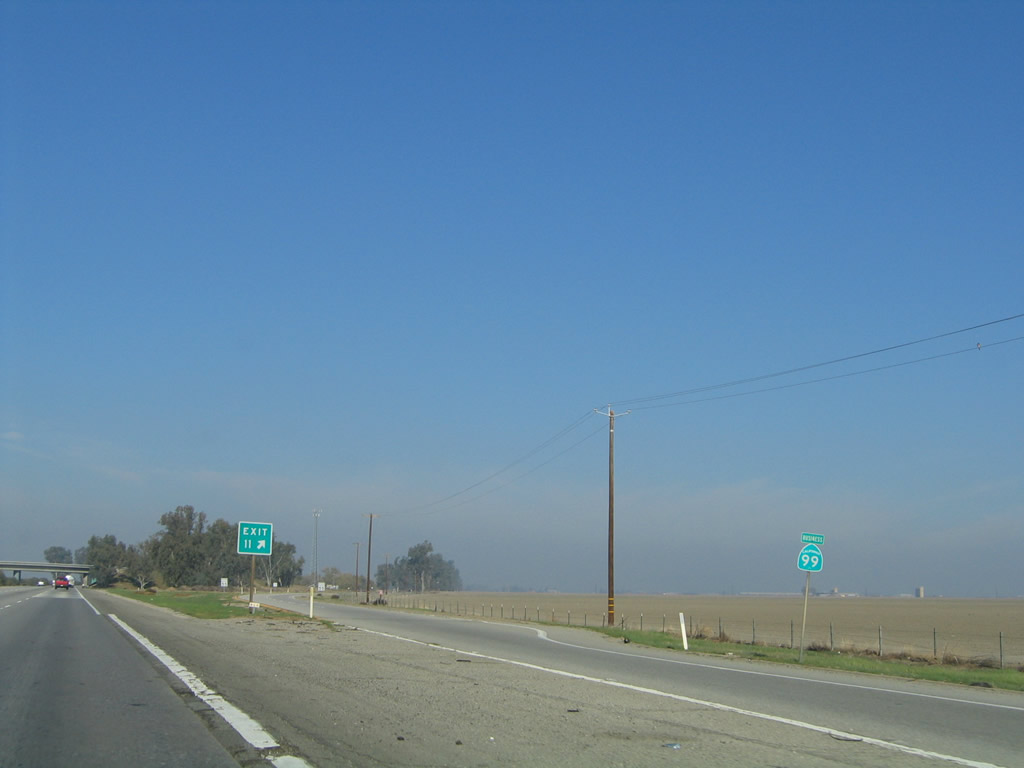
California 99 is a designated safety corridor.
11/25/04
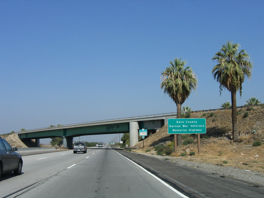
In Kern County, California 99 is known as the Kern County Korean War Veterans Memorial Highway, in addition to its more well-known designations as the Golden State Highway and Main Street of California. Behind this sign is the overpass carrying northbound Interstate 5 traffic over the California 99 main lanes.
10/07/06
A set of Pacific Gas and Electric power lines will follow the east side of the freeway from here north for several miles. Even though this interchange is located pretty far south, the power lines here are standard issue subtransmission lines for Pacific Gas and Electric, which provides electricity to most locations in the Central Valley. Southern California Edison territory begins at the Grapevine (Interstate 5 ascending from the floor of the Central Valley to Tejon Pass in the Sierra Madre Mountains in Angeles National Forest at an elevation of 4,183 feet) and continues south into Orange County, excluding the area served by the Los Angeles Department of Water and Power.
10/07/06
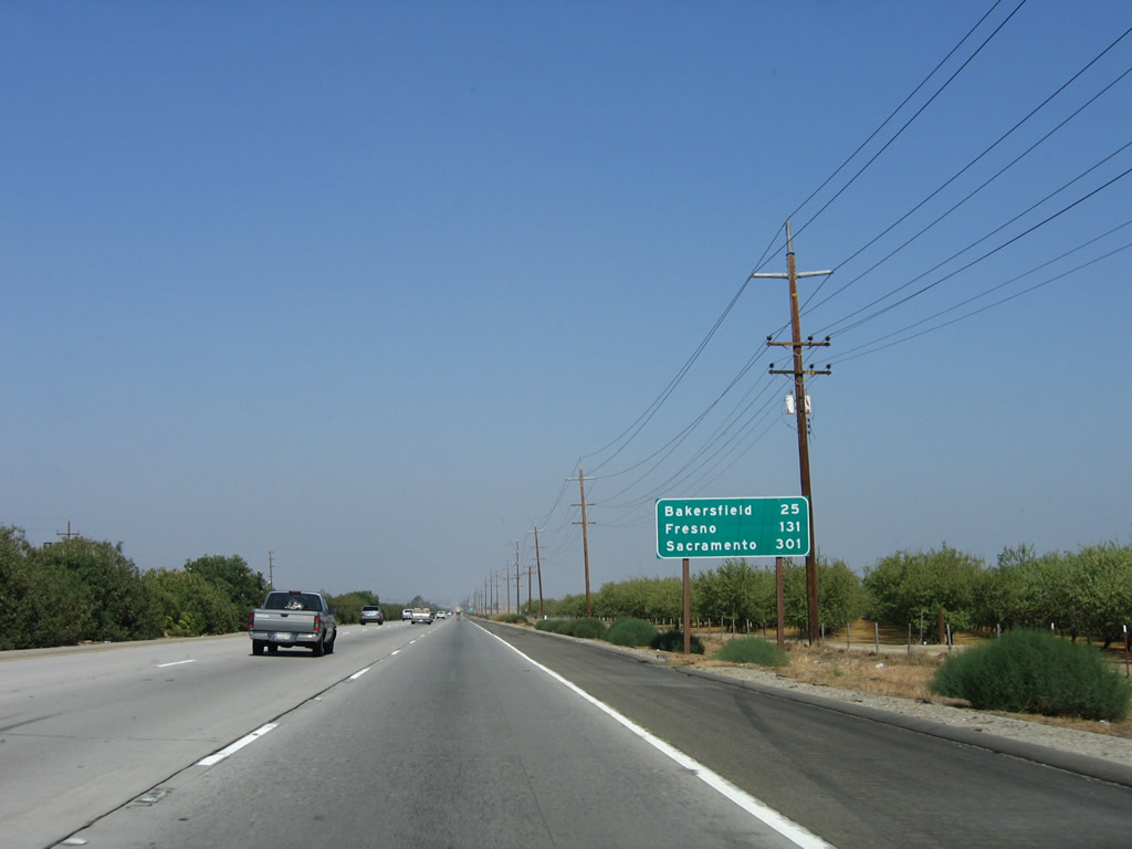
This mileage sign along California 99 (Golden State Highway) north provides the distance for three of the major cities along its route: Bakersfield (25 miles), Fresno (131 miles), and the control city, Sacramento (301 miles). The older sign (in the 2004 picture) featured kilometer distances to the same areas; the metric conversion was removed when the sign was replaced by 2006.
10/07/06
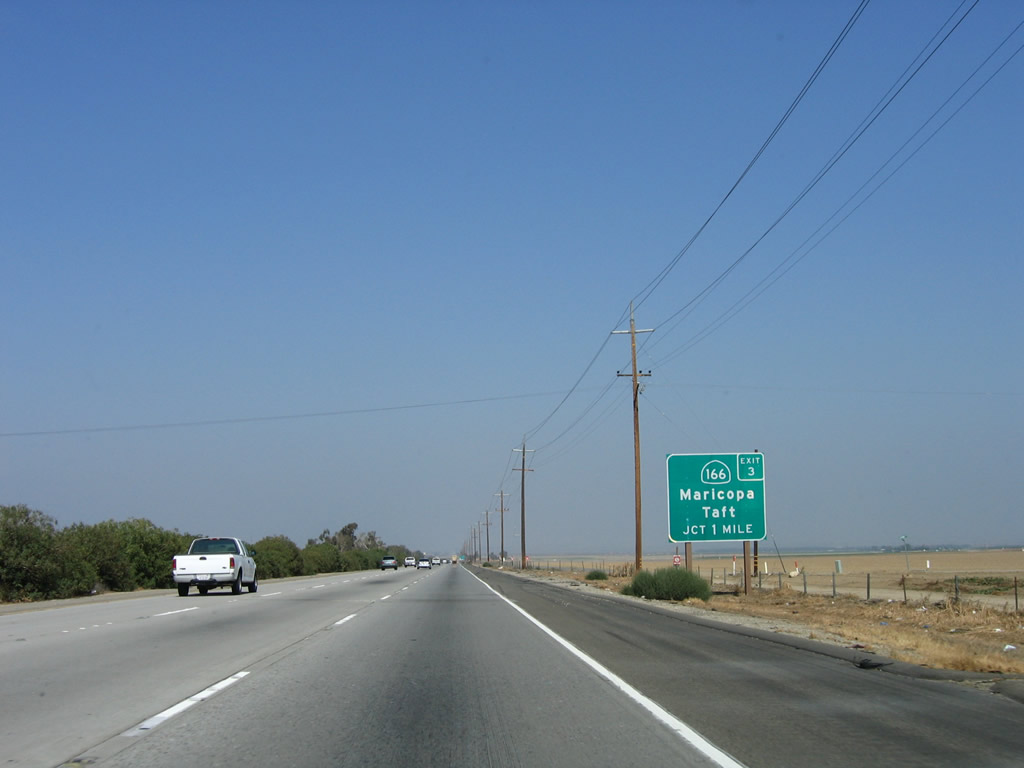
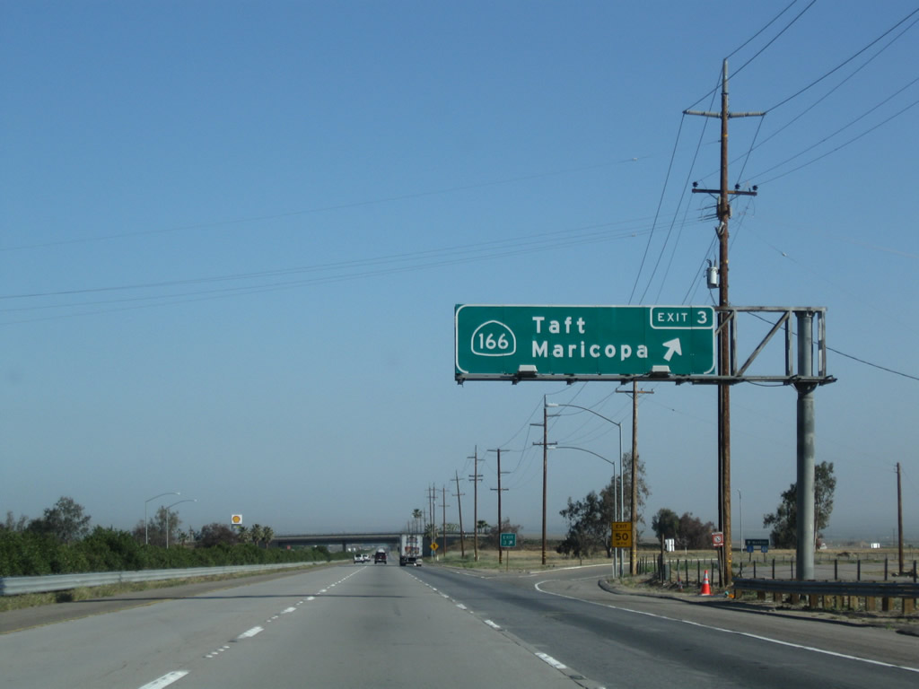
The first exit along California 99 north is Exit 3, California 166 west to Maricopa and Taft (next right).
10/07/06
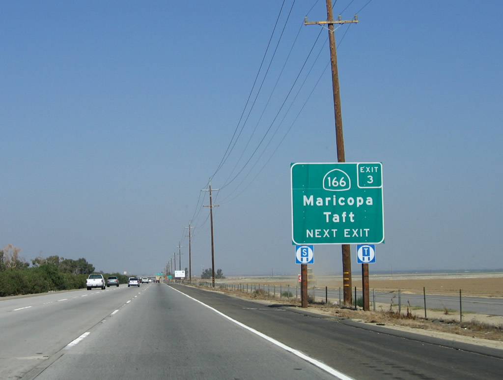
California 166 travels almost due west to Maricopa and Taft, then proceeds toward the coast, intersecting with U.S. 101 in Santa Maria and ultimately ending at California 1 in Guadalupe.
10/07/06
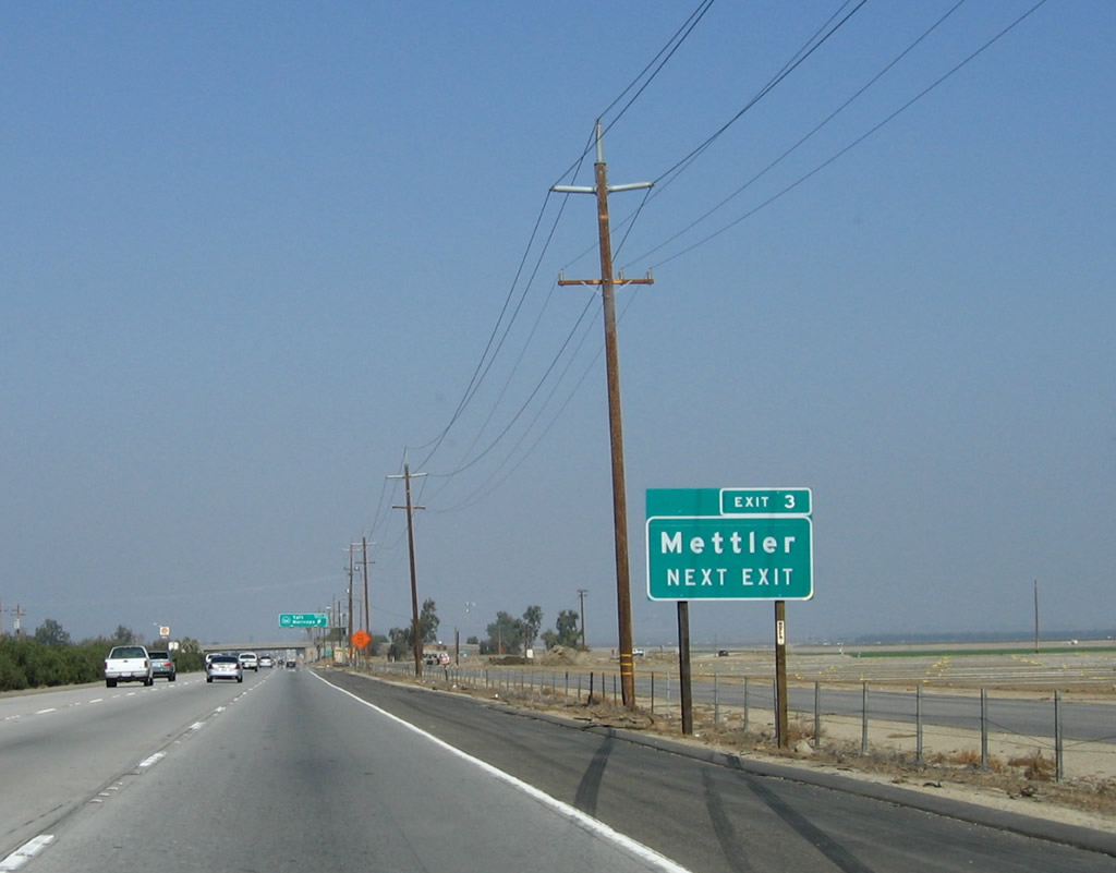
To Mettler, a small roadside community on the west side of the California 99 freeway, use California 166 west to Stevens Drive and the northbound frontage road.
10/07/06
Northbound California 99 (Golden State Highway) meets Exit 3, California 166. This marks the eastern terminus of California 166. A roadside guide sign for Mettler in 2004 was gone by 2006. This trumpet interchange only connects to California 166 west; there is no local road east of here.
04/04/09
A California 99 confirming marker is posted after the on-ramp from California 166, prior to passing under the California 166 bridge.
10/07/06
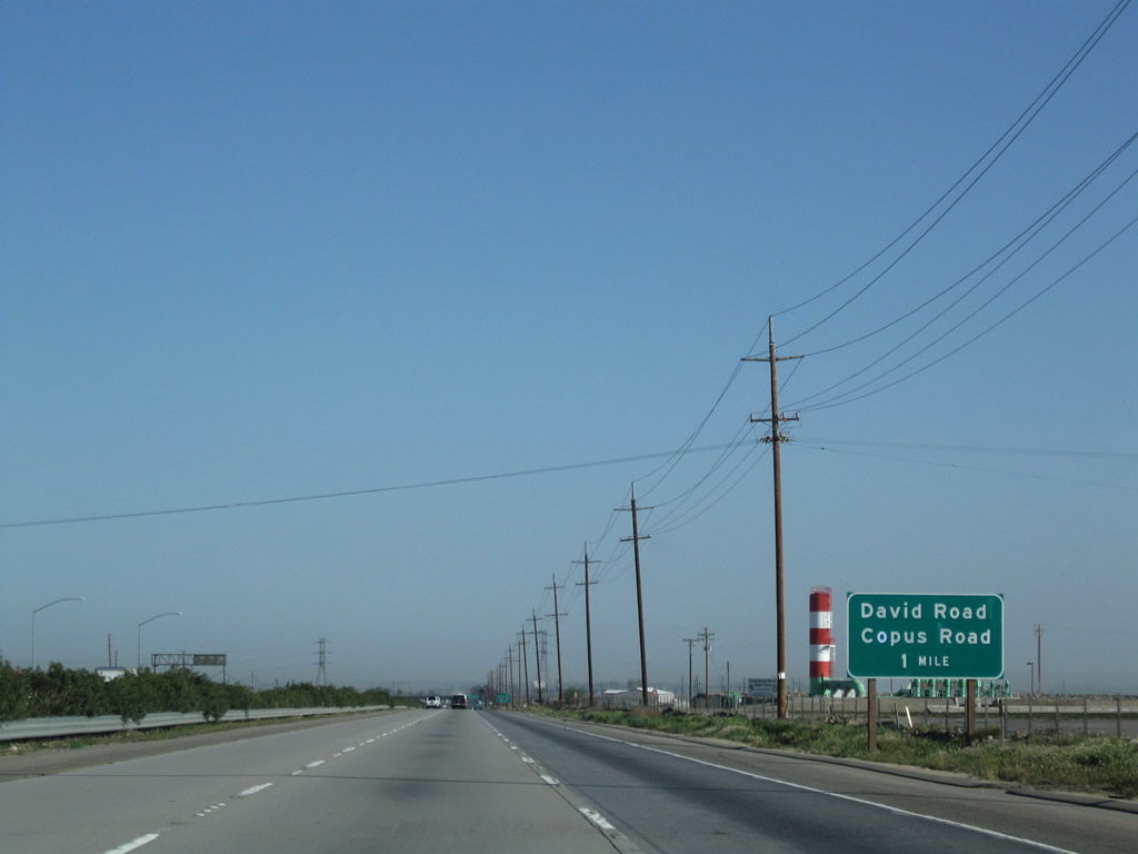
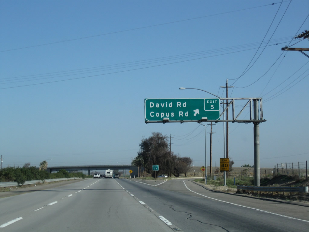
The next exit along California 99 (Golden State Highway) north is Exit 5, David Road/Copus Road, one mile.
04/04/09
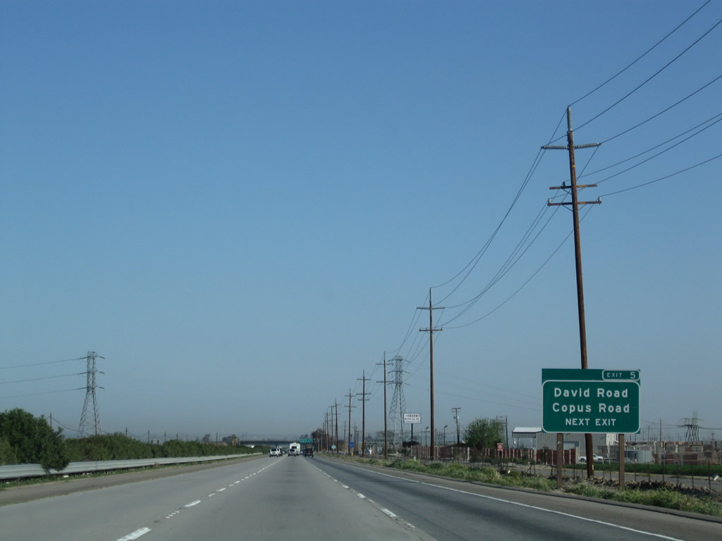
The second advance guide sign for Exit 5, David Road and Copus Road contains the exit number, unlike the first approach sign. David Road heads due east, meeting Wheeler Ridge Road (former California 184) and ending at Rancho Drive near Tejon Creek. Copus Road, meanwhile, heads west, meeting Interstate 5 and then paralleling the California Aqueduct en route to Lakeview and California 33 south of Taft and north of Maricopa.
04/04/09
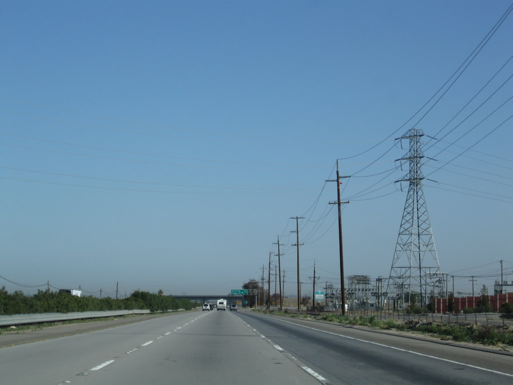
A 230kV Pacific Gas and Electric power line passes overhead and terminates in a substation located on the east side of the freeway.
04/04/09
Northbound California 99 meets Exit 5, David Road east and Copus Road west.
02/15/04
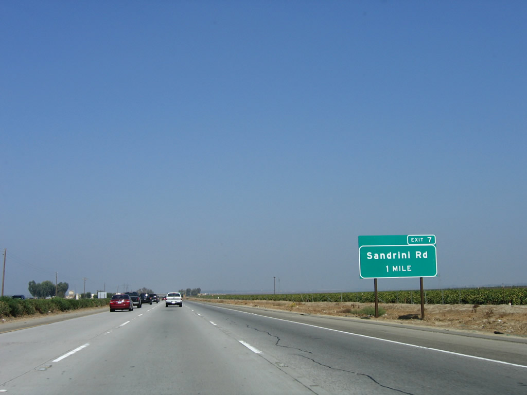
The next exit along northbound is Exit 7, Sandrini Road (one mile). Sandrini Road travels east to connect with Wheeler Ridge Road (former California 184) and Edison Road.
10/07/06
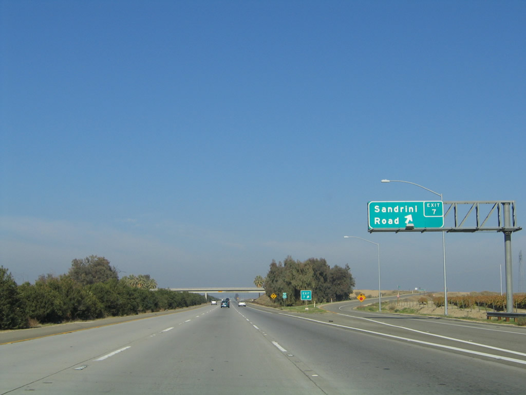
Northbound California 99 (Golden State Highway) meets Exit 7, Sandrini Road.
11/25/04
A California 99 north confirming marker is posted after the off-ramp to Exit 7, Sandrini Road.
11/25/04
Part of Path 26, this 500kV Pacific Gas and Electric power line passes over California 99 shortly after the Sandrini Road interchange. The line travels northwest to the massive Midway substation near Buttonwillow and southeast to the Vincent substation near the interchange of California 14 and Angeles Forest Highway (N-3).
06/28/06
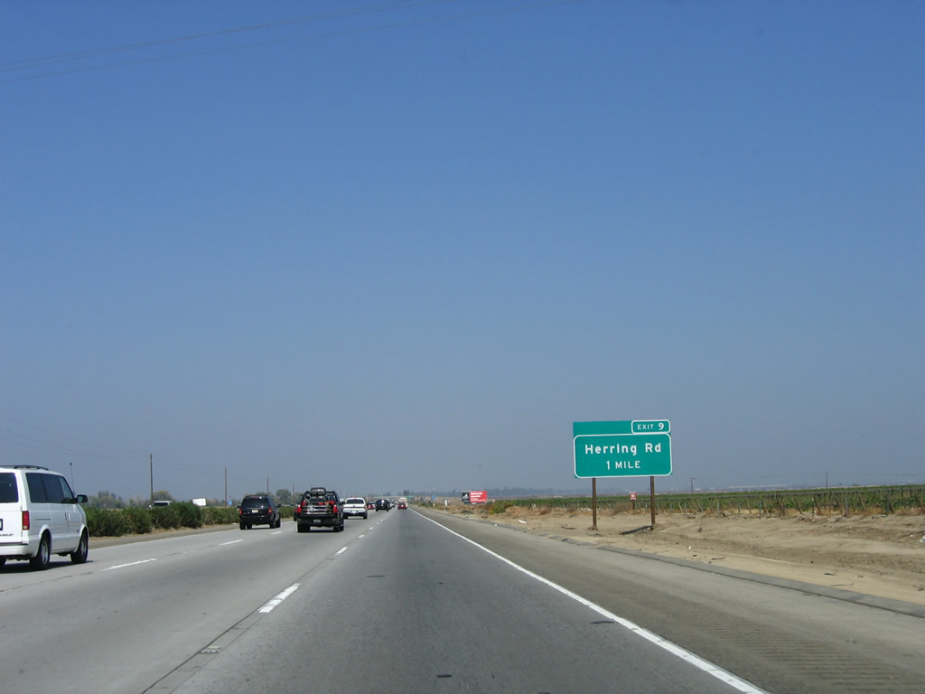
The next exit along northbound is Herring Road, which leads west across the Kern Lake Bed before meeting Old River Road west of Interstate 5.
10/07/06
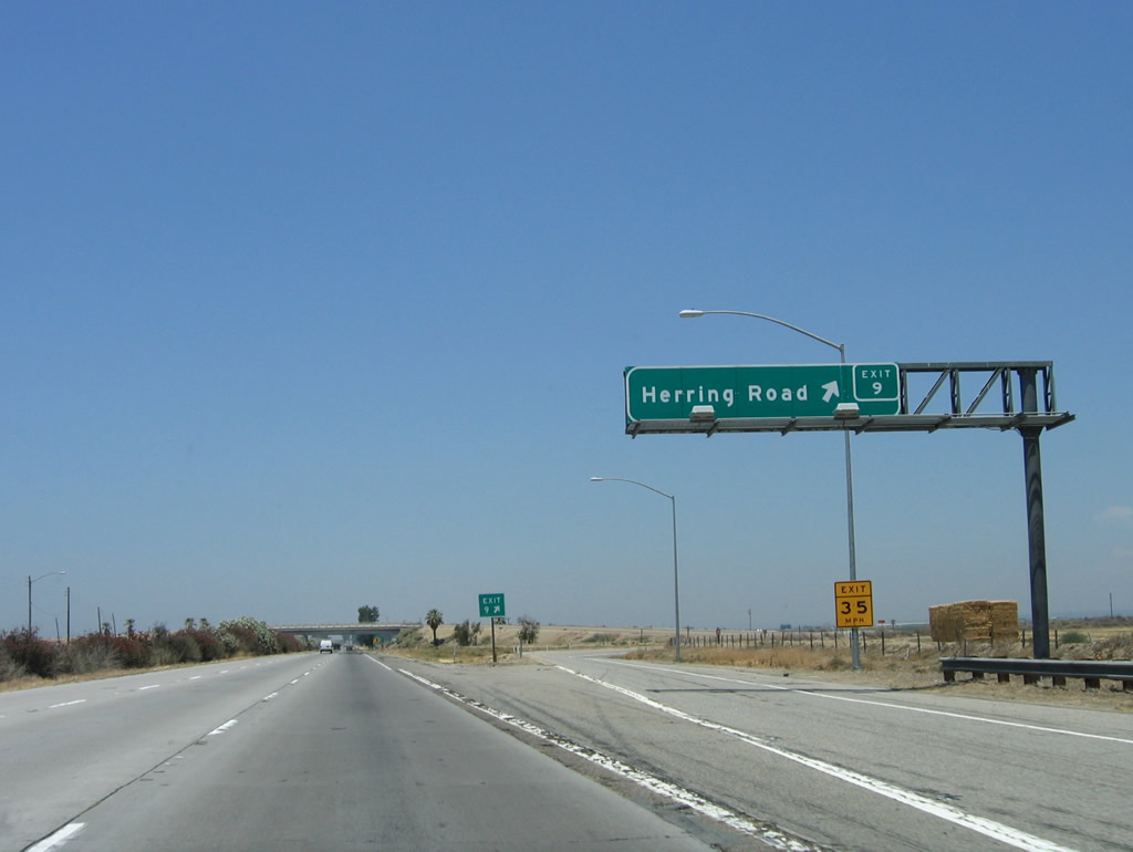
Northbound California 99 (Golden State Highway) meets Exit 9, Herring Road.
06/28/06
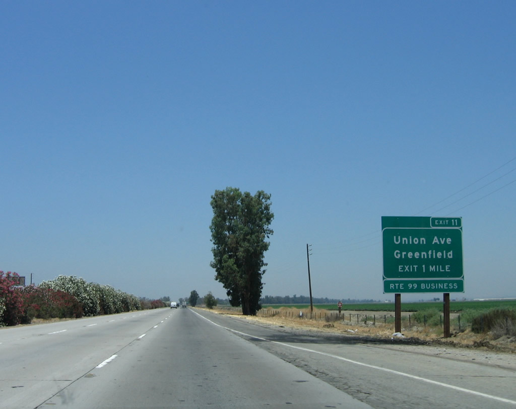
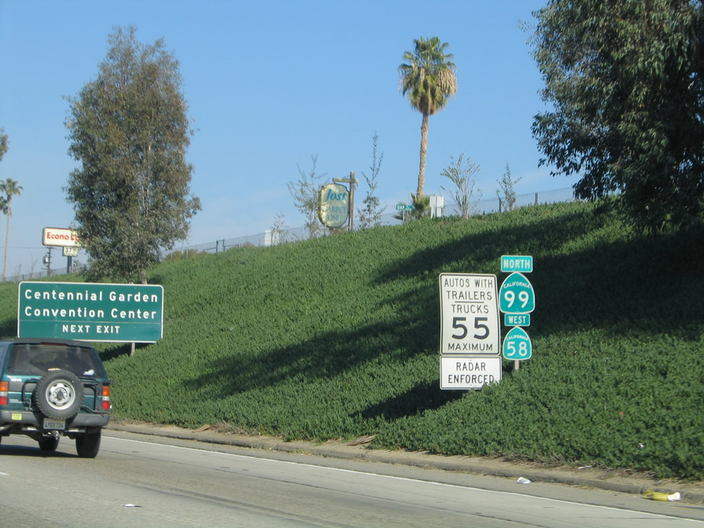
The next interchange along California 99 north is Exit 11, California 99 Business (Union Avenue) north to Greenfield and Bakersfield. California 99 Business follows the original alignment of U.S. 99 as it splits away from the freeway to the north, while the freeway angles a bit to the northwest. Initially, the business route and freeway remain very close to one another; in fact, two miles north of here, westbound California 223 meets the business route just before ascending the overpass over California 99.
06/28/06
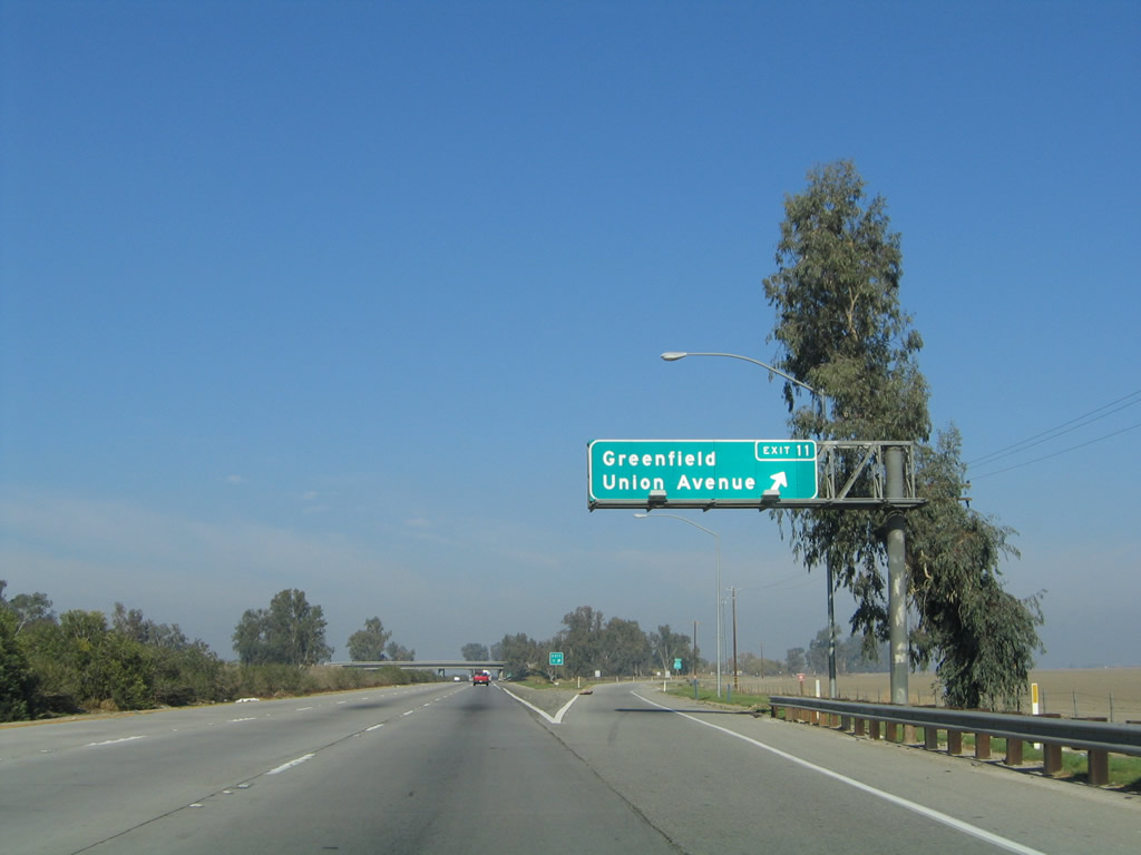
Northbound California 99 (Golden State Highway) meets Exit 11, California 99 Business (Union Avenue) north to Greenfield and Bakersfield. This is a fairly long business route, and it will reconnect to California 99 at Exit 27 (a distance of over 15 miles). The portion of California 99 Business north of California 58 is still within the state highway system and is designated as California 204.
11/25/04
The first business route shield is located right at the gore point along northbound.
11/25/04
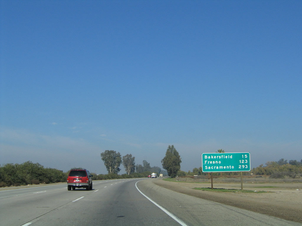
This mileage sign along California 99 north provides the distance to Bakersfield (15 miles), Fresno (123 miles), and Sacramento (293 miles).
11/25/04
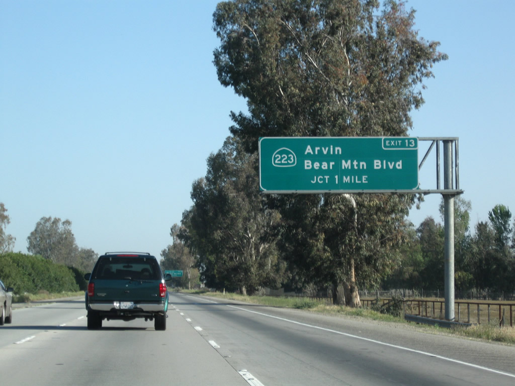
The next interchange along California 99 north is Exit 13, California 223 (Bear Mountain Boulevard) east to Arvin and west to Interstate 5.
04/04/09
Northbound California 99 (Golden State Highway) approaches Exit 13, California 223 (Bear Mountain Boulevard).
04/04/09
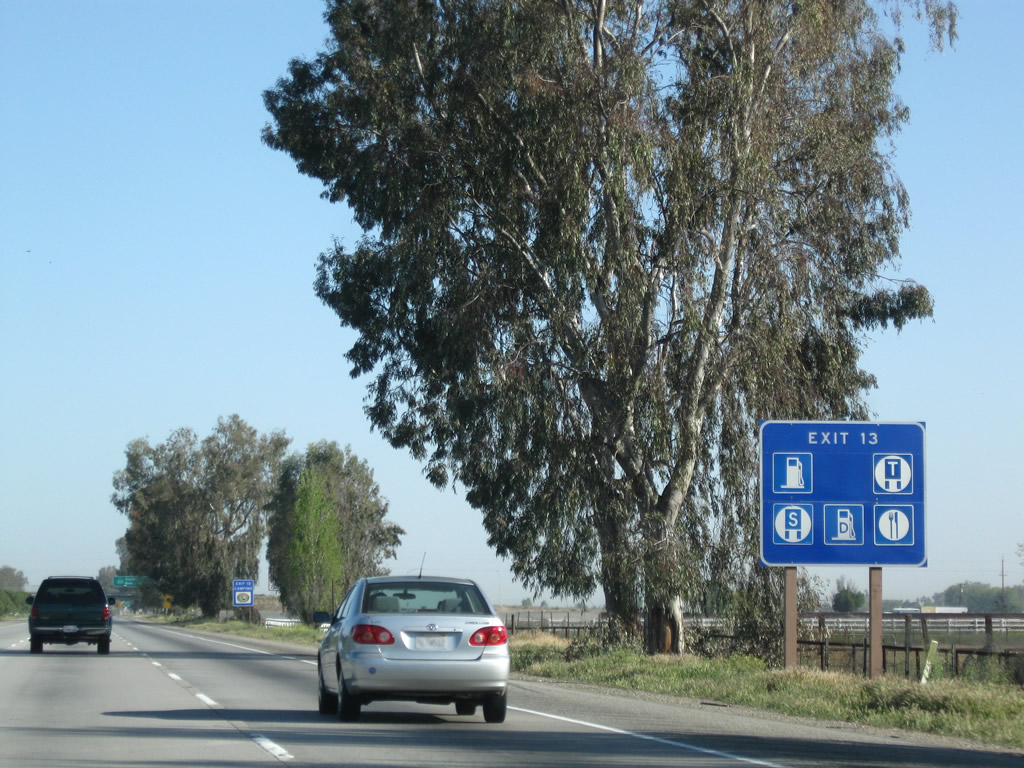
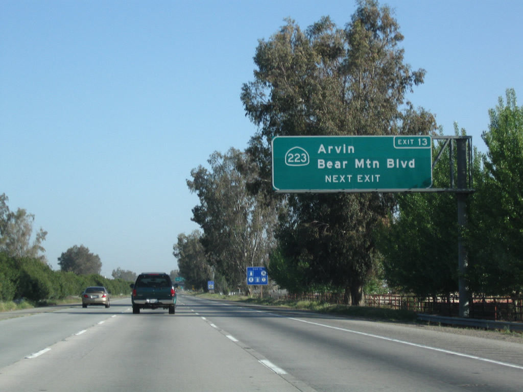
Most motorist services are available at Exit 13. It was revised to include the exit number.
04/04/09
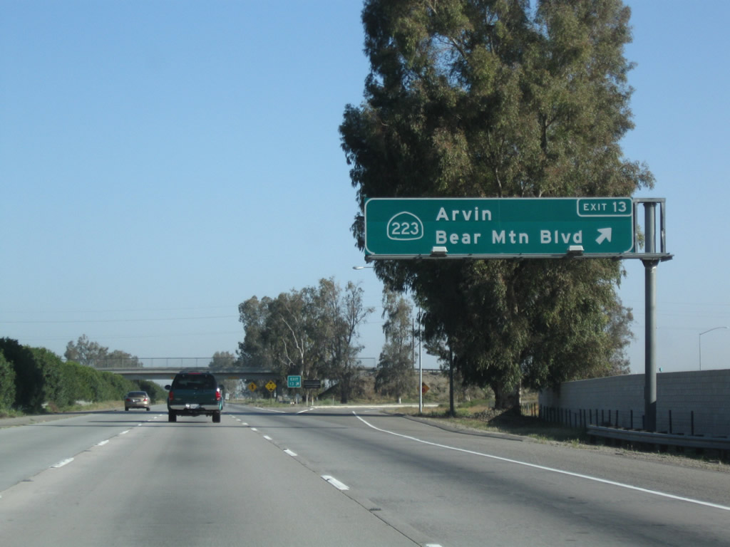
Northbound California 99 meets Exit 13, California 223 (Bear Mountain Boulevard). California 223 leads east to Arvin and ultimately California 58 near Caliente, and it also heads west to meet Interstate 5 at Exit 239.
04/04/09
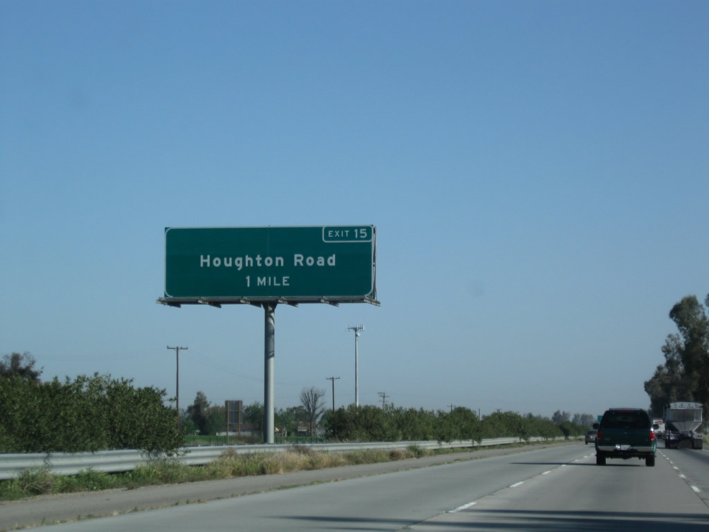
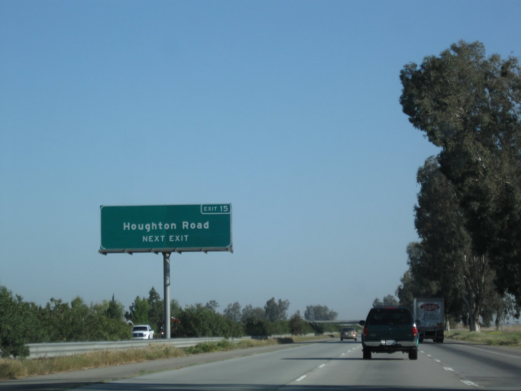
The next exit along northbound is Exit 15, Houghton Road (one mile). As a safety measure to prevent crossover accidents, guardrail was installed within the oleander bushes in the median.
04/04/09
Houghton Road travels west to Old River Road and east to Weedpatch and California 184 via Buena Vista Boulevard.
04/04/09
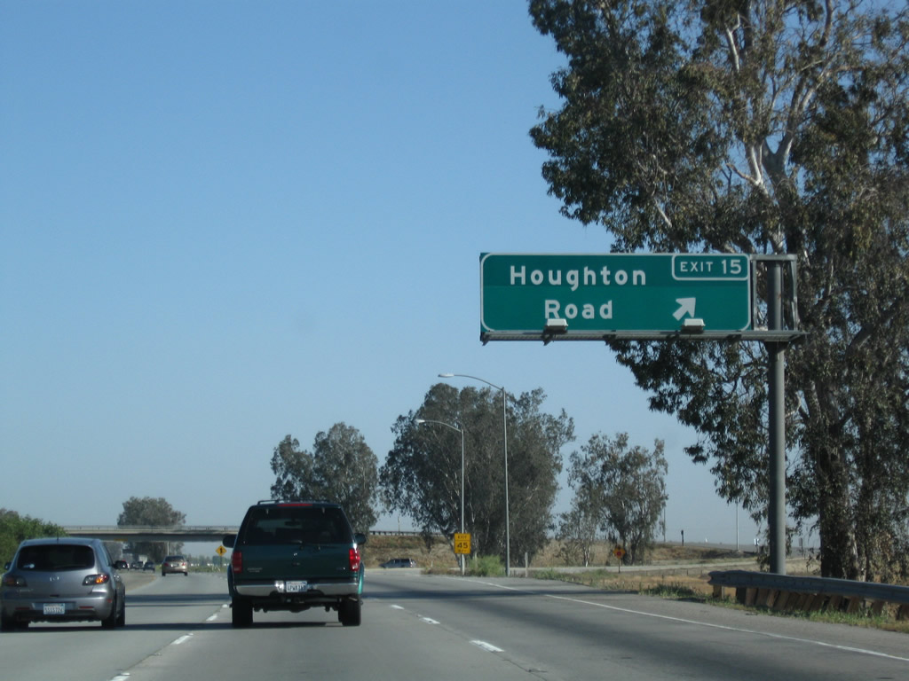
Northbound California 99 meets Exit 15, Houghton Road.
04/04/09
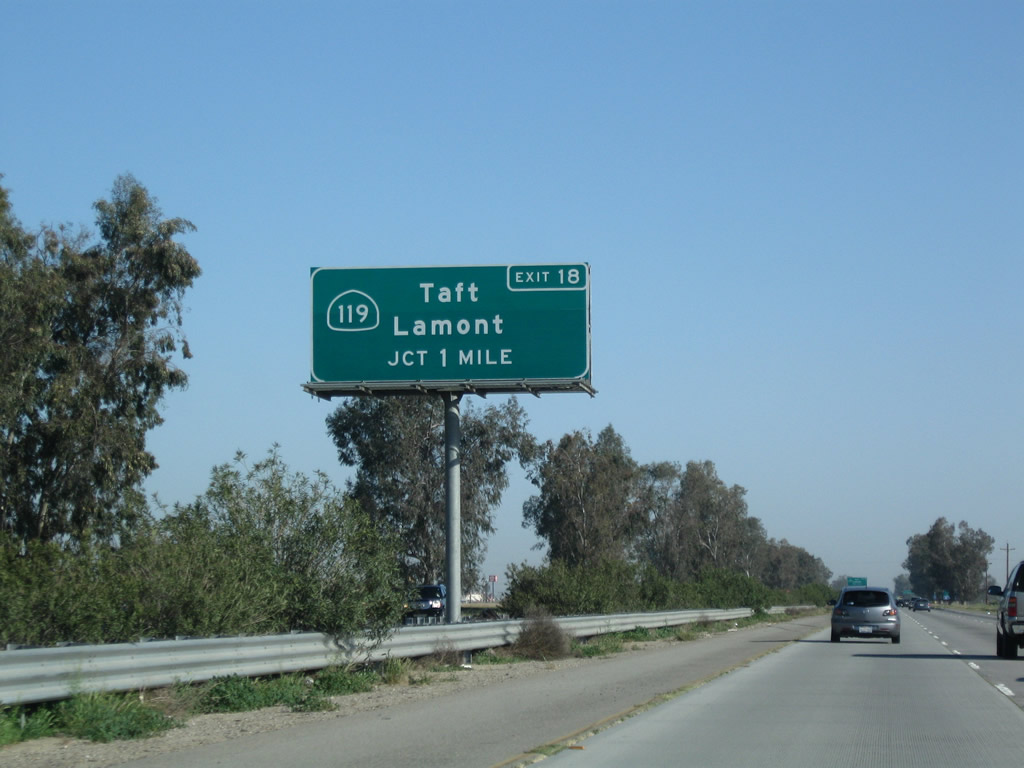
The next exit along northbound is Exit 18, California 119 (Taft Highway) west and Taft Highway east to Panama Road (one mile). California 119 is old U.S. 399. U.S. 399 used to follow California 119 west to Taft, then California 33 south to Ventura; it was eliminated along with many other U.S. routes in California in 1964.
04/04/09
Gas is available at the California 119 interchange.
10/07/06
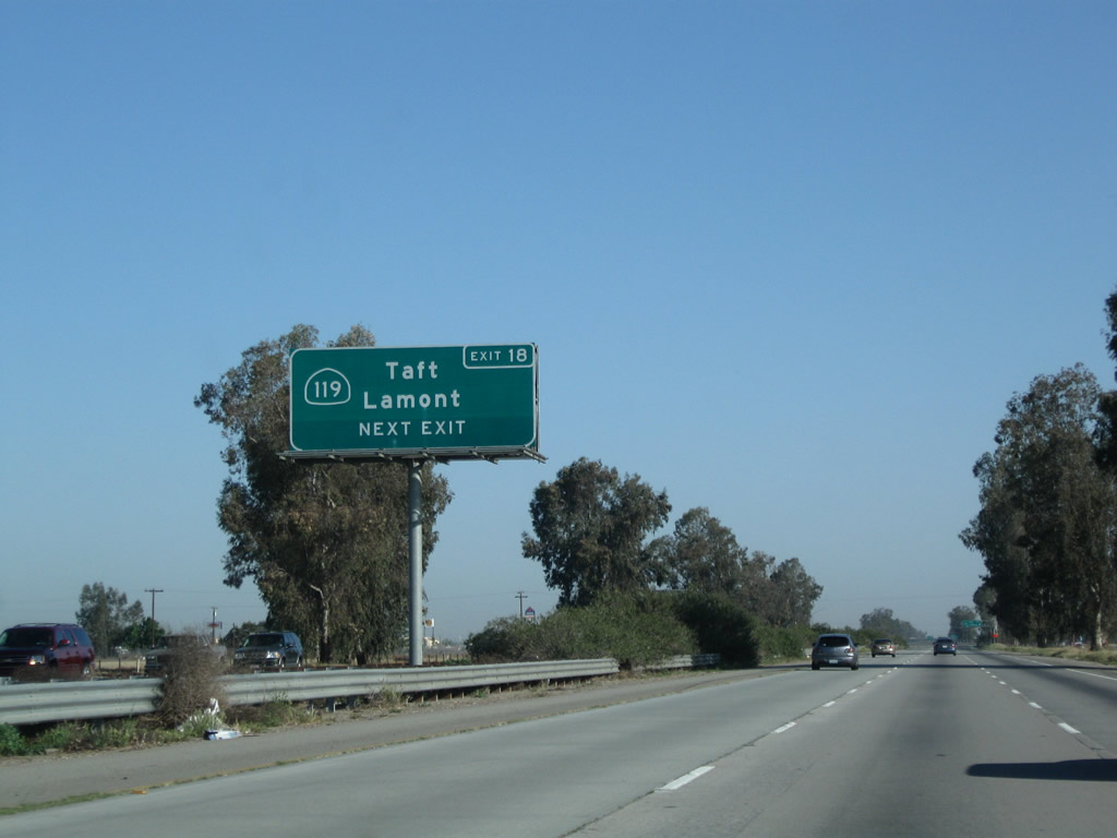
California 119 (Taft Highway) heads west to Taft, while unsigned Panama Road (not to be confused with Exit 20, Panama Lane) leads east to Lamont and California 184.
04/04/09
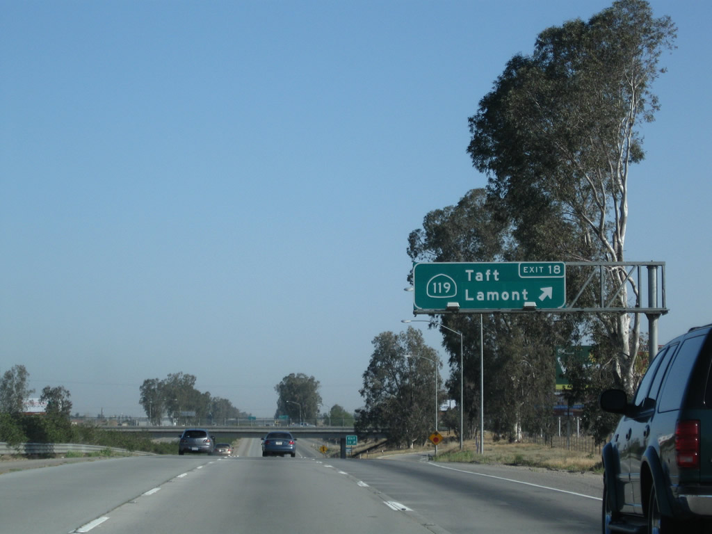
Northbound California 99 (Golden State Highway) meets Exit 18, California 119 (Taft Highway), which leads west from here into Pumpkin Center, then southwest to end at California 33 in Taft. This interchange also serves Taft Highway (Old U.S. 399) east to Union Avenue (California 99 Business and Old U.S. 99), where it changes names to Panama Road east en route to Lamont.
04/04/09
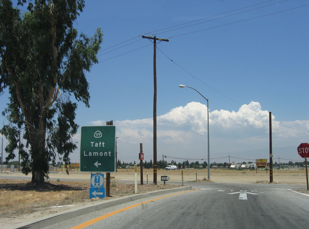
The short off-ramp from California 99 connects to H Street, which functions here as a frontage road on the east side of the freeway. H Street connects to California 119 (Taft Highway) west to Taft and Taft Highway/Panama Road east to Lamont.
06/28/06
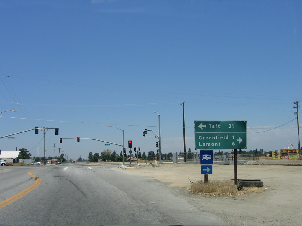
A mileage sign is posted at the traffic signal between H Street and Taft Highway. California 119 (and Historic U.S. 399) leads west to Taft, which is 31 miles west of here.
06/28/06
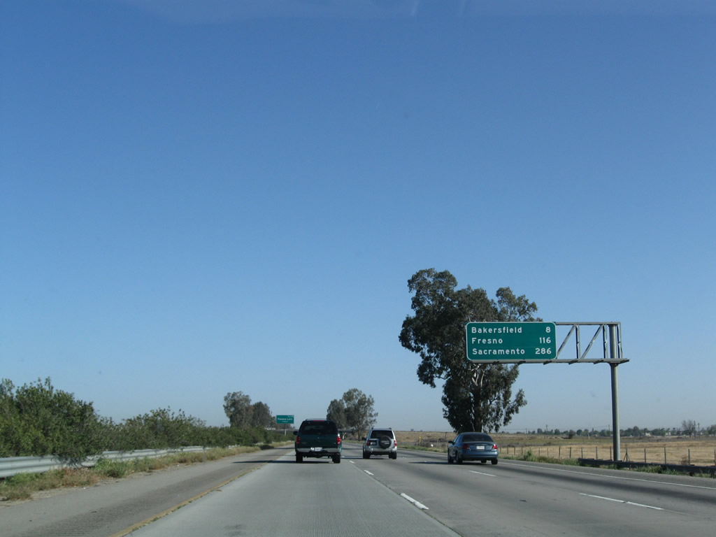
This mileage sign along California 99 (Golden State Highway) north provides the distance for three of the major cities along its route: Bakersfield (eight miles), Fresno (116 miles), and Sacramento (286 miles). This sign is positioned on an overhead gantry, which is unusual in California for this type of sign. Even though the overhead signs at the split from Interstate 5 listed California 99's control city as Fresno, it becomes Sacramento almost immediately. There is a negligible difference in the distance with either route to Sacramento - both routes are just about 295-300 miles from Wheeler Ridge to Sacramento.
04/04/09
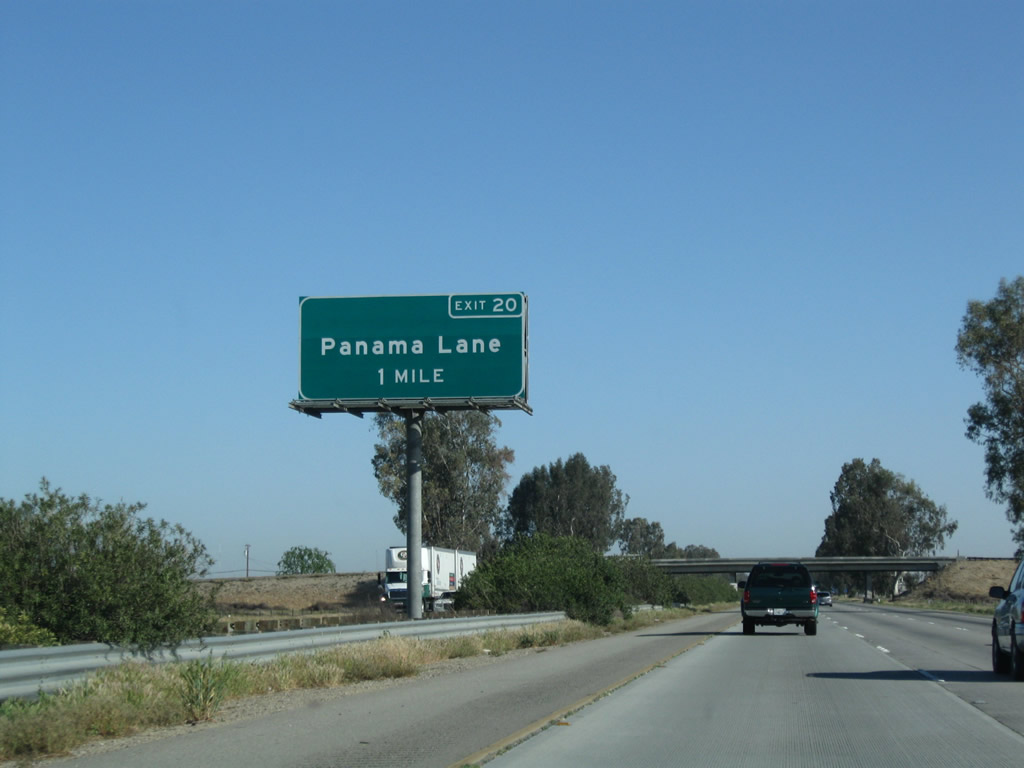
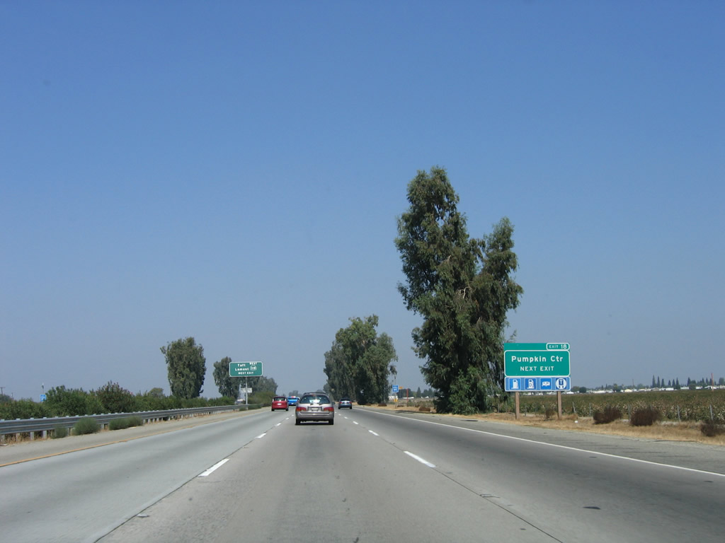
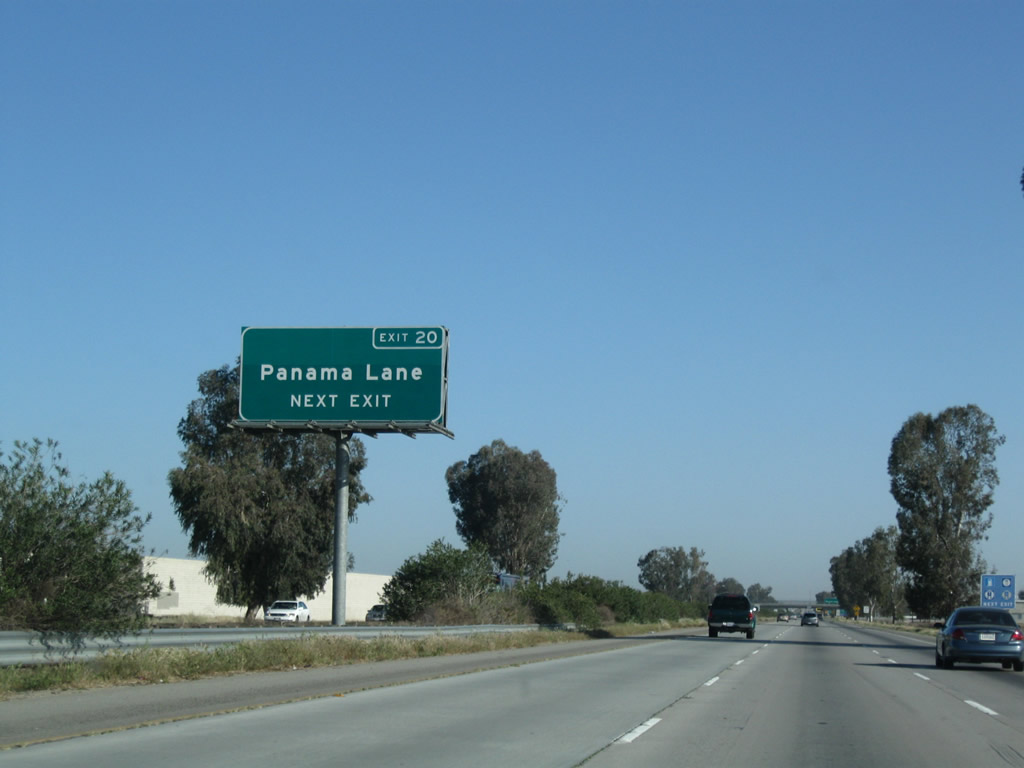
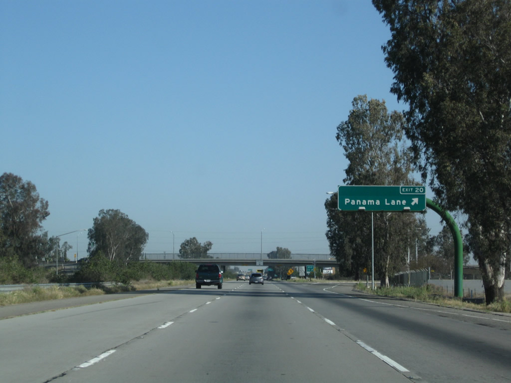
The next exit along northbound California 99 (Golden State Highway) is Exit 20, Panama Lane. The overhead sign was changed, along with most of the others along this stretch of California 99, to include the exit number.
04/04/09
Panama Lane parallels California 119 (Taft Highway/Panama Road), connecting with California 184 (Weedpatch Highway) to the east and California 43 and Interstate 5 in the west. Note the open agricultural field to the left of the freeway in this picture. This area was blocked off by a wall and developed into housing by 2006, a common experience in the Central Valley during the early to mid-2000s housing boom.
04/04/09
Gas and food are available at Exit 20, Panama Lane.
04/04/09
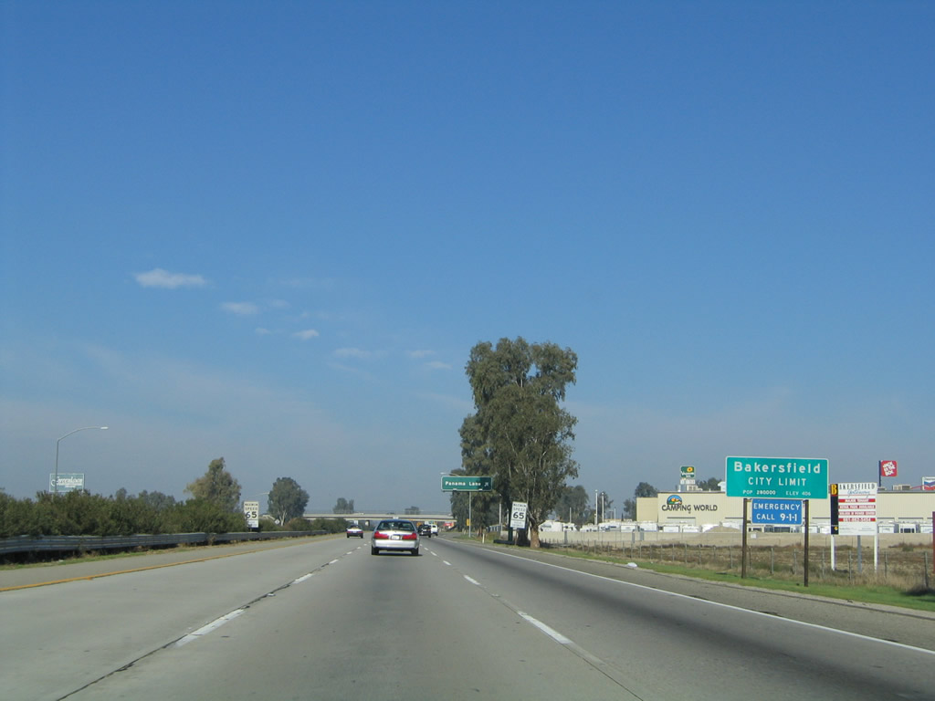
Just prior to the off-ramp for Exit 20 (Panama Lane), California 99 enters its first city: Bakersfield. The city had a population of 347,483 as of the 2010 Census after several decades of explosive growth that has tripled the population since 1980 (the 1980 Census had a population of 105,611 for Bakersfield). Downtown Bakersfield is best accessed via Exit 25 (California Avenue) and sits at an elevation of 408 feet. Located about 110 miles north of Los Angeles and 110 miles south of Fresno, Bakersfield anchors the southern Central Valley. With a history rich in oil discovery, Bakersfield is also a major agricultural area that receives an average of a little less than six and a half inches of precipitation annually. The city was incorporated on January 11, 1898.
11/25/04
Northbound California 99 (Golden State Highway) meets Exit 20, Panama Lane.
04/04/09
Passing under Panama Lane, trucks north through Bakersfield are advised to use the middle lane to avoid conflicts with entering and exiting traffic.
10/07/06
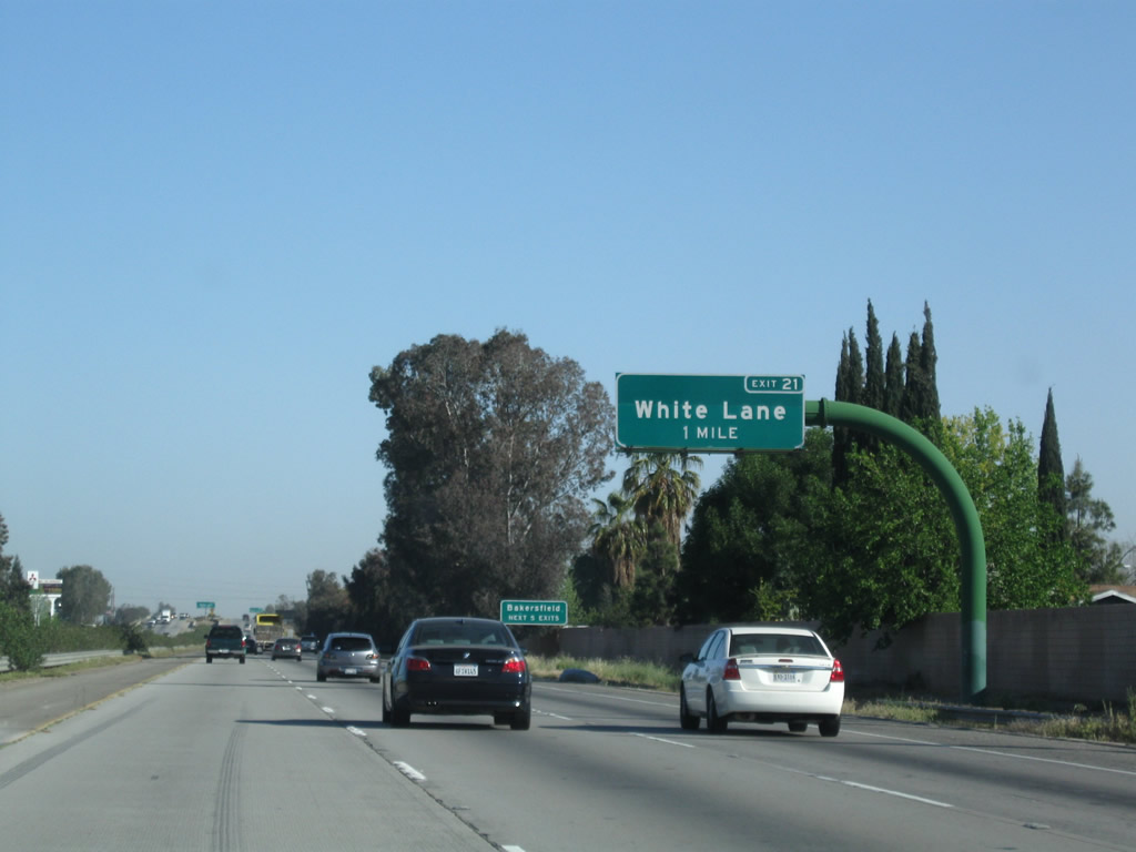
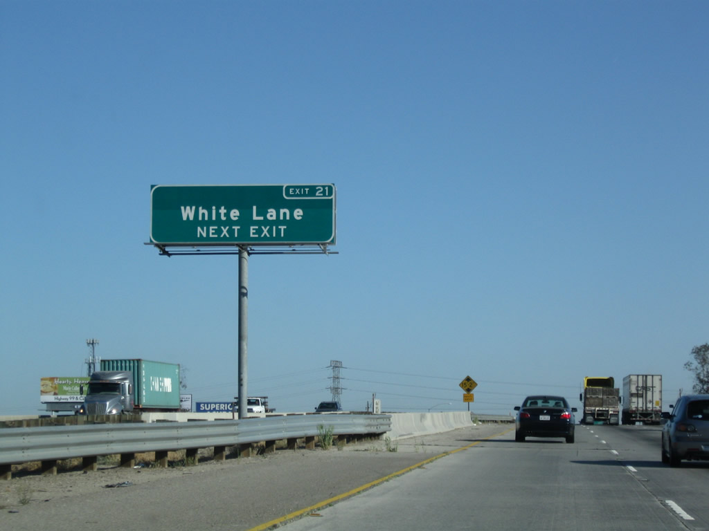
The next exit along northbound is Exit 21, White Lane (one mile). This sign was replaced with an exit number sign by 2009.
04/04/09
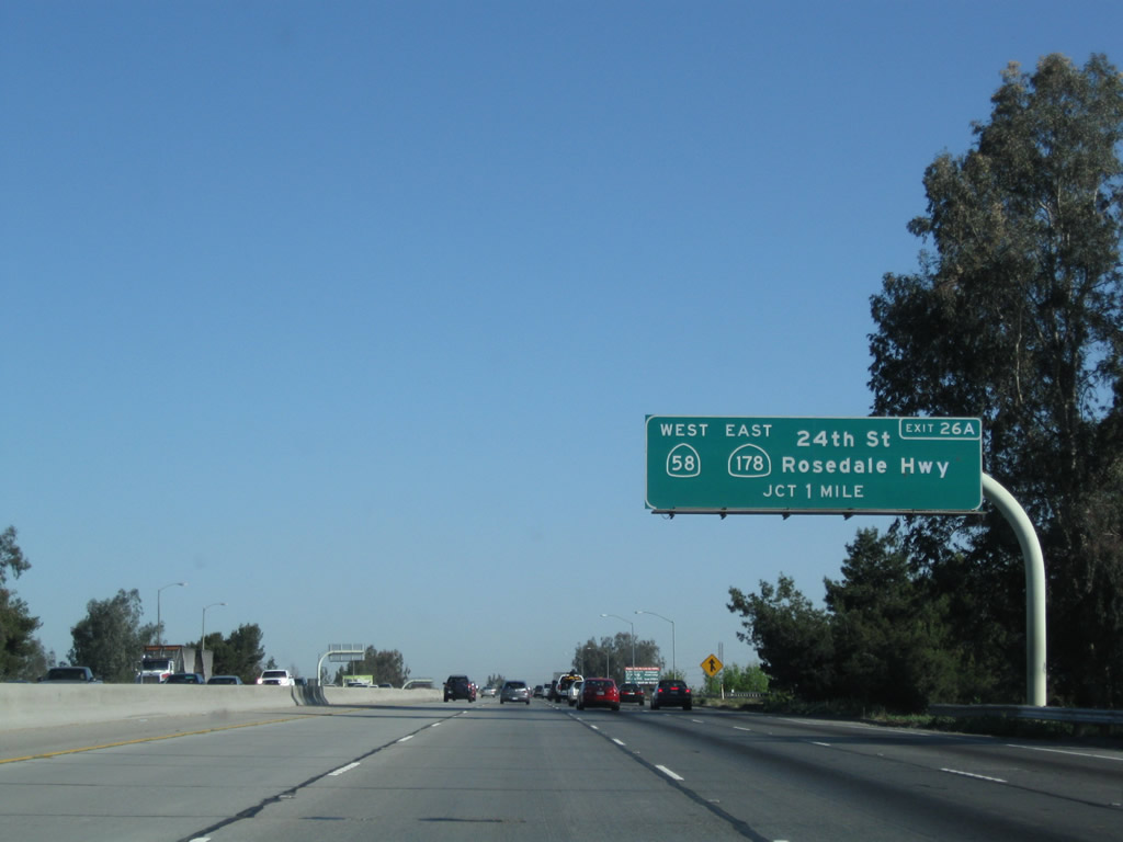
The next five exits from California 99 (Golden State Highway) north will all serve the city of Bakersfield: Exit 21, White Lane; Exit 23, Ming Avenue; Exit 24, California 58, Stockdale Highway, and Brundage Lane; Exit 25, California Avenue/Civic Center; and Exit 26A, California 58 (Rosedale Highway) west and California 178/Twenty-fourth Street east.
10/07/06
From this interchange, White Lane will travel east to meet with Union Avenue (California 99 Business and Old U.S. 99-399) near its intersection with South Chester Avenue.
04/04/09
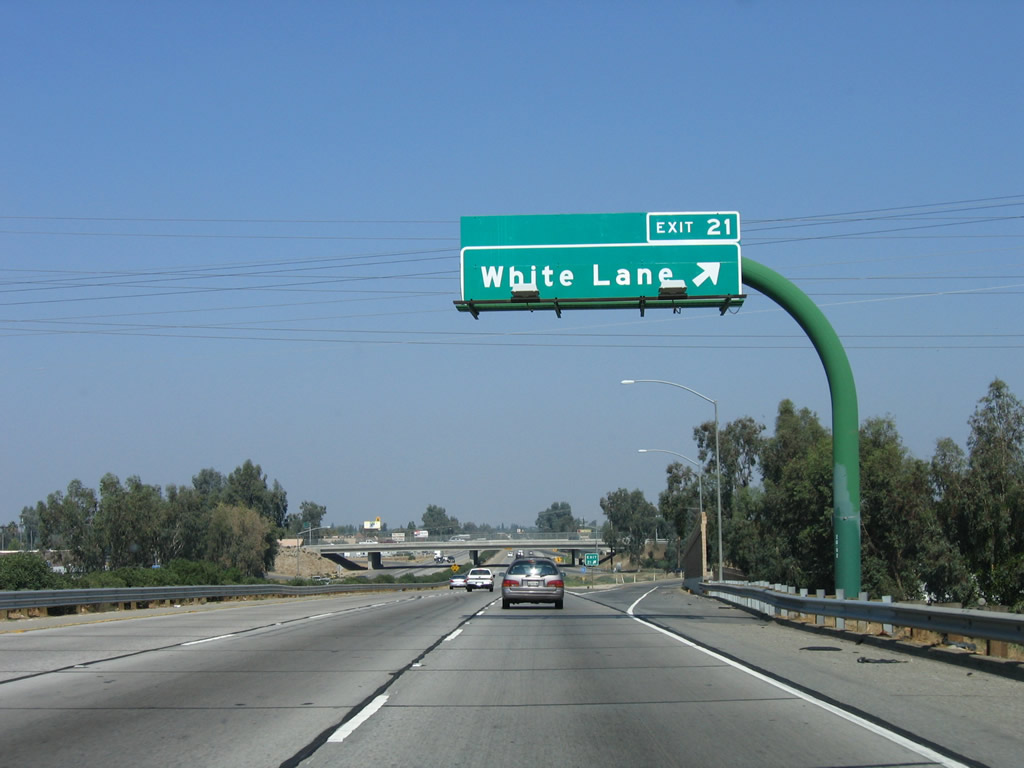
Northbound California 99 meets Exit 21, White Lane.
10/07/06
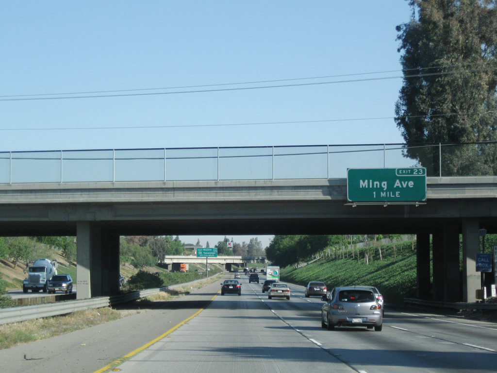
The next exit along northbound is Exit 23, Ming Avenue. This sign was also replaced by 2009.
04/04/09

The second exit (after Ming Avenue) from California 99 (Golden State Highway) north will be Exit 24, which serves as the junction with the California 58 freeway. This major state highway travels east to Tehachapi, Mojave, and Barstow, with connections from there to Las Vegas via Interstate 15 and Flagstaff, Arizona, via Interstate 40.
04/04/09
Use Exit 23 (Ming Avenue) to the Kern County Fairgrounds.
10/07/06
This mileage sign provides the distance to the next two exits along California 99 north: Exit 23, Ming Avenue and Exit 24, California 58 east, Stockdale Highway west, and Brundage Lane.
10/07/06
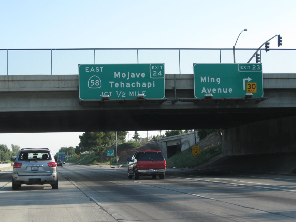
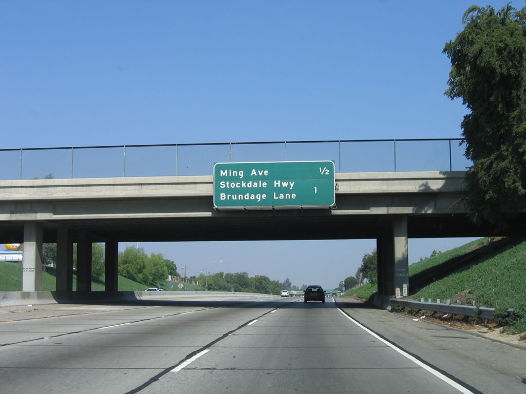
Northbound California 99 (Golden State Highway) meets Exit 23, Ming Avenue. The next exit is Exit 24, California 58 east to Tehachapi, Mojave, and Barstow. California 58 is a major east-west state route through Kern County. Traffic demands have required assorted upgrades to California 58 to where the entire route from Bakersfield to Barstow has been upgraded to freeway or expressway standards excepting sections near Kramers Junction (U.S. 395/Four Corners). An east-west freeway connection between California 99 and Interstate 5 is currently being planned in Bakersfield (Westside Parkway), and once the route is determined, it is possible that it might carry the California 58 designation, pending a connection between this freeway and the state highway network.
07/30/11
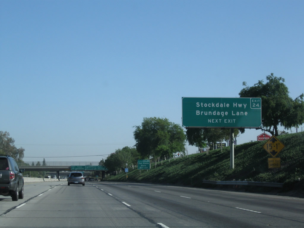
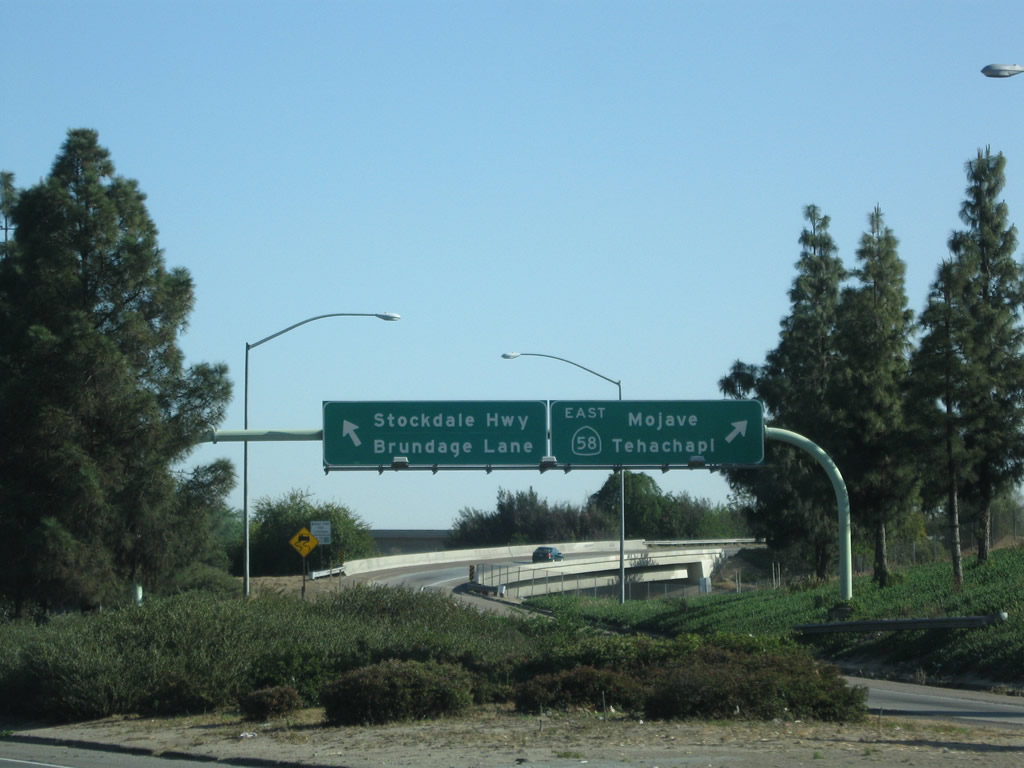
Use Exit 24 to reach Stockdale Highway and Brundage Lane. Stockdale Highway heads west from Bakersfield toward Interstate 5, and Brundage Lane heads east, parallel to California 58. Ahead, California 58 west will follow California 99 north for a couple miles.
04/04/09
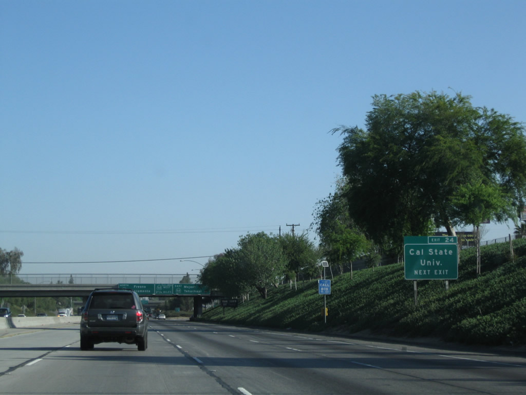
Use Exit 24 to California State University-Bakersfield.
10/07/06
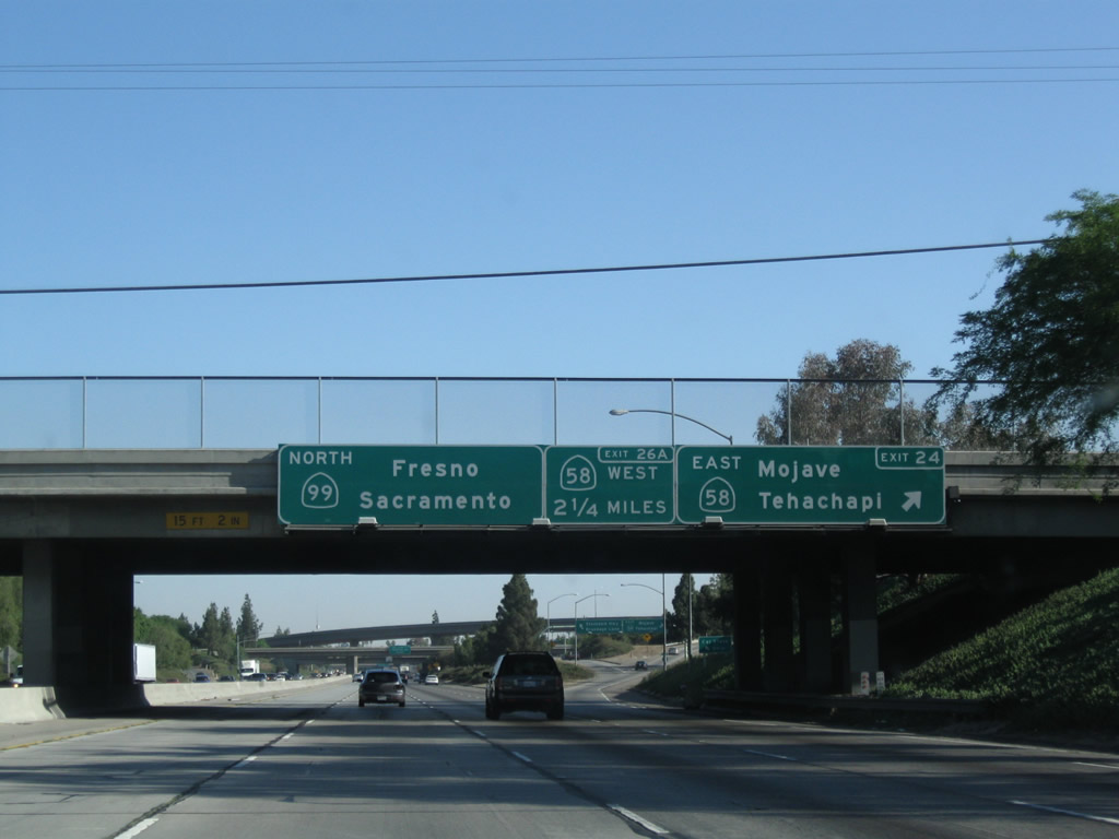
Northbound California 99 meets Exit 24, California 58 east to Barstow. Formerly known as U.S. 466 east of California 99 before 1964, California 58 is a major east-west transportation corridor. From here, California 99 merges with westbound California 58 for the next two and a half miles; California 58 splits west at Exit 26 (Stockdale Highway) to continue its journey to the coast. It passes by Interstate 5 at Buttonwillow, then crosses the Temblor Range and Carrizo Plain on its way to its western terminus at U.S. 101 in Santa Margarita, just north of San Luis Obispo.
04/04/09
This view shows the off-ramp from California 99 north to California 58 east, Stockdale Highway west, and Brundage Lane east (the latter two are via a connection along Wible Road.
04/04/09
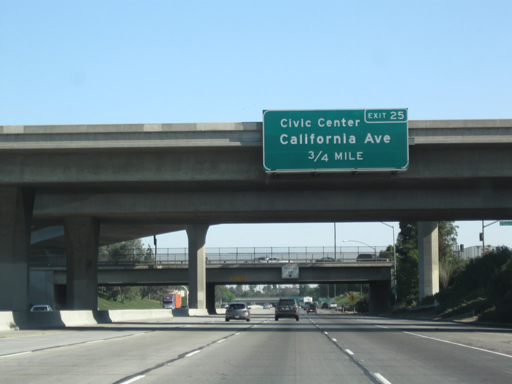
The next exit along northbound is Exit 25, California Avenue, which travels east toward the Bakersfield Civic Center and west to Stockdale Highway. California Avenue leads east into downtown Bakersfield, passing by Camelot Park, the railroad yards (to the north), and Bakersfield High School before meeting California 99 Business and California 204/Union Avenue.
04/04/09
The flyover ramp from southbound California 99 to eastbound California 58 crosses the freeway here. Since the right lane becomes exit-only, trucks are advised to remain in the number three lane.
11/25/04
These reassurance markers are located on northbound California 99 and westbound California 58 just after California 58 merges onto the freeway. Note that the California 99 shield is larger than the California 58 shield. A freeway beautification project is underway in the city, and annexation of new areas into Bakersfield continues (click on the "annexation" link on the official web page).
11/25/04
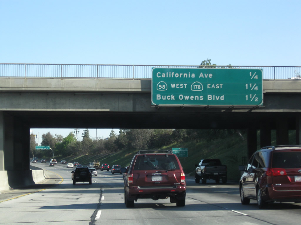
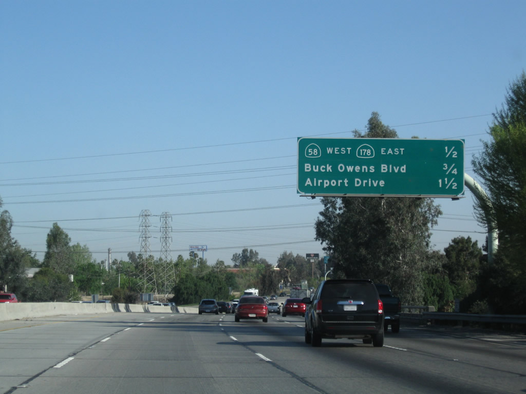
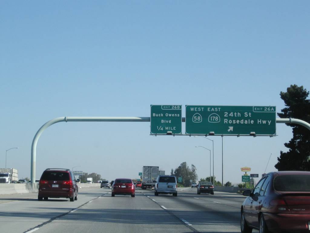
This mileage sign provides the distance to the next three exits along California 99 north: Exit 25, California Avenue; Exit 26A, California 58 (Rosedale Highway) west and California 178/Twenty-fourth Street east; and Exit 26B, Buck Owens Boulevard.
04/04/09
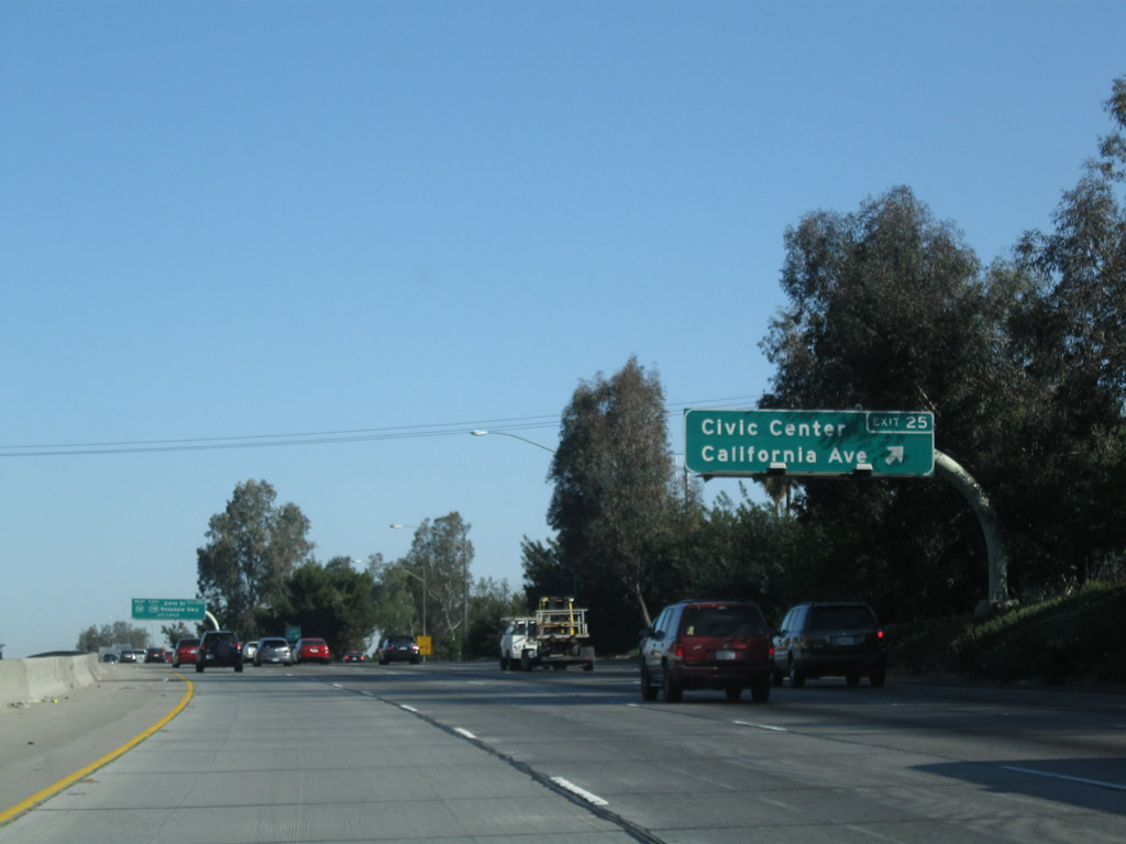
Northbound California 99 (Golden State Highway) meets Exit 25, California Avenue east to the Bakersfield Civic Center. California Avenue will travel east into downtown Bakersfield, serving the Civic Center via northbound Chester Avenue. Most of downtown is situated along Truxtun Avenue between Chester Avenue and California 204/Union Avenue, which is Historic U.S. 99-399 and is also designated as California 99 Business. Once the connection to Truxtun Avenue is completed, one may access the Westside Parkway via California Avenue east, Oak Street north, and Truxtun Avenue west.
04/04/09
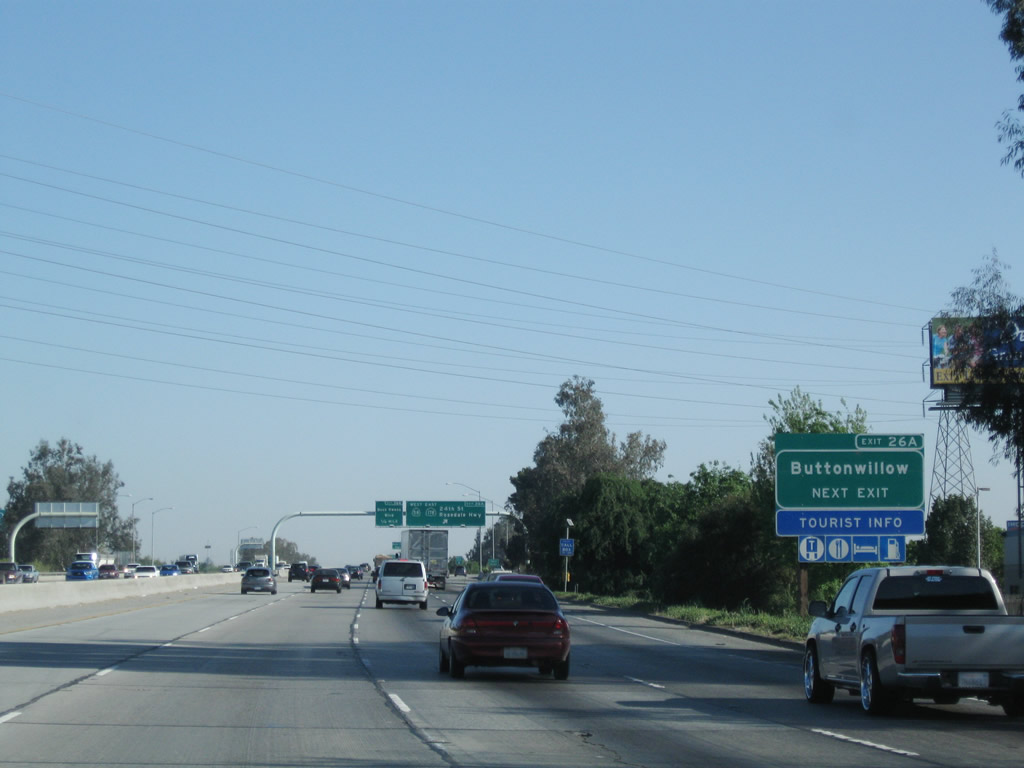
The next exit along California 99 north is Exit 26A, California 58 west and California 178 east (one mile). This exit is in the northwestern portion of Bakersfield. This marks the western terminus of California 178, the only state highway to cross the Sierra Nevada between California 58 and California 120. Although other such crossings between Yosemite and Lake Isabella were planned in the heyday of highway construction (for example, see the unconstructed segments of California 168, California 180, and California 190 that would have crossed the high mountains), none were constructed as state routes. California 178 continues east into Death Valley National Park (with a route break in the park east of Trona), and it ultimately matches up with Nevada 372. Prior to 1964, California 58 west of California 99 (U.S. 99) was known as California 178, but that changed when U.S. 466 was decommissioned.
04/04/09
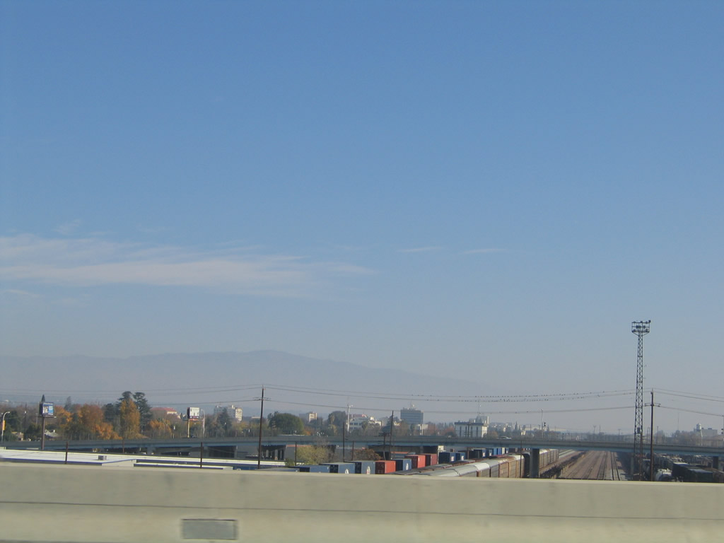
This view looks east from California 99 toward downtown Bakersfield as well as the railroad yard. After passing over the railroad tracks, California 99 will pass over Truxtun Avenue (no access) and then will pass over the Kern River, which flows out of the Sierra Nevada (Kern River Canyon) west into the southern Central Valley.
11/25/04
This mileage sign along California 99 (Golden State Highway) north provides the distance to the next three exits: Exit 26A, California 58 west and California 178 east; Exit 26B, Buck Owens Boulevard; and Exit 27, Airport Drive. Currently, California 58 is a city street and rural road west of here. Traffic demands have indicated that an east-west freeway would be needed between California 99 and Interstate 5; construction of the Westside Parkway began in summer 2009 and is expected for completion in spring 2012 between Allen Road in the west and Truxtun Avenue in the east (just shy of California 99). In future phases, the Westside Parkway is planned for eventual connections to Stockdale Highway (and possibly Interstate 5) to the west.
04/04/09
Most motorist services are available at or near the interchange with California 58 west and California 178 east. In addition, use California 58 west to Buttonwillow, which is home to the massive Midway power substation.
04/04/09
Northbound California 99 and westbound California 58 split at Exit 26A, California 58 west and California 178 east. California 58 follows Rosedale Highway west to Fruitdale, Rosedale, and Buttonwillow. Complete motorist services are found along the route just west of California 99 and again at its junction with Interstate 5. California 178 follows 24th Street east toward Garces Circle and Union Avenue.
04/04/09
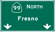
Photo Credits:
- Andy Field: 02/15/04, 11/25/04, 06/28/06, 10/07/06, 04/04/09, 07/30/11
Connect with:
Page Updated Friday February 03, 2012.