
State Route 99 North - Lodi to Galt

The next exit along California 99 north is Exit 259, Morada Lane (0.75 mile).
07/31/11

Northbound California 99 meets Exit 259, Morada Lane. Morada Lane leads west into Morada, then connects to San Joaquin County Route J-3 (West Lane).
07/31/11
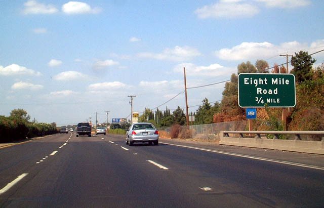
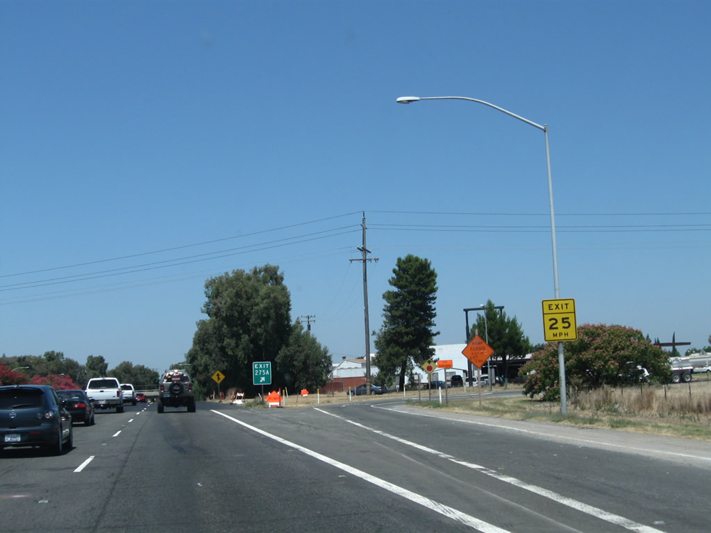
The next exit along California 99 north is Exit 260, Eight Mile Road, 0.75 mile.
08/22/03

This mileage sign provides the distance to Lodi (six miles), Sacramento (40 miles), and Red Bluff (178 miles).
07/31/11

Northbound California 99 meets Exit 260, Eight Mile Road. Eight Mile Road originates in the Delta Region, then proceeds due east across the valley toward Linden and eventually California 26 via Duncan Road.
07/31/11

The next exit along California 99 north is Exit 262, Armstong Road (one mile).
07/31/11

Use Armstong Road west to Micke Grove Road south to Micke Grove Park and Micke Grove Zoo.
07/31/11

Northbound California 99 reaches Exit 262, Armstong Road.
07/31/11
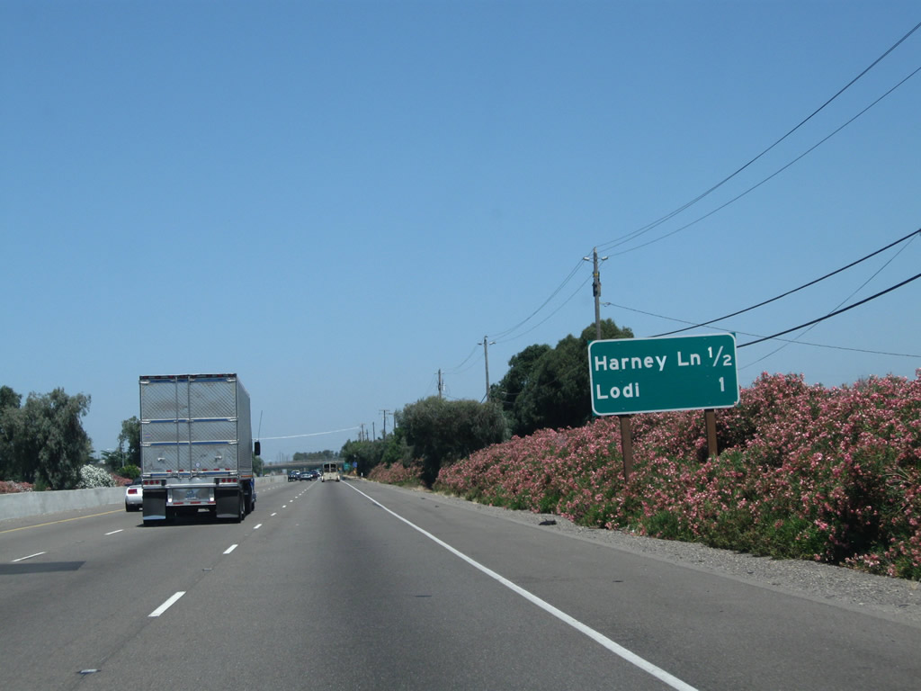
The next two exits along California 99 north are Exit 263, Harney Lane and Exit 264A, California 99 Business (Cherokee Lane) north to Lodi.
07/31/11
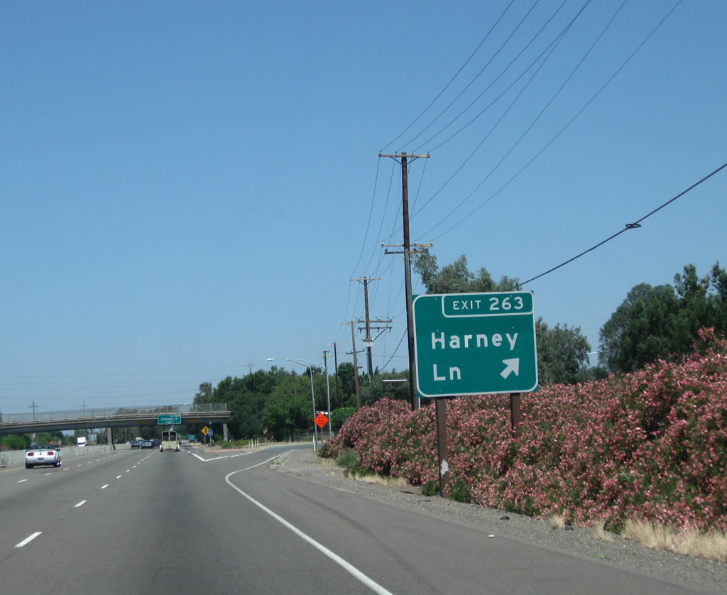
Northbound California 99 meets Exit 263, Harney Lane.
07/31/11

The next exit along California 99 north is Exit 264A, California 99 Business (Cherokee Lane) north to Lodi.
07/31/11

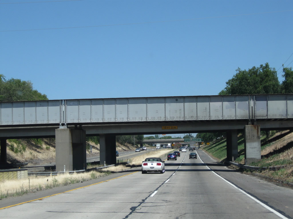
The next four exits along northbound California 99 serve the city of Lodi: Exit 264A, California 99 Business (Cherokee Lane) north; Exit 264B, California 12 (Kettleman Lane) west; Exit 266, California 12 (Victor Road) east; and Exit 267A, Turner Road.
07/31/11

California 99 Business (signed here as "Route 99 Business") follows Historic U.S. 99 along Cherokee Lane north through Lodi, returning to the freeway at Exit 267. Historically, U.S. 99 shared alignment with U.S. 50 (Lincoln Highway) between Stockton and Sacramento.
07/31/11
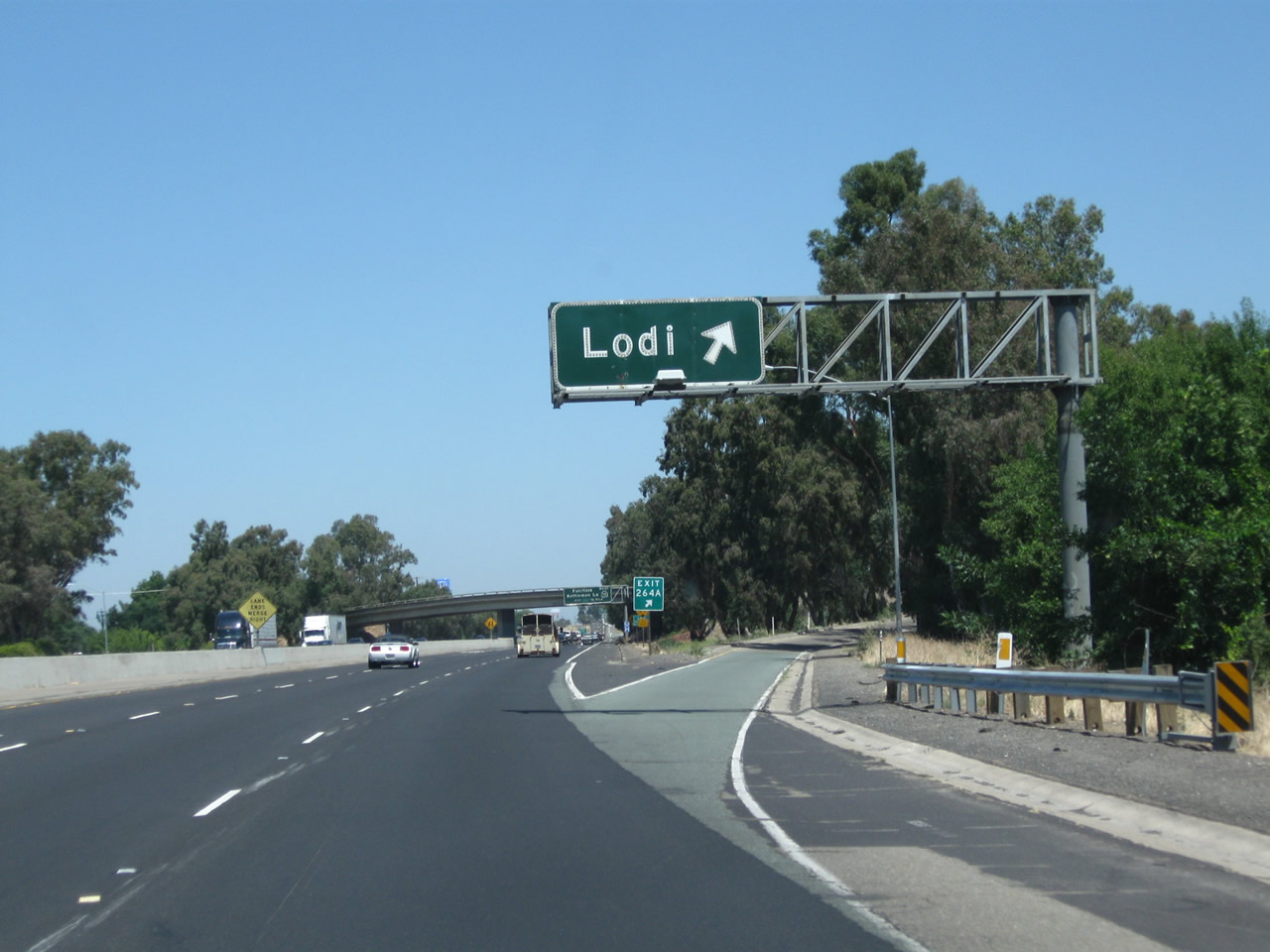
Northbound California 99 meets Exit 264A, California 99 Business (Cherokee Lane) north. The business loop follows Cherokee Lane through Lodi, which was the original path of U.S. 99 through the city. The business route through Lodi (like the Stockton loop) is sparsely signed.
07/31/11

California 99 enters the city of Lodi "Zinfandel Capital of the World", which had a population of 62,134 as of the 2010 Census and was incorporated on December 6, 1906.
07/31/11

The next exit along California 99 north is Exit 264B, California 12 (Kettleman Lane) west in Lodi. California 12 leads west into the California Delta region, connecting with Interstate 80 in Fairfield, then turning northwest into the southern end of Napa Valley before entering the comparably well-regarded Sonoma Valley. After passing through Santa Rosa, California 12 culminates its westbound journey at California 116 in Sebastopol.
07/31/11
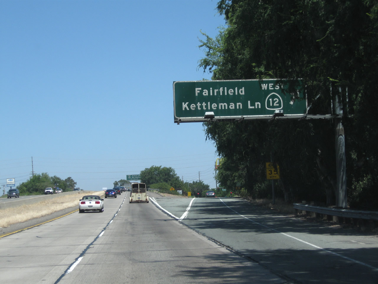
Northbound California 99 meets Exit 264B, California 12 (Kettleman Lane) west to Rio Vista and Fairfield. California 12 east merges briefly with California 99 north for approximately two miles.
07/31/11
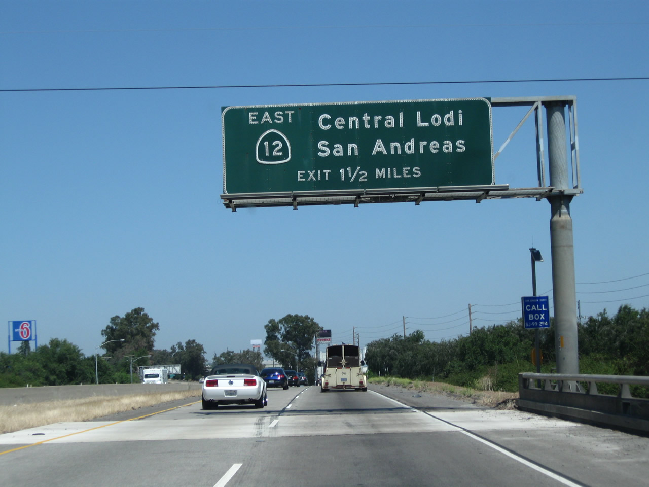
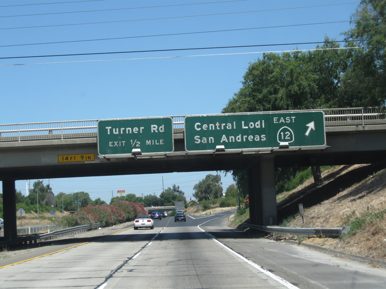
The next exit along California 99 north is Exit 266, California 12 (Victor Road) east to San Andreas. This sign is mounted on the California 99 bridge over Kettleman Lane. Ahead, traffic from California 12 east will merge onto California 99 north.
07/31/11
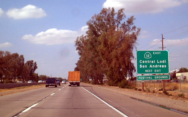
California 12 east travels to Brandywine, then connects with California 88 east of Victor. East of California 88, California 12 enters the foothills before culminating at its junction with California 49 (Gold Country Highway) in San Andreas.
08/22/03
California 99 drops below grade as it passes near downtown Lodi. A pair of bridges pass overhead.
07/31/11
After their brief overlap, California 99 north and California 12 east part ways at Exit 266, California 12 (Victor Road) east and Victor Road west (use Victor Road west to California 99 Business (Cherokee Lane) in Lodi). The next exit along California 99 north is Exit 267A, Turner Road.
07/31/11

Northbound California 99 meets Exit 267A, Turner Road.
07/31/11
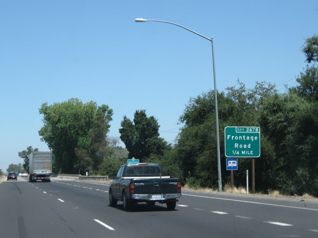
The next exit along California 99 north is Exit 267B, Frontage Road (0.25 mile).
07/31/11

Northbound California 99 meets Exit 267B, Frontage Road. This exit is located immediately after the Mokelumne River bridge.
07/31/11
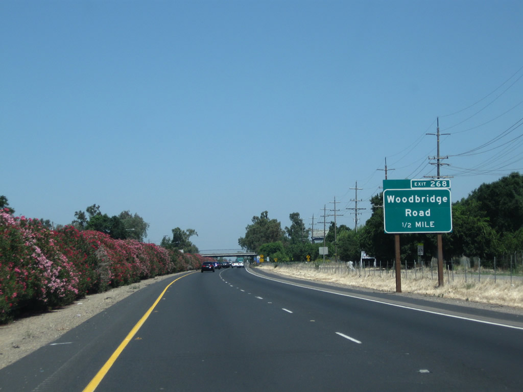
The next exit along California 99 north is Exit 268, Woodbridge Road (one-half mile). This was one of the first exit number signs to come to this stretch of California 99, as it was installed prior to August 2003.
07/31/11

Northbound California 99 meets Exit 268, Woodbridge Road.
07/31/11
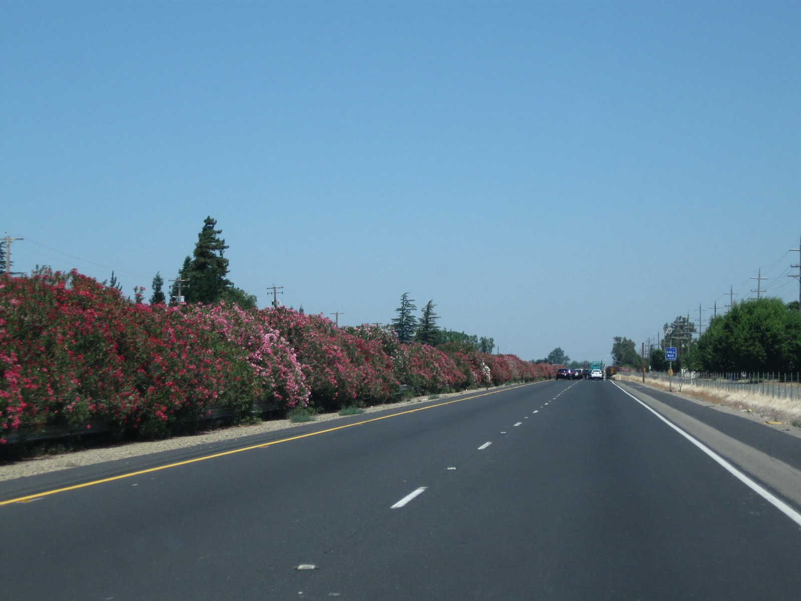
This view looks north along California 99 between Woodbridge Road and Acampo Road.
07/31/11
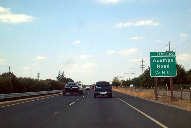
The next exit along California 99 north is Exit 269, Acampo Road, one-half mile.
08/22/03

Northbound California 99 meets Exit 269, Acampo Road. To the west, Acampo Road travels into Acampo and meets San Joaquin County Route J-10 (Sacramento Road) east of there. To the east, Acampo Road connects with San Joaquin County Route J-5 (Elliott Road) near the banks of the Mokelumne River.
07/31/11
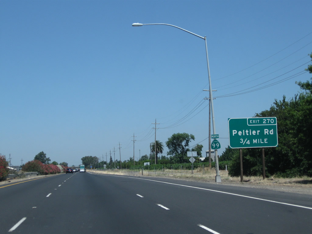
The next exit along California 99 north is Exit 270, San Joaquin County Route J-12 (Peltier Road).
07/31/11

Northbound California 99 reaches Exit 270, San Joaquin County Route J-12 (Peltier Road). CR J-12 travels about 20 miles, starting at San Joaquin County Route J-8 (Thornton Road) and traveling east via Peltier Road, Tully Road, Jahant Road, Mackville Road, and Collier Road to end at California 88 northeast of Clements.
07/31/11

The next exit along California 99 north is Exit 271, Jahant Road. The Lodi Airport is located west of the freeway via this exit.
07/31/11

Northbound California 99 reaches Exit 271, Jahant Road.
07/31/11
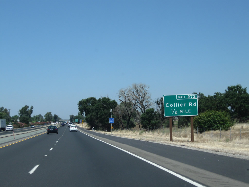
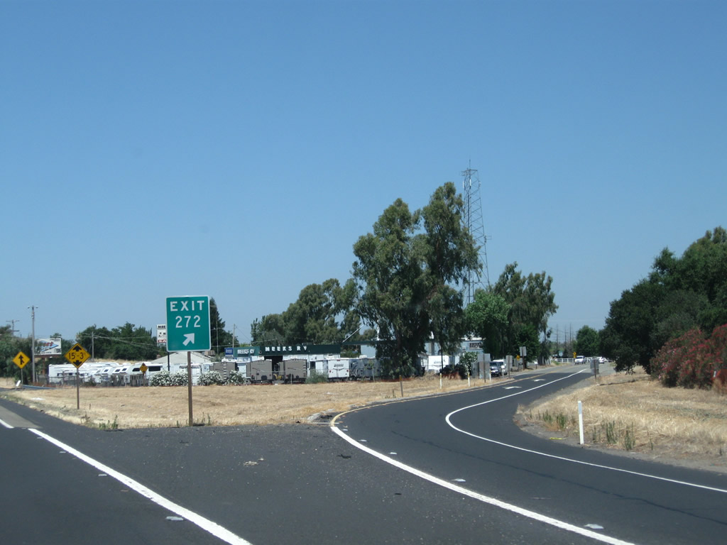
The next exit along California 99 north is Exit 272, Collier Road (0.50 mile).
07/31/11
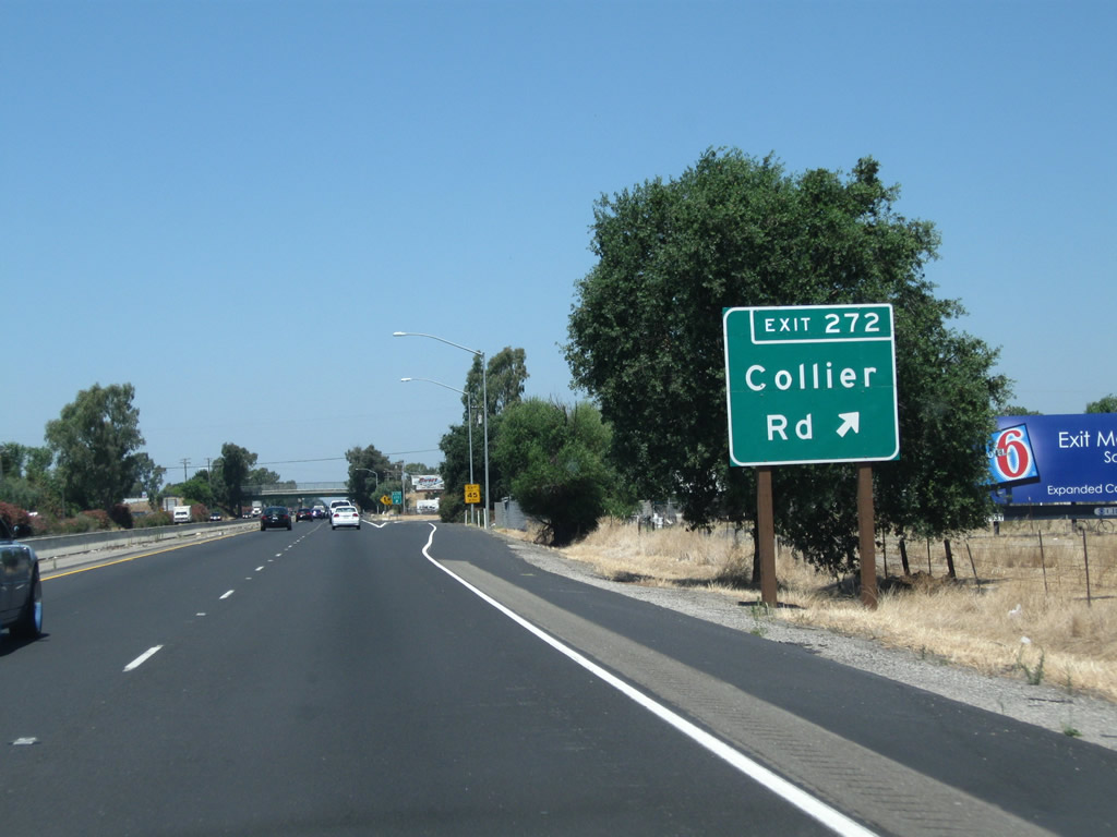
Northbound California 99 meets Exit 272, Collier Road. Like Jahant Road, Peltier Road, and Acampo Road, Collier Road travels east-west in northern San Joaquin County. Each of these county-maintained roads are spaced by approximately one mile apart from each other.
07/31/11
The off-ramp to Collier Road uses a section of frontage road before connecting to Collier Road itself.
07/31/11
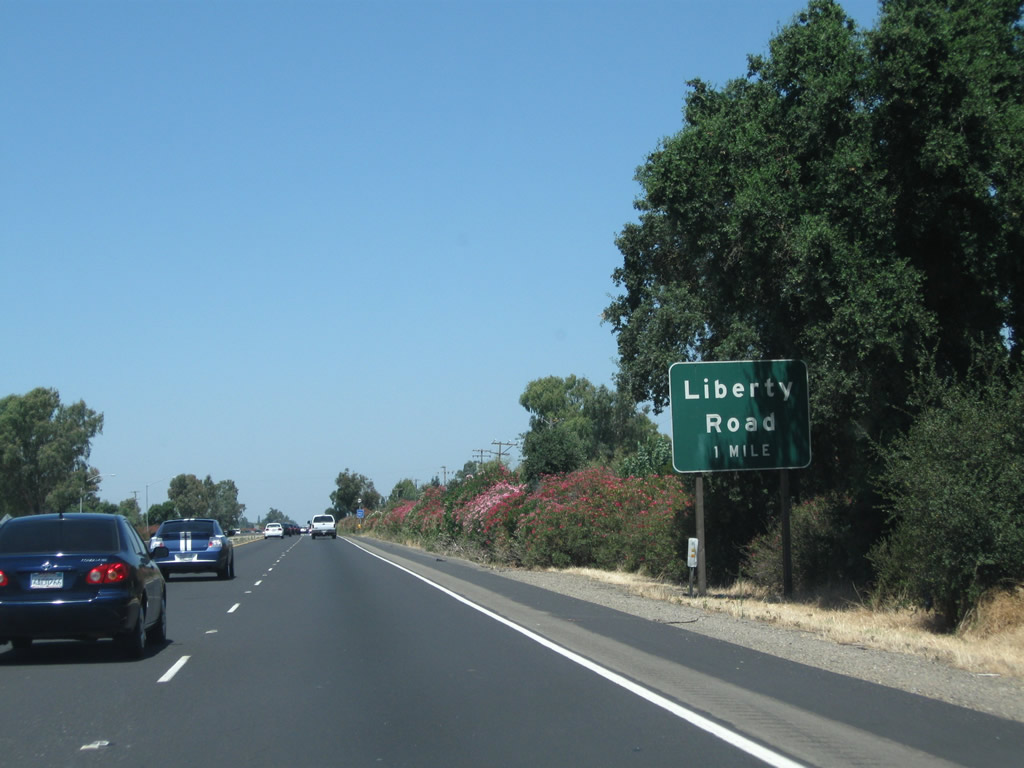
The next exit along California 99 north is Exit 273, Liberty Road (one mile).
07/31/11
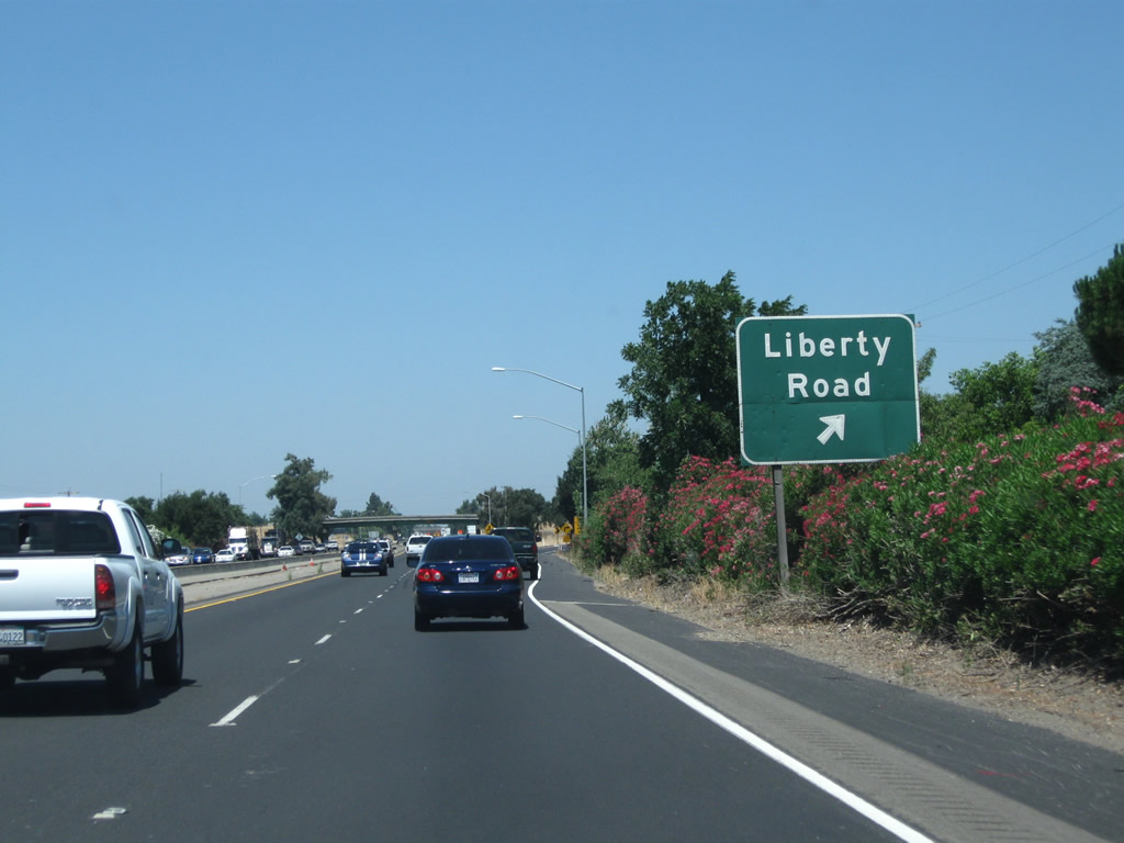
Northbound California 99 reaches Exit 273, Liberty Road. This is the last exit in San Joaquin County; after crossing the Dry Creek, California 99 will enter Sacramento County and the city of Galt.
07/31/11

The next six exits from California 99 north serve the city of Galt: Exit 274A, Crystal Way; Exit 274B, C Street west to Galt and Boessow Road; Exit 275A, Simmerhorn Road east and Simmerhorn Road west to San Joaquin County Route J-10 (Lincoln Way) and Elm Avenue; Exit 275B, Ayers Lane east, Carol Lane south, and Stockton Boulevard (Historic U.S. 50-99) north; Exit 276, Walnut Avenue; and Exit 277, California 104 (Twin Cities Road) east to Ione and San Joaquin County E-13 (Twin Cities Road) west.
07/31/11
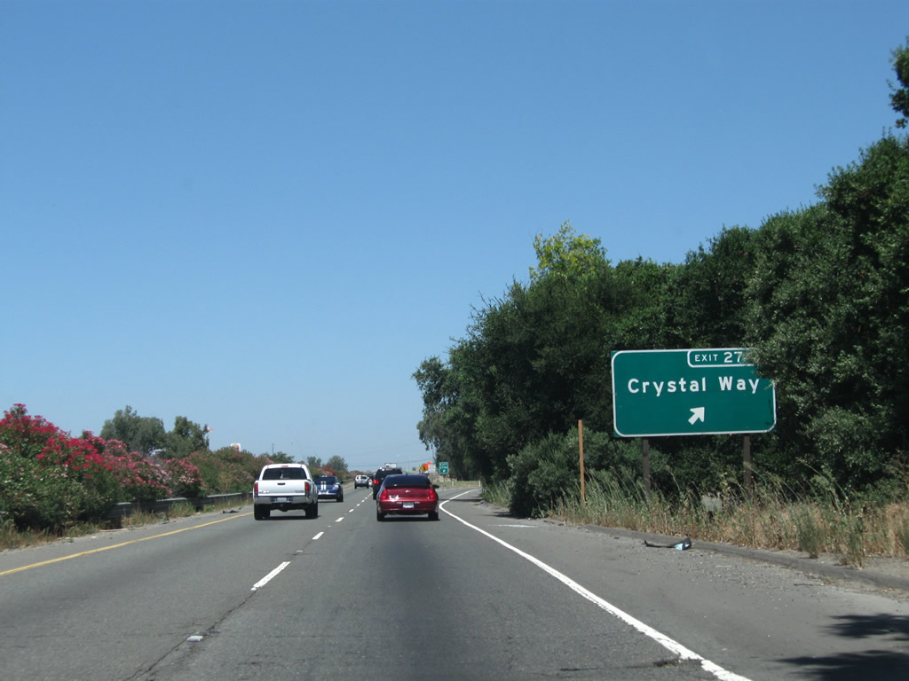
The next exit along California 99 north is Exit 274A, Crystal Way (one-half mile).
07/31/11
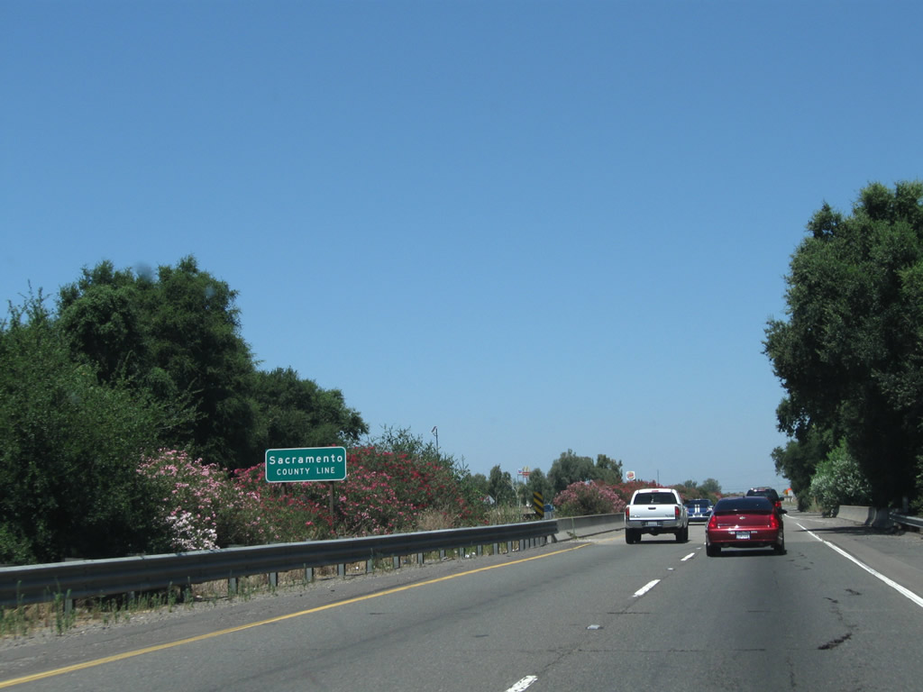
California 99 crosses Dry Creek and will soon leave San Joaquin County and enter Sacramento County.
07/31/11
California 99 leaves San Joaquin County and enters Sacramento County.
07/31/11
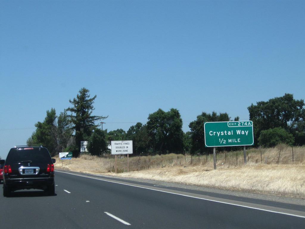
Northbound California 99 meets Exit 274A, Crystal Way. This is the first exit to serve the city of Galt, which had a population of 23,647 as of the 2010 Census and was incorporated on August 16, 1946.
07/31/11

This is the gore point to Exit 274A, Crystal Way from California 99 north.
07/31/11
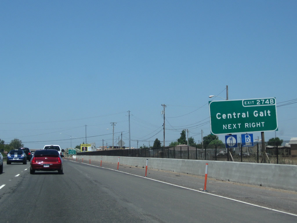
The next exit along California 99 north Exit 274B, C Street west to Galt and Boessow Road east.
07/31/11

Northbound California 99 meets Exit 274B, C Street west to Galt and Boessow Road east.
07/31/11
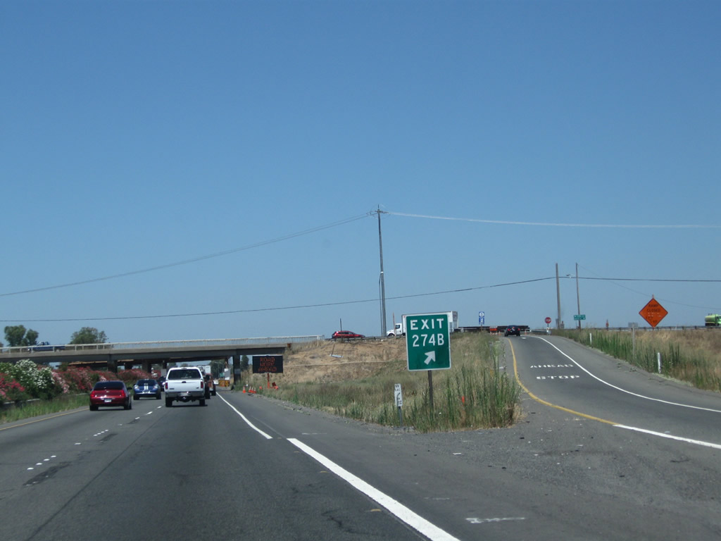
This is the gore point for Exit 274B, C Street west to Galt and Boessow Road east.
07/31/11
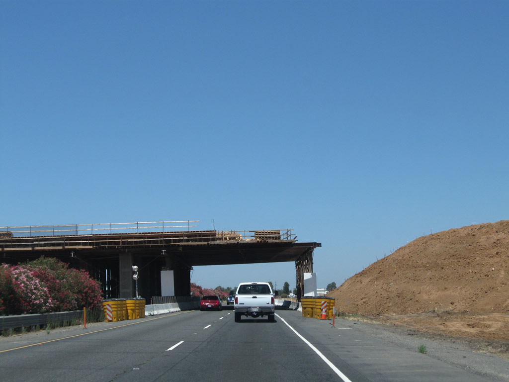
Shortly thereafter, a new bridge was under construction for A Street to cross over California 99.
07/31/11
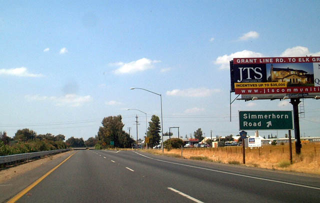
The next exit along California 99 north is Exit 275A, Simmerhorn Road to Sacramento County J-10 (Lincoln Way) south. This exit marks the northern terminus of CR J-10, which leads south into San Joaquin County to follow Sacramento Road south through Woodbridge, past Lodi, en route to Stockton.
08/22/03
Northbound California 99 meets Exit 275A, Simmerhorn Road east to Cherokee Gardens and Simmerhorn Road west to Sacramento County J-10 (Lincoln Way) south and Elm Avenue west. As the name implies, Lincoln Way is an old alignment of the Lincoln Highway and U.S. 50-99.
07/31/11

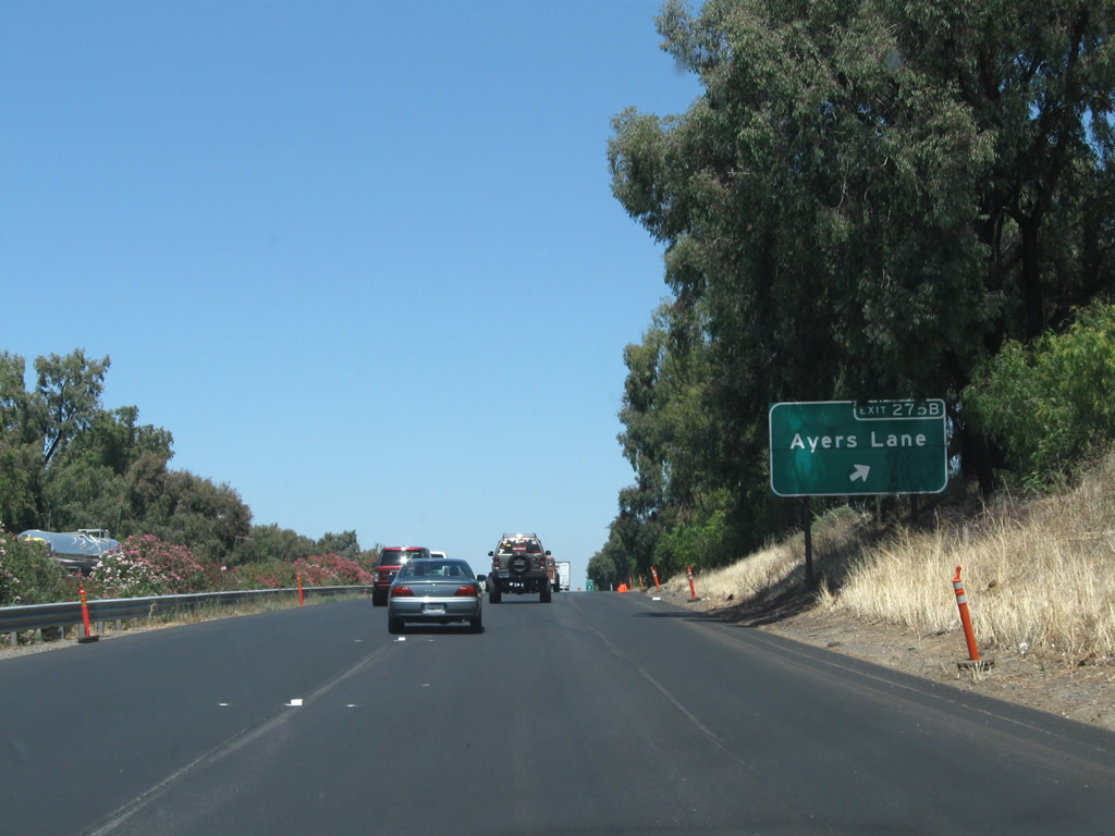
The next exit along California 99 north is Exit 275B, Ayers Lane (one-quarter mile).
07/31/11
Northbound California 99 meets Exit 274B, Ayers Lane.
07/31/11

The exit to Ayers Lane is rather sharp.
07/31/11
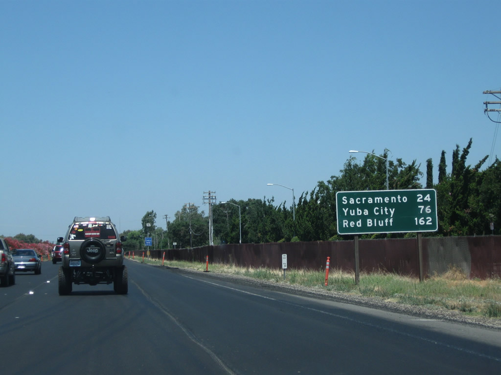
This mileage sign along California 99 north provides the distance to Sacramento (24 miles), Yuba City (76 miles), and Red Bluff (162 miles).
07/31/11
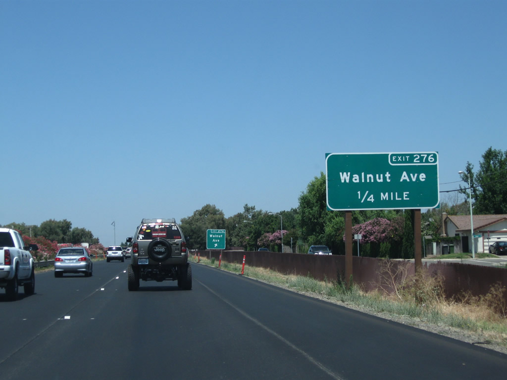
The next exit along California 99 north is Exit 276, Walnut Avenue (one-quarter mile).
07/31/11
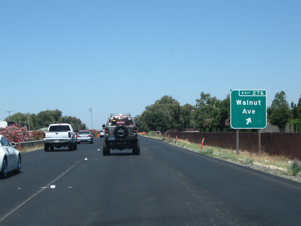
Northbound California 99 meets Exit 276, Walnut Avenue. After this exit, California 99 proceeds north to cross Deadman Gulch and will continue toward the next northbound interchange: Exit 277, California 104 east and Sacramento County Route E-13 west via Twin Cities Road.
07/31/11
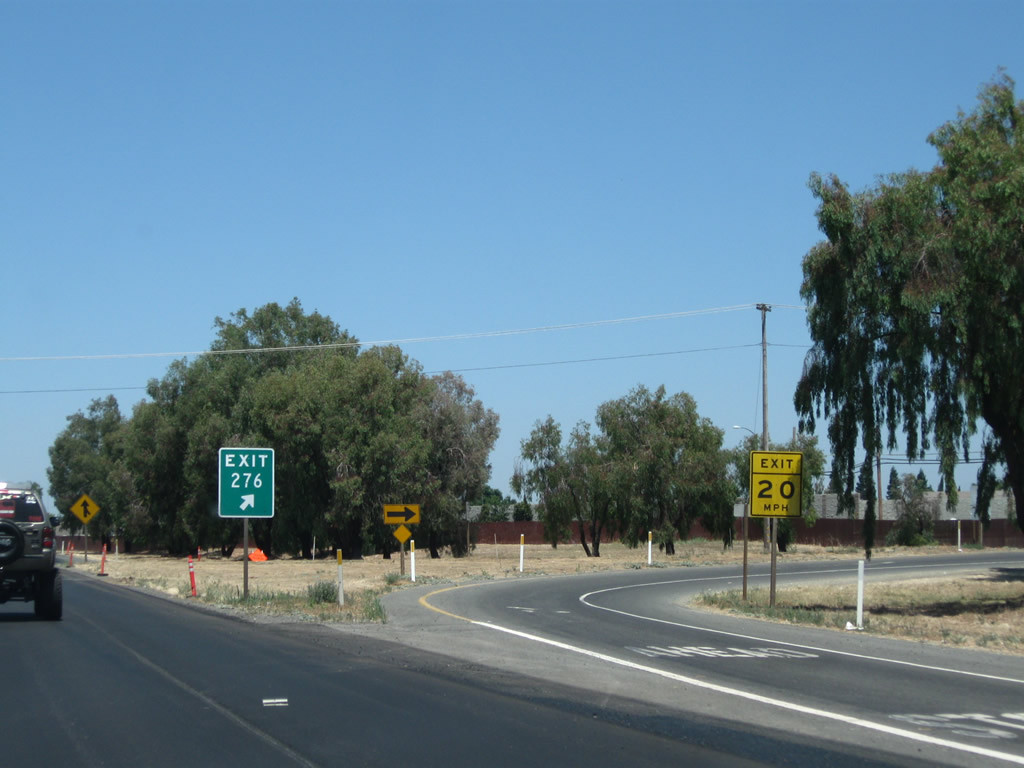
The exit to Walnut Avenue is rather sharp.
07/31/11
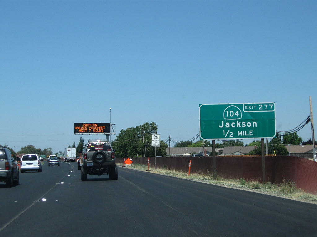
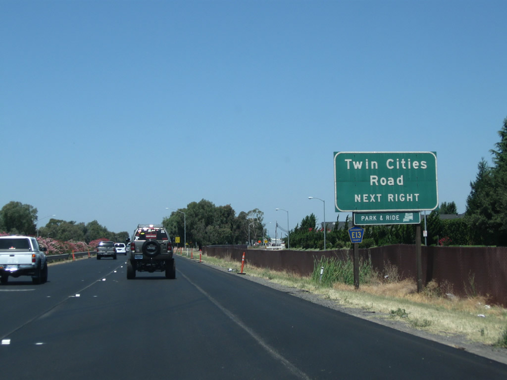
The next exit along California 99 north is Exit 277, California 104 (Twin Cities Road) east to Rancho Seco and Ione and Sacramento County Route E-13 (Twin Cities Road) west to Walnut Grove and California 160 (one-half mile). Beginning at this interchange, California 104 is an east-west state route that travels northeast toward Ione and Jackson, while Sacramento County Route E-13 travels west toward Walnut Grove in the California Delta Region.
07/31/11

A California 99 north reassurance shield is posted just before a guide sign advising that Exit 277 provides the best route east to Ione.
07/31/11
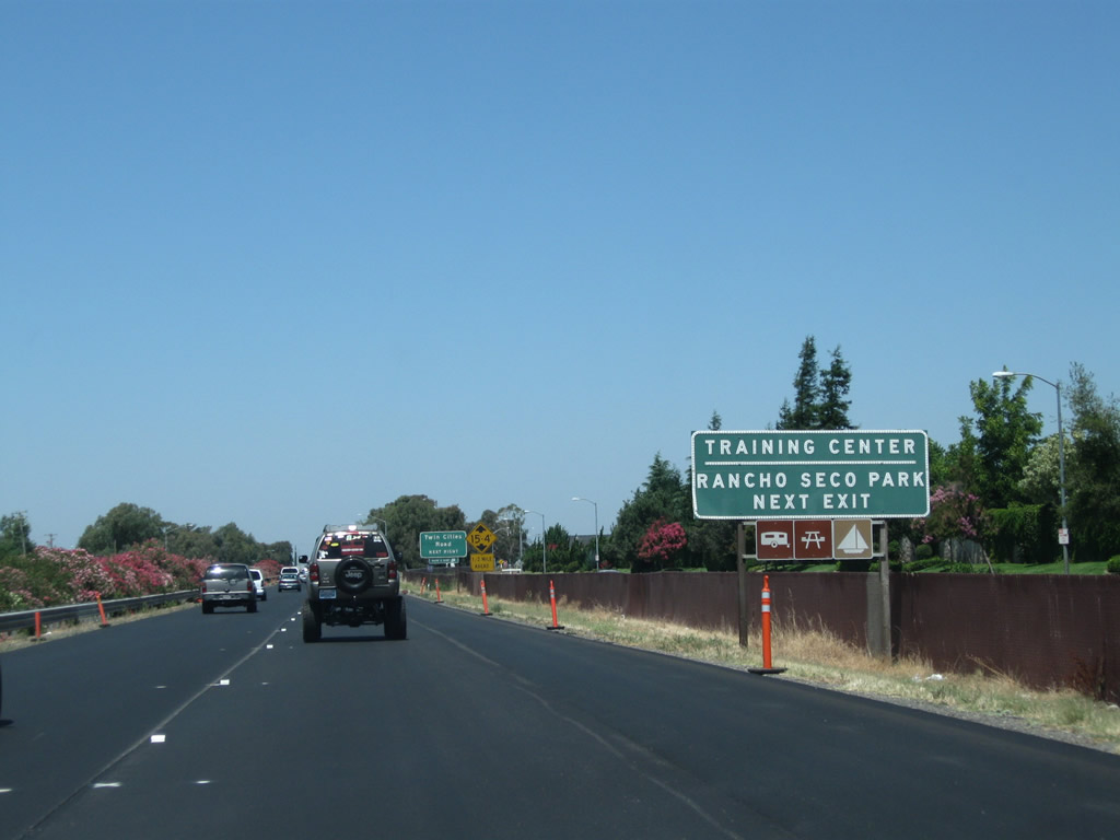
Use California 104 (Twin Cities Road) east to Rancho Seco, site of a former nuclear power generating station owned and operated by the Sacramento Municipal Utility District (SMUD). Rancho Seco began commercial operation on April 18, 1975, and it shut down operations with final defueling of the facility on December 8, 1989. The two cooling towers, which are of a design common to many nuclear power generating facilities, are visible from quite a distance from the site, with access to the natural gas-fired Consumnes Power Plant that opened in 2006. Today the site is mostly a preserve (Rancho Seco Lake and Howard Ranch), with intersecting power lines linking near the site to connect the former plant to the power grid. Much of the land at the plant was cleared for public use in 2009.
07/31/11
In typical style, the county designation and street name are only mentioned once, on this auxiliary sign on the approach to Exit 277. CR E-13 is an east-west county route that begins here at California 99 and extends west along Twin Cities Road and River Road to Walnut Grove, ending at California 160 at the west end of the Walnut Grove Bridge. The portion of CR E-13 that follows River Road is situated mostly on a levee overlooking the Sacramento River in the California Delta region.
08/22/03
Northbound California 99 meets Exit 277, California 104 east to Ione and Jackson and Sacramento County Route E-13 west to Walnut Grove (with connections to California 160 and California 220).
08/22/03
Looking at the exit ramp, we see a route marker assembly that provides directions to both California 104 and Sacramento County Route E-13. This view of the exit ramp is seen from the northbound lanes along the mainline of California 99.
08/22/03

California 99 passes under Twin Cities Road (California 104 and Sacramento County Route E-13).
08/22/03
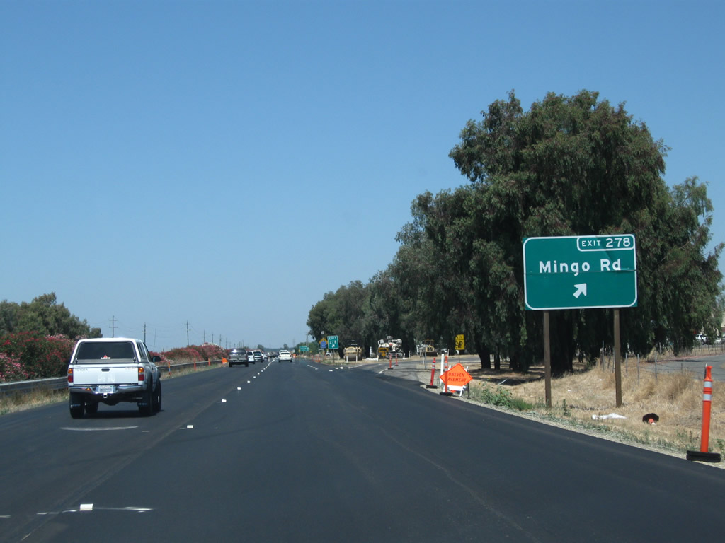
Northbound California 99 meets Exit 278, Mingo Road.
07/31/11
A California 99 north reassurance shield is posted shortly thereafter.
07/31/11

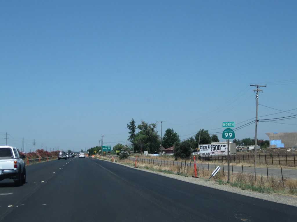
The next exit along California 99 north is Exit 280, Arno Road (one mile).
07/31/11

Northbound California 99 meets Exit 280, Arno Road.
07/31/11
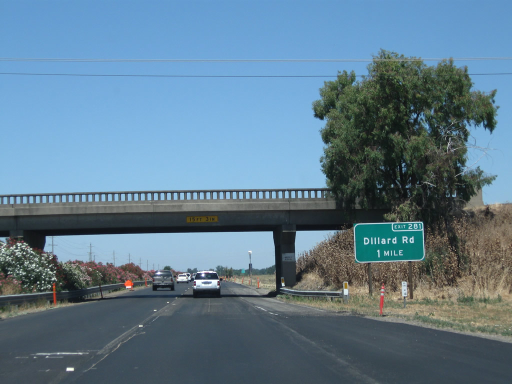
The next exit along California 99 north is Exit 281, Dillard Road, one mile. Note the overpass with the old-style guardrail.
07/31/11

A set of Sacramento Municipal Utility District (SMUD) power lines cross California 99; these lines travel east to the Rancho Seco area, then proceed northeast toward Folsom and the hydroelectric facility at Folsom Dam.
07/31/11

Northbound California 99 meets Exit 281, Dillard Road. After this exit, the freeway crosses the Consumnes River.
07/31/11
Photo Credits:
- Andy Field: 08/22/03, 07/31/11
Connect with:
Page Updated Wednesday November 28, 2012.