
State Route 99 North - Elk Grove to Sacramento

California 99 enters the city of Elk Grove ("Proud Heritage, Bright Future"), which had a population of 153,015 as of the 2010 Census and was incorporated on July 1, 2000.
07/31/11
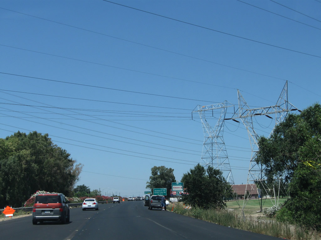
More power lines cross over California 99 just shy of Exit 284.
07/31/11
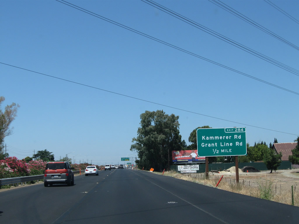
The next exit along California 99 north is Exit 284, Sacramento County Route E-2 (Grant Line Road) northeast and Kammerer Road west (one-half mile). Sacramento County Route E-2 begins its northerly journey here; it switches from Grant Line Road to Sunrise Boulevard near its junction with California 16 and then follows Sunrise Boulevard on its path through the suburbs east of Sacramento.
07/31/11

The right two lanes of California 99 north connect to Exit 284, Sacramento County Route E-2 (Grant Line Road) northeast and Kammerer Road west. This area was substantially reconfigured between 2003 and 2011.
07/31/11
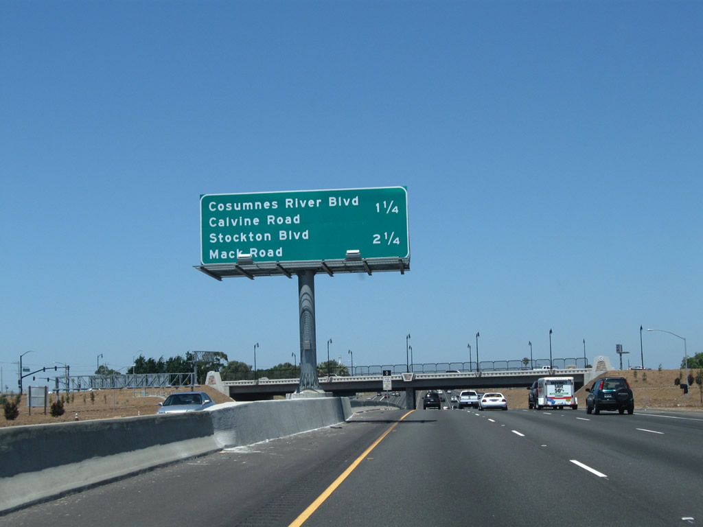
The next five exits from California 99 north serve the city of Elk Grove: Exit 284, Sacramento County Route E-2 (Grant Line Road) northeast and Kammerer Road west; Exit 286, Sacramento County Route E-12 (Elk Grove Boulevard); Exit 287, Bond Road and Laguna Boulevard; Exit 288, Sheldon Road; and Exit 289, Consumnes River Boulevard and Calvine Road.
07/31/11
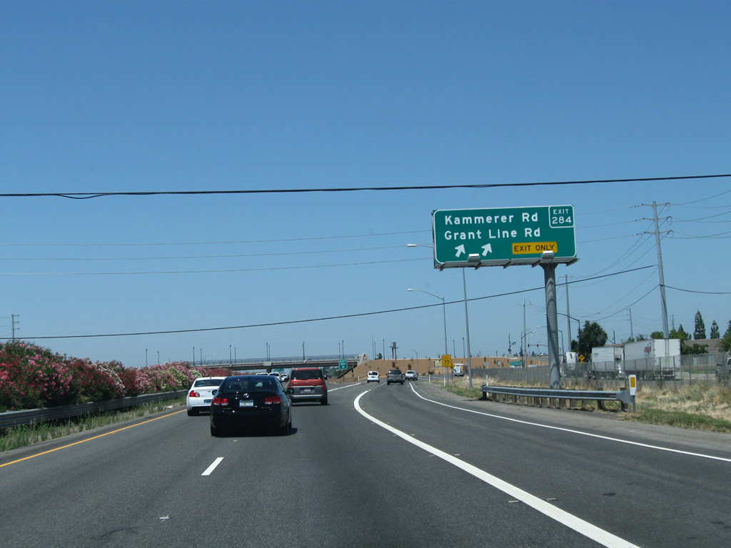
Northbound California 99 meets Exit 284, Sacramento County Route E-2 (Grant Line Road) north and Kammerer Road west. Another, separate road also known as Grant Line Road is located several miles southwest of here; it has an exit along Interstate 205 near Tracy.
07/31/11
The interchange between California 99 and E-2 was refashioned into a gateway for the city of Elk Grove.
07/31/11
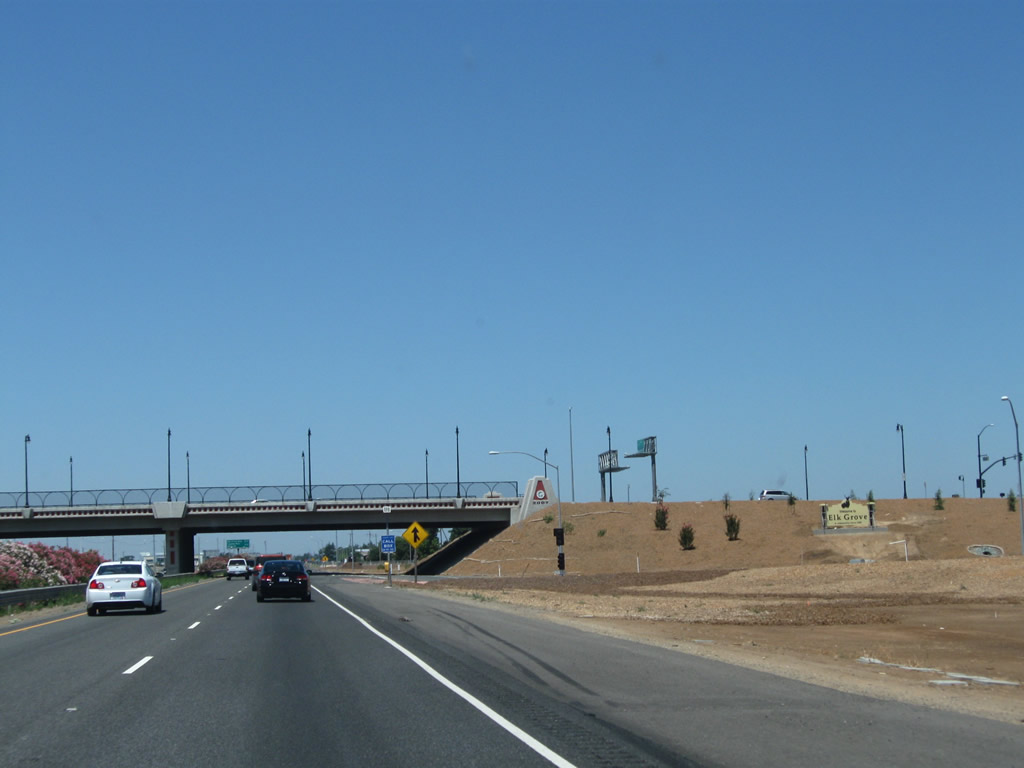
The next two exits along California 99 north are Exit 286, Sacramento County Route E-12 (Elk Grove Boulevard) and Exit 287, Bond Road and Laguna Boulevard.
07/31/11

California 99 north approaches Exit 286, Sacramento County Route E-12 (Elk Grove Boulevard) (one mile).
07/31/11

Gas, food, and a park and ride facility are all available at Exit 286.
07/31/11

Use Sacramento County Route E-12 (Elk Grove Boulevard) east to Elk Grove Park (via Elk Grove Florin Road south) and west to the Elk Grove Auto Mall.
07/31/11

Northbound California 99 meets Exit 286, Sacramento County Route E-12 (Elk Grove Boulevard). Sacramento County Route E-12 starts at its junction with Interstate 5 just west of here, and it connects with Sacramento County Route E-2 (Grant Line Road) east of Elk Grove. Regional travelers may notice that a separate segment of Grant Line Road several miles southwest of here has an exit along Interstate 205.
07/31/11
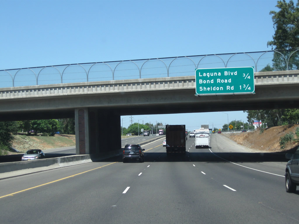
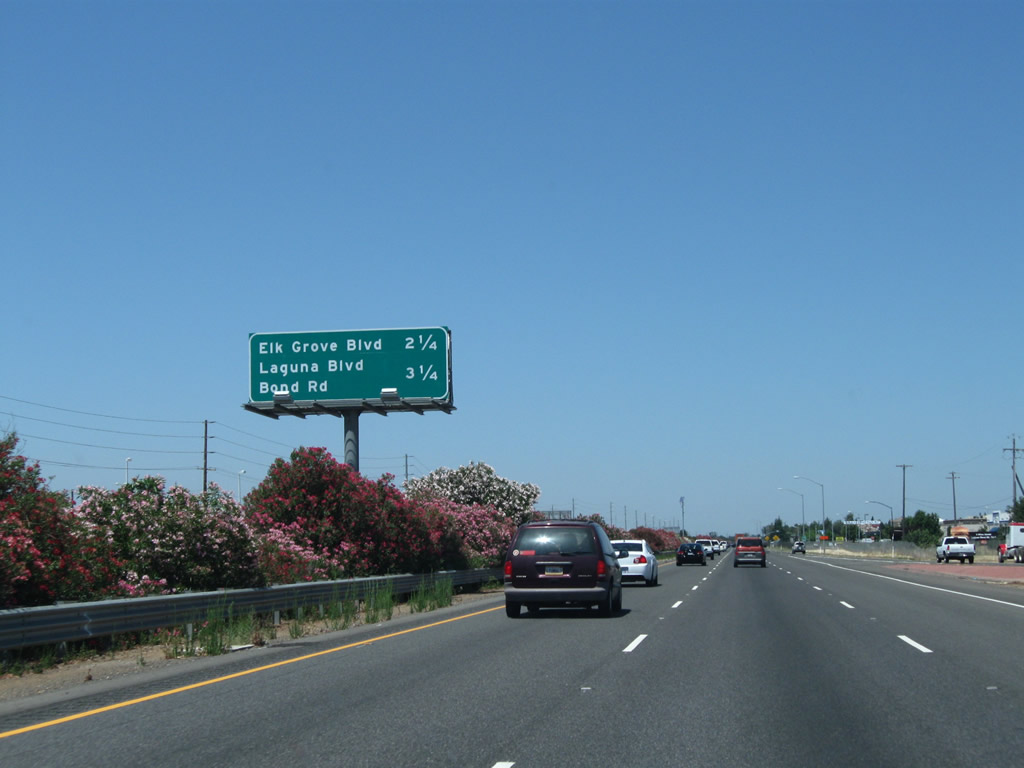
The next two exits along California 99 north are Exit 287, Bond Road and Laguna Boulevard and Exit 288, Sheldon Road.
07/31/11
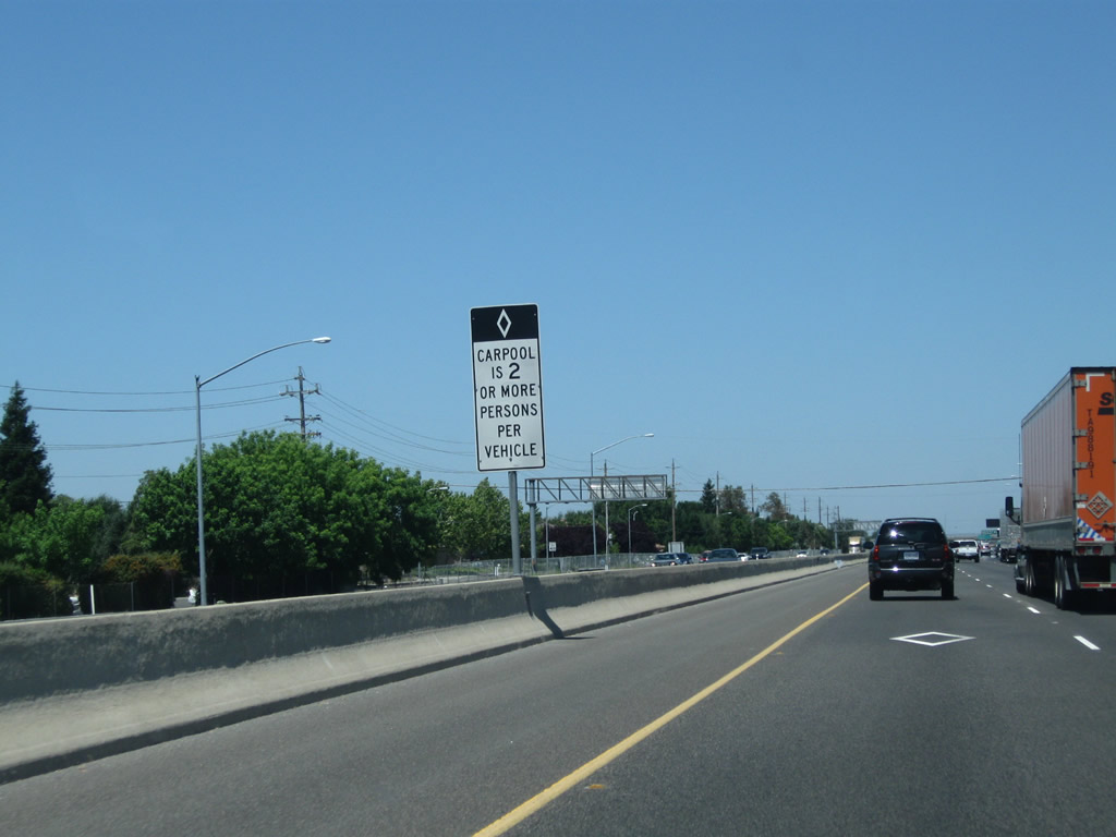
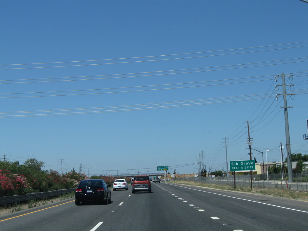
Entering the Sacramento metropolitan area, California 99 gains a high occupancy vehicle/carpool lane.
07/31/11
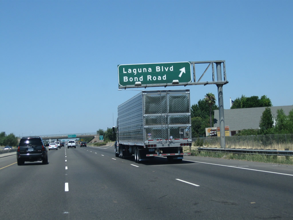
Northbound California 99 meets Exit 287, Bond Road and Laguna Boulevard in Elk Grove.
07/31/11
This mileage sign along northbound California 99 provides the distance to Exit 288, Sheldon Road (0.75 mile) and Exit 289, Consumnes River Boulevard and Calvine Road (two miles).
07/31/11

The next exit along California 99 north is Exit 288, Sheldon Road.
07/31/11
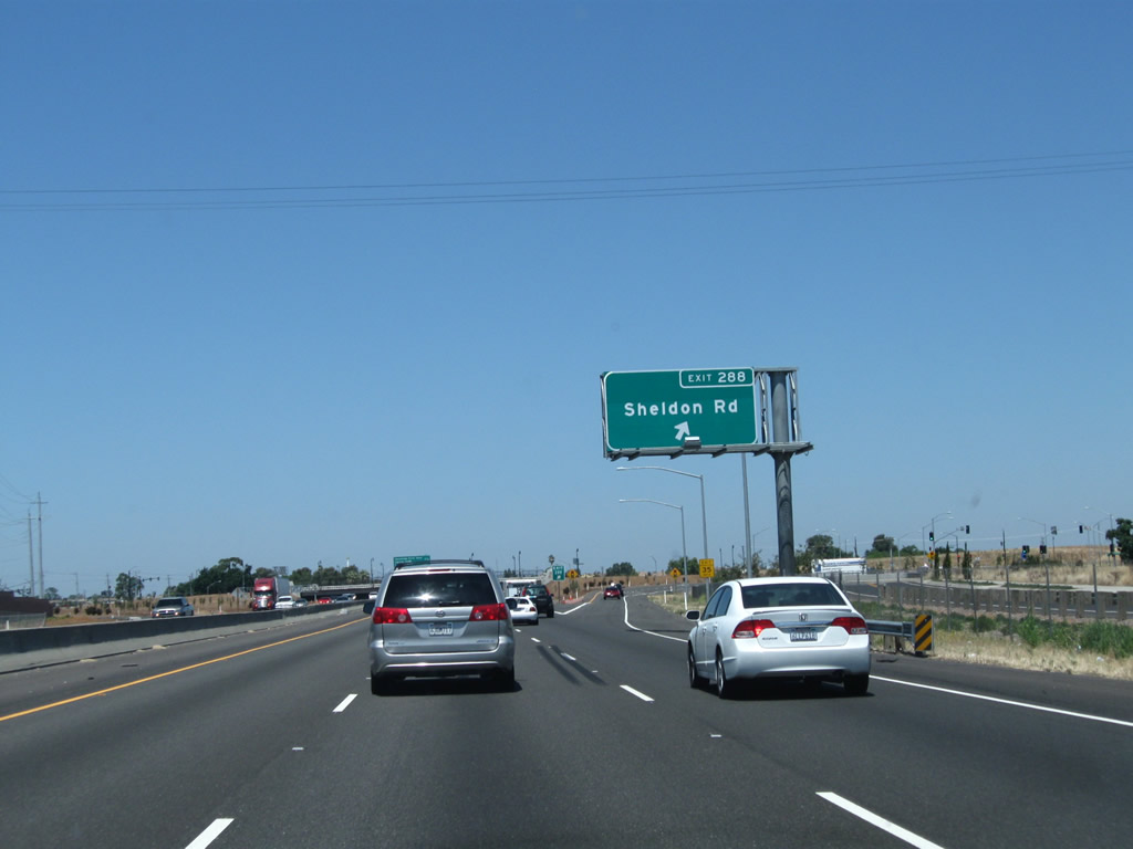
Northbound California 99 meets Exit 288, Sheldon Road.
07/31/11
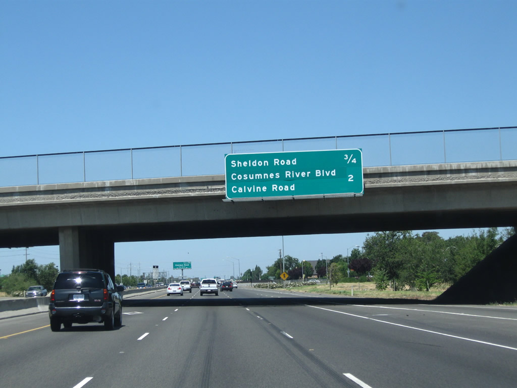
This mileage sign along northbound California 99 provides the distance to the next two exits: Exit 289, Consumnes River Boulevard and Calvine Road and Exit 291, Mack Road and Stockton Boulevard.
07/31/11

California 99 passes under Sheldon Road.
07/31/11
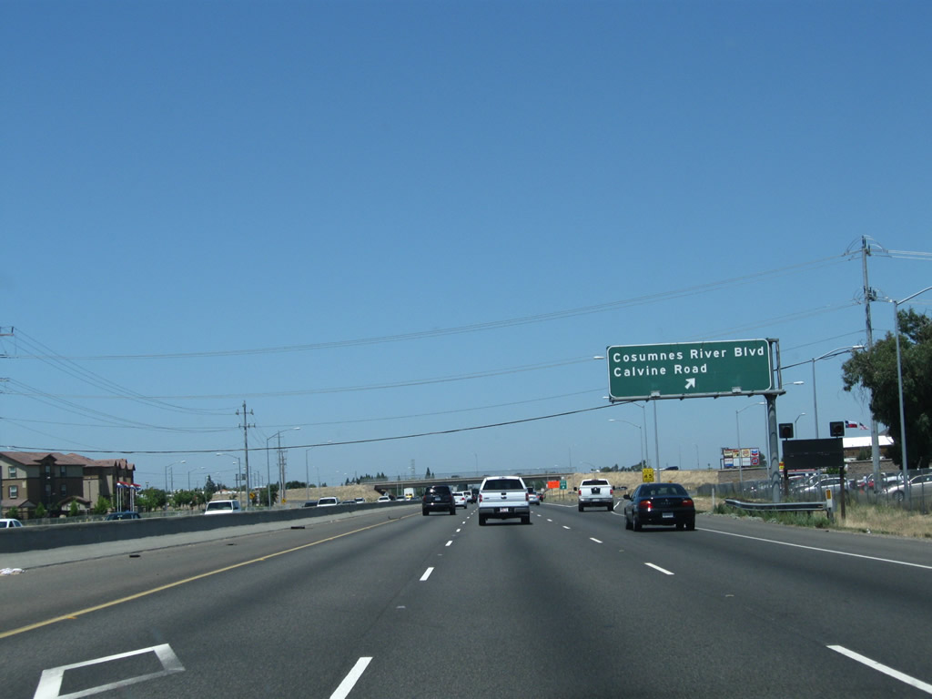
Northbound California 99 meets Exit 289, Consumnes River Boulevard and Calvine Road in Elk Grove. Despite the name, Consumnes River Boulevard does not parallel the Consumnes River, but it will serve Consumnes River College.
07/31/11
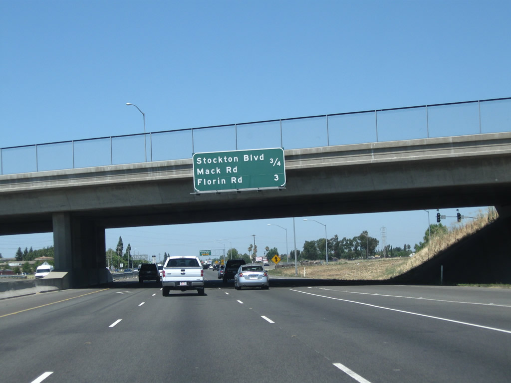
This mileage sign along northbound California 99 provides the distance to the next three exits: Exit 291, Stockton Boulevard north to Mack Road and Elsie Road and Exit 293A-B, Florin Road east and west.
07/31/11

The right lane of California 99 becomes exit only for Exit 291. Stockton Boulevard is the original alignment of U.S. 50-99 before the current freeway was constructed. It was then signed briefly as a business route until both U.S. routes were decommissioned in favor of the California 99 freeway. A residual U.S. 50 and U.S. 99 cut-out route marker assembly remained in place on Stockton Boulevard until around 1983, long after the routes were removed from this segment. The next exit (Exit 291) is for Stockton Boulevard and Mack Road.
07/31/11

Northbound California 99 meets Exit 291, Mack Road and Stockton Boulevard. Mack Road leads east to a connection with Power Inn Road and west to become Meadowview Road en route to Interstate 5.
07/31/11

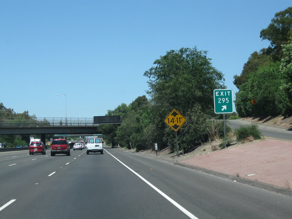
One of the reasons California 99 does not meet Interstate Highway standards is due to the substandard height of some of its bridges, including this bridge, which clocks in at 14'10". This bridge carries traffic from southbound Stockton Boulevard to southbound California 99.
07/31/11

California 99 next passes under Mack Road.
07/31/11
This mileage sign along California 99 north provides the distance to the next four exits: Exit 293A, Florin Road east; Exit 293B, Florin Road west; Exit 294A, 47th Avenue east; and Exit 294B, 47th Avenue west.
07/31/11

Northbound California 99 meets Exit 293A, Florin Road east at this cloverleaf interchange. The next exit is Exit 293B, Florin Road west. Taking Florin Road east will take motorists to California 16 en route to the Sierra Nevada foothills, while westbound Florin Road travels west to meet Interstate 5 at Exit 513.
07/31/11

California 99 carries four northbound lanes through the cloverleaf interchange with Florin Road.
07/31/11

Immediately thereafter, California 99 north meets Exit 293B, Florin Road west. The next two exits along California 99 north are Exits 294A-B, 47th Avenue (one mile).
07/31/11

California 99 passes under Florin Road and reaches the gore point with Exit 293B. Summer colors beautify the landscape within the interchange curls.
07/31/11

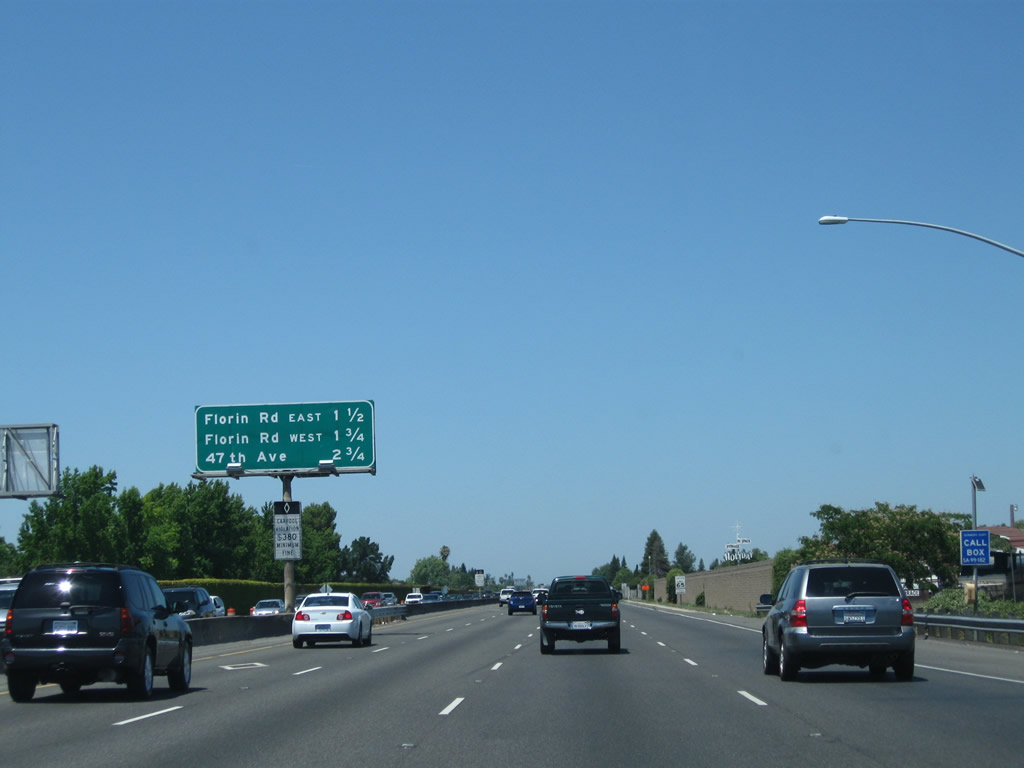
This mileage sign provides the distance to the next three exits along California 99 north: Exit 294A, 47th Avenue east; Exit 294B, 47th Avenue west; and Exit 295, Fruitridge Road and Martin Luther King, Jr. Boulevard.
07/31/11

Use 47th Street west to light rail and transit center and Sacramento County J-8 (Franklin Road).
07/31/11

Northbound California 99 reaches Exit 294A, 47th Avenue east. The interchange between California 99 and 47th Avenue is a cloverleaf. The next off-ramp connects California 99 north to Exit 294B, 47th Avenue west.
07/31/11

Another set of power lines pass overhead as we go through the 47th Avenue interchange.
07/31/11

Northbound California 99 meets Exit 294B, 47th Avenue West.
07/31/11

This mileage sign provides the distance to the next two exits along California 99 north: Exit 295, Martin Luther King, Jr. Boulevard north to Fruitridge Road east and Exit 296, Fruitridge Road west.
07/31/11
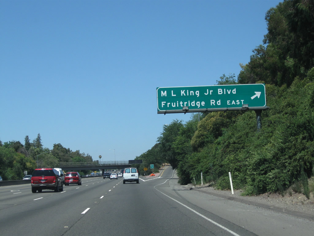
Northbound California 99 meets Exit 295, Martin Luther King, Jr. Boulevard north to Fruitridge Road east. Fruitridge runs east-west between Interstate 5 Exit 515 and Watt Avenue near a junction with California 16 (use Exit 296 for westbound). Martin Luther King, Jr. Boulevard runs north-south, with southbound connections to Franklin Boulevard (Sacramento County J-8) and northbound connections into the eastern side of downtown Sacramento.
08/22/03
This is the gore point for Exit 295, Martin Luther King, Jr. Boulevard.
07/31/11

This mileage sign provides the distance to the next five exits along California 99 north starting with Fruitridge Road west.
07/31/11

California 99 enters the city of Sacramento, the capital of the state of California and the seat of Sacramento County. Located at the crossroads of Interstate 5, U.S. 50, Interstate 80, and California 99, the city owes its origins to its location at the confluence of the Sacramento River and American River. Sacramento had a population of 466,488 as of the 2010 Census and was incorporated on February 27, 1850. Sitting at an elevation of about 25 feet, Sacramento sees rainy winters and dry summers with an average precipitation of 17.93 inches annually. California 99 will enter the capital city from the southeast and merge with Business Loop I-80 (Capital City Freeway) and U.S. 50 at the WX-29/30 Interchange.
07/31/11

Northbound California 99 meets Exit 296, Fruitridge Road west (loop ramp).
07/31/11
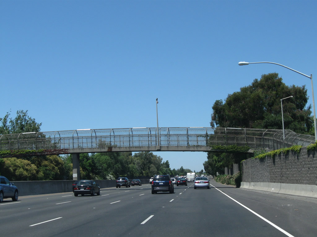
Leaving Fruitridge Road behind, a pedestrian bridge passes over California 99.
07/31/11

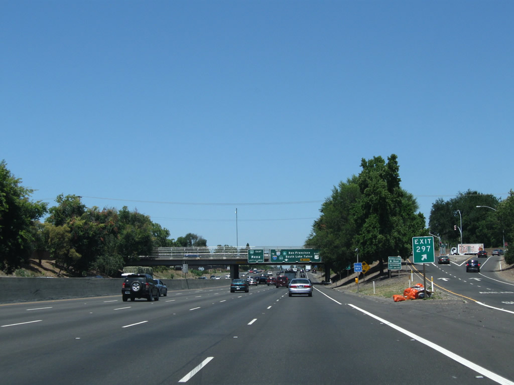
This mileage sign provides the distance to the next four exits along California 99 north starting with Exit 297 for 12th Avenue.
07/31/11
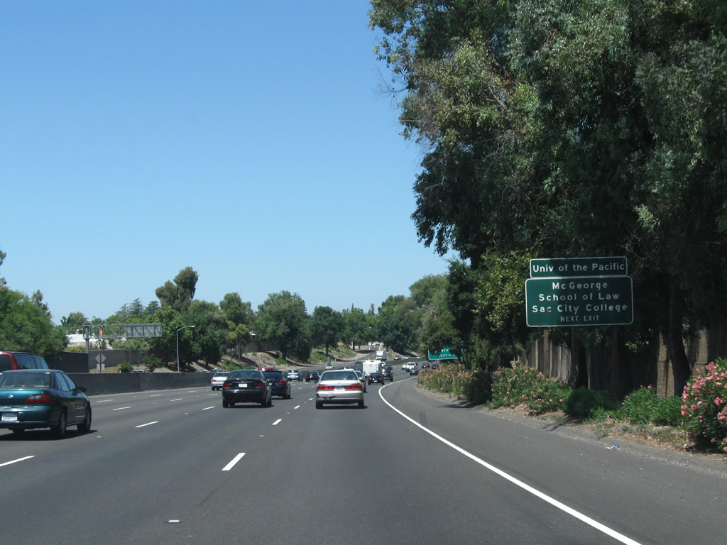
Use Exit 297 (12th Avenue) to Sacramento City College.
07/31/11
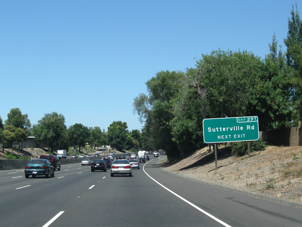
To Sutterville Road, follow 12th Avenue west.
07/31/11

To the Sacramento International Airport, use Exit 298A, Business Loop I-80 (Capital City Freeway) west, U.S. 50 west, Interstate 305 west, and California 99 north to downtown Sacramento, then turn north on Interstate 5 and California 99 to the airport exit.
07/31/11
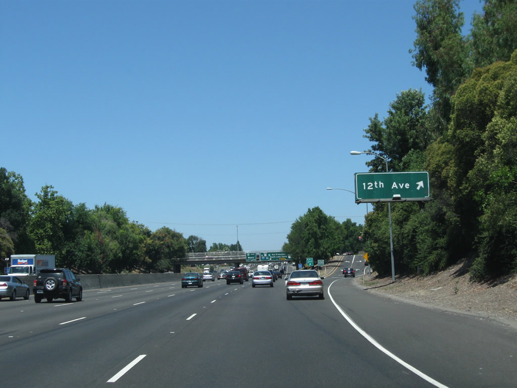
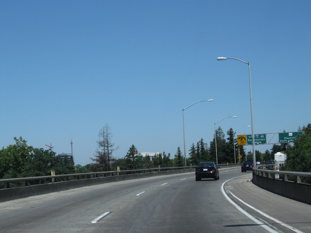
Northbound California 99 reaches Exit 297, 12th Avenue. The next exit is Exit 298A, Business Loop I-80 (Capital City Freeway) west, U.S. 50 west, Interstate 305 west, and California 99 north to downtown Sacramento, San Francisco, and Redding AND U.S. 50 (El Dorado Freeway) east to Placerville and South Lake Tahoe.
07/31/11
Upon departing the freeway at Exit 297, turn left for Sutterville Road west or right for 12th Avenue east.
07/31/11
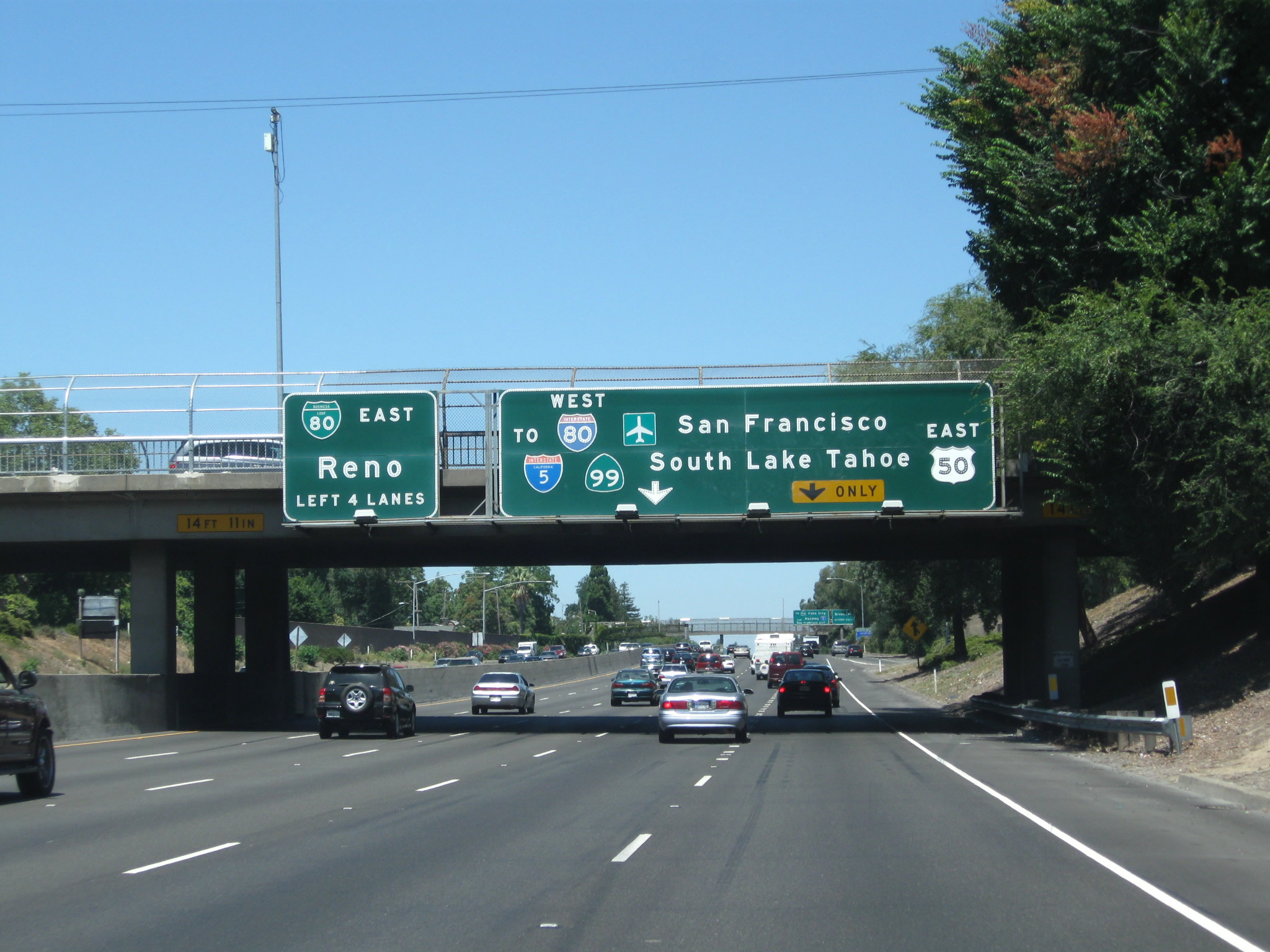
The next exit along California 99 north is Exit 298A, Business Loop I-80 (Capital City Freeway) west, U.S. 50 west, Interstate 305 west, and California 99 north to downtown Sacramento, San Francisco, and Redding AND U.S. 50 (El Dorado Freeway) east to Placerville and South Lake Tahoe. Interstate 305 is a hidden route designation that follows the east-west portion of Business 80 and U.S. 50 between this interchange and Interstate 80 in West Sacramento. Note that California 99 will exit from itself and follow Business 80 west for a few miles, then transition onto Interstate 5 north. Ahead, the main lanes of California 99 will shift onto Business 80 east and California 51 north.
07/31/11
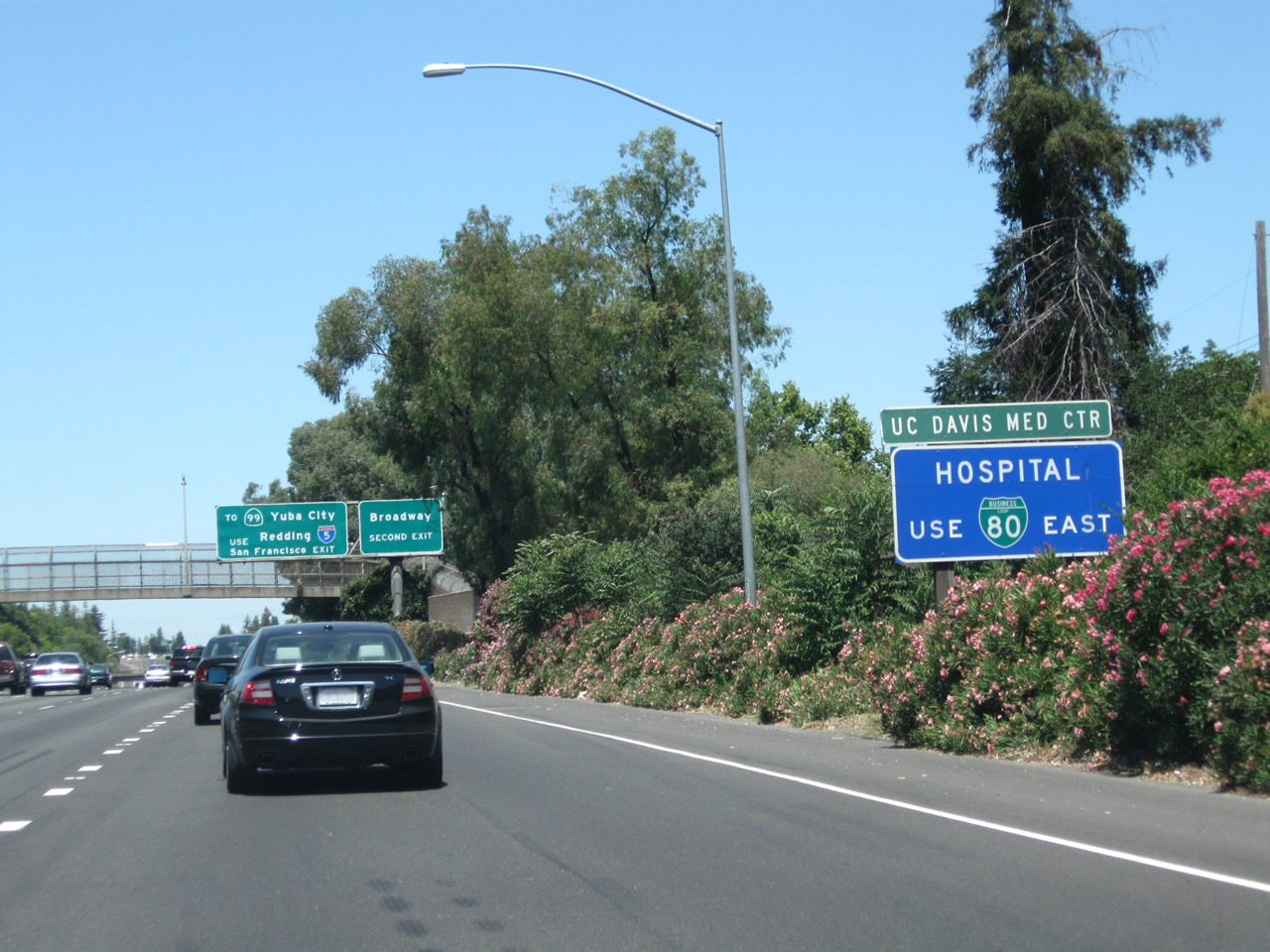
Stay left to follow Business 80 east and California 51 north to the UC Davis Medical Center, a major regional hospital and medical research center located in Sacramento. Take Business 80 east, exit onto T Street going east, and connect to Stockton Boulevard southeast to the medical center.
07/31/11

Take Business 80 west (via Exit 298A) to California 99 north. In addition, there is an exit for Broadway hidden in the middle of the upcoming interchange (Exit 298B).
07/31/11
A second trailblazer sign for Sacramento International Airport correctly advises motorists to use Business 80 west to Interstate 5 north.
07/31/11

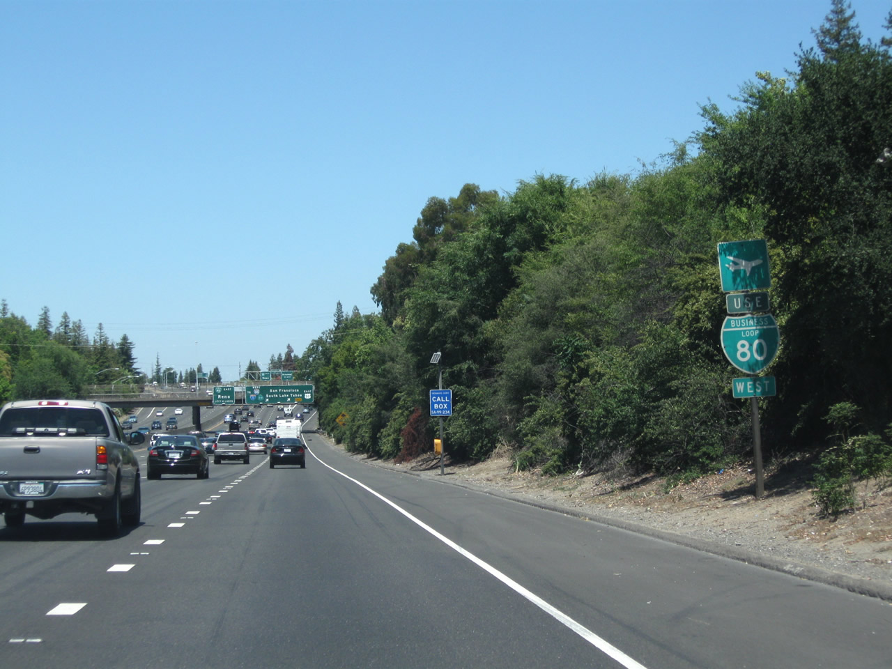
The right two lanes of California 99 will connect to Business Loop I-80, U.S. 50, Interstate 305 west and California 99 north and also to U.S. 50 east to Placerville. Meanwhile, the left four lanes continue straight ahead onto eastbound Business Loop I-80 and northbound California 51. Don't look for too many California 51 signs; it is generally not posted but has its route number on the call boxes and postmiles. California 51 is defined to extend from this interchange northeast to the 80-80 Split (at the junction with California 244).
07/31/11

Northbound California 99 reaches Exit 298A, with the left four lanes connecting to Business Loop I-80 east and the right two lanes following California 99 north to Business Loop I-80 west. Use the left four lanes for Exit 298B (Broadway) and Exit 298C (Business Loop I-80 east and California 51 north).
07/31/11

Looking back at the four-lane "ramp" to Business 80 east, this view looks at the off-ramp to Exit 298B to Broadway and Exit 298C to Business Loop I-80 (Capital City Freeway) east and California 51 north to Auburn and Reno.
07/31/11
California 99 north transitions onto Business Loop I-80 (Capital City Freeway) and U.S. 50 west.
07/31/11
Connecting to an elevated viaduct, motorists using California 99 north and Business 80 west should stay left, while those transitioning to U.S. 50 (El Dorado Freeway) east should stay right.
07/31/11
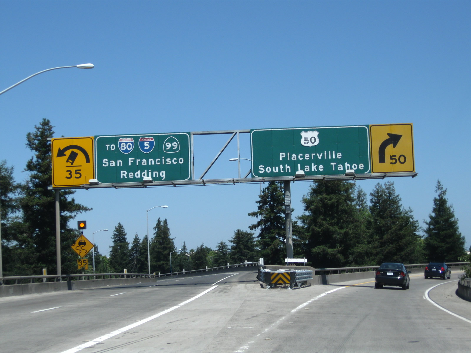
The transition ramp splits, with the left two lanes taking California 99 north onto Business 80 and U.S. 50 west to Interstate 5 north, and the right lane departing California 99 for U.S. 50 east to South Lake Tahoe.
07/31/11

This view looks east along the ramp from California 99 north to U.S. 50 (El Dorado Freeway) east to Placerville and South Lake Tahoe.
07/31/11
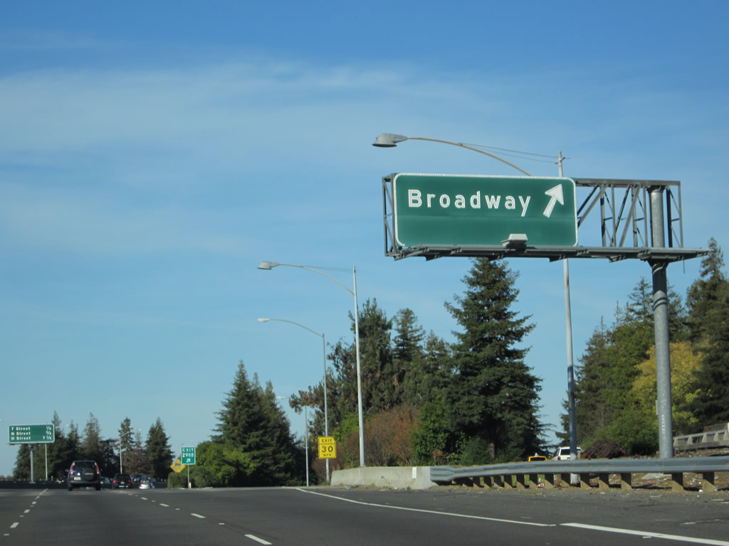
Going back to the connecting four-lane "ramp" between California 99 north and Business Loop I-80 (Capital City Freeway) east and California 51 north, this view shows the extant exits to Broadway and T Street. This short stretch of freeway is technically part of State Route 99 but is really a transition ramp from northbound California 99 onto northbound California 51 (Business Loop I-80). The transition is long enough to have its own exit: Exit 298B to Broadway (Sacramento County J-8 south). This interchange marks the northern terminus of CR J-8, which travels west briefly on Broadway, then turns south to follow Franklin Boulevard, Thornton Road, and Hammer Lane back to California 99 near Stockton in San Joaquin County). After the Broadway exit, the remaining traffic on the transition ramp is considered to be on Exit 298C, which connects onto T Street (oddly considered to be Exit 6C, even though through traffic on Business 80 east cannot access this off-ramp). After the T Street exit, then the rest of the traffic will default onto eastbound Business 80 and northbound California 51.
11/23/12

The exit number for CR J-8 (Broadway) is posted at the gore point.
11/23/12
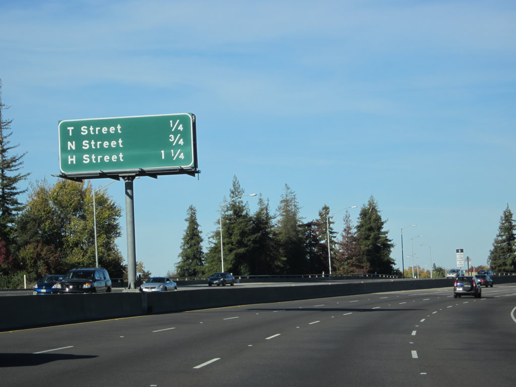
Exit 298C is the beginning of California 51 from the last four lanes. Upcoming exits are at T Street (Exit 6C), N Street (Exit 7A), and H Street (Exit 7B).
11/23/12

Photo Credits:
- Andy Field: 08/22/03, 07/31/11, 11/23/12
Connect with:
Page Updated Wednesday November 28, 2012.