
State Route North 99 - Madera to Chowchilla
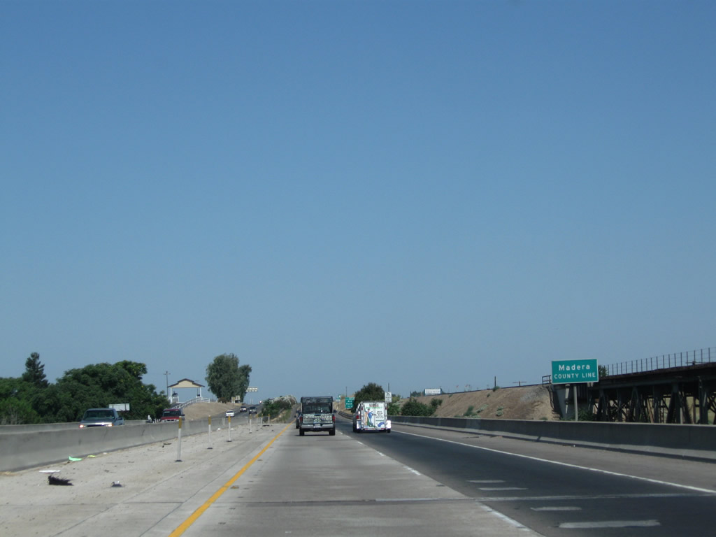
Near the midpoint of the San Joaquin River bridge, California 99 and the Burlington Northern Santa Fe (BNSF) Railroad leave Fresno County and enter Madera County (population 150,865 as of 2010 Census).
07/31/11
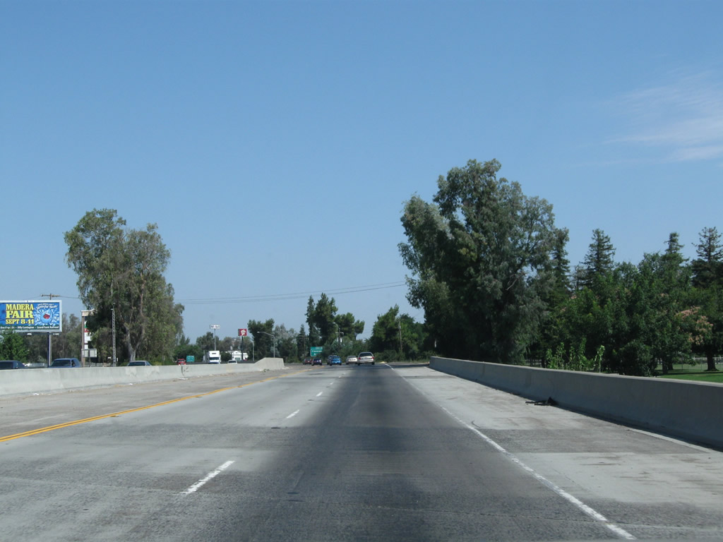
The first exit along California 99 (Golden State Highway) in Madera County is Exit 144, Avenue 7 and Road 33. This sign is posted after the San Joaquin River bridge.
07/31/11
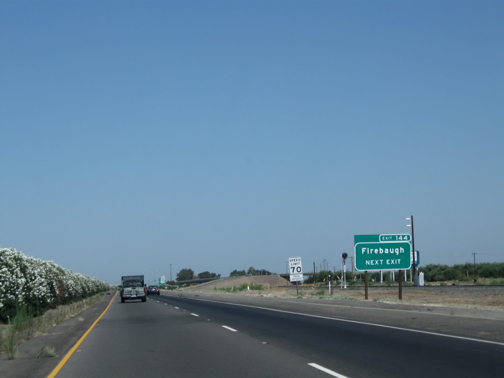
Avenue 7 travels west to Ripperdan and Firebaugh (California 33) and east to Gregg (via Road 34 north) and California 41 (via a connection with Road 35 north and Avenue 9 east). Road 33 travels north to provide local/farm access. California 99 continues on a northwesterly trajectory.
07/31/11
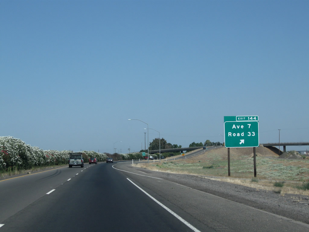
Northbound California 99 meets Exit 144, Avenue 7 and Road 33. Like Tulare County and Yolo County, Madera County uses a grid system to number its county-maintained routes. Avenues run east-west and roads run north-south, and numbers represent one-mile increments from the southernmost or westernmost point within the county limits.
07/31/11
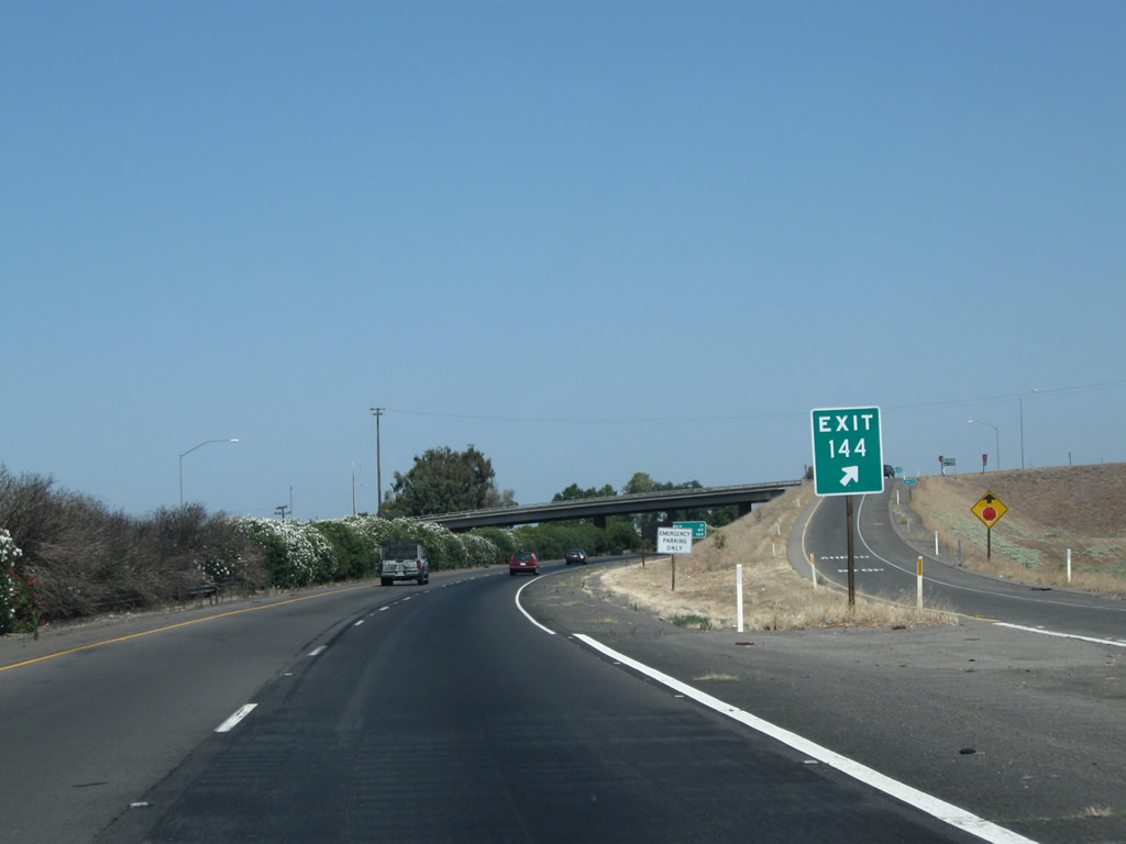
As of 2011, exit numbers are consistently applied along most of California 99 through Madera County.
07/31/11
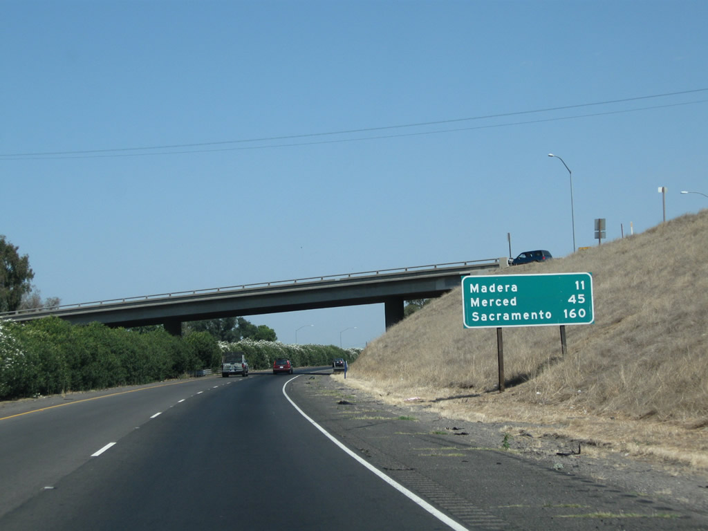
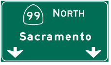
This mileage sign along California 99 north provides the distance to Madera (11 miles), Merced (45 miles), and Sacramento (160 miles).
07/31/11
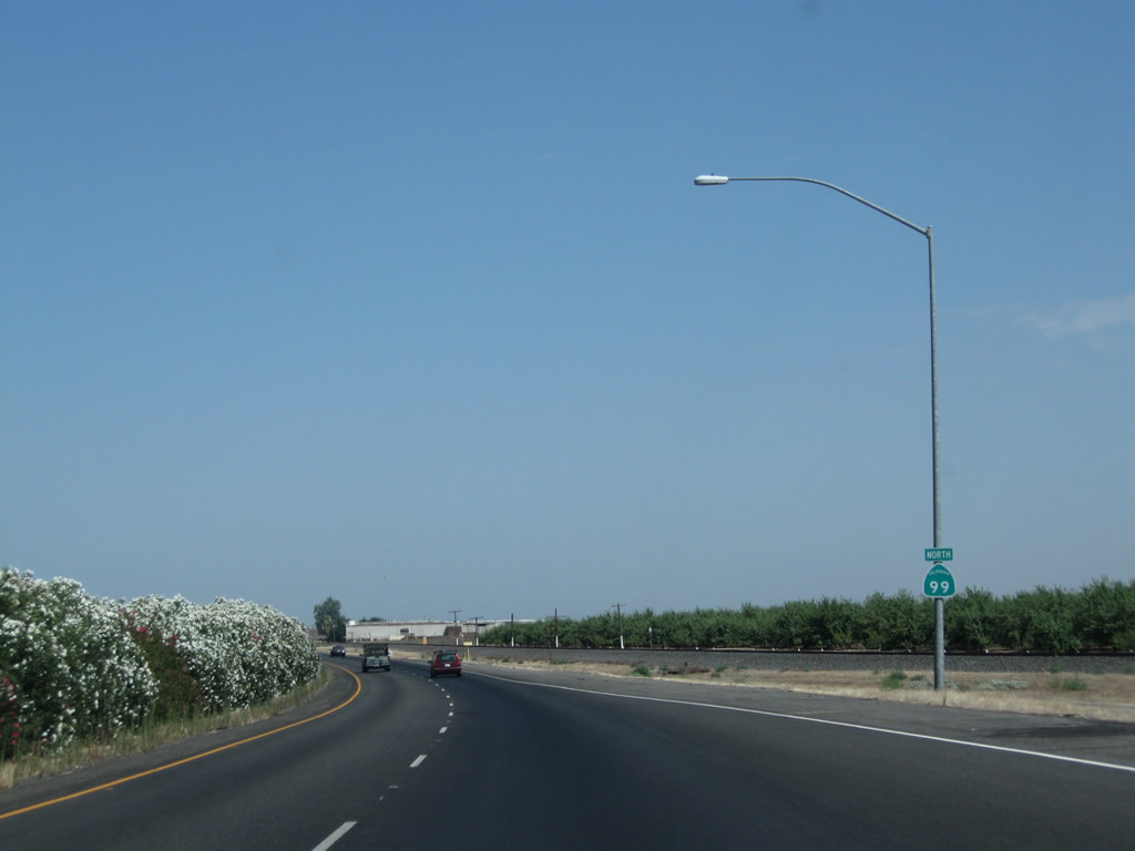
A California 99 confirming marker is posted after the on-ramp from Avenue 7.
07/31/11
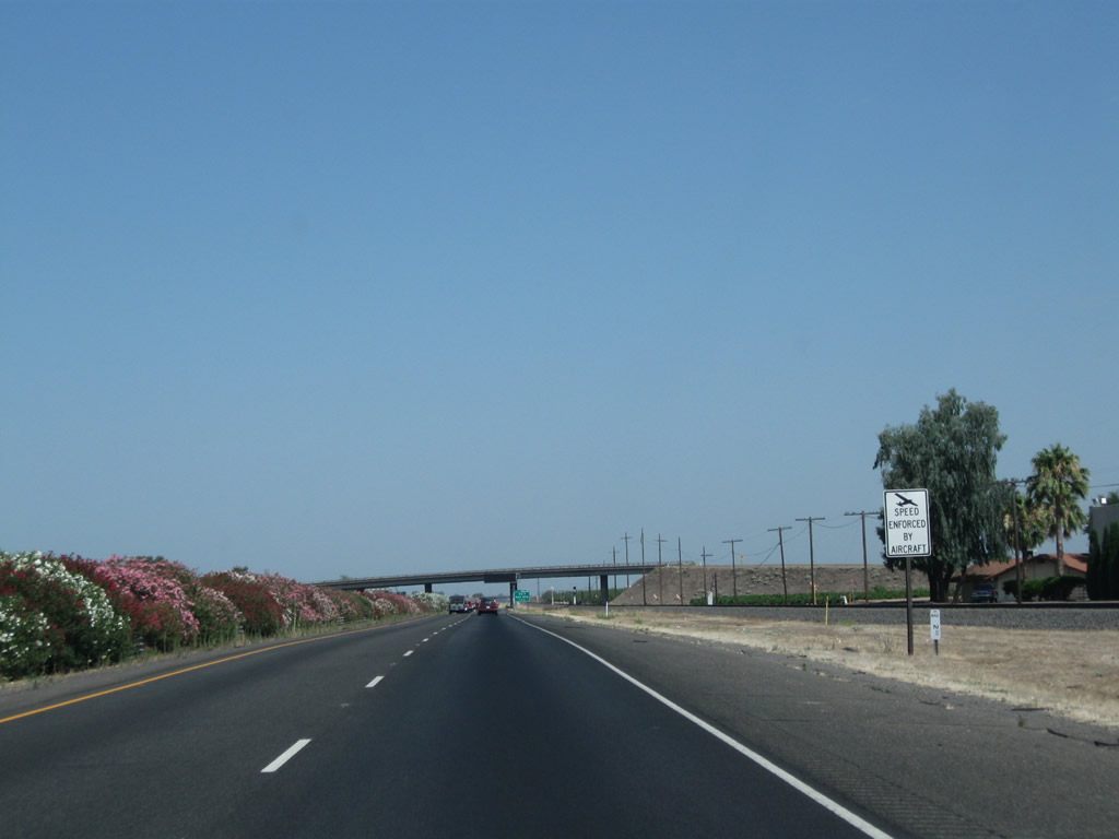
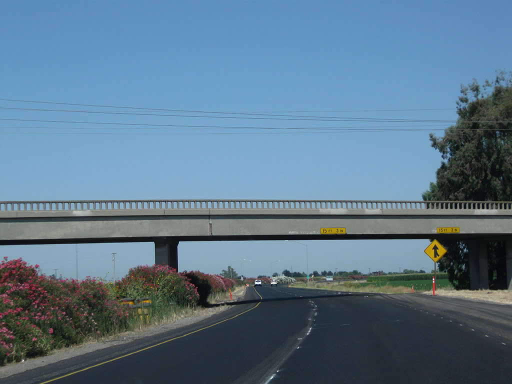
Colorful oleander cascades over the guardrails on the California 99 freeway median.
07/31/11

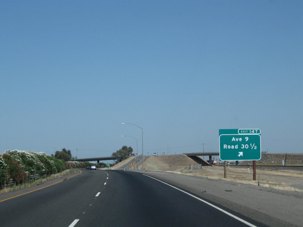
The next exit along California 99 (Golden State Highway) is Exit 147, Avenue 9 and Road 30 1/2 (one mile). This exit number sign was posted by 2004.
07/31/11
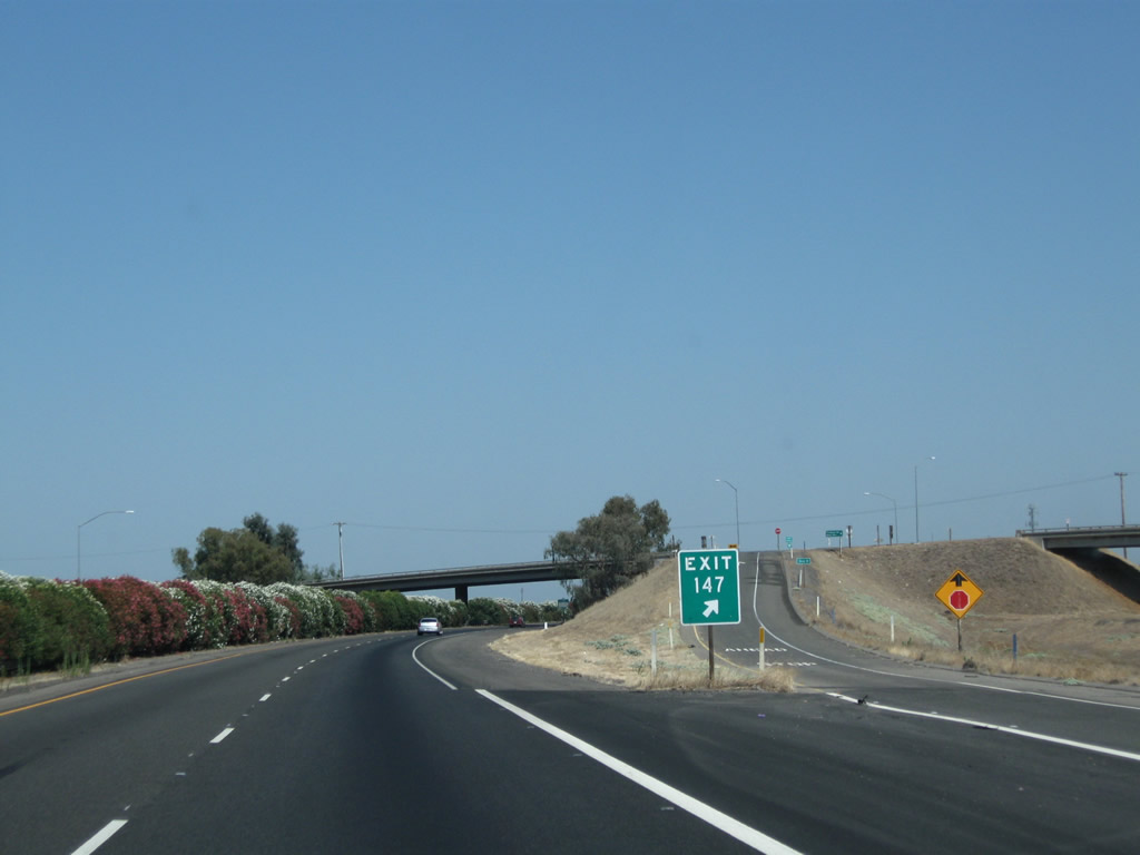
Northbound California 99 meets Exit 147, Avenue 9 and Road 30 1/2.
07/31/11
Avenue 9 passes over both the California 99 freeway and the Burlington Northern Santa Fe Railroad. Use Avenue 9 east to Gregg and California 41.
07/31/11
After the Avenue 9 interchange, the northbound lanes of California 99 run close to the edge of the railroad tracks.
07/31/11
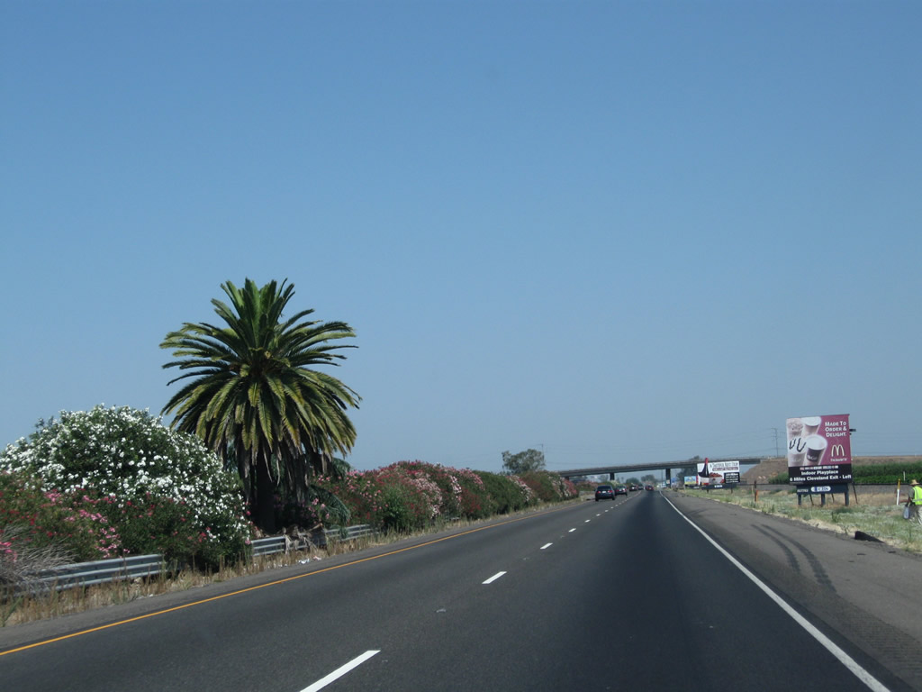
The symbolic separation between Southern California and Northern California is midway between Exits 147 and 151 along SR 99 and approximately halfway between the international border and Oregon state line. A palm signifies the south, while a pine tree signifies the north. The original pine tree fell in 2005, but a replacement tree grew in its place as seen in this picture. No one knows how the pine and palm were originally planted in the freeway median, and despite freeway expansion plans that might have threatened the trees, they are now preserved by Caltrans (Hall, 2010) (North Fork Chamber of Commerce, n.d.).
07/31/11
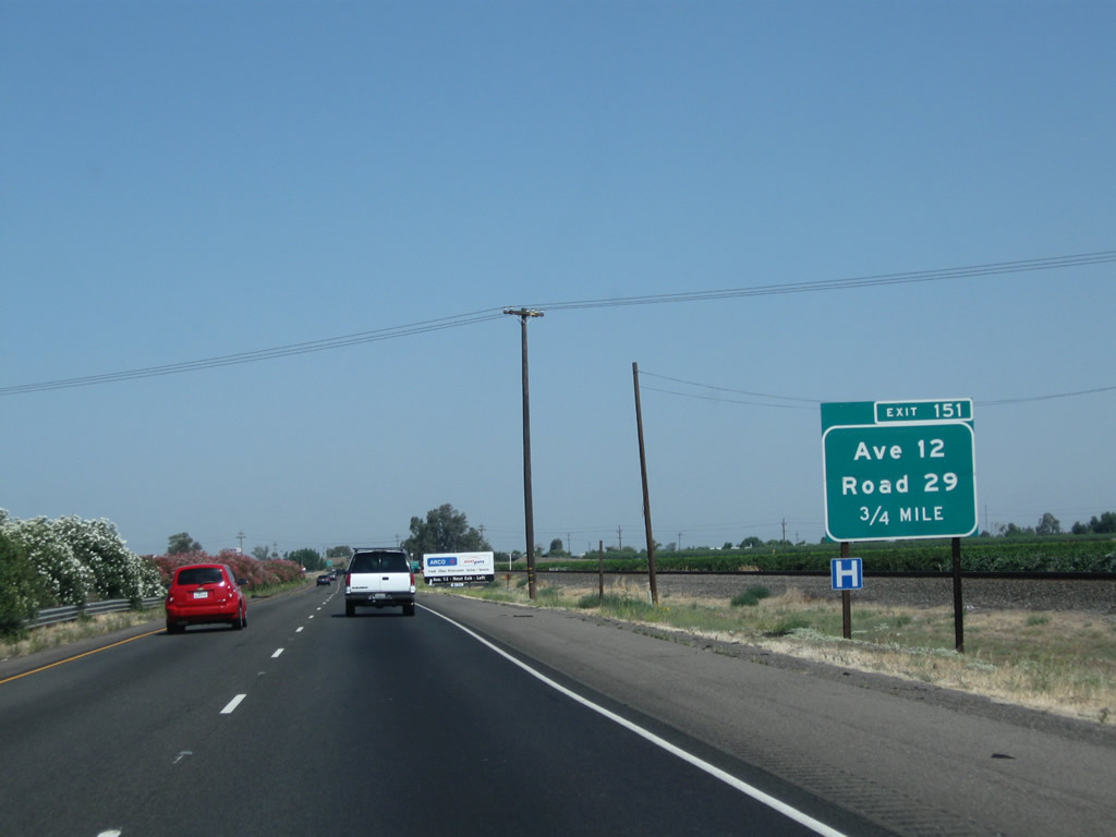
The next exit along California 99 north is Exit 151, Avenue 12 east/west and Road 29 north (one mile).
07/31/11
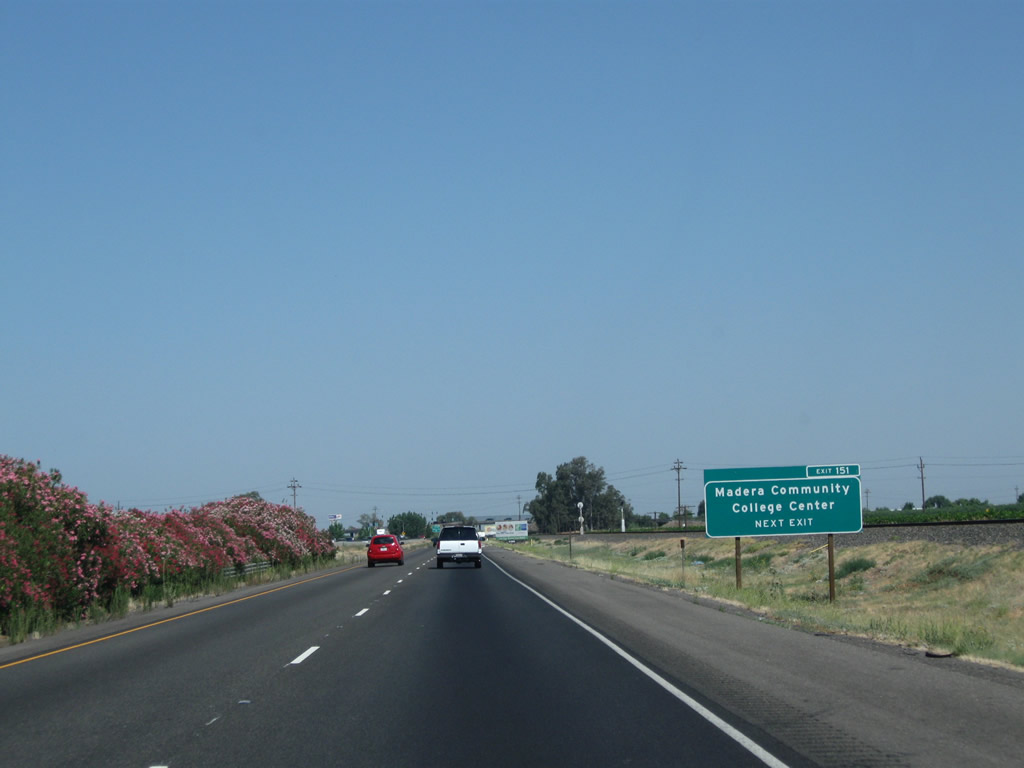
Use Avenue 12 east to the Madera Community College Center, Bonadelle Ranchos-Madera Ranchos, and California 41. Use Avenue 12 west to Firebaugh. Road 29 travels north to Parksdale and Storey.
07/31/11
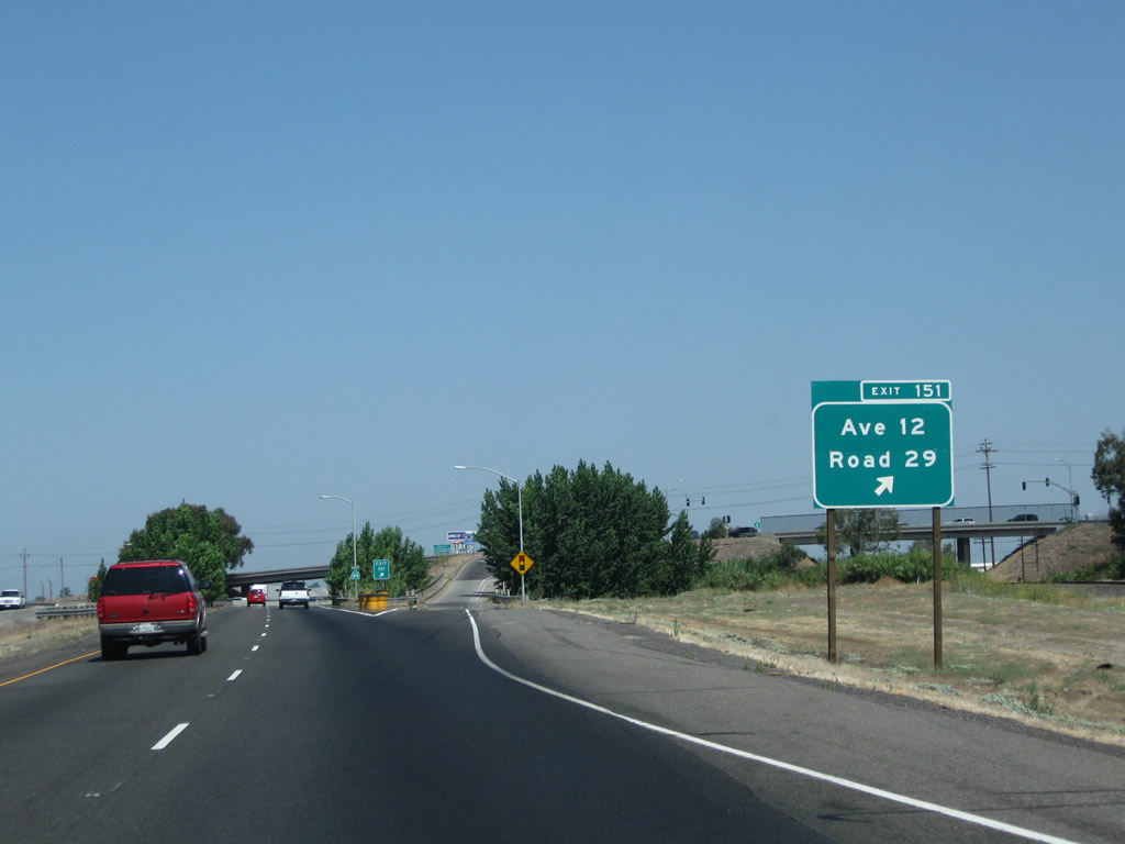
Northbound California 99 meets Exit 151, Avenue 12 and Road 29.
07/31/11
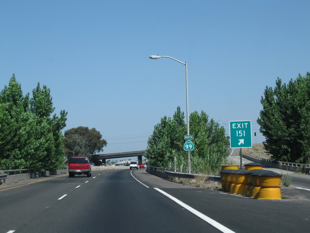
A California 99 north reassurance shield is posted immediately after the gore point for Exit 151.
07/31/11
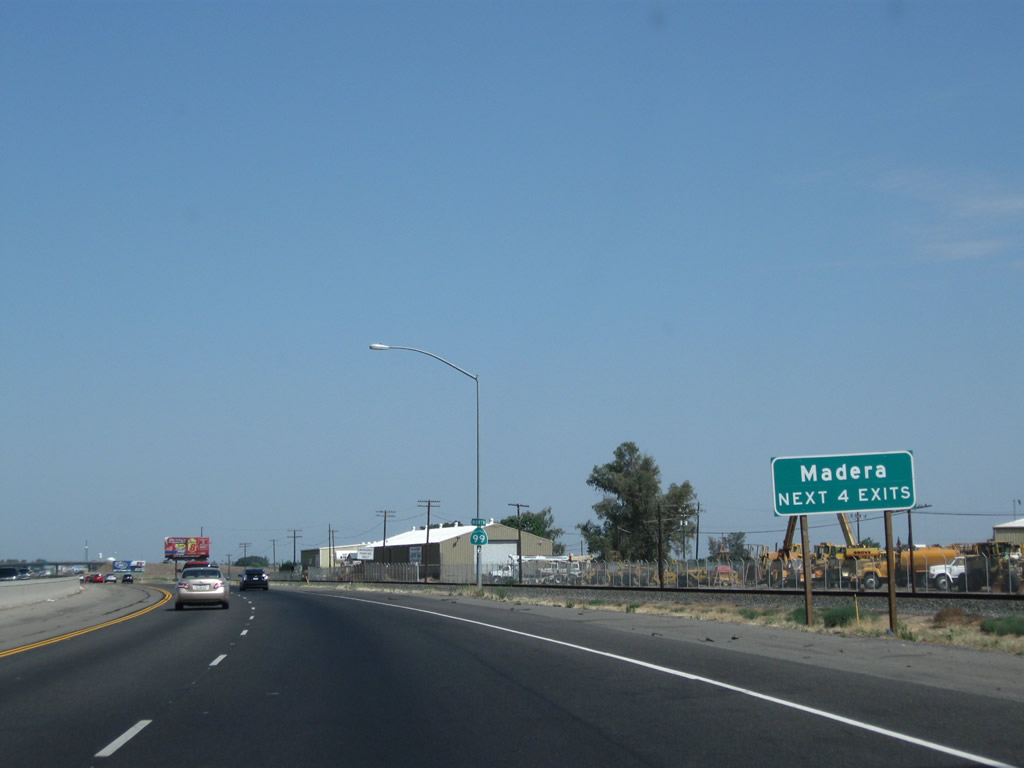
The next four exits along California 99 (Golden State Highway) north serve the city of Madera, the seat of Madera County.
07/31/11
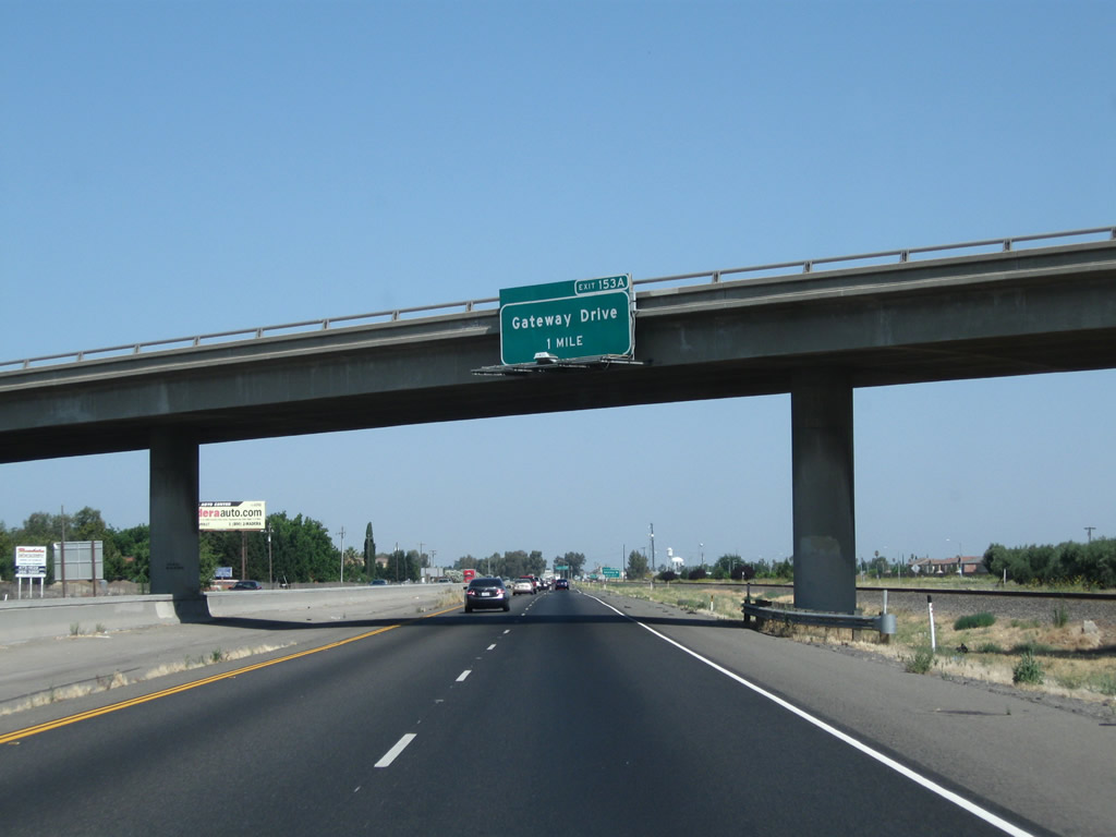
The next exit along California 99 north is Exit 153A, California 99 Business (Gateway Drive) in Madera. California 99 Business follows Historic U.S. 99 through downtown Madera via Gateway Drive.
07/31/11
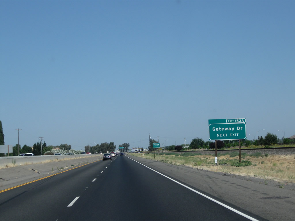
Gateway Drive (California 99 Business) will rejoin California 99 at Exit 156 (Gateway Drive and Kennedy Street).
07/31/11
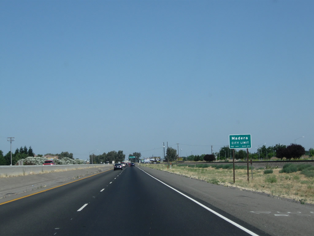
California 99 enters the city of Madera ("Valley Central"). Madera had a population of 61,416 as of the 2010 Census and was incorporated on March 27, 1907.
07/31/11
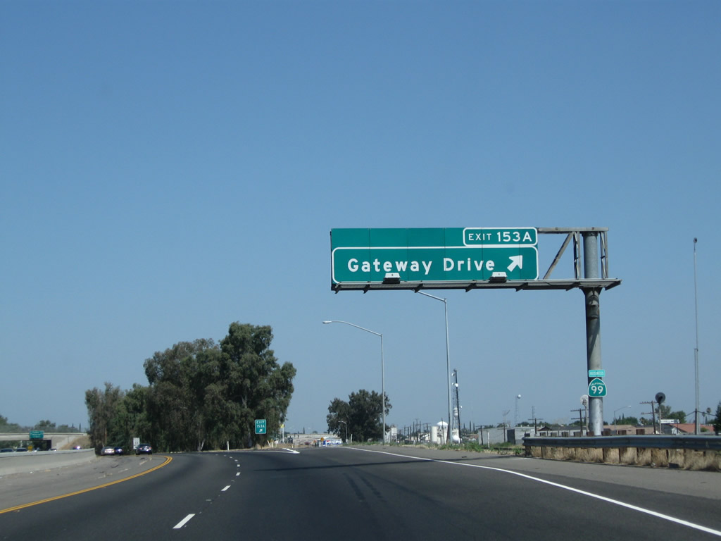
Northbound California 99 (Golden State Highway) reaches Exit 153A, California 99 Business (Gateway Drive).
07/31/11
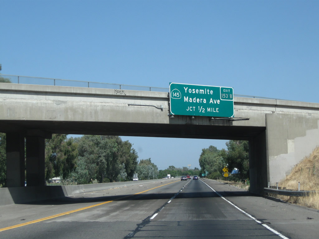
The next exit along northbound is Exit 153B, California 145 (Madera Avenue). The routing of California 145 is shaped like a backward "7," with the kink in the route at Madera. California 145 leads south toward Ripperdan and east toward Millerton Lake.
07/31/11
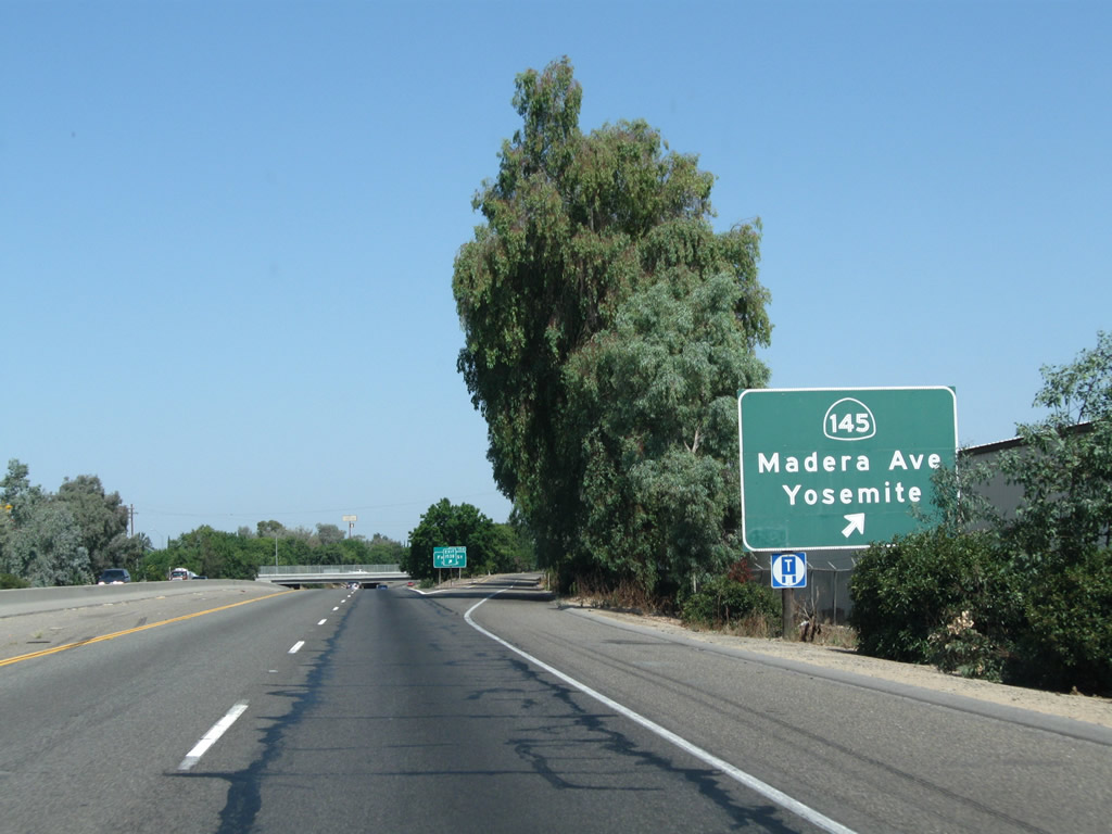
Northbound California 99 meets Exit 153, California 145 (Madera Avenue) north to downtown Madera and south to Ripperdan and Kerman. California 145 travels southwest from Madera to connect to California 33 and Interstate 5 near Coalinga.
07/31/11
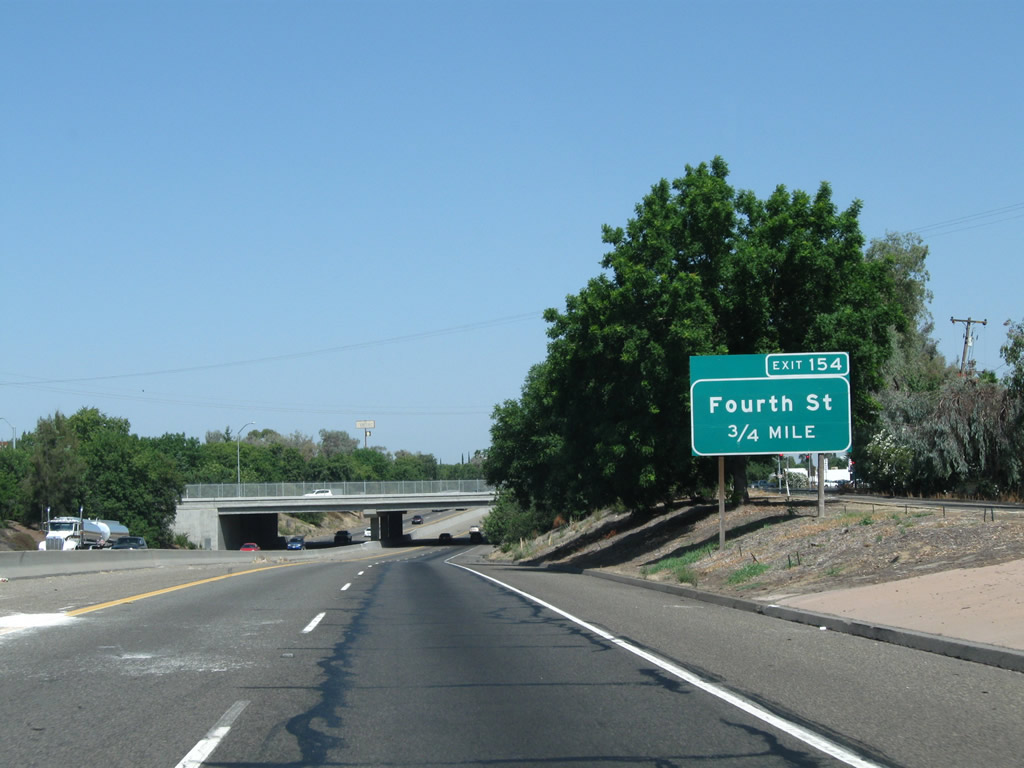
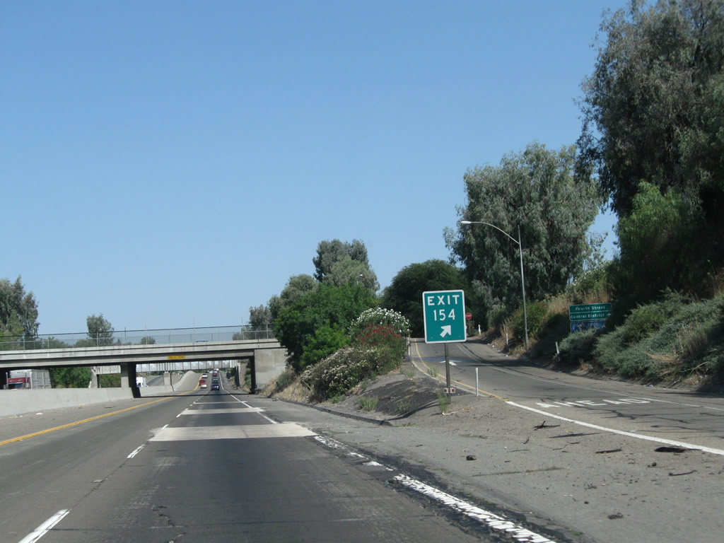
The next exit along California 99 north is Exit 154, Fourth Street (0.75 mile). This sign is posted right after the off-ramp to Exit 153.
07/31/11
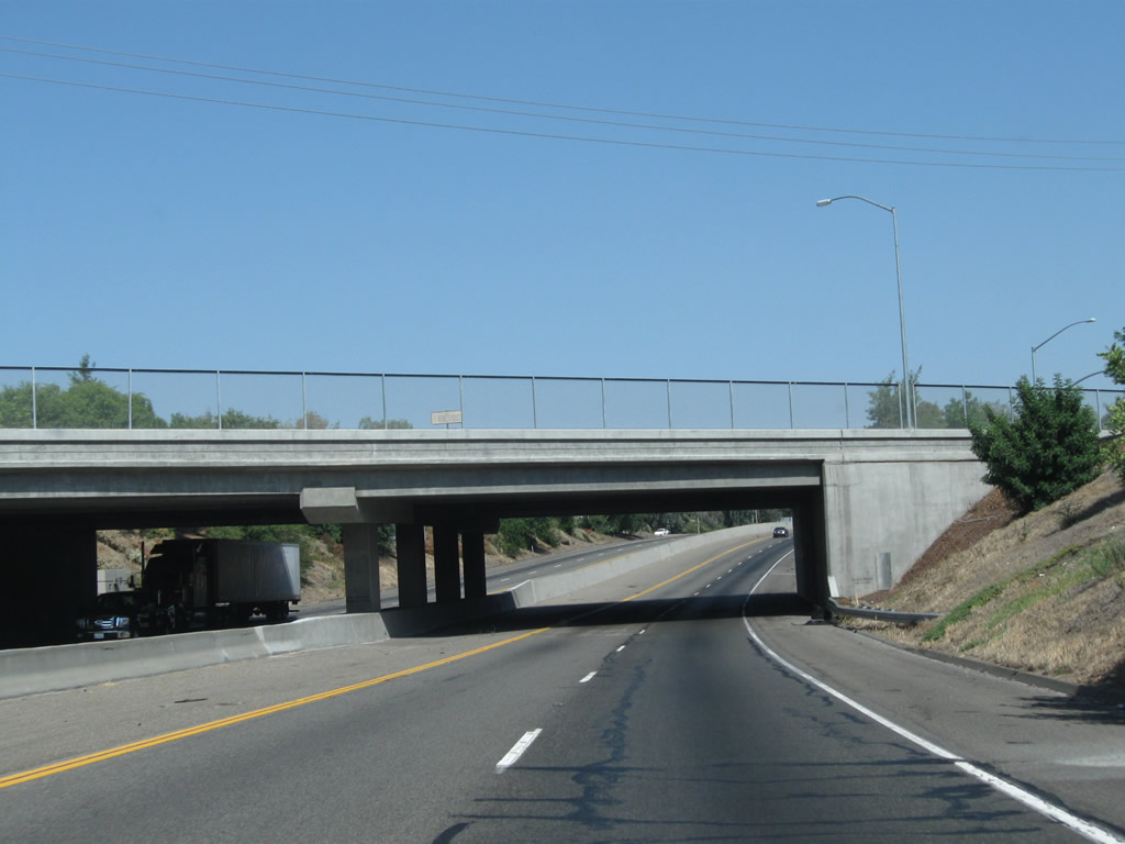
California 99 passes under California 145 (Madera Avenue).
07/31/11
All motorist services are available at Exit 154, Fourth Street in Madera. Use Fourth Street east into downtown Madera.
07/31/11
In sequence after passing under Madera Avenue, California 99 passes under Sixth Street, Yosemite Avenue, and Fourth Street.
07/31/11
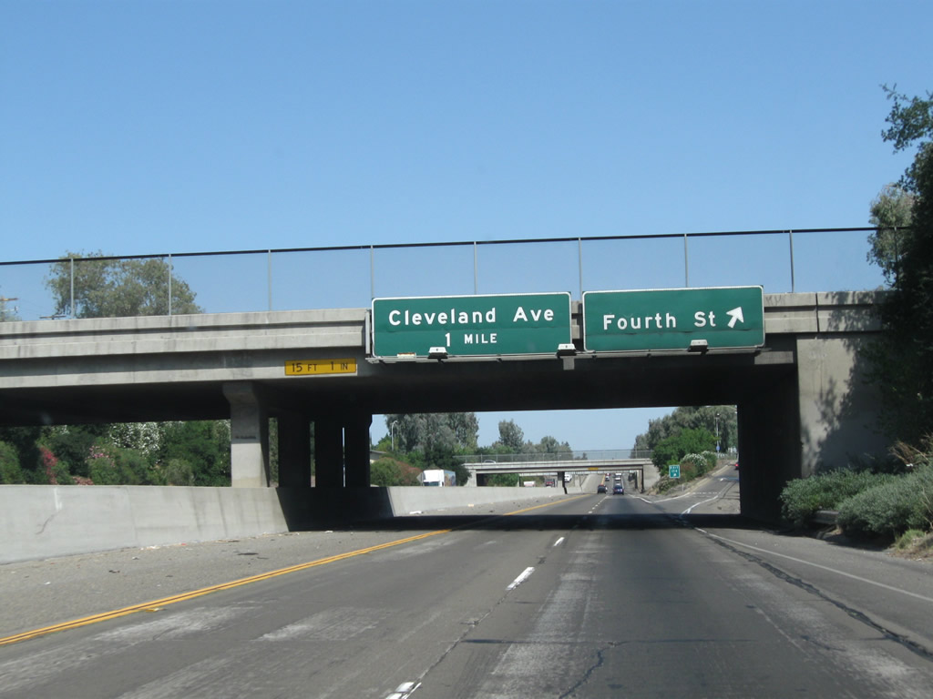
Northbound California 99 reaches Exit 154, Fourth Street in Madera. This sign is mounted onto Yosemite Avenue. Access to Fourth Street is limited to northbound motorists; there is no access from southbound California 99 as this interchange is a half-diamond. A return to California 99 north is provided by following H Street (frontage road) north. The next exit is Exit 155, Cleveland Avenue.
07/31/11
This is the gore point for Exit 154, Fourth Street.
07/31/11

California 99 passes under Fourth Street and a spur of the railroad, which parallels Third Street east of here to connect with the railroad mainline.
07/31/11
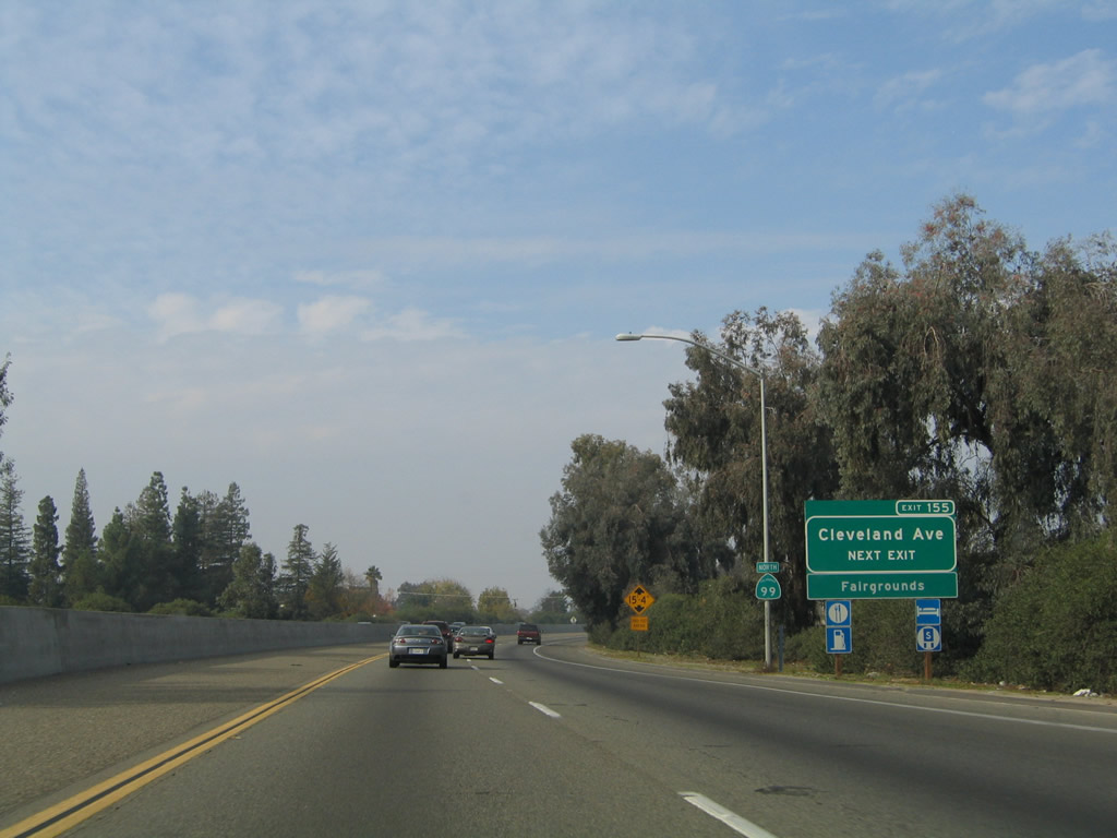
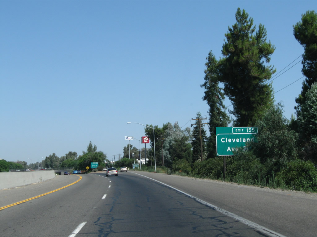
The next exit along California 99 north is Exit 155, Cleveland Avenue.
11/25/04
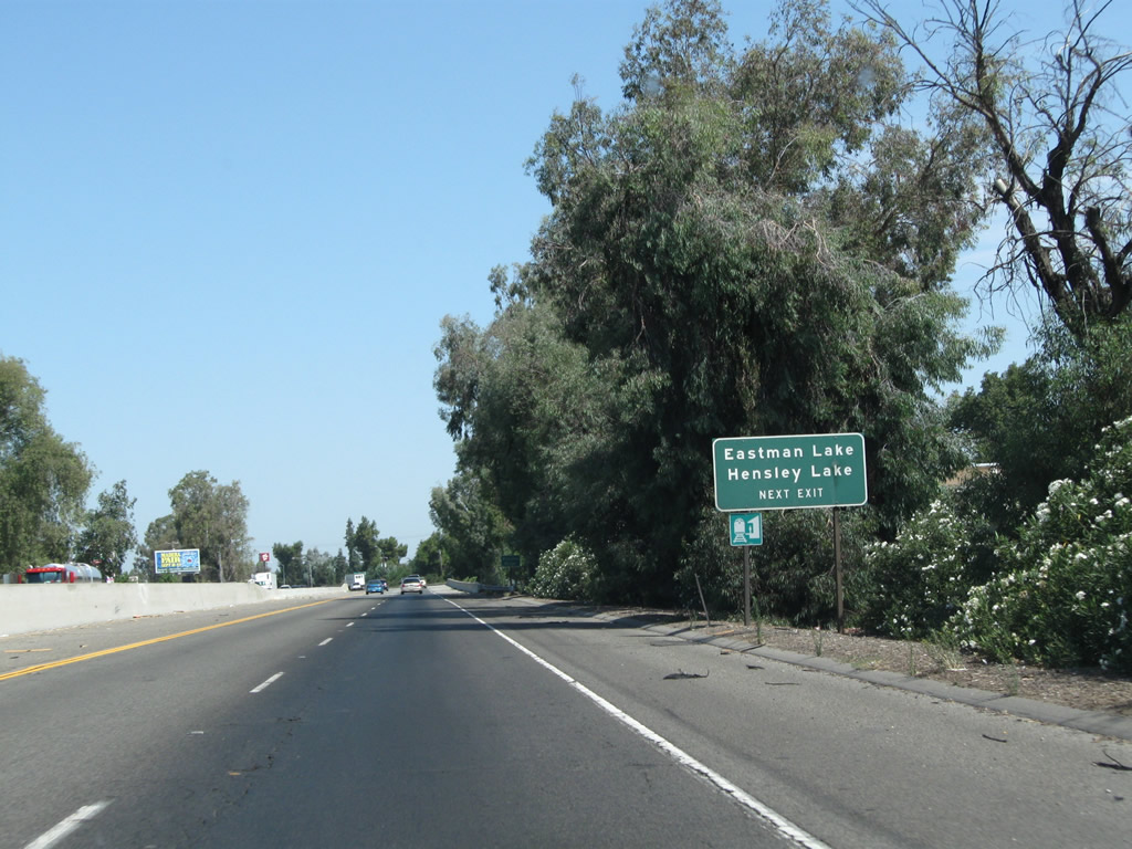
Use Cleveland Avenue east to Madera Lake Recreation Area and Hensley Lake Recreation Area. Another recreation area is located at Eastman Lake, which is in the foothills north of here and east of Chowchilla. Travel north on Road 26 from this interchange, turn east on Avenue 26, then turn north on Road 29 to the lake. To the unincorporated community of Raymond, follow Road 26 north to Avenue 21 east, then follow Raymond Road (Road 600) northeast to Raymond, a community located near the lake.
07/31/11
California 99 crosses over the Fresno River, which flows from the Sierra Nevada southwest into the San Joaquin River. Hensley Lake and Madera Lake, which are located northeast of here, are among the few reservoirs located along the 68-mile long Fresno River.
07/31/11
Northbound California 99 reaches Exit 155, Cleveland Avenue.
07/31/11
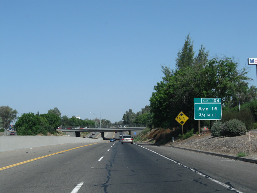
The next exit along California 99 is Exit 156, Avenue 16.
07/31/11
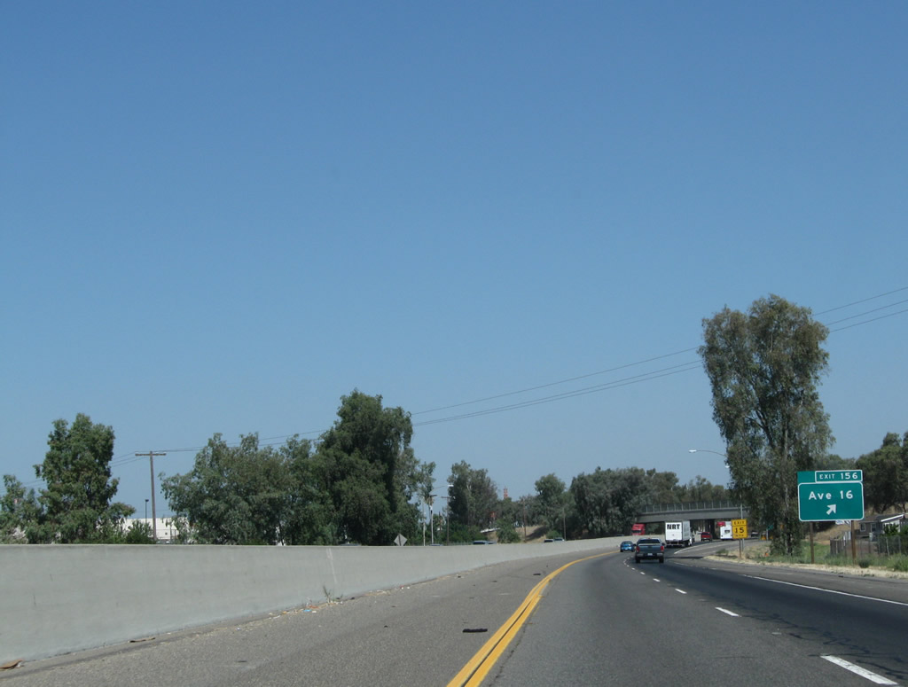
Northbound California 99 reaches Exit 156, Avenue 16.
07/31/11
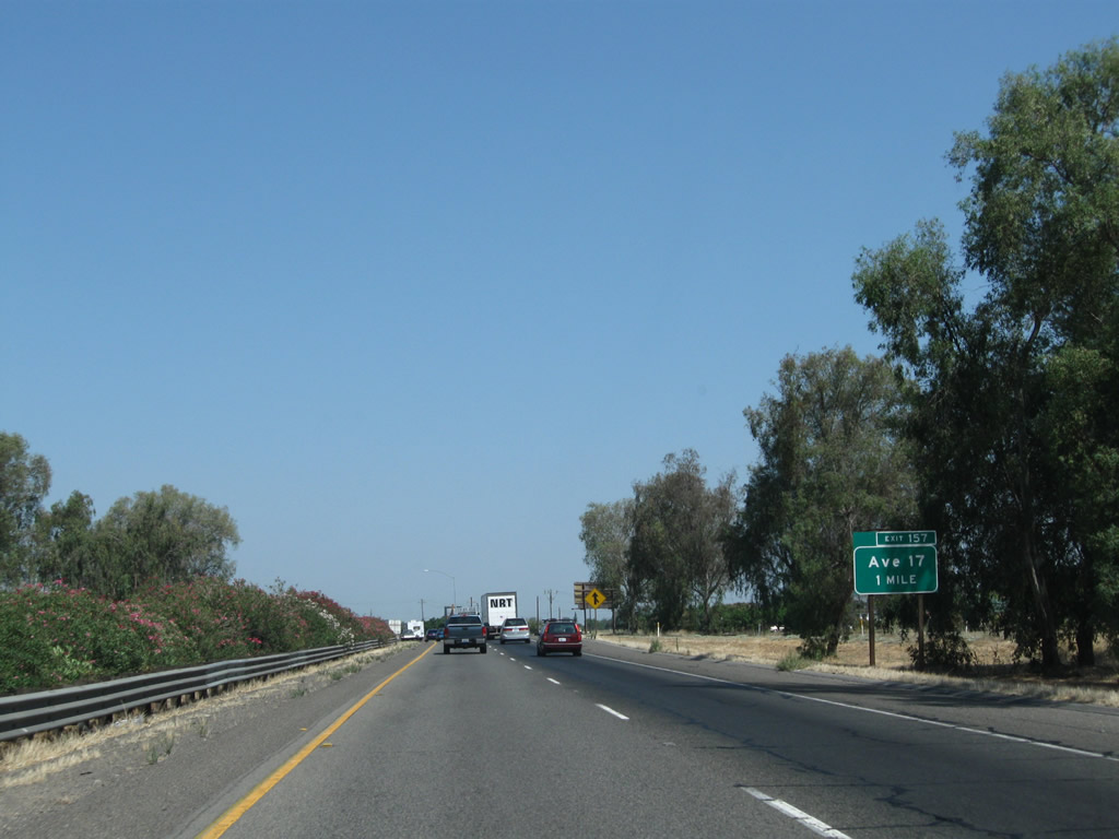
Leaving Madera, the next exit along California 99 north is Exit 157 for Avenue 17.
07/31/11
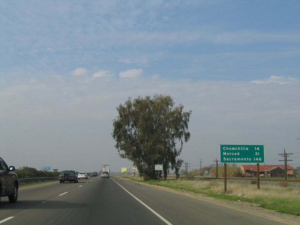
This mileage sign along California 99 north provides the distance to Chowchilla (14 miles), Merced (31 miles), and Sacramento (146 miles).
11/25/04
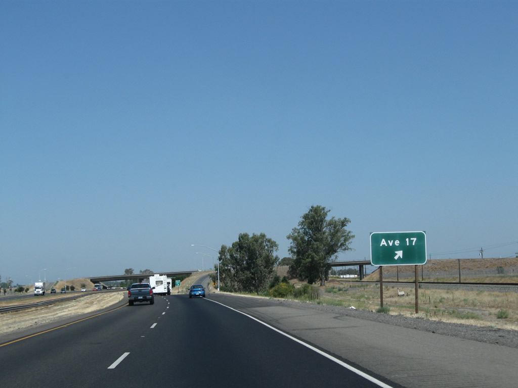
Northbound California 99 reaches Exit 157, Avenue 17.
07/31/11

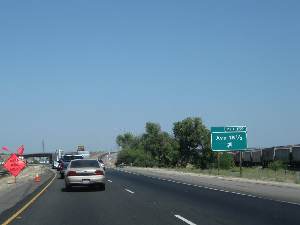
The next exit along California 99 is Exit 159, Avenue 18 1/2 (0.75 mile).
07/31/11
Northbound California 99 reaches Exit 159, Avenue 18 1/2.
07/31/11

The next exit along California 99 is Exit 162, Avenue 20 and Avenue 20 1/2 (one mile).
07/31/11
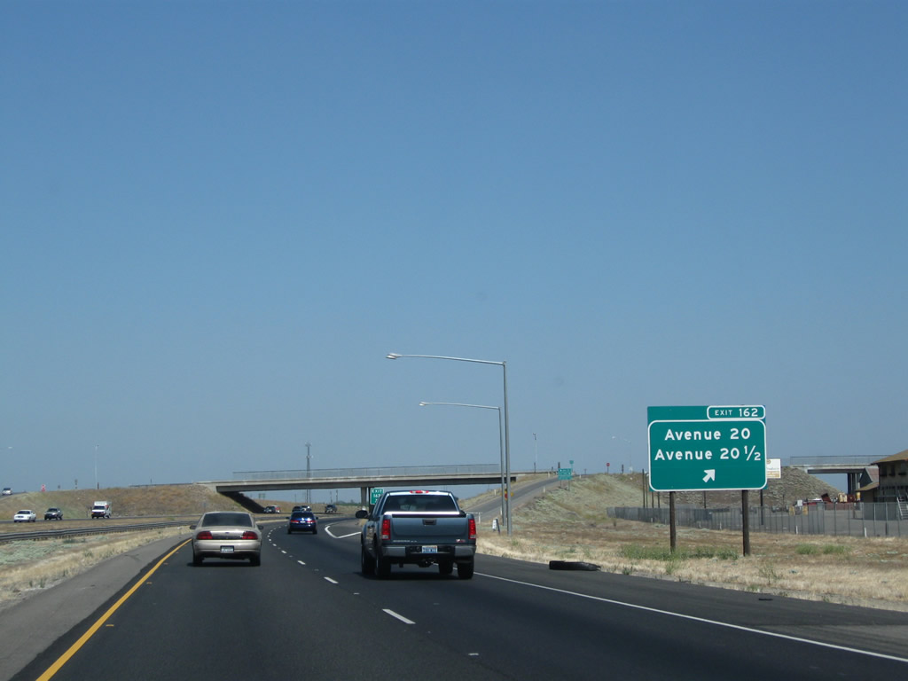
Northbound California 99 reaches Exit 162, Avenue 20 and Avenue 20 1/2 in rural Madera County.
07/31/11
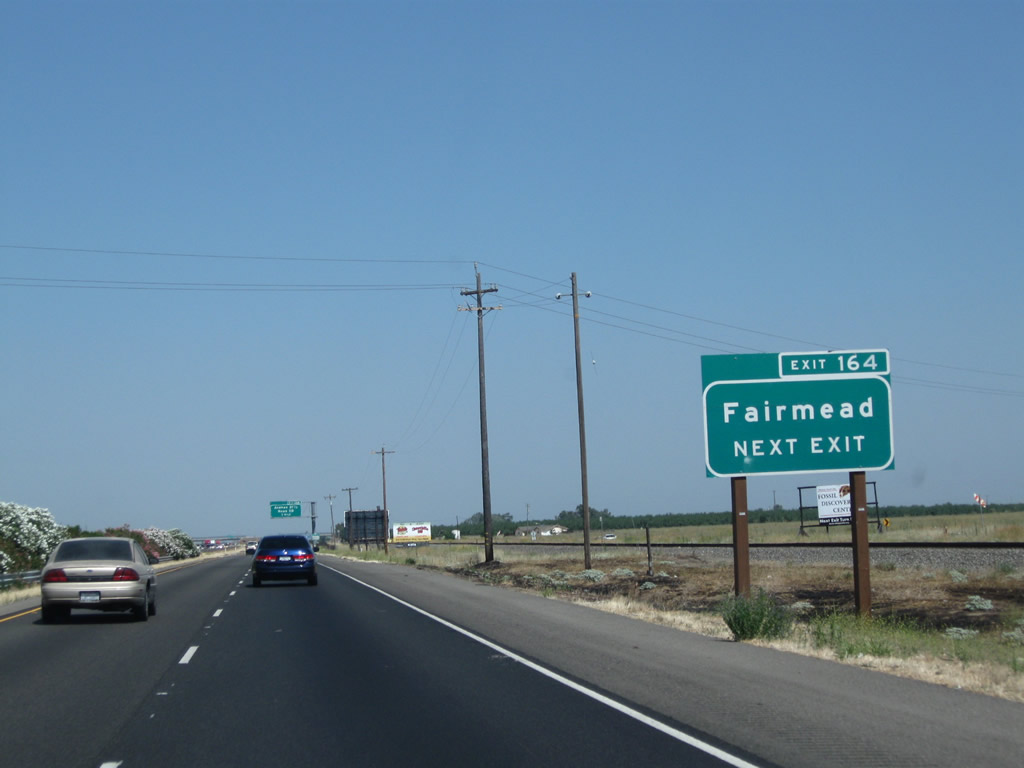
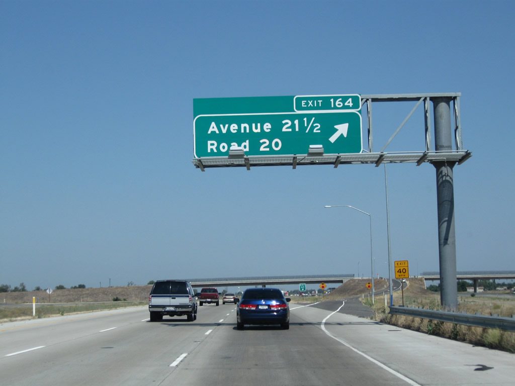
The next exit along California 99 north is Exit 164, Avenue 21 1/2 and Road 20. Use Road 20 north to Fairmead.
07/31/11

California 99 north approaches Exit 164, Avenue 21 1/2 and Road 20 to Fairmead (one mile).
07/31/11
Soon thereafter, northbound California 99 reaches Exit 164, Avenue 21 1/2 and Road 20 to Fairmead.
07/31/11
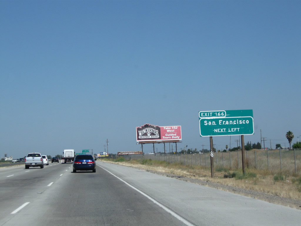
The next exit along northbound California 99 is Exit 166, California 152 west to Los Banos, Gilroy, Santa Cruz, San Jose, and San Francisco (left exit). This upcoming interchange will mark the eastern terminus of California 152. This sign used to be located further north but was relocated here after the Avenue 22 1/2 intersection was removed from service.
07/31/11

Freeway construction resulted in the elimination of the direct connection between California 99 and Avenue 22 1/2.
07/31/11
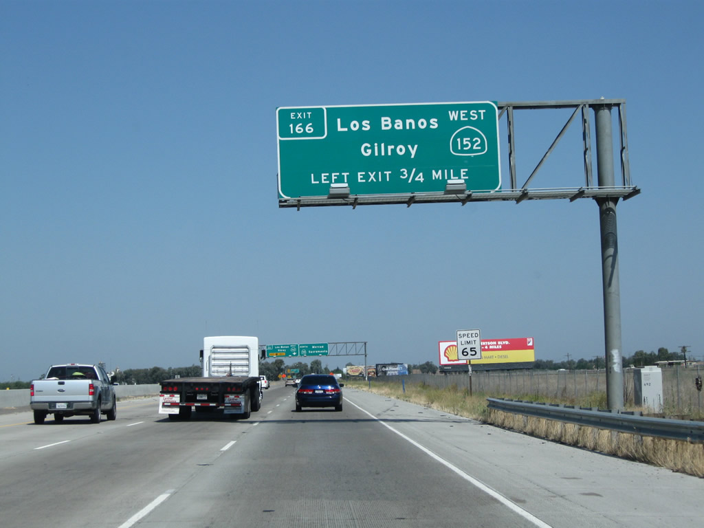
Northbound California 99 approaches Exit 166, California 152 west to Los Banos and Gilroy. California 152 is a major, east-west expressway connecting the Central Valley with the Central Coast, with connections to Gilroy, Watsonville, and Santa Cruz via California 152 west and Hollister and Monterey via California 156 west. With interchanges at California 33 and Interstate 5, much of the expressway between California 156 and California 99 is almost like a freeway.
07/31/11
The left two lanes will connect to California 152 west to Los Banos and Gilroy.
07/31/11
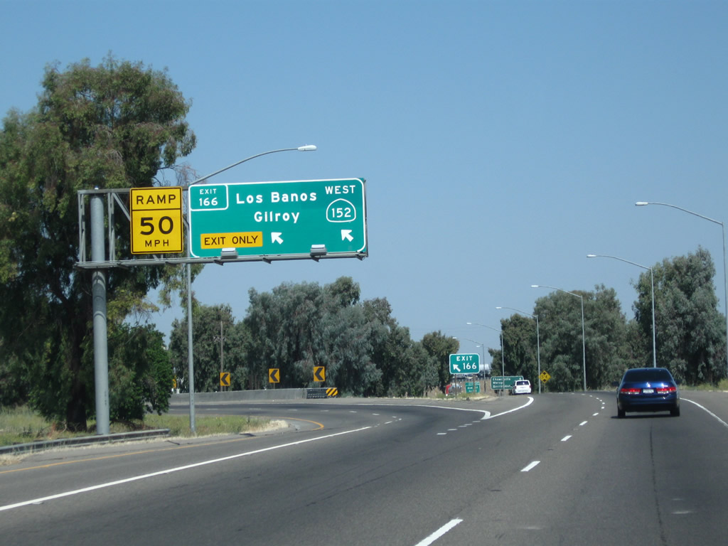
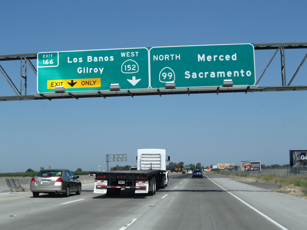
Northbound California 99 reaches Exit 166, California 152 west to Los Banos and Gilroy.
07/31/11
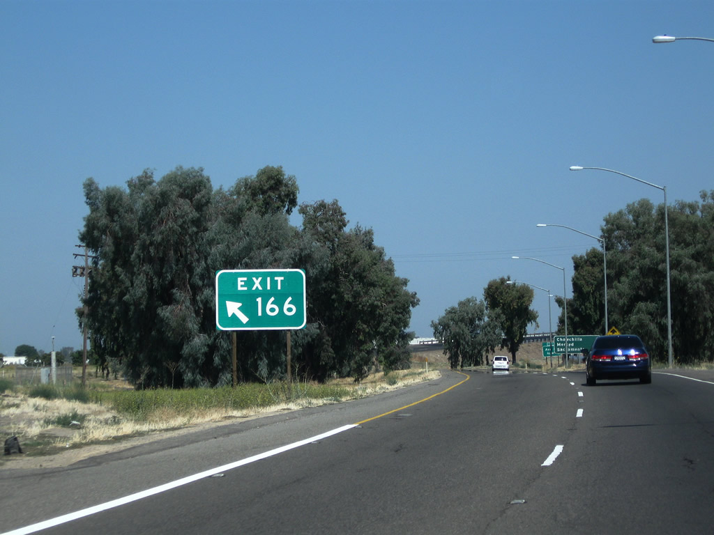
A very large gore point sign is posted for Exit 166.
07/31/11
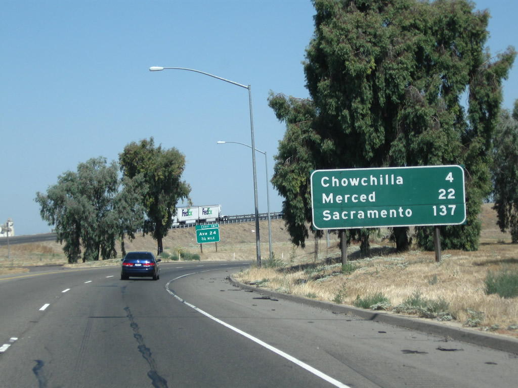
This mileage sign along California 99 (Golden State Highway) north provides the distance to Chowchilla (four miles), Merced (22 miles), and Sacramento (137 miles).
07/31/11
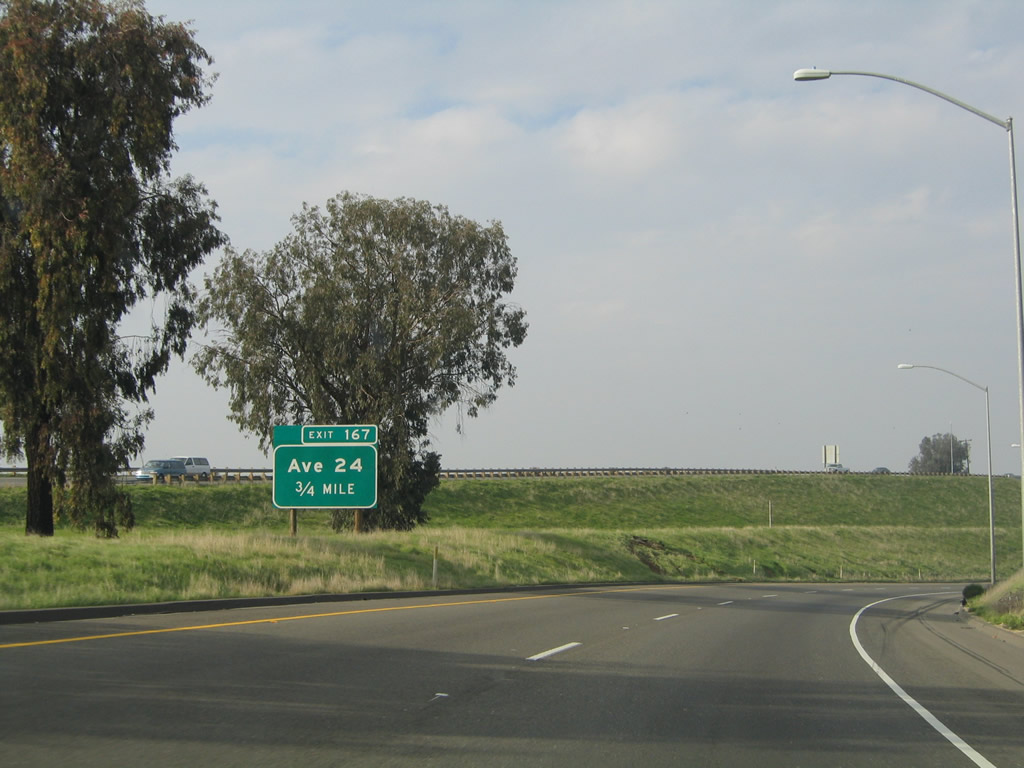
The next exit along California 99 (Golden State Highway) north is Exit 167, Avenue 24 (three-quarters mile).
11/25/04
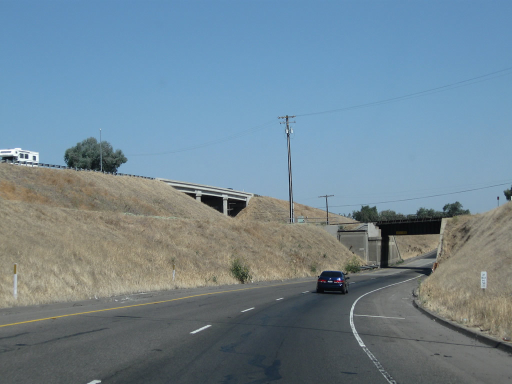
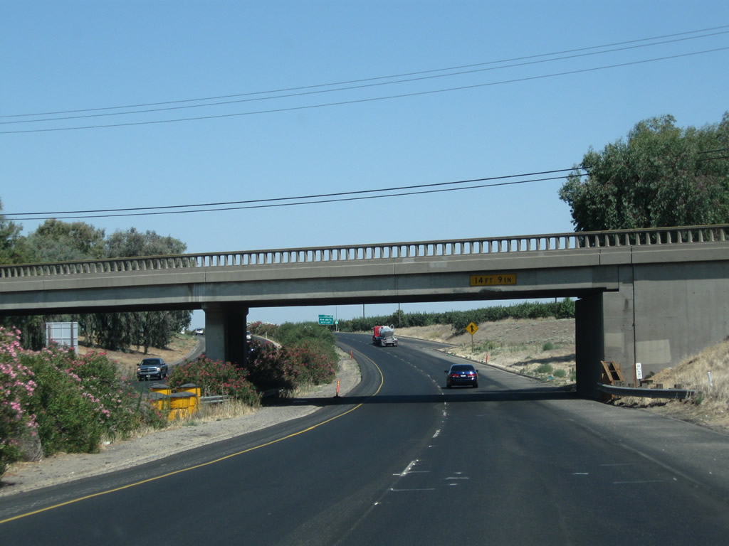
Northbound California 99 descends below grade and approaches a railroad overcrossing prior to reaching Exit 167. The sight distance through here is reduced as compared to the freeway segments south of here.
07/31/11
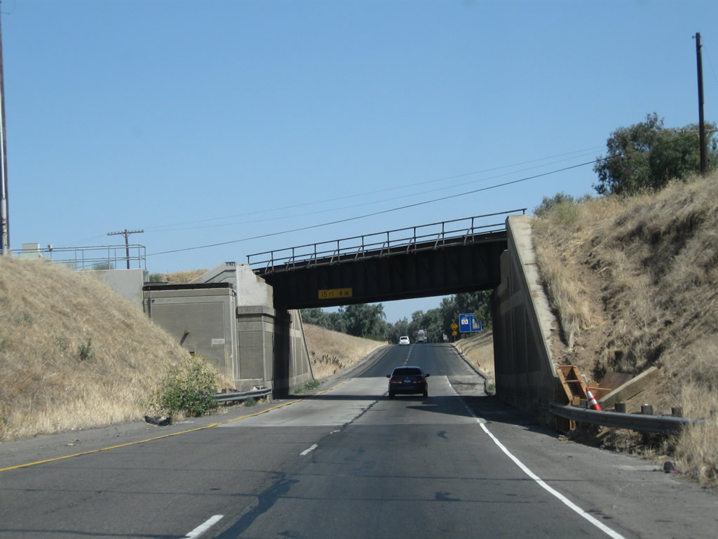
Continuing under the railroad bridge, this subway would have to be widened in order to accommodate a minimum of three northbound lanes, as is the plan for the entire Route 99 corridor from Wheeler Ridge north to Sacramento.
07/31/11
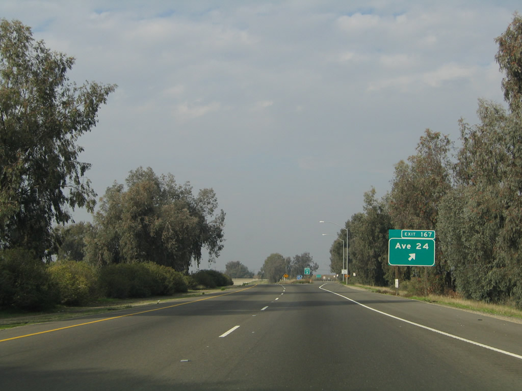
Northbound California 99 (Golden State Highway) meets Exit 167, Avenue 24. Use Avenue 24 east to the Valley State Prison for Women.
11/25/04
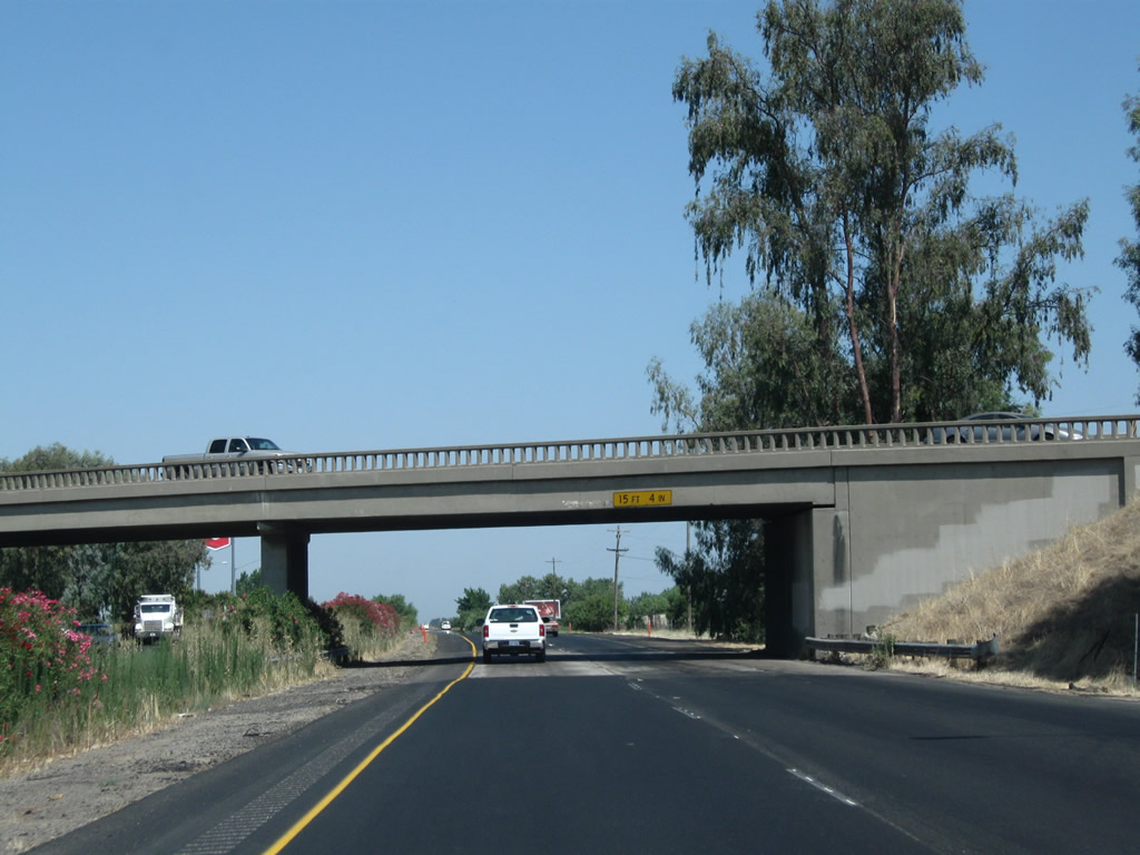
An older bridge carries Avenue 24 over California 99 (Golden State Highway).
07/31/11
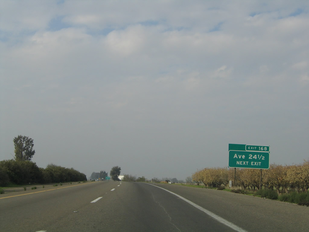
The next exit along California 99 north is Exit 168, Avenue 24 1/2, next right.
11/25/04
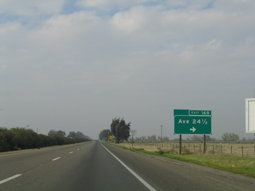
This sharp right turn connects northbound California 99 to Exit 168, Avenue 24 1/2. Chowchilla, announced in the billboard, is the next city of significance along northbound.
07/31/11
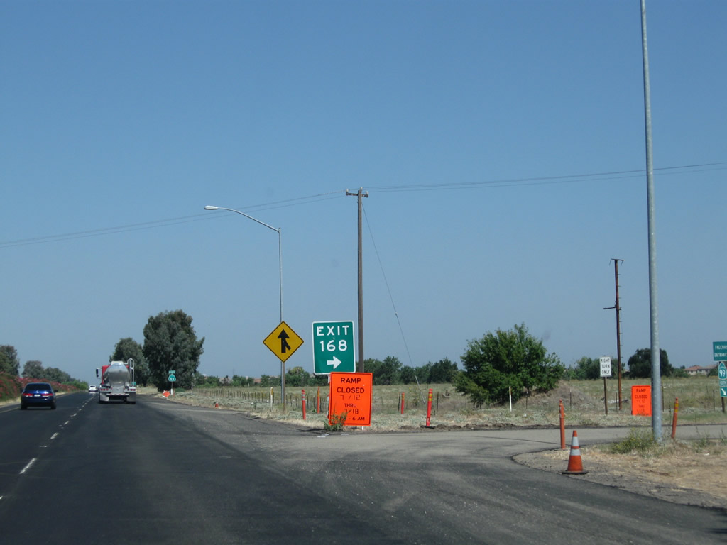
A hard right turn is needed for Exit 168 (Avenue 24 1/2).
07/31/11
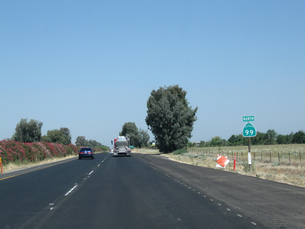
A California 99 north reassurance shield is posted after the on-ramp from Exit 168 (Avenue 24 1/2).
07/31/11

California 99 enters the city of Chowchilla, which had a population of 18,720 as of the 2010 Census and was incorporated on February 7, 1923.
11/25/04
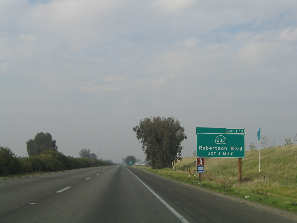
The next exit along California 99 north is Exit 170, California 233 (Robertson Boulevard) southwest and Avenue 26 east (one mile). This is the principal exit into Chowchilla.
11/25/04
California 233 serves the city of Chowchilla. This exit also connects to Avenue 26, which leads east toward Hensley Lake reservoir.
11/25/04
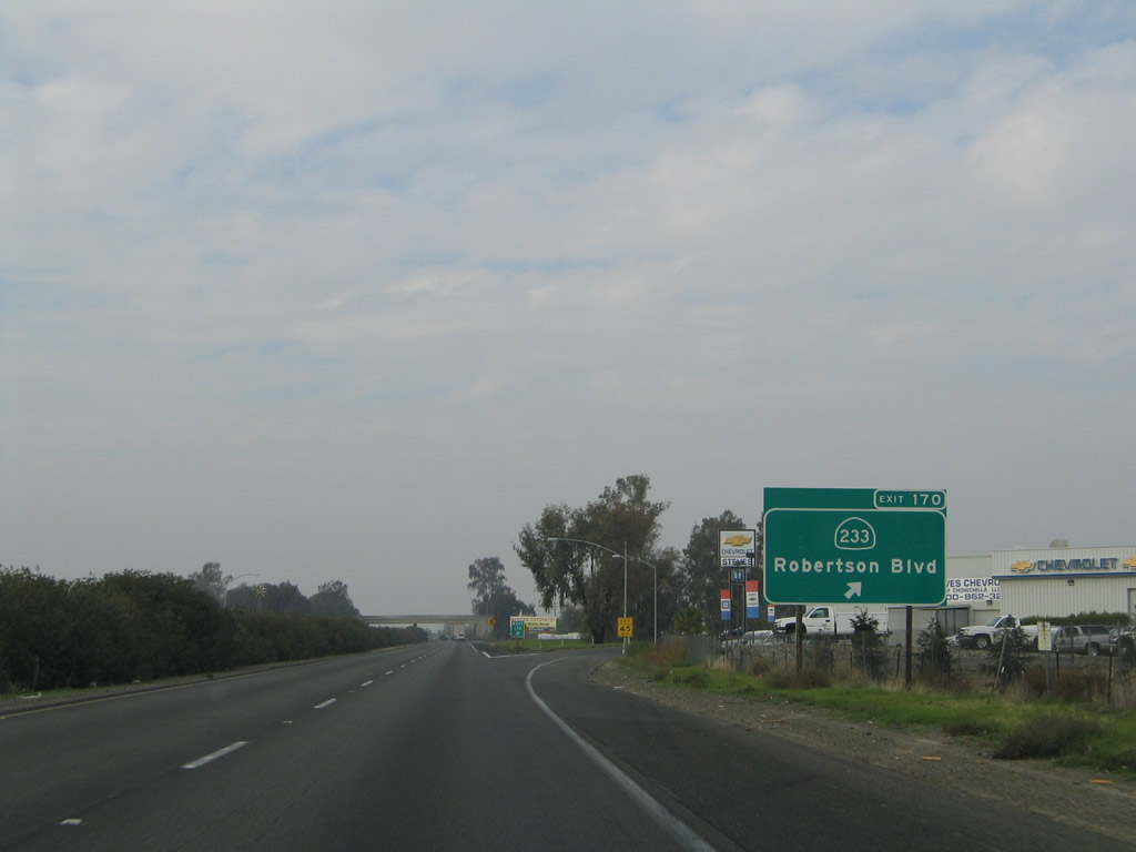
Northbound California 99 (Golden State Highway) meets Exit 170, California 233 (Robertson Boulevard) southwest to Chowchilla and Avenue 26 east. California 233 leads southwest through Chowchilla to join California 152 a few miles west of here. The exit number sign was added here in early 2003.
11/25/04
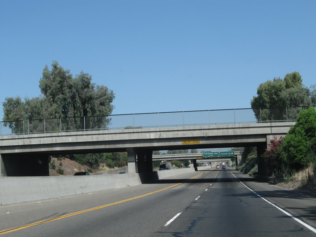
California 99 passes under California 233 (Robertson Boulevard).
07/31/11
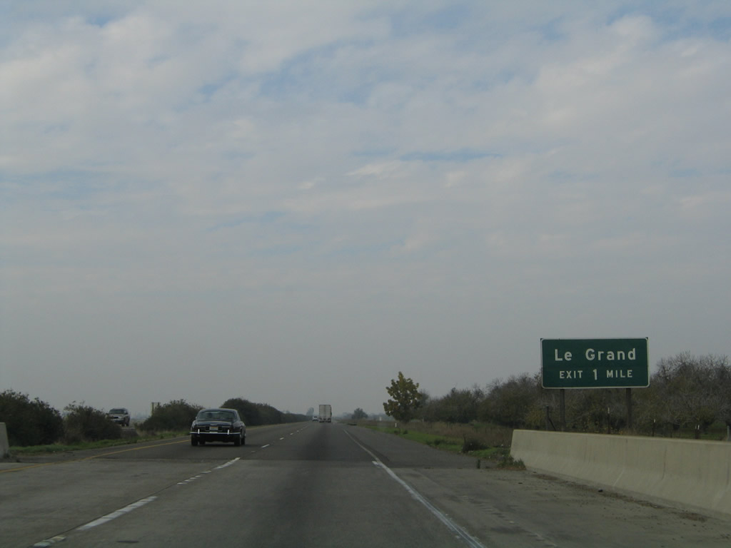
The next exit along California 99 north is Exit 171, Minturn Road (Road 15) to Le Grand. The community of Le Grand is located in Merced County, several miles north of this interchange along Minturn Road.
11/25/04
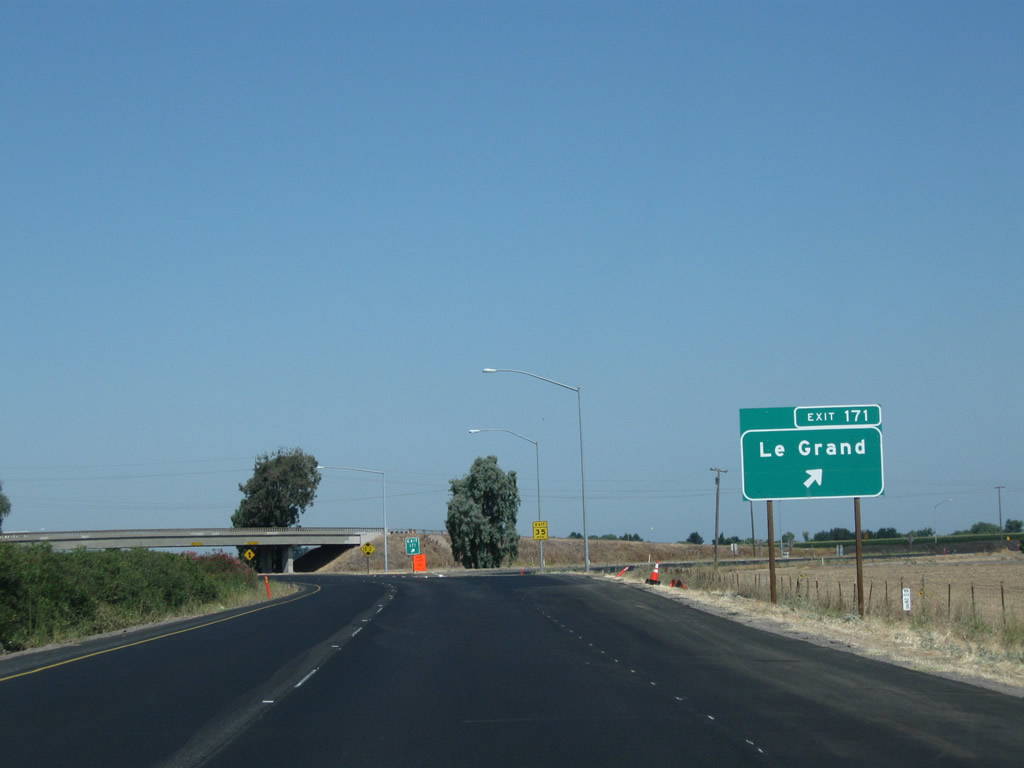
Northbound California 99 reaches Exit 171, Minturn Road (Road 15), which travels north to Le Grand.
07/31/11
California 99 passes under Minturn Road (Road 15).
07/31/11
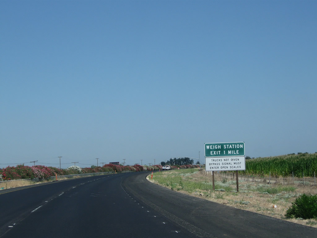
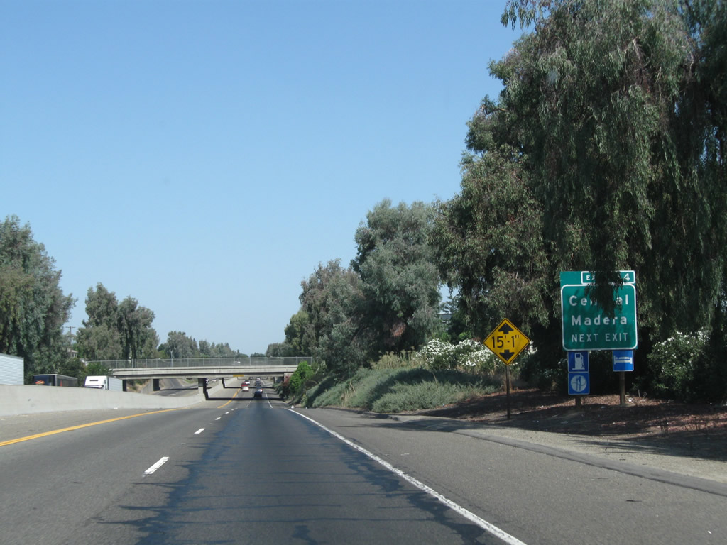
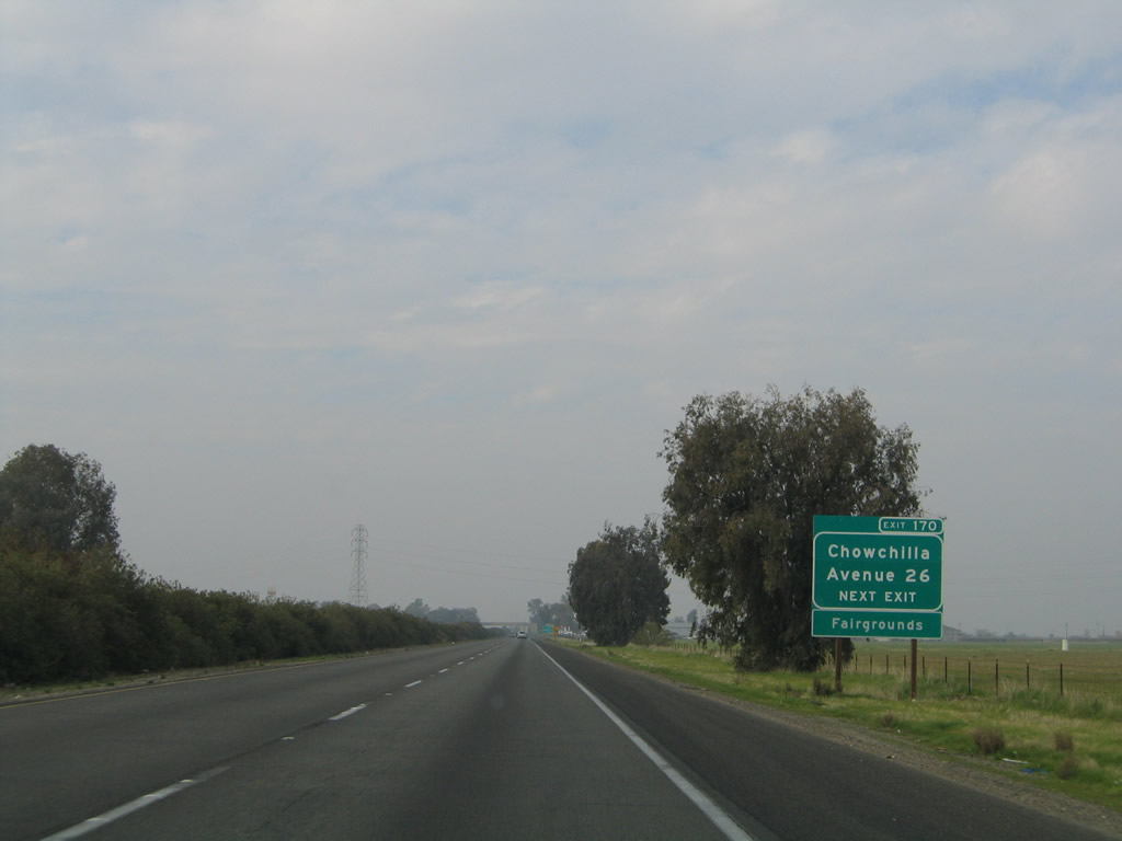
The next exit along California 99 north is Exit 172, Weigh Station (one mile). The 2011 pictures were taken during a repaving project along this stretch of California 99 in northern Madera County.
07/31/11
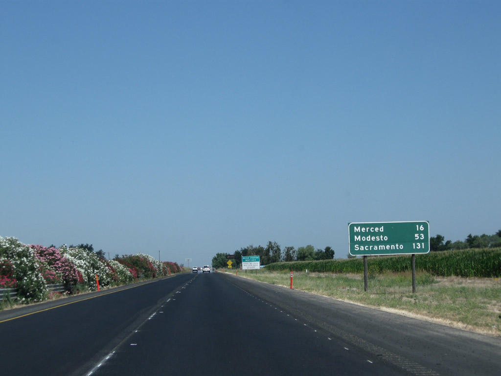
This mileage sign along California 99 (Golden State Highway) north provides the distance to Merced (16 miles), Modesto (53 miles), and Sacramento (131 miles).
07/31/11
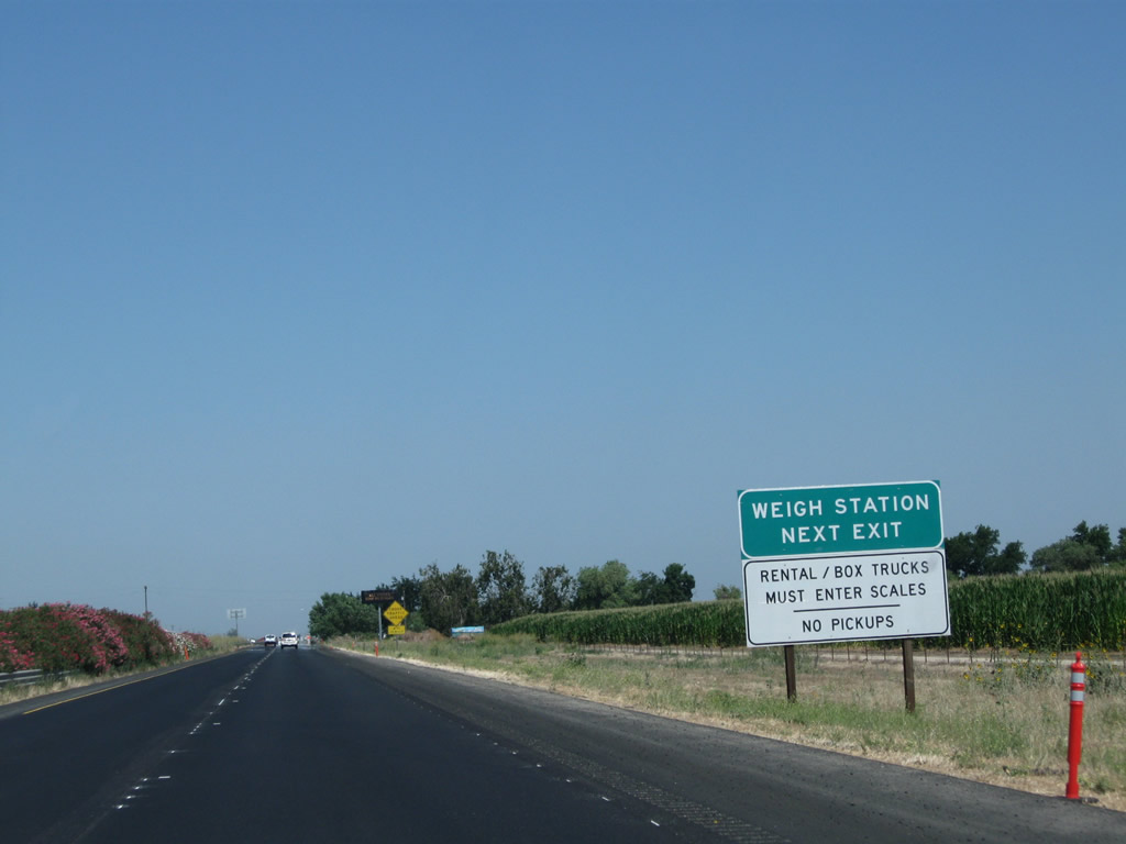
Another weigh station advance sign is posted shortly thereafter.
07/31/11
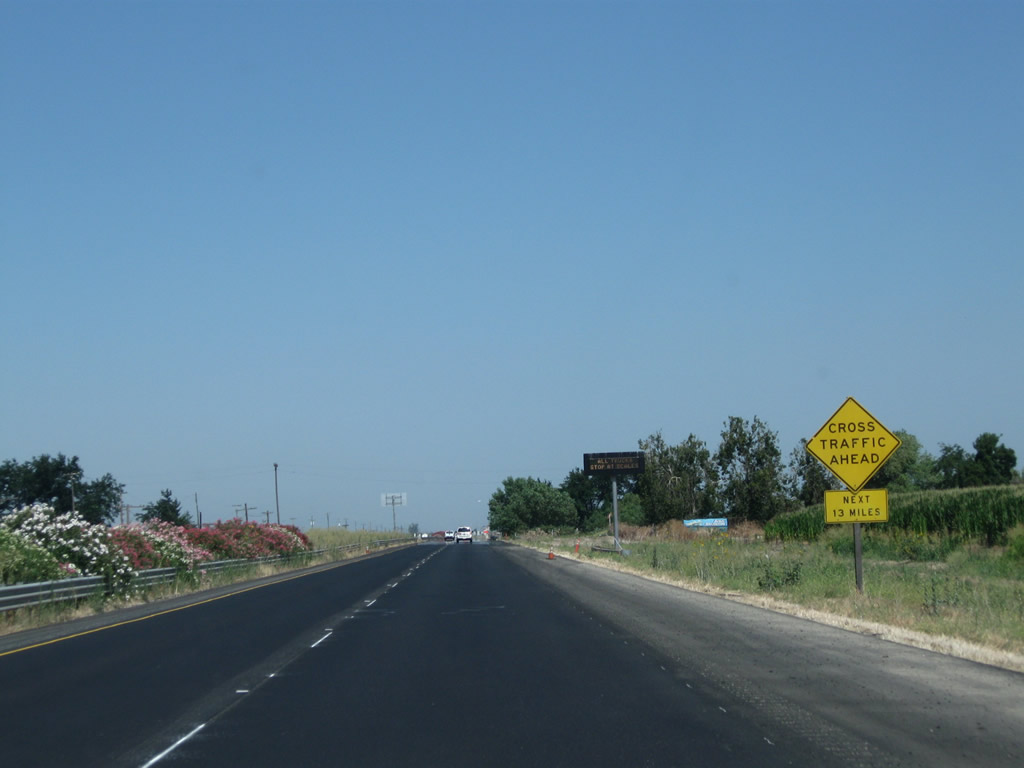
The upcoming expressway segment of California 99 is the longest remaining section with at-grade intersections in the San Joaquin Valley as of July 2011. This section with at-grade intersections extends between Chowchilla and Merced for a total of 13 miles; plans call for this segment to be widened and upgraded to freeway standards as part of the plan to convert all of California 99 through the San Joaquin Valley to a minimum of six lanes. Ahead, California 99 will leave Madera County and enter Merced County.
07/31/11
References:
Hall, D. (2010, February 27).A Geographer's Notebook: Where the Palm Meets the Pine dated February 27, 2010.Retrieved from http://duanehallca.blogspot.com/2010/02/where-palm-meets-pine.html
North Fork Chamber of Commerce. (n.d.). The Exact Center of California. "[O]ther areas claim ... to be the Center of California! One was at South Avenue 11 and Highway 99, a pine tree and palm tree, denoted equal distance of north and south on Highway 99. Bob Thomason of CalTrans, whose major efforts saved the trees from destruction, stated the person who originally planted the trees was unknown even though a thorough search had been made." Retrieved from http://www.north-fork-chamber.com/historical.html
Photo Credits:
- Andy Field: 11/25/04, 07/31/11
Connect with:
Page Updated Saturday March 10, 2012.