
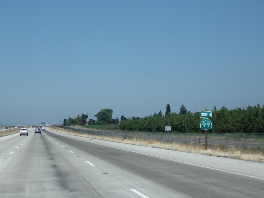
State Route 99 North - Merced to Livingston
The Atwater Merced Expressway is a three-phase project that would connect California 99 with the Castle Commerce Center (former military base) as well as UC Merced. It would create a four-lane link to both SR 59 and SR 140. The route would roughly follow Bellevue Road east and Gurr Road south. A new alignment to connect Bellevue Road and Gurr Road would become part of the northwestern quadrant of the proposed Merced Loop.
The first phase of this project is to expand SR 99 to six lanes and to construct a new expressway northeast from this point to join with Bellevue Road. This also includes partial construction of an interchange with Merced County Route J-7 (Santa Fe Avenue). A portion of phase one opened to traffic on June 24, 2015 (YourCentralValley.com, 2015). Completion is expected in 2016, with access to the Castle Commerce Center and UC Merced (Merced Sun Star, 2015). The second phase will construct the remainder of the Santa Fe Avenue interchange and extend the four-lane expressway east along Bellevue Road to SR 59, and the third phase will extend the four-lane expressway south along Gurr Road to SR 140. The former left lane exit for southbound SR 99 traffic with Buhach Road was removed.
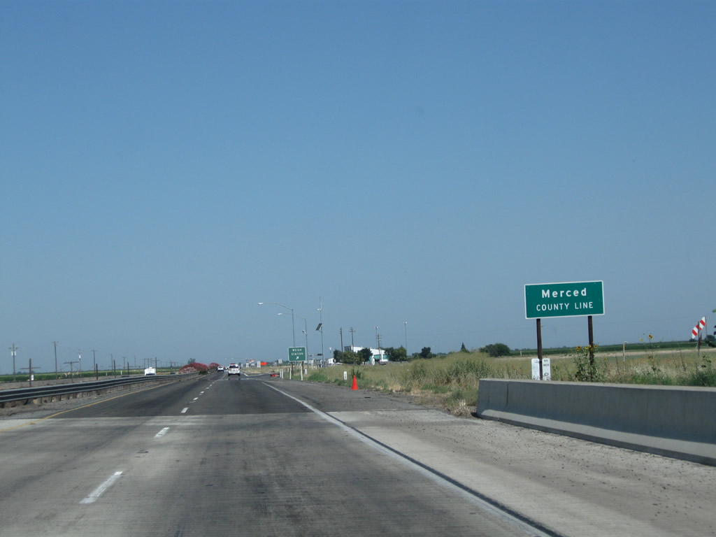
California 99 leaves Madera County upon crossing the Chowchilla River and enters Merced County.
07/31/11
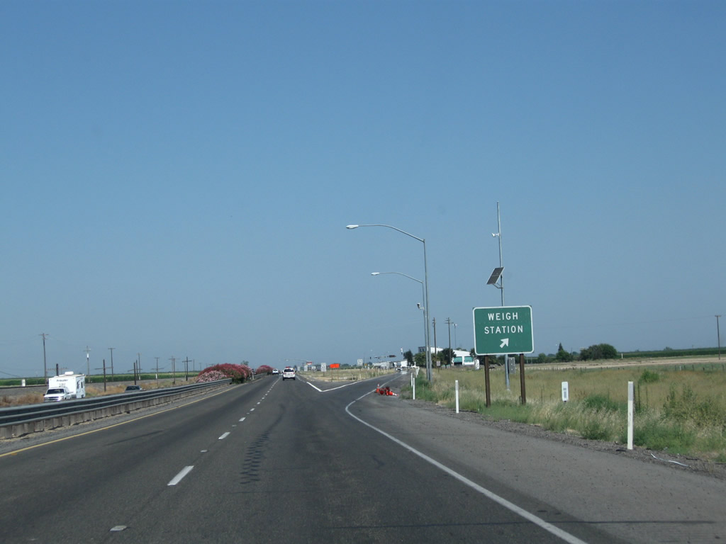
Northbound California 99 reaches Exit 172, Weigh Station. Until 2015, California 99 had a 13-mile, at-grade expressway between the county line and the southern outskirts of Merced. A freeway upgrade project, known as the Plainsburg Road Freeway and Le Grand Freeway projects, removed these at-grade intersections in 2014 and 2015. The northbound lanes of California 99 were placed on a new alignment, and interchanges were added at Plainsburg Road (Exit 176) and Le Grand Road (Exit 179).
07/31/11
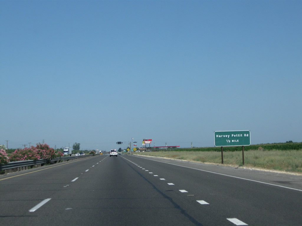
The next two intersections along California 99 north are Vista Avenue and Harvey Pettit Road (noted as being one-half mile north of here on this sign). Vista Avenue travels south, becoming Road 13 upon entering Madera County. Harvey Pettit Road travels east to meet Minturn Road.
07/31/11
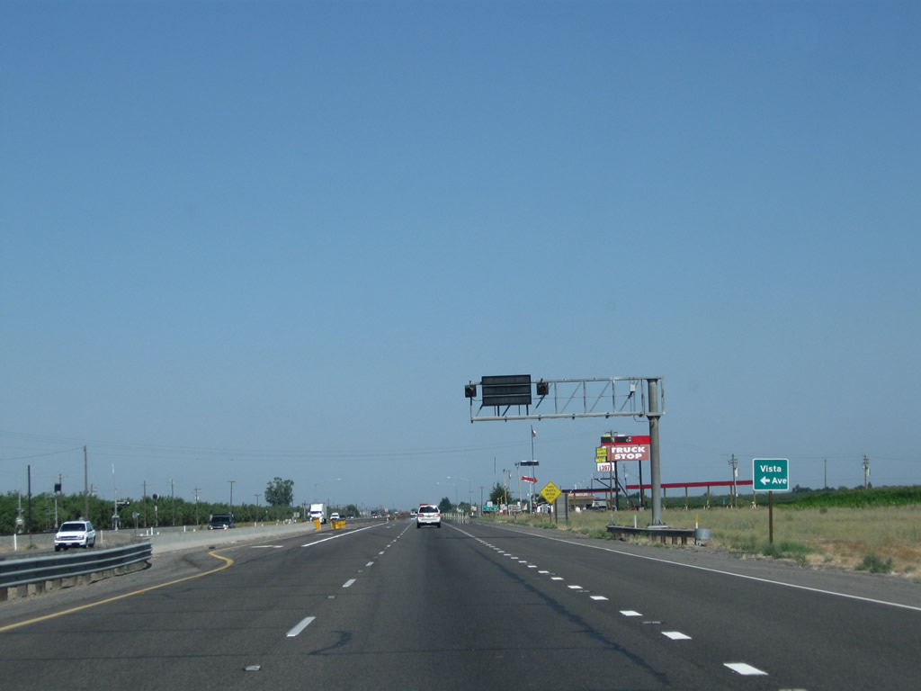
The next left turn from California 99 north connects to Vista Avenue south. Stay right for the link to Harvey Pettit Road.
07/31/11
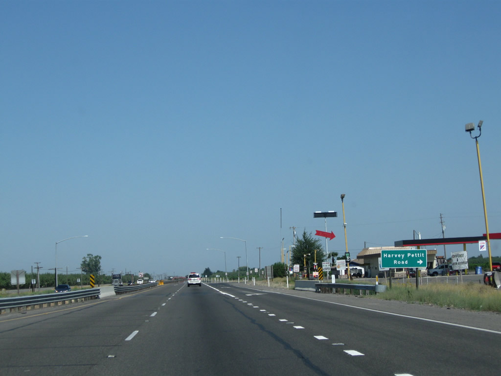
Northbound California 99 approaches the right turn to Harvey Pettit Road. A truck stop is located at this intersection.
07/31/11
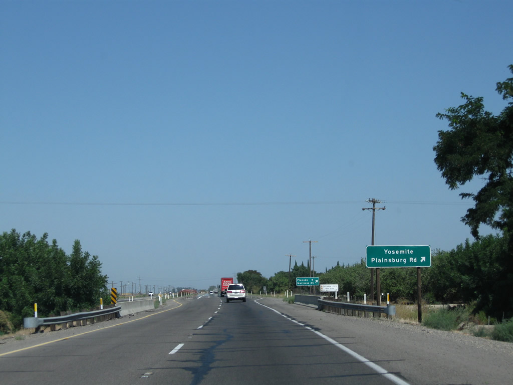
The next intersection along California 99 north is Plainsburg Road, which travels north to Plainsburg and ends at California 140 in Planada. At Planada, turn east on California 140 to Mariposa and Yosemite National Park.
07/31/11
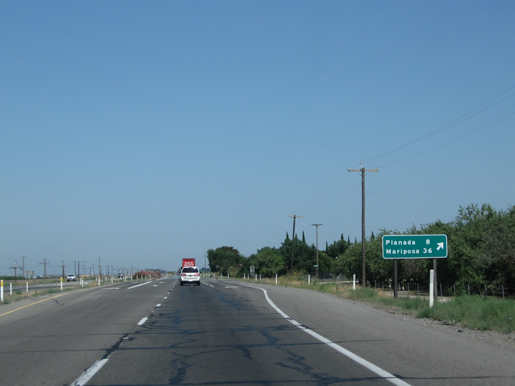
Northbound California 99 meets Plainsburg Road, which travels north to Planada (eight miles) and connects to Mariposa via California 140 east (36 miles).
07/31/11
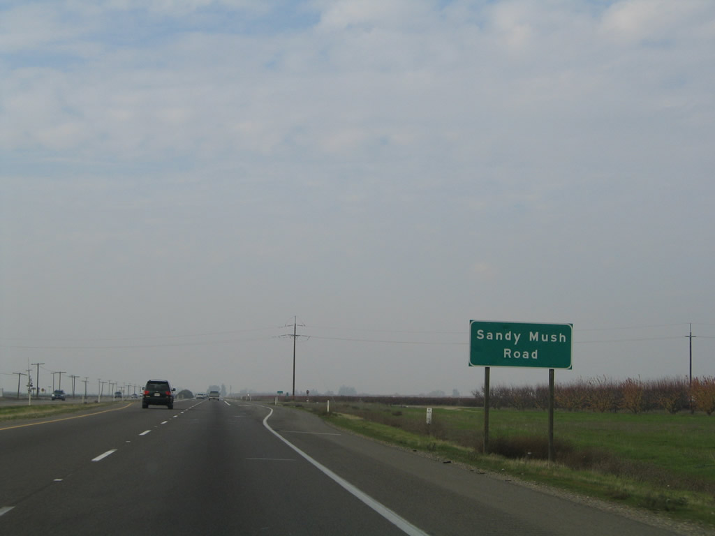
Just a short distance north is the intersection with Sandy Mush Road. A left turn follows Sandy Mush Road west through farmland and ranches to California 59 and Merced National Wildlife Refuge. A right turn connects Sandy Mush Road to Plainsburg Road.
11/25/04
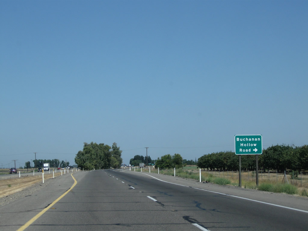
The next intersection along California 99 north is Buchanan Hollow Road east, which provides local farm and ranch access.
07/31/11
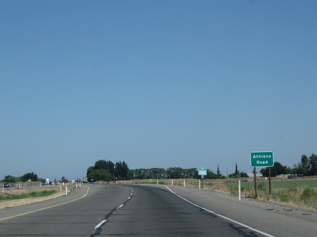
Northbound California 99 approaches Athlone Road (north/south).
07/31/11
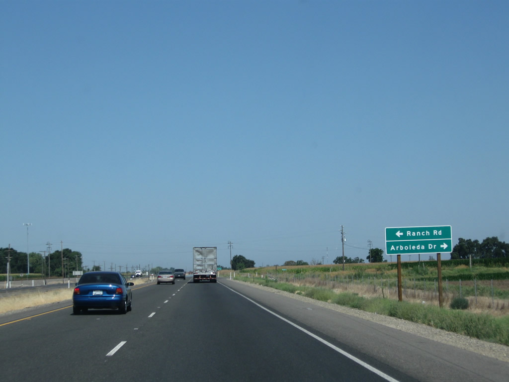
The next intersection along California 99 north is with Ranch Road south and Arboleda Drive north. Arboleda Drive is a through route that eventually connects to California 140 east of Merced.
07/31/11
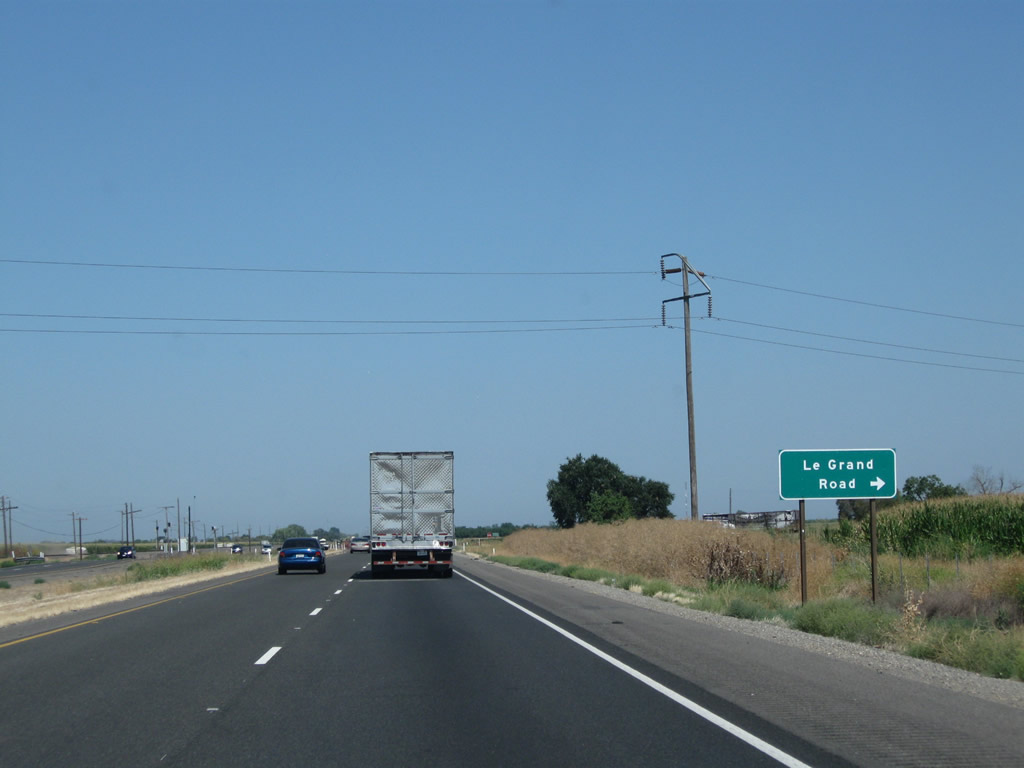
Quickly thereafter, California 99 north approaches Le Grand Road, which travels east to the community of Le Grand.
07/31/11
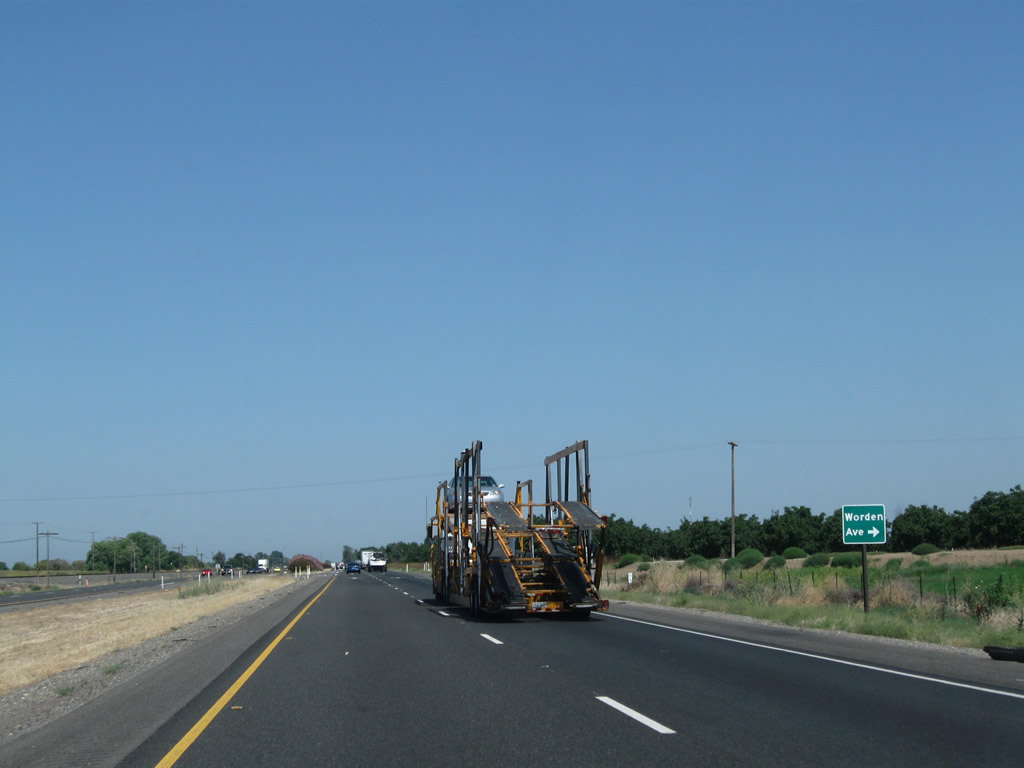
The next intersection along California 99 north is with Worden Road.
07/31/11
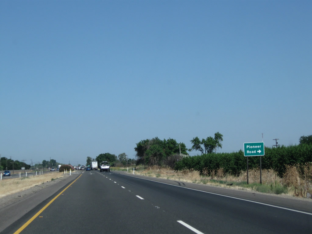
California 99 north next approaches Pioneer Road, which travels north to Lingard.
07/31/11
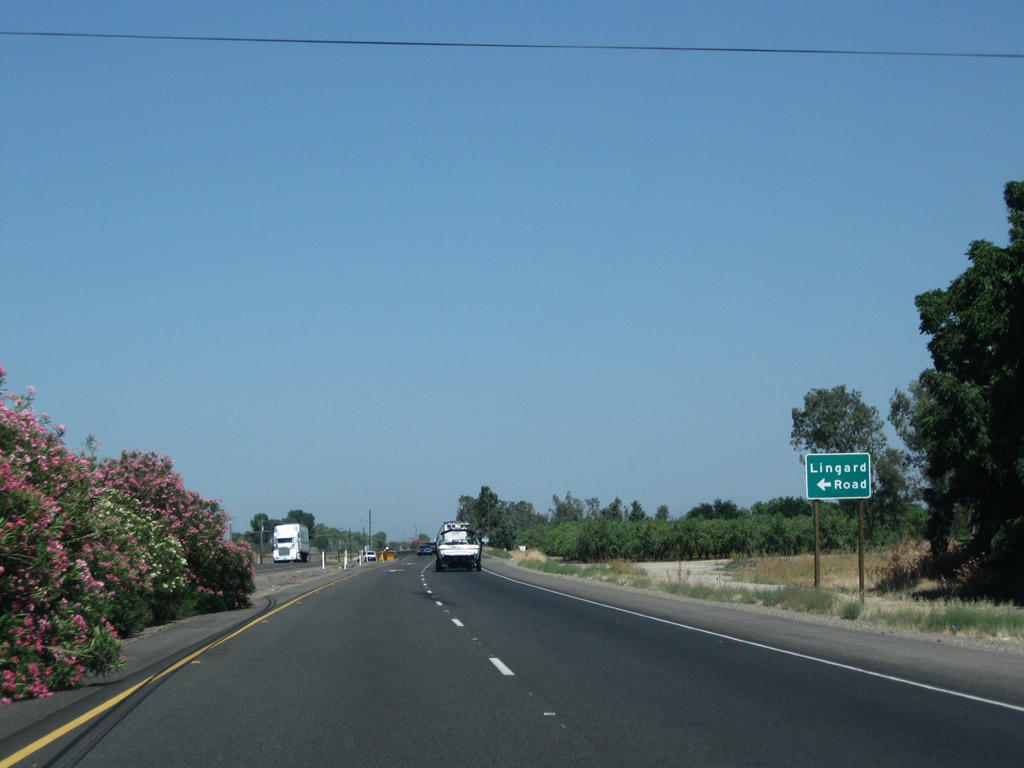
Soon thereafter, California 99 north approaches Lingard Road.
07/31/11
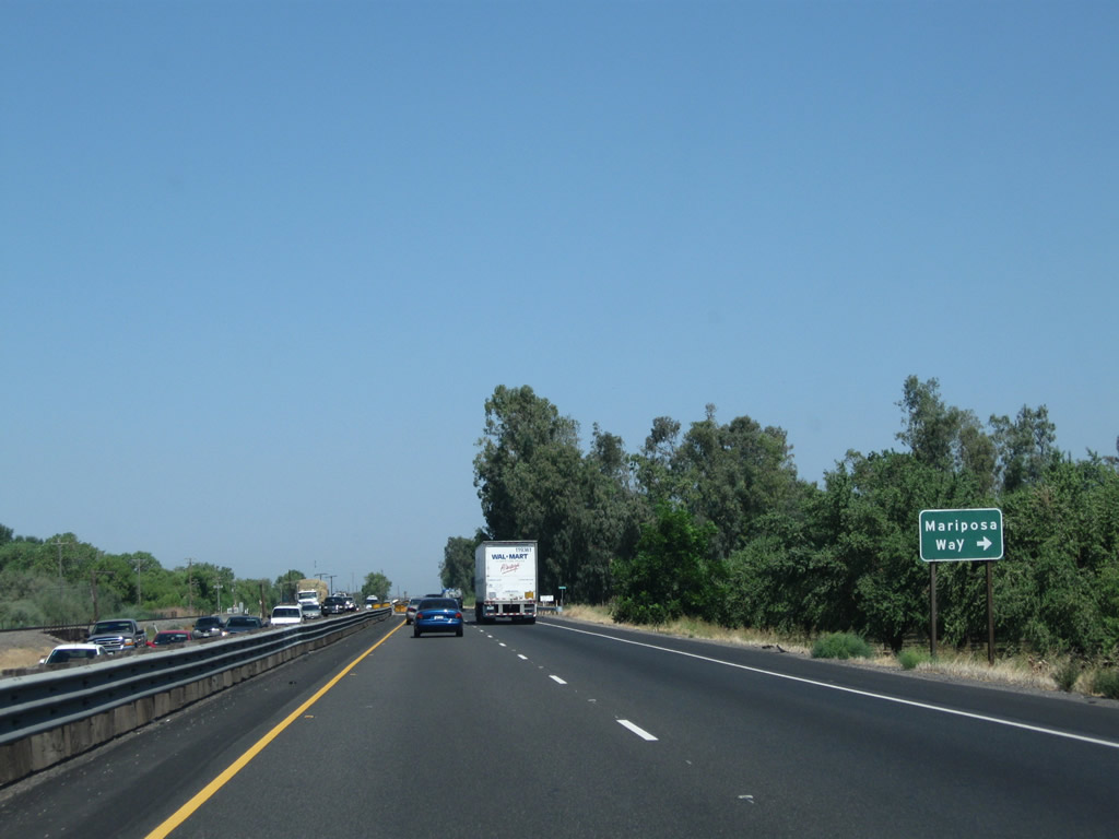
The last at-grade intersection (aside from a few driveway access points) along this section of California 99 expressway is with Mariposa Way.
07/31/11
As of 2011, the freeway along California 99 resumes after the Mariposa Way intersection, resulting in the elimination of all remaining at-grade intersections between here and the Childs Road (Exit 186A) interchange.
07/31/11
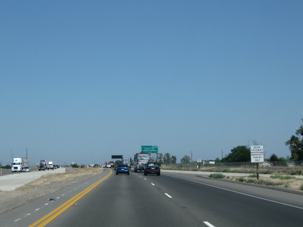
Resuming the freeway configuration, California 99 north approaches its next interchange: Exit 185, Mission Avenue and Campus Parkway.
07/31/11
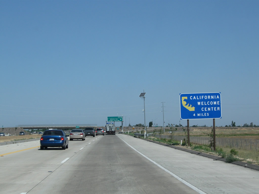
An official California Welcome Center is located in Merced, via either Exit 186C (follow California 99 Business/16th Street northwest) or Exit 188 (R Street northeast). Tourist information and restrooms are available at the welcome center, which is located in downtown Merced at the Merced Transportation Center.
07/31/11
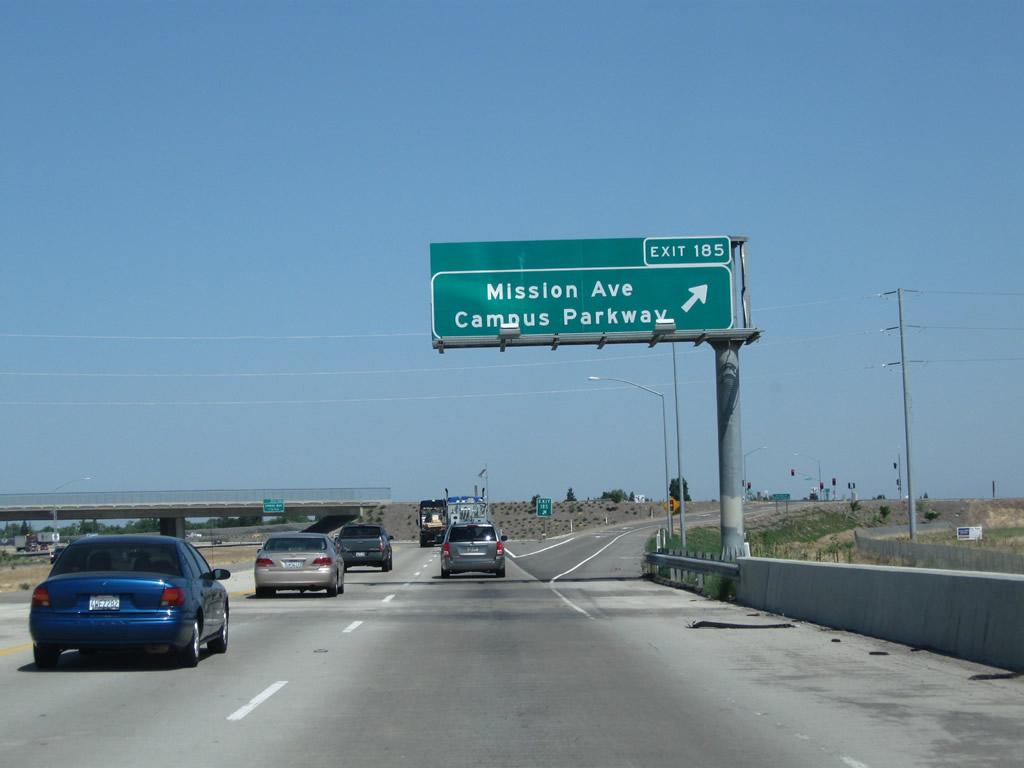
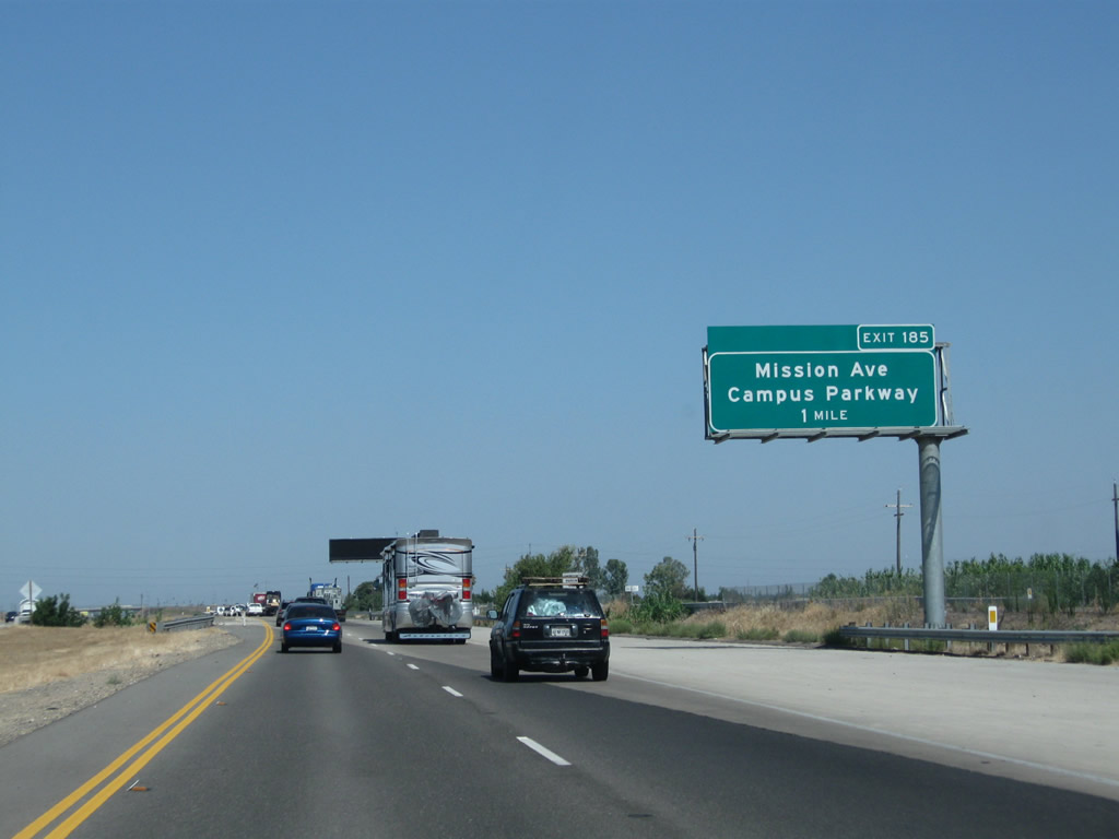
Northbound California 99 reaches Exit 185, Mission Avenue and Campus Parkway.
07/31/11
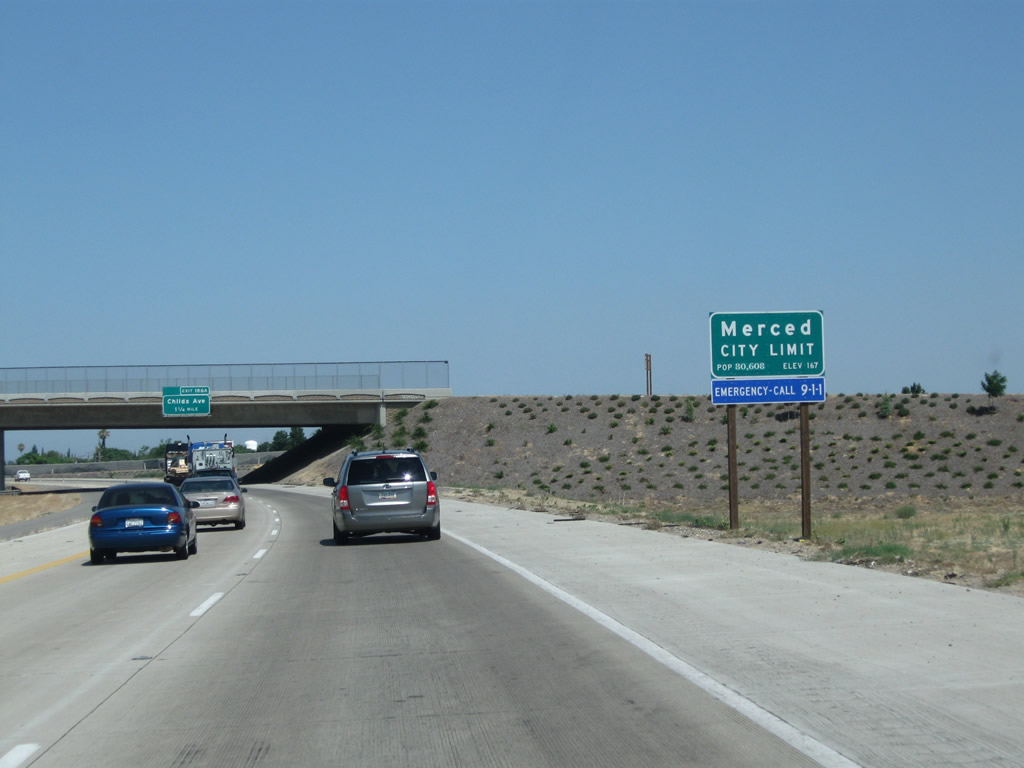
California 99 enters the city of Merced, the seat of Merced County and the "Gateway to Yosemite." Merced incorporated on April 1, 1889. It had a population of 78,958 as of the 2010 Census and is home to the University of California, Merced. The university is located northeast of the city center; Campus Parkway is intended eventually to extend east and then north to the university campus.
07/31/11
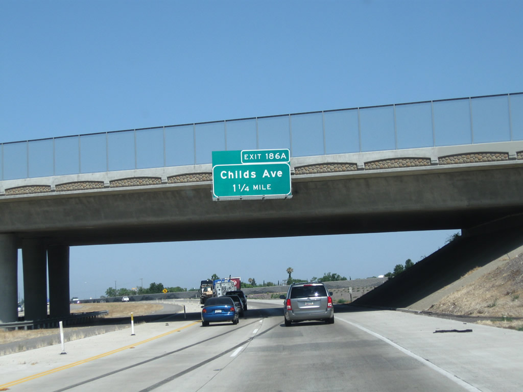
Passing under Mission Avenue and Campus Parkway, the next exit from California 99 north is Exit 186A, Childs Avenue and Motel Drive (1.25 miles).
07/31/11

An older sign advises of the next interchange (Exit 186A). This sign was removed when this section of California 99 was converted to freeway standards (a former at-grade intersection is visible after this sign for Gerard Avenue).
11/25/04
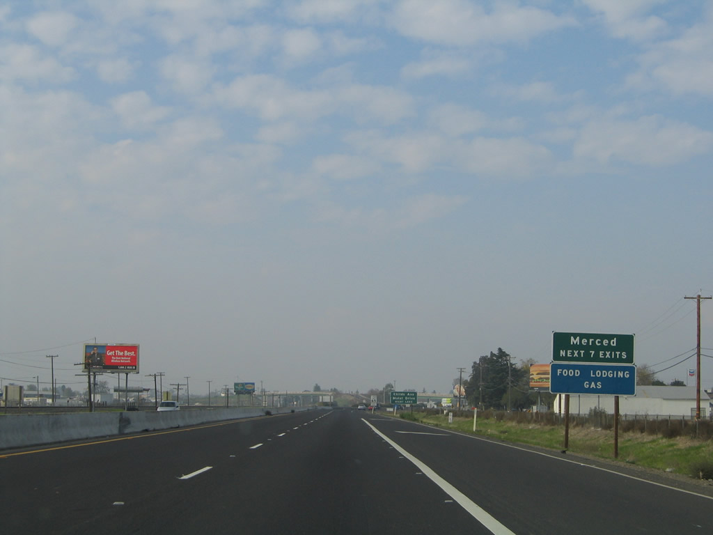
The next several exits along serve the city of Merced.
11/25/04
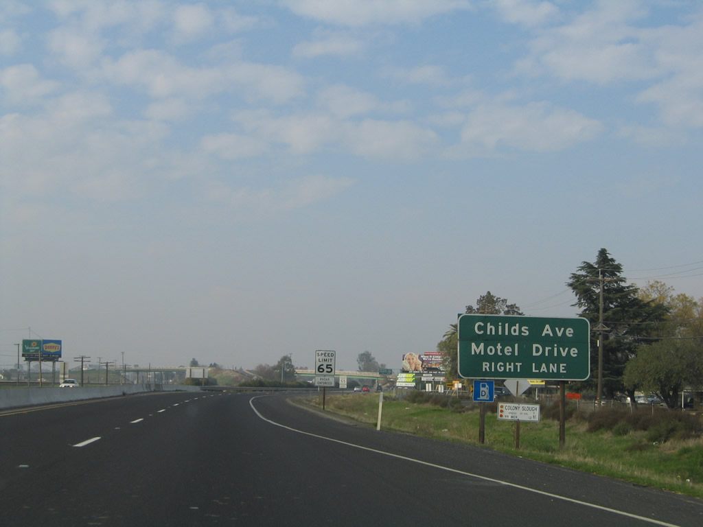
California 99 north approaches Exit 186A, Childs Avenue and Motel Drive. An extant segment of Historic U.S. 99 follows Motel Drive, which is a frontage road on the east side of the freeway. However, the official business route into Merced leaves California 99 at Exit 186C. Childs Avenue parallels California 140 to the south, connecting Merced with Planada.
11/25/04
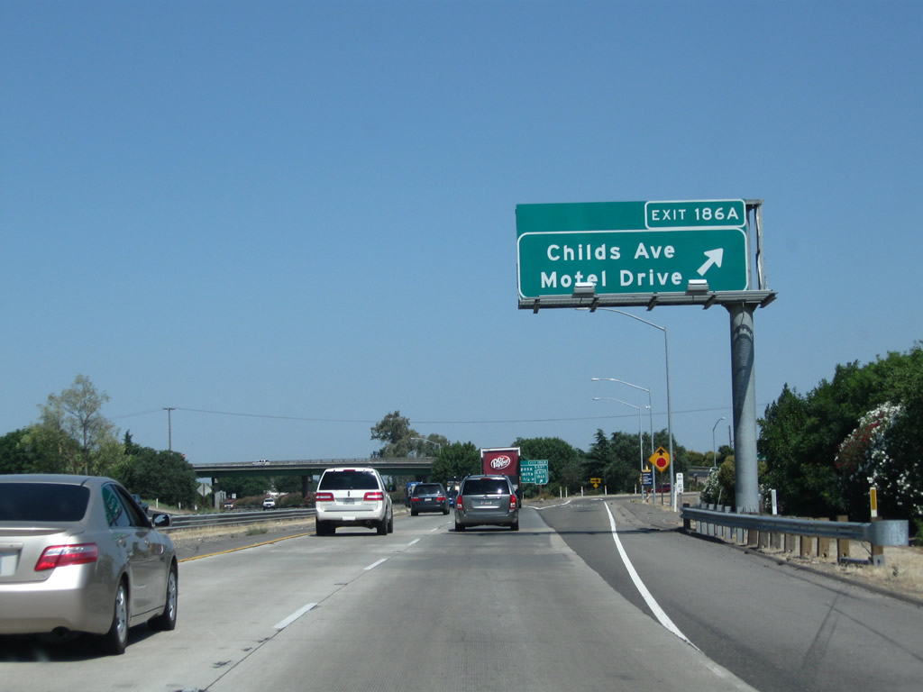
Northbound California 99 meets Exit 186A, Childs Avenue and Motel Drive. The next exit is Exit 186B, California 140 east.
07/31/11
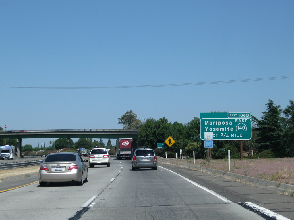
The next exit along California 99 north is Exit 186B, California 140 east to Planada, Catheys Valley, Mariposa, and Yosemite National Park.
07/31/11
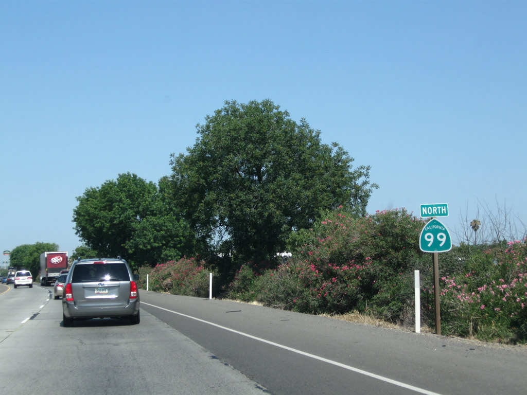
A California 99 north reassurance shield is posted shortly thereafter.
07/31/11
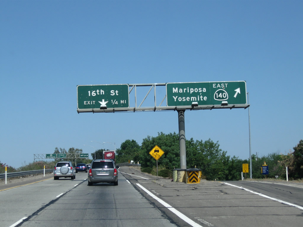
Northbound California 99 meets Exit 186B, California 140 east to Mariposa and Yosemite National Park. For access to downtown Merced, use 16th Street, which is the business route (Exit 186C, second right).
07/31/11
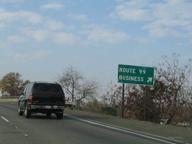
The next exit along California 99 north is Exit 186C, California 99 Business/16th Street. This roadside sign advises that Exit 186C connects to Route 99 Business. The business loop follows old U.S. 99 through Merced and offers all motorist services. It will return to California 99 at Exit 189.
11/25/04
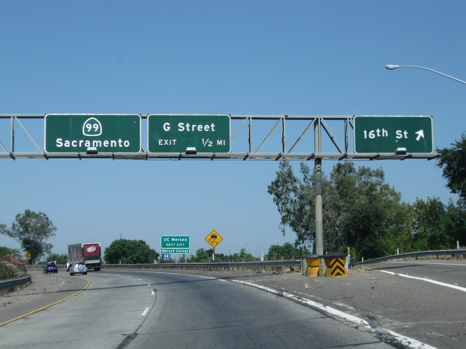
Northbound California 99 meets Exit 186C, California 99 Business/16th Street north to downtown Merced. The business loop serves the city of Merced, the Merced County seat. The next exit is Exit 187A, G Street, one-half mile. Immediately after this off-ramp, an on-ramp brings traffic from California 140 west onto California 99 north. The two routes share alignment briefly, between Exits 186C and 188.
07/31/11
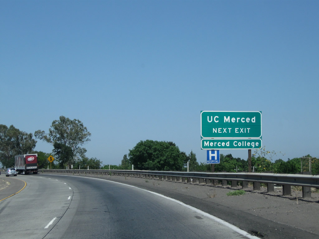
The next exit along California 99 north is Exit 187A, G Street. Use G Street northeast to Yosemite High School, Merced College, and University of California, Merced.
07/31/11
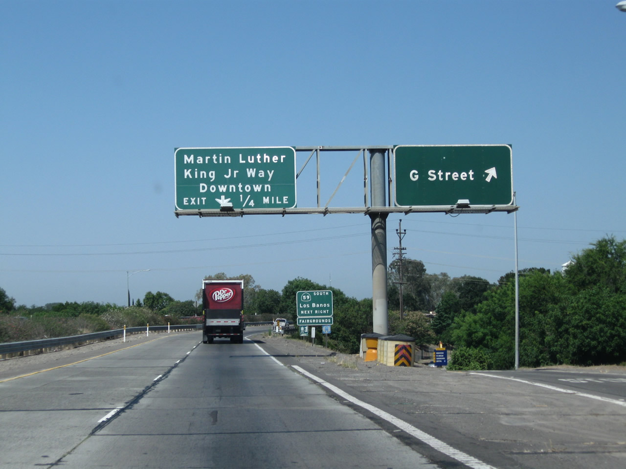
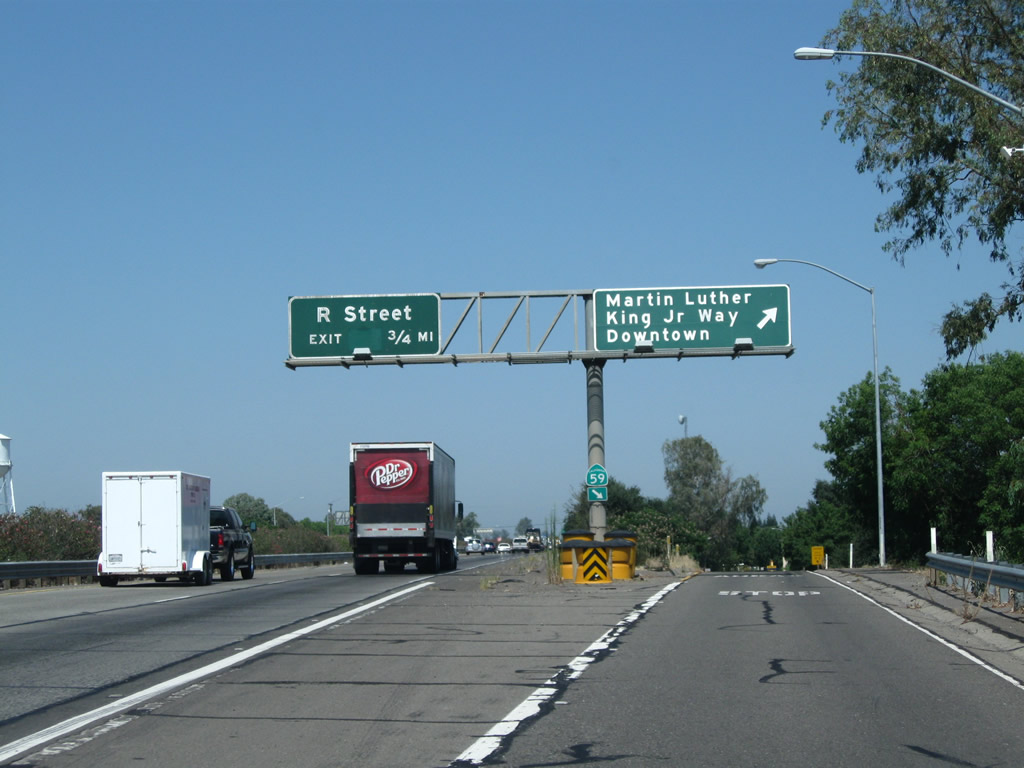
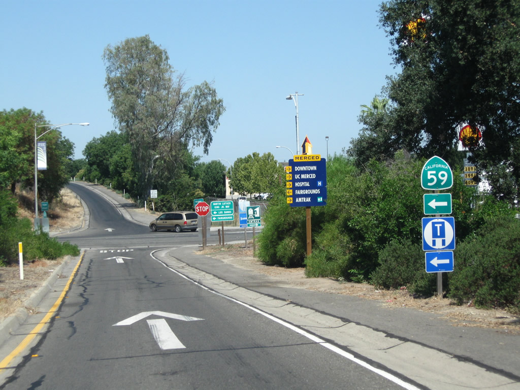
Northbound California 99 reaches Exit 187A, G Street. The second off-ramp connects to Exit 187B, California 59/Martin Luther King, Jr. Way south and Martin Luther King, Jr. Way north.
07/31/11
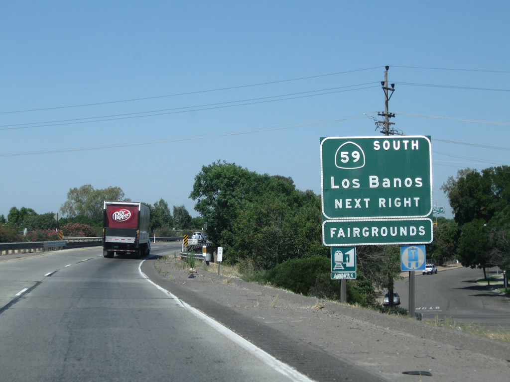
The next exit along California 99 north is Exit 187B, which not only connects to Martin Luther King, Jr. Way but also connects to California 59 south to El Nido and California 152 west to Los Banos. Continue north on California 99 to Exit 188 to California 59 north to Snelling.
07/31/11
Northbound California 99 reaches Exit 187B, Martin Luther King, Jr. Way and California 59 south to El Nido and Los Banos.
07/31/11
A California 59 south route marker is posted at the bottom of the overhead sign bridge.
07/31/11
Turn left at the bottom of the off-ramp to California 59 south.
07/31/11
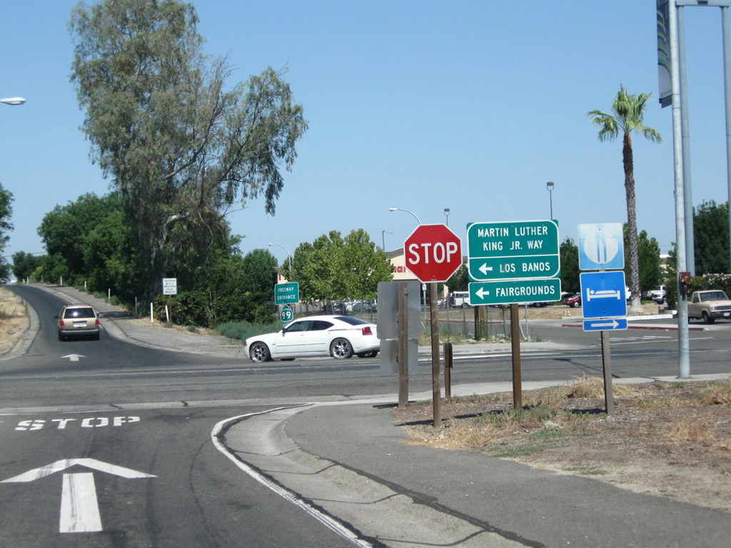
Use Martin Luther King, Jr. Way north to downtown Merced.
07/31/11
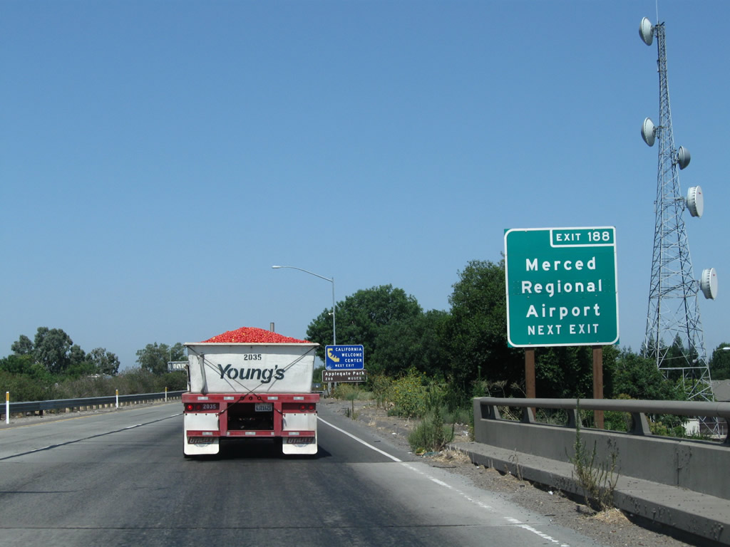
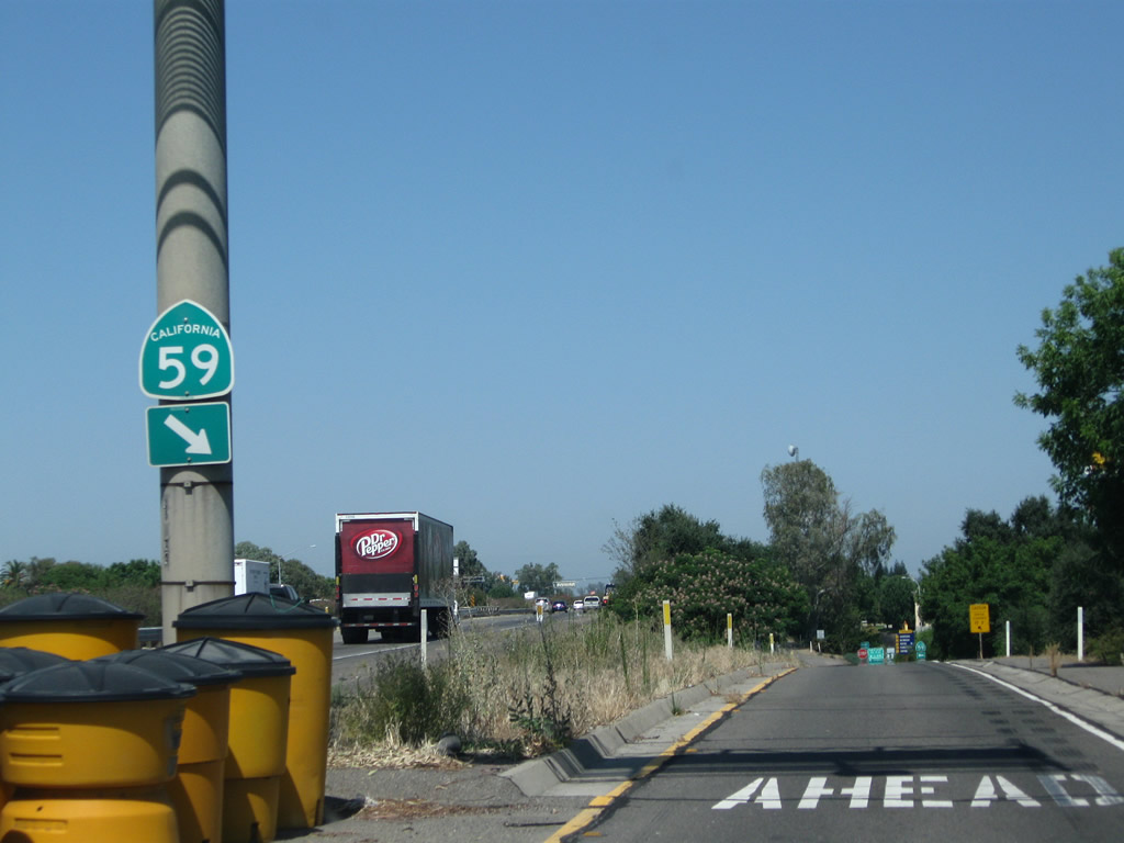
For a brief period (between Exit 187B and 188), California 99 shares pavement with California 59 north and California 140 west. However, both companion routes will exit the freeway at Exit 188. So again looking at the freeway mainline, the next exit along California 99 is Exit 188, California 59 north to Snelling and LaGrange and California 140 west to Gustine. Use Exit 188 to Merced Regional Airport (Macready Field). This sign is posted after the on-ramp from Martin Luther King, Jr. Way. There is no reassurance shield with all three routes (California 59, 99, and 140) together.
07/31/11
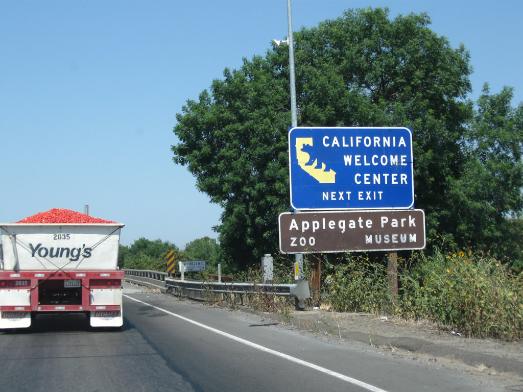
Use Exit 188 to R Street northeast to the official California State Welcome Center at the Merced Transportation Center.
07/31/11
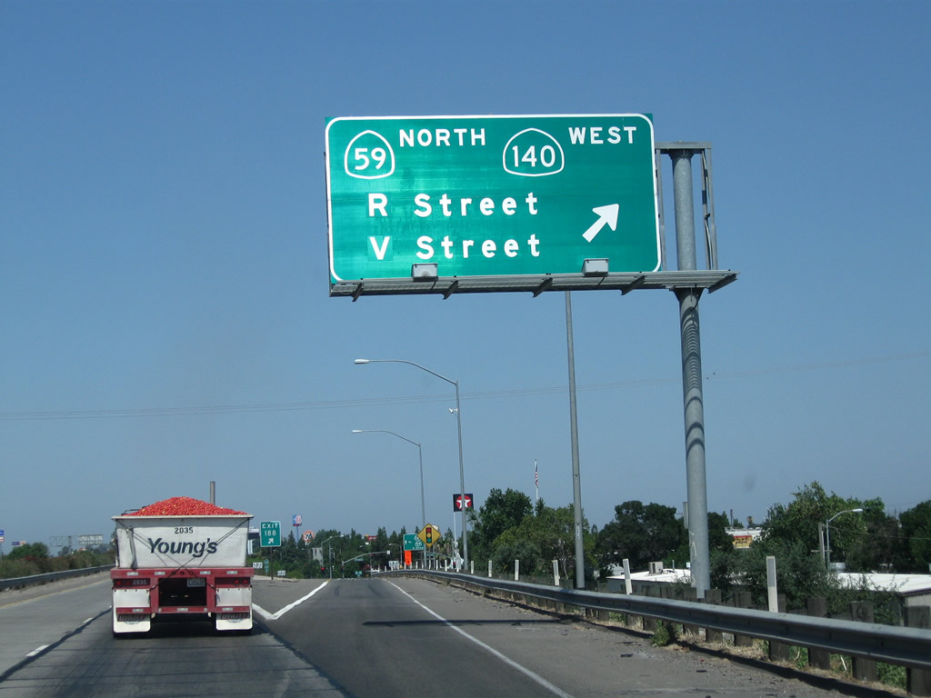
Northbound California 99 meets Exit 188, 13th Street to R Street, California 59 (V Street) north, and California 140 (McSwain Road) west. California 59 leads north to Snelling, and changes into Merced County Route J-59 after passing the Snelling Courthouse State Historic Monument and Merced County Route J-16. This is the location of the proposed Eastside Freeway (California 65). Merced County Route J-59 continues as Tuolumne County J-59 to terminate at California 108-120 west of Sonora. California 140, meanwhile, leads west via McSwain Road to serve Stevinson and Gustine before ending at Interstate 5. Photo taken 07/31/11).
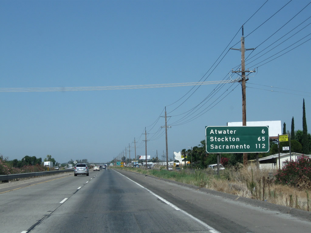
This mileage sign along California 99 north provides the distance to Atwater (six miles), Stockton (65 miles), and Sacramento (112 miles). Modesto, which appeared in the previous mileage sign, is omitted here.
07/31/11
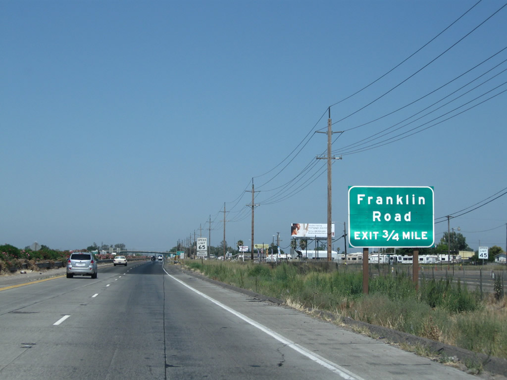
The next exit along California 99 north is Exit 191, Franklin Road. North-south Franklin Road lies between Merced and Atwater, connecting California 140 (McSwain Road) to the south and Merced County Route J-7 (Santa Fe Drive) to the north. J-7, which begins at California 59/Snelling Avenue north of Merced, travels northwest on a path parallel to California 99 from Merced northwest to Stockton.
07/31/11
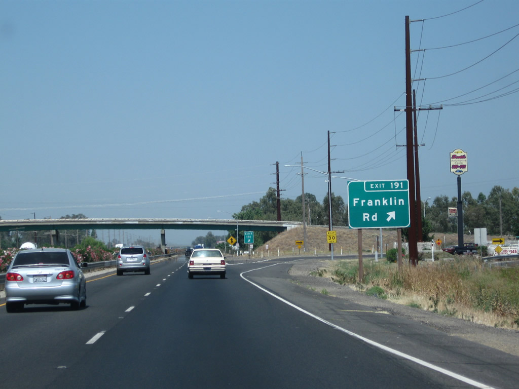
Northbound California 99 meets Exit 191, Franklin Road.
07/31/11
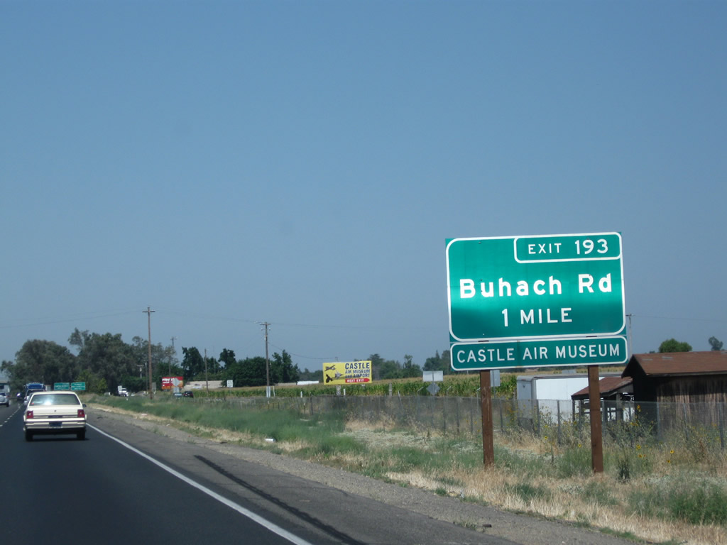
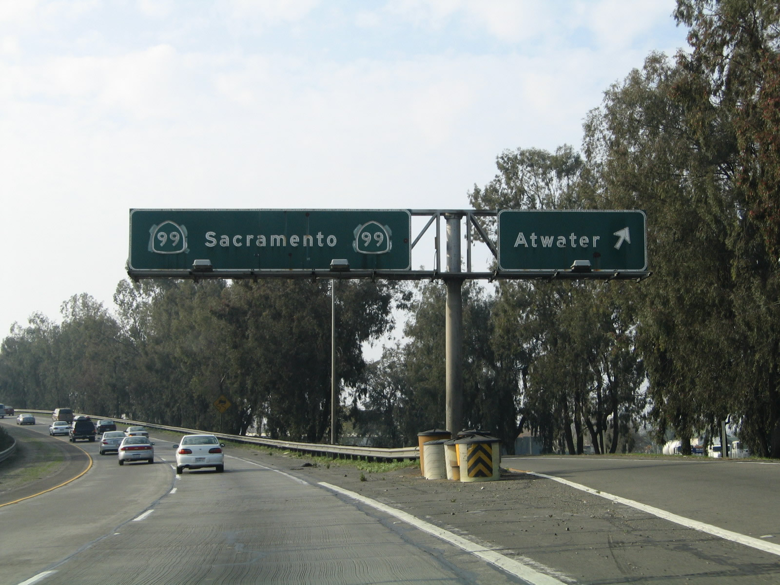
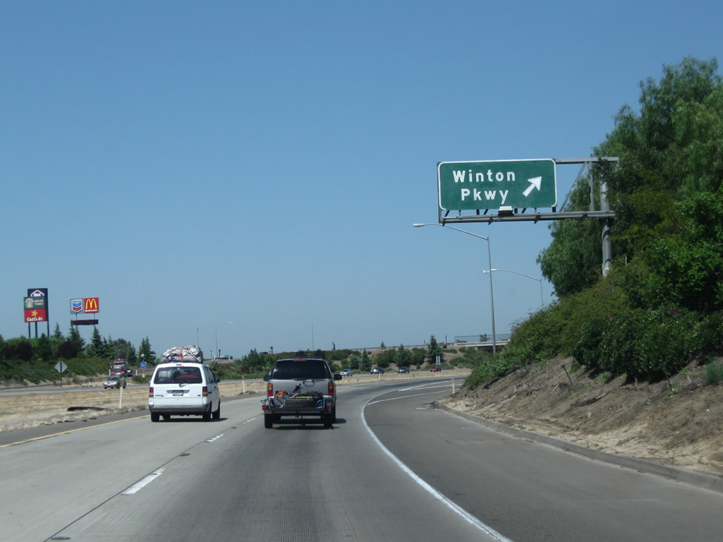
The next exit along California 99 north is Exit 193, Atwater-Merced Expressway.
07/31/11
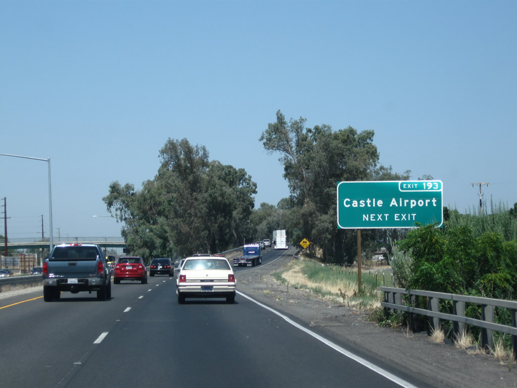
Castle Airport, a general aviation airport, lies north of here via Buhach Road. The airport is located on the site of former Castle Air Force Base, which closed in 1995.
07/31/11
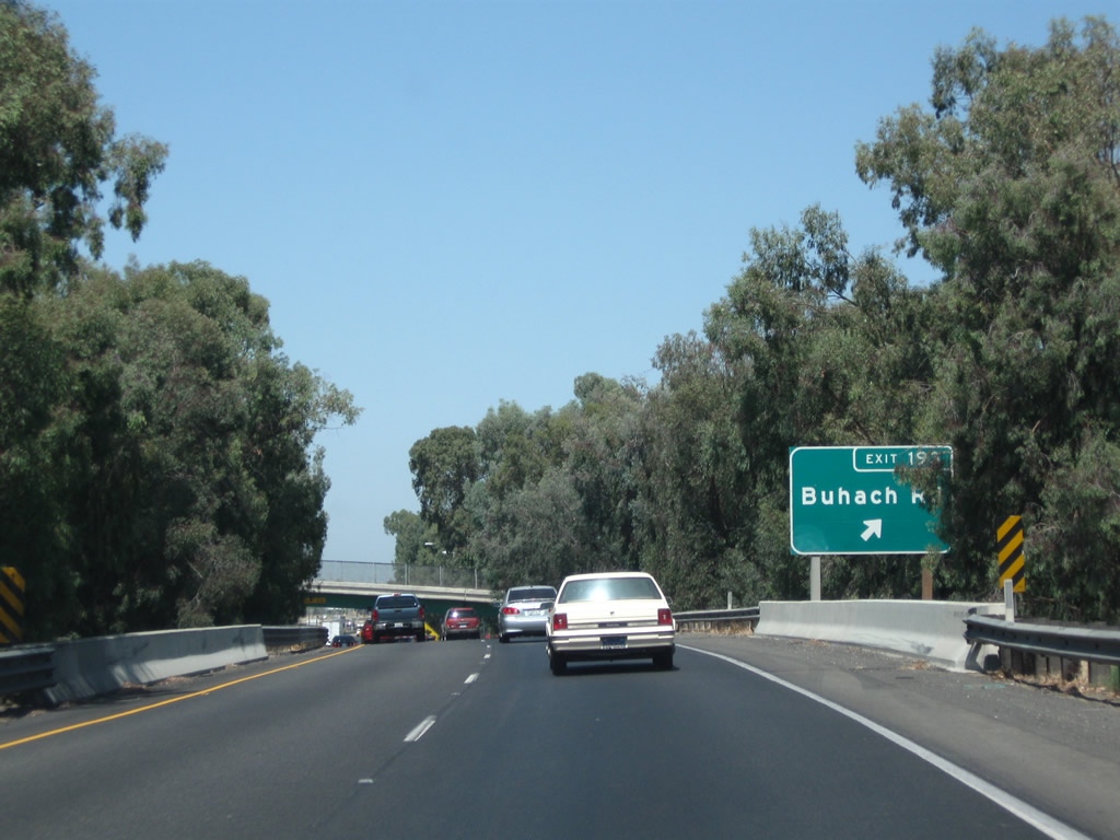
Northbound California 99 meets Exit 193, Atwater-Merced Expressway (formerly Buhach Road) to Castle Airport.
07/31/11
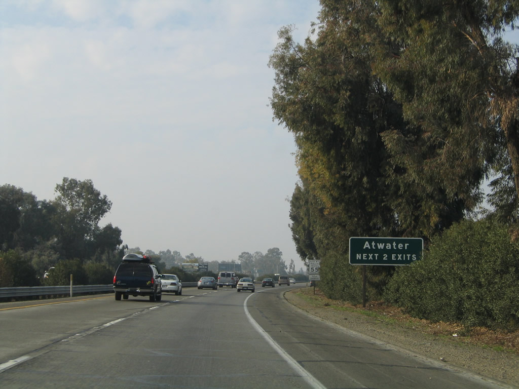
The next two exits along California 99 (Golden State Highway) north serve the city of Atwater: Exit 194, California 99 Business (Atwater Boulevard) north and Exit 195, Sycamore Avenue and Applegate Road.
11/25/04
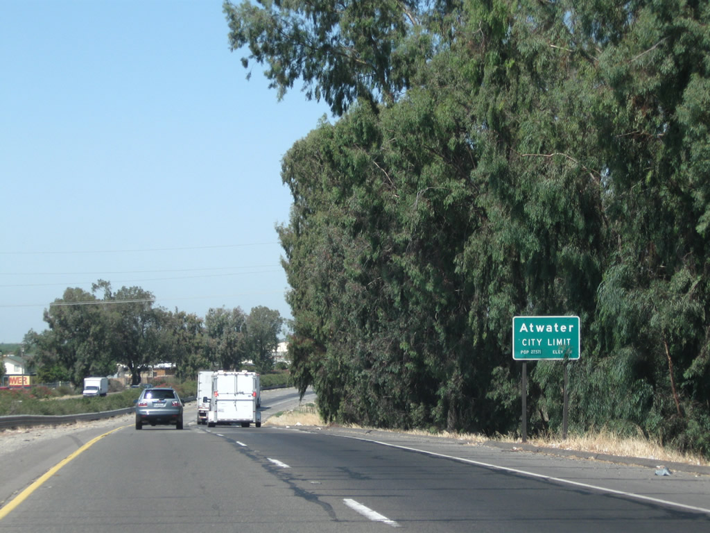
California 99 enters the city of Atwater ("Community Pride City Wide"), which had a population of 28,168 as of the 2010 Census and was incorporated on August 16, 1922.
07/31/11
Northbound California 99 (Golden State Highway) reaches Exit 194, California 99 Business (Atwater Boulevard) north. This "butterfly gantry" sign was unique in that the California 99 shields cover larger U.S. 99 shields; this sign was removed in mid-2015. California 99 Business will follow Atwater Boulevard north from this interchange and rejoins the freeway at Exit 196.
11/25/04
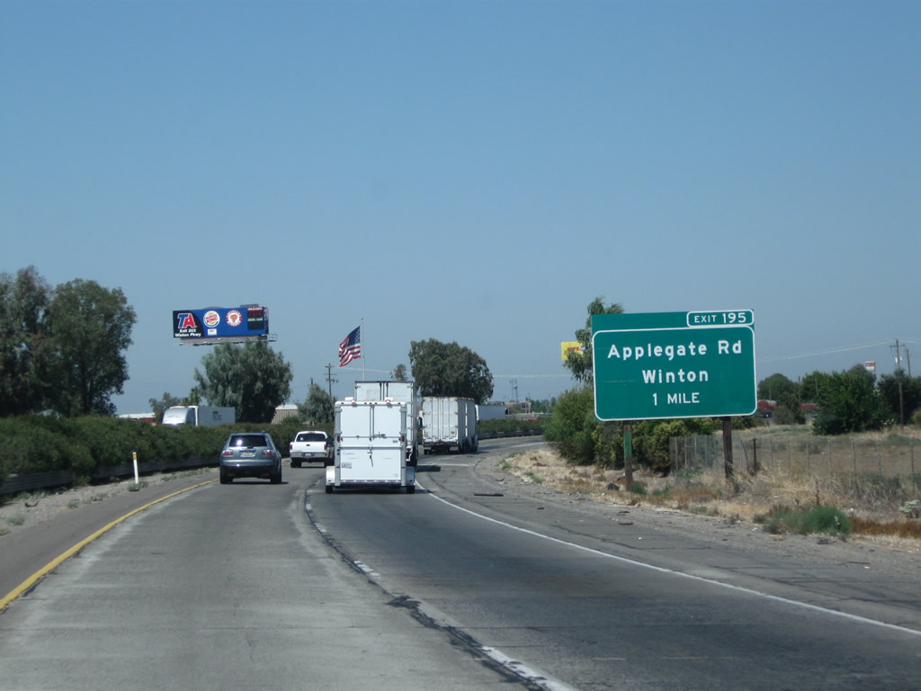
The next exit along California 99 (Golden State Highway) north is Exit 195, Sycamore Avenue and Applegate Road (one mile).
07/31/11
Use Applegate Road south to California 140 and north to Winton.
11/25/04
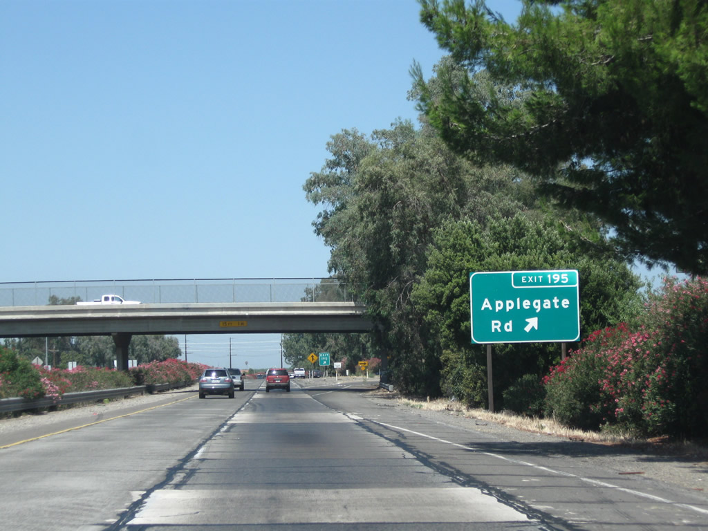
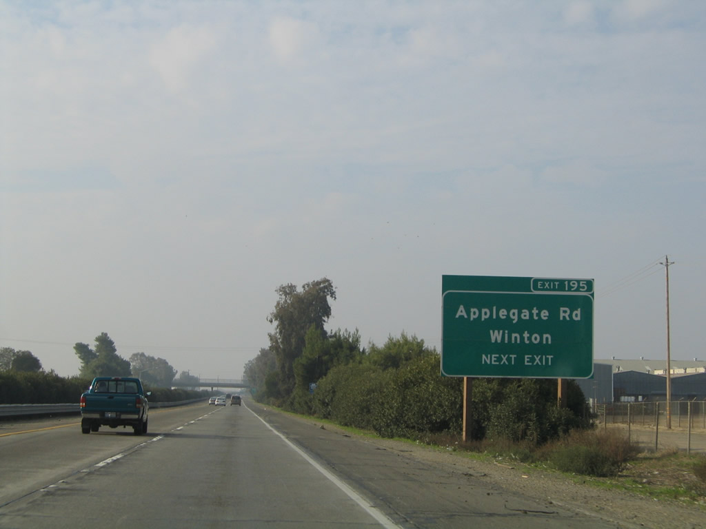
Northbound California 99 meets Exit 195, Applegate Road (the second Atwater exit). Applegate Road leads northeast to meet Merced County Route J-7 (Santa Fe Drive) in Winton. California 99 is angled in a northwesterly direction between Merced and Livingston via Atwater, then turns a bit more north around Turlock.
07/31/11
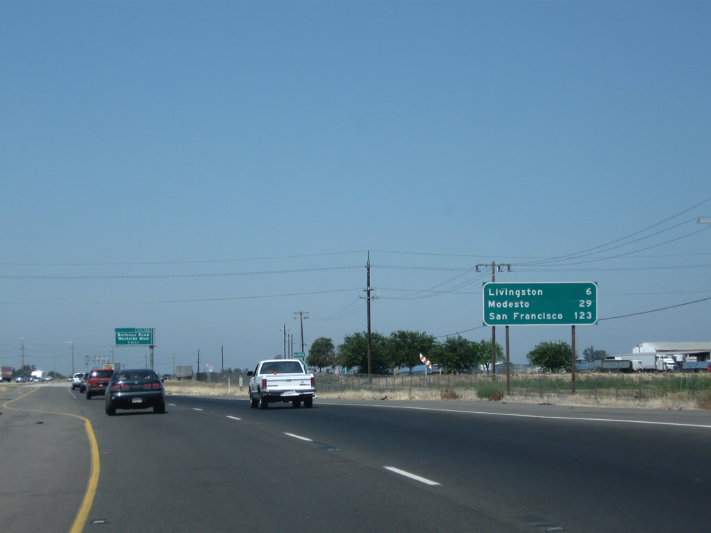
This mileage sign along California 99 north provides the distance to Livingston (six miles), Modesto (29 miles), and San Francisco (123 miles). Modesto and Sacramento, which appeared in the previous mileage sign, are omitted here.
07/31/11
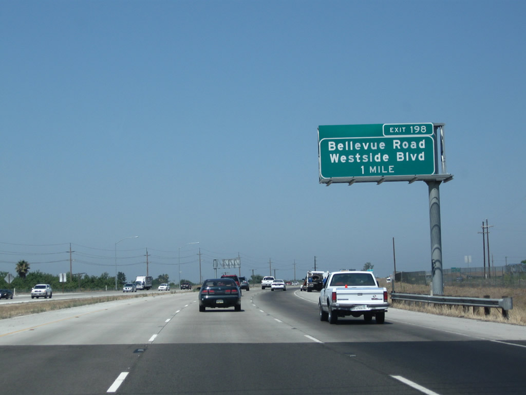
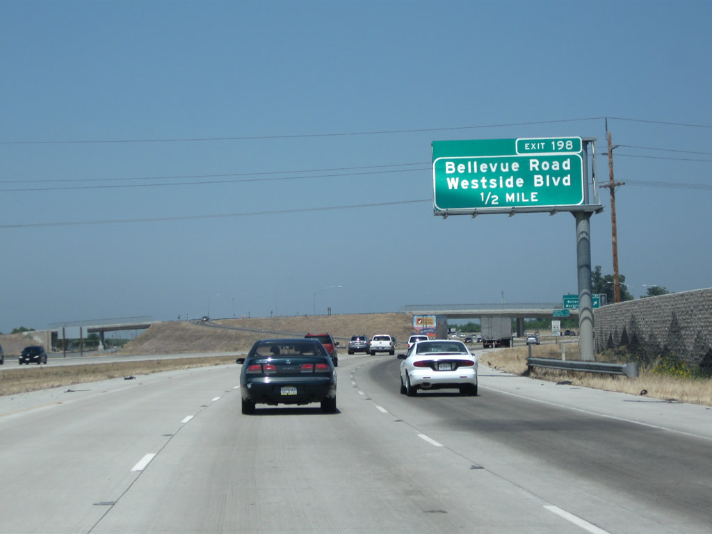
The next exit along California 99 north is Exit 198, Bellevue Avenue east and Merced County Route J-18 (Westside Boulevard) west across the Central Valley to meet Interstate 5 at the Stuhr Road interchange (Exit 423).
07/31/11
California 99 north approaches Exit 198, Bellevue Avenue east and Merced County Route J-18 (Westside Boulevard) west. Use Exit 198 to north-south Central Avenue, which used to intersect California 99 directly before the freeway was built.
07/31/11
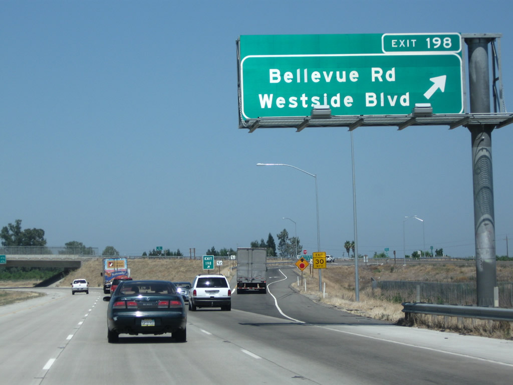
Northbound California 99 reaches Exit 198, Bellevue Avenue east and Merced County Route J-18 (Westside Boulevard) west. To Olive Avenue and Stein Avenue, use Bellevue Avenue east. Olive Avenue serves as the eastern frontage road as California 99 continues northwest (Olive Avenue changes into Campbell Boulevard northeast of here).
07/31/11
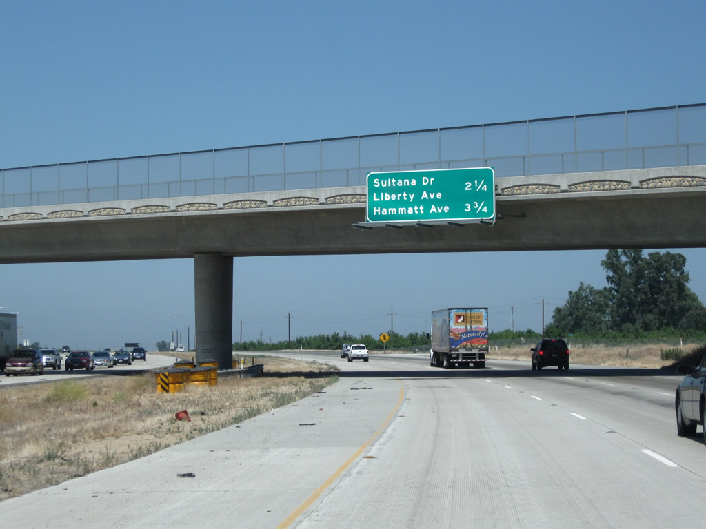
The next two exits along California 99 north are Exit 200, Sultana Drive and Liberty Avenue and Exit 201, Hammatt Avenue.
07/31/11
A California 99 north confirming marker is posted after the on-ramp from Westside Boulevard and Bellevue Avenue.
07/31/11
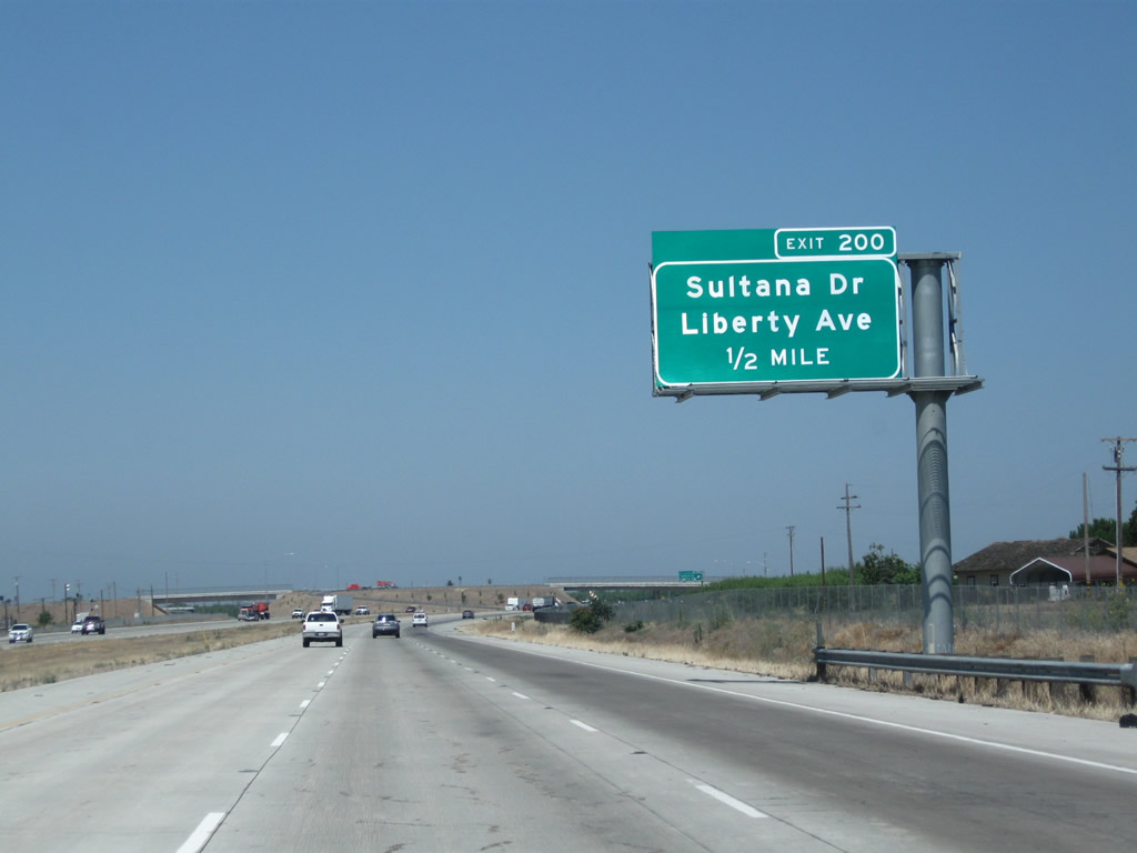
The next exit along California 99 north is Exit 200, Sultana Drive and Liberty Avenue. Use Exit 200 to Arena Way, Peach Avenue, and Hunter Road.
07/31/11
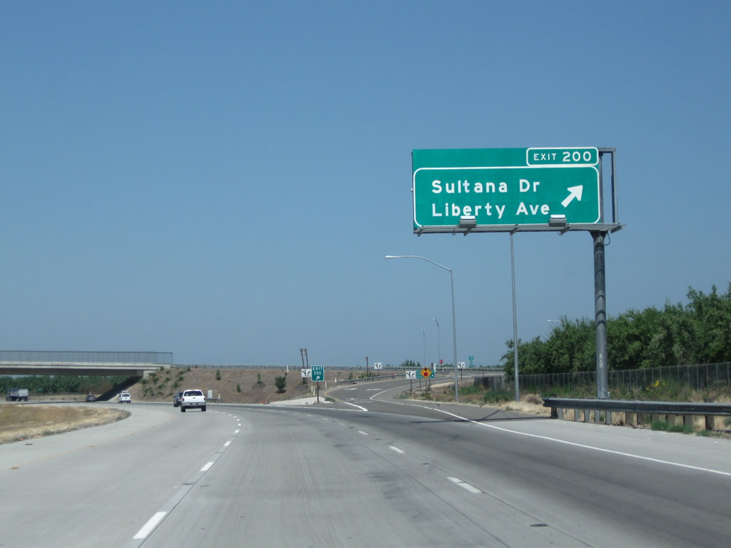
Northbound California 99 reaches Exit 200, Sultana Drive and Liberty Avenue.
07/31/11
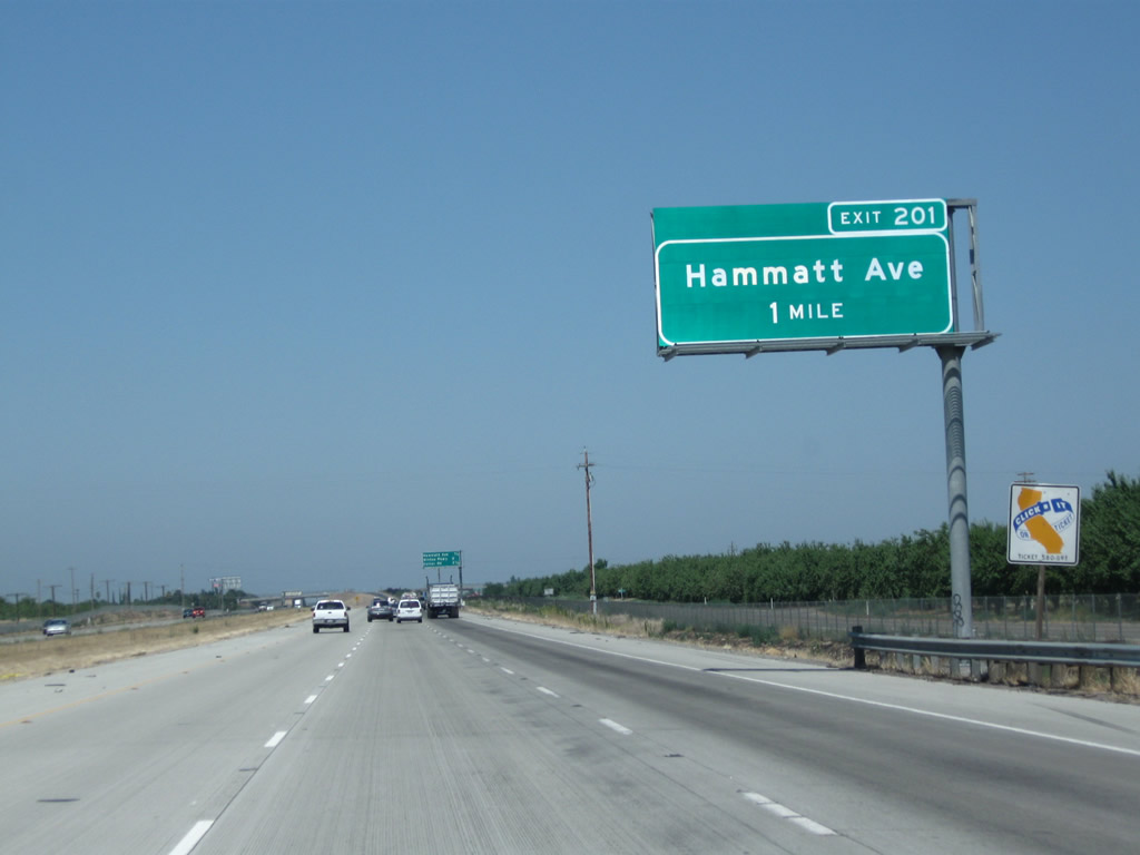
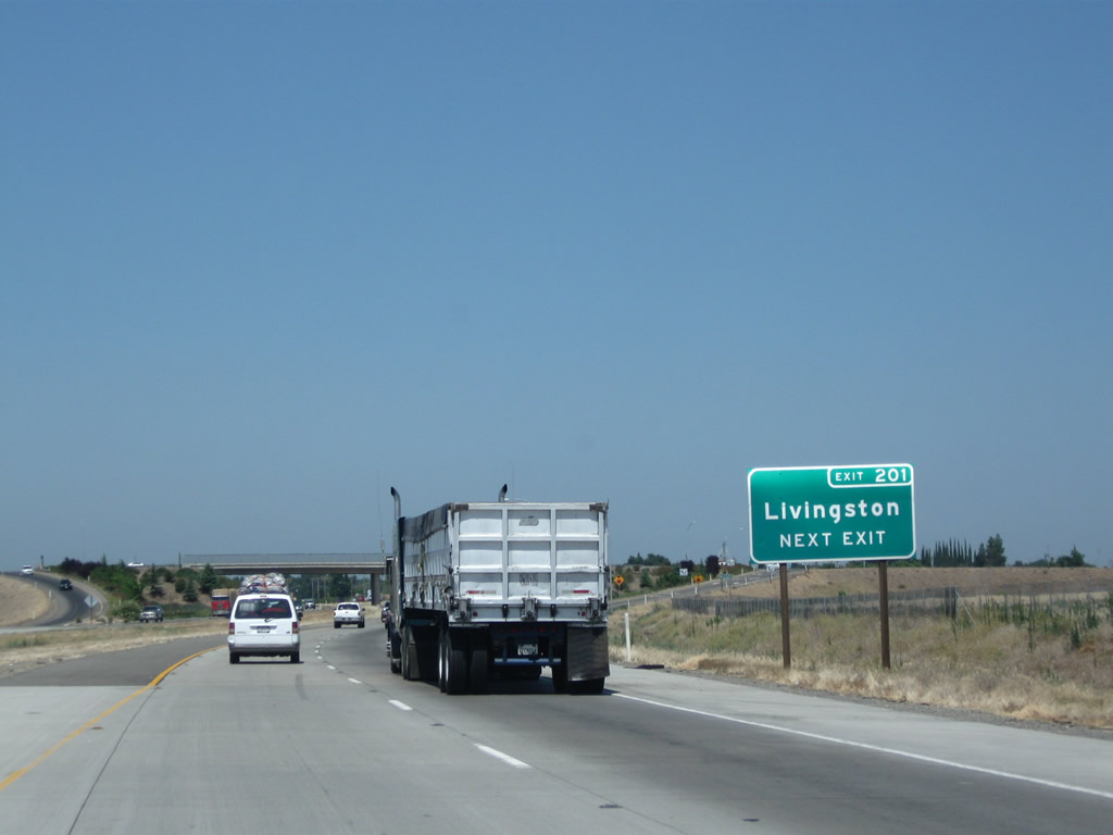
The next interchange along northbound California 99 is Exit 201, Hammatt Avenue (one mile).
07/31/11
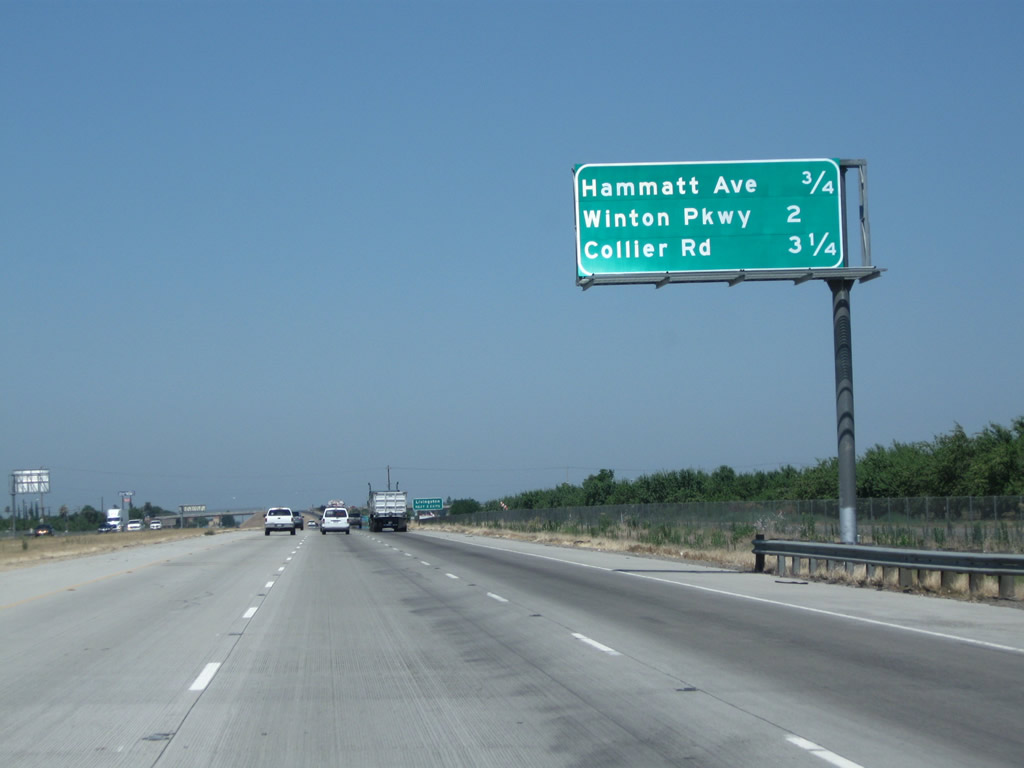
This interchange sequence sign provides the distance to the next three interchanges along northbound California 99: Exit 201, Hammatt Avenue; Exit 203, Winton Avenue; and Exit 204, Collier Avenue.
07/31/11
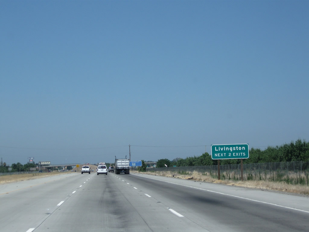
The next two interchanges (Exit 201, Hammatt Avenue and Exit 203, Winton Avenue) serve the city of Livingston.
07/31/11
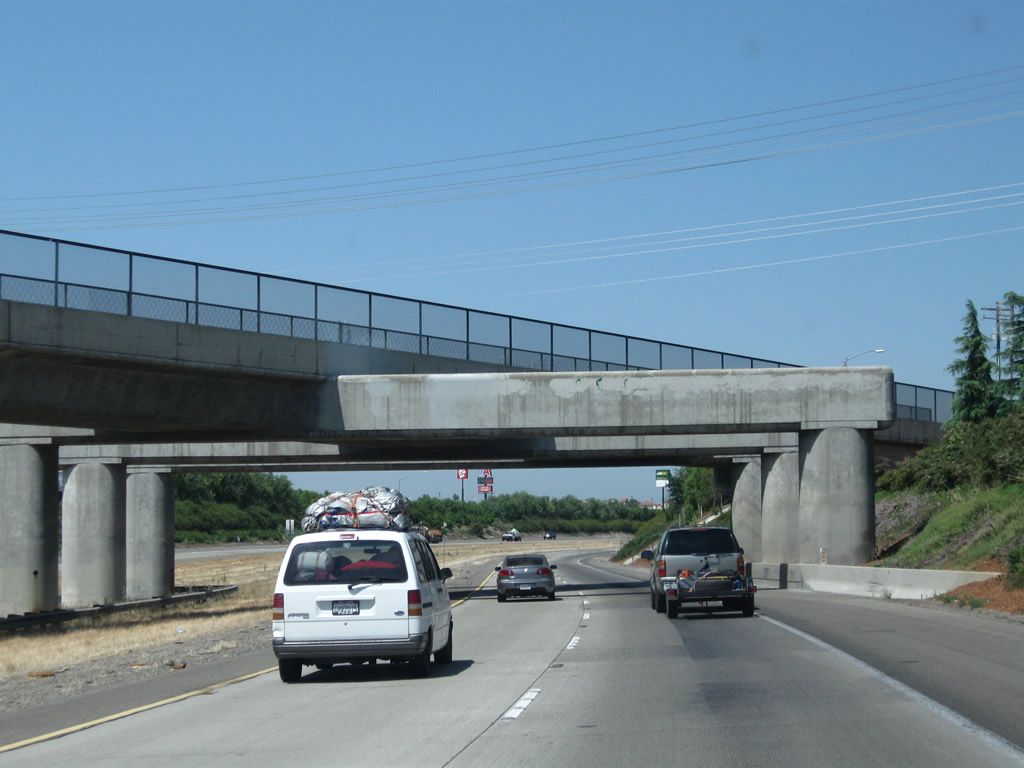
The six-lane segment of California 99 comes to an end just before the Hammatt Avenue off-ramp.
07/31/11
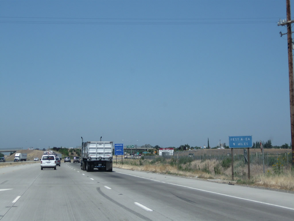
A rest area is nine miles ahead along California 99.
07/31/11
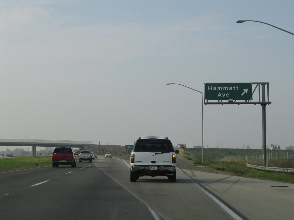
Northbound California 99 meets Exit 201, Hammatt Avenue to Livingston. Although there is no designated California 99 Business through Livingston, there are extant segments of Historic U.S. 99 in the city. Livingston was home to the last traffic signal located along the California 99 mainline between Wheeler Ridge and Sacramento. This signal was in place until around 1997, when a bypass was constructed to replace the traffic signal.
11/25/04
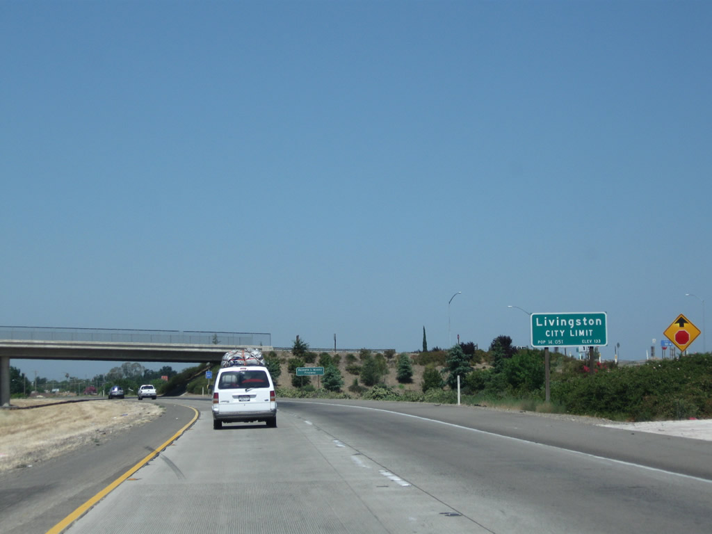
California 99 enters the city of Livingston ("The Last Stop"), which had a population of 13,058 as of the 2010 Census and was incorporated on September 11, 1922.
11/25/04
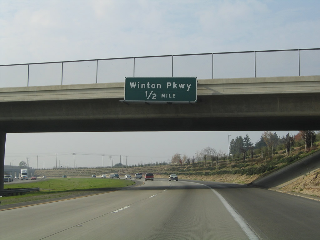
The next exit along California 99 north is Exit 203, Winton Avenue (one-half mile).
11/25/04
This unusual bridge allows the railroad to pass over California 99.
07/31/11
Northbound California 99 meets Exit 203, Winton Avenue. Connections may be made from Winton Avenue east to Livingston-Cressey Road en route to the McConnell State Recreation Area along the Merced River and the community of Cressey at Merced County Route J-7 (Santa Fe Drive). Gas and food are available at this interchange.
07/31/11
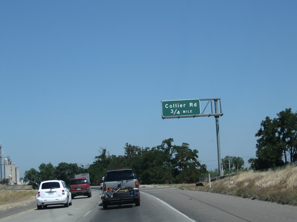
The next exit along California 99 north is Exit 204, Collier Avenue (0.75 mile).
07/31/11
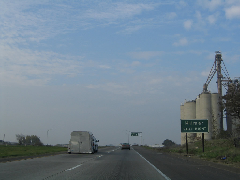
The grain elevator to the east of California 99 indicates how agricultural the Central Valley is. Use Collier Avenue to the unincorporated community of Hilmar.
11/25/04
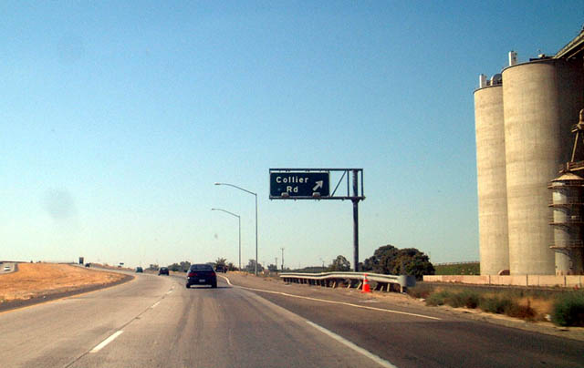
Northbound California 99 reaches Exit 204, Collier Avenue.
08/15/03
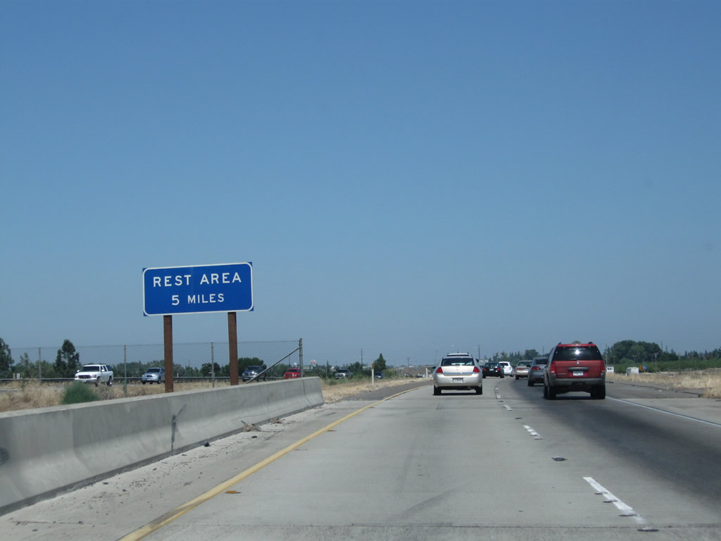
Continue north along California 99 for a rest area five miles ahead.
07/31/11
References:
Atwater-Merced Expressway Opens Up to Drivers, and Business Opportunities to City. (2015, June 24). YourCentralValley.com.
Atwater-Merced Expressway Project moves ahead; opens door for Ferrari Ranch development. (2015, February 20). Merced Sun Star.
Photo Credits:
- Andy Field: 08/15/03, 11/25/04, 07/31/11
Connect with:
Page Updated Sunday October 11, 2015.