
State Route 99 North - Manteca to Stockton
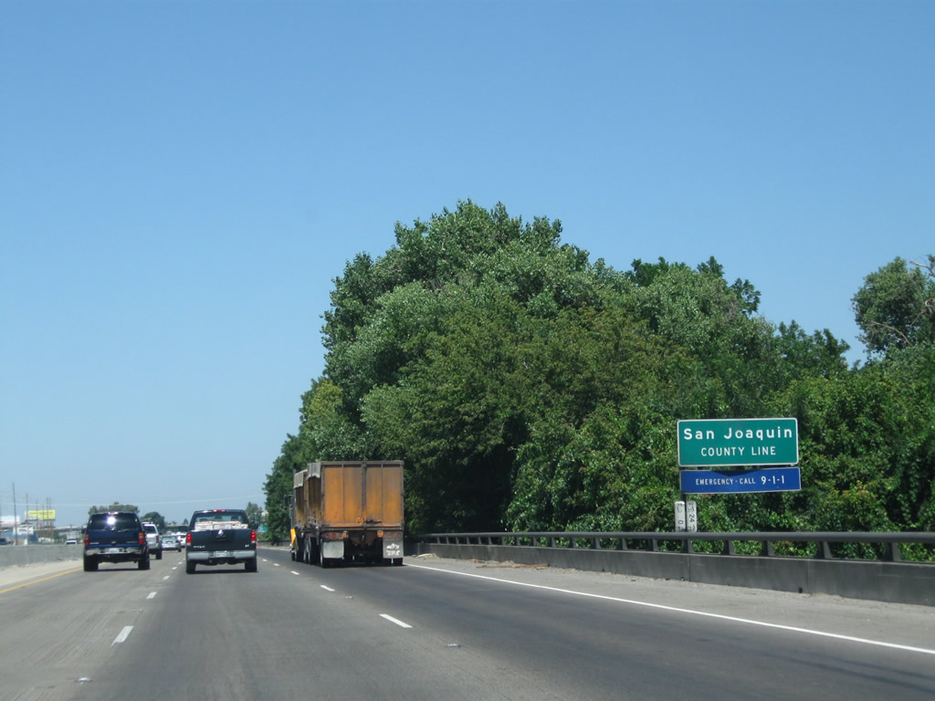
California 99 leaves Stanislaus County and enters San Joaquin County as the freeway crosses over the Stanislaus River, a major tributary of the San Joaquin River.
07/31/11
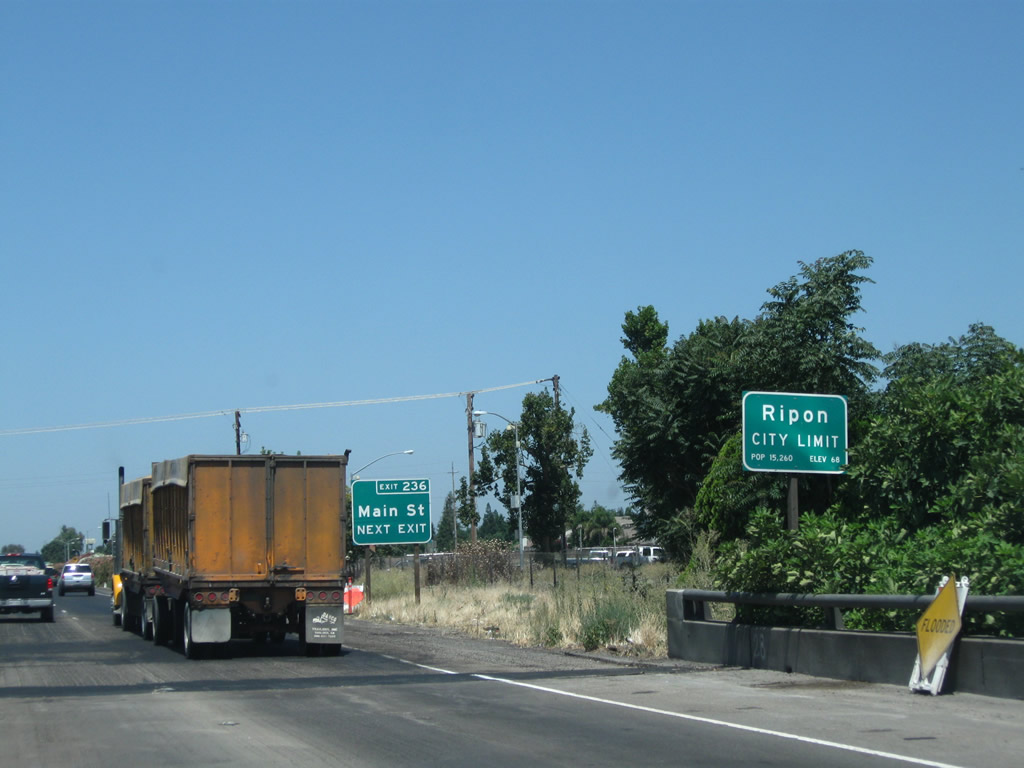
Northbound California 99 enters the city of Ripon ("The Jewel of the Valley") and approaches Exit 236, Main Street, which essentially serves as a business spur from California 99 into downtown Ripon. The city of Ripon had a population of 14,297 as of the 2010 Census and was incorporated on November 27, 1945.
07/31/11
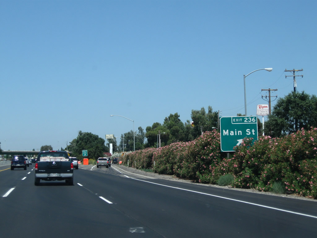
Northbound California 99 meets Exit 236, Main Street in Ripon.
07/31/11

The next exit along northbound is Exit 237A, Milgen Avenue in Ripon (0.75 mile).
07/31/11

Northbound California 99 reaches Exit 237A, Milgen Avenue.
07/31/11
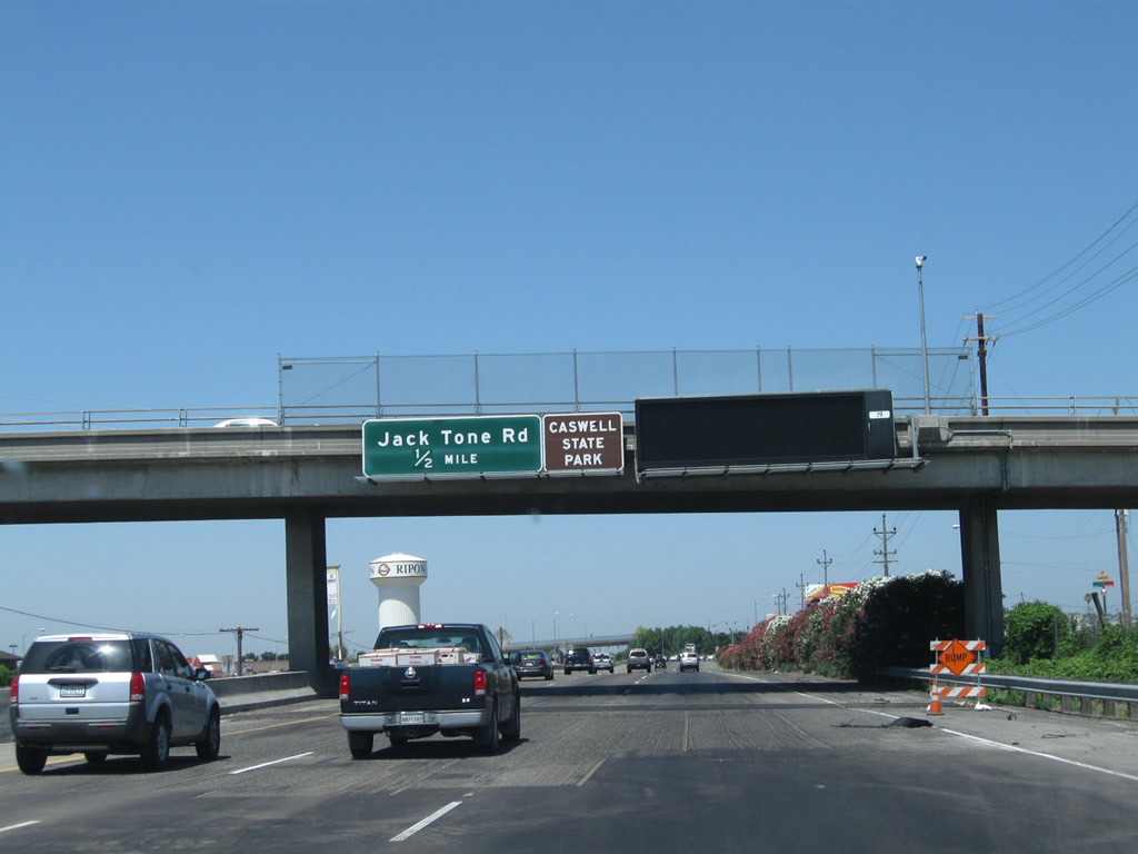
The next exit along California 99 north is Exit 237B, San Joaquin County Route J-5 (Jack Tone Road) and Colony Road. San Joaquin County Route J-5 leads north from this intersection to Five Corners, Lockeford, and Clay.
07/31/11

Northbound California 99 meets Exit 237B, San Joaquin County Route J-5 (Jack Tone Road). Most motorist services (gas, food) are available at this interchange in north Ripon.
07/31/11

A plethora of service signs are posted overhead at Jack Tone Road interchange.
07/31/11
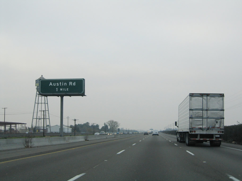
The next exit along California 99 north is Exit 240, Austin Road (one mile).
11/25/04
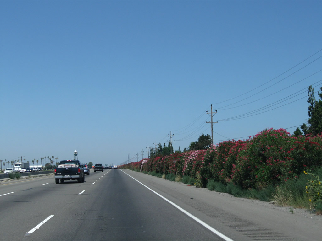
Colorful yet poisonous oleander lines the east side of the California 99 freeway between Jack Tone Road and Austin Road.
07/31/11
A mileage sign along California 99 north provides the distance to Exit 241, California 120 freeway west to Manteca, Tracy, and San Francisco and Exit 242, California 120 east to Oakdale and Sonora. Omitted from this sign is Exit 240, Austin Road.
11/25/04
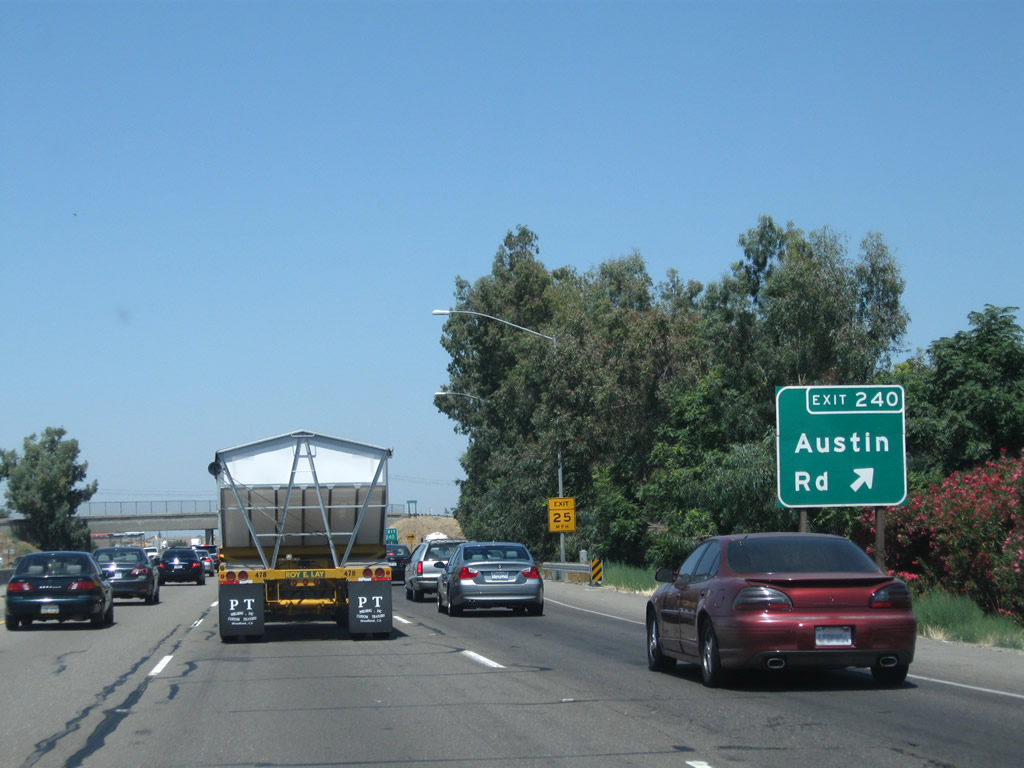
Northbound California 99 reaches Exit 240, Austin Road.
07/31/11
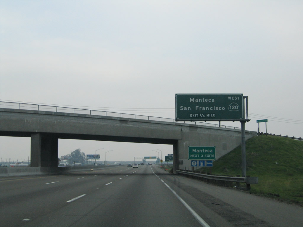
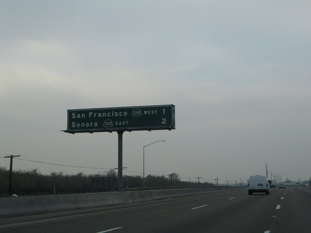
The next exit along California 99 north is Exit 241, California 120 west to Manteca, Tracy, Livermore, Dublin, Hayward, Oakland, and San Francisco. California 120 only makes it as far west as Manteca; the route does not directly serve the other locations leading into the Bay Area. San Francisco is reached via a combination of California 120, Interstate 205, Interstate 580, and Interstate 80. Use Exit 242 for California 120 east to Sonora.
11/25/04

California 120 is a major east-west corridor across central California. After passing this interchange, eastbound California 120 merges onto northbound California 99, albeit briefly. Use California 120 west to San Francisco and all Bay Area destinations.
11/25/04

Northbound California 99 meets Exit 241, California 120 freeway west to Manteca and San Francisco. Use California 120 west to Interstate 5, Interstate 205, Business Loop I-205/Historic U.S. 50, and Interstate 580.
07/31/11

California 99 northbound and California 120 eastbound are cosigned briefly before California 120 heads east on Yosemite Avenue.
07/31/11
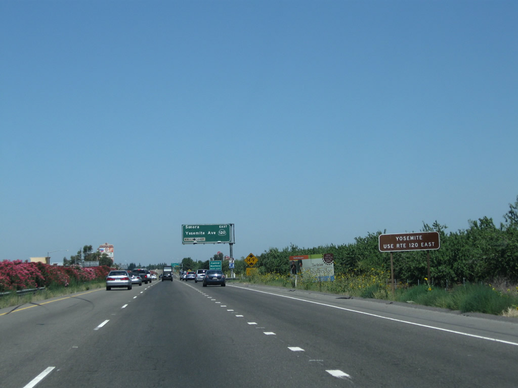
Use California 120 east to Yosemite National Park. California 120 forms the northern entrance into the park, while California 140 is the central entrance and California 41 is the southern entrance. Only California 120 survives to exit the park at the east end and descends from Tioga Pass to meet U.S. 395 near Lee Vining and ultimately U.S. 6 in Benton near the Nevada state line.
07/31/11
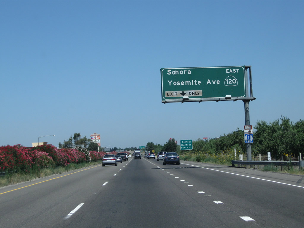
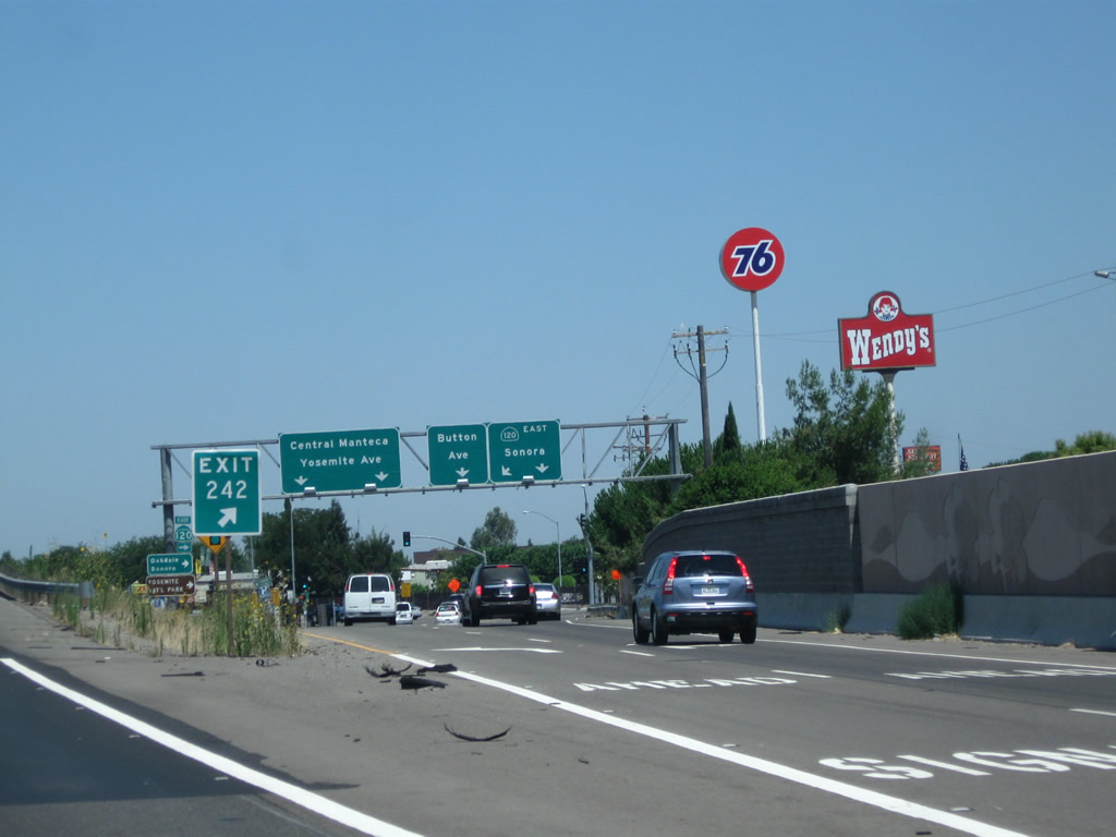
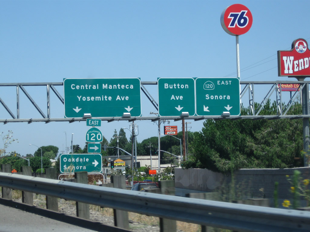
The right lane must exit onto eastbound California 120 (Exit 242). California 120 (Yosemite Avenue) leads to the Sierra Nevada Foothills and Yosemite National Park via Simms, Escalon, Oakdale, Knights Ferry, Chinese Camp, and Groveland. In the summer months, California 120 is open across Tioga Pass before meeting U.S. 395 near Lee Vining in the Eastern Sierra.
08/22/03
Use Yosemite Avenue (Old California 120) west into downtown Manteca. Yosemite Avenue is not a designated business route of California 120, but it does follow the original route through town, reconnecting with California 120 at Exit 1 just east of Interstate 5.
07/31/11

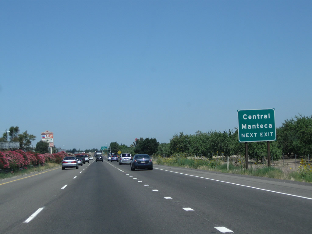
Northbound California 99 reaches Exit 242, California 120 (Yosemite Avenue) east to Oakdale and Sonora and west to downtown Manteca.
07/31/11
The off-ramp from California 99 north to Exit 242, California 120 (Yosemite Avenue) was expanded to allow for two lanes to connect to California 120 east.
07/31/11
Most motorist services (gas, food) are available at Exit 242, California 120 (Yosemite Avenue) in Manteca.
07/31/11
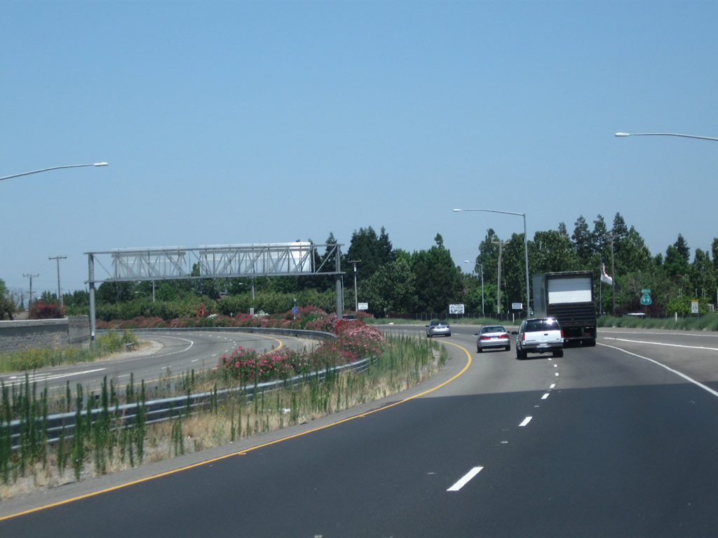
California 99 curves to the northwest as it passes through the Exit 242 interchange (California 120 (Yosemite Avenue) in Manteca.
07/31/11
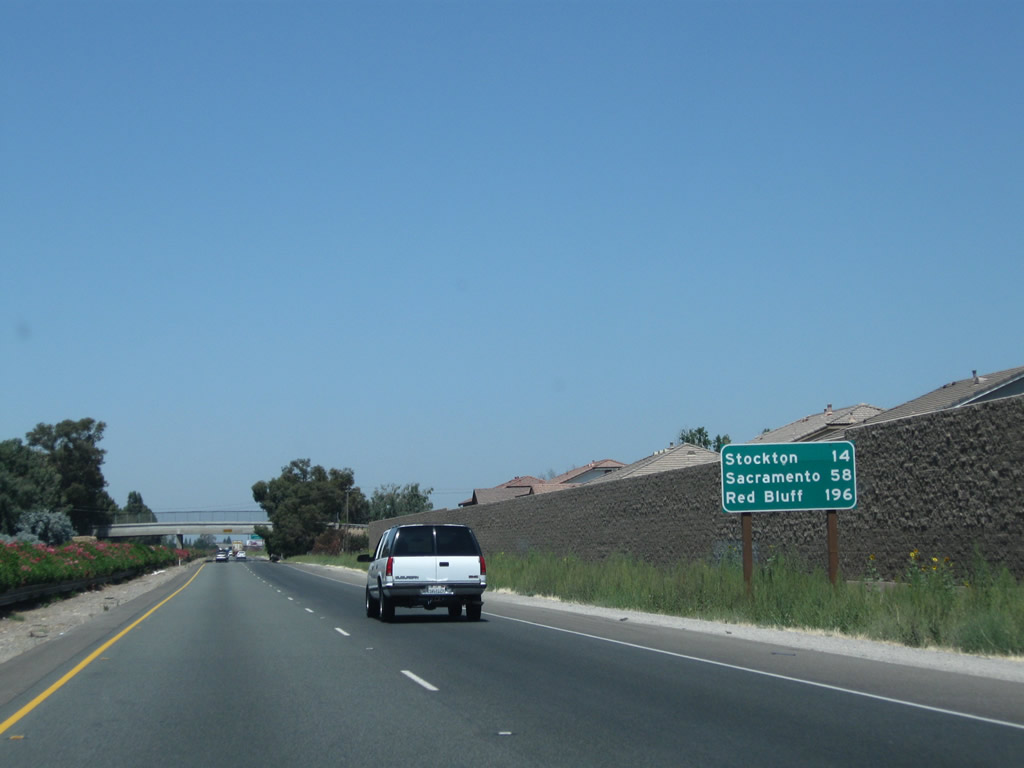
Leaving California 120 (Yosemite Avenue) behind, this mileage sign along California 99 north provides the distance to Stockton (14 miles), Sacramento (58 miles), and Red Bluff (196 miles).
07/31/11

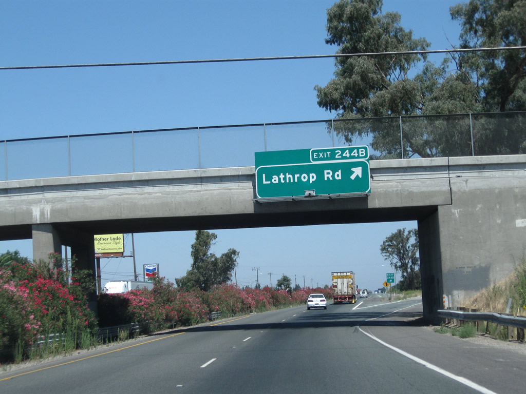
The next exit along California 99 north is Exit 244B, Lathrop Road (one mile). Exit 244A to Main Street south is not accessible from northbound California 99.
07/31/11

The next exit along California 99 north is Exit 244B, Lathrop Road, next right. Note the use of exit numbers on this series of new signs.
07/31/11
Northbound California 99 meets Exit 244B, Lathrop Road. Lathrop Road leads west to Lathrop and Interstate 5; it leads east to Austin Road.
07/31/11

The next exit along northbound is Exit 246, San Joaquin County Route J-9 (French Camp Road) in one mile.
07/31/11

San Joaquin County Route J-9 is a diagonal route, connecting California 99 with Five Corners and Simms (California 120) to the southeast and French Camp and Interstate 5 to the northwest.
07/31/11
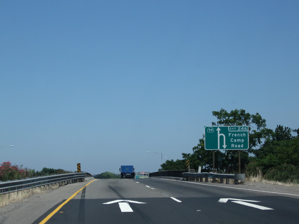
This unique diagrammatic sign is used for the exit from northbound California 99 to San Joaquin County Route J-9 (French Camp Road) (Exit 246).
07/31/11

Northbound California 99 reaches Exit 246, San Joaquin County Route J-9 (French Camp Road). A nice view looks north along the 99 freeway.
07/31/11

The next exit along northbound California 99 is Exit 248, which connects to Kingsley Road (the frontage road). There are several exits along this stretch of California 99 that connect to the frontage road, which occasionally was the original alignment of old U.S. 99. This is a substandard exit that would need to be reconfigured to meet today's Interstate standards.
07/31/11

There is no deceleration lane for the "off-ramp" to Kingsley Road (the frontage road, which really is a hard, 90-degree right turn).
07/31/11
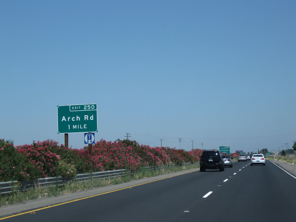
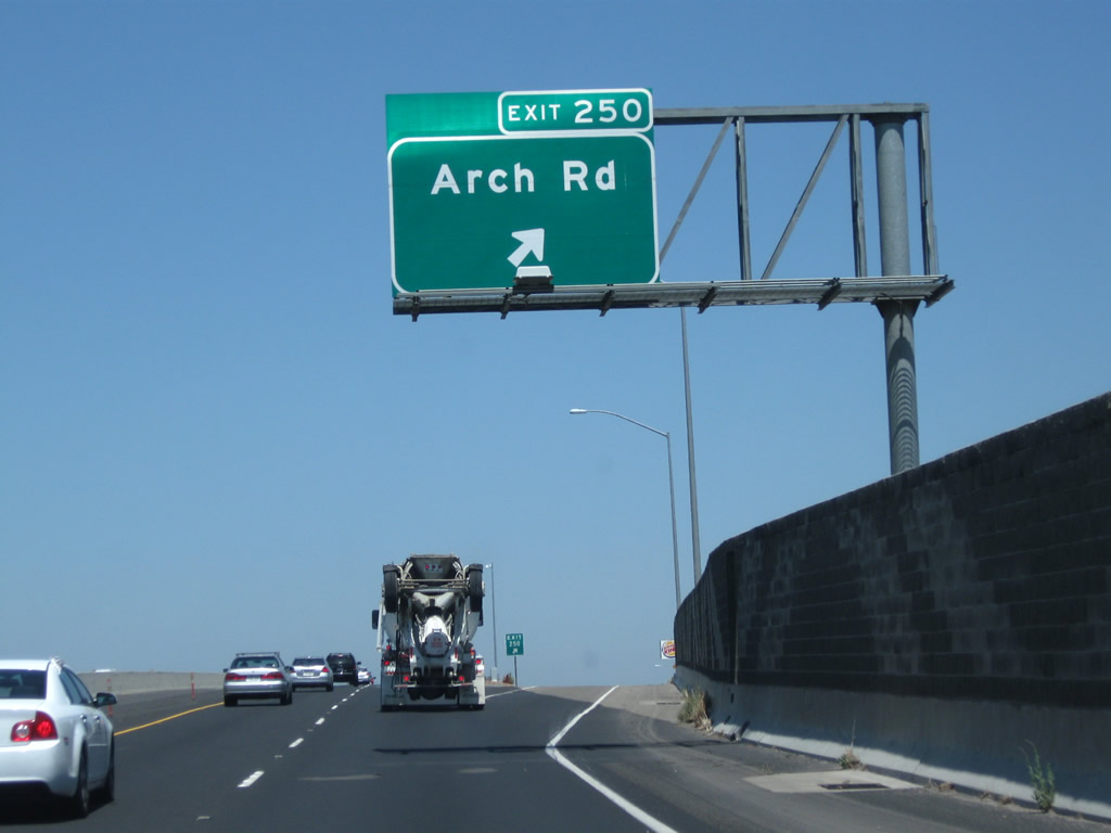
The next exit along California 99 north is Exit 250, Arch Road, one mile. This is a single-point urban interchange (one of the few along California 99), and it is the first to serve the city of Stockton. Interchange improvements were completed here in 2003-2004.
07/31/11
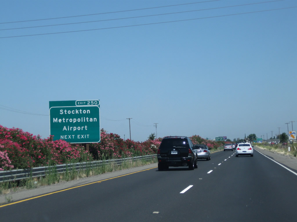
Use Arch Airport Road west to Stockton Metropolitan Airport. A proposed California state route is defined legislatively as California 234 but has not been constructed. California 234 is proposed to run east-west between California 99 and Interstate 5 along either Arch Airport Road or San Joaquin County Route J-8 (French Camp Road). However, there are no active plans to construct this route.
07/31/11
Arch Airport Road travels west to Stockton Metropolitan Airport, and Arch Road travels east to Austin Road (which connects to Mariposa Road).
07/31/11

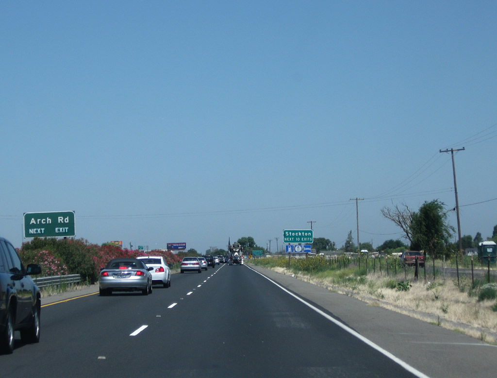
The next 10 exits along California 99 serve the city of Stockton.
07/31/11
Northbound California 99 meets Exit 250 to Arch Road.
07/31/11
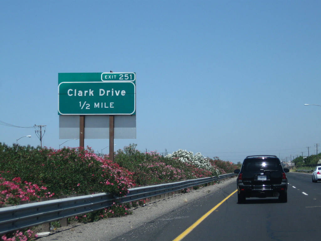
The next exit along California 99 north is Exit 251, Clark Drive, next right.
07/31/11
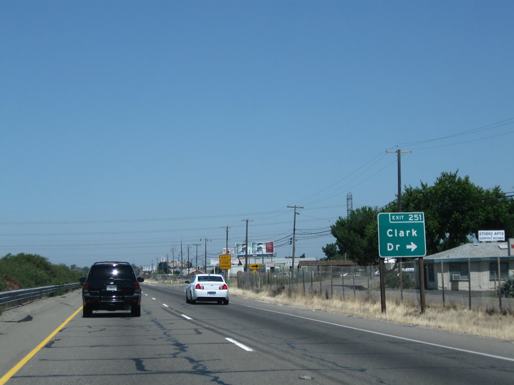
Northbound California 99 meets Exit 251, Clark Drive. If California 99 were to be upgraded to Interstate standards, sharp right turn exits such as this one may have to be upgraded to modern standards.
07/31/11
Exiting traffic will have to stop upon leaving the freeway.
07/31/11
Clark Drive travels east from the interchange and connects to the 99 Frontage Road on the east side of the freeway.
07/31/11
The next exit along northbound California 99 is Exit 252A, California 99 Business and San Joaquin County Route J-7 (Mariposa Road). San Joaquin County Route J-7 and California 99 Business lead northwest into Stockton; San Joaquin County Route J-7 leads southeast toward Escalon, Riverbank, and Empire. Use California 99 Business (Mariposa Road) north to California 4 Business west.
08/22/03
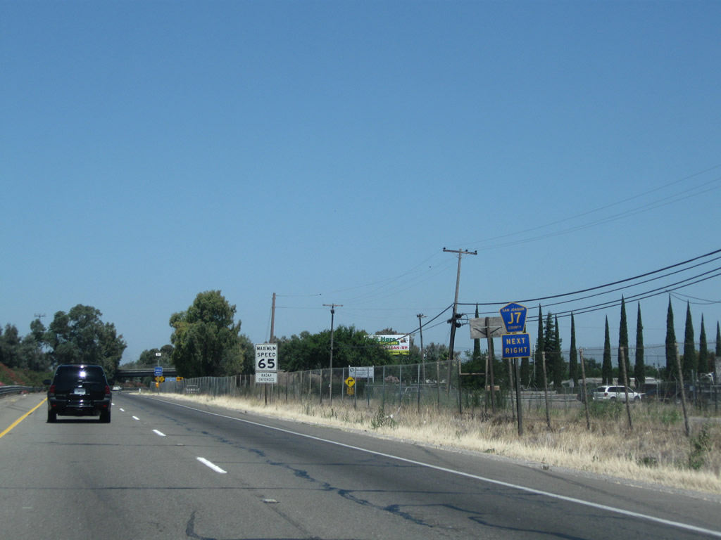
This advance marker for San Joaquin County Route J-7 is a standard advance shield, placed separately from the overhead guide sign.
07/31/11
Mariposa Road serves as the southernmost segment of the business route for California 99. It is unusual to see business route signs that feature shields on the freeway; the normal standard is for such signage to be text only. Notably, this sign mentions California 4 Business; since California 4 was rerouted onto the Crosstown Expressway, a business route was commissioned along its original route via Charter Way. Following northbound California 99 Business and San Joaquin County Route J-7 connects with Charter Way as a more direct route to California 4 Business (Charter Way). This sign was gone by 2011.
08/22/03
Northbound California 99 meets Exit 252A, California 99 Business (Mariposa Road) north and San Joaquin County Route J-7 (Mariposa Road) south. J-7 is a long county route that extends from Stockton southeast to California 59 near Merced. The next exit along California 99 north is Exit 252B, California 4 (Farmington Road) east and California 4 Business (Farmington Road) west.
07/31/11
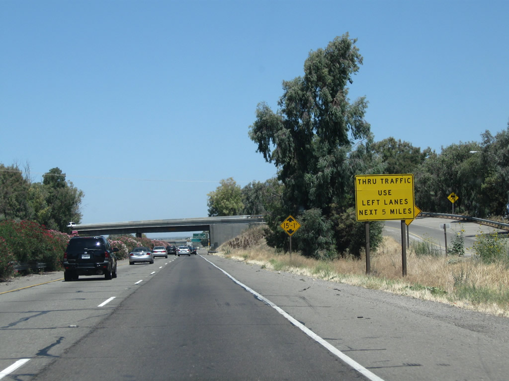
Due to high entering/exiting traffic volume along California 99 north, through traffic is advised to use the left lane. The city of Stockton is the seat of San Joaquin County and had a population of 291,707 as of the 2010 Census. Stockton was incorporated on July 23, 1850, and sits on the eastern edge of the California Delta, with a deep water port near Interstate 5 and California 4. This city was hit hard by the foreclosure crisis that began in 2007 and reduced property values substantially through 2010.
07/31/11

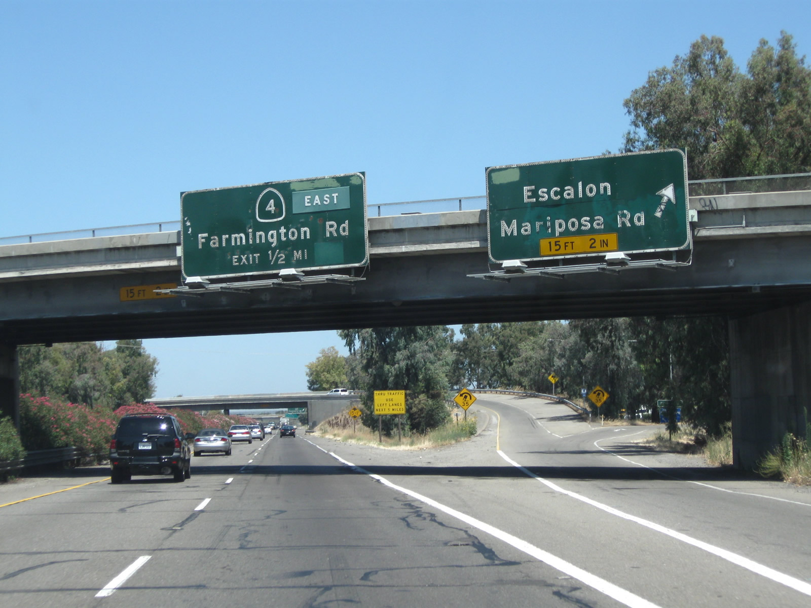
Immediately thereafter, northbound California 99 meets Exit 252B, California 4 (Farmington Road) east to Farmington, Copperopolis, Angels Camp, Murphys, and Arnold. California 4 Business (Farmington Road) (which was signed in 2003 but appears to be unsigned as of 2011) travels west from this interchange to meet Mariposa Road.
08/22/03
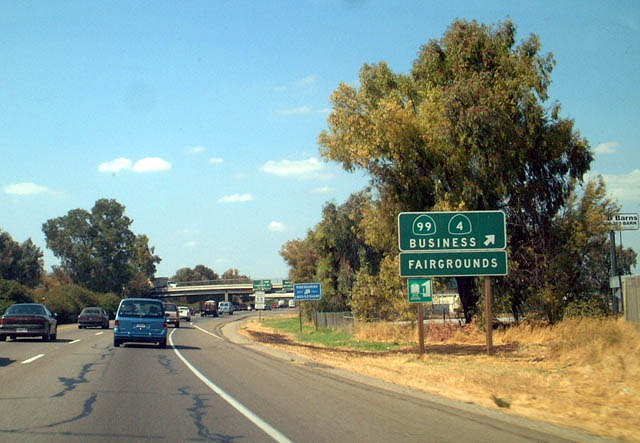
As traffic from California 4 west merges onto California 99 north, this mileage sign provides the distance to the next three exits: Exit 253, Main Street; Exit 254A, California 4 (Crosstown Freeway) west, and Exit 254B, California 26 (Fremont Street) east. If the Crosstown Freeway is extended east of California 99 someday, California 4 would be rerouted onto that freeway, and the existing sections on Farmington Road would likely become part of California 4 Business.
07/31/11
A California 99 north reassurance shield is posted shortly thereafter.
07/31/11

Main Street is the next exit along northbound (Exit 253). Farmington Road (which carries California 4 into Stockton from the east) becomes Main Street upon entering the city. Taking this exit westbound follows California 4 Business into Stockton, and it connects with Charter Way and California 99 Business just west of here.
07/31/11

California State University-Stanislaus has a campus in Stockton, but this sign is interesting for omitted the state shield outline around the "4."
07/31/11

Northbound California 99 reaches Exit 253, Main Street. The following off-ramp is Exit 254A, California 4 (Crosstown Freeway) west to Antioch and Concord. If California 99 is upgraded into Interstate 9, that route may turn west onto California 4 to end at Interstate 5.
07/31/11

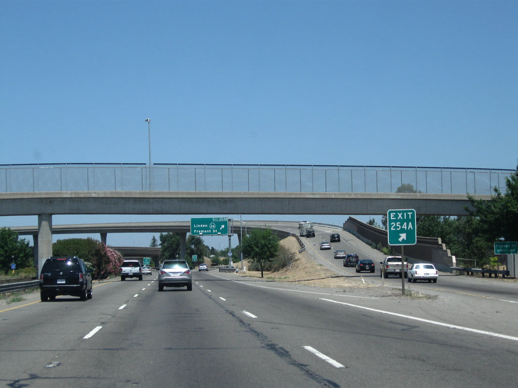
The next exit along California 99 north is Exit 254A, California 4 (Crosstown Freeway) west, followed by Exit 254B, California 26 (Fremont Street) east to Linden, Valley Springs, and Mokelumne Hill.
07/31/11
Northbound California 99 reaches Exit 254A, California 4 (Crosstown Freeway) west to Interstate 5. The California 4 east-west freeway across Stockton was constructed in the early 1990s, opening in 1994. It is officially known as the Ort Loftus Freeway. The freeway may be extended east to connect with Farmington Road (thus expanding this interchange) and extended west, perhaps as part of an upgrade of the entire California 4 corridor between Stockton and Antioch to expressway or even freeway standards over time. This picture shows northbound California 99 at the interchange with California 4, which mentions its connection to Interstate 5 west of here.
07/31/11
Two lanes transition from California 99 north to California 4 west. The left three lanes continue north.
07/31/11
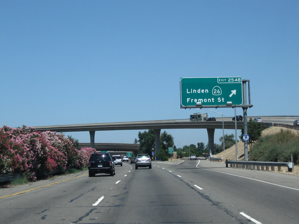
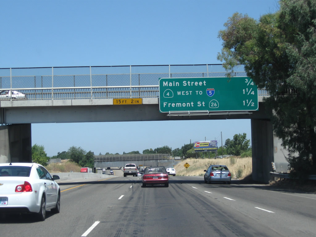
Immediately thereafter, California 99 north meets Exit 254B, California 26 (Fremont Street) east. This is the first two exits that connect to California 26 and Fremont Street.
07/31/11

The next exit along California 99 north is Exit 254C, Fremont Street west and California 26 (Fremont Street) east (again). California 26 was known as California 8 until 1964, when it was renumbered to avoid route number duplication with newly designated Interstate 8 in Southern California.
07/31/11

The right lane of California 99 north becomes exit only for Exit 254C, California 26 (Fremont Street). This second exit allows traffic from California 4 east to access California 26 east. This interchange serves as the western end of California 26. Fremont Street west of here is not part of the state highway system. Fremont Street enters the city center of Stockton, connecting to California 99 Business near downtown.
07/31/11
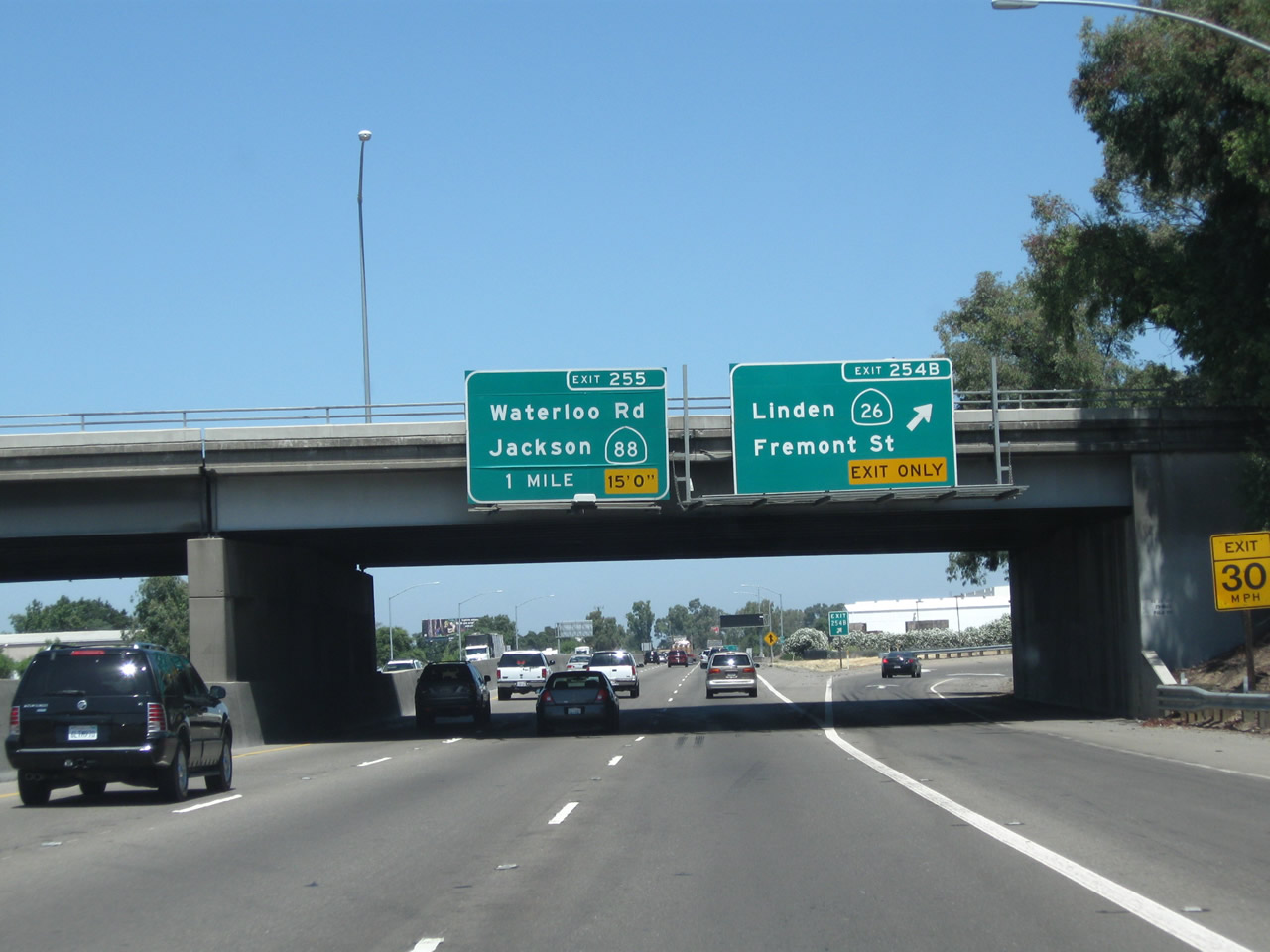
Northbound California 99 reaches Exit 254C, Fremont Street west and California 26 (Fremont Street) east. The next exit along California 99 north is Exit 255, California 88 (Waterloo Road).
07/31/11

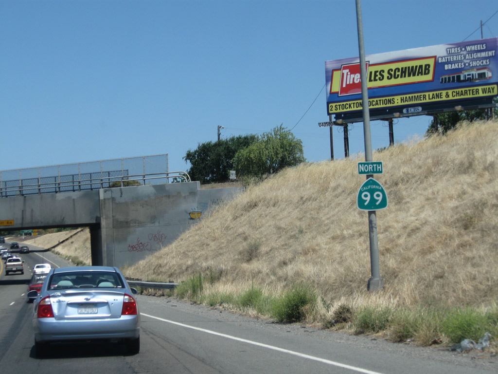
This mileage sign along California 99 north provides the distance to the next three exits: Exit 255, California 88 (Waterloo Road) east and Waterloo Road west; Exit 256, Cherokee Road; and Exit 258, San Joaquin County Route J-8 (Hammer Lane). Exit 257 (a frontage road off-ramp) no longer exists.
07/31/11

California 88 is a major east-west state route that travels northeast toward the Sierra Nevada via Jackson in the foothills, taking Carson Pass over the top en route to Gardnerville, Nevada, and U.S. 395.
07/31/11
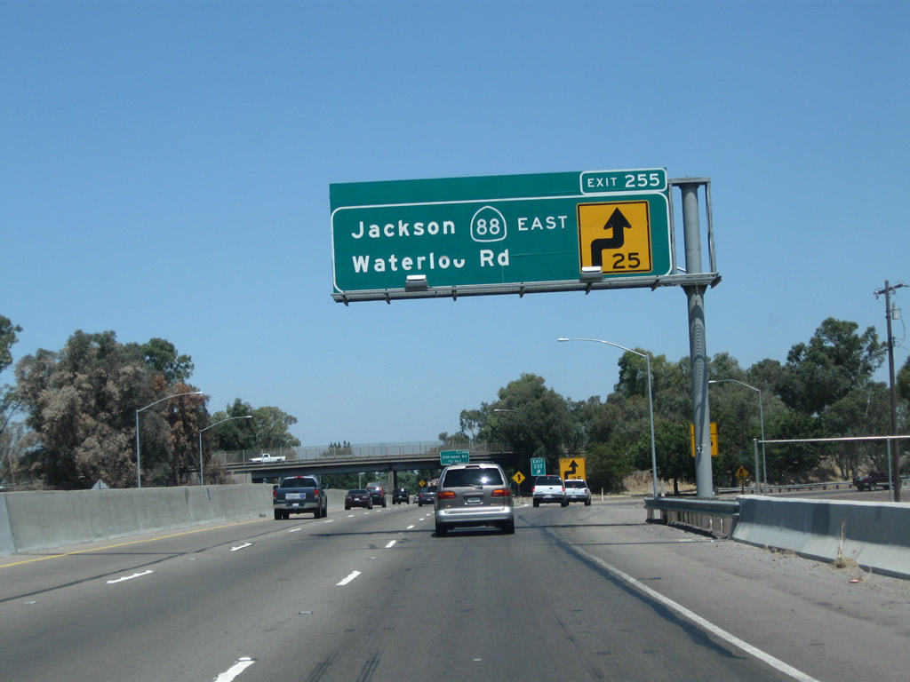
Northbound California 99 meets Exit 255, California 88 (Waterloo Road) east. California 88 leads northeast along an all-weather road across the Sierra Nevada, culminating at U.S. 395 in Minden, Nevada.
07/31/11

The next exit along California 99 north is Exit 256, Cherokee Lane.
07/31/11
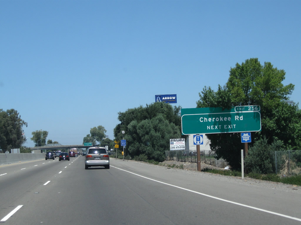
Cherokee Road parallels California 88 on a northeasterly trajectory between California 99 and Alpine Road.
07/31/11
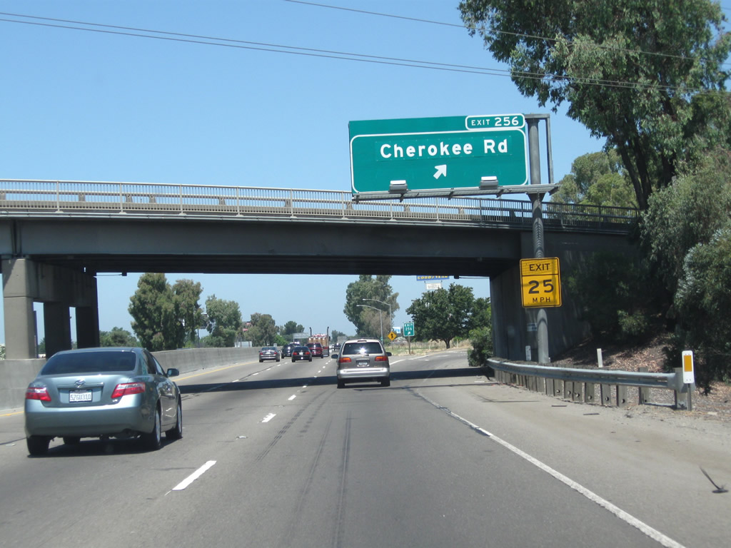
Northbound California 99 meets Exit 256, Cherokee Road.
07/31/11

California 99 passes under a railroad bridge shortly thereafter.
07/31/11

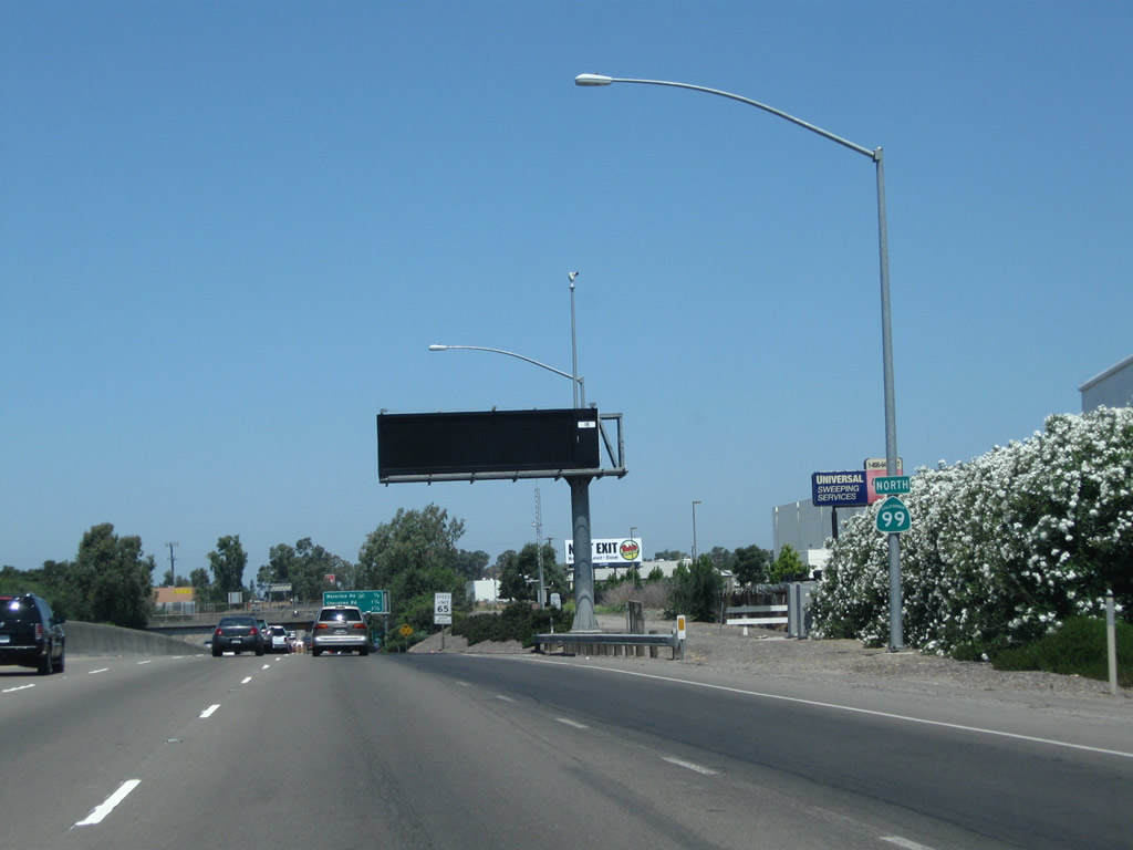
The next exit along California 99 north is Exit 258, San Joaquin County Route J-8 (Hammer Lane) (one mile). Nearly every kind of service is available at this major exit.
07/31/11

Traffic from California 99 Business (Wilson Way) merges onto California 99 from the left.
07/31/11
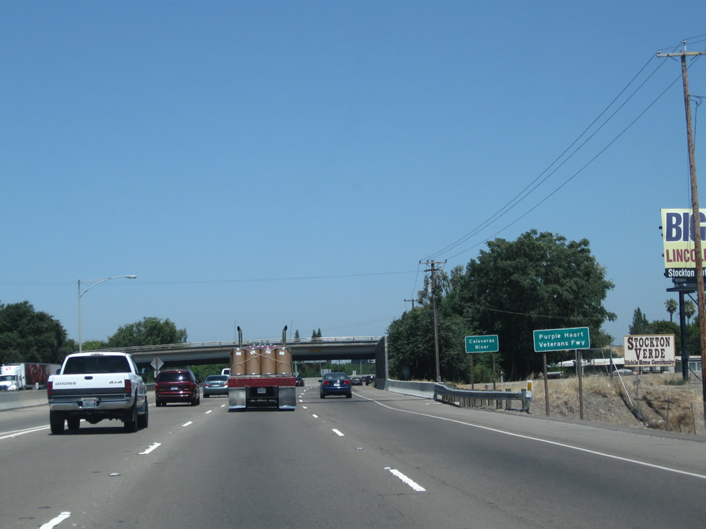
California 99 crosses over the Calaveras River, another tributary of the San Joaquin River.
07/31/11
Shortly after traffic merges onto California 99 north from California 99 Business (Wilson Way) was a former off-ramp to Exit 257B, Frontage Road (it is now gone).
08/22/03

The right lane of California 99 north becomes exit only along Exit 258, San Joaquin County Route J-8 (Hammer Lane).
07/31/11

Northbound California 99 meets Exit 258, San Joaquin County Route J-8 (Hammer Lane). J-8 travels west to Interstate 5 Exit 478. This interchange was reconstructed in the late 2000s.
07/31/11
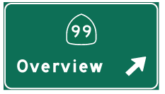
Photo Credits:
- Andy Field: 08/22/03, 11/25/04, 07/31/11
Connect with:
Page Updated Saturday March 17, 2012.