
State Route 139
California 139 begins in Susanville at its junction with California 36 and travels north past Eagle Lake into Modoc County. After the junction with California 161 near Tulelake, California 139 crosses the Oregon state line and transitions directly onto Oregon 39. Oregon 39 in turn continues north to Klamath Falls, Oregon, where it meets U.S. 97.
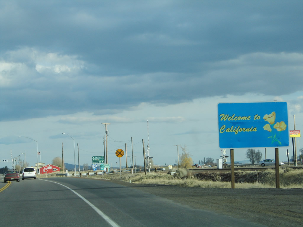
Oregon 39 transitions directly onto California 139 when the road crosses from Klamath County in Oregon to Siskiyou County in California. Almost immediately after crossing into California, southbound California 139 approaches California 161, an east-west state route that parallels the state line and connects to U.S. 97 northeast of Dorris.
04/01/05
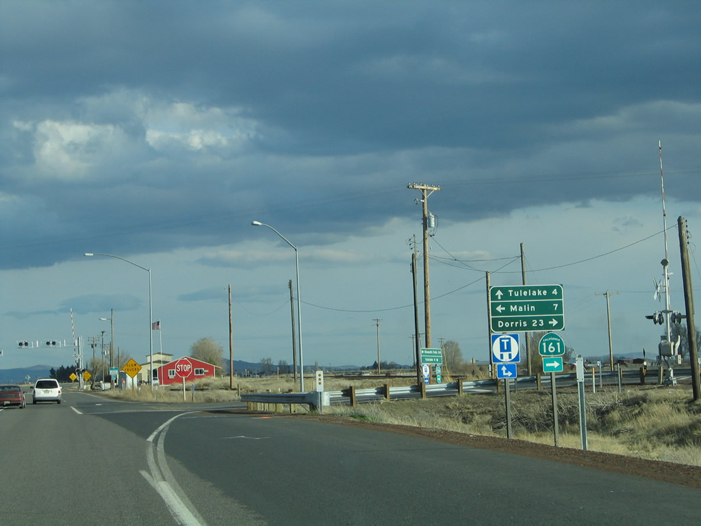
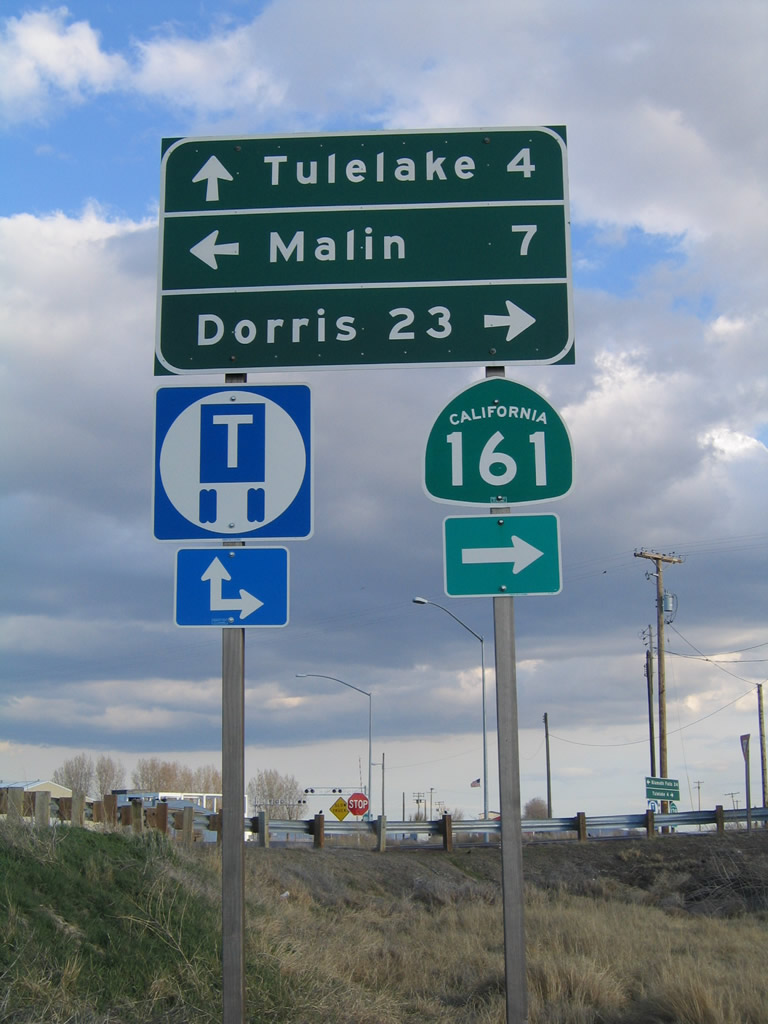
Southbound California 139 meets California 161 at this intersection. Turn right to follow California 161/State Line Road west to the Lower Klamath National Wildlife Refuge and U.S. 97 near Dorris. Turn left here to follow State Line Road, a county-maintained highway, east to Malin, Oregon. California 139, meanwhile, continues southeast toward Tulelake and Newell in Siskiyou County.
04/01/05
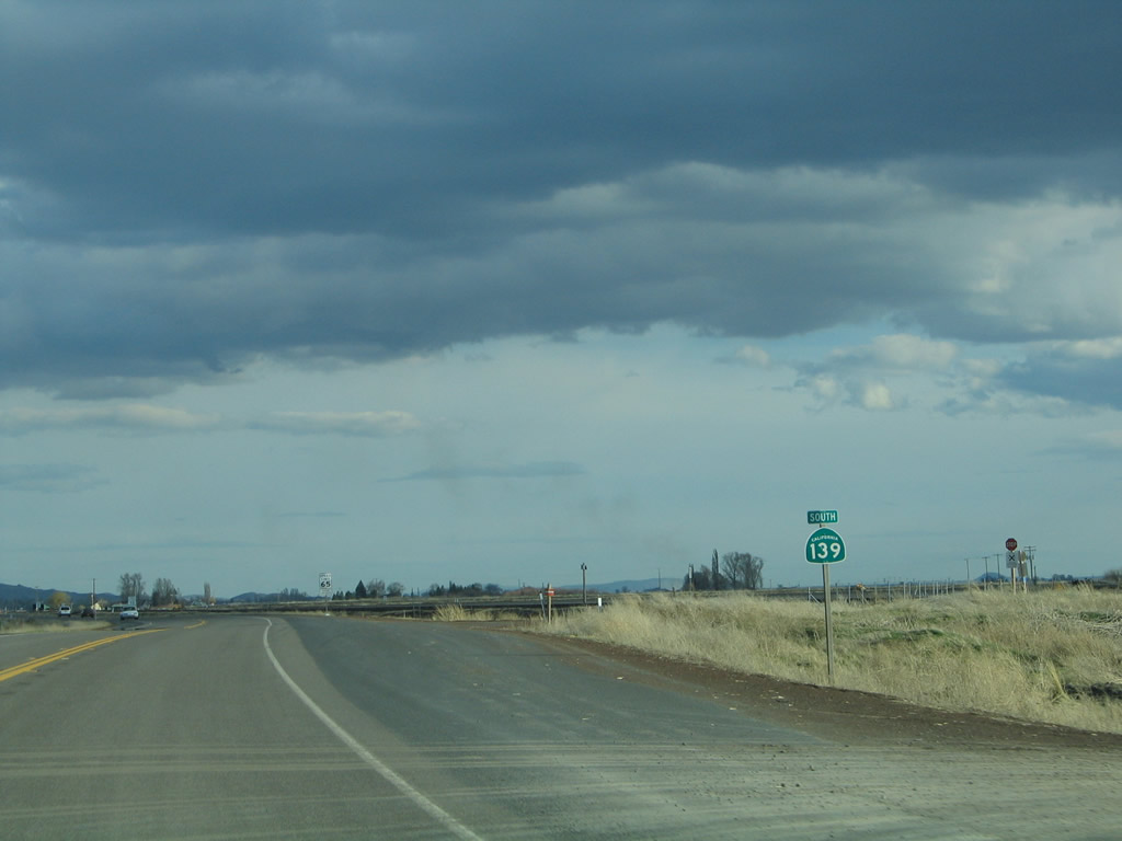
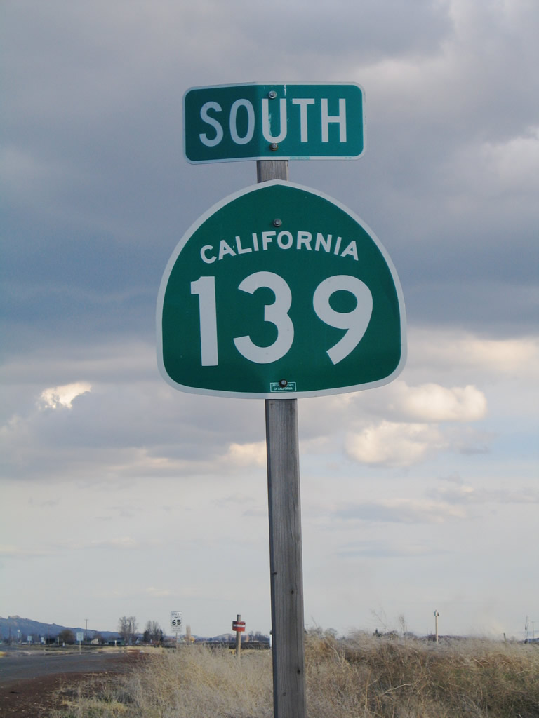
The first California 139 south reassurance shield is posted after the California 161 intersection.
04/01/05
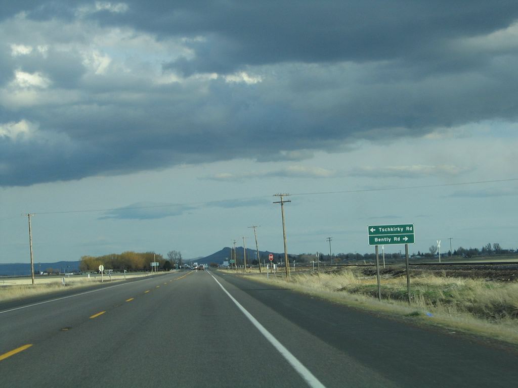
Southbound California 139 approaches Tschirky Road east and Kandra Road west. Both county roads provide local farm and ranch access. The railroad parallels California 139 south through Tulelake to Canby, then turns east to Alturas and the U.S. 395 corridor.
04/01/05
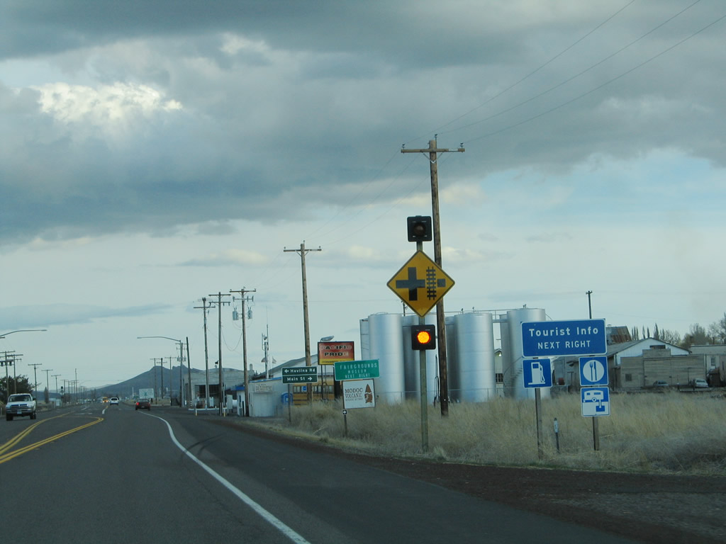
SR 139 runs along the east side of the city of Tulelake (population 1,020 as of the 2000 Census). Main Street ties into SR 139 north from Downtown across from Havlina Road. Main Street south also links SR 139 with Volcania Legacy Scenic Byway west to Lava Beds National Monument. Ancient lava flows, lava tubes (caves formed by historic lava flows), and craters are among the many features to the unique landscape at the monument.
04/01/05
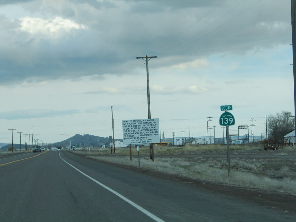
Another California 139 south reassurance shield is posted after the Main Street intersection. A white regulatory sign advises that the agricultural inspection station in Modoc County will require specific inspection permits.
04/01/05
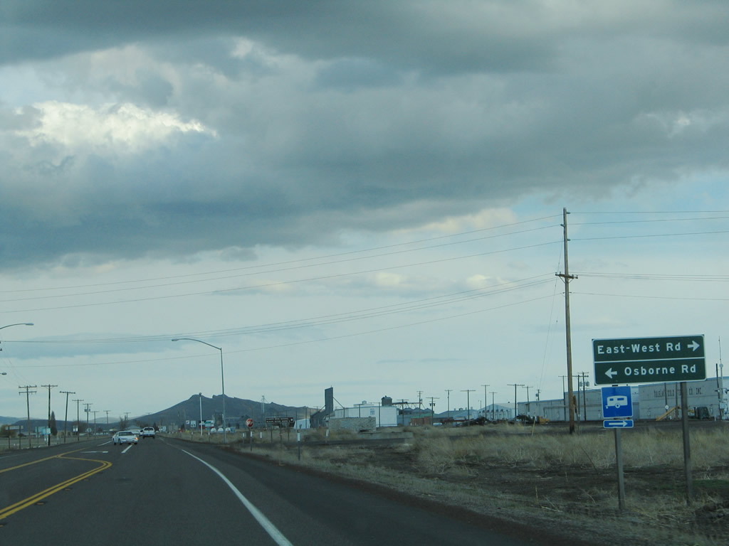
Southbound California 139 approaches East-West Road west to Sheepy Peak along the north shore of Tule Lake and Osborne Road east into Modoc County.
04/01/05
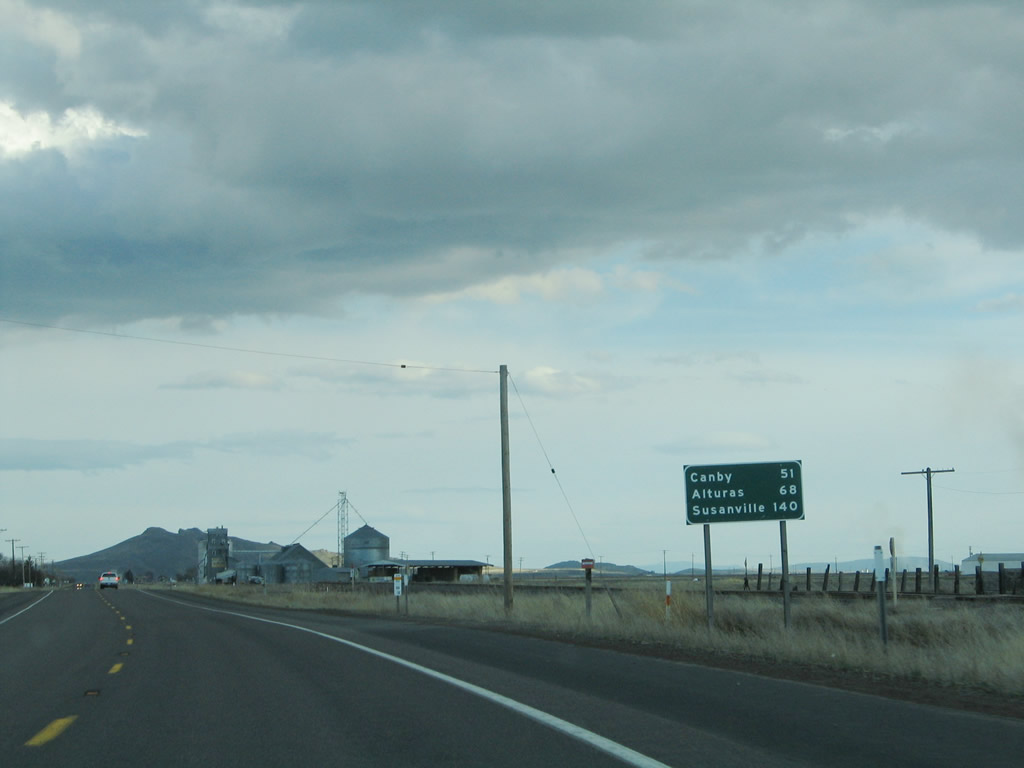
This mileage sign on California 139 south provides the distance to Canby (51 miles), Alturas (68 miles), and Susanville (140 miles).
04/01/05
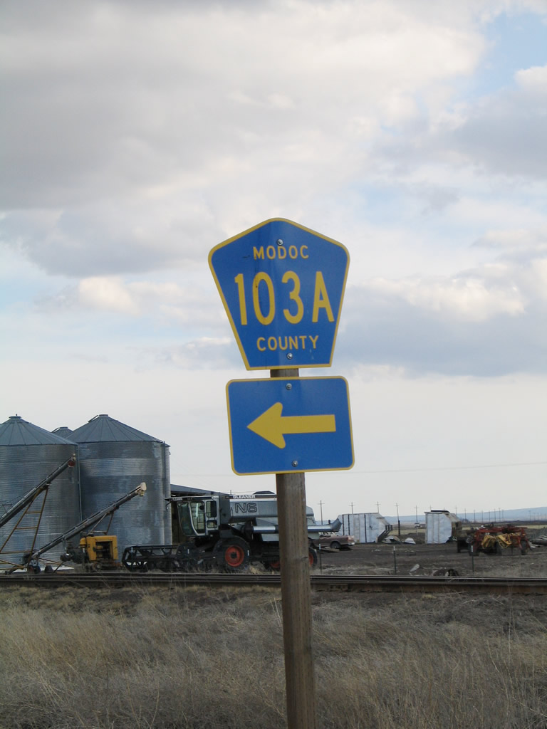
Close to the Siskiyou-Modoc County Line, southbound California 139 approaches Modoc County 103A, which parallels the county line.
04/01/05
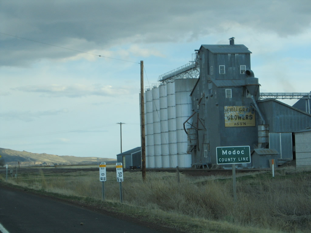
Upon reaching the intersection with Modoc County 103A, California 139 leaves Siskiyou County and enters Modoc County.
04/01/05
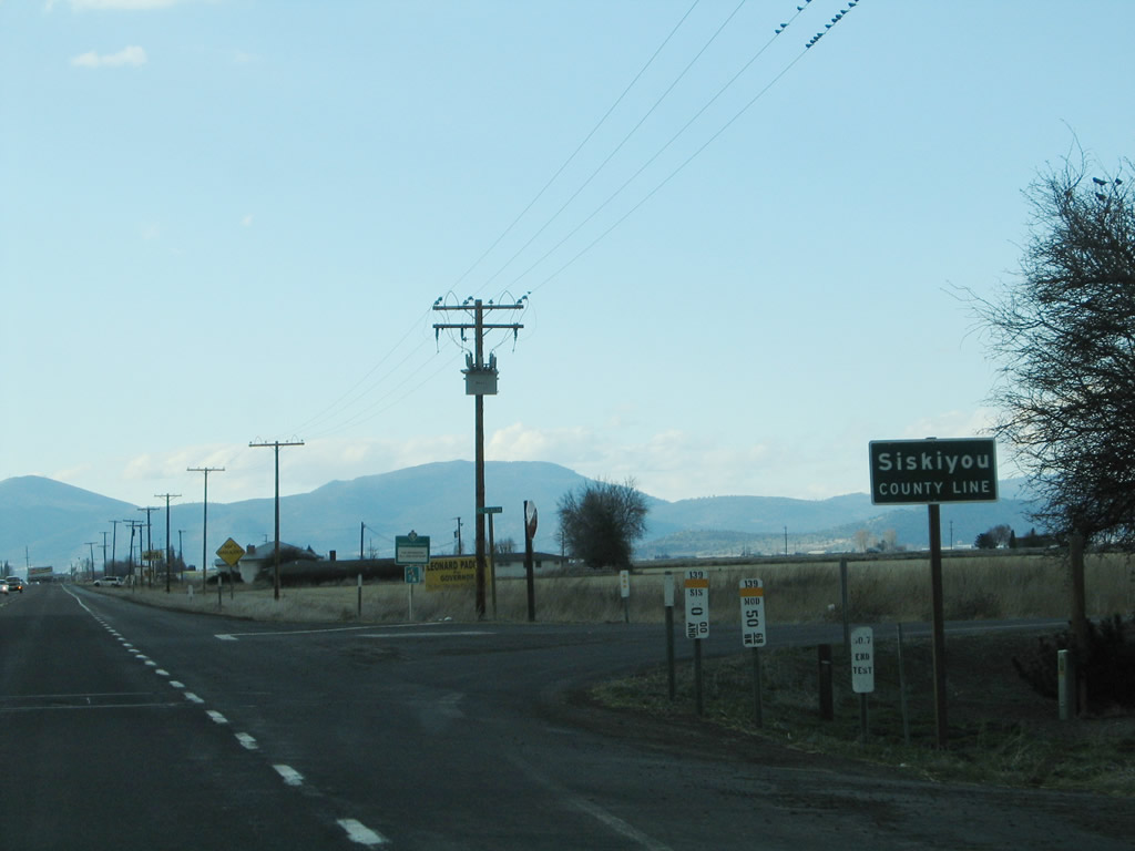
At the intersection with Modoc County 103A, California 139 leaves Modoc County and enters Siskiyou County.
04/01/05
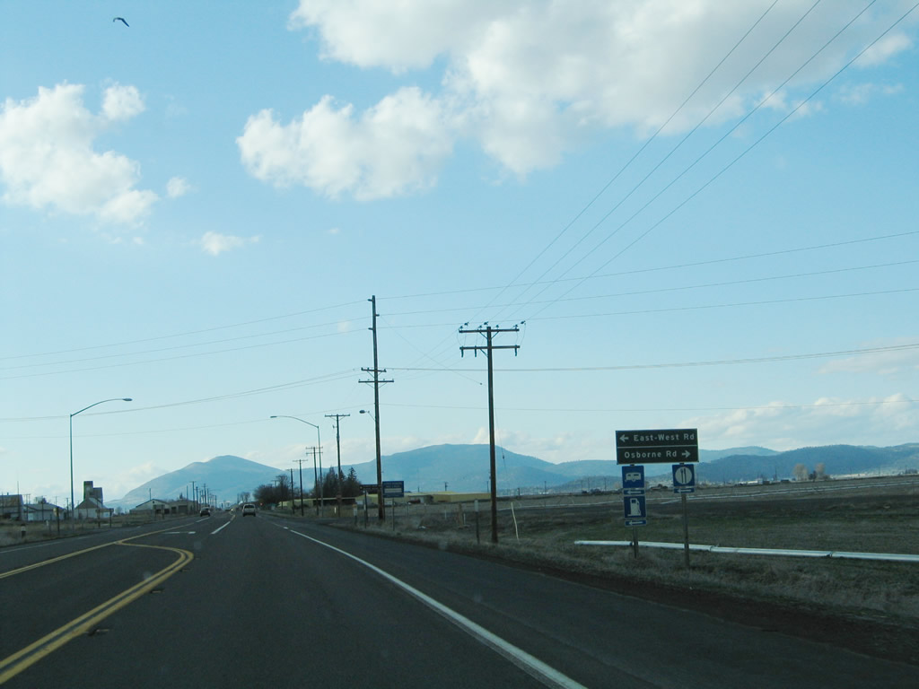
Northbound California 139 approaches East-West Road west to Sheepy Peak along the north shore of Tule Lake and Osborne Road east into Modoc County.
04/01/05
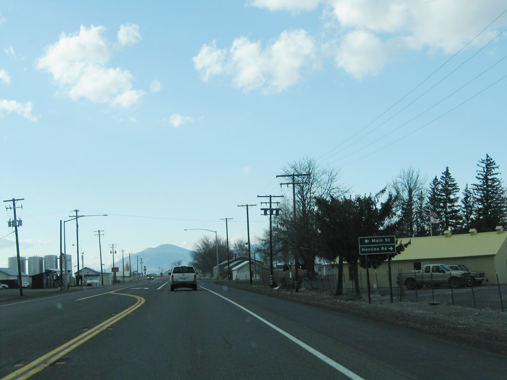
SR 139 parallels the Tulelake city line southeast to Main Street and Havlina Road. Main Street heads south through the Tulelake business district to E Street. Volcanic Legacy Scenic Byway extends west from E Street to Lava Beds National Monument via Hill Road in Siskiyou County.
04/01/05
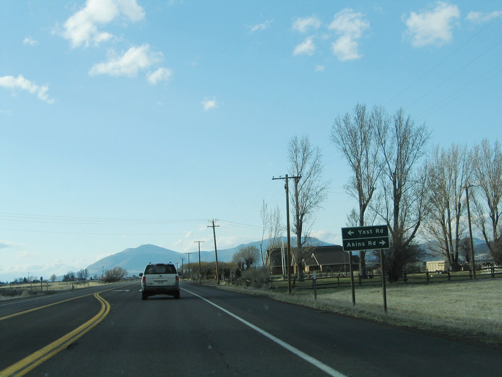
Northbound California 139 approaches Yost Road and Akins Road.
04/01/05
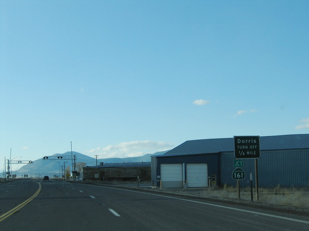
Nearing the California-Oregon state line, California 139 north approaches California 161 west to U.S. 97 and Dorris. California 161 follows State Line Road and parallels the California-Oregon border through the Lower Klamath National Wildlife Refuge.
04/01/05
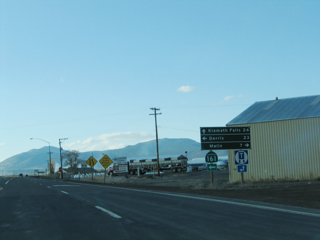
A mileage sign is posted at the California 139 north and California 161 west intersection. Dorris is 23 miles west of here, and Klamath Falls, Oregon, is 24 miles north of here. Turn right to follow county-maintained State Line Road east to Malin, Oregon (seven miles). After this intersection, California 139 will end and Oregon 39 will begin.
04/01/05
Photo Credits:
- Andy Field: 04/01/05
Connect with:
Page Updated Saturday February 09, 2008.