
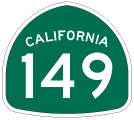
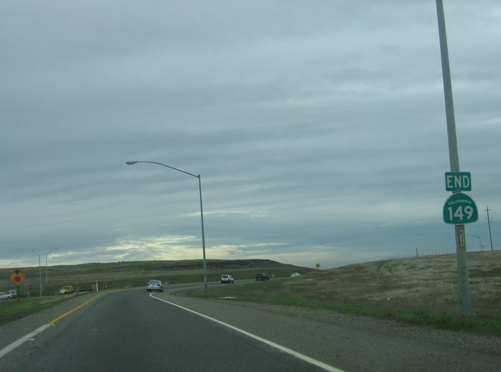
State Route 149
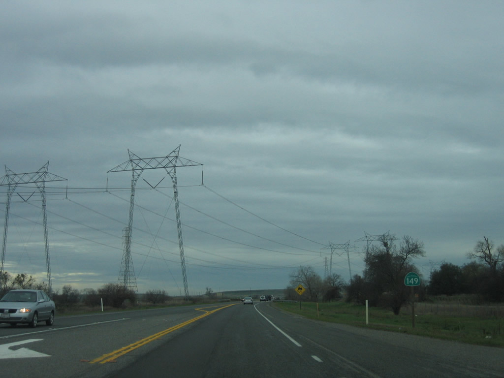
California 149 is a short, four-lane expressway route between California 70 and California 99 in the northern Central Valley. It does not serve any cities directly, but it provides a connection between Oroville and Chico via California 70 and California 99, respectively. It was upgraded to four-lane expressway standards with freeway connectors at either end in late 2008.
California 149 was originally routed along Openshaw Road, which is the northeastern frontage road that parallels modern California 149. Originally, California 149 was called the Oroville-Chico Highway (also known as the Oro-Chico Highway) that also followed the alignment of Table Mountain Boulevard (Old California 70) to the south. Construction of the Wicks Corner Interchange replaced the 1964 intersection between California 149 and California 70. Old right of way for the original connection between Oro-Chico Highway and Table Mountain Boulevard is just east of the exchange.
The Openshaw Road alignment of California 149 was bypassed in 1975 onto its current, two-lane alignment. Around the same time, California 99 was widened from two to four lanes from the California 149 intersection to north of Durham-Dayton Highway (today's Exit 376). This included construction of the Durham interchange. Exit signage for that interchange has changed over the years. Originally, it was signed as "Pentz Road - Durham" (from the 1970s to the 1990s), then it was signed as "Butte College - Durham" and other short lived variations (from the 1990s until 2008). In 2008, with the construction of the California 99 and California 149 interchange, Exit 376 was signed simply as "Durham."
Prior to the 1950s, there was no highway going south from the California 99-149 junction, since Old U.S. 99E was aligned on the Midway to the west. Midway is Old U.S. 99E from Richvale north through Durham to Chico.
All of California 149 was upgraded to four-lane expressway standards with freeway connectors at either end in late 2008. The 1975 alignment is now under the northbound lanes on the northwest portion starting east of the Shippee Road intersection. The remaining portion of the 1975 alignment is under the southbound lanes.
Prior to the completion of the Wicks Corner Interchange project in 2008, California 149 was a two-lane highway with one lane in each direction. An at-grade intersection connected California 70 with California 149. This two-lane segment was upgraded to four lanes in late 2008.
01/15/06
For the first half of the state route, the new configuration converted the original, two-lane highway into the southbound lanes for California 149, and new lanes were constructed for northbound traffic. This means that the original 1975 alignment is now under the southbound lanes. This will remain the case for the rest of the southeastern portion (between the southern terminus northwest to a point just east of the Shippee Road intersection). The remaining portion of the 1975 alignment (from near the Shippee Road intersection northwest to California 99) is under the northbound lanes.
05/24/08
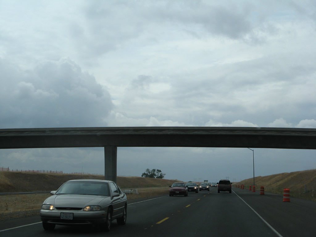
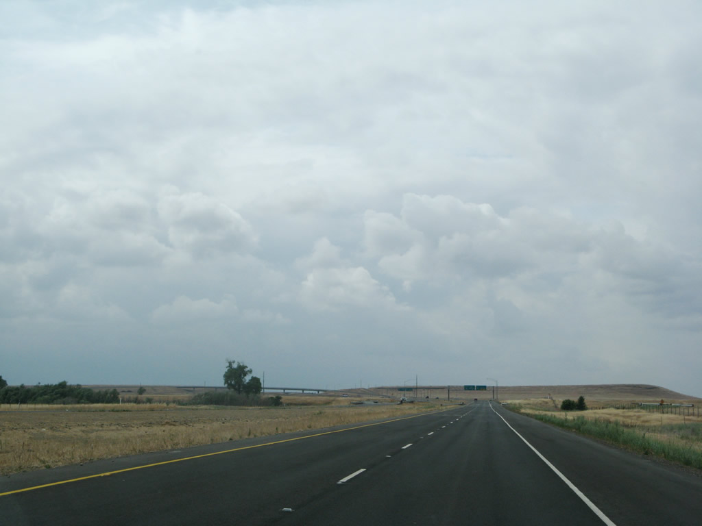
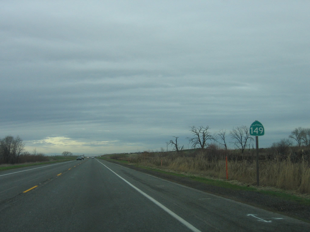
Leaving the Wicks Corner Interchange, this California 149 north reassurance shield is posted as the four-lane expressway proceeds northwest between California 70 and California 99. California 149 essentially functions as a freeway, with the exception of one at-grade intersection.
11/08/08
01/15/06
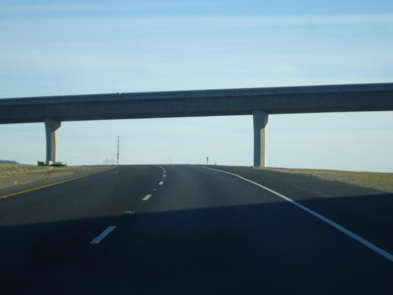
California 149 passes under a one-lane bridge that connects to Openshaw Road, the frontage road that is the original alignment of California 149. (This configuration, which shows the southbound lanes still under construction, has since been upgraded to four lanes on two separate carriageways.)
05/24/08
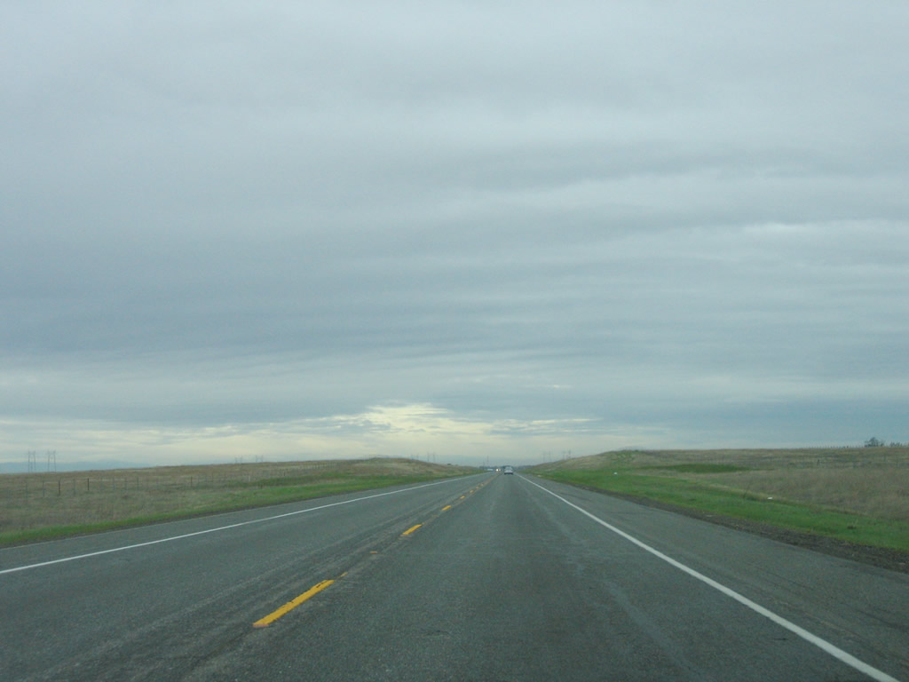
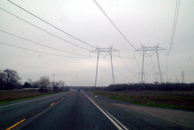
Under the old configuration, two-lane California 149 passed through rural, agricultural land.
01/15/06
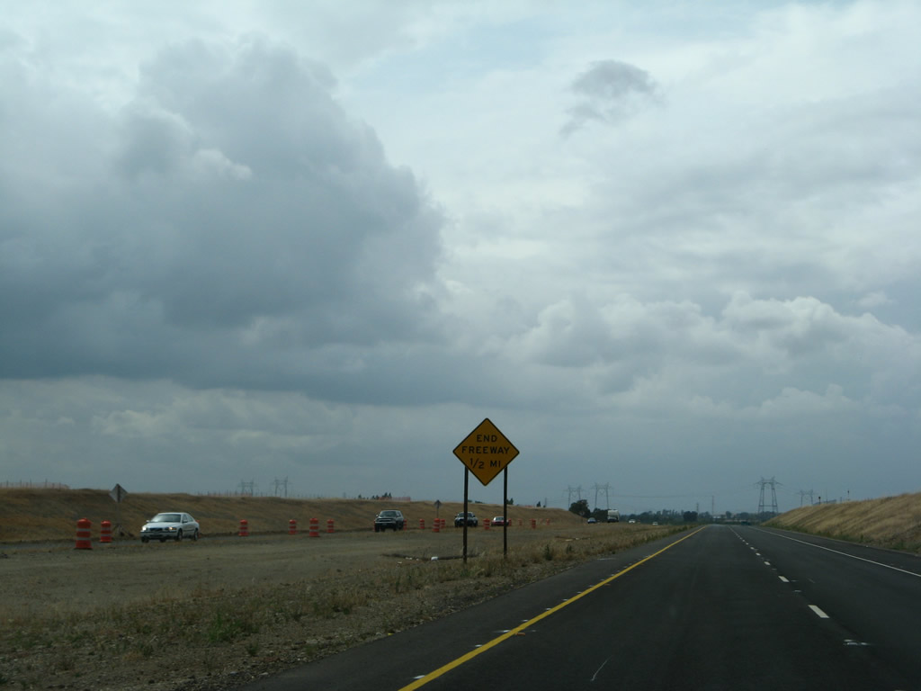
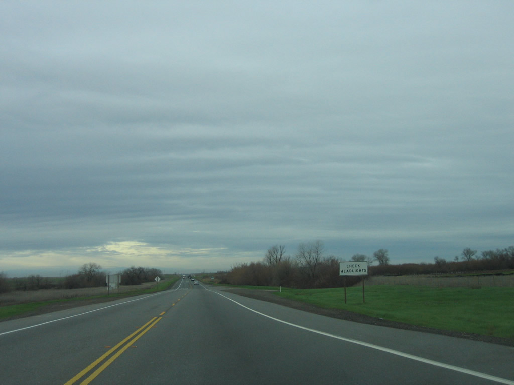
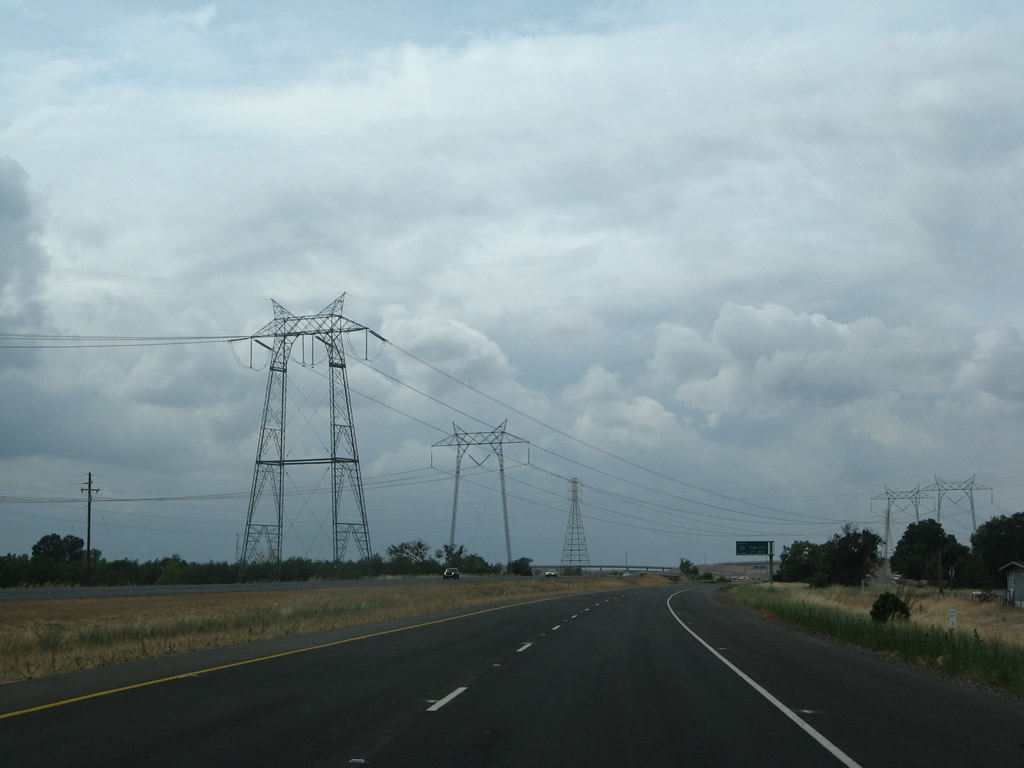
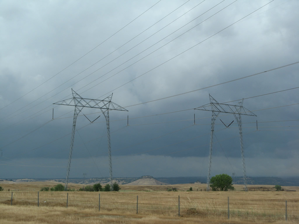
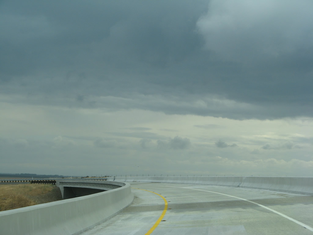
Under the new configuration, four-lane California 149 has an expressway segment with only one at-grade intersection (hence the "end freeway 1/2 MILE" sign posted here). The 500kV Pacific Gas & Electric power lines, which span most of the state of California, will pass over California 149 ahead near the intersection with Openshaw Road and Shippee Road (which is approximately one-half mile ahead).
05/24/08
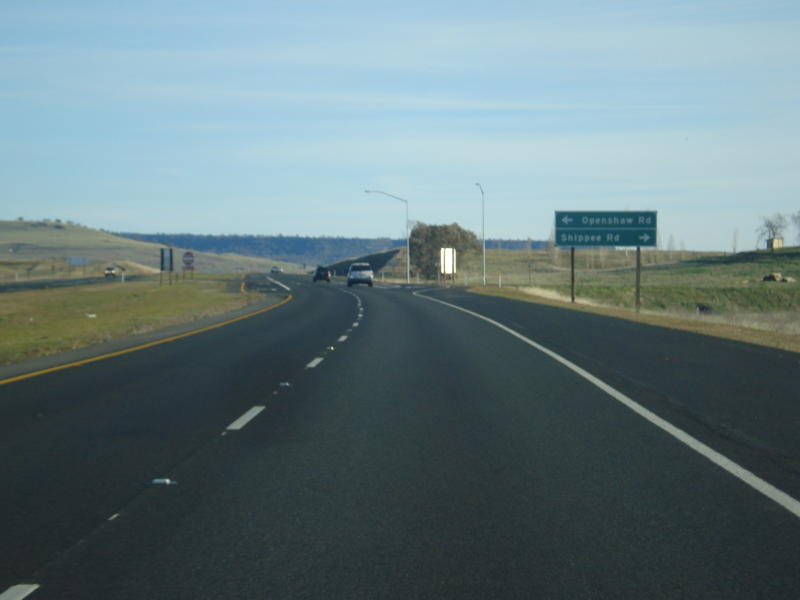
An end freeway sign is posted just before the intersection with Openshaw Road and Shippee Road (for local and ranch access as well as a visit to see the old alignment on Openshaw Road). Around this point is where the northbound lanes shift from the new alignment over to the old, 1975 alignment.
05/24/08
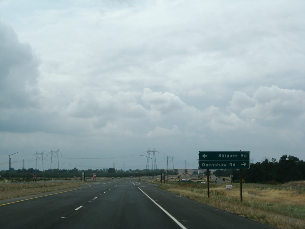
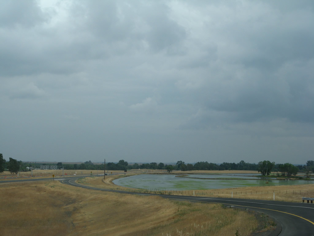
Northbound California 149 meets Openshaw Road and Shippee Road. This is the only intersection along California 149 between the two endpoint interchanges. The location of this intersection was moved as a result of the expressway widening project in 2008.
05/24/08
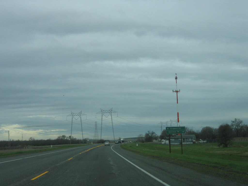
The old intersection with Openshaw and Shippee Roads was further north than the current location.
01/15/06
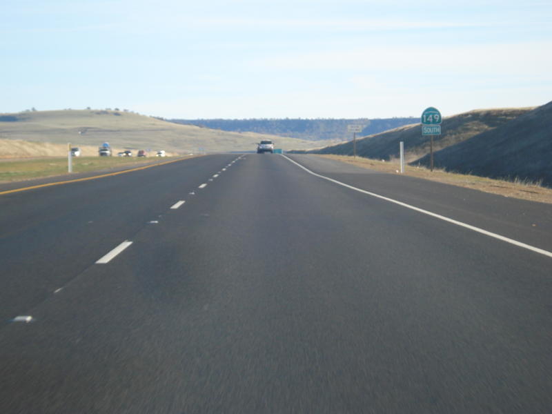
California 149 north after the intersection with Openshaw Road and Shippee Road.
05/24/08
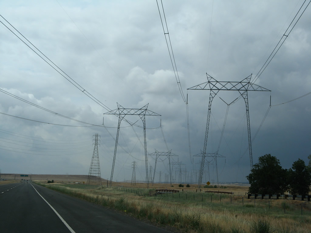
One of the 500kV towers had to be demolished and replaced as a result of the expressway expansion.
01/15/06
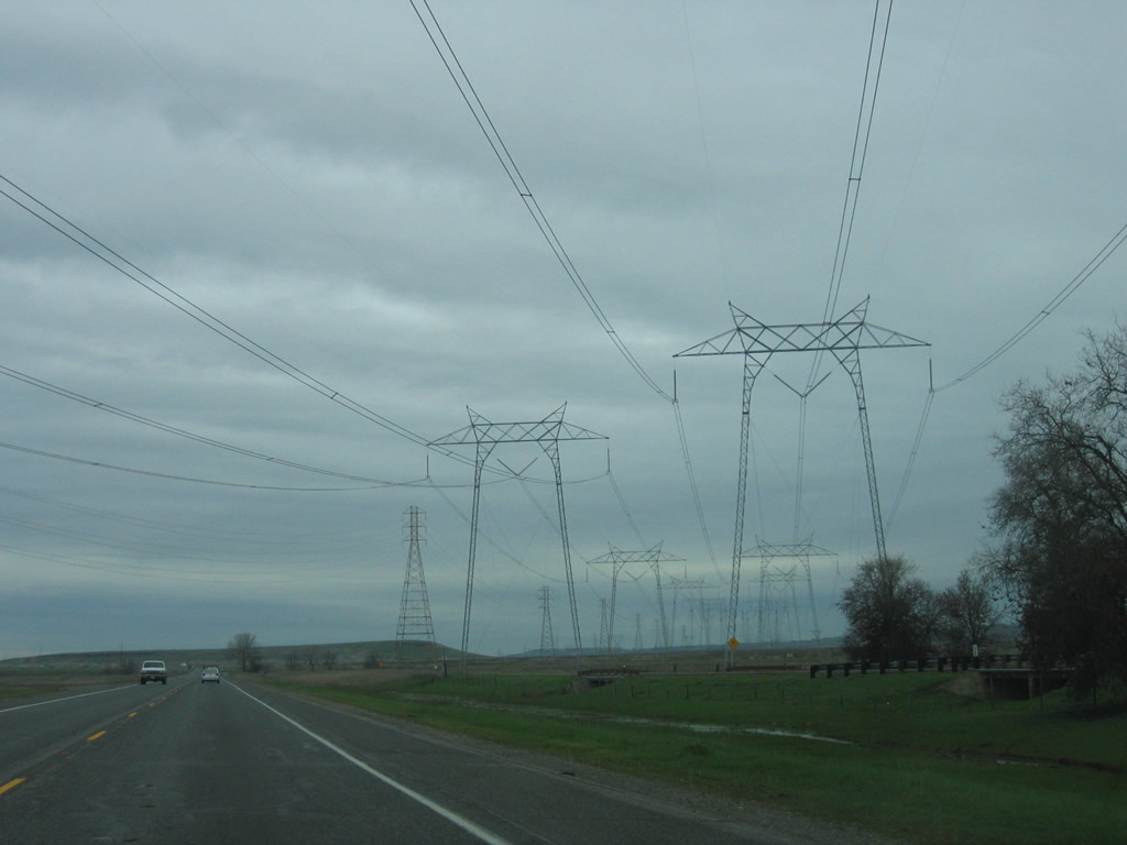
These 500kV power lines extend south to the Table Mountain substation, where electricity generated at Oroville Dam joins the statewide electrical grid. To the north, they lead to the Round Mountain substation east of Redding and Malin substation in Oregon.
05/24/08
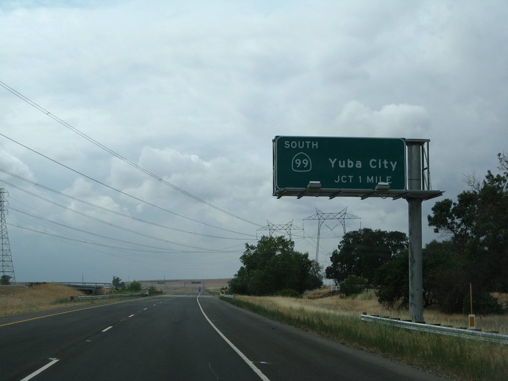
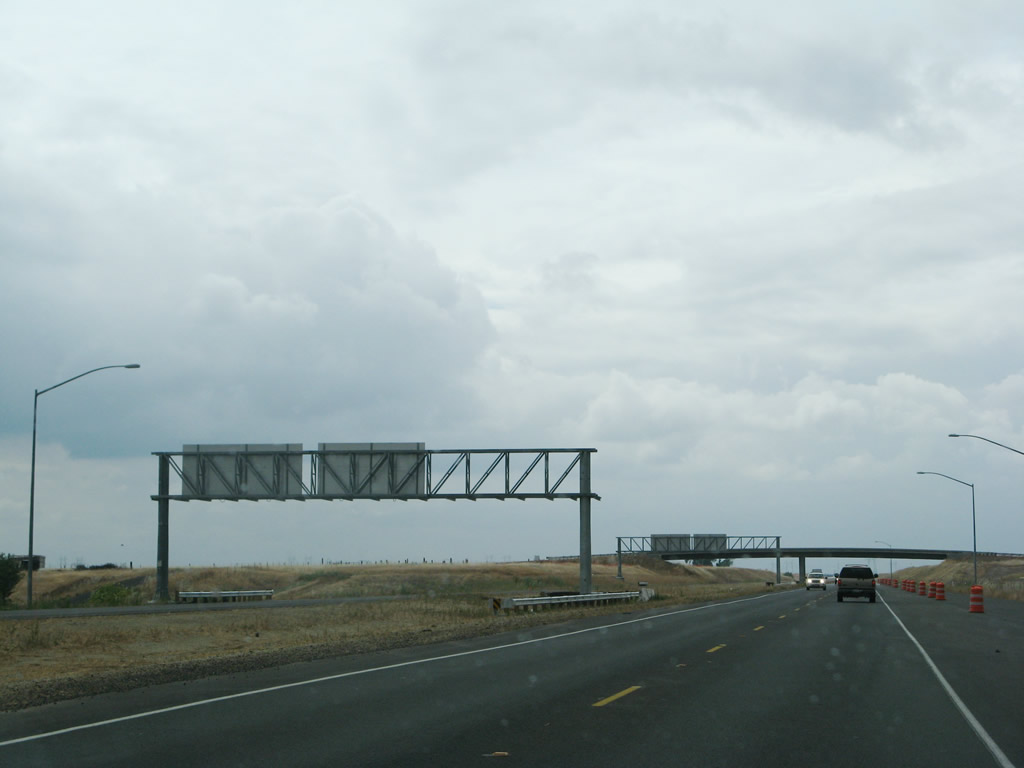
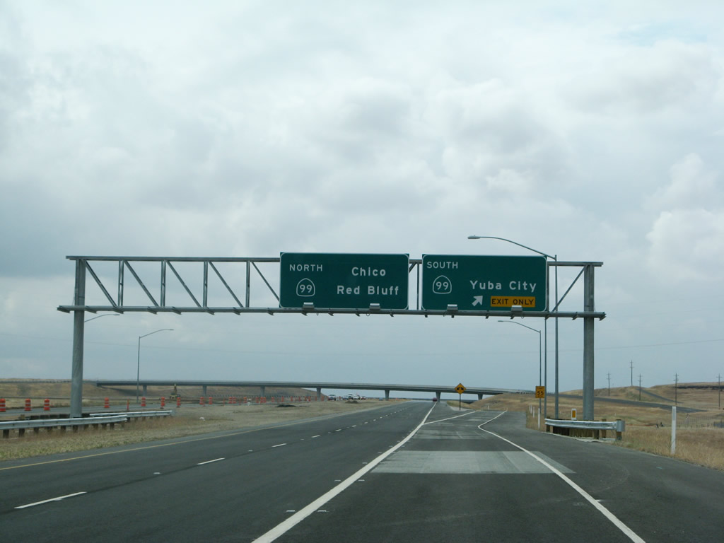
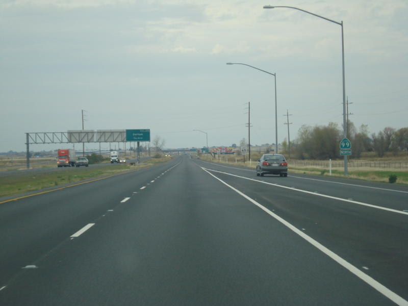
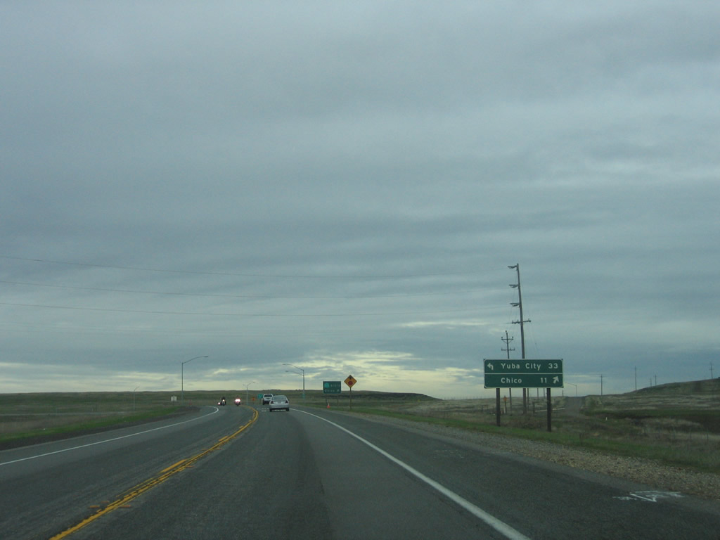
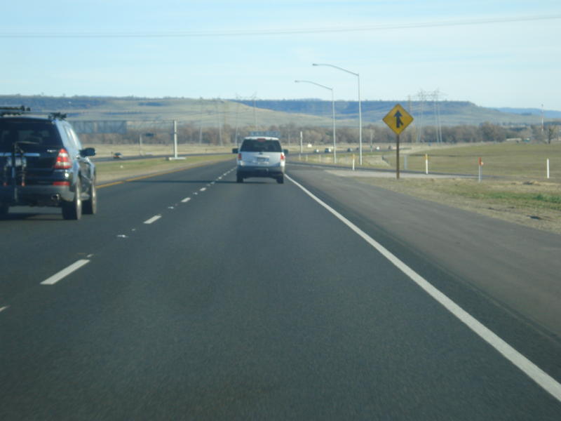
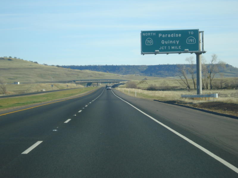
The final interchange along California 149 north is Exits 5A-B, California 99 north to Chico and Red Bluff and south to Gridley and Yuba City (one mile). This sign was added when the state route was widened to expressway standards.
05/24/08
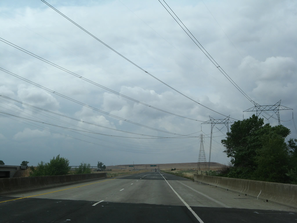
California 149 crosses over Clear Creek and below the 500kV power lines on a 1975 bridge. The southbound lanes are on a bridge built in 2008.
05/24/08
01/15/06
The 500kV power lines connect to various hydroelectric and other power generating facilities in the Pacific Northwest and Intermountain West (via a 500kV line that leads east into Idaho). These lines include Path 15, a major power corridor that extends through Central California to connect power grids in the northern and southern parts of the state.
05/24/08
01/15/06
Looking south, these 500kV power lines run together to the Table Mountain substation, then proceed south until separating at Sutter Buttes. One line leads southwest toward the Vaca-Dixon substation off Interstate 80, then proceeds south to the Tesla substation. The other skirts Sacramento and Davis, connecting to the grid again at the Tracy and Tesla substations. South of Tesla substation, the 500kV power lines continue along Path 15 to the Los Banos, Gates, and Midway substations.
05/24/08
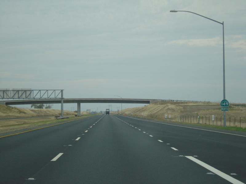
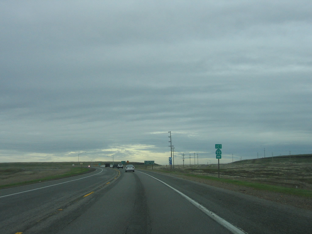
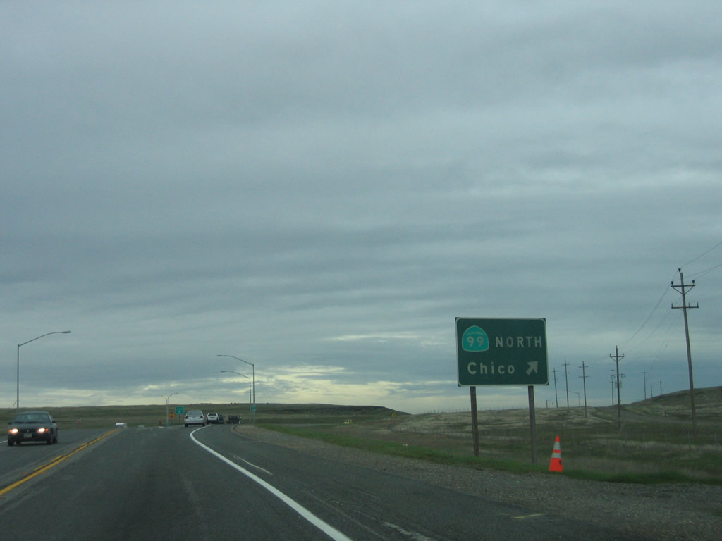
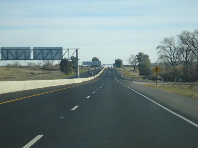
California 149 finishes as a freeway as it approaches the California 99 interchange. Stay left for Exit 5A, California 99 south to Yuba City, or stay left for Exit 5B, California 99 north to Chico and Red Bluff.
05/24/08
Northbound California 149 reaches Exit 5A, California 99 south to Yuba City. The left two lanes will default onto Exit 5B, California 99 north to Chico and Red Bluff.
05/24/08
The transition ramp from northbound California 149 to California 99 south to Yuba City (Exit 5A). This sweeping ramp provides a high-speed, seamless connection between the two routes.
05/24/08
The sweeping ramp from California 149 north to California 99 south eventually merges together, now traveling south toward Gridley and Yuba City.
05/24/08
Traffic from California 99 north merges with California 149 from the right, giving the impression that California 149 is the superior route. Photo taken 11/08/08 by Dominic Ielati.
California 149 north at California 99 before the freeway interchange was constructed and opened to traffic in 2008.
01/15/06
California 99 heads south to Gridley and Yuba City and north to Chico and Red Bluff.
01/15/06
Northbound California 149 previously split into two ramps for California 99.
01/15/06
An end shield was posted for California 149 north along the transition ramp to northbound California 99.
01/15/06
Separating from southbound California 99, two lanes carry California 149 southeast toward Oroville. The highway will carry a freeway configuration except for an at-grade intersection with Openshaw Road and Shippee Road.
01/03/09
Southbound California 149 passes under the transition ramp from California 149 north to California 99 south.
01/03/09
The lanes of southbound California 149 merge with the transition ramp from California 99 north to California 149 south.
01/03/09
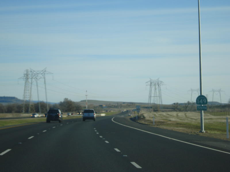
A California 149 south reassurance shield is posted shortly thereafter.
01/03/09
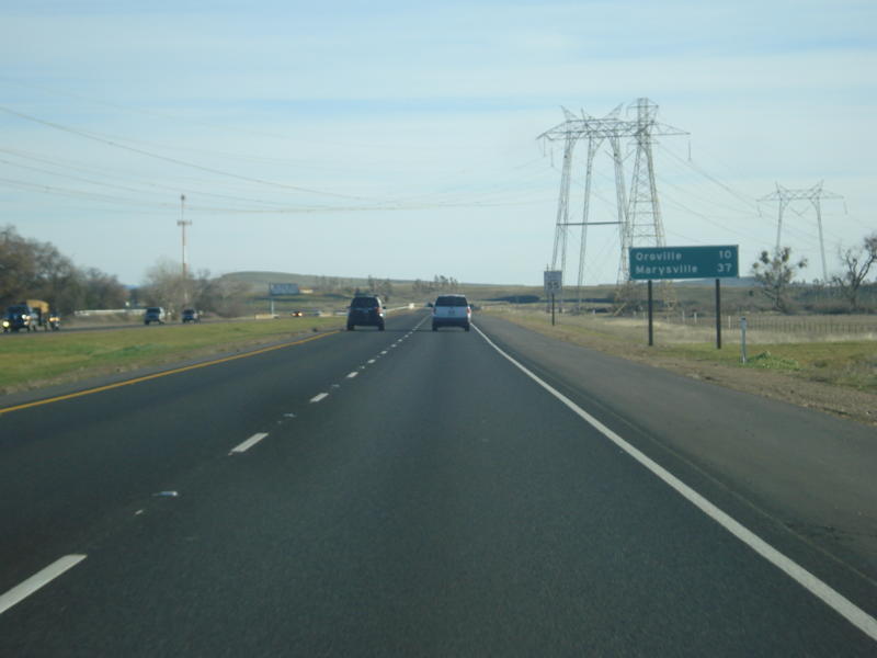
This mileage sign along California 149 south provides the distance to Oroville (ten miles) and Marysville (37 miles).
01/03/09
Looking back to 2003 before the expressway was completed, California 149 passed under the Pacific Gas & Electric 500kV power transmission facilities as seen on this picture along southbound. The power tower on the left was dismantled and replaced to make way for the southbound lanes when the expressway was built in 2008.
01/20/03
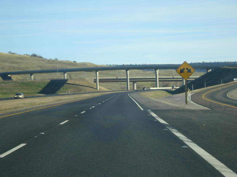
Returning to the expressway configuration, southbound California 149 meets Openshaw Road and Shippee Road at this at-grade intersection.
01/03/09
A California 149 south reassurance shield is posted after the Openshaw Road and Shippee Road intersection.
01/03/09
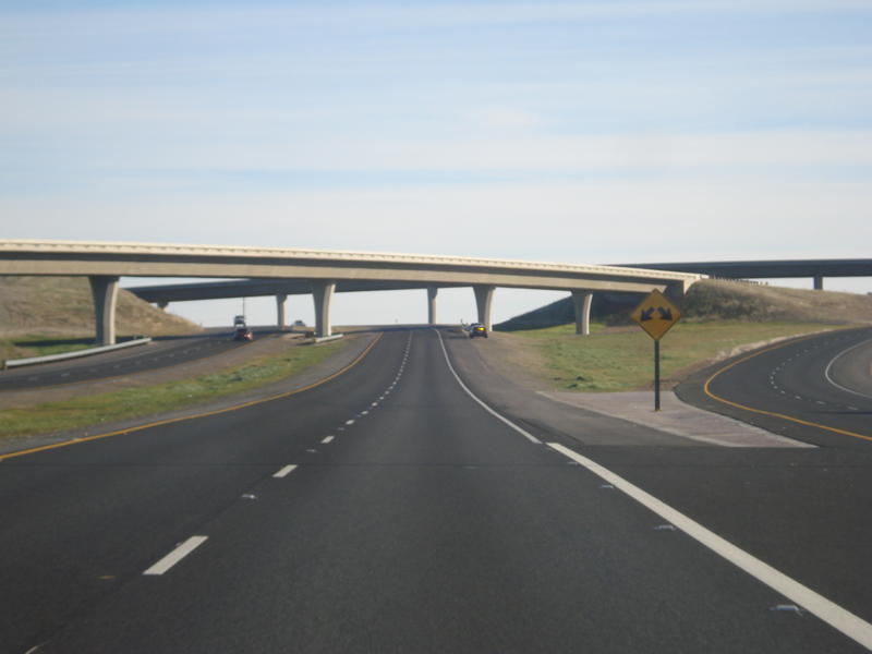
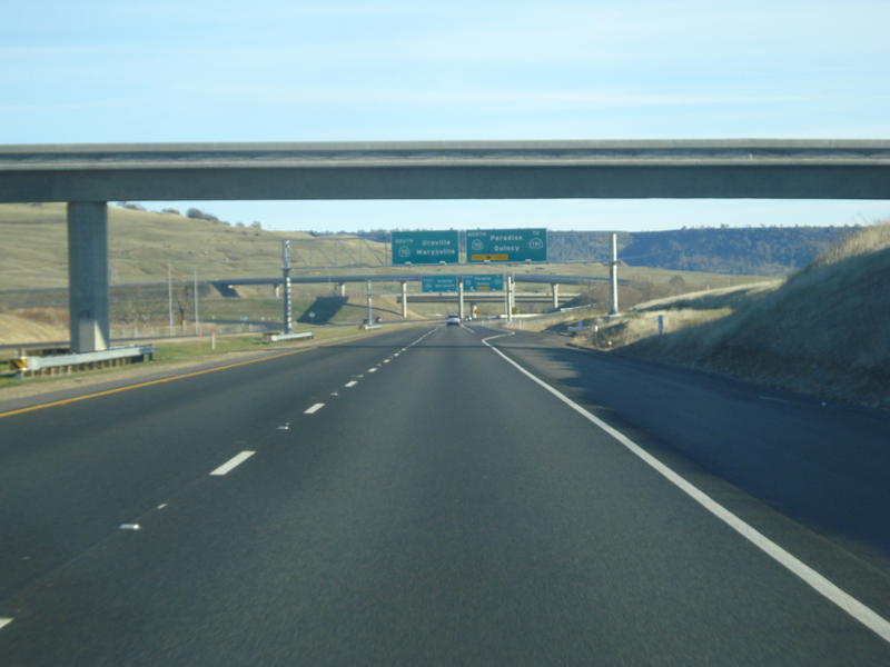
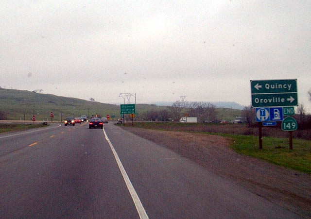
Southbound California 149 next approaches Exits 1B-A, California 70 east to Quincy and California 191 and south to Oroville and Marysville. This is the Wicks Corner Interchange, built in 2008 (replacing an at-grade intersection).
01/03/09
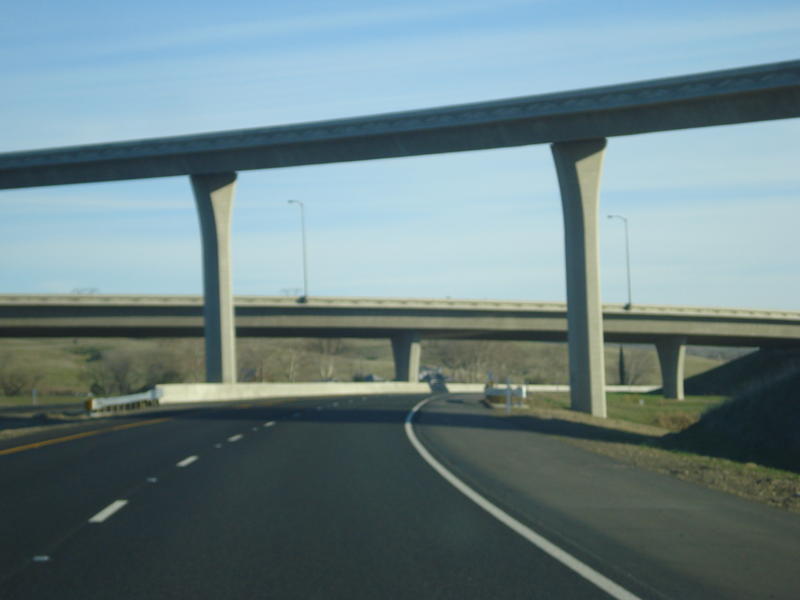
California 149 passes under Openshaw Road.
01/03/09
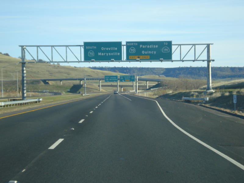
The right lane becomes exit only for Exit 1B, California 70 east to Quincy and California 191 north to Paradise. The left two lanes will default onto California 70 south to Oroville via Exit 1A.
01/03/09
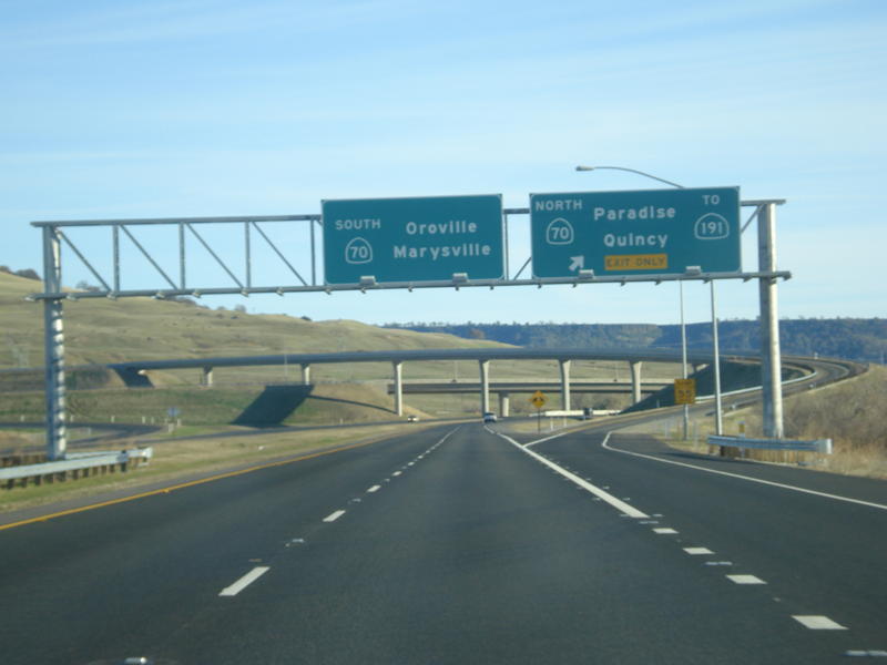
Southbound California 149 meets Exit 1B, California 70 east to Quincy and California 191 north to Paradise. The left two lanes default onto California 70 south to Oroville via Exit 1A.
01/03/09
California 149 reaches its southern terminus at the California 70/Wicks Corner Interchange.
01/03/09
Southbound California 149 passes under the transition ramp from California 70 west to California 70 south.
01/03/09
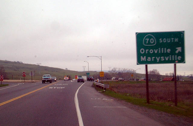
Traffic from California 70 west merges with California 149 south; together they form California 70 south en route to Oroville.
01/03/09
The previous at-grade intersection joining California 149 south with California 70 that was replaced with the Wicks Corner Interchange.
01/20/03
California 70 leads south from the intersection with California 149 to Marysville.
01/20/03
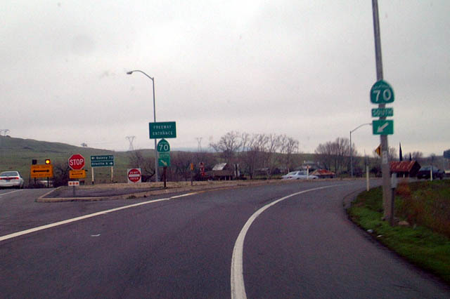
Freeway entrance signs where California 149 transitioned onto California 70 south to Oroville.
01/20/03
References:
Thanks to Dominic Ielati for assistance with pictures and insight on this short yet very important state route in Northern California.
Photo Credits:
- Dominic Ielati: 01/15/06, 01/03/09
- Andy Field: 01/20/03, 05/24/08, 11/08/08
Connect with:
Page Updated Monday January 09, 2012.