
State Route 190
California 190 is a major east-west route in central and eastern California. It is major state route that is split into two components, divided by the Sierra Nevada Mountains. The western California 190 begins at California 99 (Golden State Freeway) at Tipton and heads east into Giant Sequoia National Monument - South Unit, ending within the park.
The eastern California 190 begins at the junction with U.S. 395 at Olancha and heads east into Death Valley National Park, providing the primary access into the park featuring the lowest points in the contiguous United States. California 190 ends at its junction with California 127 a few miles from the California-Nevada state line.
There were originally plans to route California 190 over the Sierra Nevada, but such a connection seems very unlikely to be constructed due to environmental concerns, even though the route remains on paper as a legislative route.
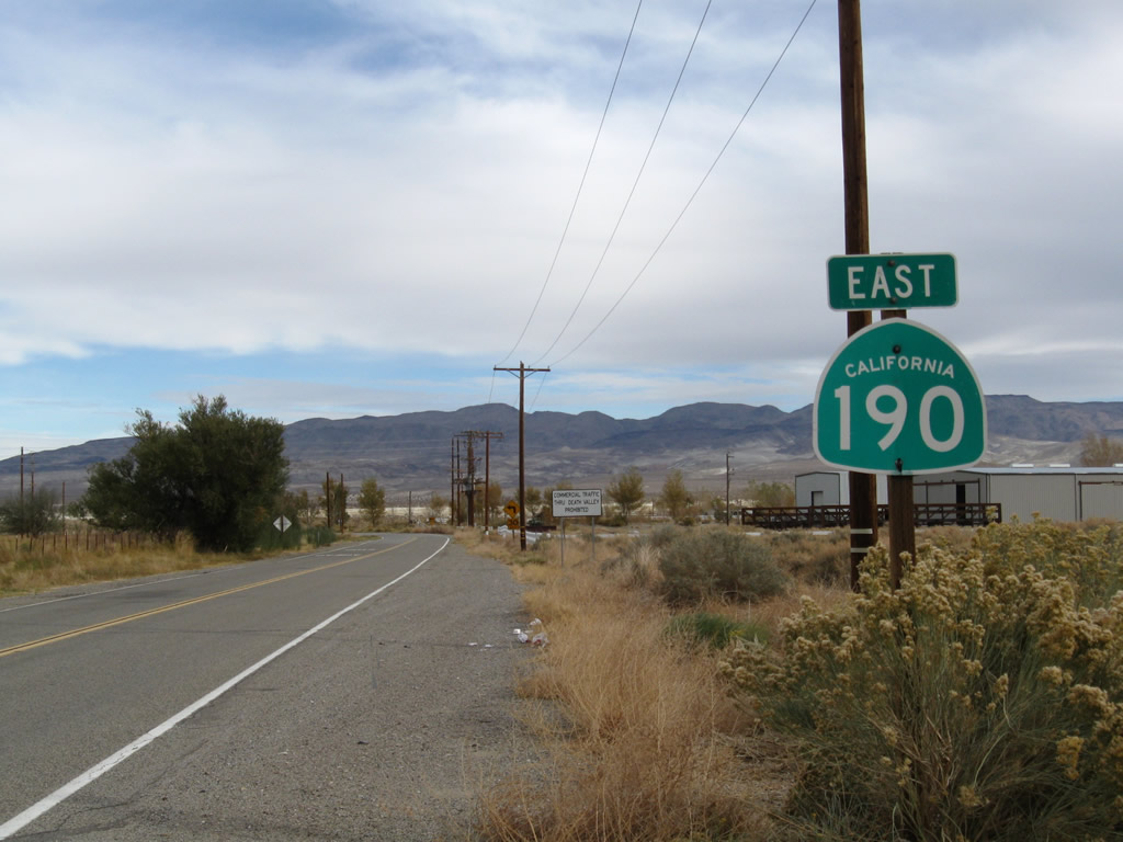
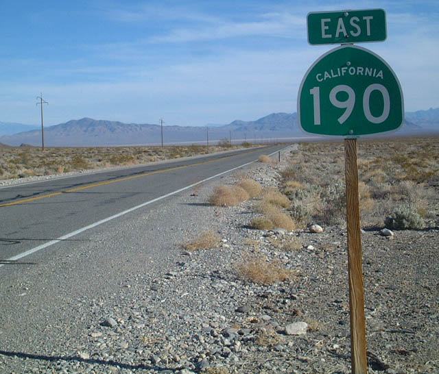
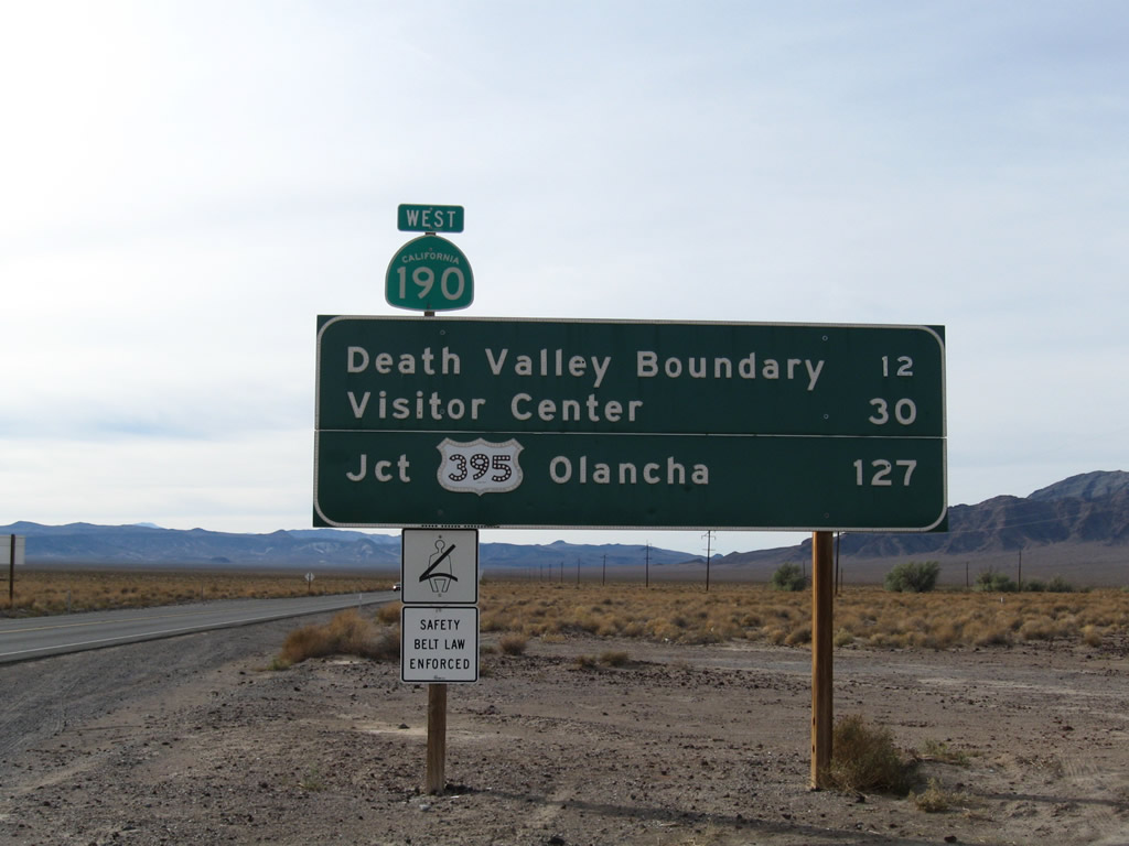
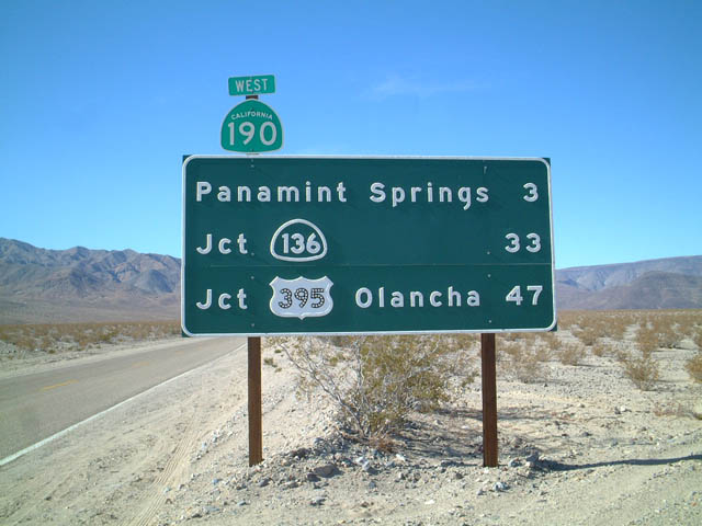
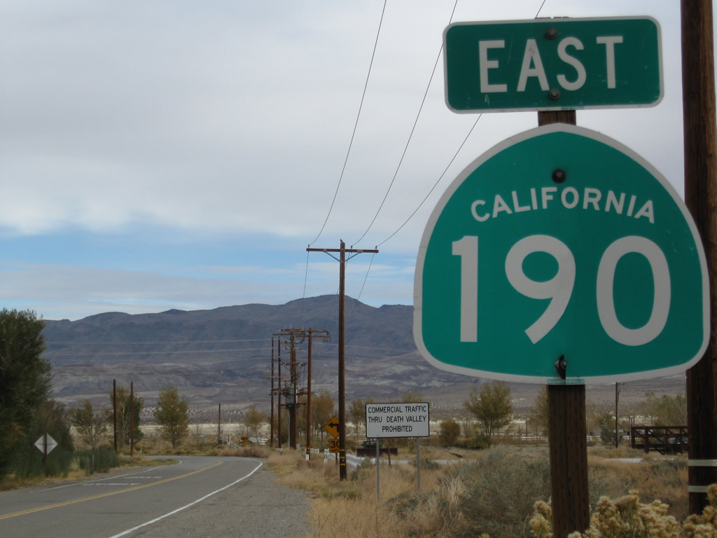
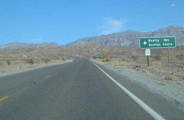
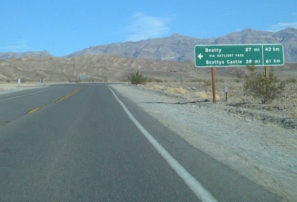
The first reassurance shield for California 190 east is found after the intersection with U.S. 395 in the unincorporated community of Olancha in Inyo County. From here, California 190 proceeds northeast around the southern edge of mostly dry Owens Lake toward a rendezvous with California 136.
11/10/08
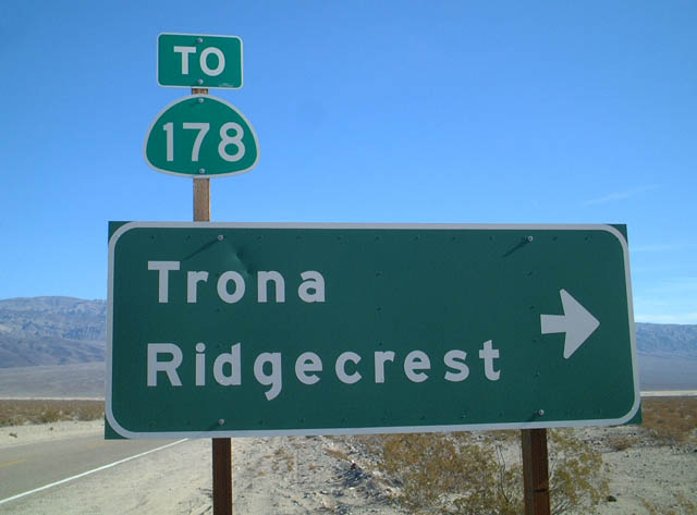
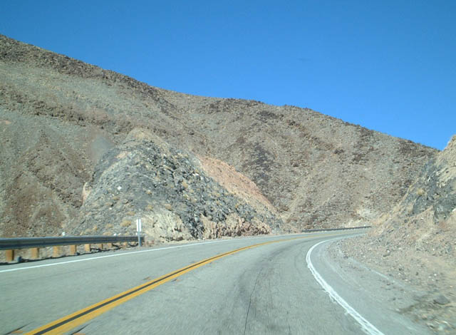
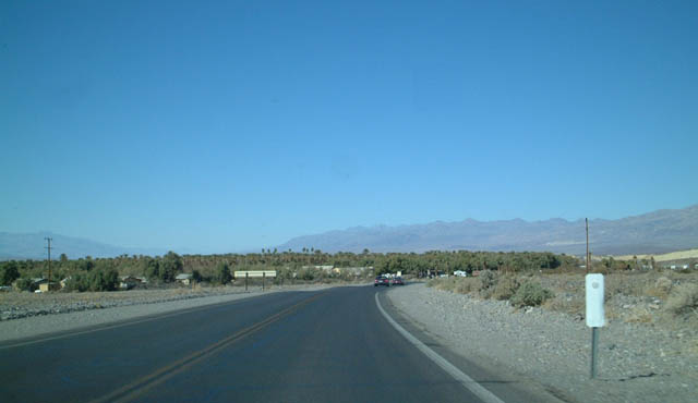
Eastbound California 190 approaches its intersection with Panamint Valley Road in Panamint Springs. Note the trailblazer sign to California 178, which begins at a point southwest of Trona.
01/19/02
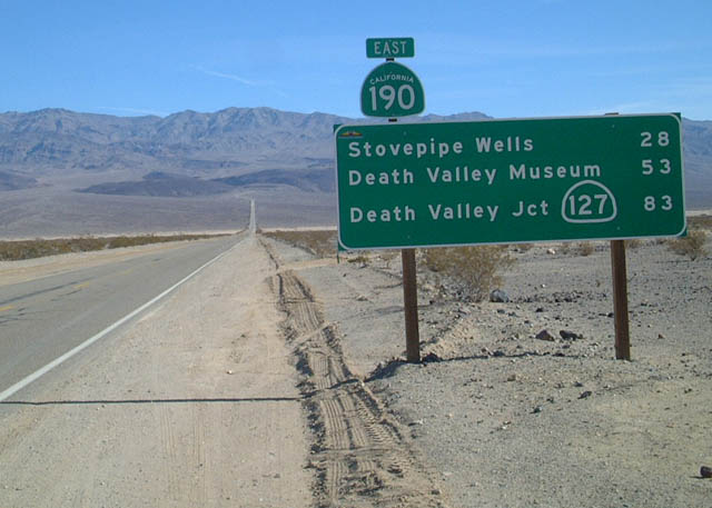
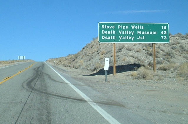
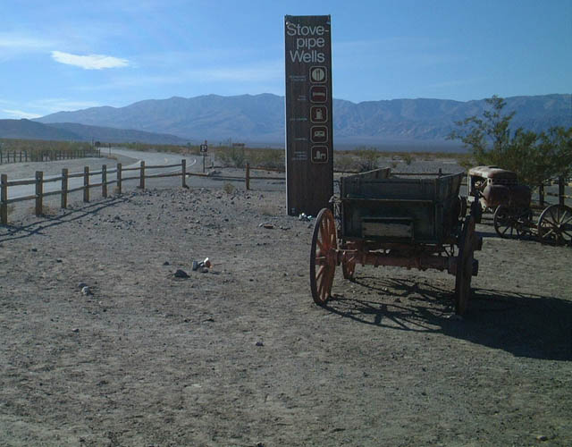
After Panamint Valley Road is this mileage sign, which provides the distance to Stovepipe Wells, which is the location of the next motorist services. The sign also provides distances to Death Valley Junction and California 127. California 190 is the main route into Death Valley National Park from the west.
01/19/02
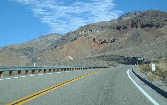
California 190 climbs Towne Pass (el. 4,956 feet), which separates Panamint Valley from Death Valley. The state route will descend from here to the lowest elevation in the United States.
01/19/02
At the top of Towne Pass is this mileage sign on California 190.
01/19/02
Eastbound California 190 meets Wildrose Road (Emigrant Canyon cutoff) nine miles west of Stovepipe Wells.
01/19/02
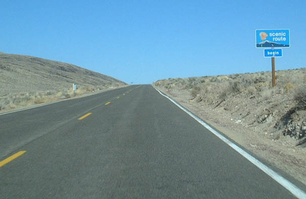
A California 190 east reassurance shield (with scenic route marker) is posted after the Wildrose Road/Emigrant Canyon cutoff.
01/19/02
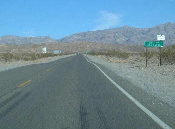
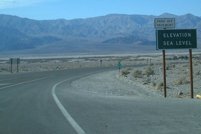
An elevation Sea Level sign is posted shortly thereafter along eastbound California 190 in Death Valley National Park.
01/19/02
Further ahead, a California 190 east reassurance shield is posted in Death Valley.
01/19/02
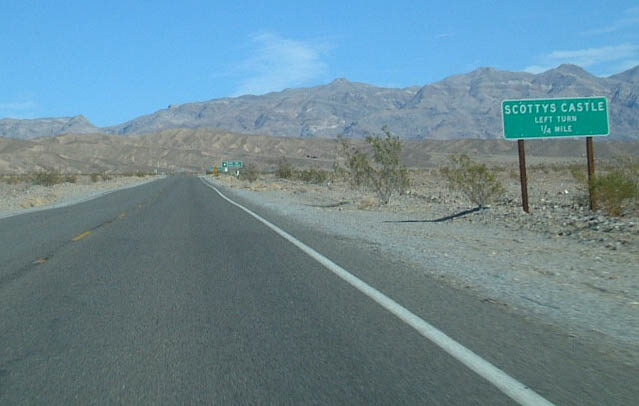
Eastbound California 190 approaches the turnoff to Scottys Castle, a large estate constructed in the middle of the desert that is part of Death Valley National Park.
01/19/02
A mileage sign is posted on California 190 east near the eastern boundary of Death Valley National Park. Several of the original, button-copy, non-reflective signs had been replaced with reflective signs such as this one. Reflective signs first appeared in California in 1999, so this sign had been in place for only a short time at the time this picture was taken.
01/19/02
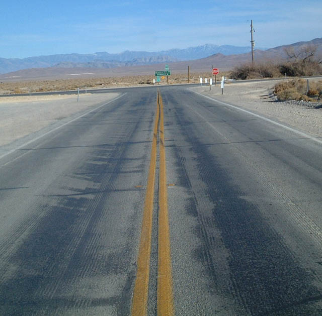
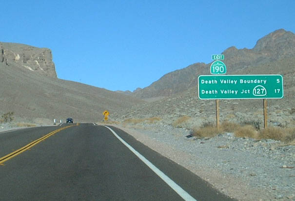
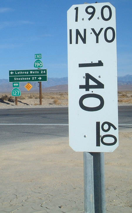
Approaching California 127 at Death Valley Junction is the eastern terminus of California 190.
01/19/02
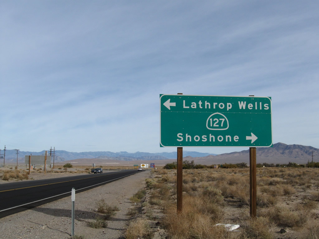
Eastbound California 190 approaches California 127, which leads north to Amargosa Valley, Nevada (formerly Lathrop Wells) and south to Shoshone. Services are available in both communities. This sign was placed in late 2001 or early 2002.
11/11/08
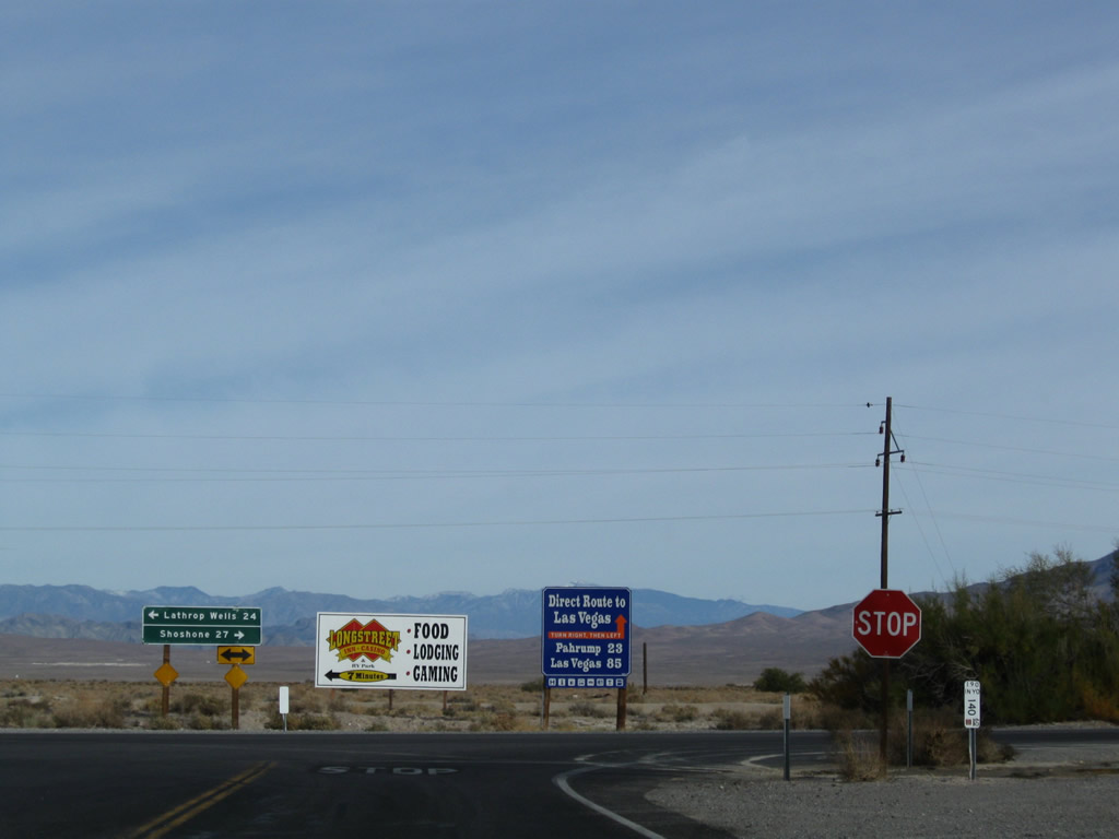
A stop sign and arrow warning sign are posted at the "end of the line" for California 190 east at the intersection with California 127 in Death Valley Junction. No services are available here.
11/11/08
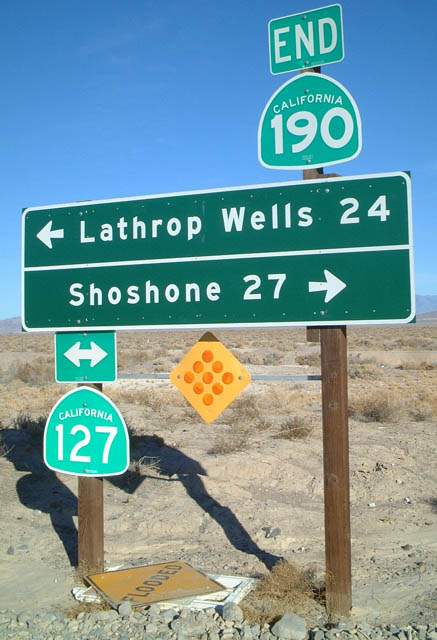
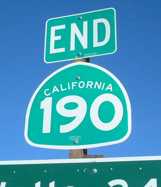
An end California 190 shield was posted at Death Valley Junction and the T-intersection with California 127; it was gone by November 2008, having been replaced with a less descriptive reflective sign. The mileage to the destinations (Lathrop Wells, which is the former name of Amargosa Valley and Shonshone) was the only information remaining on the sign.
01/19/02
A final California 190 postmile is found at the junction with California 127.
01/19/02
This mileage sign and first reassurance shield are posted along California 190 west after the California 127 intersection.
11/11/08
01/19/02
Button copy shields are increasingly rare and hard to find as signs across the state of California are changed to reflective standards. The assembly on SR 190 west of SR 127 was replaced by 2021.
11/11/08
Westbound California 190 meets the cutoff to Badwater and Devils Golf Course. Although not signed, this road connects to California 178.
01/19/02
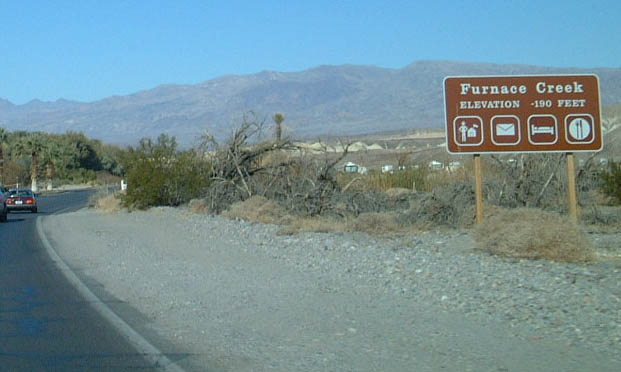
California 190 west approaches Furnace Creek, a visitors center located within Death Valley National Park. All services are available here.
01/19/02
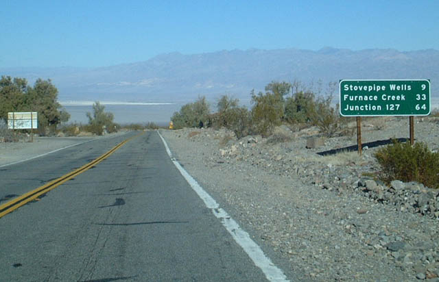
Westbound California 190 approaches Stovepipe Wells, the first services since Furnace Creek. Unlike many other national parks in the United States, the primary route remains signed as a state route throughout Death Valley National Park. Compare this to the numerical routes entering Yellowstone National Park or Yosemite National Park, which are not signed.
01/19/02
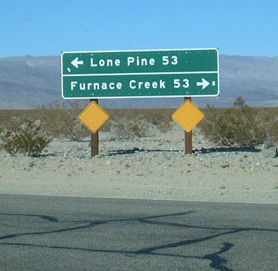
A mileage sign along westbound California 190 is posted at the Wildrose Road and Emigrant Canyon Cutoff intersection.
01/19/02
Destination sign posted for SR 190 at the northern end of Panamint Valley Road.
01/19/02
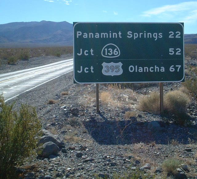
Another mileage sign is posted on westbound California 190 after Panamint Valley Road.
01/19/02
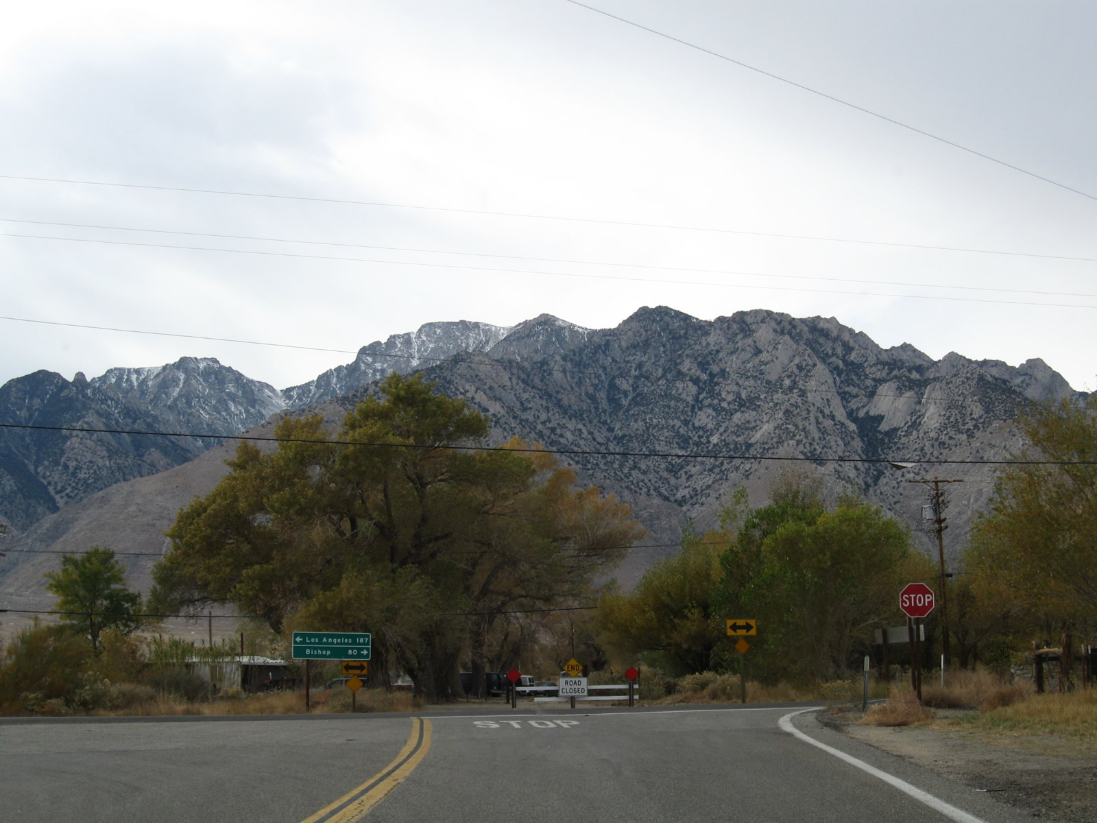
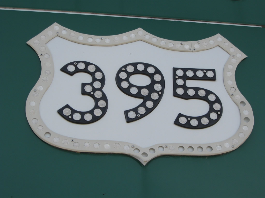
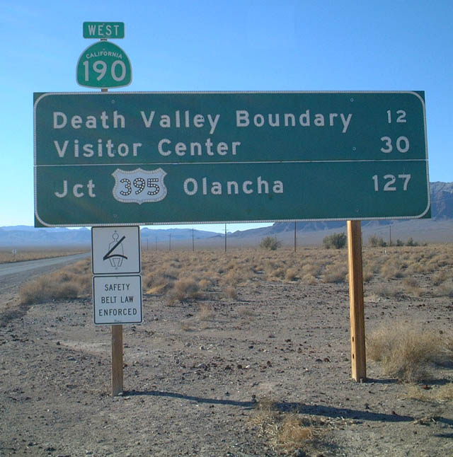
Westbound California 190 concludes at U.S. 395 in the unincorporated community of Olancha. On the other side of the Sierra Nevada, California 190 has a short segment in the Central Valley that is not directly connected to this section. Plans originally called for connecting the two state routes, but the highway was not built over the towering mountains.
11/10/08
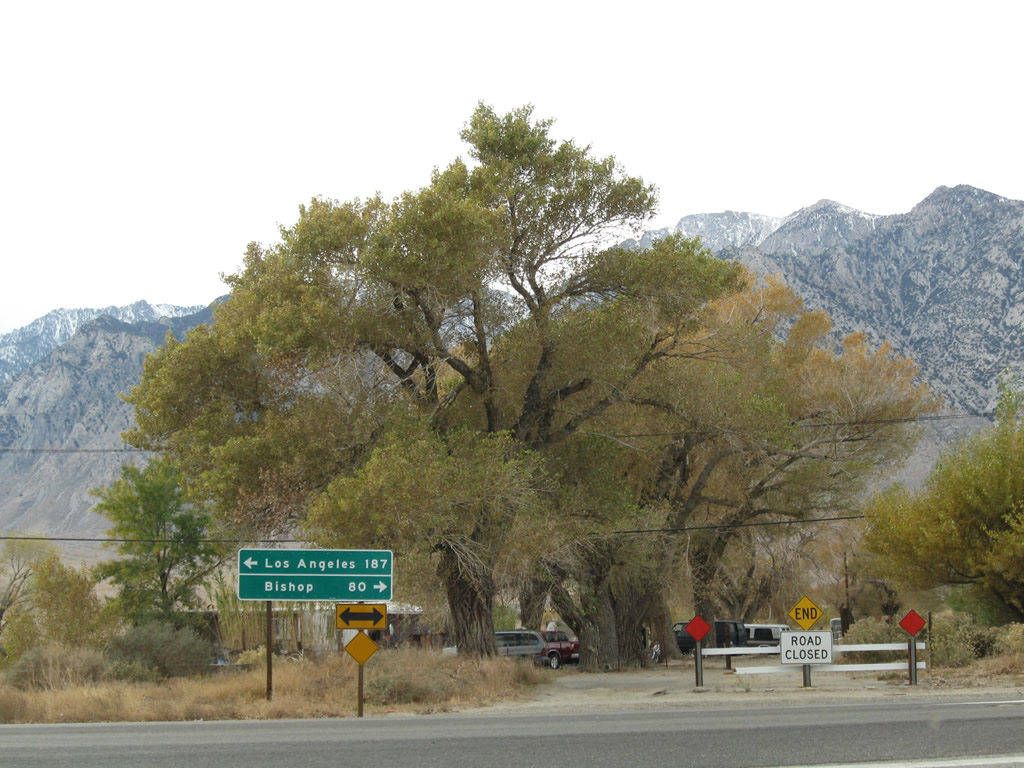
Turn left to follow U.S. 395 south to Los Angeles via California 14 (187 miles) or north to Bishop (80 miles).
11/10/08
The road leading from California 190 to the Dante's View overlook is narrow but paved and passable. This view shows the final ascent to the vista point. Dante's View is named after the classicDante's Infernoand its multiple circles of hell (limbo, lust, gluttony, avarice, wrath/sloth, heresy, violence, fraud, and treason). It probably stands to reason that since Dante's View overlooks Death Valley, a reference to hell is in order.
01/19/02
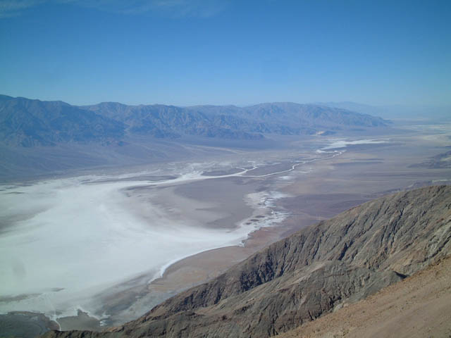
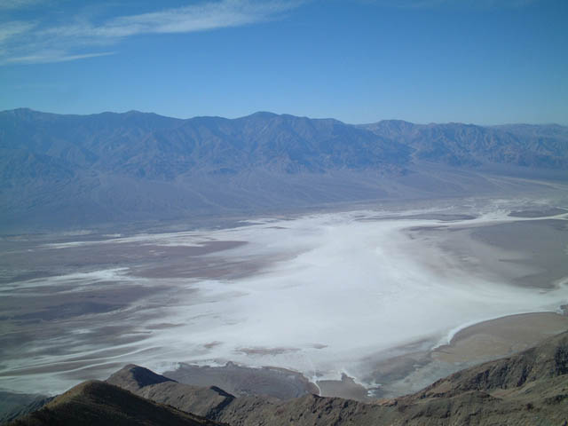
View of Death Valley and the wide swath of the Amargosa River as seen from Dante's View (a vista point over Death Valley located in the Amargosa Range). Dante's View may be reached from a turnoff from California 190 along Furnace Creek Road.
01/19/02
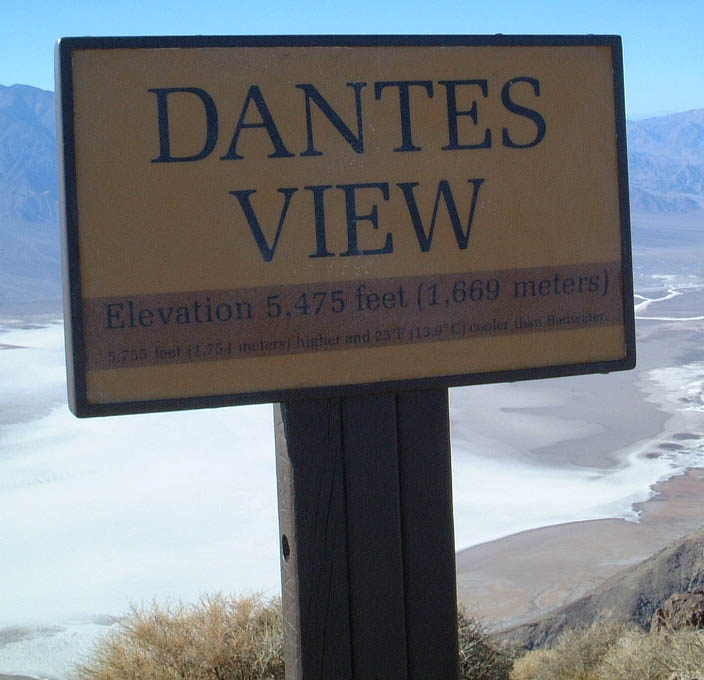
This sign is posted at Dante's View, elevation 5,475 feet. The valley floor is 282 feet below sea level at its lowest. Badwater, the lowest point in the United States, is not visible from Dantes View. In the movieStar Wars: A New Hope,the scene where Obi-Wan Kenobi looks down on Mos Eisley the spaceport on Tatooine and calls the city a "wretched hive of scum and villany," he was looking down at Death Valley from Dante's View.
01/19/02
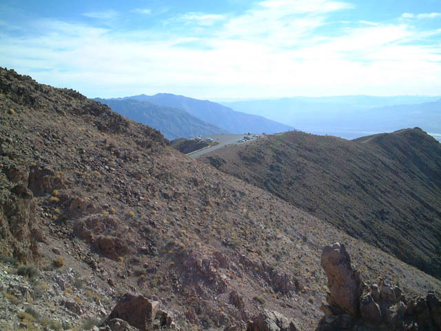
Dante's View and Death Valley below from a nearby outcropping.
01/19/02
Photo Credits:
- Andy Field: 01/19/02, 11/10/08, 11/11/08
Connect with:
Page Updated Friday March 19, 2010.