
Clark County Route 215 West and North (Inner Loop)
Work between February 2025 and February 2028 reconstructs the exchange joining Clark County Route 215 (Bruce Woodbury Beltway) and the west end of SR 613 (Summerlin Parkway) at Sunset Run Drive in Summerlin. Initially costing $130 million, improvements at the Clark County CC-215 & Summerlin Parkway Interchange project include a loop ramp from Sunset Run Drive east to CC-215 north and a directional ramp from CC-215 south to SR 613 east.

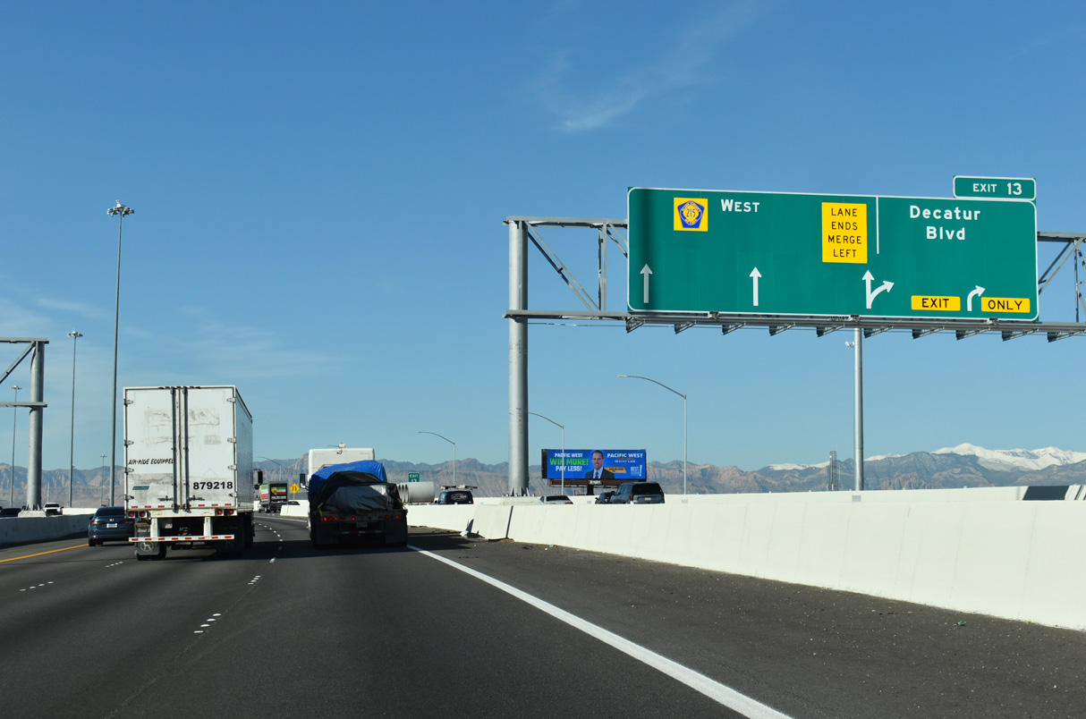
Passing under Dean Martin Drive, Exit 13 leaves Clark County Route 215 (CC-215) for Decatur Boulevard.
11/25/25

A c/d roadway was built between I-15 at Exit 12 and Decatur Boulevard at Exit 13 as part of improvements to the Bruce Woodbury Beltway that was completed in 2025.
11/25/25
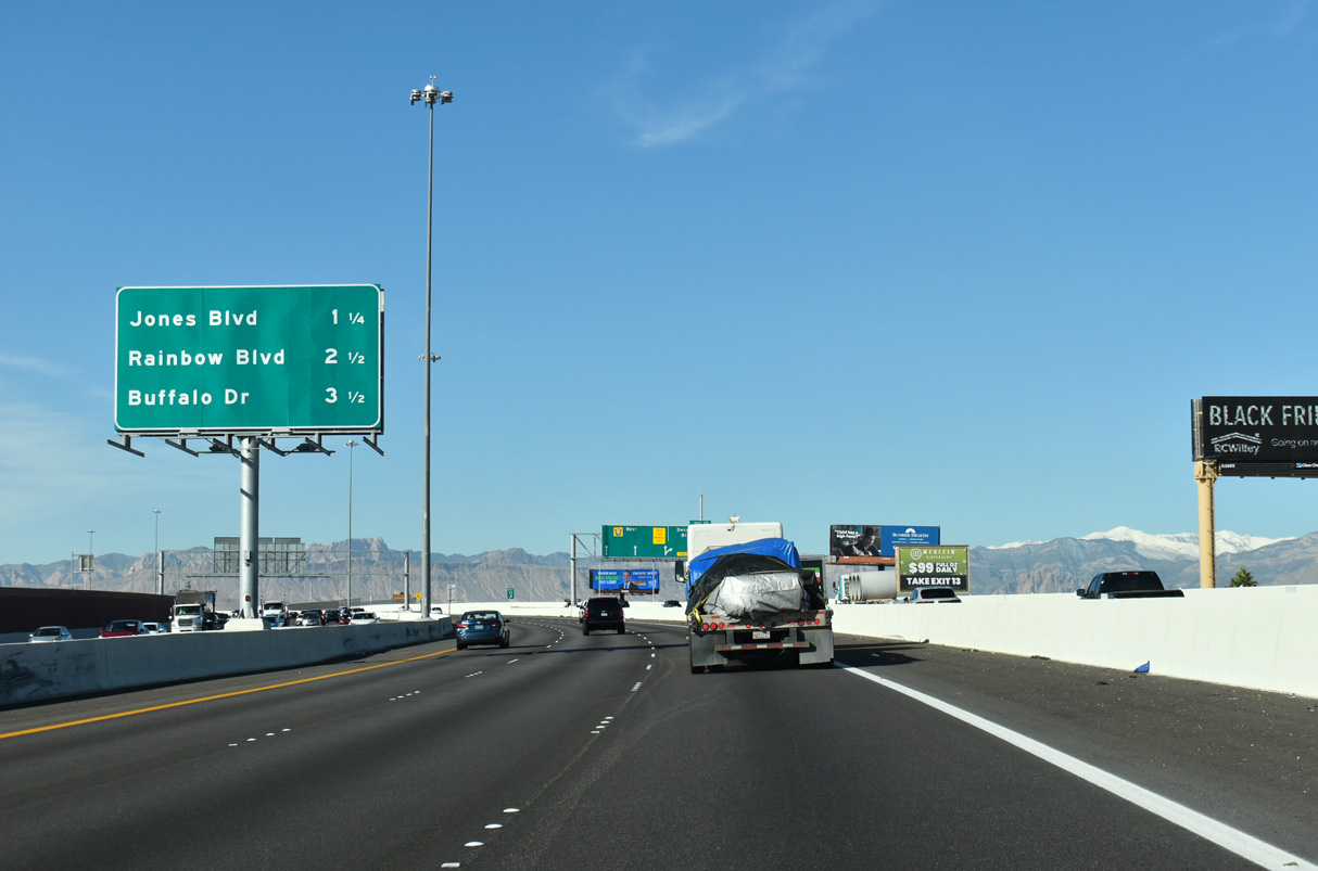
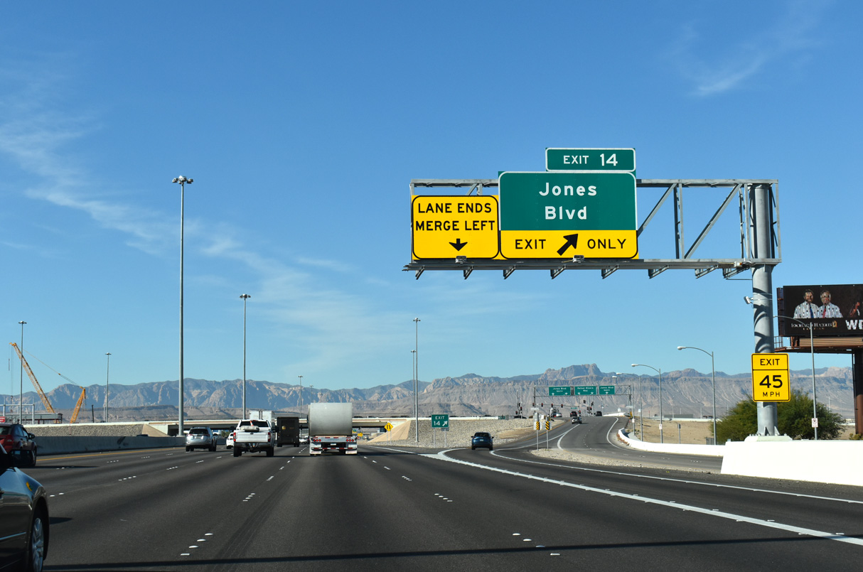
CC-215 (Bruce Woodbury Beltway) advances west 1.25 miles to meet Jones Boulevard next.
11/25/25
Decatur Boulevard extends 9.8 miles north through Spring Valley and western Las Vegas to North Las Vegas Airport (VGT) at SR 599 (Rancho Drive).
11/25/25
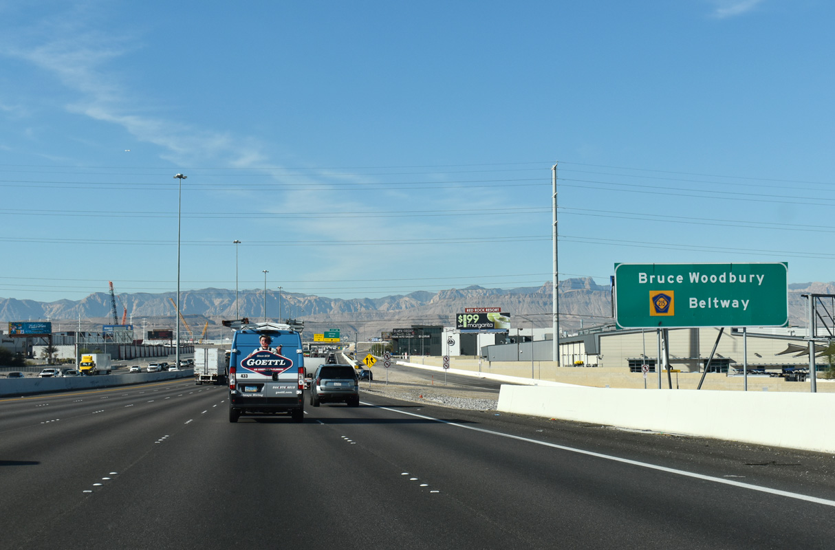
CC-215 overlays the remainder of the Bruce Woodbury Beltway around the Las Vegas region.
11/25/25
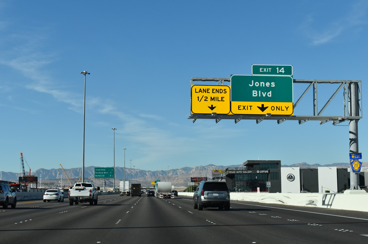
Jones Boulevard originates in south Enterprise, meeting CC-215 ahead of entering Spring Valley.
11/25/25
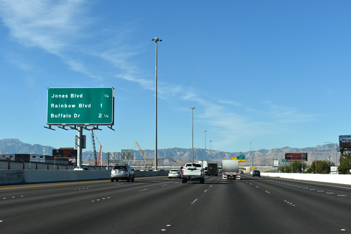
The Bruce Woodbury Beltway leaves unincorporated Enterprise at Rainbow Boulevard in one mile.
11/25/25
Jones Boulevard travels north from CC-215 into Spring Valley and Las Vegas, meeting the northern side of the beltway near Copperfield neighborhood.
11/25/25
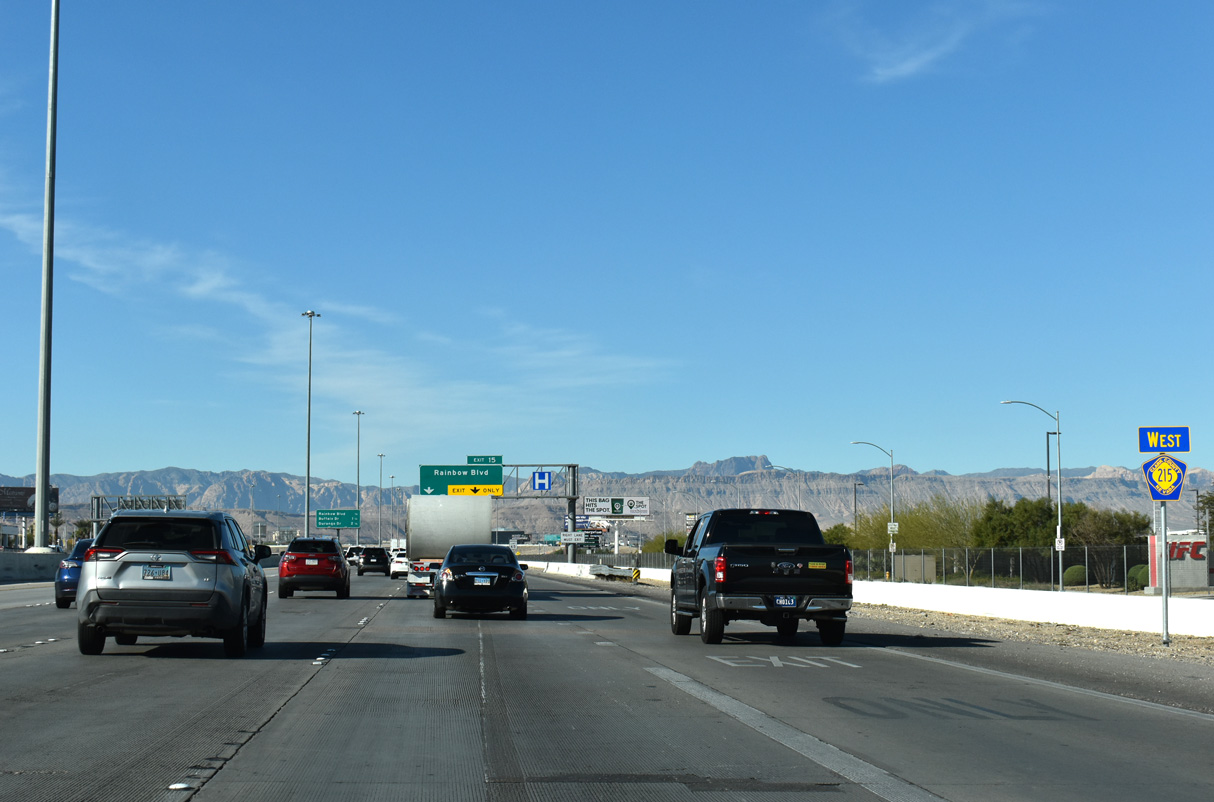
Westbound CC-215 (Bruce Woodbury Beltway) advances to Rainbow Boulevard next at Exit 15.
11/25/25
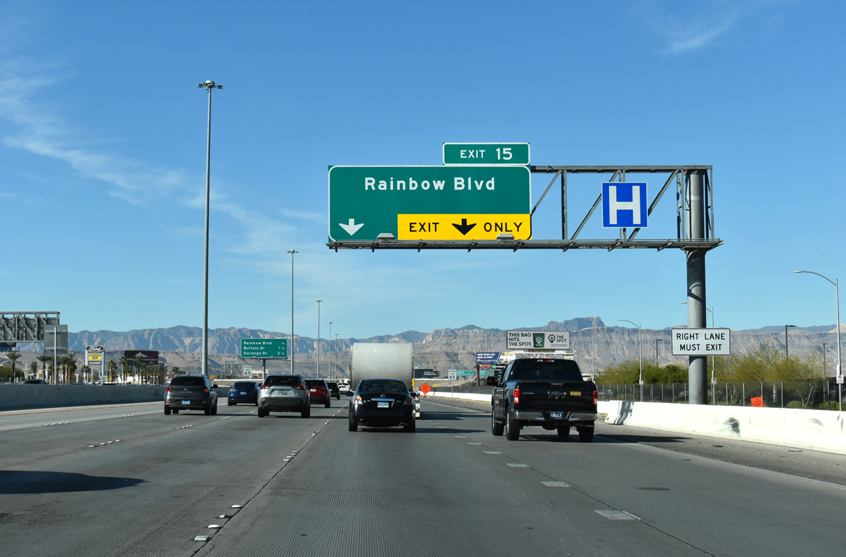
Rainbow Boulevard is a major arterial that connects the Bruce Woodbury Beltway with Spring Valley and Enterprise.
11/25/25
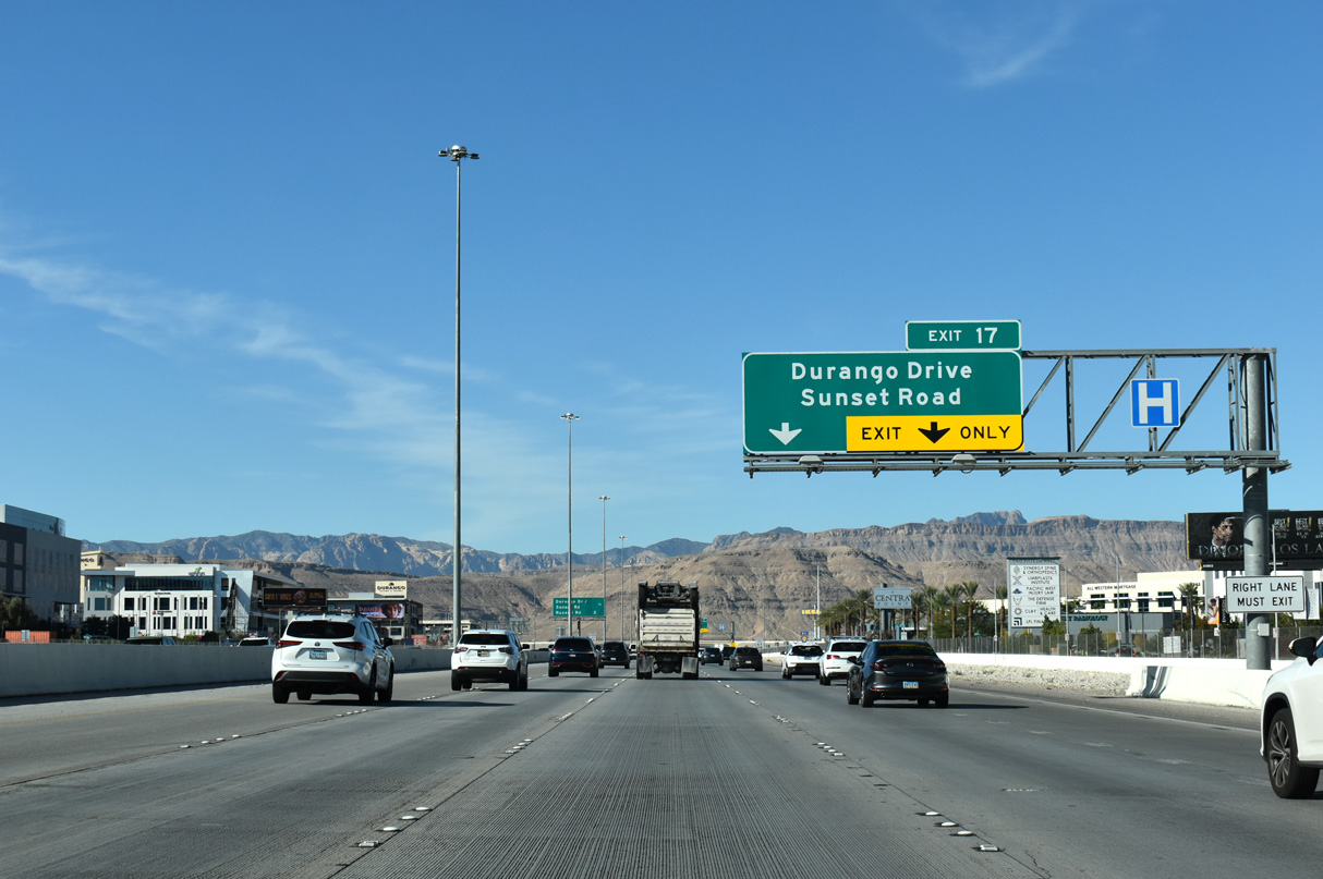
The Bruce Woodbury Beltway curves northward 2.25 miles to Durango Drive at Exit 17.
11/25/25

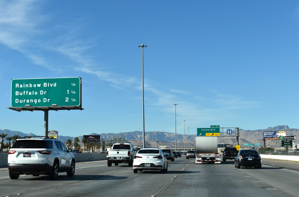
Rainbow Boulevard heads north through central Spring Valley into western neighborhood of Las Vegas. Southward, Rainbow Boulevard extends to SR 160 and south Enterprise.
11/25/25
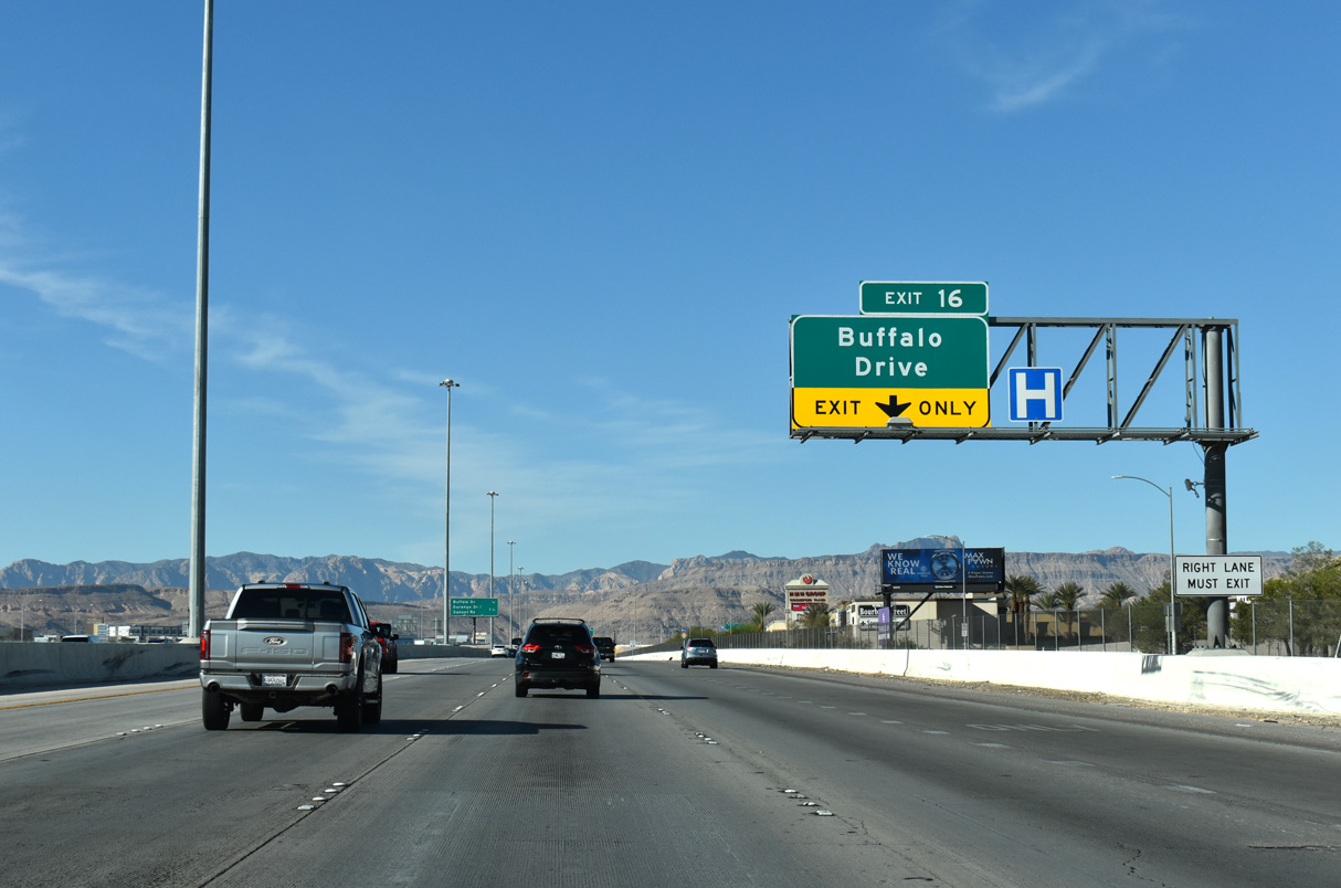
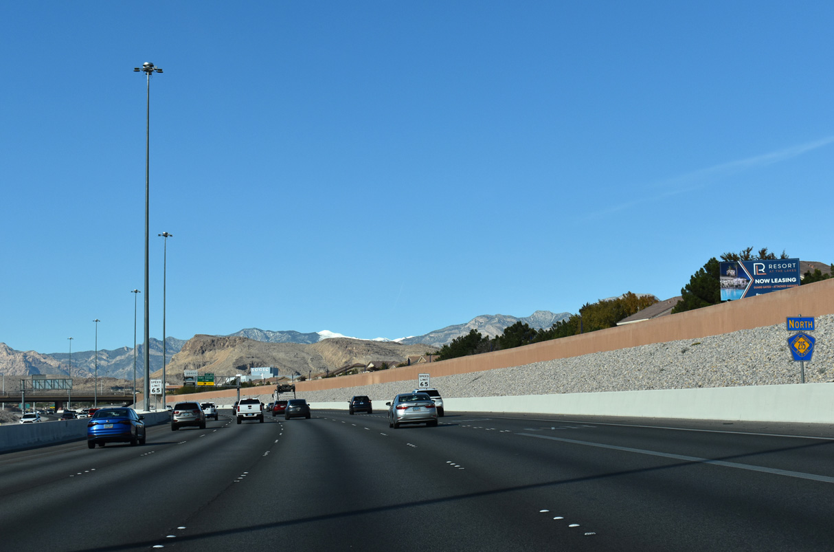
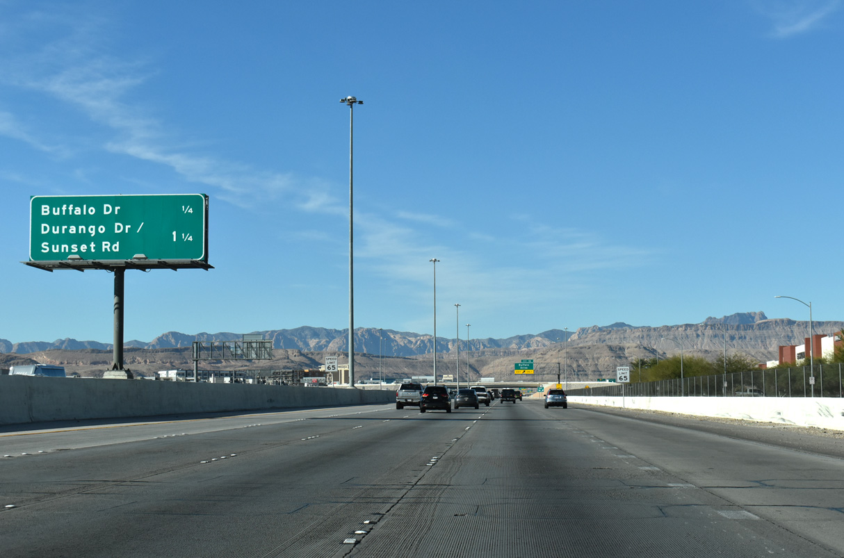
Buffalo Drive meets the Bruce Woodbury Beltway one mile west of Rainbow Boulevard at Exit 16.
11/25/25

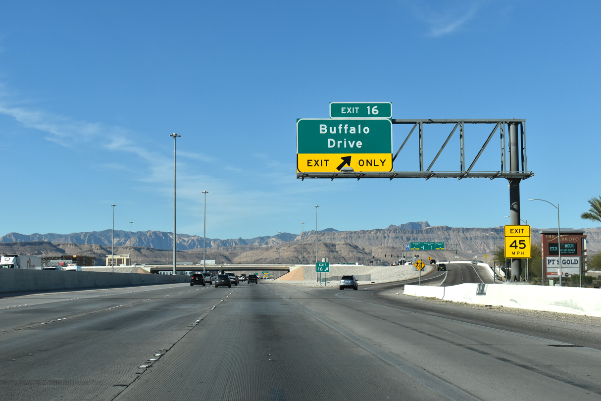
A split diamond interchange joins CC-215 with Durango Drive and Sunset Road in 1.25 miles.
11/25/25
Locally, Buffalo Drive extends south to SR 160 (Blue Diamond Highway) and north to Hacienda Avenue.
11/25/25
Blue Diamond Hill (el. 4,956 feet) and the Sandstone Bluffs become more visible as CC-215 advances west one half mile to Durango Drive / Sunset Road.
11/25/25
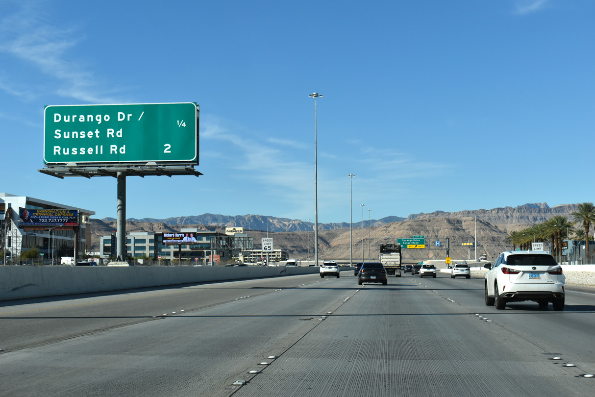
Sunset Road stretches 18.3 miles overall east across the lower valley between Spring Valley and Henderson while Durango Road travels 13.2 miles north from Enterprise to Summerlin.
11/25/25
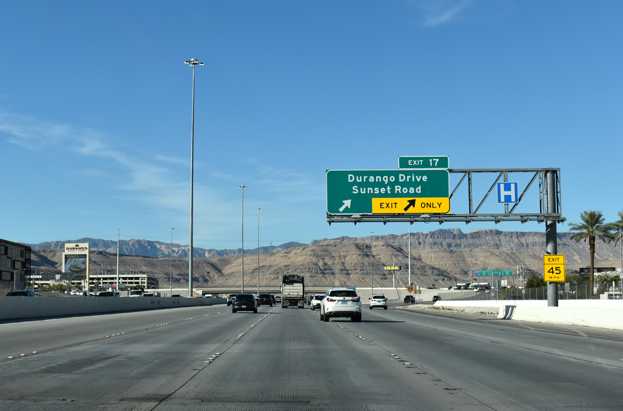
The split diamond (Exit 17) interchange with Durango Drive and Sunset Road along CC-215 west. Durango Road heads 1.3 miles north to meet Russell Road and south 0.7 miles to Warm Springs Road.
11/25/25
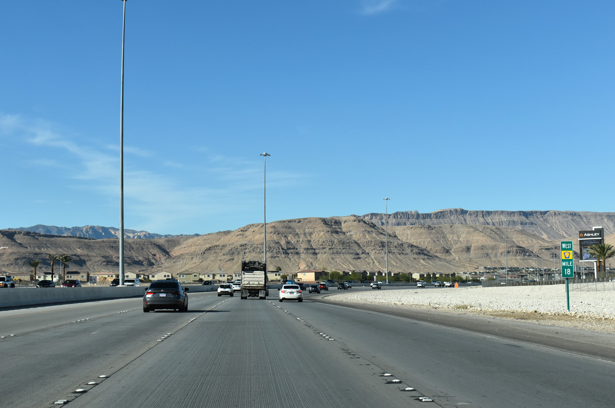
18 miles from the Henderson Bowl interchange (I-11), CC-215 and the Bruce Woodbury Beltway turns north toward Summerlin and northern reaches of Las Vegas.
11/25/25
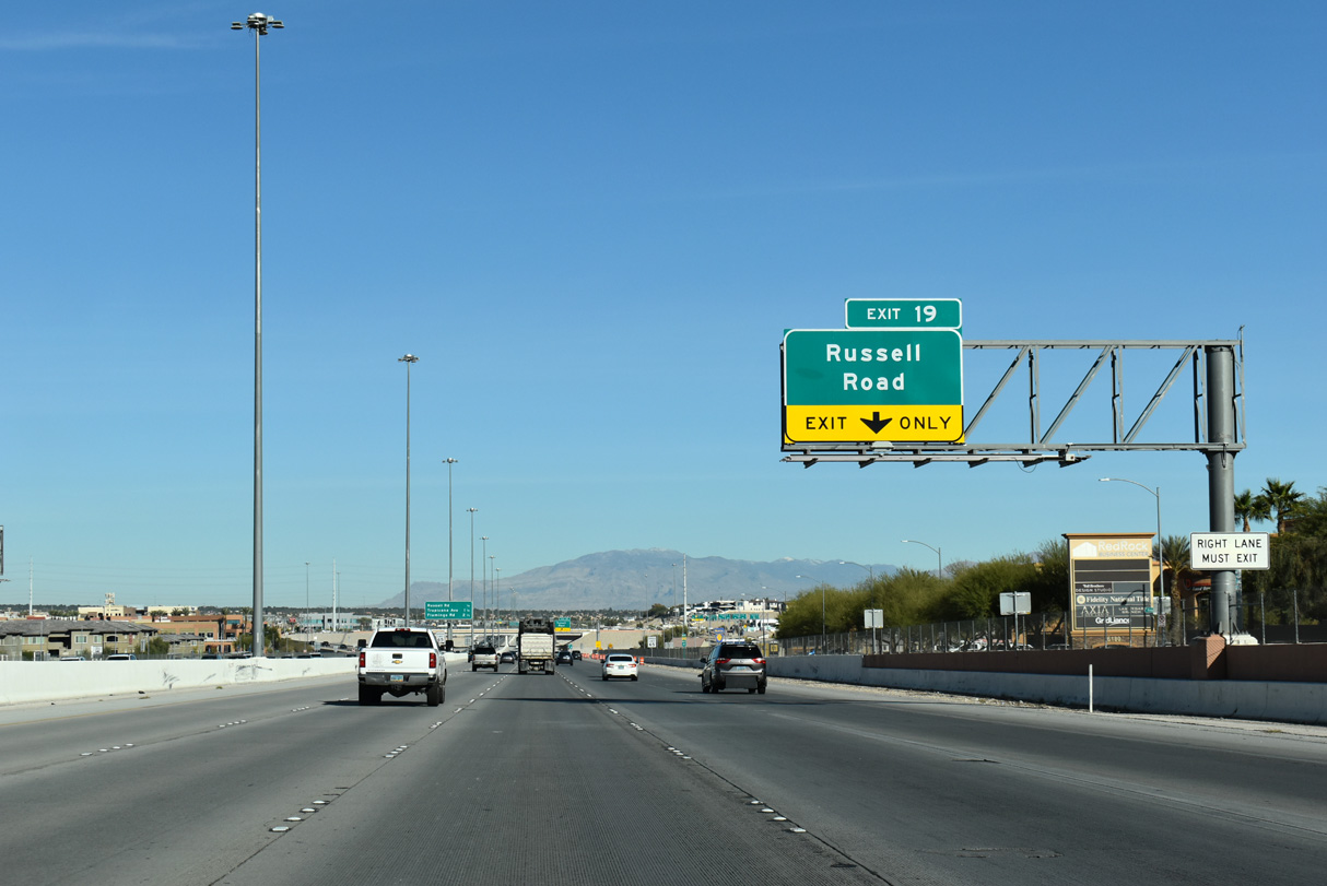
The next interchange along CC-215 is with Russell Road at Exit 19.
11/25/25
This confirming marker near milepost 19 indicates the cardinal direction change along the Bruce Woodbury Beltway.
11/25/25
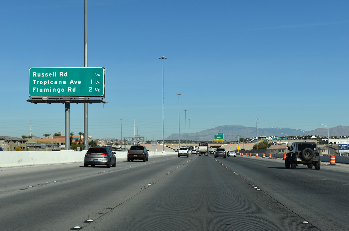
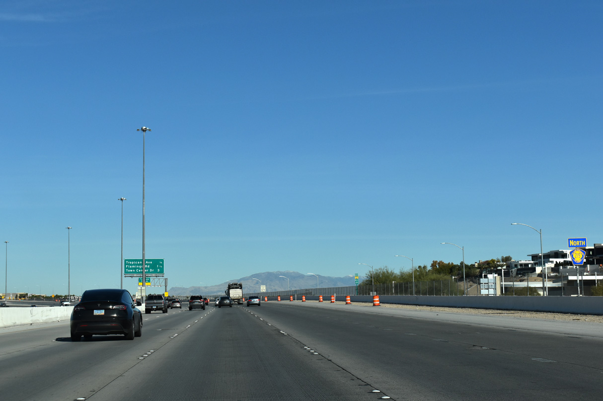
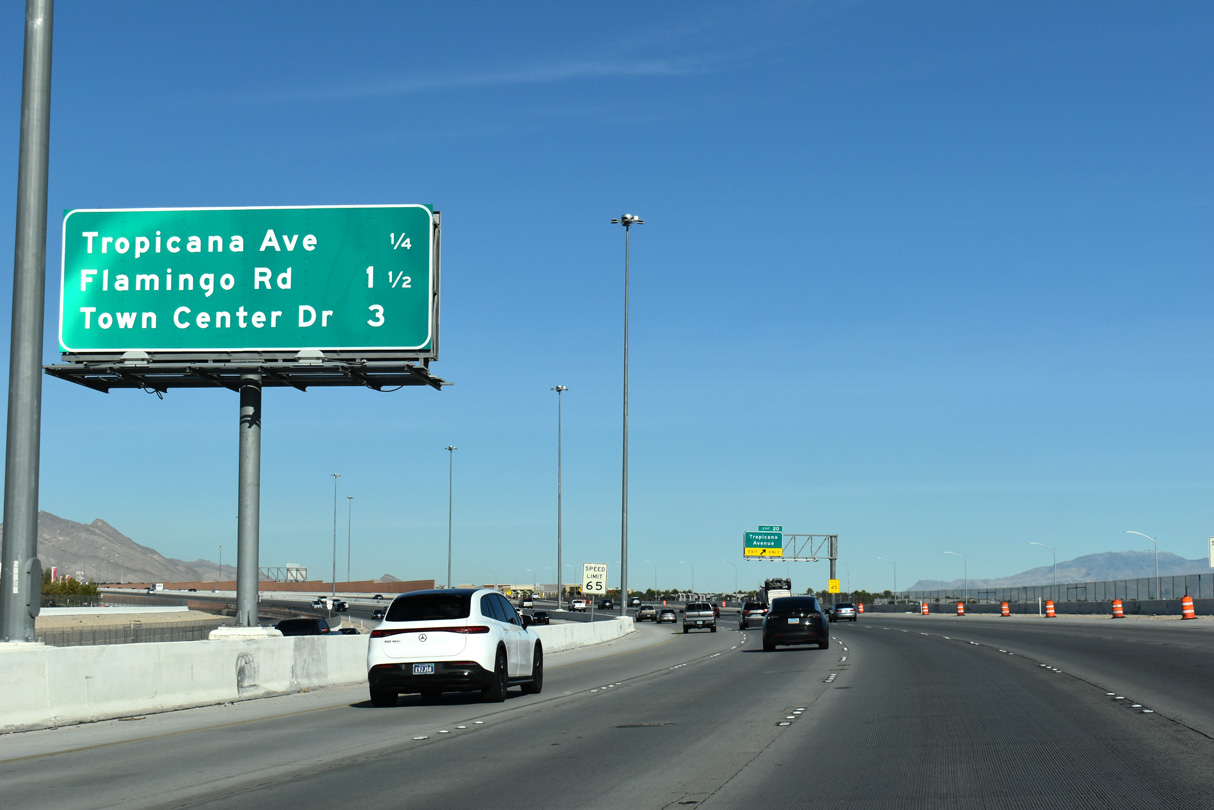
Both Tropicana Avenue from Exit 20 and Flamingo Road from Exit 21 stretch across Spring Valley to the southern half of the Las Vegas Strip.
11/25/25
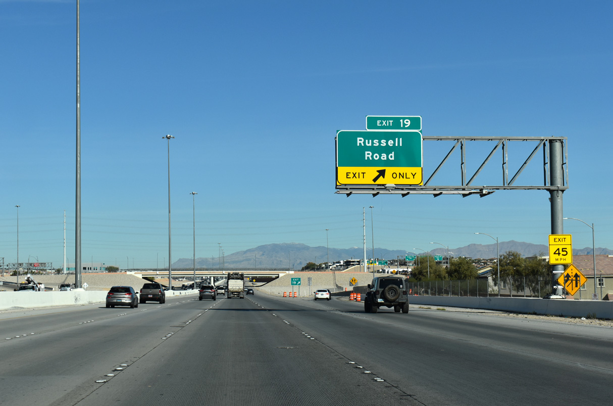
Exit 19 joins CC-215 (Bruce Woodbury Beltway) to Russell Road. Locally, Russell Road extends west to Hualapai Way and east to Buffalo Drive.
11/25/25

Clark County Route 215 advances from Russell Road to meet Tropicana Avenue next at Exit 20.
11/25/25
The Bruce Woodbury Beltway follows an S-curve through the exchange (Exit 20) with Tropicana Avenue. A single point urban interchange (SPUI) joins the freeway with Town Center Drive in three miles.
11/25/25

A slip ramp departs CC-215 north at Exit 20 for Brent Thurman Way to Tropicana Avenue. Tropicana Avenue connects the western suburbs with the Strip, Harry Reid International Airport (LAS), and the University of Nevada at Las Vegas (UNLV).
11/25/25
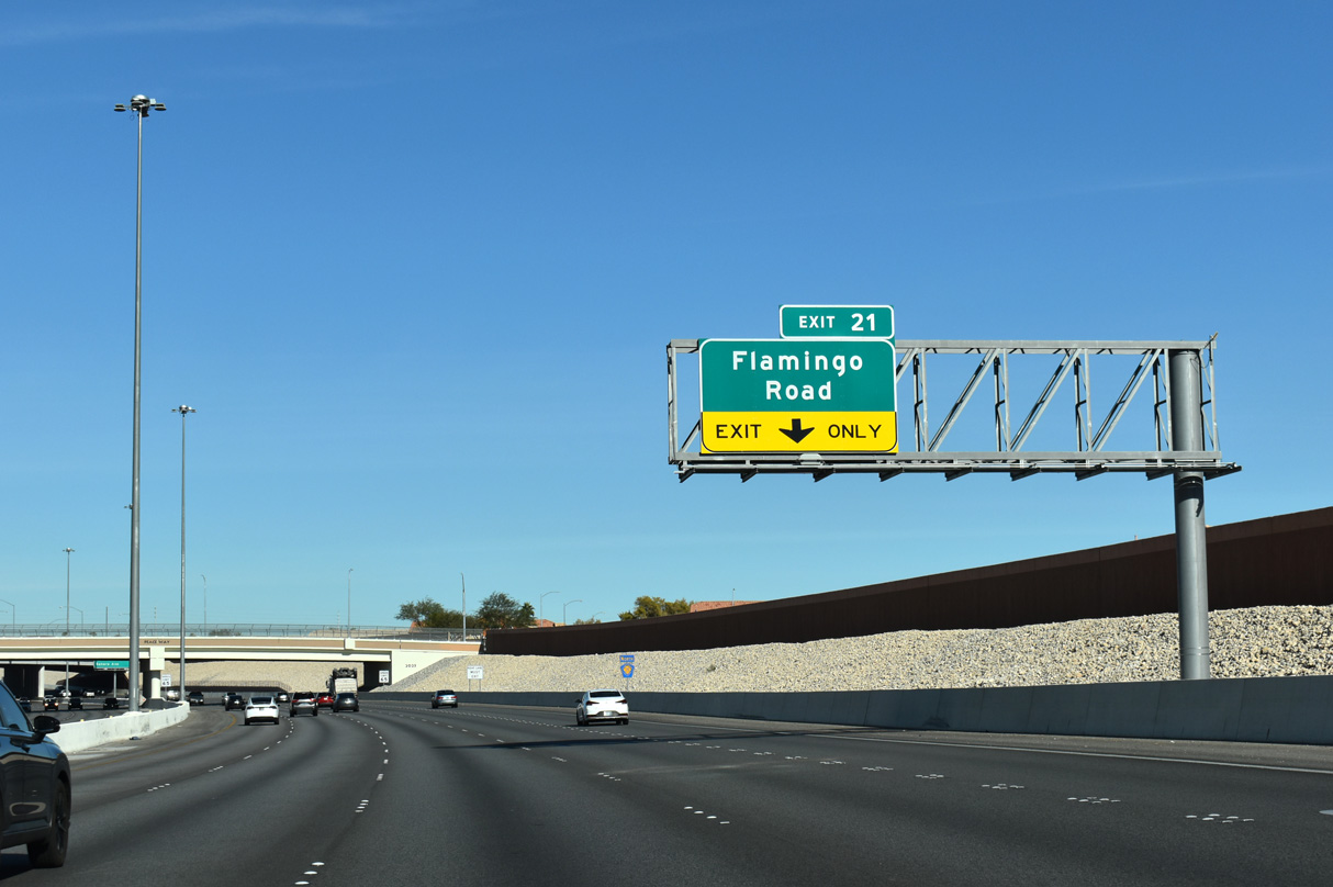
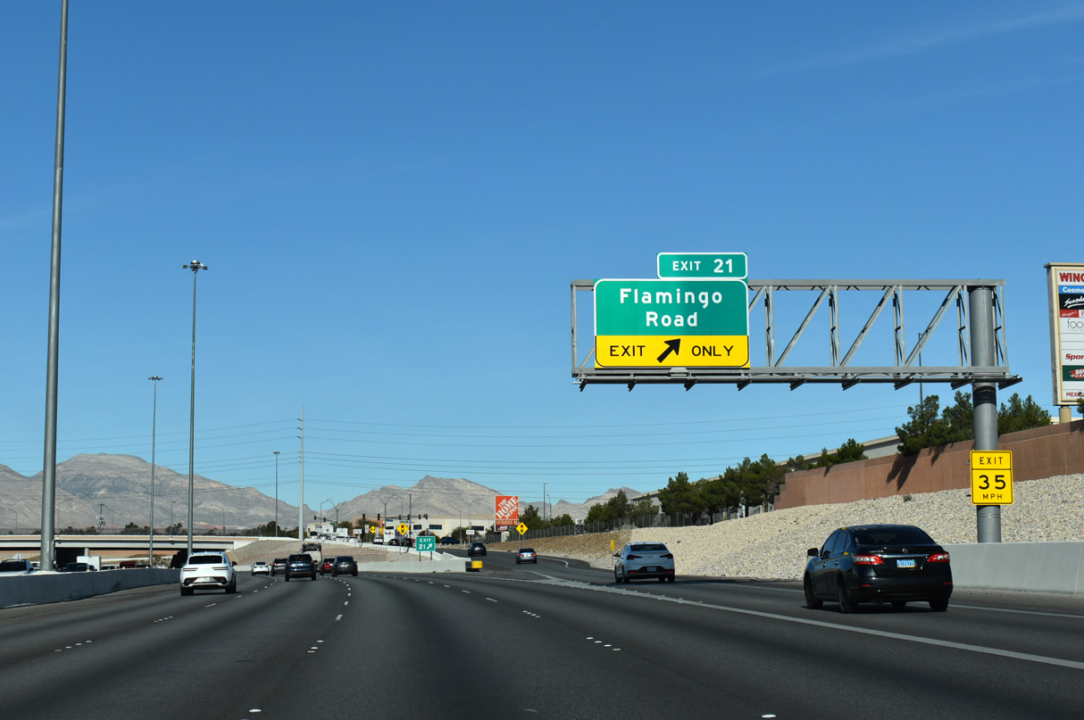
Sound walls divide the Bruce Woodbury Beltway from residential neighborhoods between Tropicana Avenue and Exit 21 to Flamingo Road.
11/25/25
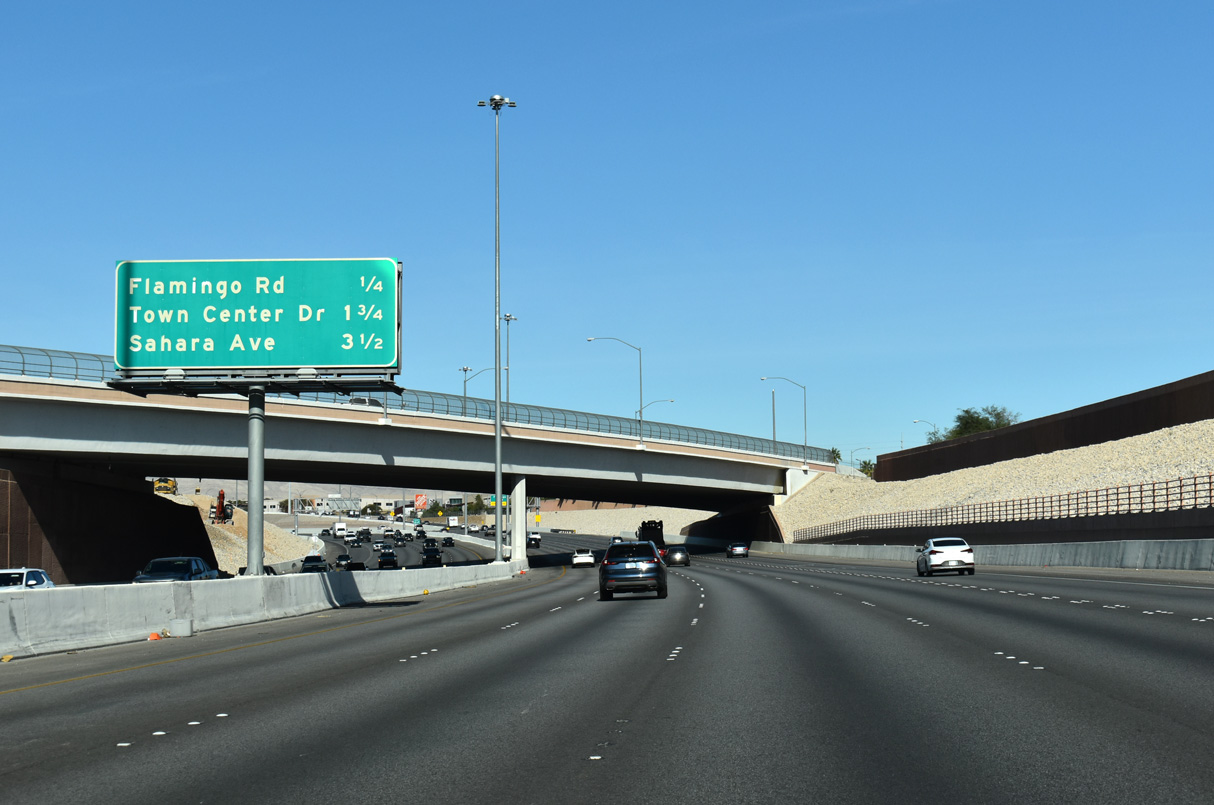
Fort Apache Road spans CC-215 ahead of Flamingo Road. Sahara Avenue and Desert Foothills Drive come together at the freeway in 3.5 miles.
11/25/25
Flamingo Road parallels the Bruce Woodbury Beltway northwest from Exit 21 to Desert Inn Road opposite Red Rock Ranch Road. Going east, Flamingo Road enters central Spring Valley en route to I-15 and the Strip.
11/25/25
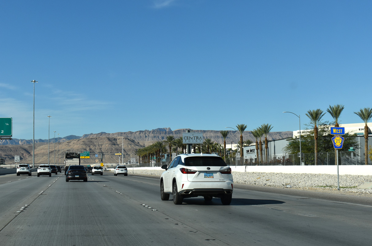
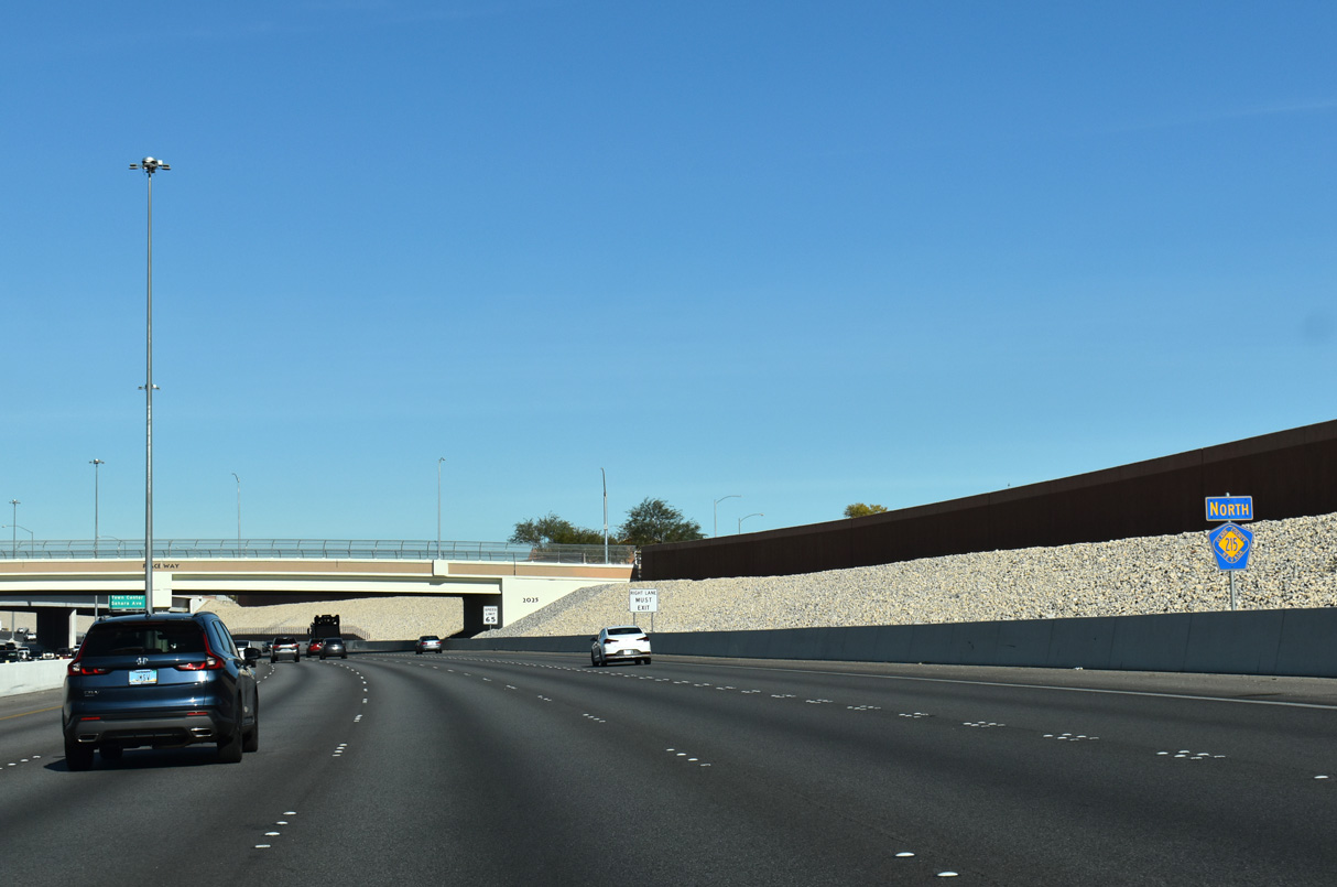
CC-215 angles northwest to Town Center Drive next, passing under Hualapai Way en route.
11/25/25

Summerlin, a master planned community, houses over 100,000 residents over 22,500 acres of the western valley region.1 The Bruce Woodbury Beltway travels the next eight miles through the community.
07/21/17
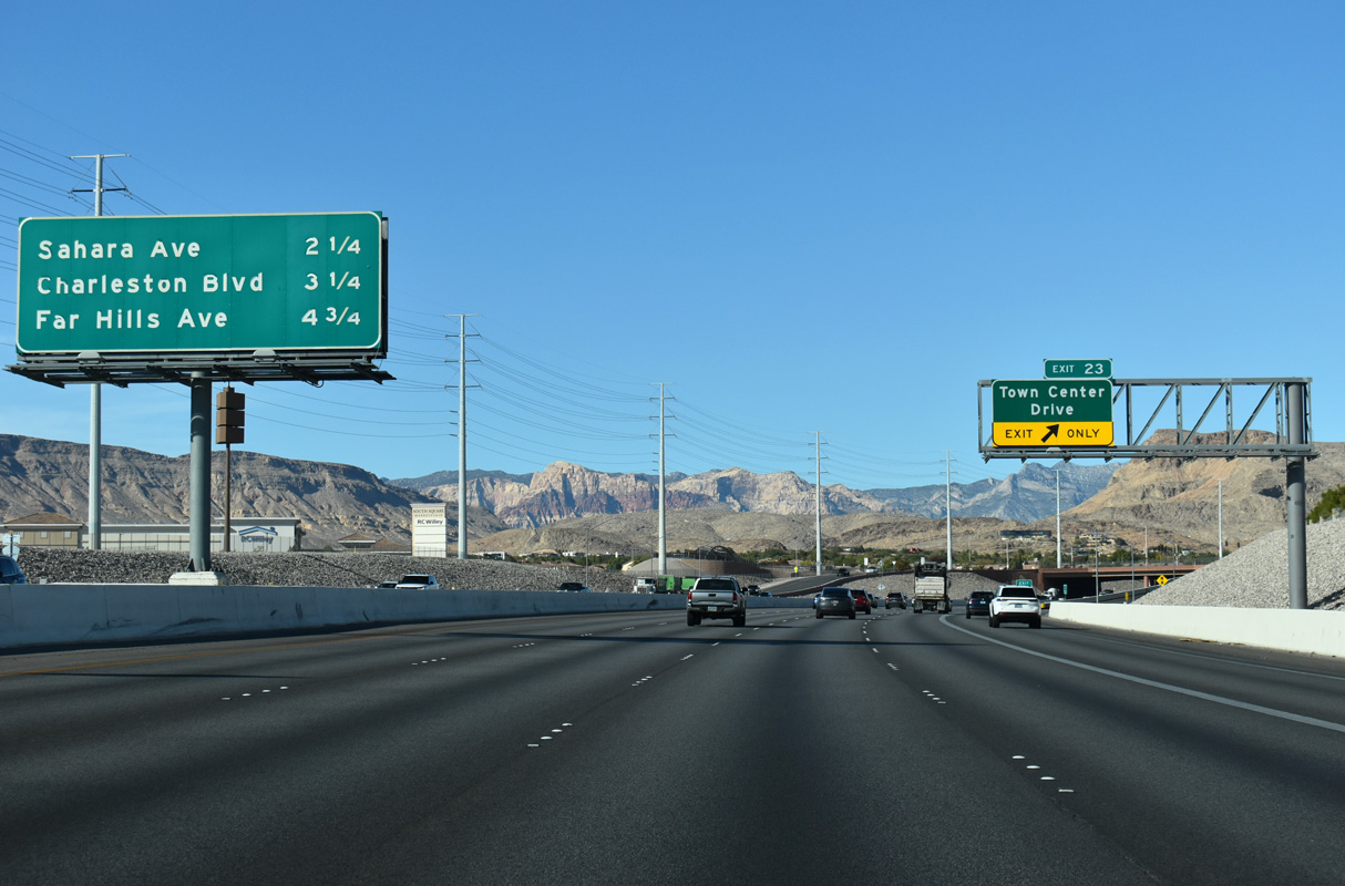
Far Hills Avenue meets CC-215 at a SPUI near the Amber Hills and Quail Ridge neighborhoods within Summerlin 4.75 miles ahead.
11/25/25
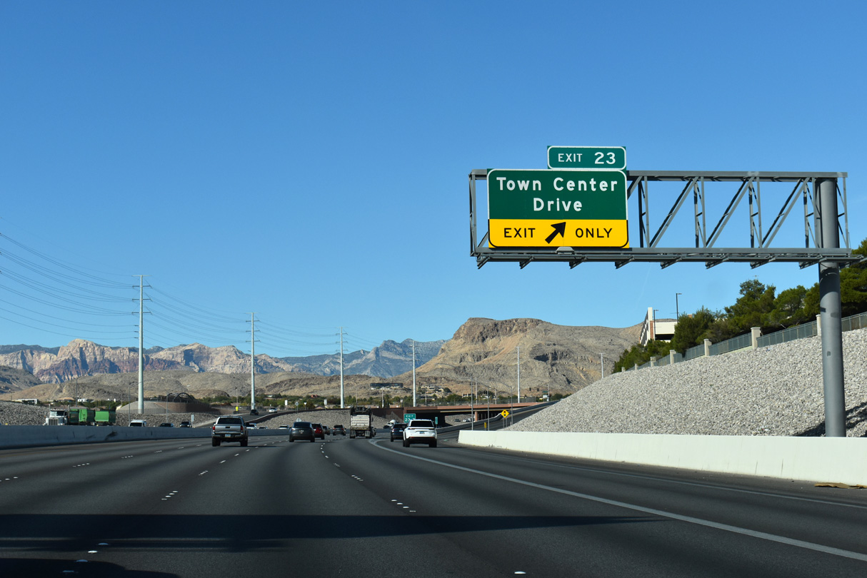
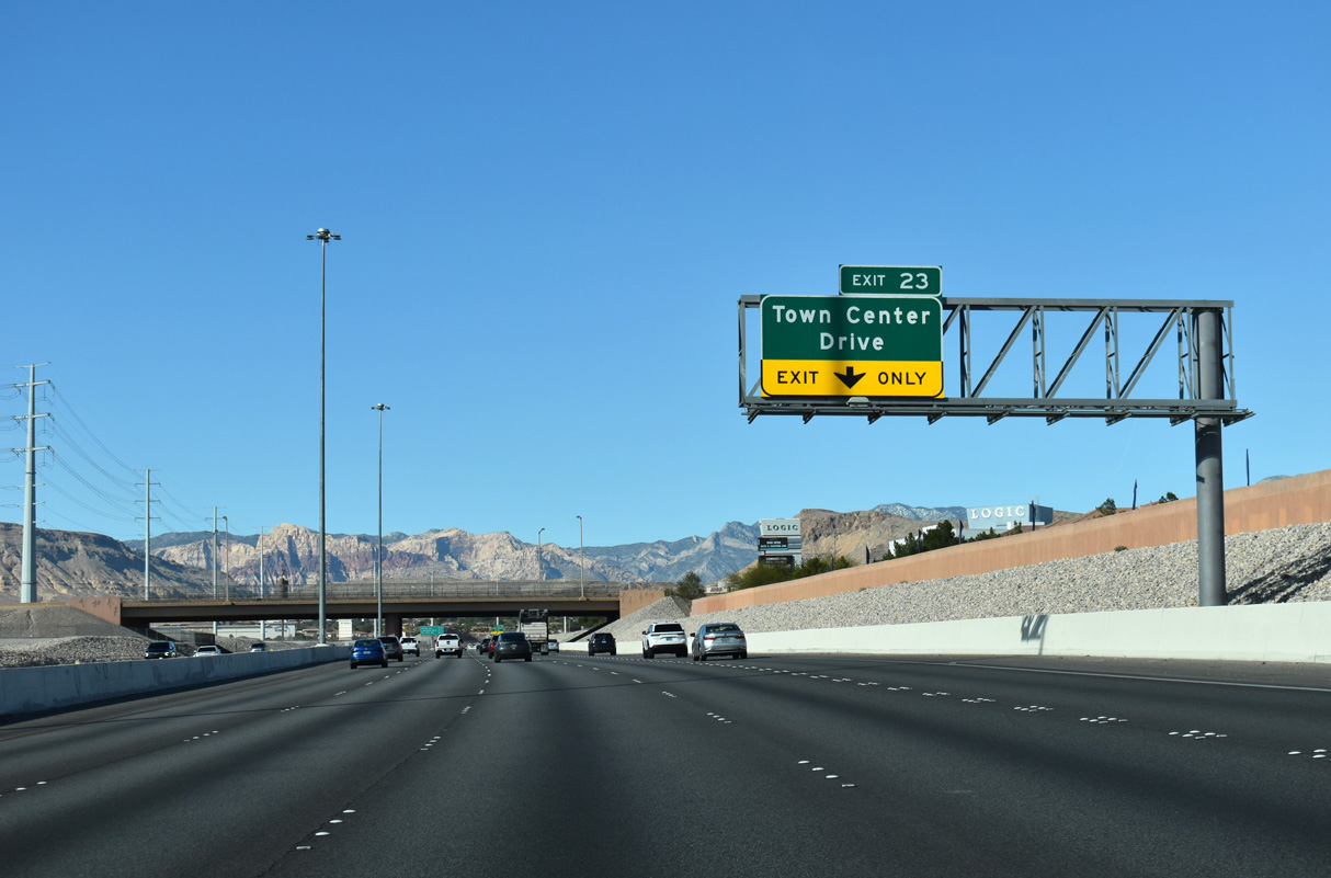
The Bruce Woodbury Beltway at Exit 23 to Town Center Drive. The Gardens neighborhood lines Town Center Drive to the north while Ridgebrook lies to the south near Flamingo Road.
11/25/25
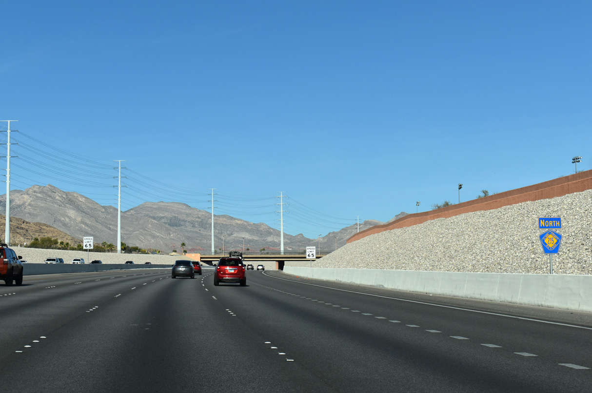
Confirming marker posted along northbound CC-215 within the interchange at Town Center Drive.
11/25/25
CC-215 (Bruce Woodbury Beltway) re-curves north between the Gardens and Ridgebrook neighborhoods one mile out from Exit 25 with Sahara Drive.
11/25/25
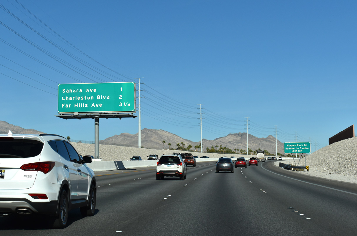
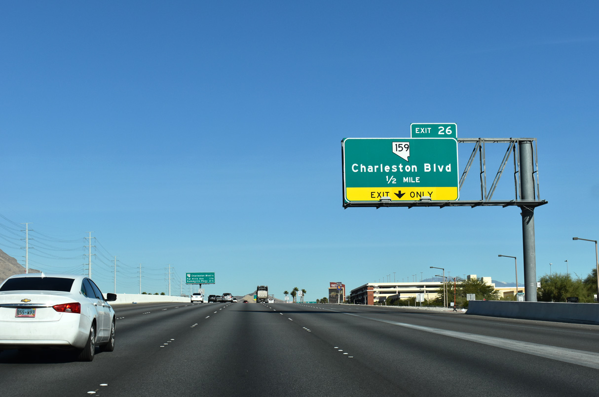
Hughes Park Drive forms a frontage road system along the beltway, connecting Sahara Avenue with Charleston Boulevard (SR 159) at Exit 26.
11/25/25
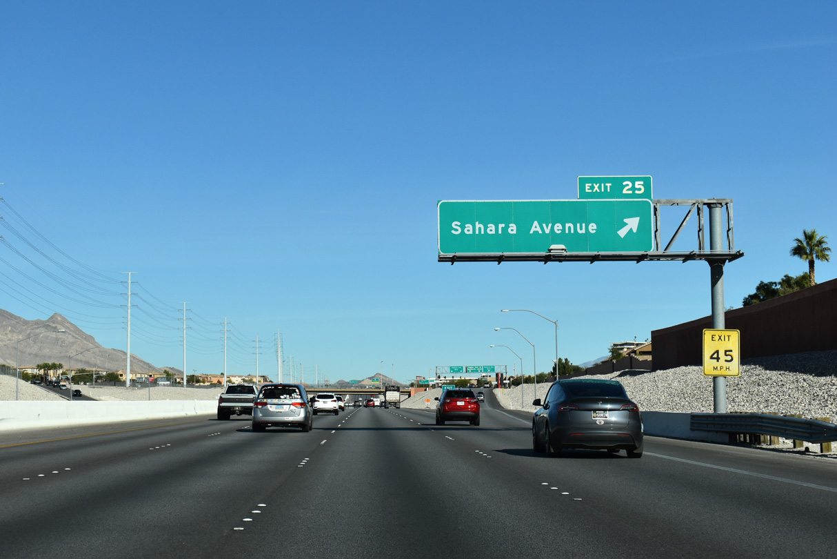
Sahara Avenue joins CC-215 with Downtown Summerlin at Exit 25. Downtown Summerlin opened October 9, 2014 offering shopping, dining, and entertainment.2
11/25/25
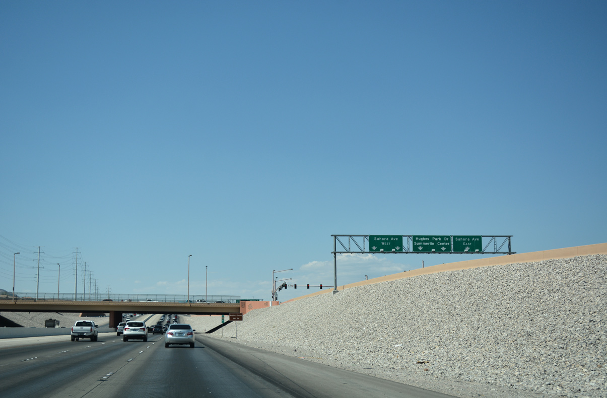
Heading east from CC-215, Sahara Avenue continues through Spring Valley to I-15 and the north end of the Las Vegas Strip. Hughes Park Drive advances north for Summerlin Centre Drive within the Downtown Summerlin complex.
07/21/17
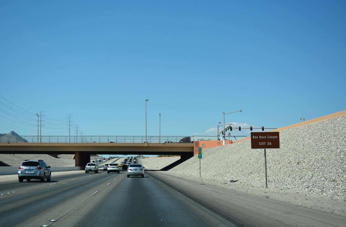
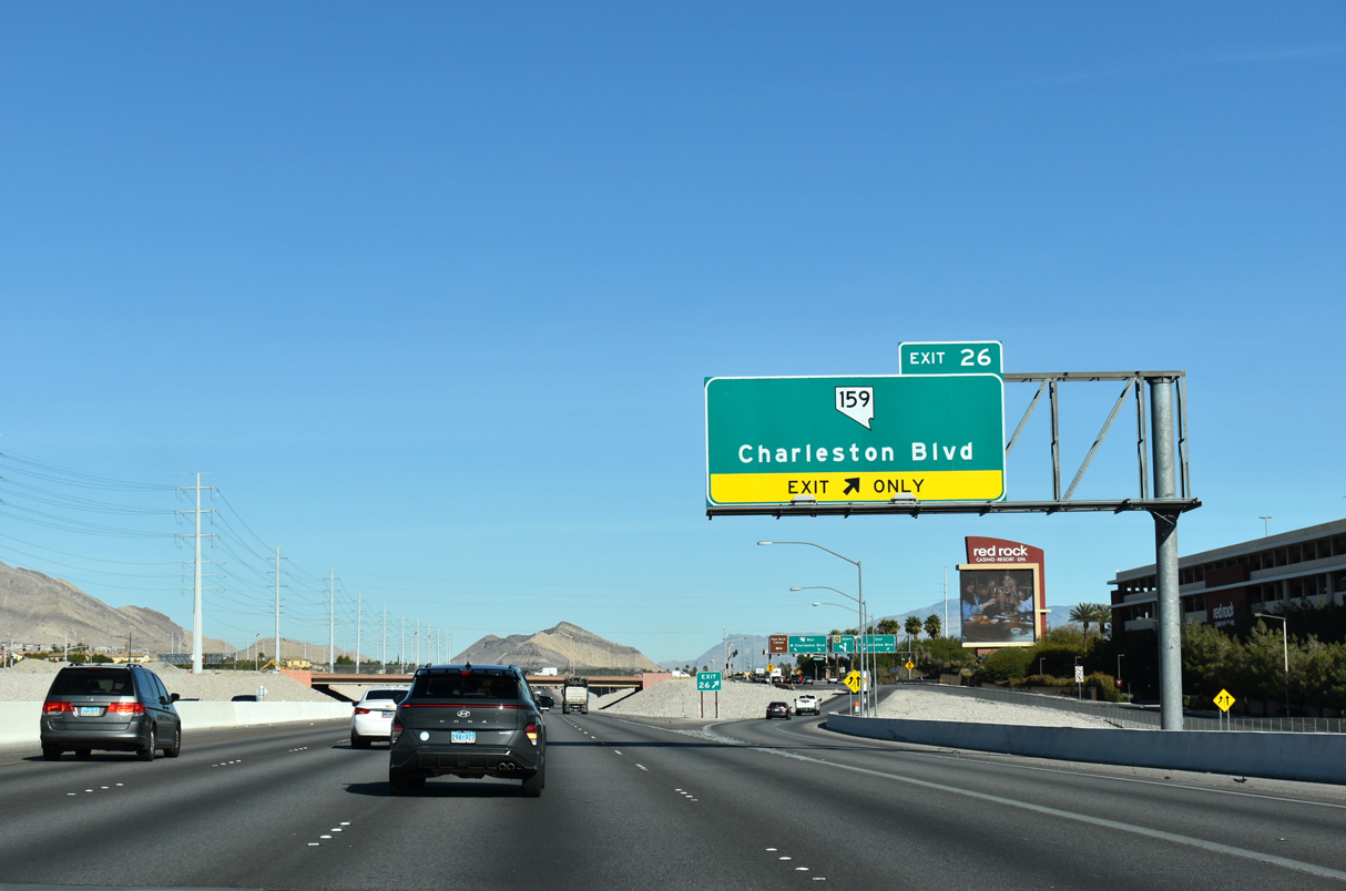
Red Rock Canyon National Conservation Area borders Summerlin to the west along SR 159 (Charleston Boulevard) which meets the Bruce Woodbury Beltway at Exit 26 next.
07/21/17
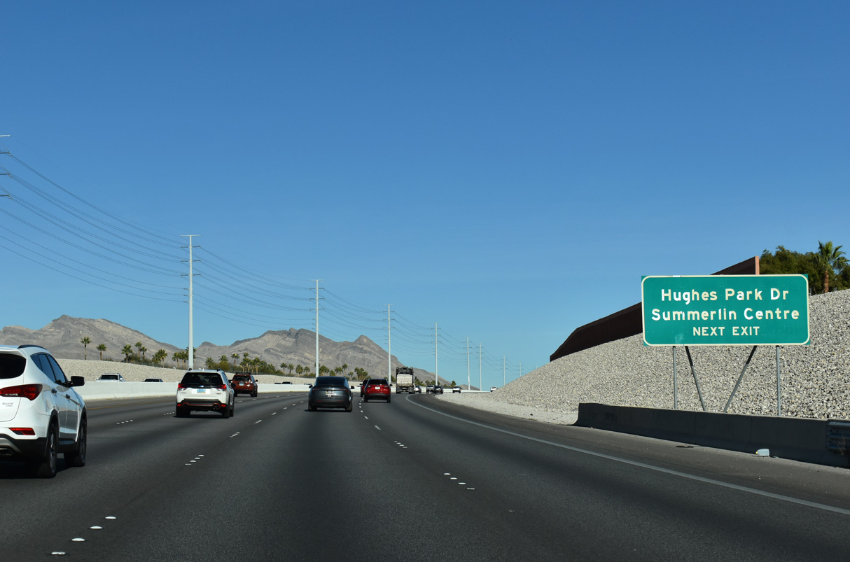
Hughes Park Drive E serves as the frontage road between CC-215 north and the Downtown Summerlin complex, connecting Sahara Avenue with Charleston Boulevard (SR 159).
07/22/17
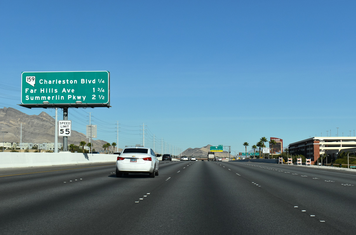
SR 159 forms a 15.9 mile loop joining the Bruce Woodbury Beltway with Red Rock Canyon to the west of Las Vegas and SR 160 near Blue Diamond.
11/25/25
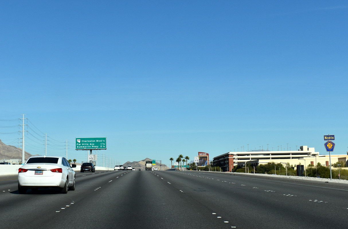
CC-215 lines the west limits of the Downtown Summerlin complex and Red Rock Casino Resort north to SR 159.
11/25/25
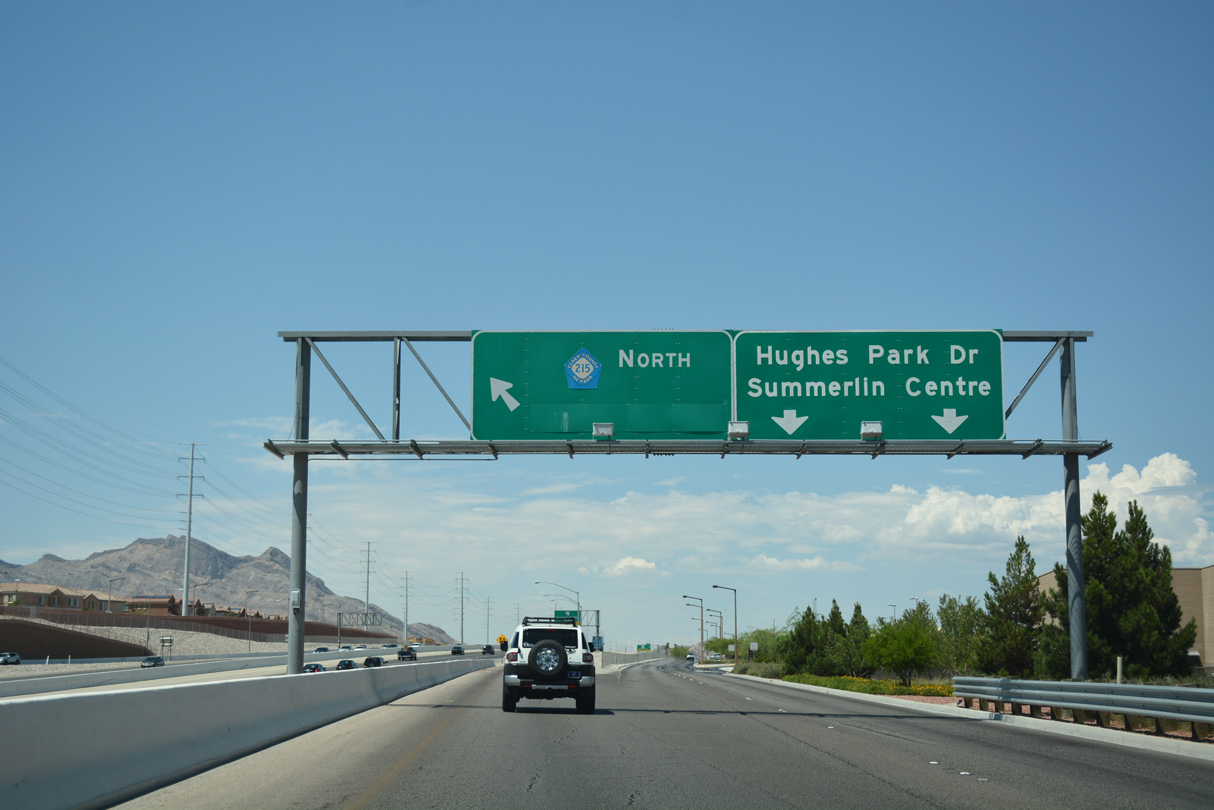
SR 613 (Summerlin Parkway) joins the Bruce Woodbury Beltway (CC-215) with I-11/U.S. 95 (Oran K. Gragson) to Downtown Las Vegas in 2.50 miles.
11/25/25
Crossing over Summerlin Centre Drive, Exit 26 leaves CC-215 north for Hughes Park Drive E to SR 159 (Charleston Boulevard).
11/25/25
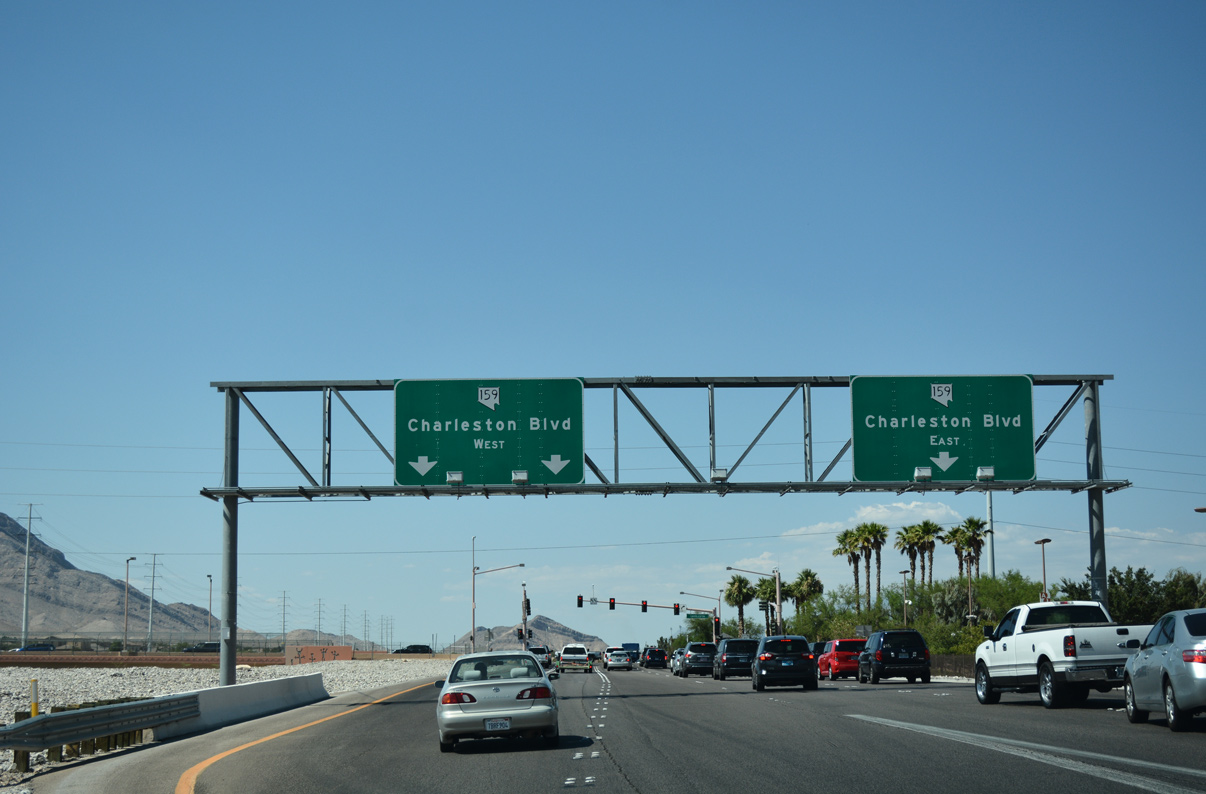
Charleston Boulevard represents a major thoroughfare across the Las Vegas region, connecting CC-215 with Downtown Las Vegas. Prior to 2019, SR 159 extended east along Charleston Boulevard from the beltway to SR 612 (Nellis Boulevard) in eastern reaches of Las Vegas.
07/21/17
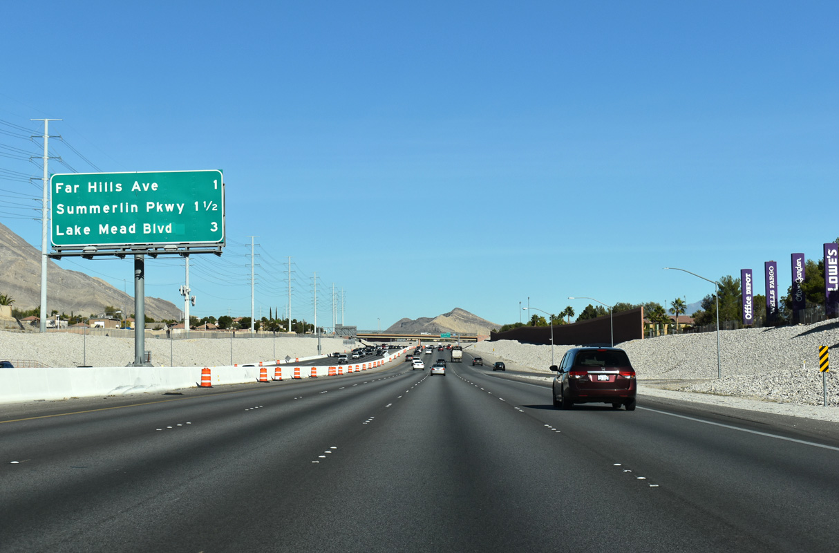
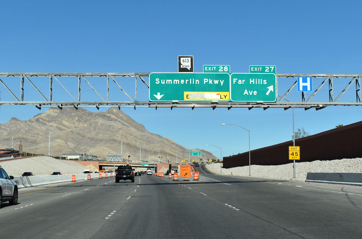
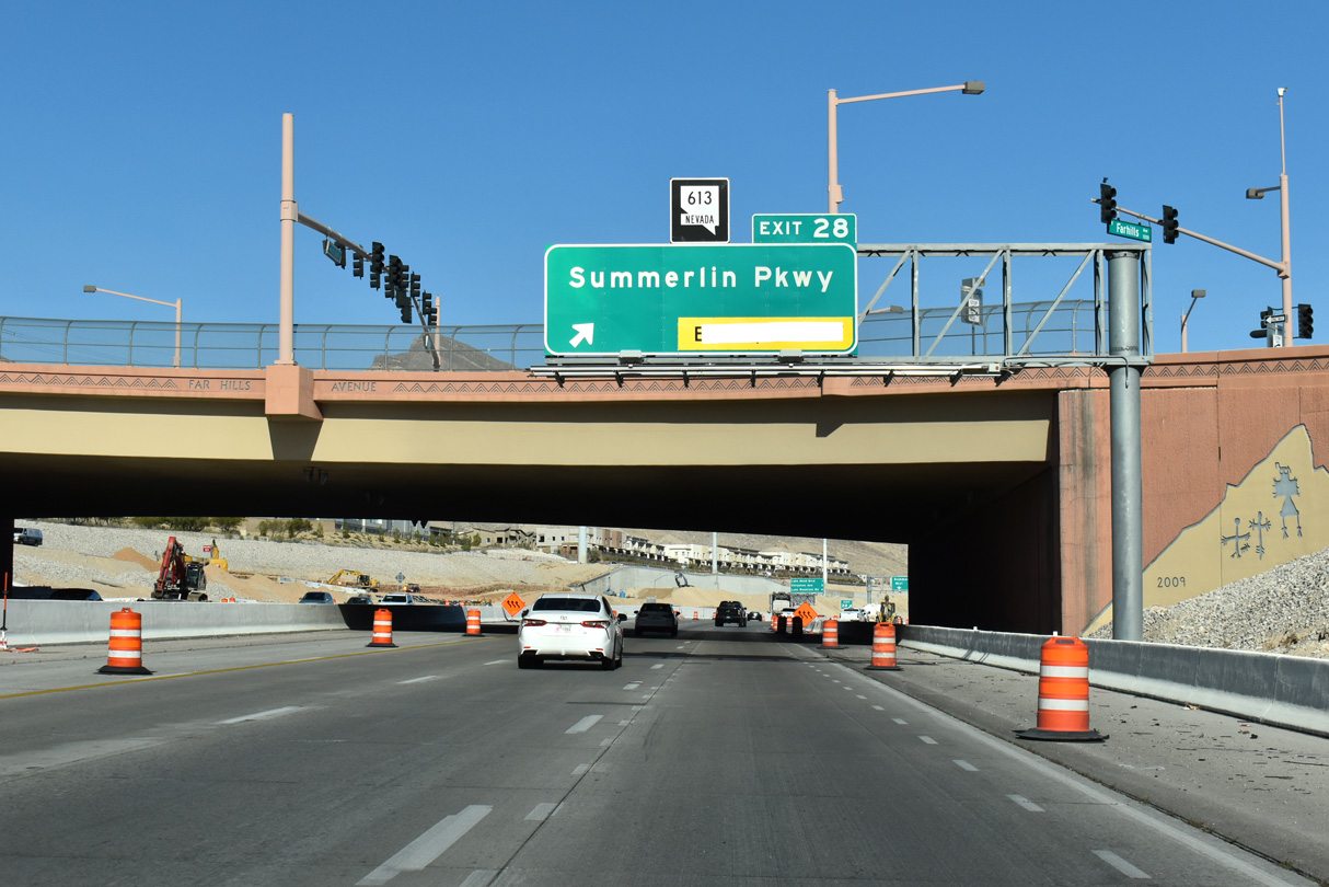
Advancing north from SR 159, the Bruce Woodbury Beltway next meets Far Hills Avenue ahead of SR 613 (Summerlin Parkway).
11/25/25
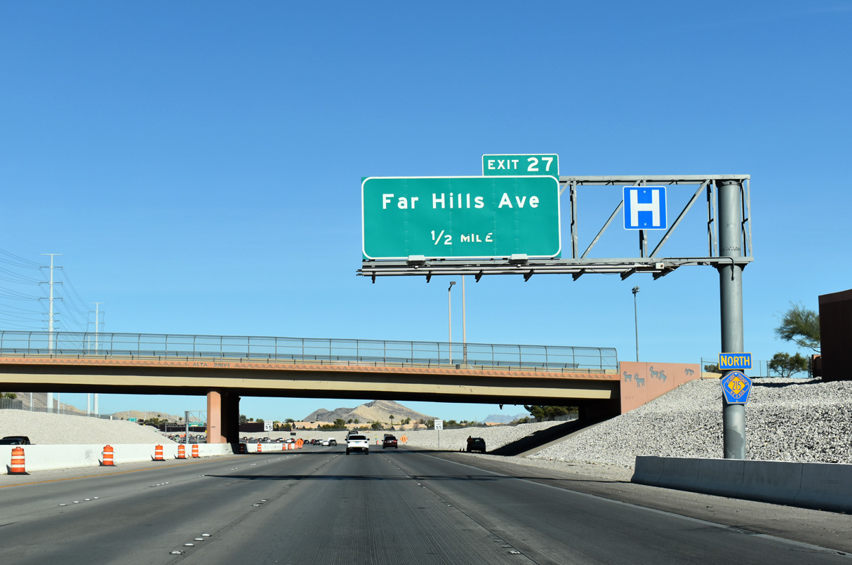
CC-215 passes under Alta Drive 0.50 miles out from the SPUI with Far Hills Avenue. Far Hills Avenue joins the beltway with the Arbors neighborhood of Summerlin.
11/25/25
Far Hills Avenue angles southeast from CC-215 along a residential corridor to Town Center Drive and west to the Talaverde neighborhood.
11/25/25
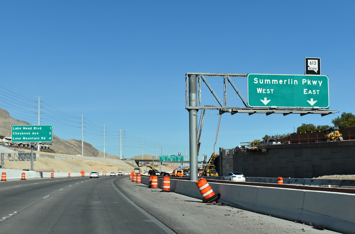
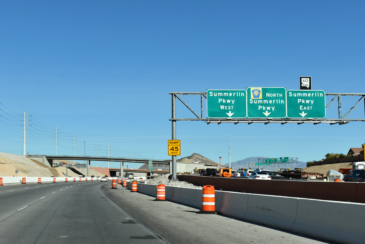
Summerlin Parkway is a 6.5 mile commuter freeway linking CC-215 with I-11/U.S. 95 and Downtown Las Vegas. NDOT took over maintenance of Summerlin Parkway in 2019, assigning SR 613 to the freeway.
11/25/25
Lanes partition for SR 613 (Summerlin Parkway) east and Sunset Run Drive west ahead of Exit 28. Work through early 2028 modifies the parclo interchange at Exit 28 to improve traffic flow.
11/25/25
One mile separates Lake Mead Boulevard at Exit 29 with Cheyenne Avenue at Exit 30 along CC-215 north.
11/25/25
The initial four mile segment of Summerlin Parkway (SR 613) opened between U.S. 95 (Oran K. Gragson Freeway) and Town Center Drive by 1990.1
11/25/25
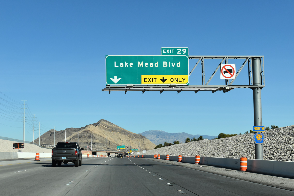
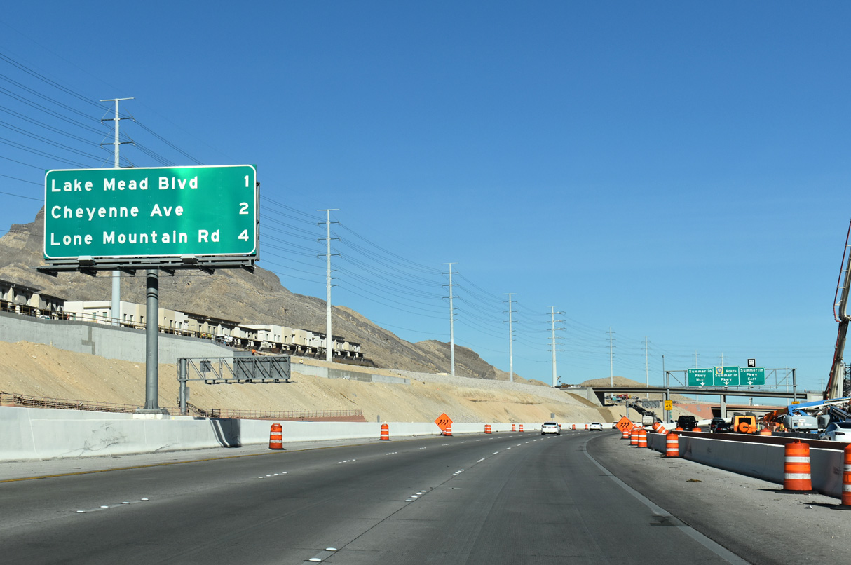
Clark County Route 215 (Las Vegas/Bruce Woodbury Beltway) advances 0.30 miles north from SR 613 (Summerlin Parkway) to meet Lake Mead Boulevard next.
11/25/25
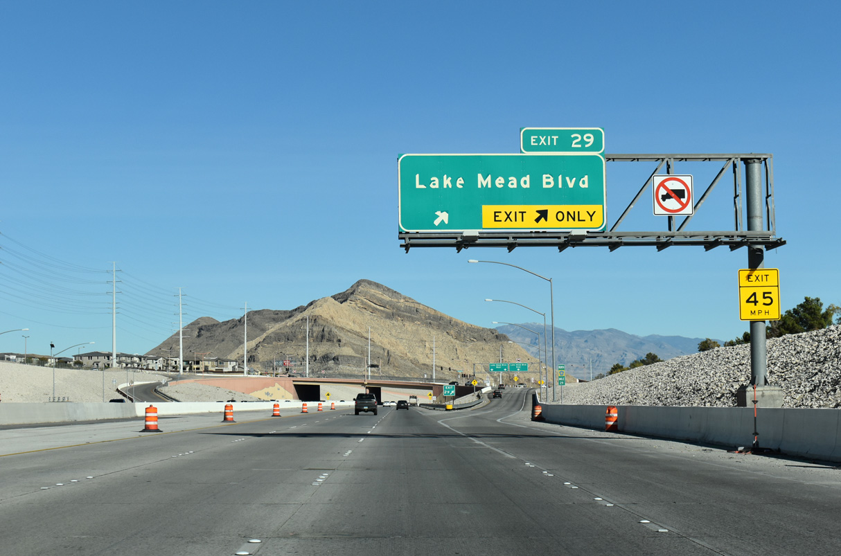
Two lanes separate from the Bruce Woodbury Beltway to Lake Mead Boulevard at Exit 29. Locally, Lake Mead Boulevard connects to the Trails neighborhood and the age restricted Sun City Summerlin, both within the master planned community of Summerlin.
11/25/25
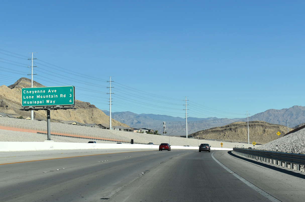
The Las Vegas Beltway turns eastward to meet Hualapai Way at Exit 35 in six miles. Lone Mountain Road meets Clark County Route 215 at a diamond interchange (Exit 32) in three miles.
11/25/25
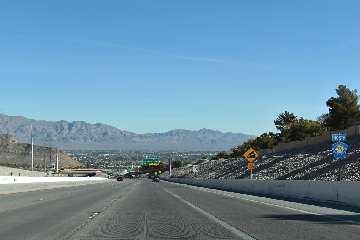
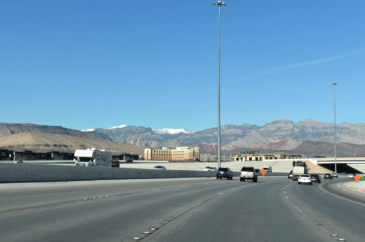
This view shows the Fossil Ridge mountain range along the northern horizon from where northbound CC-215 descends 300 feet in elevation toward Exit 30 for Cheyenne Avenue. Cheyenne Avenue is the final exchange for Summerlin.
11/25/25
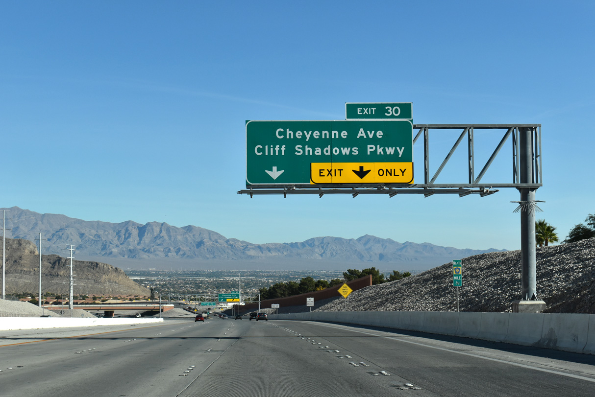
Bordering Sun City Summerlin to the north, Cheyenne Avenue is an arterial leading east through Las Vegas. Cliff Shadows Parkway continues north from upcoming Exit 30 to Lone Mountain Road.
11/25/25
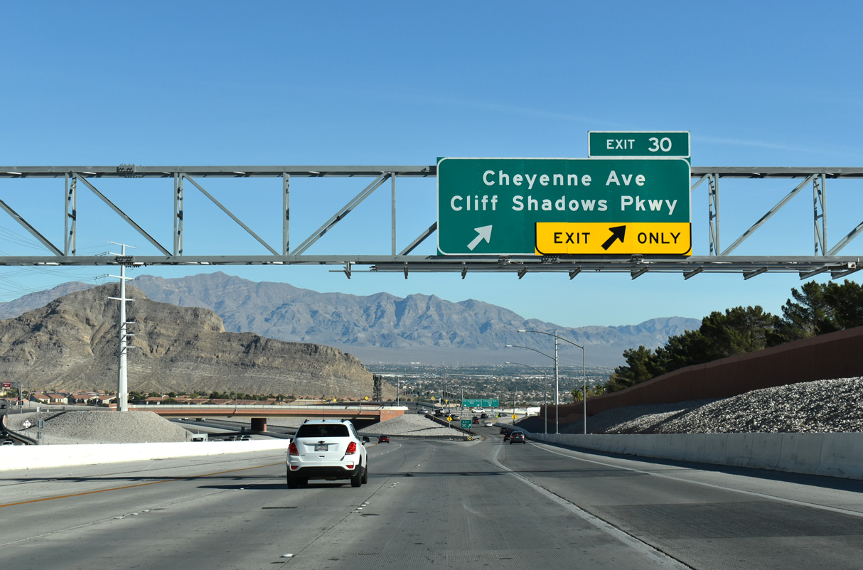
Two lanes depart from the Bruce Woodbury Beltway (CC-215) at Exit 30 for Cheyenne Avenue and Cliff Shadows Parkway.
11/25/25

SR 574 overlays Cheyenne Avenue east from Decatur Boulevard and the North Las Vegas city line to SR 612 (Nellis Boulevard).
11/25/25
References:
- History Timeline - Official Summerlin website.
- Downtown Summerlin - Official Summerlin website.
Photo Credits:
- Brent Ivy: 07/21/17, 07/22/17, 11/25/25
Connect with:
Page Updated Friday December 12, 2025.