
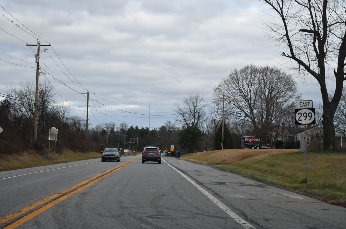
State Route 299 East

 East
East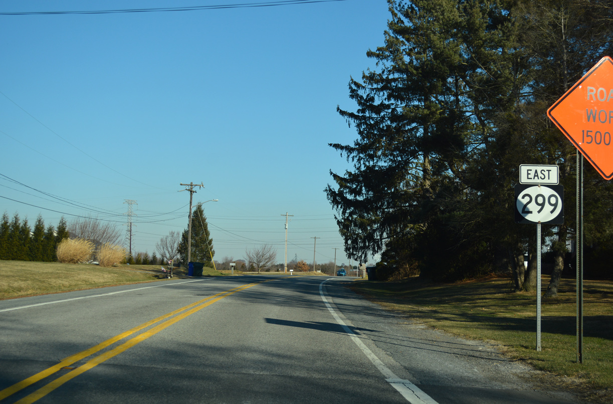
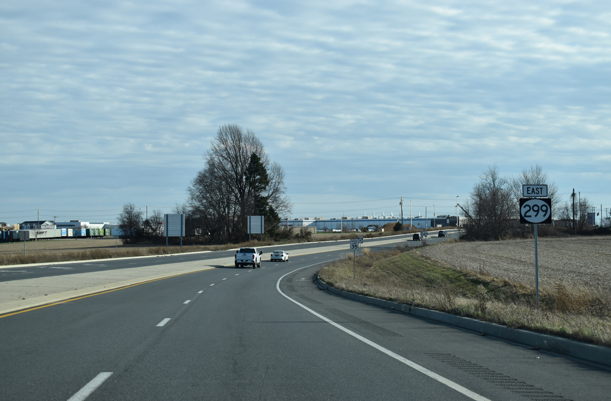
SR 299 (Warwick Road) takes over for MD 282 (Main Street) east from the state line along a rural stretch outside the Middletown limits.
12/29/17
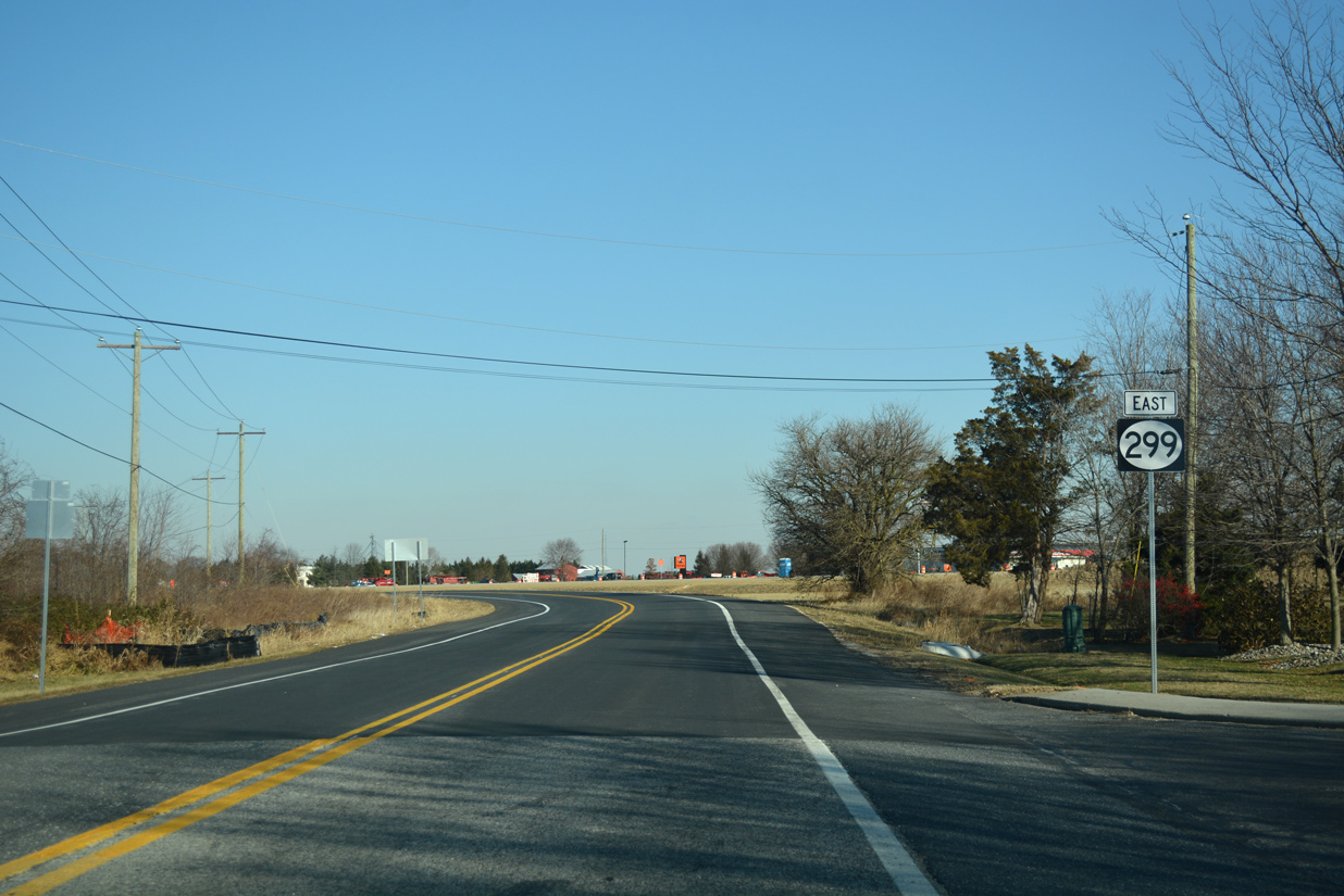
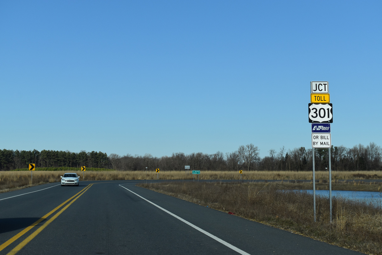
The realignment of SR 299 made in 2017 shifted the state route northward from its previous intersection with U.S. 301, located by this reassurance marker, toward Middle Neck Road.
12/29/17
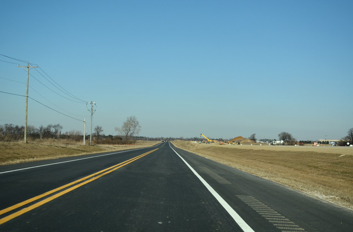
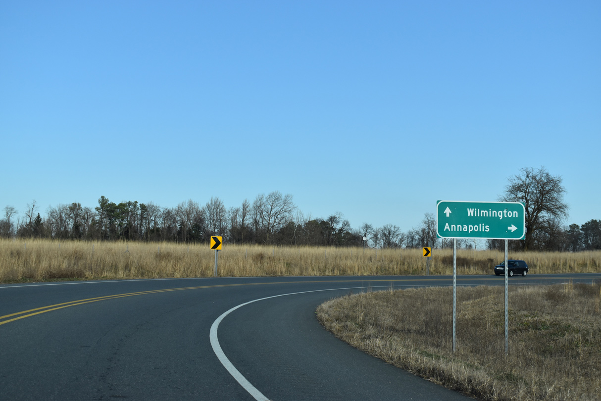
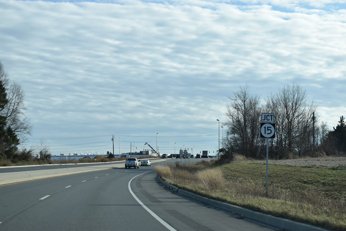
SR 299 (Warwick Road) parallels the southbound lanes of U.S. 301 (First Responders Memorial Highway) to Middle Neck Road. Middle Neck Road (Rd 444) angles northwest to agricultural areas outside the Middletown city limits.
12/29/17
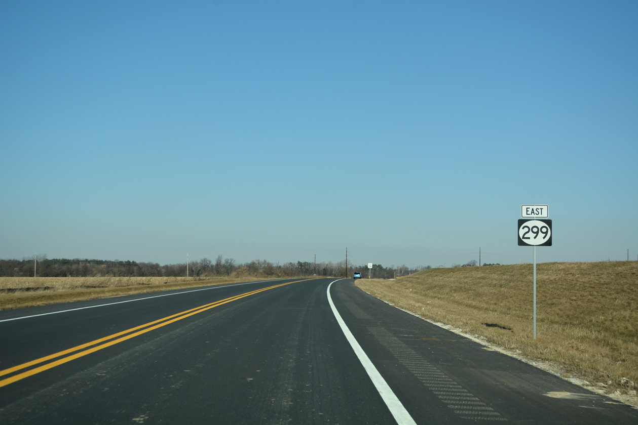
The third shield for SR 299 east stands beyond the intersection with Middle Neck Road.
12/29/17
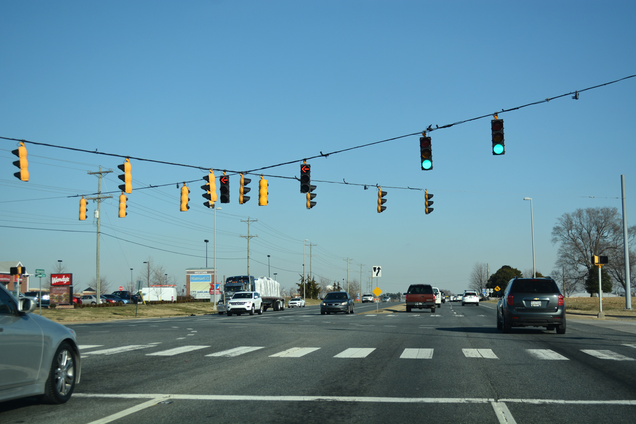
SR 299 (Warwick Road) navigates through a broad curve into the diamond interchange (Exit 2) with U.S. 301 (First Responders Memorial Highway).
12/28/20
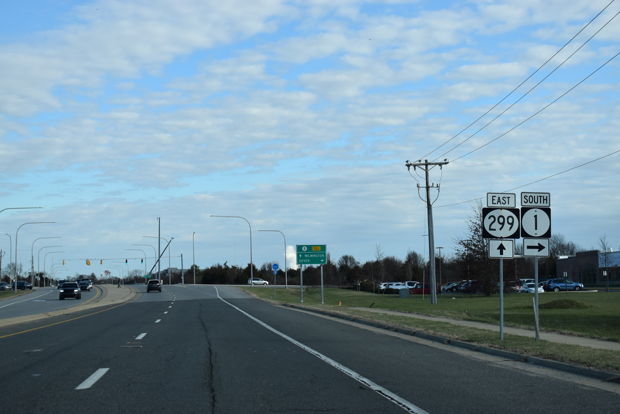
The toll road along U.S. 301 extends 9.3 miles northeast to SR 1 ahead of St. Georges. Annapolis, Maryland lies 65 miles to the southwest.
12/28/20
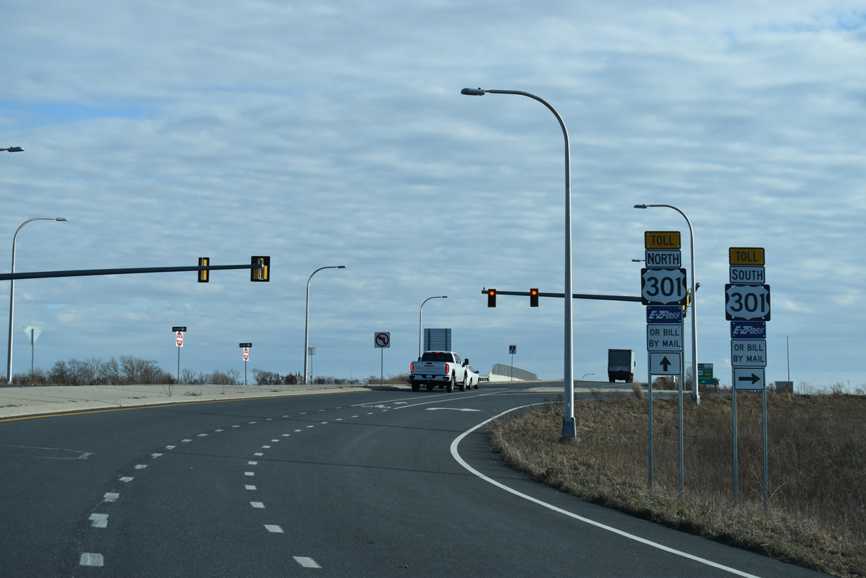
U.S. 301 (First Responders Memorial Highway) uses all electronic toll (AET) collection with E-Zpass transponders or pay-by-plate.
12/28/20
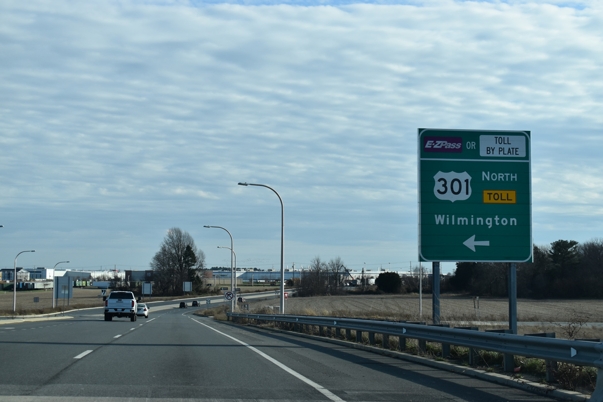
Located 27 miles to the northeast, U.S. 301 to SR 1 connects with Interstate 95 north to Wilmington.
12/28/20
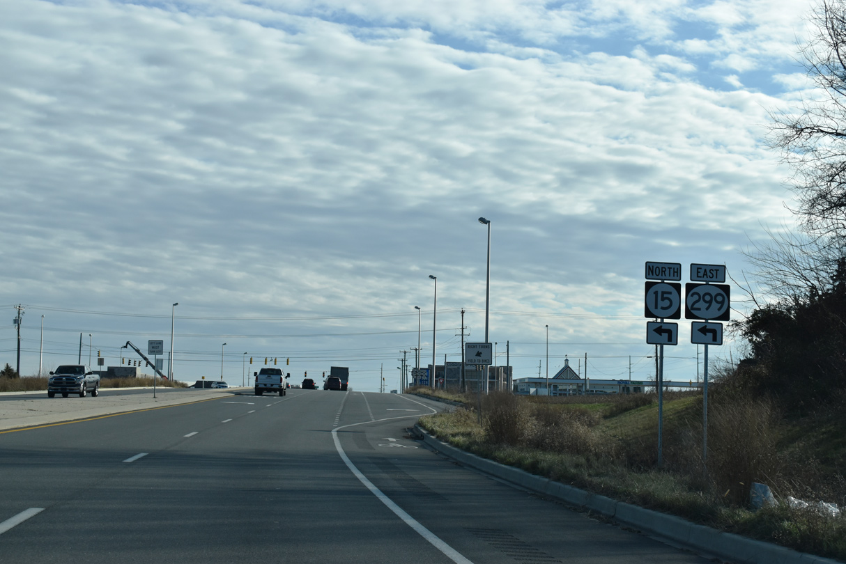
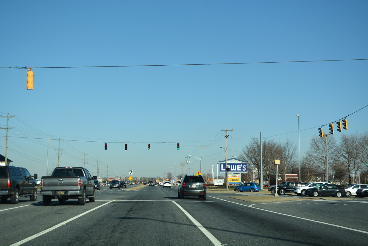
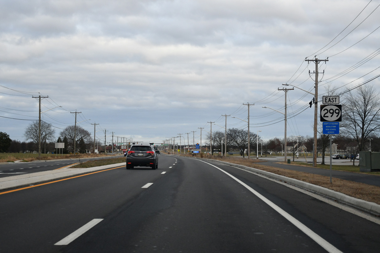
Continuing from the east side ramps with U.S. 301, SR 299 (Warwick Road) advances to Middletown Warwick Road and SR 15 (Levels Road).
12/28/20
SR 15 follows Levels Road south to Charles E. Price Memorial Park and Dogtown Road to the west of Townsend.
12/28/20
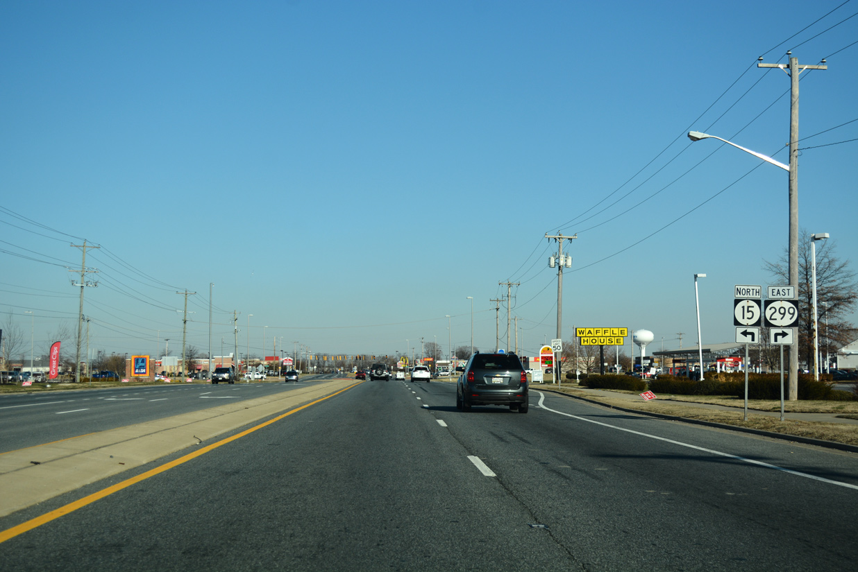
SR 15 north combines with SR 299 east along Middletown Warwick Road (old U.S. 301) toward central Middletown.
12/28/20

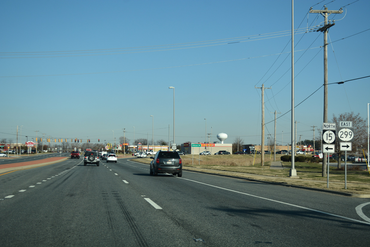
SR 15 comprises a rural route connecting Middletown with Clayton in Kent County. Northward, SR 15/299 (Middletown Warwick Road) overlap for 1.05 miles to W Main Street.
12/28/20
 North East
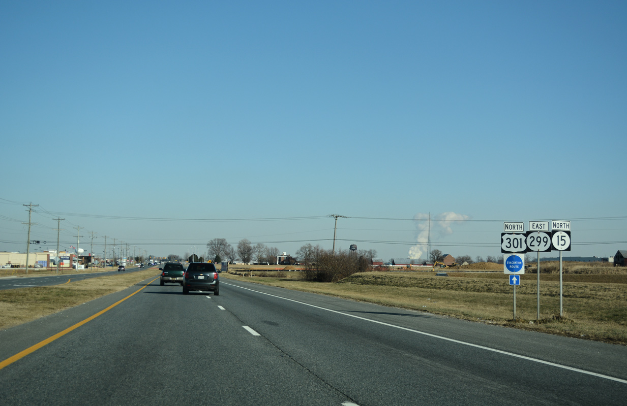
SR 15/299 east advance northeast along a commercialized stretch lined with restaurants, big box retail and gas stations. Only SR 299 is acknowledged on replacement shields posted beyond Levels Road.
12/16/17
Merrimac Avenue constitutes a four lane boulevard south to an area of warehouses and distribution centers and north through the Westown retail area to the Parkway development.
12/16/17

SR 15/299 (Middletown Warwick Road) east continue by Westown center into central Middletown.
12/16/17
South Ridge Avenue connects SR 15/299 (Middletown Warwick Road) with additional retail and the Parkway community.
12/16/17
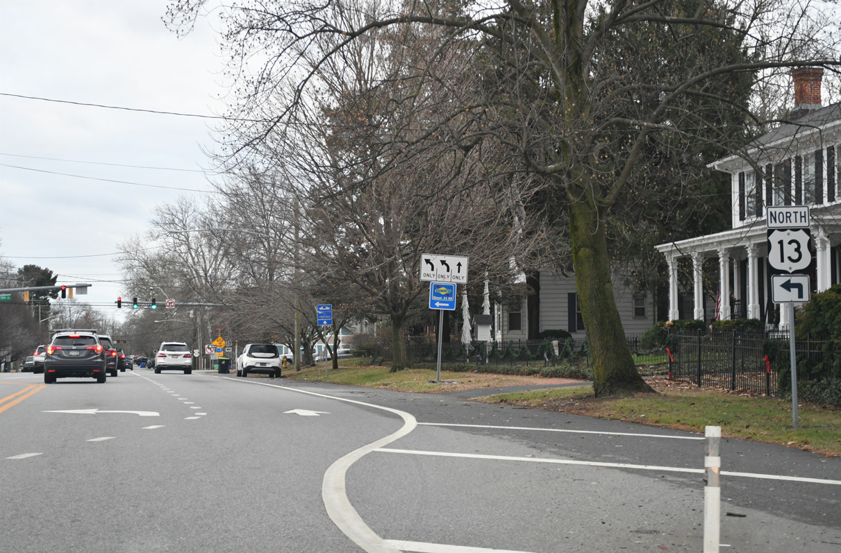
SR 15 turns west along Bunker Hill Road from SR 299 and Middletown Warwick Road (old U.S. 301) at W Main Street. Bunker Hill Road spans U.S. 301 (First Responders Memorial Highway) west to Choptank Road.
12/16/17
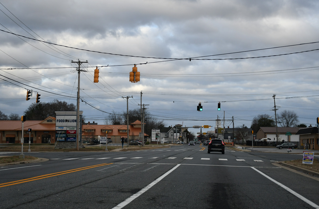
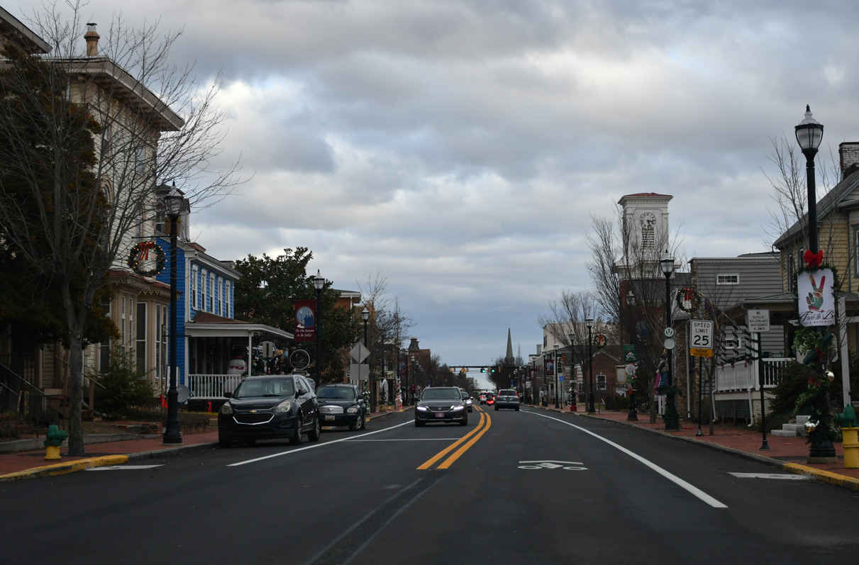
SR 299 follows Main Street east from SR 15 and Middletown Warwick Road through Downtown Middletown.
12/16/17
East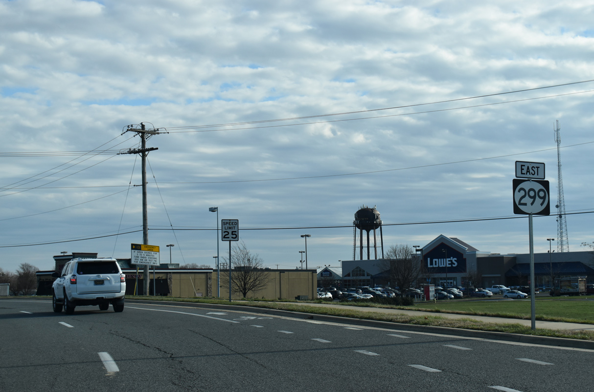
W Main Street narrows from four to two lanes just east of Middletown Warwick Road (old U.S. 301) and this confirming marker for SR 299 that was removed in 2024.
12/28/20
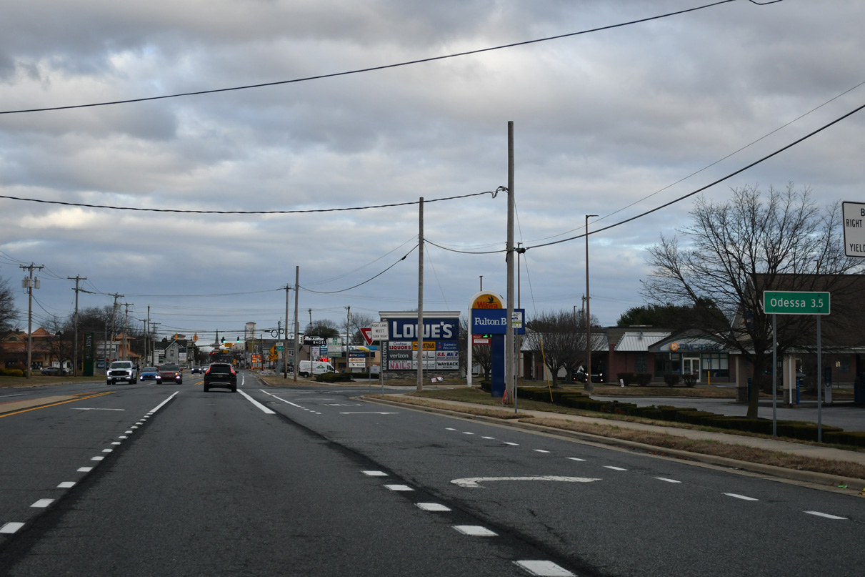
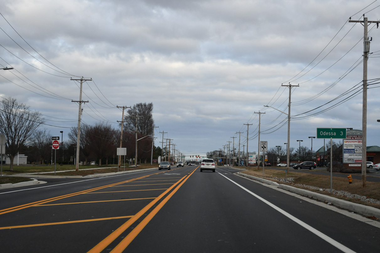
The town of Odessa lies 3.5 miles east along SR 299 from SR 15 and Middletown Warwick Road (former U.S. 301).
12/29/24
Industrial Drive loops south and west to industrial businesses and distribution centers between this traffic light on SR 299 (W Main Street) and SR 15 (Levels Road).
12/29/24
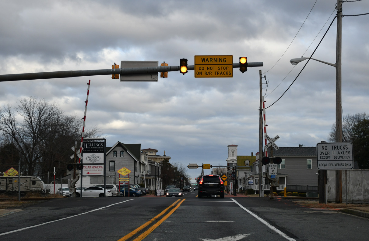
W Main Street crosses the Delmarva Central Railroad east of Peterson Road.
12/29/24
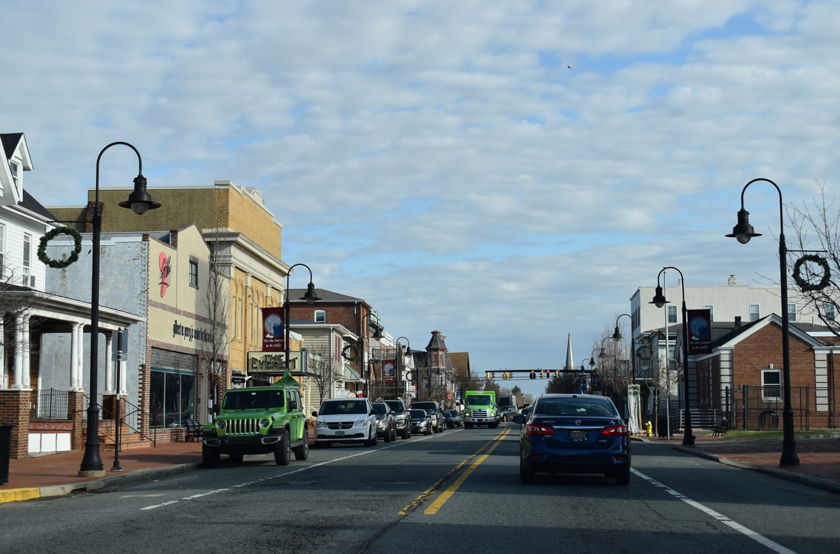
W Main Street east at Scott Street in Downtown Middletown.
12/29/24
W Main Street east at Cass Street in Downtown Middletown.
12/28/20
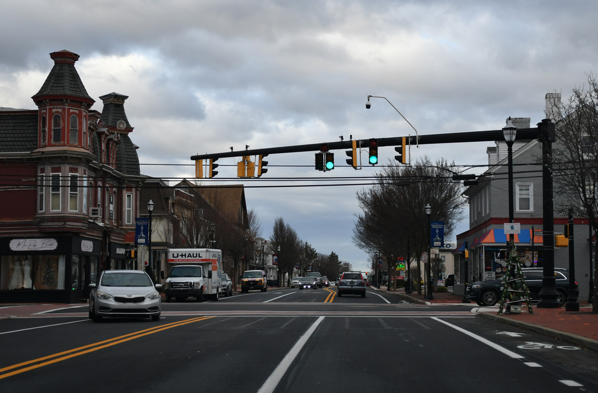
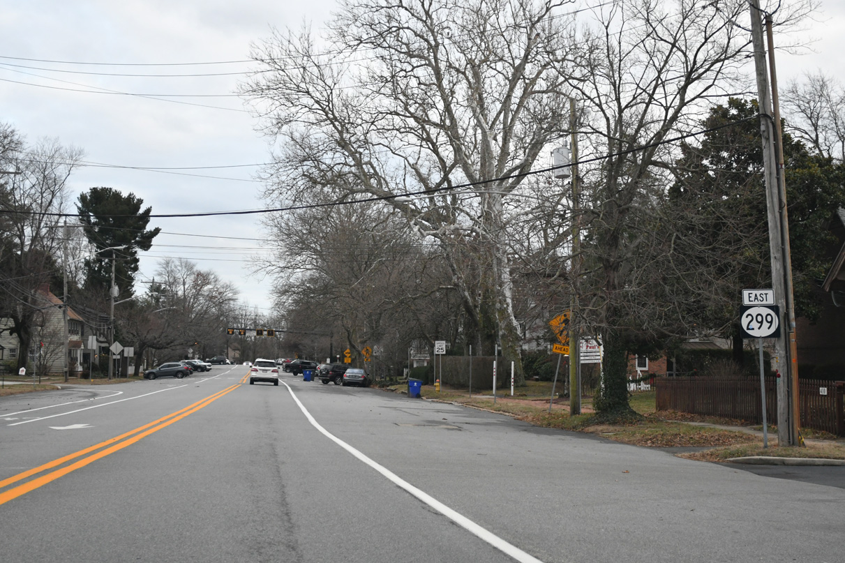
SR 71 crosses SR 299 (Main Street) along Broad Street. Unmarked along both directions of Main Street, SR 71 heads north to Mount Pleasant and south to Townsend.
12/29/24
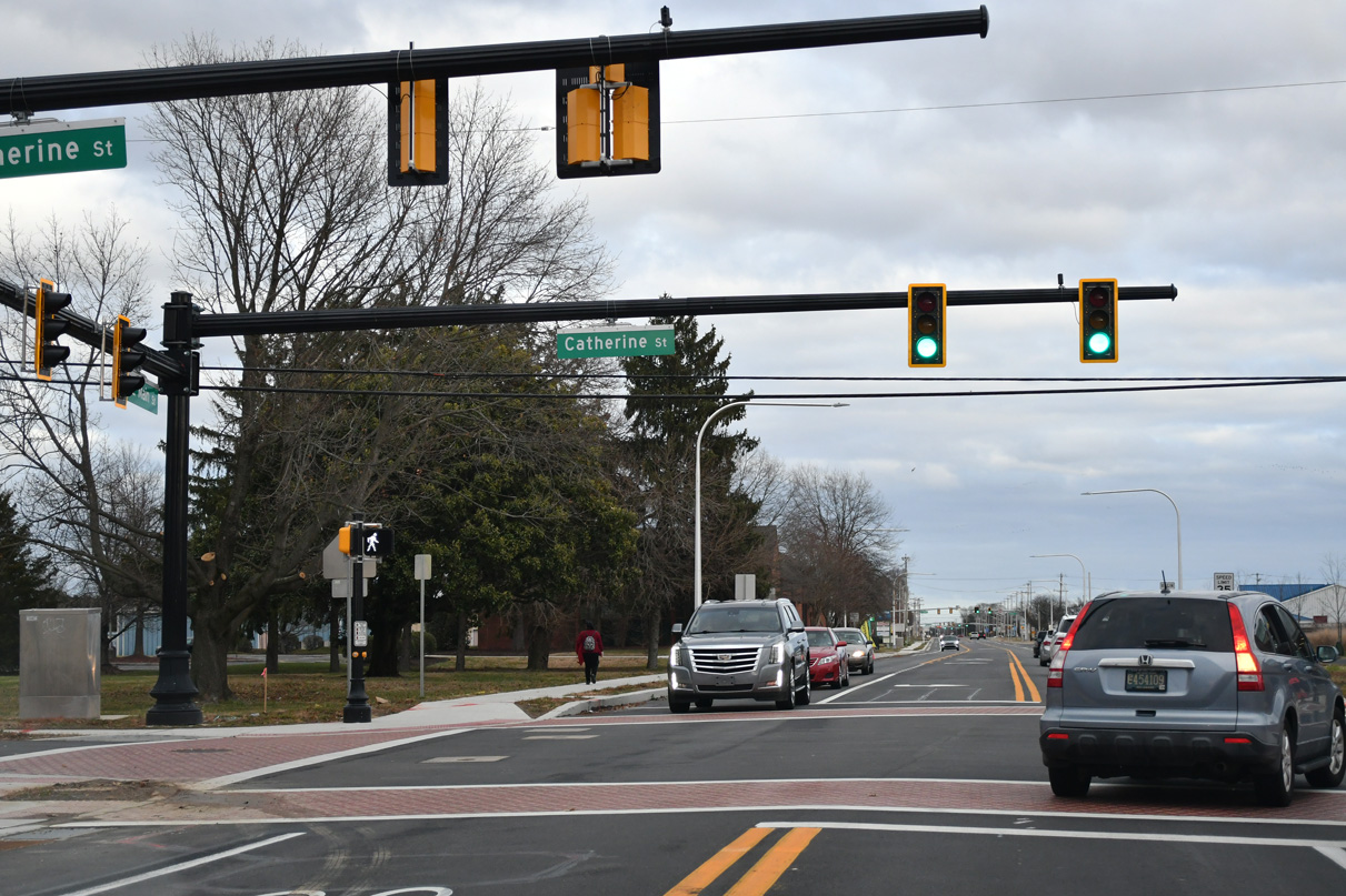
Catherine Street intersects SR 299 (E Main Street) four blocks north of Silver Lake Park.
12/29/24
2021-23 construction expanded SR 299 (E Main Street) from two to five lanes east from Catherine Street in Middletown.
12/29/24
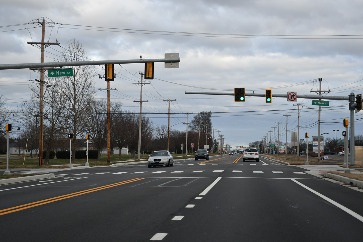
Traffic lights were installed along SR 299 at New Street during 2003 construction widening Main Street.
12/29/24
The Odessa town center lies 2.5 miles east of New Street along SR 299.
12/29/24
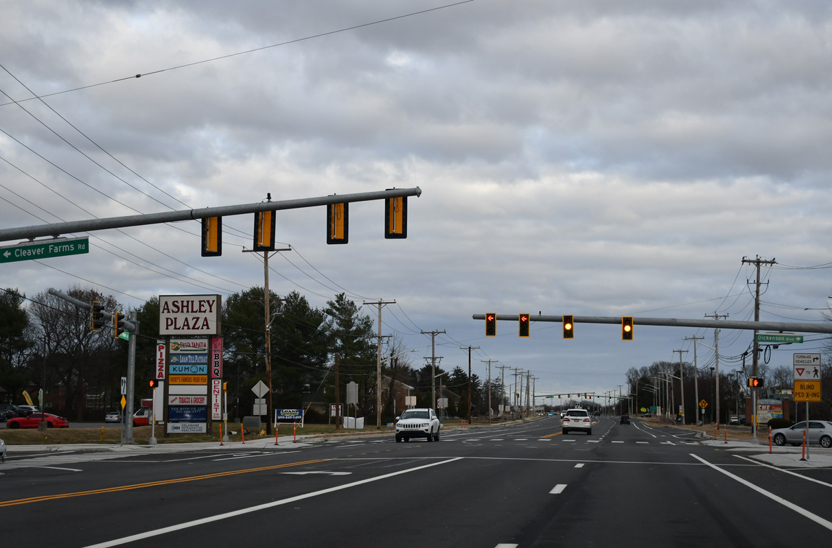
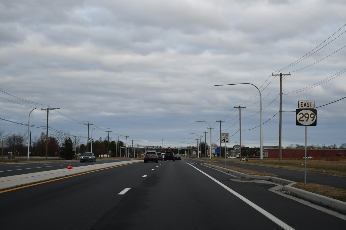
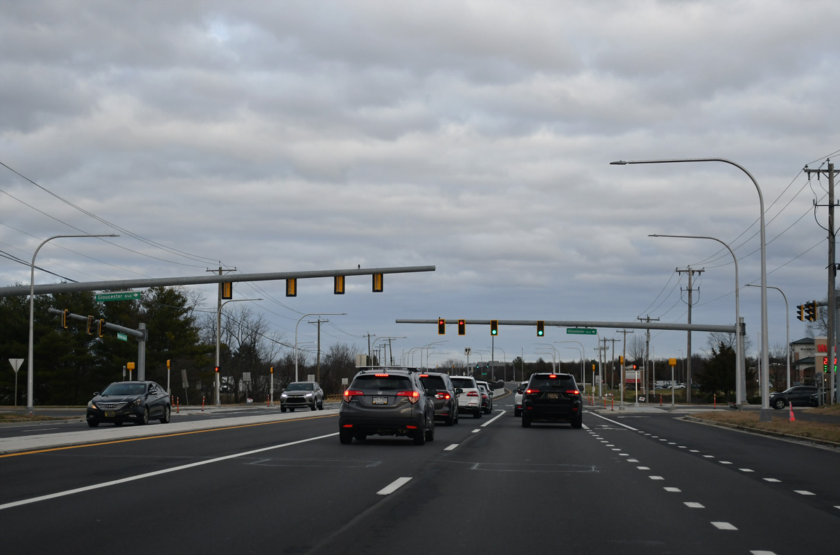
Clever Farm Road south and Dickenson Boulevard north come together at the succeeding traffic light along SR 299 (E Main Street) eastbound.
12/29/24
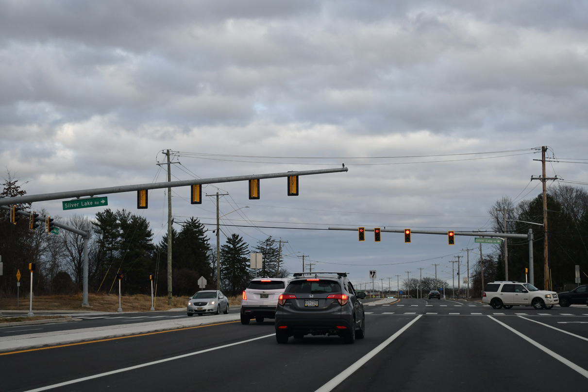
Silver Lake Road (Rd 442) stems 1.11 miles south from SR 299 (E Main Street) to Noxontown Road (Rd 38) across Silver Lake.
12/29/24
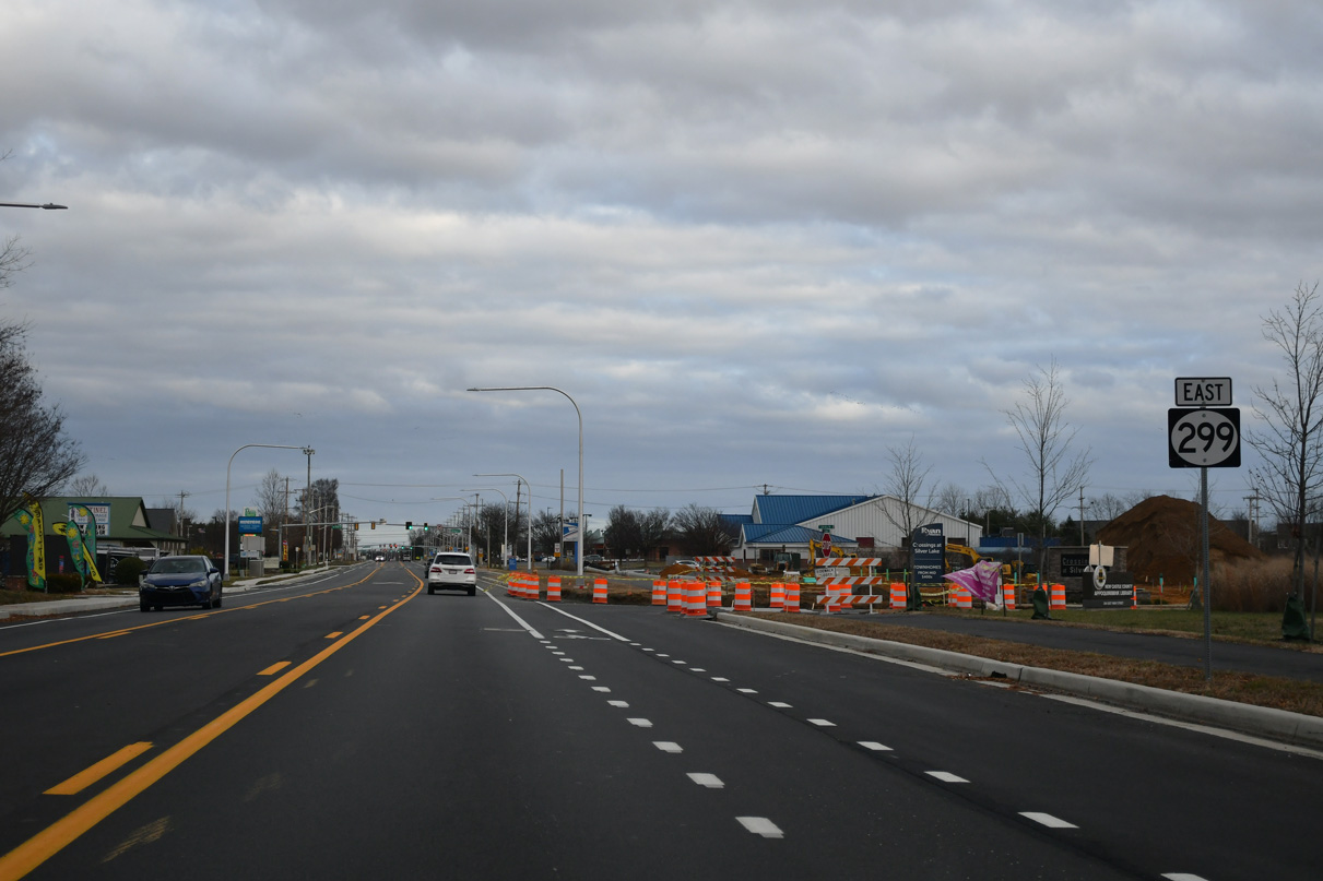
Road work through 2023 expanded SR 299 to a four lane, divided arterial east from Silver Lake Road to the exchange with SR 1.
12/29/24
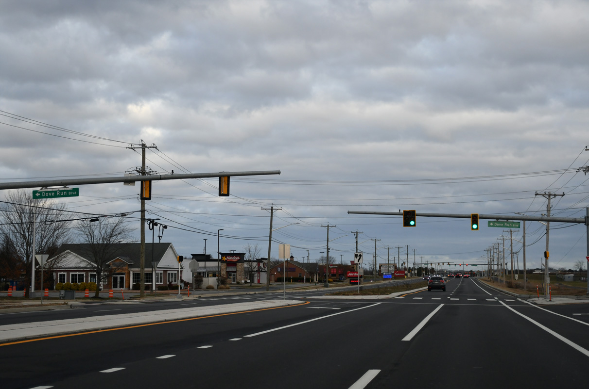
Dove Run Boulevard heads south from the Dove Run Estates division to intersect SR 299 (Main Street) across from Middletown High School.
12/29/24
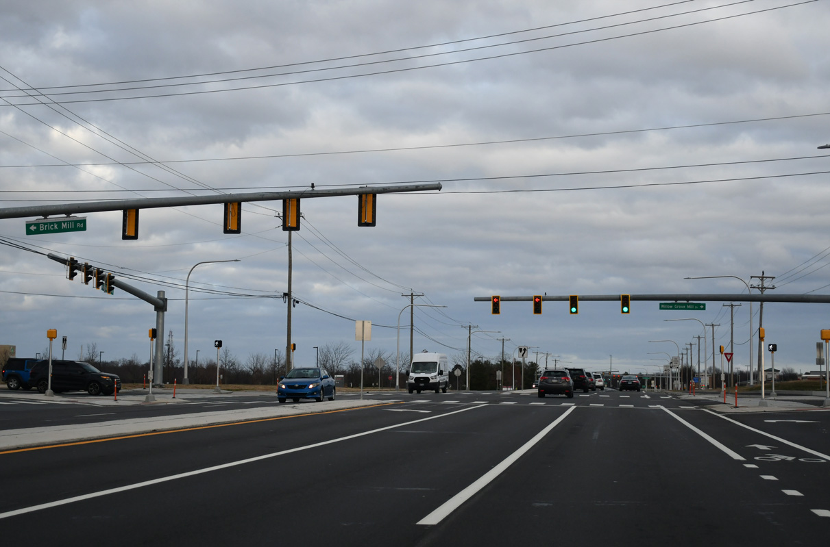
Brick Mill Road (Rd 430) heads 1.14 miles north from SR 299 at Willow Grove Mill Drive to Marl Pit Road (Rd 429). Willow Grove Mill Drive represents the main entrance to the Longmeadow development.
12/29/24
Reassurance marker posted east of Brick Mill Road.
12/29/24
Gloucester Boulevard leads south to the Willow Grove Mill development from SR 299 opposite the access road to the ChristianaCare Middletown Campus.
12/29/24
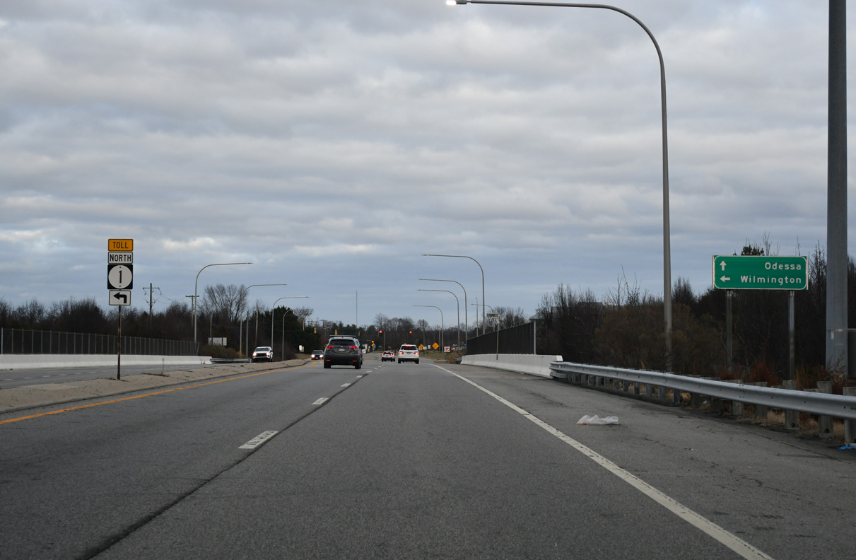
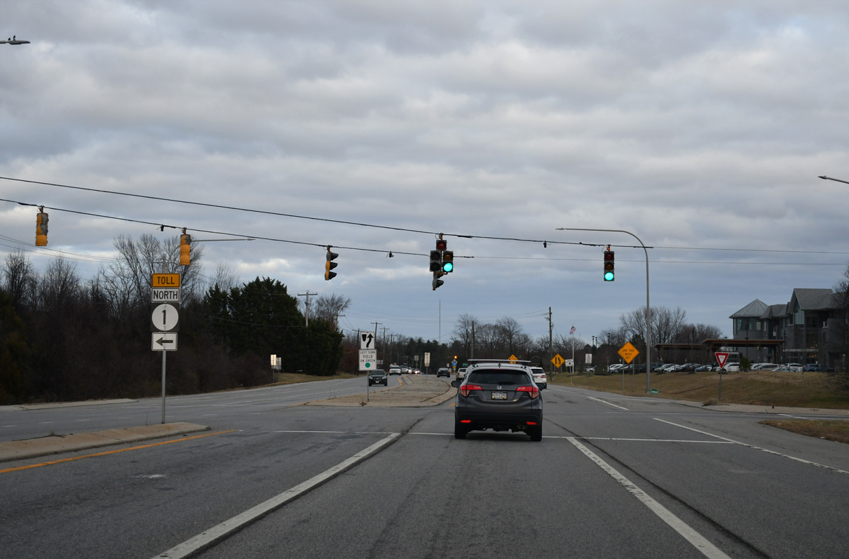
SR 299 (Middletown Odessa Road) previously expanded to four lanes through the diamond interchange (Exit 136) with SR 1 (Korean War Veterans Memorial Highway). This shield assembly was removed during 2021-23 road work.
12/28/20
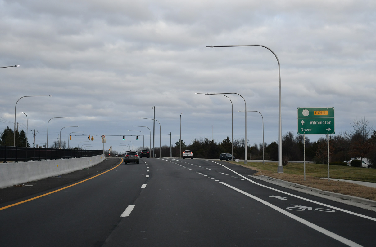
The toll road along SR 1 travels south from Odessa to Smyrna and Dover.
12/29/24
SR 1 wraps around the west side of Odessa northward to St. Georges, Bear and I-95 at Churchmans Crossing.
12/29/24
Tolls are collected along SR 1 north at the exchange with Pole Bridge Road at Boyds Corner and on the mainline at the Biddles Corner Toll Plaza.
12/29/24
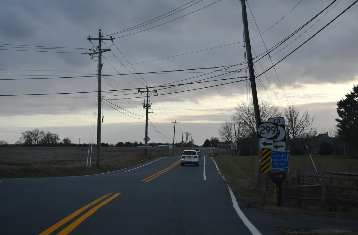
SR 299 (Middletown Odessa Road) enters the town of Odessa a quarter mile from the ramps with SR 1 (Korean War Veterans Memorial Highway).
12/29/24
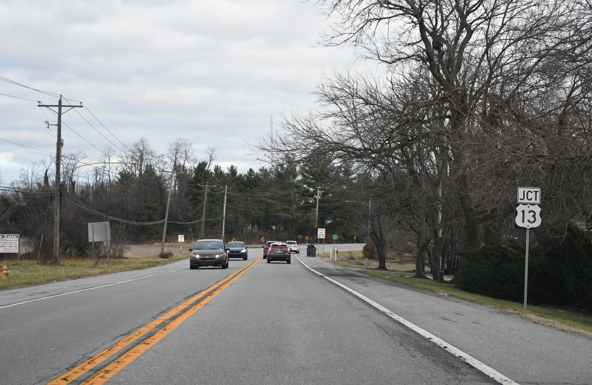
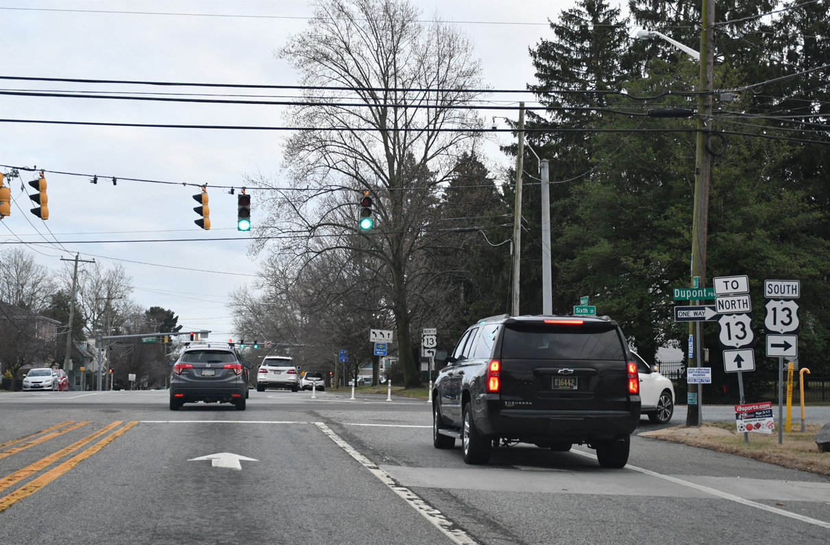
SR 299 curves east along Main Street to Odessa Memorial Park and U.S. 13. U.S. 13 separates into the one way couplet of 6th and 5th Streets through Odessa.
12/29/24
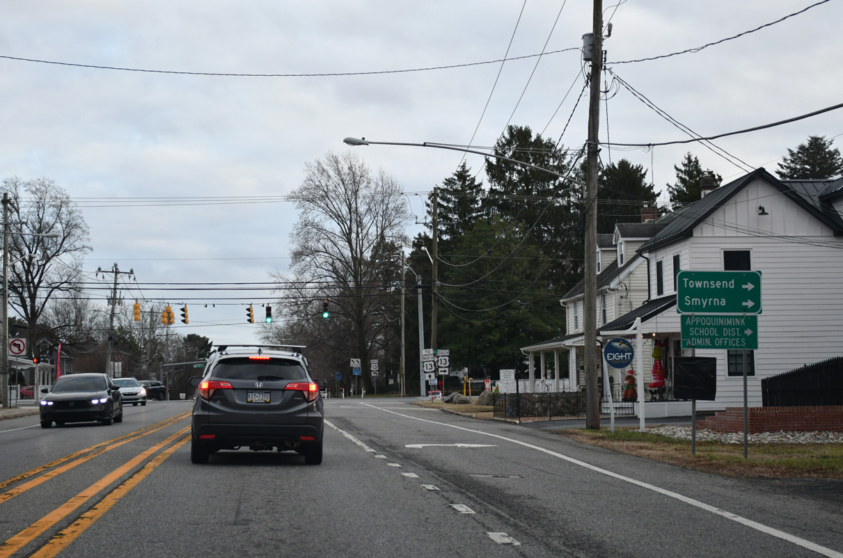
U.S. 13 (6th Street) travels south from Odessa to the town of Smyrna. The town of Townsend is located to the southwest from U.S. 13 via Pine Tree Road.
12/29/24
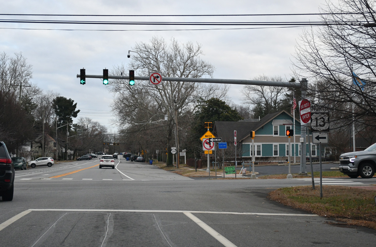
SR 299 (Main Street) east intersects U.S. 13 (5th Street) north to Boyds Corner ahead of the Odessa historic district.
12/29/24
Main Street expands to include on-street parking where SR 299 east leads away from U.S. 13 (5th Street) north.
12/29/24
Main Street east at 2nd Street. SR 299 makes an S-curve beyond Front Street to leave Downtown.
01/15/17
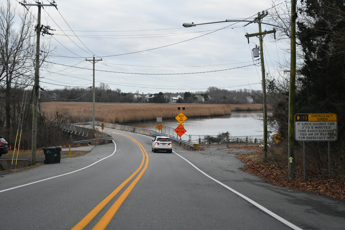
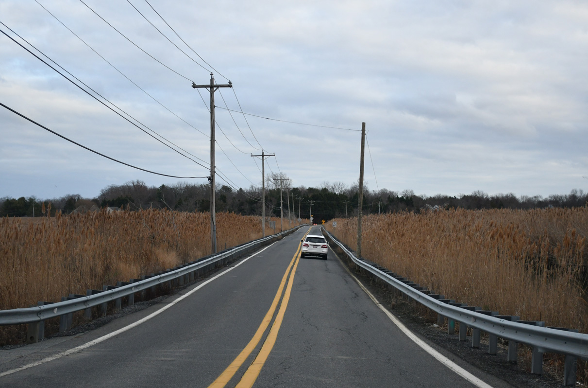
Crossing the Appoquinimink River, SR 299 lowers across an area of wetlands by the Odessa Access Area.
12/29/24
Old State Road curves southward between the Appoquin Farms subdivisions to Taylors Bridge Road. SR 299 turns east while Old State Road (Rd 441) loops 1.44 miles west to U.S. 13 (Dupont Parkway).
12/29/24
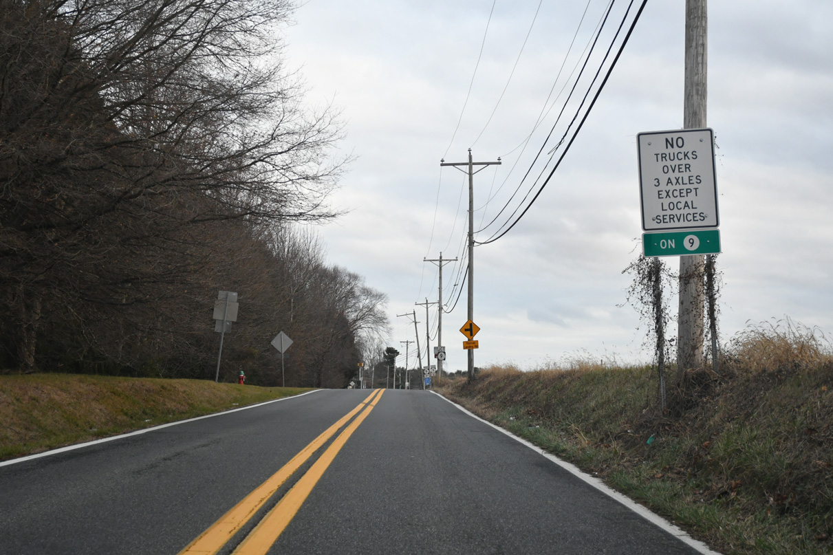
Truck traffic along the coastal route of State Route 9 is limited to local deliveries.
12/29/24
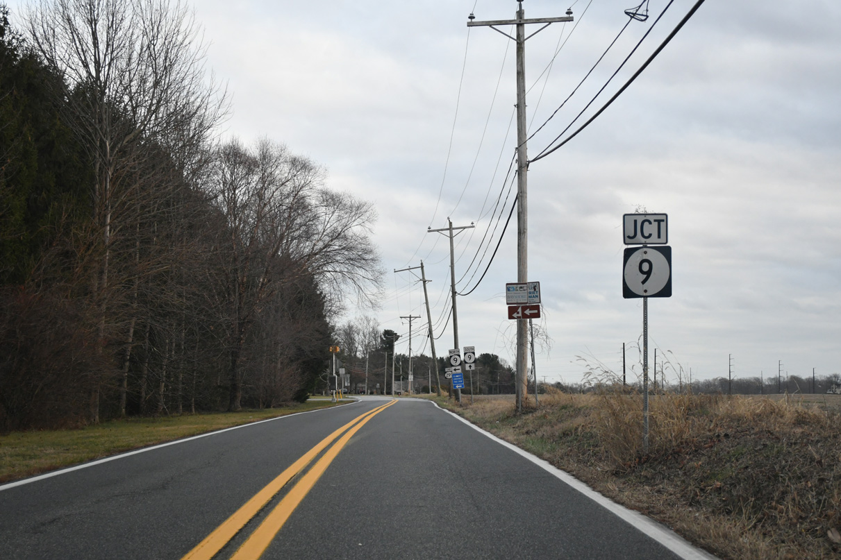
Taylors Bridge Road links SR 299 east with SR 9 (Thomas Landing Road), 0.18 miles to the east of Old State Road.
12/29/24
SR 9 straddles coastal areas of New Castle County southward from Reedy Point Bridge to Flemings Landing and Kent County. The state route also serves several subdivisions built to the east of Odessa and Fieldsboro.
12/29/24
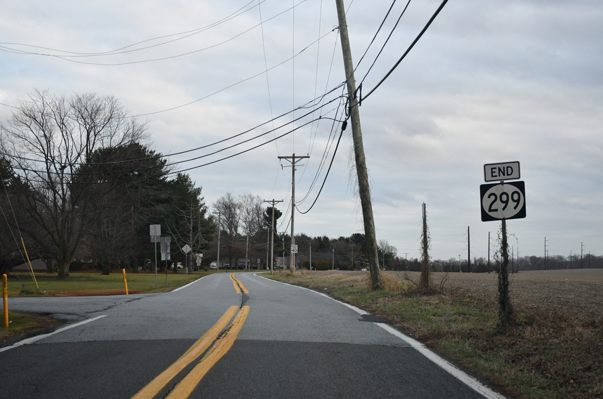
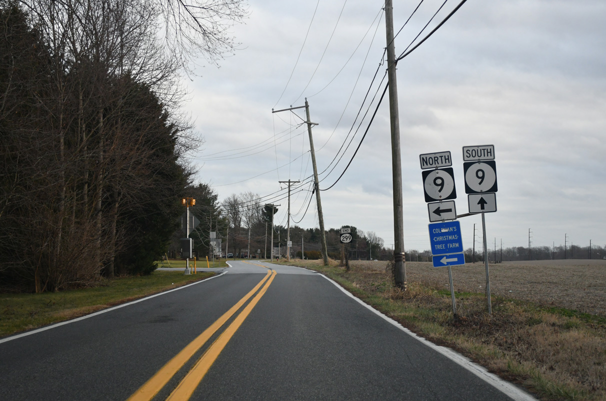
An end shield marks the conclusion of SR 299 by the Silver Hill Farms neighborhood.
12/29/24
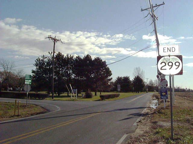
An older shield style shield for the east end of SR 299 previously posted at SR 9.
12/21/01
Photo Credits:
- Alex Nitzman: 12/21/01, 01/15/17, 12/29/17, 12/28/20, 12/29/24
- ABRoads: 12/16/17
Connect with:
Page Updated Sunday January 05, 2025.