
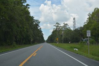
State Road 51
State Road 51 serves the Big Bend Region of Florida from Steinhatchee along the Gulf Coast northeast to Mayo, Live Oak and Jasper. The northern 16.98 miles of SR 51 represent the hidden component of U.S. 129. U.S. 129/SR 51 overlap from 11th Street SW in Live Oak to the intersection of 2nd Avenue NE and Hatley Street, where U.S. 41/129 meet CR 6 east and CR 51 north in Downtown Jasper. SR 51 branches southwest from U.S. 129 along a 53.48 mile course to southern Taylor County.
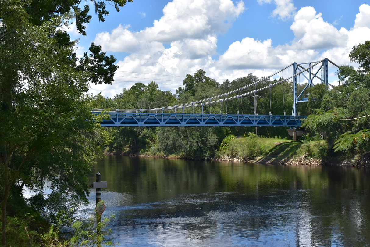
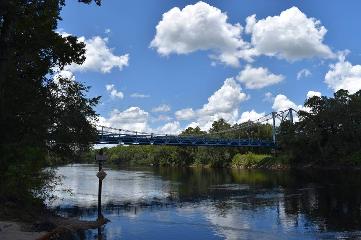
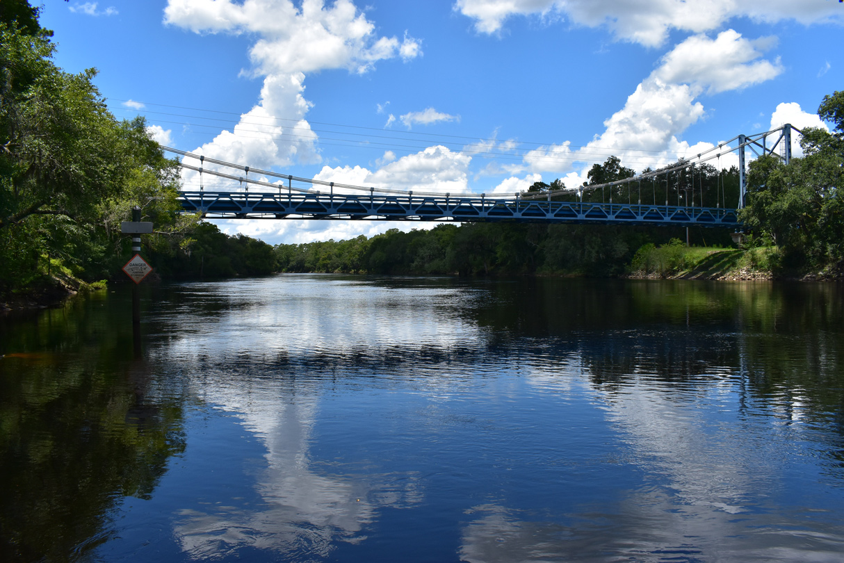
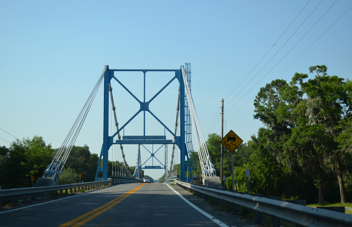
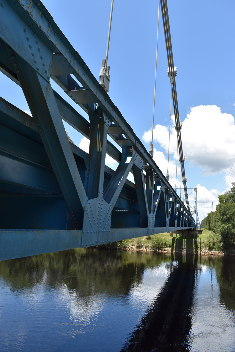
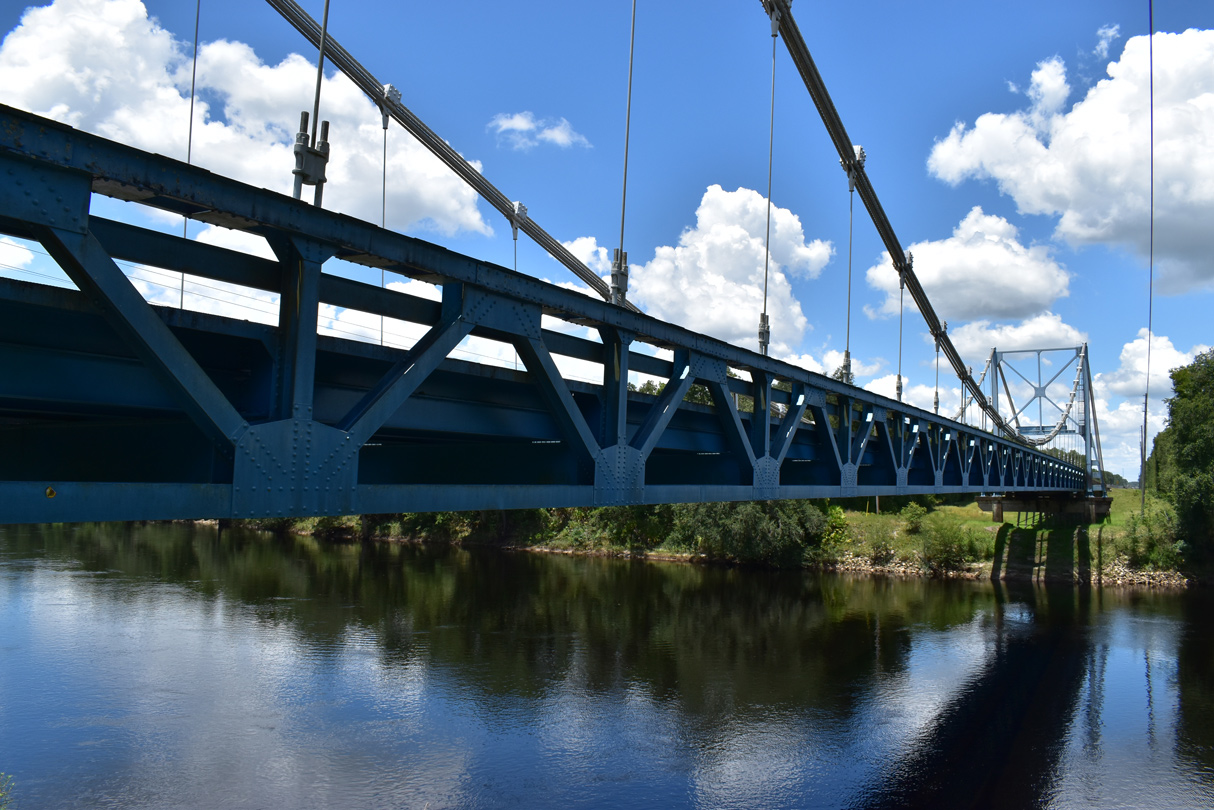
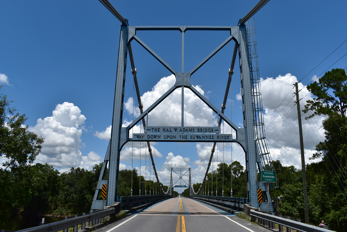
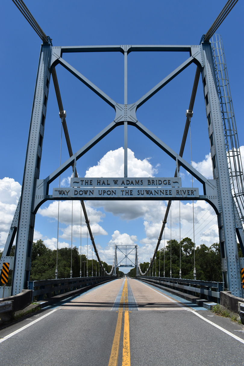
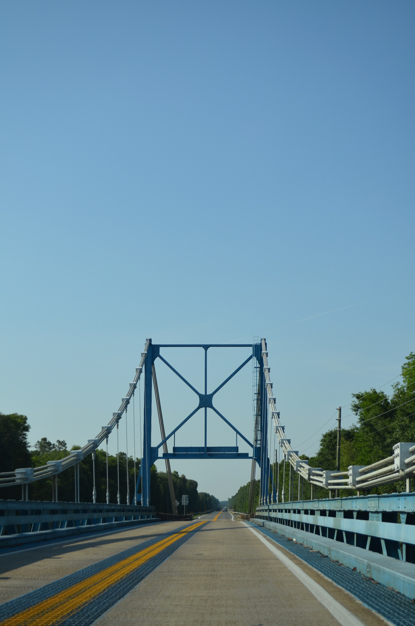
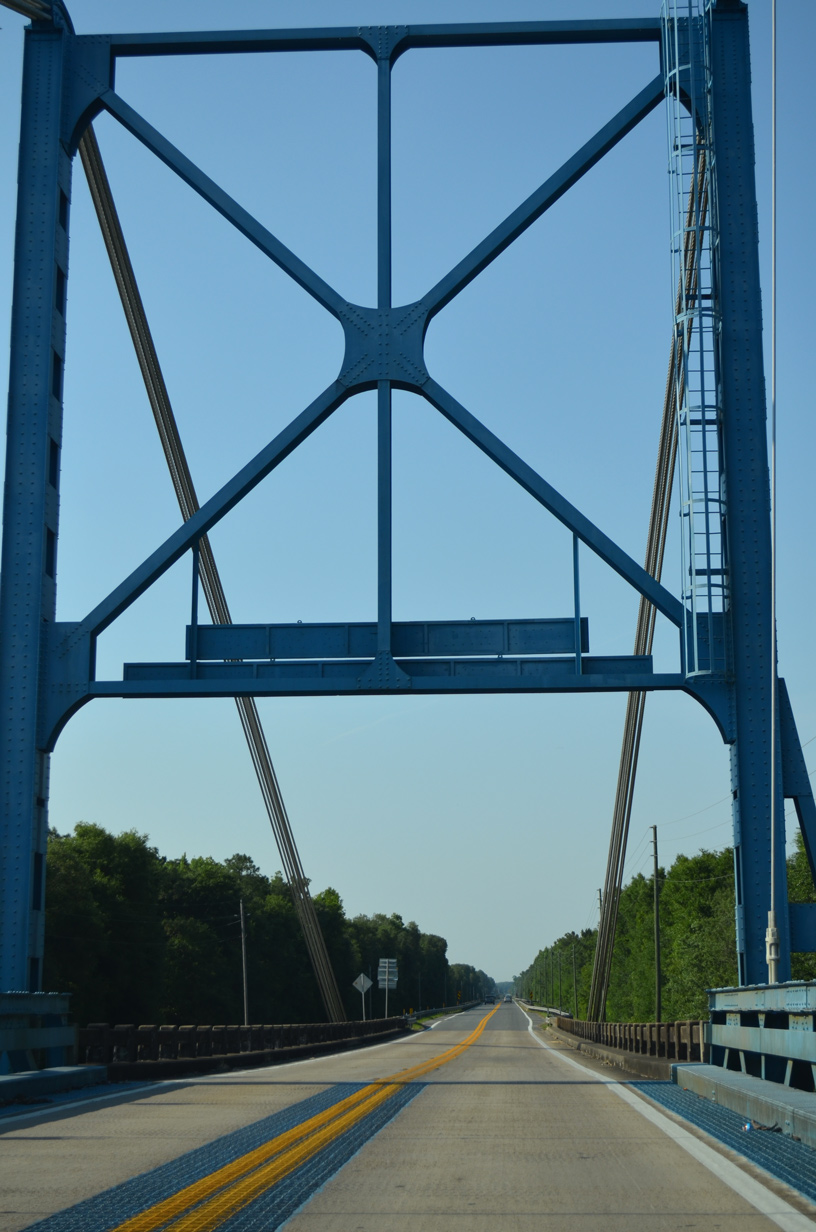
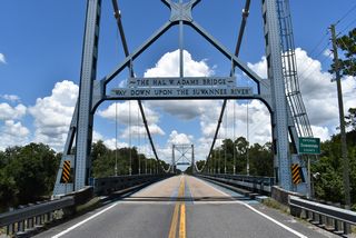
The Hal W. Adams Bridge carries SR 51 across the Suwannee River between Lafayette and Suwannee Counties. The lone suspension bridge in the state of Florida, the 687 foot long span was constructed in 1946-47 by the L.J. and W.J. Cobb Construction Company of Tampa. It replaced a 40 year old through truss bridge. Measuring 420 feet between the two approximately 50 foot high towers, the Hal Adams Bridge spans the Suwannee River at Luraville with a 19.7 foot vertical clearance. A suspension type was selected for the crossing due to the unstable river bottom and potential difficulty with setting bridge pier foundations. Hal Adams was a northern Florida circuit court judge.1,2
Hamilton County Road 51 extends 7.06 miles north from the end of SR 51 in Jasper to the Georgia state line. Florida Department of Transportation (FDOT) GIS data omits 0.82 miles of SR 51 along 2nd Avenue NE and Palmetto Avenue within the city of Jasper. Northward, CR 51 follows a rural course by Buzzard Bay and Smith Bay to Bakers Mill.
Florida State Road 51 Guides
References:
- Archaeological Consultants, Inc. (December 2012). Description of Significant Historic Bridges Historic Highway Bridges in Florida (p. 30). Florida Department of Transportation Environmental Management Office.
- Hal Adams Bridge. http://bridgehunter.com/fl/lafayette/hal-adams/ Bridgehunter.com.
Connect with:
Page Updated Friday July 24, 2020.