
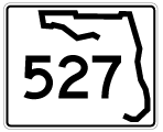
State Road 527 / County Road 527 North
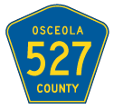
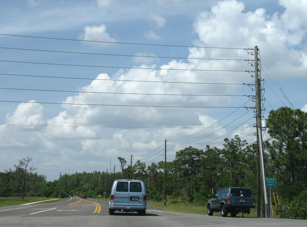
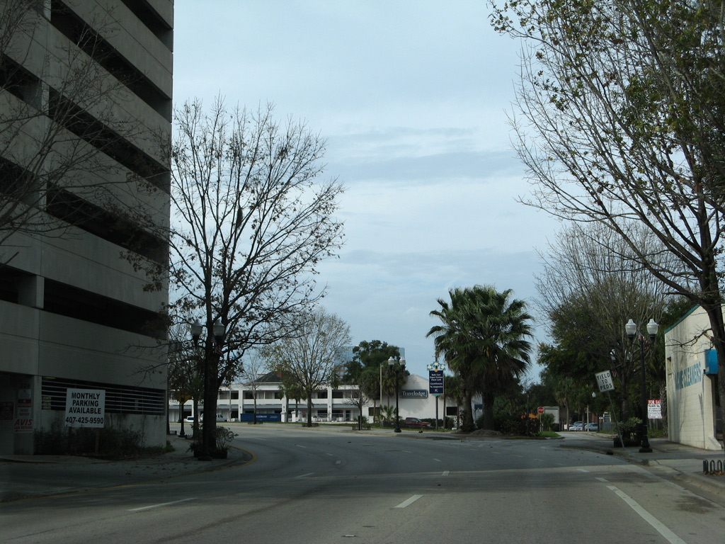
Orange Avenue extends 0.558 miles north from Osceola Parkway (CR 522) to cross the Orange County line. CR 527 is unsigned in Osceola County.
05/03/08
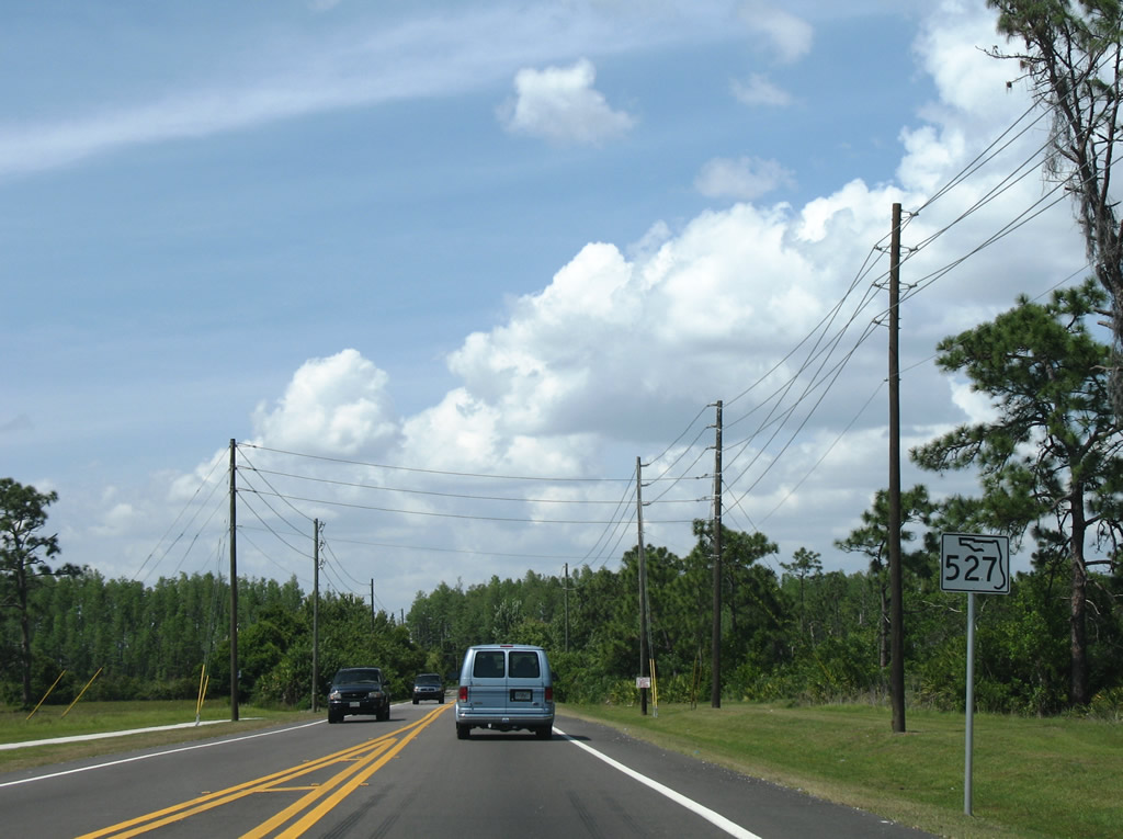
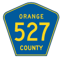
A State Road 527 confirming shield stood just inside Orange County along Orange Avenue northbound. The assembly was replaced by 2016 with a County Road 527 pentagon.
05/03/08
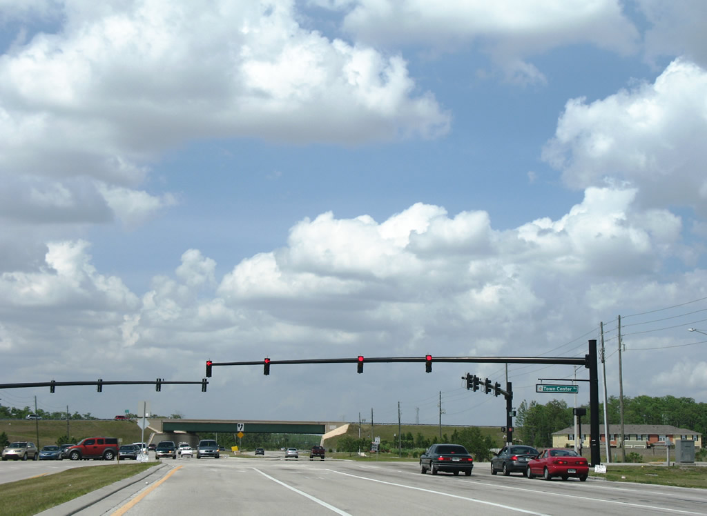
Orange Avenue (CR 527) passes over Florida's Turnpike and expands to meet Town Center Boulevard, an east-west arterial linking Hunter's Creek with the Meadow Woods community.
05/03/08
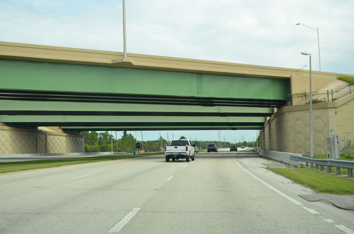
County Road 527 (Orange Avenue) passes under the Central Florida GreeneWay north from Town Center Boulevard near the Meadow Woods community. There is no direct access to SR 417 toll road from Orange Avenue.
09/03/17
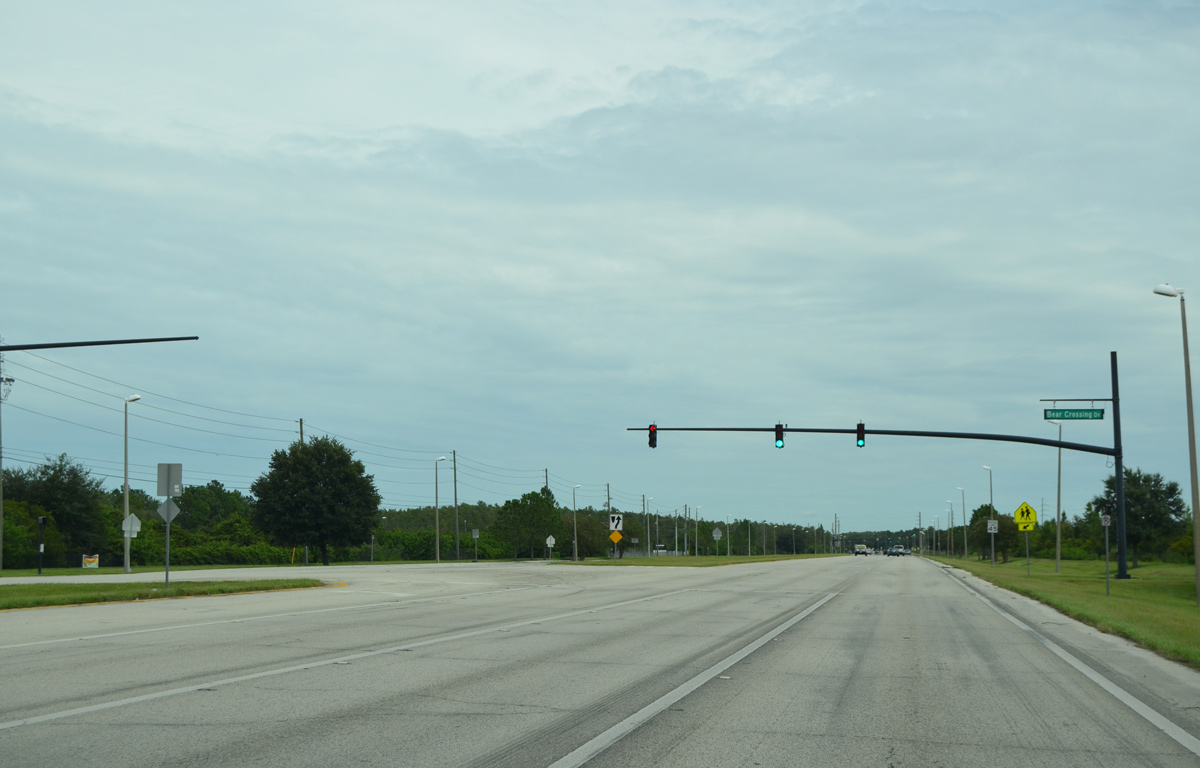
Bear Crossing Drive spurs west from Orange Avenue to Cypress Creek High School and Bear Creek Recreation Complex.
09/03/17
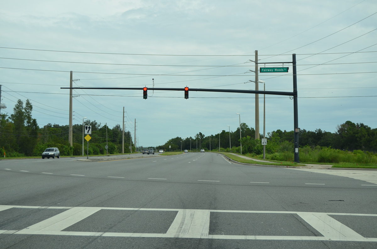
Fairway Woods Boulevard links Orange Avenue with the Meadow Woods community and the Meadow Woods Sunrail Station constructed in 2017-18.
09/03/17

Weatherbee Road is a suburban arterial west from Orange Avenue through the Southchase community to U.S. 17-92-441 (Orange Blossom Trail). East from CR 527, Weatherbee Road continues throughnorthern reaches of Meadow Woods to Boggy Creek Road outside Orlando International Airport (MCO).
09/03/17
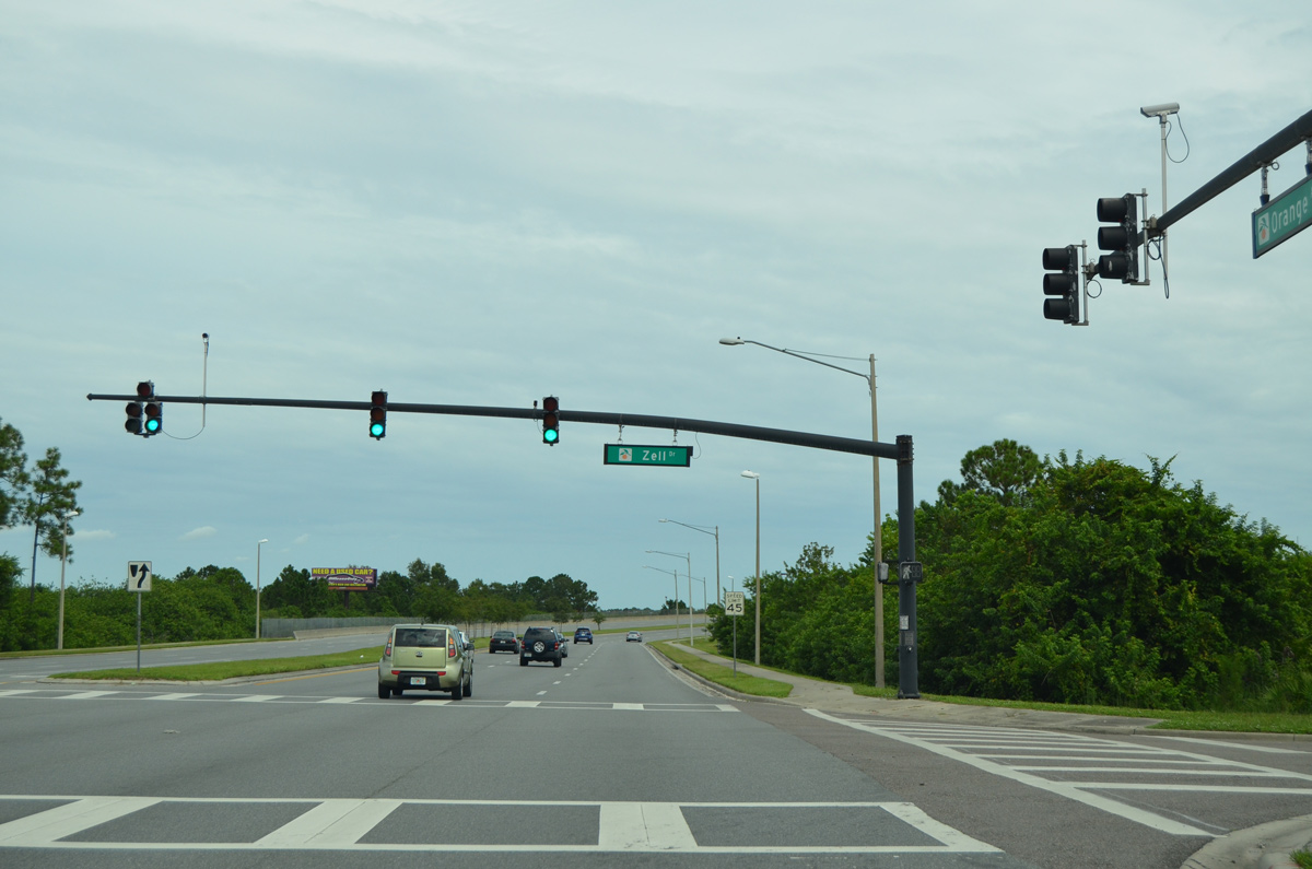
Remaining parallel to Sunrail, CR 527 (Orange Avenue) enters Regency Industrial Park at Zell Drive.
09/03/17
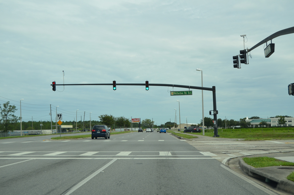
Orange Avenue shifts east across Sunrail and next interects Wetherbee Road Extension north from Jetport Industrial Park.
09/03/17
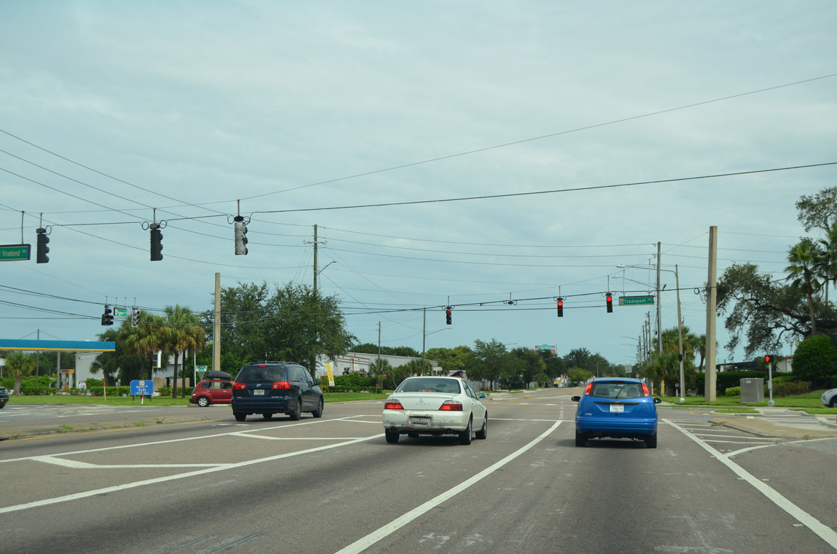
Taft-Vineland Road leads east from U.S. 17-92-441 (OBT) through an array of industrial parks to become Tradeport Drive at CR 527 (Orange Avenue). Tradeport Drive east connects Orange Avenue with Airport Industrial Park in the city of Orlando.
09/03/17
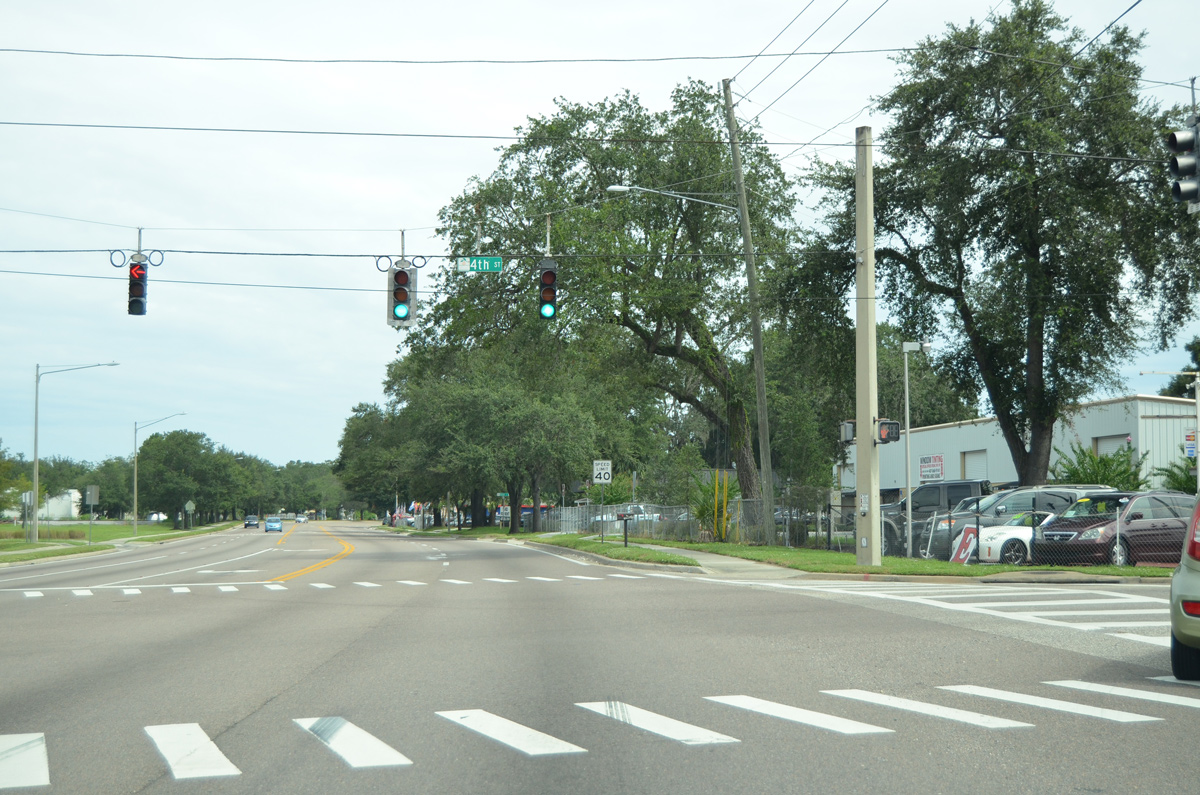
Orange Avenue advances north through the unincorporated community of Taft to 4th Street.
09/03/17
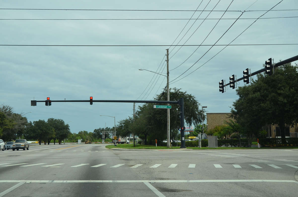
Landstreet Road runs just north of Taft and crosses paths with Orange Avenue at the next northbound traffic light. Landstreet Road heads east to the Villages of Southport in Orlando and west to Orange Blossom Trail at the exchange with Florida's Turnpike and SR 528.
09/03/17
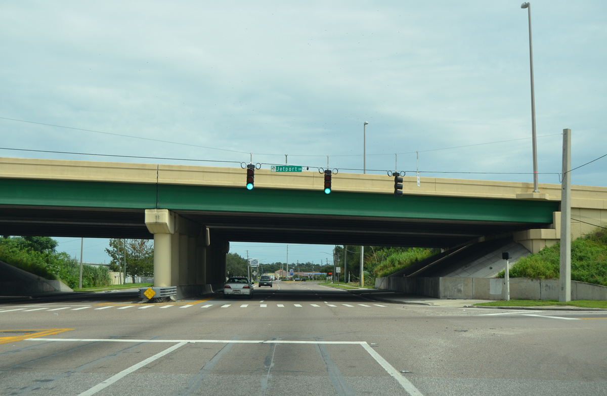
Jetport Drive comprises a south side frontage road for the tolled Beachline Expressway (SR 528) east from Orange Avenue to Belle Isle and Tradeport Drive by MCO Airport.
09/03/17
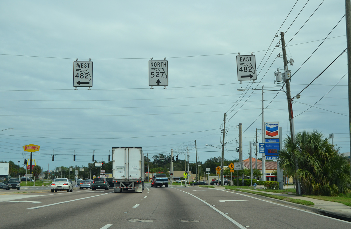
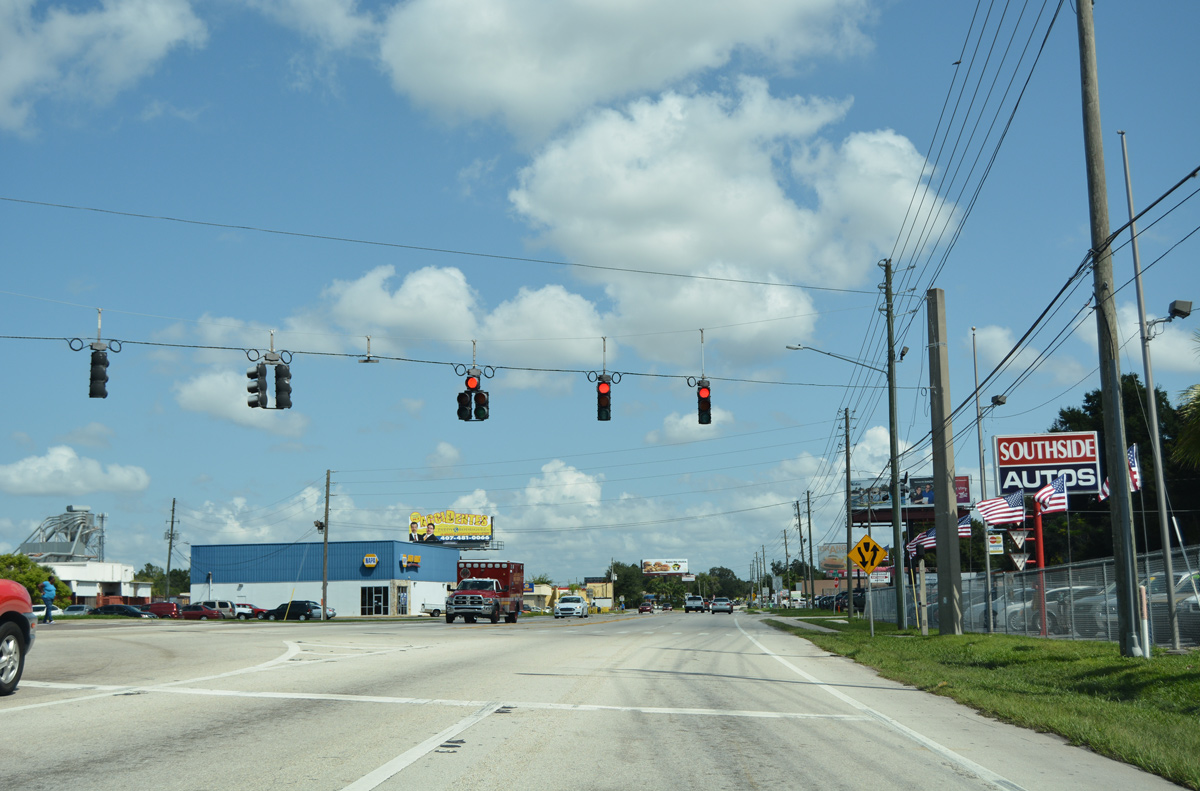
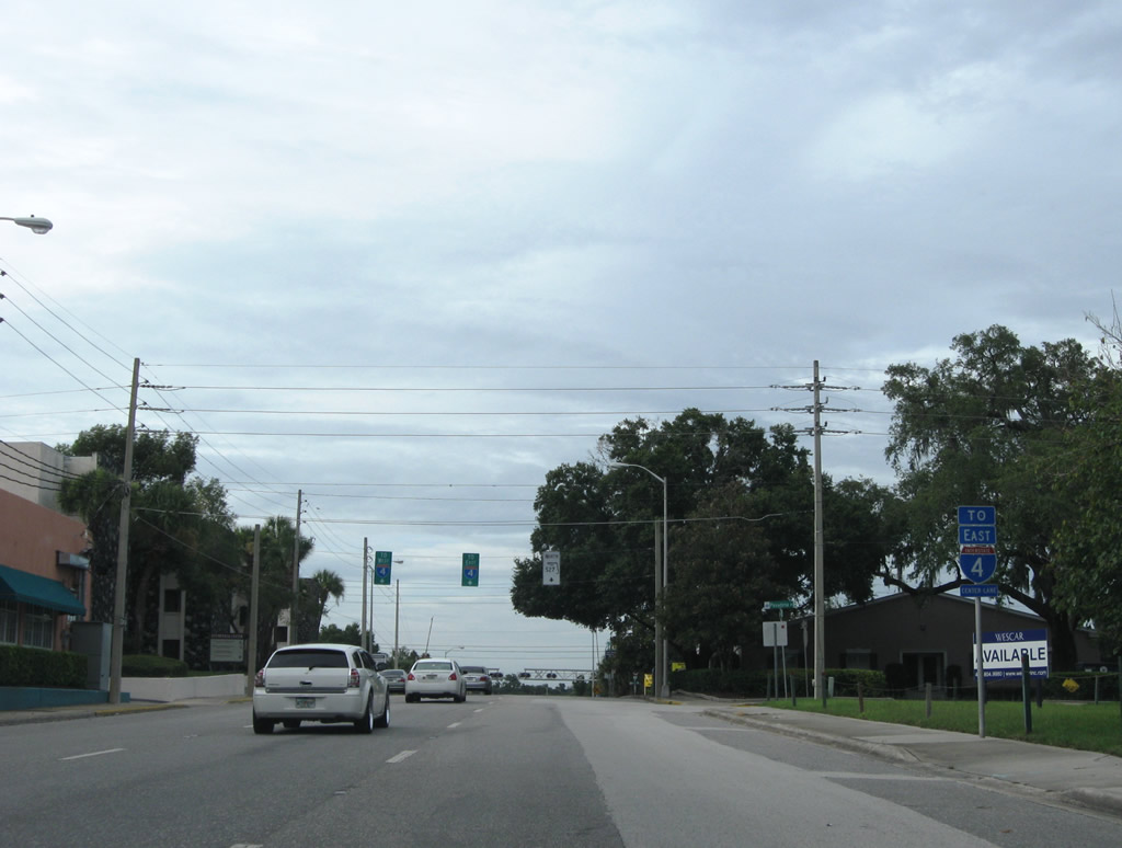
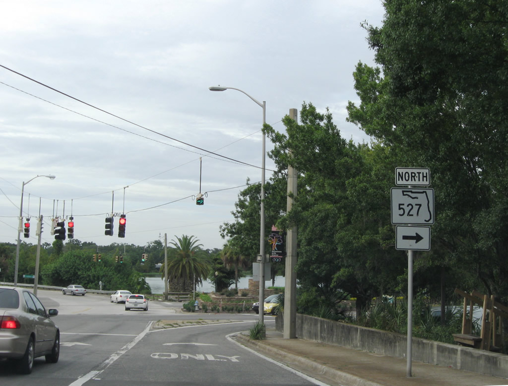
SR 482 (McCoy Road) branches west from SR 528 (Beachline Expressway) at Boggy Creek Road and Jetport Drive to intersect Orange Avenue at the transition from CR 527 to SR 527. The remainder of SR 482 west follows Sand Lake Road to Florida Mall and I-4 at Dr. Phillips.
09/03/17
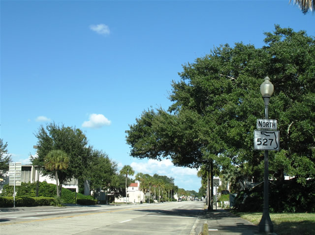
 North
North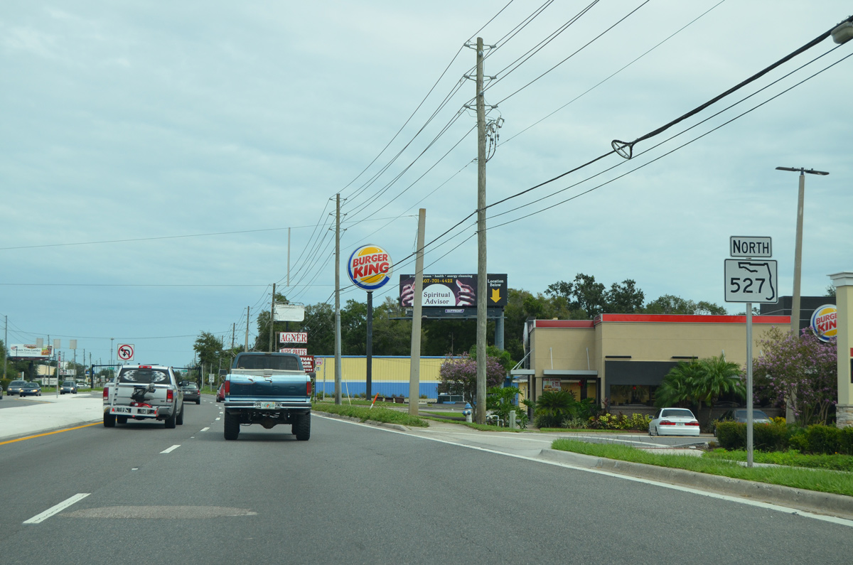
SR 527 extends Orange Avenue north from SR 482 through the community of Pine Castle. The first confirming marker stands just beyond McCoy and Sand Lake Roads.
09/03/17
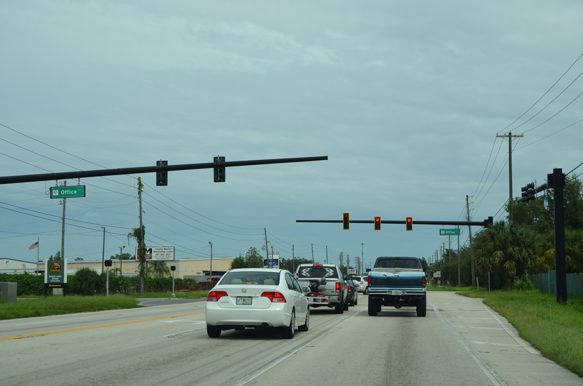
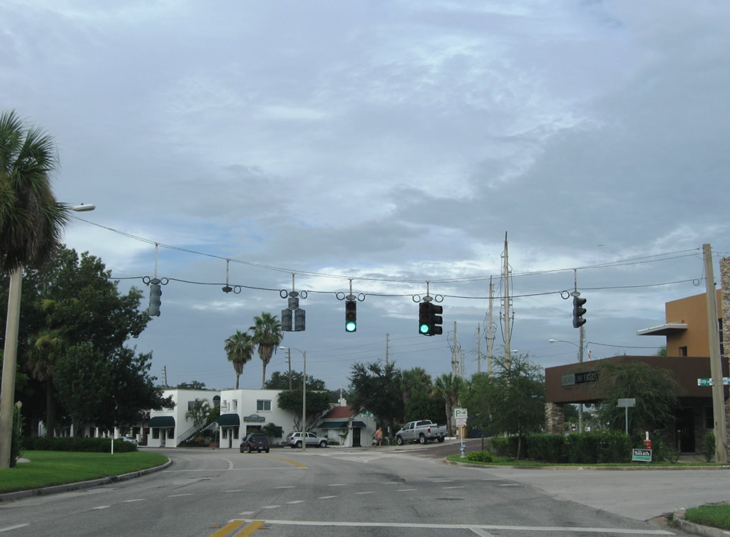
Traffic lights serves a commerce park sandwiched between SR 527 (Orange Avenue) and nearby Sunrail at Office Court. The signals replaced a set of flashers here in 2017.
09/03/17
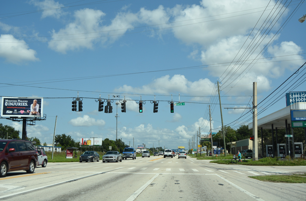
SR 527 and Sunrail converge again as Orange Avenue intersects Nela Avenue. Nelva Avenue leads east into the city of Belle Isle, spanning an inlet across Lake Conway to the Nela Isle Island community.
09/07/16
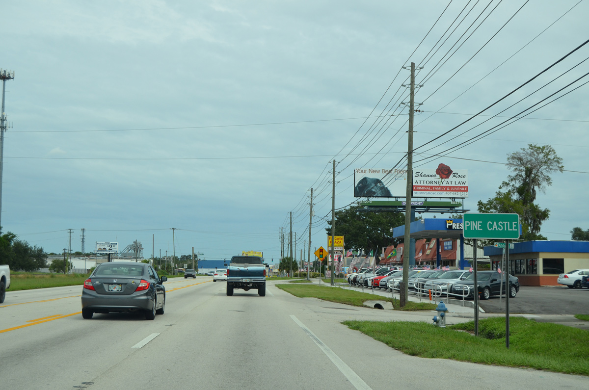
SR 527 (Orange Avenue) advances north through Pine Castle.
09/03/17
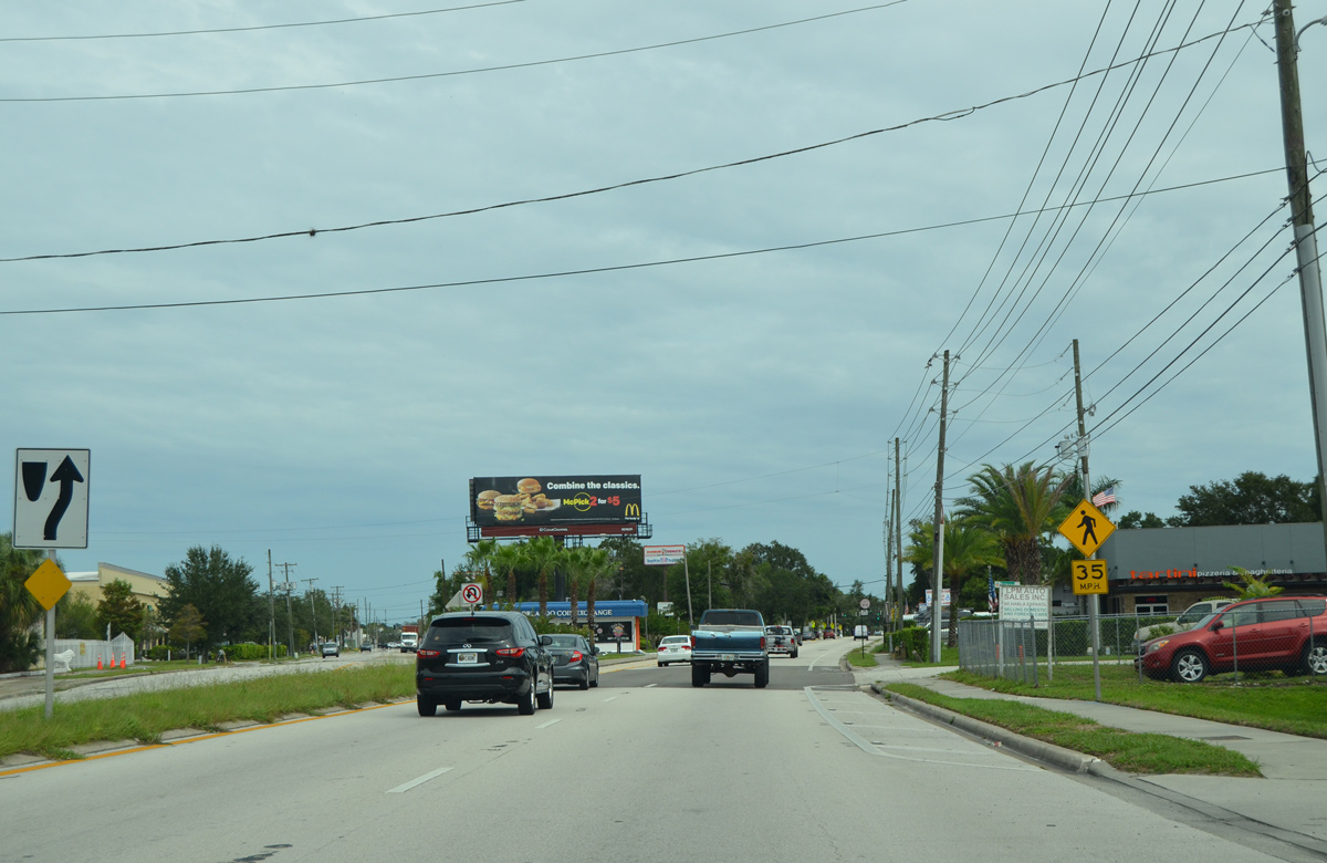
Lancaster Road stems west from Orange Avenue to the Sky Lake community and U.S. 17-92-441 (OBT) at Orlando Central Park.
09/07/16
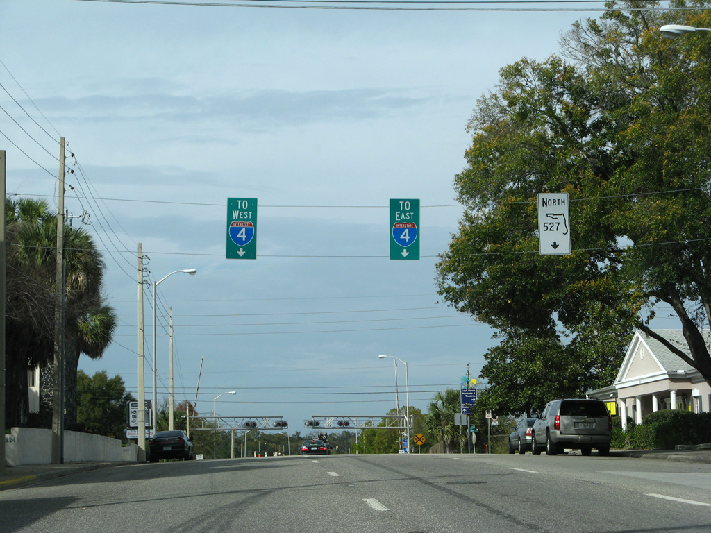
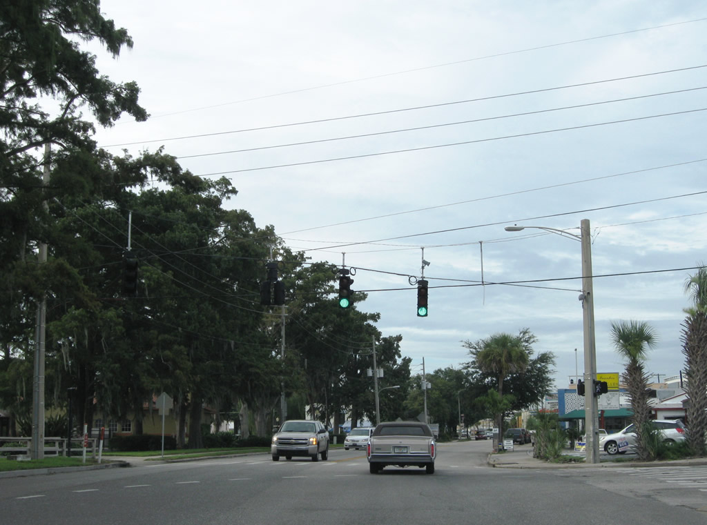
SR 527 partitions into a one way couplet with northbound traffic following Hansel Avenue and southbound motorists remaining along Orange Avenue.
09/03/17
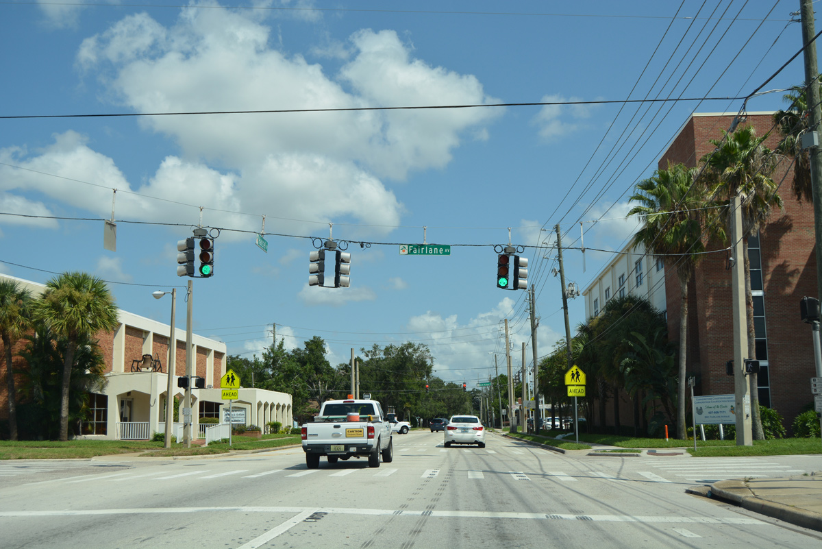
Northbound Hansel Avenue at Fairline Avenue in the Pine Castle business district.
09/07/16
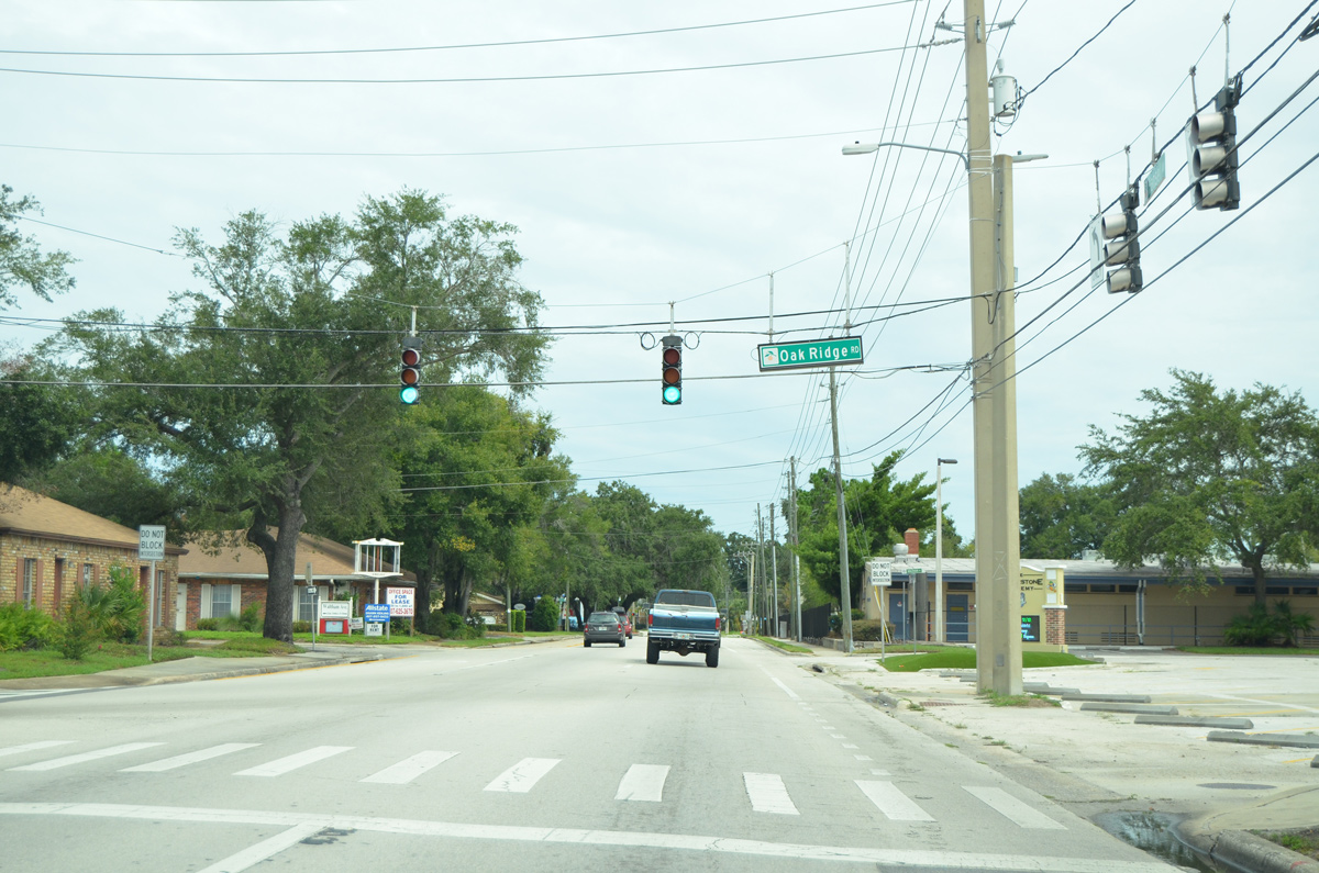
Oak Ridge Road east ends at SR 527 (Hansel Avenue) at the ensuing northbound signal. Oak Ridge Road doubles as CR 506, an unmarked route west 1.77 miles to U.S. 17-92-441 (OBT).
09/03/17
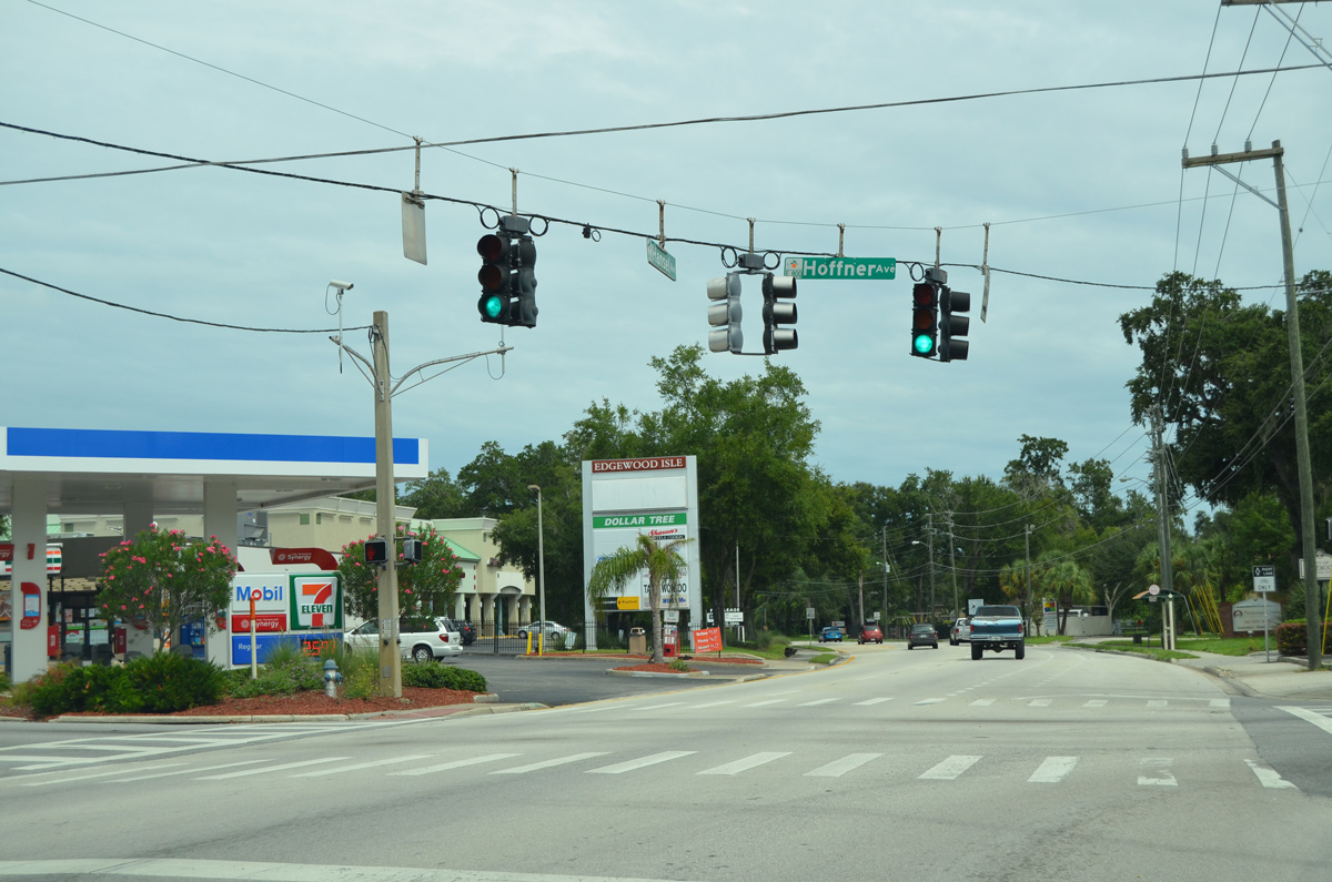
Hoffner Avenue east into the city of Belle Isle represents the continuation of County Road 506 to SR 15 at Conway Road.
09/03/17
The split directions of SR 527 (Hansel Avenue north and Orange Avenue south) combine at Mandalay Road in the city of Edgewood.
09/07/16
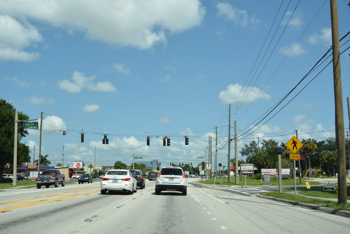
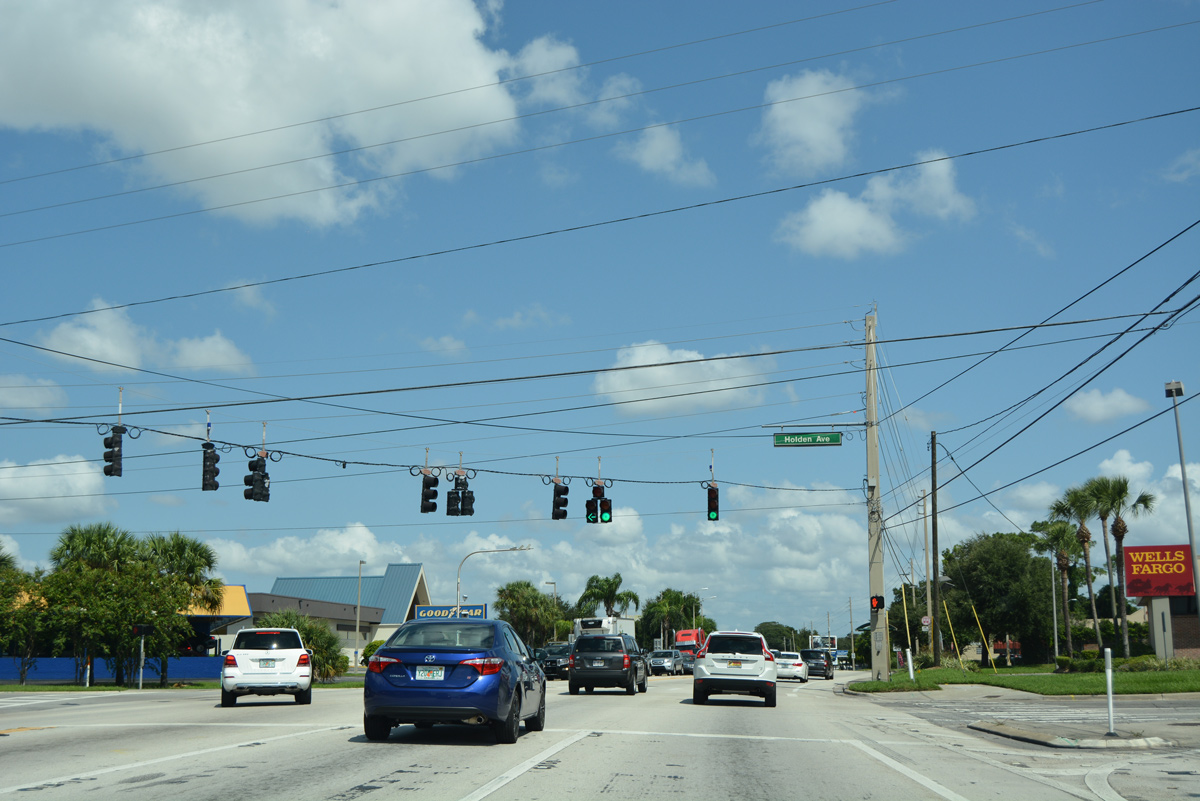
Gatlin Avenue west and Holden Avenue east tie into SR 527 (Orange Avenue) at a staggered intersection in Edgewood.
09/07/16
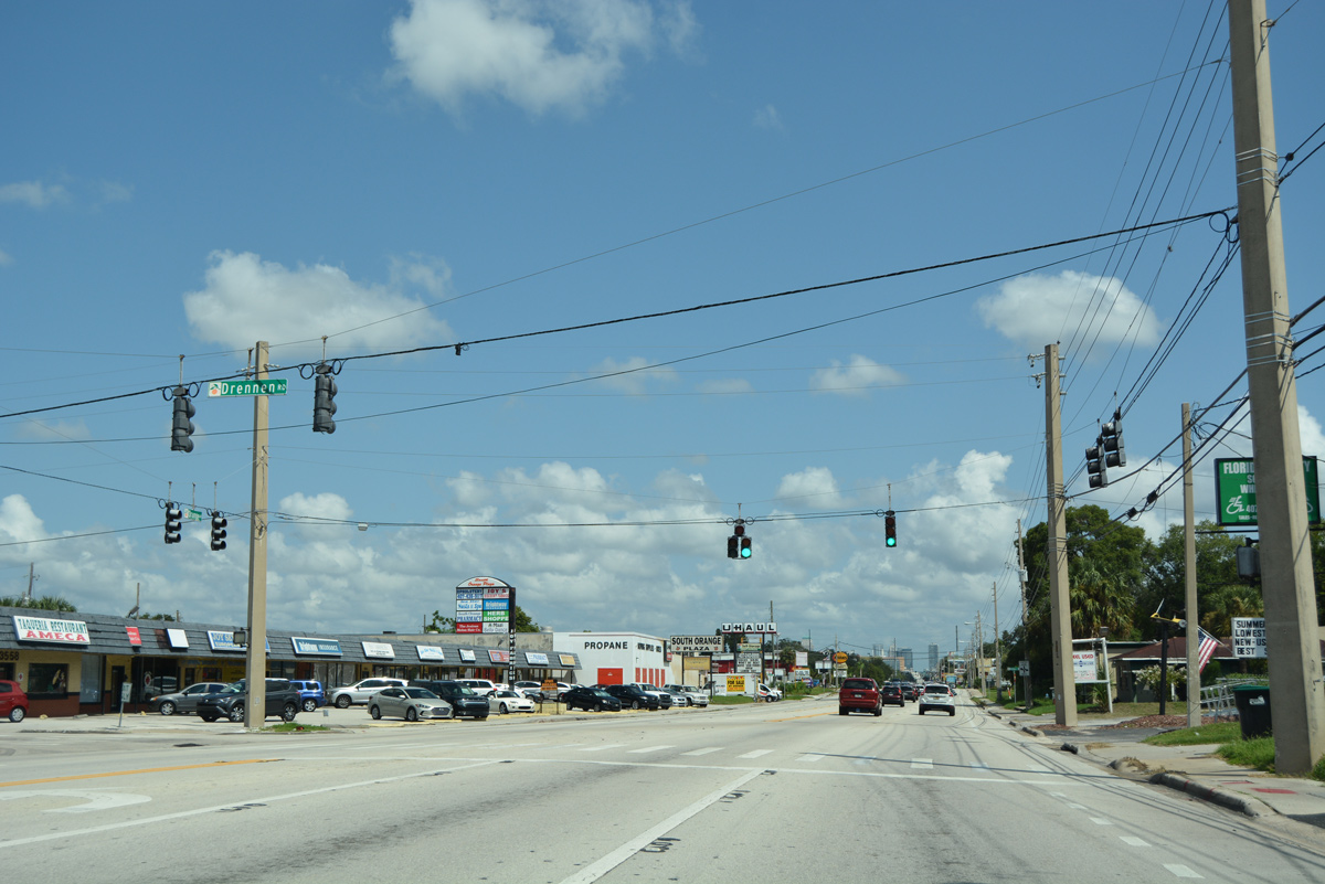
SR 527 crosses into the Orlando city limits by Lake Jennie Jewel. The ensuing traffic light operates at Drennen Road west to the Lake Holden Grove and Medallion Estates neighborhoods off Lake Holden.
09/07/16
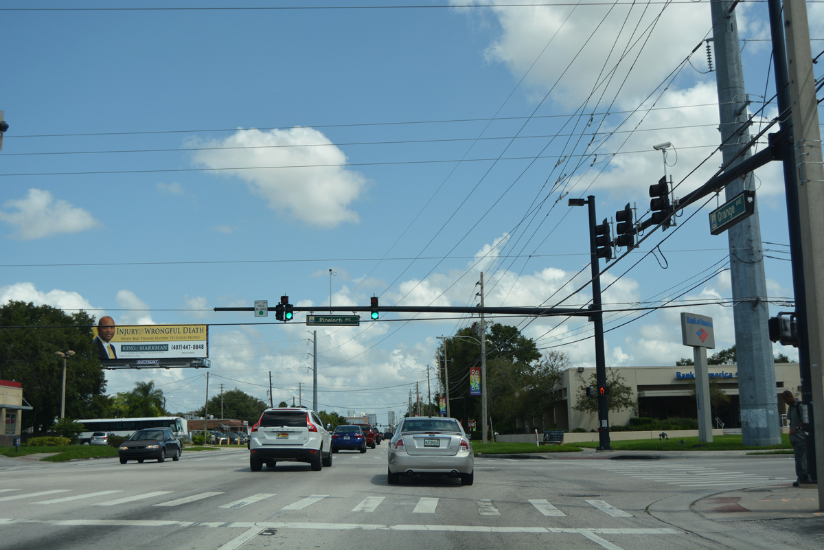
SR 527 (Orange Avenue) north at Pineloch Avenue. Pineloch Avenue serves adjacent retail and industrial businesses west toward Lake Holden and east to Lake Pineloch.
09/07/16
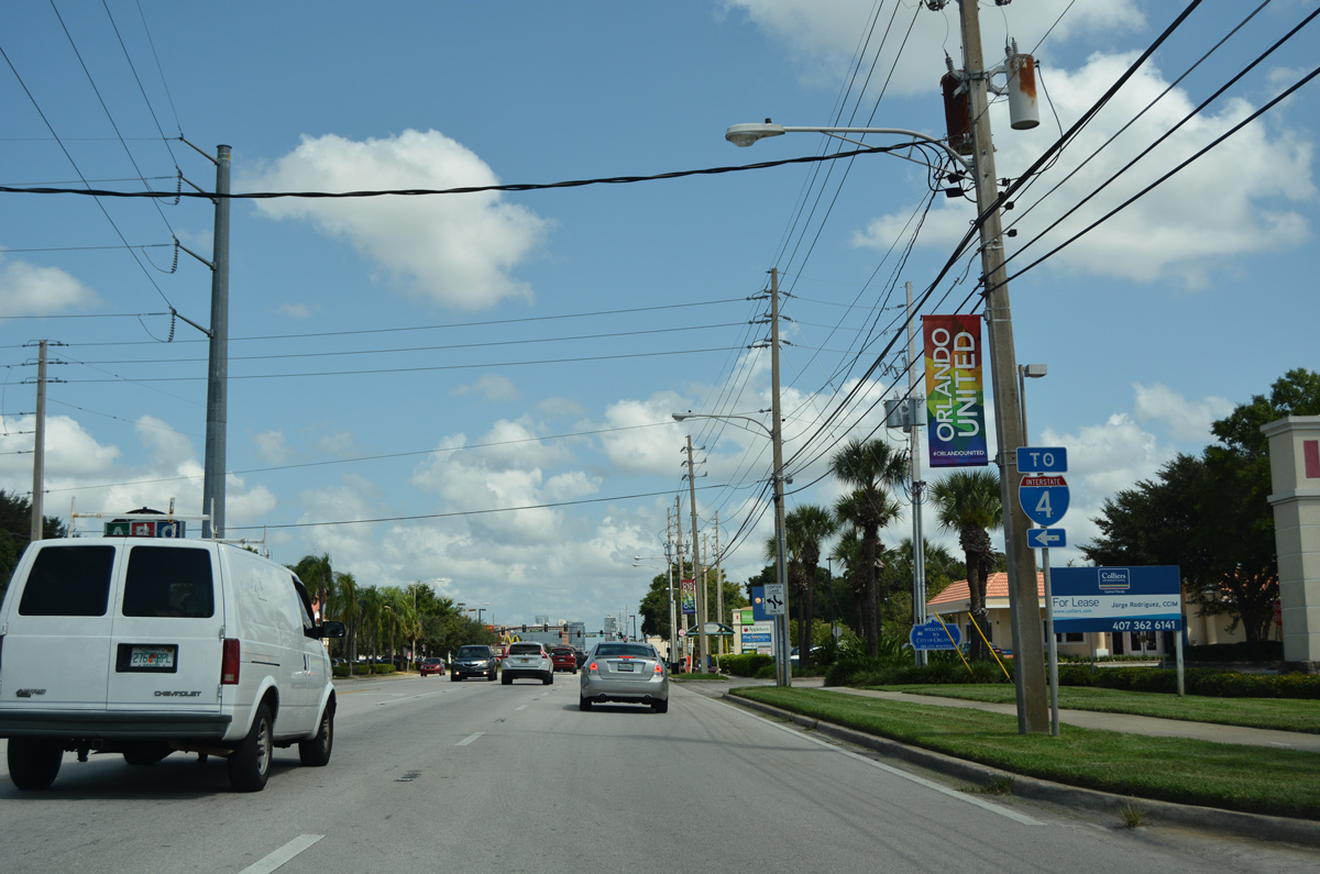
Continuing north, SR 527 approaches Michigan Avenue, which winds west around Lake Holden Business Park 0.8 miles to meet Interstate 4 eastbound.
09/07/16
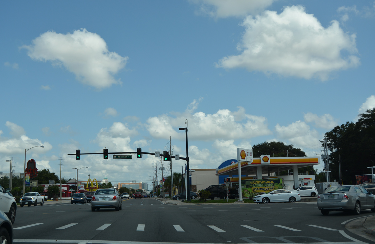
Michigan Street is an urban collector connecting SR 527 with U.S. 17-92-441 (OBT) at Angebilt to the west and Crystal Lake Drive at Conway to the east.
09/07/16
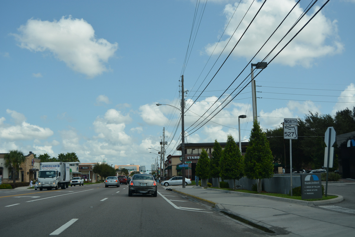
Reassurance marker for SR 527 north posted after Michigan Street and ahead of the Sodo District.
09/07/16
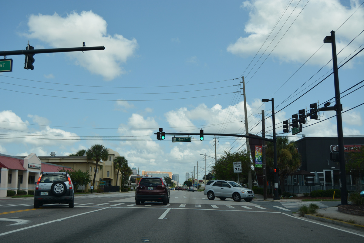
Grant Street intersects SR 527 (Orange Avenue) west from Wadeview Park by the Sodo District.
09/07/16
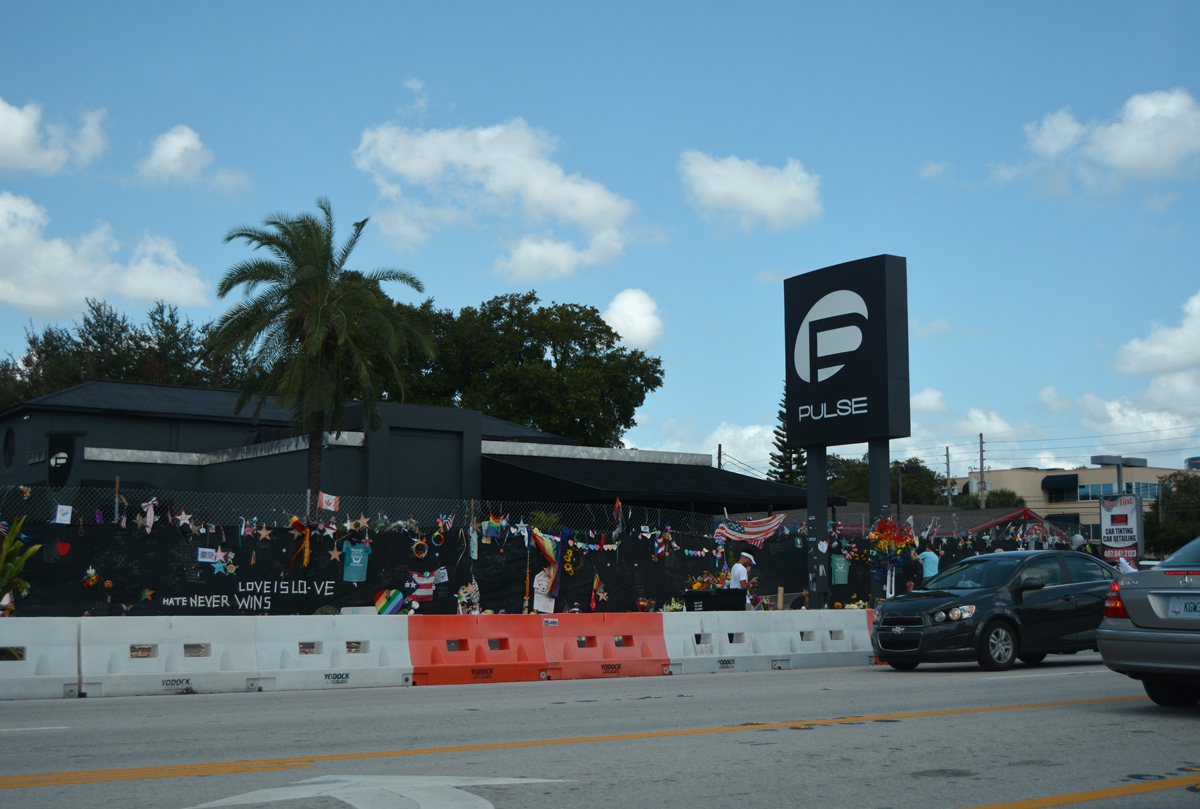
The Pulse nightclub was located at the northwest corner of Orange Avenue (SR 527) and Esther Street. Pulse was the site of a mass shooting on June 12, 2016, in which 49 lost their lives and another 58 were injured.
09/07/16
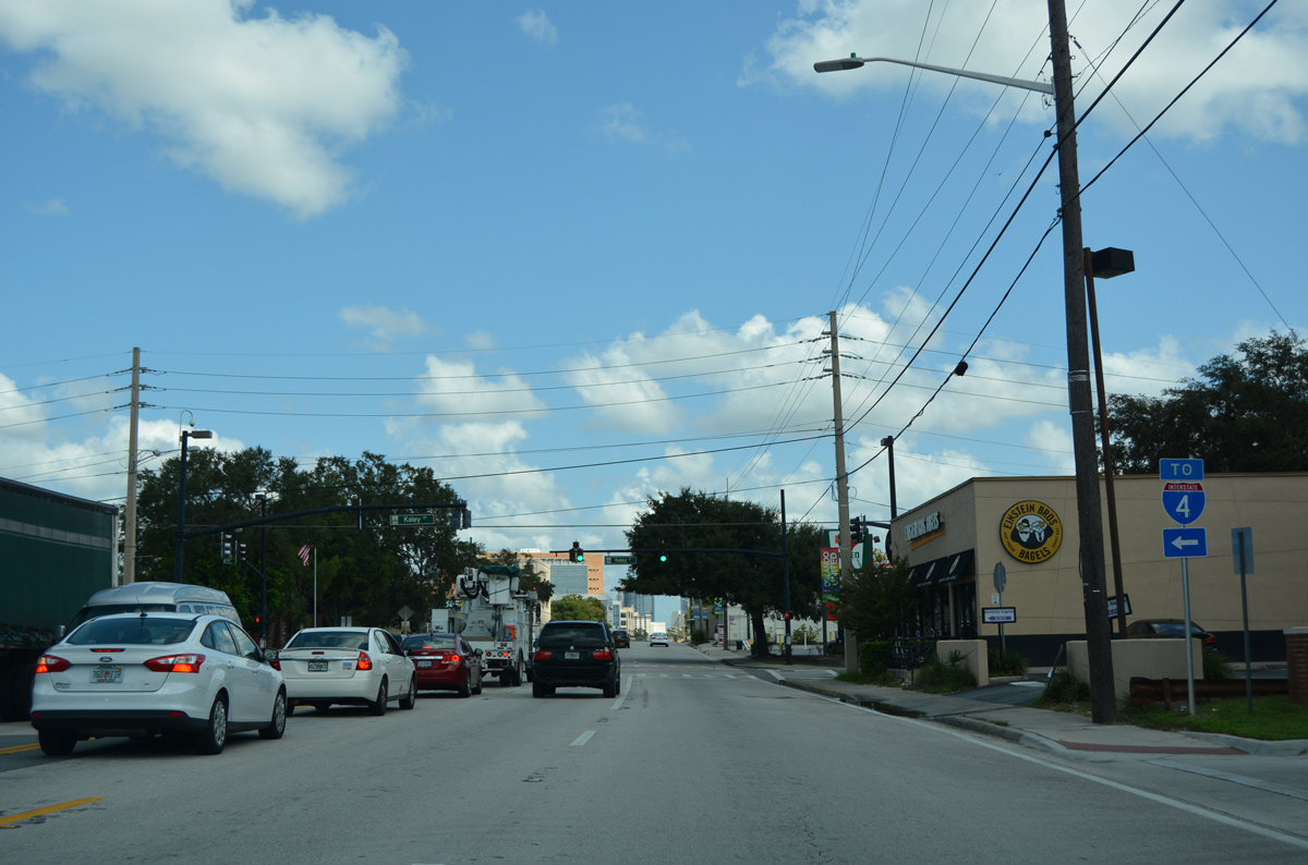
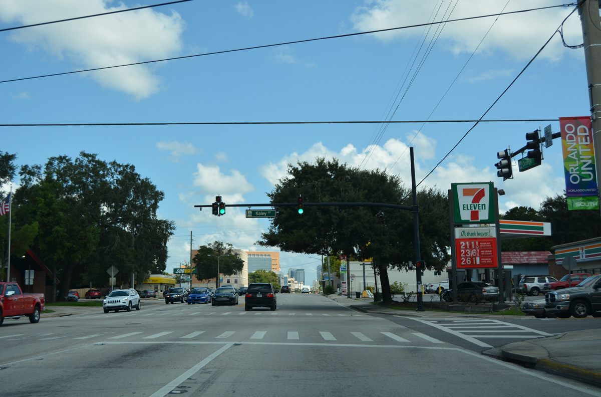
Kaley Street provides a direct route from SR 527 (Orange Avenue) west to Interstate 4 westbound.
09/07/16
Kaley Avenue crosses areas of Orlando west to Parramore Avenue adjacent to I-4 and east to Lancaster Park. Kaley Avenue extends west through the Angebilt community to OBT and Clear Lake and east to Peel Avenue at the Asbury Park subdivision.
09/07/16
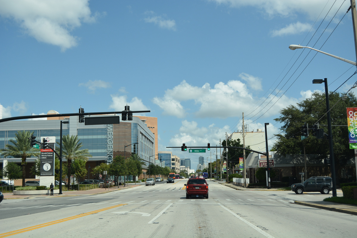
Miller Street and Wisteria Avenue intersect SR 527 (Orange Avenue) by Lake Lurna and the Copeland Park neighborhood.
09/07/16
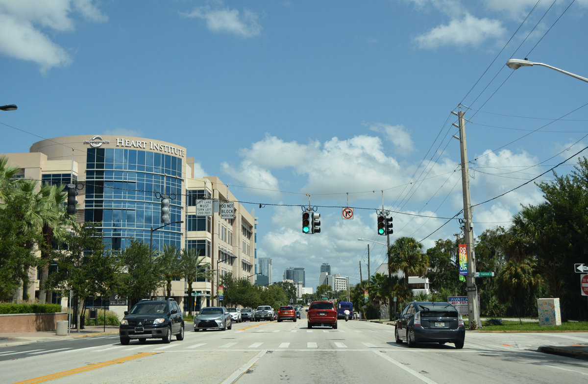
Orange Avenue travels alongside Orlando Health Heart Institute north to the signal with Copeland Drive.
09/07/16
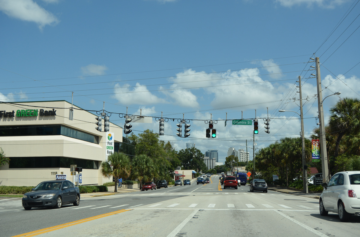
Columbia Street west links Orange Avenue at Lake Copeland with Division Avenue.
09/07/16
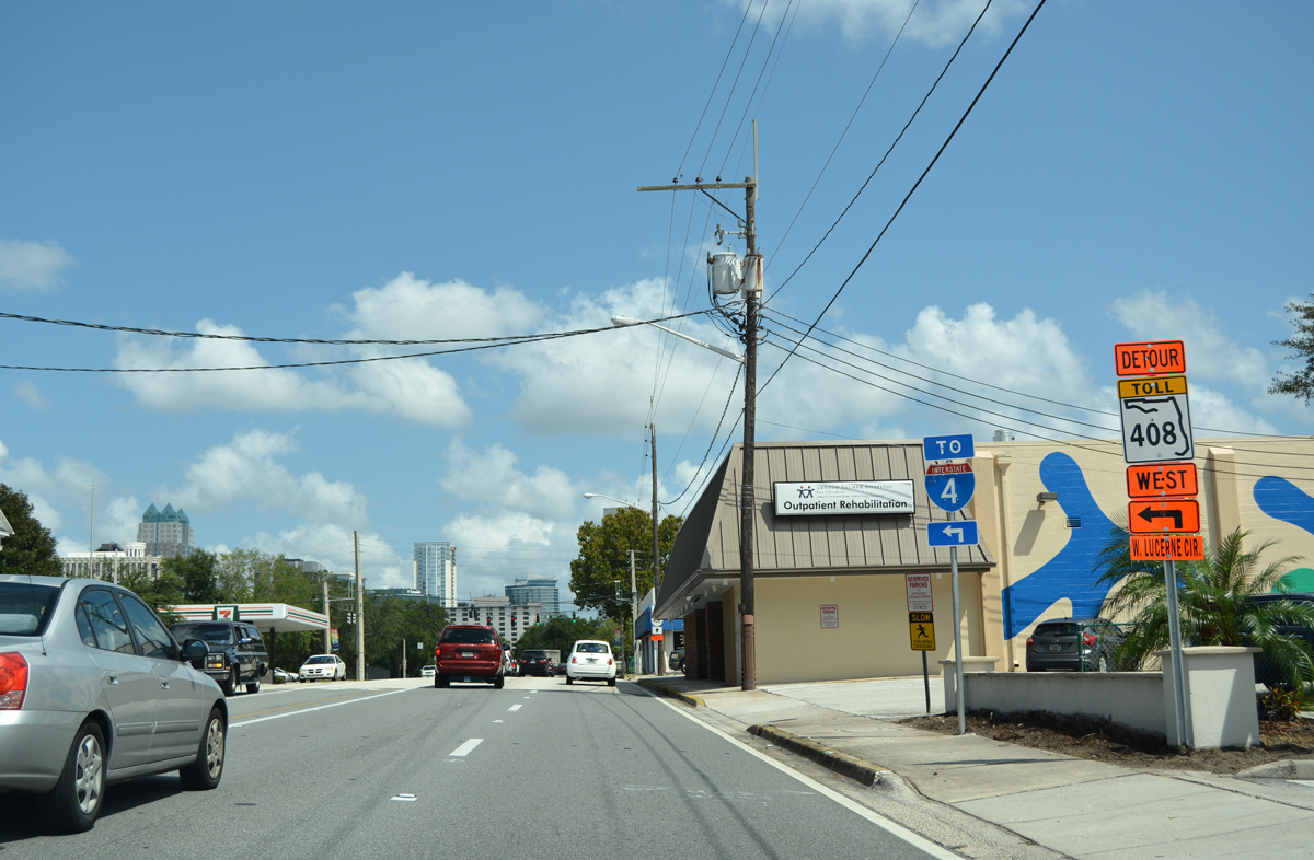
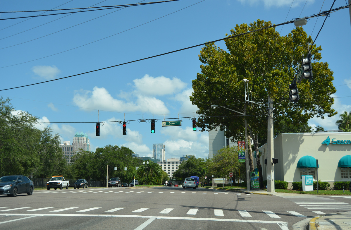
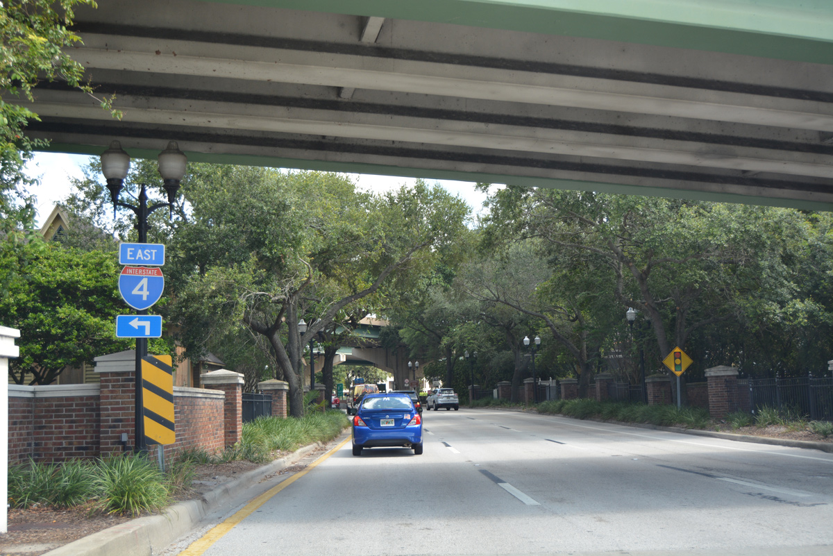
Forthcoming Gore Street leads west from Delaney Avenue and SR 527 to a westbound on-ramp to Interstate 4.
09/07/16
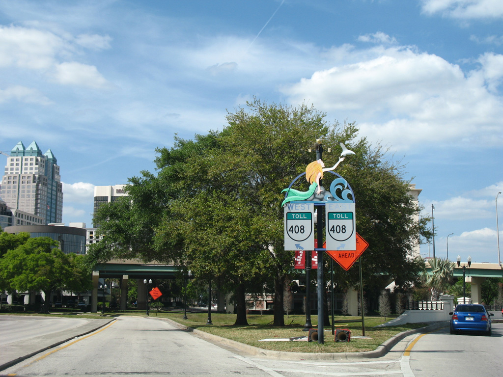
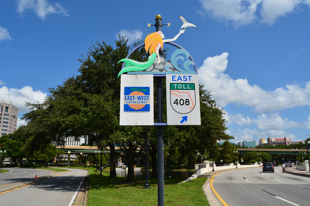
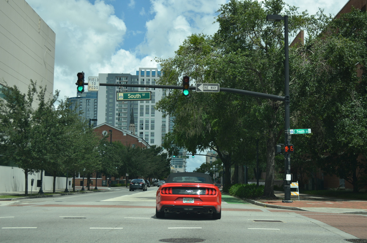
SR 527 ends at Gore Street, with Orange Avenue continuing north as a city-maintained street to Anderson and South Streets, which connect with the tolled East-West Expressway.
09/07/16
Gore Street is a through street west to Orange Center Boulevard and SR 423 (John Young Parkway). Orange Avenue north enters Downtown Orlando just beyond Lake Lucerne, where it splits into a couplet with Rosalind Avenue (former SR 527 northbound).
09/07/16
- North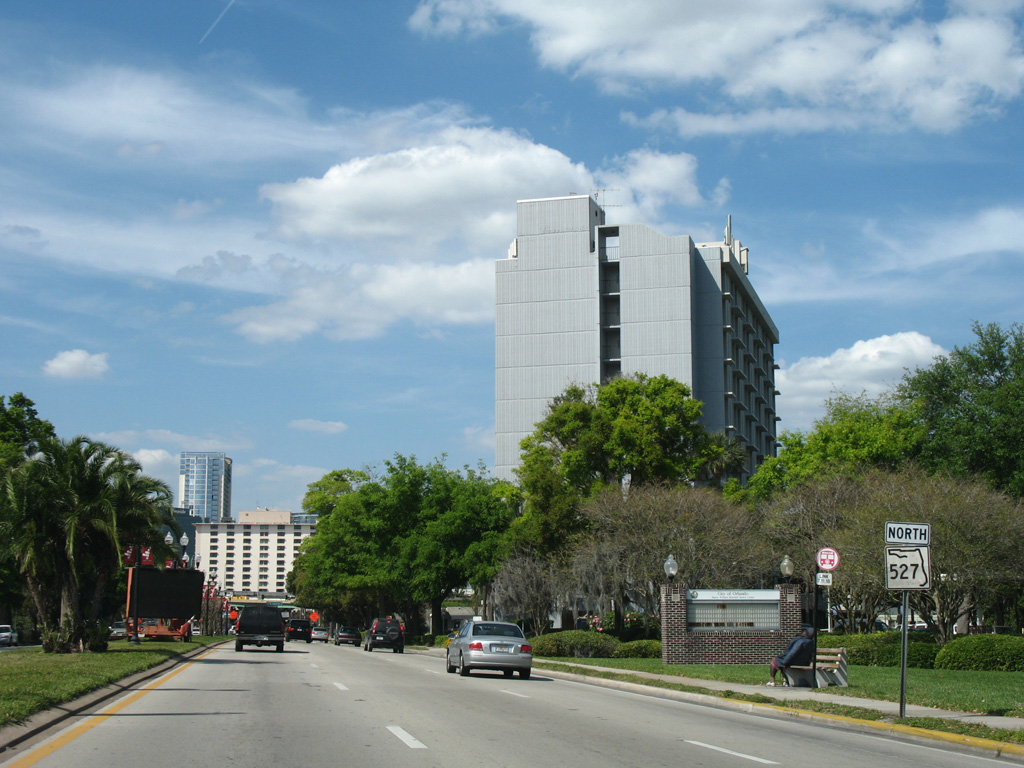
Former reassurance marker for SR 527 north of Gore Street.
03/28/08
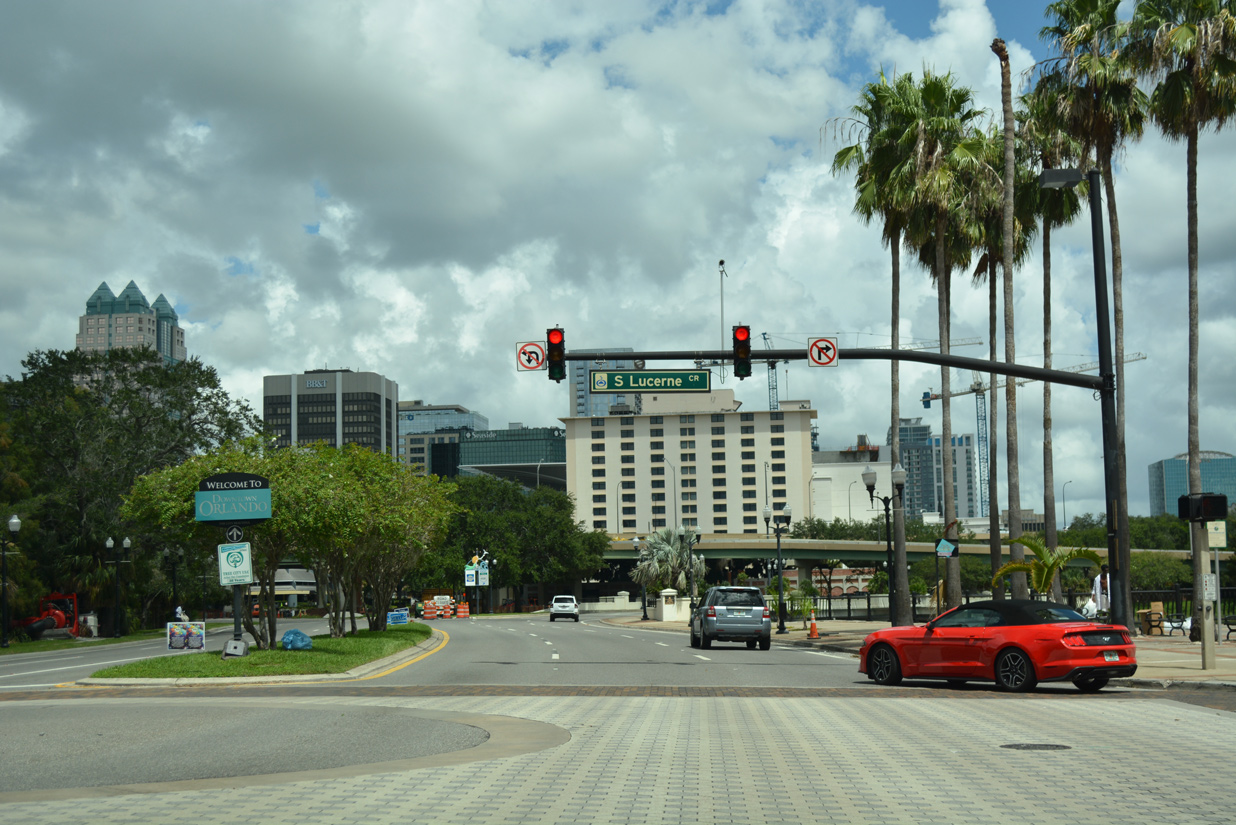
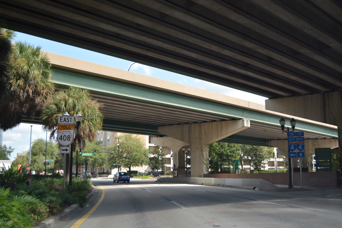
With one way traffic leading to Orange Avenue, South Lucerne Circle wraps around Lake Lucerne from Orange Avenue south and the SR 408 eastbound off-ramp to Downtown at Delaney Avenue to the east.
09/01/18
Traffic on Orange Avenue partitions across Lake Lucerne for Rosalind Avenue north into Downtown and a ramp curving west to Lake Lucerne Circle North and SR 408 westbound toward Pine Hills and Ocoee.
03/28/08
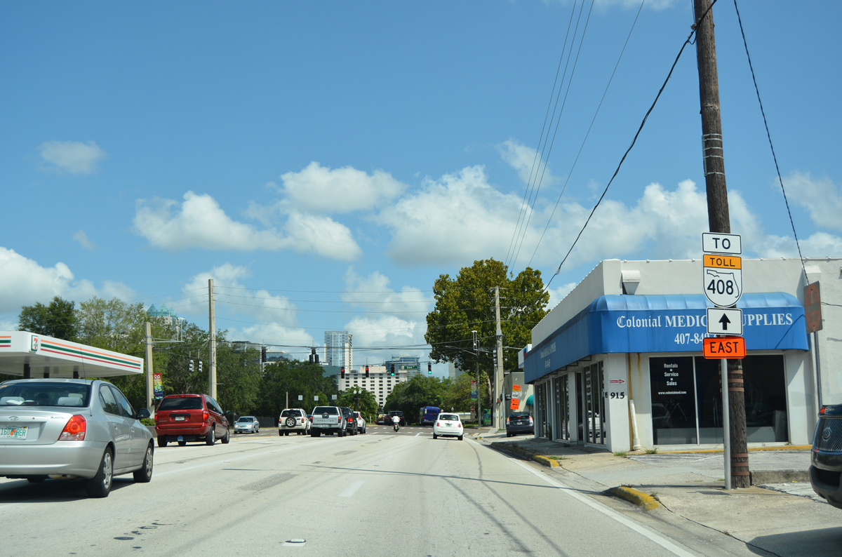
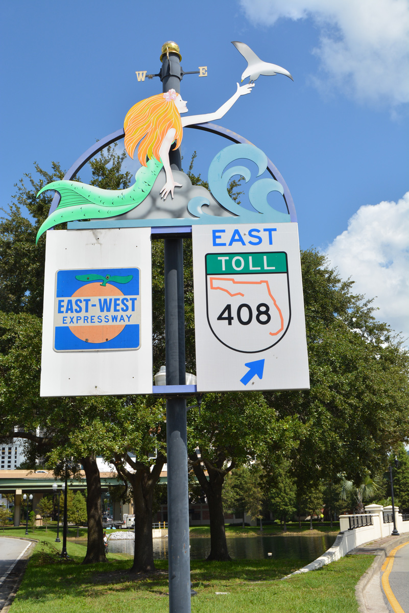
A decorative sign assembly directs motorists bound for SR 408 at the split with Rosalind Avenue. The westbound on-ramp to SR 408 was closed for I-4 Ultimate construction of a systems interchange between SR 408 and Interstate 4. The SR 408 west shield was removed during this time, revealing the previous trailblazer used for the East-West Expressway.
09/07/16
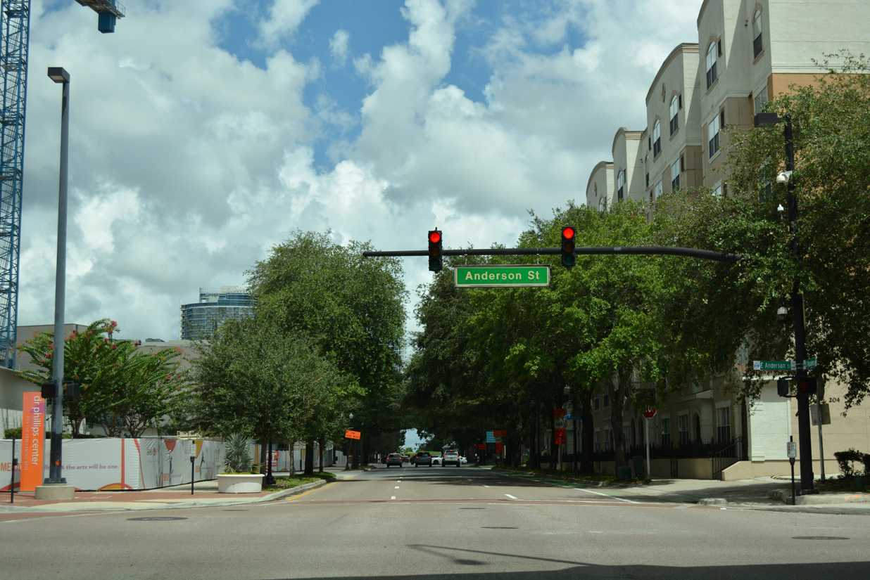
Curving northeast, drivers on Rosalind Avenue (former SR 527) north pass under the ramp from SR 408 east to Orange Avenue and approach Anderson Street. Anderson Street links with I-4 eastbound a short distance to the west.
09/07/16
Anderson Street becomes one way eastbound and forms the south side frontage road for the East-West Expressway between Rosalind Avenue and Lake Underhill. An on-ramp for SR 408 east to Union Park departs from Anderson Street in two blocks.
09/07/16
09/01/18
Rosalind Avenue passes between the Dr. Phillips Center for the Performing Arts and The Grande condominium complex between Anderson Street and South Street west.
09/01/18
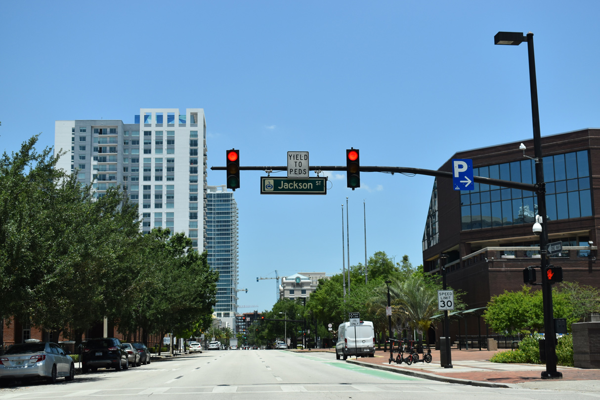
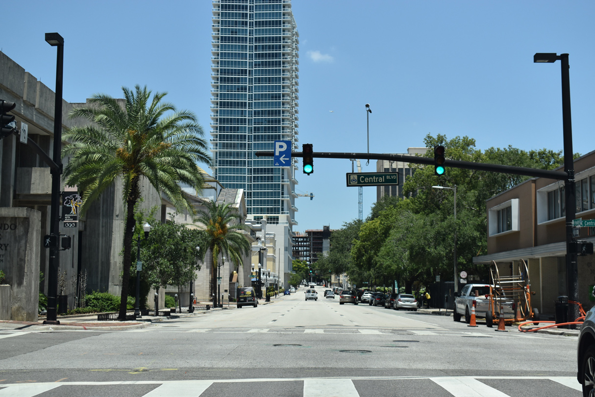
An array of churches and government offices line the four block stretch of Rosalind Avenue north from South Street. Pictured here is the signal with Jackson Street.
05/22/20
Rising prominently between Pine Street and Central Boulevard is the 22-story Modera Central luxury mixed-used apartment community. Housing 350 apartment units, the high rise was built between 2016-18 at the 1960-site of the University Club of Orlando.1
05/22/20
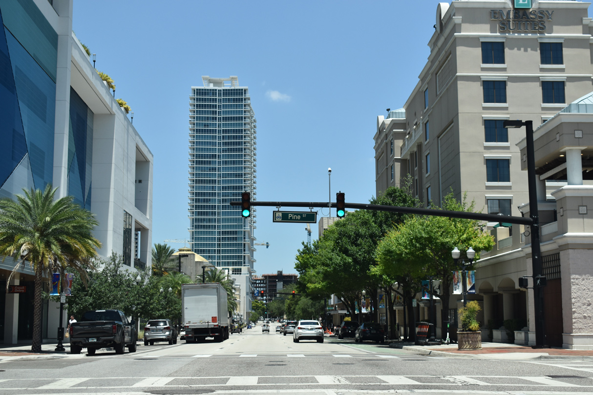
Rosalind Avenue north at Pine Street. A dedicated bike lane lines the third lane along Rosalind Avenue north through Downtown Orlando.
05/22/20
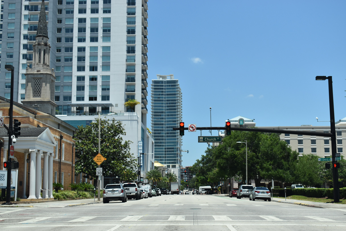
Rosalind Avenue intersects Central Boulevard at the southwest corner of Lake Eola Park and the Orlando Public Library.
05/22/20
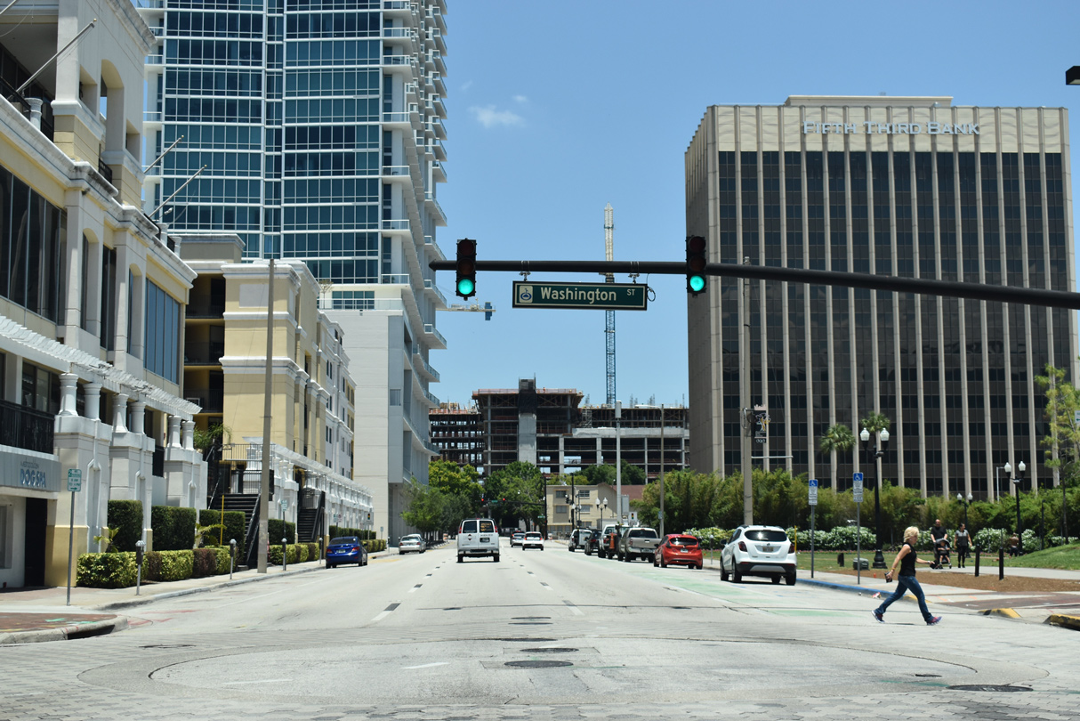
Washington Street stems west from Rosalind Avenue by the Walt Disney Amphitheater at Lake Eola. Beyond Downtown, Washington Street is a part of SR 526 between I-4 and Orange Blossom Trail at the Parramore community.
05/22/20
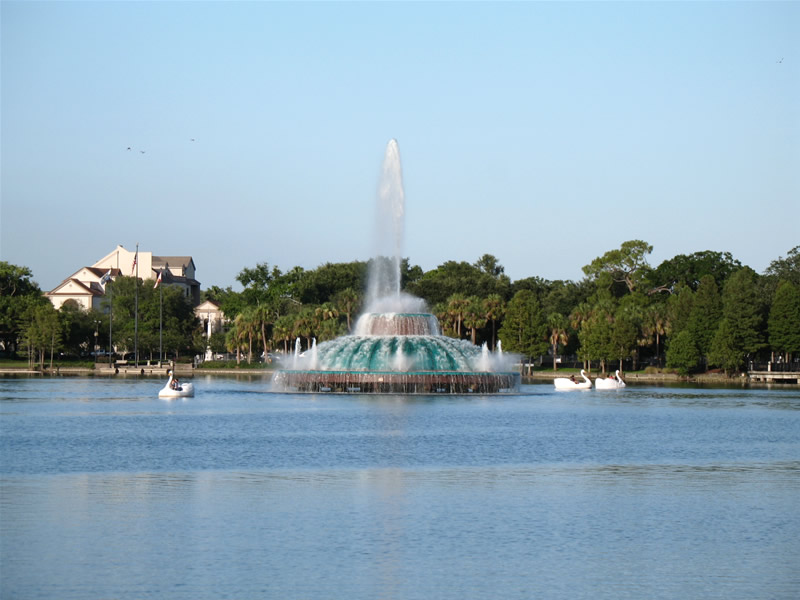
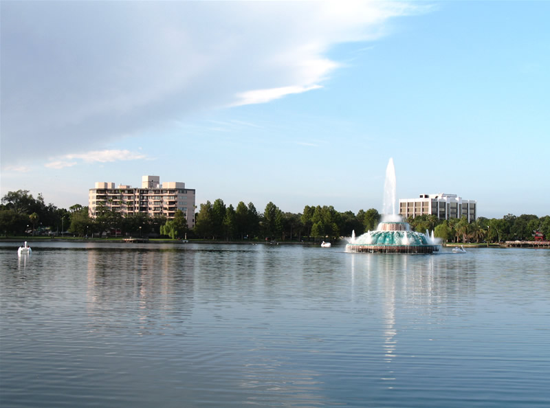
Lake Eola Park lines the east side of Rosalind Avenue between Central Boulevard and SR 526 (Robinson Street). The park is home to an amphitheater, fountain and walking paths. The fountain was installed in 1912, with a second added in 1957.
07/29/06
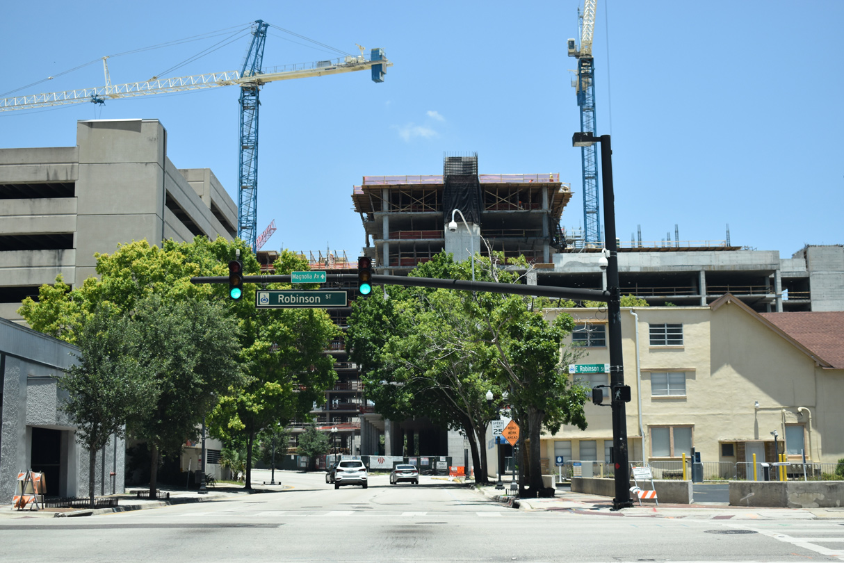
Unmarked along Rosalind Avenue north, Robinson Street doubles as State Road 526 west to Hughey Avenue at I-4 and east through the Thornton Park and East Central Park communities to Crystal Lake Drive.
05/22/20
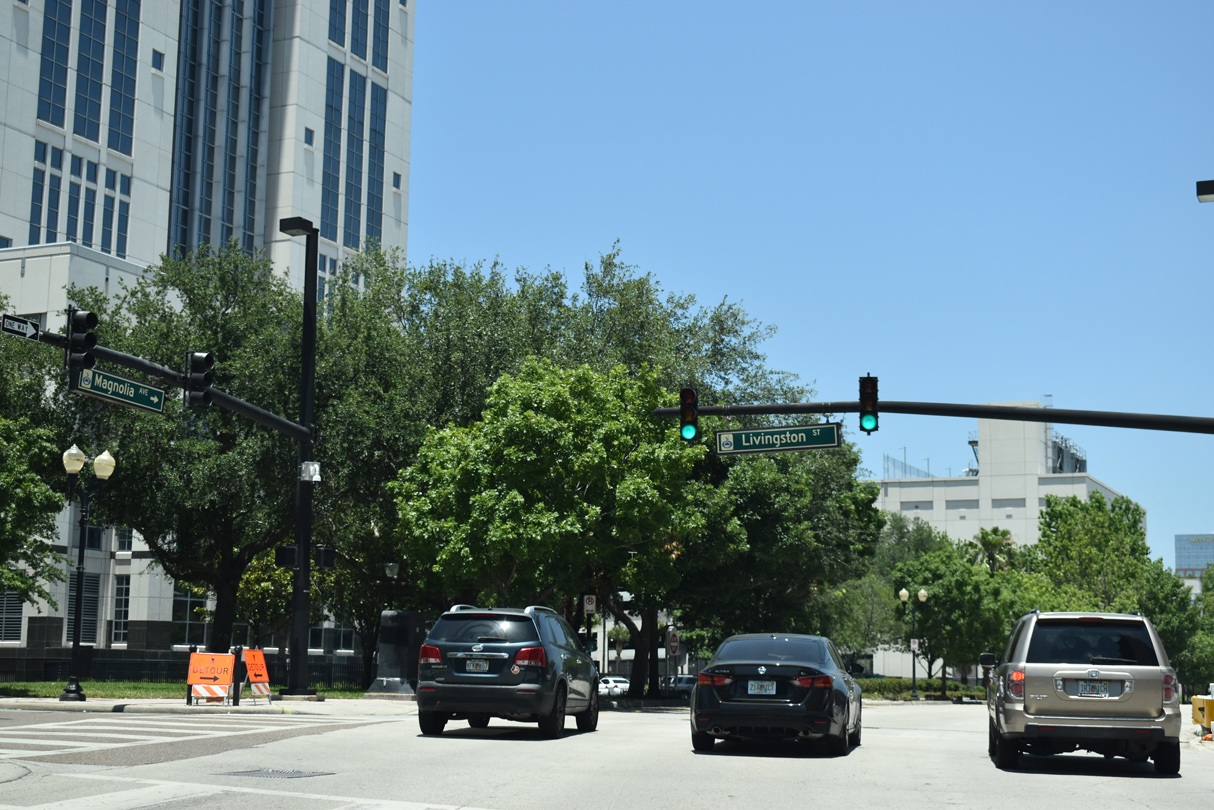
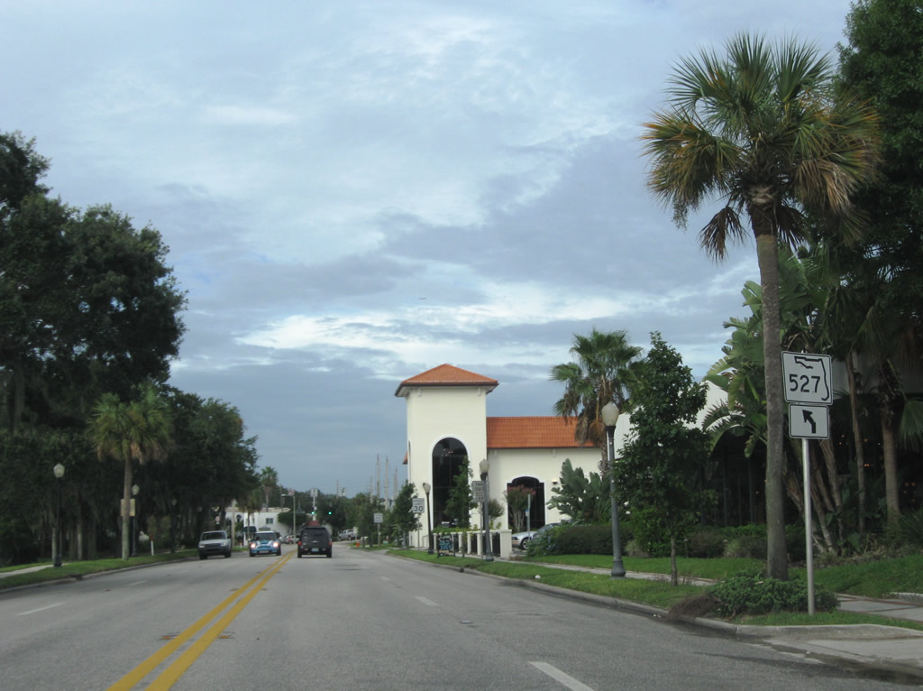
SR 527 shifted westward from Rosalind Avenue onto Magnolia Avenue between Robinson Street (SR 526) to Livingston Street.
02/18/08
Three lanes continue north along Magnolia Avenue from Livingston Street by the Orange County Courthouse.
05/22/20
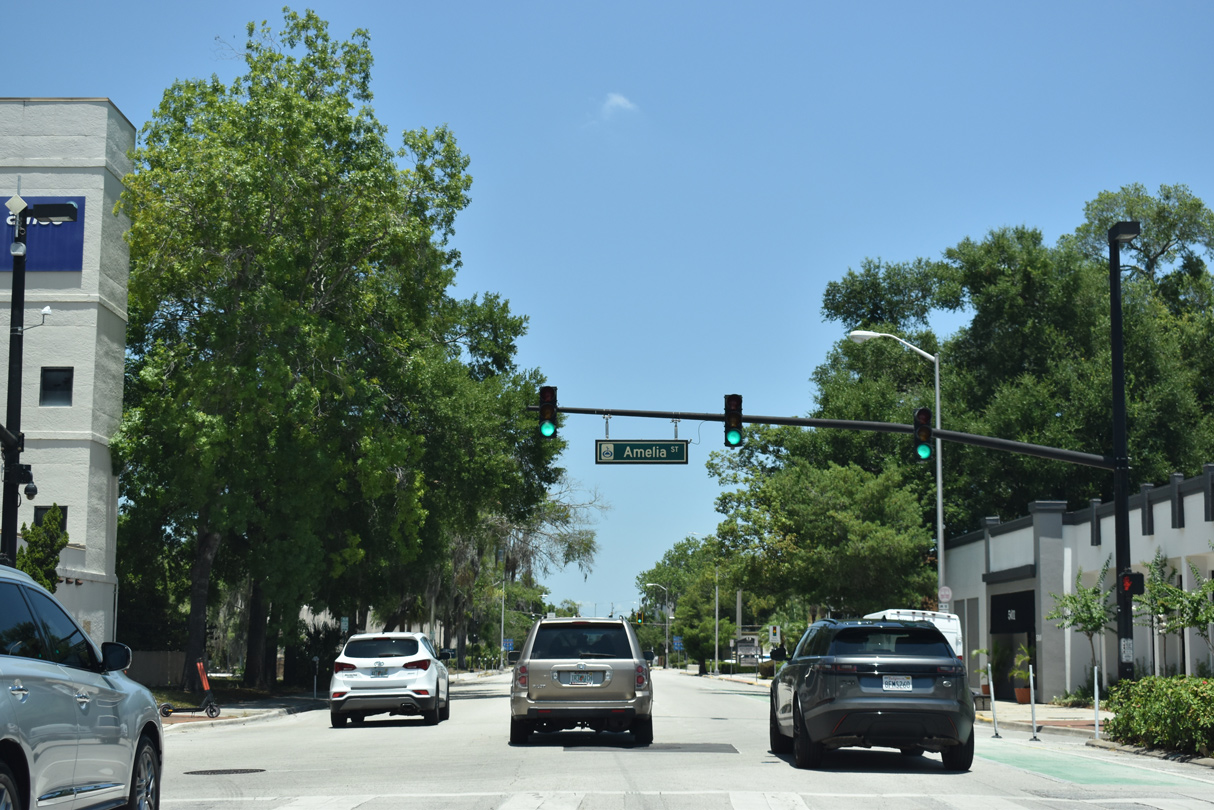
Magnolia Avenue (old SR 527) north at Amelia Street.
05/22/20
The ensuing traffic light on Magnolia Avenue northbound operates at Concord Street.
05/22/20
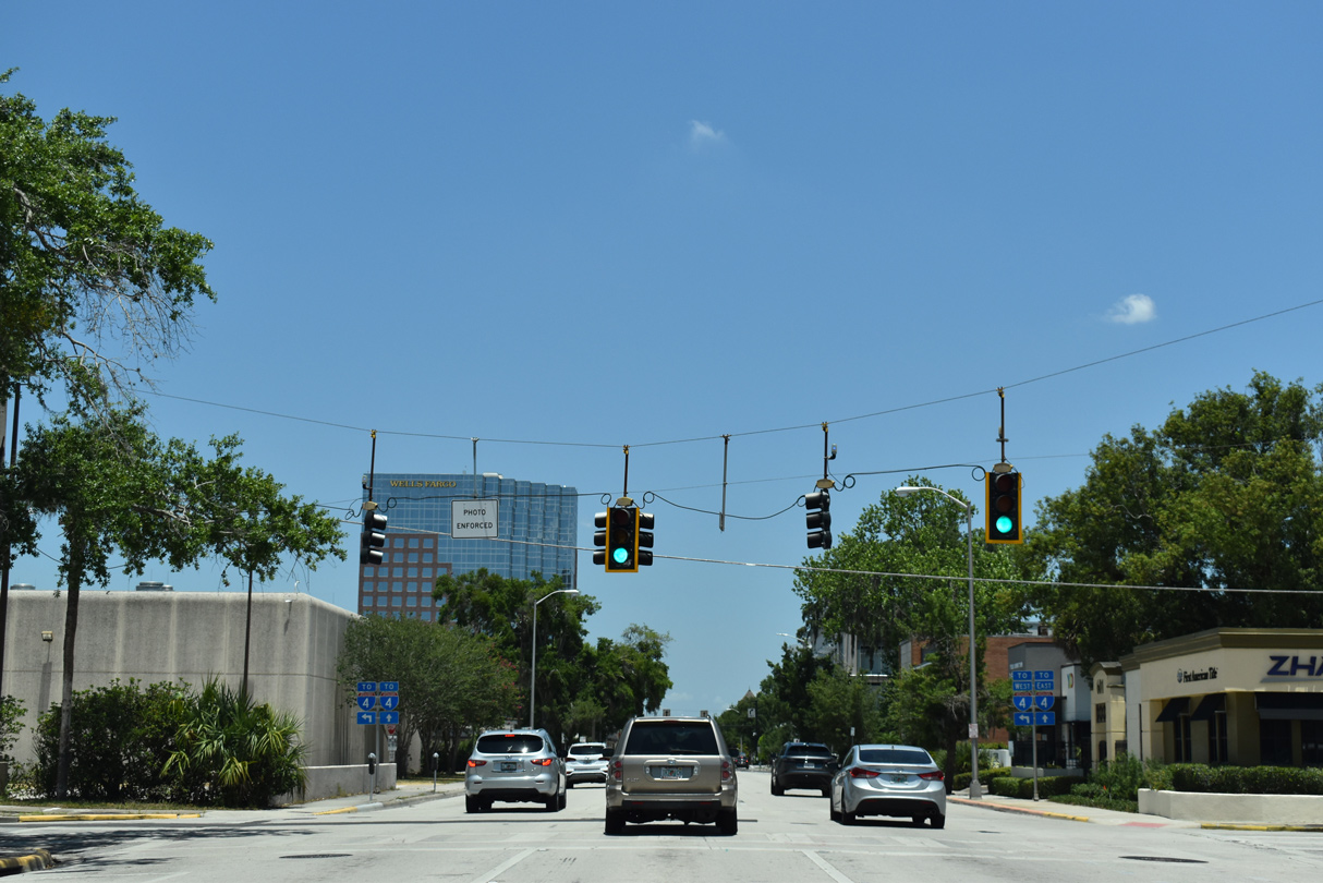
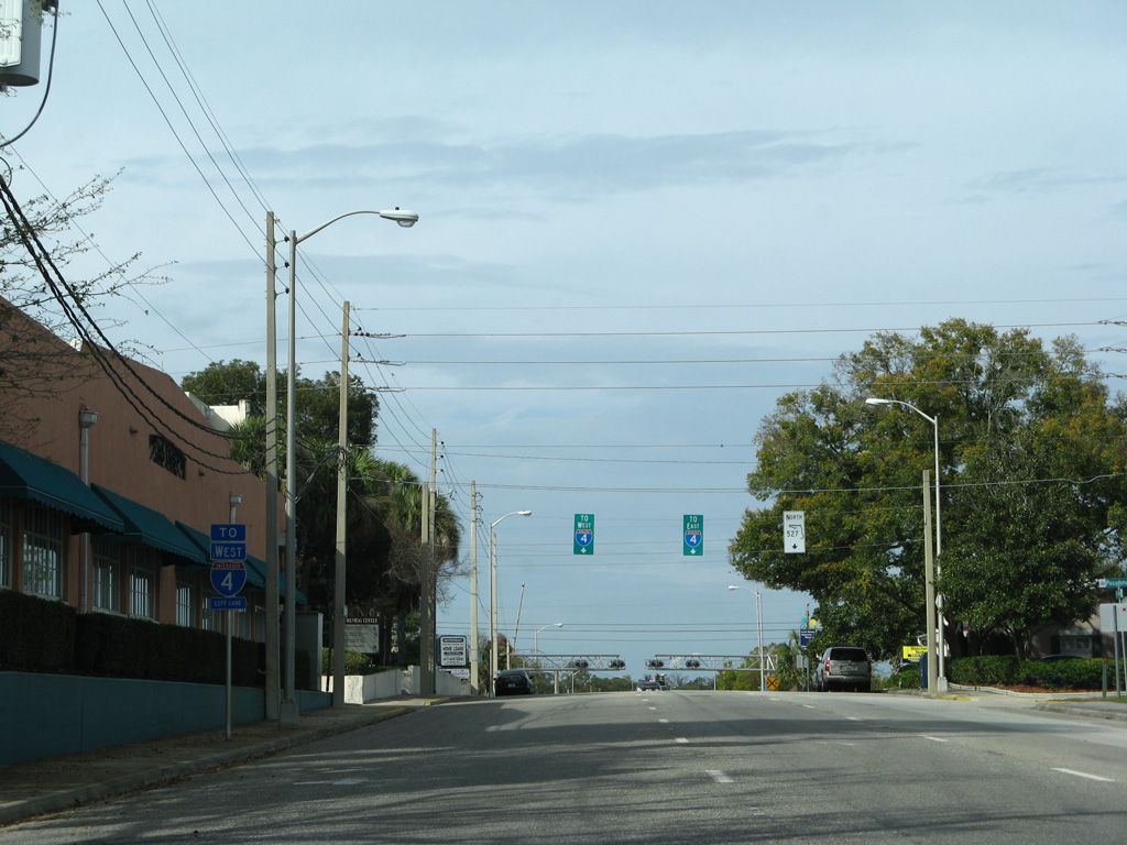
Interstate 4 trailblazers directs drivers bound for the freeway westbound onto forthcoming Colonial Drive and eastbound to remain along Magnolia Avenue to the on-ramp at Lake Ivanhoe.
05/22/20
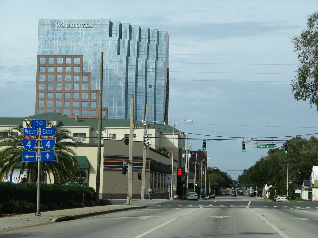
A single point urban interchange (SPUI) joins SR 50 and U.S. 17-92 (Colonial Drive) with I-4 two blocks to the west.
02/18/08
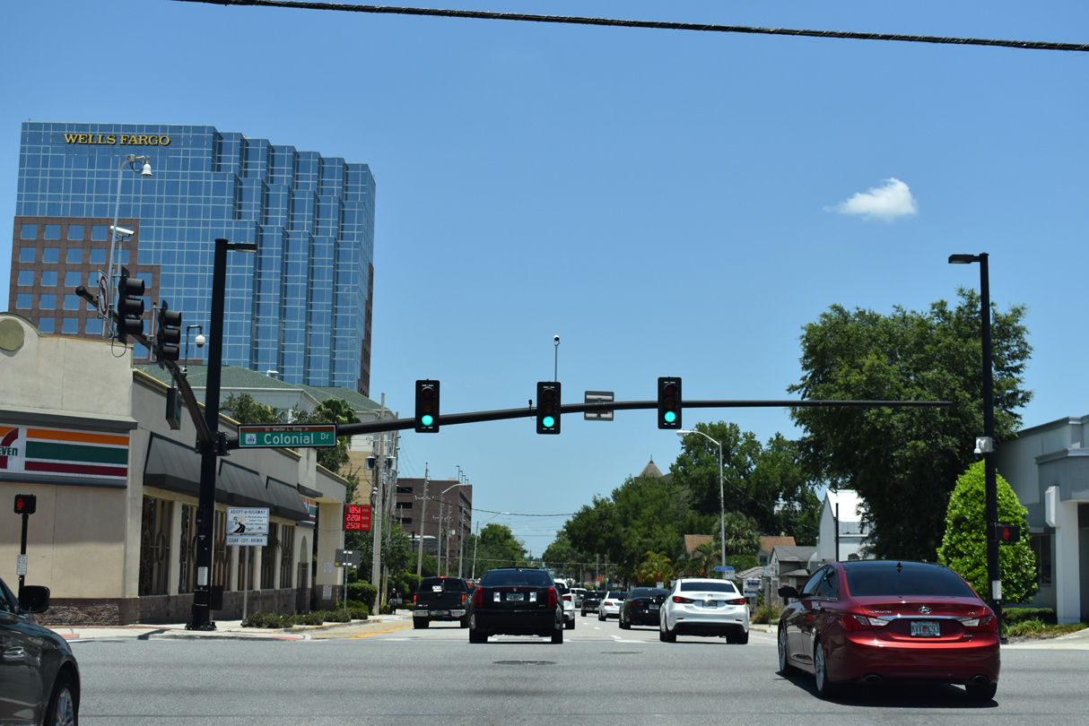
Entering the intersection with Colonial Drive (SR 50), which carries U.S. 17/92 nearly two miles between Orange Blossom Trail (U.S. 441) and Mills Avenue (SR 15).
05/22/20
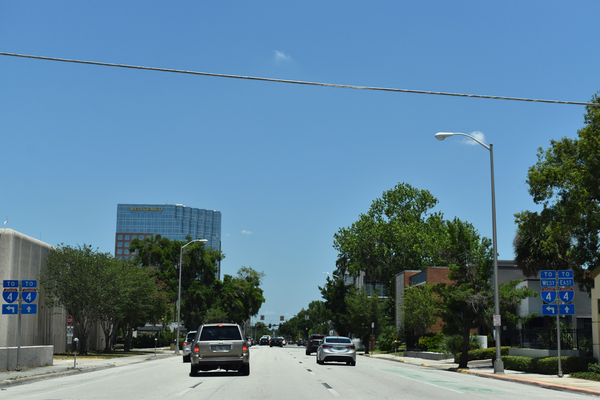
North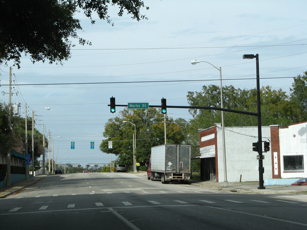
SR 527 resumes north of U.S. 17-92 & SR 50 (Colonial Avenue) on Magnolia Avenue north. The route however is unmarked to Marks Street.
02/18/08
A pair of trailblazers for I-4 stand along SR 527 (Magnolia Avenue) north at Pasadena Place. Magnolia Avenue leads directly to the eastbound on-ramp for Sanford, DeLand and Daytona Beach.
08/15/08
02/18/08
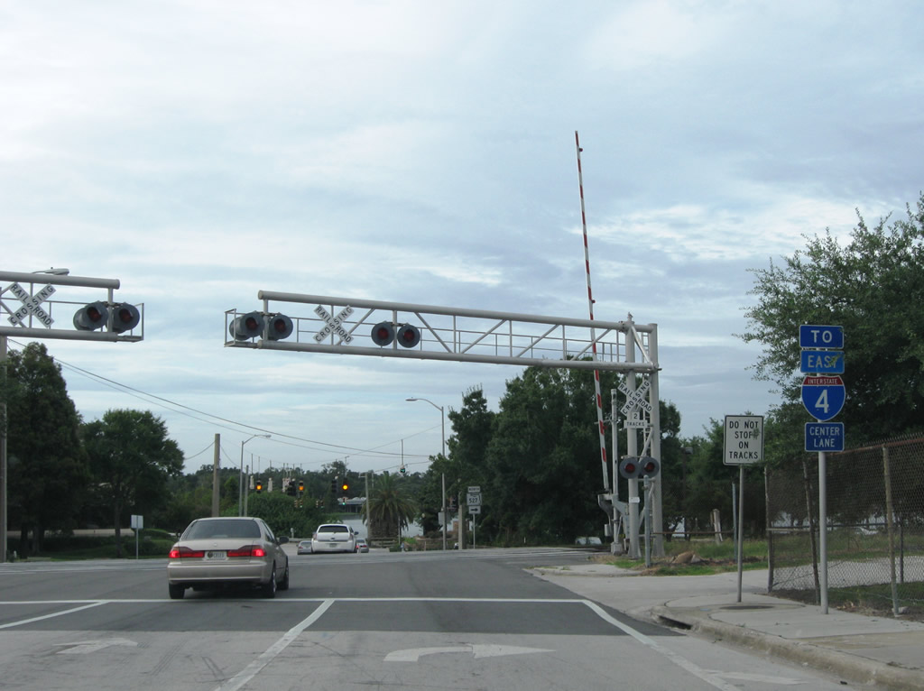
SR 527 partitions with Magnolia Avenue just beyond an at-grade crossing with the CSX Railroad line. I-4 Ultimate construction reconfigures the parclo B2 interchange with Ivanhoe Boulevard into a modified diamond interchange. Ramps from Magnolia Avenue north will connect with both the general travel lanes of I-4 east, and the tolled Express Lanes.
02/18/08
08/15/08
Orange Avenue returns to two-way traffic east as SR 527 turns northeast from Magnolia Avenue along Lake Ivanhoe.
08/15/08
SR 527 (Orange Avenue) encircles the east side of Lake Ivanhoe to NE Ivanhoe Boulevard.
08/15/08
Northbound Orange Avenue at Highland Avenue south and Alden Road north to the Mark O'Meara Family Sports Complex.
08/15/08
Virginia Avenue stems east from SR 527 (Orange Avenue) and Gaston Edwards Park to U.S. 17/92 (Mills Avenue) and the Mt. Vernon Heights neighborhood.
08/15/08
Orange Avenue continues northeast from a six-point intersection with SR 527 and U.S. 17/92 (Orlando Avenue) into Winter Park. The last confirming marker for SR 527 north was here until 2008.
11/05/06
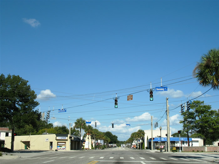
A second six-way intersection lies midway along Orange Avenue northeast between U.S. 17/92 (Orlando Avenue) and the merge with SR 426 (Fairbanks Avenue). Denning Drive travels north-south from the city line to Park Avenue; Minnesota Avenue heads east-west from Orlando Avenue to Pennsylvania Avenue.
11/05/06
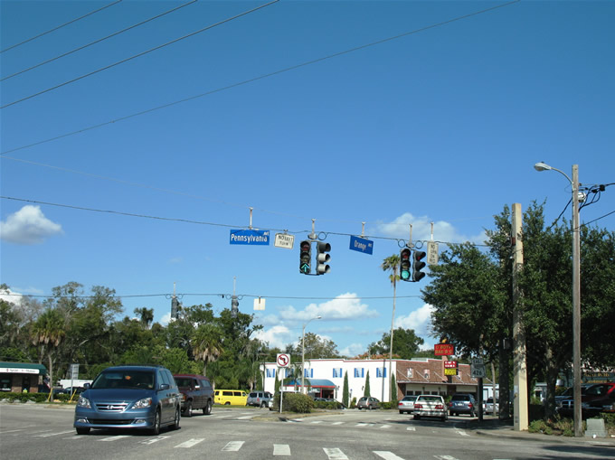
SR 527 north ended at the five point intersection with SR 426 (Fairbanks Avenue) and Pennsylvania Avenue. SR 426 constitutes the main east-west arterial through Winter Park. Pennsylvania Avenue travels north to Lake Maitland and south to Lake Sue Avenue at the Forest Hills neighborhood.
11/05/06
References:
- "Mill Creek Announces Start of Preleasing at Modera Central." Mill Creek Residential, press release. June 5, 2018.
Photo Credits:
- Alex Nitzman: 03/28/08, 05/03/08, 08/15/08, 09/07/16
- ABRoads: 09/07/16, 09/03/17, 09/01/18, 05/22/20
- Alex Nitzman, Justin Cozart: 07/29/06, 11/05/06
- AARoads: 02/18/08
Connect with:
Page Updated Friday May 29, 2020.