
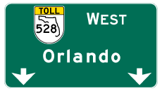
State Road 528 West - Cape Canaveral to Orlando


 West
West  North
North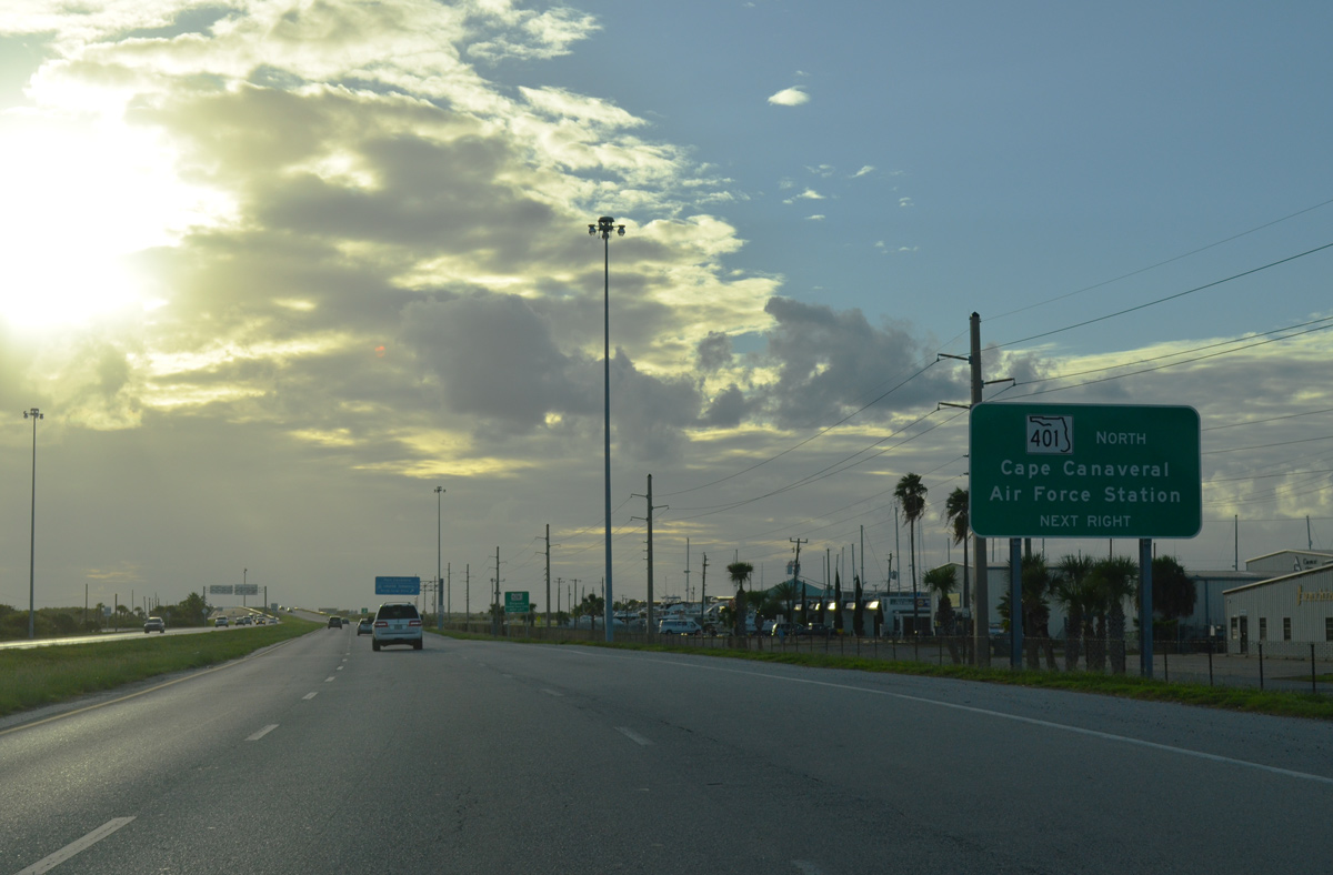
SR A1A (Astronaut Boulevard) turns west toward SR 401 and the westbound beginning of SR 528 at Bennett Causeway. The two state roads combine over the Banana and Indian Rivers.
09/28/13
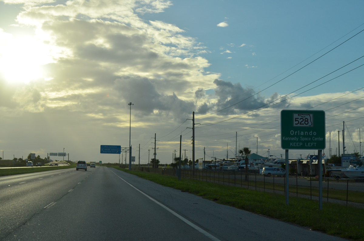
SR 528 extends west from SR A1A to Orlando and Orlando International Airport (MCO). Bennett Causeway represents the state road across Merritt Island and Cocoa to Interstate 95 and the Beachline Expressway.
09/28/13
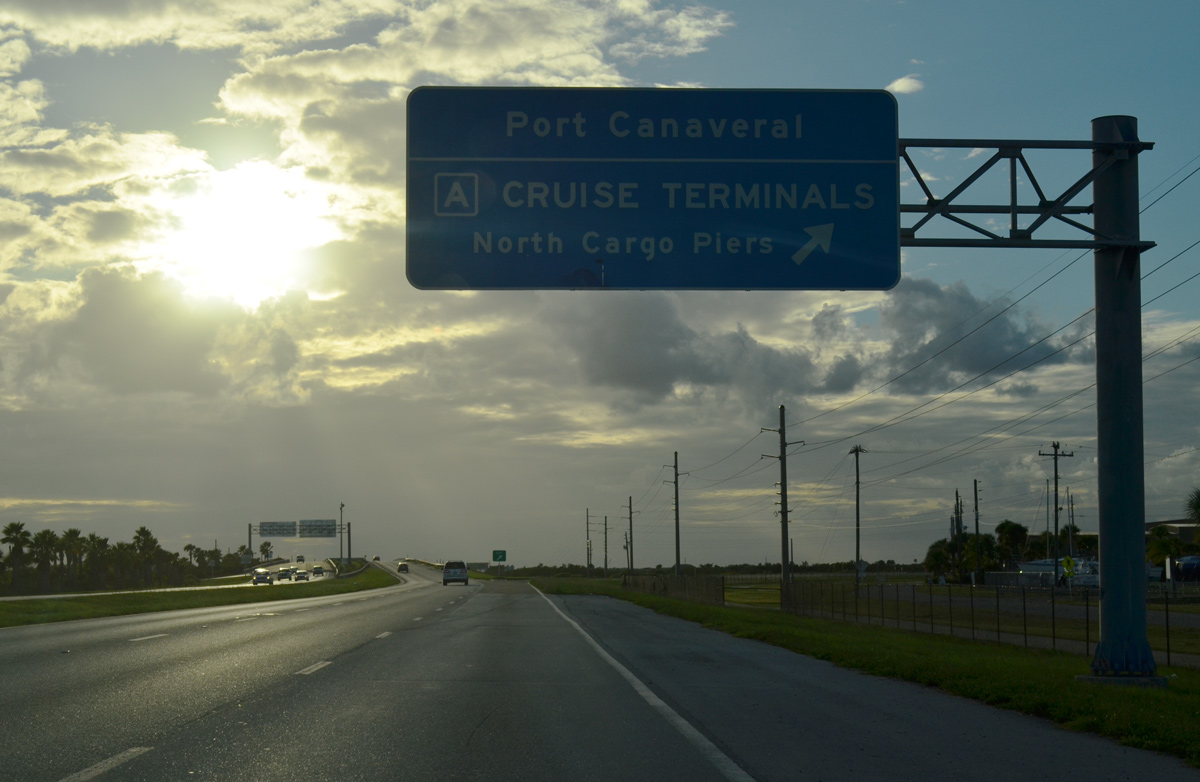
Entering the trumpet interchange with SR 401 north on SR A1A north. SR 401 constitutes a short spur northeast to the A Cruise terminals of Port Canaveral and the gate to Cape Canaveral Air Force Station.
09/28/13
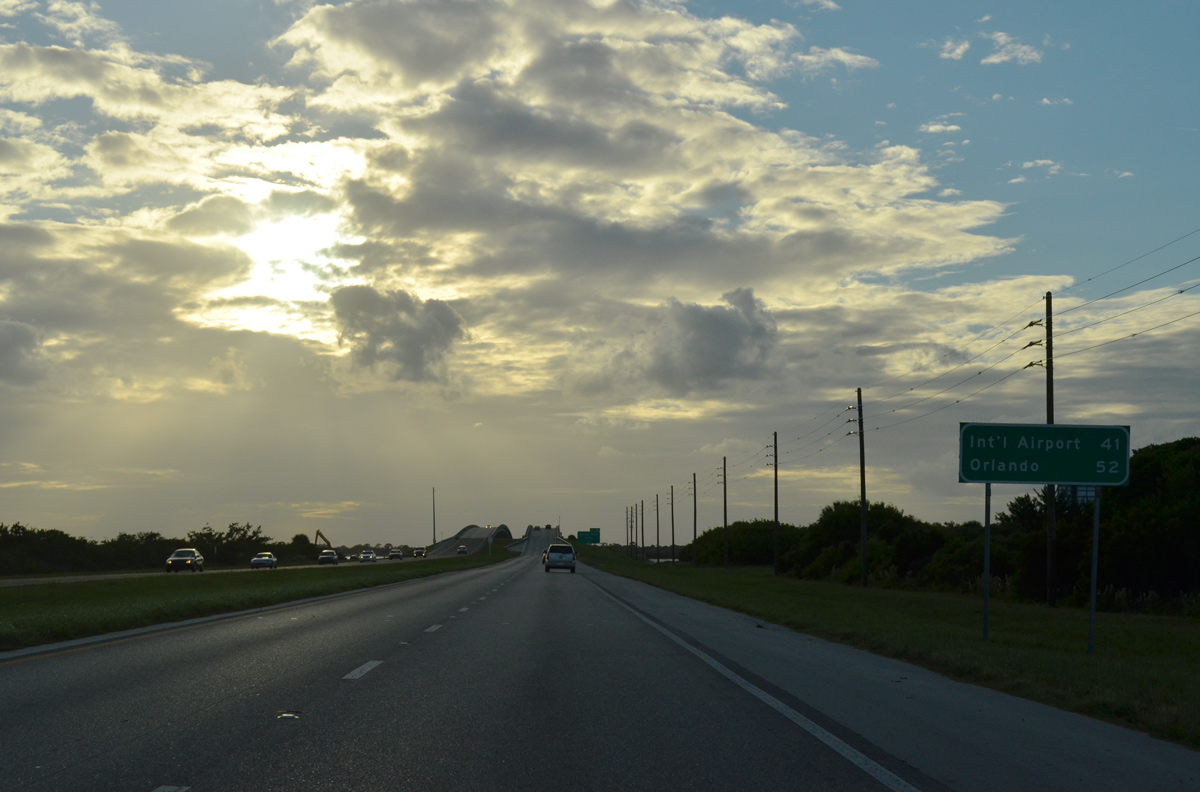
Distance sign posted for the Martin Andersen Beachline Expressway along Bennett Causeway.
09/28/13
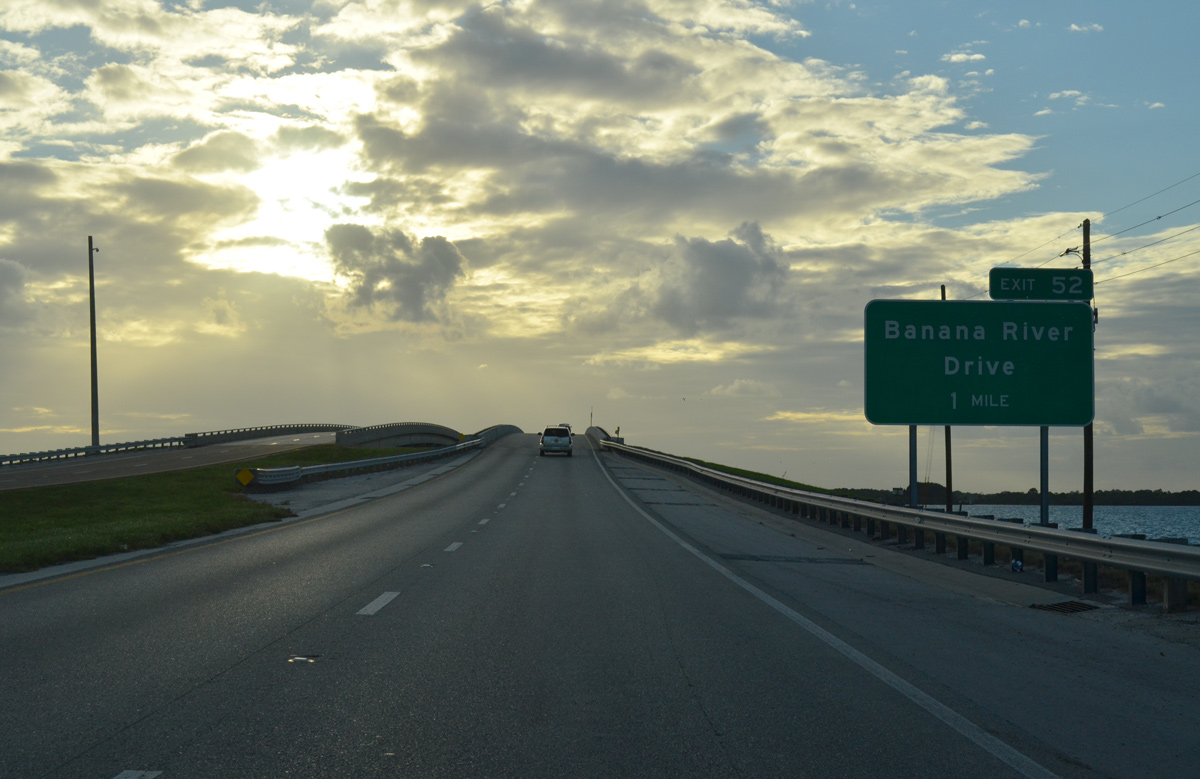
SR A1A/528 (Bennett Causeway) span the Banana River west from Cape Canavaral to Merritt Island across a pair of low rise bridges. A diamond interchange (Exit 52) joins the freeway with Banana River Drive on the west side of the river.
09/28/13
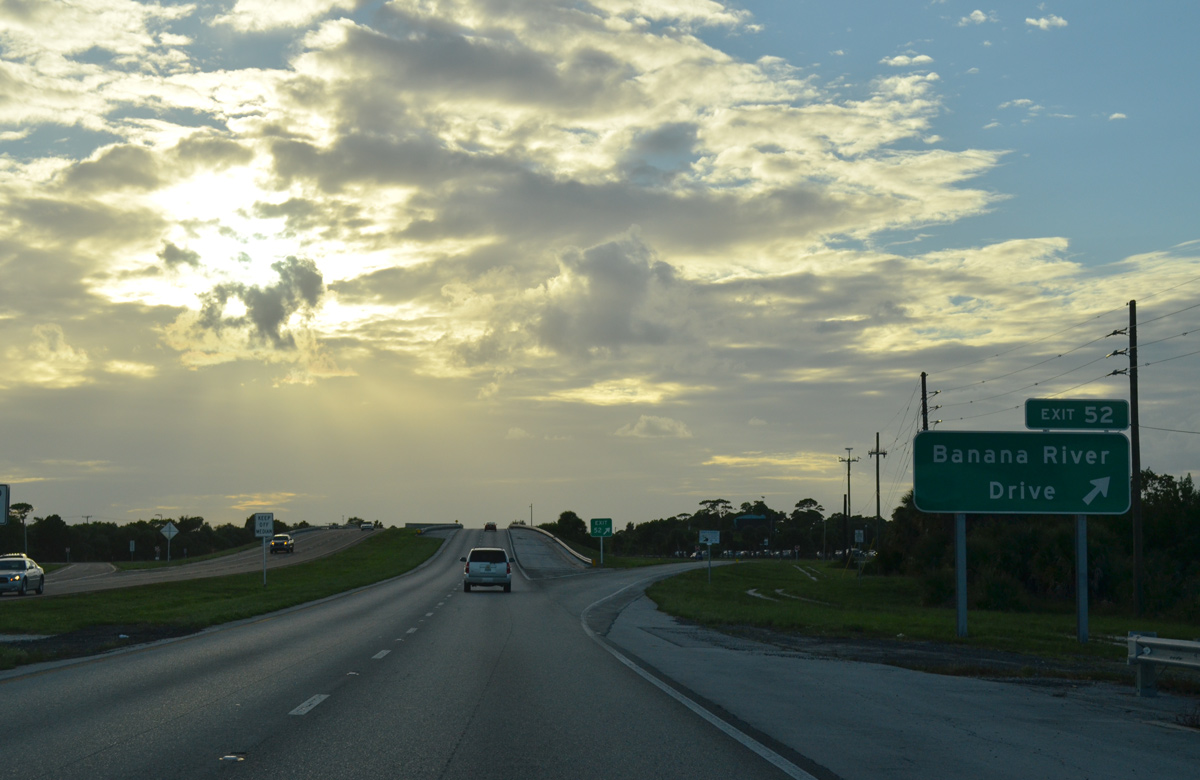
Exit 52 departs Bennett Causeway westbound for Banana River Drive and eastern Merritt Island. Banana River Drive meanders southward from Kelly Park through residential areas spreading west from the Banana River to Sykes Creek Parkway and SR 520 (Merritt Island Causeway).
09/28/13
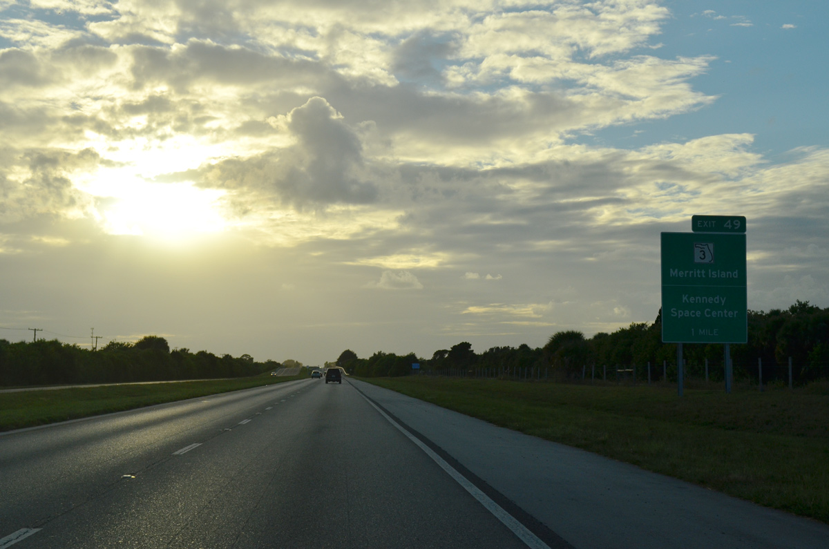
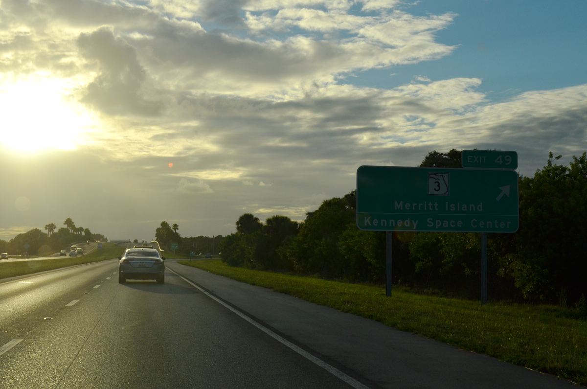
Bennett Causeway traverses an area of wetlands ahead of Sykes Creek. Exit 49 follows with SR 3 (Courtenay Parkway).
09/28/13
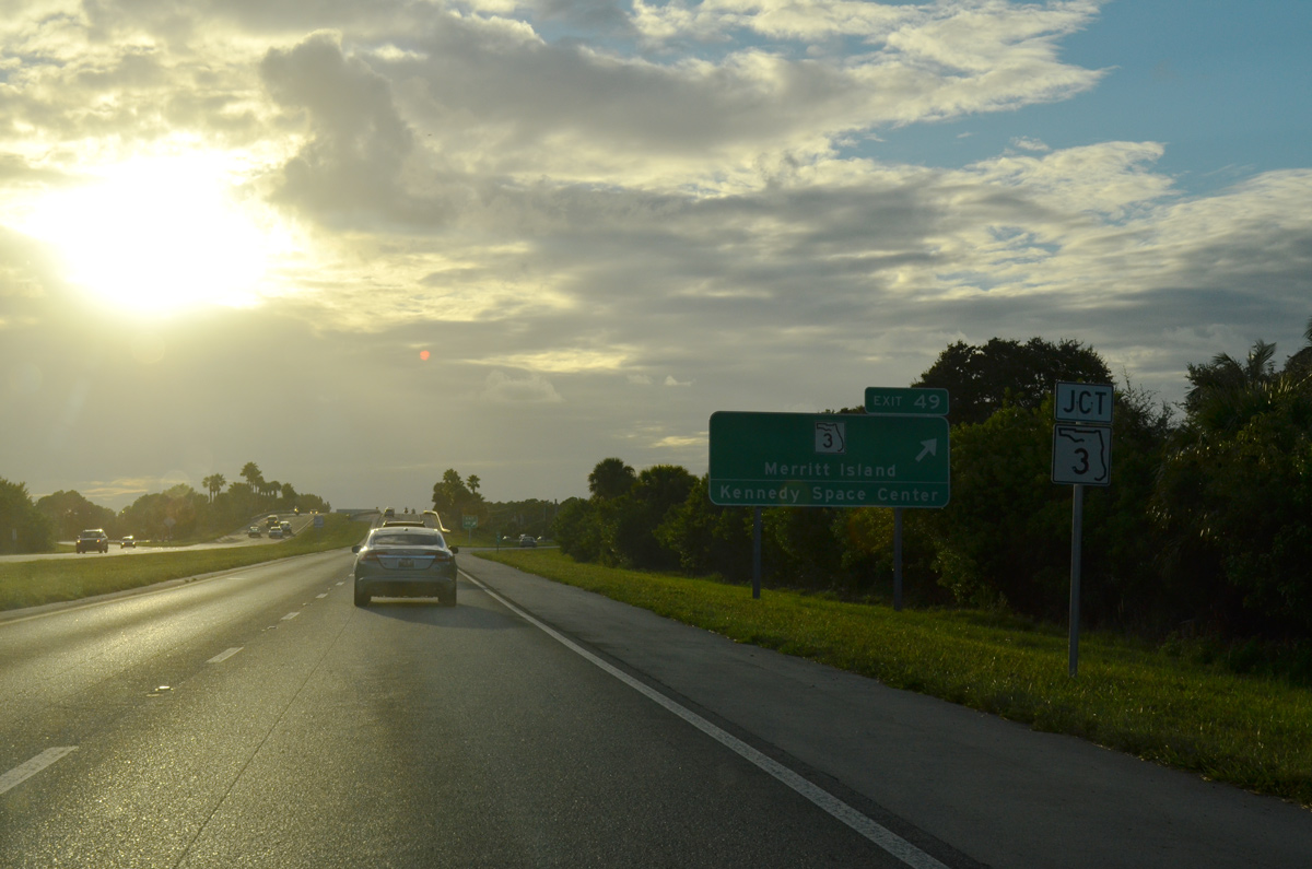
SR A1A north / SR 528 west reach the diamond interchange (Exit 49) with SR 3. Courtenay Parkway leads SR 3 north to NASA's Kennedy Space Center.
09/28/13
SR 3 travels south from Bennett Causeway to Indianola, SR 520 (Merritt Island Causeway), Footman and South Tropical Trail at Rockwell.
09/28/13
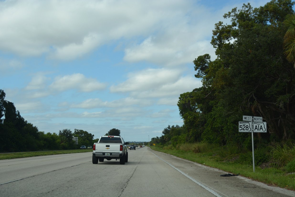
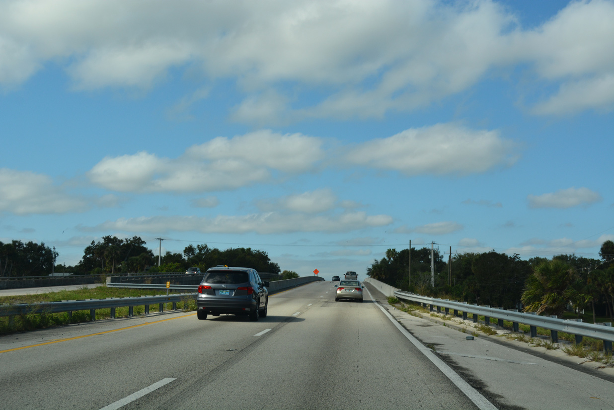
Continuing west, SR A1A/528 parallel the Canaveral Barge Canal to the Indian River.
10/21/18
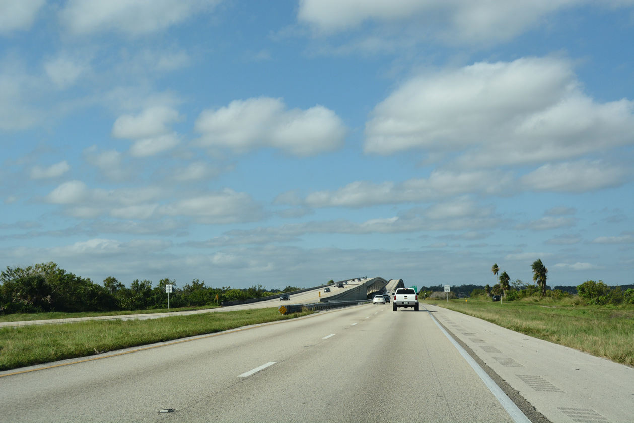
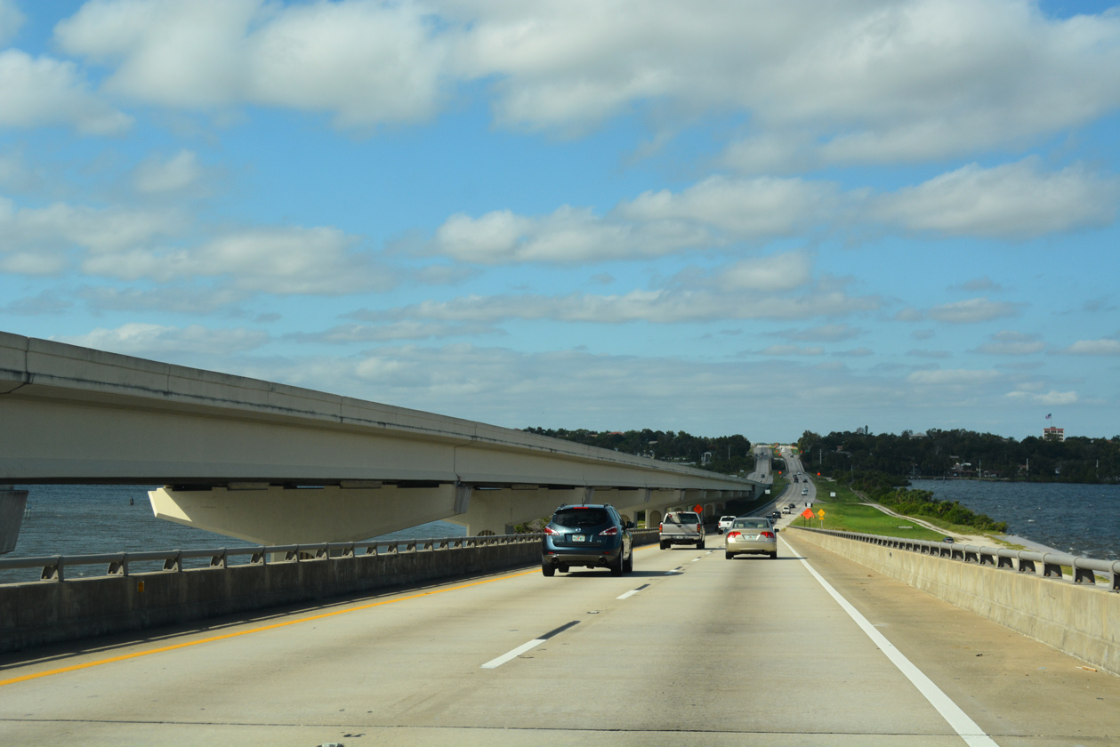
SR A1A/528 span the Indian River along Bennett Causeway between Merritt Island and Cocoa.
10/21/18
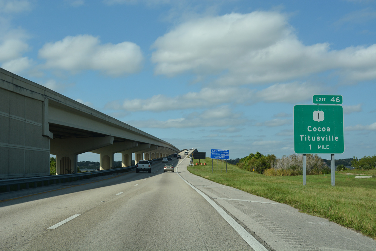
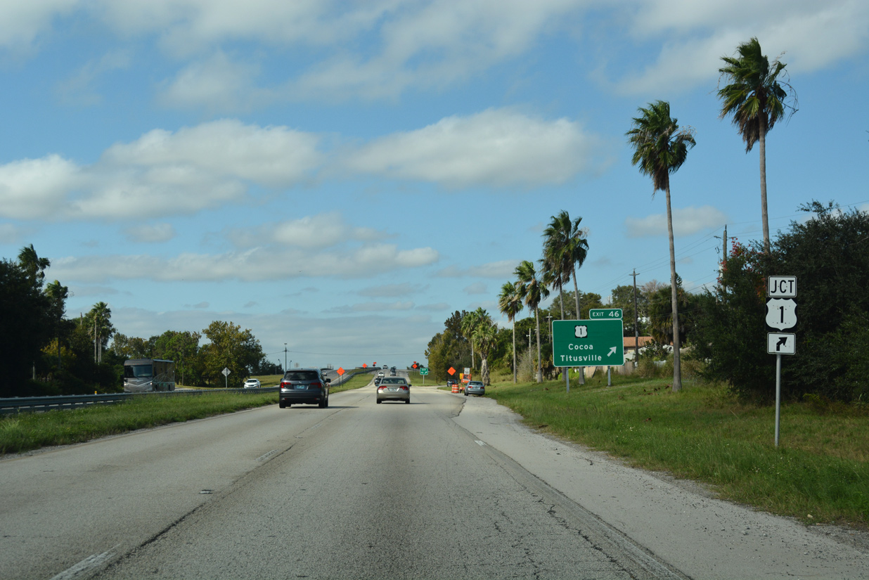
Exit 46 lies at the west end of Bennett Causeway with U.S. 1 (Cocoa Boulevard).
10/21/18
Construction from 2003 to 2006 built a new eastbound span for Bennett Causeway. The wider and higher bridge was a replacement for the 1963-built westbound span, which was later demolished.
10/21/18
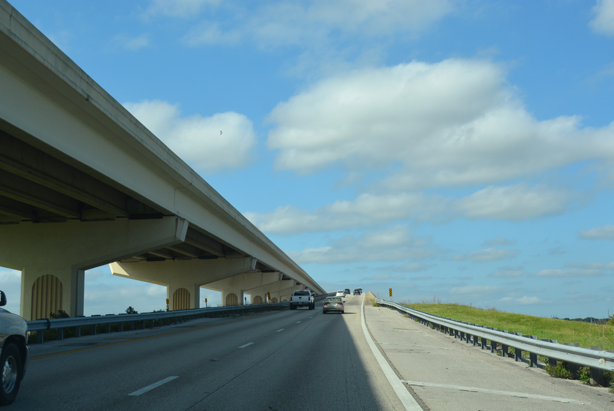
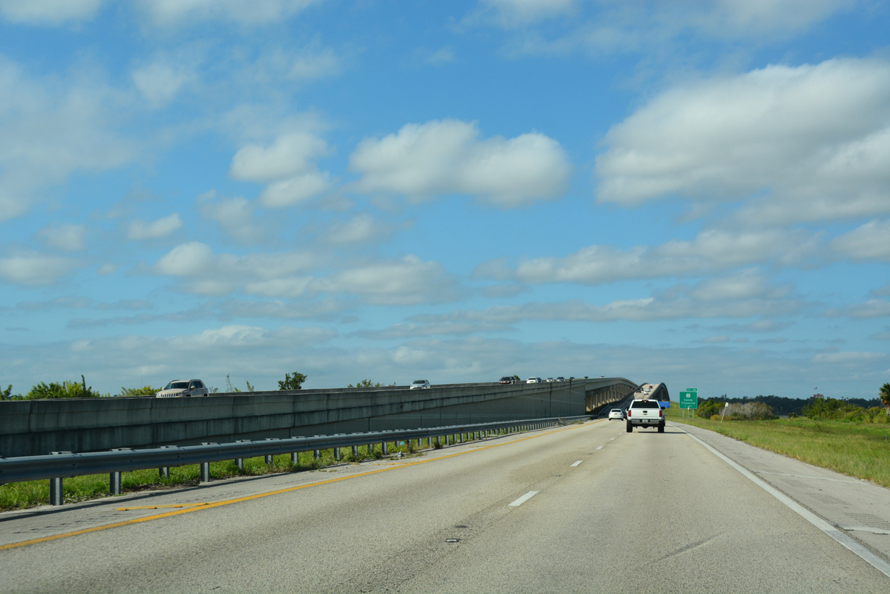
The Indian River widens to the north between Merritt Island and Jones Point. The 2,303 foot long westbound span for SR A1A/528 crests at 65 feet above the Intracoastal Waterway.1
10/21/18
SR A1A north / SR 528 west were relocated onto the 1970-built bridge that previously carried eastbound traffic to Merritt Island in 2006. This bridge was expected to remain in service for another 10 to 15 years.
10/21/18
Bennett Causeway approaches the Florida mainland south of City Point in north Cocoa.
10/21/18
Bennett Causeway elevates again across the Indian River west relief channel and Indian River Drive (CR 515). This 468.5 foot long span was built in 1963 and reconstructed in 2001.2
10/21/18
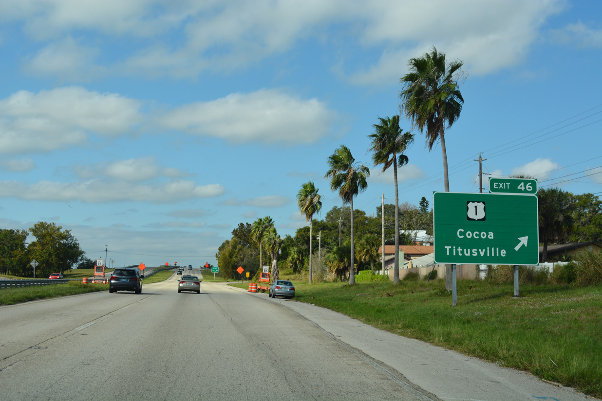
A folded diamond interchange (Exit 46) connects Bennett Causeway with U.S. 1 opposite a Florida East Coast (FEC) Railway line. State Road A1A ends here.
10/21/18
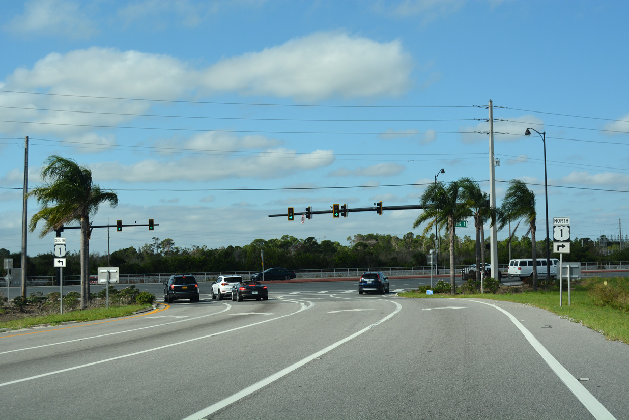
U.S. 1 is the main arterial route linking Titusville, Cocoa and Rockledge, serving the business districts of all three communities.
10/21/18
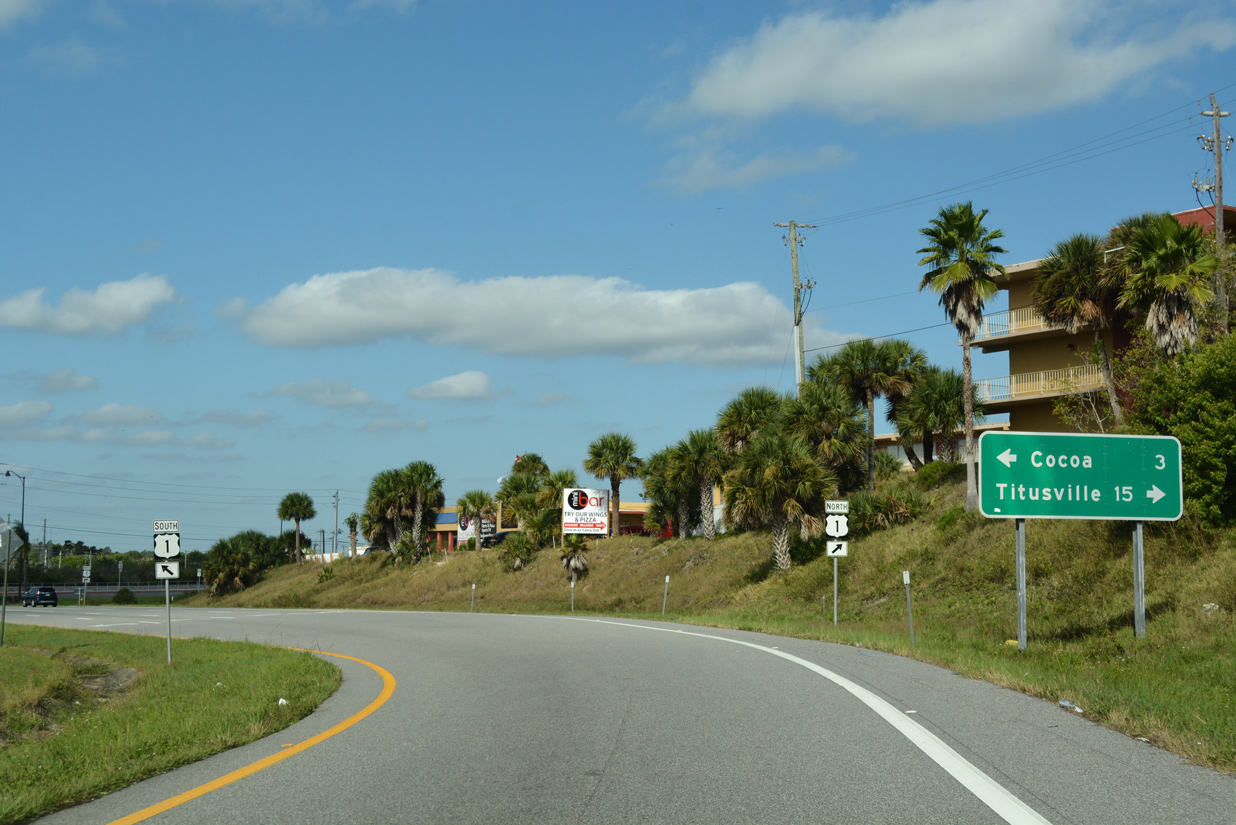
Taking Exit 46 from Bennett Causeway to U.S. 1 (Cocoa Boulevard). Locally the U.S. highway travels north through Sharpes and south to Downtown Cocoa and SR 520 at the Hubert Humphrey Bridge to Merritt Island.
10/21/18
West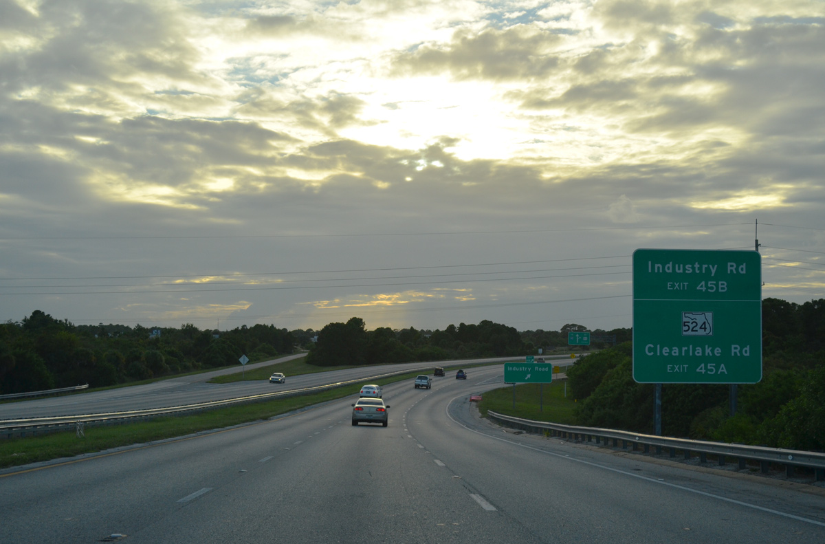
SR 528 passes over the FEC Railway ahead of the ramps to Industry Road for SR 501 and 524 (Clearlake Road).
09/28/13
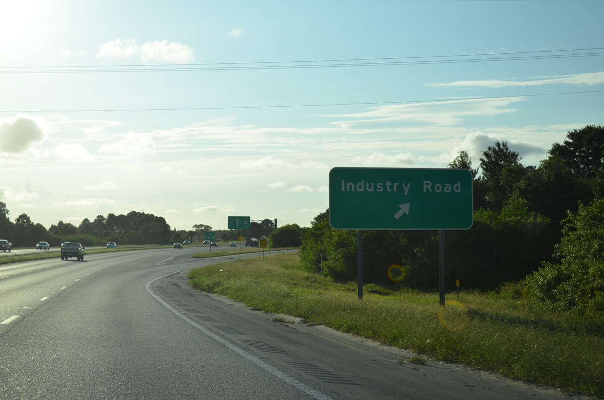
Industry Road continues northward from Exit 45B to Grissom Parkway nearby. Grissom Parkway branches west and northward to Port St. John.
10/01/15
SR 524 (Clearlake Road) begins just south of the six-ramp parclo interchange with SR 528.
10/01/15
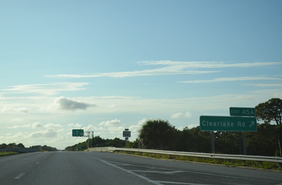
Exit 45A comprises a loop ramp onto Industry Road south to Clearlake Road. Clearlake Road continues east and south from SR 524 as SR 501 to the Eastern Florida State College - Cocoa Campus and SR 520 (West King Street).
10/01/15
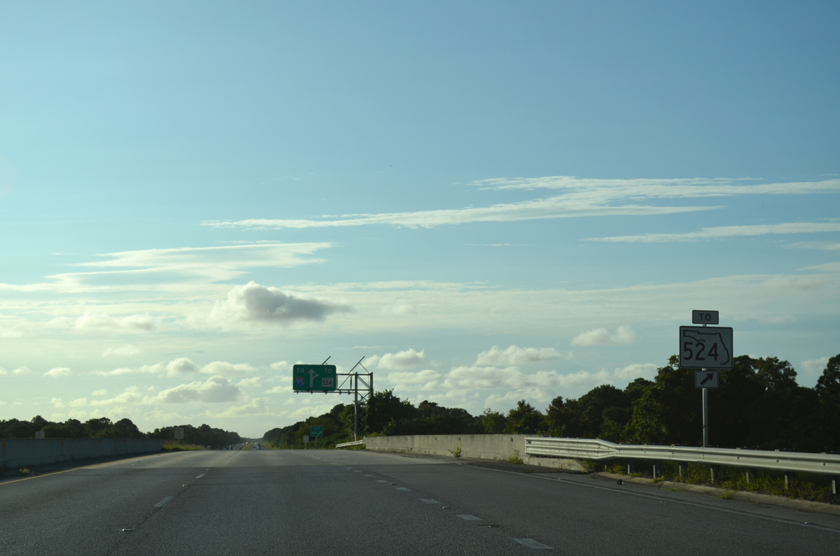
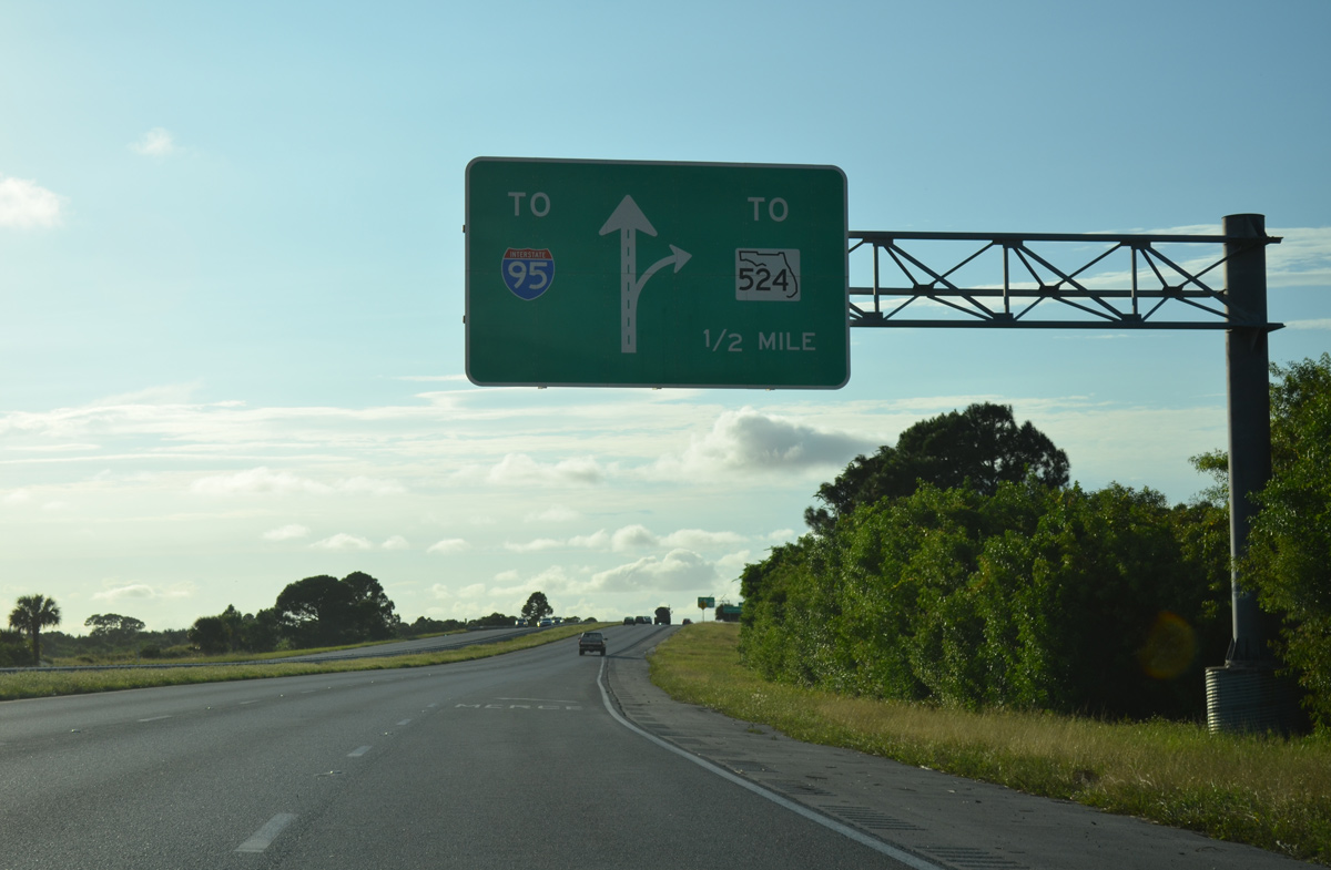
The connection with SR 524 provides an alternate route to Interstate 95 in lieu of SR 528. The state road meets Interstate 95 in three miles.
10/01/15
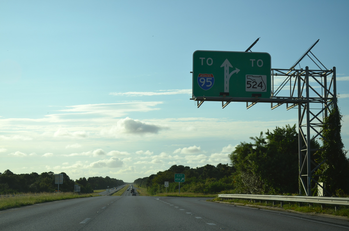
Exit 45A departs SR 528 west for Industry Road south to SR 524, which in turn heads southwest through Cocoa to SR 520.
10/01/15
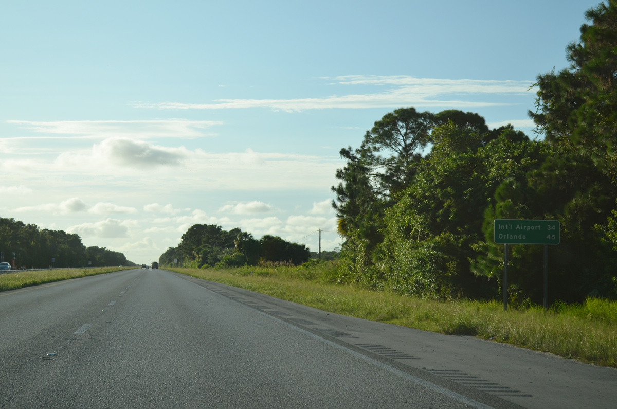
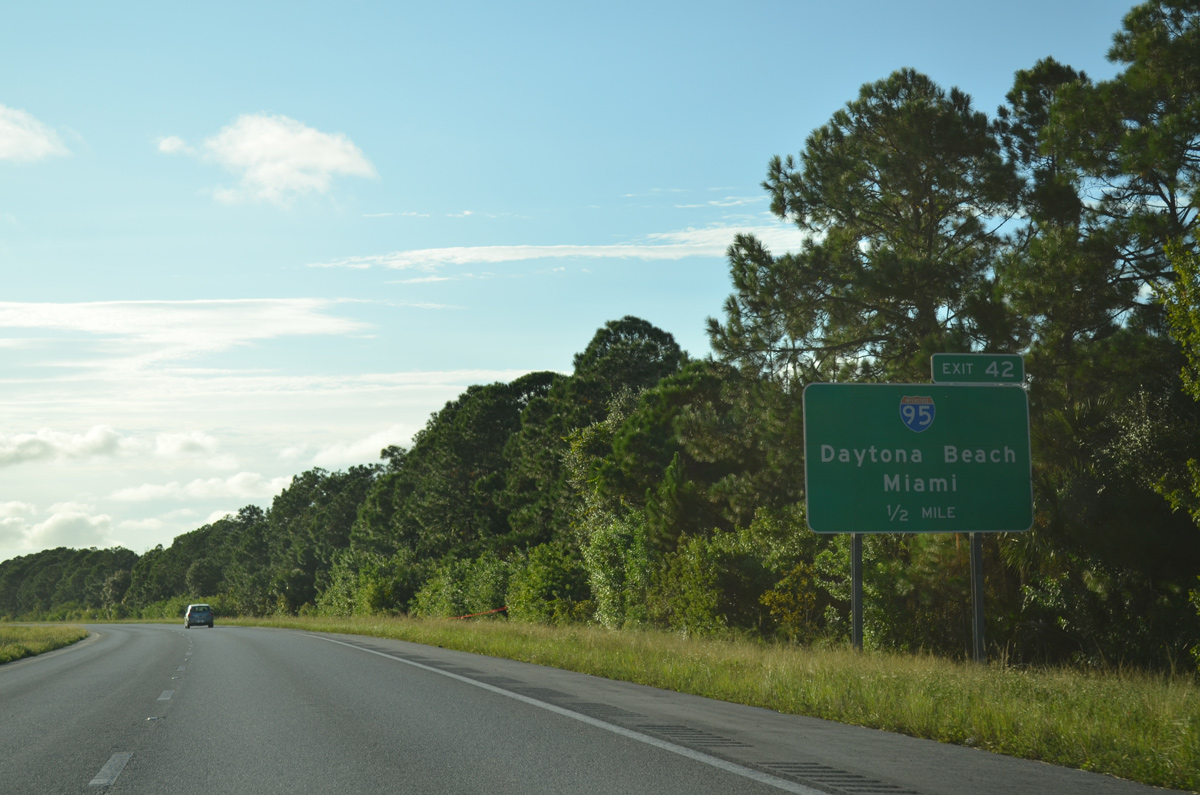
SR 528 shifts northward through western reaches of Cocoa beyond Industry Road. Traveling away from the Space Coast, the Beachline Expressway reaches MCO Airport in 34 miles.
10/01/15
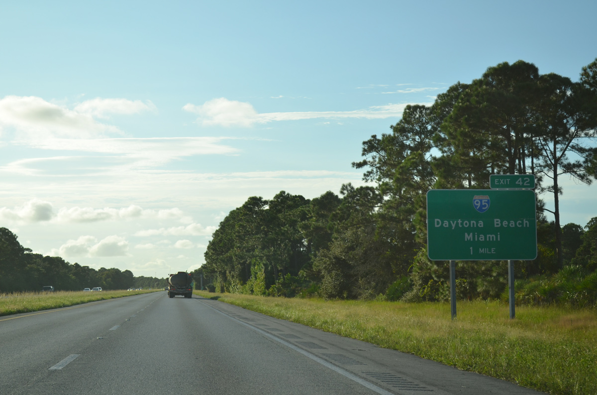
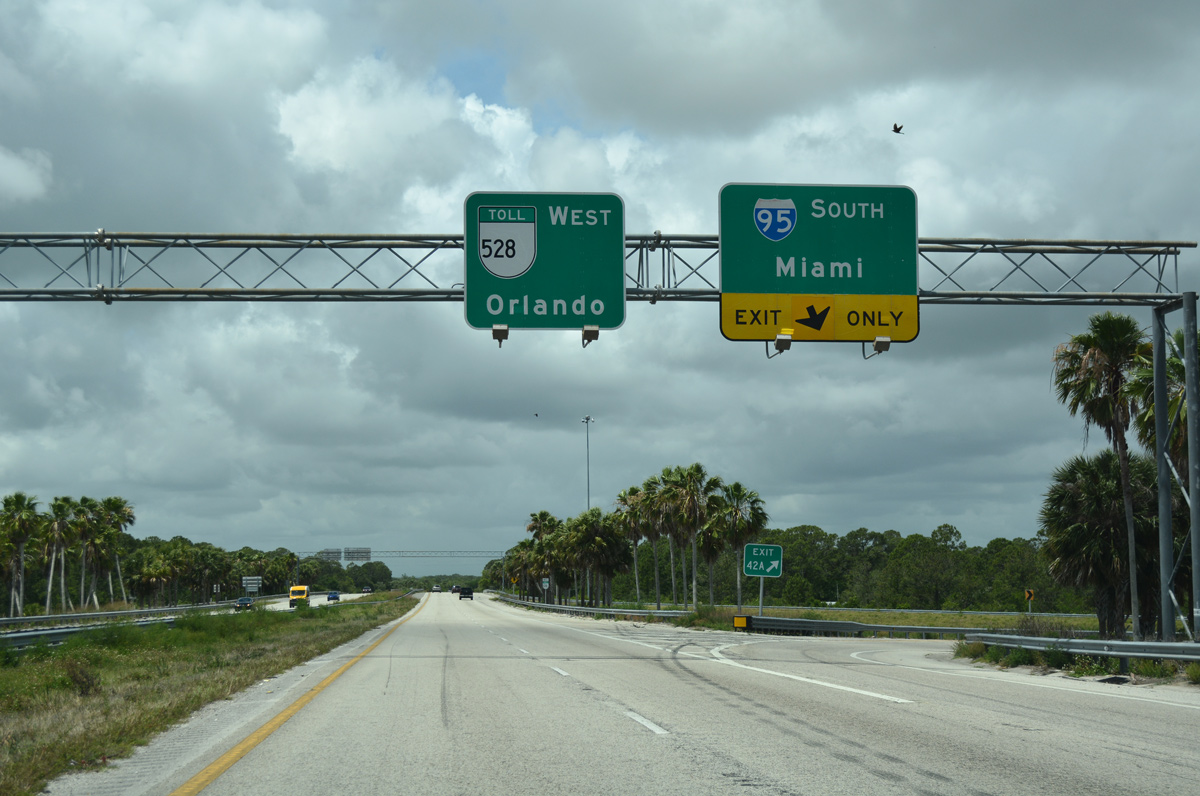
A full cloverleaf interchange (Exits 42B/A) joins the Beachline Expressway with Interstate 95 in one mile.
10/01/15
Interstate 95 is the main route from the Space Coast south to West Palm Beach, Fort Lauderdale and Miami. Northward to the First Coast, I-95 travels from Daytona Beach to St. Augustine and Jacksonville.
10/01/15
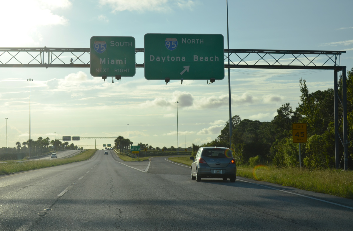
Exit 42B leaves SR 528 west for I-95 north to Port St. John and Titusville. The freeway meets the east end of I-4 in 55 miles and the east end of I-10 in Jacksonville in 146 miles.
10/01/15
SR 528 westbound at the loop ramp (Exit 42A) for Interstate 95 south. I-95 reaches Melbourne in 22 miles and Miami in 196 miles.
05/05/18
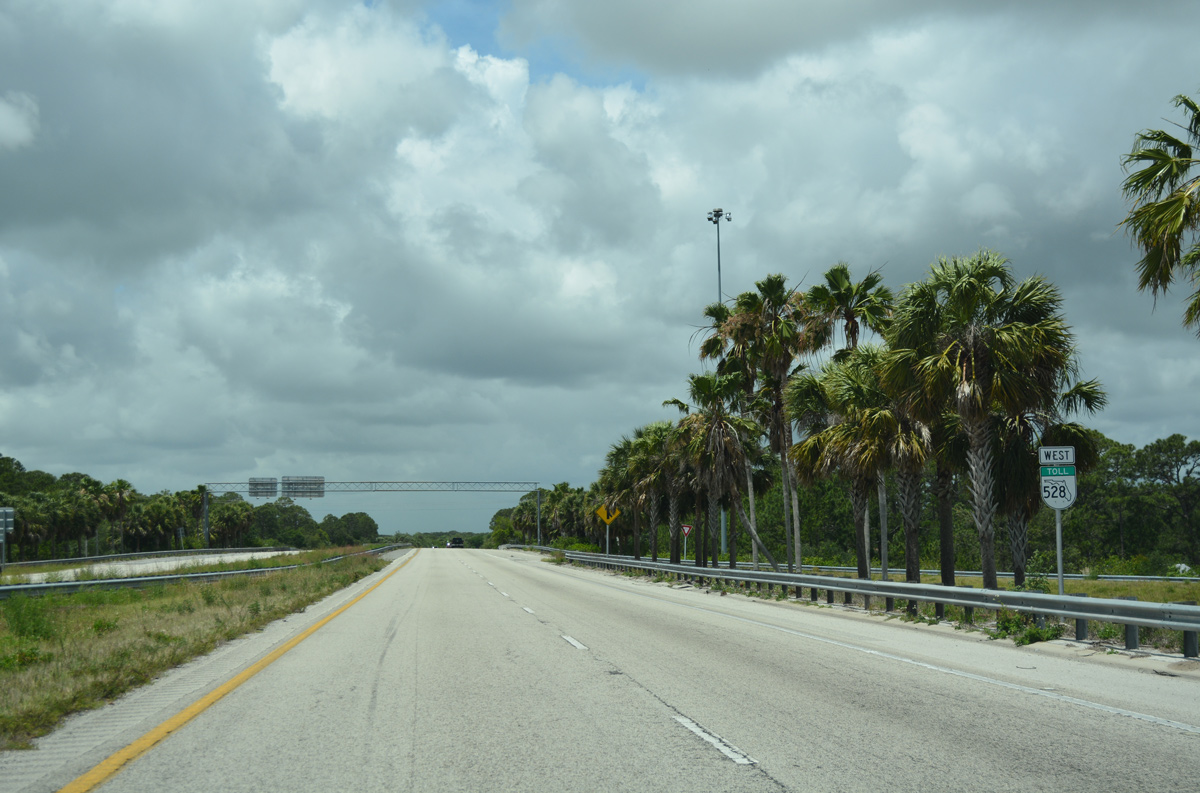
There are no westbound off-ramps between Interstate 95 and the Brevard County line. Florida's Turnpike Enterprise (FTE) maintains this stretch of SR 528.
05/05/18
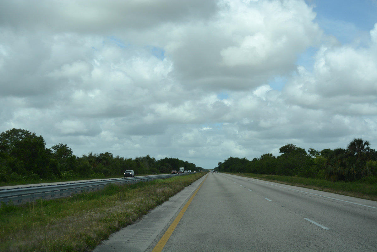
Angling northwest from the Canaveral Acres community, SR 528 (Beachline Expressway) transitions into a rural freeway.
05/05/18
SR 407 (Challenger Memorial Parkway) merges with SR 528 west at a wye interchange. SR 407 connects Titusville with the Beachline Expressway west.
05/05/18
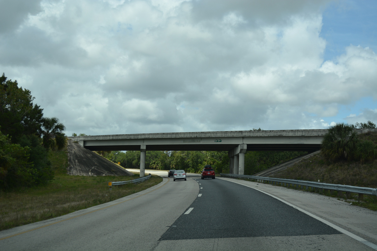
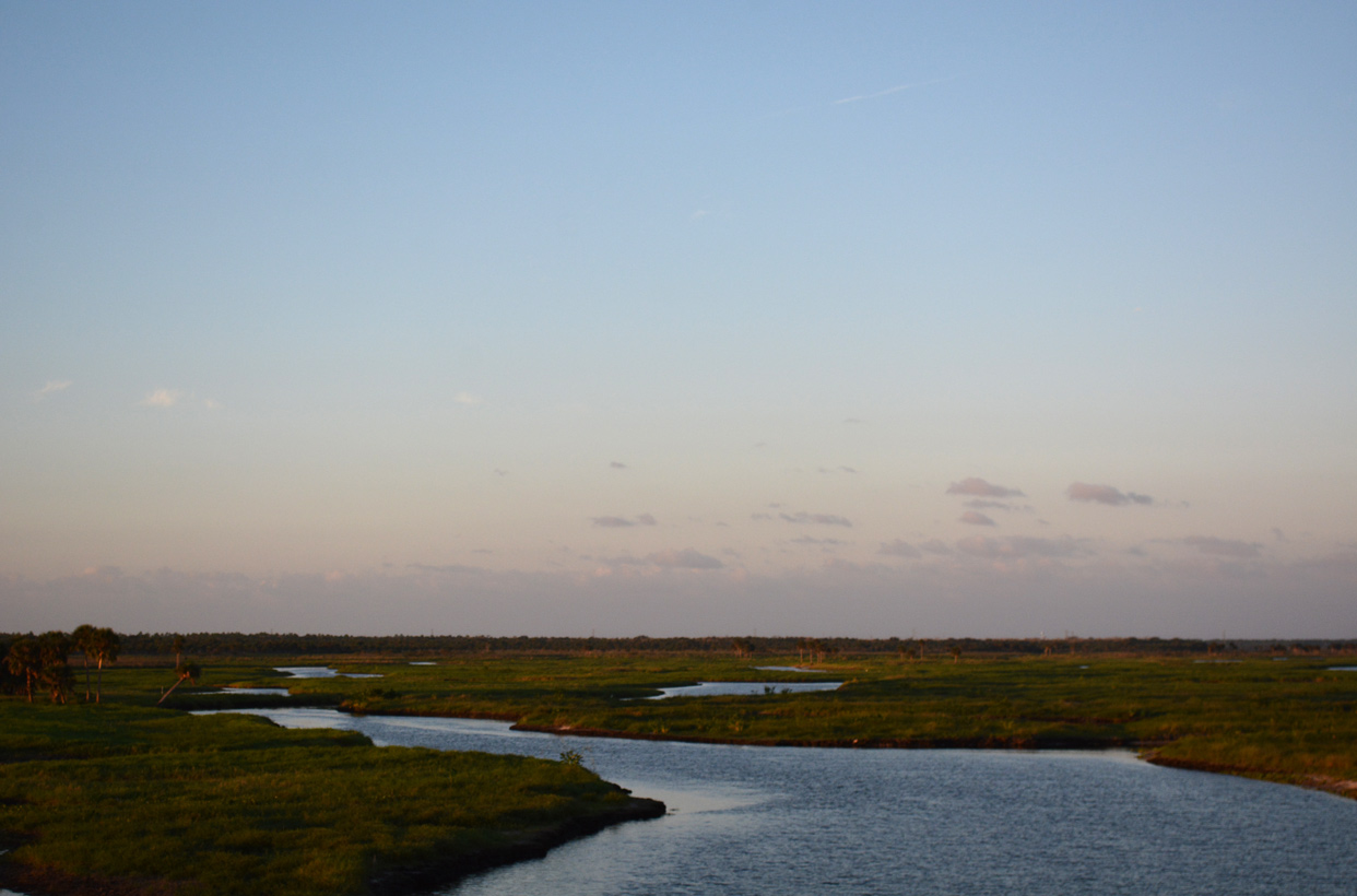
Turning due west, SR 528 enters William Beardall Tosohatchee State Reserve.
05/05/18
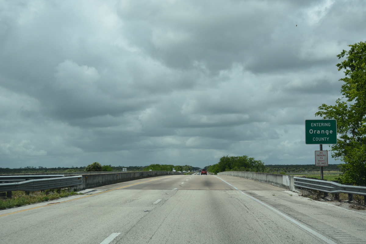
Spanning the St. Johns River, westbound travelers enter Orange County.
05/05/18
10/21/18
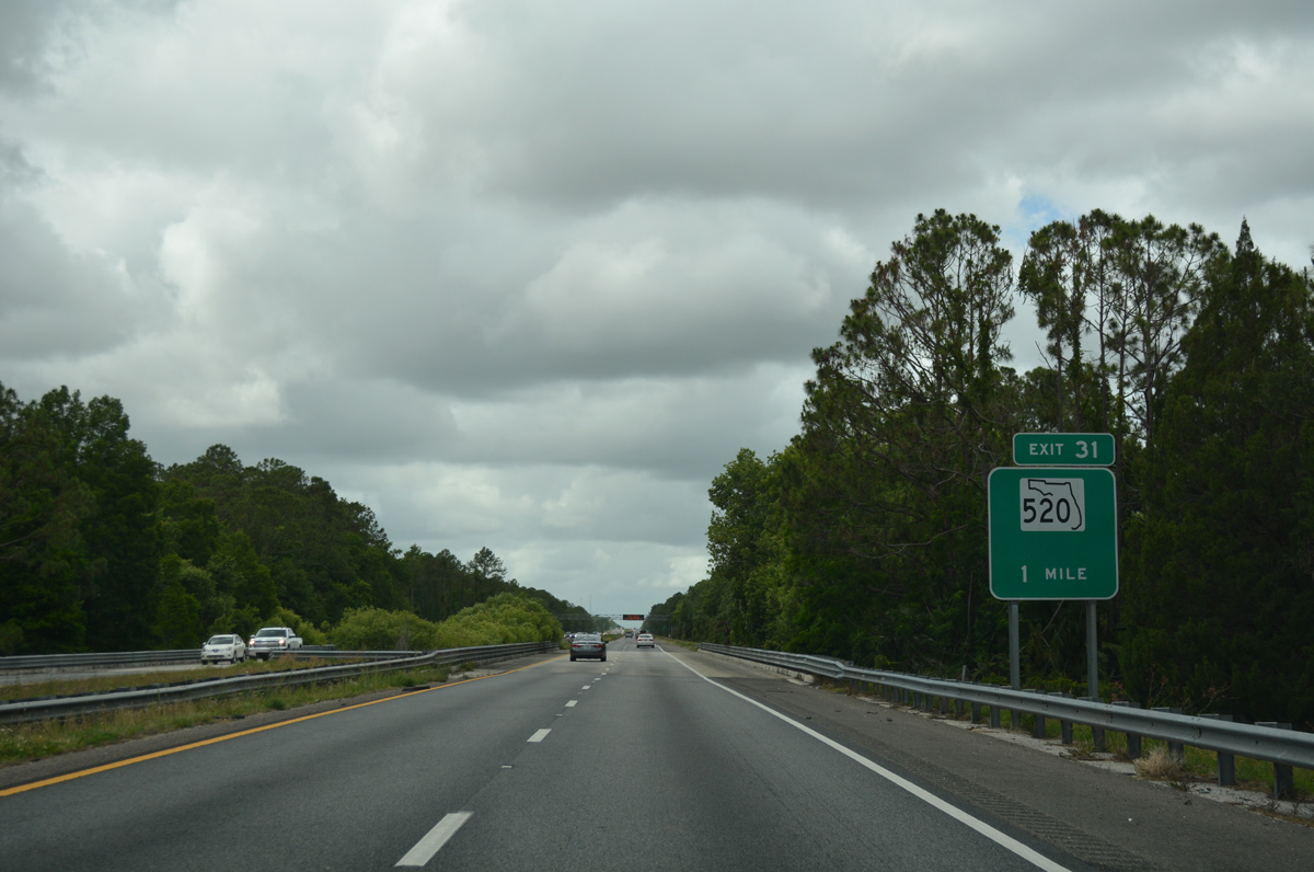
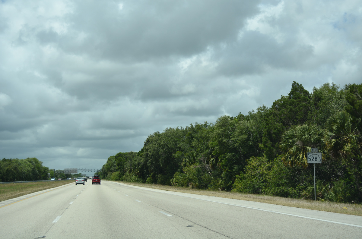
The eastern third of Orange County remains rural with large tracts of land protected in wildlife management areas such as the Toshohatchee State Reserve. SR 520 crosses paths with the four lane toll road next at Exit 31.
05/05/18
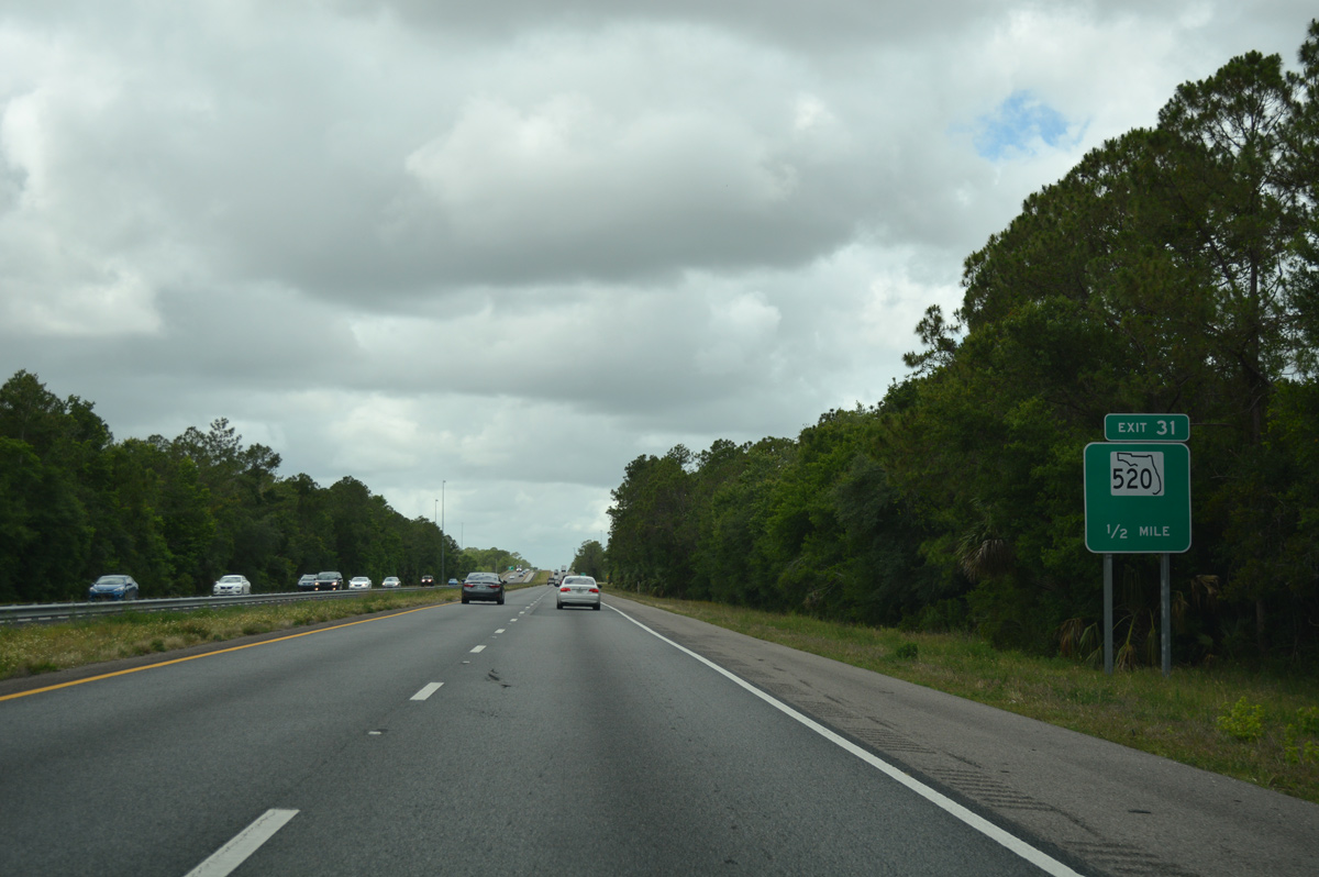
SR 520 heads northwest from Rockledge and Cocoa to SR 50 near Christmas and Bithlo. A diamond interchange (Exit 31) joins the state road with the Beachline Expressway.
05/05/18
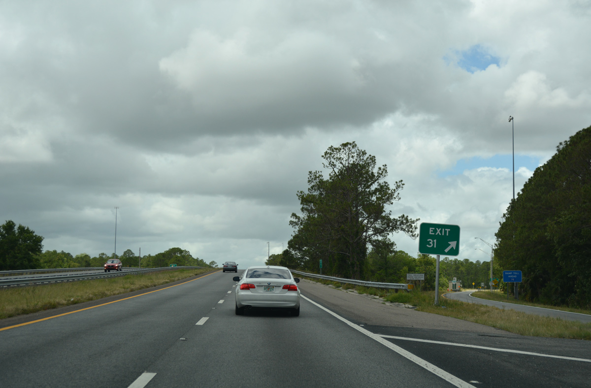
Since at least 2003, the final sign for SR 520 along SR 528 westbound is omitted. Additionally signs for Exit 31 do not acknowledge the ramp toll.
05/05/18
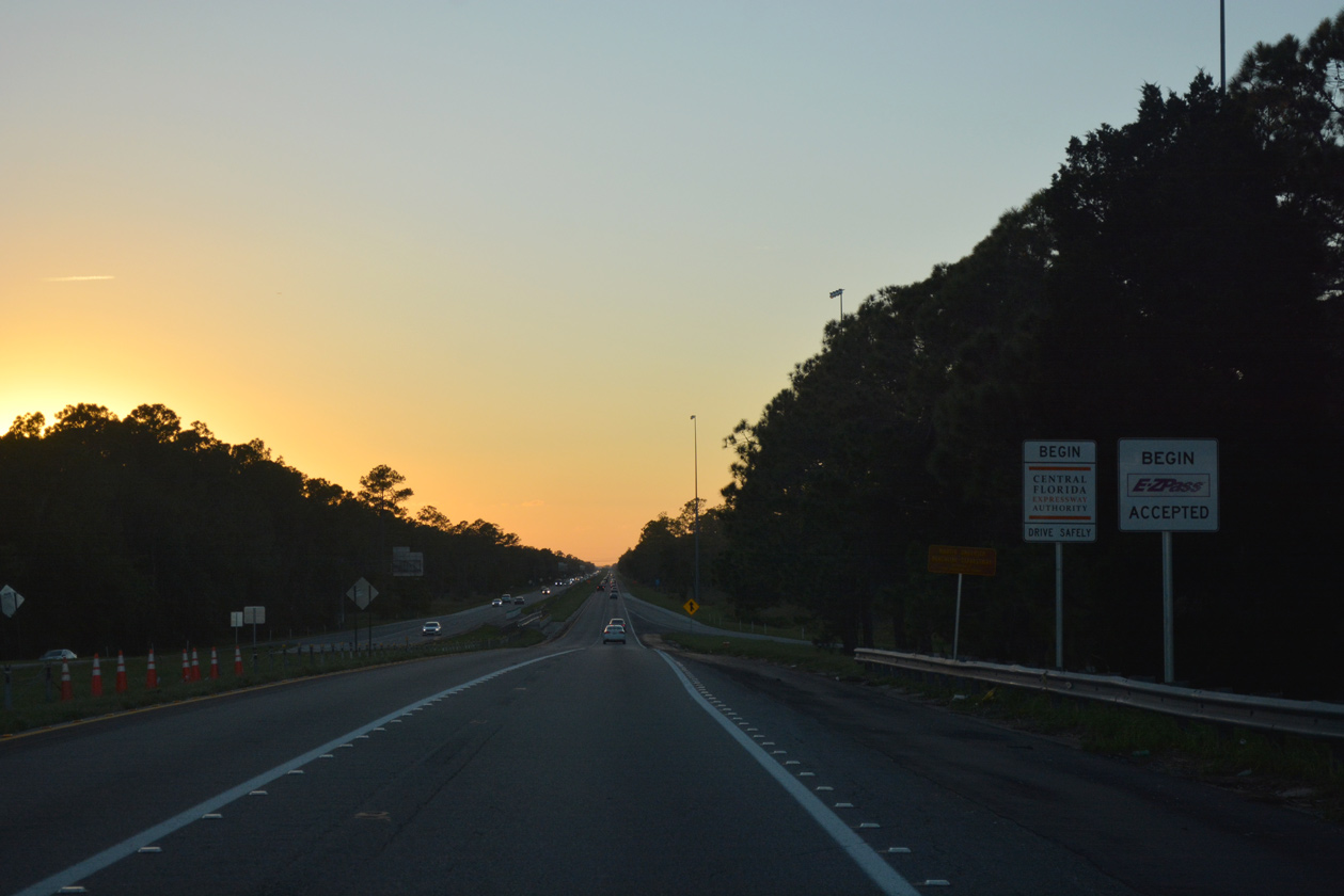
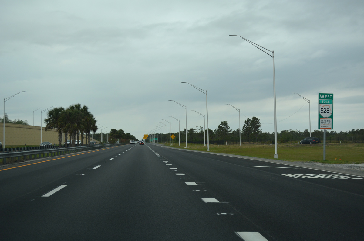
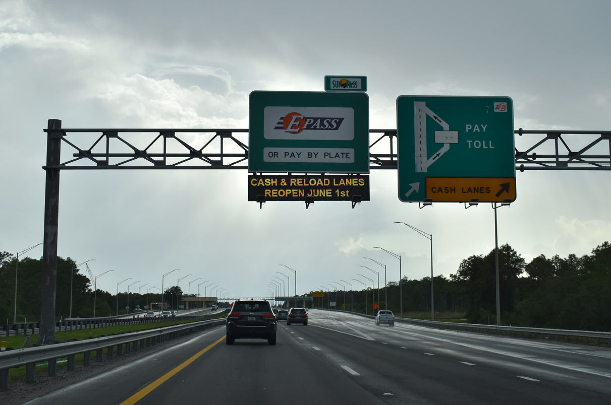
The Central Florida Expressway Authority (CFX) takes control of maintenance for the Beachline Expressway west from SR 520 to the Via Flora underpass near Boggy Creek Road. CFX toll roads joined the E-ZPass toll collection network on September 1, 2018.
10/21/18
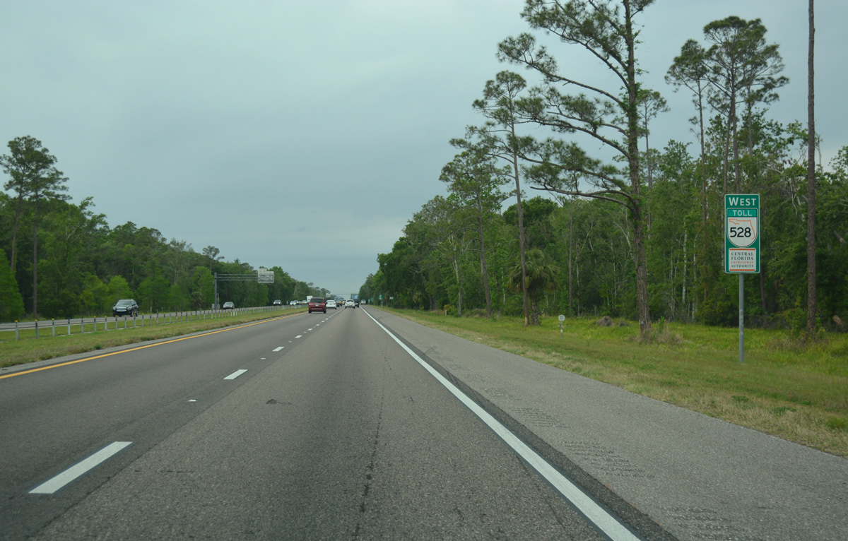
CFX confirming markers regularly combine shields for SR 528 with the CFX logo. This assembly stands west of SR 520.
03/31/18

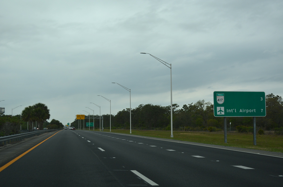
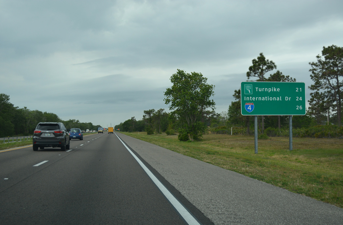
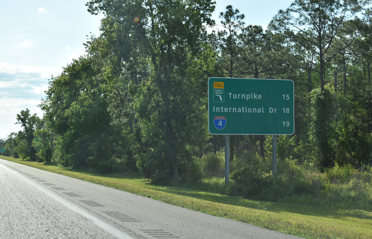
The first of two westbound distance signs lists the distances to SR 417 (Central Florida GreeneWay) and Orlando International Airport (MCO).
03/31/18
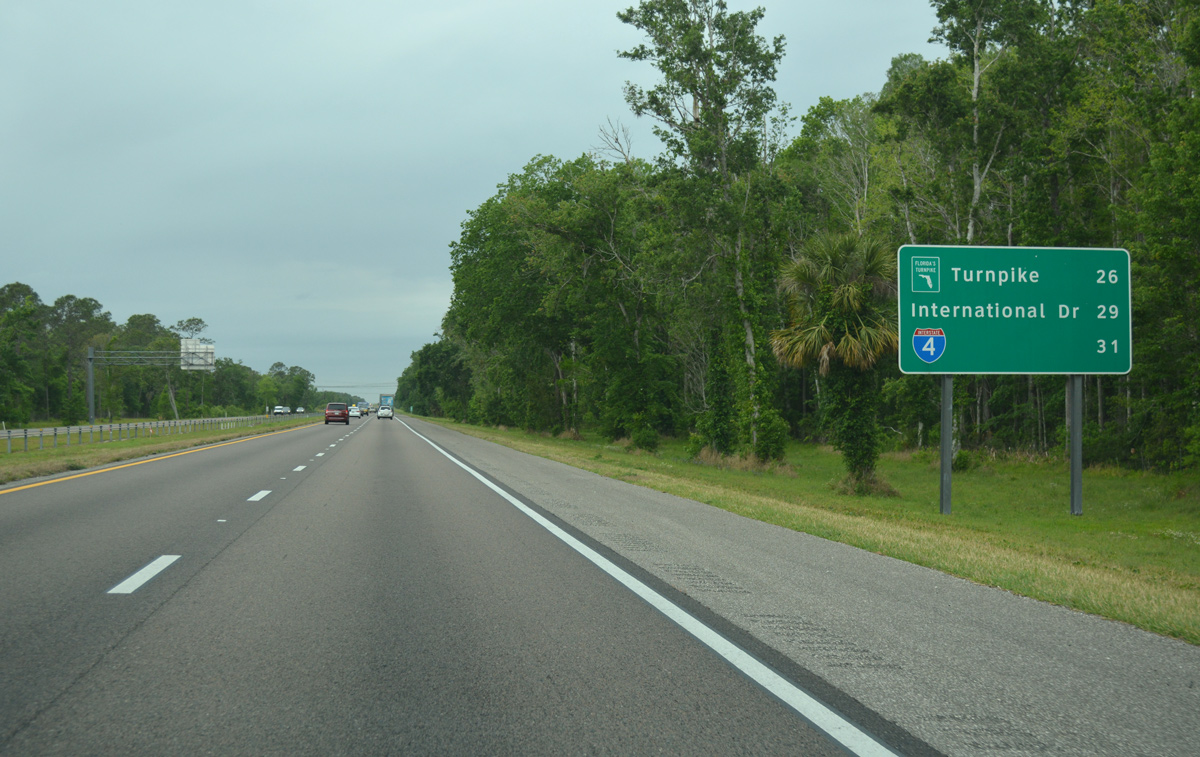
The second distance sign includes mileage to Florida's Turnpike (via Orange Blossom Trail), International Drive and the Beachline Expressway west end at Interstate 4.
03/31/18
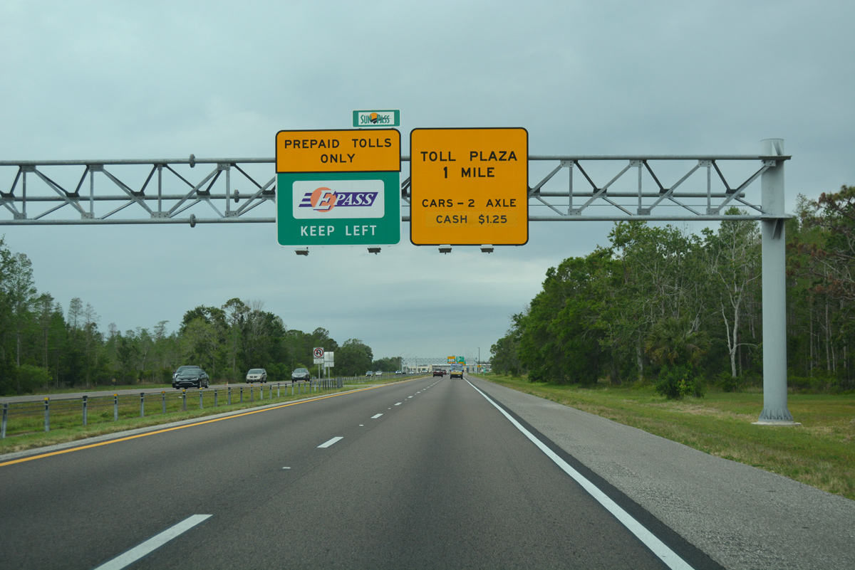
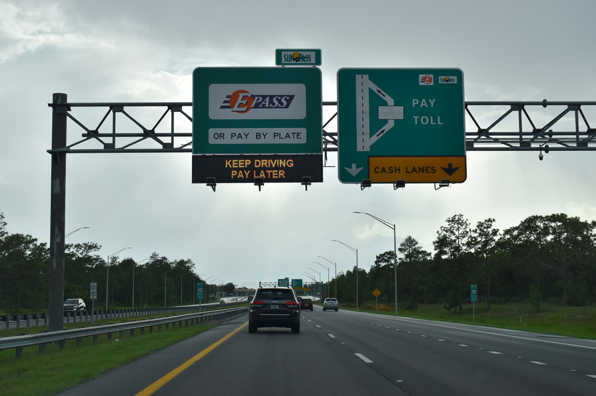
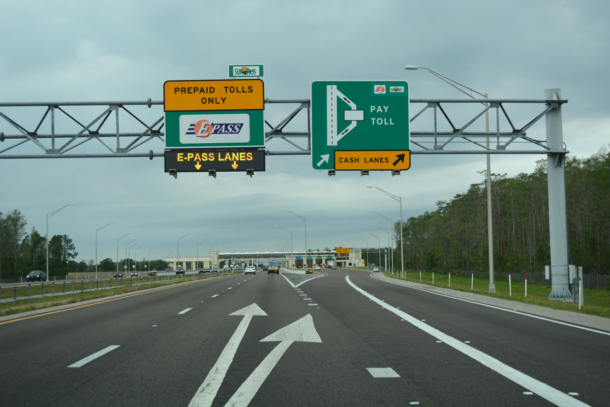
Advancing west, motorists on the Beachline Expressway enter the Dallas Mainline Toll Plaza. Constructed in 2011-12, completion of the toll collection point preceded work at the new Innovation Way interchange (Exit 19), which does not include ramp tolls.3
03/31/18
Two high speed lanes allow EPass, Sunpass and E-ZPass motorists to proceed through the Dallas Mainline Toll Plaza at freeway speeds. Four toll booth lanes operate in each direction for cash toll transactions.
03/31/18
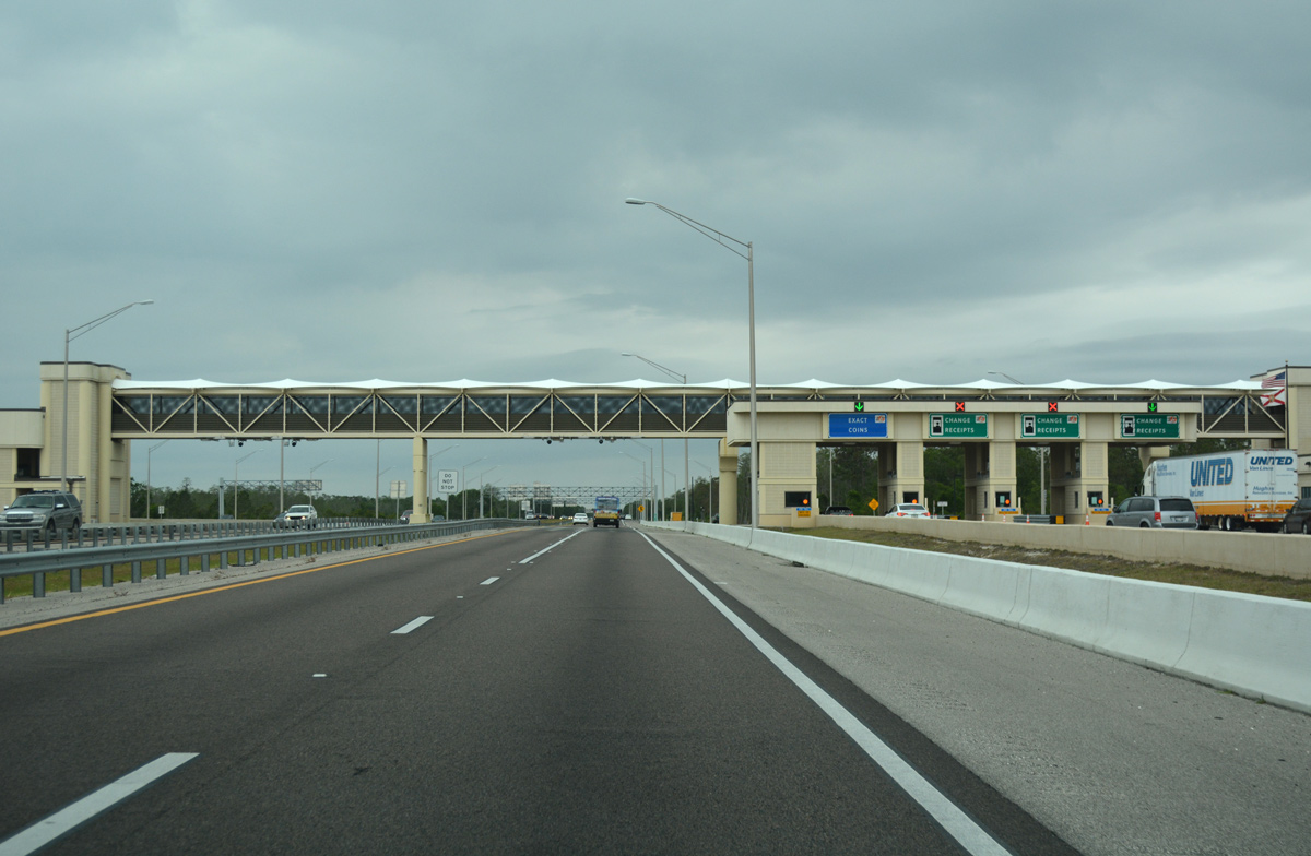
A 260-foot long pedestrian bridge spans the toll plaza, joining the administration building with the eastbound cash lanes.3
03/31/18

Additional distance signs reference SR 417, MCO Airport, I-4, etc. west of the Dallas Mainline Toll Plaza.
03/31/18

A half diamond interchange (Exit 24 on eastbound) with Dallas Boulevard connects the Wedgefield community with the Beachline Expressway west.
04/24/19
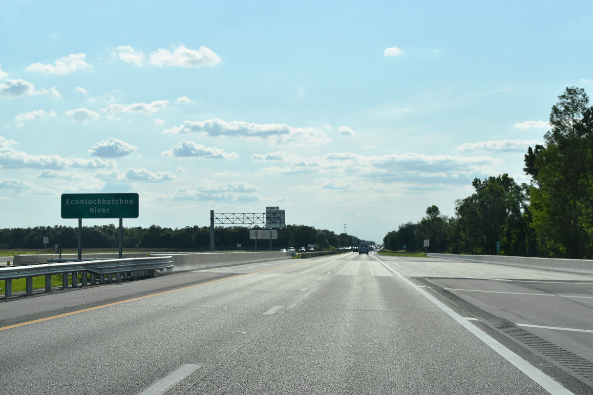
SR 528 spans the Econlockchatchee River just west of Dallas Boulevard. Both spans taking the Beachline Expressway across the waterway were replaced during work completed in late 2018.
04/24/19
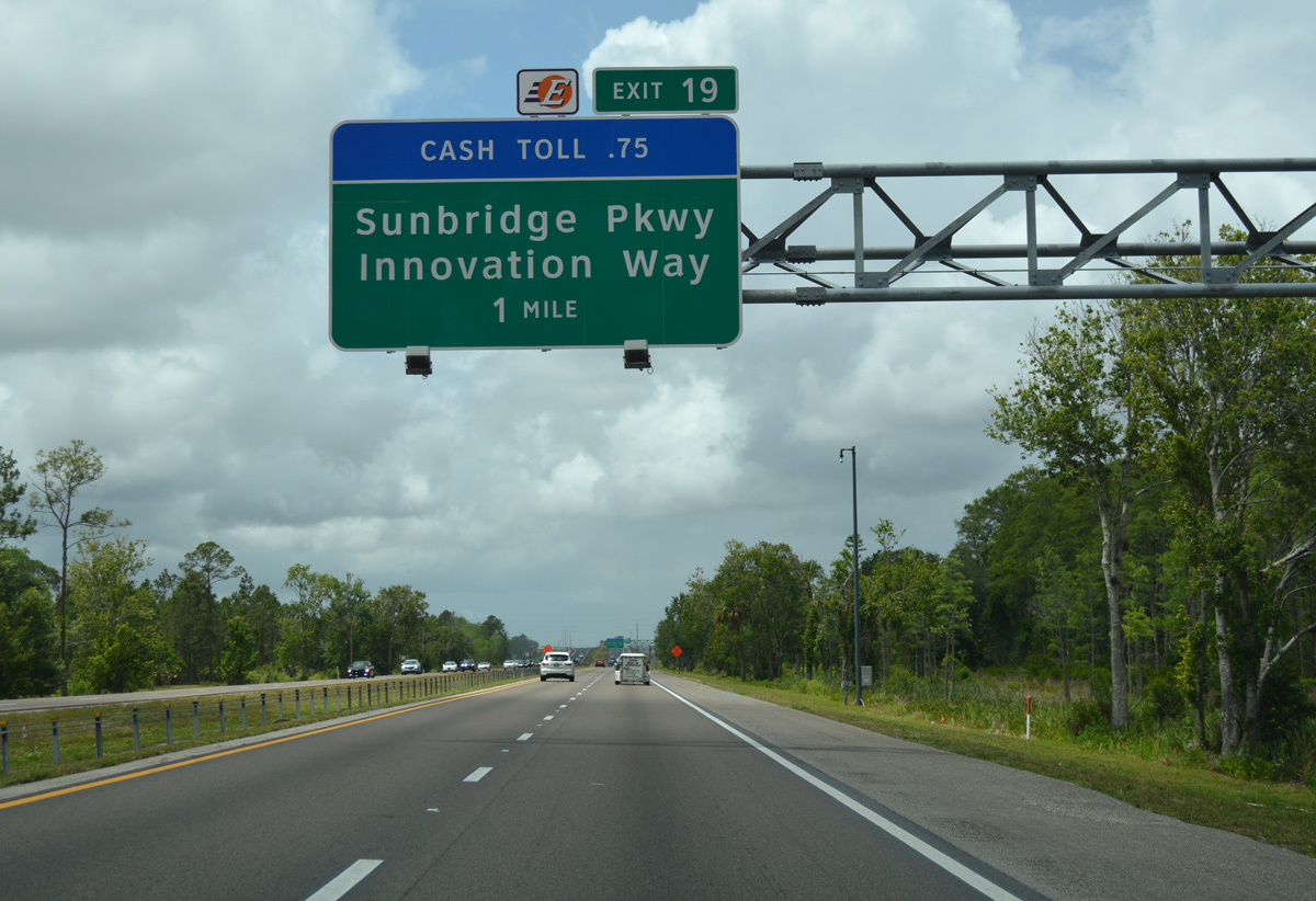
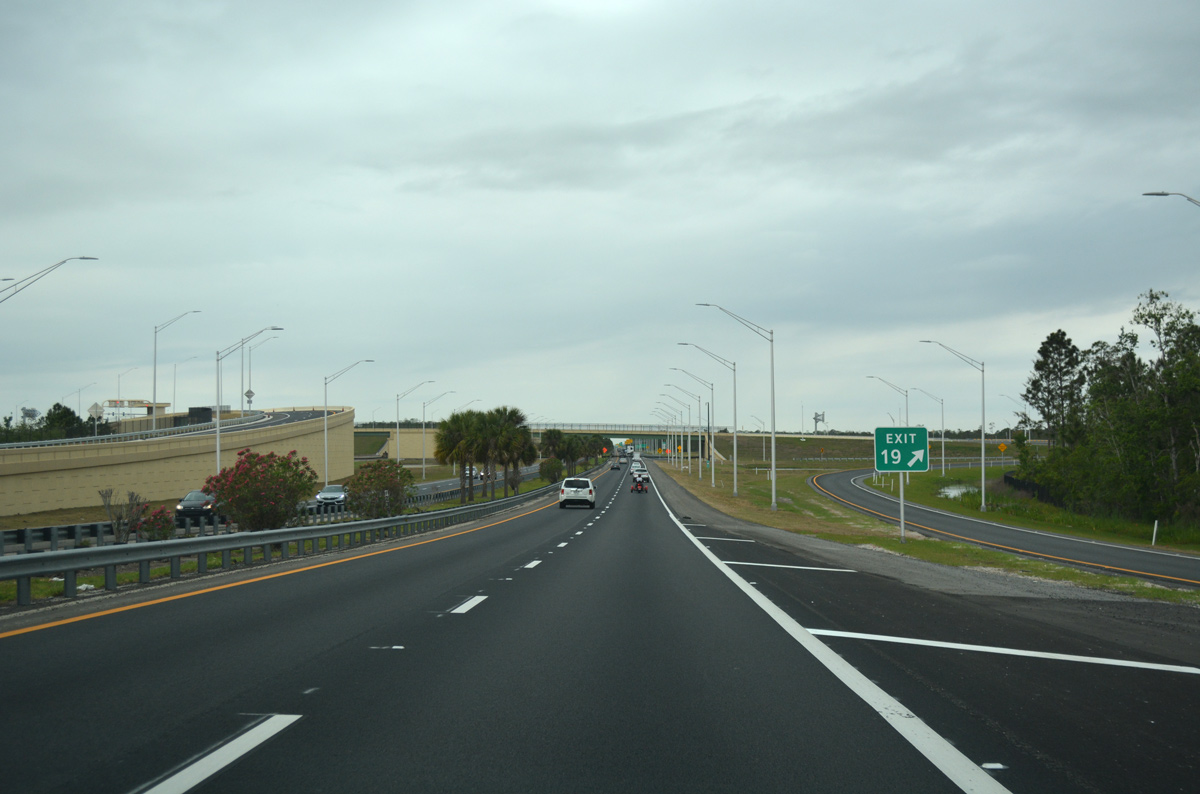
Exit 20 formerly linked the Beachline Expressway with International Corporate Park (ICP) Boulevard. The split diamond interchange was replaced by the nearby ramps (Exit 19) with Innovation Way.
05/05/18
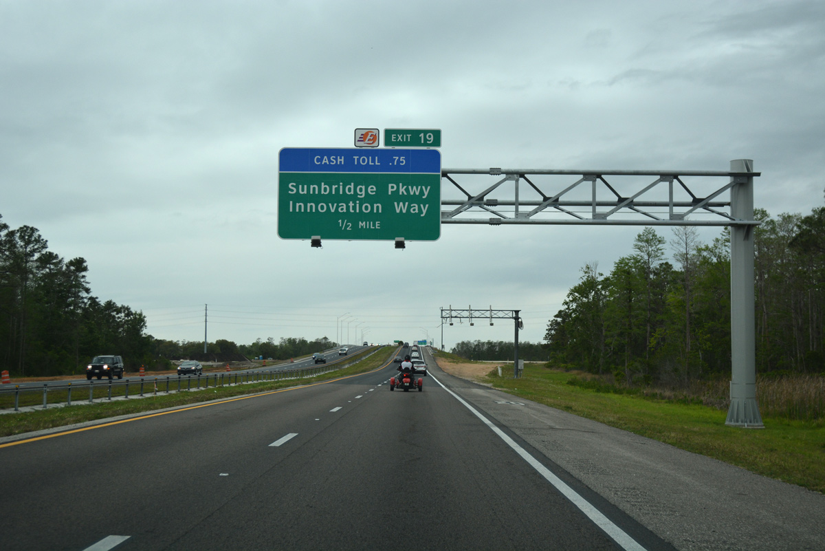
The $62.5 million project to build the new parclo interchange with Innovation Way started in July 2016 and ended with a ribbon cutting ceremony on March 9, 2018. Ramps for the north-south arterial opened initially March 31, 2017, with the westbound connection to SR 528 from Innovation Way.4
03/31/18
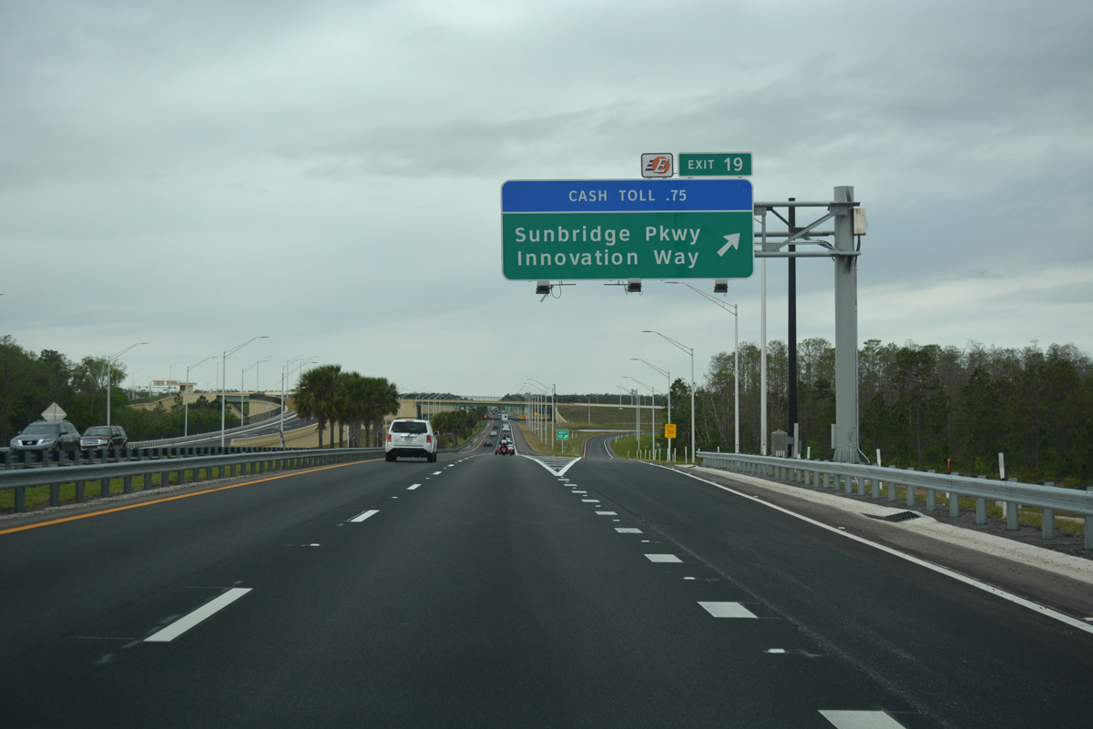
The westbound off-ramp (Exit 19) for Innovation Way north and Sunbridge Parkway south opened to traffic on July 11, 2017. Innovation Way winds northward from ICP Boulevard to Avalon Park. Sunbridge Parkway extends the arterial south to Aerospace Parkway and the end of ICP Boulevard.4
03/31/18
SR 528 westbound shield assembly posted beyond the Innovation Way entrance ramp.
03/31/18
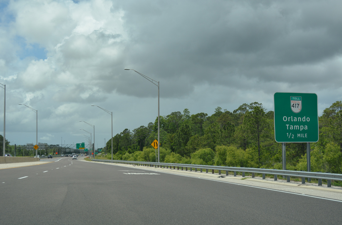
Continuing west across wetland areas south of Wide Cypress Swamp, the Beachline Expressway travels three miles to SR 417 and 20 miles to Interstate 4.
03/31/18
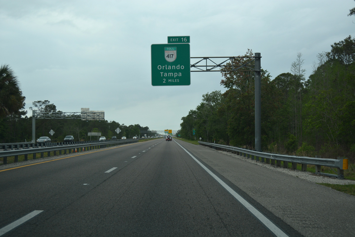
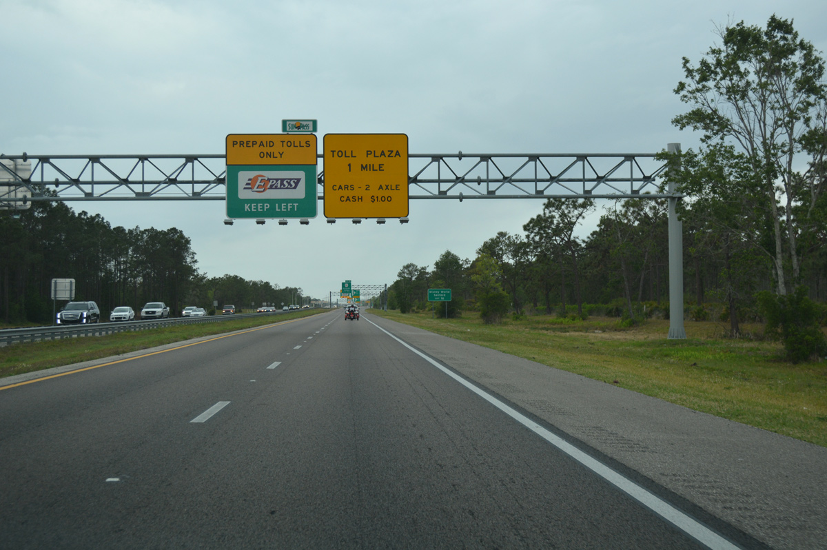
SR 528 west passes through the Beachline Mainline Toll Plaza just ahead of the systems interchange (Exit 16) with the Central Florida GreeneWay.
03/31/18
04/24/19
05/05/18
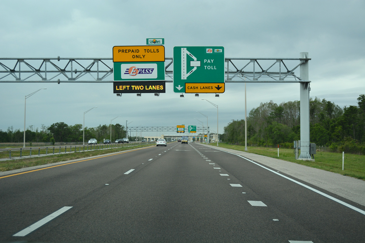
The Beachline Mainline Toll Plaza was rebuilt and expanded to include four high speed all-electronic-toll (AET) lanes. Prior to the 2008-09 work, EPass and SunPass account holders were required to slow through former toll booth lanes.
05/27/20
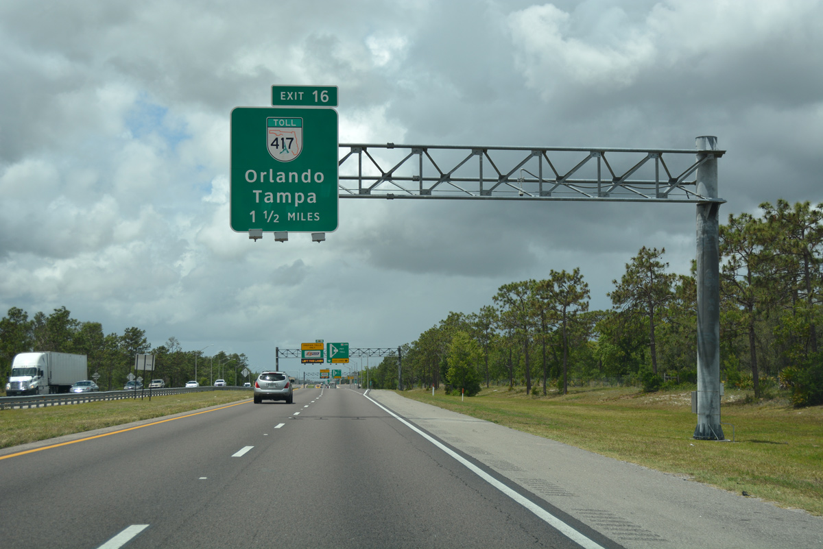
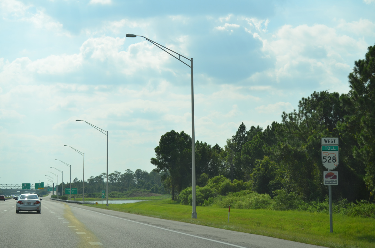
Less than a half mile separates the toll collection point from the ramps to SR 417 (Central Florida GreeneWay).
05/05/18
SR 528 west expands to four lanes to Exit 16. SR 417 wraps around the southeast side of Orlando along the tolled Central Florida GreeneWay to Lake Nona, Hunters Creek and Celebration.
05/05/18
The Beachline Expressway travels just north of the Orlando city line to the Central Florida GreeneWay. This shield assembly was removed by 2018.
07/31/14
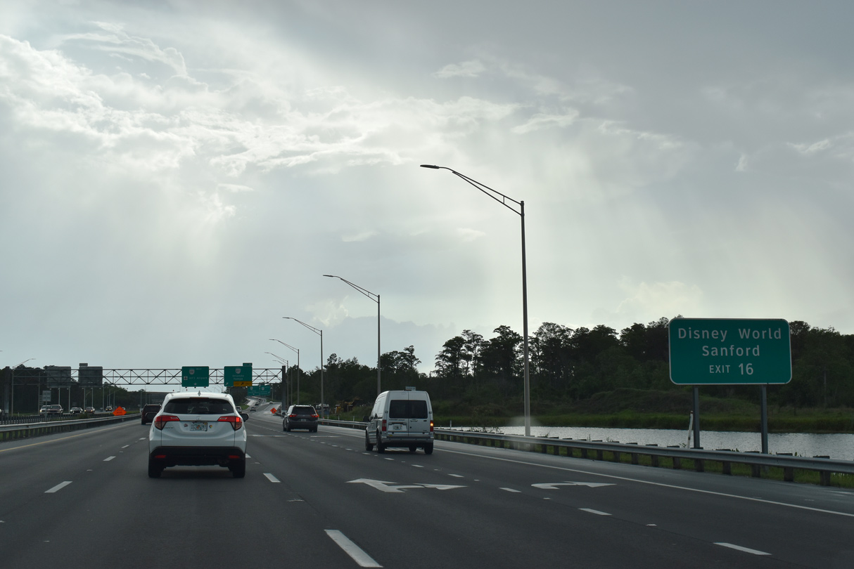
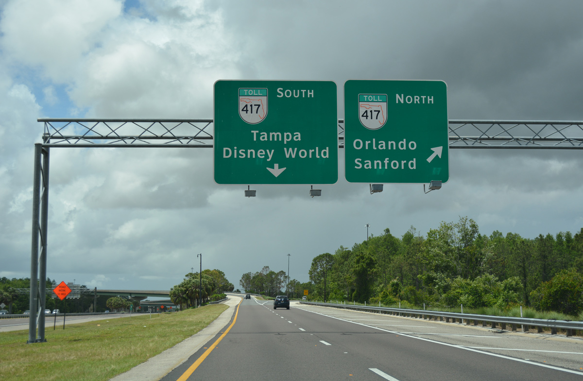
SR 417 south to Osceola Parkway leads to Walt Disney World. North into Seminole County, SR 417 continues to Orlando Sanford International Airport (SFB) and the county seat of Sanford.
05/27/20
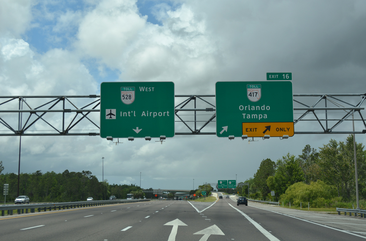
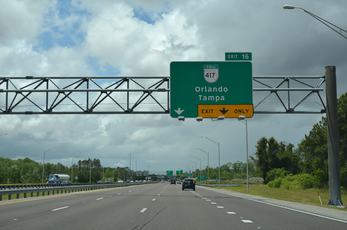
Exit 16 carries all traffic to SR 417 in unison for east Orlando, Oviedo and Kissimmee.
05/05/18
The Central Florida GreeneWay becomes the Seminole Expressway north beyond the county line en route to Winter Springs, Oviedo and Lake Mary. Connections with SR 408 (East-West Expressway) also serve Downtown Orlando.
05/05/18
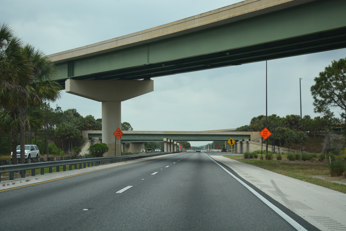
A high-speed flyover carries drivers onto SR 417 south. The Central Florida GreeneWay is maintained by the CFX in Orange County and Florida's Turnpike in Osceola County.
03/31/18

References:
- SR-528 WB over Indian River, Brevard County, Florida. http://bridgereports.com/1084282 BridgeReports.com
- SR-528 WB over CR-515 & Indian River, Brevard County, Florida. http://bridgereports.com/1084217 BridgeReports.com
- SR 528 Dallas Boulevard ORT Plazas
http://rsandh.com/who-we-serve/transportation/tolls-and-managed-lanes/sr-528-dallas-boulevard-ort-plazasRS&H web site. accessed March 2, 2018. - SR 528 / Innovation Way Interchange. Central Florida Expressway Authority web site. accessed March 1, 2018. https://www.cfxway.com/for-travelers/projects/528/sr-528-innovation-way-interchange/
Photo Credits:
- ABRoads: 09/28/13, 07/31/14, 03/31/18
- Alex Nitzman: 10/01/15, 05/05/18, 10/21/18, 04/24/19, 05/27/20
- Brent Ivy: 10/21/18
- abt: 03/31/18
Connect with:
Page Updated Thursday May 28, 2020.