
State Road 542
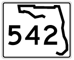
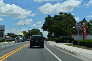
Florida State Road 542 runs 5.90 miles east from SR 549 (1st Street) at Downtown Winter Haven east to U.S. 27 at Dundee in central Polk County. SR 542 lines Central Avenue east onto Lake Elbert Drive SE, which lines the southern periphery of Lake Elbert. Beyond the lake, SR 542 transitions onto Dundee Road through eastern reaches of Winter Haven and into the town of Dundee just ahead of U.S. 27 and CR 542.
Florida State Road 542 Guides
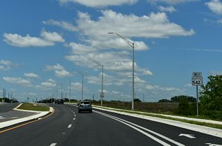
$48.3 million in road work completed the second phase of widening along SR 542 (Dundee Road) from Buckeye Look Road east to U.S. 27 in Dundee. The two lane road was expanded to a four lane arterial, installed traffic lights at CR 550 / Overlook Drive (activated August 21, 2022) and added bike lanes, sidewalks and street lights along a 3.5 mile long stretch. Construction got underway on September 8, 2020 and was completed on April 28, 2023.1
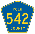
There are four branches of Polk County Road 542. The western leg follows Old Tampa Highway east from S County Line Road and the Hillsborough County border 4.31 miles to the intersection of S Wabash Avenue and Olive Street in Lakeland.
The second branch of CR 542 extends east along Main Street from SR 655 (New Combee Road) at unincorporated Crystal Lake outside Lakeland. Signage along SR 655 however references CR 542 as continuing west along Main Street to Lakeland. Measuring 8.02 miles in length, CR 542 continues east from Main Street to the census designated place of Fussels Corner, where it becomes K-Ville Avenue at Old Dixie Highway. K-Ville Road runs east to Kossuthville before shifting southeast across SR 570 (Polk Parkway) through southwest Auburndale. CR 542 passes through Jones Corner ahead of Auburndale Speedway and SR 655 (Recker Highway).
CR 542 on K-Ville Road ties into SR 655 (Recker Highway) 0.3 miles north of the CR 542 leg along Avenue G NW to Inwood and Winter Haven. 3.22 miles in length, CR 542 takes Avenue G NW east to N Lake Howard Drive, which encircles the north side of Lake Howard. N Lake Howard Drive defaults onto Avenue D NW east to adjacent U.S. 17. FDOT GIS Data shows CR 542 instead taking Pope Avenue southeast to a six point intersection with Avenue B NW and U.S. 17 (6th Street SW).
Separate sections of CR 542 also extend from both ends of SR 542. The 0.38 mile long section on Central Avenue between U.S. 17 (6th Street) and SR 549 (1st Street) in Downtown Winter Haven is unmarked. Dundee Road east from U.S. 27/SR 542 is CR 542 onto Main Street in Downtown Dundee. The 0.87 mile long leg passes south of Lake Dell and ties into SR 17 where it turns from Center Street onto E Main Street.
The easternmost branch of County Road 542 travels 10.37 miles from SR 17 in Lake Hamilton to Perch Street at Lake Hatchineha Resort and RV Park. Following Lake Hatchineha Road, CR 542 leaves the town of Lake Hamilton across remaining orange groves to suburban development in eastern Dundee. Lake Hatchineha Road shifts southward to Marigold Avenue at the southern extent of the Poinciana community. East from there, CR 542 traverses protected land ahead of Lake Hatchineha to the lakeside RV park.
References:
- 410666-3 SR 542 (Dundee Road) from Buckeye Loop Road to east of US 27. Florida Department of Transportation (FDOT), District 1 project web site. Accessed May 9, 2024.
Connect with:
Page Updated Friday May 10, 2024.