
Route 76 - Fort Weaver Road

Hawaii Route 76 follows Fort Weaver Road south 6.617 miles from I-H1 and Route 750 (Kunia Road) between Village Park and Waipahu to the end of Fort Weaver Road at 'Ewa Beach Park and Popoi Place. Fort Weaver Road initially parallels the Mamala Bay coast line west between the NOAA Pacific Tsunami Warning Center and a strip of densely populated houses. Route 76 expands to four lanes at Ewa Beach Road before turning northward away from the coast and the community of 'Ewa Beach.
Fort Weaver Road expands from a five lane boulevard into a four lane, divided highway north of Keone'ula Boulevard and the Hoakalei Ocean Pointe development. Route 76 continues north by the Hawaii Prince Golf Club to the 'Ewa Gentry development and the 'Ewa Villages census designated place. Curving east by West Loch Estate, Route 76 passes through West Loch Golf Course to the West Loch Estates development along the West Loch of Pearl Harbor.
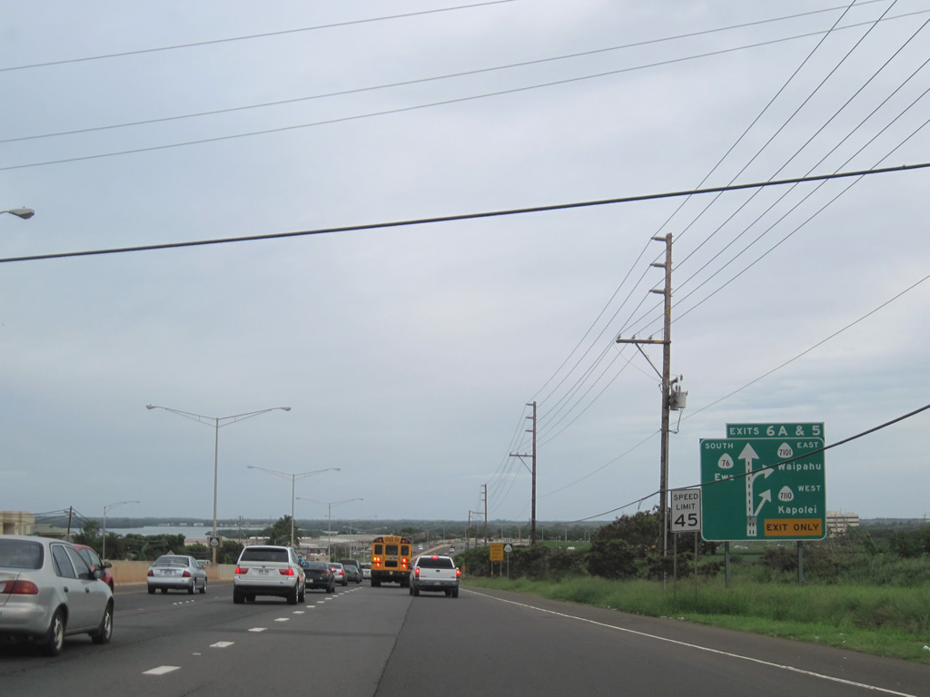
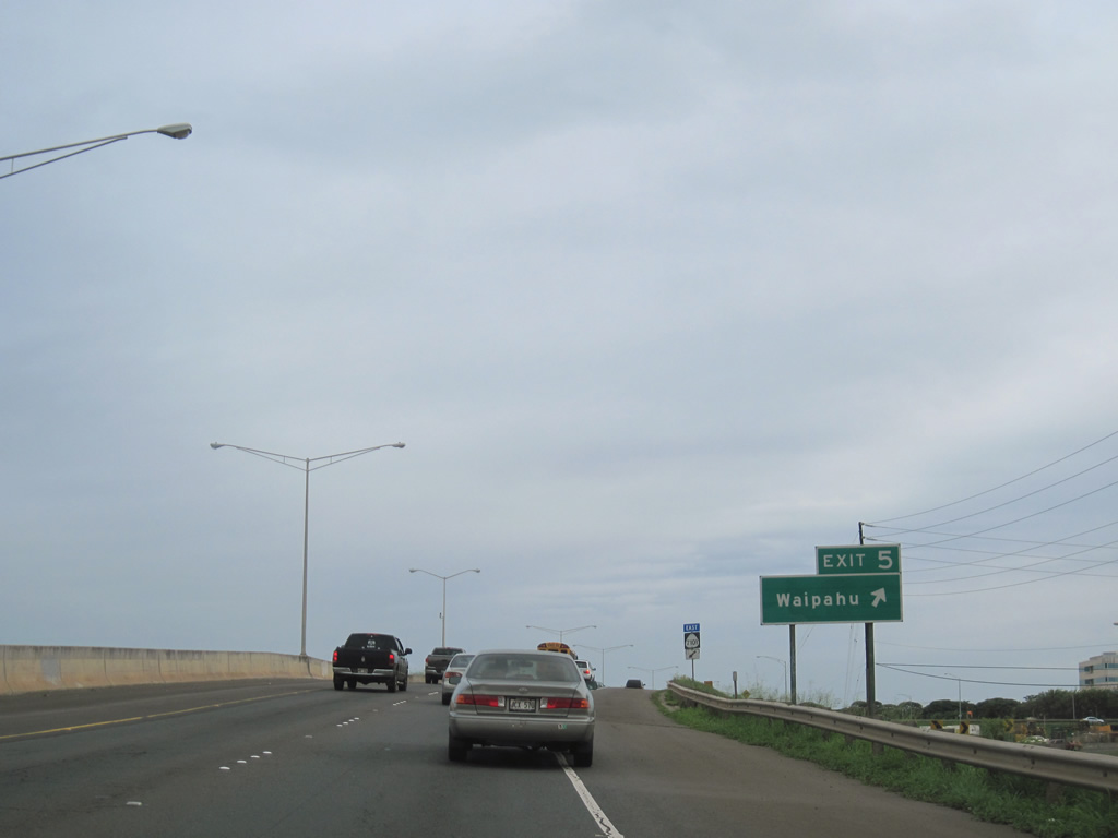
North of Laulaunui Street, Route 76 upgrades to a controlled access expressway. A parclo interchange (Exits 5/6 A) joins Fort Weaver Road with Farrington Highway (Route 7110) west toward Kapolei and (Route 7101) east to Waipahu. North beyond the RIRO intersection with Honowai Street east, Route 76 connects with Interstate H1 at a parclo interchange (Exit 5) across from Route 750 (Kunia Road).
Historically Route 76 continued north from Waipahu along Kunia Road to Schofield Barracks, Wheeler Army Airfield and Route 99 (Wilikina Drive). Kunia Road 8.05 miles north from I-H1 to Route 99 was renumbered as Route 750.
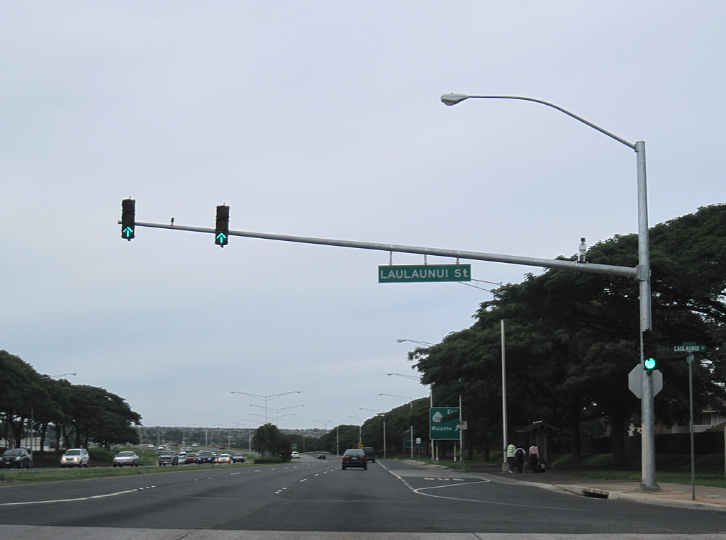
Route 76 runs across West Loch Golf Course ahead of the signalized intersection with Laulaunui Street. Laulaunui Street connects Fort Weaver Road with the Queen's Medical Center West O'ahu and the West Loch Estates housing development.
01/18/11
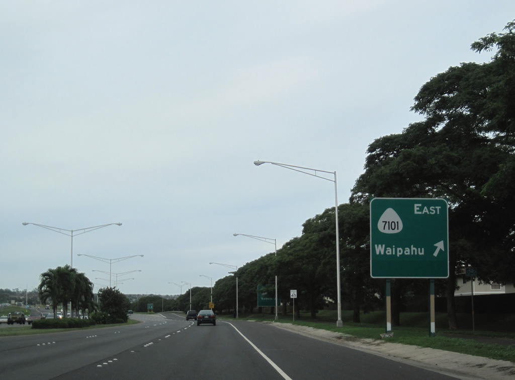
Route 76 (Fort Weaver Road) upgrades to an expressway from Laulaunui Street north into a parclo interchange (Exit 5) with Farrington Highway. Exit 5 provides access only to Route 7101 east from Fort Weaver Road northbound.
01/18/11
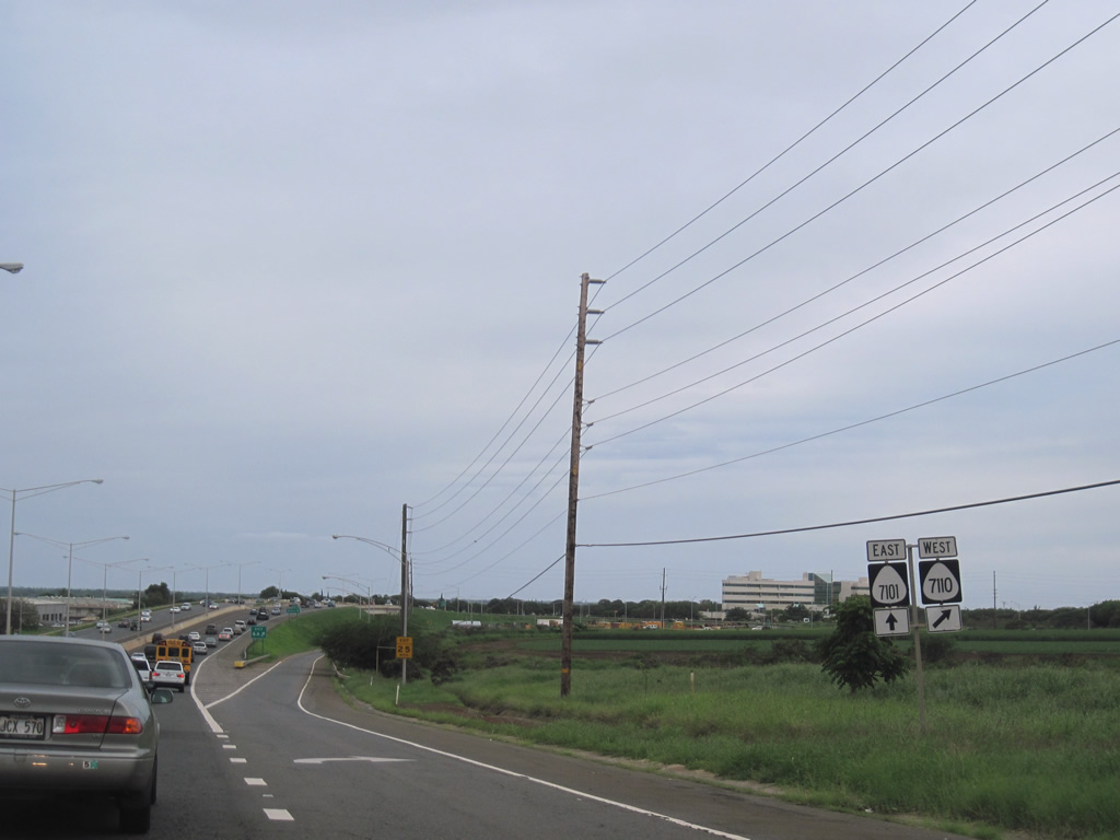
Following Farrington Highway 3.00 miles east to Route 99 (Kamehameha Highway), route 7101 leads directly into the commercial district of Waipahu. Route 7110 continues Farrington Highway west 0.60 miles toward Kapolei, but access to that direction requires a U-turn on Route 7101.
01/18/11
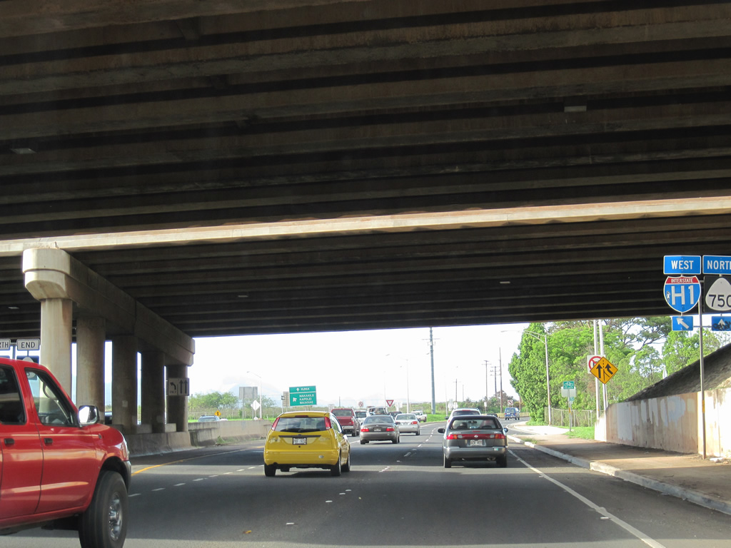
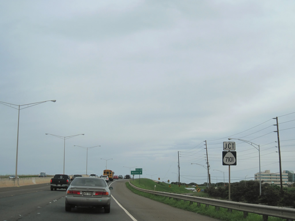
Route 76 ends where Fort Weaver Road transitions into Kunia Road and the northbound beginning of Route 750 underneath the Interstate H1 overpasses.
01/17/11
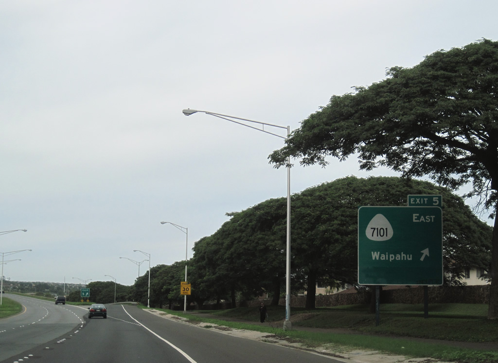
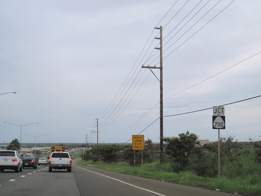
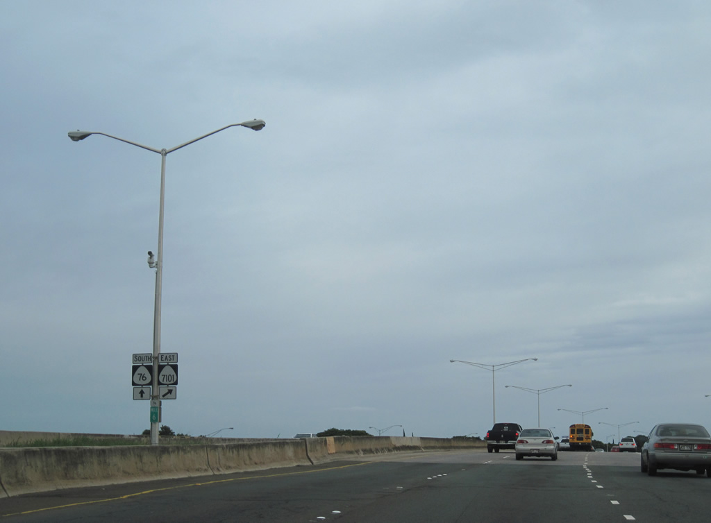
Route 76 follows a short expressway along the west side of Waipahu. A parclo interchange joins Fort Weaver Road with Farrington Highway (Route 7110) west at Exit 6 A and Farrington Highway (Route 7101) east at Exit 5.
01/18/11
The auxiliary lane from Interstate H1 east defaults onto Exit 6 A for Route 7110 (Farrington Highway) west. Farrington Highway links Waipahu with the growing Kapolei area south of I-H1.
01/18/11
Route 7110 extends Farrington Highway 0.60 miles west from the Route 76 (Fort Weaver Road) overpass. Unsigned County Route 9107 continues Farrington Highway 4.04 miles southwest to Kapolei and Route 901 (Fort Barrette Road).
01/18/11
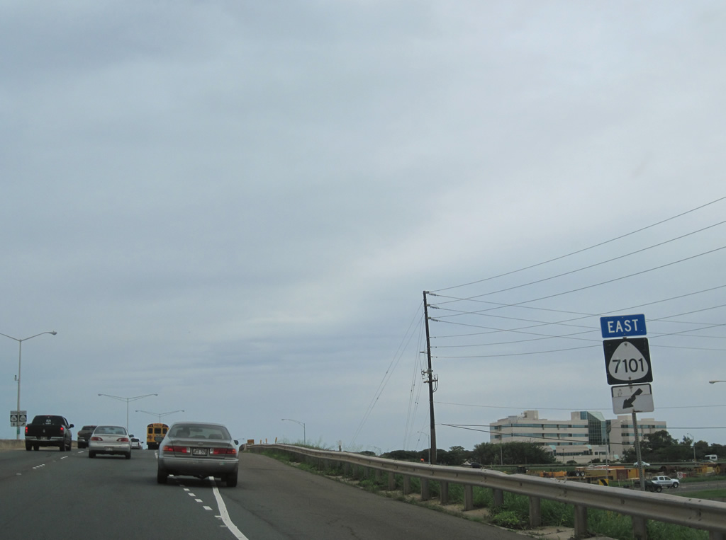
Route 7101 shield preceding the loop ramp at Exit 5 onto Farrington Highway east to Waipahu.
01/18/11
Farrington Highway comprises the main commercial route through the community of Waipahu.
01/18/11
Paralleling the Skyline light rail line, Route 7101 follows Farrington Highway 3.00 miles east from Route 76 to Route 99 (Kamehameha Highway).
01/18/11
Route 76 (Fort Weaver Road) spans Farrington Highway southbound at milepost six. Replacing a two lane alignment to the west (Old Fort Weaver Road), the four lane expressway opened in 1980.
01/18/11
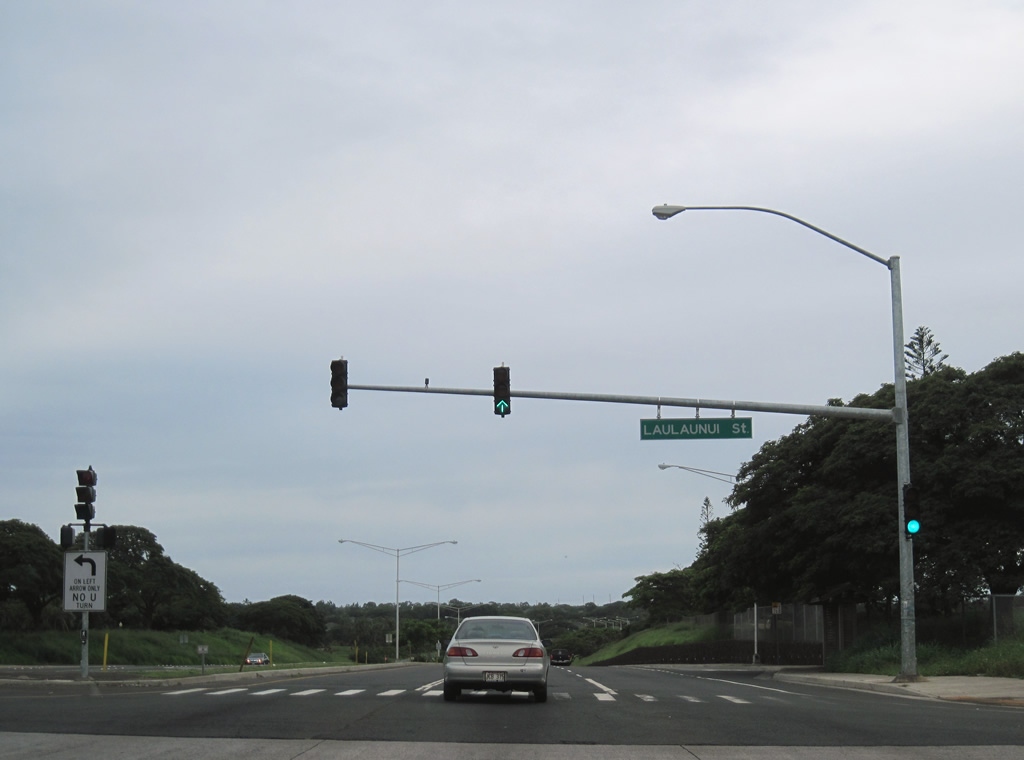
Laulaunui Street intersects Route 76 between Honouliuli and the West Loch Golf Course and the West Loch Estates housing development.
01/18/11
Photo Credits:
- Alex Nitzman: 01/17/11, 01/18/11
Connect with:
Page Updated Wednesday August 31, 2011.