
Interstate 4 West - Daytona Beach to DeBary
DeLand began in 1876 after Henry A. DeLand purchased the land, settled there, and encouraged others to invest in area property. DeLand founded the DeLand Academy, which later became Stetson University, after benefactor John B. Stetson and the request of John DeLand himself. New York Avenue (SR 44) derives its name from DeLand's home state of New York.3
Orange City was started by Dr. Seth French and company in 1874 with a purchase of 5,000 acres. The town derives its name from the numerous orange groves planted in the area. Orange City was incorporated in 1882.4
Deltona began as a Mackle Brothers vision in 1962 with the purchase of 17,203 acres. The developers aspired to build a master-planned retirement community with 35,143 lots. Construction followed soon thereafter, with the initial population living in Deltona by April of 1963. By 1991, 52,000 called Deltona home. Unincorporated until a successful vote on December 31, 1995,5 the city now boasts over 90,000 residents.
DeBary incorporated in 1993 to prevent annexation by the larger Orange City to the north. The community was founded by Frederick DeBary with a 400-acre purchase of land in 1871.6
The community of Enterprise lies along the north shore of Lake Monroe one mile east of Interstate 4. Enterprise consists of an unincorporated community rich in history. During the 1800s, Enterprise became a weekend destination for area residents with its mineral springs, lakeside access, and steamboat access to Jacksonville. Enterprise was the first county seat for Volusia in 1854. Later the town became a railroad depot along the Jacksonville Tampa and Key West Railroad.7
Interstate 4 crosses the St. Johns River into Seminole County. The name St. Johns is based on the Catholic mission established in 1578 on Fort St. George Island near the river's mouth, the San Juan del Puero. The River took the name Rio de San Juan because of that. Rio de San Juan translated to St. Johns River in English, and the name has remained ever since.9
 West
West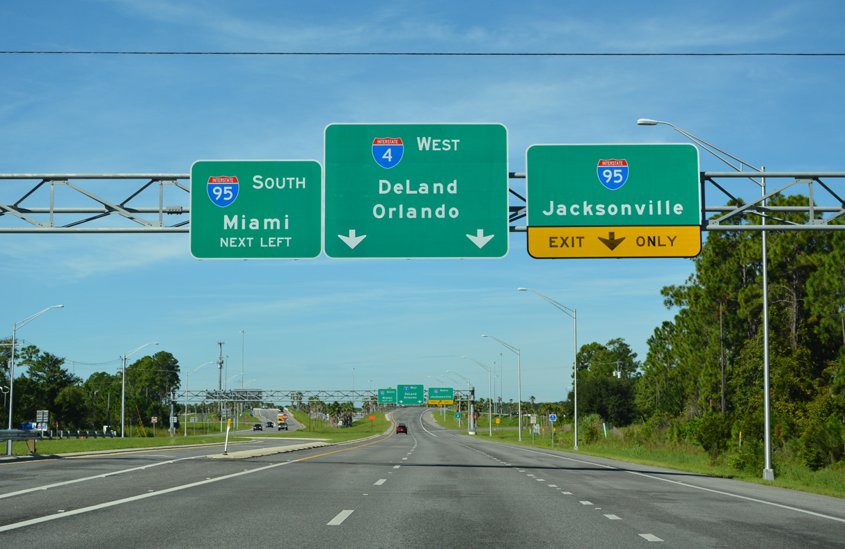
SR 400 (Beville Road) transitions into Interstate 4 west of CR 4009 (Williamson Boulevard). With improved ramp geometry and c/d roadways, construction through late 2018 2019 Spring 2020 upgraded the cloverleaf with I-95 into a systems interchange.
09/12/22
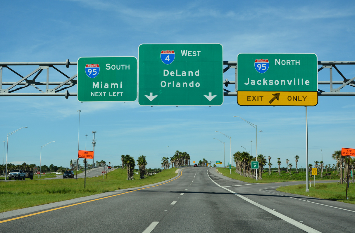
New roadways for the I-4/SR 400 connection were built in 2018. The previous ramp to I-4 west carried just a single lane as it passed over the wye interchange joining I-4 east with I-95 north.
09/12/22
The $205 million Systems Interchange Reconstruction project1 replaced the loop ramp for I-95 south to Melbourne, West Palm Beach and Miami with a left exit from the westbound beginning of Interstate 4.
09/12/22
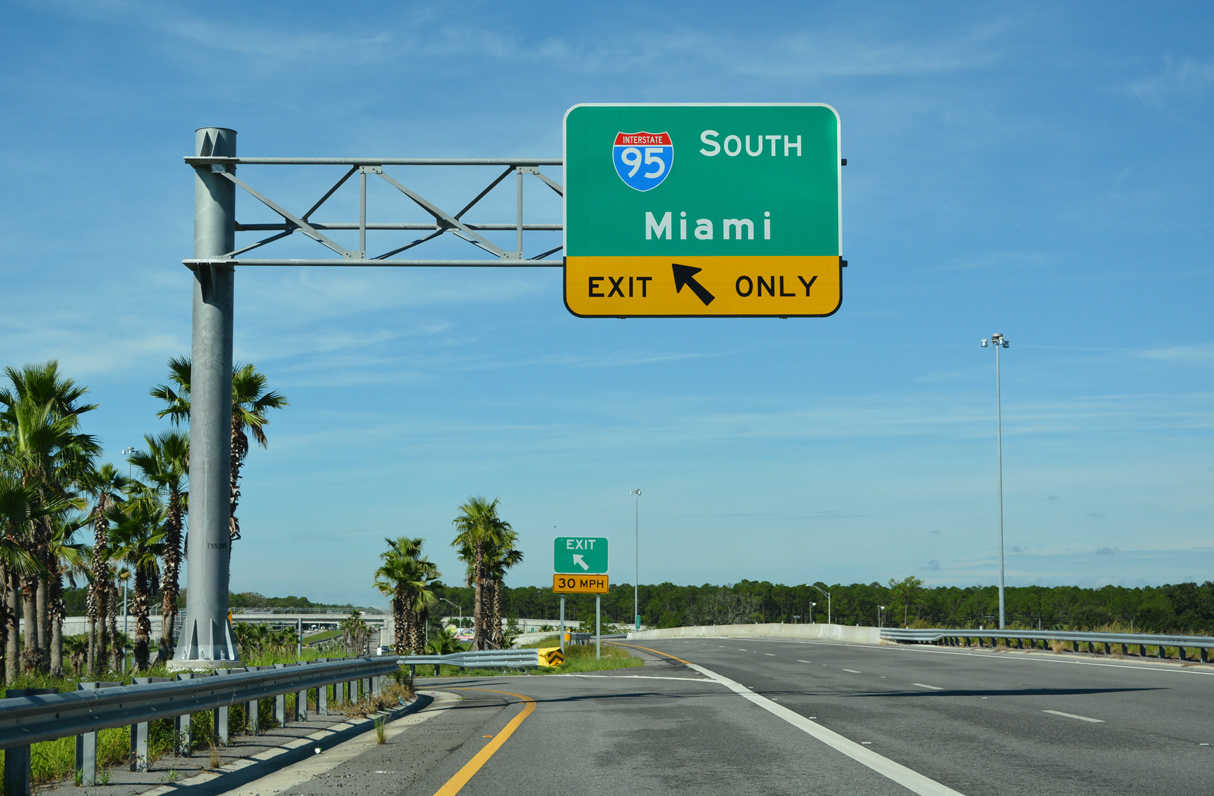
The unnumbered left exit for I-95 south combines with traffic from I-4 east ahead of Port Orange. Interstate 95 heads south to the Space Coast and Treasure Coast en route to Miami in South Florida.
09/12/22
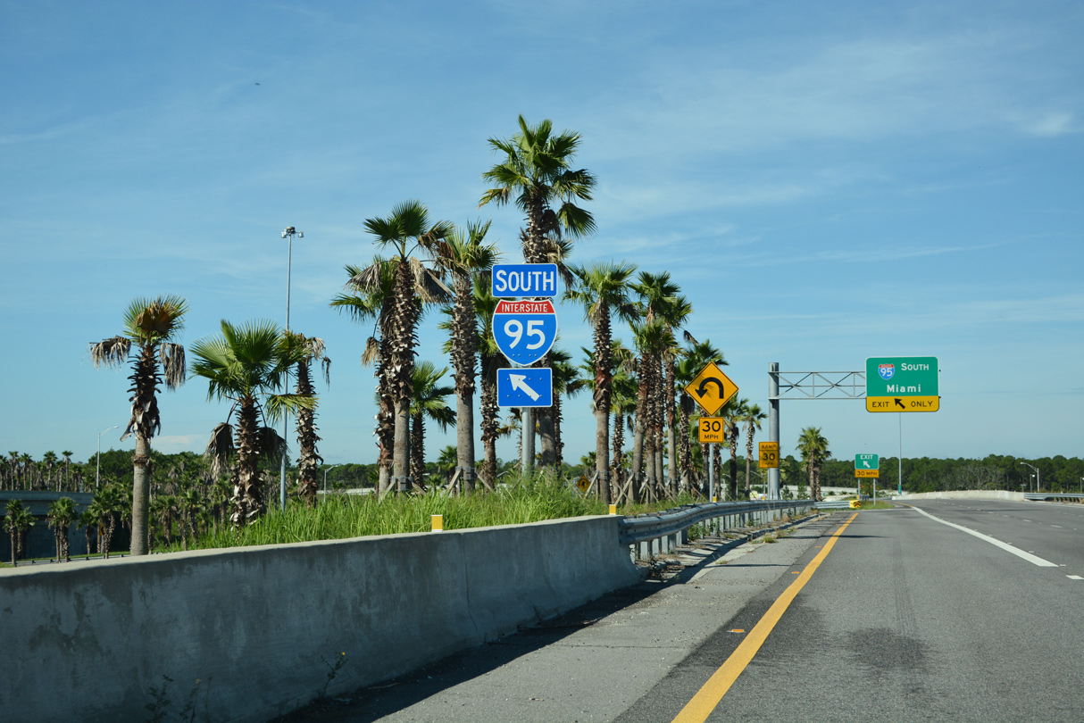
A two lane ramp joins Interstate 95 south from Daytona Beach ahead of the reassurance shield posted west of the Tomoka Farms Road (CR 415) overpass.
09/13/22
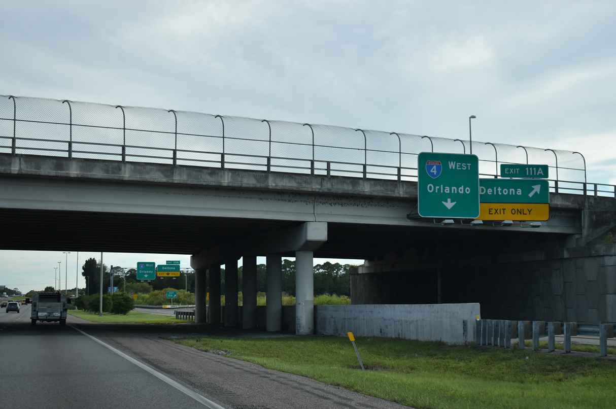
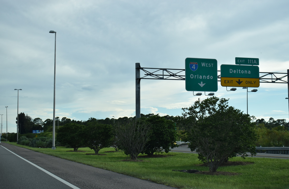
A 12.8 mile exit less ensues south from Interstate 95 to SR 44 at DeLand.
05/24/17
Connector ramps join U.S. 92 west with I-4 west and from I-4 east to U.S. 92 (International Speedway Boulevard) east at respective wye interchanges.
09/13/22
Widening of I-4 to six overall lanes was underway between I-95 and SR 44 / Exit 118 from 2013 to Spring 2017.
09/13/22

Downtown Orlando lies 47 miles to the southwest, followed by Tampa at the west end of Interstate 4 in 127 miles.
09/13/22
Interstate 4 passes by tracts of Tiger Bay State Forest southwest to Deep Creek Swamp.
09/13/22
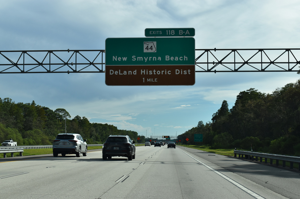
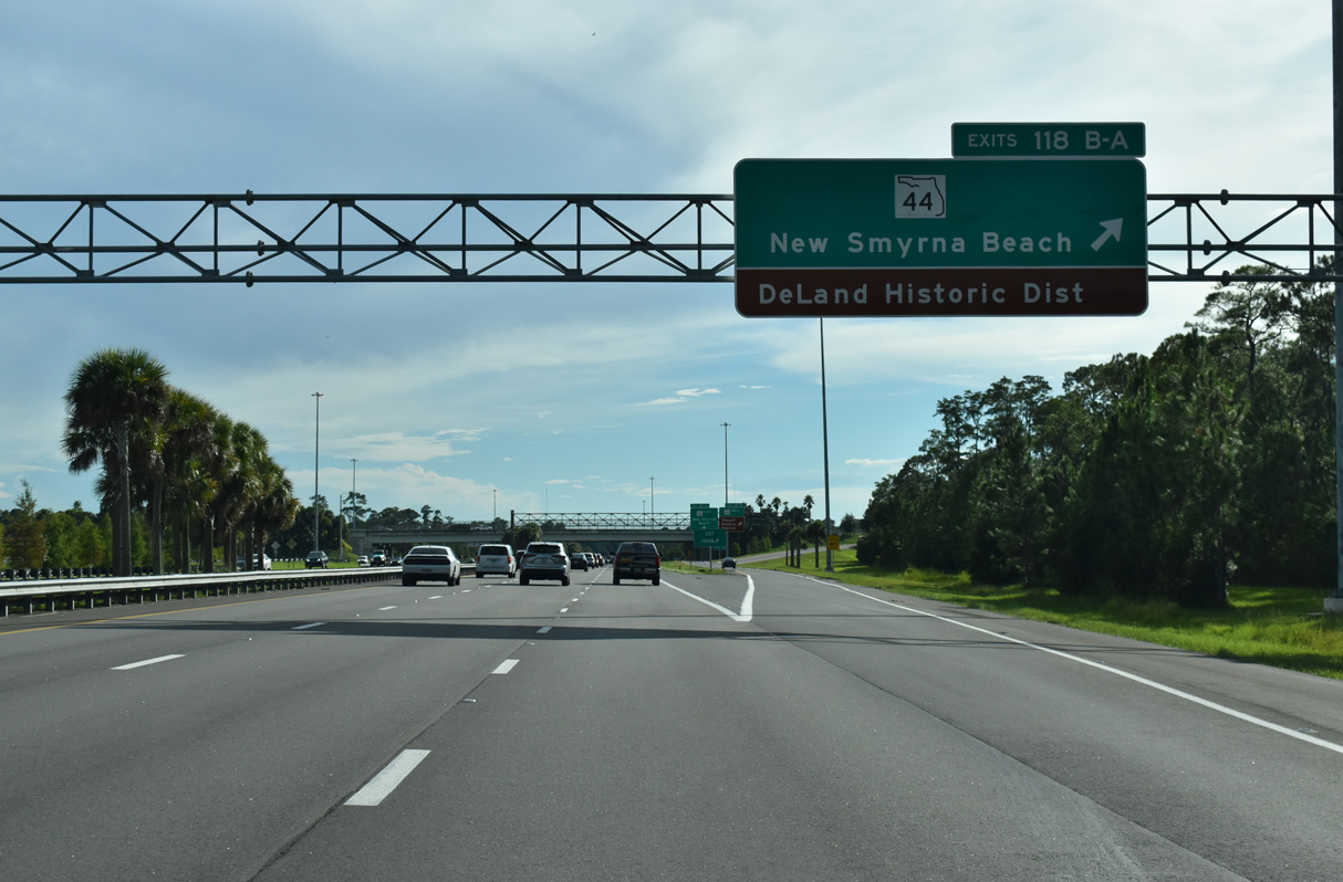
State Road 44 travels west from New Smyrna Beach through central Volusia County to a six-ramp parclo interchange (Exits 118 B/A) with Interstate 4 along the DeLand city line. The forthcoming exchange was expanded with two new ramps in 2006.
09/13/22
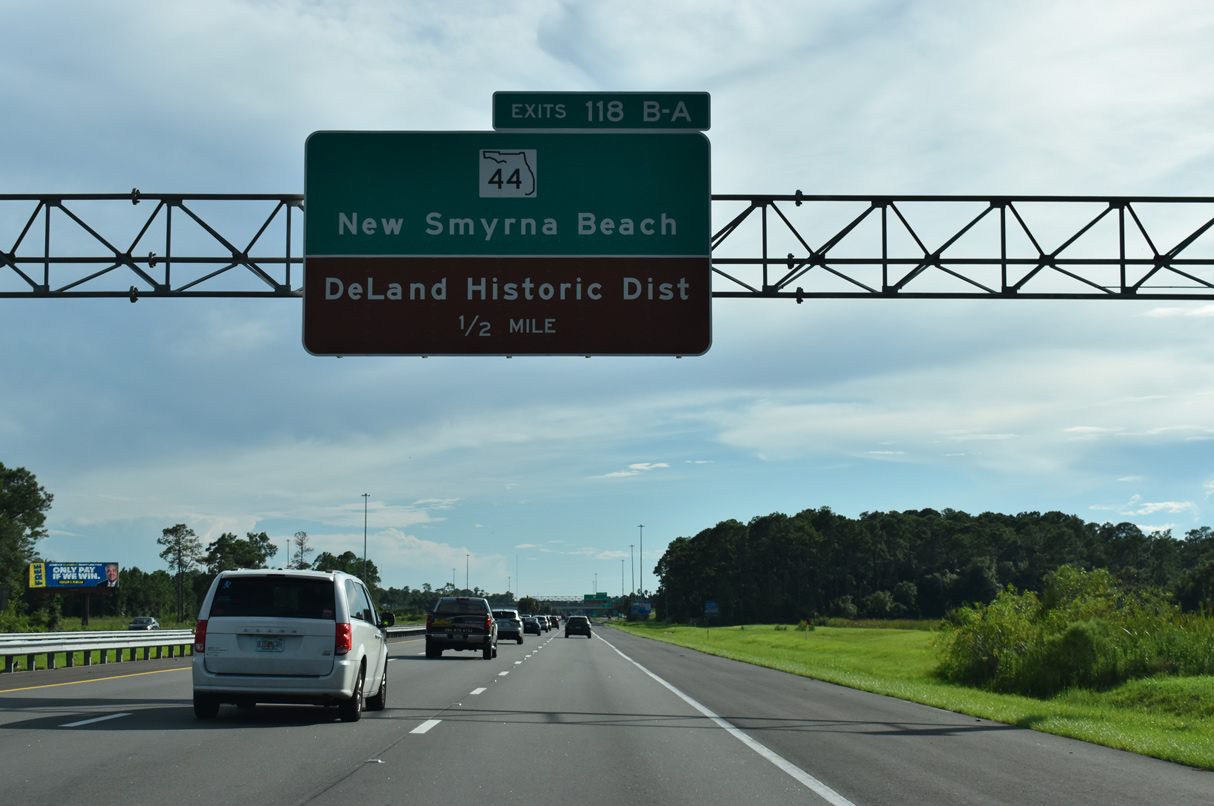
SR 44 (New York Avenue) continues west from Exit 118 B to the DeLand Historic District south of Stetson University. The Volusia County Fairgrounds lie just east of Exit 118 A.
09/13/22
A distributor roadway separates from the I-4 mainline to Exits 118 B/A with SR 44. SR 44 exists in three portions, with the central section running 52.20 miles from SR A1A in New Smyrna Beach to U.S. 441 in Mount Dora.
09/13/22
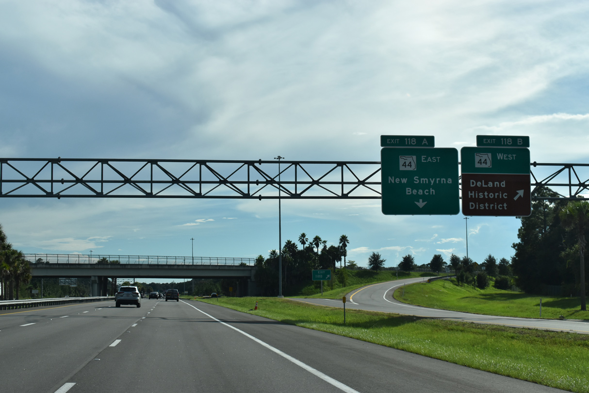
West from Exit 118 B, SR 44 (New York Avenue) arcs around Lake Winnemissett en route to U.S. 17/92 in Downtown DeLand. New Smyrna Beach is 19 miles to the east.
09/13/22
Interstate 4 continues southwest into the city of Lake Helen. Lake Helen was developed by Henry DeLand and named after his daughter Helen in 1883. The community began with a sawmill and hotel at the small Lake Helen and spread out from there.2
09/13/22
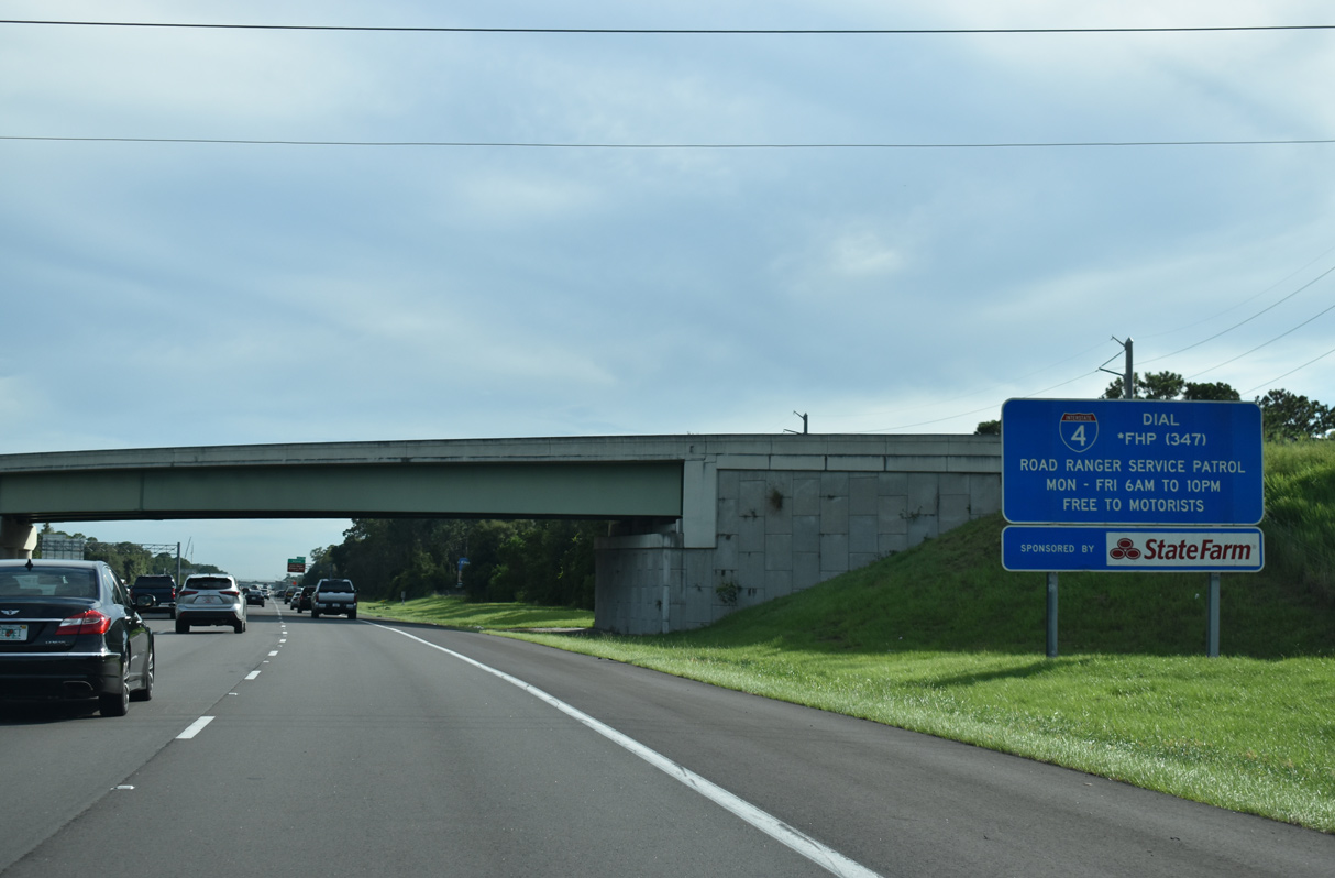
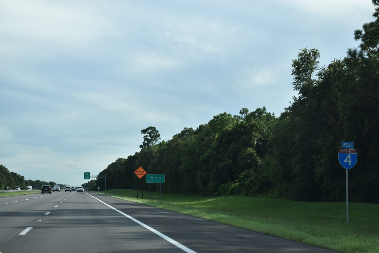
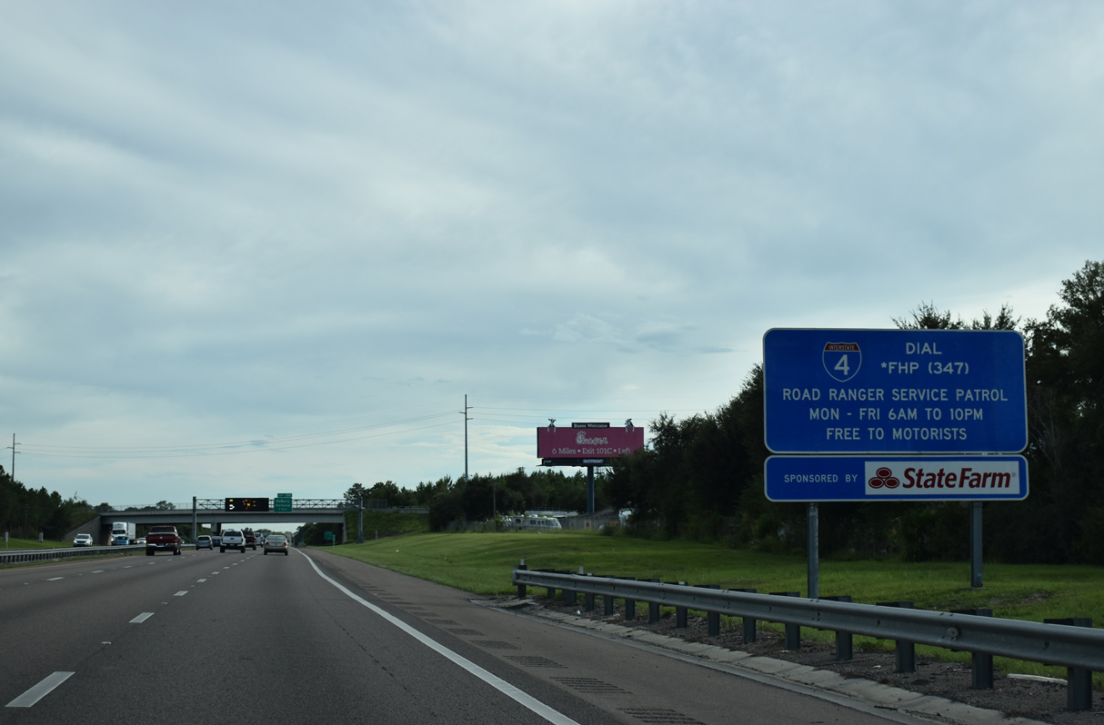
Road Ranger Services are available weekdays to motorists along Interstate 4 south from Volusia to Osceola County and the greater Orlando area.
09/13/22
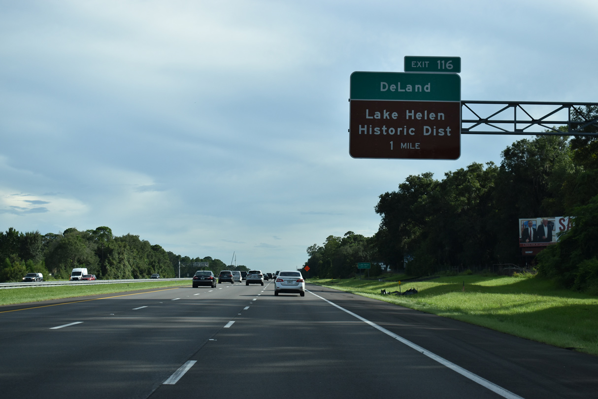
Meeting Interstate 4 at Exit 116 is CR 4116 (Orange Camp Road) and W Main Street from Lake Helen. Downtown Lake Helen and its lake lie one mile east of the parclo B2 interchange.
09/13/22
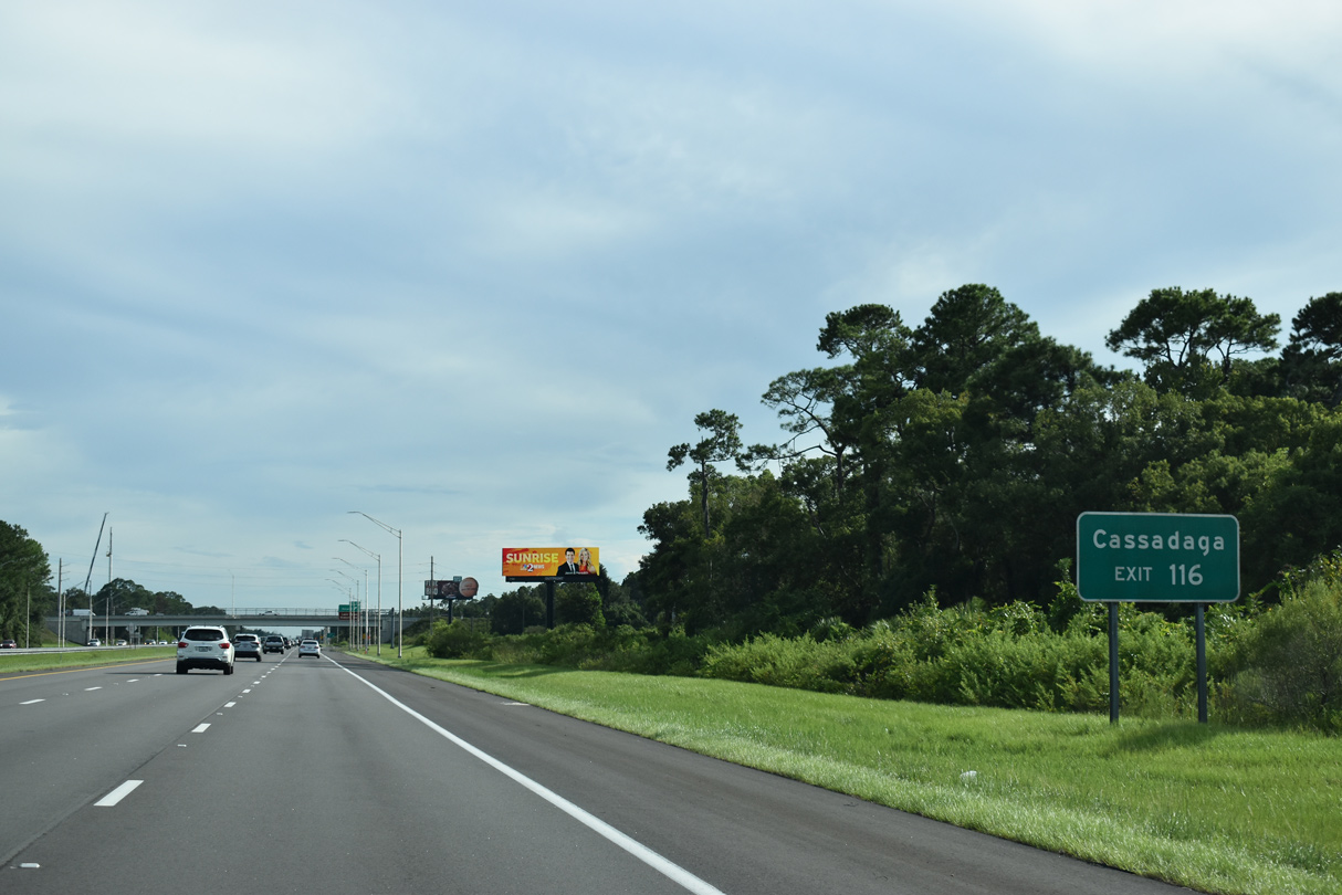
CR 4116 (Main Street) east concludes at CR 4139 (Lakeview Drive). CR 4139 dog legs west along Ohio Avenue to Macy Avenue south to Marion Street in the unincorporated community of Cassadaga.
09/13/22
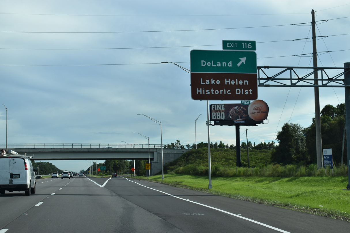
Exit 116 departs Interstate 4 west for CR 4116 (Orange Camp Road) west and W Main Street east. Orange Camp Road extends west three miles from I-4 to U.S. 17/92 (Woodland Boulevard South) at McGregor Road in DeLand.
09/13/22
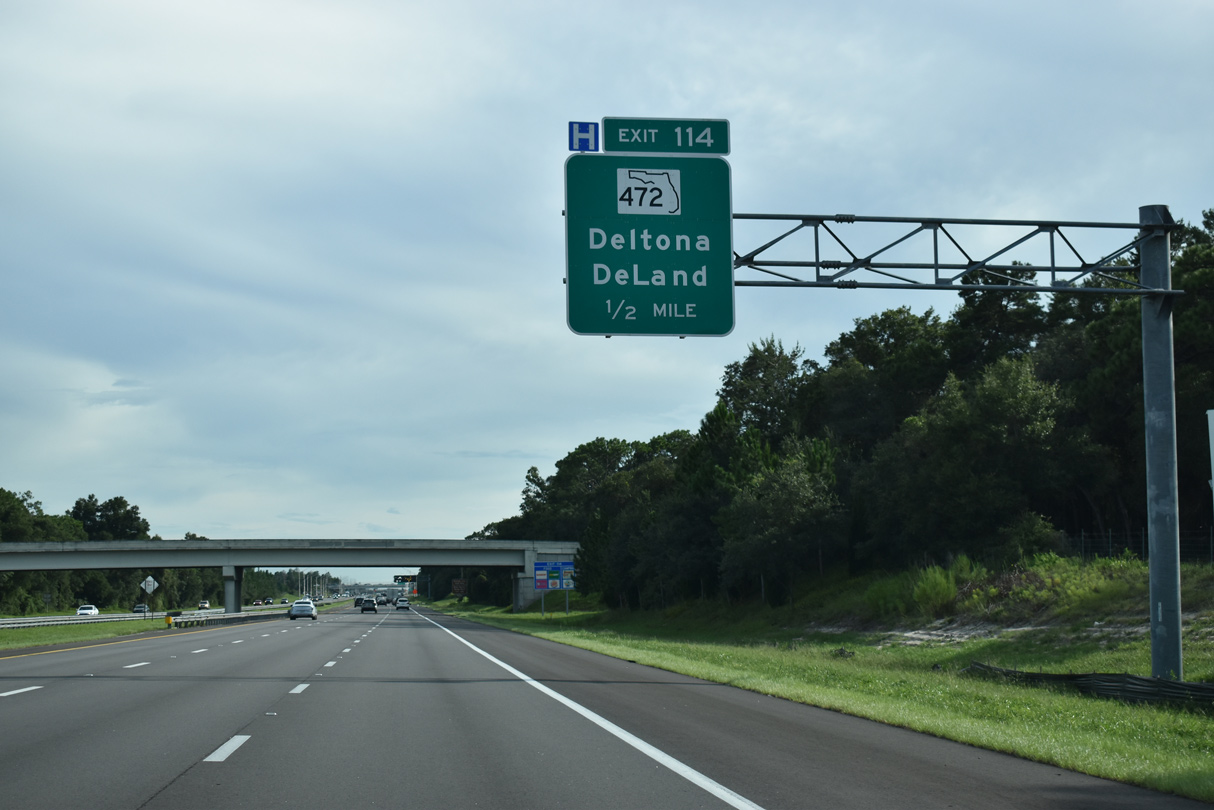
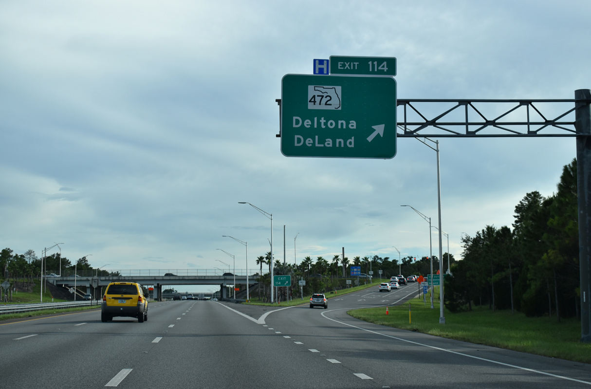
The city limits of DeLand, Deltona and Orange City come together at the upcoming crossroads of Interstate 4 and State Road 472.
09/13/22
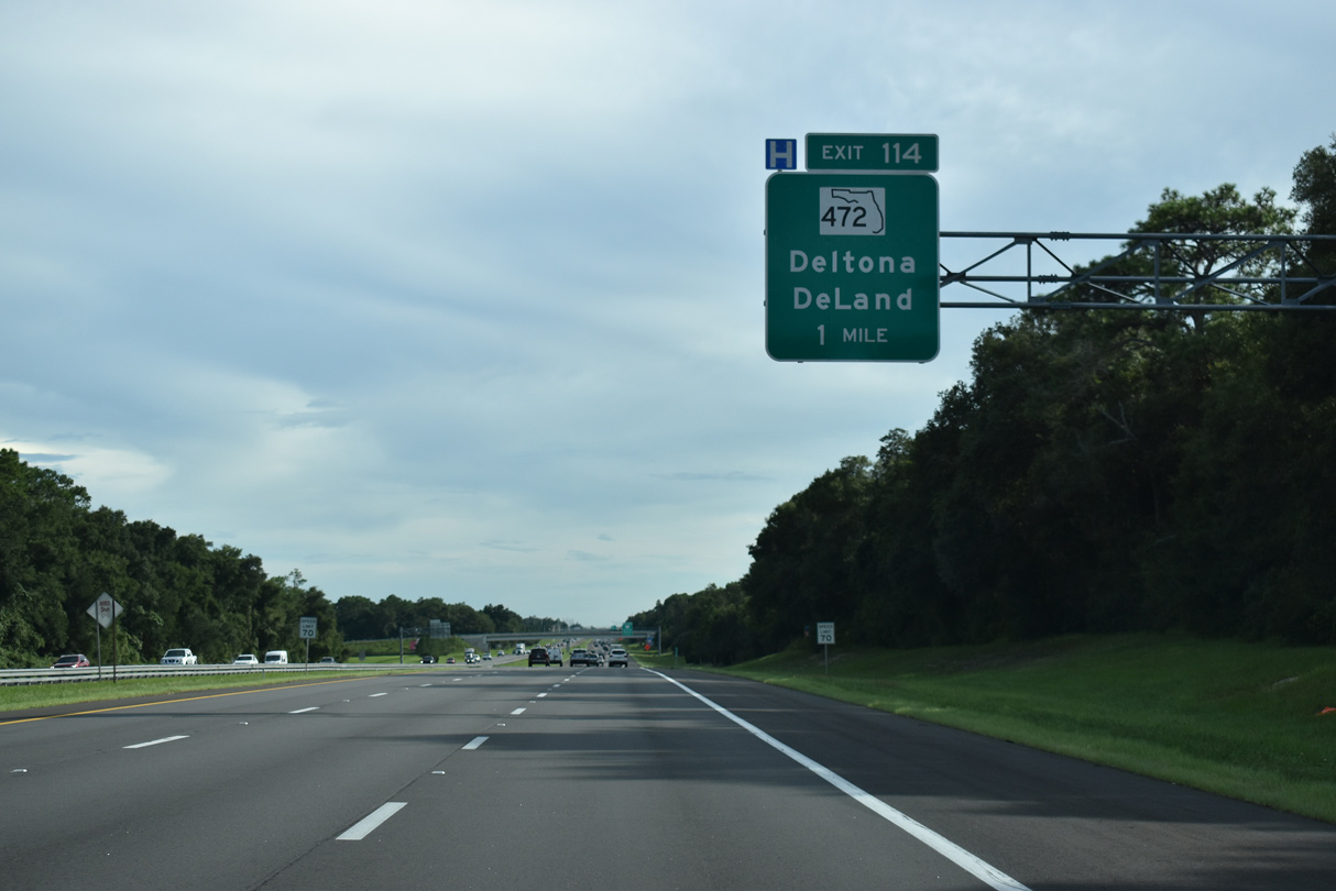
A parclo interchange joins Interstate 4 with SR 472 (Howland Boulevard) at Exit 114. SR 472 angles 3.41 miles northwest to U.S. 17/92 (Woodland Boulevard) between DeLand and Orange City.
09/13/22
CR 4145 (Graves Avenue) branches 2.74 miles west from SR 472 (Howland Boulevard) just south of Exit 114 to U.S. 17/92 in Orange City. Blue Springs State Park lies further west along CR 4142 (French Avenue W). With the waters of Blue Springs remaining constant at 72 degrees Fahrenheit all year round, the warmth provides a haven for manatee during the winter months.
09/13/22
Road construction during 2006 expanded the previous trumpet interchange at SR 472 with an extension of Howland Boulevard to the east. Howland Boulevard (CR 4145) arcs 8.64 miles southeast through Deltona to SR 415.
09/13/22
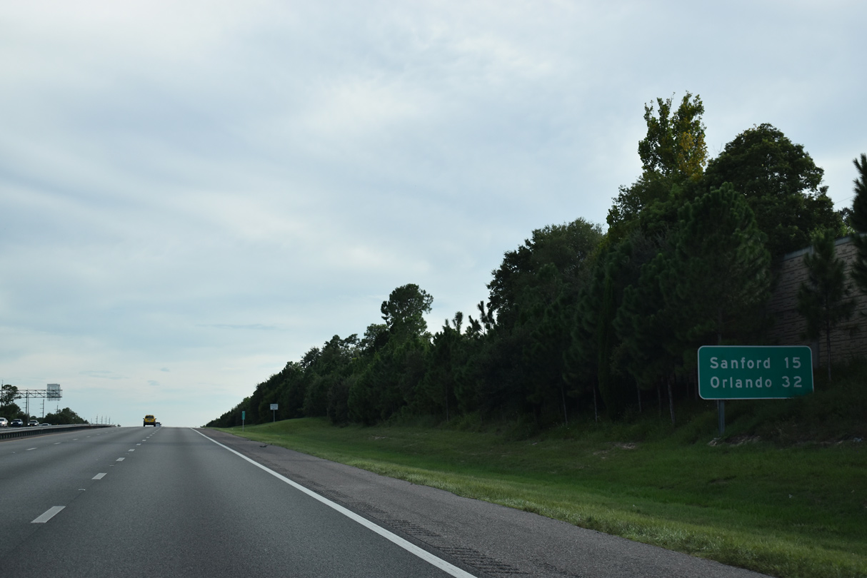
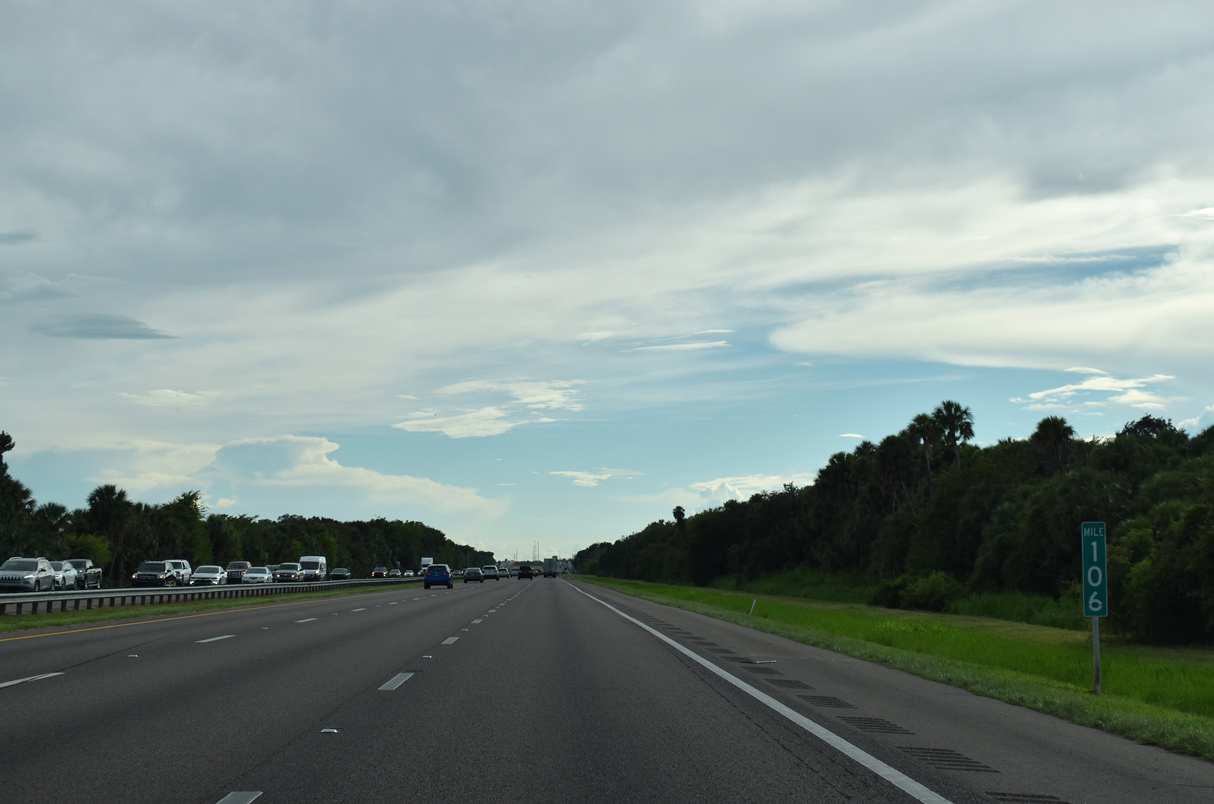
Expansion of Interstate 4 to six lanes in the early 2000s included the installation of sound barriers by Orange City. Sanford, seat of Seminole County, debuts at 15 miles out on this distance sign while Orlando remains a half hour away.
09/13/22
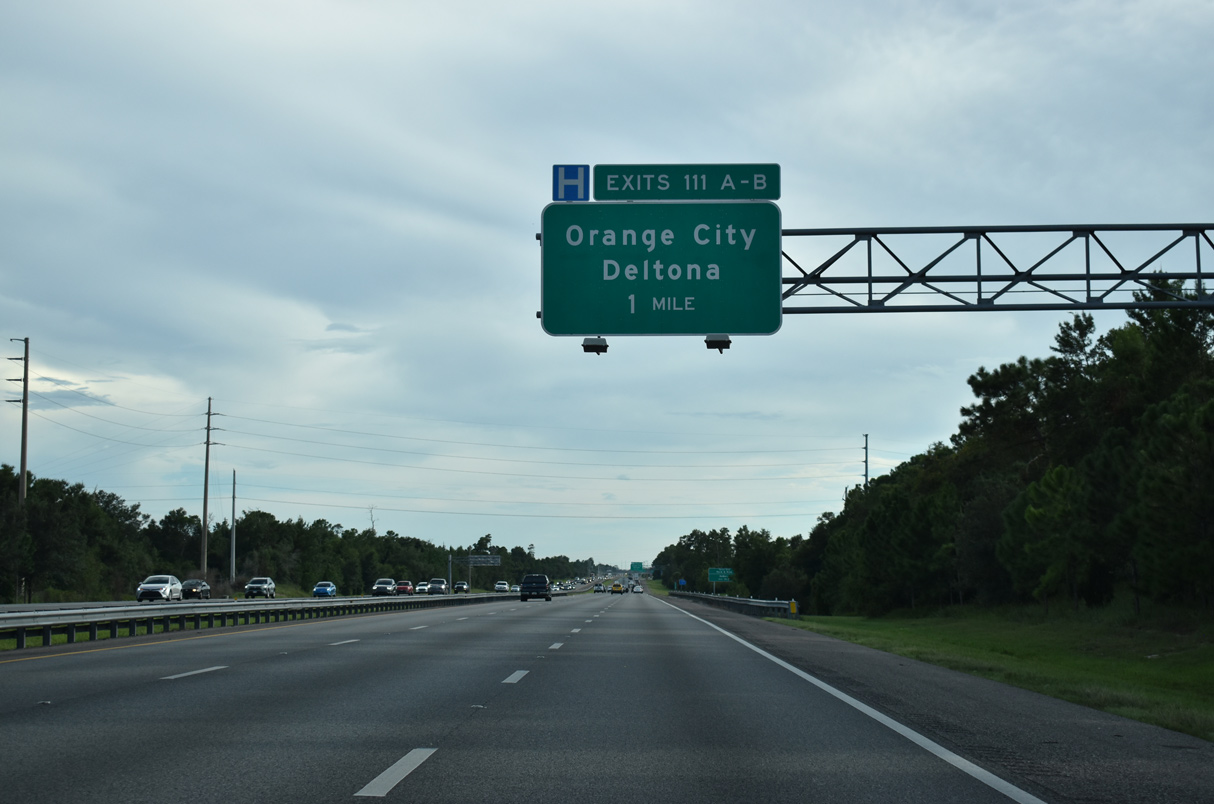
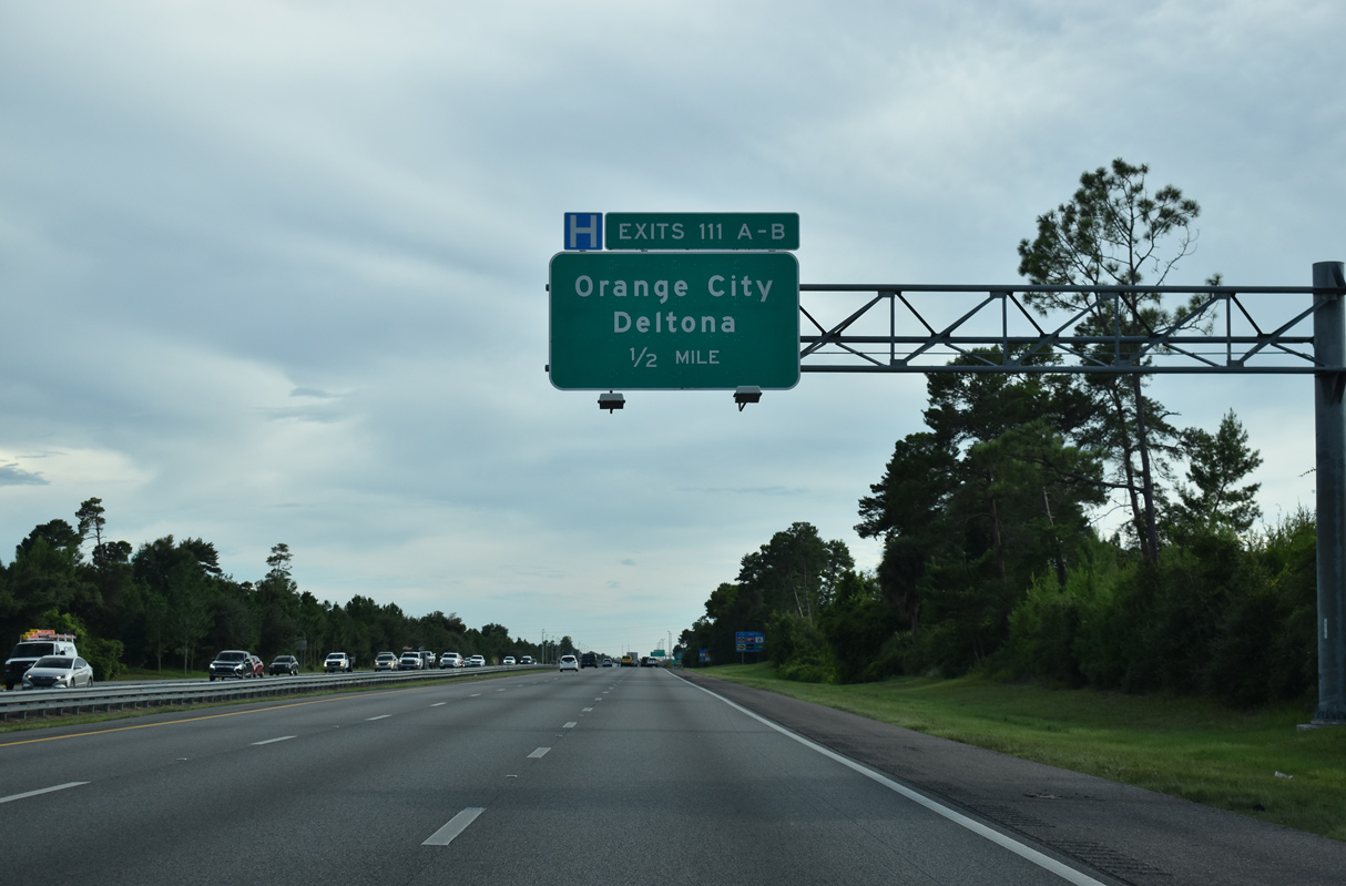
The succeeding exit from Interstate 4 westbound is the three quarter cloverleaf interchange with Saxon Boulevard (CR 4146).
09/13/22
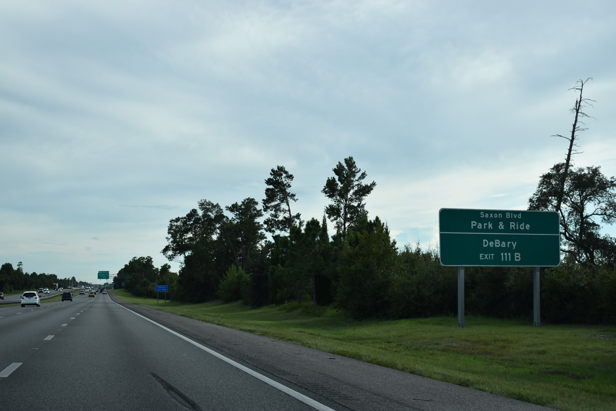
CR 4146 (Saxon Boulevard) west from Exit 111 B into Orange City serves northern reaches of DeBary via U.S. 17/92 (Charles Beall Boulevard) south.
09/13/22
Saxon Boulevard forms a 6.18 mile long arterial loop southeast from Enterprise Road (CR 4158) in Orange City to Doyle Road (CR 4162) in Deltona.
09/13/22
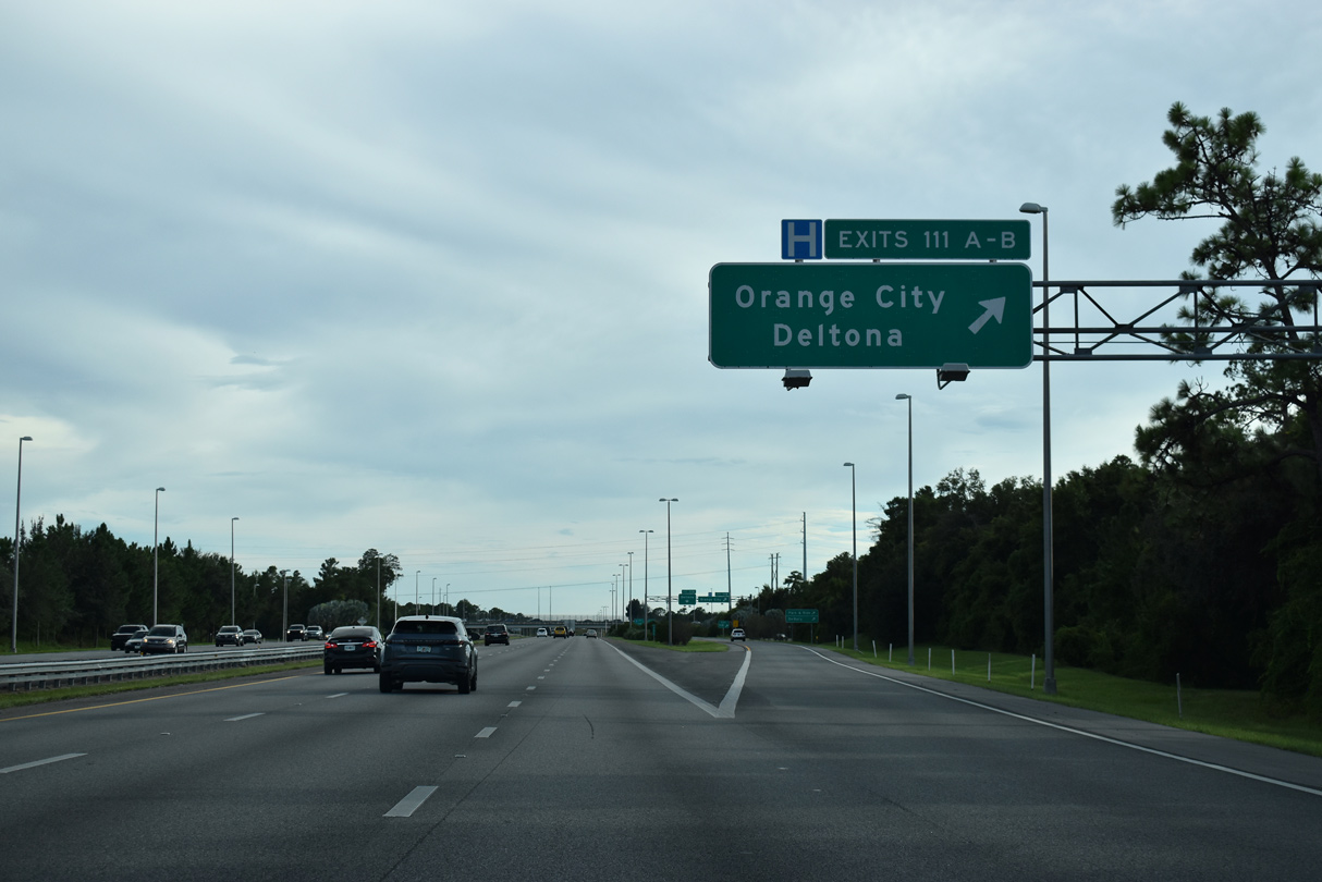
A collector distributor roadway separates from Interstate 4 westbound at Exit 111 for Saxon Boulevard (CR 4146).
09/13/22
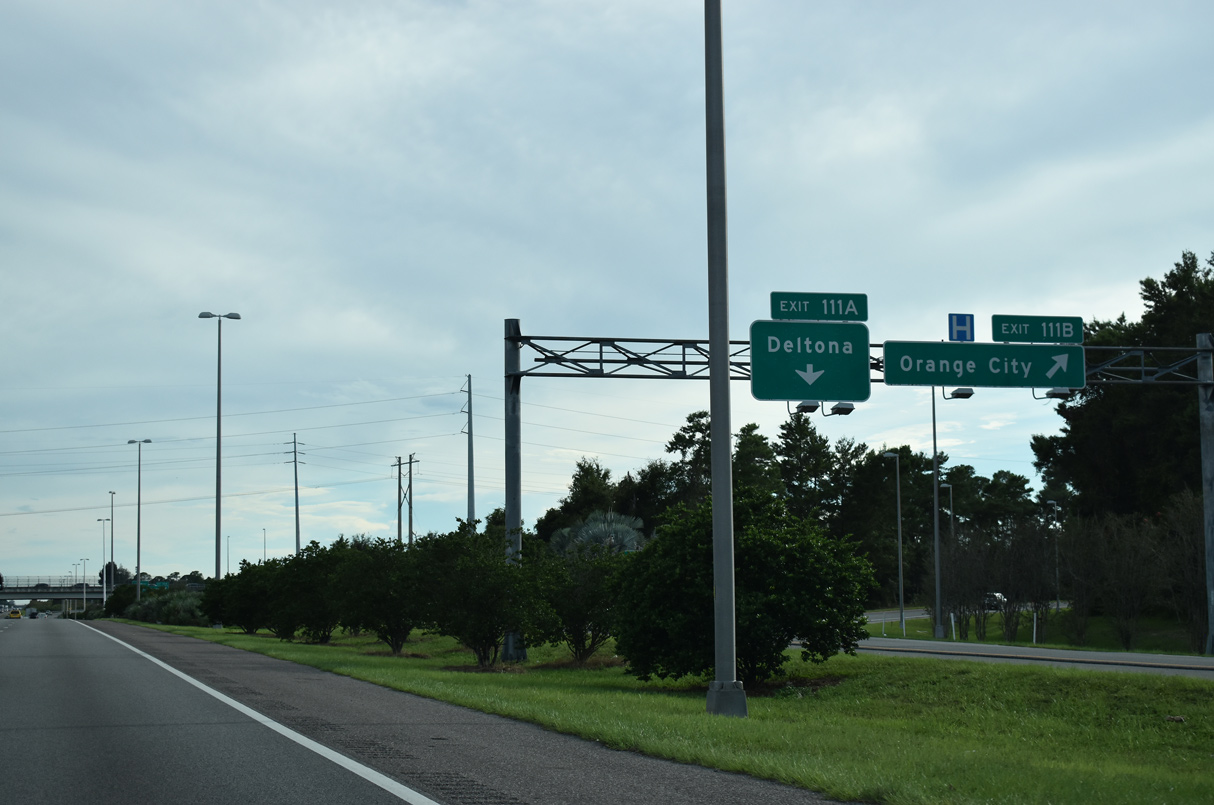
Exit 111 B departs for CR 4146 (Saxon Boulevard) west 1.75 miles to U.S. 17/92 (Charles Richard Beall Boulevard).
09/13/22
Exit 111 A loops onto Saxon Boulevard (CR 4146) east into central Deltona.
09/13/22
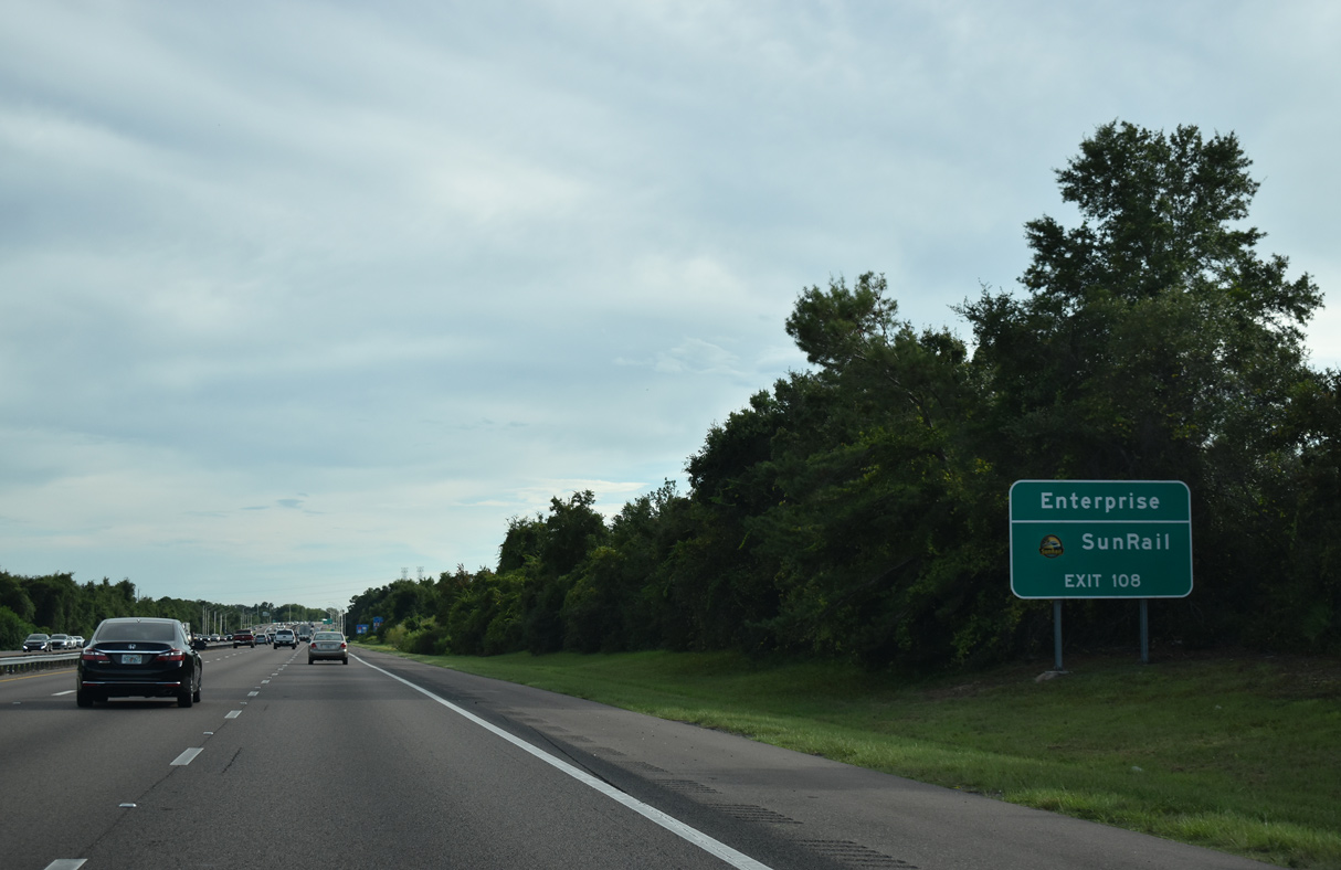
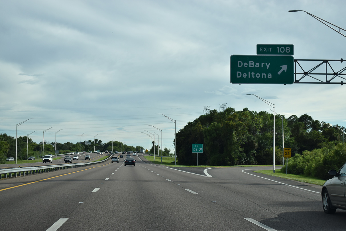
Interstate 4 runs along the DeBary and Deltona city line southward to Exit 108 near Lake Monroe and Enterprise.
09/13/22

Enterprise Road (CR 4156) passes over Interstate 4 one mile north of the folded diamond interchange (Exit 108) with CR 4162 (DeBary Avenue / Dirksen Drive).
09/13/22
Enterprise Road angles southeast to the DeBary Avenue bypass (CR 4162) just northwest of Enterprise. The DeBary Sunrail station lines the west side of U.S. 17/92 south of Dirksen Drive.
09/13/22
CR 4162 (Dirksen Drive) weaves west through DeBary to Gemini Springs Park and U.S. 17/92. CR 4162 east takes DeBary Avenue to the Debary Avenue bypass around Enterprise, Doyle Road and ultimately SR 415. The Debary Avenue bypass was completed on July 31, 2010 at a cost of $12.1 million. Road work commenced in April 2008 on the two mile realignment.8
09/13/22
Interstate 4 curves southwest by Lake Monroe. Part of the St. Johns River system originating in Indian River County, the lake spreads to the east. This confirming marker was removed after 2018.
05/24/17
Interstate 4 traverses wetlands along the western shore of Lake Monroe between Exit 109 and the St. Johns River.
09/13/22
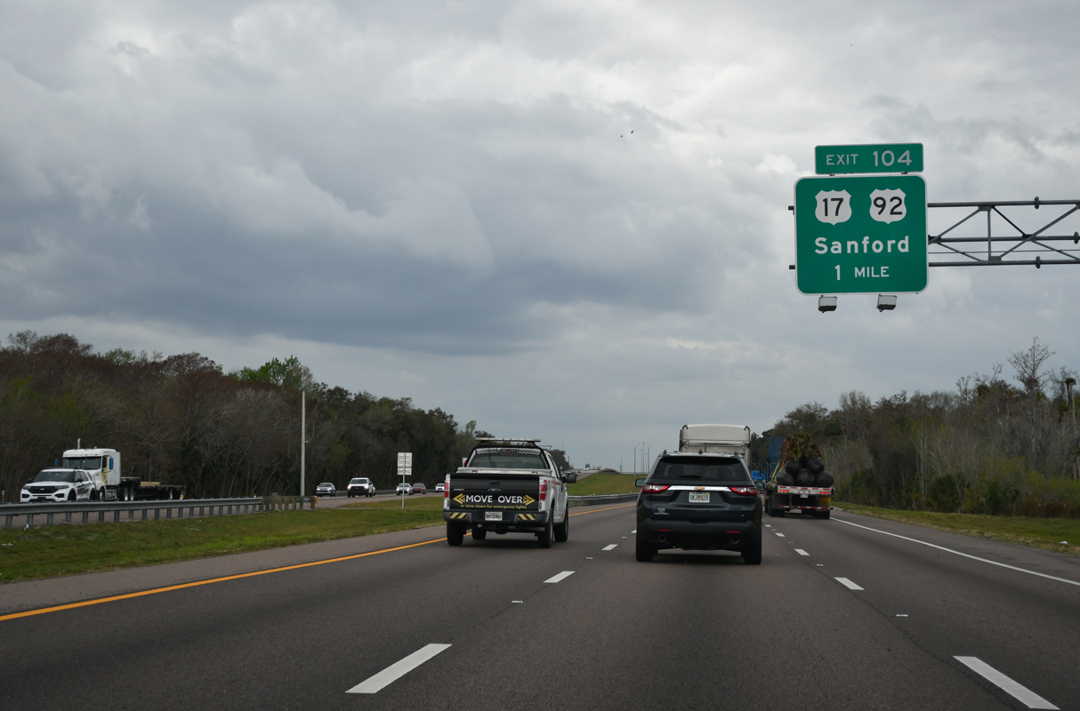
Spanning the St. Johns River, U.S. 17/92 turn southeast from DeBary to meet Interstate 4 at a folded diamond interchange (Exit 104) and the community of Lake Monroe.
02/12/24
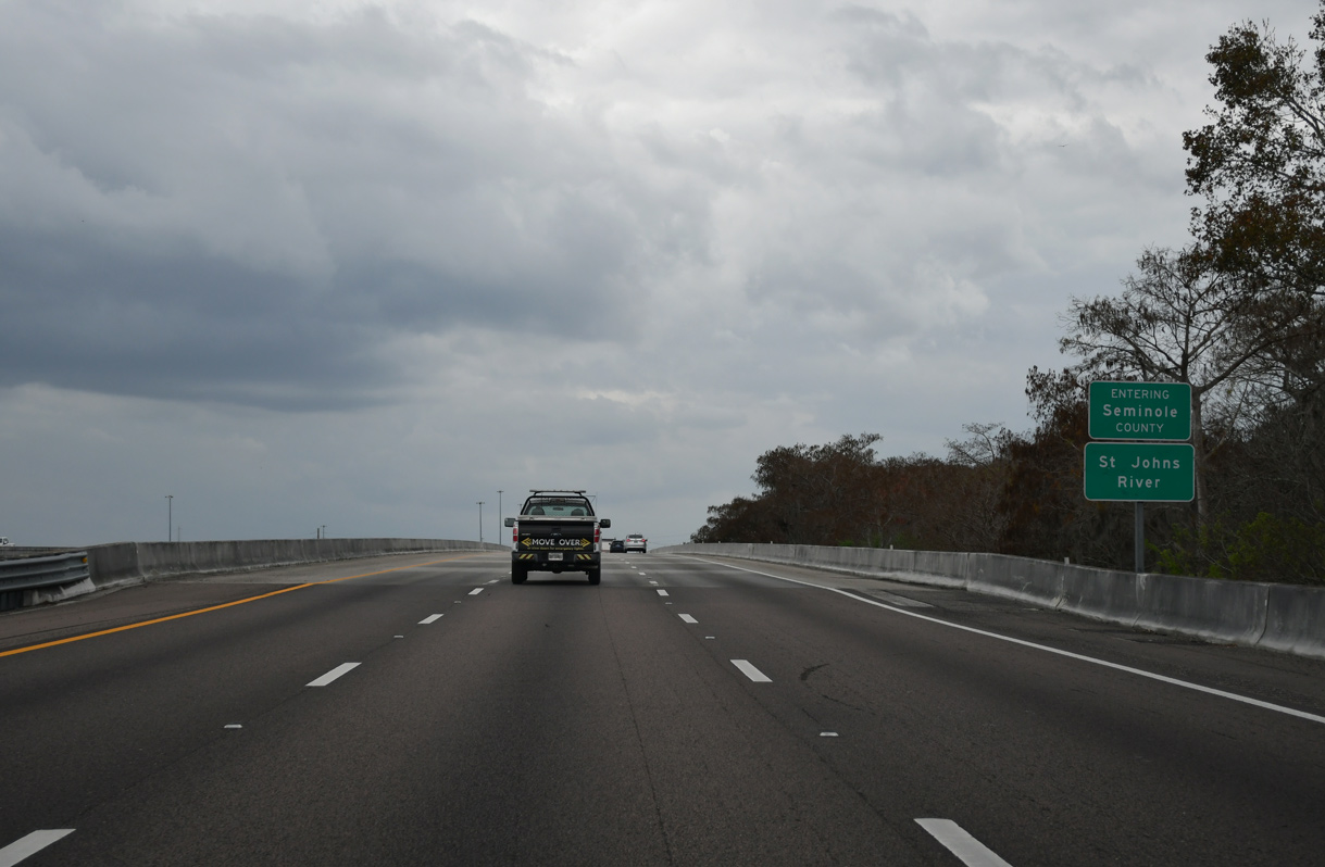
The St. Johns River Veterans Memorial Bridges, a pair of three lane spans, take I-4 across both the St. Johns River and Seminole County line. The St. Johns River flows northward to Jacksonville and the Atlantic Ocean. It is the longest northward flowing river in the United States.
02/12/24

References:
- I-95 Widening and Systems Interchange Reconstruction Design-Build from North of S.R. 44 to North of U.S. 92 - 242715-2. FDOT District 5, project web site.
- Lake Helen, Florida - Community Information of Lake Helen Florida.
http://www.volusia.com/lakehelen/ - City of DeLand, Florida - Virtual Tour - The History of DeLand
http://www.deland.org/ tour/history_overview.htm, City of DeLand. - City of Orange City, Florida -- Orange City Town History.
http://www.ci.orange-city.fl.us/ index.asp?Type=B_BASIC&SEC=%7B3A964F0C- F92B-43E6-8947-0B107833C839%7D - City of Deltona - General Information - City History.
http://cideltona.zgraph.com/ 2001/generalinfo/history.html - DeBary, Florida. Wikipedia.org.
- History of Enterprise
http://www.oldenterprise.org/ History.htm, Oldenterprise.org. - "Bypass blazes happy trail - Traffic-weary residents of Enterprise walking on air." Daytona Beach News-Journal (FL), August 1, 2010.
- St. Johns River. Wikipedia.org.
- Alex Nitzman: 09/12/22, 09/13/22
- ABRoads: 05/24/17
- Alex Nitzman, JP Nasiatka: 02/12/24
Photo Credits:
Connect with:
Page Updated Tuesday February 13, 2024.