
Interstate 5 North - Federal Way to Seattle
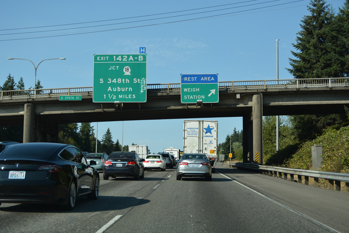
S 375th Street passes over Interstate 5 north at the rest area / weigh station off-ramp. The first of three exits to Federal Way joins I-5 with SR 18, a freeway leading northeast to Auburn, Covington and Hobart.
07/20/23
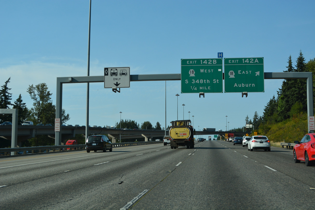
SR 161 (Enchanted Parkway) spans I-5 a half mile south of the systems interchange (Exit 142) with SR 18. SR 18 travels 28.41 miles overall from the intersection of S 348th Street and SR 99 (Pacific Highway) in Federal Way to Interstate 90 at Exit 25.
07/20/23
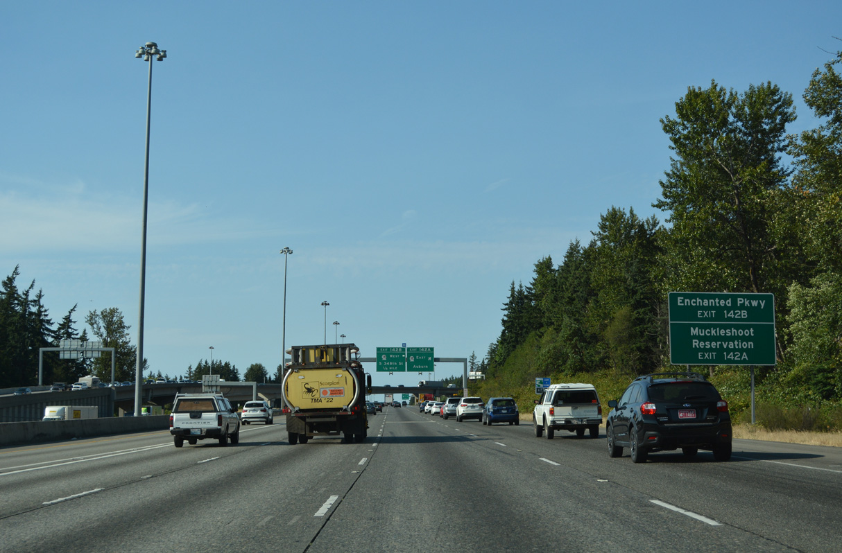
There is no direct access to SR 161 (Enchanted Parkway) from I-5. Instead motorists are directed onto SR 18 (S 348th Street) west to make the connection. SR 161 is a 36.25 mile long route that begins at SR 18 and leads south to Six Flags Wild Waves Theme & Water Park, Milton, Edgeway and Puyallup.
07/20/23
SR 18 is a freeway for all but seven miles of the route east of Hobart to I-90. Costing $655 million, the SR 18, Issaquah Hobart Rd to Deep Creek Vicinity – Widening & Fiber project underway from 2018-32 widens a five mile section of SR 18 between Issaquah-Hobart Road and Deep Creek. This is not an upgrade to freeway standards due to a RIRO intersection at Tiger Mountain Summit (WSDOT, 2025).
07/20/23
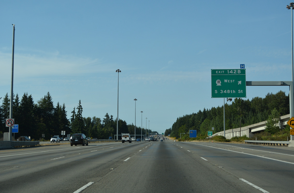
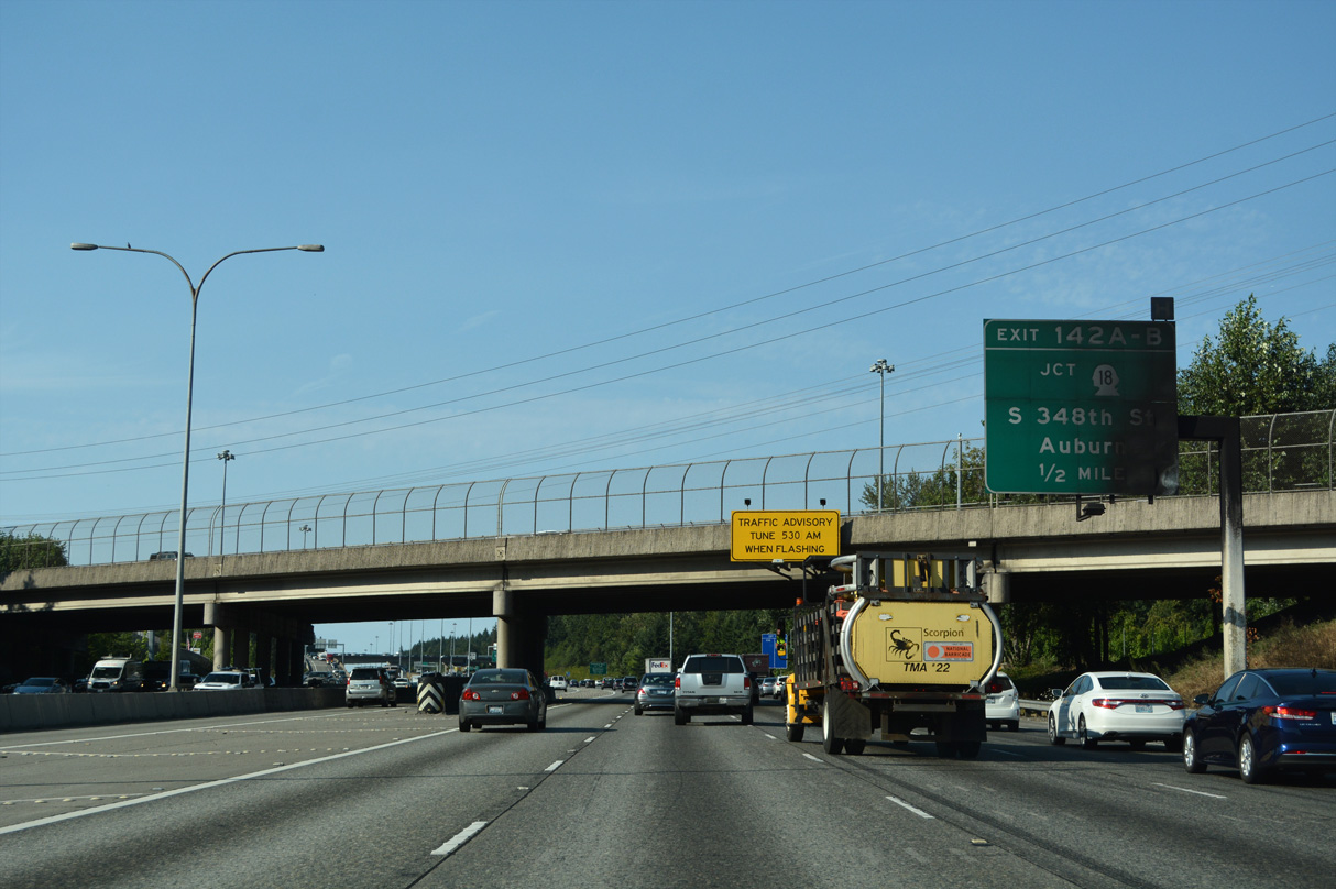
Exit 142 B loops onto SR 18 (S 348th Street) ahead of a heavily commercialized area 0.54 miles west to SR 99 (Pacific Highway). 348th Street continues beyond the state route portion to West Hylebos State Park, St. Francis Hospital, and Campus Drive.
07/20/23
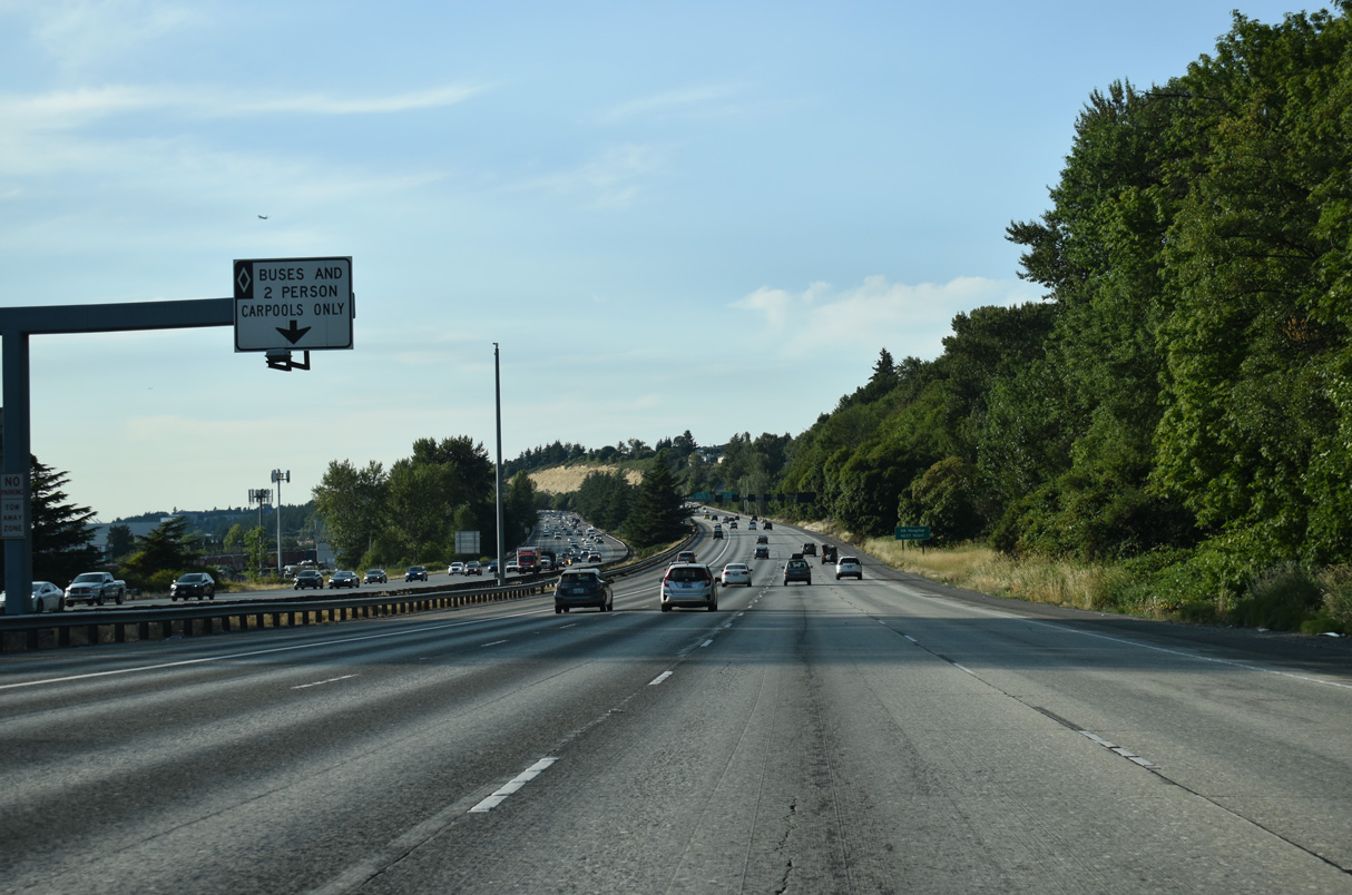
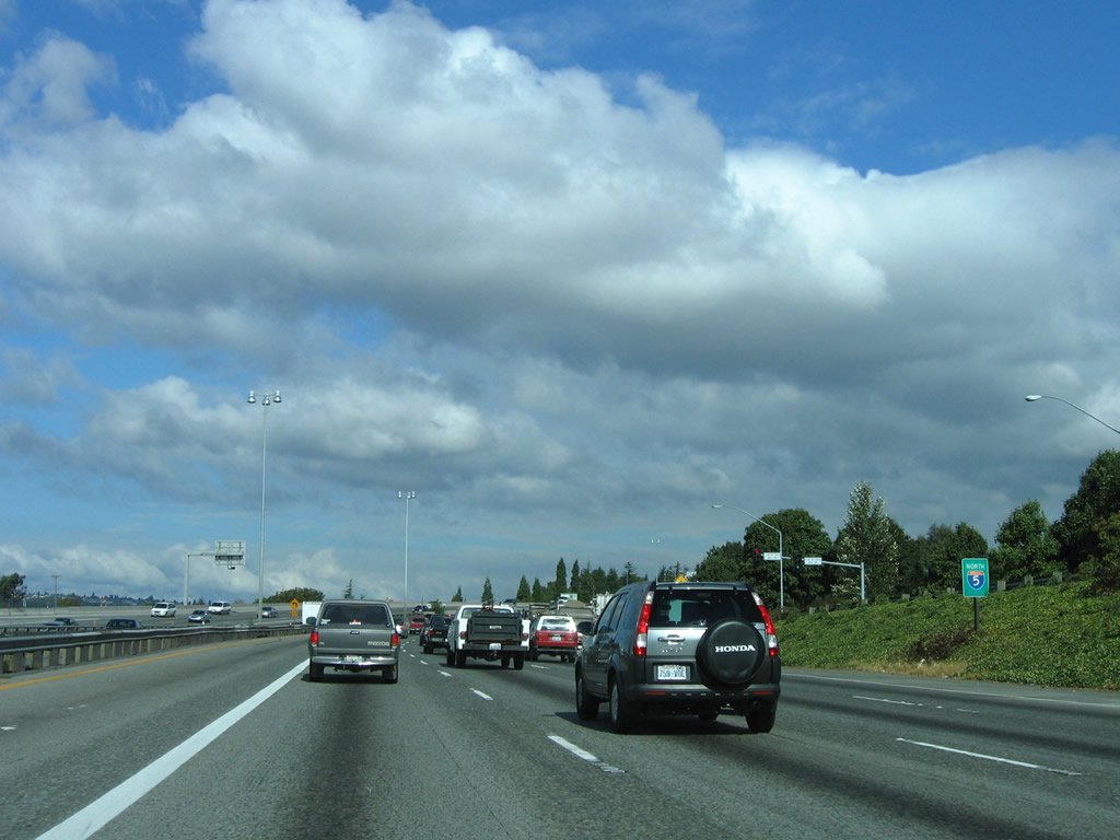
Including an HOV lane in each direction, Interstate 5 is ten lanes wide overall.
07/20/23
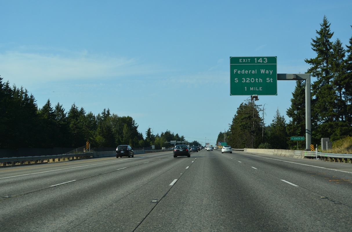
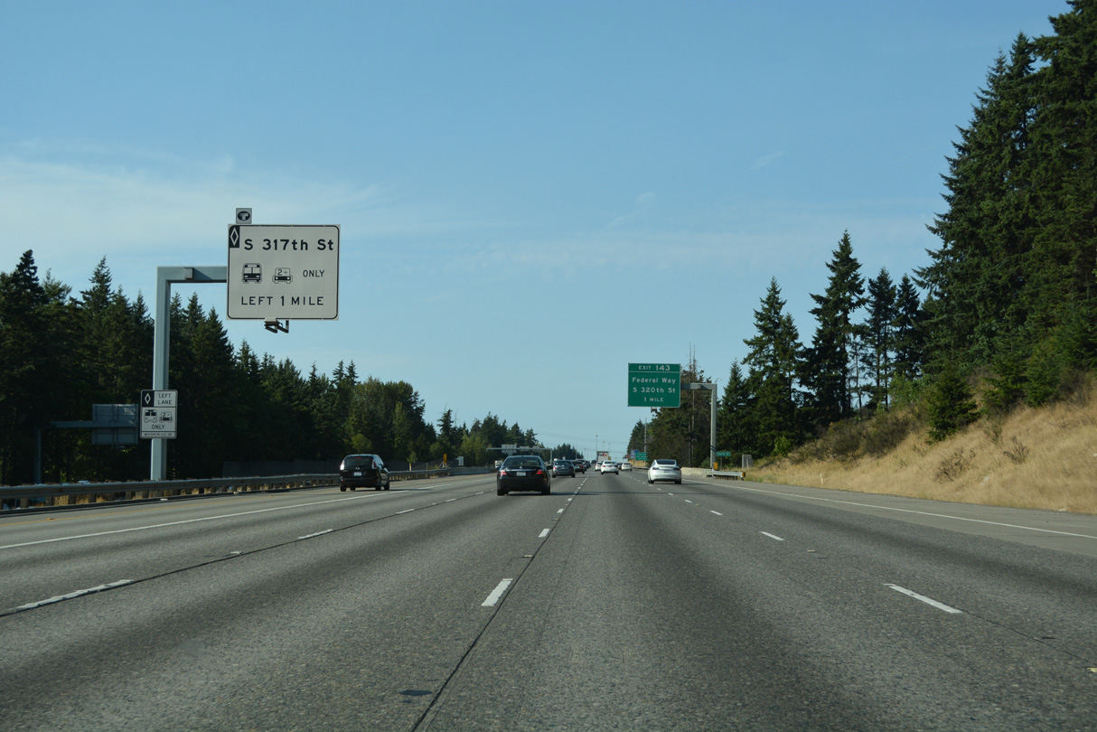
The second Federal Way exit joins Interstate 5 with S 320th Street near the city center and The Commons at Federal Way (formerly the Seatac Mall).
07/20/23
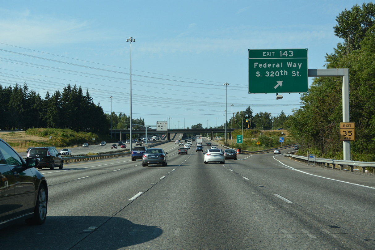
East from the parclo interchange (Exit 143) with I-5 and the Federal Way city line, S 320th Street becomes Peasley Canyon Road toward Auburn. S 320th Street extends west to 47th Avenue SW by Dash Point State Park.
07/20/23
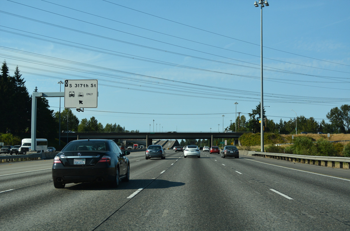
The HOV-2 lane also has an exit ramp for the Federal Way city center. Departing to the left, the ramp connects with an access road to a roundabout between S 317th Street and 28th Avenue S.
07/20/23
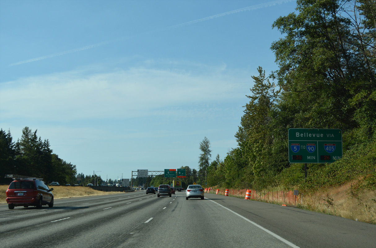
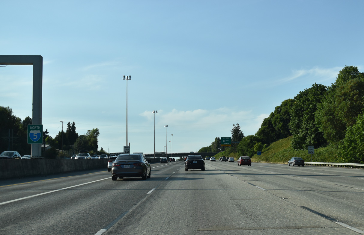
Interstate 5 straddles the Federal Way city line northward to the city of Kent. This distance sign stands at the Military Road under crossing.
07/20/23
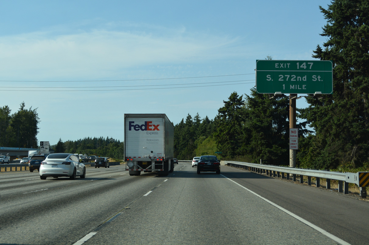
The diamond interchange at Exit 147 joins I-5 with S 272nd Street one mile north of the S 288th Street underpass. Suburban development lines both sides of the freeway to the Kent city line.
07/20/23
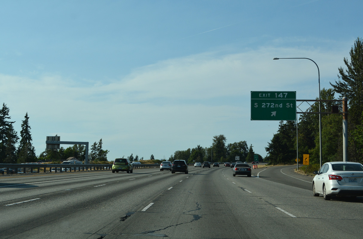
S 272nd Street runs along the Kent and Federal Way city line west to SR 99 (Pacific Highway) at Woodmont Beach, south of Saltwater State Park. Eastward, the four lane boulevard continues to Star Lake and S 277th Street to SR 167 near Thomas.
07/20/23
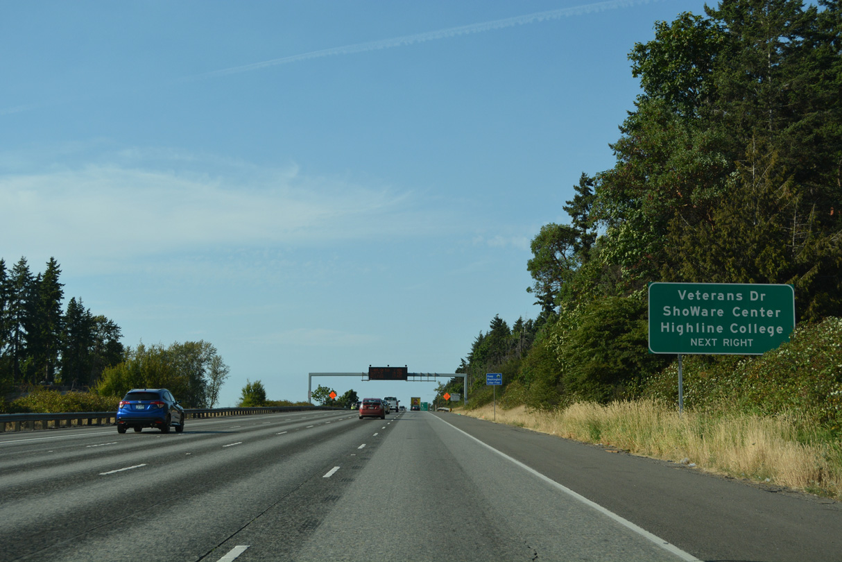
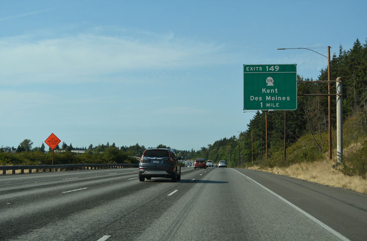
Leading toward the Kent city center, SR 516 (Kent Des Moines Road) constitutes an expressway east from I-5 at Exit 149 to SR 167.
09/27/25
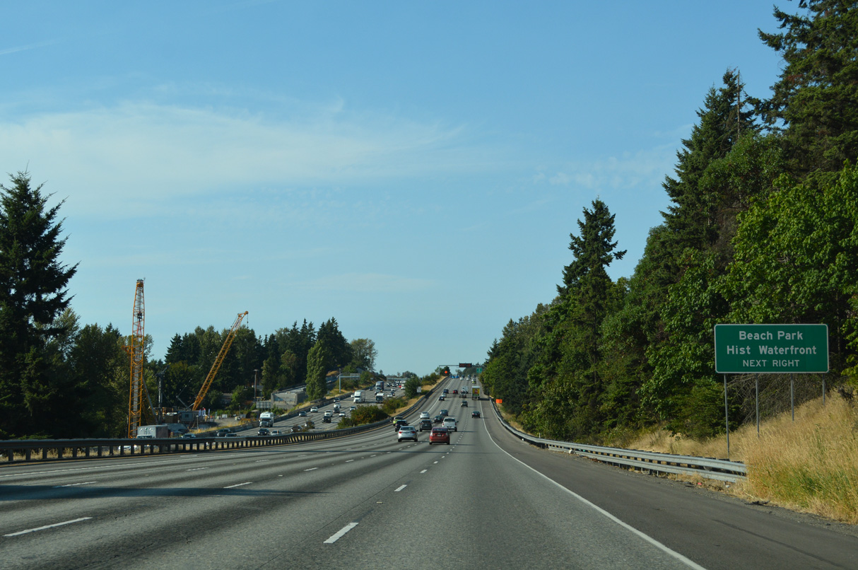
Construction of the Federal Way Link Extension lengthened the SoundTransit Link 1 Line 7.8 miles south to new stations at Kent Des Moines, Star Lake and Federal Way Downtown. Passenger service commences on December 6, 2025 (Sound Transit, 2025). The succeeding exit serves the Des Moines Beach Park Historic Waterfront.
09/27/25
The WSDOT I-5/SR 516 Interchange project underway from late 2021 to mid 2025 reconstructed the exchange at Exit 149. Included in the work was an extension of Veterans Drive west across the ramps north of SR 516 (Kent Des Moines Road).
09/27/25
SR 516 meanders west from I-5, 2.02 miles to become SR 509 north at Marine View Drive near Des Moines Beach. Overall the state route travels 16.49 miles east from Des Moines to SR 169 at Maple Valley.
09/27/25
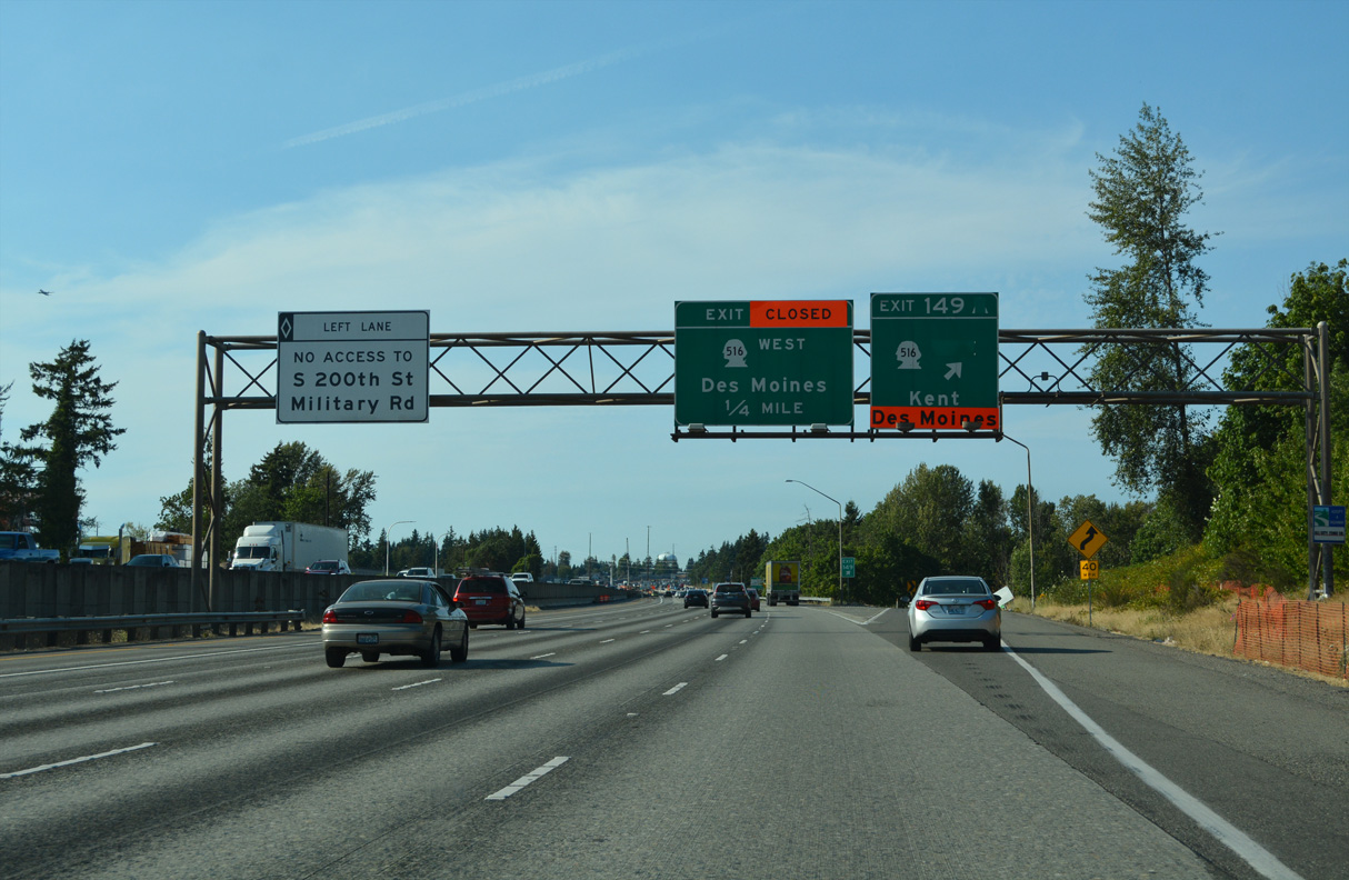
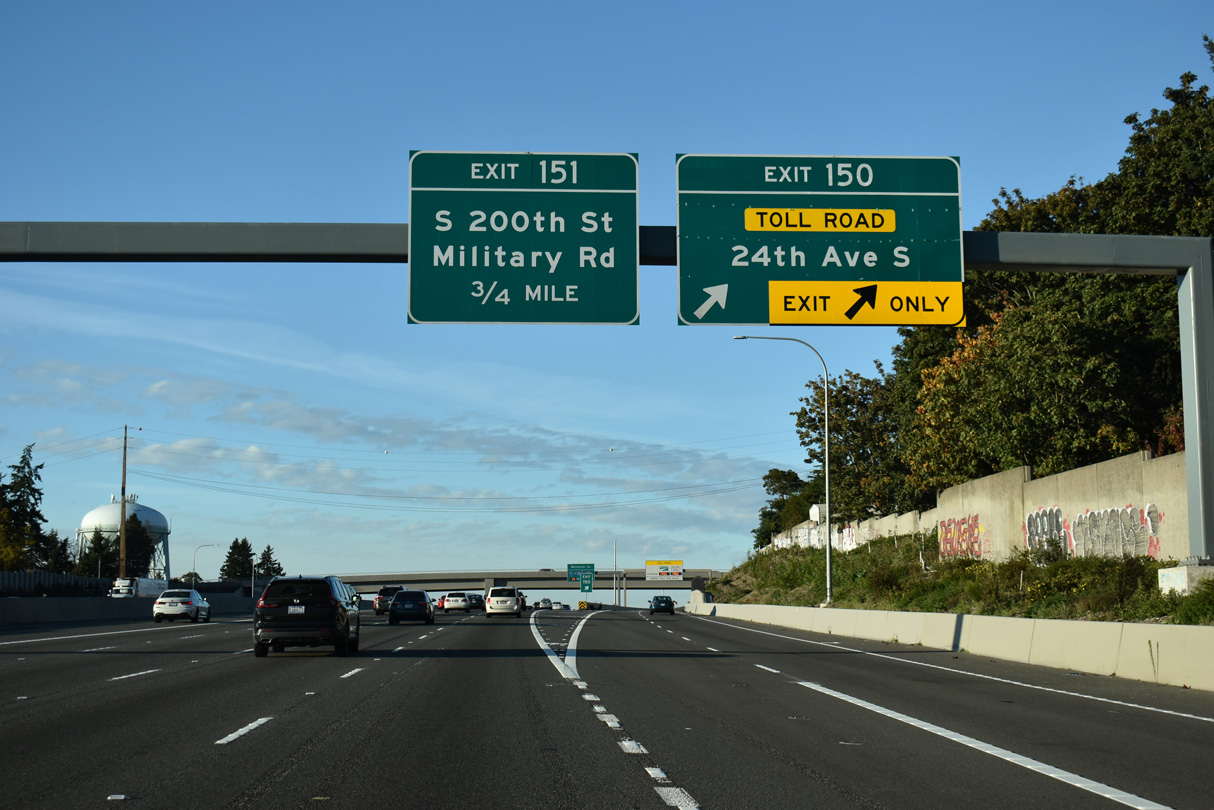
The loop ramp at Exit 149 B was eliminated during 2021-25 construction to accommodate the Veterans Drive extension. I-5 advances 1.25 miles north from the parclo interchange with SR 516 (Kent Des Moines Road) at Kent to the SR 509 toll road.
09/27/25
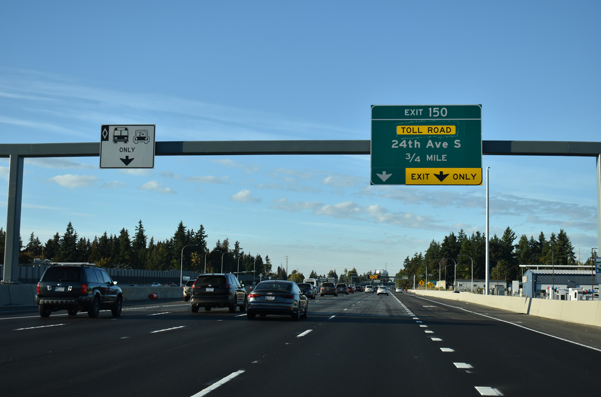
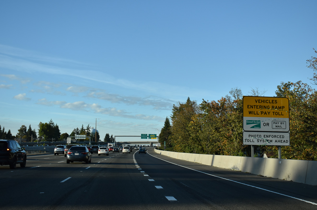
Dubbed the SR 509, I-5 to 24th Avenue South – Expressway Project, Stage 1b of the SR 509 Completion Project built the first mile of the SR 509 expressway from Exit 150 to 24th Avenue S.
09/27/25
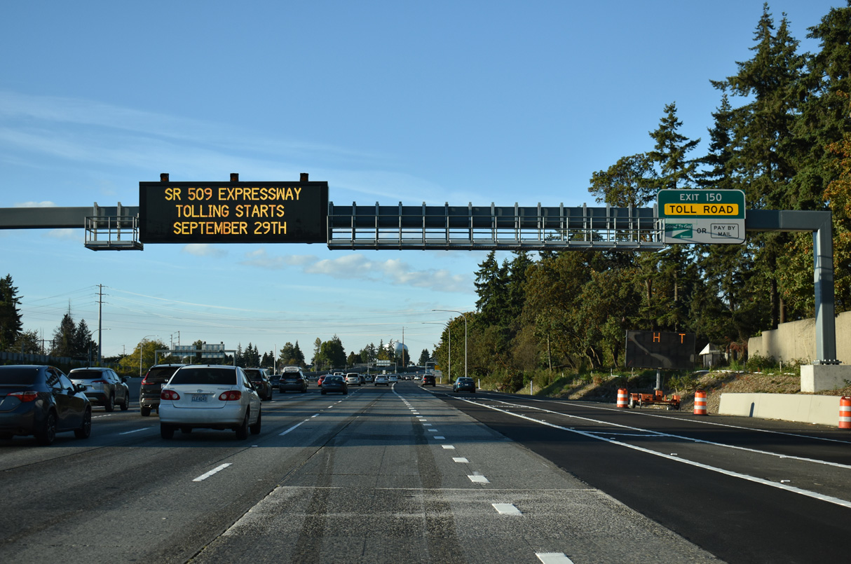
The SR 509 expressway to 24th Avenue S opened to traffic on June 28, 2025. Tolling commenced on September 29, 2025.
09/27/25
Stage 2 of the SR 509 Completion Project completes the final two miles. Work on SR 509 north to S 188th Street commenced in late 2024 and continues into 2029 (WSDOT, 2025).
09/27/25
Meeting the freeway at a parclo A2 interchange (Exit 151) adjacent to S 200th Street, Military Road continues alongside Interstate 5 from Kent to Seatac.
09/27/25
Exit 151 joins I-5 north with adjacent Military Road ahead of S 200th Street at Seatac. S 200th Street leads west to SR 99 and Normandy Park. Military Road continues northeast between Interstate 5 and Angle Lake to McMicken Heights in Seatac.
09/27/25
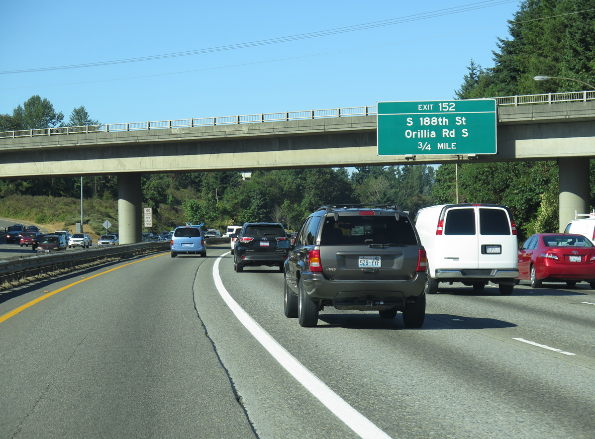
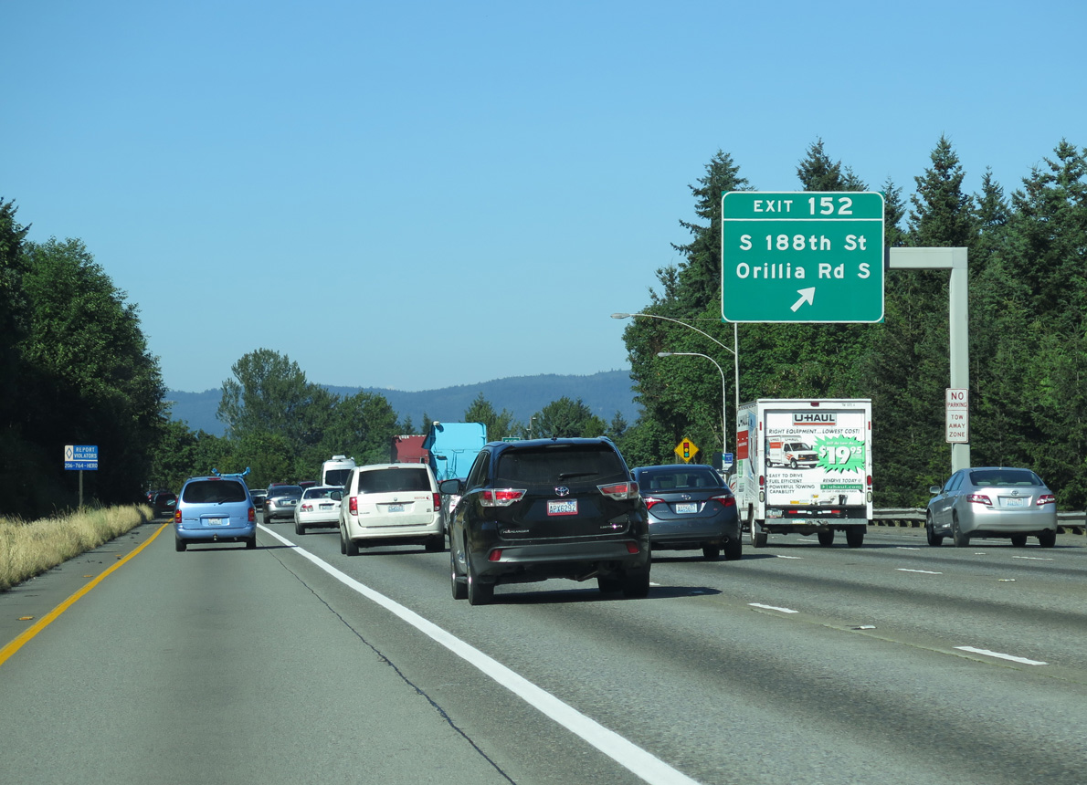
Orilla Road stems north from S 212th Street at Kent to meet Interstate 5 at a diamond interchange (Exit 152) opposite from S 188th Street.
09/27/25
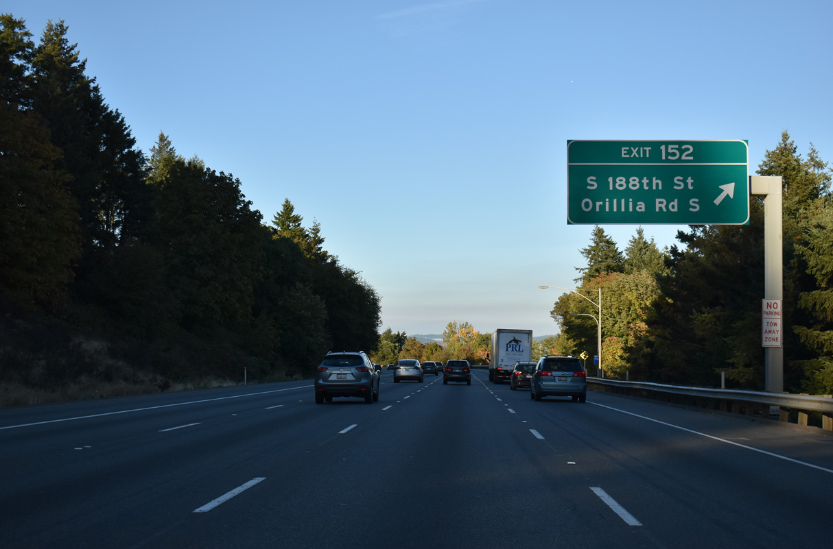
S 188th Street runs west from Orillia Road and Exit 152 across Seattle-Tacoma International Airport (SEA) to SR 509.
09/27/25
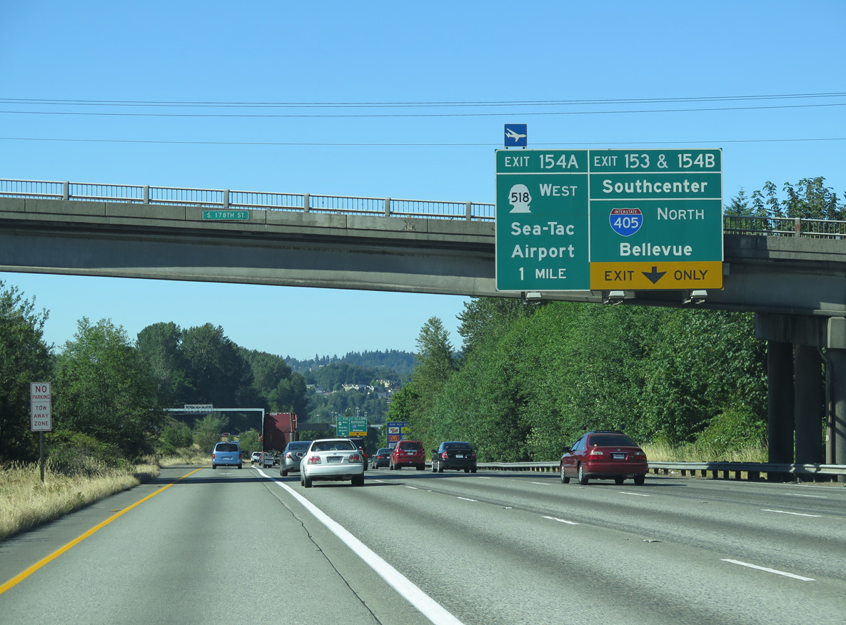
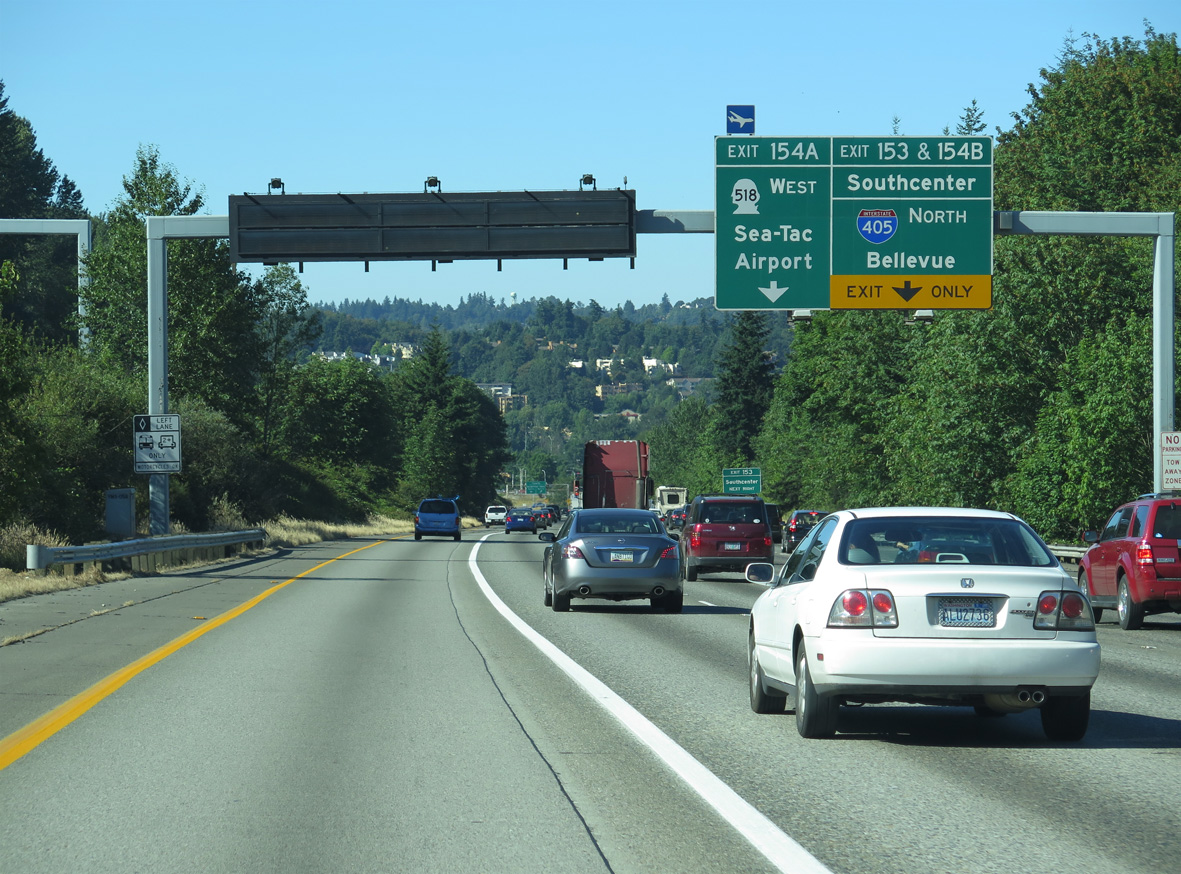
Interstate 5 north lowers to the interchange complex (Exits 153-154) with Southcenter Parkway, Interstate 405 north, and SR 518 west.
09/21/25
Interstate 405 is an urban loop around Lake Washington and the city of Seattle stretching 30.3 miles north from Tukwilla to Lynnwood. SR 518 is a 3.40 mile long freeway spurring west from I-5/405 to SR 509 at Burien.
09/21/25
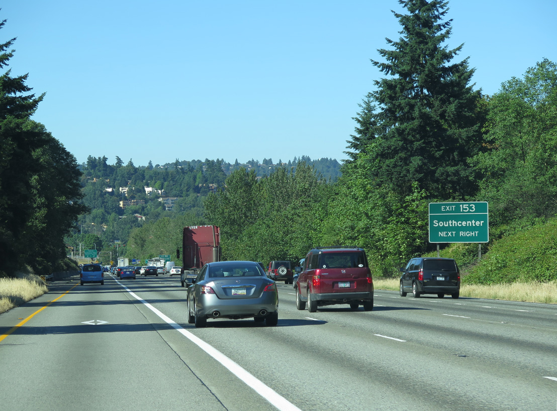
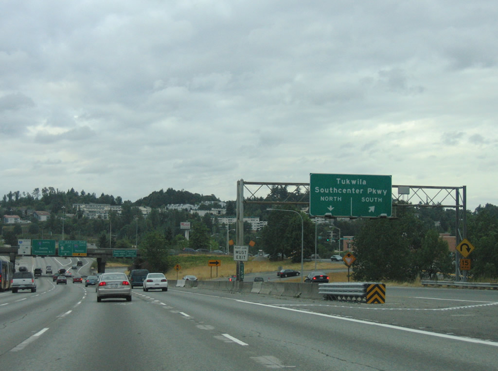
Exit 153 departs for parallel Southcenter Parkway to Tukwila Parkway ahead of the ramps for Interstate 405 north and SR 518 west. Exit 153 serves the adjacent Southcenter Mall.
09/21/25
Southcenter Mall lies north of a pervasive warehouse and commercial area bound by Southcenter Parkway and SR 181 (W Valley Highway) in the city of Tukwila. Northward, Southcenter Parkway becomes Tukwila Parkway east to 66th Avenue S at the Green River.
09/21/25
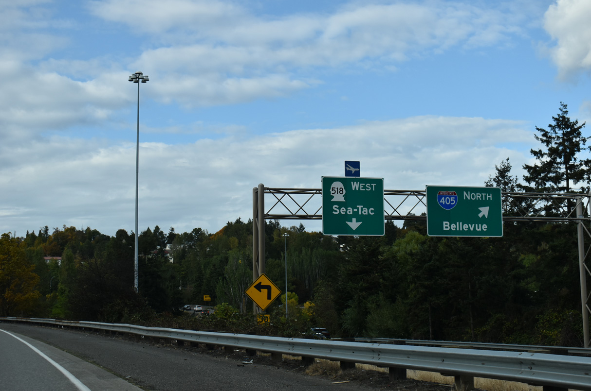
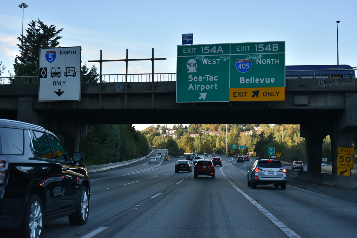
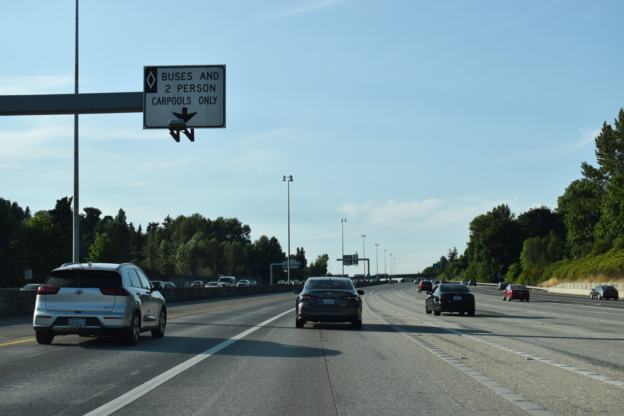
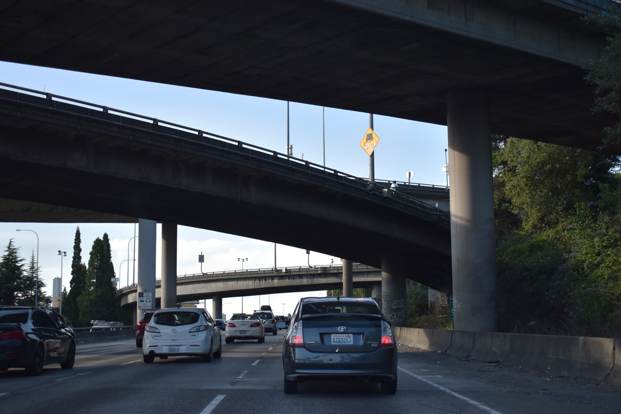
The HOV-2 lane separates through the cloverstack interchange with I-405 north and SR 518 west. The majority of I-405 and SR 518 was constructed between 1965-70.
09/21/25
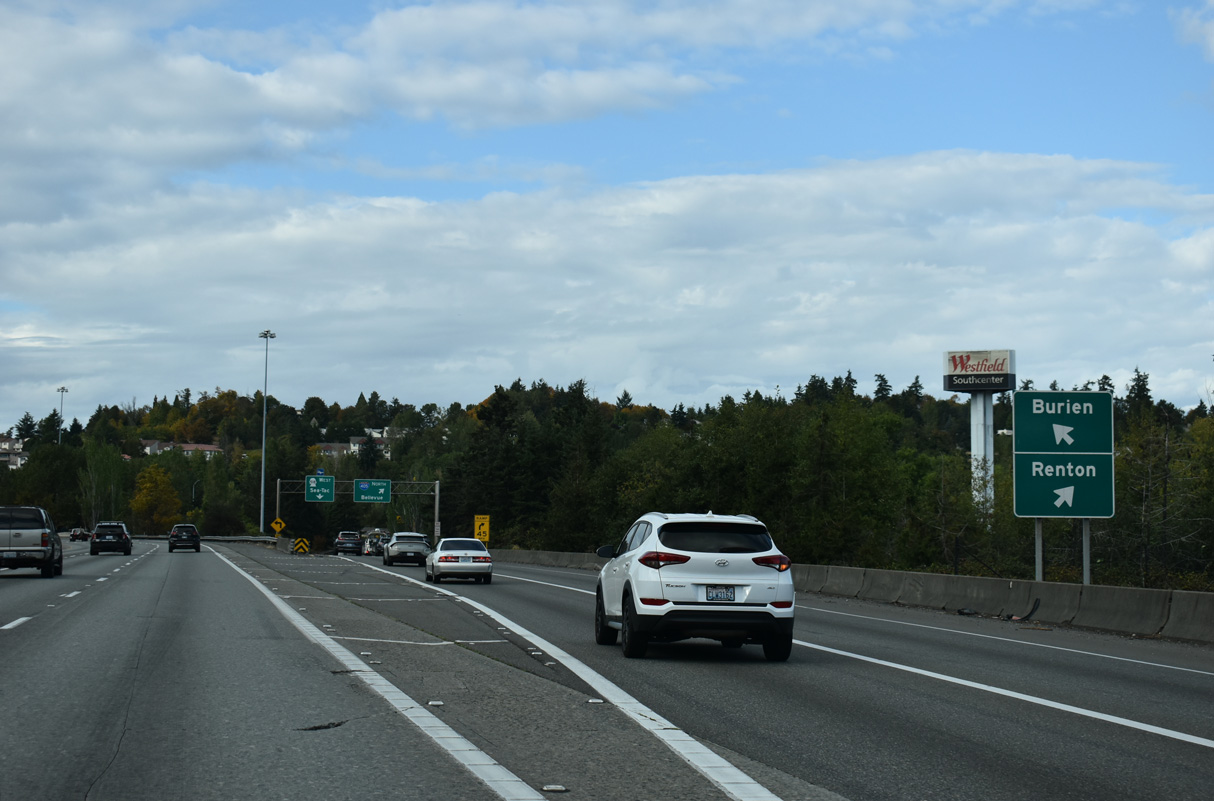
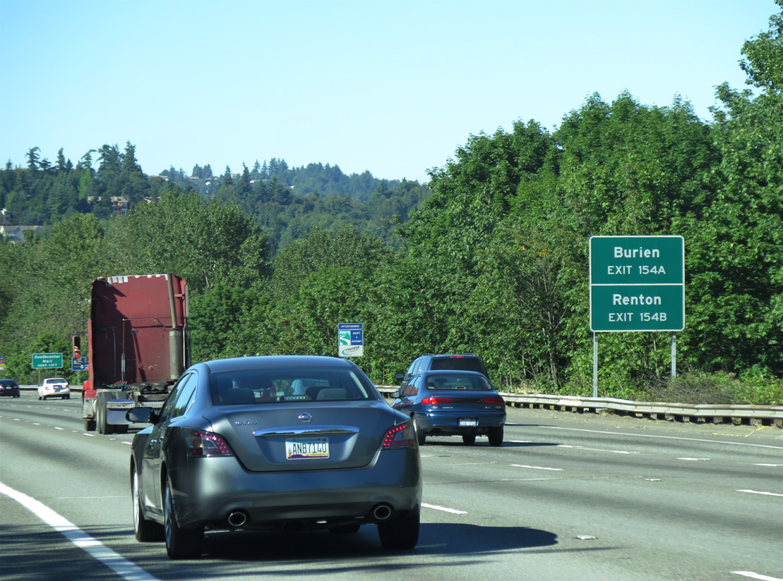
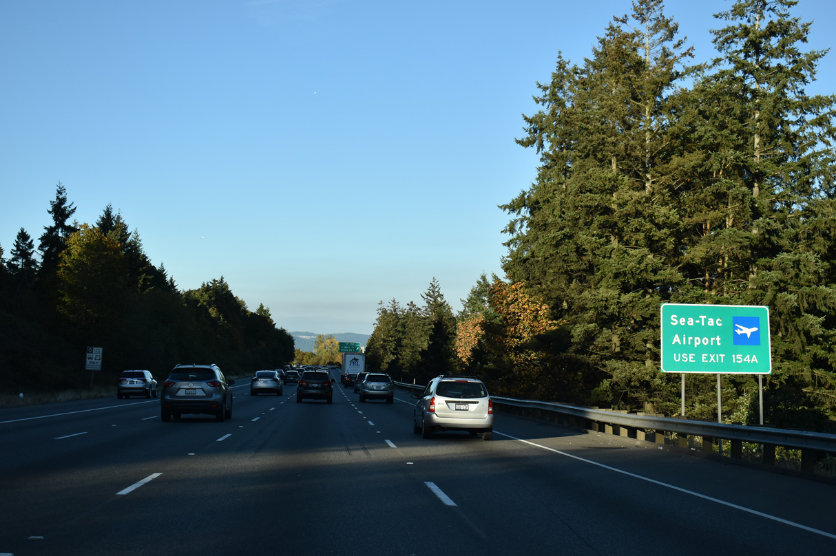
Exit 154 B connects with I-405 north to Renton, Newcastle and Bellevue. Exit 154 A joins the left lanes of SR 518 west to Seatac and Burien.
09/21/25
SR 518 leads directly to SW 148th Street and Seattle-Tacoma International Airport (SEA). I-405 meets Interstate 90 in 11.05 miles.
09/21/25
The entrance ramp from SR 518 east to Interstate 5 north merges with the HOV-2 lane beyond the Southcenter Boulevard underpass.
09/21/25
07/20/23
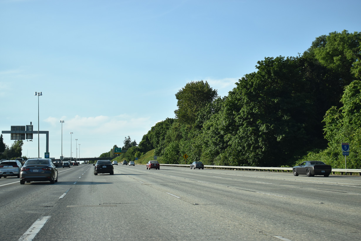
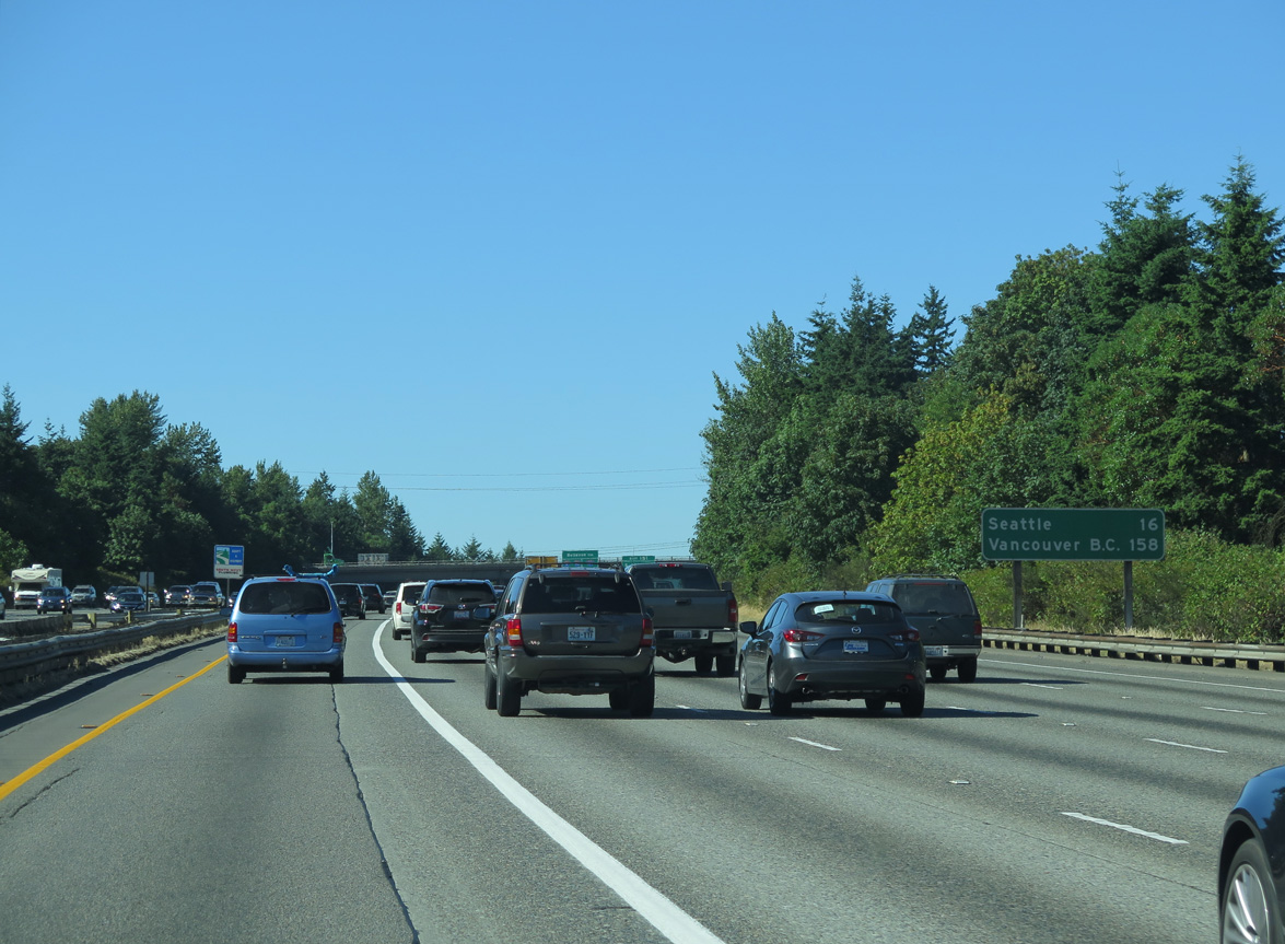
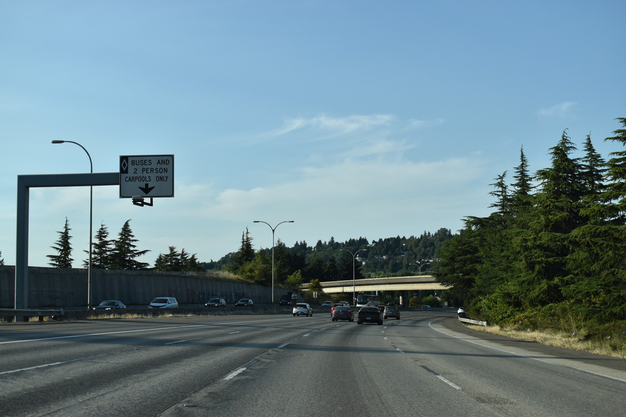
Including the HOV-2 lanes an a northbound auxiliary lane, Interstate 5 is 13 lanes wide between Exits 154 and 156.
09/21/25
07/20/23
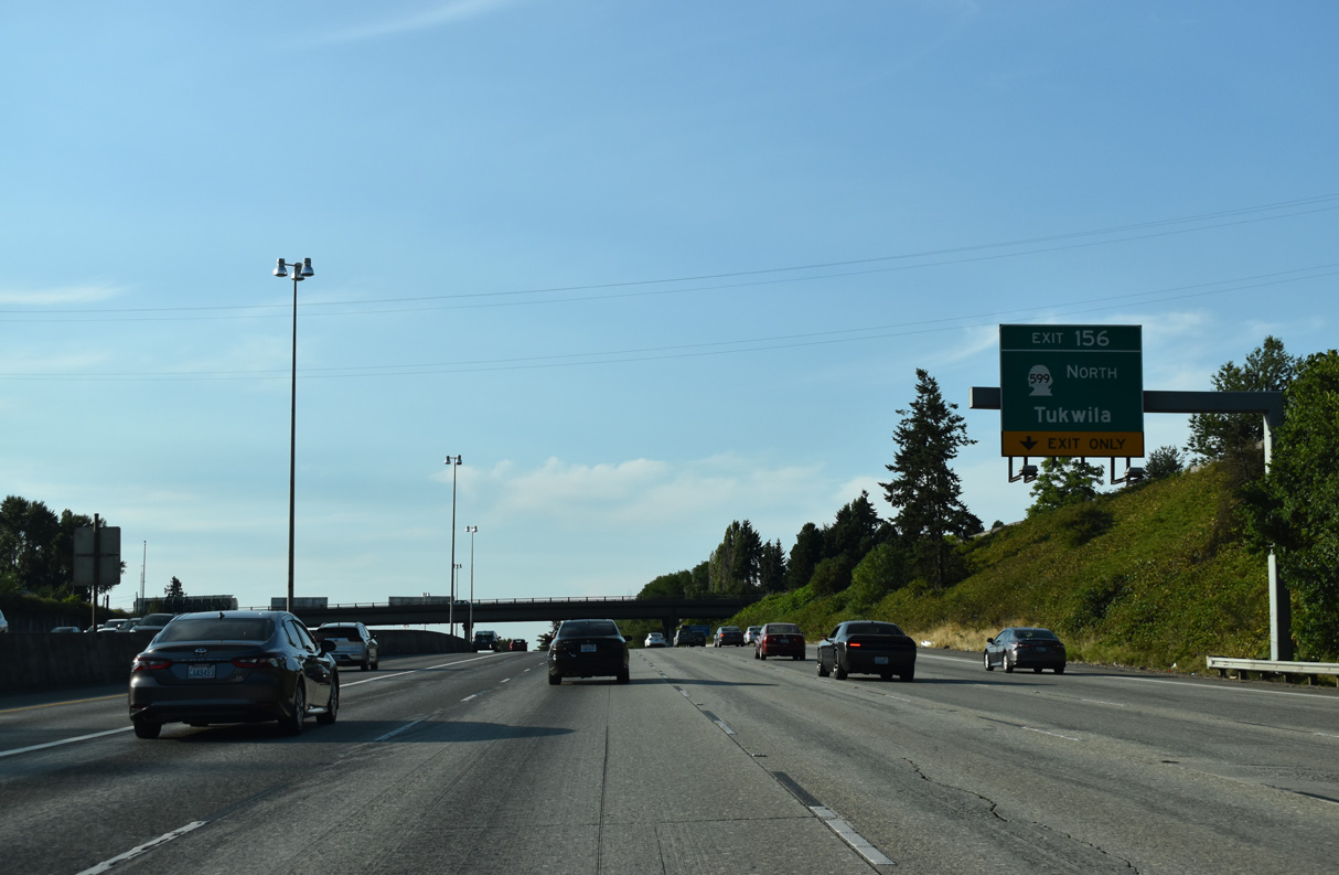
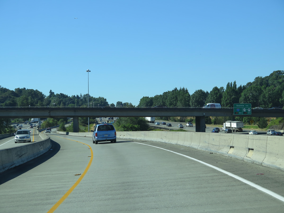
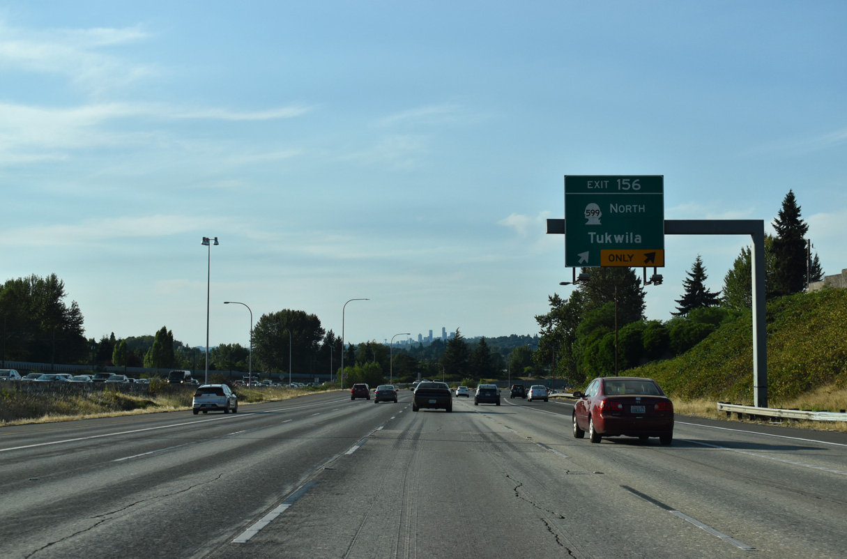
SR 599 constitutes a 1.75 mile long freeway connecting Exit 156 with SR 99 (W Marginal Way) in north Tukwila. SR 99 ends at SR 518 in SeaTac and resumes at the exchange joining SR 599 with Tukwila International Boulevard. The stretch along Tukwila International Boulevard in between was decommissioned in 2004 (AARoads Wiki, 2025).
09/21/25
Northbound at the wye interchange (Exit 156) with SR 599 north on Interstate 5. Paralleling Interurban Avenue, SR 599 connects with S 133rd Street at a nearby industrial area. SR 599/99 provide a seamless freeway to the 1st Avenue Bridge into the Georgetown section of Seattle.
09/21/25
Access from SR 599 is provided to the southbound HOV lane, but not from the northbound I-5 carpool lane to SR 599.
07/20/23
Turning northwest, Interstate 5 parallels the Union Pacific and BNSF Railroads in addition to SR 900 (Martin Luther King, Jr. Way) at the Allentown and Duwamish sections of north Tukwila.
07/20/23
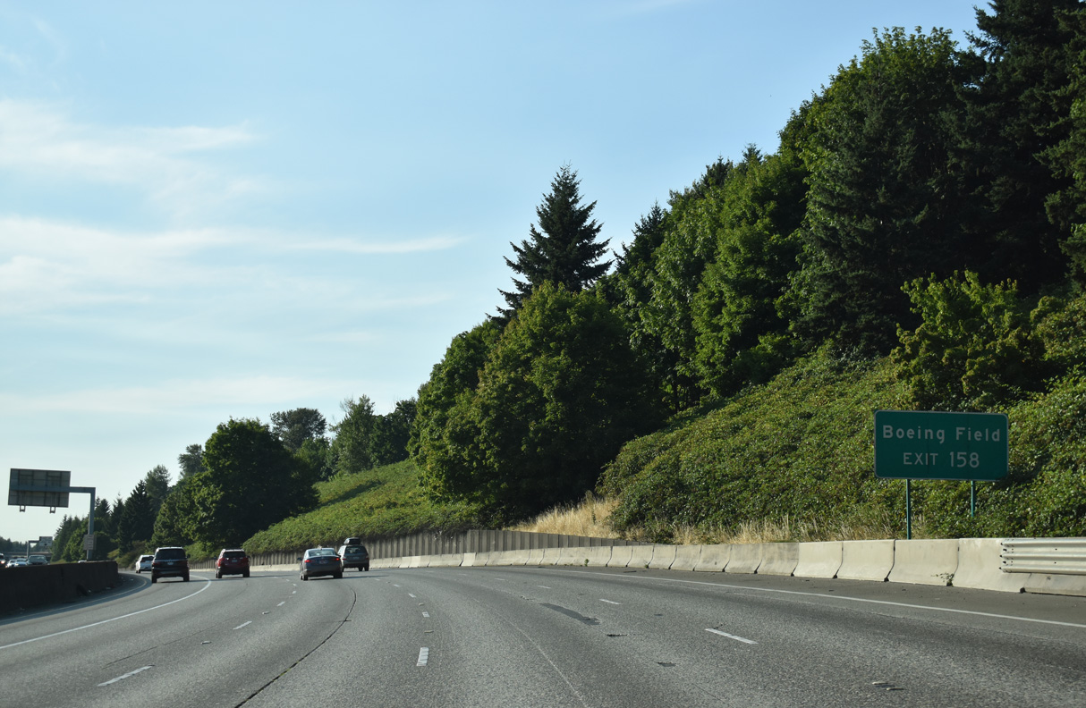
S Boeing Access Road west from Exit 158 to Airport Way and E Marginal Way north leads to King County International Airport - Boeing Field (BFI).
07/20/23
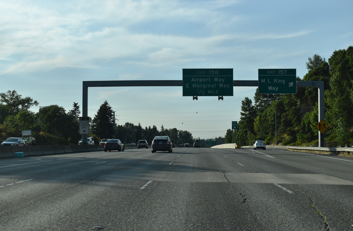
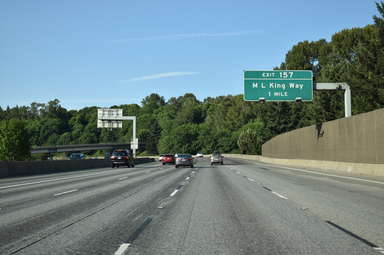
Martin Luther King, Jr. Way partitions into a couplet at the split diamond interchange (Exit 157) with I-5. Exit 157 is a slip ramp onto the adjacent roadway north to Ryan Way east and Boeing Access Road west. SR 900, not signed here, follows MLK Way south from Ryan Way to Sunset Boulevard in Renton.
07/20/23
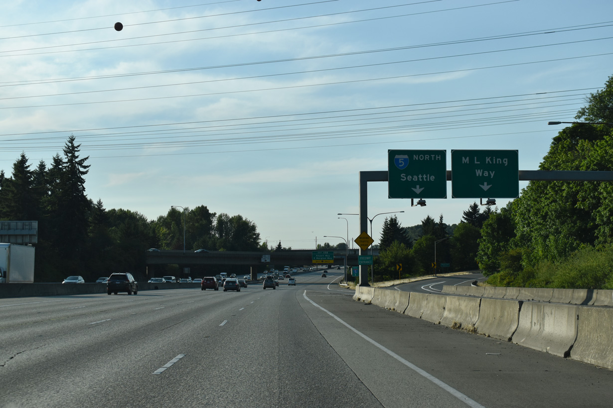
A slip ramp provides access to Interstate 5 north from Martin Luther King, Jr. Way north ahead of S Boeing Access Road west and Ryan Way east. Ryan Way leads to 51st Avenue in south Seattle.
07/20/23
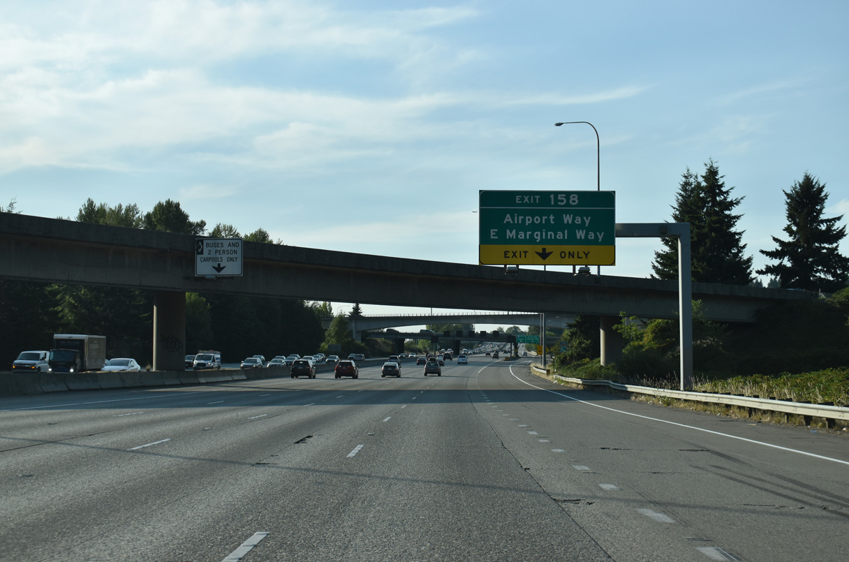
Exit 158 provides access to S Boeing Access Road west to E Marginal Way south of the Boeing Developmental Center and the Museum of Flight. S Boeing Access Road comprises a short expressway between SR 900 and Tukwila International Boulevard (historic U.S. 99).
07/20/23
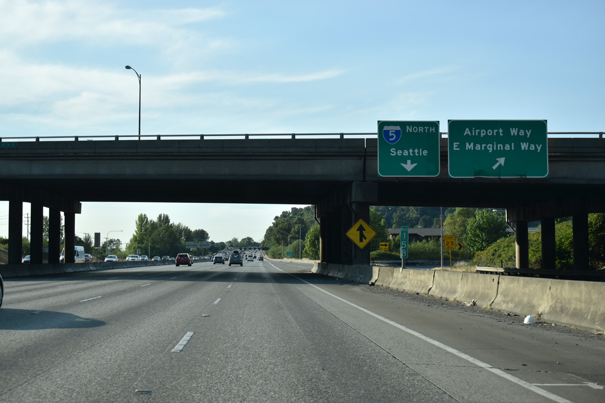
Paralleling I-5 to Interstate 90, Airport Way stems north from a trumpet interchange with S Boeing Access Road nearby to King County International Airport - Boeing Field (BFI).
07/20/23
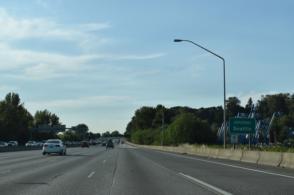
Interstate 5 enters the city of Seattle just north of Exit 158.
07/20/23
A brief roadway separation follows along Interstate 5 along the hills east of King County International Airport - Boeing Field (BFI).
07/20/23
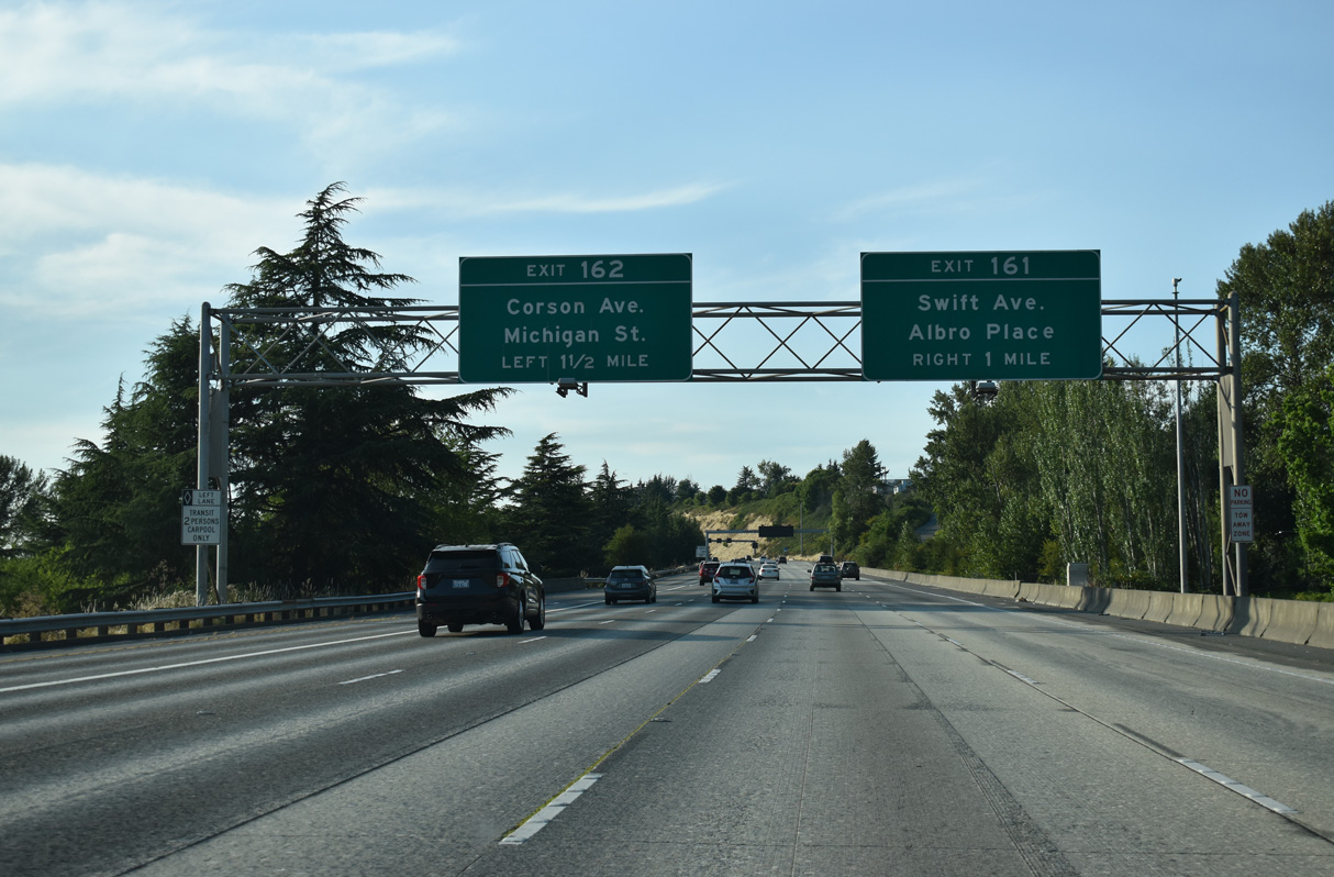
Swift Avenue continues Myrtle Street northwest along Interstate 5 to S Albro Place. Exit 161 joins the northbound freeway with Swift Avenue ahead of Graham Street, west of the Holly Park neighborhood.
07/20/23
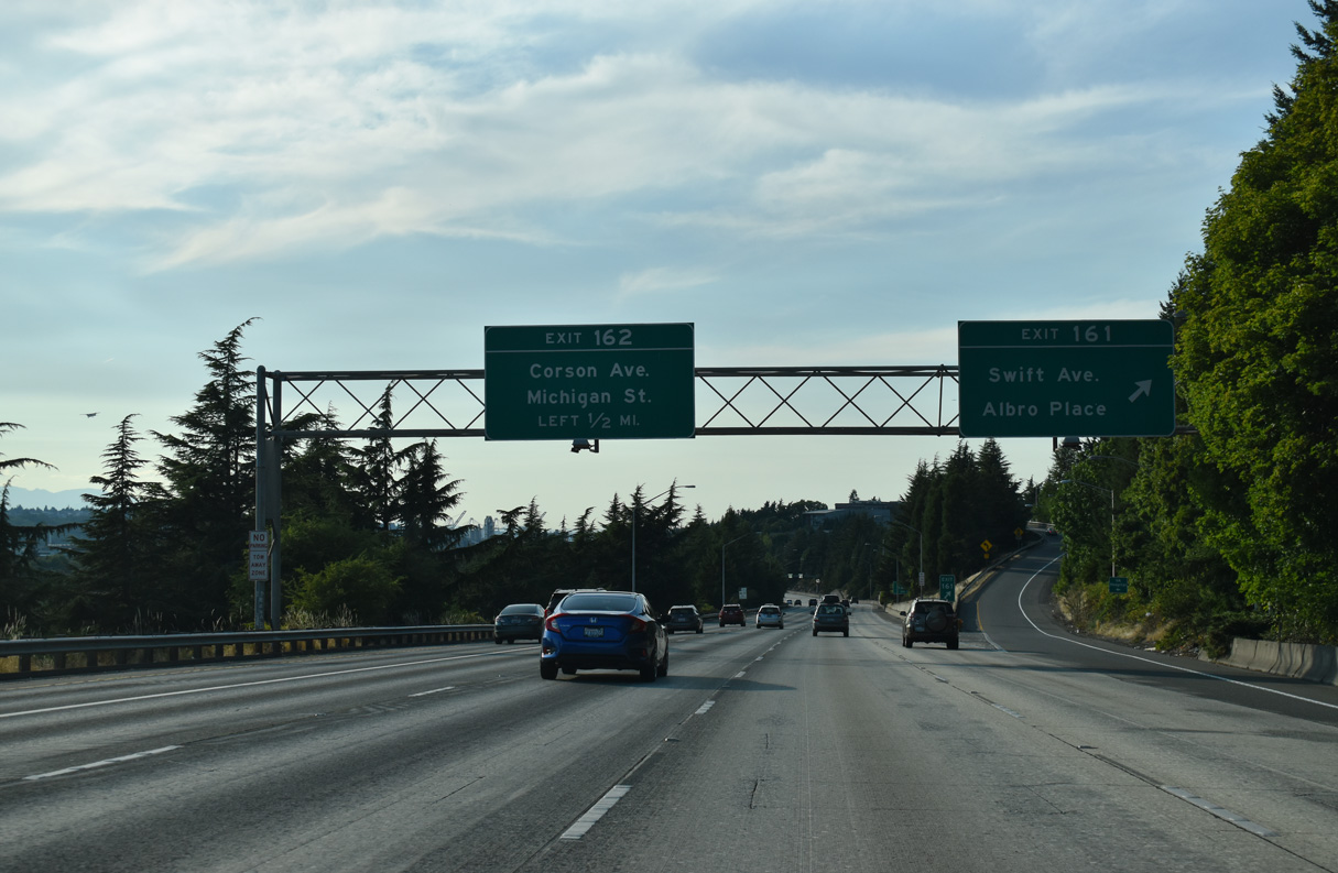
Exit 161 ascends from I-5 north to Swift Avenue. Graham Street leads east to Holly Park and Brighton while S Albro Place crosses the freeway and adjacent railroad lines west to Ellis Avenue at the Georgetown section of the city.
Exit 162 departs next as part of a pair of directional ramps to industrial areas along Corson Avenue and Michigan Street at Georgetown.
07/20/23
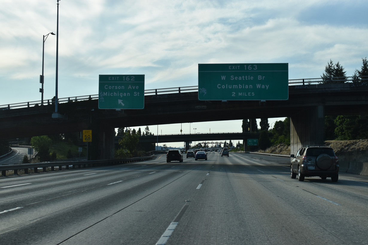
Left Exit 162 for Corson Avenue south to Michigan Street separates from I-5 north at the Albro Place overpass. Michigan Street angles southwest to the 1st Avenue Bridge (SR 99) and E Marginal Way.
07/20/23
Directional ramps join I-5 north and south from Bailey Street east from Michigan Street by this northbound reassurance assembly.
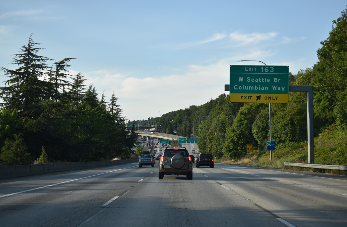
09/27/25
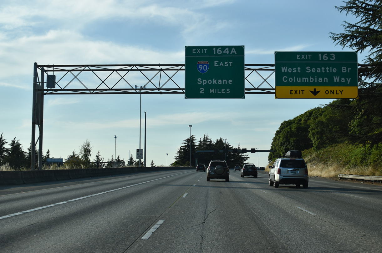
Forthcoming Exit 163 connects with Columbian Way east to South Seattle and the West Seattle Bridge to Riverside and Youngstown. Signed as Business Loop I-5, Exit 164 A joins I-5 north with Interstate 90 east across the Mercer Island Floating Bridge to Bellevue.
07/20/23
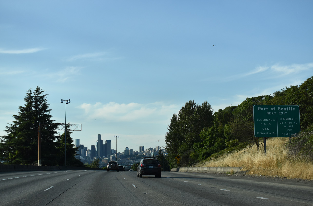
Interstate 5 continues with roadways at different grades through South Seattle. Port of Seattle facilities are located along Harbor Island north of Pigeon Point.
07/20/23
The impressive Downtown Seattle skyline comes into view along Interstate 5 north at South Seattle.
07/20/23
A multi level interchange links I-5, the West Seattle Bridge, and Columbian Way east. The West Seattle Bridge is a locally maintained freeway leading west to 35th Avenue SW and Fauntleroy Way SW at West Seattle.
07/20/23
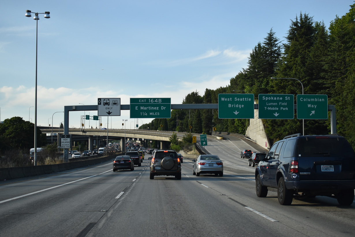
Spokane Street parallels the West Seattle Bridge viaduct, connecting Interstate 5 with 1st Avenue S north to Lumen Field and T-Mobile Park. Columbian Way winds east from the viaduct to Beacon Hill, South Seattle and Rainier Valley.
07/20/23
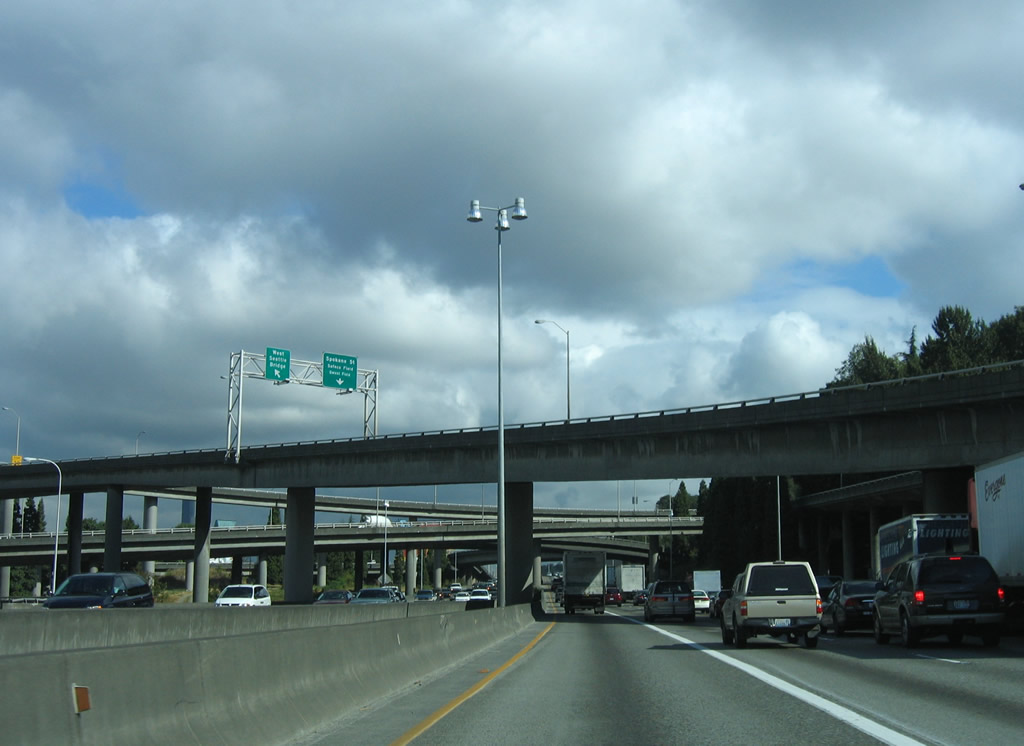
Passing underneath the flyover ramps at the West Seattle Bridge interchange. The West Seattle Bridge was constructed between 1981 and 1984 ("West Seattle Bridge", 2010).
09/27/25
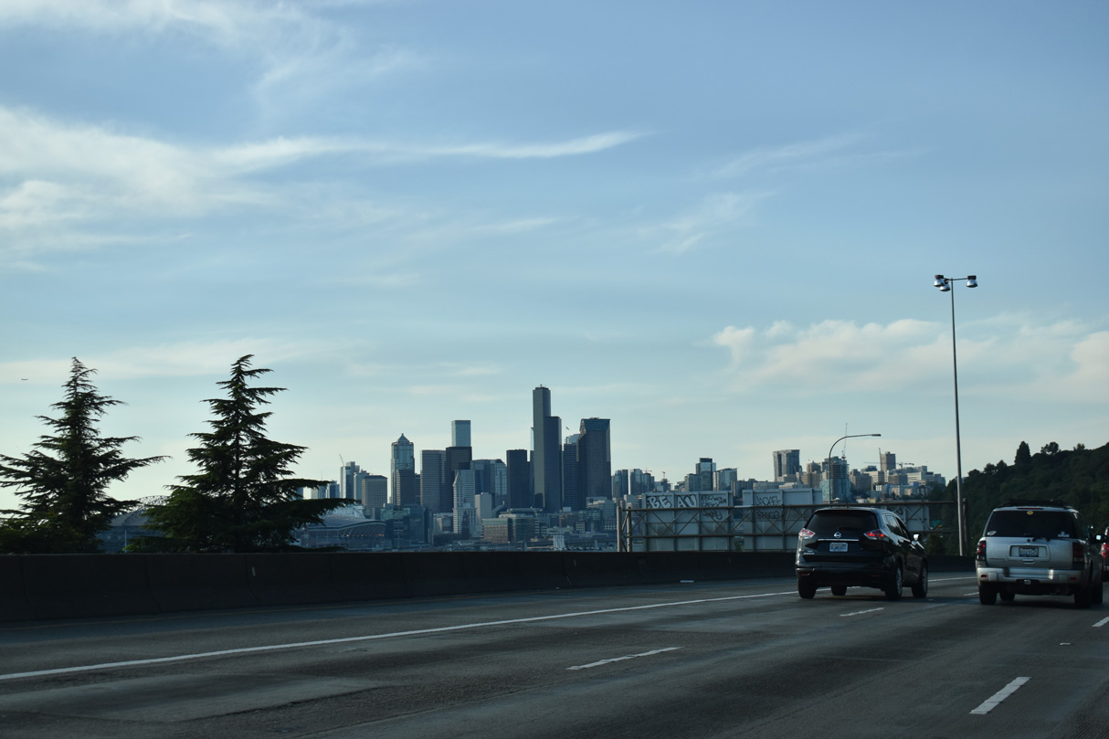
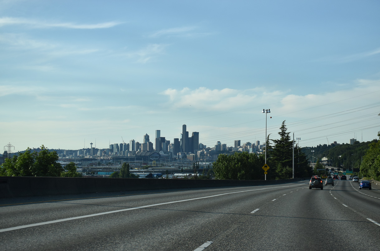
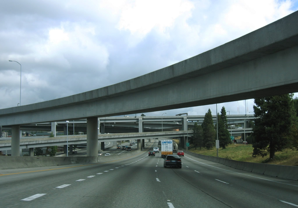
Interstate 5 lines the hillside by Beacon Hill above the industrial plain to the west. The Downtown Seattle skyline remains in view northwest to the systems interchange (Exit 164 A) with Interstate 90.
07/20/23
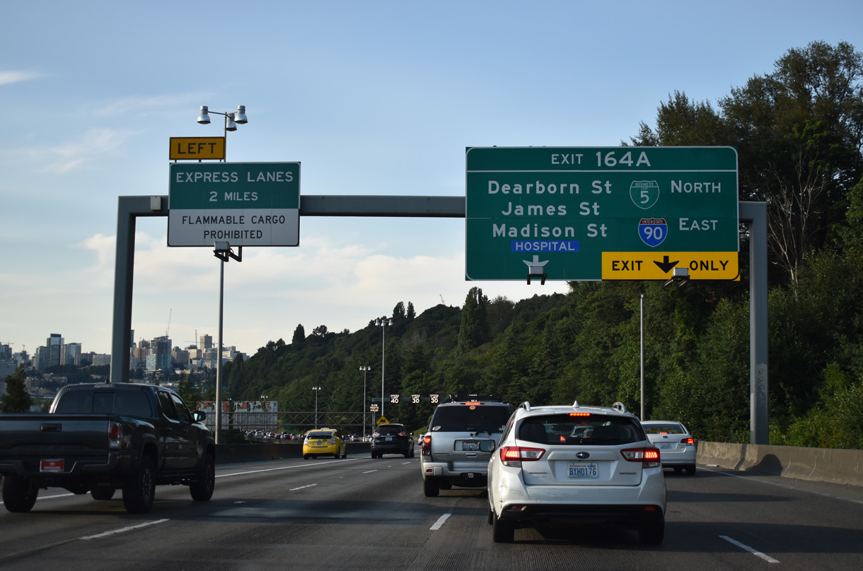
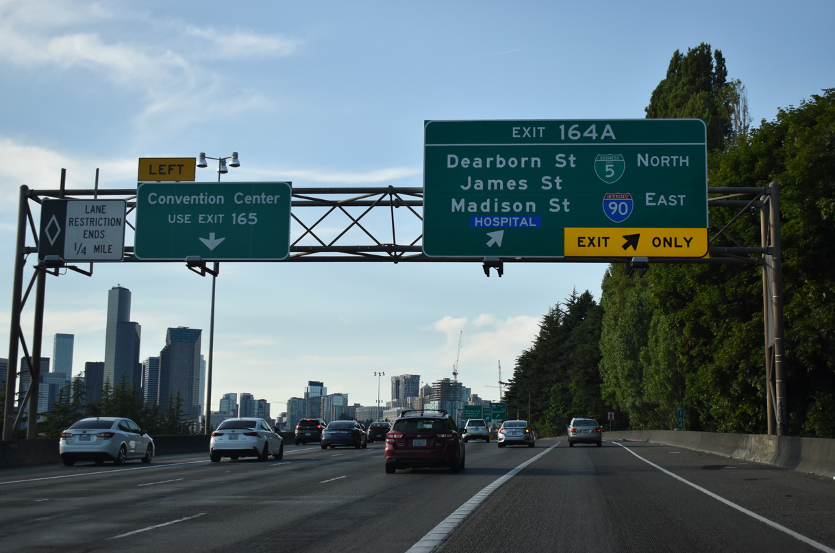
Exit 164 A, the 1.77 mile long collector distributor roadway north to the Freeway Park tunnel, was temporarily referenced as Business Loop I-5 from 2018 to 2024. The c/d roadway provides access to I-90 east in addition to Dearborn, James, and Madison Streets. Beginning at 4th Avenue S (SR 519) by Lumen Field and the International District, I-90 arcs southeast to meet I-5 near Yesler Terrace.
09/27/25

Heavy traffic is common in both directions of I-5 near Beacon Hill. WSDOT traffic counts recorded 240,000 vehicles per day (vpd) along the freeway between Exits 163 and 164 A in 2009 and 253,019 in 2024. Variable speed limits are used on this stretch.
07/20/23
I-90 is the longest Interstate highway in the system at 3,020.54 miles in length. The transcontinental route joins Washington's largest city with Spokane, the state's largest city east of the Cascades. Further east, I-90 spans the Rockies to Butte, Montana and across the Great Plains to Sioux Falls, South Dakota. I-90 joins the major metropolitan areas of Minneapolis-St. Paul, Chicago, Cleveland, Buffalo and Boston.
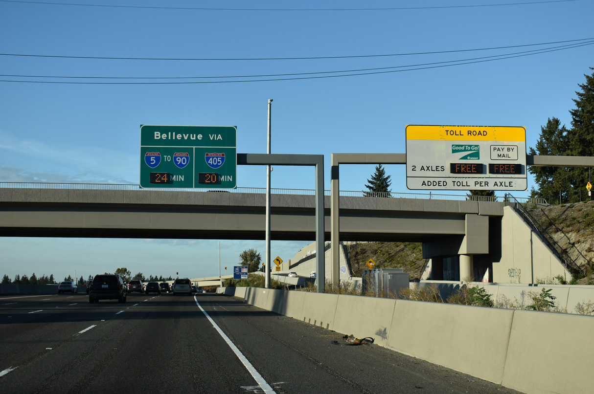
09/27/25
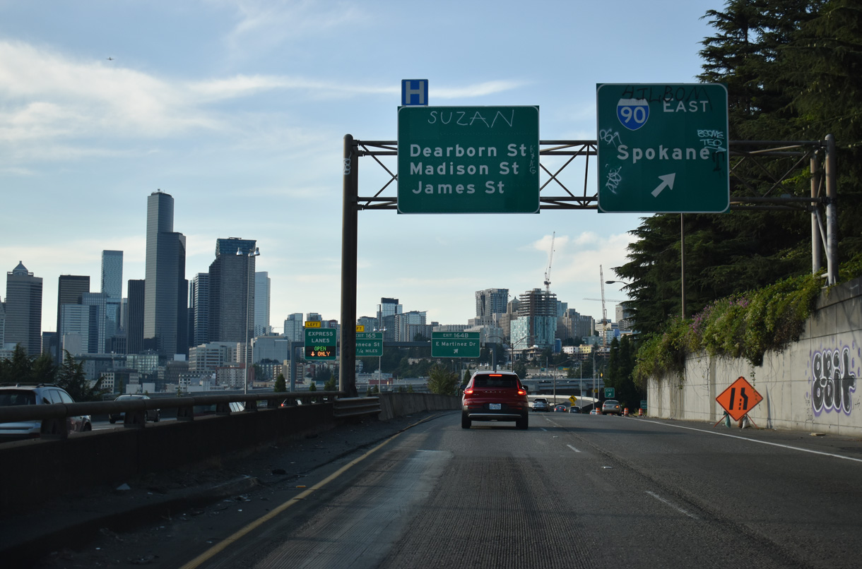
The exit for Interstate 90 east to Mercer Island, Bellevue, and Issaquah part ways from the c/d roadway along I-5 north. Interstate 90 meets I-405 at Exit 10 and I-82 at Exit 110. Spokane lies 275 miles to the east.
07/20/23
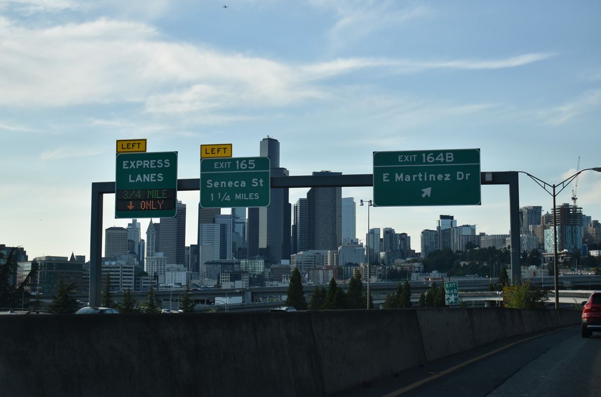
Exit 164 B leads to the west end of Interstate 90 at Edgar Martinez Drive (SR 519) and Lumen Field. A 1.09 mile long route, SR 519 turns north from 4th Avenue S onto 1st Avenue S to Alaskan Way and the Washington State Ferry terminal.
09/27/25
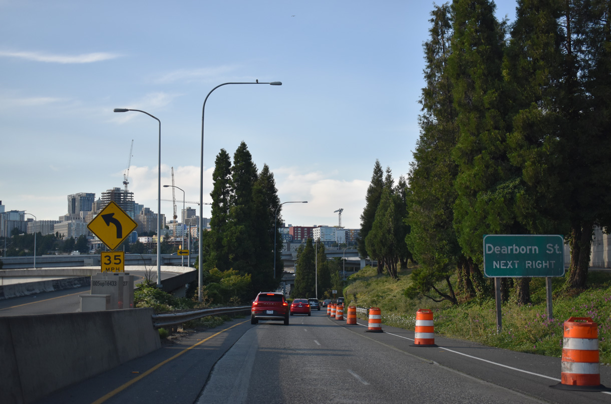
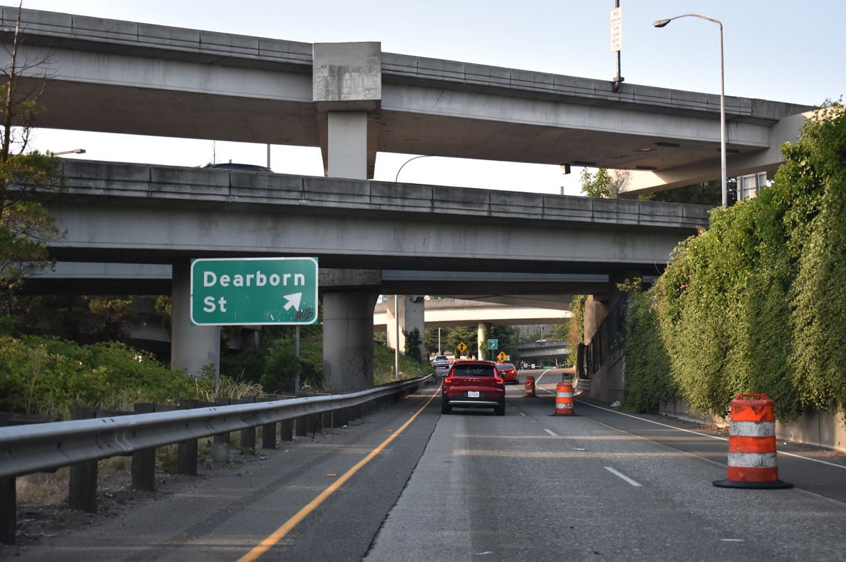
The succeeding exit from the c/d roadway joins Interstate 5 north with Deaborn Street west to the International District.
07/20/23
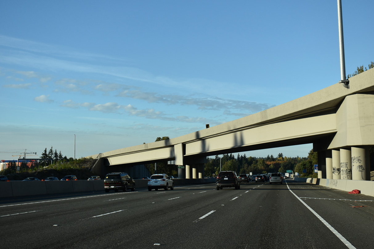
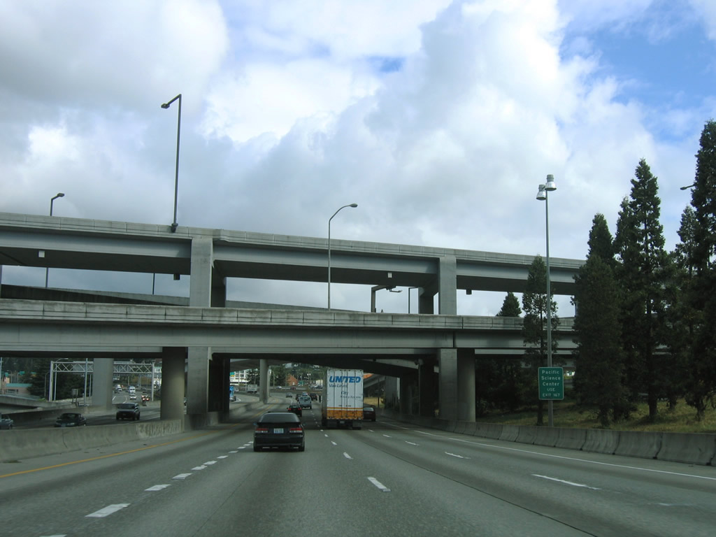
Traveling through the exchange with Interstate 90 on I-5 north. I-90 is double-decked between 6th Avenue S and 12th Avenue S.
09/27/25

References:
Washington State Department of Transportation (WSDOT). (2025, August 14). SR 18, Issaquah Hobart Rd to Deep Creek Vicinity – Widening & Fiber. WSDOT. https://wsdot.wa.gov/construction-planning/search-projects/sr-18-issaquah-hobart-rd-deep-creek-vicinity-widening-fiber
SoundTransit. (2025, August 28) Link 1 Line service to Federal Way begins Dec. 6. https://www.soundtransit.org/get-to-know-us/news-events/news-releases/link-1-line-service-to-federal-way-begins-dec-6
Washington State Department of Transportation (WSDOT). (2025, August 20). SR 509 Completion Project. https://wsdot.wa.gov/construction-planning/search-projects/sr-509-completion-project
AARoads Wiki. (2025, March 8). Washington State Route 99. AARoads Wiki. Retrieved September 2, 2025, from https://wiki.aaroads.com/wiki/Washington_State_Route_99
West Seattle bridge. (2010, November 17) In Wikipedia https://en.wikipedia.org/w/index.php?title=West_Seattle_Bridge&oldid=397394364
Photo Credits:
- Brent Ivy: 07/20/23
- Alex Nitzman: 09/21/25, 09/27/25
Connect with:
Page Updated Friday October 03, 2025.