
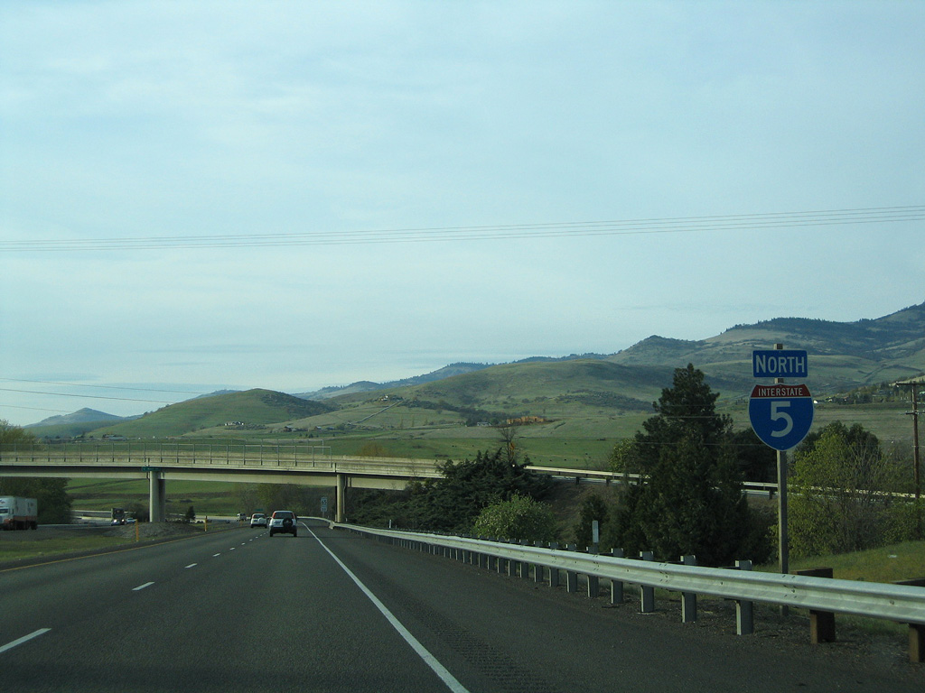
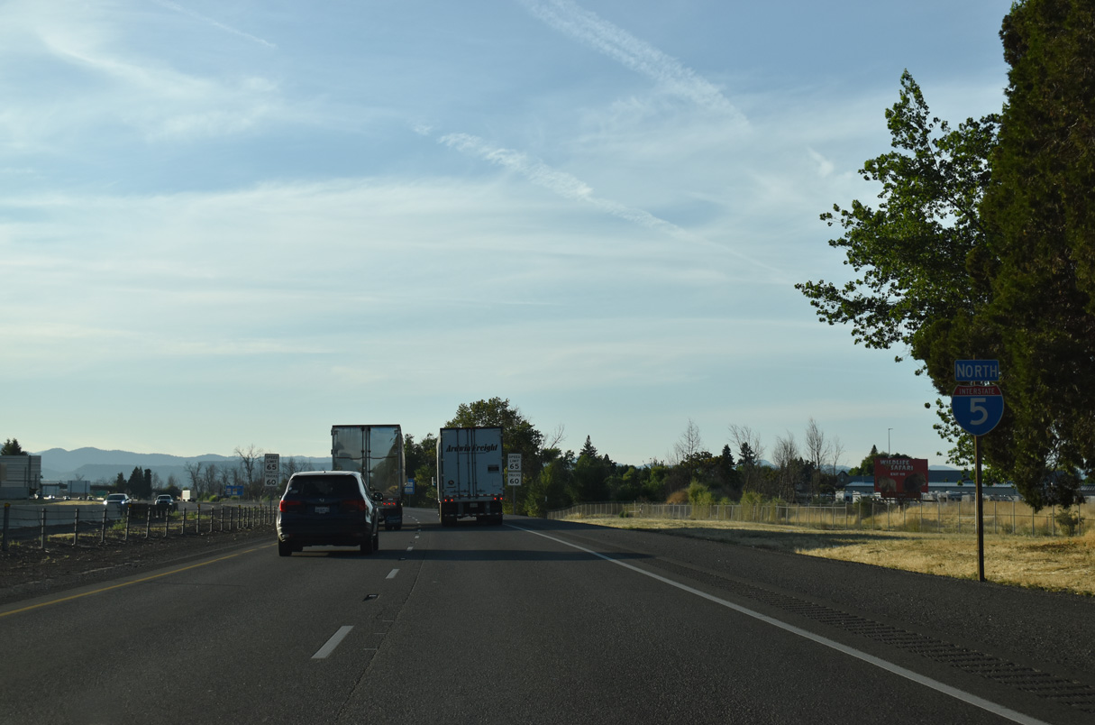
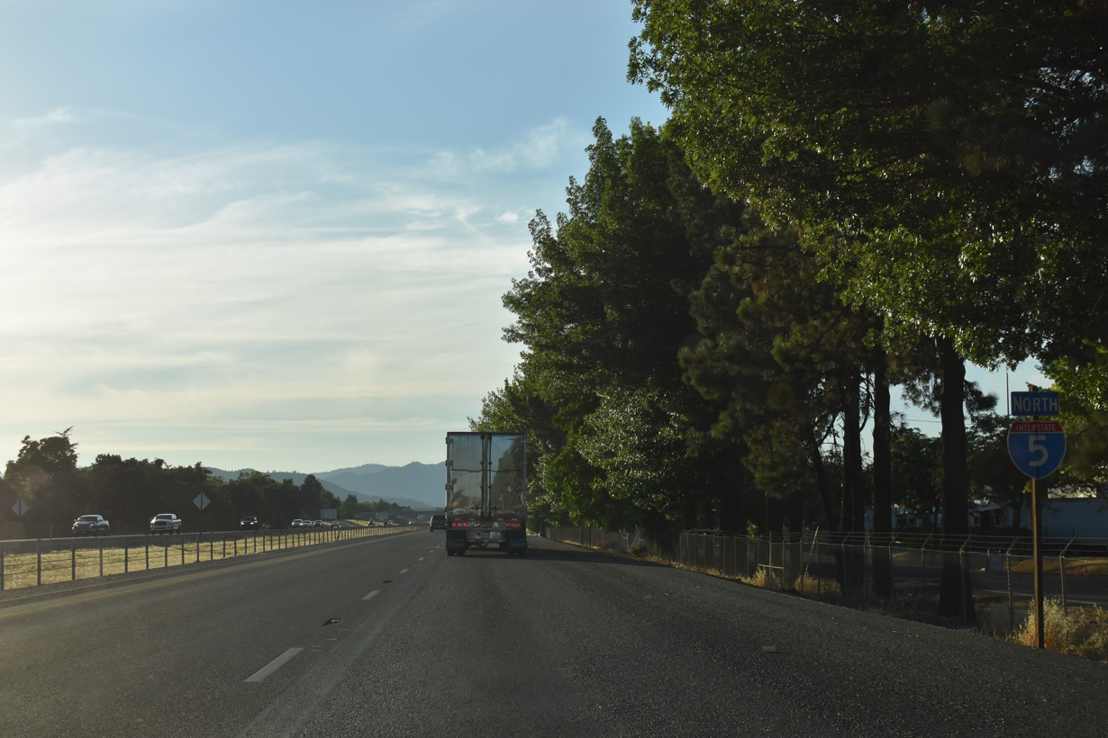
Interstate 5 North - Ashland to Medford

Interstate 5 enters the Beaver State at Siskiyou Summit south of Ashland. The mountainous stretch in southern Jackson County rises to 4,310 feet above sea level, the highest point anywhere along I-5. The freeway begins a pronounced descent from the summit into the city of Ashland.
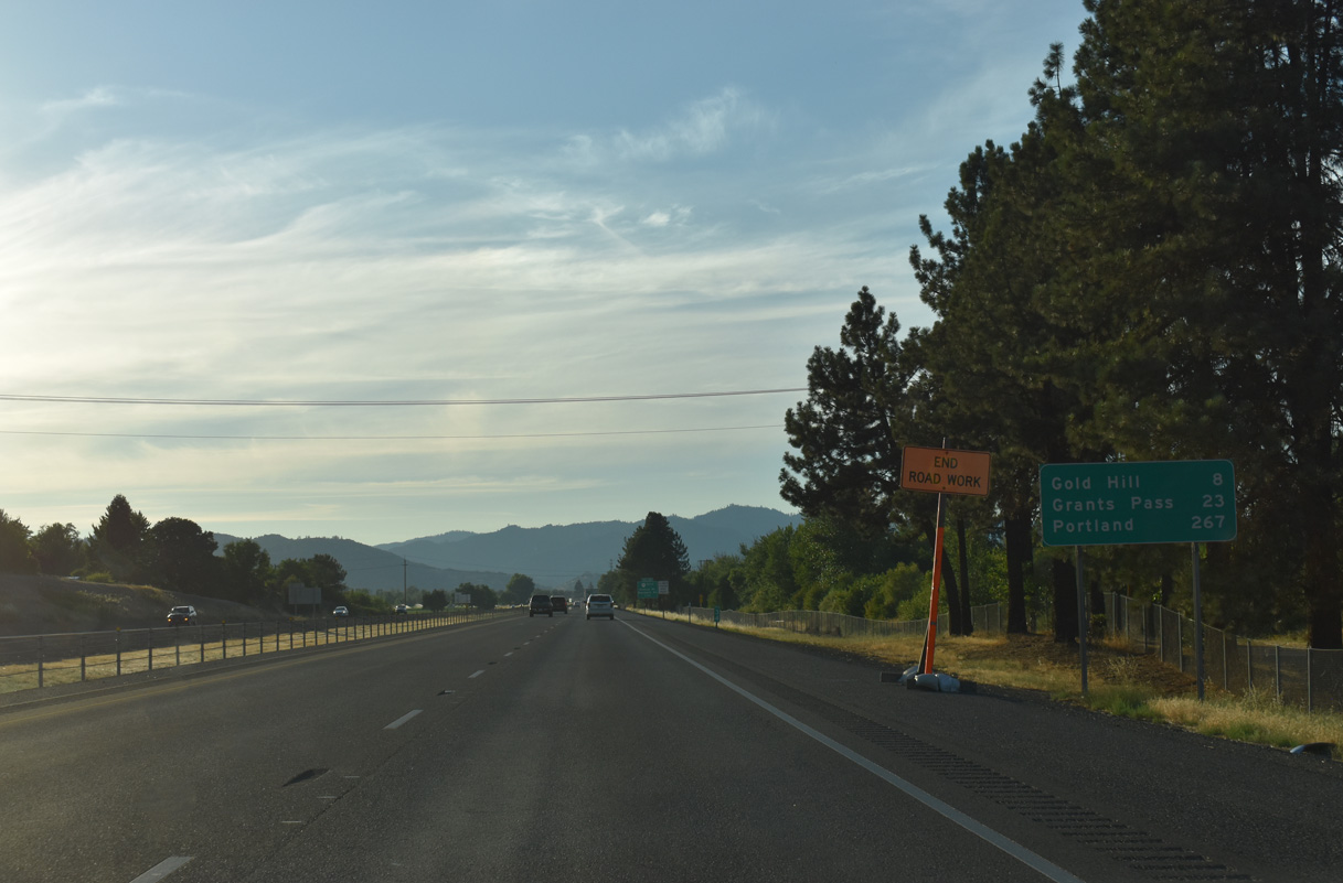
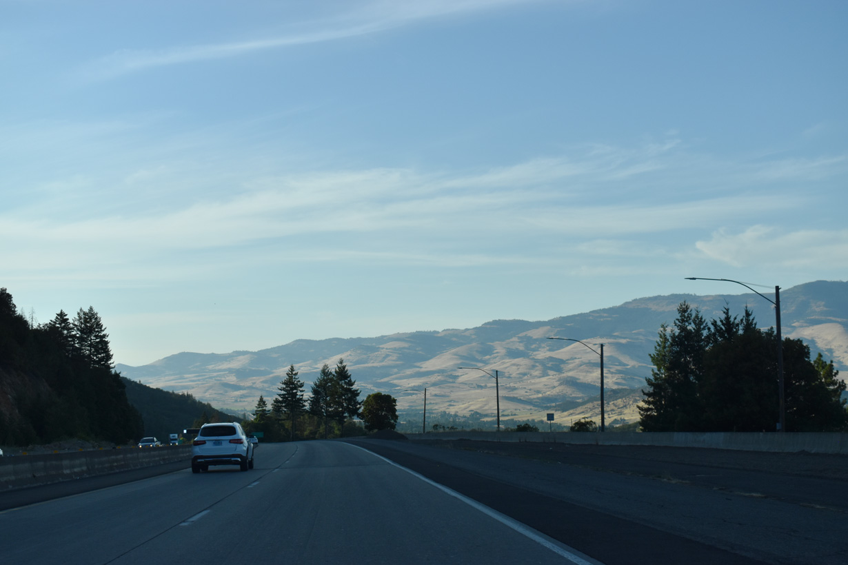
Passing along the eastern edges of Ashland between Exits 11 and 19, Interstate 5 continues from short distance to Phoenix and Medford, the Jackson County seat. Once in Medford, the freeway navigates through the heart of the city including an elevated section. West of Central Point, the freeway progresses toward Gold Hill, Rogue River, and Grants Pass.
The city of Phoenix, dubbed "The Other Phoenix" in reference to Phoenix, Arizona, began with the residence of early pioneer Sam Colver in 1851. The Rogue Valley became a gold mining area with the discovery of the Jacksonville gold fields soon thereafter and Phoenix grew as a popular stage stop known as Gasburg around the original Colver House. Growth continued and the establishment of a post office by S.M. Waite introduced the name Phoenix for the town. Waite had a policy with the Phoenix Fire Insurance Company and decided to name his post office Phoenix. The name eventually stuck.
Medford began as an early 1880s railroad town built by the Oregon & California Railroad at a site along Bear Creek. Originally dubbed Middle Ford, railroad engineer David Loring shortened the name to Medford based upon his home town of Medford, Massachusetts. The O & C Railroad reached the settlement by 1884, and incorporation of the town occurred on February 24, 1885. Medford's growth continued as a agricultural and timber center and the seat of Jackson County. The largest city in southern Oregon operates as a regional trade center today.
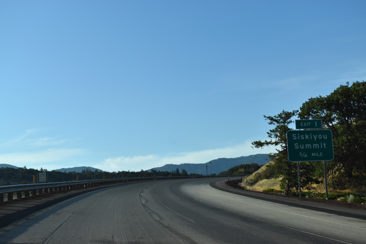
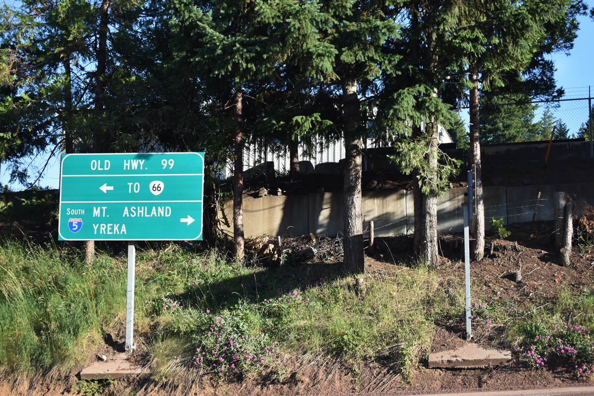
Interstate 5 north enters Jackson County from the Golden State ahead of a wye interchange (Exit 1) with Old Highway 99 S (former U.S. 99). Though not signed for the most part, Old Highway 99 S north 12.42 miles to OR 66 is Oregon State Route 273.
07/15/23
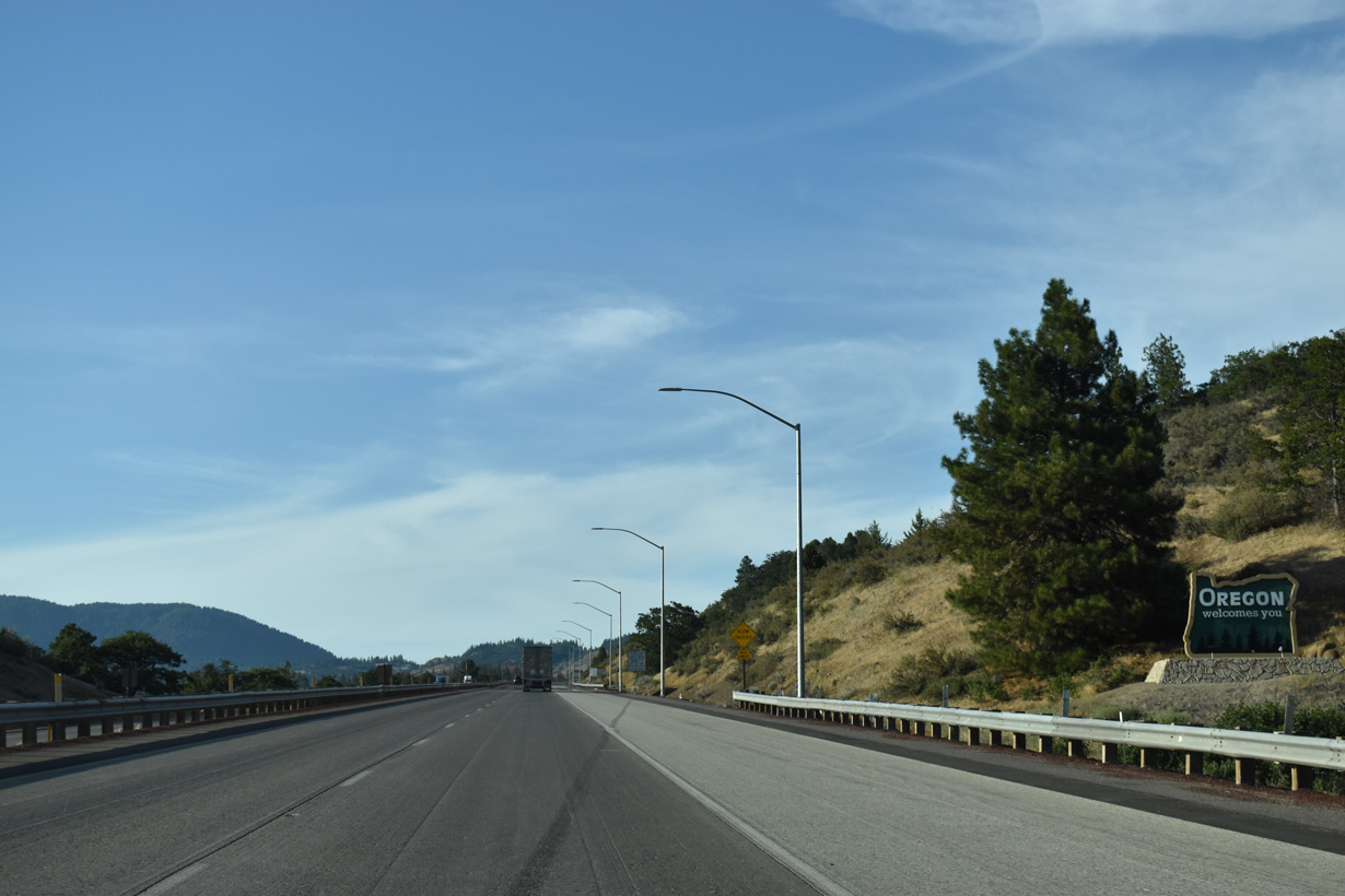
Replacing a guide sign posted by the state border, an Oregon welcome monument was installed by 2012.
07/15/23
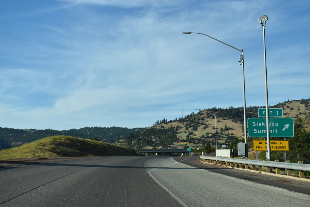
Old Highway 99 S (OR 273) follows a winding course 5.5 miles north through Siskiyou Pass and Siskiyou Summit, returning to I-5 at Exit 6.
07/15/23
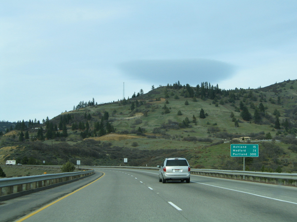
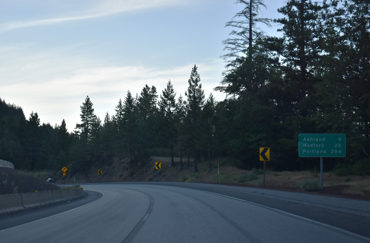
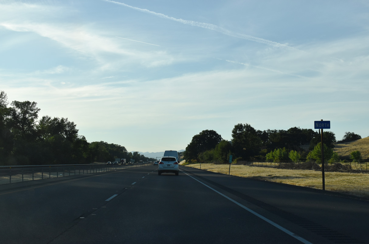
Ashland is located 15 miles ahead followed by the Jackson County seat of Medford in 28 miles.
03/31/05
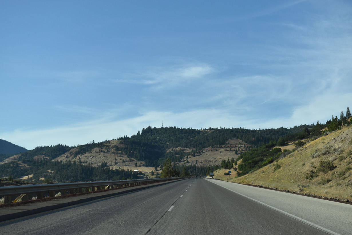
The seven miles of I-5 north of Exit 1 was previously designated by ODOT as a Truck Safety Corridor.
07/15/23
The northbound lanes of I-5 rise over 20 feet higher than the southbound roadway as the freeway ascends to Siskiyou Summit.
07/15/23
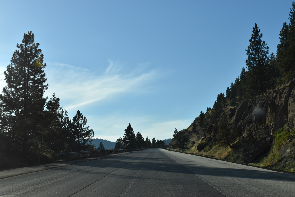
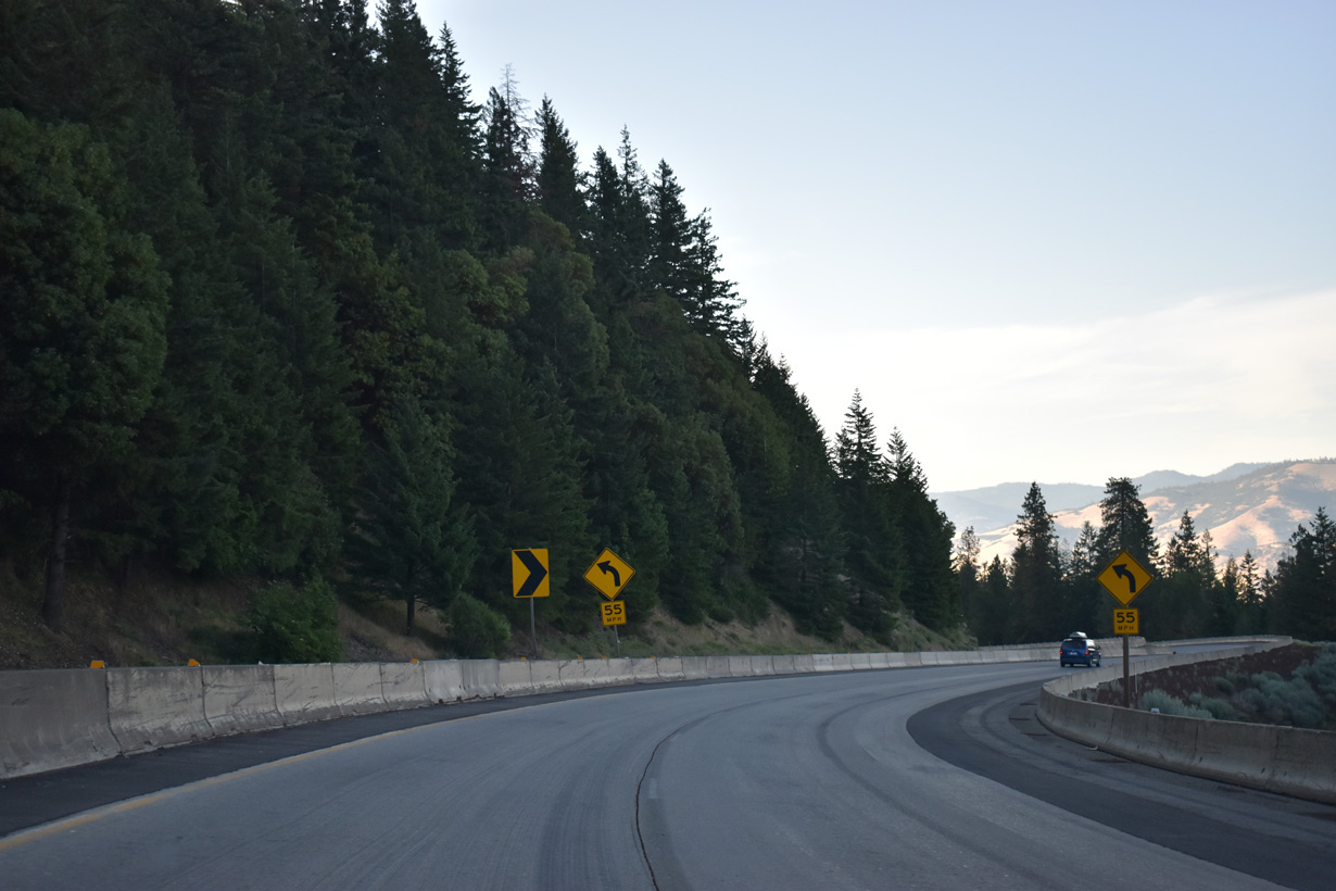
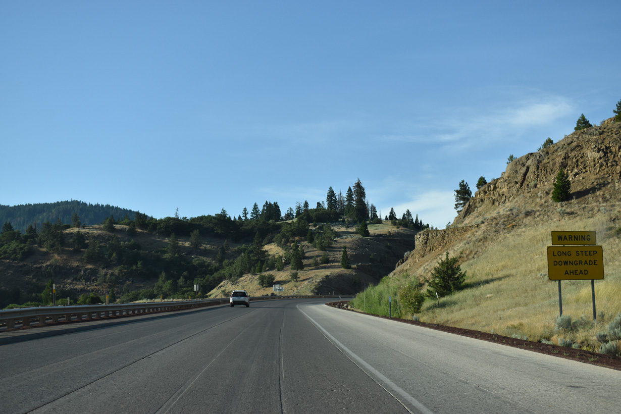
A 6% downgrade ensues beyond Siskiyou Mountain Summit along Interstate 5 north.
07/15/23
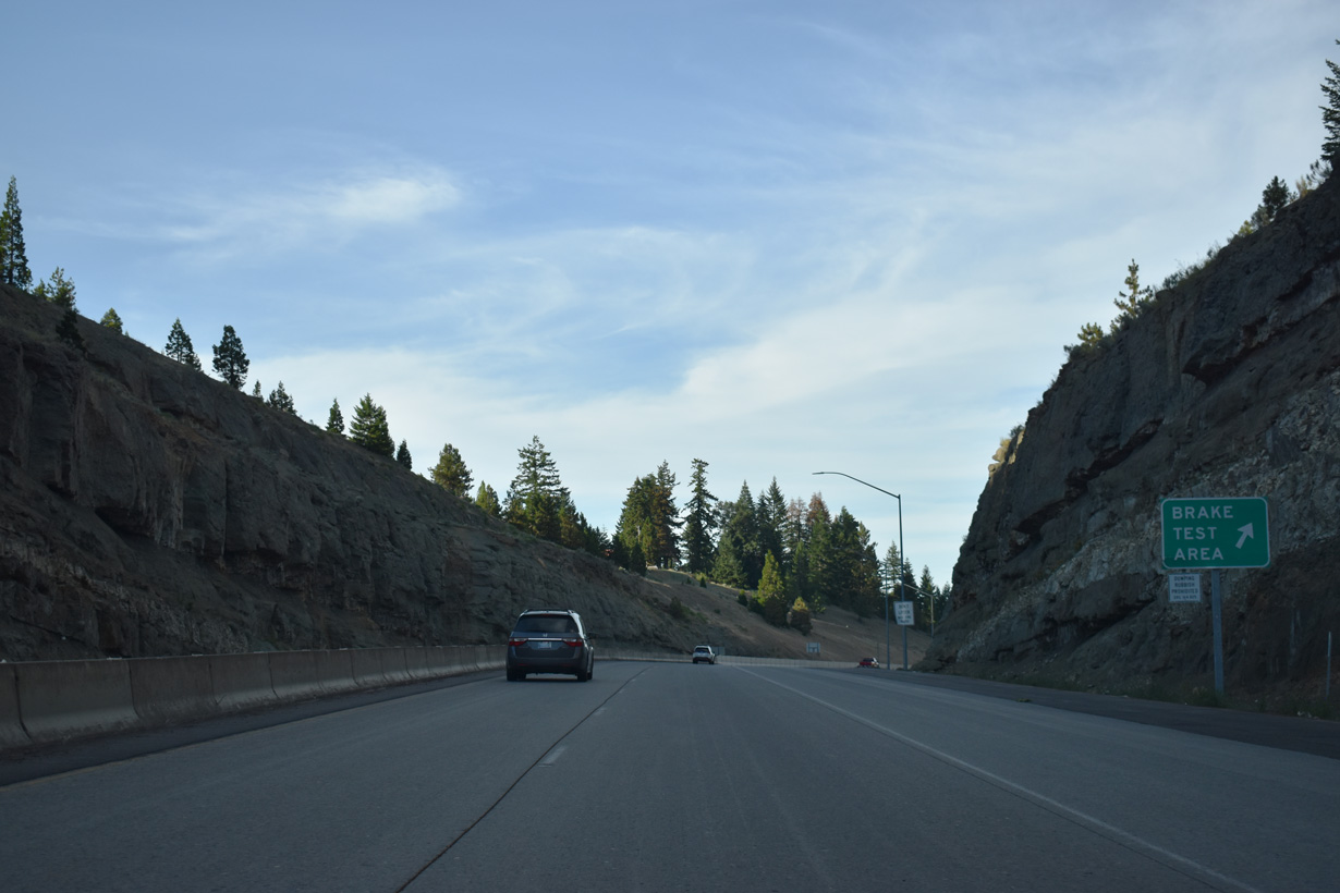
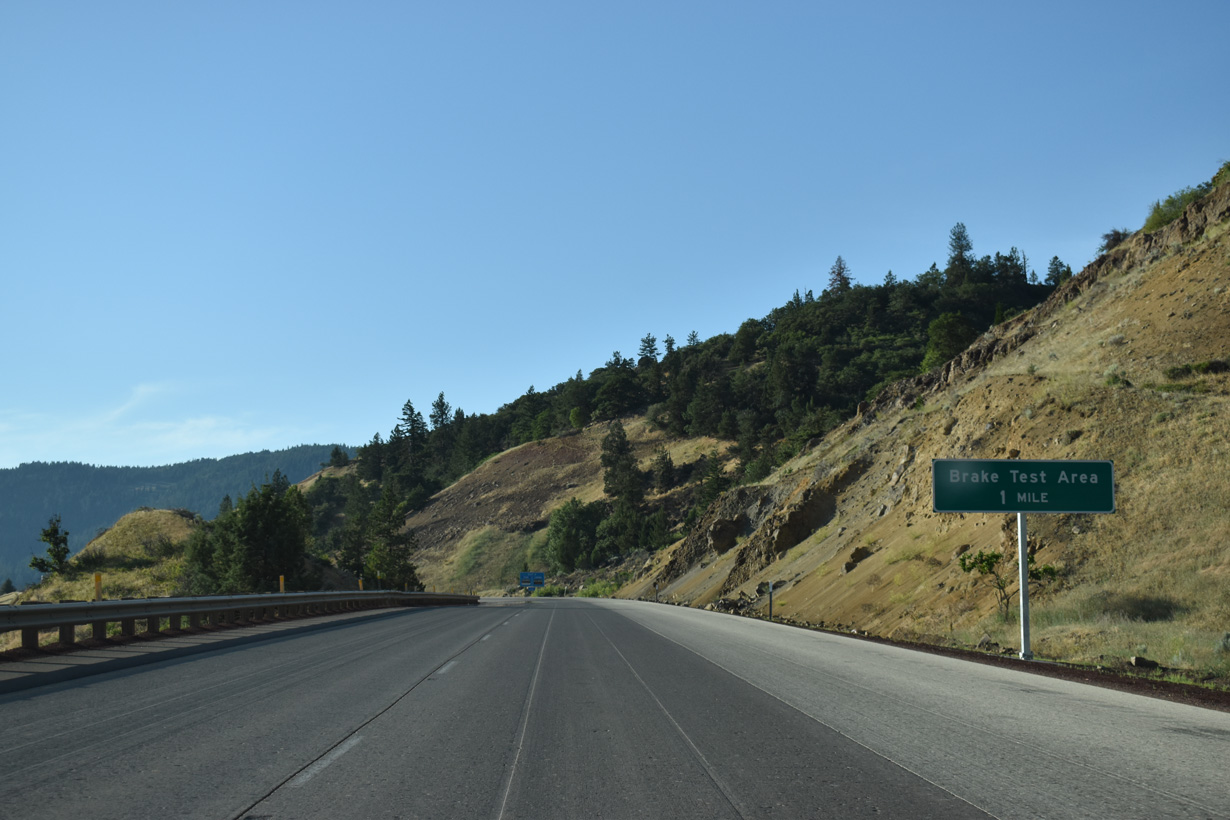
A brake area for semi-trucks is located at Siskiyou Mountain Summit.
07/15/23
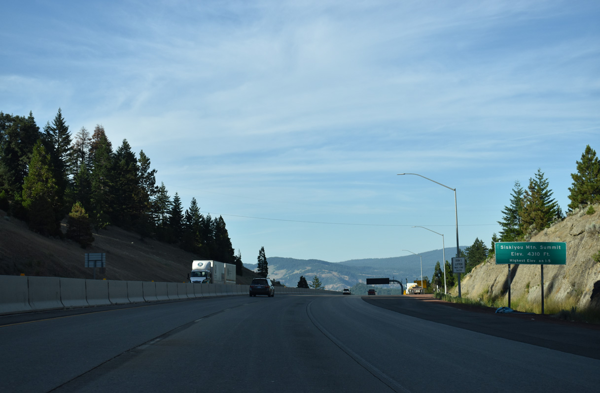
Interstate 5 peaks at the highest elevation (4,310 feet above sea level) along the entire course between Mexico and Canada at Siskiyou Mountain Summit.
07/15/23
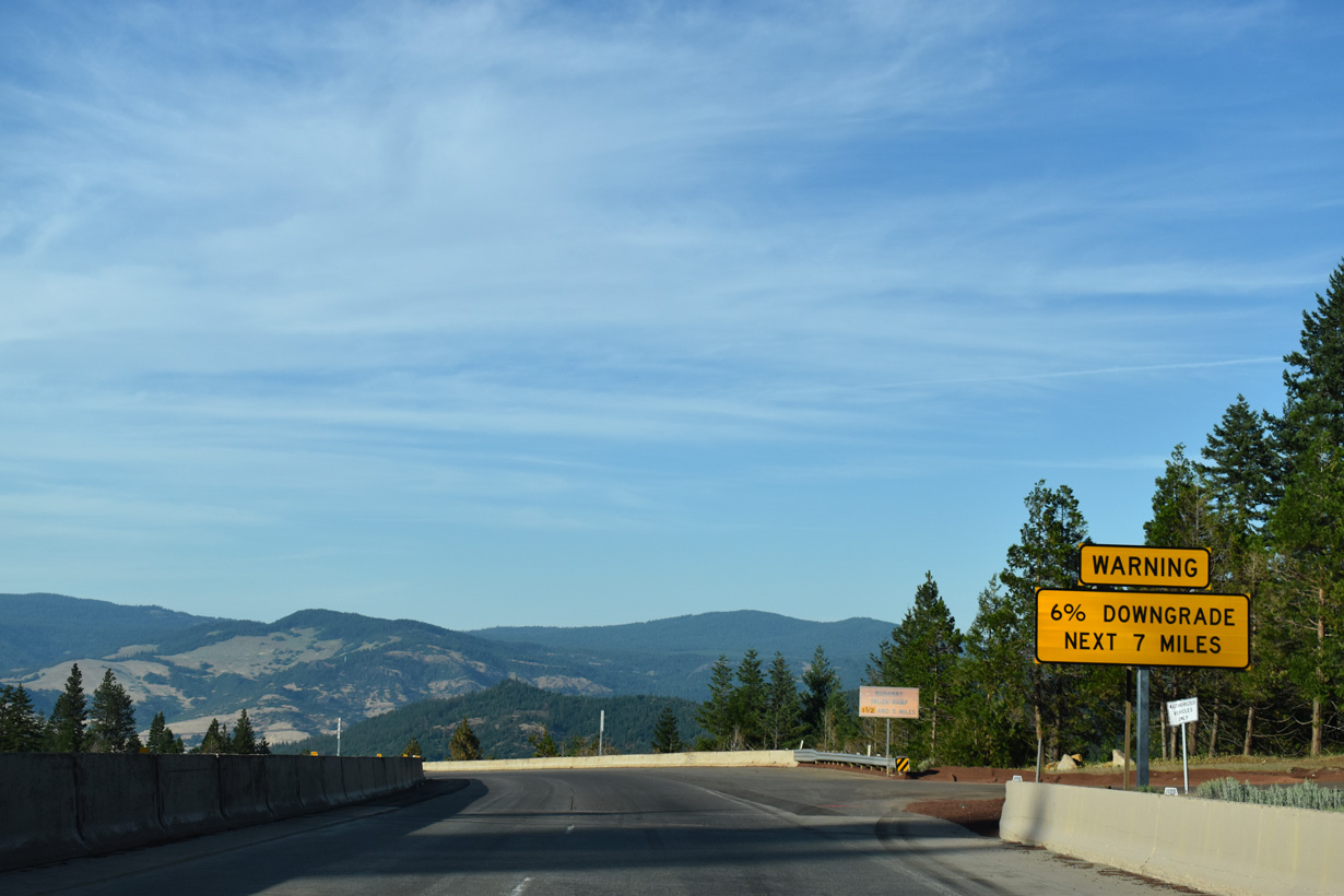
The 6% grade along Interstate 5 from Siskiyou Summit concludes seven miles to the north at Ashland (el. 1,951 feet).
03/31/05
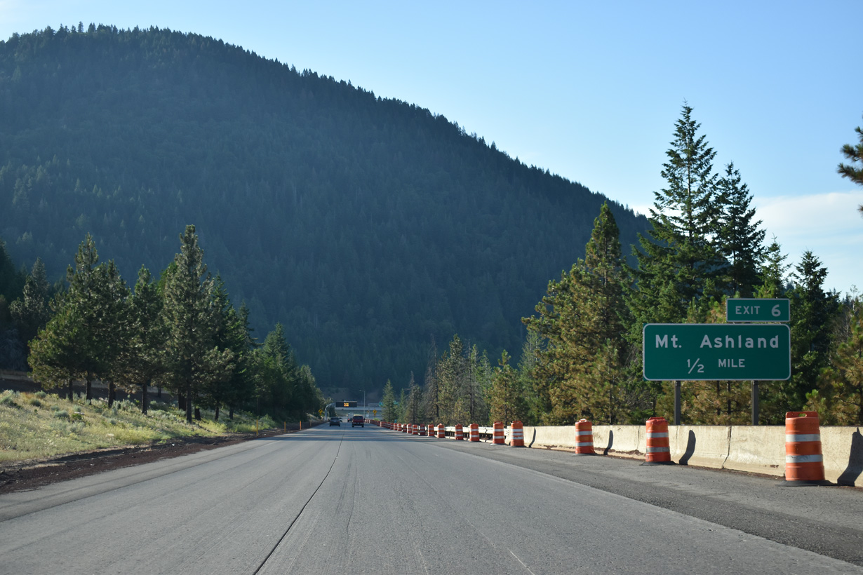
Old Highway 99 S (OR 273) returns to I-5 at a folded diamond interchange (Exit 6).
07/15/23
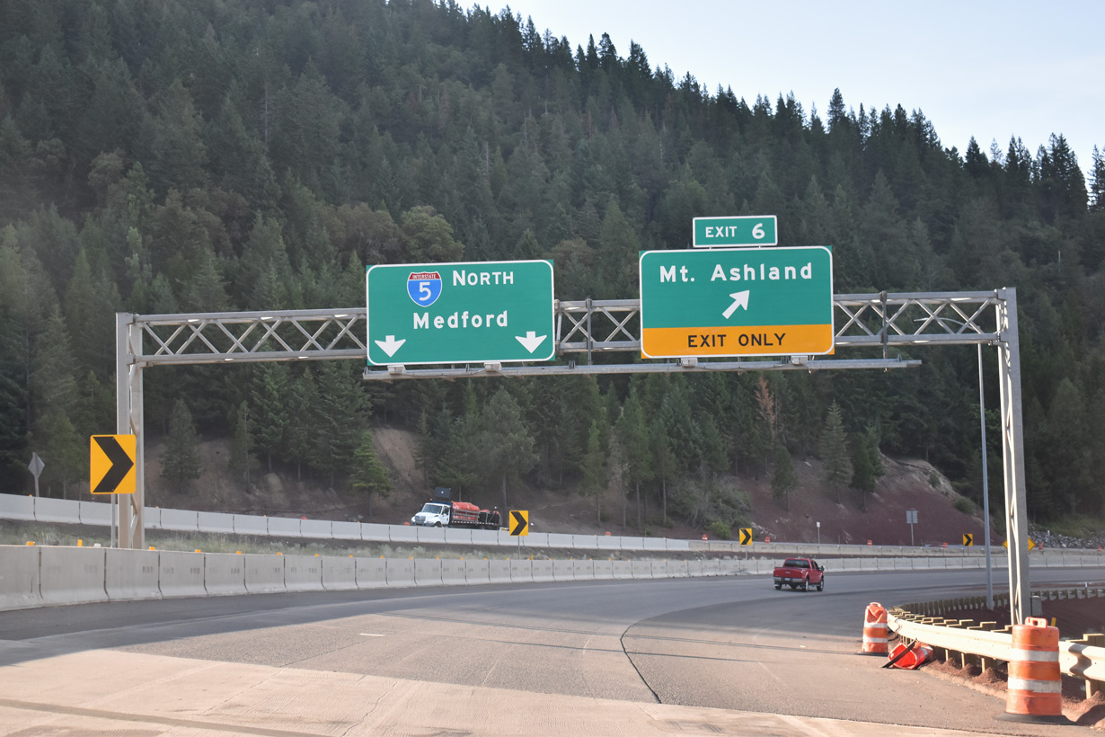
A loop ramp joins I-5 with Old Highway 99 S / Old Siskiyou Highway (OR 273) at Exit 6. Old Highway 99 S connects I-5 with Mt. Ashland Ski Road west to Mount Ashland.
07/15/23
OR 273 continues along Old Siskiyou Highway (former U.S. 99) north along a convoluted path east of I-5 to OR 66 (Green Springs Highway) and Emigrant Lake.
07/15/23
The first of two northbound truck escape ramps precedes this curve ahead of mile marker 7.
07/15/23
Interstate 5 continues north from the Siskiyou Mountains on a gradual descent nine miles to Ashland. A previous distance sign that was removed by 2007 was located a mile further south.
07/15/23
The Central Oregon & Pacific Railroad parallels I-5 to the west before navigating through a switch back and then turning south over the freeway by mile marker 7. The railroad makes a second switch back east of I-5 to resume north to Ashland.
07/15/23
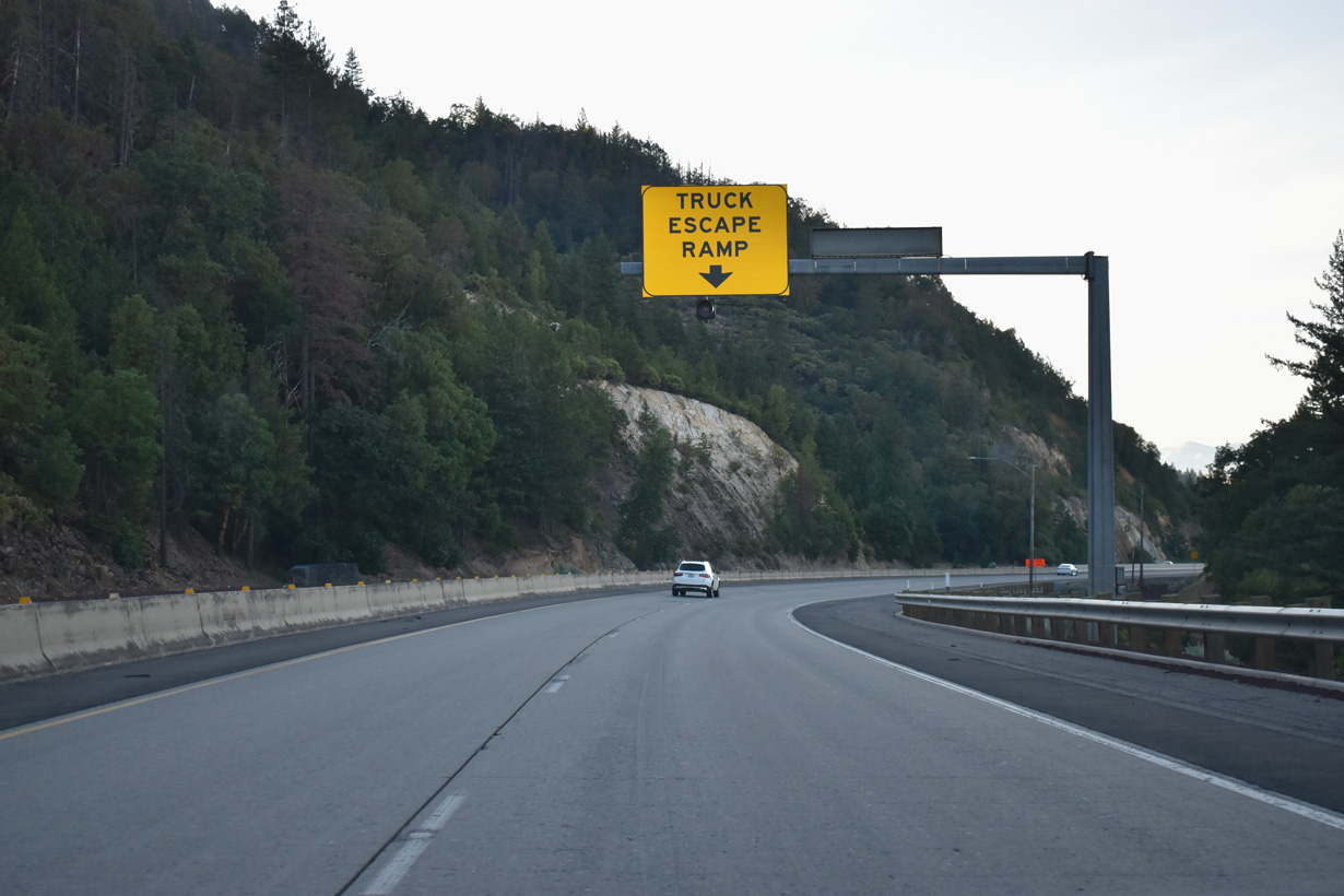
The second runaway truck ramp along Interstate 5 north precedes the Neil Creek Road underpass.
07/15/23
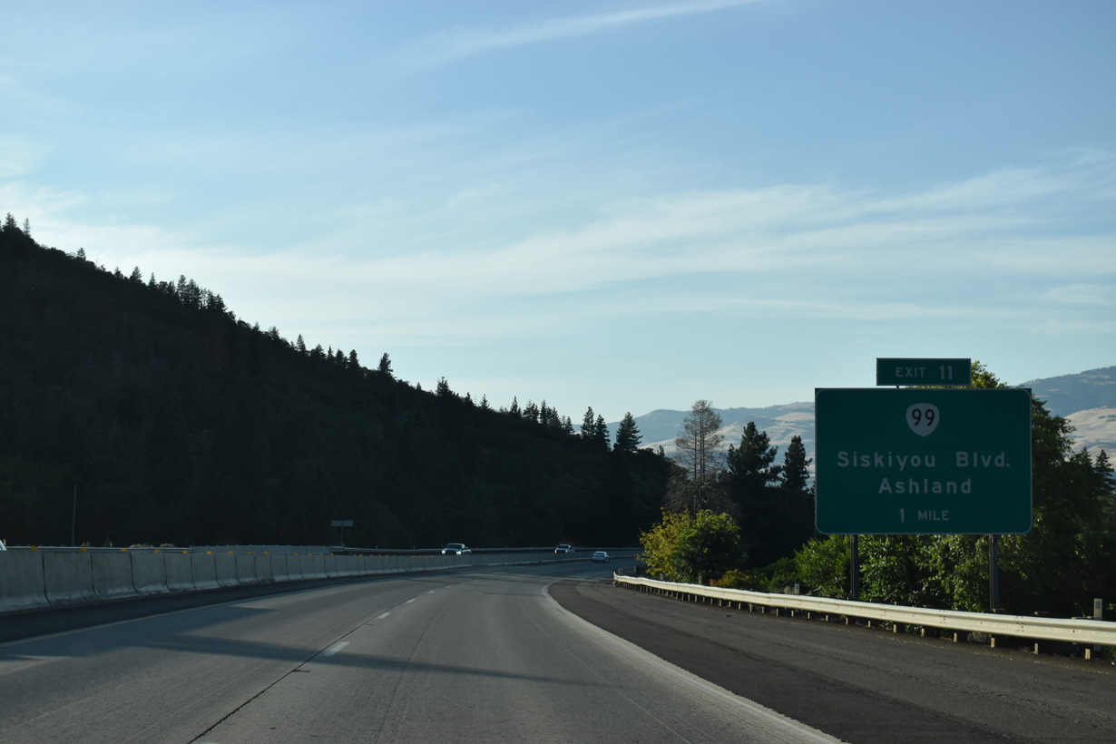
OR 99 (former U.S. 99) begins along Siskiyou Boulevard from the wye interchange at Exit 11. The state highway acts as a business loop through the city of Ashland from Interstate 5 north to Valley View Road at Exit 19.
07/15/23
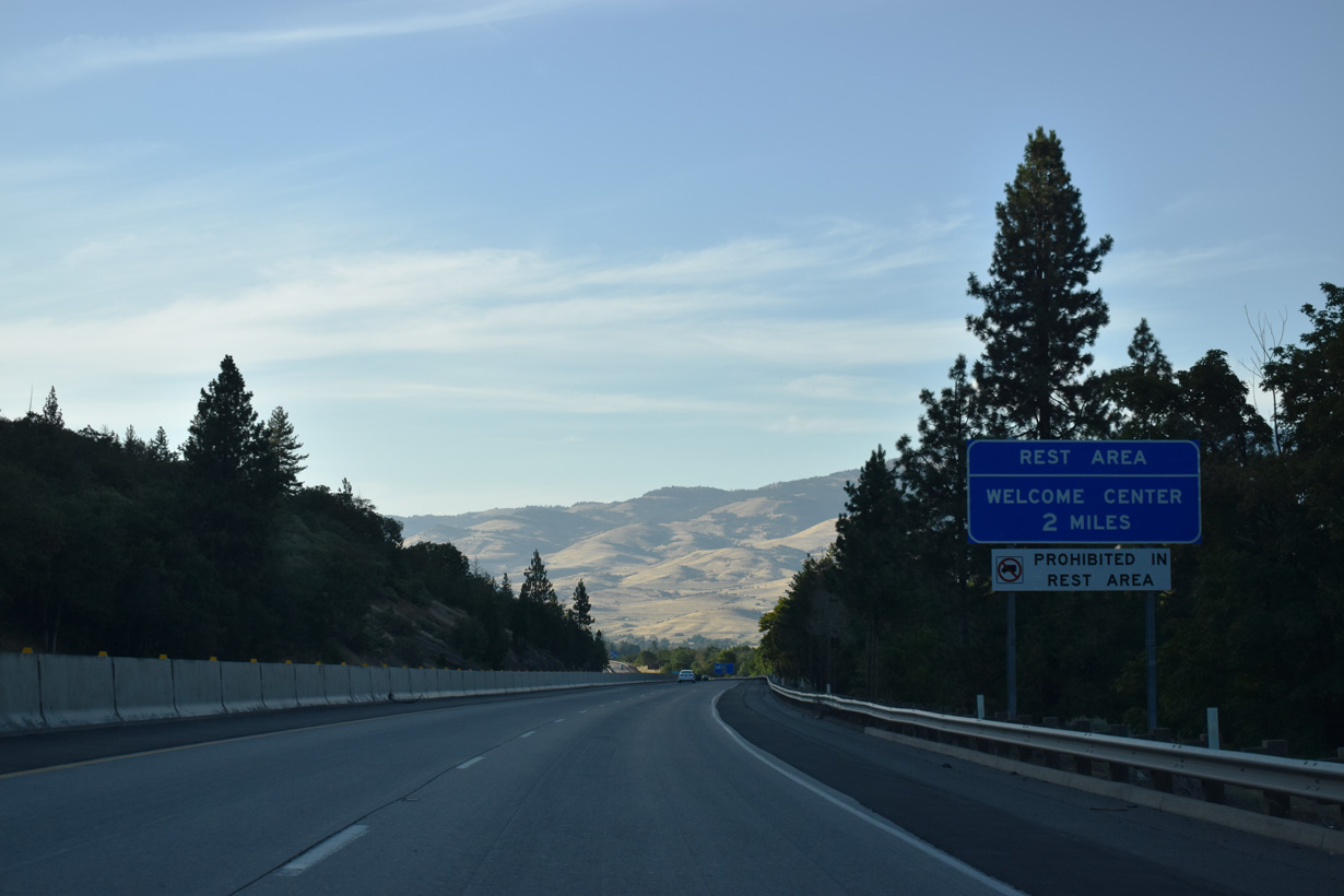
Constructed in 2018/19, a rest area and tourist information center were added Interstate 5 northbound after mile marker 12.
07/15/23
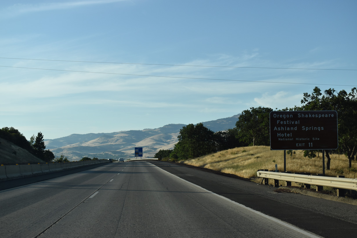
Founded in 1874, the city of Ashland is home to Southern Oregon University and the Oregon Shakespeare Festival.
07/15/23
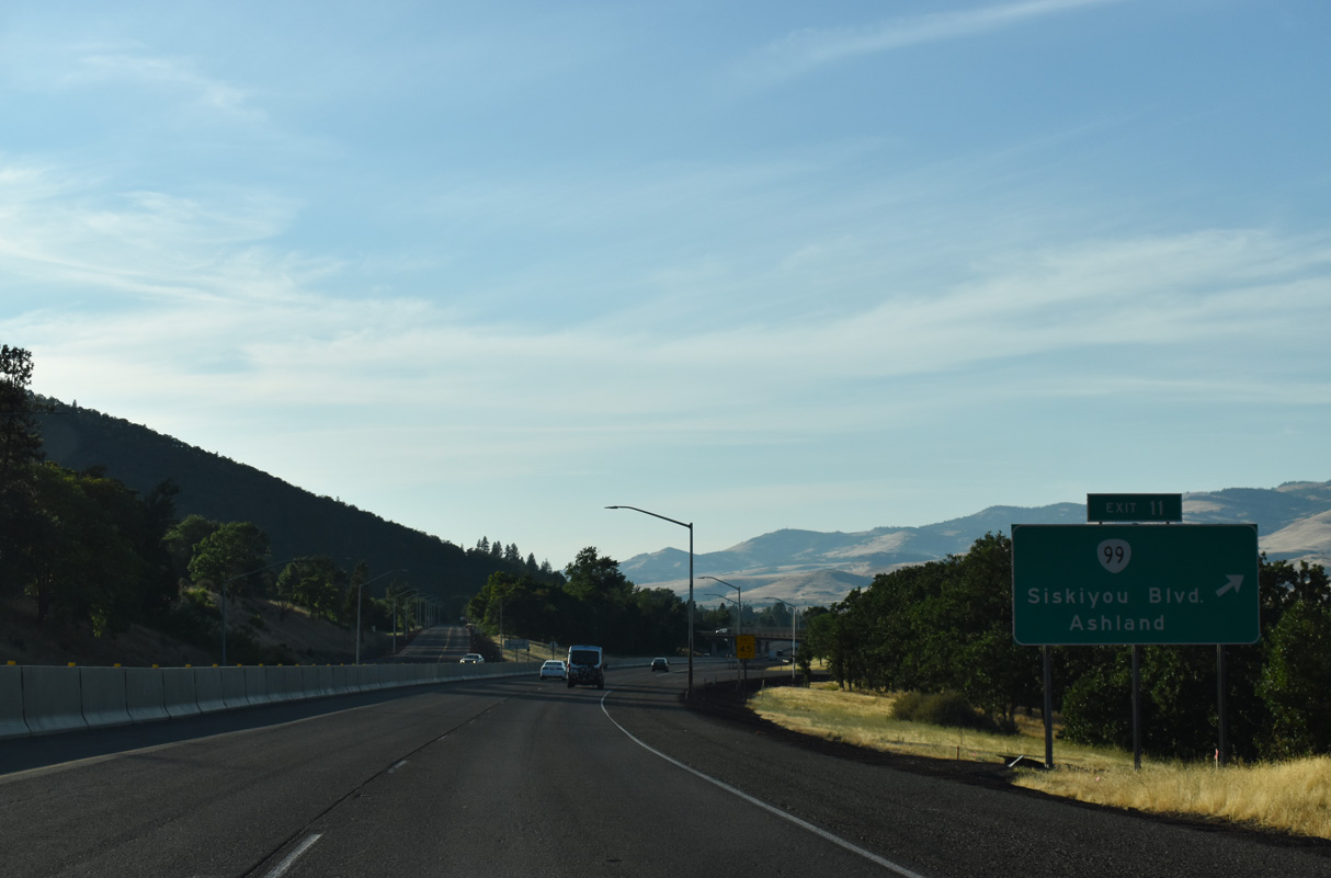
OR 99 (Siskyou Boulevard) angles 3.4 miles northwest from Exit 11 to OR 66 (Ashland Street) at Southern Oregon University.
07/15/23
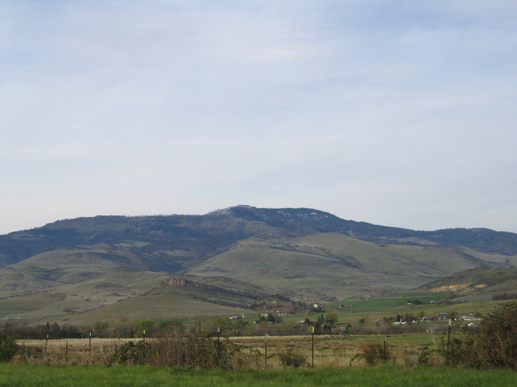
Dunn Butte and Tom Spring Mountain rises east of Ashland and the Rogue River Valley.
03/31/05
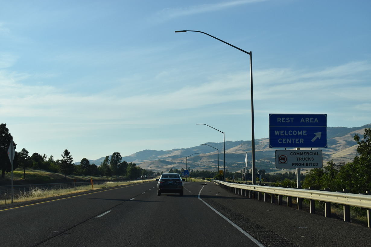
The Siskiyou Rest Area and Welcome Center along Interstate 5 northbound opened on July 30, 2019 and was constructed at a cost of $12 million (KTVZ, 2019).
07/15/23
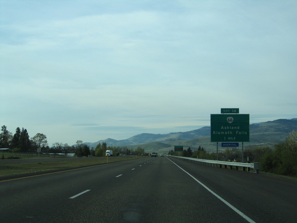
The diamond interchange (Exit 14) with OR 66 (Ashland Street) is the second of three Ashland exits along Interstate 5 north.
03/31/05
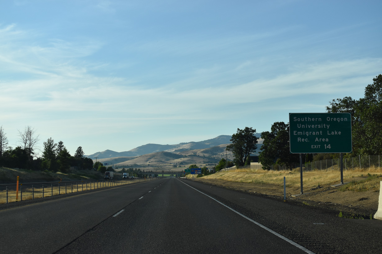
OR 66 begins 1.3 miles west of I-5 at OR 99 (Siskiyou Boulevard) by Southern Oregon University. The state highway follows Green Springs Highway east from Ashland four miles to Emigrant Lake Recreation Area.
07/15/23
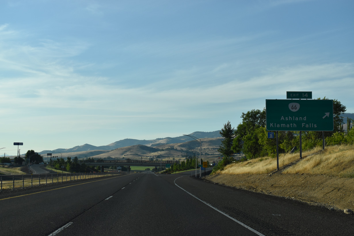
OR 66 (Ashland Street) provides the most direct route between Ashland and Klamath Falls to the east. The state highway ends at OR 140 near U.S. 97 in 58 miles. Dead Indian Memorial Road links Ashland with OR 140 near Mt. McLaughlin (el. 9,495 feet).
The first Interstate 5 northbound reassurance marker in Oregon appeared beyond the entrance ramp from OR 66 (Ashland Street) at Exit 14. Main Street passes over the freeway ahead.
03/31/05
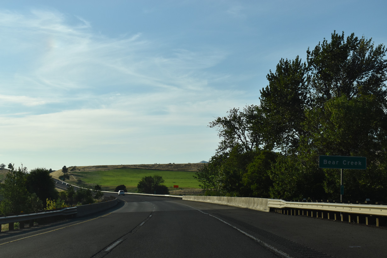
Interstate 5 turns more to the northwest across Bear Creek at mile marker 15.
07/15/23
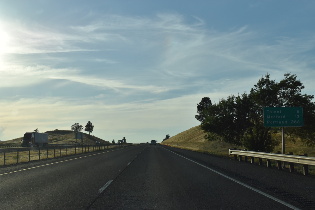
Paralleling Bear Creek, continues on a northwest course 5.6 miles to Talent. The freeway serves as a buffer between urban areas of Ashland and rural farmland to the north.
07/15/23
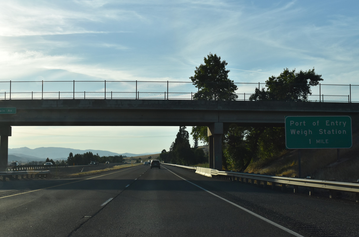
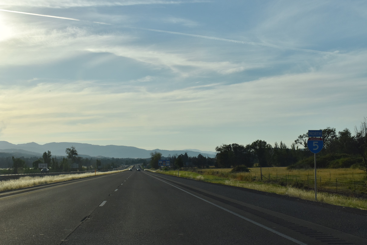
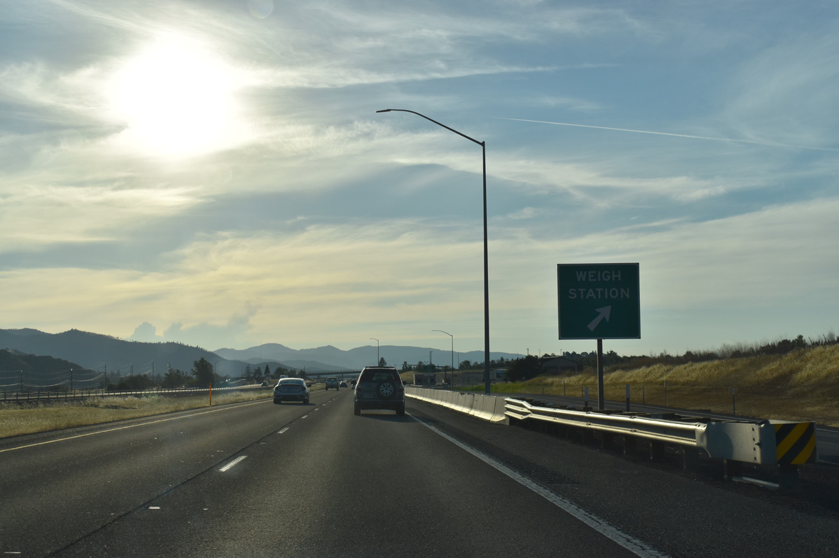
The first Oregon Port of Entry is located beyond the Ashland city limits at mile marker 18.
07/15/23
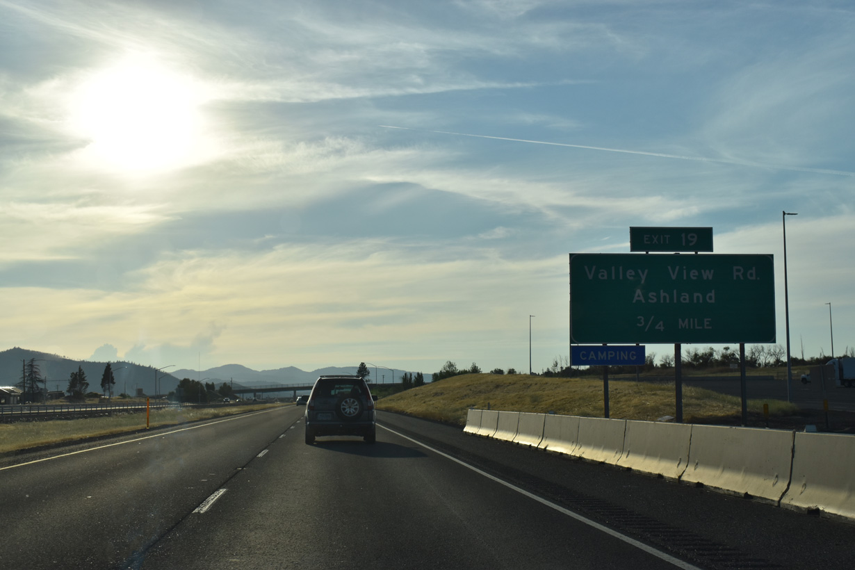
Three quarters of a mile separate the Port of Entry along I-5 north with the diamond interchange (Exit 19) at South Valley View Road. Inventoried by ODOT as the N Ashland Connector Number 2, South Valley View Road links Exit 19 with OR 99 (Rogue Valley Highway), 0.59 miles to the south.
07/15/23
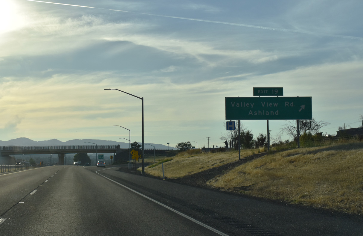
South Valley View Road in conjunction with OR 99 (Rogue Valley Highway) south provides a direct route to Main Street and Downtown Ashland. South Valley View Road north leads into agricultural areas beyond Myer Creek.
07/15/23
I-5 runs east of the city of Talent between mile markers 20 and 22. Located 1,635 feet above sea level, Talent began as the homestead for Jacob Wagner in 1853 and later as the military post, Fort Wagner. The fort never really saw combat and instead became a focal point for social and religious activities. Growth continued in 1889 when A.P. Talent designated a town site here, naming it Talent. Incorporation followed on November 11, 1911.
07/15/23
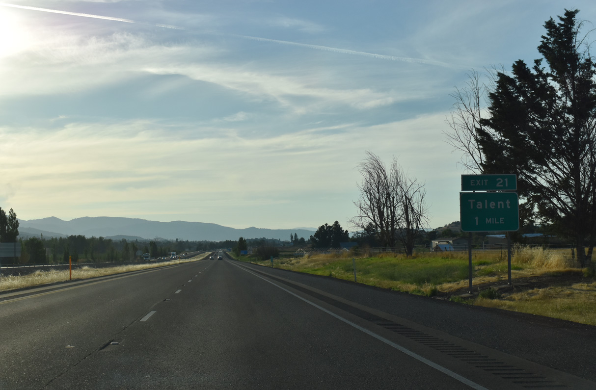
West Valley View Road meets Interstate 5 at a parclo interchange (Exit 21) a half mile east of OR 99 (Pacific Highway) along the Talent city line.
07/15/23
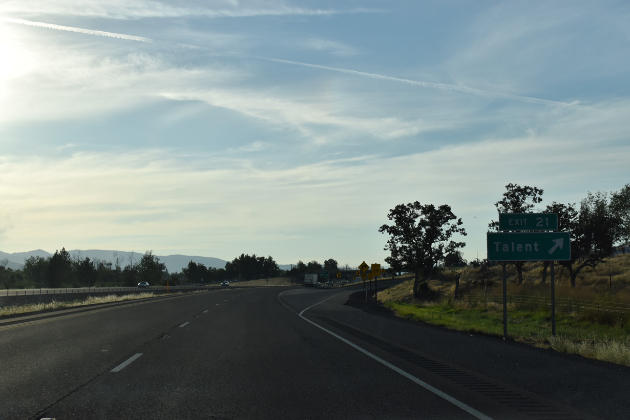
West Valley View Road leads 1.8 miles east from Exit 21 back to South Valley View Road and 0.8 miles west to Main Street in Talent. The road formerly extended west to Talent Avenue, but a roundabout with an extension of E Main Street replaced that connection.
07/15/23
Confirming marker posted along Interstate 5 northbound ahead of the Suncrest Road over crossing east of Talent.
07/15/23
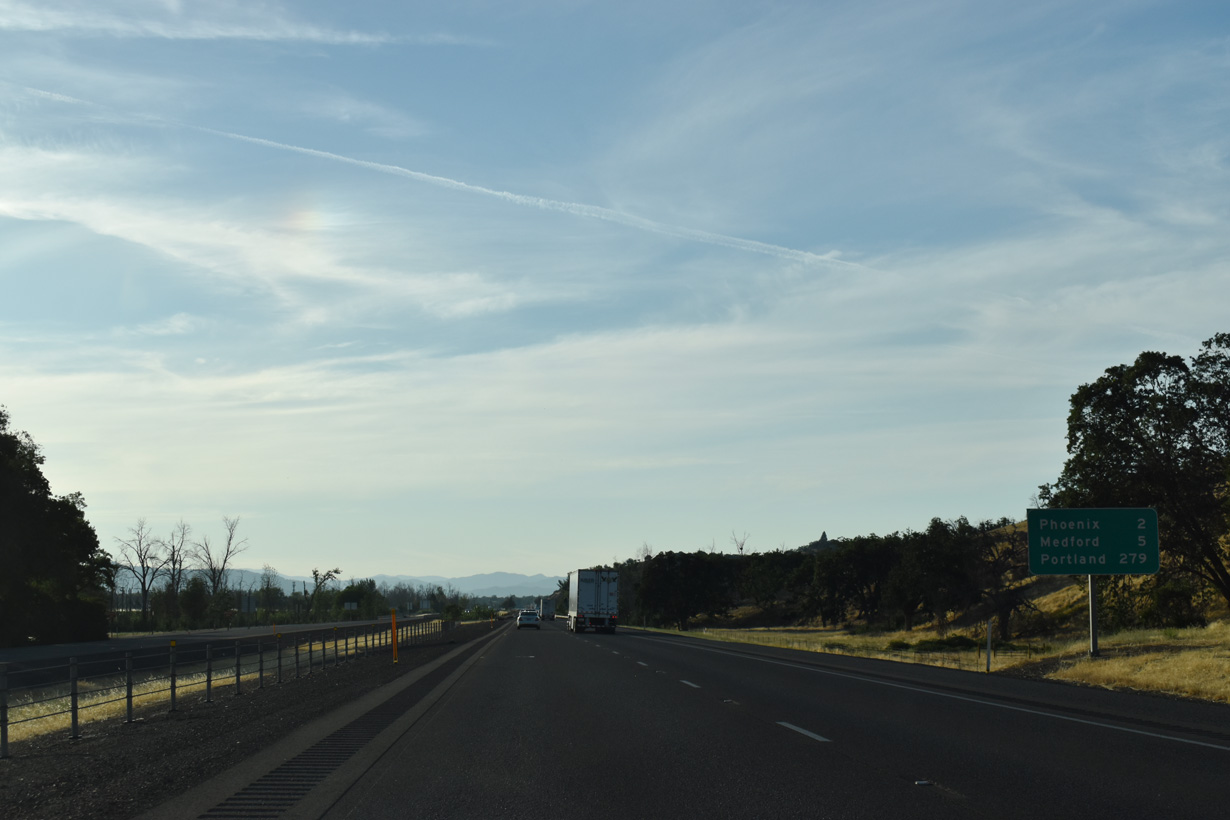
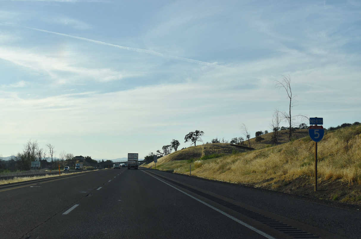
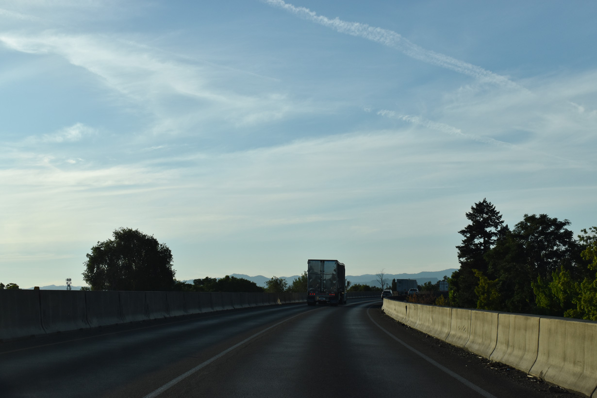
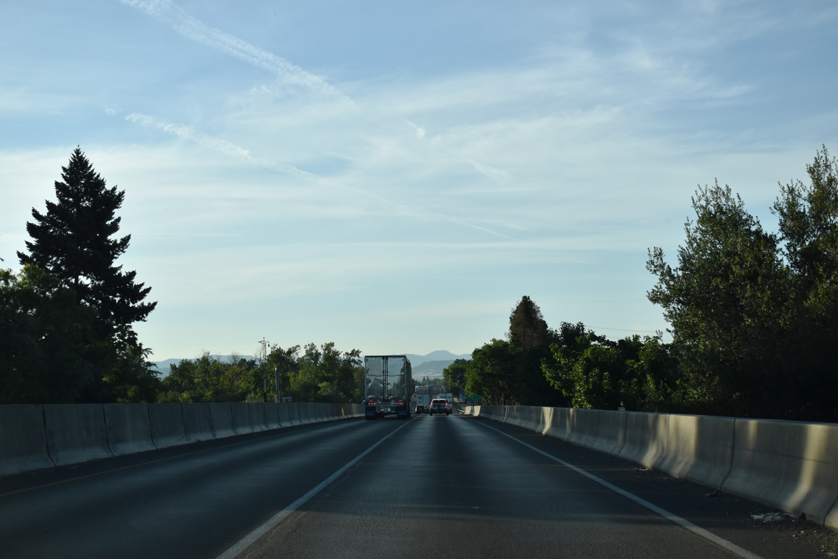
Interstate 5 continues northwest two miles from Talent to Phoenix and five miles into Medford.
07/15/23
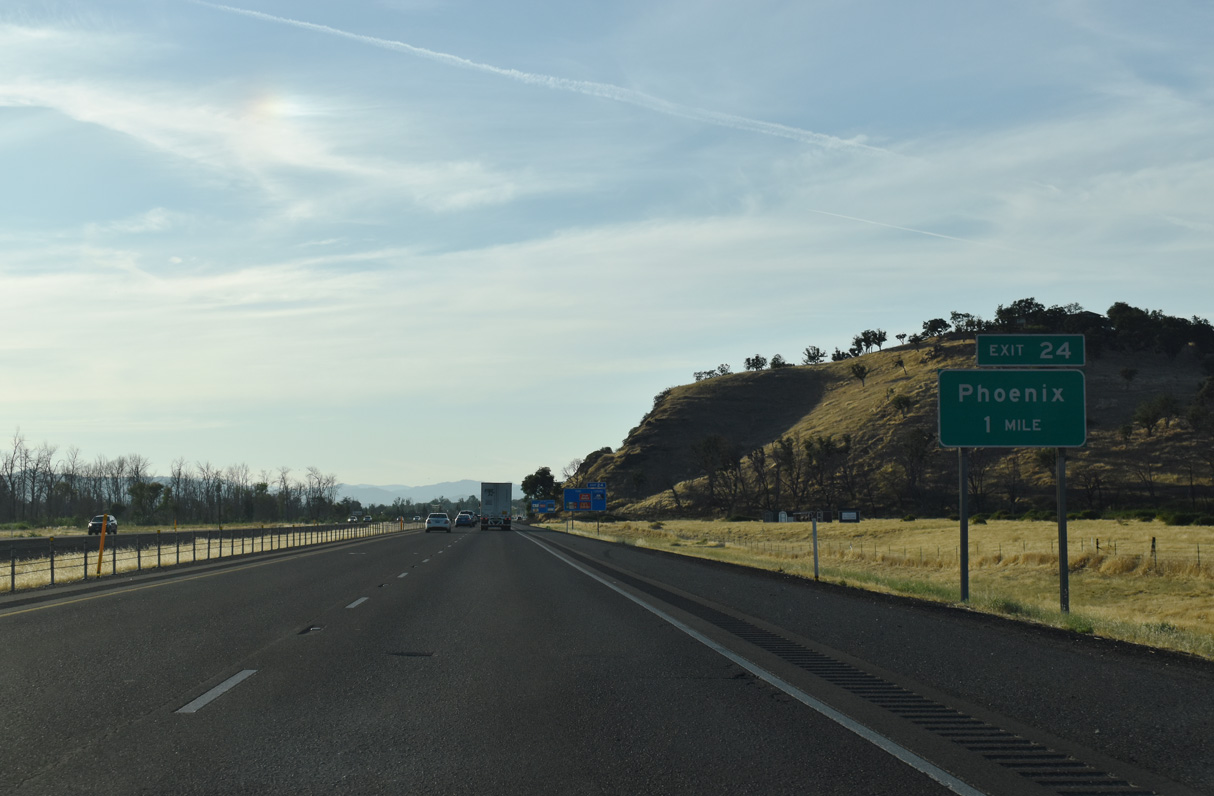
The succeeding exit connects Interstate 5 north with N Phoenix Road in the city of Phoenix. Underway between 2014 and July 2016, the $72 million Fern Valley Interchange project replaced what was a diamond interchange with Fern Valley Road into a DDI. The last ramp at the new exchange opened to traffic on July 22, 2016 (Oregon Department of Transportation, 2016).
07/15/23
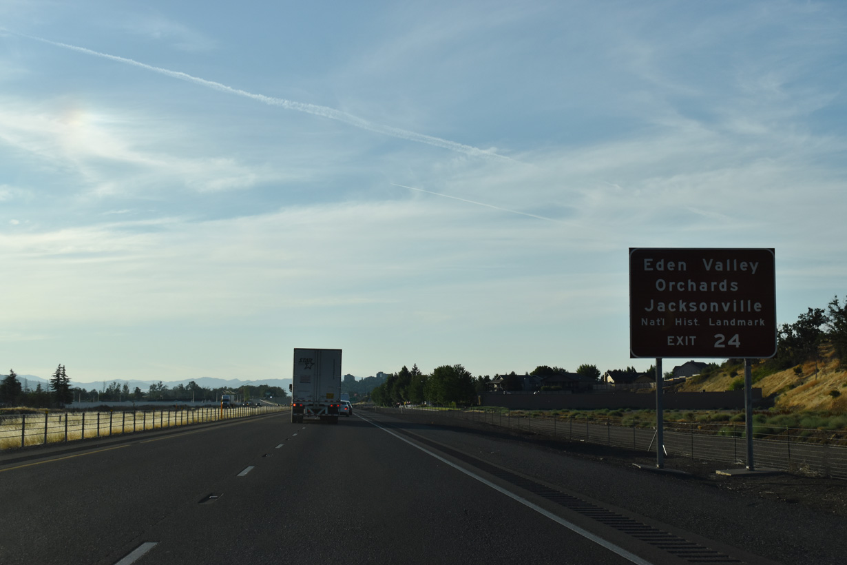
Points of interest for Exit 24 include Eden Valley Orchards and Historic Jacksonville.
07/15/23
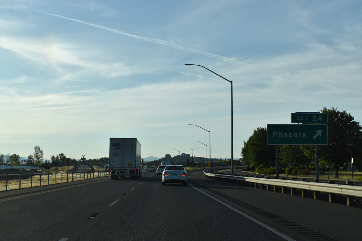
A realignment of N Phoenix Road replaced Fern Valley Road west across Interstate 5 to 0.4 miles to OR 99 (Main Street). Turning north from Exit 24, the arterial narrows to two lanes ahead of Centennial Golf Club in Medford.
07/15/23
The missing confirming marker posted in north Phoenix by mile marker 25 was restored by 2024.
07/15/23
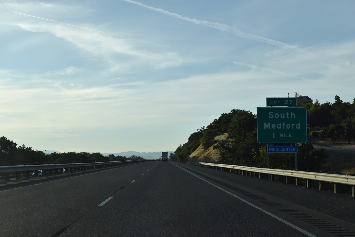
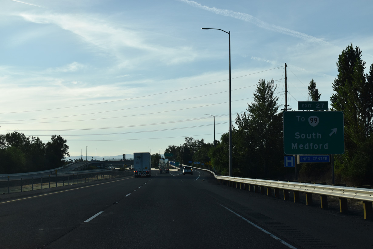
Construction underway in 2007/08 replaced what was a six-ramp parclo interchange linking I-5 and Barnett Road with a SPUI to the south with Garfield Street / Highland Drive. Exit 27 with Barnett Road serves a tourist information center for the Rogue River Valley and Medford.
07/15/23
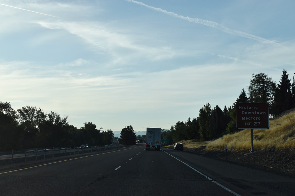
Garfield Street southwest from Exit 27 to OR 99 (Riverside Avenue) north leads to historic Downtown Medford. OR 99 partitions into the one way couplet of Riverside Avenue north and Central Avenue south through the Medford business district. I-5 parallels Bear Creek to the east.
07/15/23
A large area of big box retail and hotels occupies space between Interstate 5 at Exit 27 and OR 99 (Rogue Valley Boulevard). Garfield Street west and Highland Drive north extend from the area into residential neighborhoods in Medford.
07/15/23
A four lane viaduct takes Interstate 5 across Bear Creek from E 12th Street north to E Jackson Street east of Downtown Medford.
07/15/23
The elevated portion of Interstate 5 runs alongside Bear Creek north from E 10th Street.
07/15/23
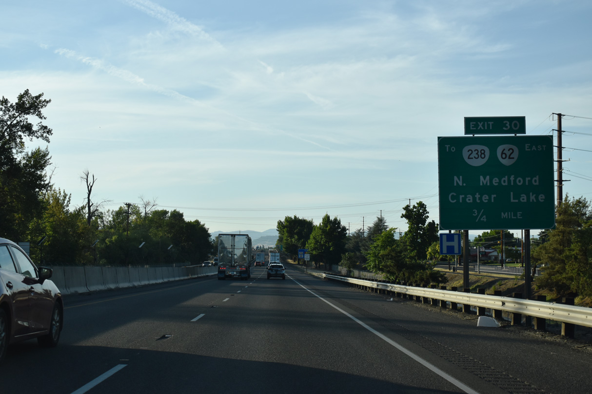
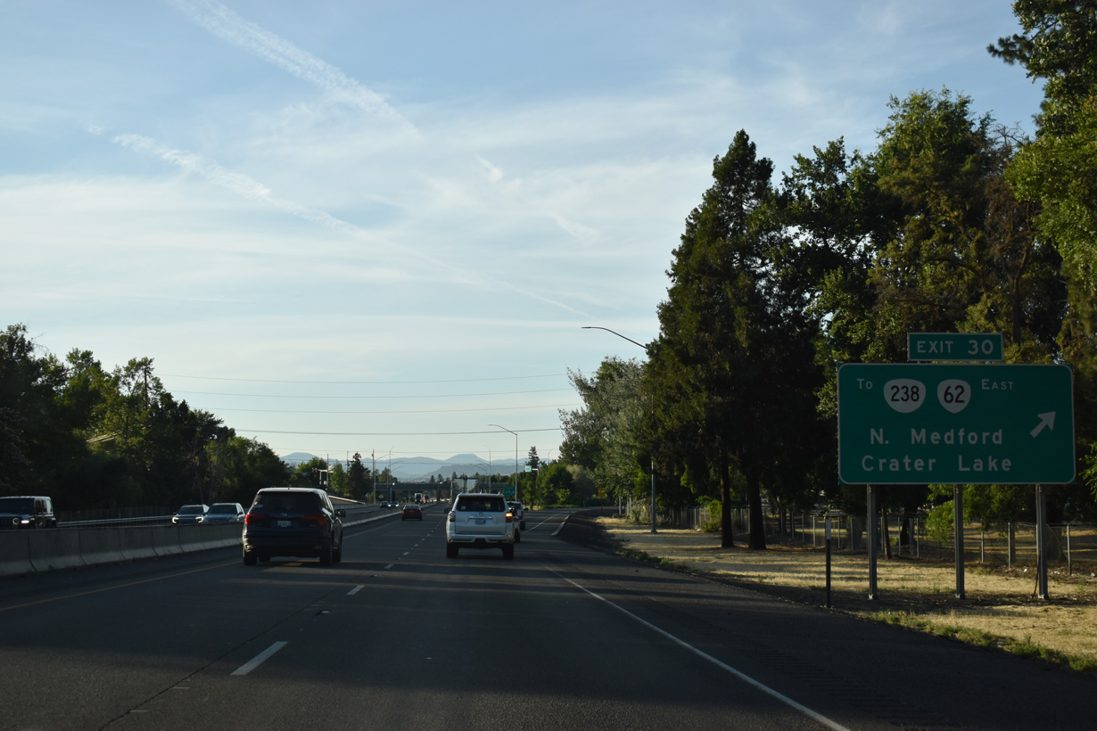
OR 62 (Crater Lake Highway) commences 0.40 miles east of I-5 at OR 99 (N Pacific Highway) and OR 238 (Rossanley Drive). OR 62 links the Medford area with Crater Lake National Park to the far northeast. The state route forms a 103.95 mile long arc between Medford and U.S. 97 near Chiloquin.
07/15/23
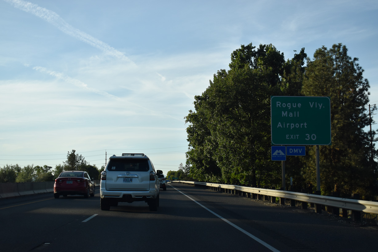
A grade separated intersection joins OR 62 (Crater Lake Highway) with parallel Biddle Road north to Rogue Valley International-Medford Airport (MFR). Rogue Valley Mall is west of I-5 adjacent to OR 99 (Riverside Avenue) northbound and OR 62. OR 99 southbound follows Court Street to Central Avenue.
07/15/23
Construction finished in 2005 rebuilt the exchange at Exit 39 into a six-ramp parclo interchange. OR 238 (Jacksonville Highway) comprises a 38.75 mile long loop southwest from Medford to Jacksonville and Ruch and northwest to Applegate and U.S. 199/OR 99 in Grants Pass.
07/15/23
I-5 advances northwest into the city of Central Point. Founded in 1889, Central Point lies at 1,282 feet above sea level and is home to around 19,000 residents. The city's economy is fueled by agriculture, tourism, timber products and retail trade industries.
07/15/23
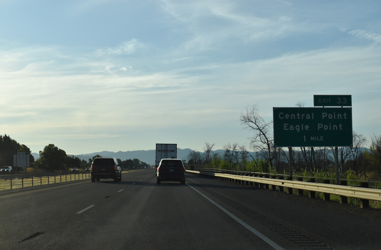
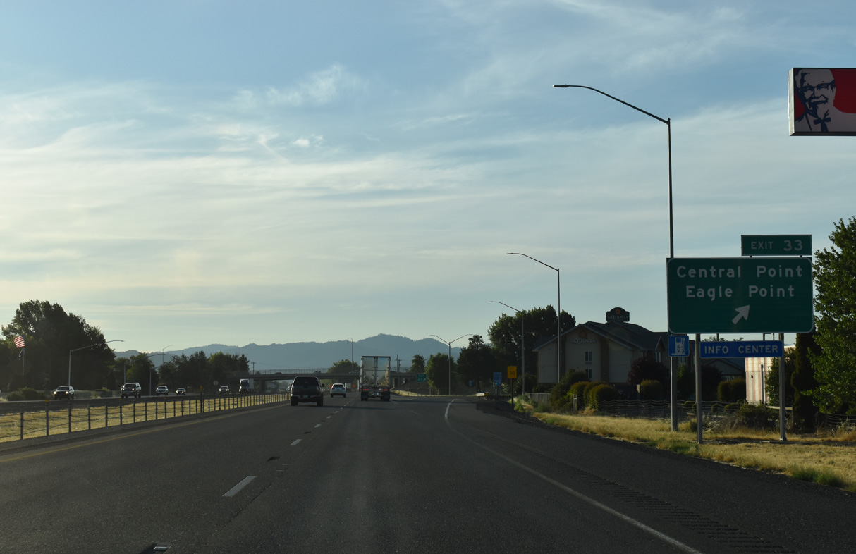
Pine Street arcs 0.8 miles east from OR 99 (Front Street) through Downtown Central Point to the diamond interchange at Exit 33. Eagle Point is a city nine miles to the northeast along OR 62.
05/28/06
Pine Street east becomes Biddle Road at Hamrick Road en route to Rogue Valley International-Medford Airport (MRD). Peninger Road forms a frontage road along the east side of I-5 north from Pine Street to the Jackson County Expo complex and Upton Road.
07/15/23
Bear Creek, which has paralleled Interstate 5 north since mile marker 15 near Ashland, diverges from the freeway northward on the ensuing stretch. The creek flows into the Rogue River southwest of Lower Table Rock.
07/15/23
Continuing from Center Point, I-5 turns west eight miles to Gold Hill and 23 miles to Grants Pass.
07/15/23
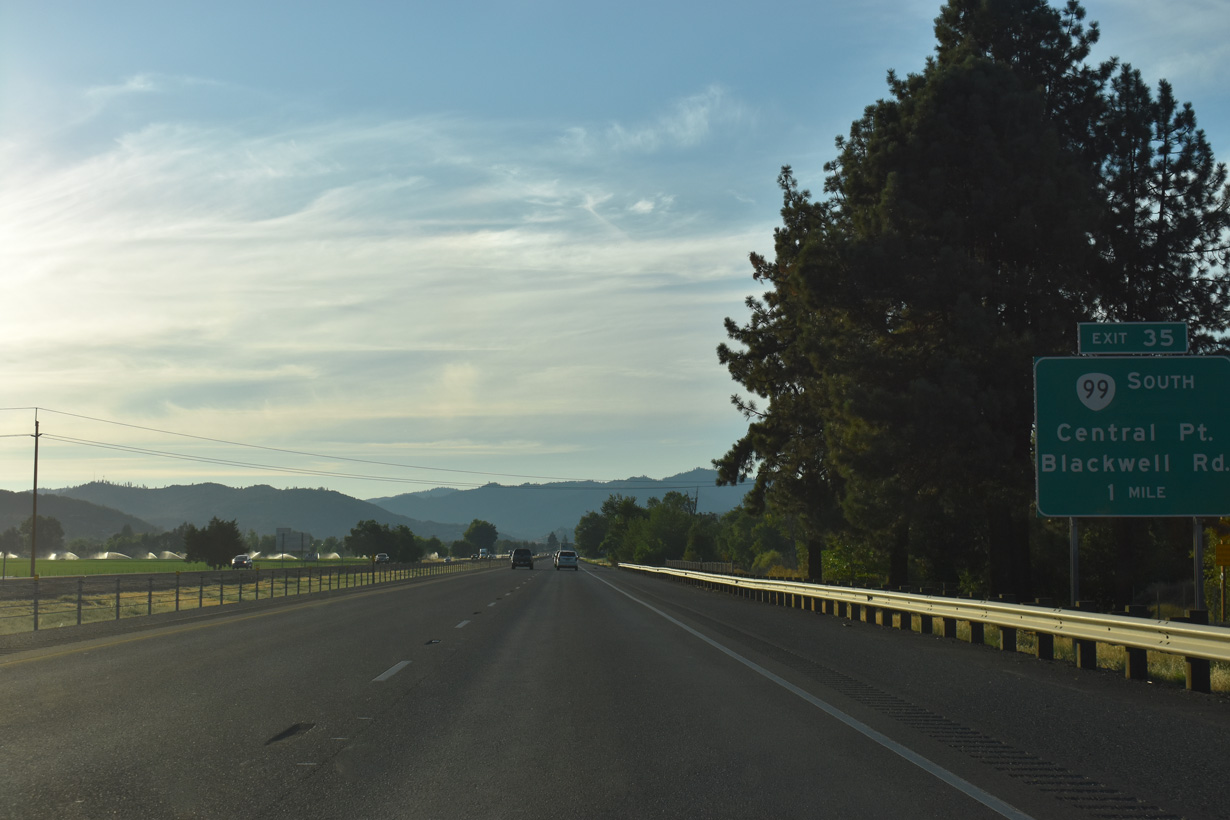
OR 99 (Pacific Highway) north from Center Point meets Interstate 5 at the parclo interchange (Exit 35) opposite from OR 140 (Blackwell Road) south. OR 99 combines with I-5 west 5.3 miles to Gold Hill. Parallel Blackwell Road is the former alignment of U.S. 99 west to Gold Hill.
07/15/23
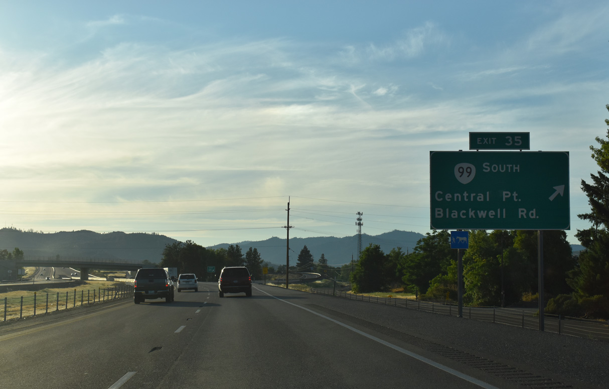
OR 140 lines Blackwell Road 1.2 miles north from Exit 35 to Kirtland Road. OR 140 turns east along Kirtland Road en route to White City and Klamath Falls. The exchange at Exit 35 was originally a diamond interchange. Ramps along southbound were reconfigured to meet OR 99 at Willow Springs Road.
07/15/23

Lower Table Rock rises prominently to the north adjacent to the Rogue River Valley
03/31/05

OR 99 is omitted from reassurance shields along Interstate 5 between Exits 35 and 40.
07/15/23

A barrier median separates the roadways along I-5/OR 99 (Pacific Highway) where the freeway heads west to Hidden Valley.
05/28/06

Beyond Milepost 38 and south of Blackwell Hill, I-5/OR 99 descend toward the Rogue River valley.
05/28/06

OR 99 branches north from I-5 alongside OR 234 (Gold Hill Spur) from the diamond interchange (Exit 40) with Old Stage Road. OR 99/234 turn west at Blackwell Road and cross the Rogue River along 2nd Avenue into Gold Hill. Incorporated in 1895, Gold Hill began as a mining town after the discovery of a single gold nugget. The town grew as a trading post.
07/15/23

Old Stage Road travels seven miles northwest from Beall Lane outside of Central Point to I-5 at Exit 40. OR 234 is an Oregon Scenic Byway from Gold Hill northeast to OR 62 north of Eagle Point. The scenic byway extends along OR 62 northeast to OR 230, and on OR 230 and OR 138 around Crater and Diamond Lakes.
07/15/23

References:
KTVZ. (2019, July 30). New I-5 rest area, welcome center opens near Ashland. KTVZ.com. https://ktvz.com/news/2019/07/30/new-i-5-rest-area-welcome-center-opens-near-ashland/
Oregon Department of Transportation. (2016, July 22). Final off-ramp opens at I-5 Phoenix interchange. GovDelivery. https://content.govdelivery.com/accounts/ORDOT/bulletins/15808b0
Photo Credits:
- Brent Ivy: 03/31/05, 07/15/23
- AARoads: 03/31/05, 07/15/23
- Andy Field, Joel Windmiller: 05/28/06
Connect with:
Page Updated Saturday August 16, 2025.