
Route 99 and Historic U.S. 99
OR 99 follows the route of Old U.S. 99, mostly following Interstate 5 between Ashland near Siskiyou Summit and Eugene. North of Eugene, OR 99 divides into OR 99W and OR 99E in Junction City, with OR 99W passing through Corvallis and McMinnville and OR 99E serving Albany and Salem. The two routes converge in Portland at the foot of the Interstate Bridge over the Columbia River, although significant segments of both OR 99E and OR 99W have been decommissioned and shifted to city maintenance.
U.S. 99, the Pacific Highway, was the main north-south route between northern California, western Oregon and western Washington. U.S. 99 served the cities of Ashland, Medford, Grants Pass, Roseburg, Eugene-Springfield, Albany, Salem, and the greater Portland metropolitan area. The completion of Interstate 5 replaced the need for U.S. 99, and in 1971 the highway was decommissioned and renumbered as Oregon Route 99. The majority of old U.S. 99 was retained in the state route system, however several segments bypassed by I-5 were turned over to county maintenance. Sections of OR 99 overlap with I-5 from Ashland north to the Columbia River.
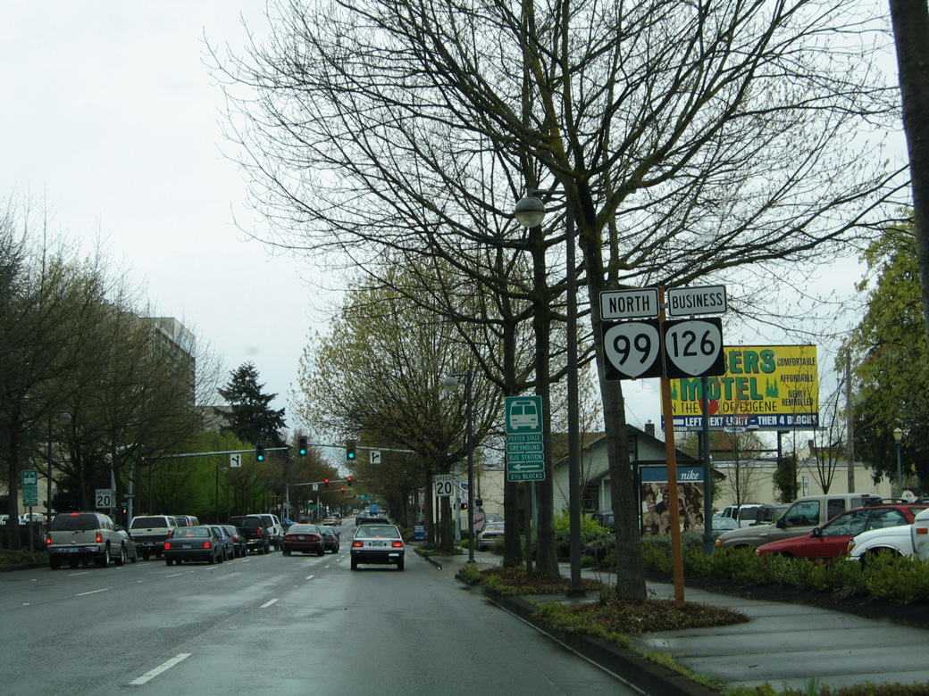
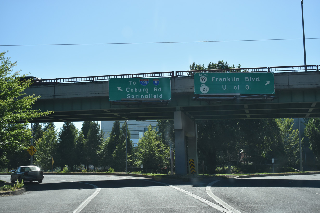
Within the city of Eugene, U.S. 99 combined with U.S. 126. The two highways overlapped along Franklin Boulevard west to Broadway, Mill Street, and the one-way couplet of 6th/7th Avenues. U.S. 126 was relocated to a freeway in 1971 and decommissioned in 1972. Oregon Route 126 Business follows the former surface street alignment through both Downtown Eugene and Springfield. OR 99/OR 126 Business overlap as their predecessors did from Interstate 105 east to I-5.
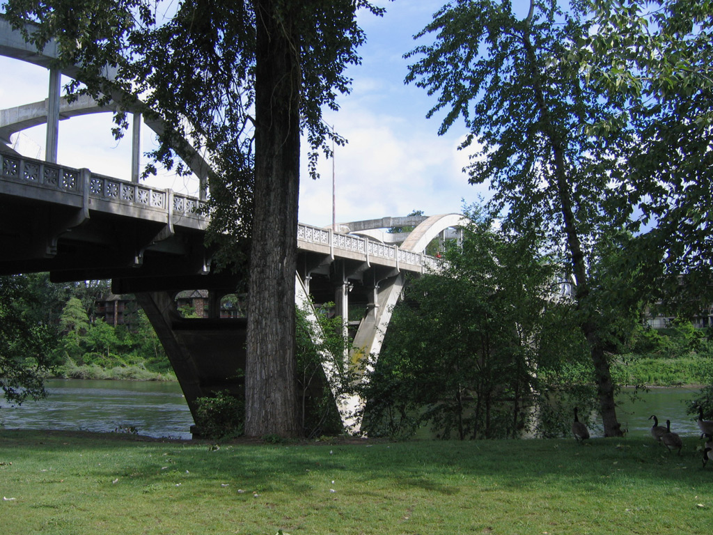
The Caveman Bridge is a through arch bridge crossing the Rogue River along OR 99 (6th Street) southbound in Grants Pass. The historic span opened traffic in 1931 as part of U.S. 199. OR 99 northbound follows the adjacent 7th Street Bridge toward Downtown Grants Pass. 05/28/06
Oregon Route 99 Guides
South - Grants Pass - 36 photos
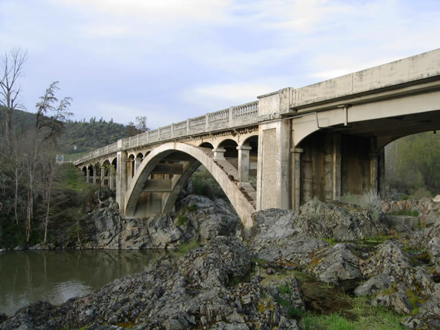
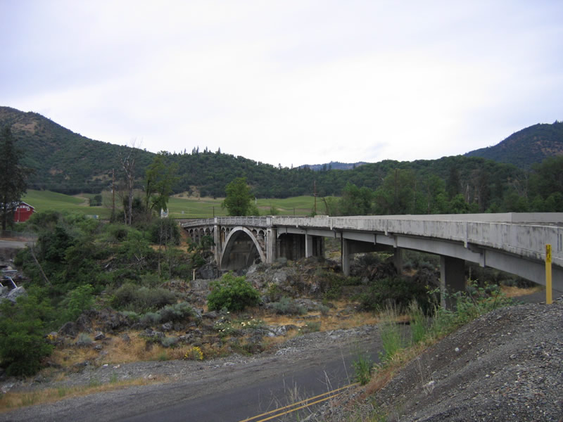
Rock Point Bridge
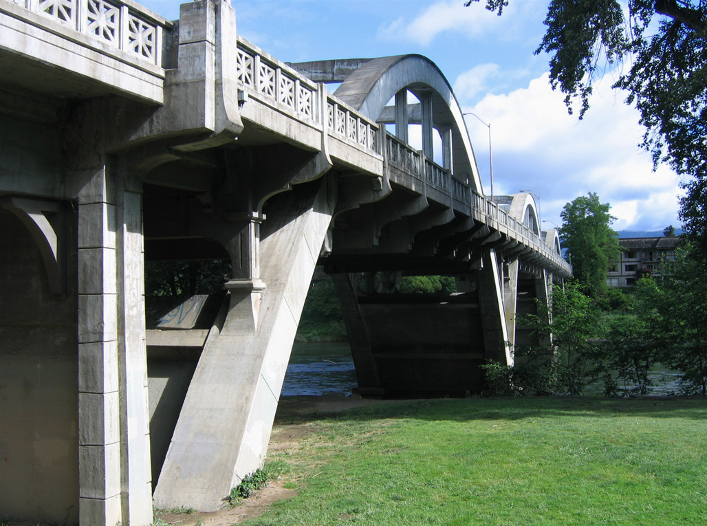
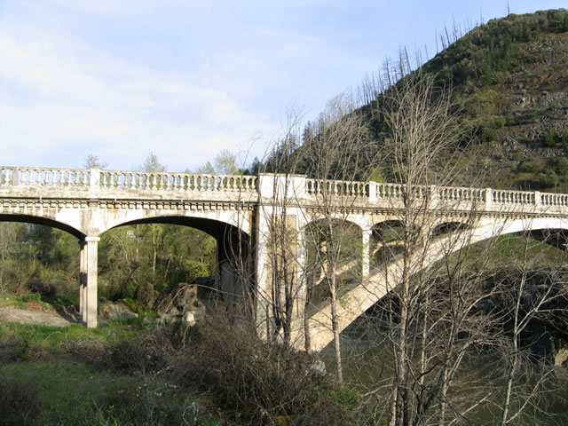
Known also as the Old Pacific Highway Bridge, the Rock Point Bridge spans the Rogue River at Rock Point west of Gold Hill in southern Oregon. Opened to traffic in 1920, the concrete arch span replaced a covered bridge built in 1859. Operated by the Rock Point Bridge Company with tolls collected, the span was later purchased by Jackson County and made into a free crossing.1
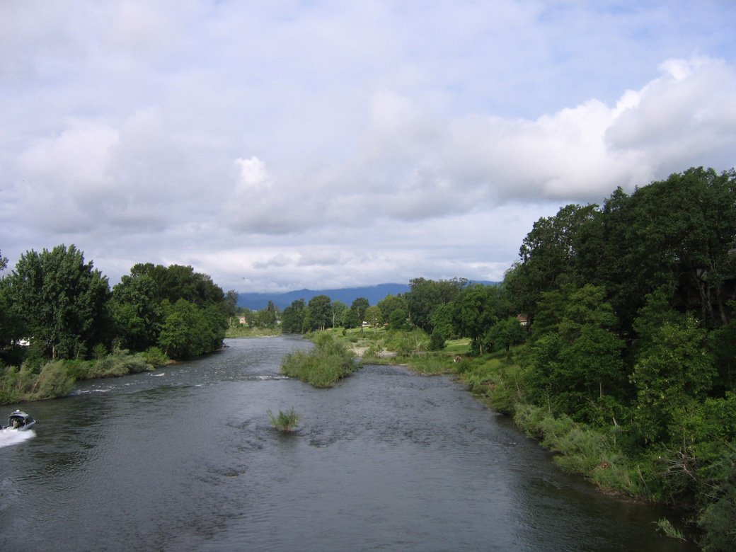
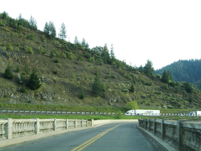
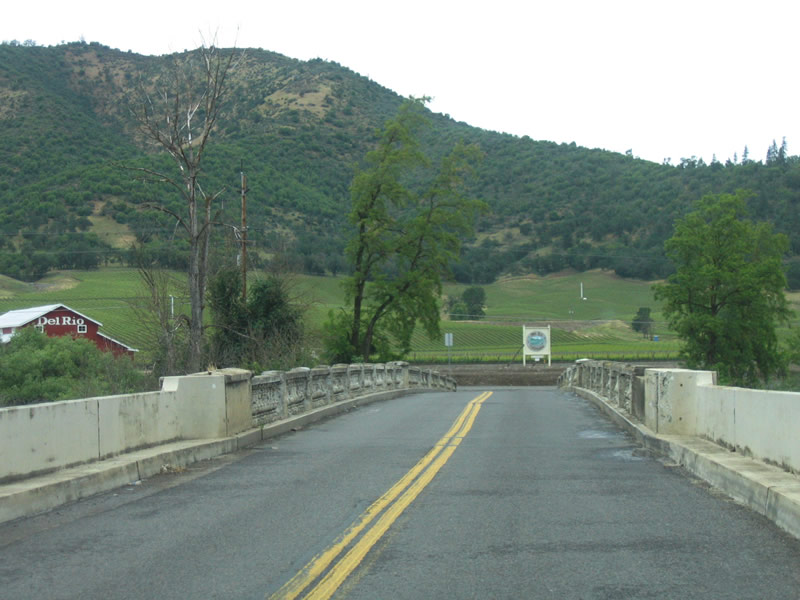
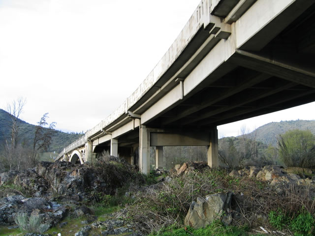
The Rock Creek Bridge carries OR 99 across the Rogue River between North River Road / Sams Valley Highway and Rogue River Highway west of Gold Run. The Rogue River flows south from Diamond Lake in the Cascade Range to Gold Hill, Rogue River, Grants Pass and the Pacific Ocean at Gold Beach.
03/31/05
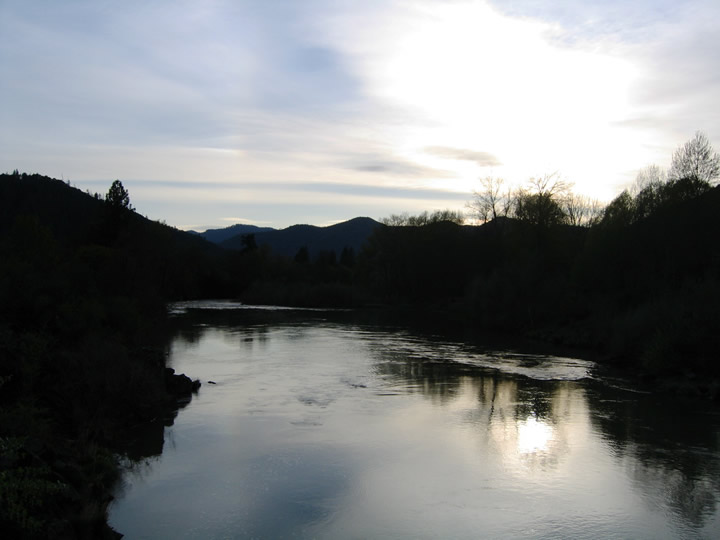
Looking west at the Rogue River from the Rock Point Bridge area. The Rogue was designated a Wild and Scenic River by Congress.
03/31/05
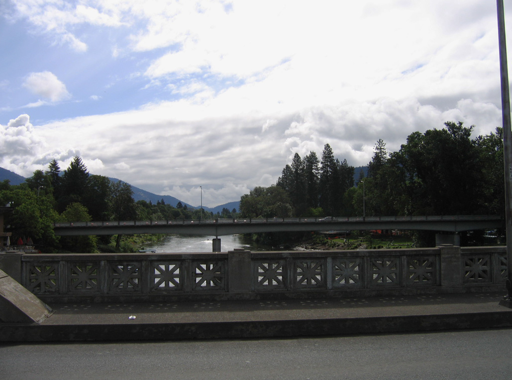
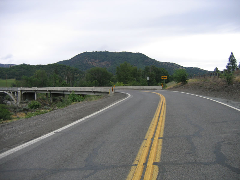
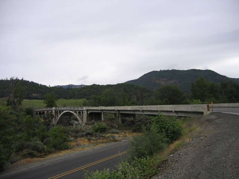
OR 99 (Sams Valley Highway) turns onto the Rock Point Bridge west of Gold Hill at Rock Point in southwestern Oregon. Interstate 5 parallels the state route closely along the south banks of the Rogue River.
03/31/05
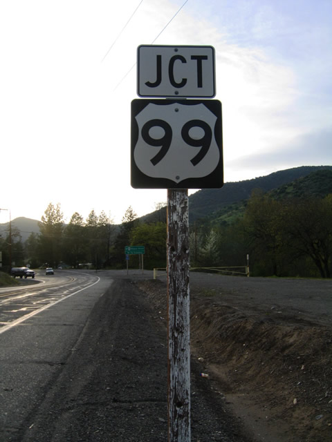
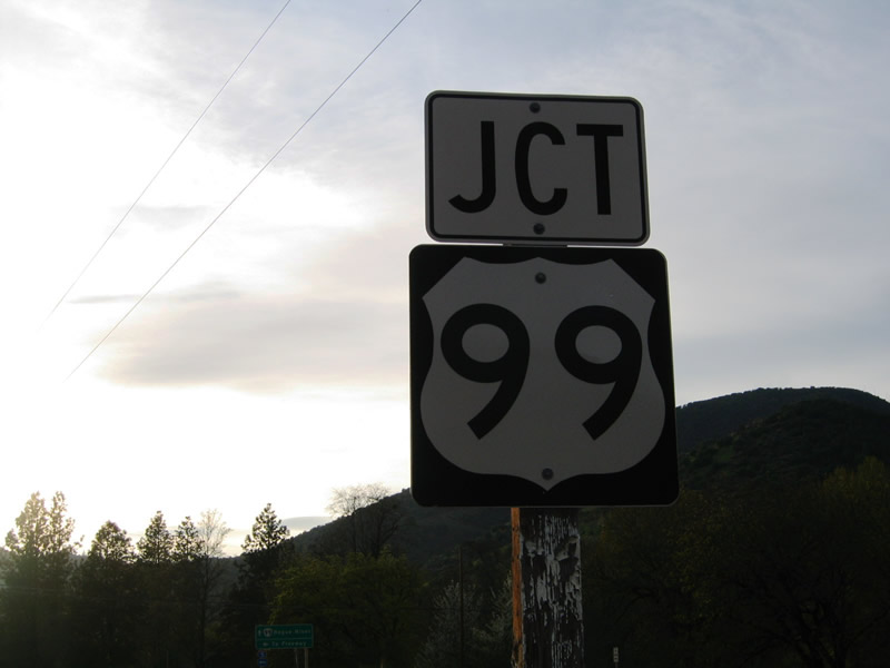
This U.S. 99 shield was posted along OR 99 (Rogue River Highway) northbound ahead of the access road to I-5 at Exit 43. OR 99 crosses the Rock Point Bridge and meets Interstate 5 at a diamond interchange nearby.
03/31/05
The erroneous assembly remained even after sign replacements in the vicinity in 2006. It was, however, removed sometime after 2012.
05/28/06
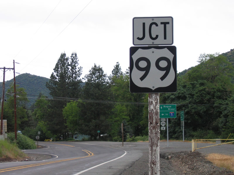
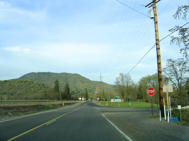
Sign assembly posted on OR 99 (Rogue River Highway) south at the access road to Interstate 5 at Exit 43. Both highways straddle the Rogue River west five miles to the city of Rogue River.
05/28/06
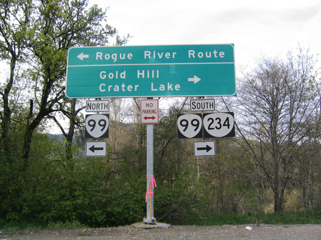
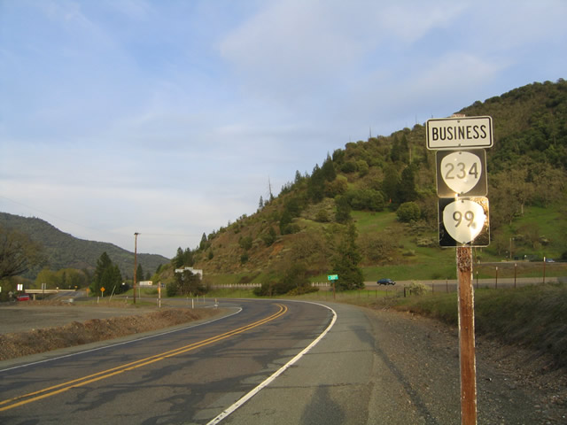
OR 99 (Rogue River Highway) connects with OR 234 at 2nd Avenue and 4th Street in Gold Hill east of I-5 (Exit 43).
03/31/05
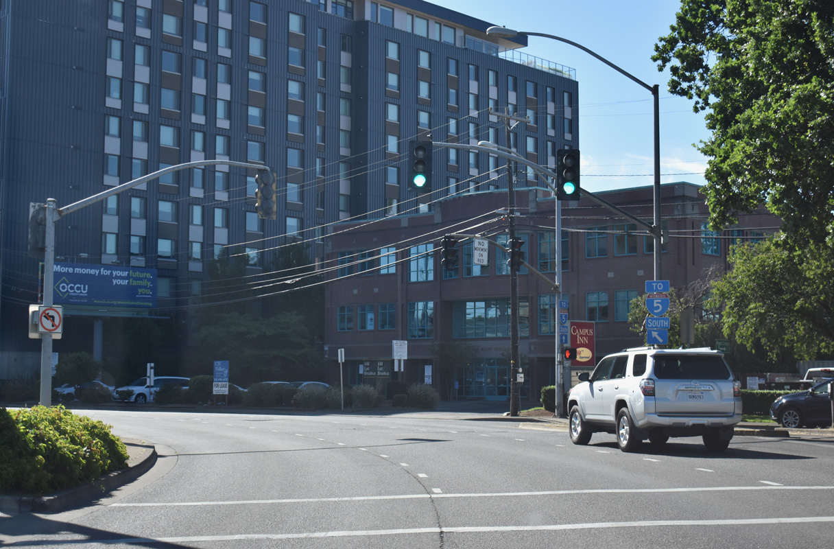
OR 99/126 Business turn north from Broadway onto Hilyard Street in Eugene. Hilyard Street transitions into E 6th Avenue ahead of this OR 99 reassurance marker posted near Ferry Street.
07/16/23
Broadway Street west where Mill Street turns north. Overheads here allude to Mill Street as part of OR 99 north and OR 126 Business west, but signage preceding Hilyard Street indicates that the two routes turn there.
04/01/05
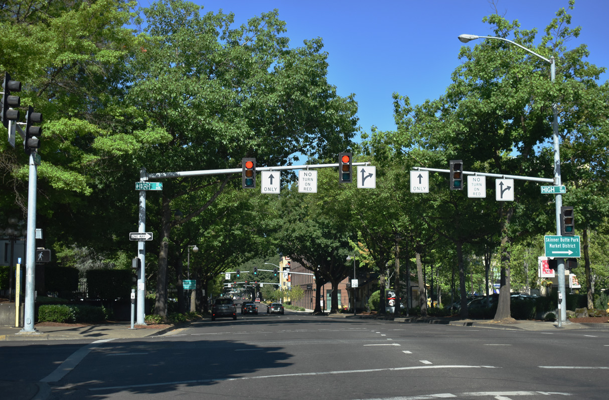
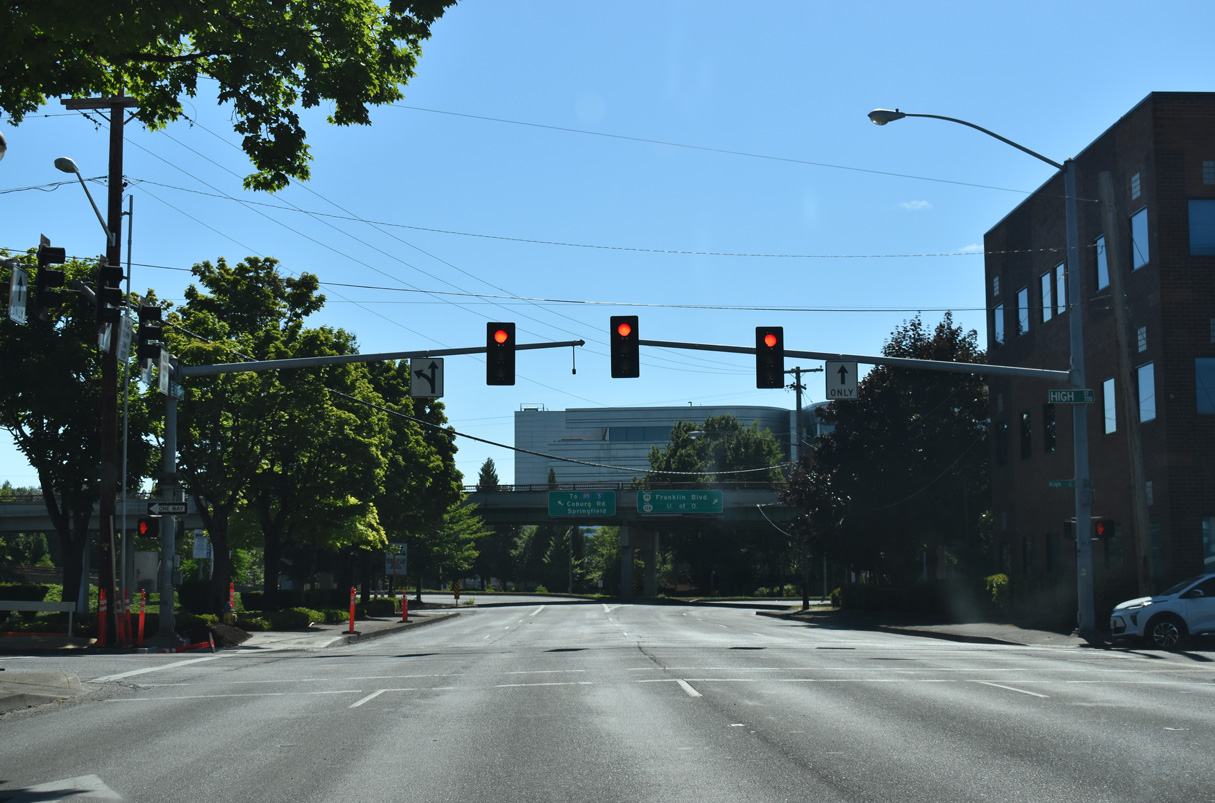
6th Avenue passes under the viaduct along Coburg Road west ahead of High Street. An off-ramp from Coburg Road south merges with 6th Avenue at the signalized intersection. High Street north leads the 5th Street Public Market and Skinner Butte Park along the Willamette River.
07/16/23
Removed by 2008, reassurance markers for OR 99 north and OR 126 Business west were previously posted along 6th Avenue after High Street.
04/01/05
Pearl Street leads one mile south to 19th Avenue, where the street becomes Amazon Parkway. Amazon Parkway extends south past New Civic Park to 30th Avenue east in south Eugene.
07/16/23
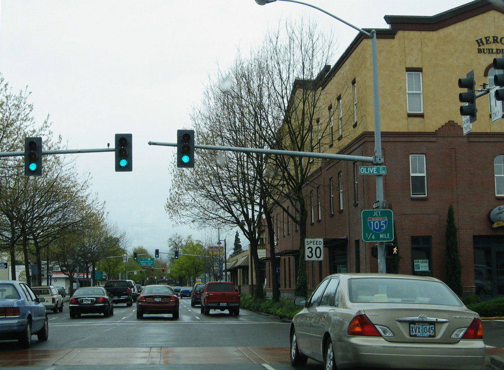
OR 99/126 Business intersect Olive Street one quarter from Interstate 105.
04/01/05
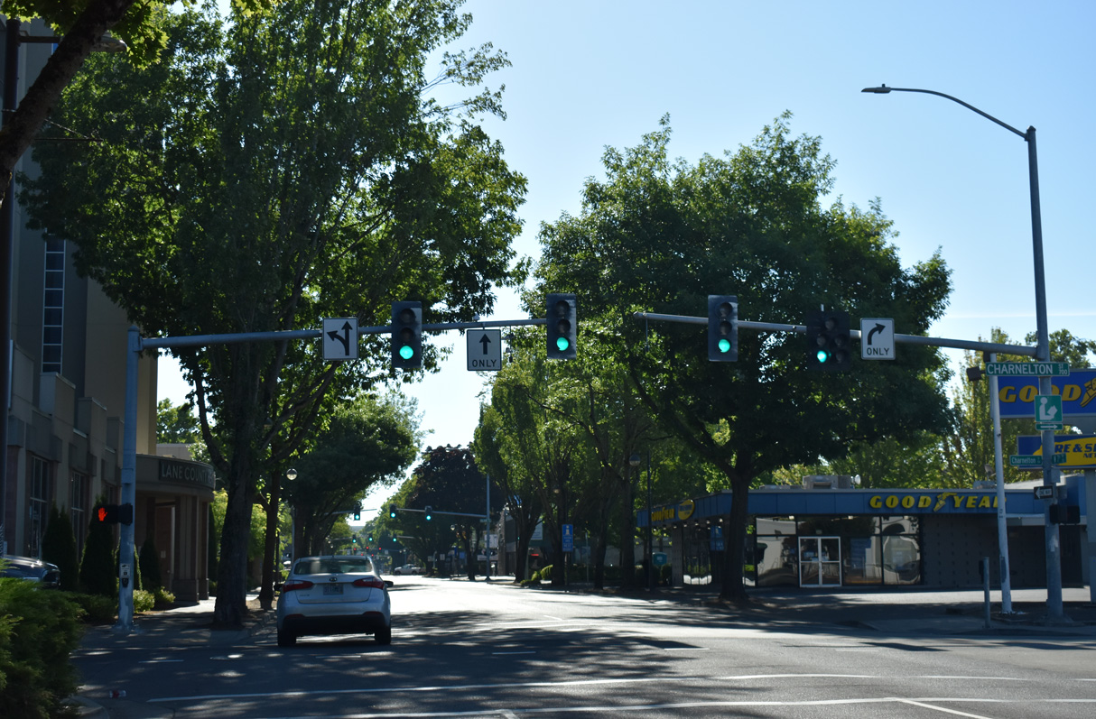
A guide sign for Interstate 105 appeared at 6th Avenue and Charnelton Street, two blocks ahead of the entrance ramp for the freeway north across the Willamette River. This panel was removed by 2008.
04/01/05
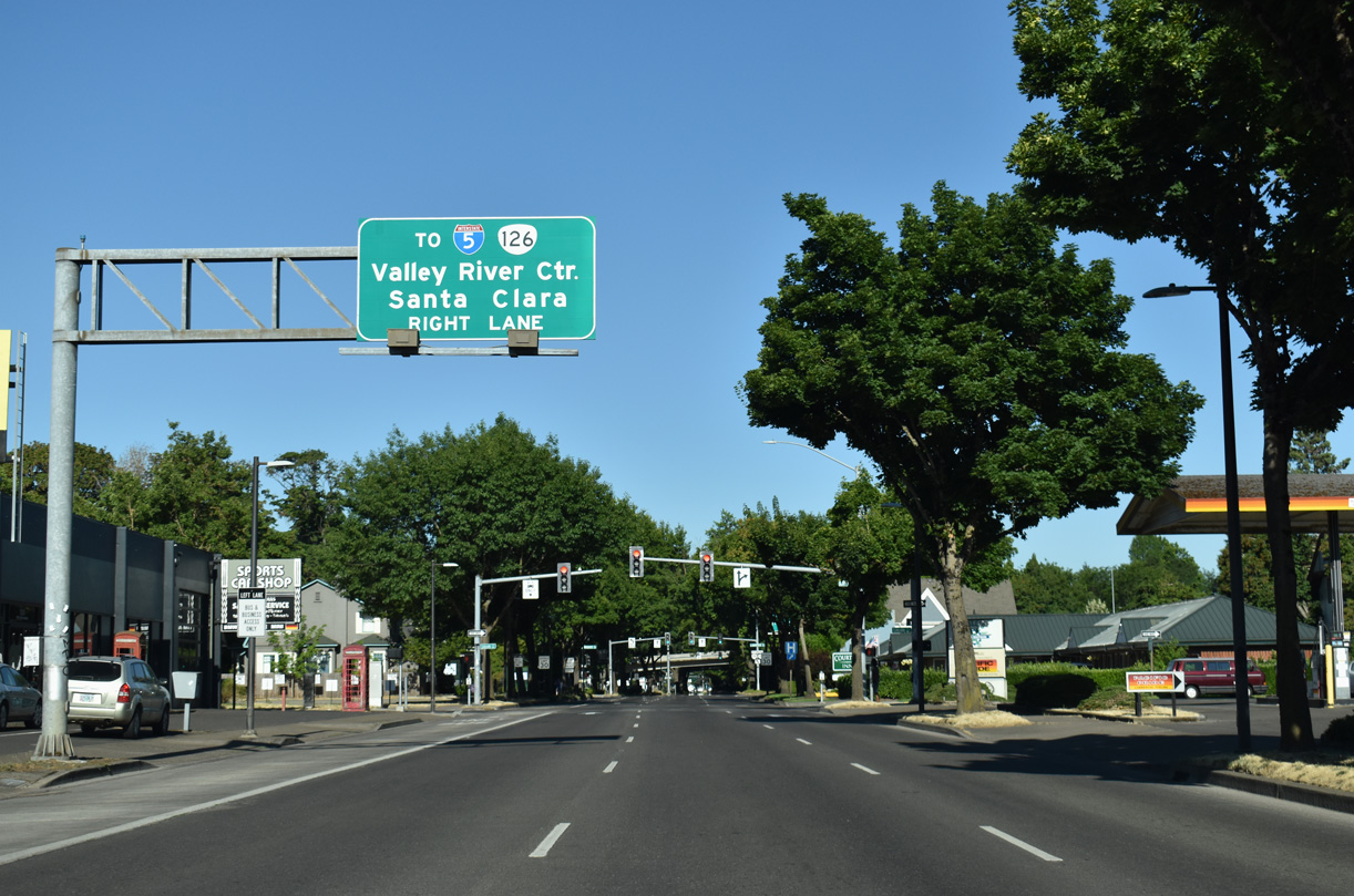
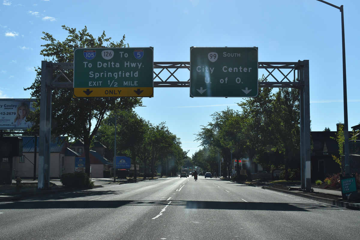
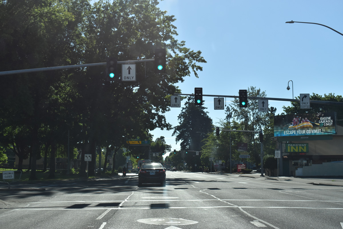
The entrance ramp for I-105/OR 126 east separates from OR 99/126 Business (6th Avenue) west of Lincoln Street. I-105 heads north to Delta Highway (OR 132) near Valley River Center mall and east to I-5 at the Springfield city line.
07/16/23
OR 126 eastbound joins I-105 to cross the Jefferson-Washington Street Bridge over the Willamette River. The route extends east into Springfield along a freeway to 52nd Street.
07/16/23
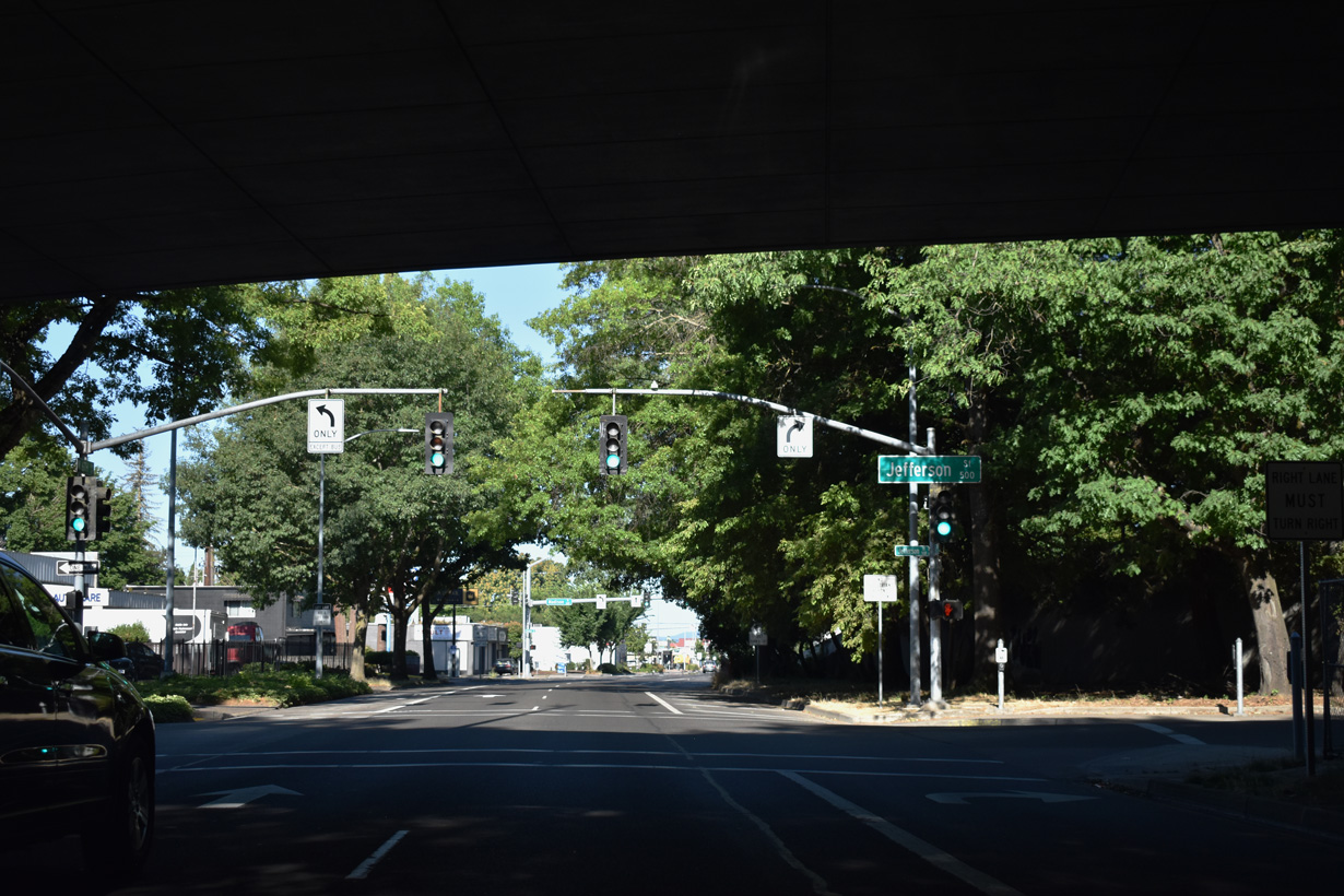
OR 99/126 Business proceed west from Washington Street to Jefferson Street underneath the ramps linking I-105/OR 126 and 7th Avenue.
07/16/23
A button copy sign for OR 99 south was previously affixed to the Washington Street flyover for I-105/OR 126 east.
04/01/05
An exit ramp joins the west end of I-105 with 6th Avenue beyond Jefferson Street.
07/16/23
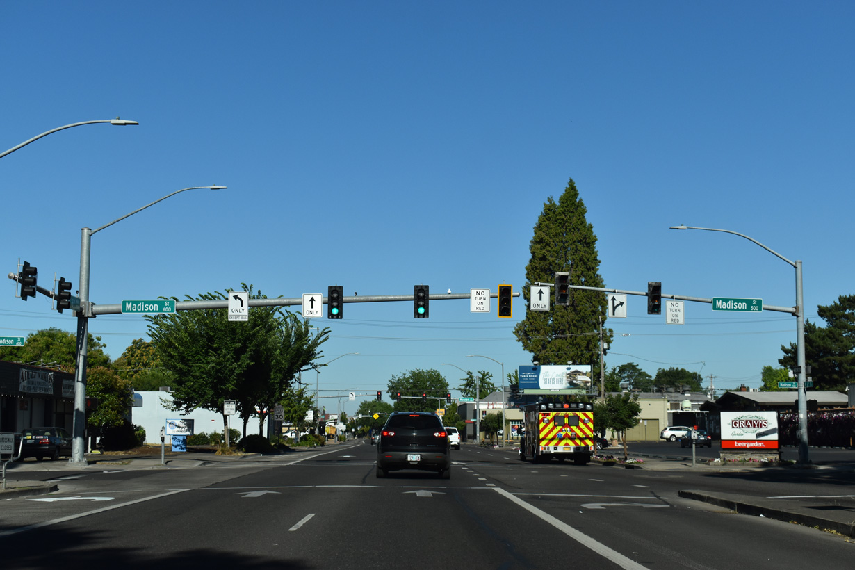
OR 126 Business ends where OR 126 joins OR 99 northbound at Madison Street.
07/16/23
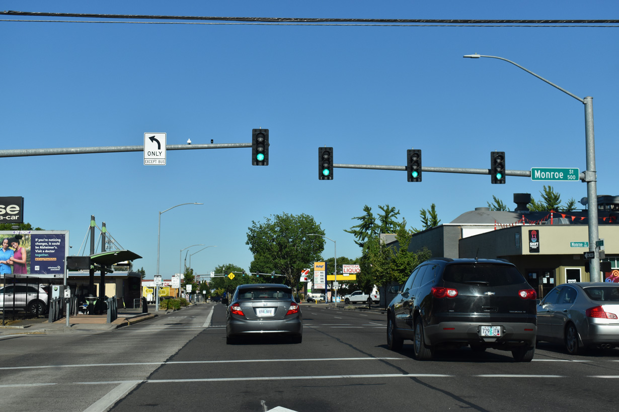
OR 99/126 west at Monroe Street. A sequence of streets intersecting W 6th Avenue are named after former U.S. presidents, beginning with Washington and ending with Taylor. For some reason William Henry Harrison is omitted from the streets between Van Buren and Tyler.
07/16/23
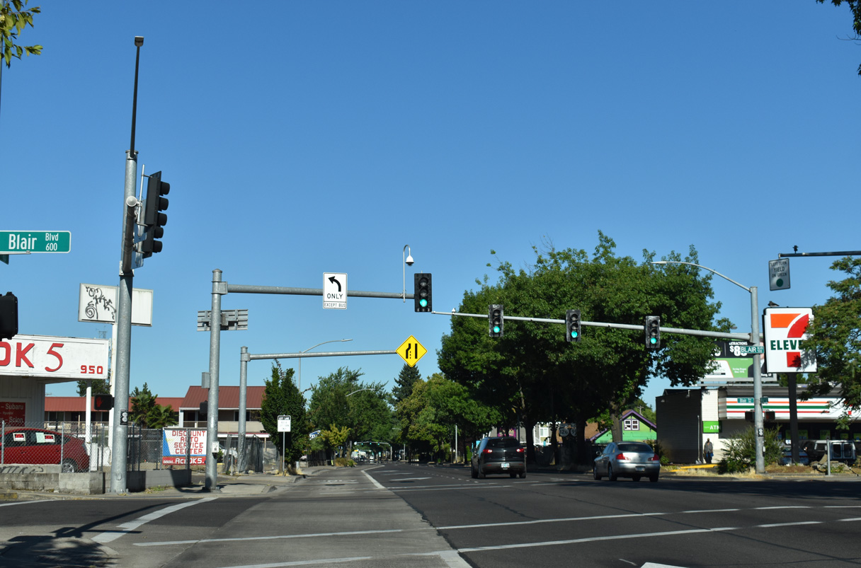
Blair Boulevard angles northwest from Monroe Street across OR 99/126 to a dead end beyond W 1st Avenue.
07/16/23
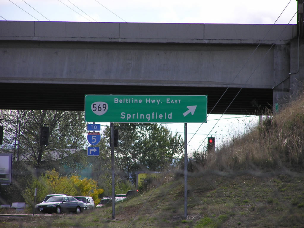
A folded diamond interchange (Exit 5) joins OR 99 with OR 569 (Randy Pepe Beltline) along the west Eugene city line. OR 569 is a freeway extending east to I-5 at the Springfield city line. This guide sign was replaced after 2011.
11/06/07
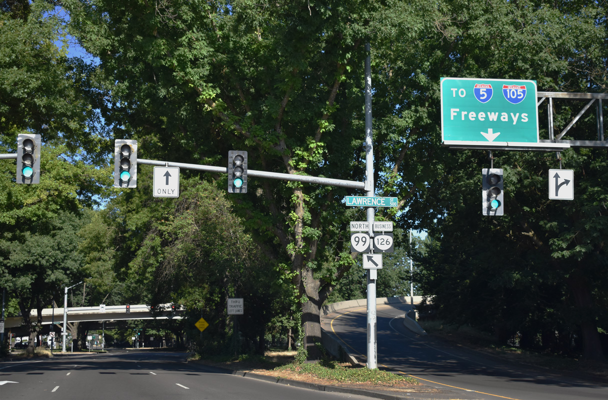
Interstate 105 begins north from OR 99/126 (W 7th Avenue) in a half mile at Washington Street.
07/16/23
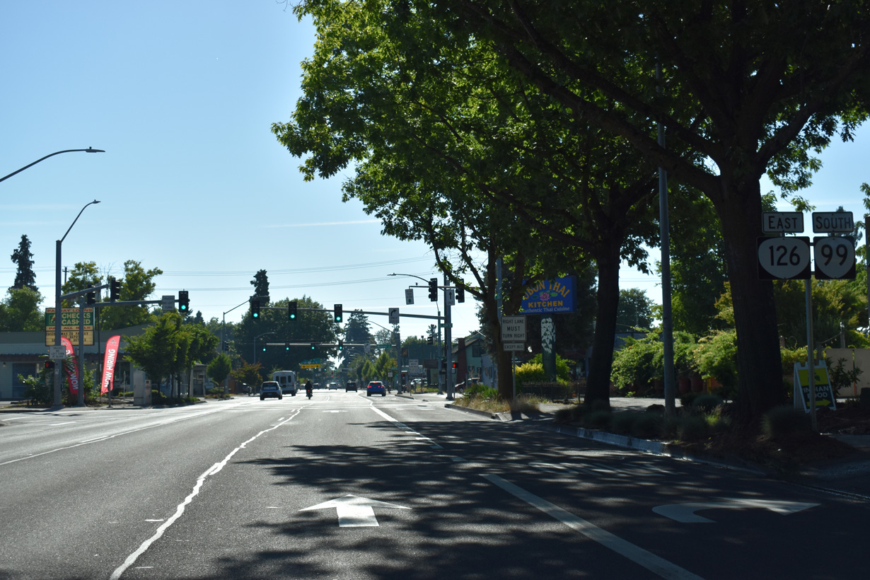
OR 99/126 reassurance markers preceding Blair Boulevard on 7th Avenue eastbound.
07/16/23
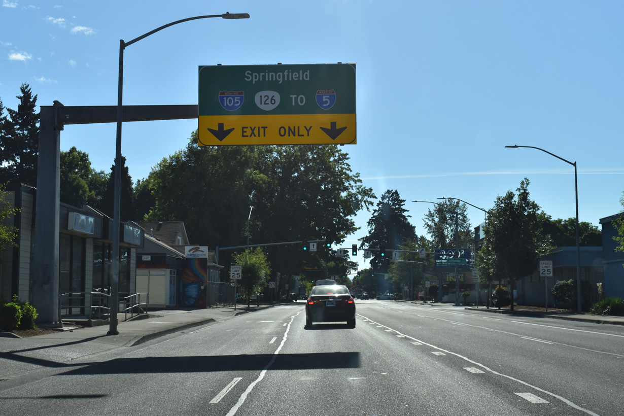
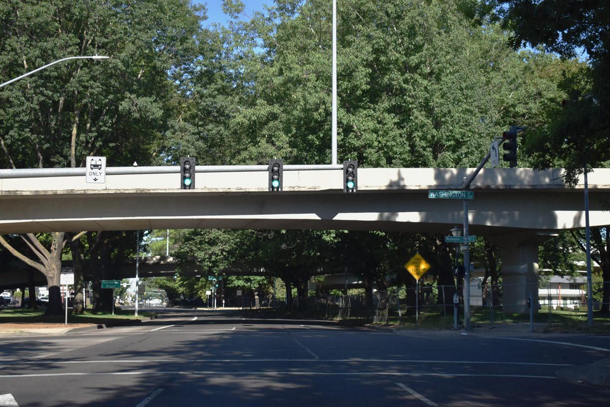
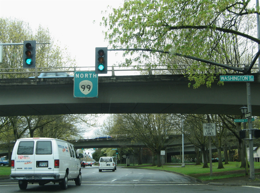
OR 126 separates with OR 99 (W 7th Avenue) southbound and joins Interstate 105 north across the Washington-Jefferson Street Bridge and the Willamette River.
07/16/23
Two lanes lower from the elevated roadway at the west end of Interstate 105 onto Jefferson Street south at OR 99/126 (7th Avenue) east. Jefferson Street continues south to the Lane County Fairgrounds at 13th Avenue.
07/16/23
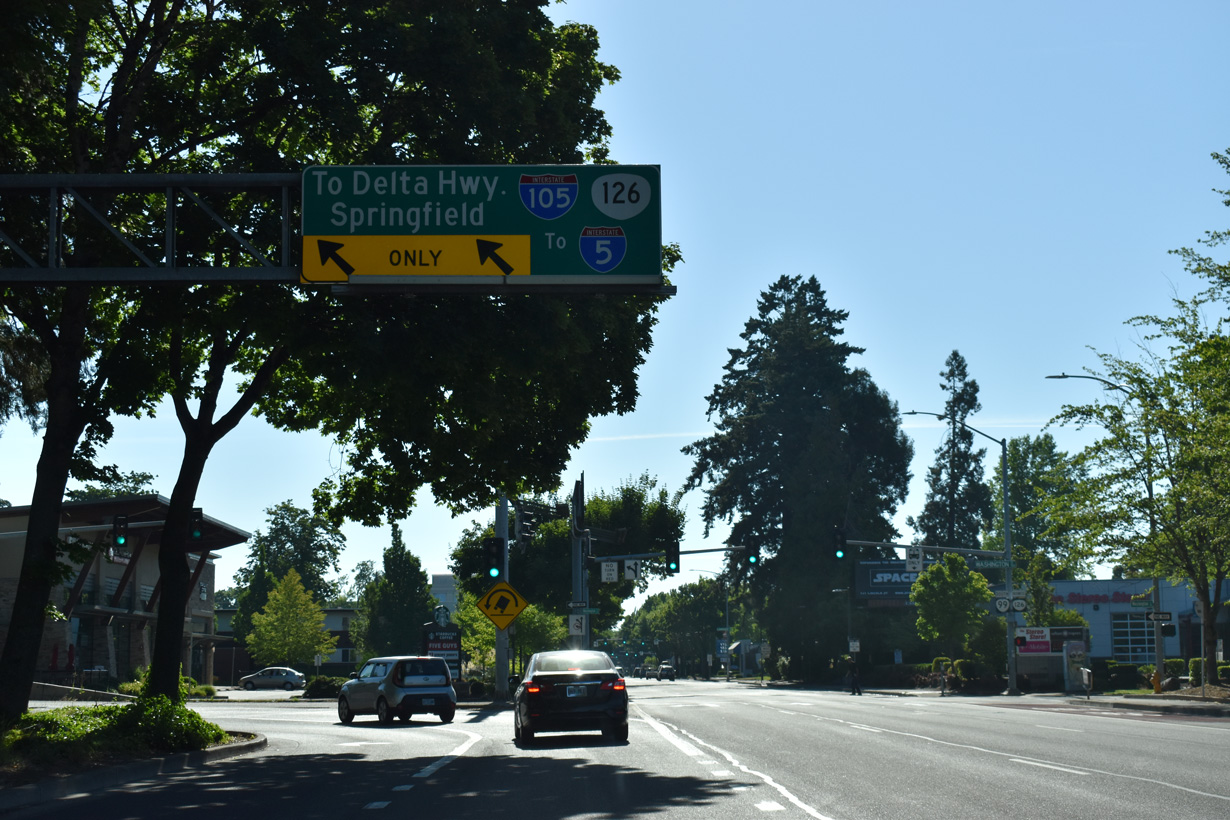
I-105/OR 126 overlap north to OR 132 (Delta Highway) near Valley River Center mall and east to Interstate 5 along the Springfield city line.
07/16/23
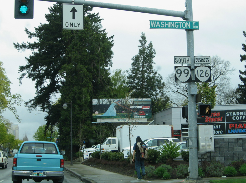
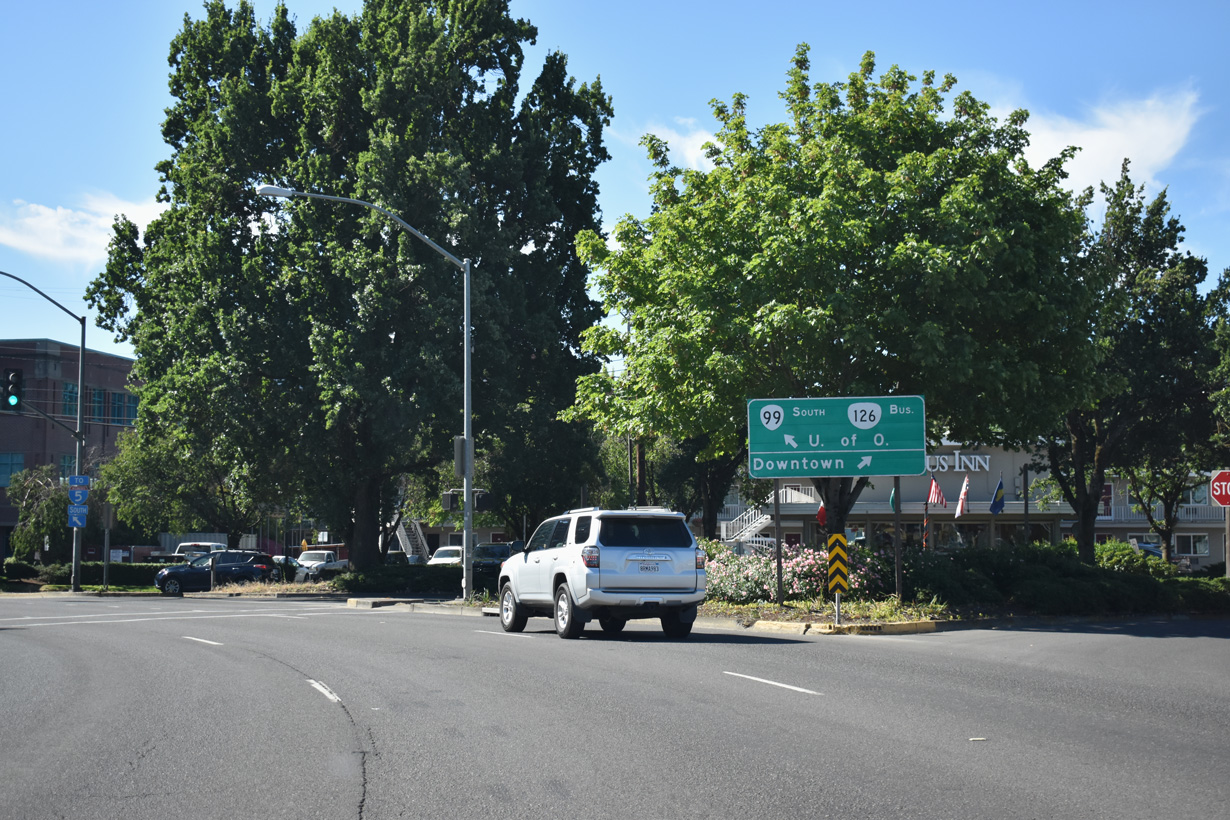
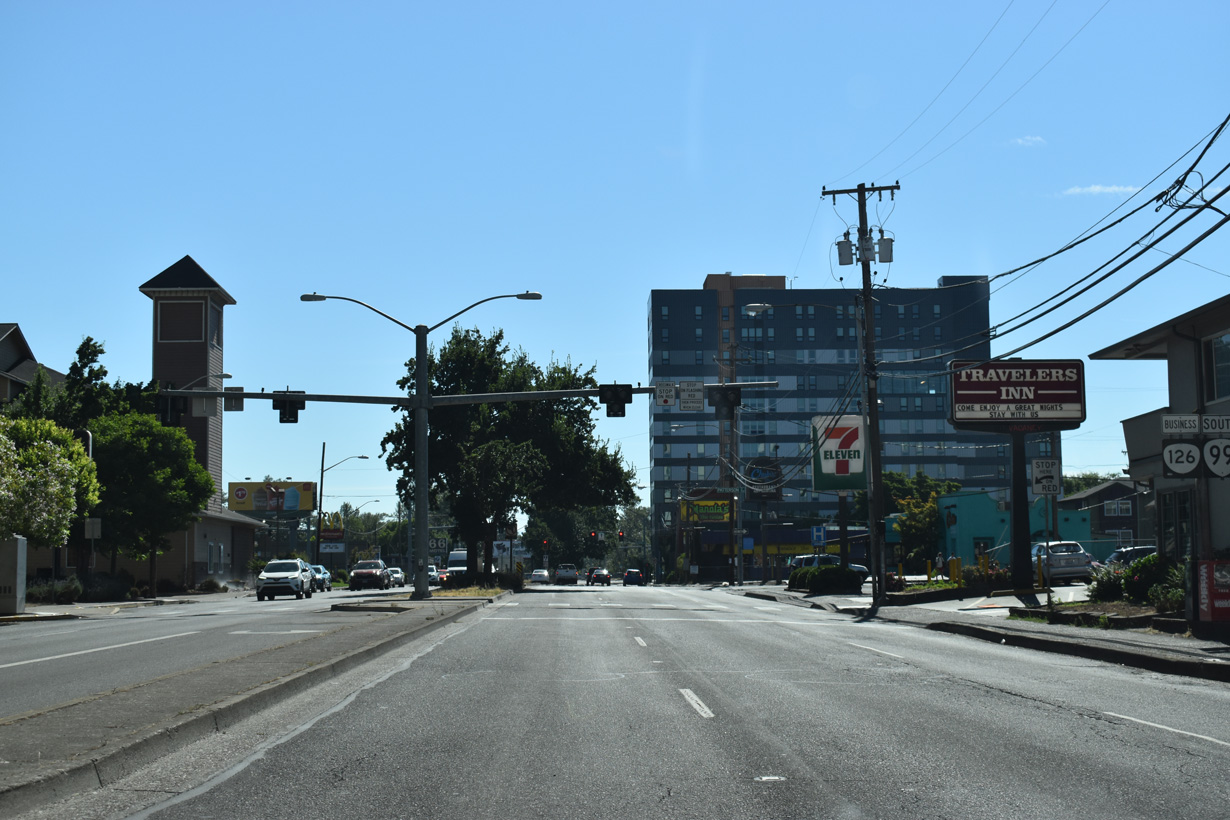
OR 126 Business commences east along 7th Avenue at Washington Street. The bannered route overlaps with OR 99 southbound through downtown Eugene to the University of Oregon campus.
04/01/05
W 7th Avenue advances two blocks east from I-105 to Lincoln Street.
07/16/23
OR 99/126 Business (W 7th Avenue) east at Charnelton Street.
07/16/23
The 6th/7th Avenue couplet along OR 99/126 Business extends east to High Street.
07/16/23
Traffic partitions at the east end of 7th Avenue for a ramp onto the Coburg Road viaduct northeast across the Willamette River to Martin Luther King Jr. Boulevard and I-105/OR 126. OR 99/126 curve south onto Mill Street for two blocks to make the connection with Broadway.
07/16/23
Two lanes from Coburg Road tie into OR 99/126 south on Mill Street at E 8th Avenue. Mill Street proceeds south onto Broadway at the succeeding intersection.
07/16/23
OR 99/126 Business follow Broadway east from Mill Street to the University of Oregon campus and Franklin Boulevard.
07/16/23
Broadway constitutes a five lane boulevard east from Mill Street to Hiyard Street, where SR 99/126 Business westbound turn north. Reassurance markers for the state routes precede the HaWK signal between Ferry and Patterson Streets.
07/16/23
The previous reassurance markers for OR 99 south / OR 126 Business east between Ferry and Patterson Streets. Broadway changes to Franklin Boulevard in east Eugene at the University of Oregon campus en route to Interstate 5 south near the Judkins neighborhood.
04/01/05
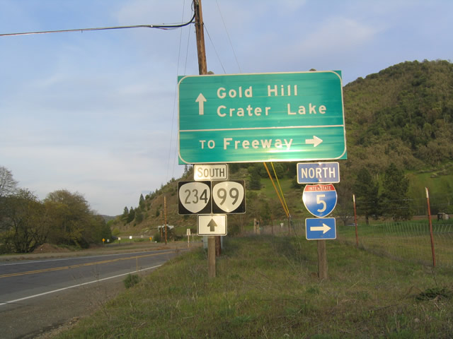
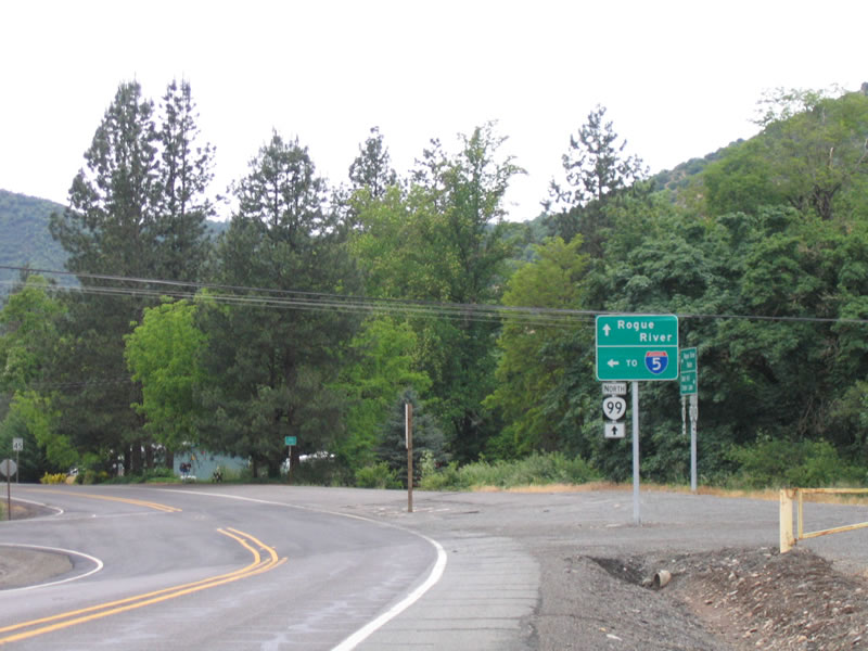
OR 99 (Rogue River Highway) southbound at the Exit 43 access road to Interstate 5 near Rock Point. Exit 43 of the freeway provides access to OR 234 north, an Oregon Scenic Byway leading to Crater Lake National Park. OR 99 meets the southern terminus of OR 234 (4th Street) via 2nd Avenue in downtown Gold Hill ahead.
03/31/05
This confirming marker assembly south of the connection to I-5 at Exit 43 was removed after 2012 and not replaced.
03/31/05
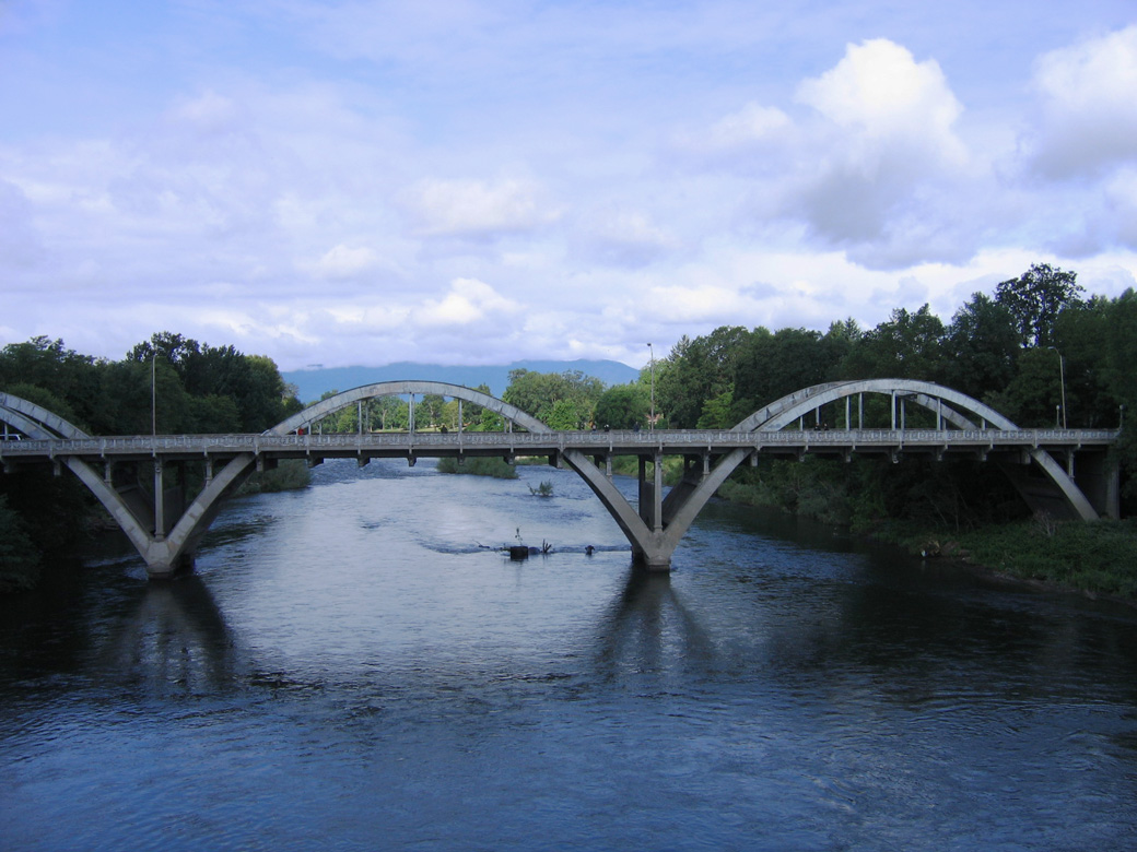
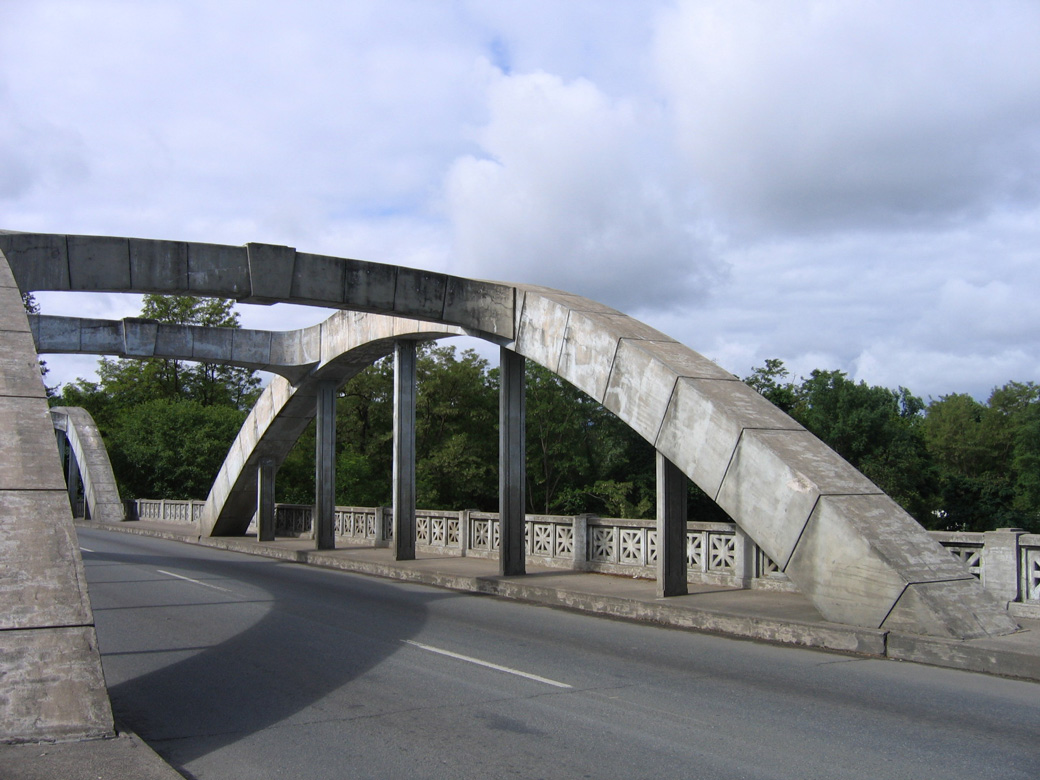
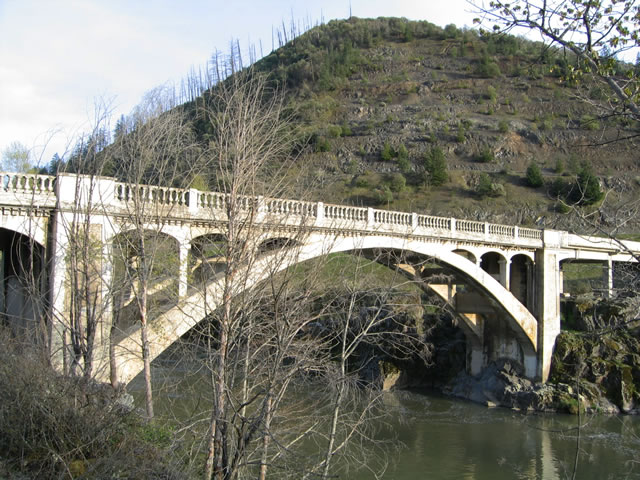
The Rock Point Bridge over the Rogue River comes into view shortly after the shield assembly.
05/28/06
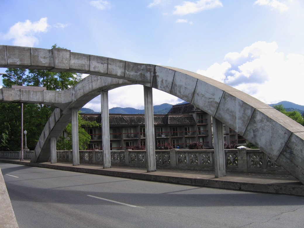
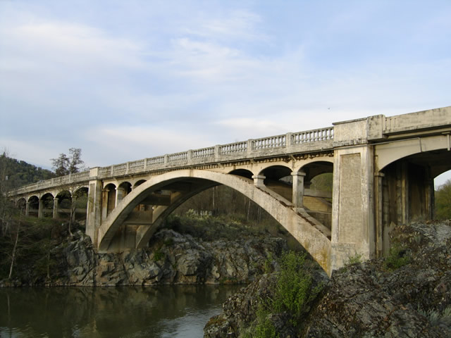
OR 99 turns north and crosses the Rock Point Bridge over the Rogue River near the Exit 43 diamond interchange of Interstate 5. Named after the Rock Point post office nearby, the concrete arch span joins the Rogue River Highway with North River Road west and Sams Valley Highway east.
05/28/06
OR 99 travels alongside the Southern Pacific Railroad through rural areas east of the Rock Point Bridge to Gold Hill. Pictured here is the North River Road intersection with OR 99 (Rock Point Bridge).
03/31/05
References:
- Structurae [en]: Rock Point Bridge (1920). https://structurae.net/en/structures/rock-point-bridge
Photo Credits:
- AARoads: 04/01/05, 03/31/05, 04/01/05
- Andy Field, Joel Windmiller: 05/28/06
- Brent Ivy: 07/16/23
- Chris Elbert: 11/06/07
Connect with:
Page Updated Wednesday August 20, 2025.