
Interstate 5 North - Portland

Interstate 5 navigates through Multnomah County entirely within the Portland city limits. The freeway enters the county in southwest Portland, where hilly terrain results in several S-curves from Exits 294 to 298. Beyond the split with Interstate 405 to Downtown at Exit 299 B, I-5 crosses the Willamette River over the two-level Marquam Bridge and follows the east bank of the Willamette River. North from there, the freeway proceeds through a network of overpasses and flyover ramps at the exchanges with Interstate 84 east and the north end of I-405 (Stadium Freeway). The river bends west, and I-5 continues a northbound trajectory through Portland neighborhoods to the Columbia River.
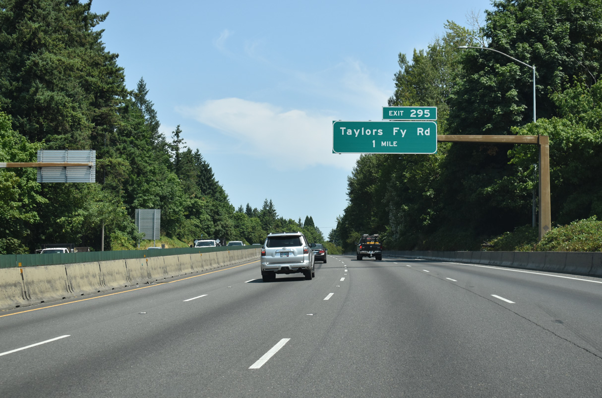
I-5 weaves northeast between the Crestwood and West Portland Park neighborhoods one mile to Exit 295 for Taylors Ferry Road. Heading east, Taylors Ferry Road navigates across the hills of southwest Portland, eventually reaching OR 43 near the Willamette River.
07/20/23
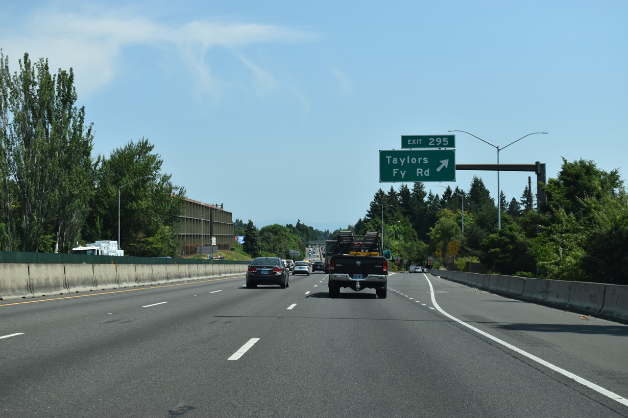
The original construction of I-5 severed Taylors Ferry Road. Exit 295 consists of a slip ramp onto adjacent SW 35th Avenue for the continuation of SW Taylors Ferry Road east at the Markham neighborhood.
07/20/23
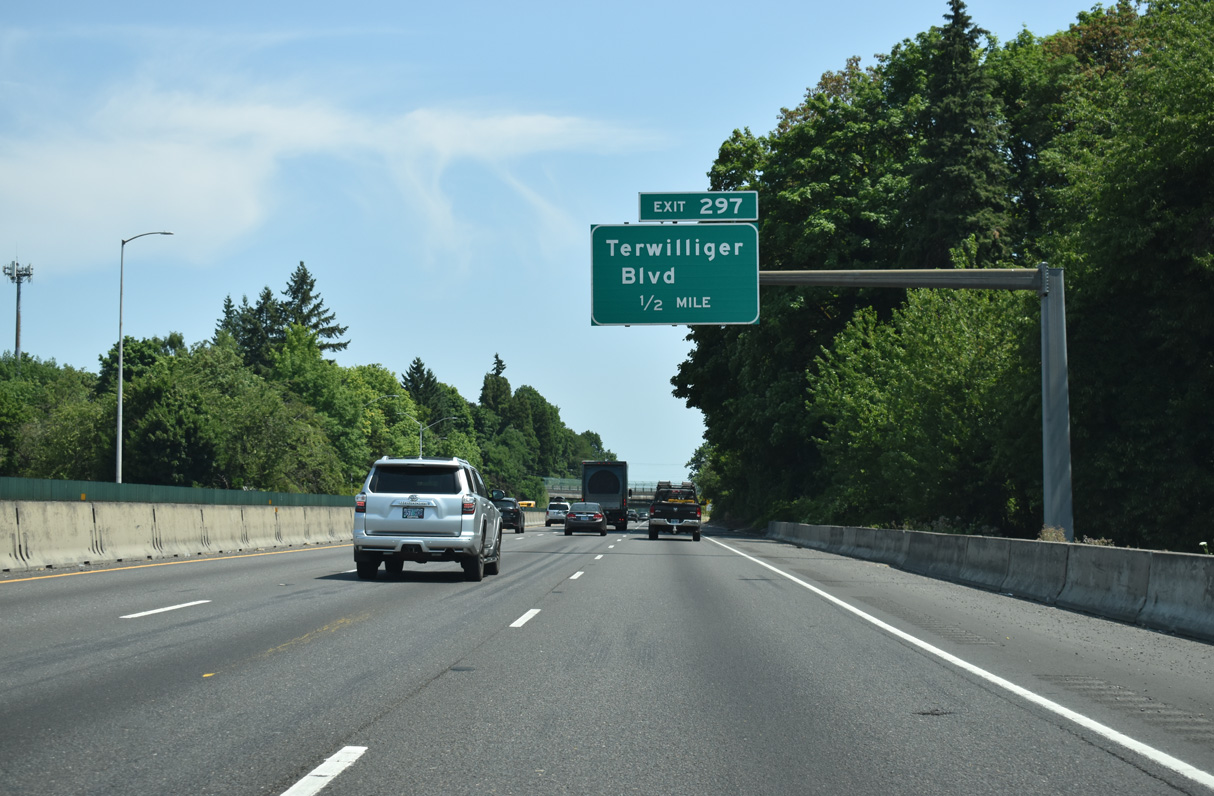
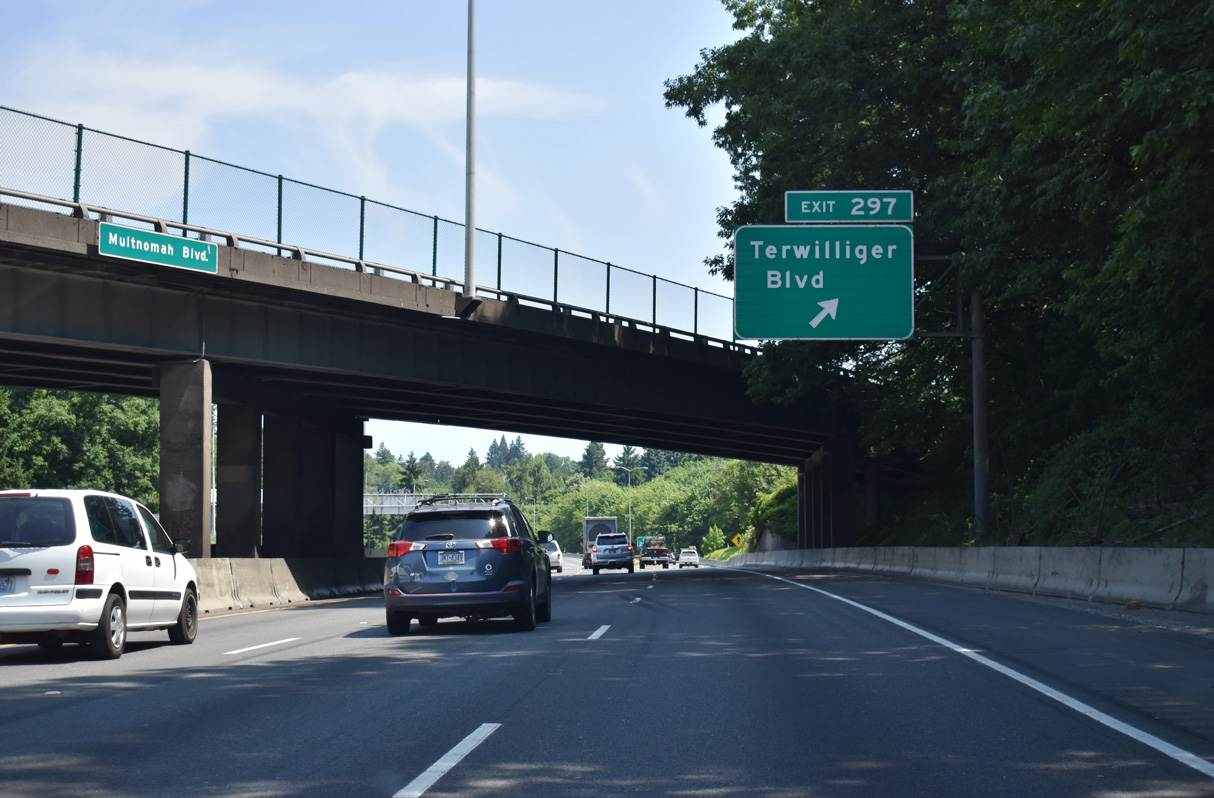
Continuing northeast by the Multnomah neighborhood, the succeeding exit departs in a half mile for Terwilliger Boulevard.
07/20/23
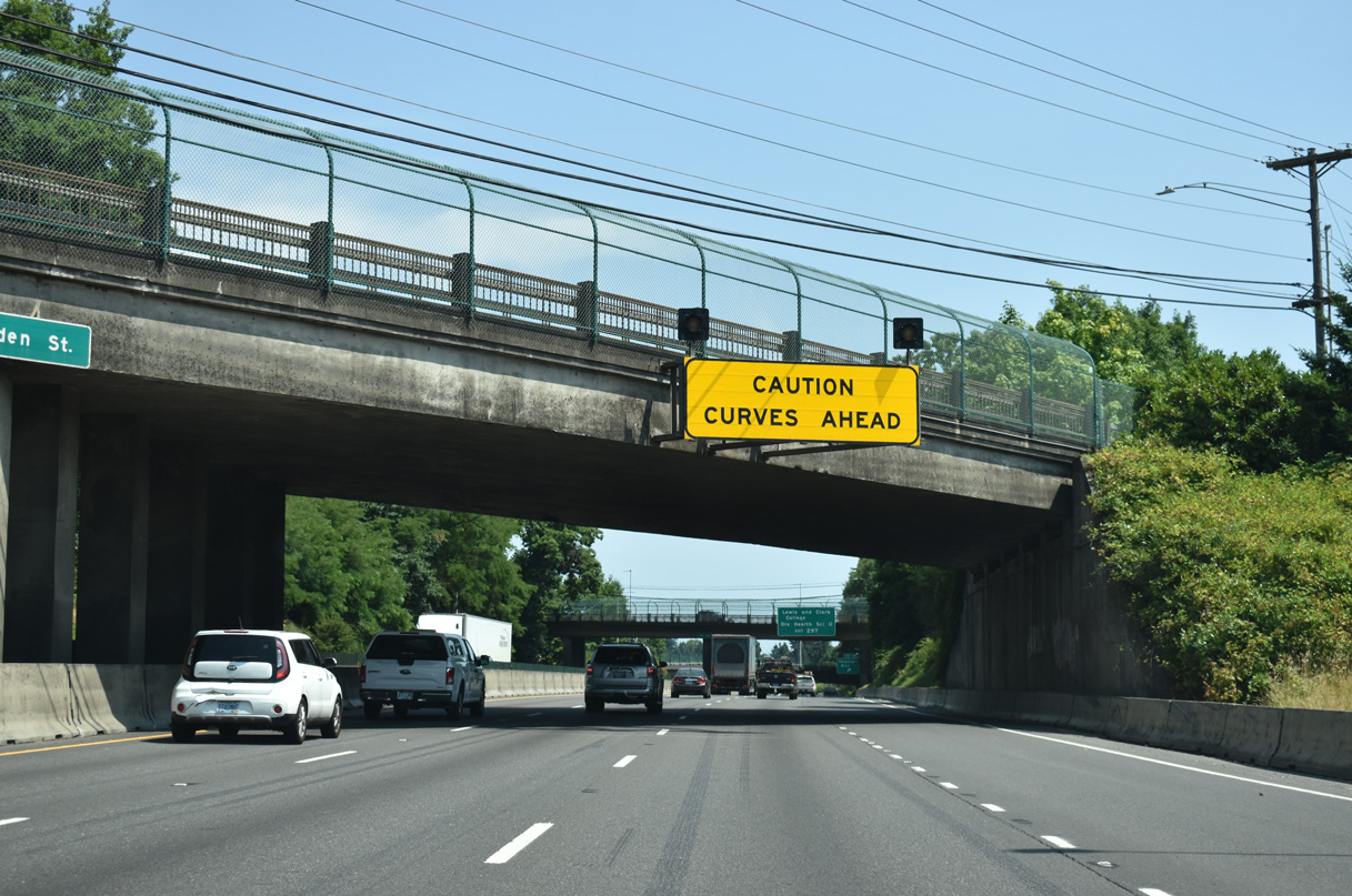
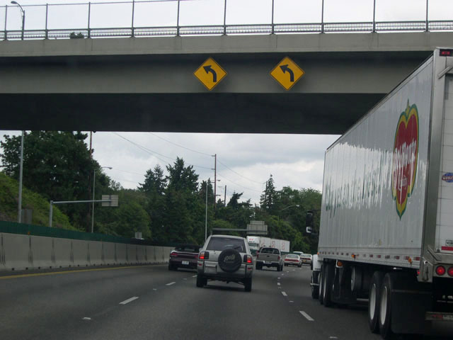
This sign at the Spring Garden Street overpass warns motorists of the upcoming "Terwilliger Curves", a series of sharp S-curves south of the Hillsdale District.
07/20/23
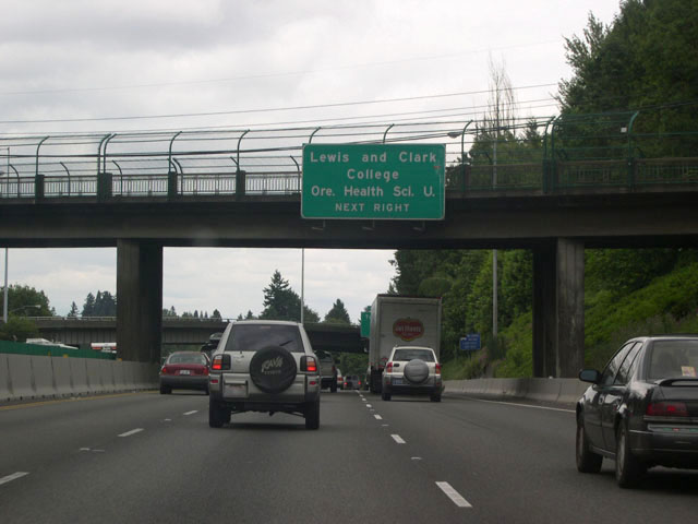
Exit 297 joins a collector distributor roadway from Multnomah Boulevard north to Terwilliger Boulevard. Terwilliger Boulevard heads north to Oregon Health Sciences University and south to Lewis and Clark College.
06/26/05
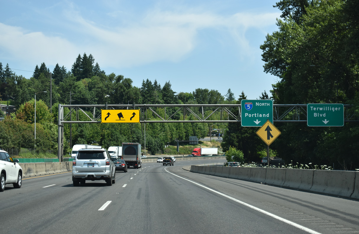
Exit 297 separates from I-5 northbound for Terwilliger Boulevard at the South Burlingame neighborhood.
07/20/23
Navigating through the hilly terrain of southwest Portland along "Terwilliger Curves".
07/20/23
06/26/05
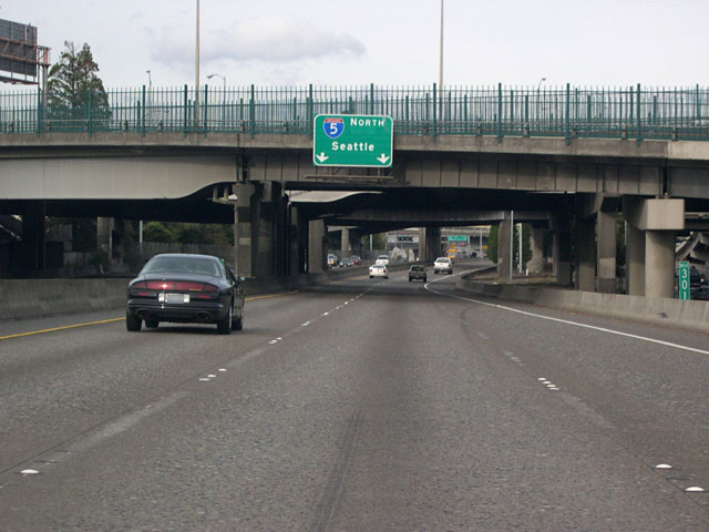
Confirming marker for Interstate 5 north posted by Fulton Park and the Briel Place overpass.
07/20/23
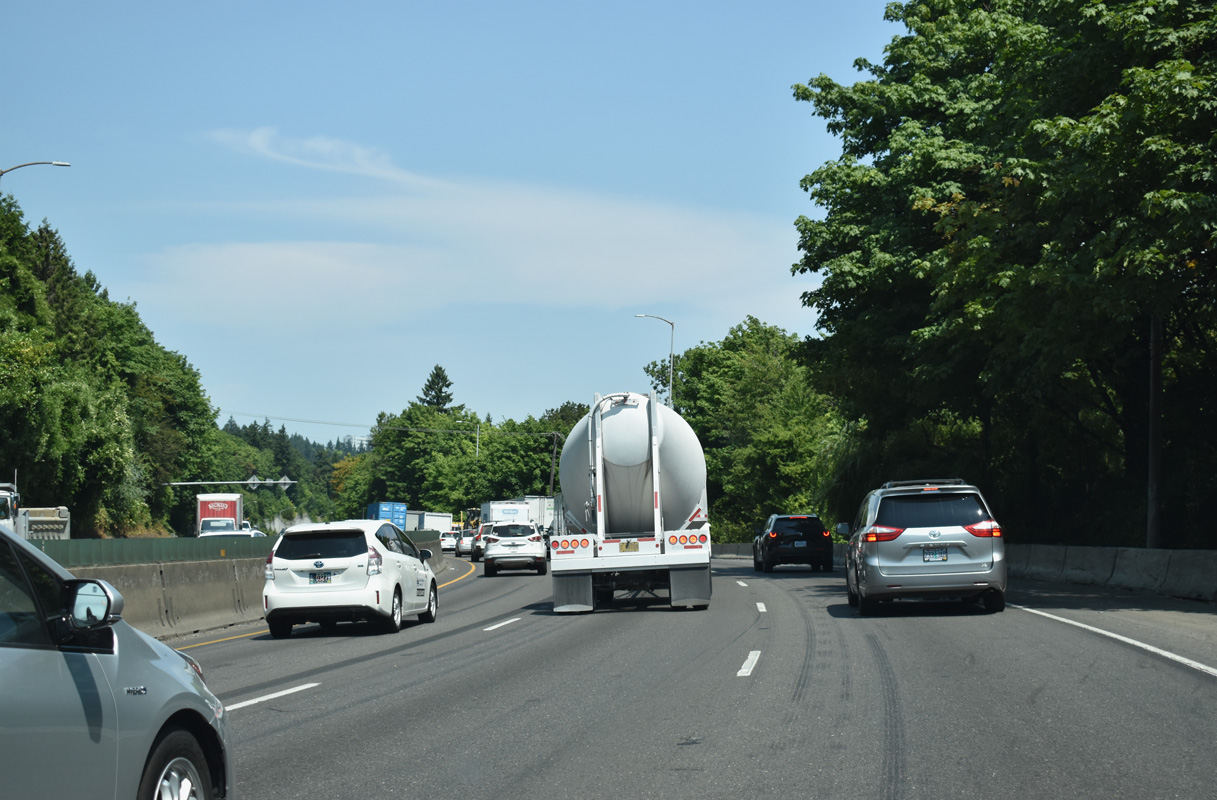
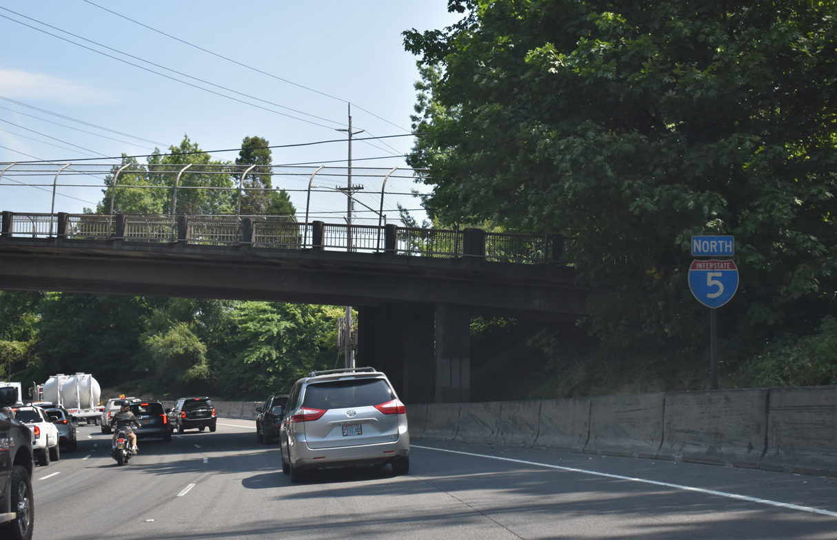
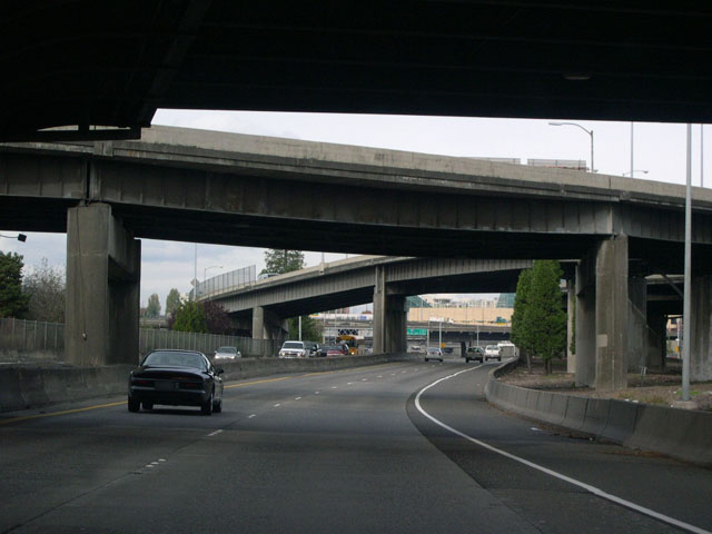
Turning north from the Terwilliger Curves, Interstate 5 travels between OR 99W (Barbur Boulevard) and the South Portland neighborhood along OR 43 (Macadam Avenue).
07/20/23
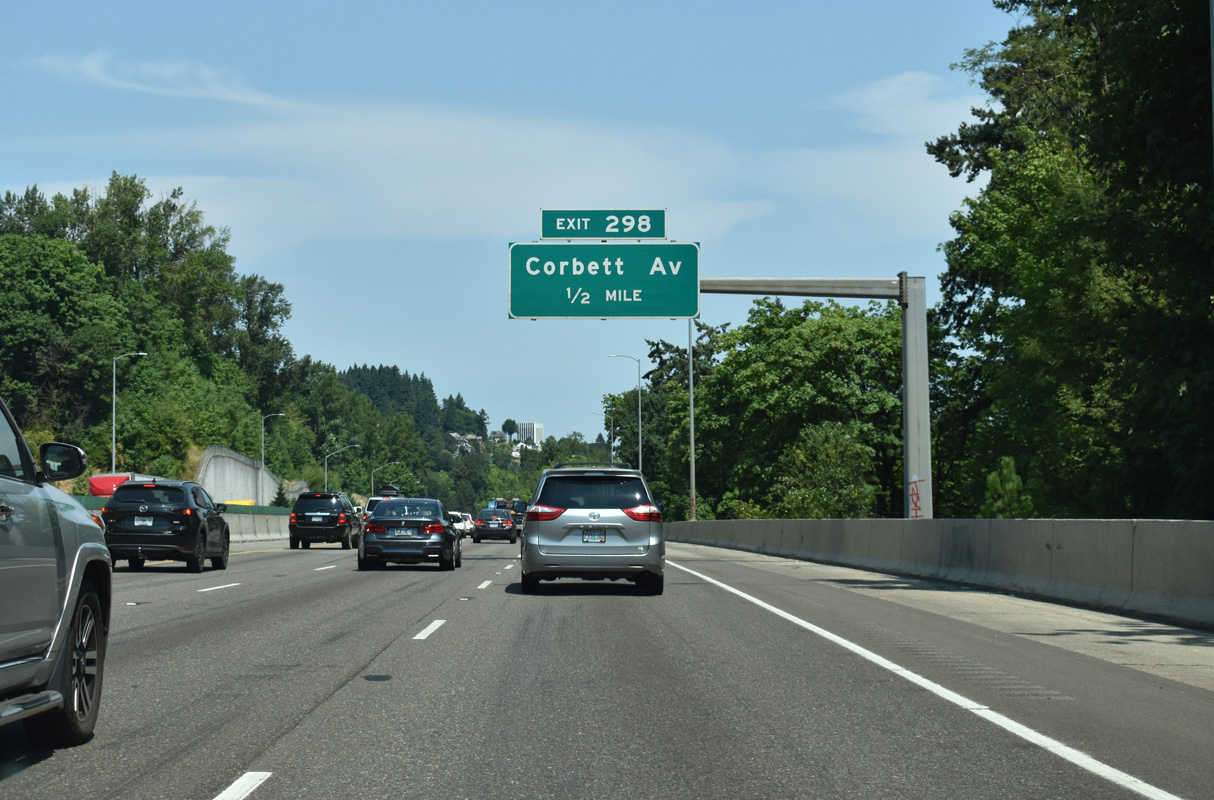
Exit 298 connects Interstate 5 north with Corbett Avenue at South Portland in a half mile. Corbett Avenue leads south to the Corbett-Terwilliger-Lair Hill community and north to the Johns Landing neighborhood.
07/20/23
Exit 298 constitutes just a single ramp from I-5 northbound to Corbett Avenue. I-5 separates with SW Harbor Drive north at the ensuing exit for Interstate 405 (Stadium Freeway).
07/20/23
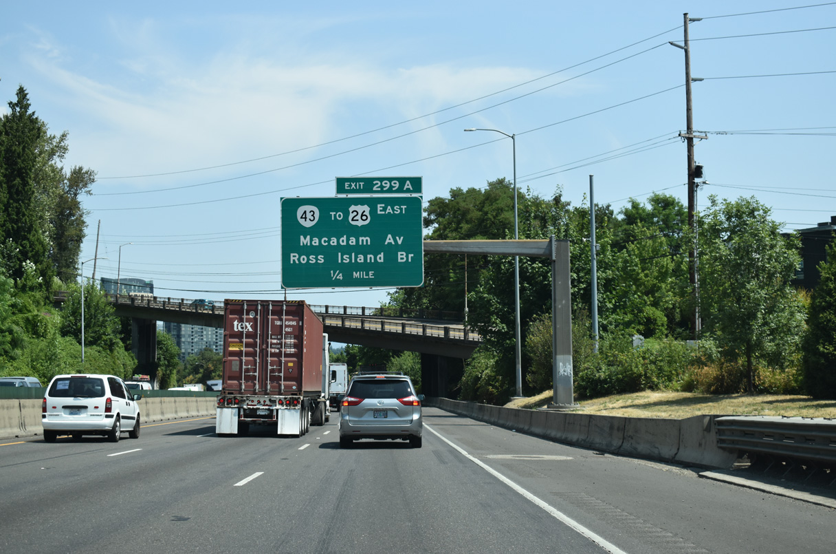
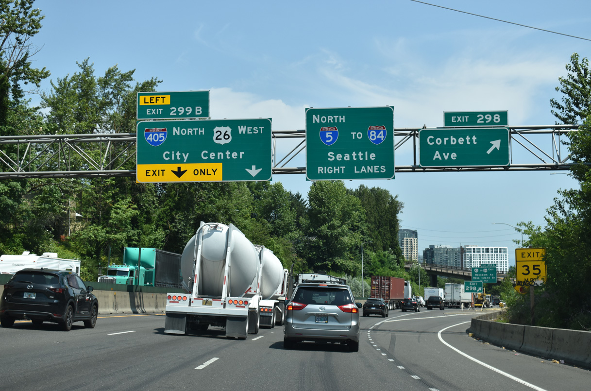
A split diamond interchange at Exit 299 A links Interstate 5 with Macadam Avenue, U.S. 26 (Ross Island Bridge), and the north end of OR 43 (Macadam Avenue).
07/20/23
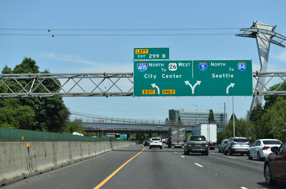
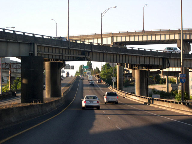
Interstate 5 branches northeast from S Harbor Drive at a three-wye interchange (Left Exit 299B) with the Stadium Freeway and Marquam Bridge. I-405 initially follows S Harbor Drive before turning west via a flyover ramp onto the Stadium Freeway north around Downtown Portland to U.S. 26 (Sunset Highway) west.
07/20/23
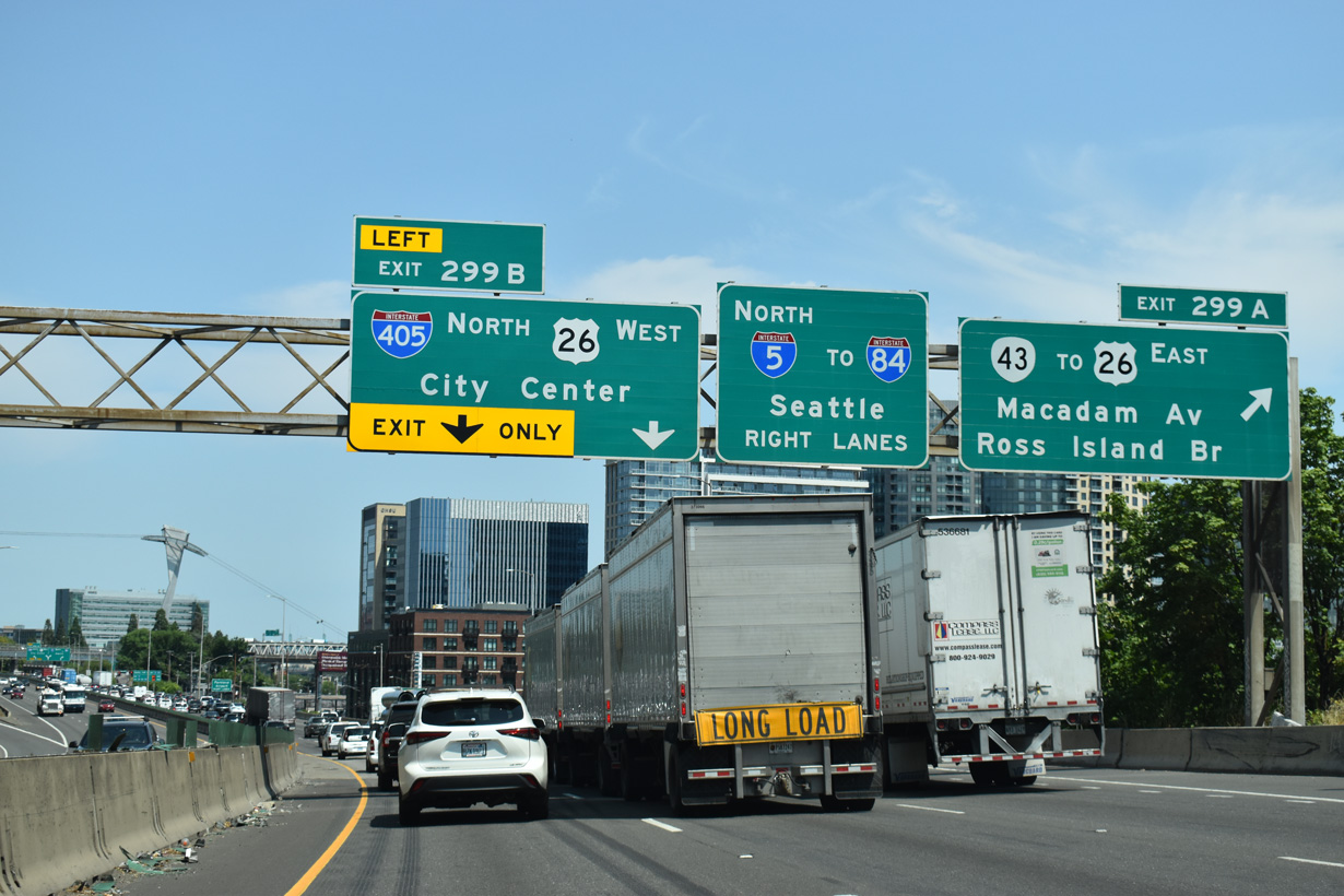
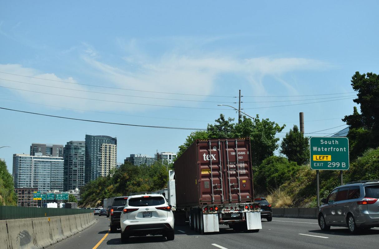
The Ross Island bridge takes U.S. 26 across the Willamette River to Brooklyn. OR 43 comprises a 11.68 mile long route from Interstate 5 south to OR 99E in Oregon City. The split with Interstate 405 (S Harbor Drive) follows at Left Exit 299 B.
07/20/23
A support structure of the Portland Aerial Tram rises along the east side of Interstate 5 ahead of the separation with I-405 (S Harbor Drive). The tram connects Marquam Hill and Oregon Health and Sciences University (OHSU) with the South Waterfront neighborhood.
07/20/23
Until 1974, South Harbor Drive spurred north through the Riverplace neighborhood toward the Steel Bridge along the Willamette Riverfront. The freeway was removed and converted into parkland at that time, leaving a short at-grade roadway extending from I-405 (Stadium Freeway) to Naito Parkway (former OR 99W).
07/20/23
Two lanes continue beyond the split with I-405 onto the Marquam Bridge spanning the Willamette River. An entrance ramp merges with I-5 north from Macadam Avenue as well.
10/30/05
Northbound I-5 traffic along the Marquam Bridge travels on the upper deck of steel-truss cantilever bridge across the Willamette River.
07/19/05
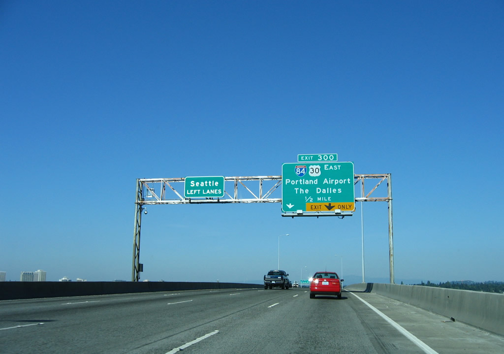
The entrance ramp from I-405 (Stadium Freeway) south expands the top deck of the Marquam Bridge to four northbound lanes. Exit 300 separates for I-84/U.S. 30 east in a half mile.
08/27/06
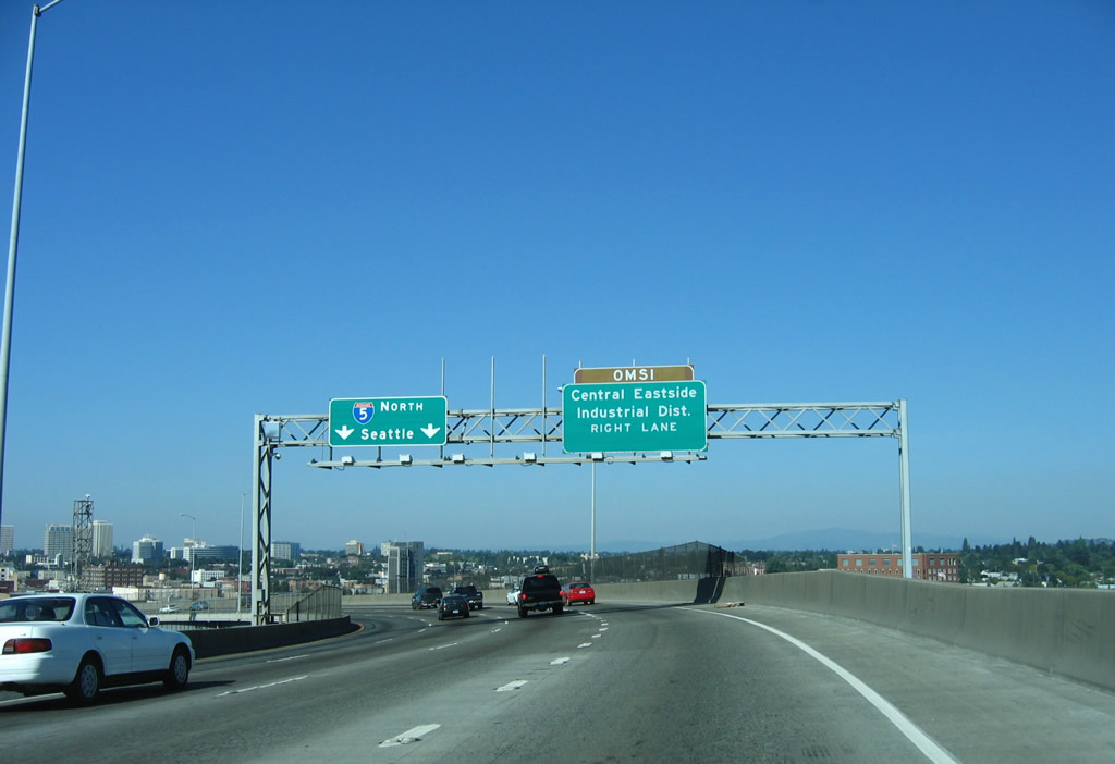
Exit 300 forms a lengthy distributor roadway leading north to I-84/U.S. 30 east, with local access to Water Avenue for the Oregon Museum of Science and Industry (OMSI).
08/27/06
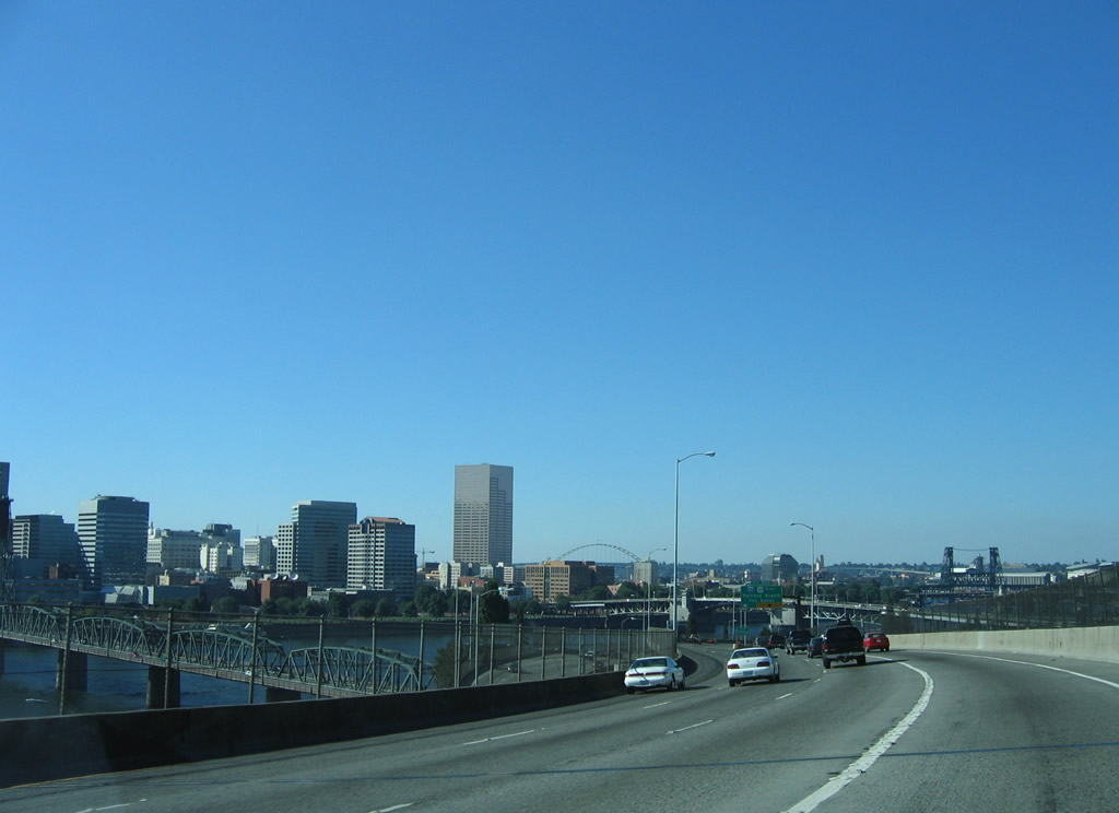
Portland is a city of bridges; the Willamette River divides the city into eastern and western sections.
08/27/06
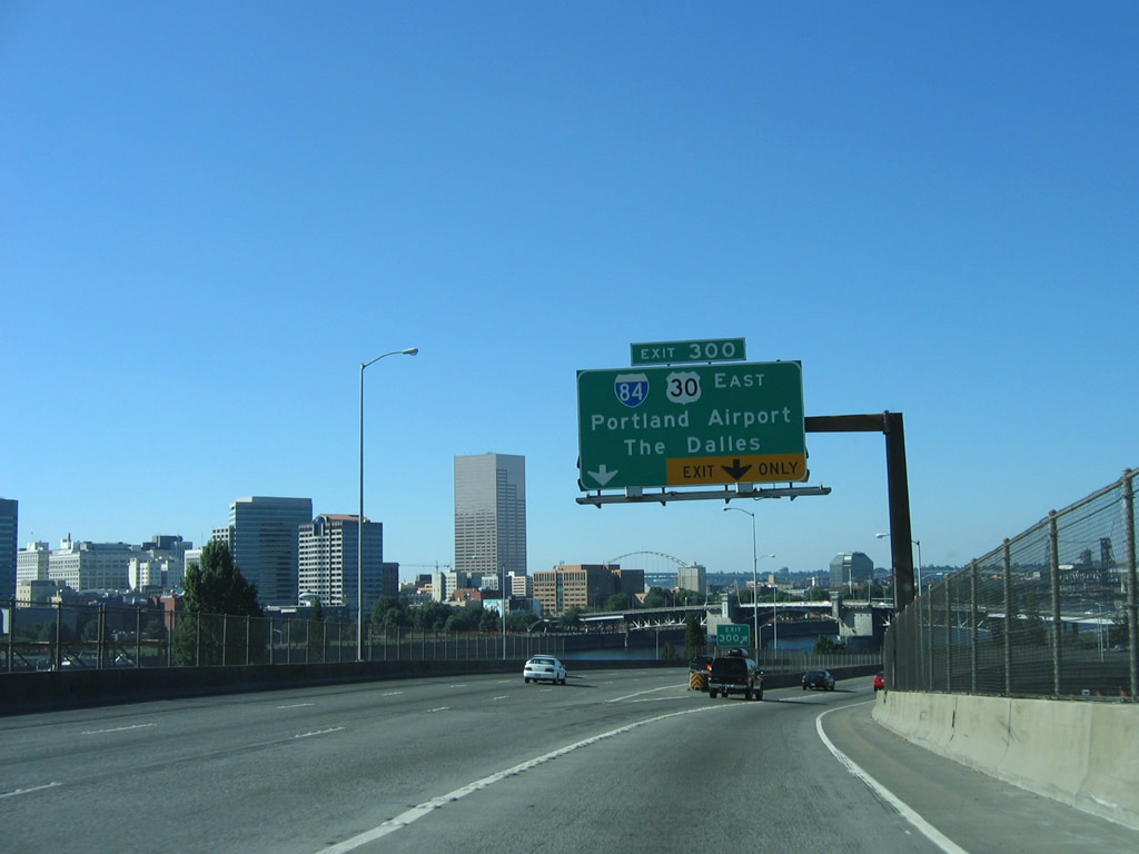
Two lanes partition from the Marquam Bridge for I-84/U.S. 30 east. The Dalles is 84 miles away at the eastern end of the Columbia River Gorge.
08/27/05
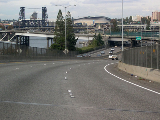
Moda (Rose Garden) Center appears in the distance where Interstate 5 lowers to grade level from the Marquam Bridge. Also appearing is the Steel Bridge, one of the only examples of a dual lift bridge in the world. Finished in 1912, the bridge's lower deck can be lifted independently of the upper deck.1
10/30/05
Once off the Marquam Bridge at milepost 301, northbound I-5 enters a labyrinth of overpasses and flyover ramps. Except for some auxiliary lanes, northbound traffic reduces to two lanes until just past the northern interchange with I-405.
10/30/05
I-5 northbound passes under the knot of ramps taking traffic to and from the Morrison Bridge. There is no direct access to the bridge from northbound I-5; the ramps originate mostly from surface streets and the bridge itself. The Morrison Bridge connects west side Washington and Alder streets with east side Morrison and Belmont streets.
10/30/05
The Burnside Bridge (Burnside Street is Portland's north-south divider arterial) spans Interstate 5 north in this scene. The elevated lanes ferrying traffic to and from I-84 parallel this stretch. Spires of the Oregon Convention Center rise along the east side.
07/19/05
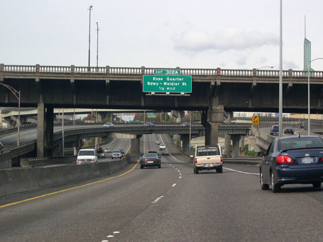
The advance sign for Exit 302 A for the Moda Center, a sports and entertainment venue, and the couplet of Broadway and Weidler Street appears at the Burnside Bridge.
10/30/05
Northbound I-5 passes under the flyover ramp bringing traffic from westbound I-84 to southbound I-5. The flyover just beyond carries traffic from southbound I-5 to eastbound I-84.
07/19/05
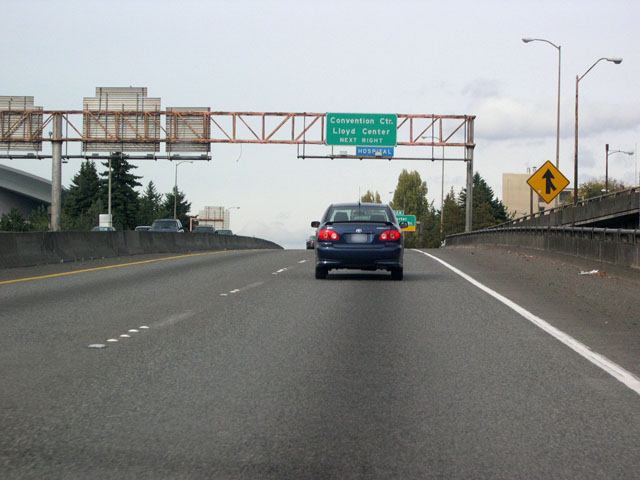
Exit 302 A links Interstate 5 north with the Oregon Convention Center and Lloyd Center mall. The entrance ramp from I-84/U.S. 30 west adds a short auxiliary lane.
10/30/05
Portland's Rose Quarter consists of the Moda Center, home of the Portland Trailblazers and Portland Winterhawks hockey team, and the older Veterans Memorial Coliseum. Previously named Rose Garden Arena, the sports and concert venue was completed in 1995.
09/02/06
Northbound I-5 shield assembly posted on the viaduct above Holladay and Multnomah Streets at the Lloyd District in Portland.
09/02/06
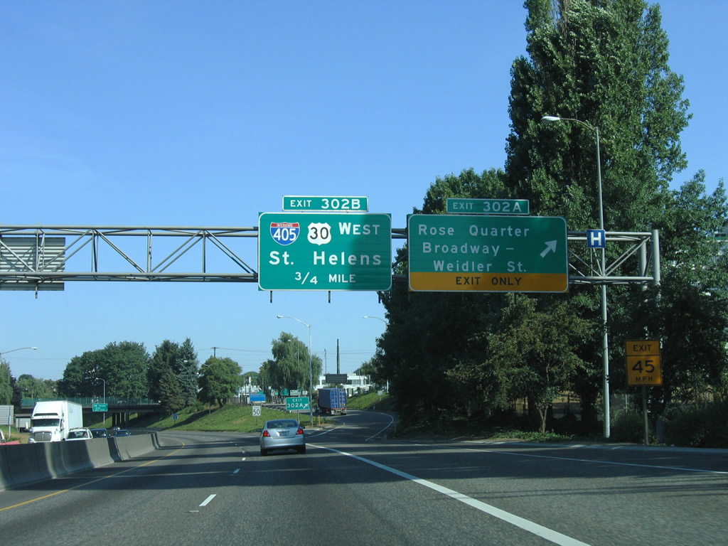
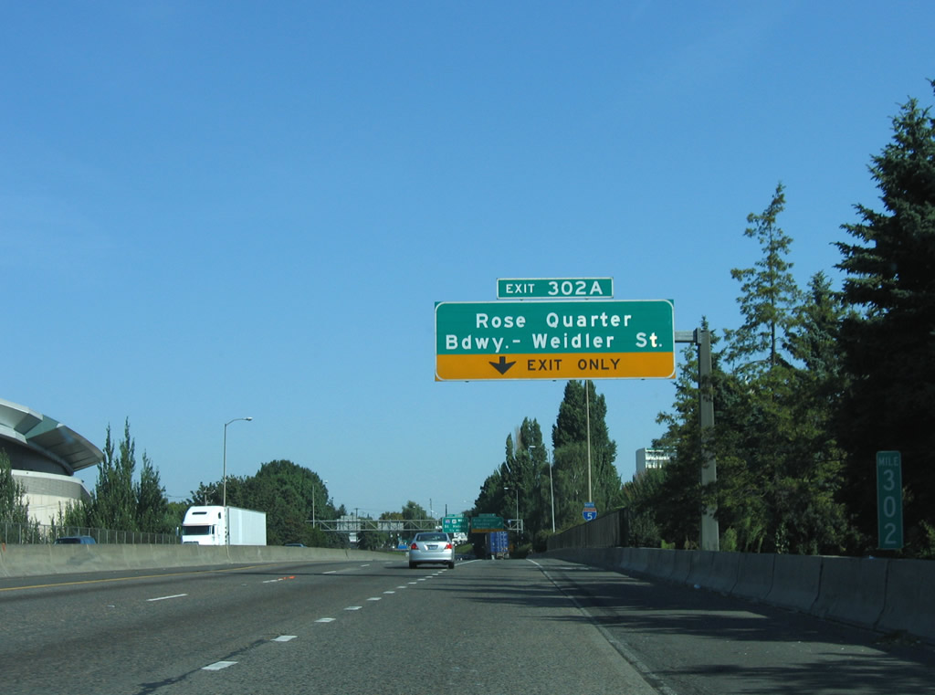
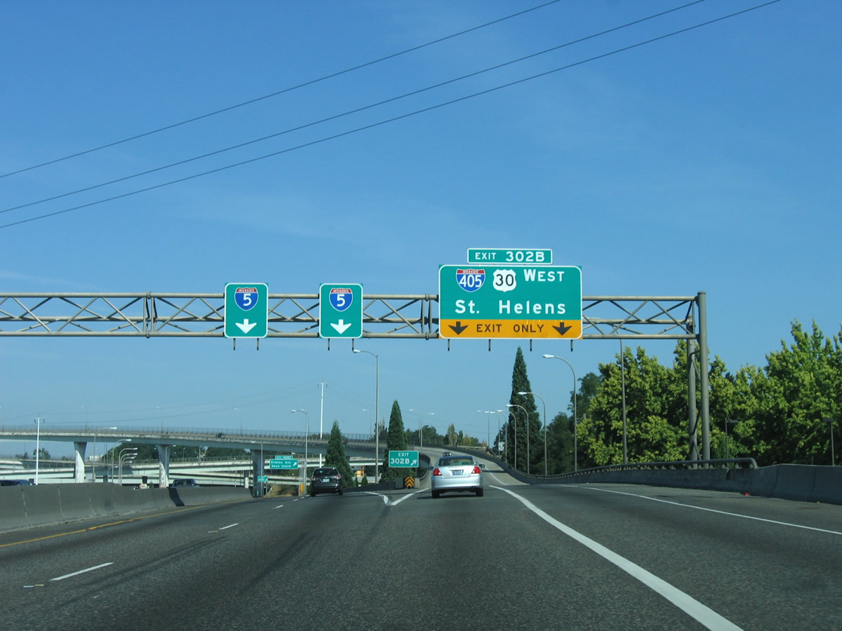
Exit 302 A leaves I-5 north for Weidler Street. U.S. 30 west combines with the freeway north a half mile to Interstate 405.
09/02/06
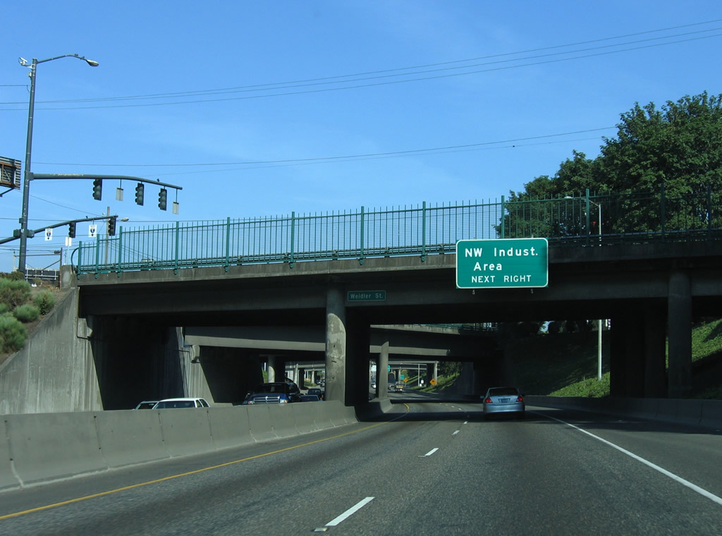
U.S. 30 overlaps with I-405 south across the Fremont Bridge to the Northwest Industrial Area in Portland. Though there is still a fair amount of industry remaining, some areas of former light industrial and warehouse sites, such as the Pearl District, were converted to high-density housing and artsy commercial developments.
09/02/06
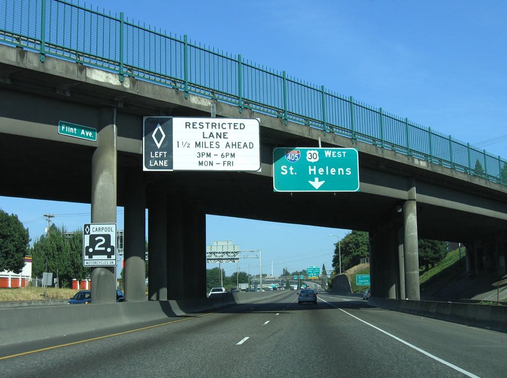
I-5/U.S. 30 pass under the Flint Avenue overpass ahead of Exit 302 B and an HOV lane.
09/02/06
The entrance ramp from Williams Avenue north at Broadway adds an auxiliary lane for Exit 302 C.
09/02/06
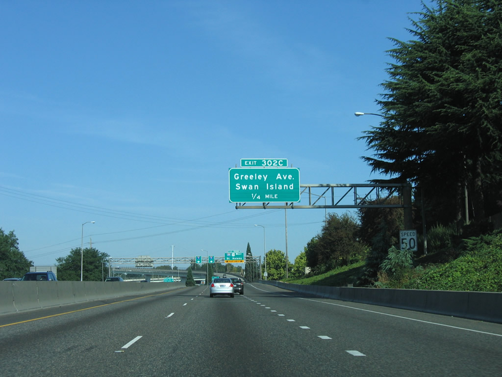
Exit 302 C departs I-5 north from within the directional T interchange with Interstate 405 and the Fremont Bridge to Greeley Avenue, an urban boulevard leading north to the Overlook neighborhood.
09/02/06
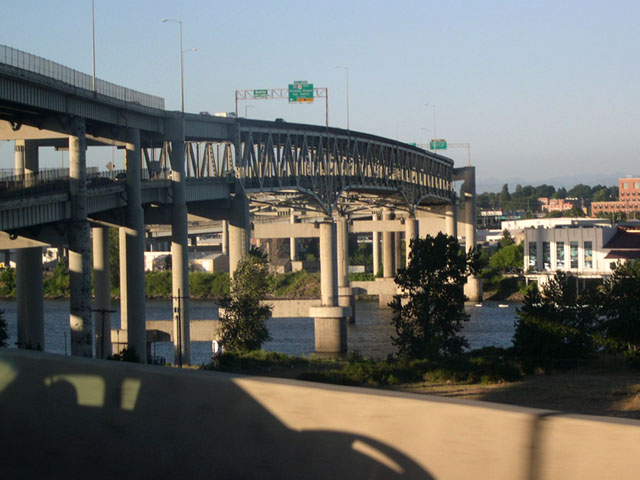
I-405/U.S. 30 cross the Willamette River on the double decked Fremont Bridge southwest between Exit 302 B and the former I-505 freeway spur to Yeon Avenue. U.S. 30 heads through the industrial district on Yeon Avenue, eventually turning northwest along the Columbia River to the Columbia County seat of St. Helens.
09/02/06
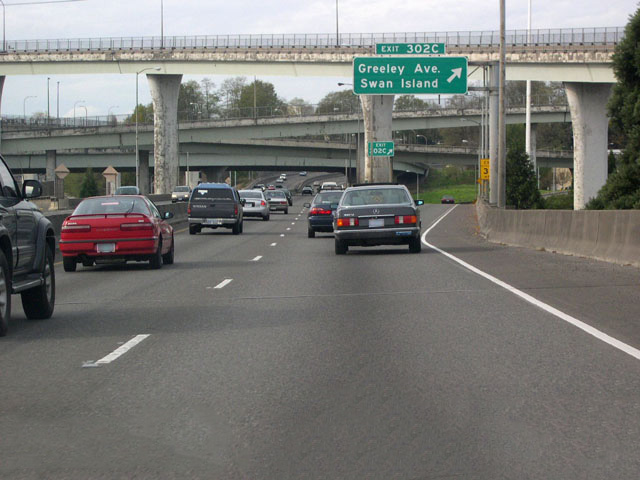
High flyovers connect I-5 with the Fremont Bridge above Exit 302 A for Greeley Avenue. The Stadium Freeway spurs northeast from this exchange to Kerby Avenue at Gantenbein Avenue. Intended to continue northeast to the unconstructed Prescott Freeway as the Rose City Freeway, the freeway stub provides local access to Martin Luther King, Jr. Boulevard (OR 99E) at the Boise section of the city.
10/30/05
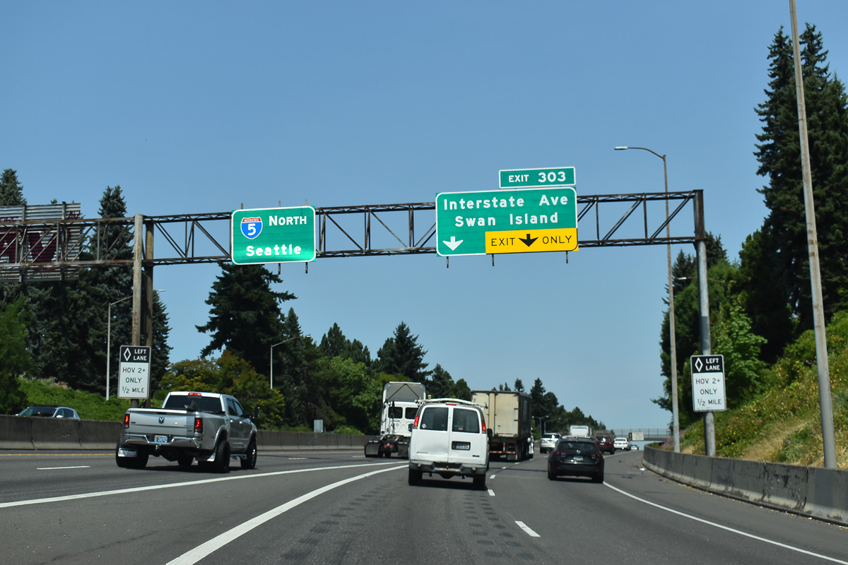
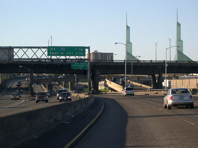
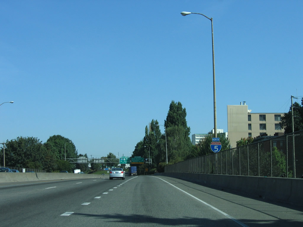
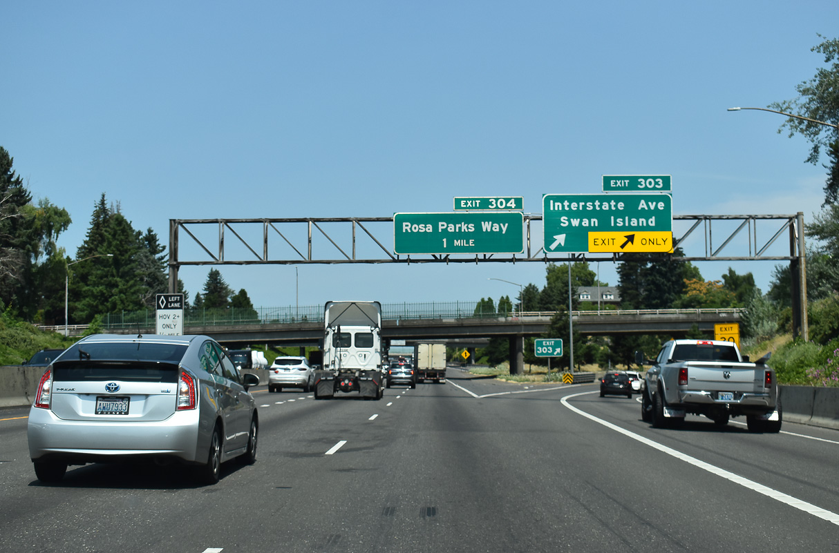
The flyover from I-405 (Stadium Freeway) adds two lanes to I-5 northbound at Albina in Portland. A trumpet interchange (Exit 303) follows with Going Street west to Interstate Avenue (former OR 99W) and Swan Island.
07/20/23
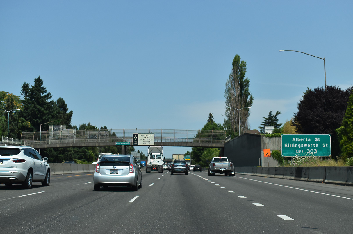
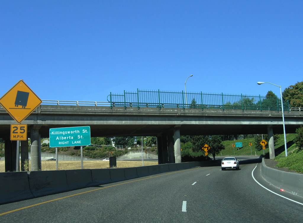
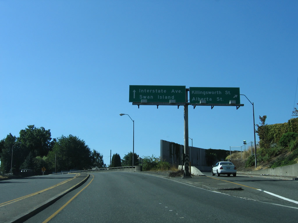
Exit 303 provides connections to Interstate Avenue (OR 99W) and Alberta Street via the frontage street of Missouri Avenue. Killingsworth Street parallels Going Street nine blocks to the north between the Overlook and Humboldt neighborhoods.
07/20/23
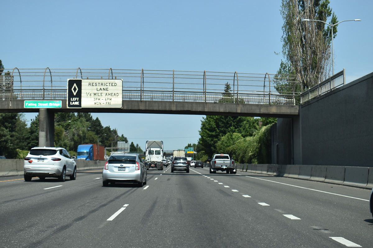
The HOV lane begins one quarter mile north of the Failing Street pedestrian bridge over Interstate 5. The lane is only restricted on weekdays during peak commute times.
07/20/23
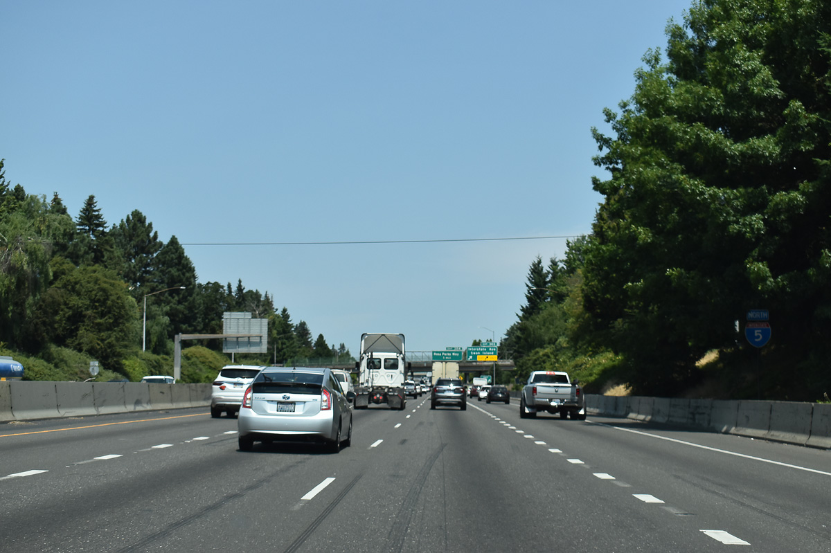
Having cleared the Downtown area of Portland, northbound I-5 advances through Portland's north side neighborhoods. Constructed in the early 1960s in place of Minnesota Avenue, most of Interstate 5 along this stretch is below grade. Historically I-5 was referred to as the Minnesota Freeway here.
07/20/23
Interstate Avenue (OR 99W) is several blocks to the west of the freeway where it runs a parallel course with I-5 through north Portland. The Interstate MAX light rail also lines the center of Interstate Avenue.
07/20/23
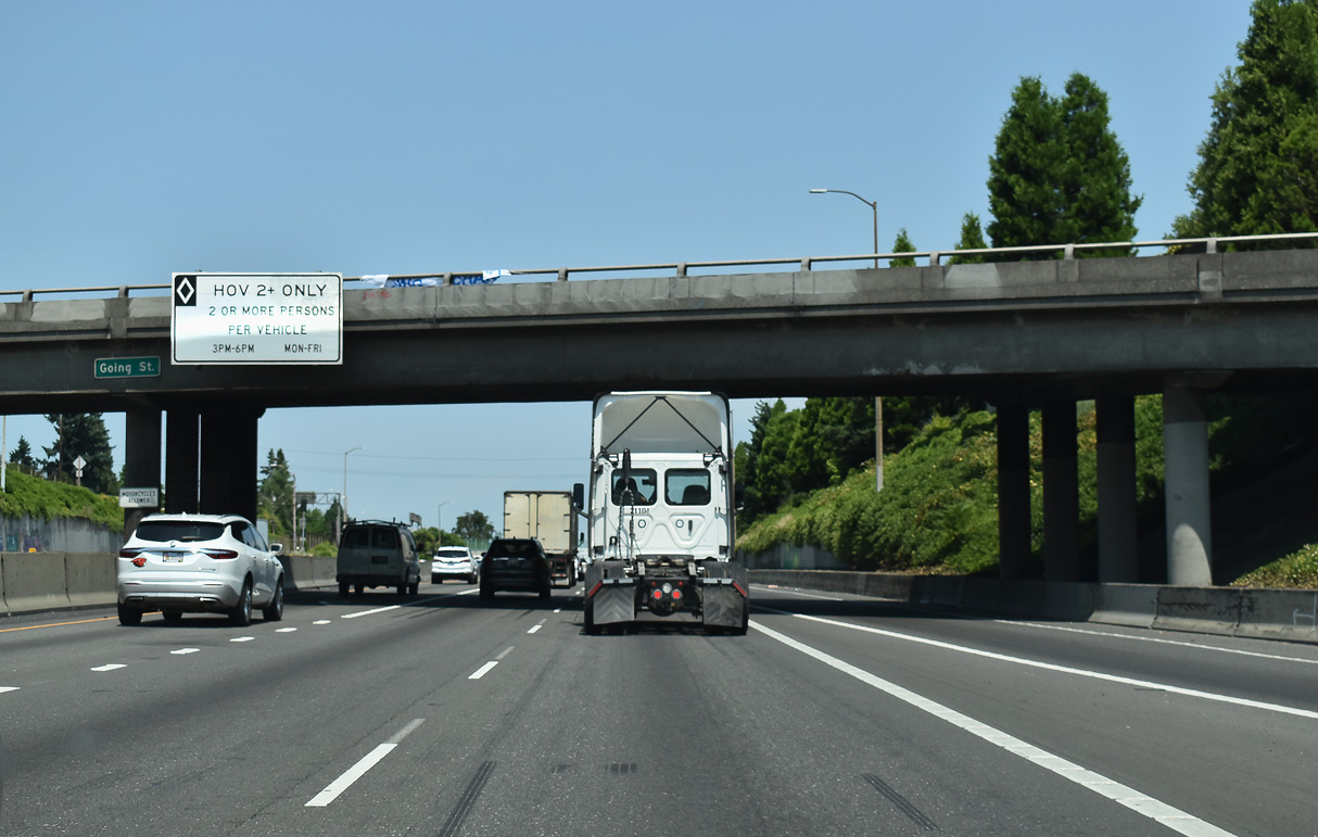
Beyond the Skidmore Street over crossing, a ramp departs from Exit 303 for Missouri Avenue north to Alberta and Killingsworth Streets. Two lanes form westbound Going Street to Swan Island and Overlook.
08/27/06
Exit 303 partitions into ramps for Going Street west and Missouri Avenue north. Killingsworth Street crosses Interstate 5 one half mile to the north by Portland Community College - Cascade Campus and the Humboldt neighborhood.
08/27/06
Going Street, which leads to Swan Island Industrial Park, passes over Interstate 5. The HOV-2 lane north to Exit 307 commences here.
07/20/23
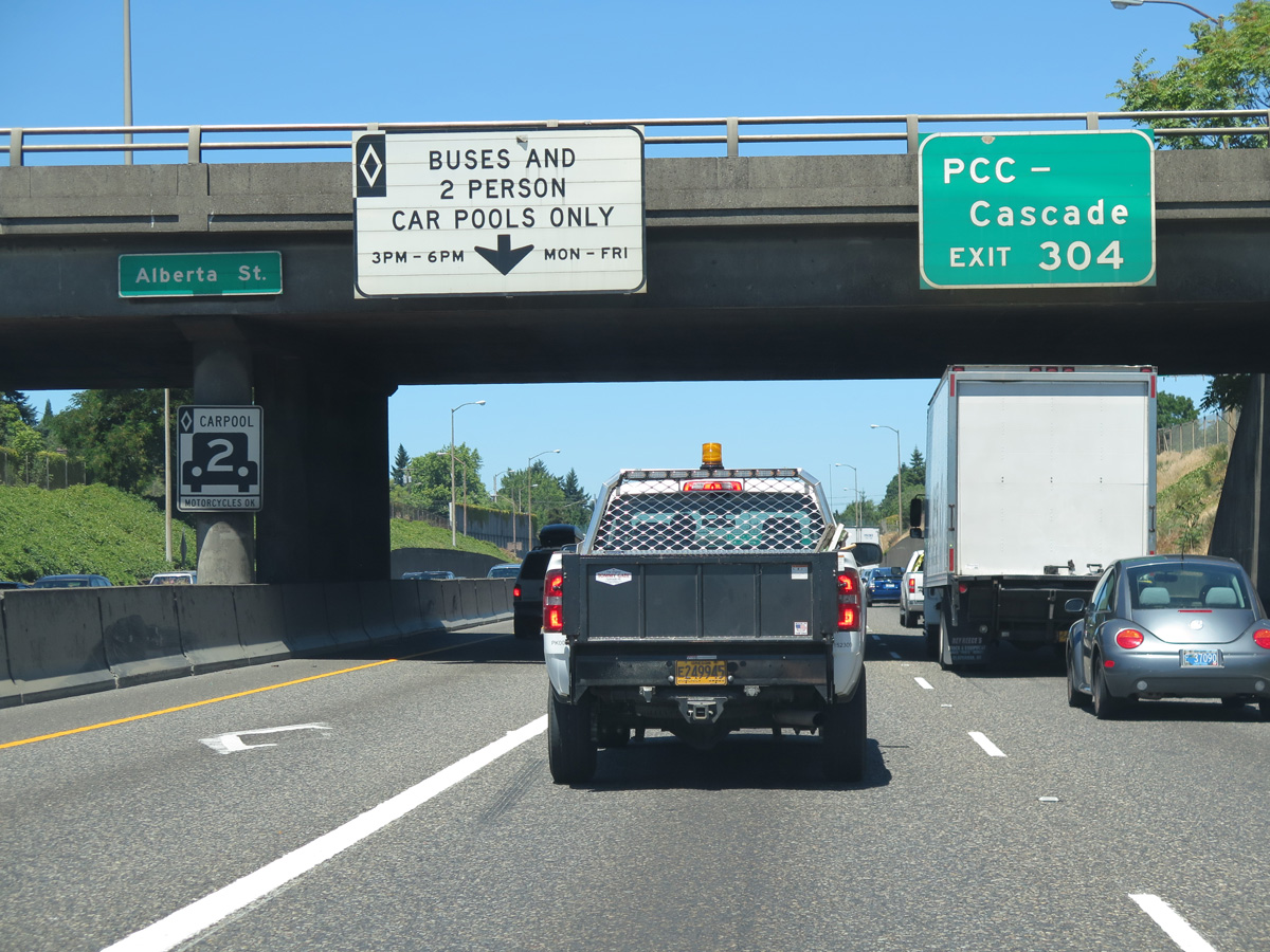
Traveling under the Alberta Street overpass on Interstate 5 north. Exit 304 provides a second access point to reach Portland Community College-Cascade.
06/25/15
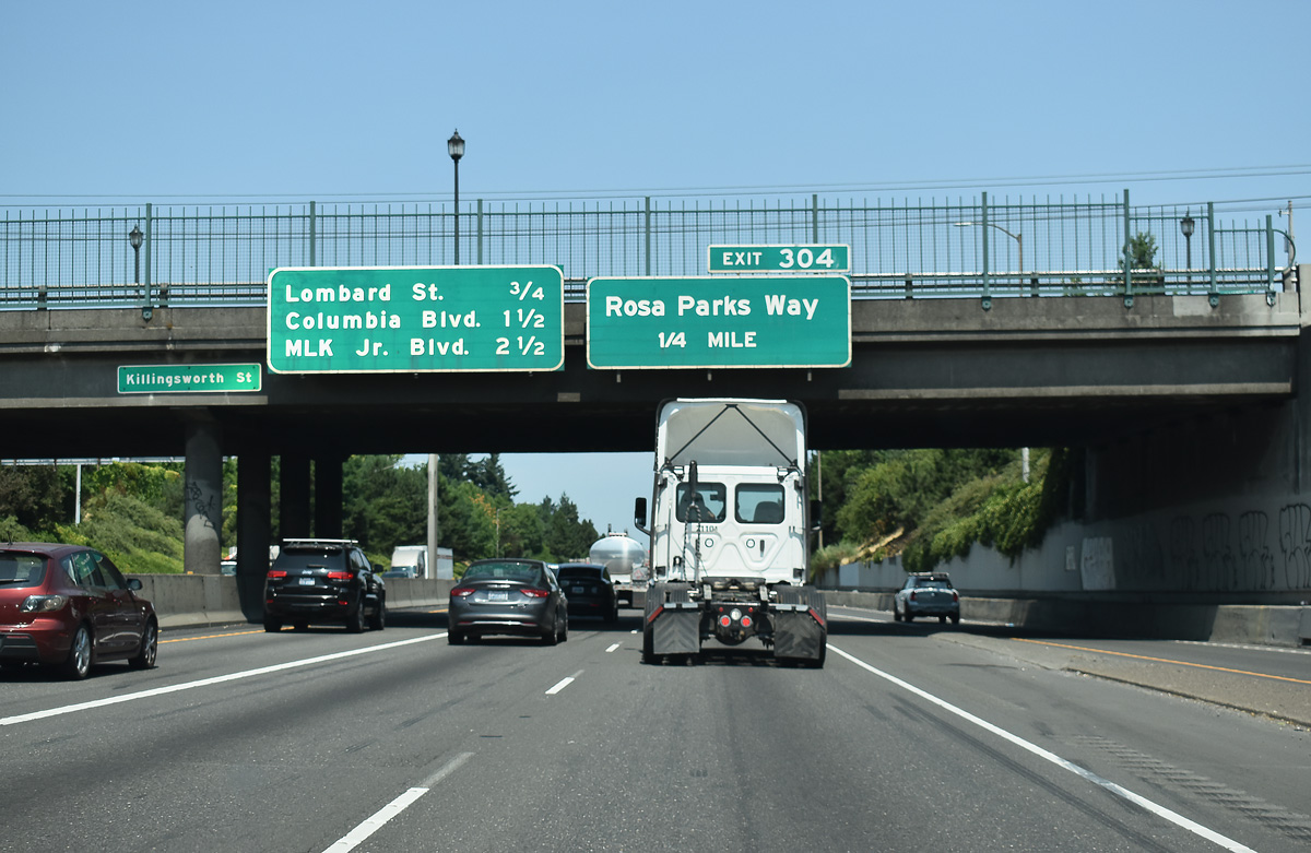
The diamond interchange (Exit 304) with Rosa Parks Way is one quarter mile beyond the Killingsworth Street over crossing.
07/20/23
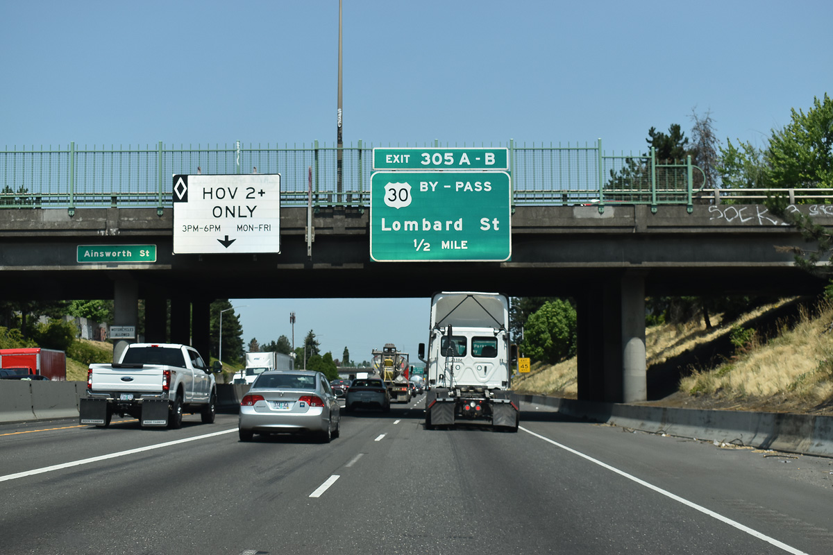
Exits 305 A/B follows Rosa Parks Way at a half cloverleaf interchange with U.S. 30 Bypass (Lombard Street). U.S. 30 Bypass travels 14.76 miles east from U.S. 30 near Cathedral Park to the Gresham city line.
07/20/23
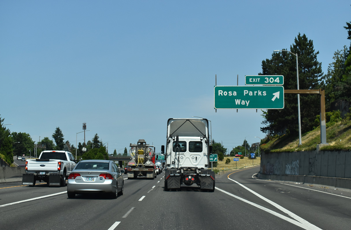
Exit 304 departs I-5 north for Rosa Parks Way. Formerly Portland Boulevard, the minor arterial street joins the Arbor Lodge and Piedmont neighborhoods in north Portland.
07/20/23
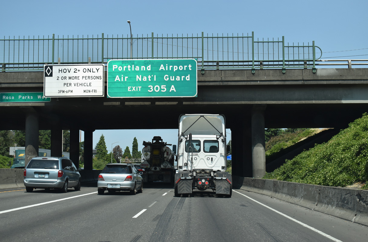
Northbound I-5 passes under Rosa Parks Way. Lombard Street (U.S. 30 bypass) east leads to Portland International Airport (PDX) from forthcoming Exit 305 A.
07/20/23
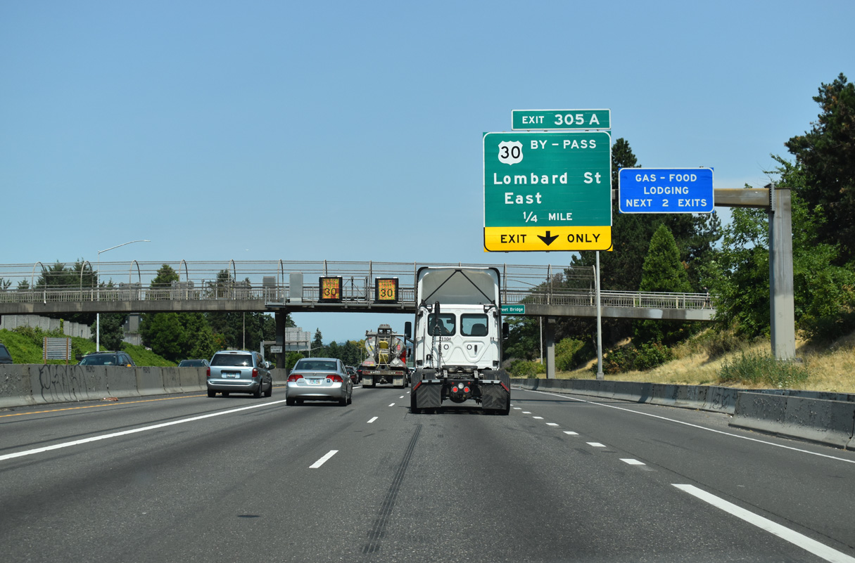
Exit 305 A joins I-5 north with Lombard Street (US 30 bypass) eastbound to the Piedmont and Woodlawn neighborhoods.
07/20/23
Prior to completion of the Banfield Freeway (I-80N/84), U.S. 30 followed two primary routes in Portland: the business route split from the bypass in Parkrose and followed Sandy Boulevard to the Burnside Bridge and the city center. The bypass route followed Portland Highway / Lombard Street along northern reaches of the city. Crossing the St. Johns Bridge, the two branches rejoined at the western end of the Willamette River.
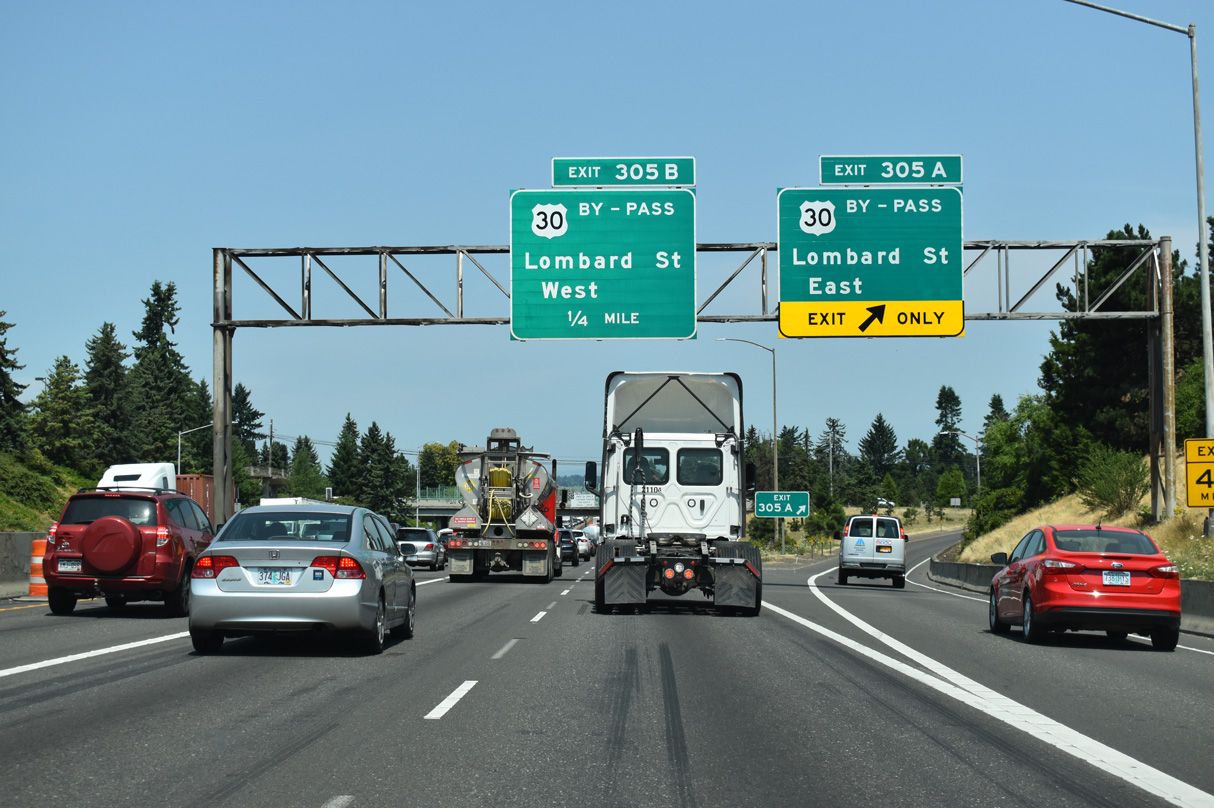
07/20/23
Exit 305 B loops away from I-5 north to Lombard Street west toward University Park and the University of Portland, Portsmouth and the St. Johns Bridge. Lombard Street extends north to Kelley Point Park, located at the confluence of the Willamette and Columbia Rivers.
07/20/23
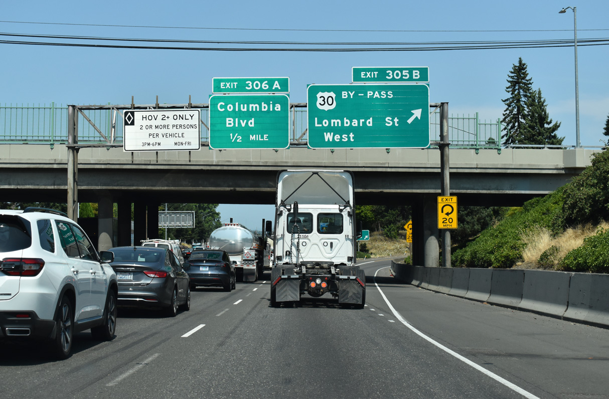
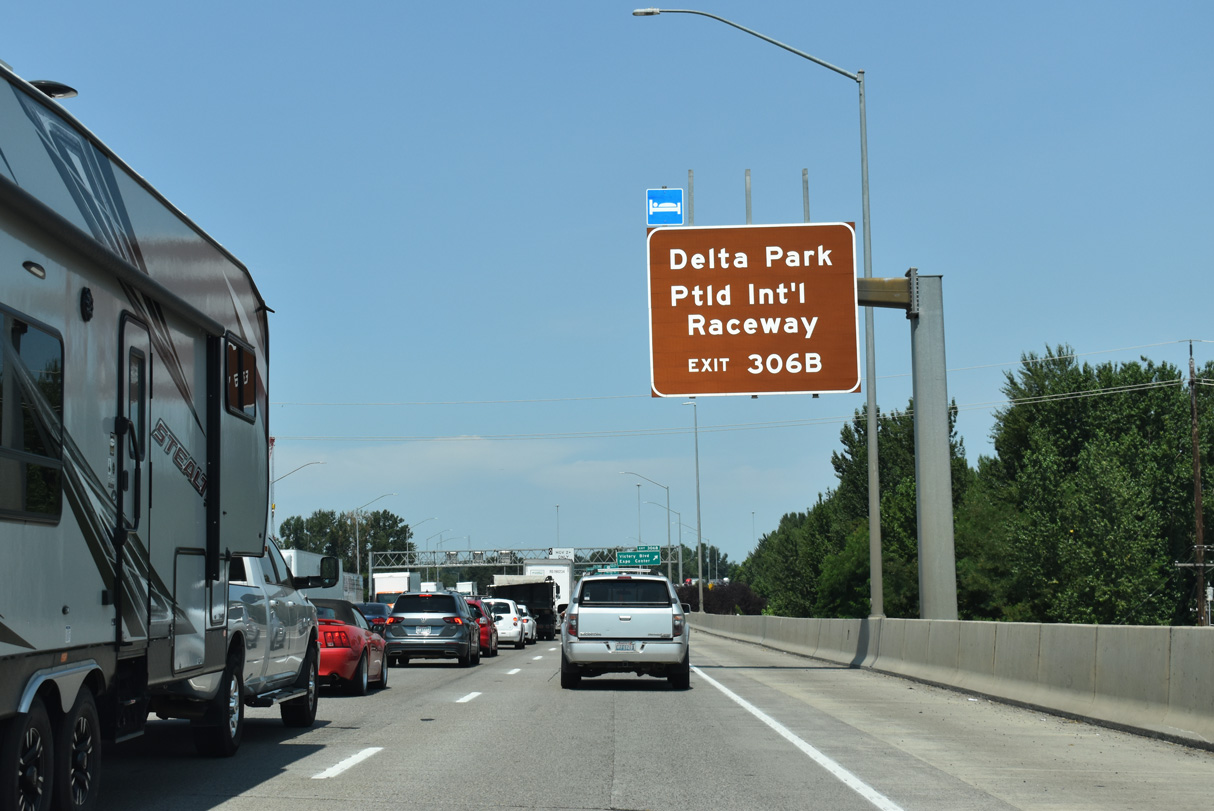
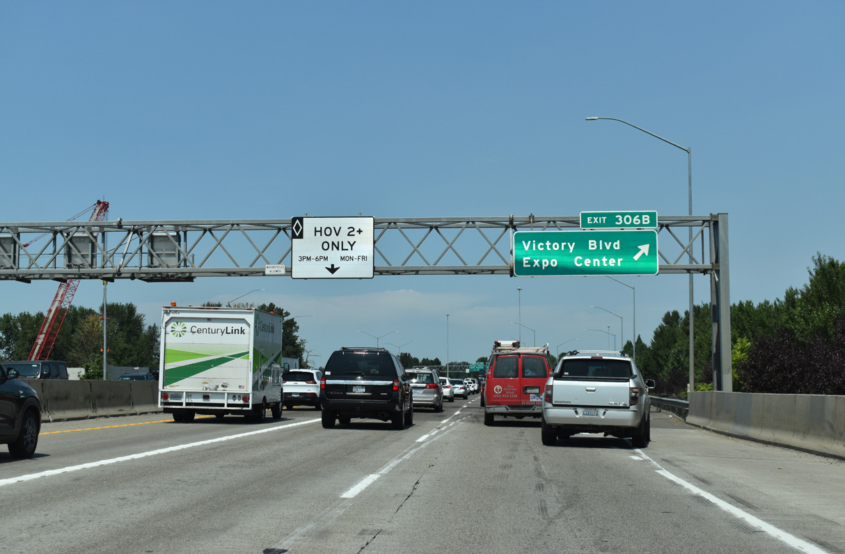
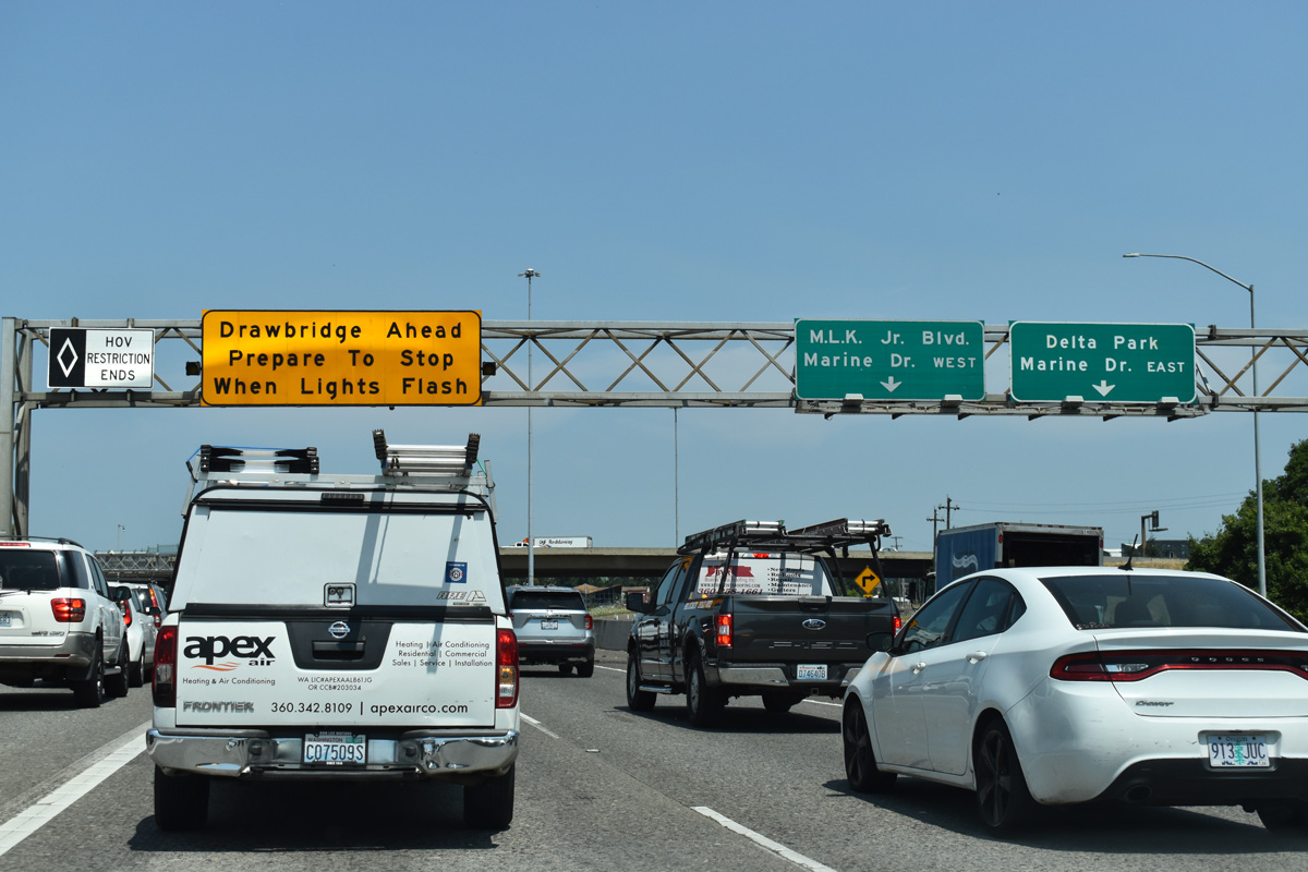
Exit 306 B joins I-5 north with Victory Boulevard west and Whitaker Road south by Delta Park and Delta Park Center retail area.
07/20/23
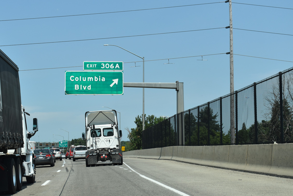
Interstate 5 spans a Union Pacific Railroad line travels as it reaches Exit 306 A for Columbia Boulevard. Columbia Boulevard travels through mostly commercial and light industrial areas spreading south of the Columbia River.
07/20/23
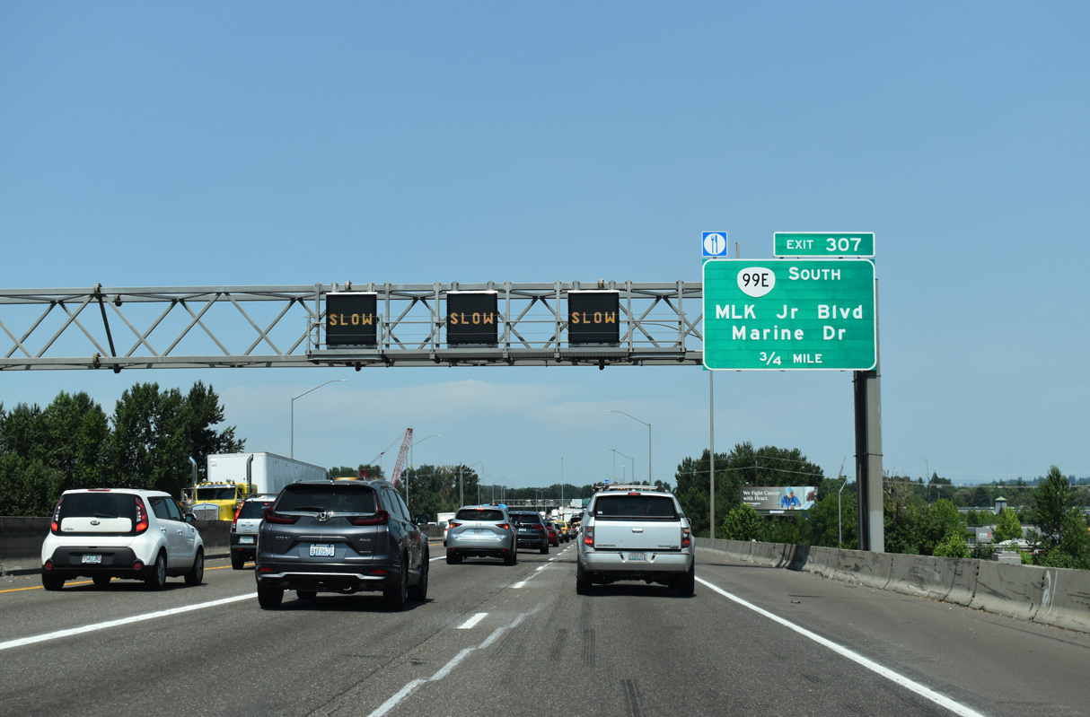
Marine Drive and OR 99E (Martin Luther King, Jr. Boulevard) come together with Intestate 5 at Exit 307, by the Delta Park - Owens Sports Complex in 0.75 miles.
07/20/23
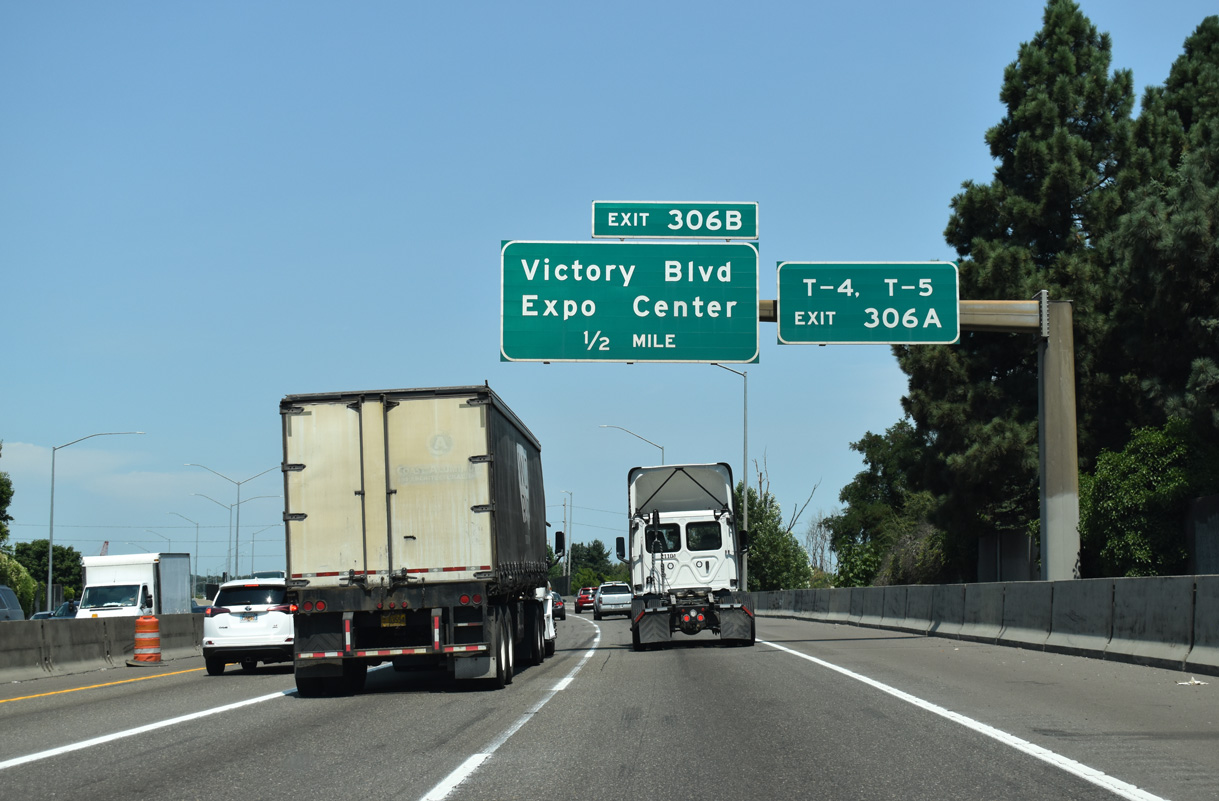
Portland International Raceway spreads to the north of Columbia Slough and Delta Park West. The Portland Expo Center lies west of the exchange with OR 99E (MLK, Jr. Boulevard) along N Marine Drive.
07/20/23
Whitaker Road extends south from Victory Boulevard to an area of distribution centers north of Columbia Slough along Schmeer Road.
07/20/23
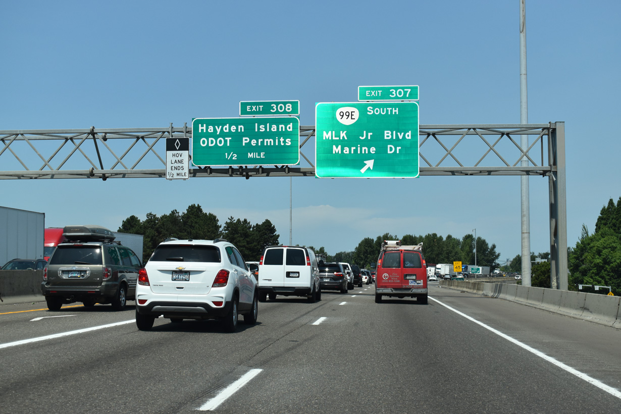
Exit 307 separates from I-5 north as a distributor roadway for OR 99E (Martin Luther King, Jr. Drive) south, Delta Park and Marine Drive.
07/20/23
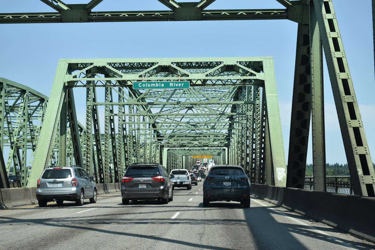
The HOV lane ends at Exit 307, 0.8 miles ahead of the Interstate Bridge taking Interstate 5 across the Columbia River.
07/20/23
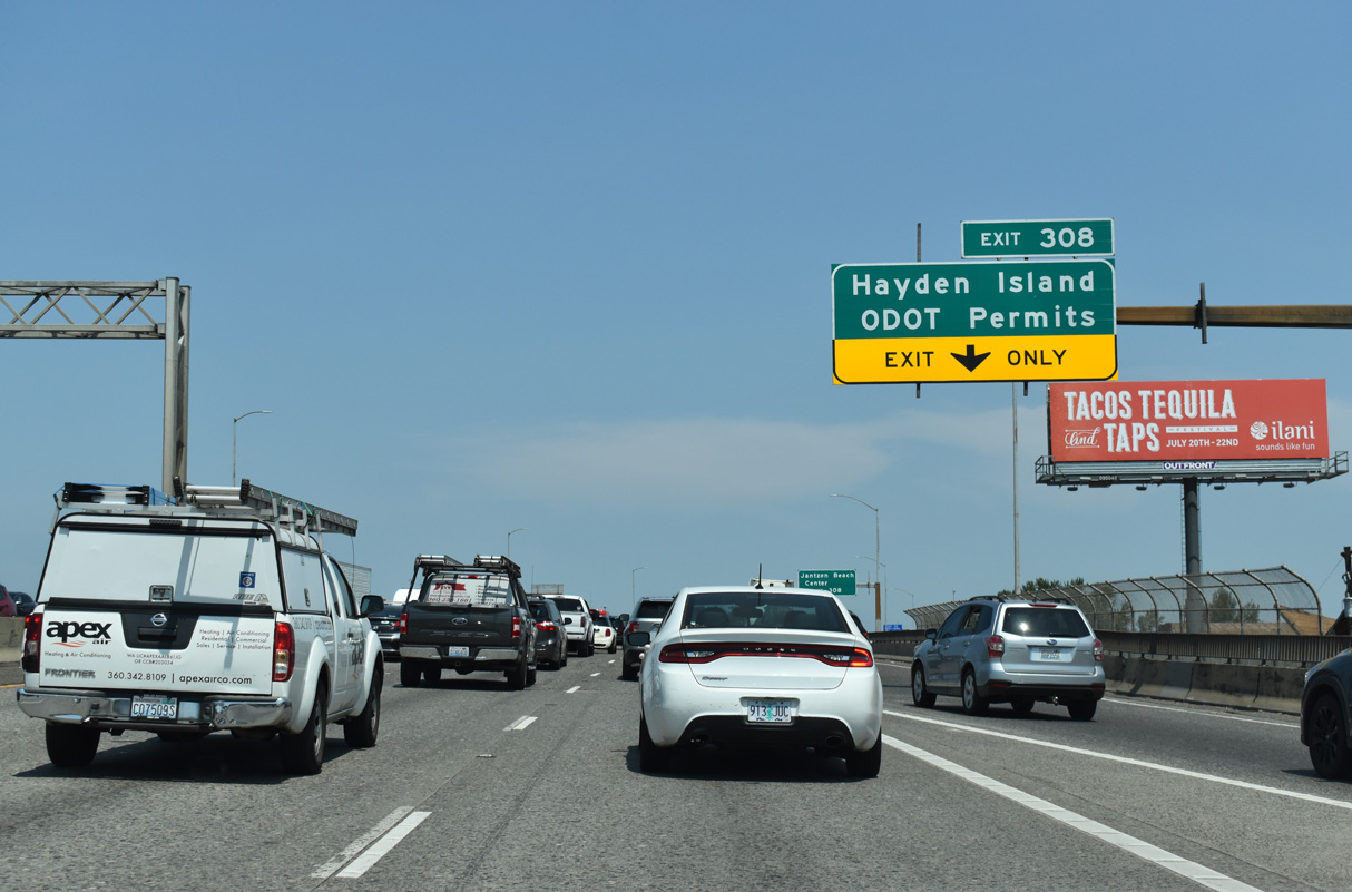
Interstate 5 spans North Portland Harbor north onto Hayden Island.
07/20/23
Hayden Island is home of the Jantzen Beach Center. Oregon has no sales tax, so the big box retail complex is popular with Washingtonians.
07/20/23
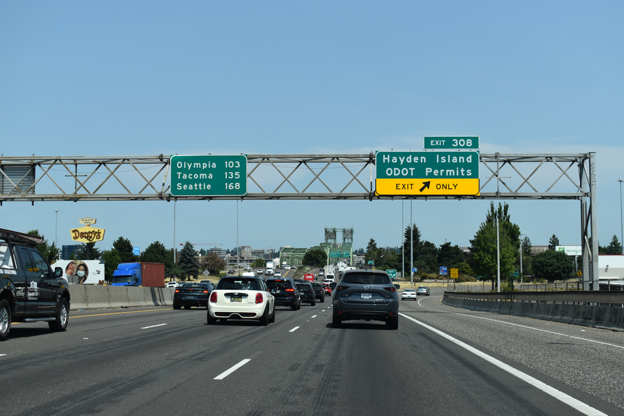
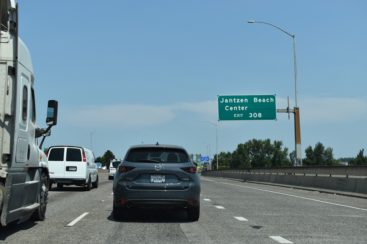
Exit 308 is a folded diamond interchange with Hayden Island Drive. Tomahawk Island Drive stems east from the exchange to the marinas on Tomahawk Island while Hayden Island Drive extends west to the undeveloped portion of the island.
07/20/23
Exit 308 parts ways with I-5 north for Tomahawk Island Drive at Jantzen Beach. Commercial properties line both sides of Interstate 5 ahead of the Interstate Bridge leading into Vancouver, Washington.
07/20/23
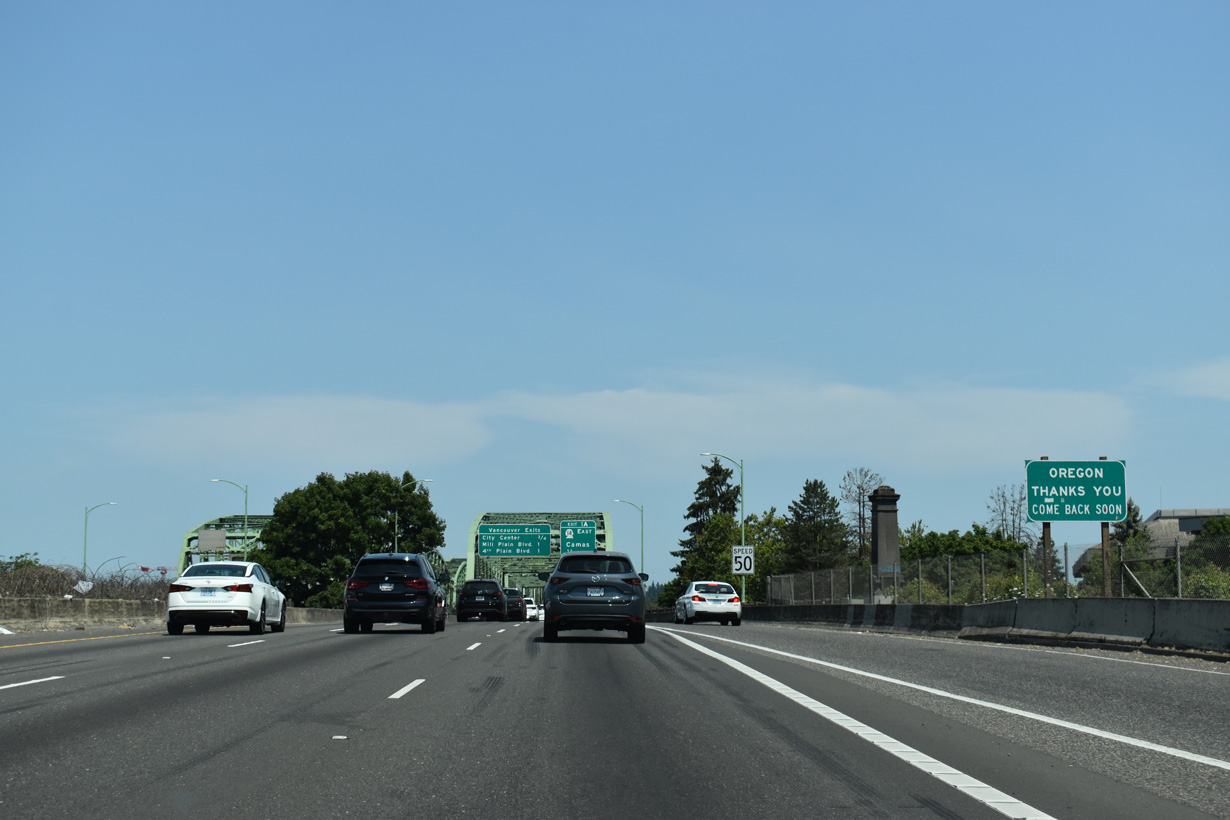
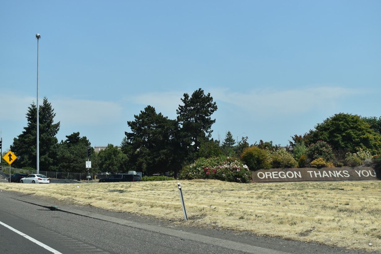
Continuing onto the Interstate Bridge, a sign thanks motorists for visiting Oregon.
07/20/23
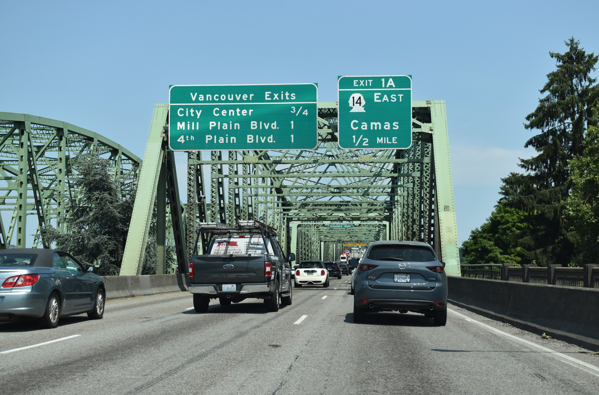
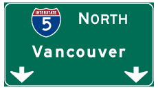
Interstate 5 enters Vancouver, Washington along the east side of Downtown. Exit 1 A connects with the freeway along SR 14 paralleling the Columbia River east to I-205 and Camas.
07/20/23
The Interstate Bridge consists of two narrow draw bridges. The northbound span predates the U.S. highway system, having carried the Pacific Highway and later U.S. 99 across the Columbia River. It replaced ferry service between Portland and Vancouver.
07/20/23
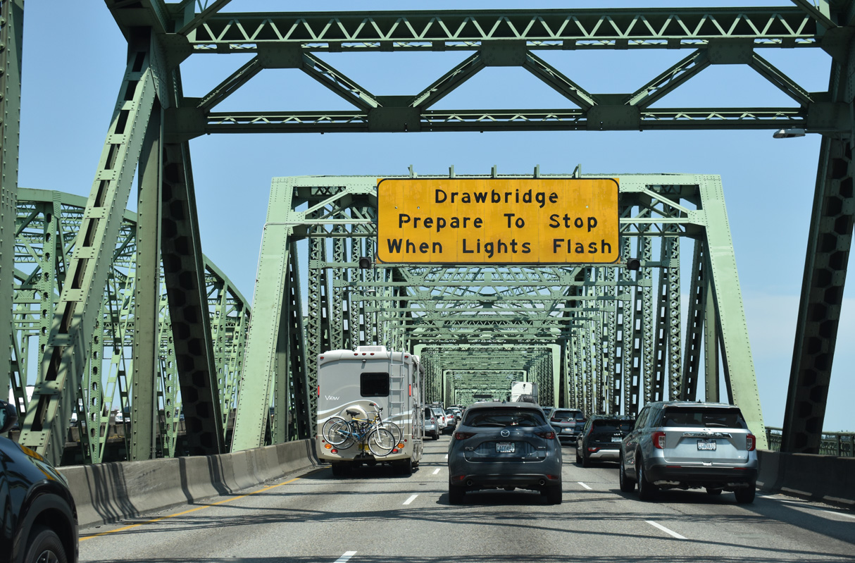
The lift portion of the Interstate Bridge falls just within the Evergreen State.
07/20/23

The Interstate Bridge carrying traffic along Interstate 5 southbound dates to 1958.
07/20/23
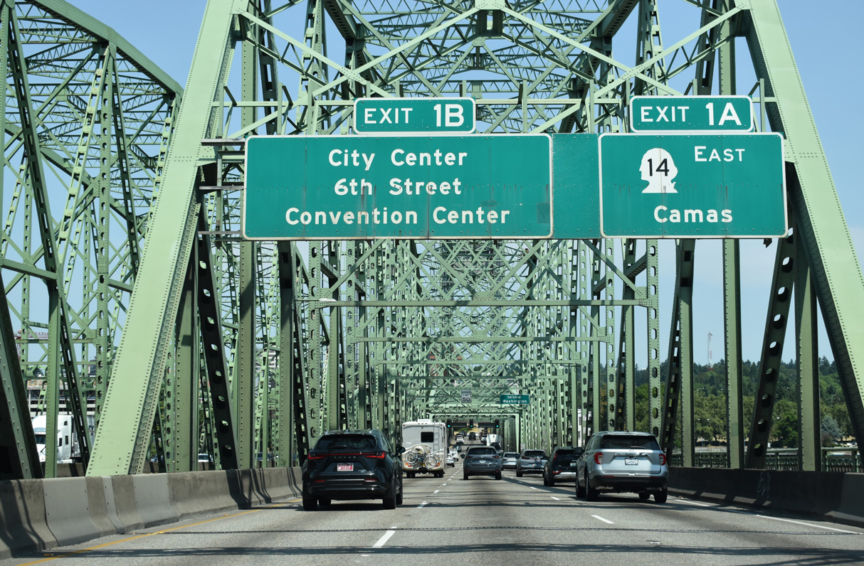
Back to back ramps depart at the north end of the Interstate Bridge for SR 14 (Lewis and Clark Highway) east and C Street north / 6th Street west to the Vancouver city center.
07/20/23
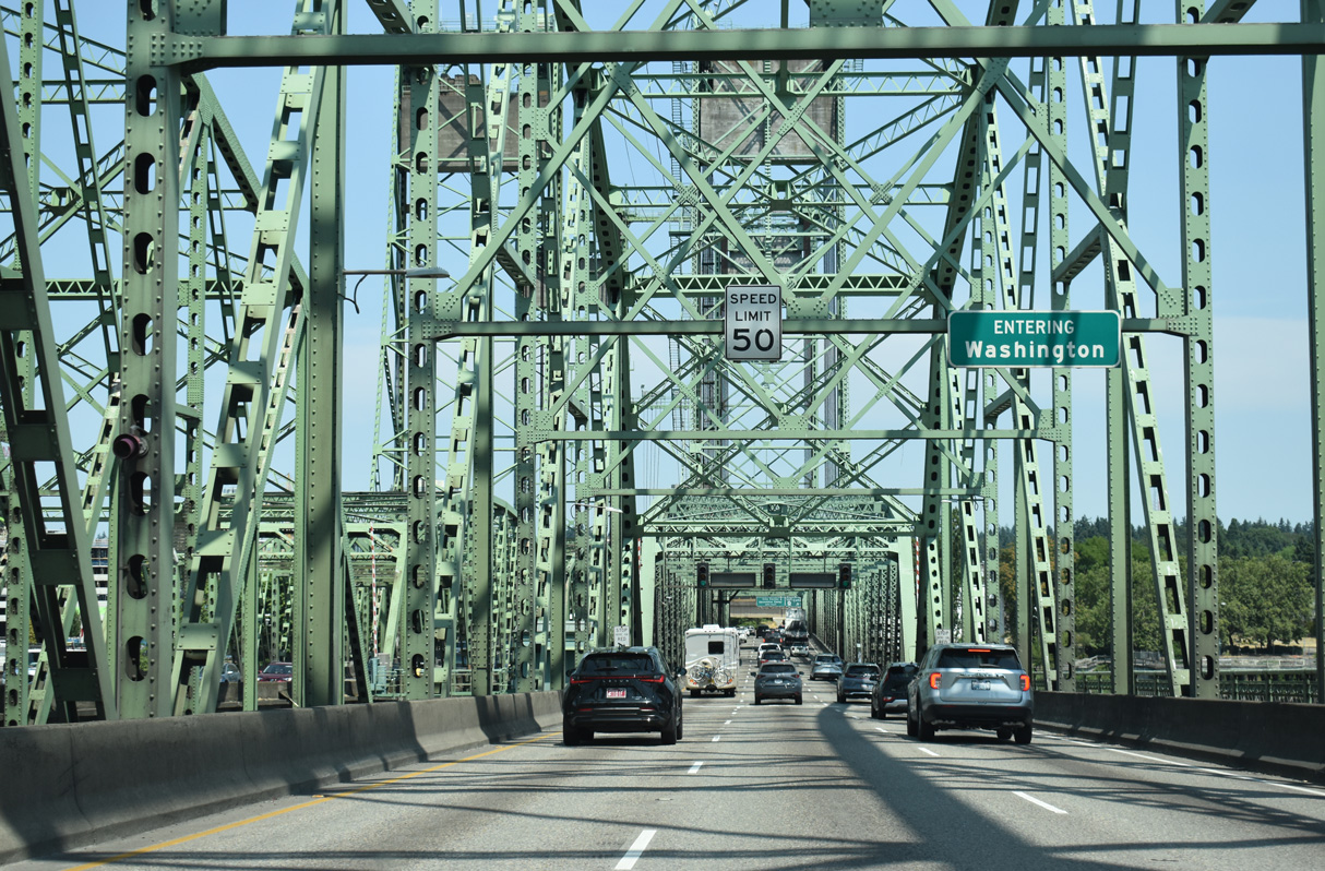
The Washington state line crosses I-5 midway across the Columbia River.
07/20/23

References:
- Steel Bridge. PortlandBridges.com.
Photo Credits:
- Brent Ivy: 07/20/23
- Matt Strieby: 06/26/05, 07/19/05, 10/30/05
- AARoads: 08/27/05, 08/27/06
- Andy Field: 09/02/06, 06/25/15
Connect with:
Page Updated Friday August 22, 2025.