
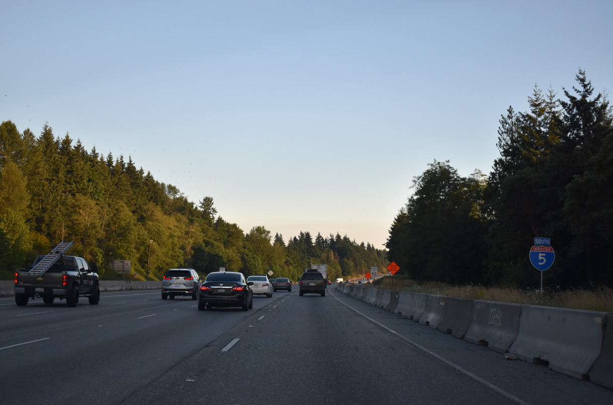
Interstate 5 South - Seattle to Federal Way
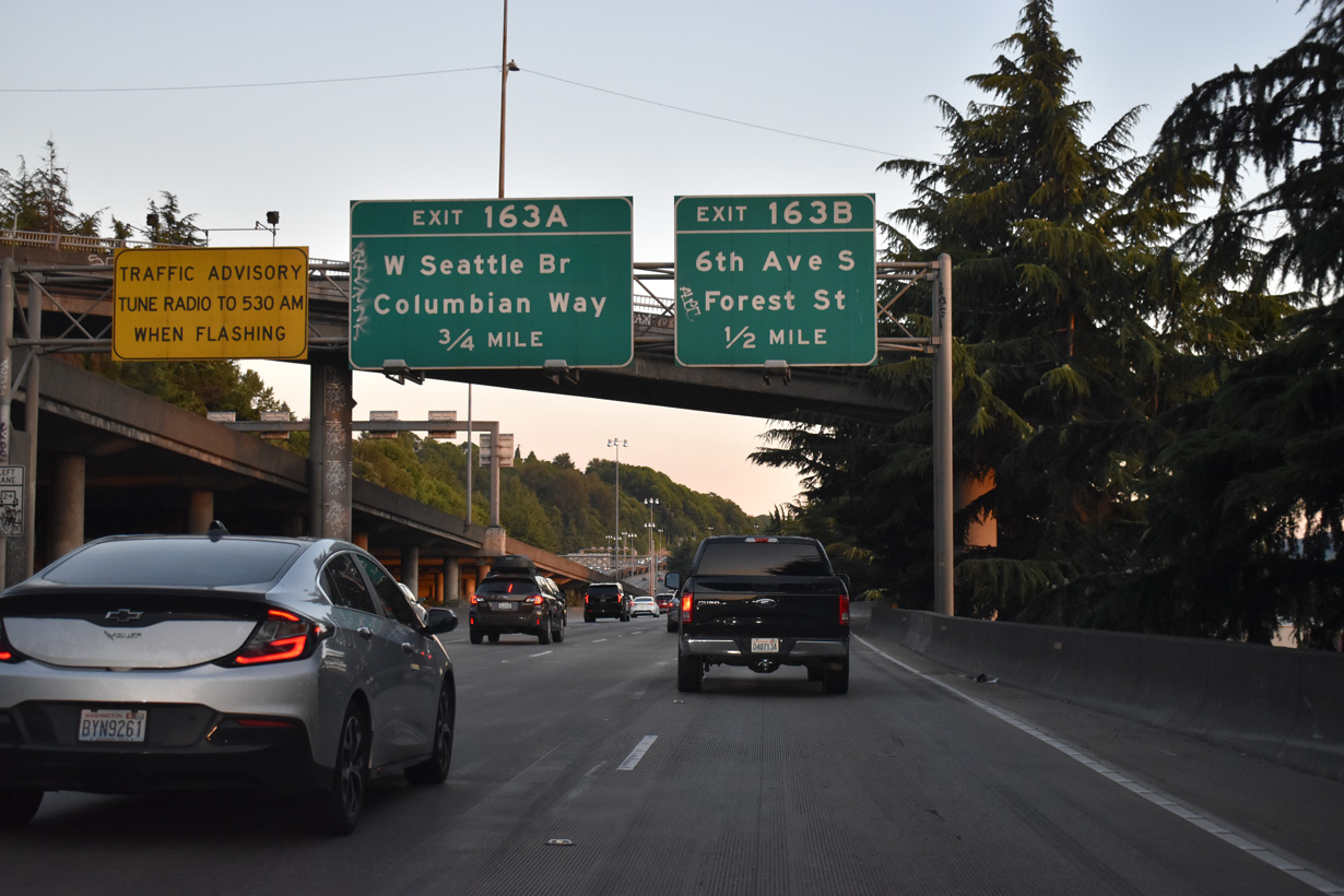
Interstate 5 south travels below I-5 north along the hill side west of Beacon Hill. Passing under Beacon Avenue, the freeway advances to Exit 163 B for Forest Street west.
07/20/23
Exit 163 A joins Interstate 5 south with both the West Seattle Bridge to Harbor Island and West Seattle, and Spokane Street below to the Duwamish industrial area and Port of Seattle facilities. The West Seattle Bridge constitutes an elevated freeway west to Fauntleroy Way in West Seattle.
This sign has been missing since 2021.
08/30/06
Exit 163 B drops onto Forest Street ahead of the intersection with 6th Avenue S. 6th Avenue S provides access to northern areas of the Duwamish Industrial area.
07/20/23
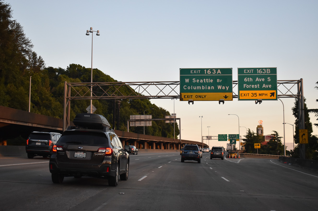
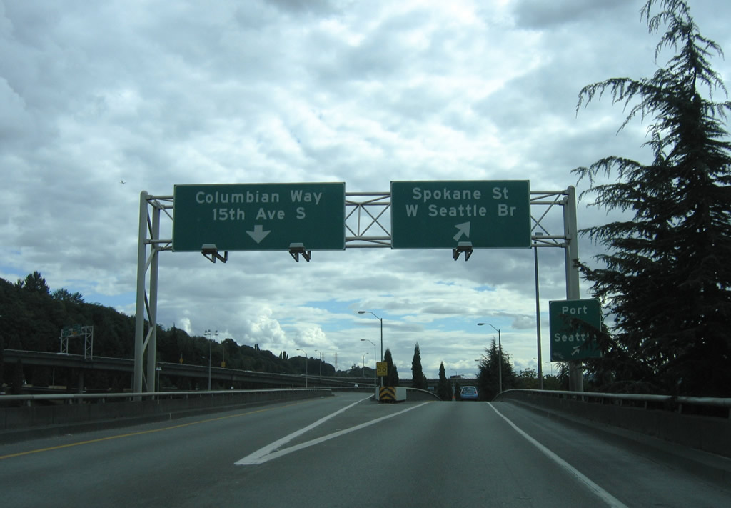
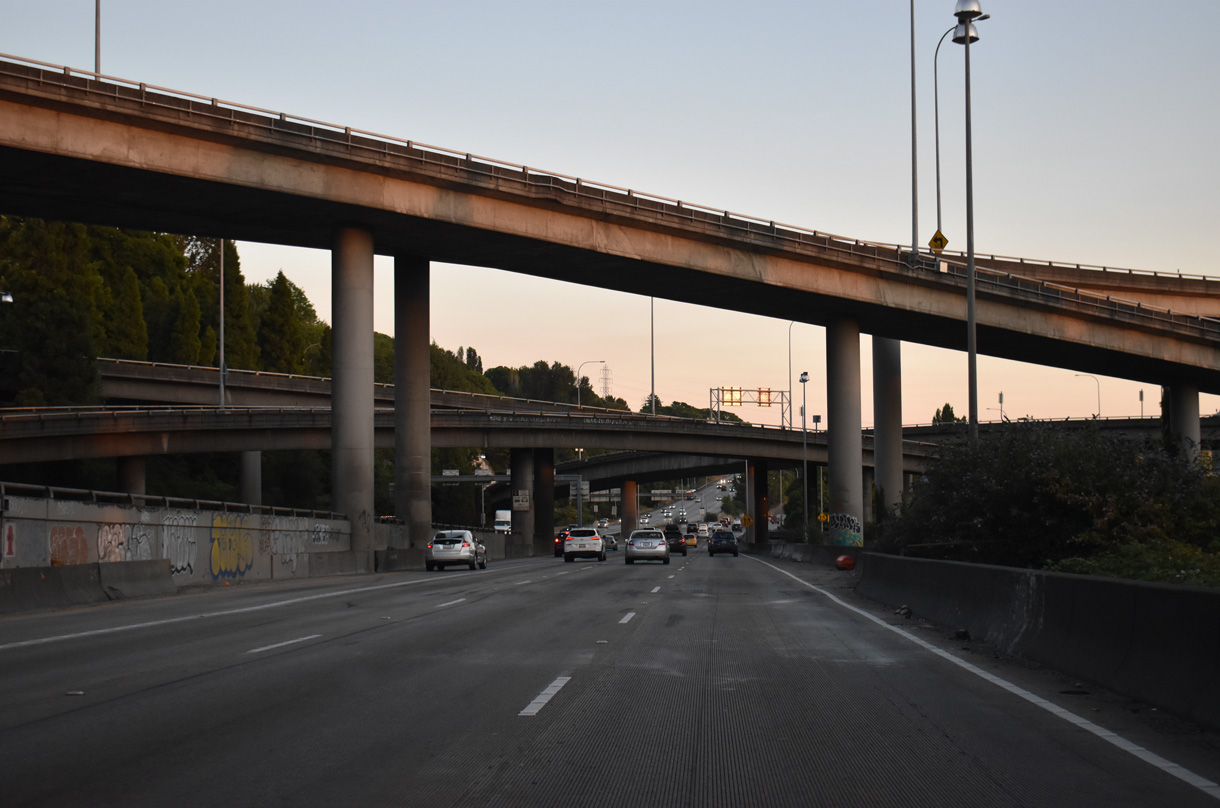
Exit 163 A carries traffic to both Columbian Way east to Beacon Hill and South Seattle, and the Spokane Street Viaduct west to Harbor Island, Youngstown, and West Seattle. Completed in the early 1980s, the freeway underwent expansion and modernization in 2010.
07/20/23
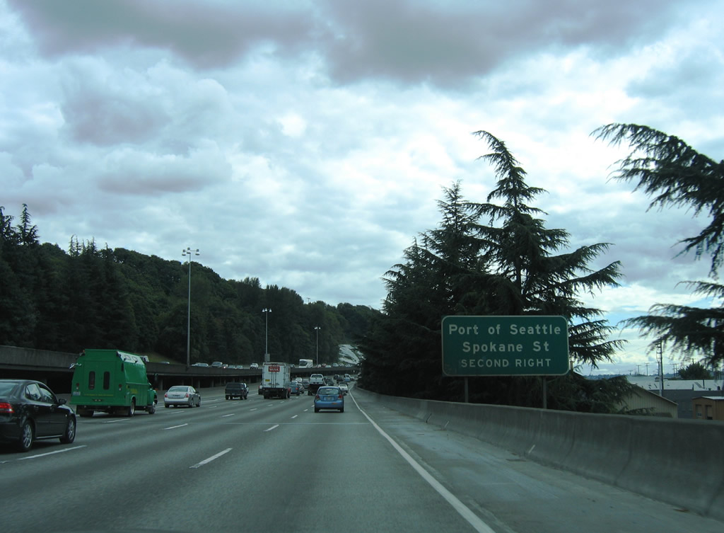
Columbian Way extends from the Spokane Street Viaduct to the Beacon Hill street grid at 14th and 15th Avenues S. The viaduct west provides access to Spokane Street and the Port of Seattle facilities below at 1st Avenue S and Harbor Island.
08/30/06
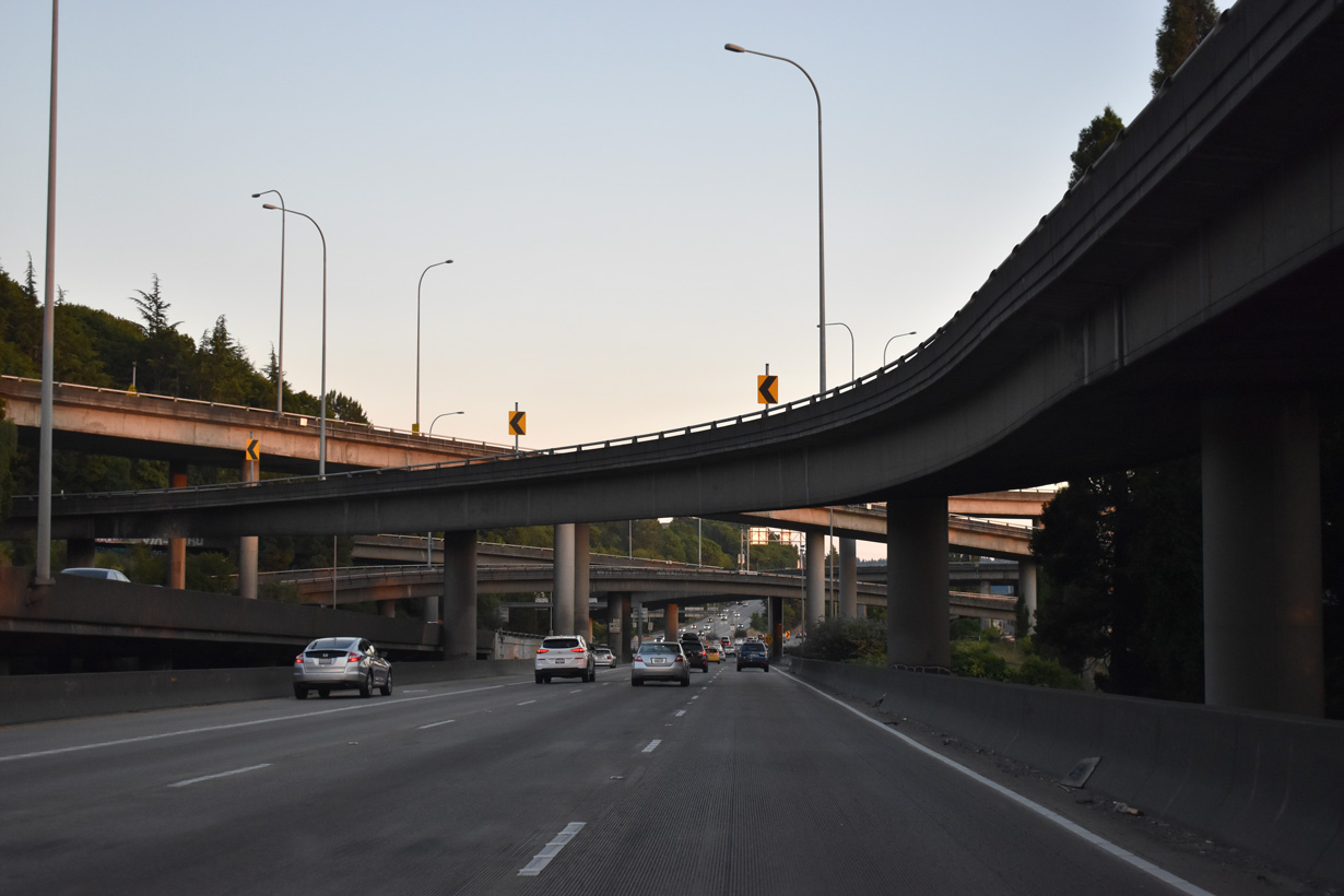
Interstate 5 south at the multi level interchange (Exit 163 A) with the Spokane Street Viaduct west and Columbian Way east.
07/20/23
Succeeding exits join Interstate 5 south with the Georgetown and Van Asselt areas of south Seattle.
07/20/23
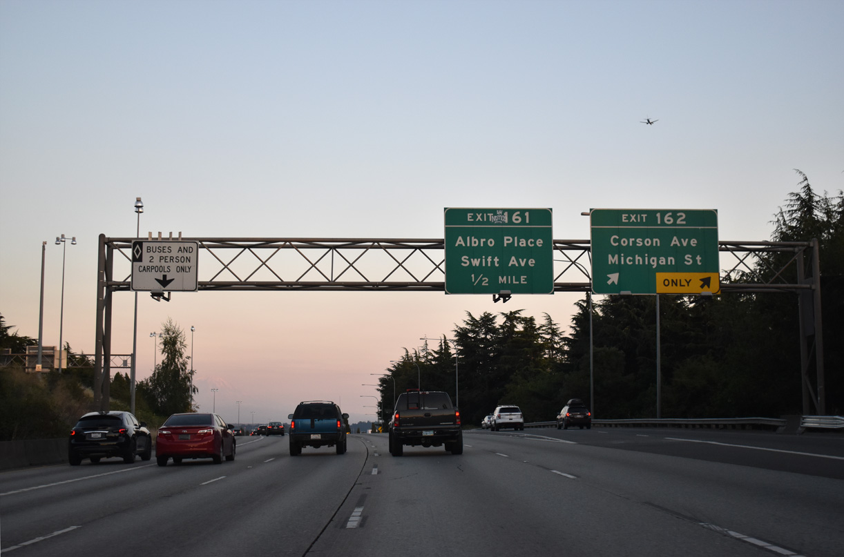
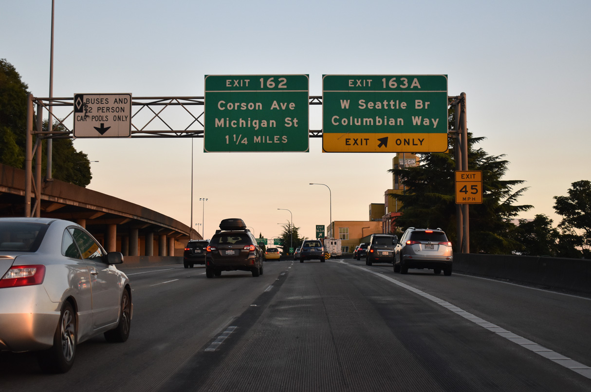
Exit 162 passes over the parallel BNSF Railroad before lowering onto Corson Avenue ahead of Michigan Street. Much of the Georgetown area west of Corson Avenue is industrialized. Michigan Street connects Bailey Street with SR 99 and the 1st Avenue Bridge over the Duwamish Waterway.
07/20/23
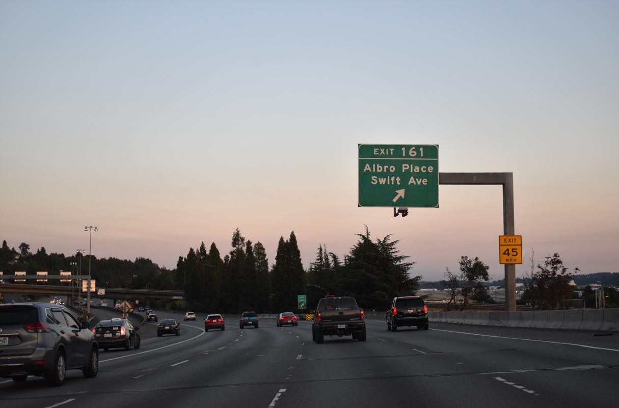
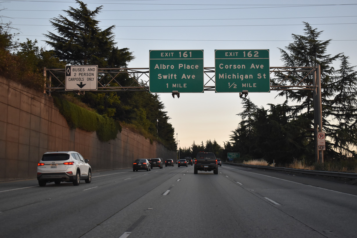
Exit 161 leads directly to Albro Place at Corglat Drive. Albro Place connects Interstate 5 with Ellis Avenue at Georgetown to the west and Swift Avenue near Holly Park on the adjacent hillside.
07/20/23
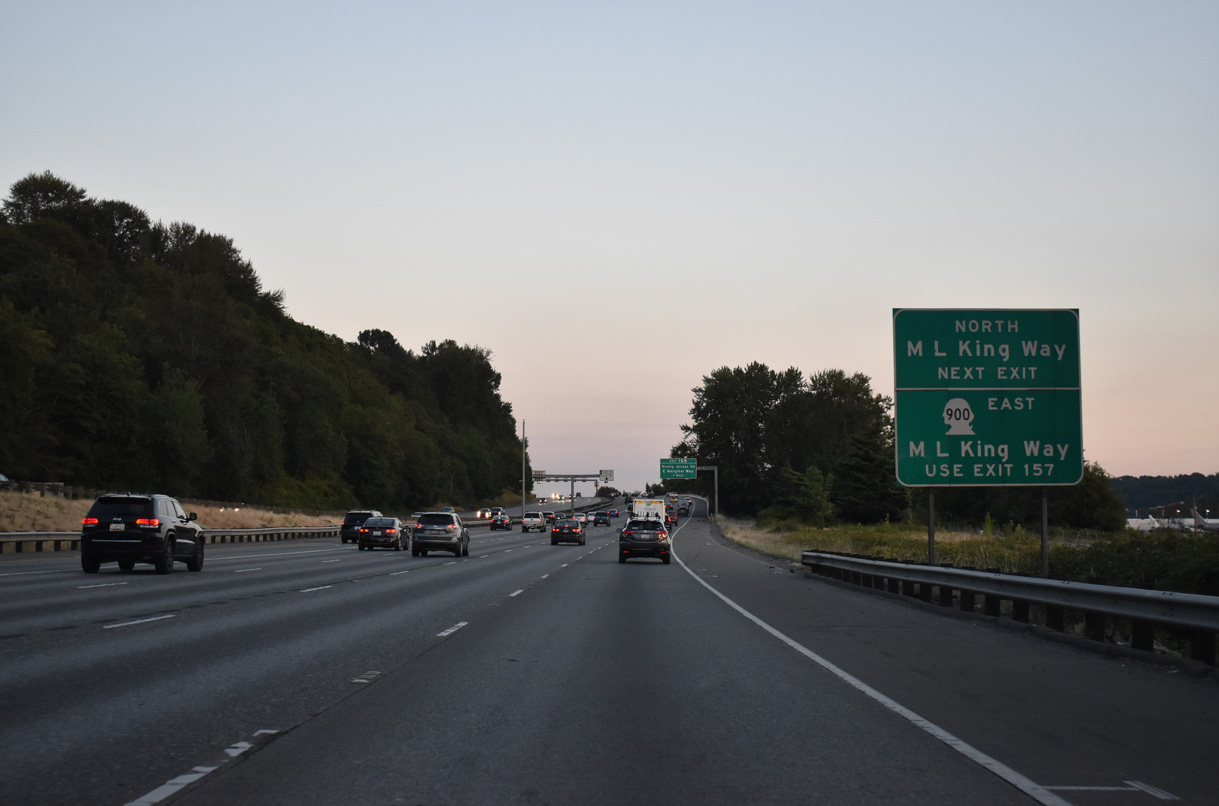
Beginning from S Boeing Access Road at S Ryan Way, SR 900 follows Martin Luther King, Jr. Way southeast from northeast Tukwila to Renton. The state route originally continued along MLK Way north to Interstate 90.
07/20/23
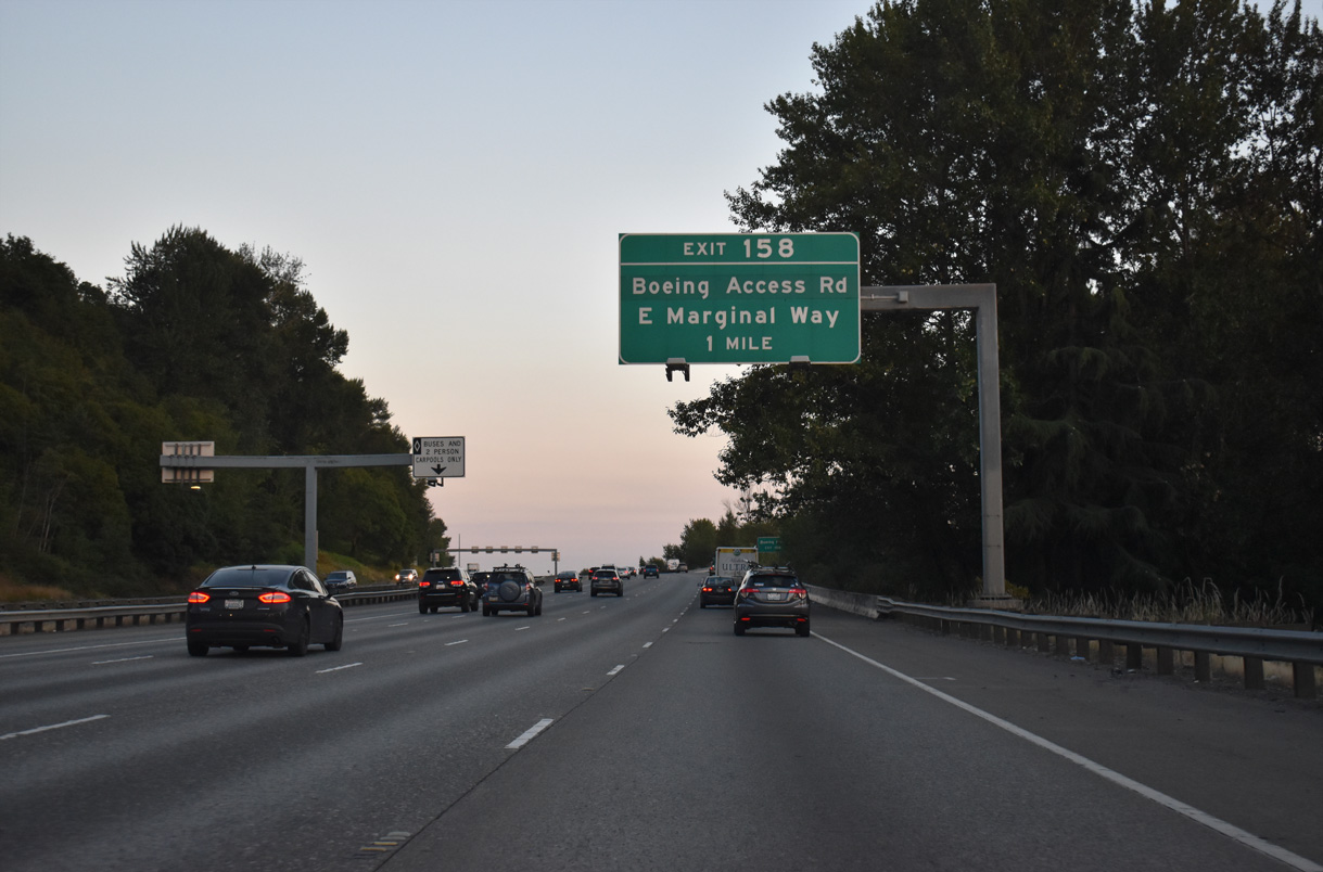
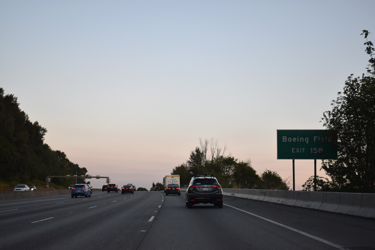
Exit 158 provides access to S Boeing Access Road west to Airport Way and E Marginal Way south of the Seattle Boeing plant and adjacent airport. S Boeing Access Road comprises a short expressway between SR 900 (Martin Luther King Jr., Way) and Pacific Highway S (historic U.S. 99).
07/20/23
Boeing Field / King County International Airport (BFI) is west of Exit 158 via S Boeing Access Road west to a trumpet interchange with Airport Way S. Airport Way began at 4th Avenue S near Lumen Field.
07/20/23
E Marginal Way splits with historic U.S. 99 (Pacific Highway) at Duwamish and Boeing Access Road west of Exit 158. Pacific Highway angles southwest to Riverton Heights in Tukwilla while E Marginal Way parallels the SR 599 freeway near the Allentown and Foster communities.
07/20/23
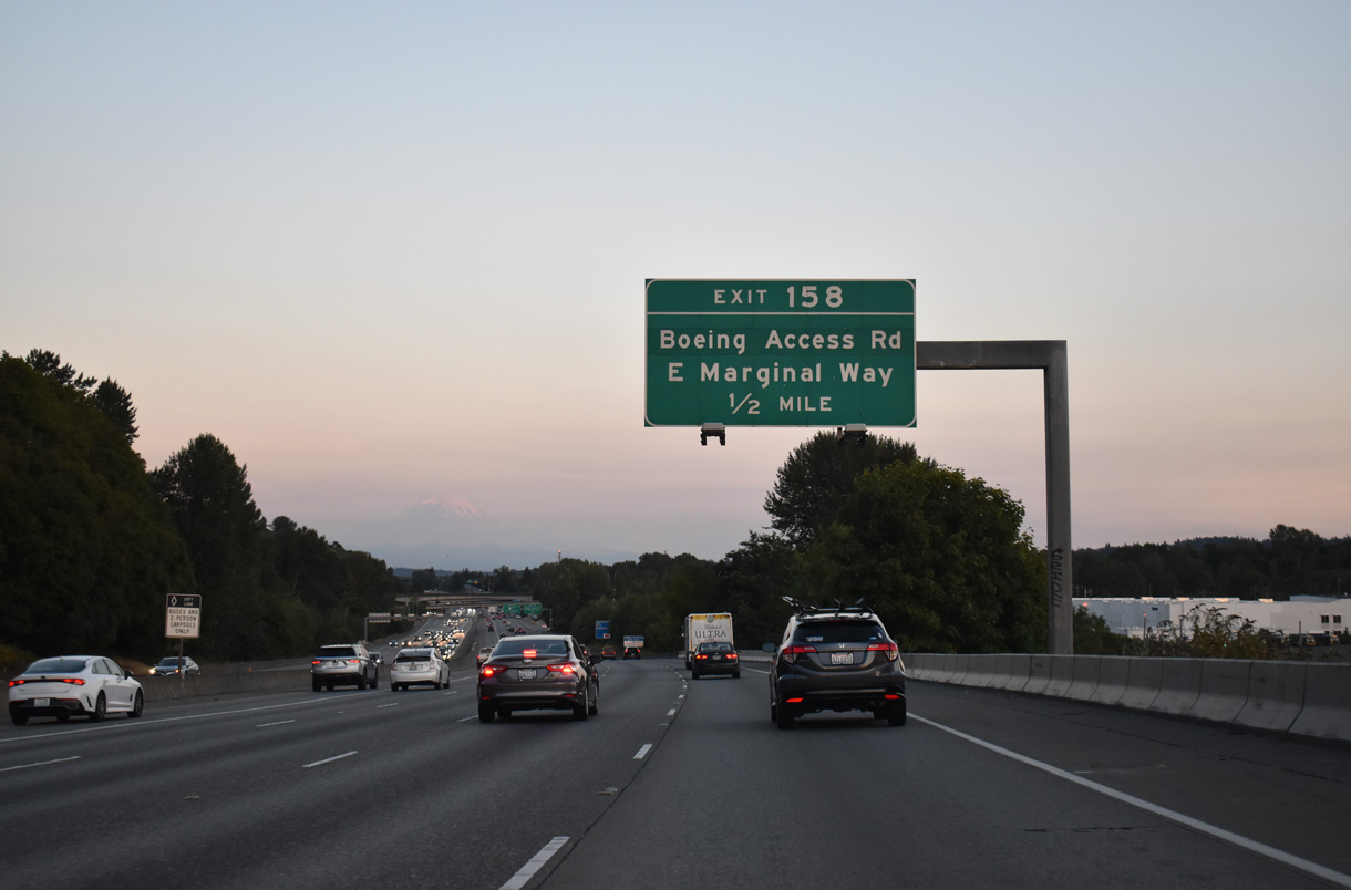
Southbound at the Exit 158 to S Boeing Access Road. The western section of SR 900 runs 4.00 miles east to 3rd Street at SR 167 (Rainier Avenue) in Renton. The eastern segment heads 9.68 miles east from I-405 at Exit 5 in Renton to I-90 at Exit 15 at Issaquah.
07/20/23
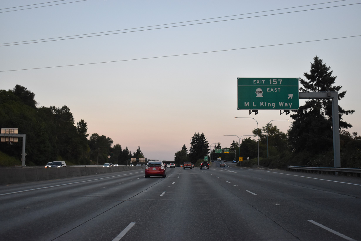
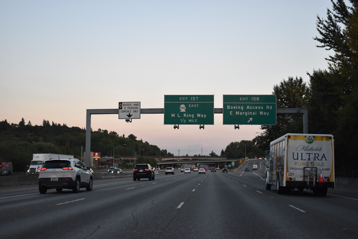
SR 900 (Martin Luther King, Jr. Way) separates into one way roadways by I-5 at Exit 157. A slip ramp provides access onto SR 900 east before I-5 curves west over the Duwamish River. SR 900 continues into unincorporated Skyway and the city of Renton via Sunset Boulevard.
07/20/23
07/20/23
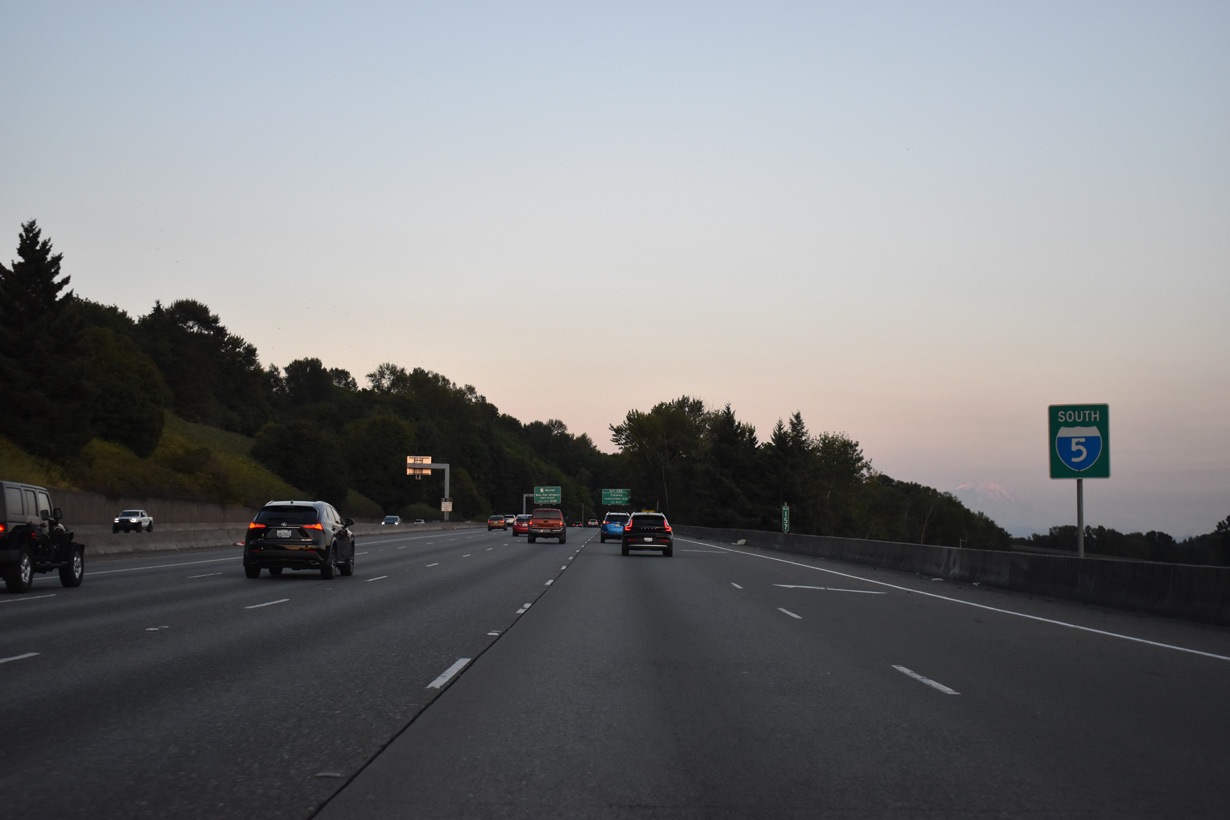
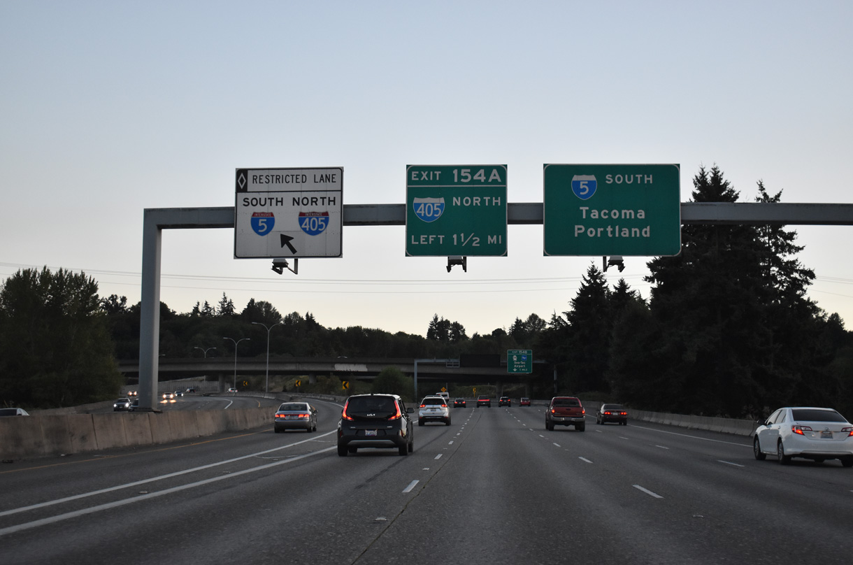
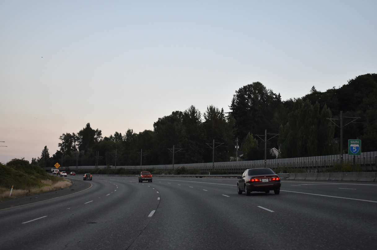
Interstate 5 crosses northern Tukwila, meeting Interurban Avenue at Exit 156, SR 599 south via a wye interchange, and SR 518 at Exit 154 B over the course of three miles.
07/20/23
Lowering to cross the BNSF Railroad and Duwamish River on I-5 south. The HOV-2 lane partitions onto a separate roadway to Exit 154 for Interstate 405 north and SR 518 to SEA Airport.
08/29/06
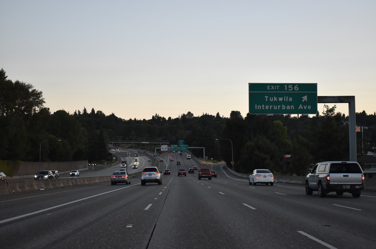
Interurban Avenue heads north from Exit 156 to E Marginal Way near Duwamish and south to I-405 and SR 181 (West Valley Highway) in east Tukwila. The avenue was originally part of an extended SR 181 to Boeing Access Road (AARoads Wiki, 2023).
07/20/23
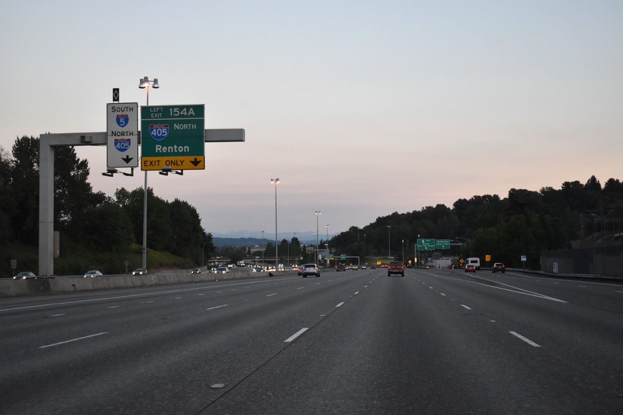
Leaving the half diamond interchange with Interurban Avenue, I-5 converges with SR 599 south, 1.50 miles out from the cloverstack interchange with I-405 north and SR 518 west.
07/20/23
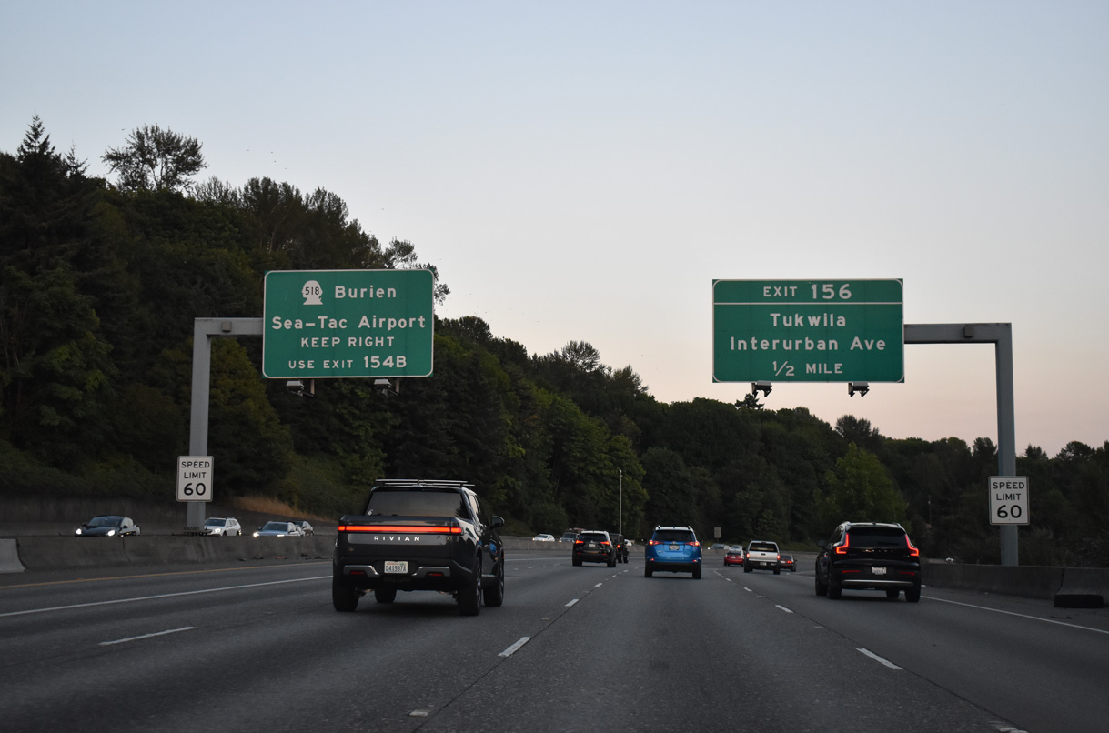
SR 518 extends west along a freeway from Interstate 405 to Seattle-Tacoma International Airport (SEA) and Burien at SR 509.
07/20/23
SR 518 extends 3.42 miles west along a freeway to SR 509 at SW 148th Street in Burien. Burien is a city along Puget Sound.
07/20/23
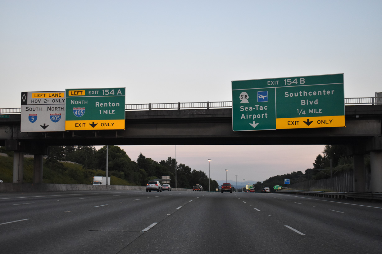
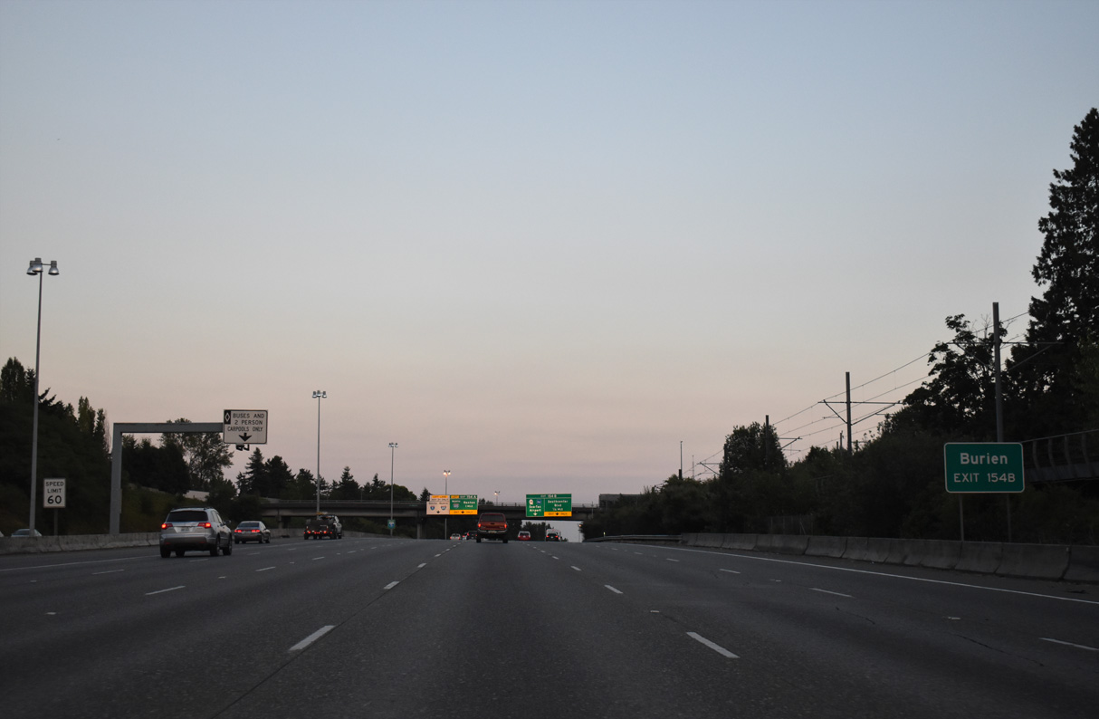
Southcenter Boulevard is a parallel road linking the Southcenter Mall area with S 154th Street (former SR 518) at Riverton Heights. Left Exit 154 A departs in one mile for Interstate 405 north to Renton, Newcastle and Bellevue.
07/20/23
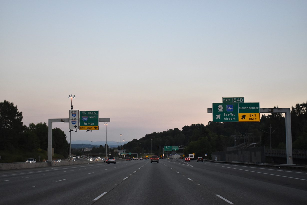
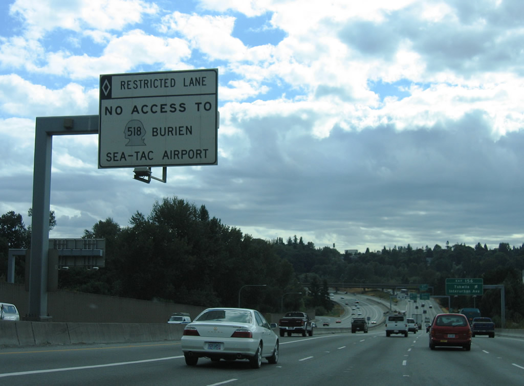
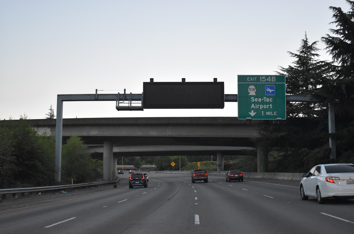
Exit 154 B parts ways with I-5 south for Southcenter Mall and Seattle-Tacoma International Airport (SEA). SR 518 leads west through SeaTac to 148th Street near the Burien city center.
07/20/23
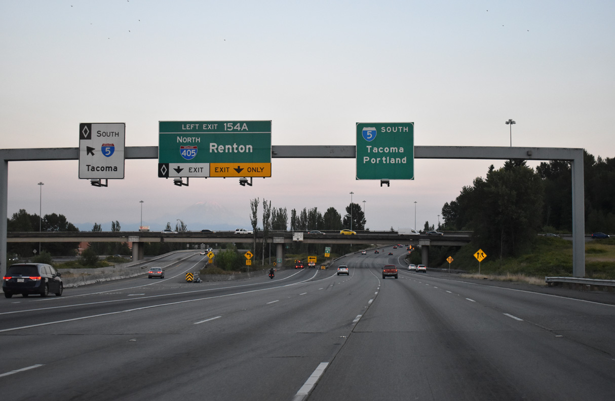
The connection with Interstate 405 north joins the inside lanes of the freeway loop ahead of SR 181 and Renton. I-405 travels 30.30 miles north to Bellevue, Kirkland and Bothell.
07/20/23
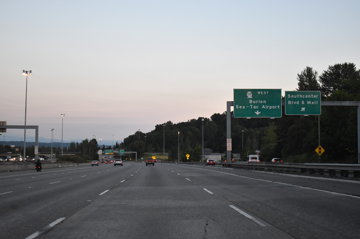
Southcenter Boulevard parallels Interstate 405 east to 61st Avenue for access to the mall and SW Grady Way in Renton. Extending westward from Southcenter Boulevard, S 154th Street, the original alignment of SR 518, leads to Five Corners and Sunnydale in Burien.
07/20/23
Direct HOV lane connections between I-5/405 are available due to the left side ramp. Interstate 405 first opened between Tukwila and Renton on September 3, 1965 as SR 405 (AARoads Wiki, 2025).
07/20/23
Entrance ramps from SR 518 east and Klickitat Drive combine before merging onto Interstate 5 south at this confirming marker.
07/19/23
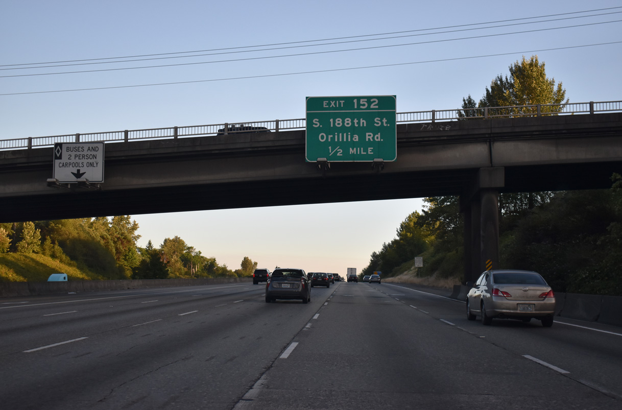
Continuing south, Interstate 5 enters the city limits of SeaTac and next meets S 188th Street west to Angle Lake and east to Orillia Road south at Exit 152.
07/19/23
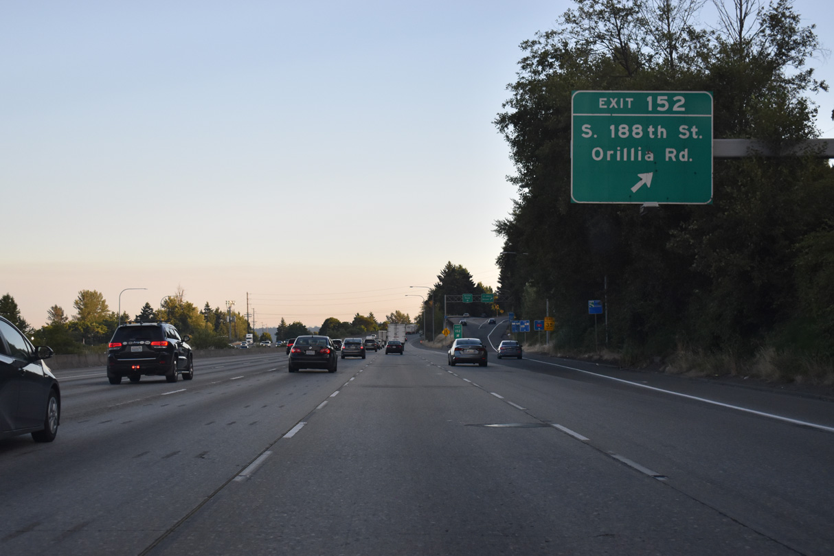
Orillia Road runs from the east side of Interstate 5 between Exit 152 and S 212th Street in south Tukwila. S 188th Street heads west to Seattle-Tacoma International Airport (SEA) and the freeway along SR 509 at Burien.
07/19/23
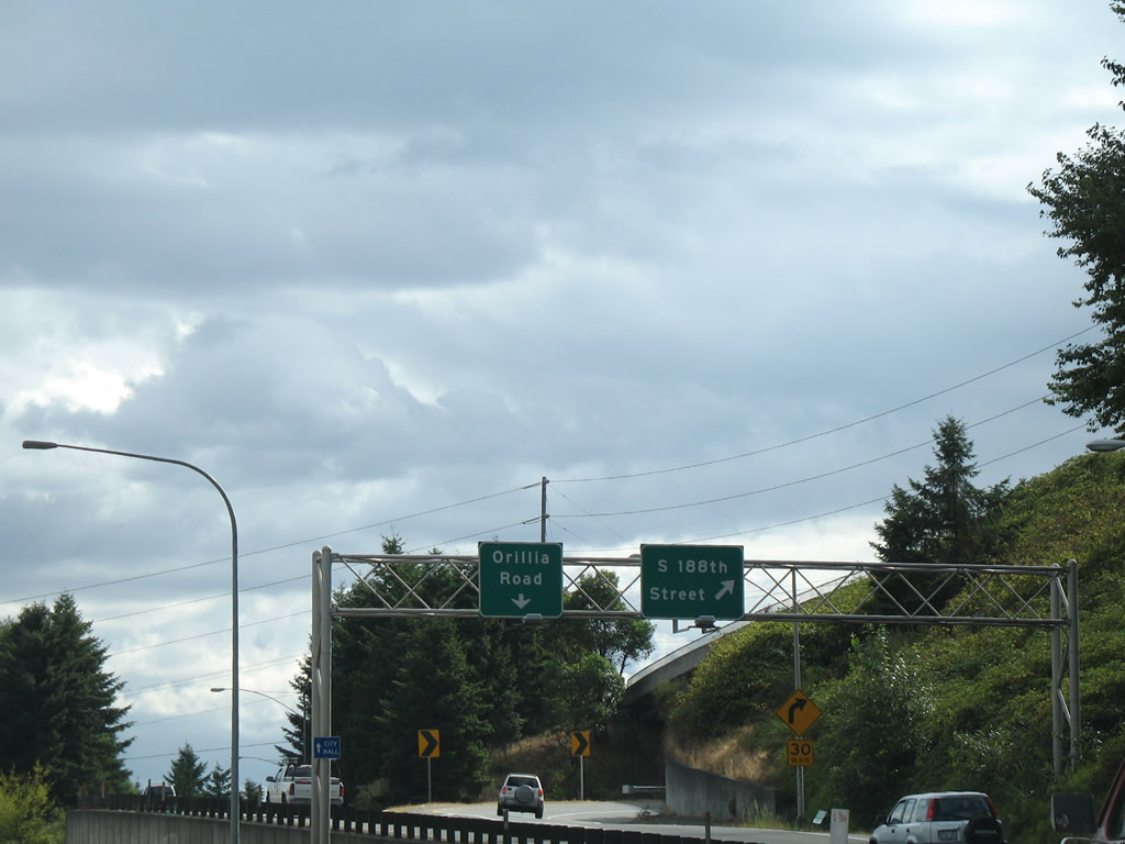
A diamond interchange joins Interstate 5 with S 188th Street, plus a separate ramp passing under Military Road to 188th Street west.
08/29/06
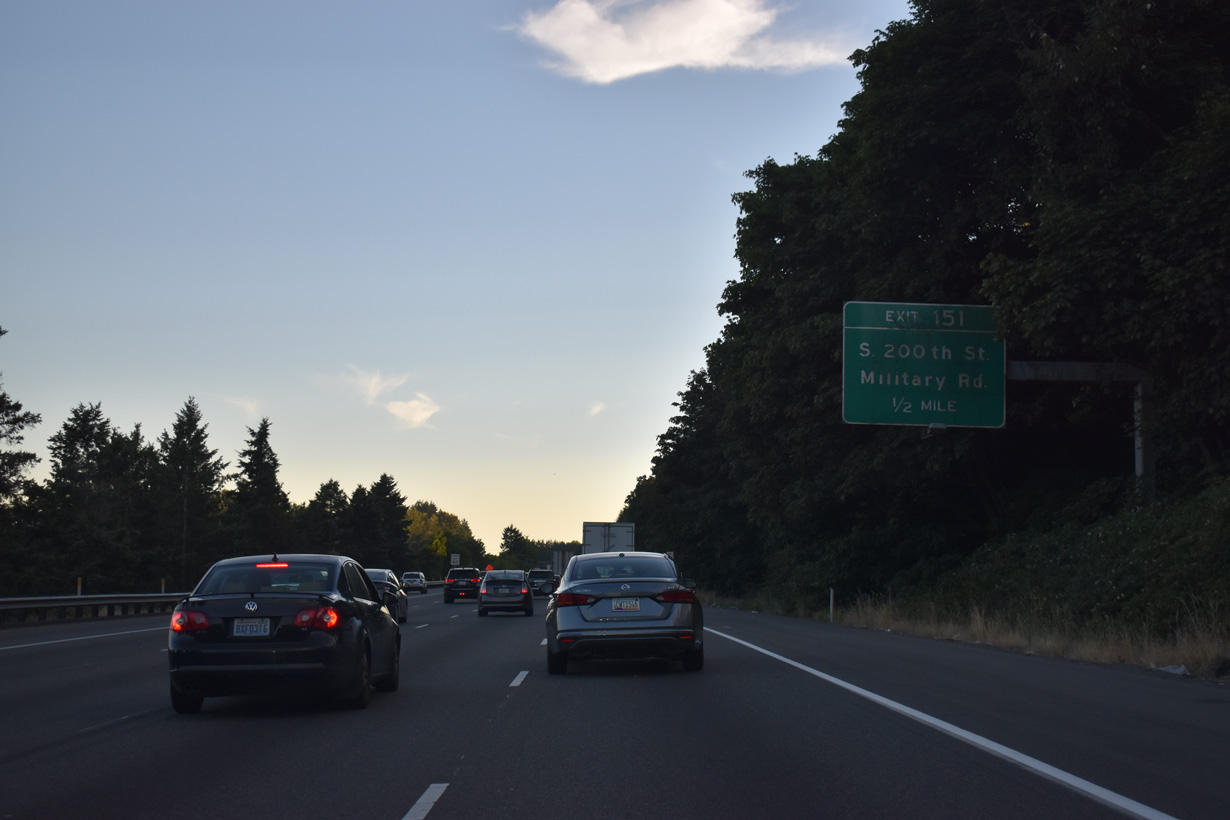
Military Road extends south from S 160th Street through the McMicken Heights neighborhood in SeaTac to eventually run alongside Interstate 5 from S 188th Street to Exit 151 at S 200th Street.
07/19/23
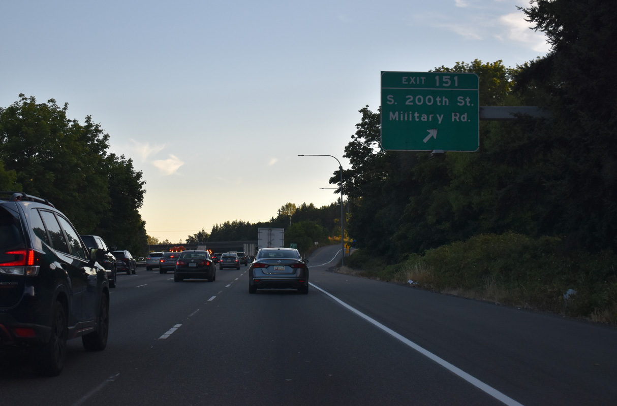
S 200th Street stems west from the southbound I-5 ramps at Exit 151 to North Hill in Des Moines. Military Road shifts to the east side of the freeway toward western reaches of Kent.
07/19/23
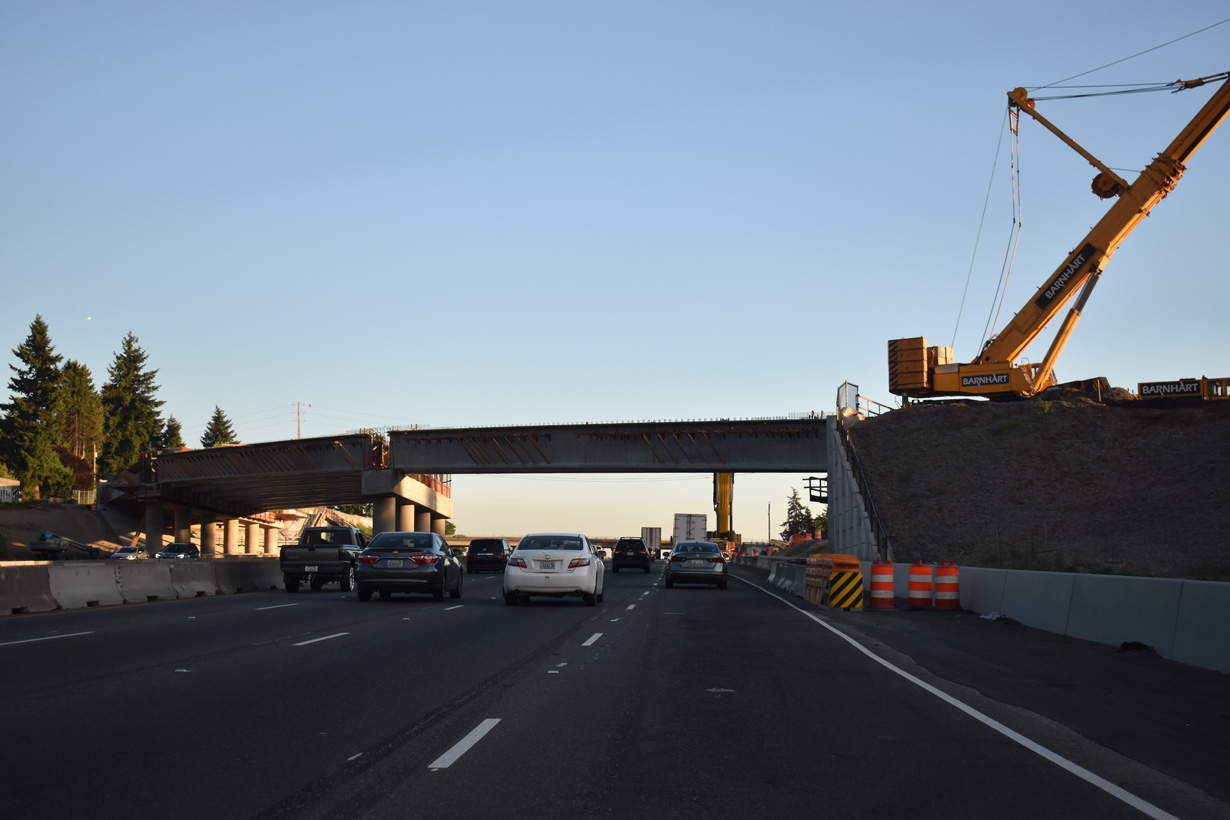
The SR 509, I-5 to 24th Avenue South – Expressway Project through 2029 extends the freeway along SR 509 south from S 188th Street to a wye interchange with I-5. Associated work lengthened the ramp at Exit 149 to a point ahead of where SR 509 south ends.
07/19/23
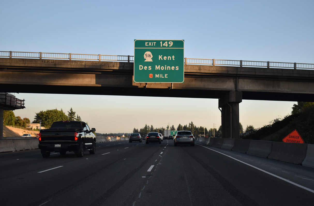
SR 516 (Kent des Moines Road) constitutes a 16.49 mile route between Marine View Drive near the Des Moines city center and Maple Valley. The state route connects Interstate 5 with Highline Community College to the west and Kent to the east.
07/19/23
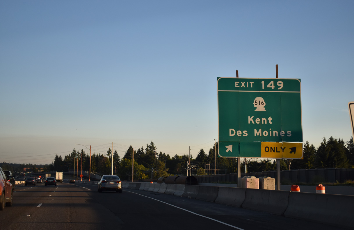
SR 516 (Kent des Moines Road) intersects SR 99 south (Pacific Highway) nearby and winds east three miles to the Kent city center. The state route is an expressway between I-5 and SR 167.
07/19/23
The WSDOT I-5/SR 516 Interchange project from late 2021 to mid 2025 rebuilt the exchange at Exit 149. Work included removing the loop ramp from SR 516 east to I-5 north. This confirming marker follows southbound.
07/19/23
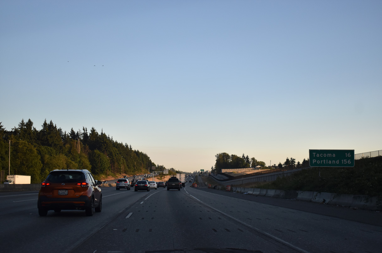
Southbound distance sign posted 16 miles north of Tacoma and 156 miles from Portland, Oregon. This stretch of Interstate 5 was previously expanded as part of the I-5 - SR 509 Corridor Completion and Freight Improvement Project.
07/19/23
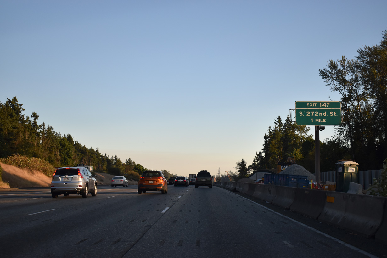
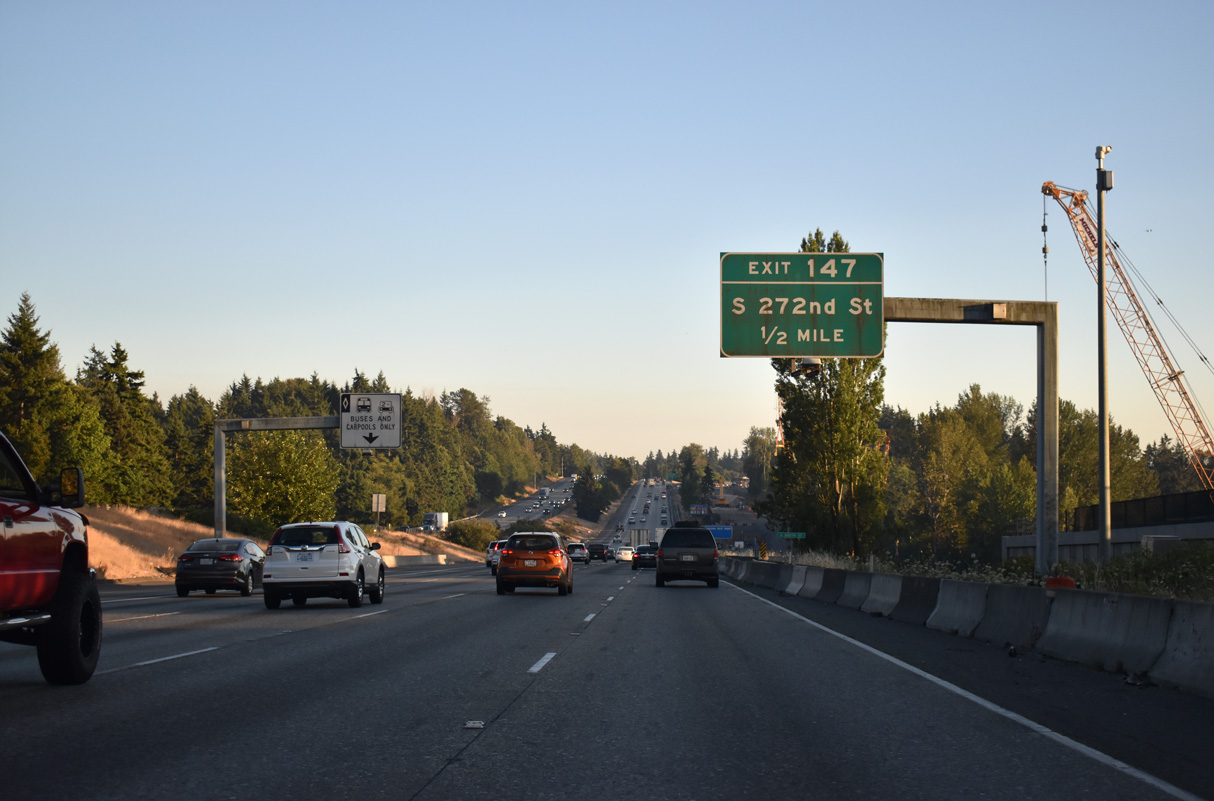
Exit 147 is the first of three from I-5 serving the city of Federal Way. S 272nd Street follows the municipal boundary between Federal Way and Kent west to SR 99 (Pacific Highway).
07/19/23
S 272nd Street leads west to Woodmont Beach and east to Star Lake and S 277th Street to SR 167 near Thomas.
07/19/23
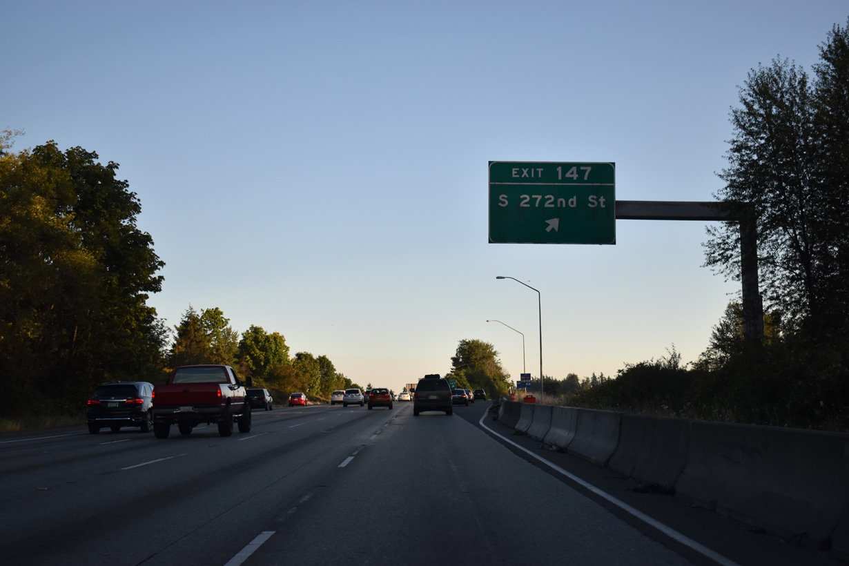
Southbound at the diamond interchange (Exit 147) with S 272nd Street on Interstate 5.
07/19/23
The Federal Way Link Extension leading the SoundTransit Link 1 Line south to Federal Way Downtown runs along the west side of Interstate 5 south to Exit 143.
07/19/23
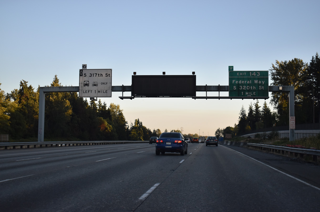
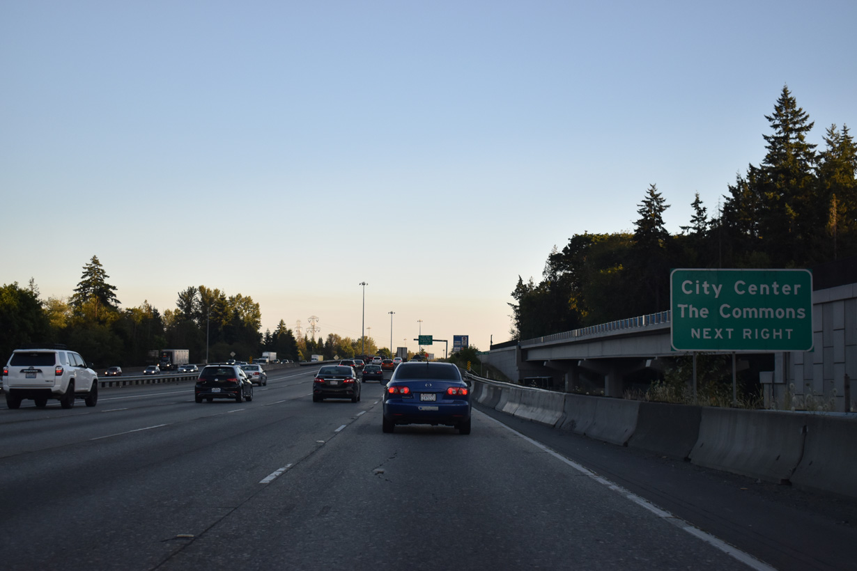
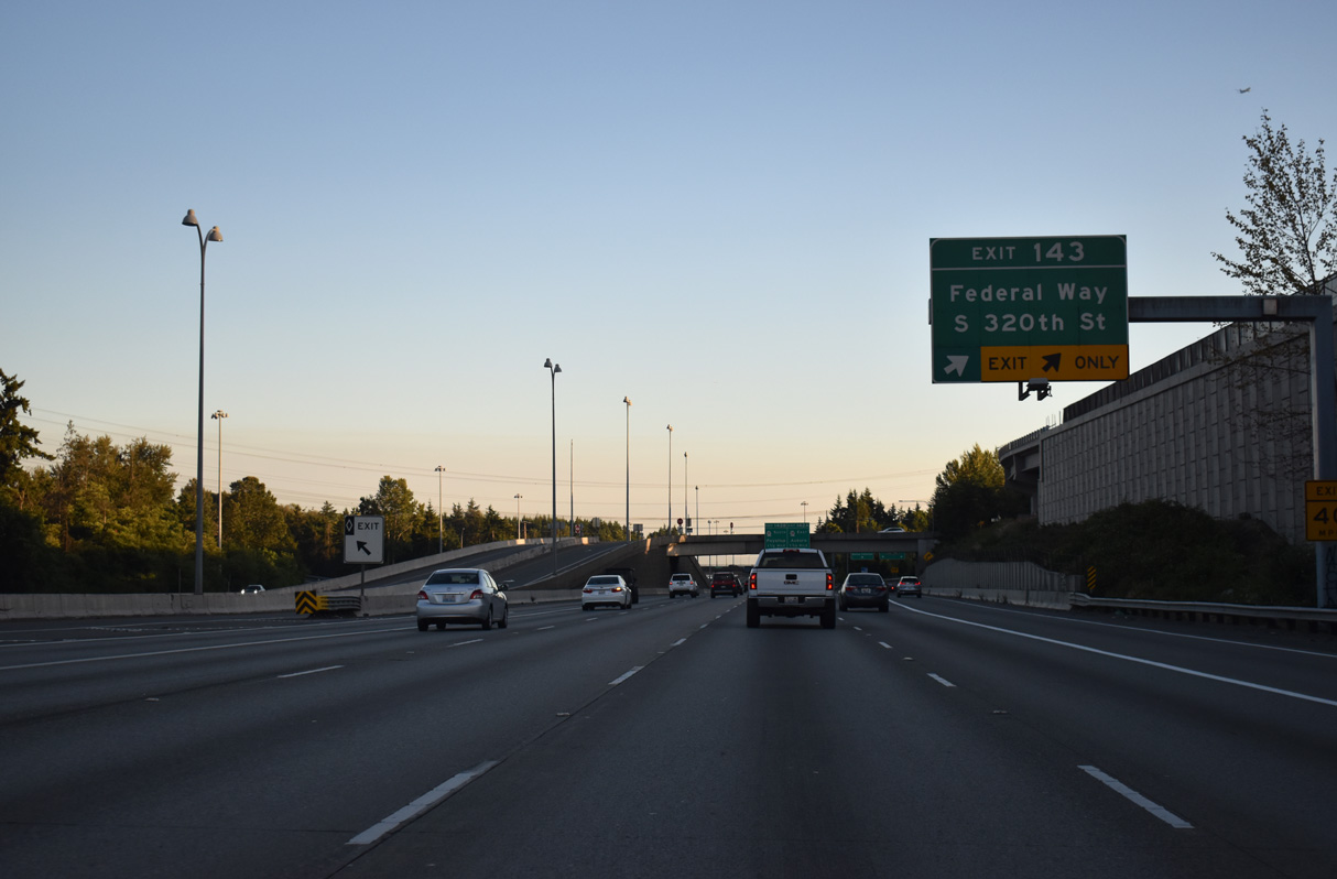
The second Federal Way exit joins Interstate 5 with S 320th Street near the city center and The Commons at Federal Way (formerly Seatac Mall).
07/19/23
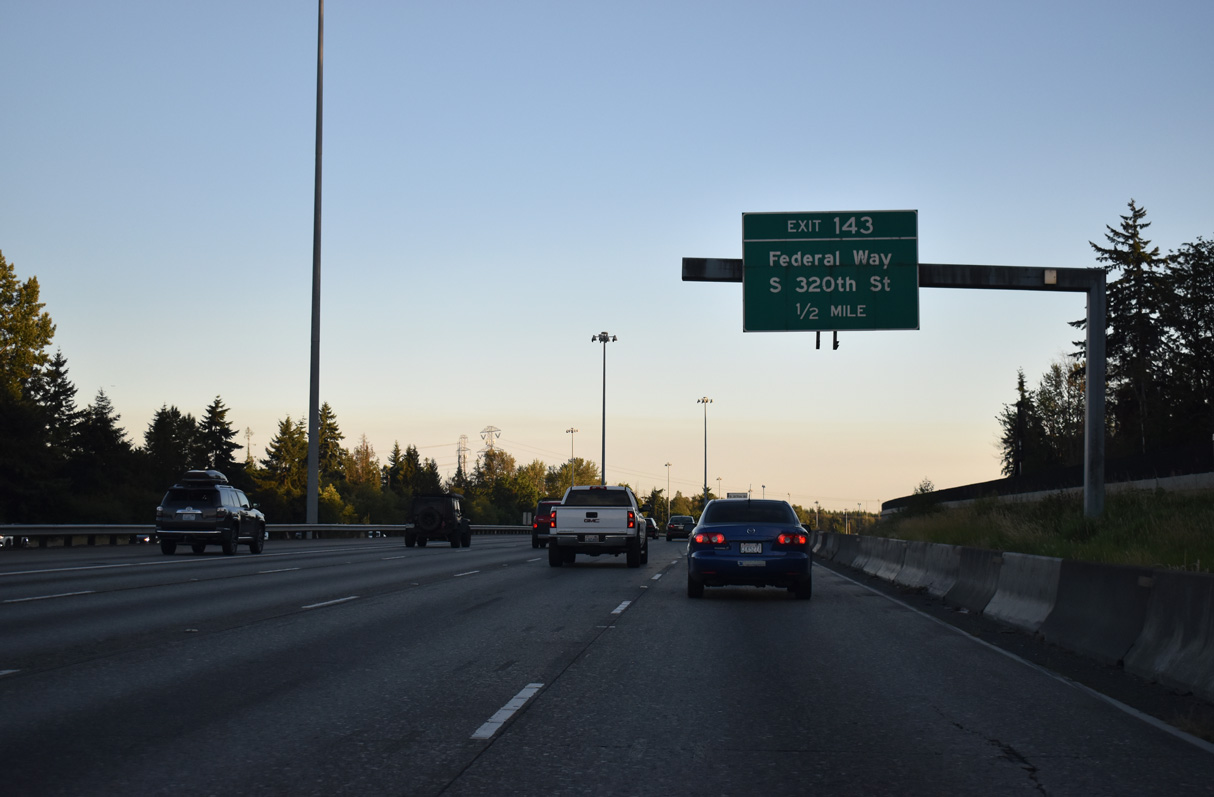
A parclo interchange connects Interstate 5 with S 320th Street in Federal Way. S 320th Street leaves the city to the east, becoming Peasley Canyon Road toward Auburn.
07/19/23
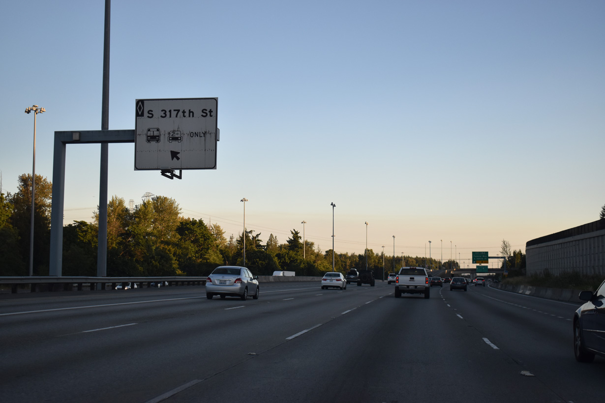
The HOV-2 lane also has a ramp for Downtown Federal Way. The left exit connects with an access road to a roundabout between S 317th Street and 28th Avenue S.
07/19/23
S 320th Street continues west from Exit 143 to 47th Avenue SW near Dash Point State Park.
07/19/23
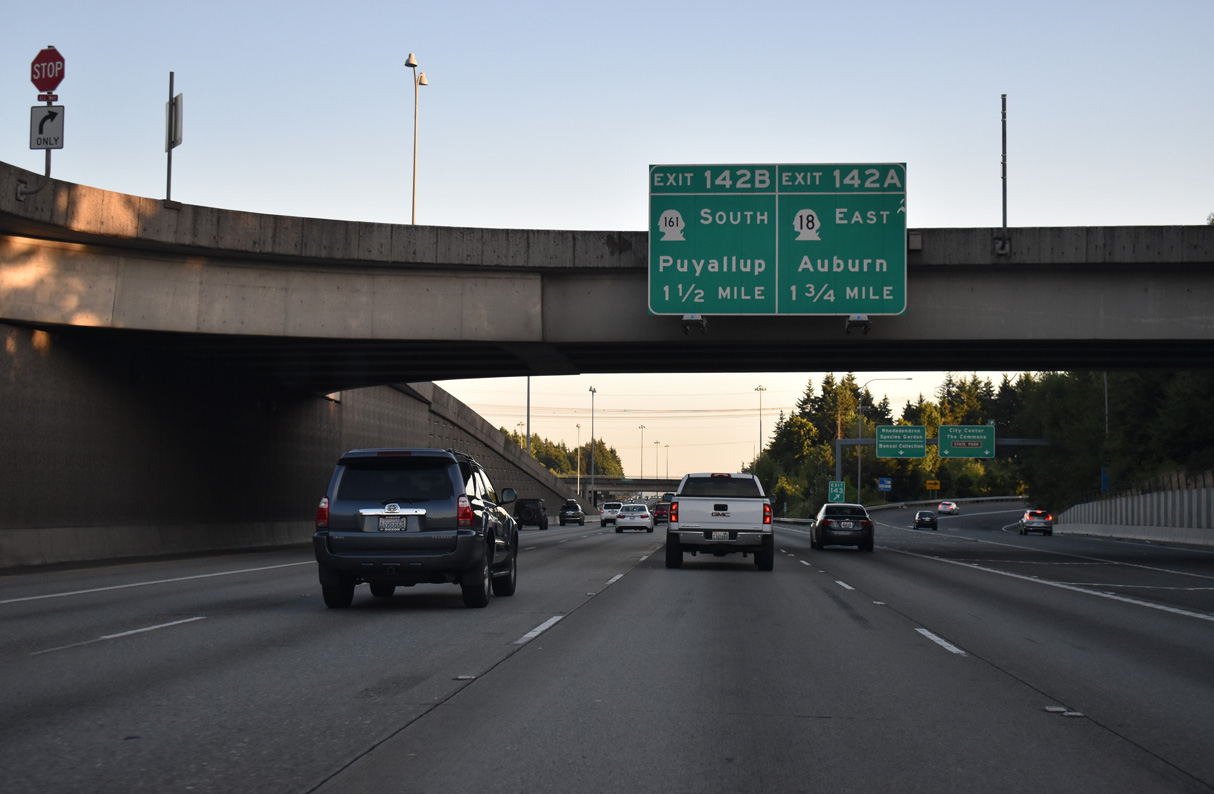
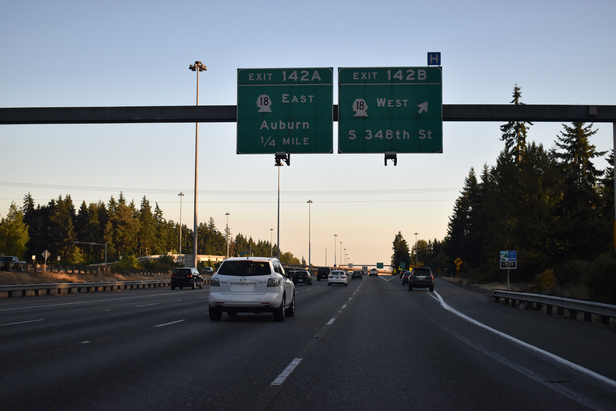
SR 18, a 28.41 mile long route, converges with I-5 at a cloverleaf interchange (Exit 142) in Federal Way.
07/19/23
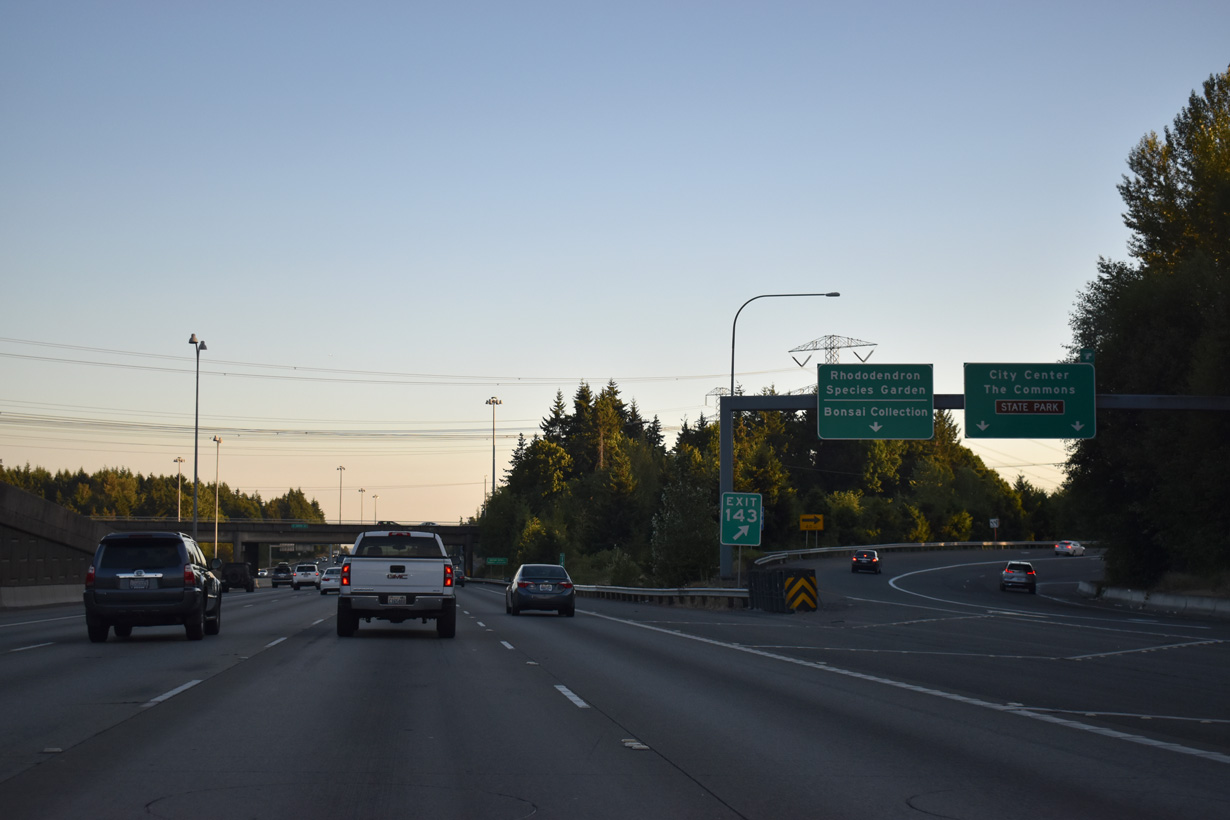
S 320th Street east to Weyerhaeuser Way south leads to the Rhododendron Species Botanical Garden. The park is next to the exchange joining I-5/SR 18.
07/19/23
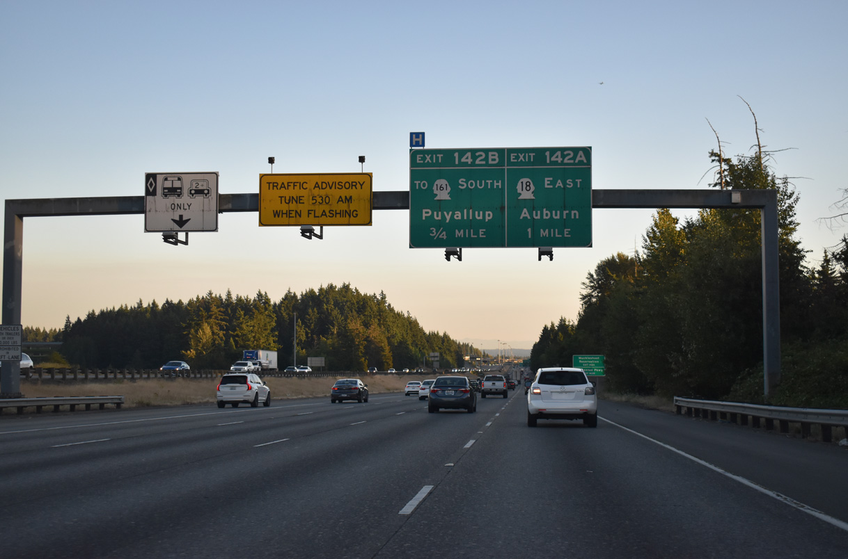
Exit 142 B departs in 0.75 miles mile for SR 18 (S 348th Street) west to SR 161 (16th Avenue S) and SR 99.
07/19/23
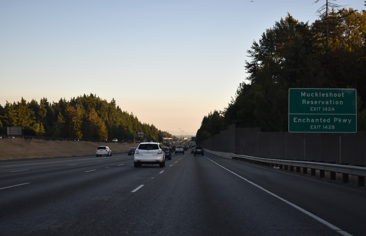
There is no direct access from I-5 to nearby SR 161 (Enchanted Parkway). Instead motorists are directed onto SR 18 (S 348th Street) west to SR 161. SR 161 is a 36.25 mile long highway that leads south from SR 18 to the Six Flags Wild Waves theme park, Milton, Edgeway and Puyallup.
07/19/23
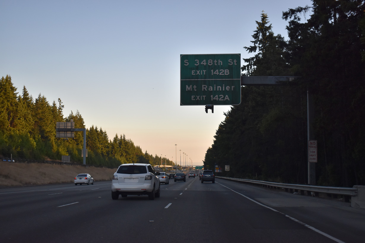
SR 18 connections with SR 164 at Auburn or SR 167 south to SR 410 (historic U.S. 410) at Sumner lead motorists to Enumclaw and Mount Rainer.
07/19/23
SR 18 is a freeway for 21.2 miles northeast to a point beyond 276th Avenue SE at Mirrormont. The SR 18, Issaquah Hobart Rd to Deep Creek Vicinity – Widening & Fiber project underway from 2018-32 widens the remaining two lane section of SR 18 to five miles between Issaquah-Hobart Road and Deep Creek.
07/19/23
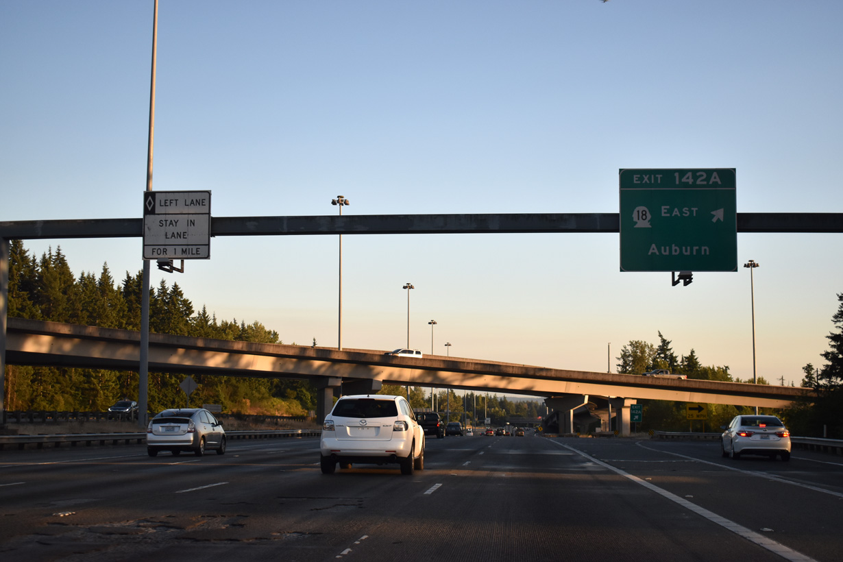
Exit 142 A connects with SR 18 east on the freeway to Auburn, Covington and Maple Valley.
07/19/23
Traffic in the Interstate 5 carpool lane is restricted from making lane changes until after the S 375th Street overpass near the Pierce County line.
07/19/23


References:
AARoads Wiki. (2023, September 8). Washington State Route 181. AARoads Wiki. Retrieved September 2, 2025, from https://wiki.aaroads.com/wiki/Washington_State_Route_181
AARoads Wiki. (2025, March 8). Interstate 405 (Washington). AARoads Wiki. Retrieved September 2, 2025, from https://wiki.aaroads.com/wiki/Interstate_405_(Washington)
Photo Credits:
- Brent Ivy: 07/19/23, 07/20/23
- AARoads: 08/29/06, 08/30/06
Connect with:
Page Updated Tuesday September 16, 2025.