
Business Loop I-8 West - Gila Bend

 West
West
Business Loop I-8 (Butterfield Trail) stems north from 9 Mile Well Road and the diamond interchange along Interstate 8 at Exit 119.
11/12/07
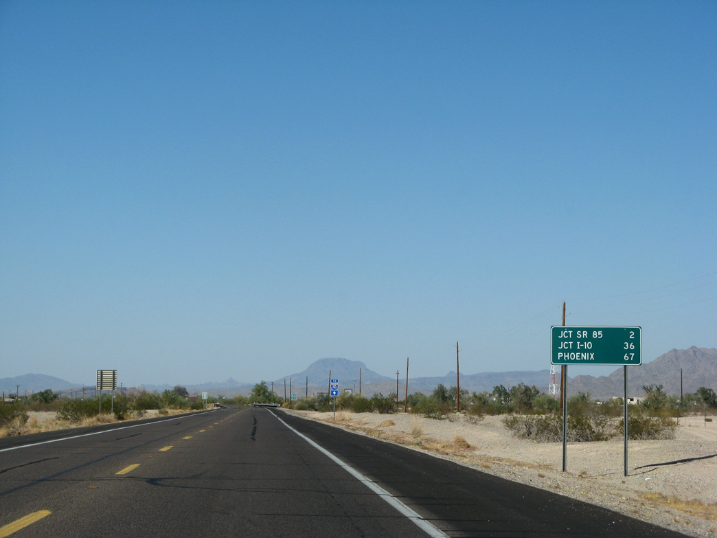
59 miles of Interstate 8 east remain from Business Loop I-8 (Butterfield Trail) to I-10 southeast of Arizola.
11/12/07
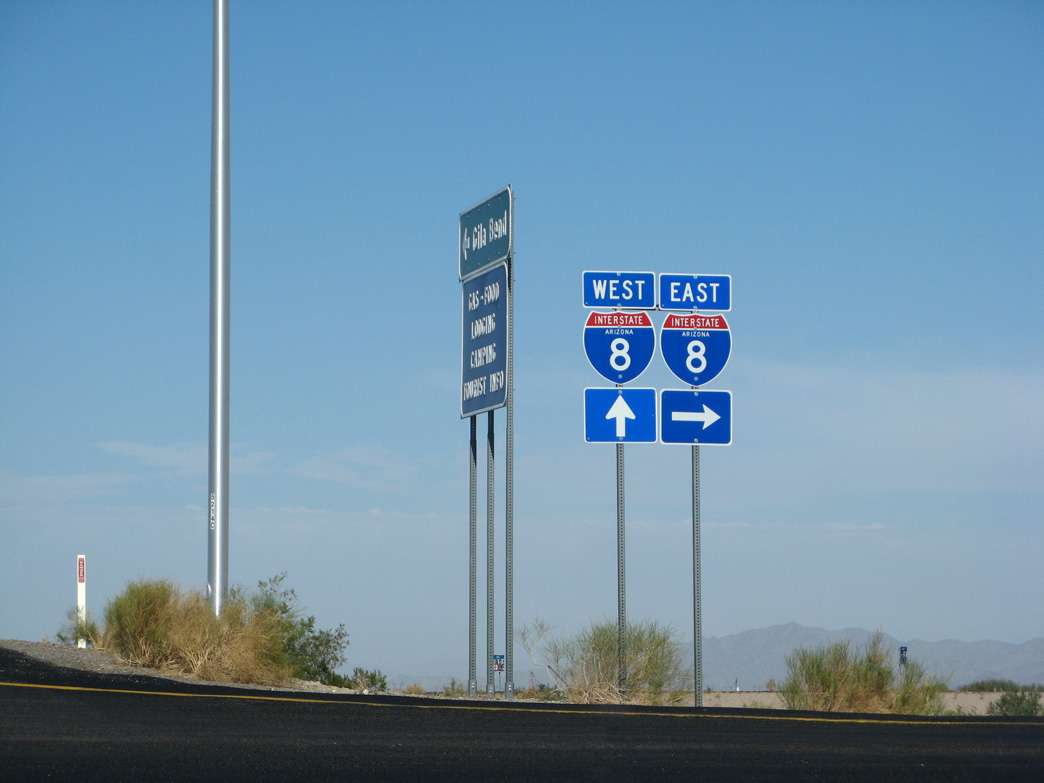
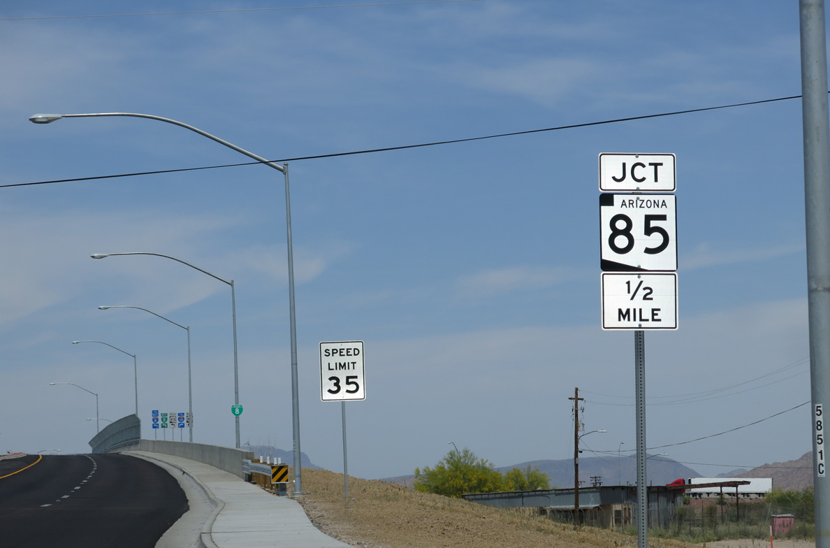
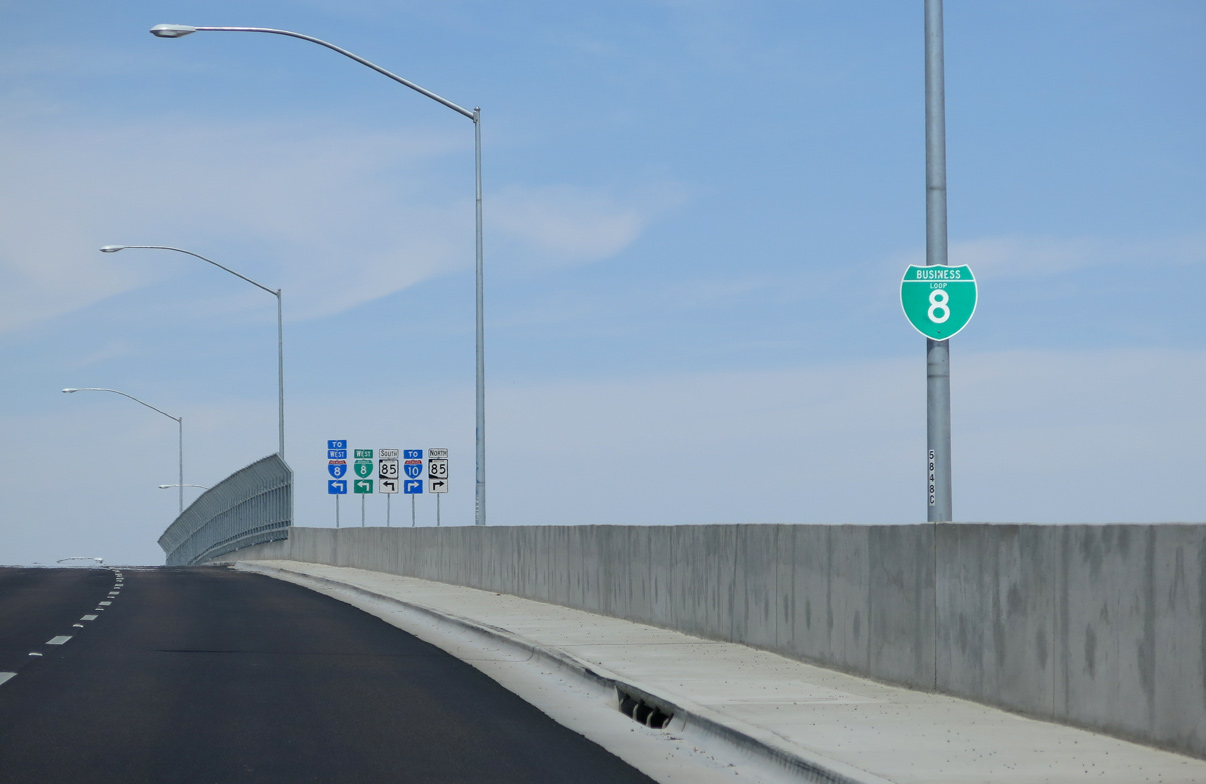
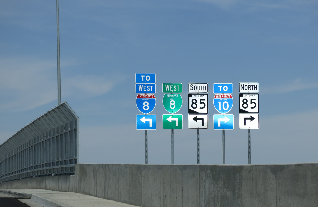
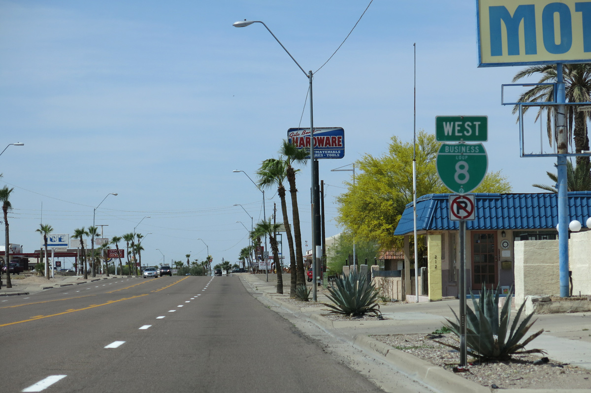
Business Loop I-8 converges with SR 85 at Pima Street 2.43 miles from Interstate 8.
11/12/07
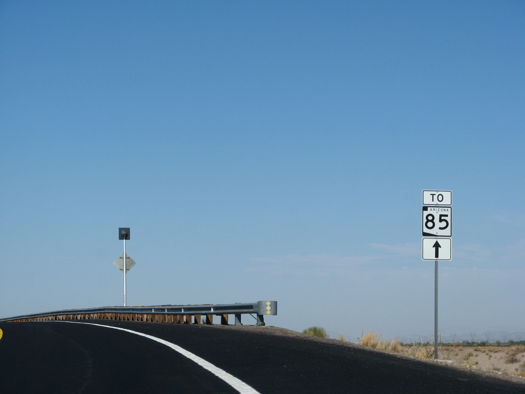
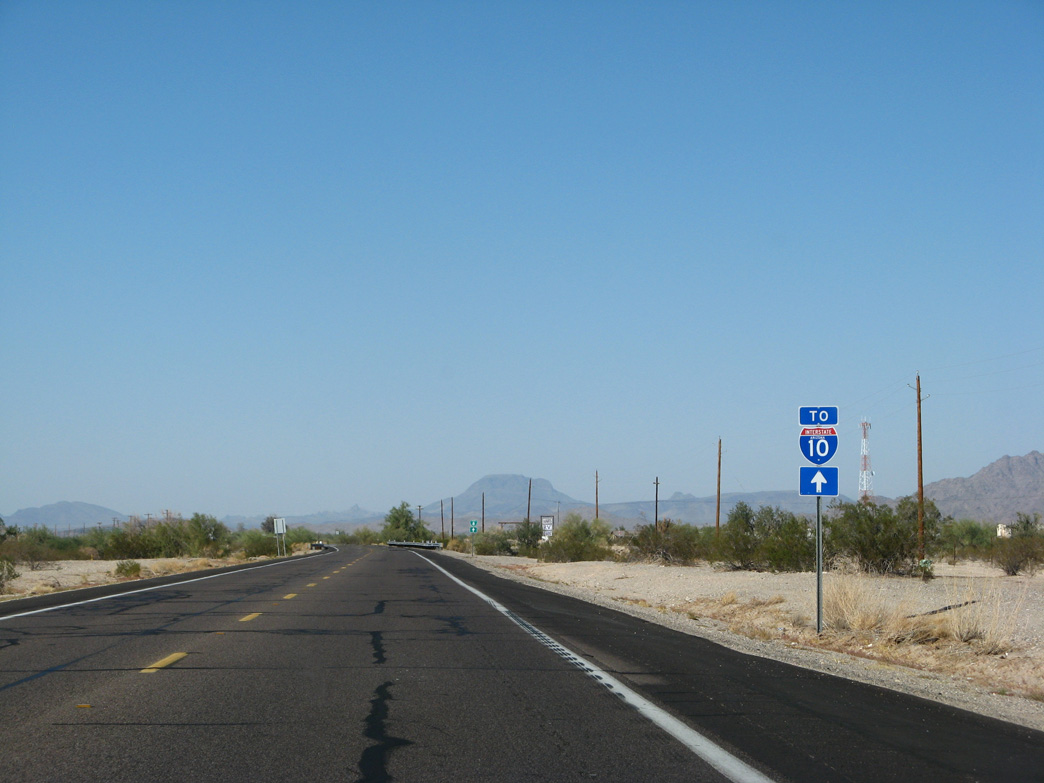
Interstate 8 continues 3.5 miles west to Exit 115 with the southern leg of SR 85.
11/12/07
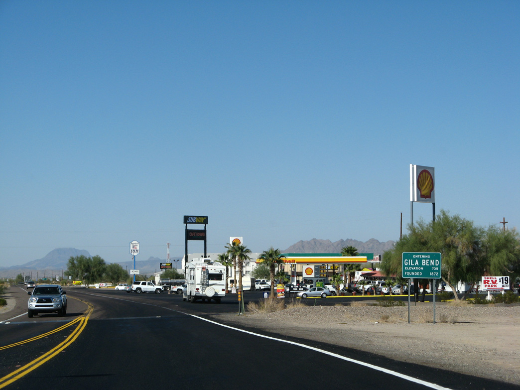
Business Loop I-8 (Butterfield Trail) enters the town of Gila Bend to the immediate northwest of Interstate 8.
11/12/07
Business Loop I-8 west to SR 85 north complete the Phoenix Bypass from I-8.
11/12/07

The first trailblazer for Business Loop I-8 westbound precedes Old Highway 84.
11/12/07
Old Highway 84 is an unimproved road spurring southeast. Business Loop I-8 (Butterfield Trail) replaced SR 84 northwest to SR 85/Old U.S. 80.
11/12/07
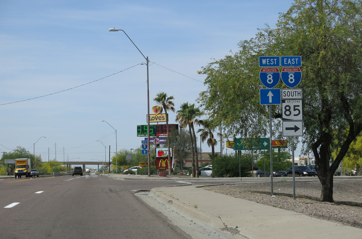
Business Loop I-8 (Butterfield Trail) ascends across the Union Pacific Railroad line ahead of SR 85 and Pima Street.
04/07/13
Road work underway in 2011/12 replaced the Union Pacific Railroad bridge and flyover joining Business Loop I-8 west and SR 85 south with a signalized intersection.
04/07/13
SR 85 travels 34.67 miles north from Business Loop I-8 (Butterfield Trail) to Intestate 10 near Goodyear.
04/07/13
I-8 west, Business Loop I-8 west and SR 85 provide a long distance bypass route of Phoenix for Interstate 10 west between Tucson and Los Angeles, California.
04/07/13
SR 85 expands to a four lane, divided highway 3.2 miles north of Business Loop I-8 along the final route of what was U.S. 80.
04/07/13
West  South
South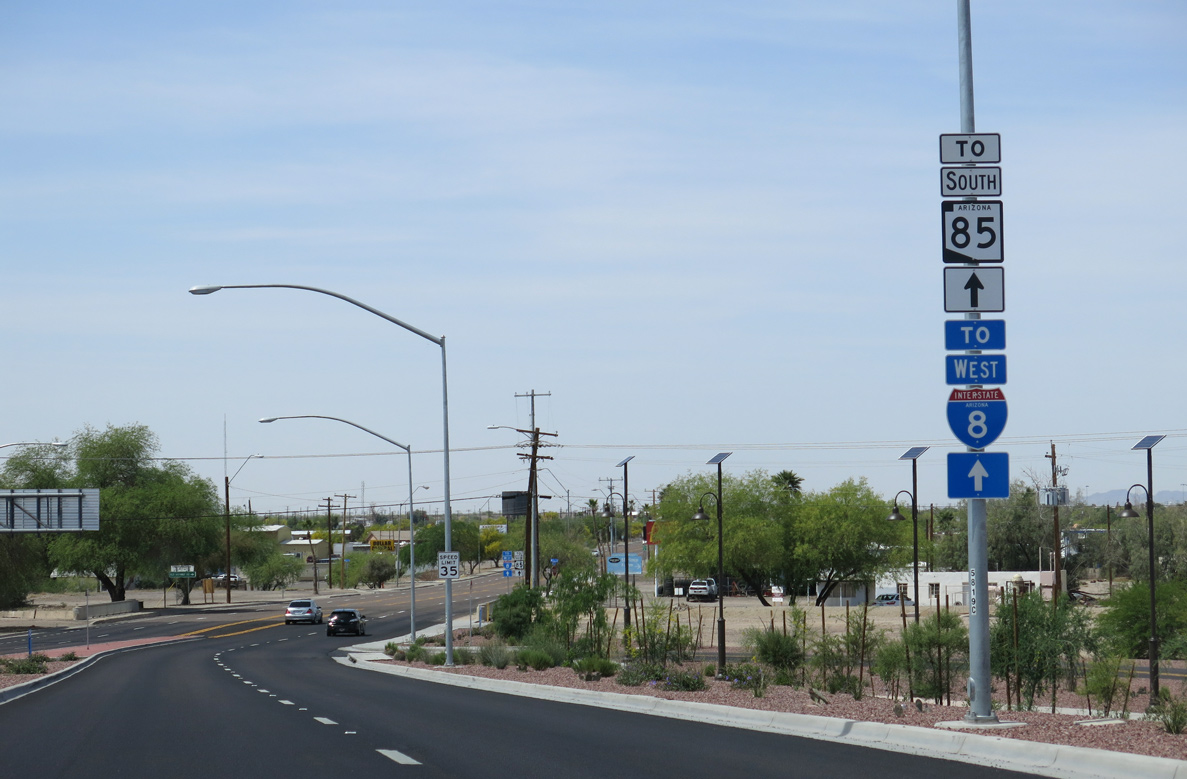
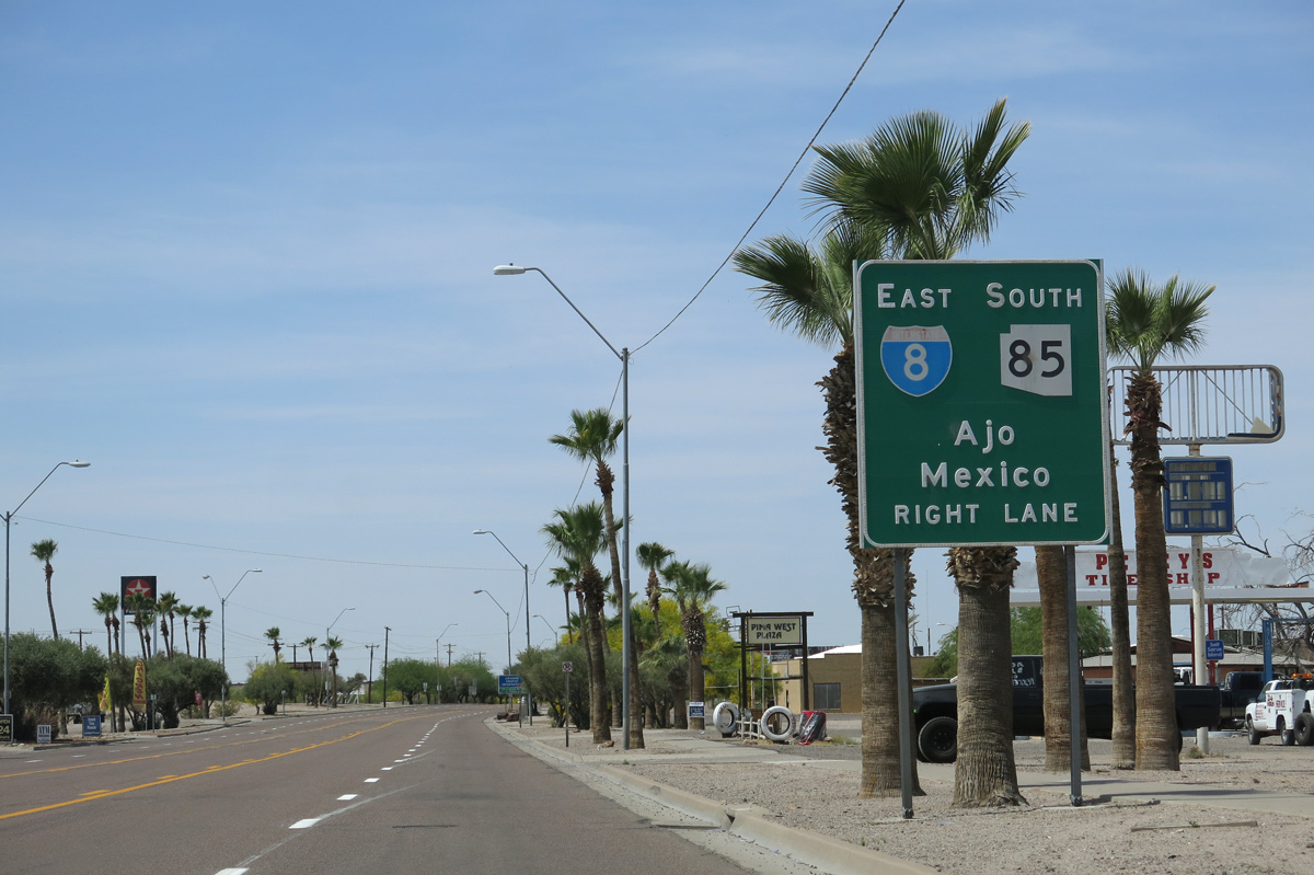
SR 85 combines with Business Loop I-8 west for two miles along Pima Street to the south branch leading to Ajo and Why.
04/07/13
Paralleling Gila Bend Canal, Old US Highway 80 ties into Business Loop I-8/SR 85 at the ensuing intersection along Pima Street westbound.
04/07/13

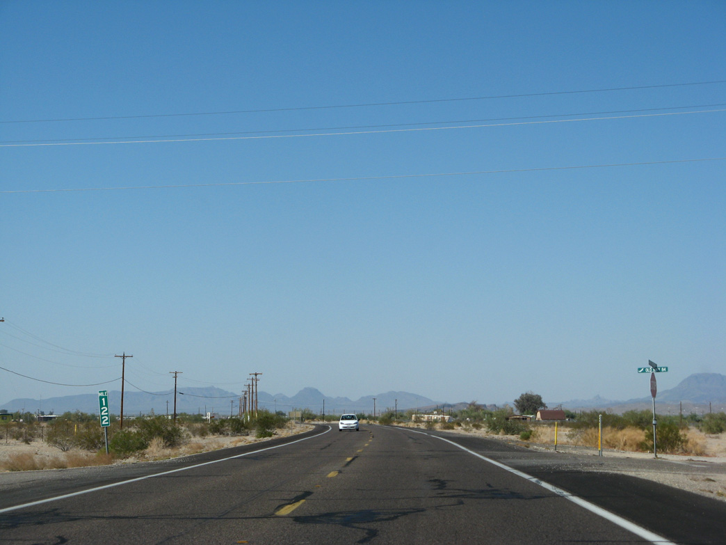
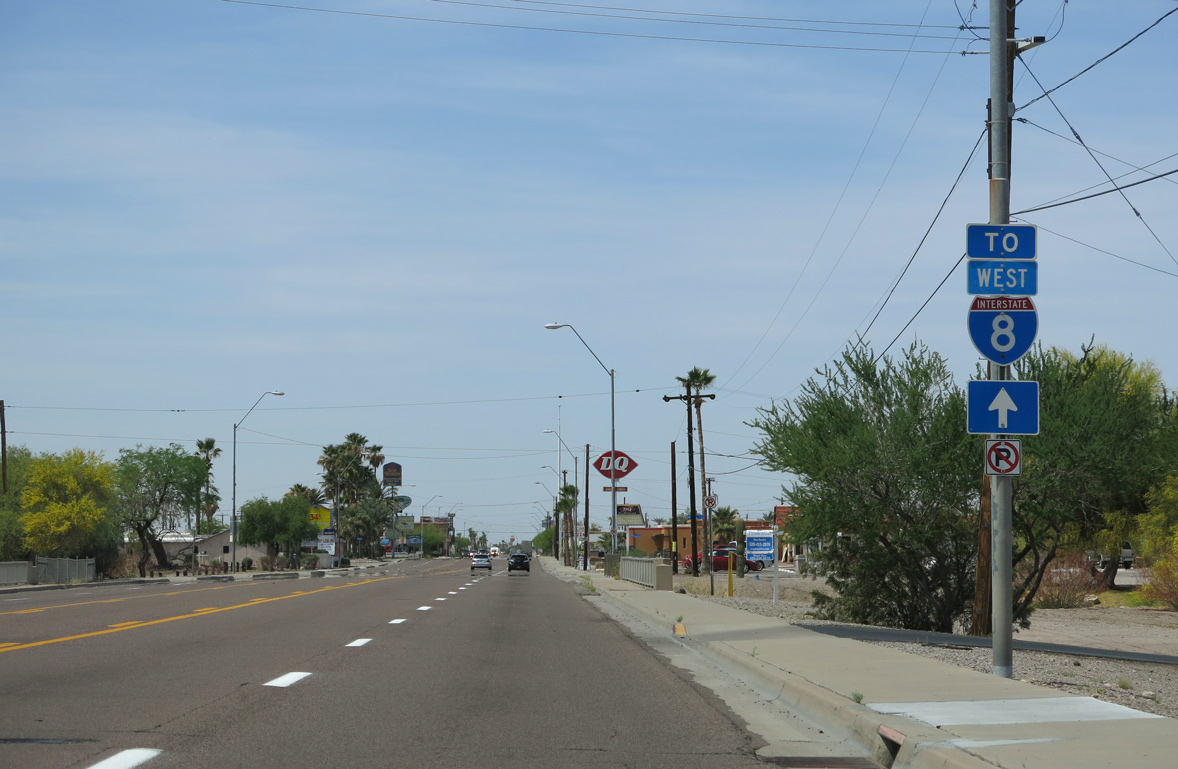
A reassurance marker for Business Loop I-8 precedes mile marker 120 and Palo Verde Avenue.
04/07/13
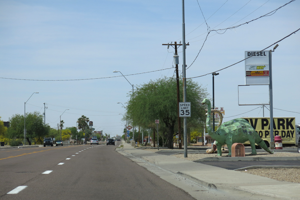
A number of dinosaur sculptures stand along the north side of Pima Street at a gas station adjacent to Palo Verde Avenue.
04/07/13
Pima Street west crossing Sand Tank Wash.
04/07/13
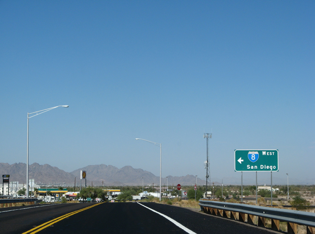
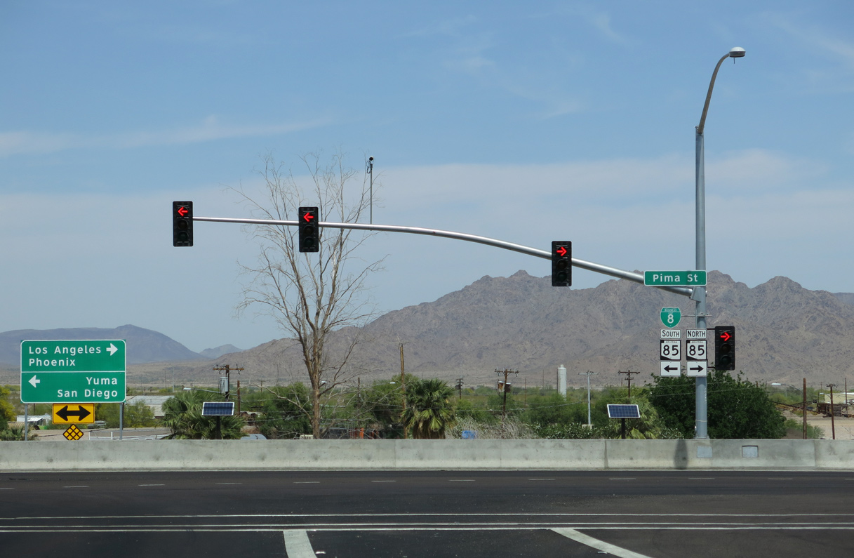
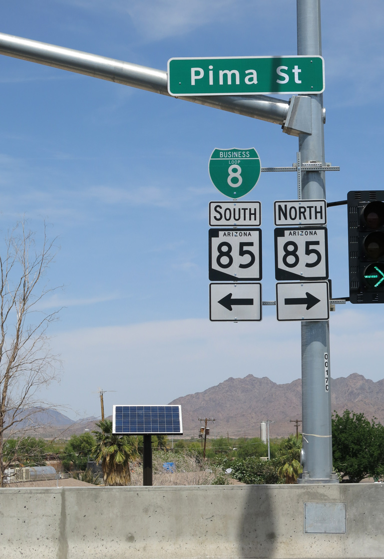
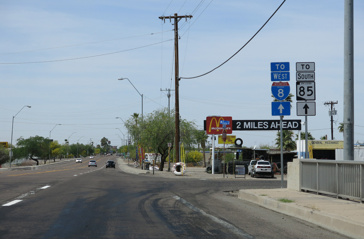
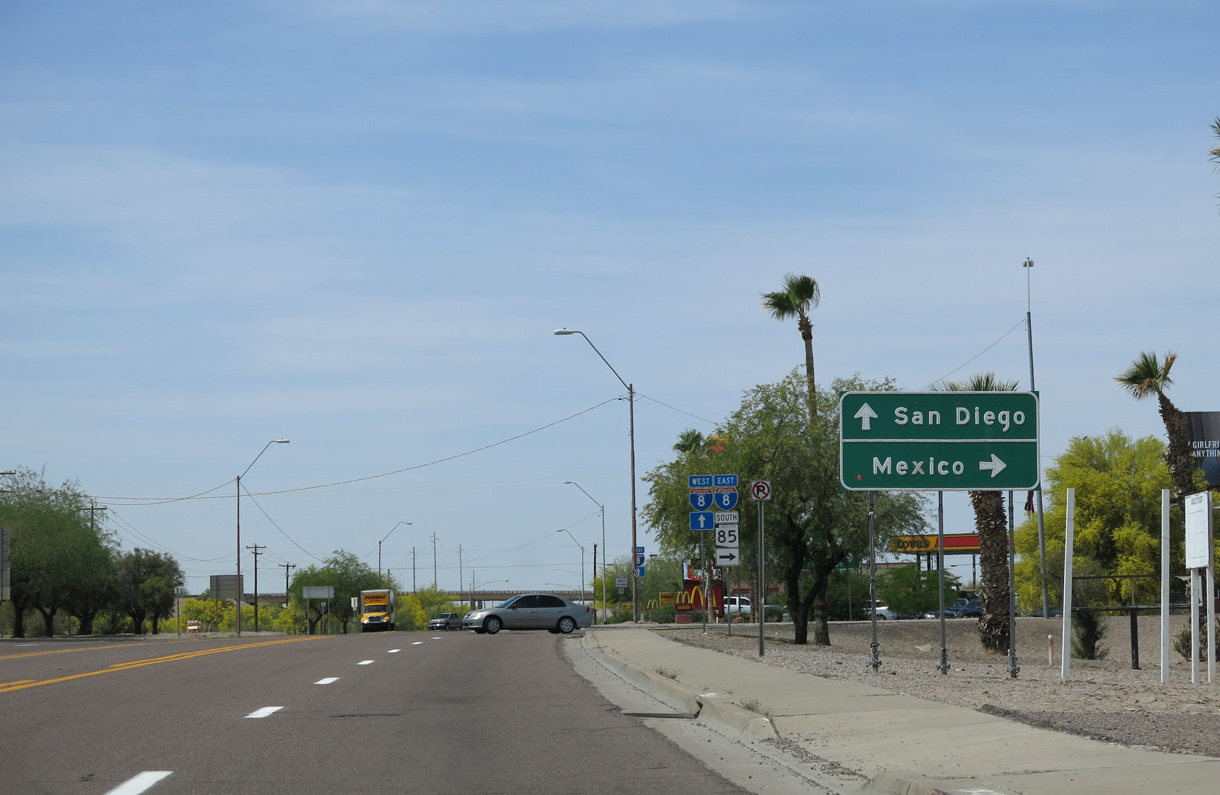
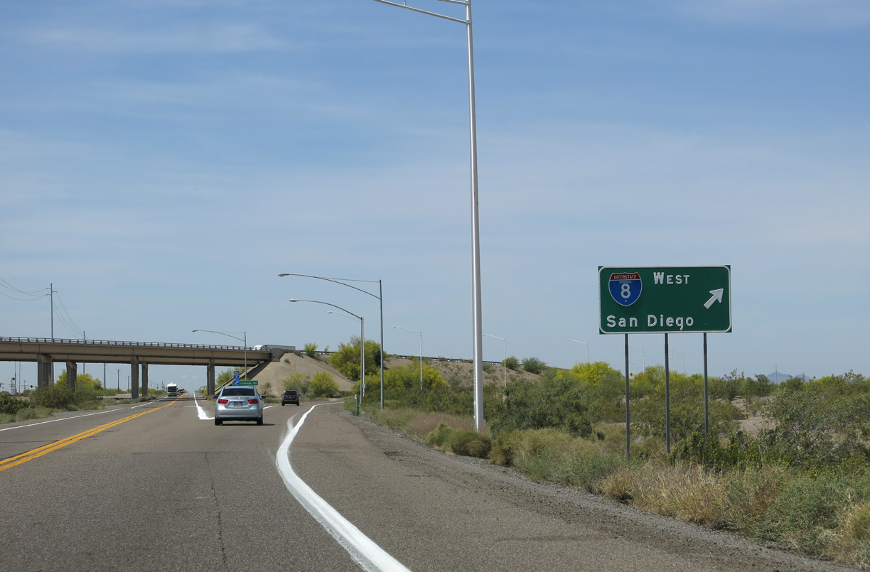
An I-8 trailblazer references the west end of Business Loop I-8 for motorists continuing from SR 85 south to Yuma and San Diego, California.
04/07/13
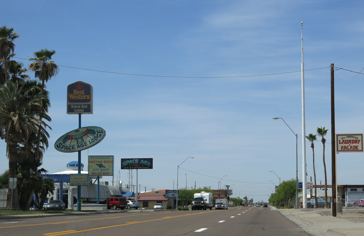
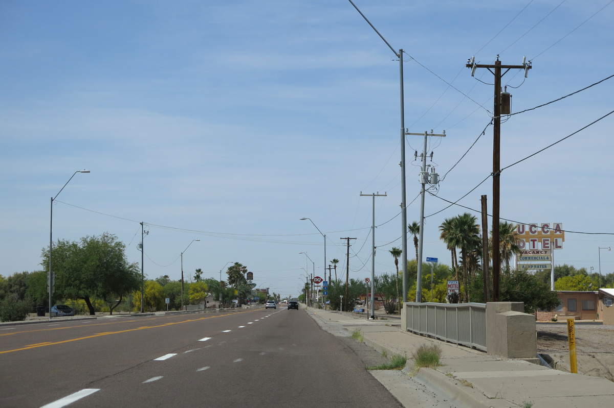
Continuing west from Sand Tank Wash, Pima Street enters the Gila Bend business district.
04/07/13
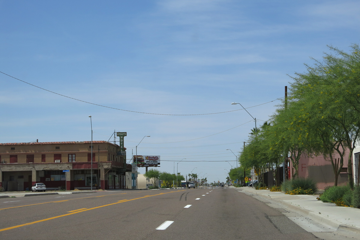
Pima Street west at Capitol Avenue in the Gila Bend town center.
04/07/13
Martin Avenue, the former alignment of SR 85 south from Pima Street (old U.S. 80), intersects Business Loop I-8 ahead of this trailblazer for Interstate 8.
04/07/13
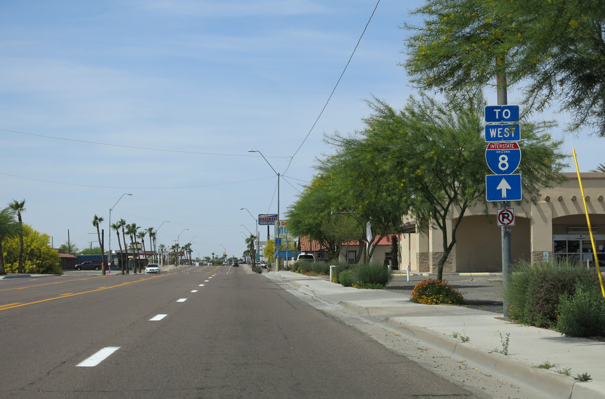
The final reassurance marker for Business Loop I-8 west in Gila Bend appears along Pima Street between Euclid and Scott Avenues.
04/07/13
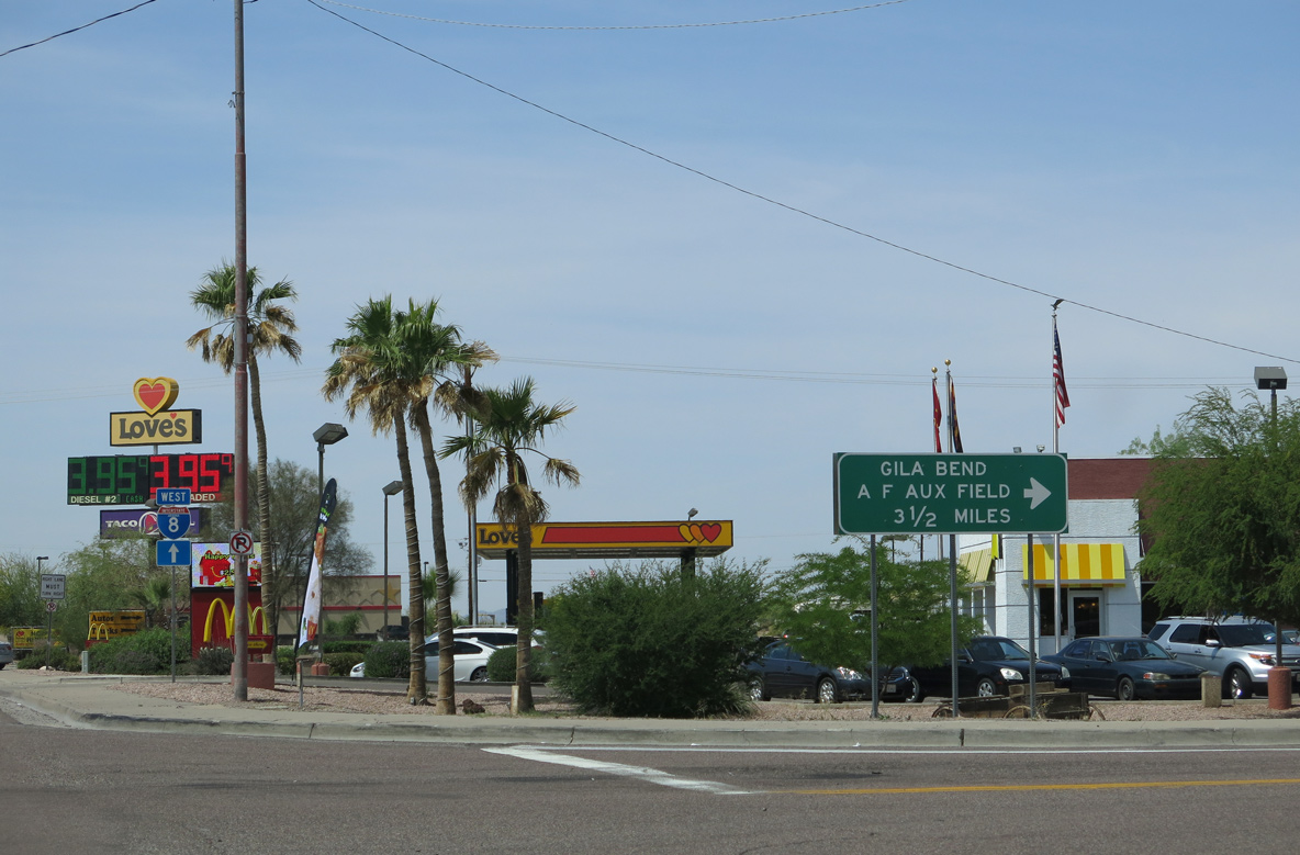
SR 85 parts ways with Business Loop I-8 west a third of a mile beyond Dodson Street. The state route continues south to Gila Bend Air Force Auxiliary Field and Ajo by the Little Ajo Mountains.
04/07/13
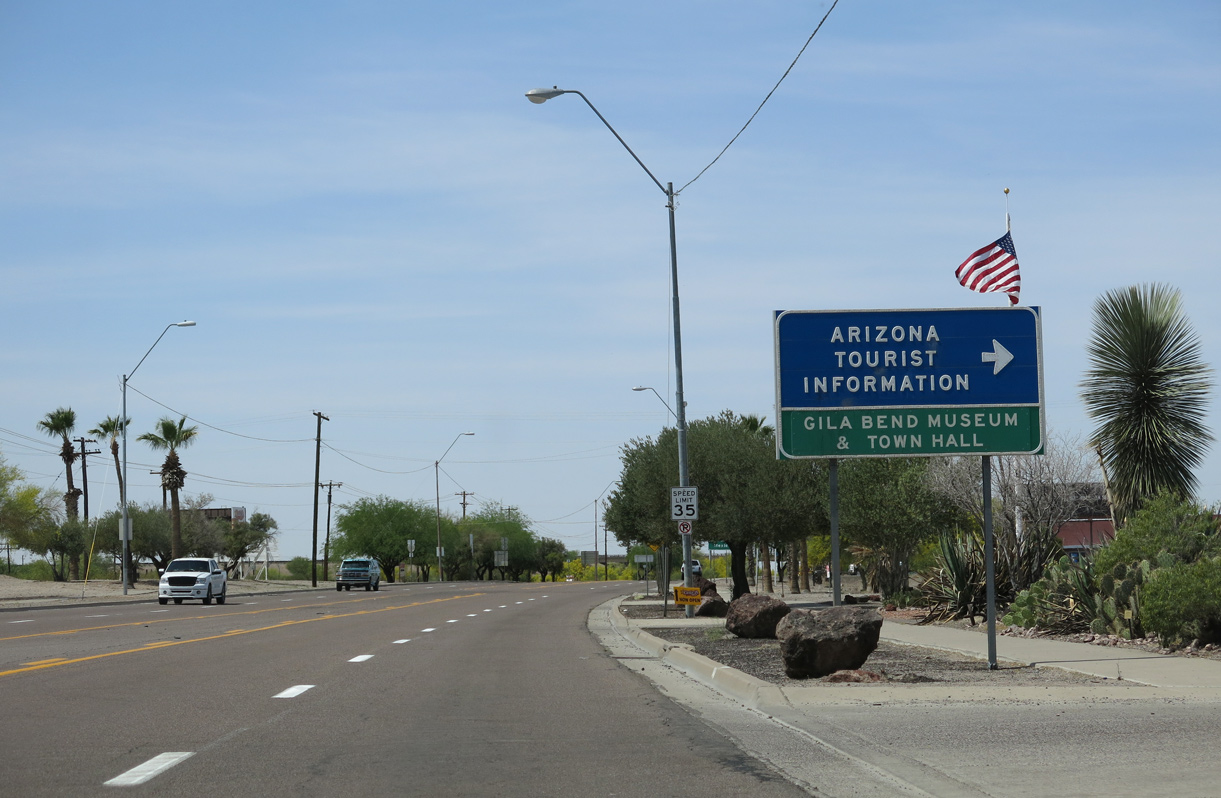
The Gila Bend Visitor Center and Museum lies along the north side of Pima Street west ahead of Harrington Avenue.
04/07/13
SR 85 extends 80.14 miles south to Lukeville and the international border with Mexico. Mexico Federal Route 8 continues from there to Sonoyta and Puerto Peñasco (Rocky Point).
04/07/13
SR 85 travels south from Ajo into the Valley of the Ajo and the unincorporated community of Why.
04/07/13
SR 85 passes through the Barry M. Goldwater Air Force Range south to Ajo and Organ Pipe Cactus National Monument beyond Why.
04/07/13
West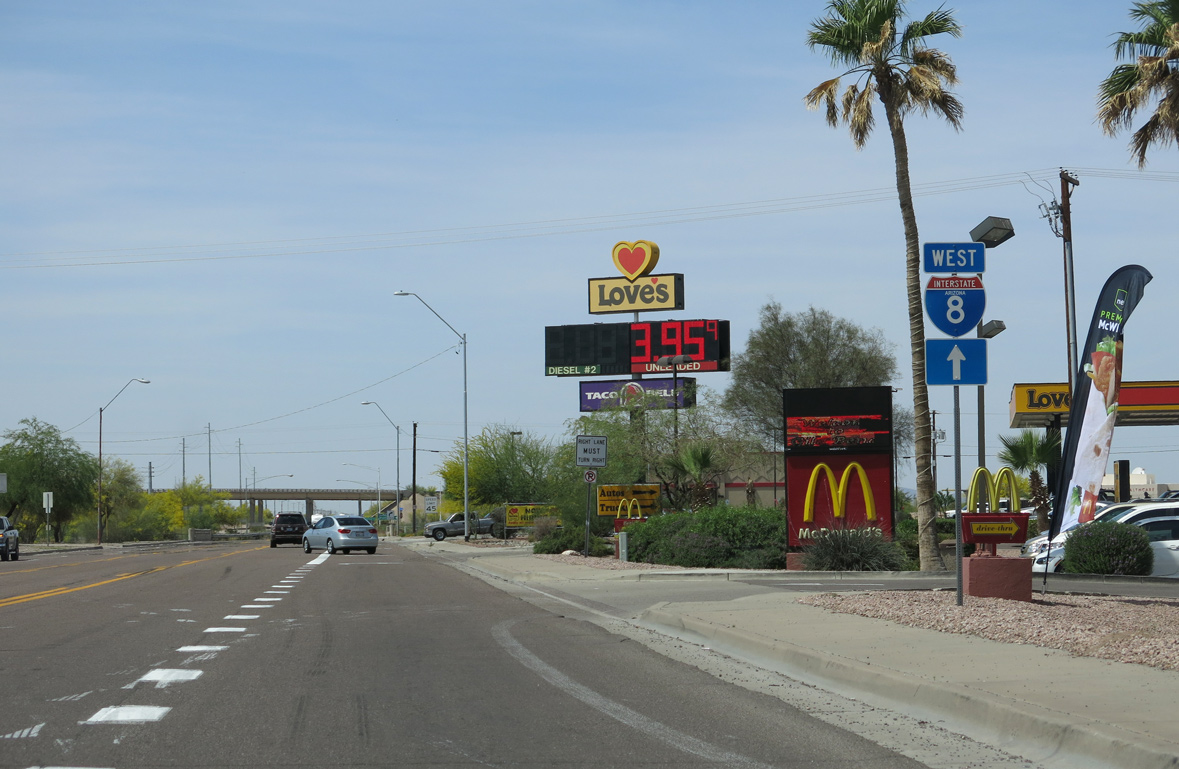
The last traveler services for Interstate 8 from Gila Bend to Sentinel, 28 miles to the west, are located within the loop ramp taking SR 85 south below Business Loop I-8.
04/07/13
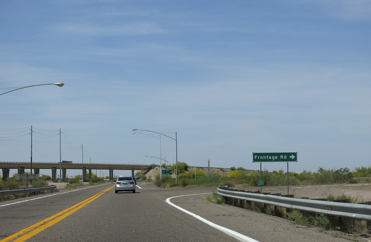
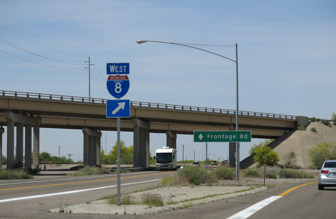
The north Frontage Road for Interstate 8 stems west from Business Loop I-8 beyond the grade separation with SR 85.
04/07/13
The entrance ramp for Interstate 8 west to Yuma and San Diego, California follow.
04/07/13
Pima Street continues below Interstate 8 to the south Frontage Road (old U.S. 80).
04/07/13
Photo Credits:
- Andy Field: 11/12/07, 04/07/13
Connect with:
Page Updated Wednesday April 06, 2022.