
Interstate 10 East - Hidalgo and Grant Counties


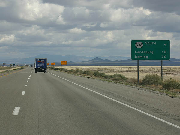
Interstate 10 overtakes old U.S. 80 east from Roadforks across Animas Valley. The succeeding exit is with NM 338 south in five miles, followed by the city of Lordsburg in 16 miles.
02/27/05
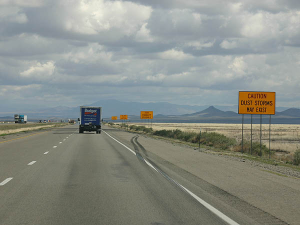
Interstate 10 bee lines northeast alongside Animas Dry Lake. Dust storms are common along I-10 from Phoenix, Arizona to El Paso, Texas, especially during the Spring.
02/27/05

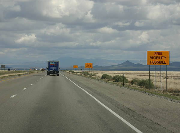
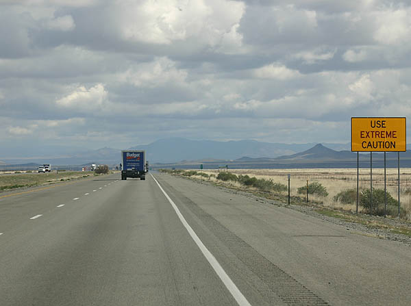
When conditions become too hazardous due to both low visibility and high winds, the freeway closes and motorists are diverted along U.S. 70 from Safford, Arizona to Lordsburg.
02/27/05
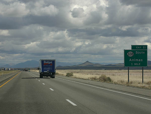
One mile ahead of Exit 11 for NM 388 south to Cotton City and Animas. NM 388 connects with NM 9, a lengthy route traveling east from NM 80 to Hachita and close to the U.S.-Mexico border between the Cedar Mountain Range and NM 136 at Santa Teresa.
02/27/05
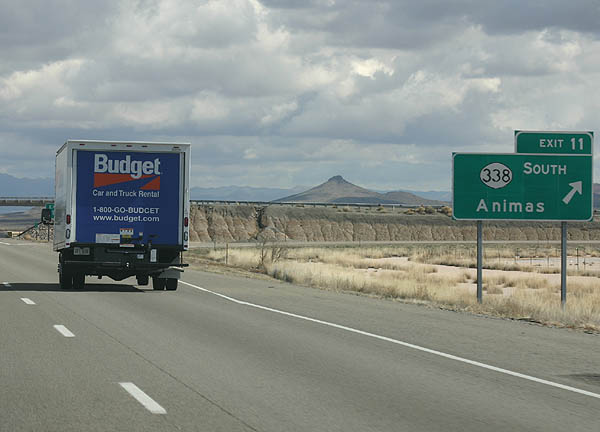
NM 338 travels 24.29 miles south from Interstate 10 to end just beyond NM 9 in Animas. Cloverdale Road (FL-1333) extends south from Animas 42 miles to Cloverdale through southern reaches of Animas Valley.
02/27/05
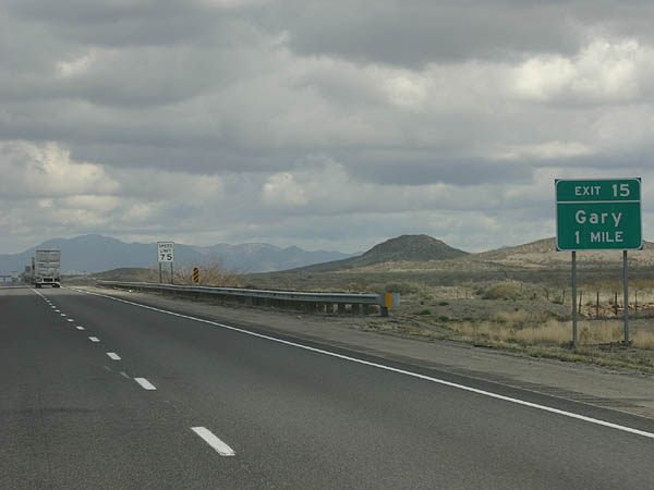
The next exit along Interstate 10 east is with Wildcat Mountain Road (FR 1005) to the Union Pacific Railroad siding of Gary.
02/27/05
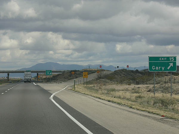
Wildcat Mountain Road links the diamond interchange at Exit 15 with old U.S. 80 at Gary, a half mile to the north.
02/27/05
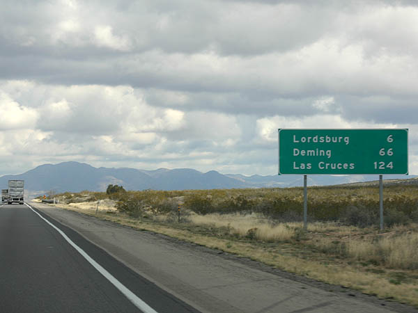
This sign shows mileage to the three major cities along Interstate 10 in New Mexico - Lordsburg, Deming and Las Cruces. Much of the Interstate highway replaced U.S. 80, which was truncated west of Mesquite, Texas.
02/27/05
Interstate 10 arcs eastward around the north side of the Pyramid Mountains to the first of three interchanges with Lordsburg in 1.5 miles.
02/27/05
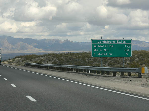
Following old U.S. 80 along Motel Drive, Business Loop I-10 branches north from I-10 at a parclo interchange (Exit 20) on the west side of Lordsburg.
02/27/05
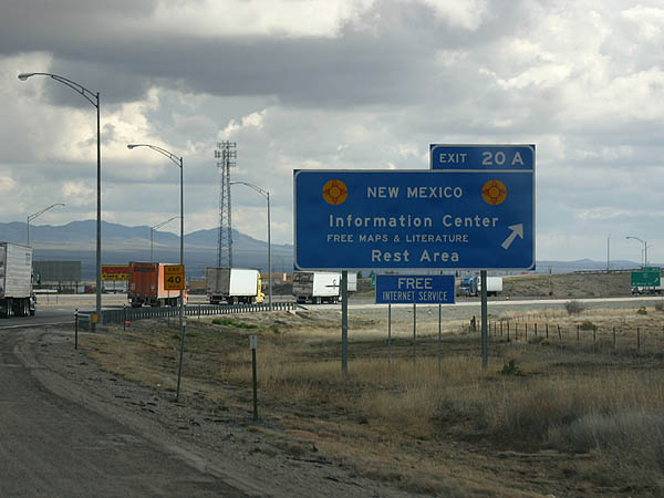
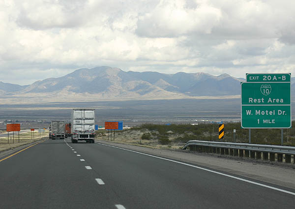
Exit 20A loops onto Business Loop I-10 (W Motel Drive) east at the entrance ramp for the New Mexico information center and rest area.
02/27/05
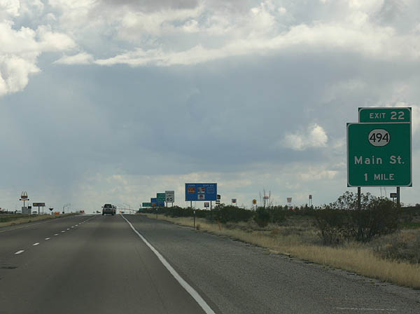
Interstate 10 runs south of Downtown Lordsburg, meeting NM 494 (Main Street) at Exit 22.
02/27/05
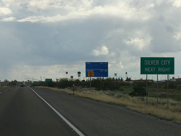
Silver City, seat of Grant County, lies 44 miles to the northeast of Lordsburg via U.S. 70 and NM 90.
02/27/05
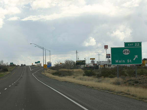
Entering the diamond interchange (Exit 22) with NM 494 (Main Street) on I-10 eastbound. NM 494 spurs 1.94 miles from Business Loop I-10/U.S. 70 to the south Lordsburg city line. Banner Mine Road extends from the end of state maintenance to Aberdeen Peak in the Pyramid Mountains.
02/27/05
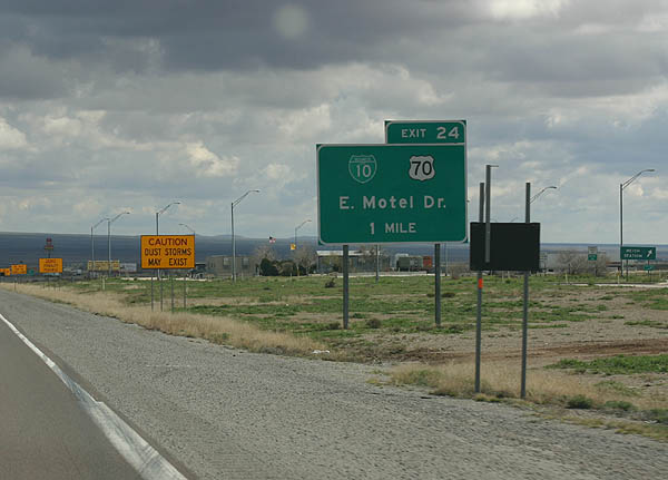
Business Loop I-10/U.S. 70 combine from Downtown Lordsburg to a parclo interchange (Exit 24) at the east end of the city.
02/27/05
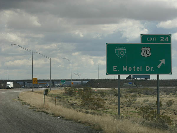
Business Loop I-10 concludes a 4.37 mile route along East Motel Drive at Exit 24. Providing an alternate route to Phoenix, Arizona, U.S. 70 enters Lordsburg from the northwest.
02/27/05
 East
East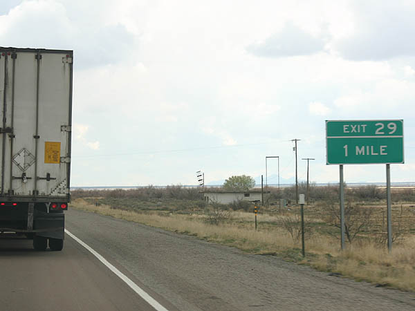
U.S. 70 merges with Interstate 10 east to Deming and Las Cruces. The overlap however is not acknowledged on guide signs or reassurance markers. Leaving Lordburg, I-10 reaches the ranch exit with FR 1010 (Ulmorris Road).
02/27/05
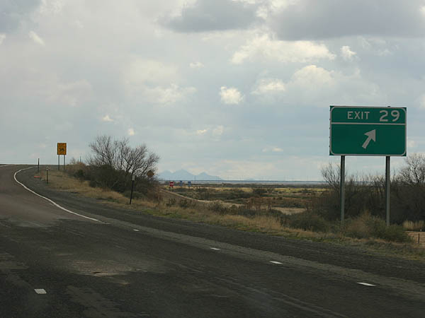
Several interchanges throughout the state of New Mexico are signed simply with an exit number, such as the exchange (Exit 29) with FR 1010 to the UP Railroad siding of Ulmoris.
02/27/05
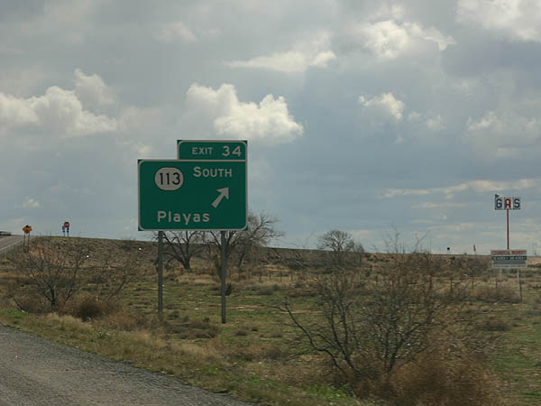
Exit 34 connects I-10 east with the north end of NM 113. NM 113 runs along the Grant County line, traversing Playas Valley south 20.60 miles to NM 9.
02/27/05
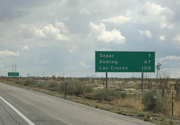
Interstate 10 and the adjacent Union Pacific Railroad bee line eastward seven miles to the settlement of Separ. Las Cruces is 105 miles to the east.
02/27/05
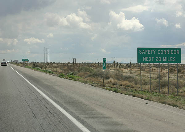
I-10 between mile post 35 and Deming is a Safety Corridor. While there is no speed limit reduction, this stretch of road is a double fine area.
02/27/05
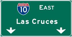

Photo Credits:
- Kevin Trinkle: 02/27/05
Connect with:
Page Updated Wednesday April 03, 2019.