
Interstate 10 West - Chandler to Phoenix
 West
West
Loop 202 encircles Chandler and Gilbert along the Santan Freeway east to U.S. 60 (Superstition Freeway), then loops westward along the Red Mountain Freeway around Mesa.
04/26/17
04/26/17

04/26/17

Loop 202 constitutes a 78.05 mile long beltway across the Valley of the Sun from I-10 at Maryvale Village in Phoenix to I-10/SR 51 northeast of Downtown Phoenix.
04/26/17
04/26/17

Loop 202 west 22.28 miles along the South Mountain Freeway opened to traffic on December 21, 2019.
04/26/17
04/26/17

The South Mountain Freeway was constructed over Pecos Road west by Ahwatukee Foothills Village in southeast Phoenix.
04/26/17
04/26/17

Guide signs at Exit 161 omit any control cities for Loop 202.
04/26/17
04/26/17

The systems interchange joining Interstate 10 with Loop 202 was completed in late 2003.
04/26/17
04/26/17

Exit 160 separates from I-10 within the exchange at Loop 202 for Chandler Boulevard. Chandler Boulevard leads east by a series of warehouses and distribution centers and west by a number of apartment complexes and retail centers.
04/26/17
04/26/17

An HOV lane opens along Interstate 10 westbound below the flyovers with the Santan and South Mountain Freeways.
04/26/17
04/26/17

04/26/17

The succeeding exit along I-10 west is the diamond interchange (Exit 159) with Ray Road.
04/26/17
04/26/17

Ray Road accesses the primary commercial center of Ahwatukee and West Chandler, with big box retail centers lining both sides of Interstate 10 at Exit 159.
04/26/17
04/26/17

04/26/17

04/26/17

04/26/17

04/26/17

Elliot Road east passes south of the town of Guadalupe and leads west into the Phoenix community of Ahwatukee.
04/26/17
04/26/17

04/26/17

Westbound Interstate 10 at Exit 157 for Elliot Road.
04/26/17
04/26/17

Baseline Road parallels U.S. 60 (Superstition Freeway) east across Tempe into Mesa. Baseline Road west heads to reach the base of South Mountain.
04/26/17
04/26/17

Exit 155 departs from I-10 west at Guadalupe. Guadalupe is a small town settled by the Pasqua Yaqui tribe, who fled from Mexico to escape persecution.
04/26/17
04/26/17

U.S. 60 along the Superstition Freeway travels east across Mesa and Apache Junction. Beyond there, U.S. 60 angles southeast along a divided highway to SR 79 (former U.S. 80/89) at Florence Junction.
04/26/17
04/26/17

Exit 155 leaves I-10 west for Baseline Road west to South Mountain Resort and South Mountain Community College and east to adjacent Arizona Mills mall.
04/26/17
04/26/17

Prior to 1993, U.S. 60 along the Superstition Freeway was designated SR 360, while U.S. 60/89 followed Main Street through Mesa. U.S. 60 was relocated onto the Superstition Freeway as part of action truncating U.S. 89 north to Flagstaff in 1992.
04/26/17
04/26/17

U.S. 60 travels 80 miles from the directional T interchange at Exit 154 to the west end of U.S. 70 at Globe.
04/26/17
04/26/17

U.S. 60 west combines with I-10 for 4.90 miles to the south end of Interstate 17.
04/26/17
04/26/17

2019 ADOT traffic counts swell to 295,833 vpd with the addition of U.S. 60 along Interstate 10 (Maricopa Freeway) west.
04/26/17
04/26/17
 West
West
SR 143 (Hohokam Expressway) branches north from Exit 153 to Phoenix Sky Harbor International Airport (PHX) and Loop 202 (Red Mountain Freeway).
04/26/17
04/26/17

52nd Street extends north from Exit 153B and Broadway Road through an industrial park area east of SR 143.
04/26/17
04/26/17

Tempe Diablo Stadium, home of Los Angeles Angels Spring Training, lies west of I-10/U.S. 60 and south of Broadway Road from Exit 153B. SR 143 (Hohokam Expressway) stems north 48th Street ahead of Exit 153A.
04/26/17
04/26/17

Paralleling former SR 153 (Sky Harbor Expressway) to the east, SR 143 spurs 4.06 miles north to Sky Harbor Boulevard west into Phoenix Sky Harbor International Airport (PHX) and McDowell Road beyond Loop 202.
04/26/17
04/26/17

04/26/17

I-10/U.S. 60 (Maricopa Freeway) continue west from 48th Street/SR 143 into the city of Phoenix. The ensuing exit is for 40th Street to industrial areas south of the Salt River.
04/26/17
04/26/17

04/26/17

04/26/17

04/26/17

04/26/17

The succeeding three exits from I-10 west are for University Drive and 32nd Street, 24th Street, and I-17/U.S. 60. 32nd Street is discontinuous northward due to the Salt River and Sky Harbor Airport (PHX), as is University Drive.
04/26/17
04/26/17

I-10/U.S. 60 curve northwest at the diamond interchange (Exit 151) with 32nd Street south and University Drive east.
04/26/17
04/26/17

Trucks with hazardous cargo are directed onto I-17/U.S. 60 to avoid the Deck Park Tunnel along Interstate 10 (Papago Freeway).
04/26/17
04/26/17

I-10/U.S. 60 (Maricopa Freeway) span the Salt River ahead of Interstate 17.
04/26/17
04/26/17

U.S. 60 accompanies Interstate 17 south and west of Central City to Thomas Road at Grand Avenue.
04/26/17
04/26/17

U.S. 60 angles northwest from I-17 (Black Canyon Freeway) through Glendale, Peoria and Surprise en route to U.S. 93 at Wickenburg.
04/26/17
04/26/17

The half diamond interchange (Exit 150B) with 24th Street serves warehouses and distribution centers southwest of Phoenix Sky Harbor International Airport (PHX). The three-wye interchange (Exit 150A) with Interstate 17 is to the immediate west.
04/26/17
04/26/17

Interstate 17 travels 145.97 miles to I-40/SR 89A at Flagstaff. I-10 and I-17 cross paths again in 6.8 miles.
04/26/17
04/26/17
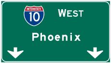

Photo Credits:
- ABRoads: 04/26/17
Connect with:
Page Updated Thursday April 14, 2022.