
Interstate 10 West - New Mexico to Willcox
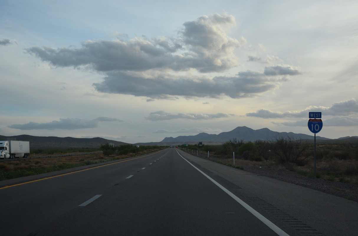
 West
West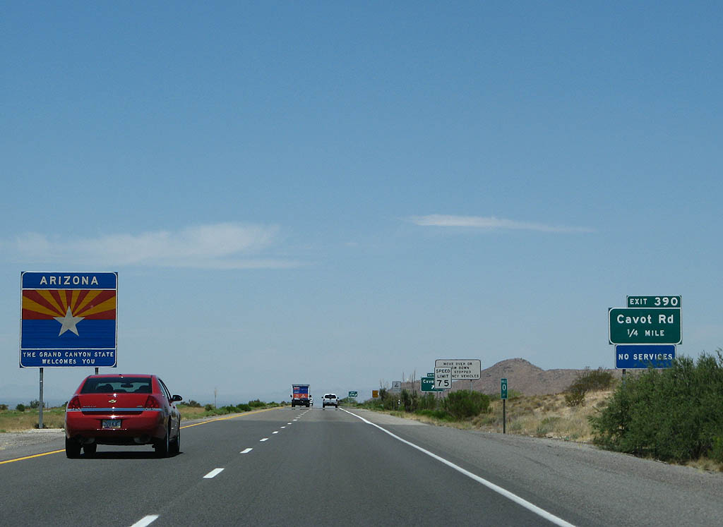
Interstate 10 enters Arizona from the Peloncillo Mountains, 0.46 miles ahead of Cavot Road.
06/15/08
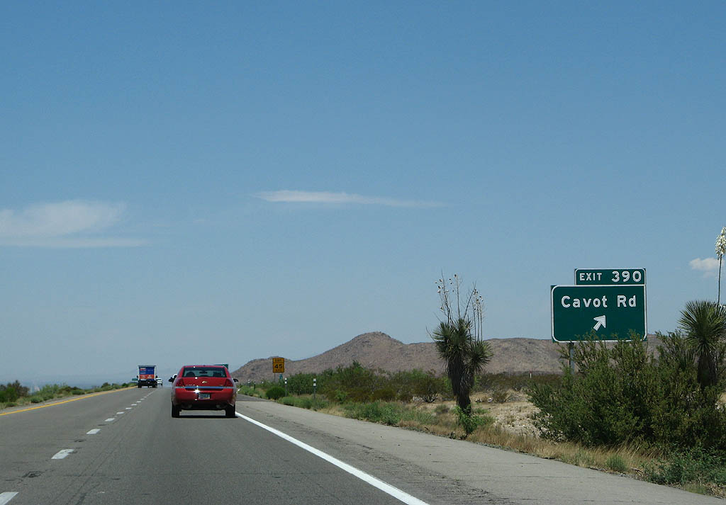
Cavot Road spurs 2.34 miles southwest from the diamond interchange at Exit 390 to Carr Road and agricultural areas along the San Simon River.
06/15/08
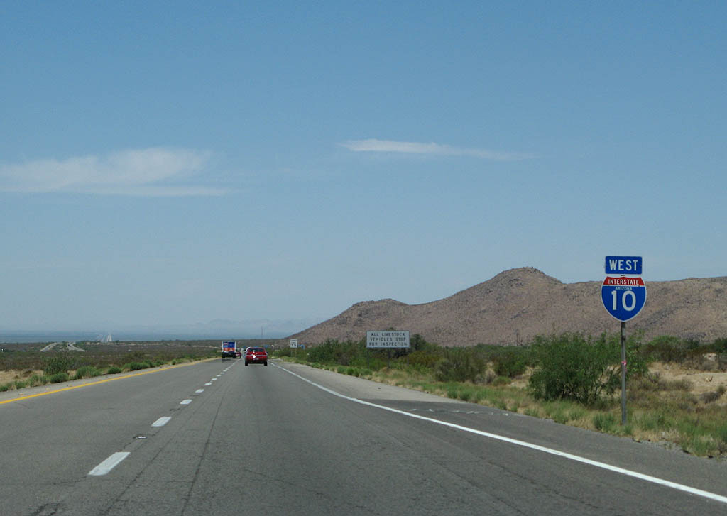
The first confirming marker for Interstate 10 west in the Grand Canyon State.
06/15/08
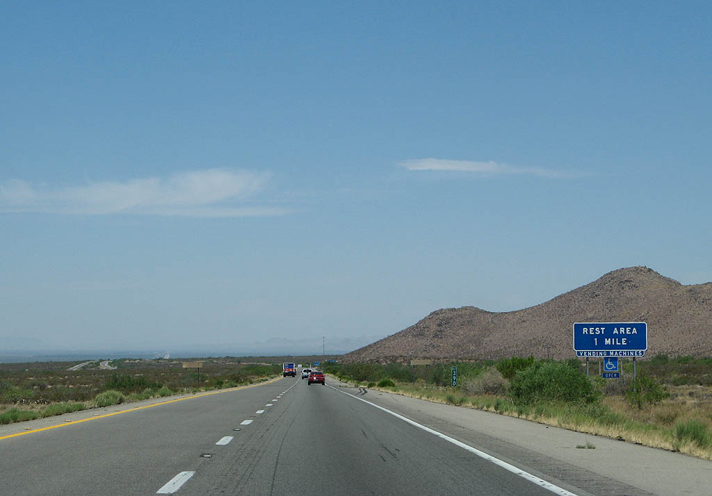
The roadways for Interstate 10 separate around a wide median leading west to the San Simon Rest Area.
06/15/08
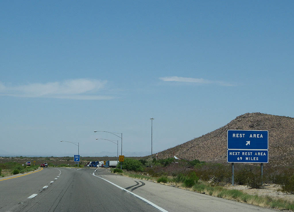
The first rest area inside Arizona is the San Simon Safety Rest Area. The next rest area is at Texas Canyon, 69 miles ahead.
06/15/08
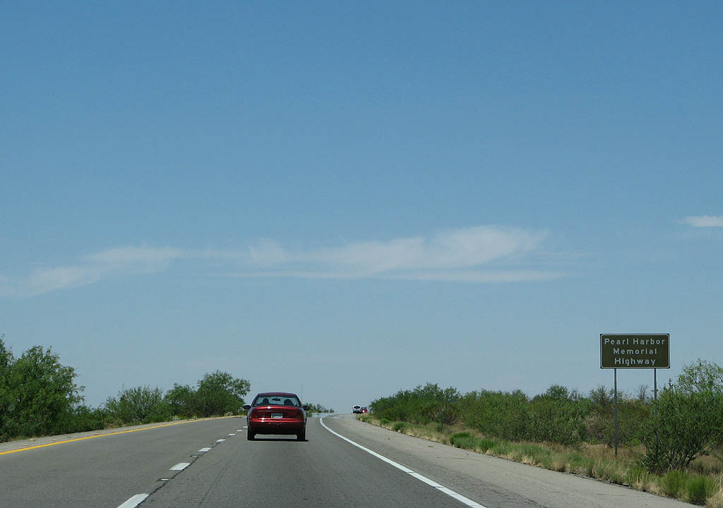
Interstate 10 is the Pearl Harbor Memorial Highway through Arizona. This is the first of many signs denoting the designation.
06/15/08
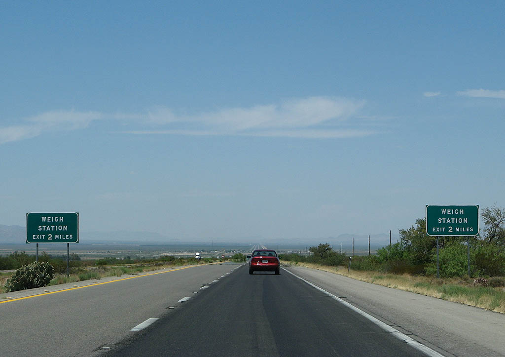
Advance signage for the San Simon weigh station, two miles.
06/15/08
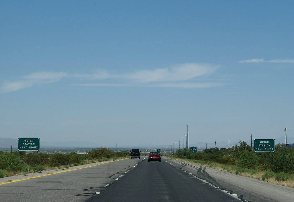
Commercial trucks must enter the San Simon weigh station when in operation.
06/15/08
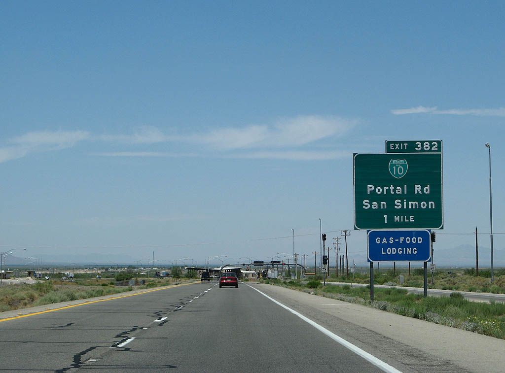
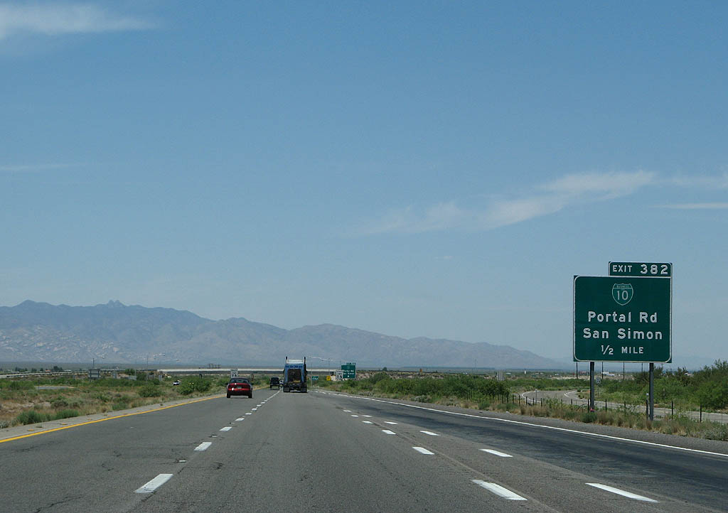
Business Loop 10 west through San Simon separates at Exit 382 just beyond the weigh station.
06/15/08
San Simon is an unincorporated ranching town along the San Simon River. Historically, the San Simon Valley had some of the richest grasslands in Arizona. Overgrazing in the late 1890s, similarly taking place statewide, consumed much of the grassland.
06/15/08
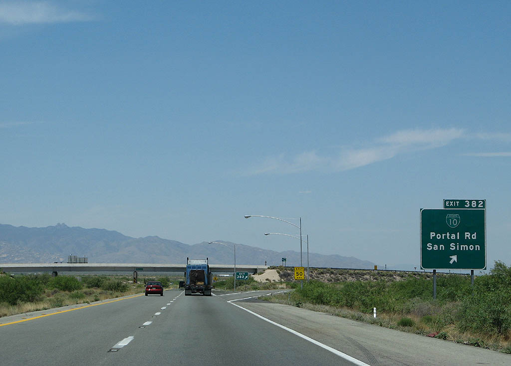
The trumpet interchange (Exit 382) with Business loop I-10 ties into W Power Road, the south side frontage road for I-10 linking with Portal Road south to Portal.
06/15/08
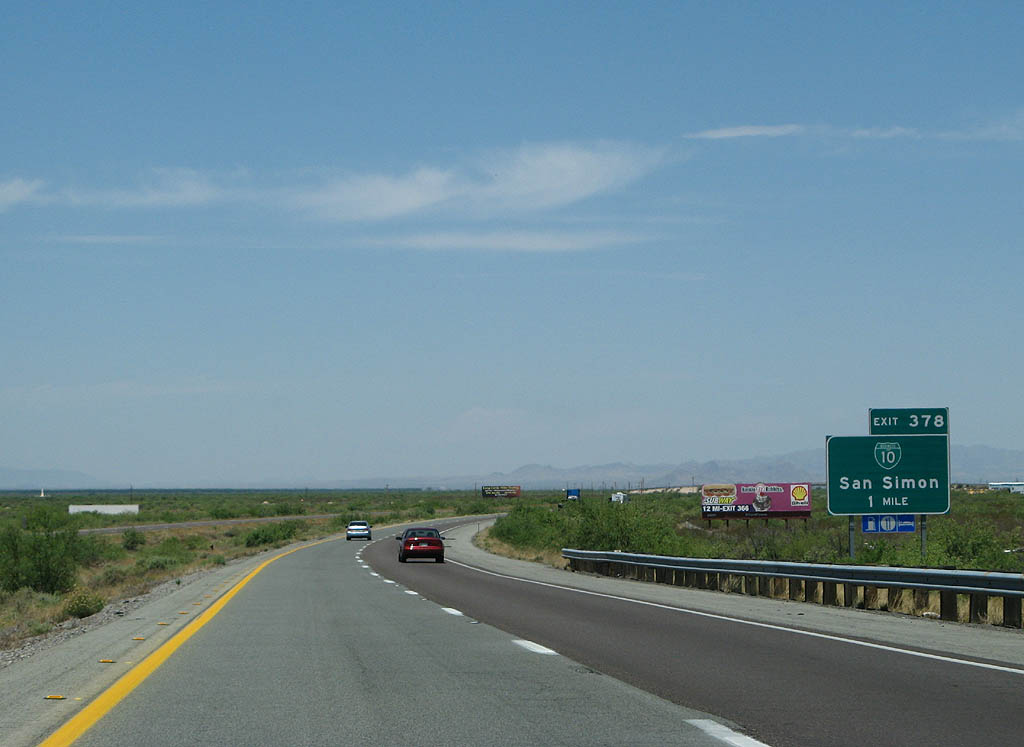
Interstate 10 shifts south of Business Loop I-10, which follows old SR 86 through San Simon. The two rejoin at Exit 378.
06/15/08
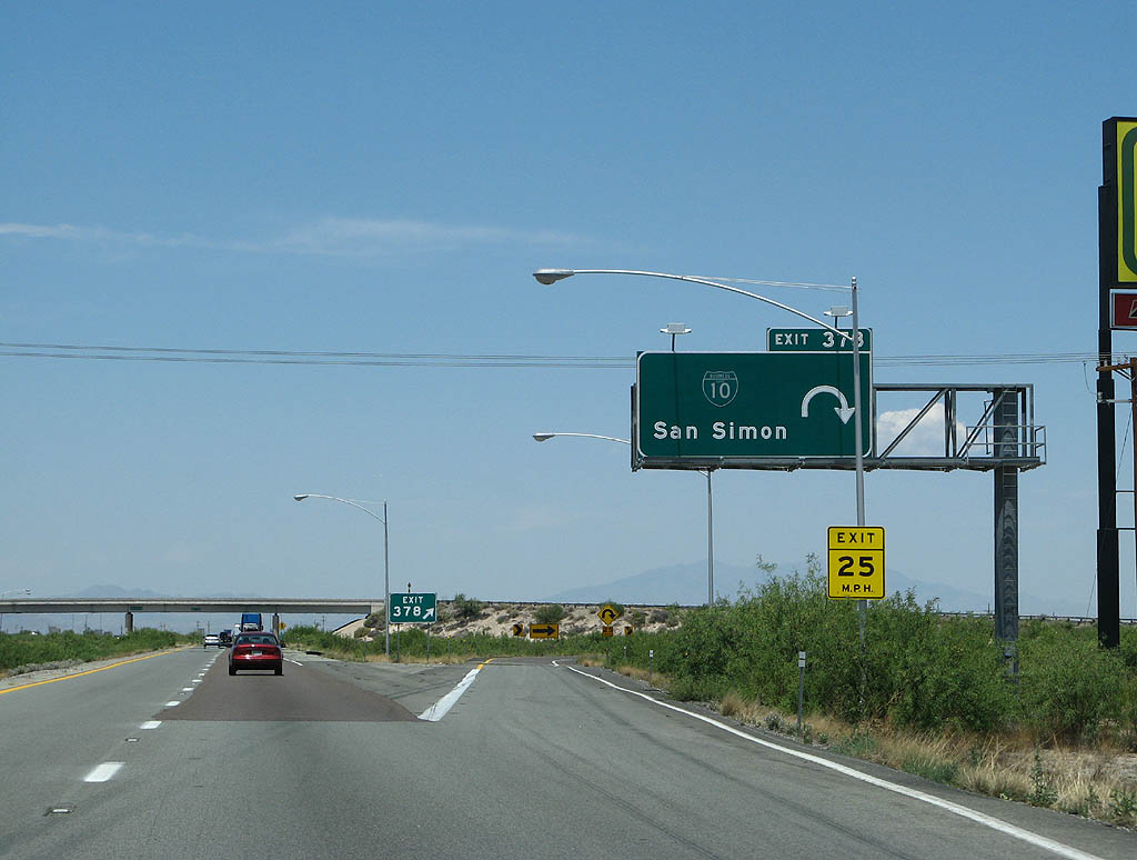
Entering the trumpet interchange with Business Loop I-10 east back into San Simon and Olga Road, the north side frontage road west.
06/15/08
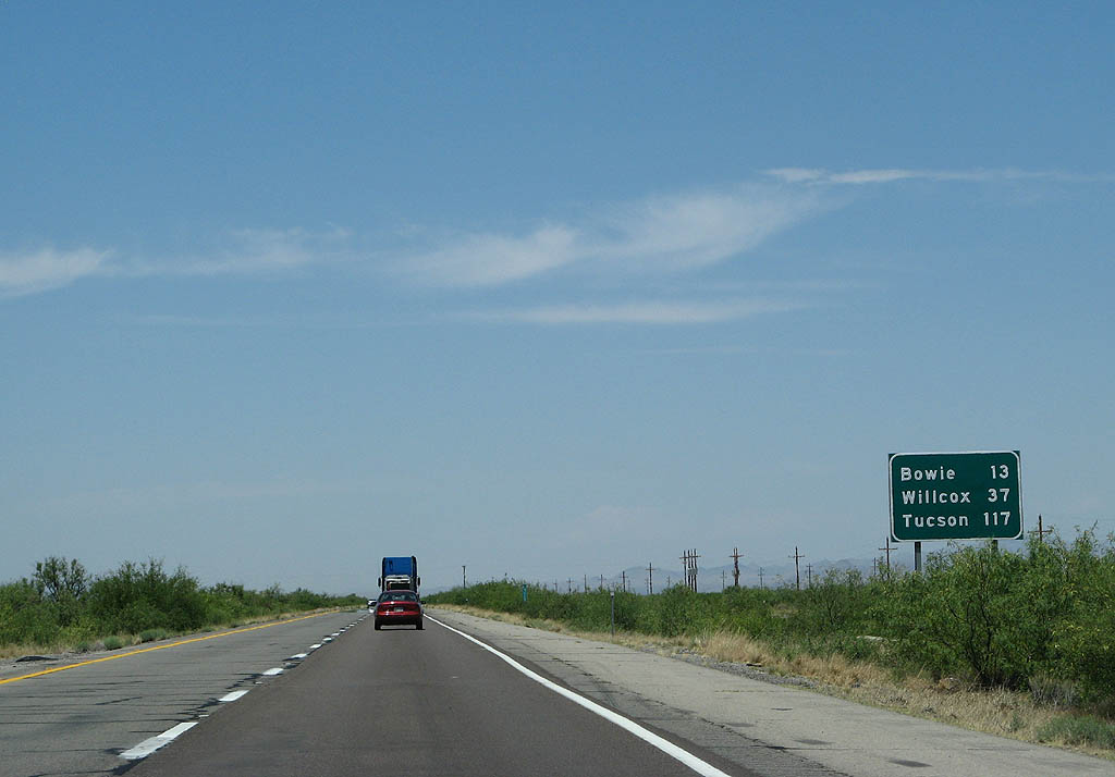
Interstate 10 continues west to unincorporated Bowie in 13 miles and the city of Willcox in 37 miles.
06/15/08
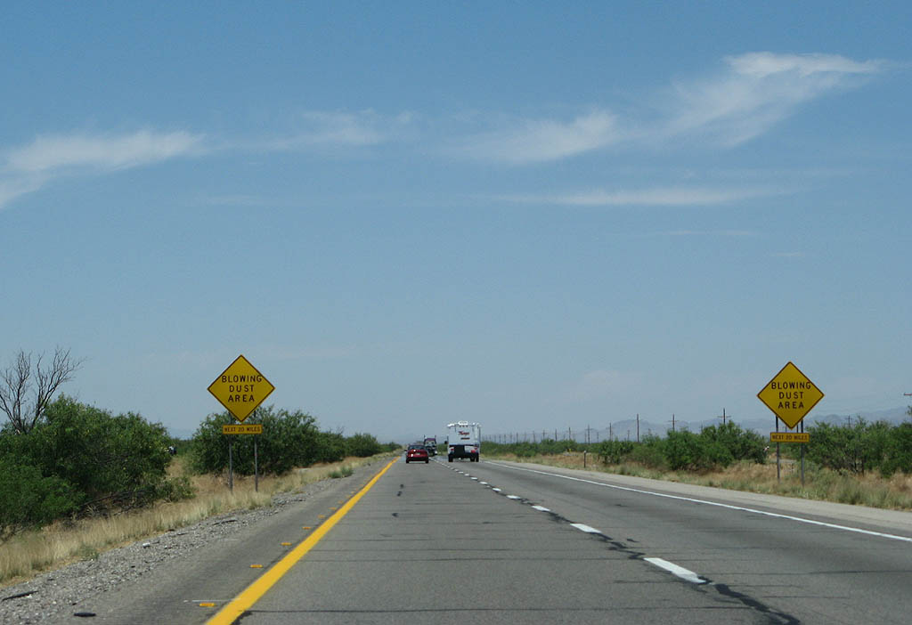
Due to the overgrazing and loss of vegetation in the San Simon Valley, Interstate 10 is subject to blowing dust during strong wind events.
06/15/08
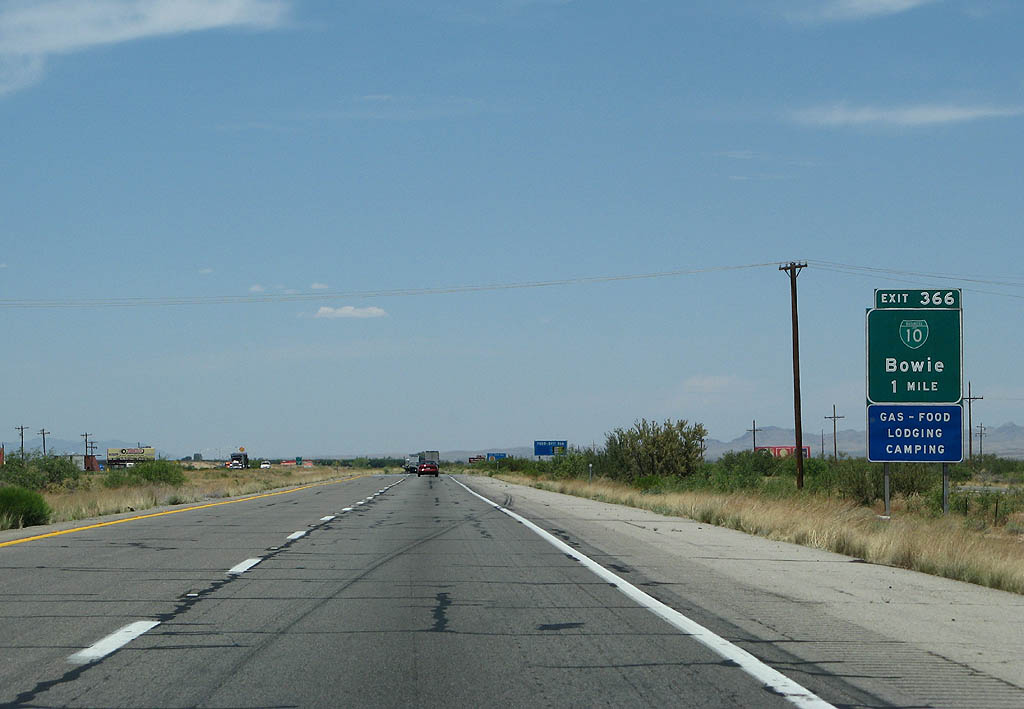
Business Loop I-10 runs 4.65 miles through Bowie from forthcoming Exit 366.
06/15/08
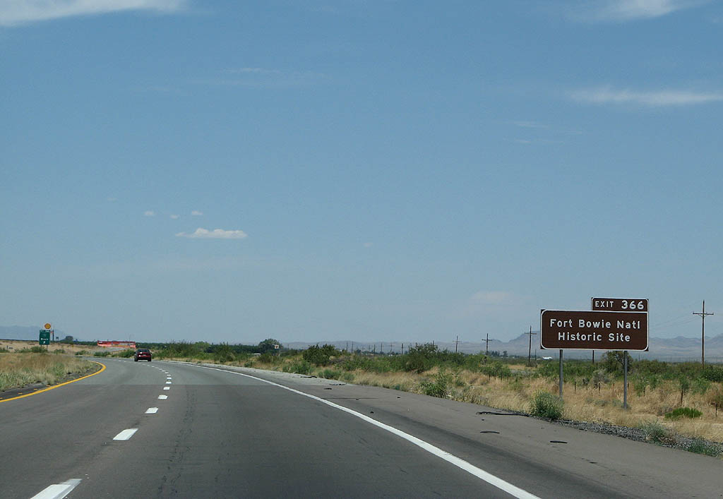
Bowie is named after nearby Fort Bowie National Historical Site, which was established to protect Apache Pass from Apache raids. The National Historic Site lies 13.5 miles to the southwest via Apache Pass Road.
06/15/08
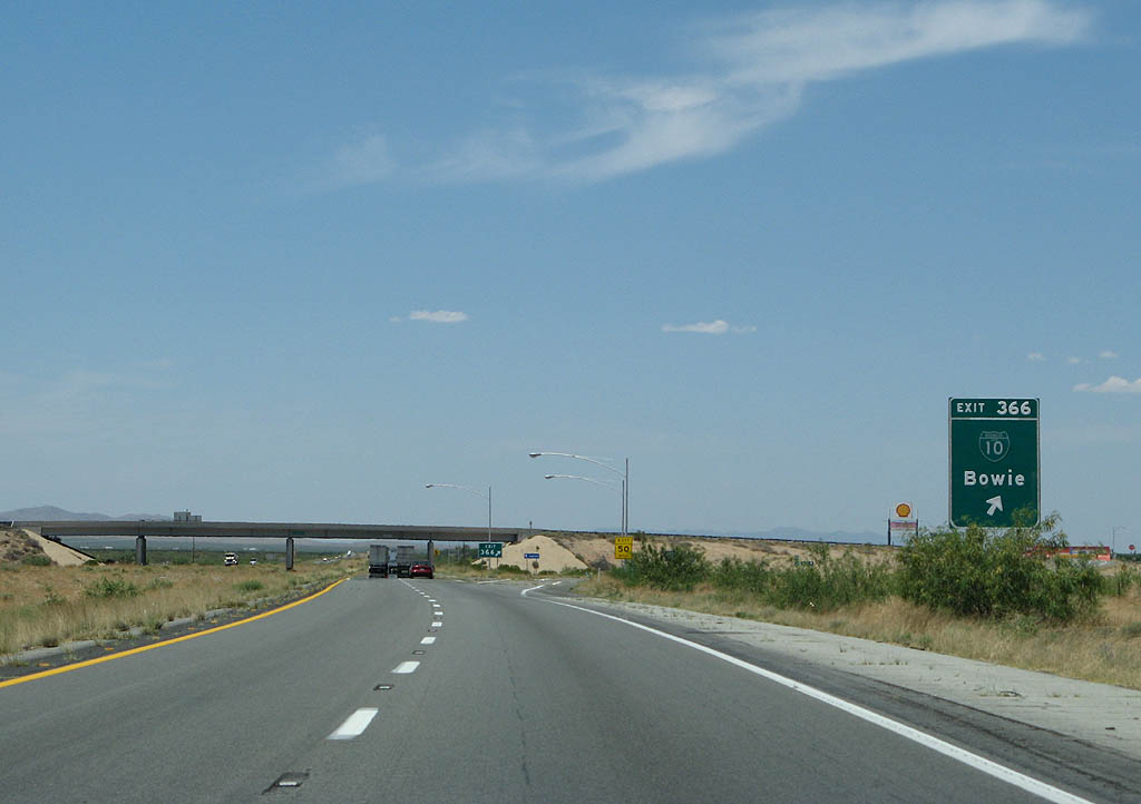
Business Loop I-10 at Bowie, like the one through San Simon, is old SR 86.
06/15/08
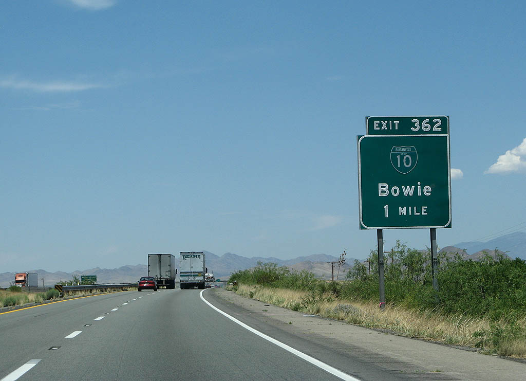
Interstate 10 passes south of Bowie and next meets the end of Business Loop I-10 at Exit 362. The old alignment of SR 86 was replaced by Interstate 10 between the Arizona-New Mexico State Line and Benson. U.S. 80 historically followed NM 80 and SR 80 south to Douglas.
06/15/08
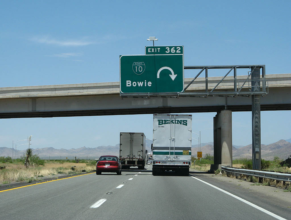
The folded diamond interchange (Exit 362) with the west end of Business Loop I-10 at Bowie lies adjacent to Buckeye Wash.
06/15/08
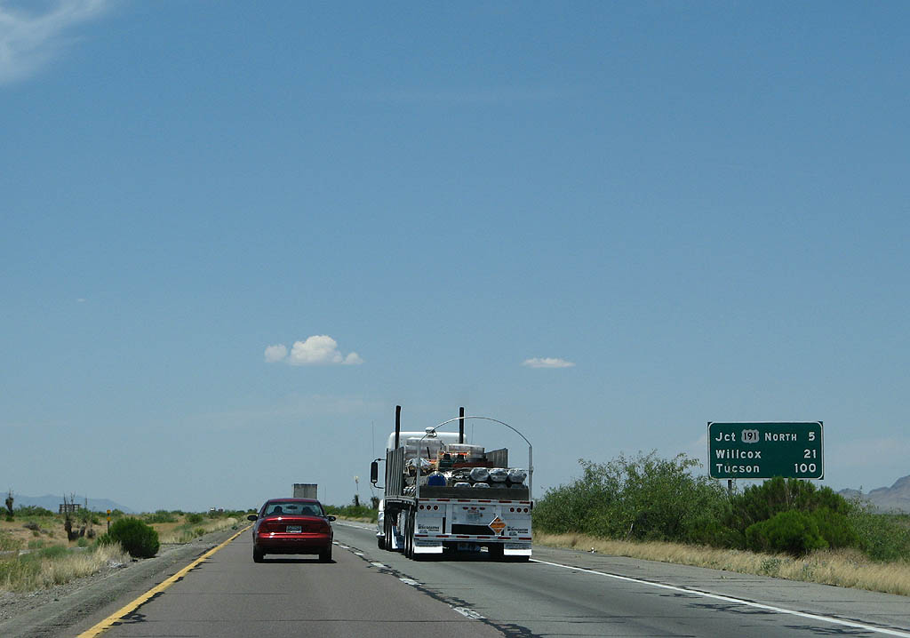
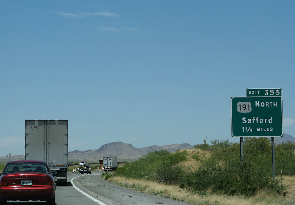
Interstate 10 slowly gains elevation, reaching 4,000 feet in elevation at Exit 355 with N Page Ranch Road (old U.S. 191Y) in five miles.
06/15/08

U.S. 191Y was an unsigned route providing a cut off from I-10 west to U.S. 191 north to Safford. U.S. 191Y is also a former cutoff loop of SR 86. N Page Ranch Road northwest 3.51 miles to U.S. 191 is no longer state maintained.
06/15/08
U.S. 666 in Arizona was incorporated into a southern extension of U.S. 191 from I-40 in 1992. Traveling overall from Douglas north to Malta, Montana, the only break in U.S. 191 is through Yellowstone National Park in Wyoming, because it is closed there in the Winter months.
06/15/08
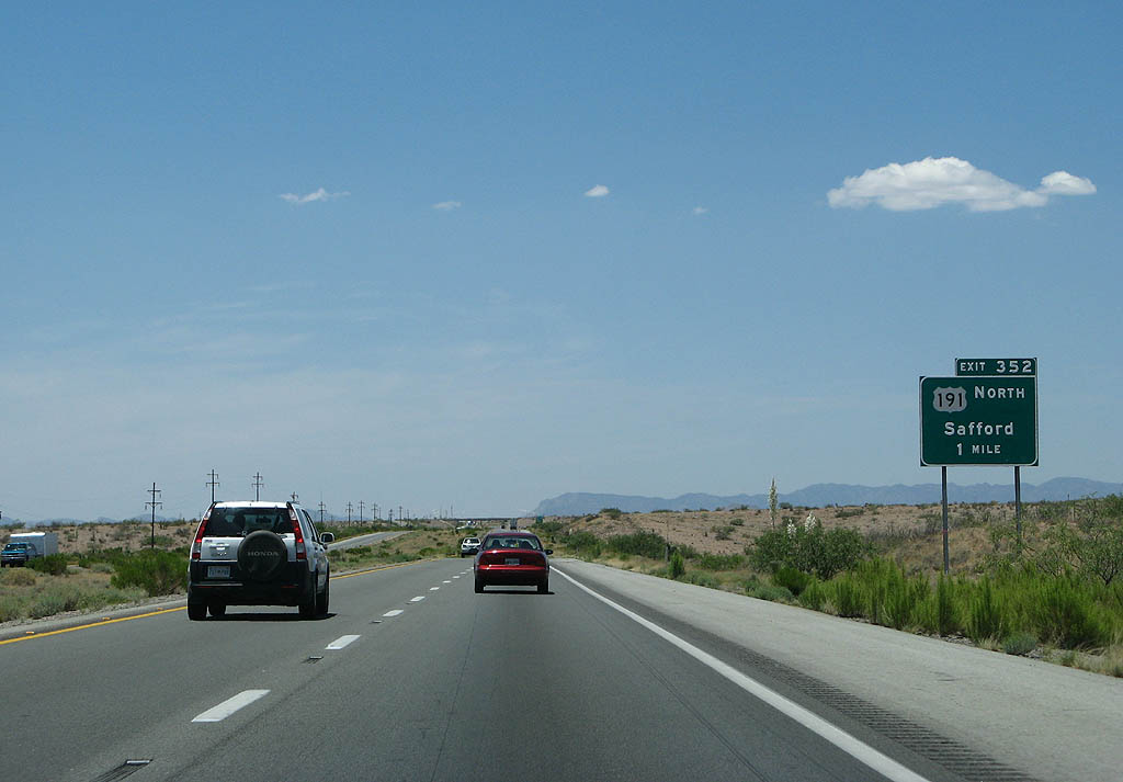
Turning west paralleling Railroad Wash, Interstate 10 converges with U.S. 191 south at Exit 352.
06/15/08
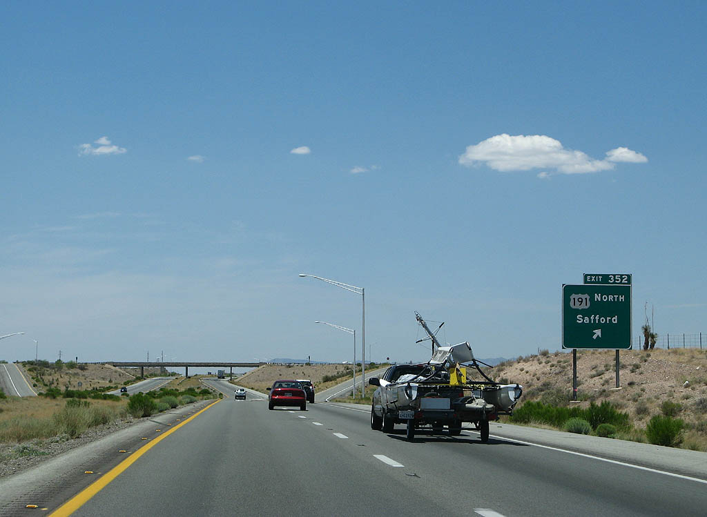
U.S. 191 leads to Safford at the north end of San Simon Valley, where it combines with U.S. 70 east en route to Clifton. The highway continues along a winding course across Apache National Forest and the Mogollon Rim to Eagar.
06/15/08
West  South
South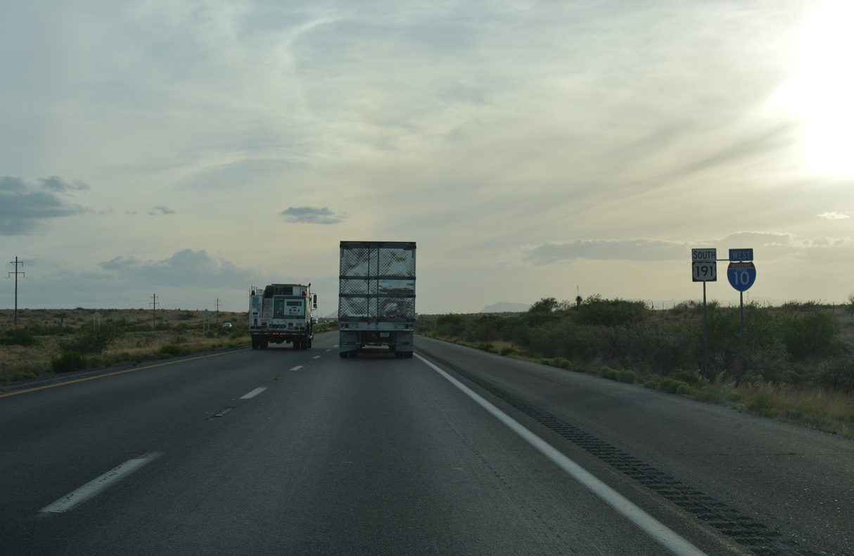
U.S. 191 overlaps with Interstate 10 southwest for 20.34 miles.
04/25/17
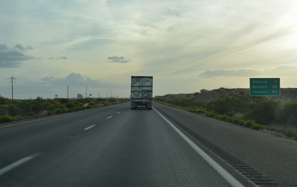
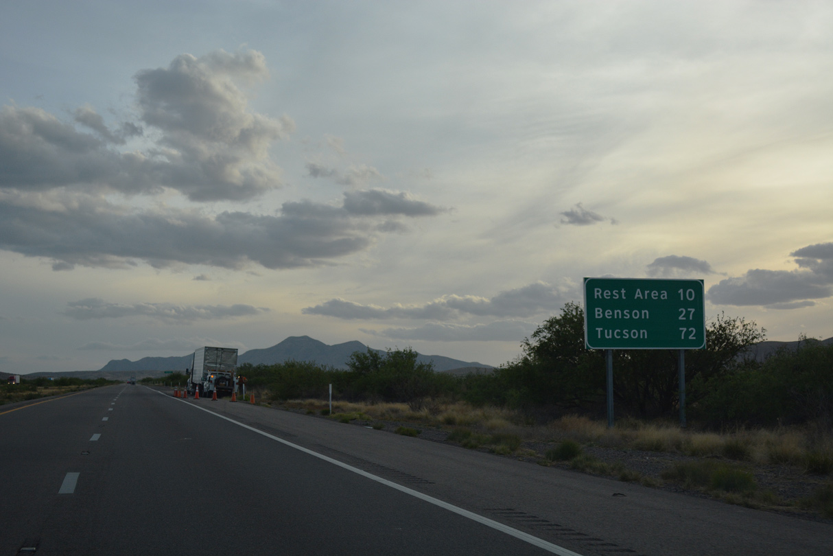
Benson is 46 miles to the southwest, followed by Tucson in 90 miles.
04/25/17
I-10/U.S. 191 make a gradual southwestern turn toward Sulphur Springs Valley at Railroad Pass.
04/25/17
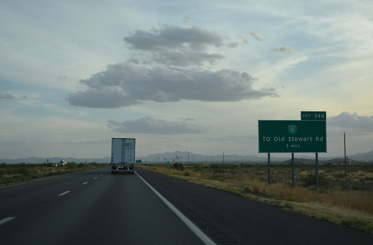
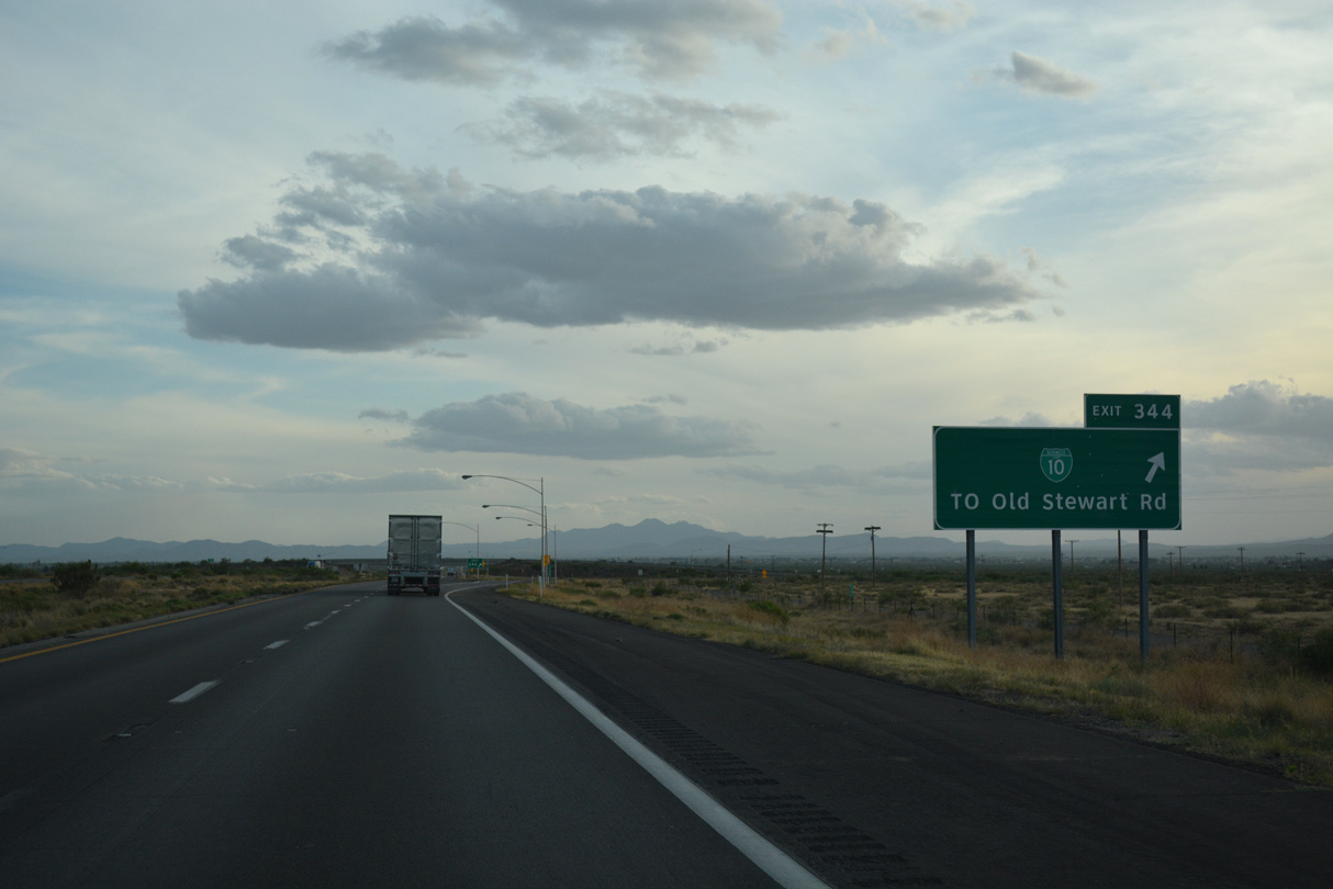
Exit 344 is the first of three interchange along I-10/U.S. 191 west for Willcox. Named after a former general, Willcox is a busy cattle shipping town and farming community. Historically, stagecoaches to places as far north as Globe departed from here before the Railroad opened.
04/25/17
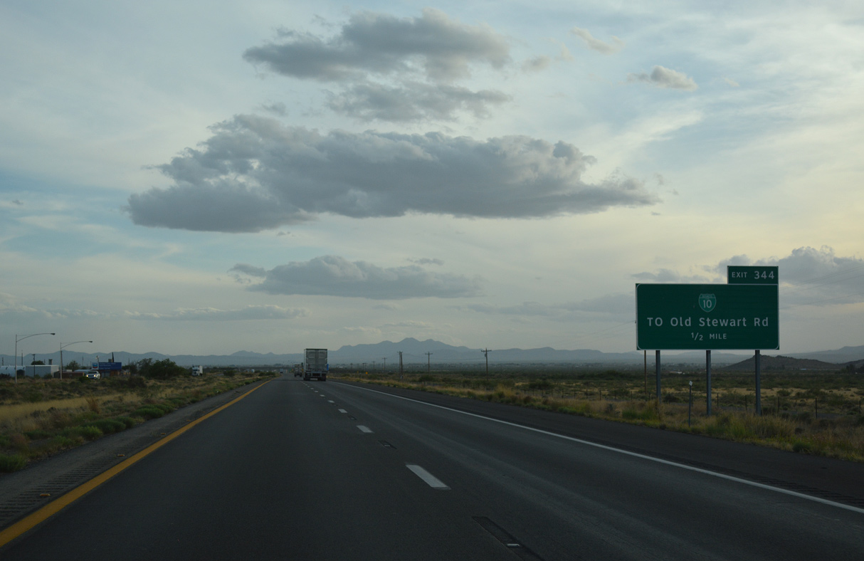
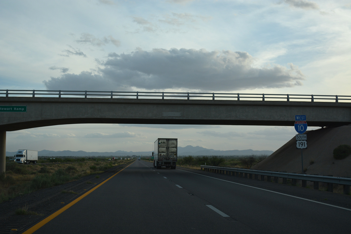
Business Loop I-10 west to Willcox commences at a folded diamond interchange (Exit 344) with Haskell Avenue and Old Stewart Road in one half mile.
04/25/17
Business Loop I-10 follows old U.S. 666 south from I-10/U.S. 191 through Willcox. Former SR 86 was replaced by Interstate 10 in 1970.
04/25/17
I-10/U.S. 191 pass through the west side of Willcox on the ensuing stretch.
04/25/17
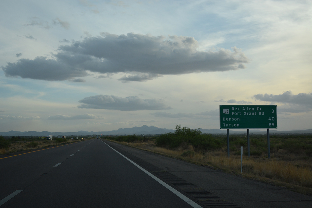
SR 186 (Rex Allen Drive) connects I-10/U.S. 191 with Downtown Willcox from Exit 340 in three miles.
04/25/17
The Winchester Mountains rise along the west side of Sulphur Springs Valley from Willcox.
04/25/17
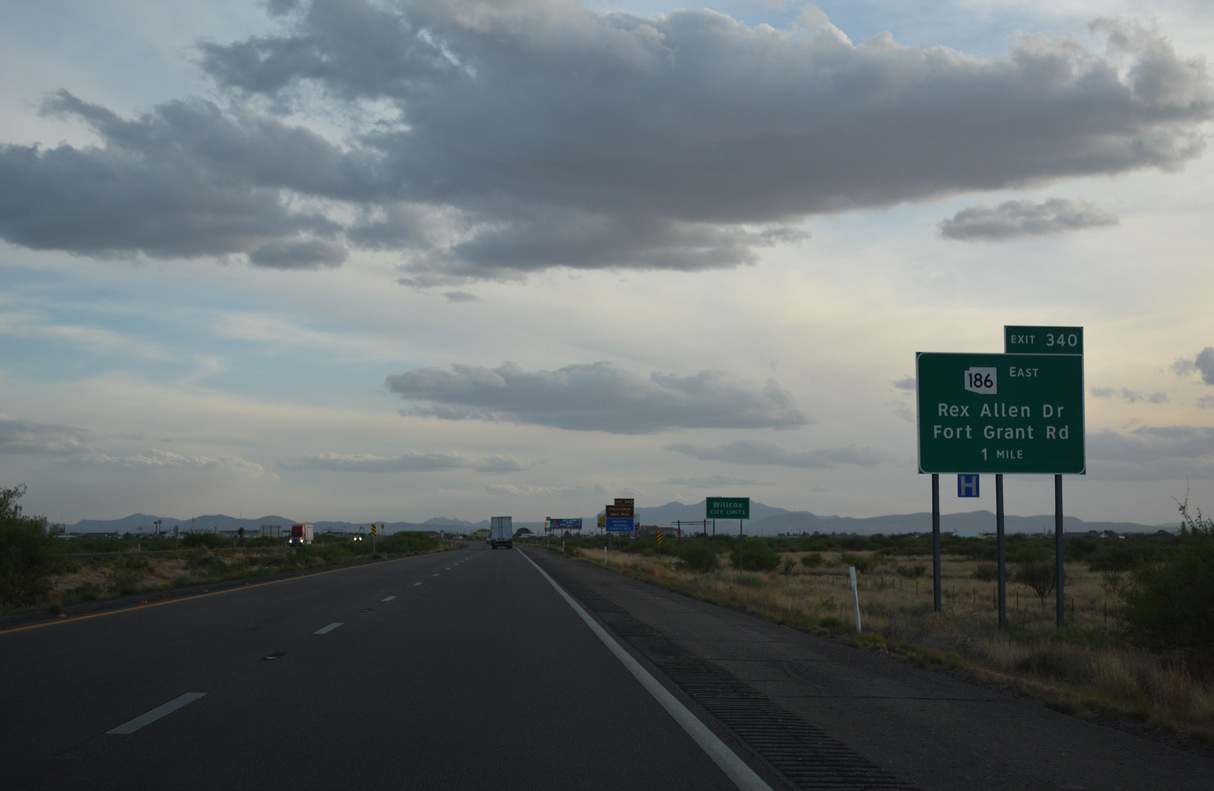
Exit 340 joins I-10/U.S. 191 with the west end of SR 186 (Rex Allen Drive) and Fort Grant Road north toward Bonita.
04/25/17

SR 186 was added to the state highway in 1956 to connect Willcox with Chiricahua National Monument. The state route was originally numbered as a branch of SR 86.
04/25/17

An array of traveler services line Rex Allen Drive east and Fort Grant Road west by the exchange at Exit 340.
04/25/17

SR 186 travels 33.39 miles overall from I-10/U.S. 191 to SR 181 west of Chiricahua National Monument.
04/25/17
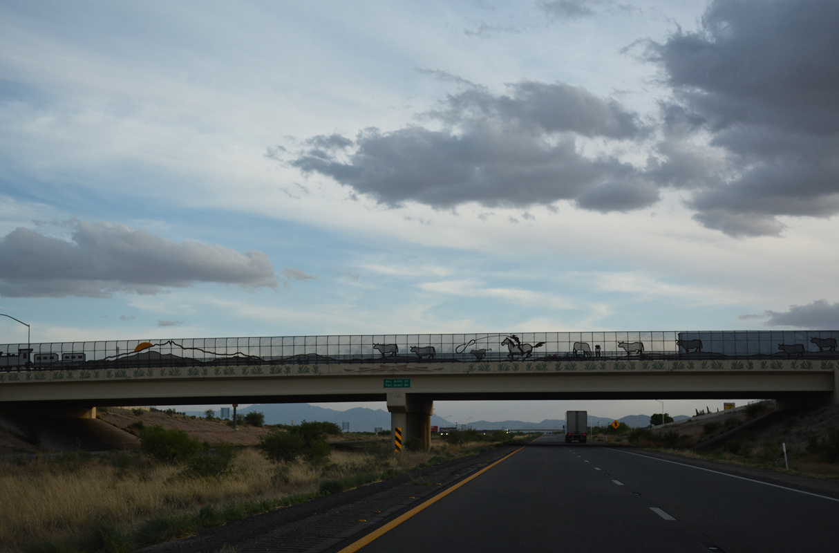
An elaborately decorated overpass for SR 186 (Rex Allen Drive) spans I-10/U.S. 191. The diamond interchange at Exit 340 was rebuilt in 2007.
04/25/17

ADOT recorded 17,148 vehicles per day along I-10/U.S. 191 west of Exit 340 in 2019.
04/25/17

U.S. 191 parts ways with Interstate 10 west eight miles beyond the Airport Road overpass at Willcox.
04/25/17
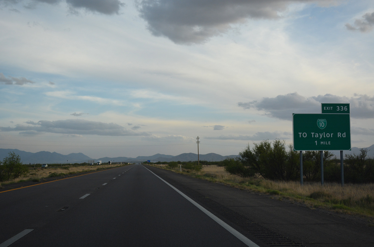
Business Loop I-10 continues 3.72 miles southwest from an overlap with SR 186 at Downtown Willcox to I-10/U.S. 191 at Taylor Road.
04/25/17
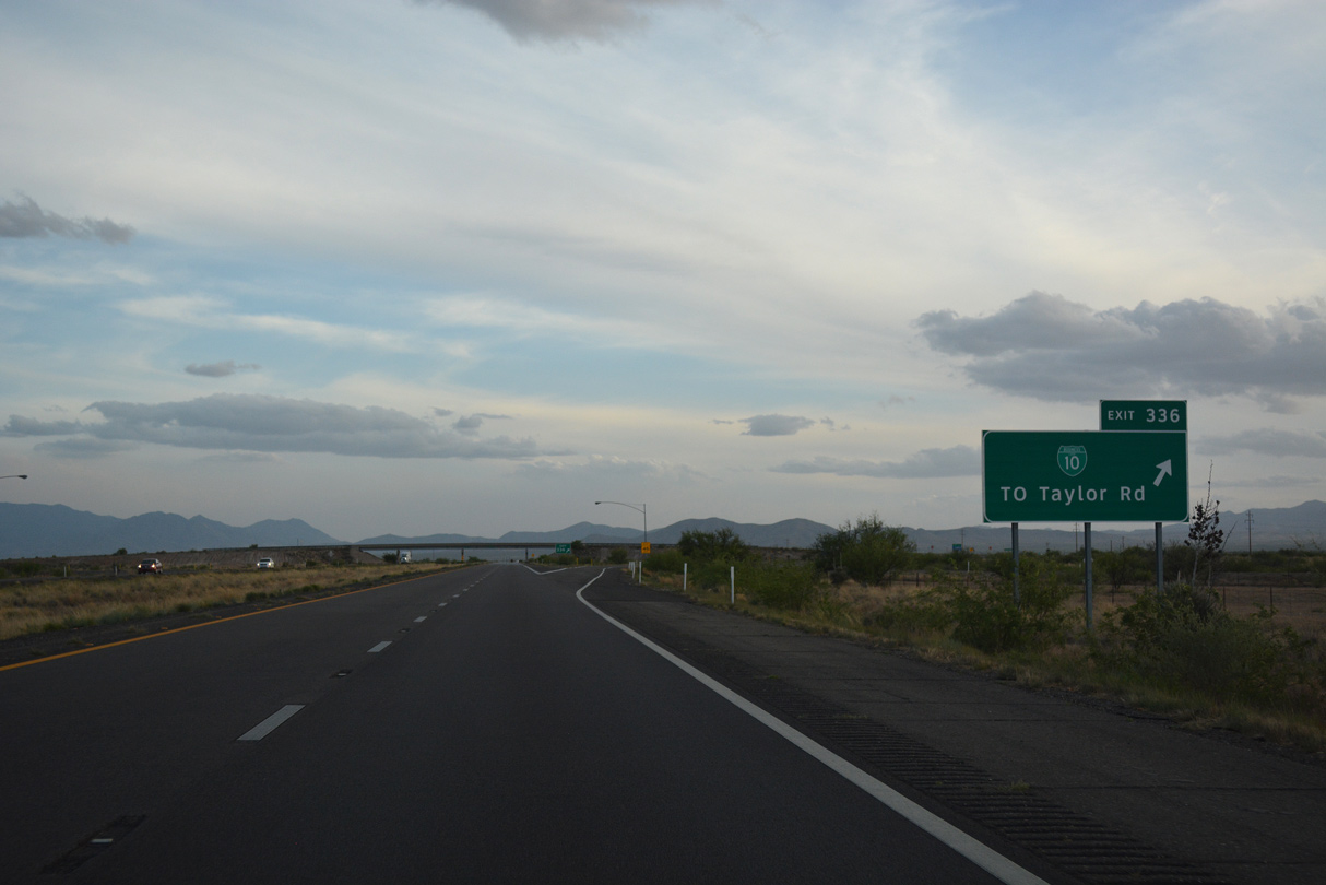
Taylor Road stems 3.98 miles north to Fort Grant Road from the diamond interchange (Exit 336) with Business Loop I-10 (Haskell Avenue) east.
04/25/17
Leaving Willcox, I-10/U.S. 191 bee line southwest past Willcox Playa.
04/25/17
The previous distance sign posted beyond Exit 336 referenced Benson at 31 miles and Tucson at 75 miles.
04/25/17
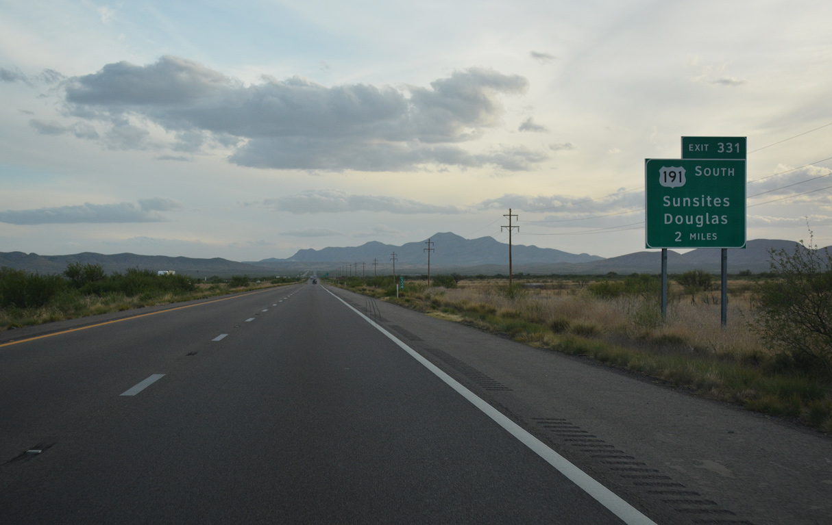
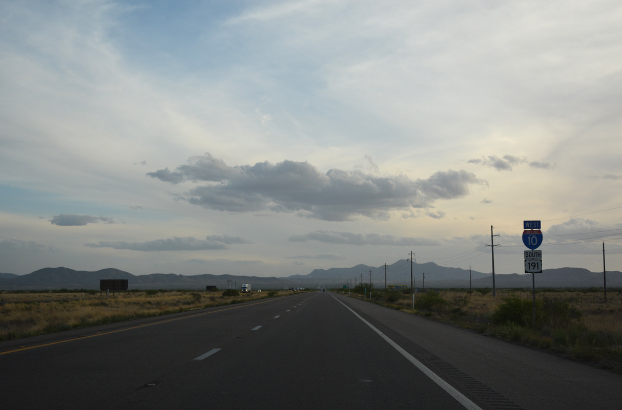
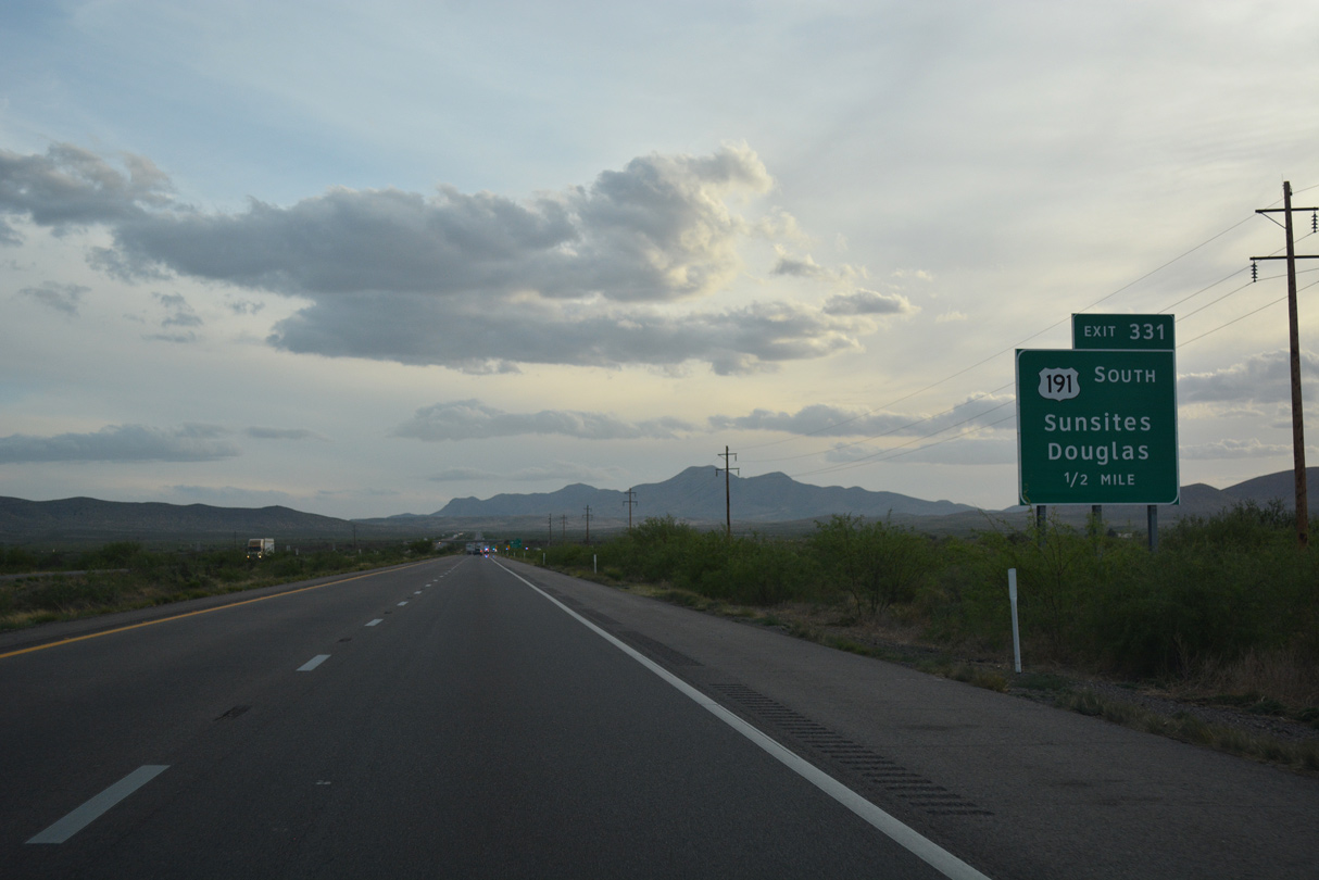
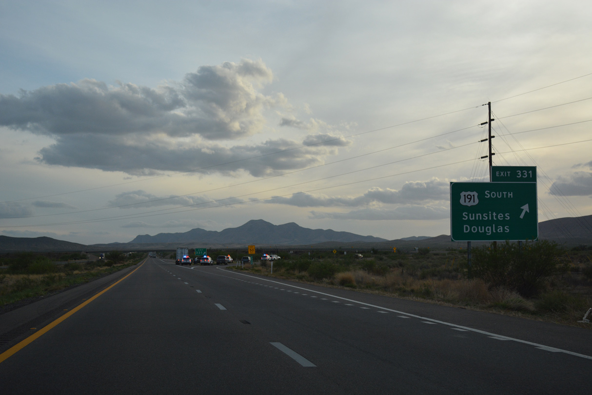
U.S. 191 separates from Interstate 10 west at a trumpet interchange (Exit 331) in two miles.
04/25/17
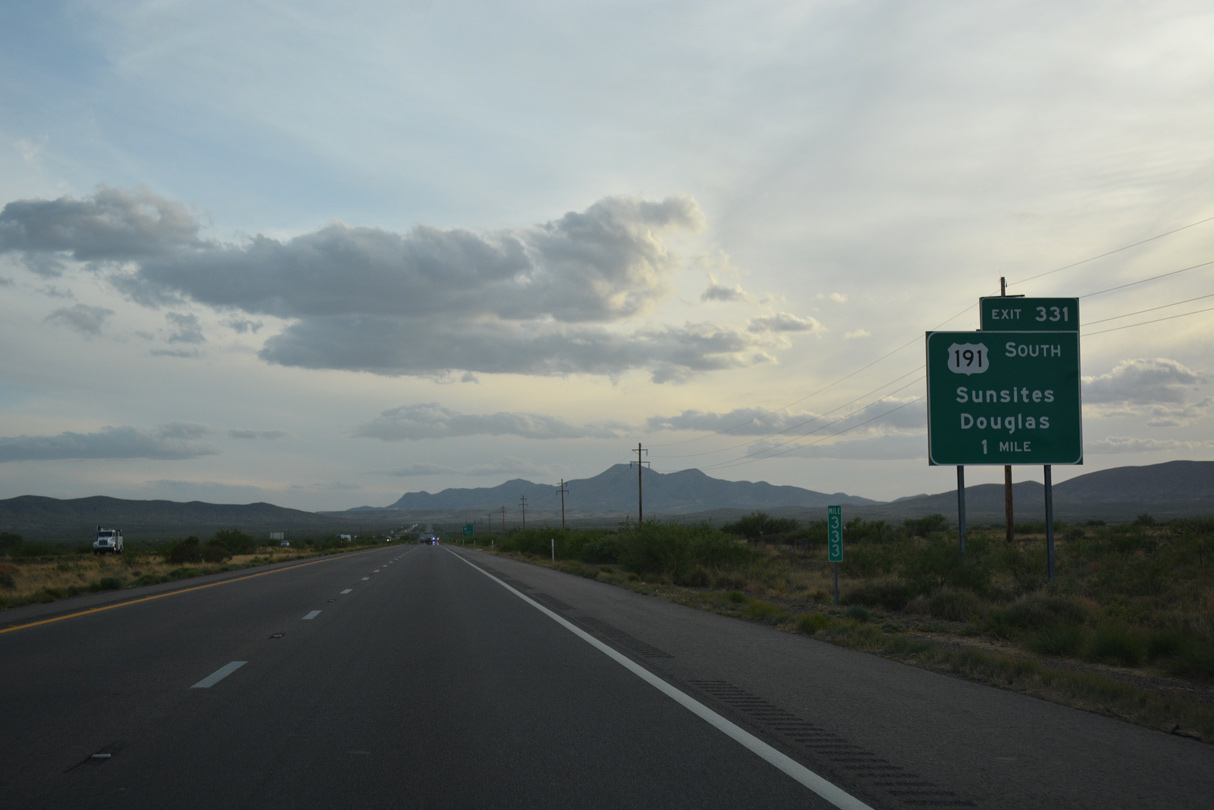
US 191 travels 67.25 miles south to SR 80 at Douglas, just north of the International border with Mexico. U.S. 666 along this stretch was rebranded as U.S. 191 in 1992 to offset negative cultural connotations and eliminate sign thefts.
04/25/17
U.S. 191 continues beyond Willcox Playa and Cochise to Sunsites, east of the Cochise Stronghold Campground in the Dragoon Mountains.
04/25/17
U.S. 191 continues to the south end of Sulphur Springs Valley via Elfrida and McNeal.
04/25/17
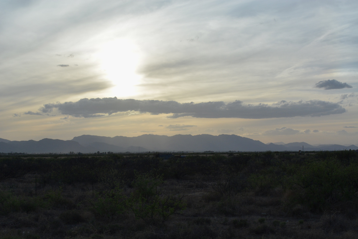
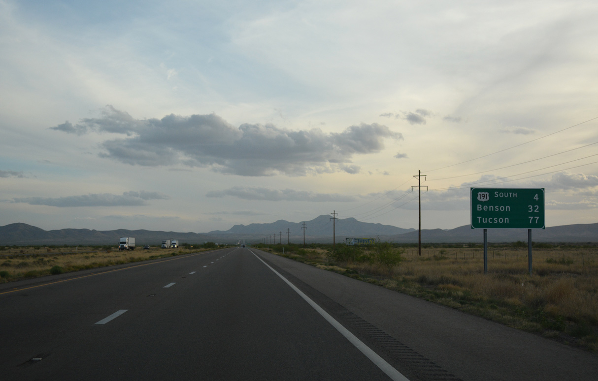
Interstate 10 continues southwest from U.S. 191 toward the distant Little Dragoon Mountains.
04/25/17
The Texas Canyon Rest Area lies ten miles ahead. A previous sign posted here listed Benson at 26 miles and Tucson at 70 miles.
04/25/17
Interstate 10 west advances across Walnut Gap west of the Gunnison Hills.
04/25/17
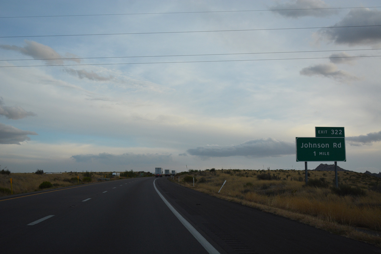
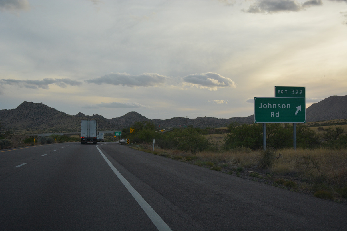
Bowlin's "The Thing" Travel Center lies just off Exit 322 along Johnson Road. Advertised by numerous billboards, The THING? opened in 1965, after being displaced from old U.S. 91 in California. The exhibit is probably one of the most infamous roadside tourist traps/curio shops remaining along the Interstate Highway system.
04/25/17
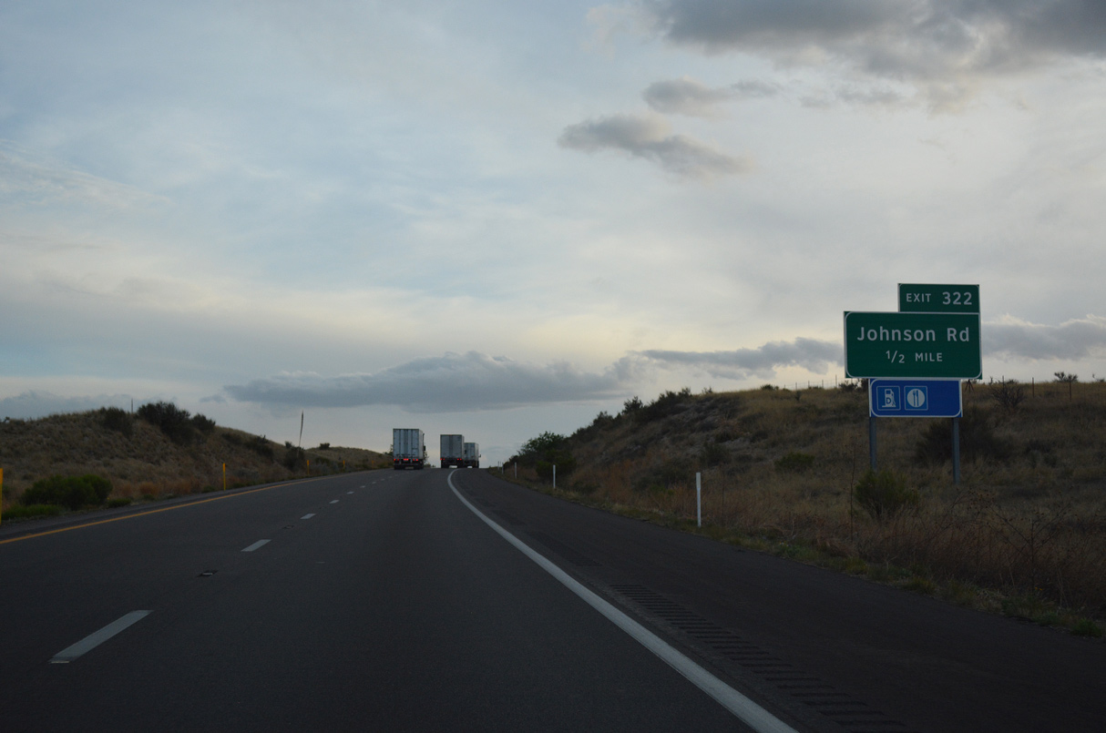
Johnson Road meets Interstate 10 at a diamond interchange (Exit 322).
04/25/17
West from Johnson Road, Interstate 10 crosses Big Draw.
04/25/17

The Texas Canyon Rest Area lies midway between milepost 321 and 320.
04/25/17
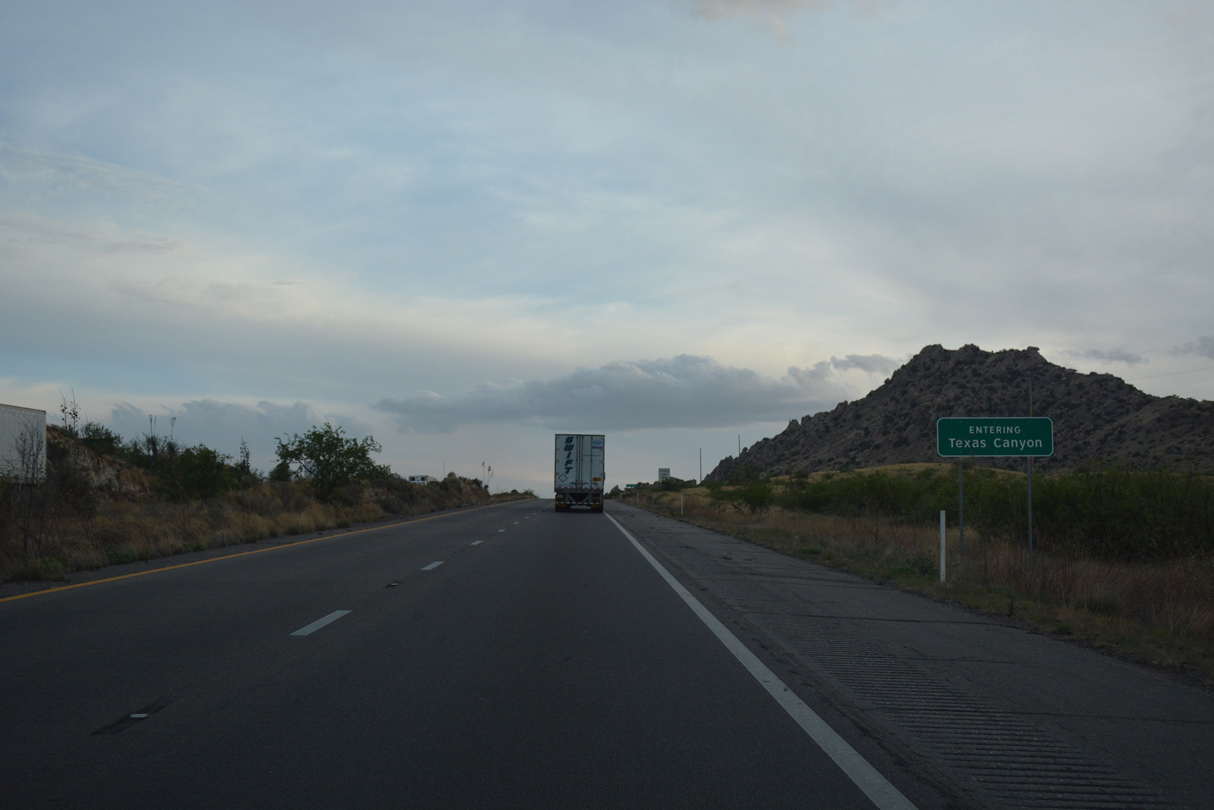
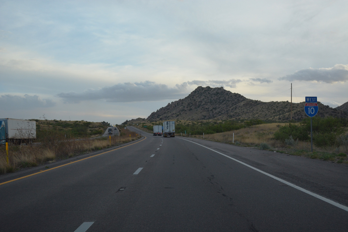
Interstate 10 ascends from the high plains around Willcox to the San Pedro Valley and Benson through Texas Canyon. The rocky canyon is named for being on the road to Texas.
04/25/17

I-10 reaches Texas Summit at 4,974 feet above sea level just ahead of the Texas Canyon Rest Area. The succeeding rest area is after Casa Grande, 138 miles away.
04/25/17
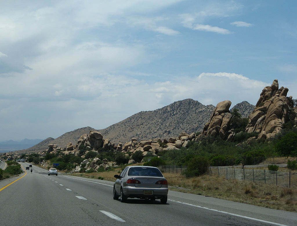
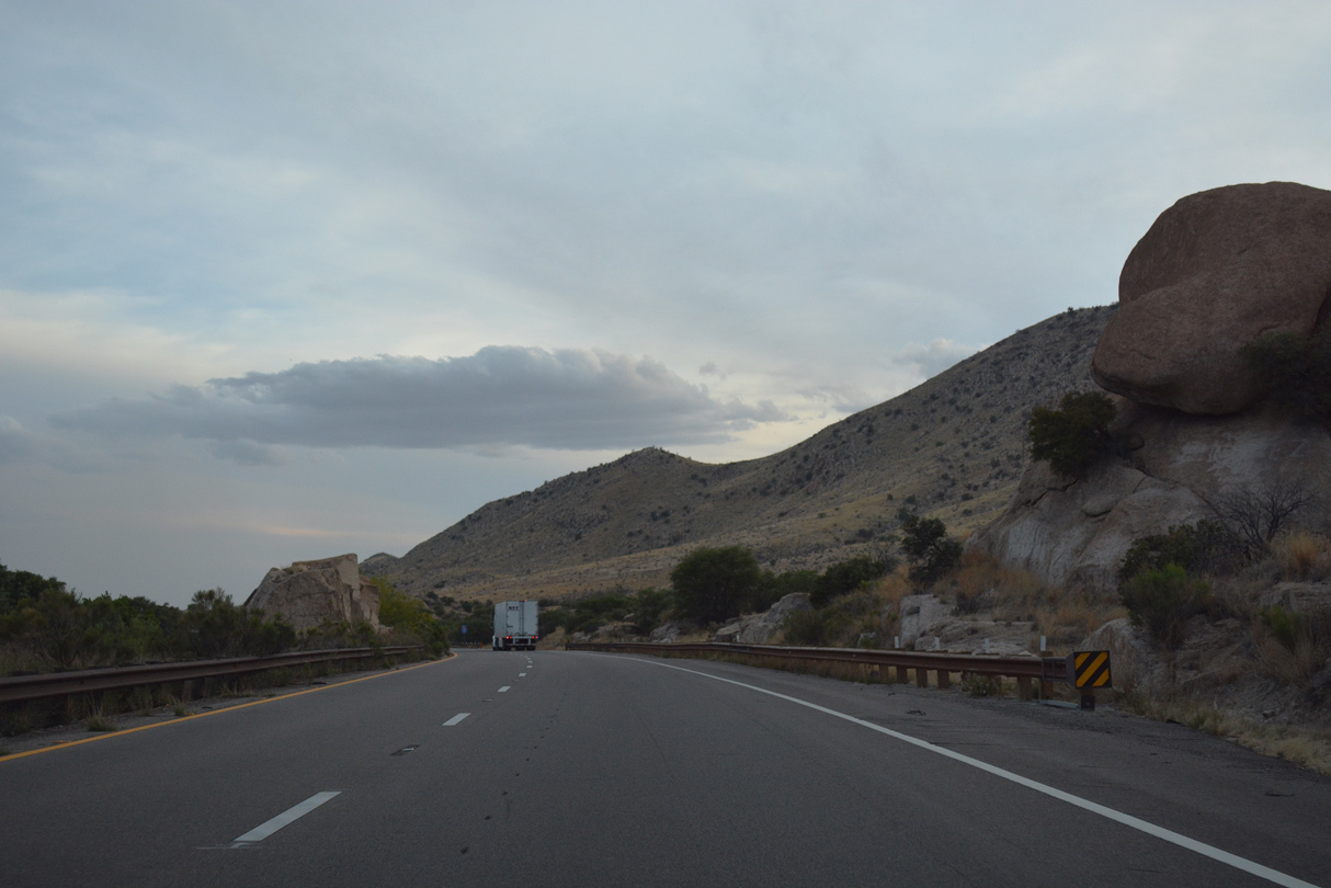
Interstate 10 weaves through Texas Canyon by a series of hills strewn with boulders.
06/15/08
04/25/17
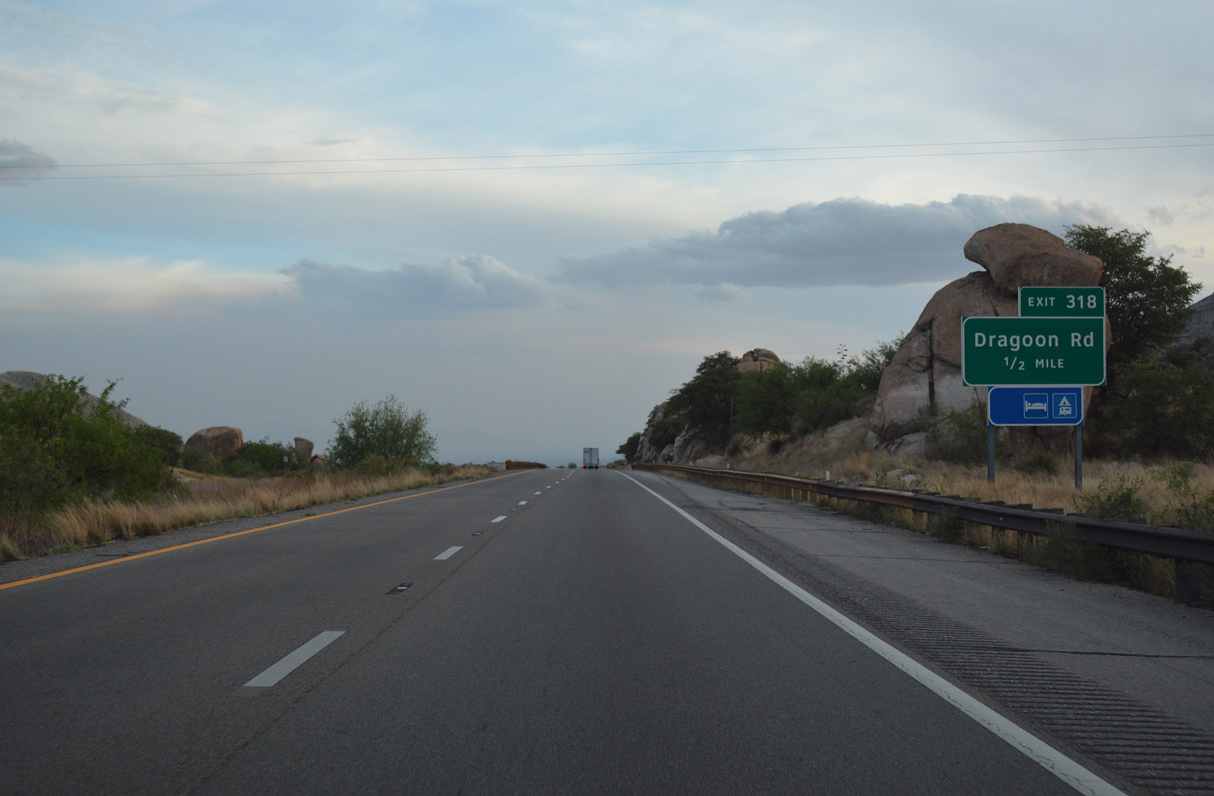
Dragoon Road runs 3.76 miles west from the unincorporated community of Dragoon to the trumpet interchange at Exit 318.
04/25/17
Interstate 10 winds south of Adams Peak.
04/25/17
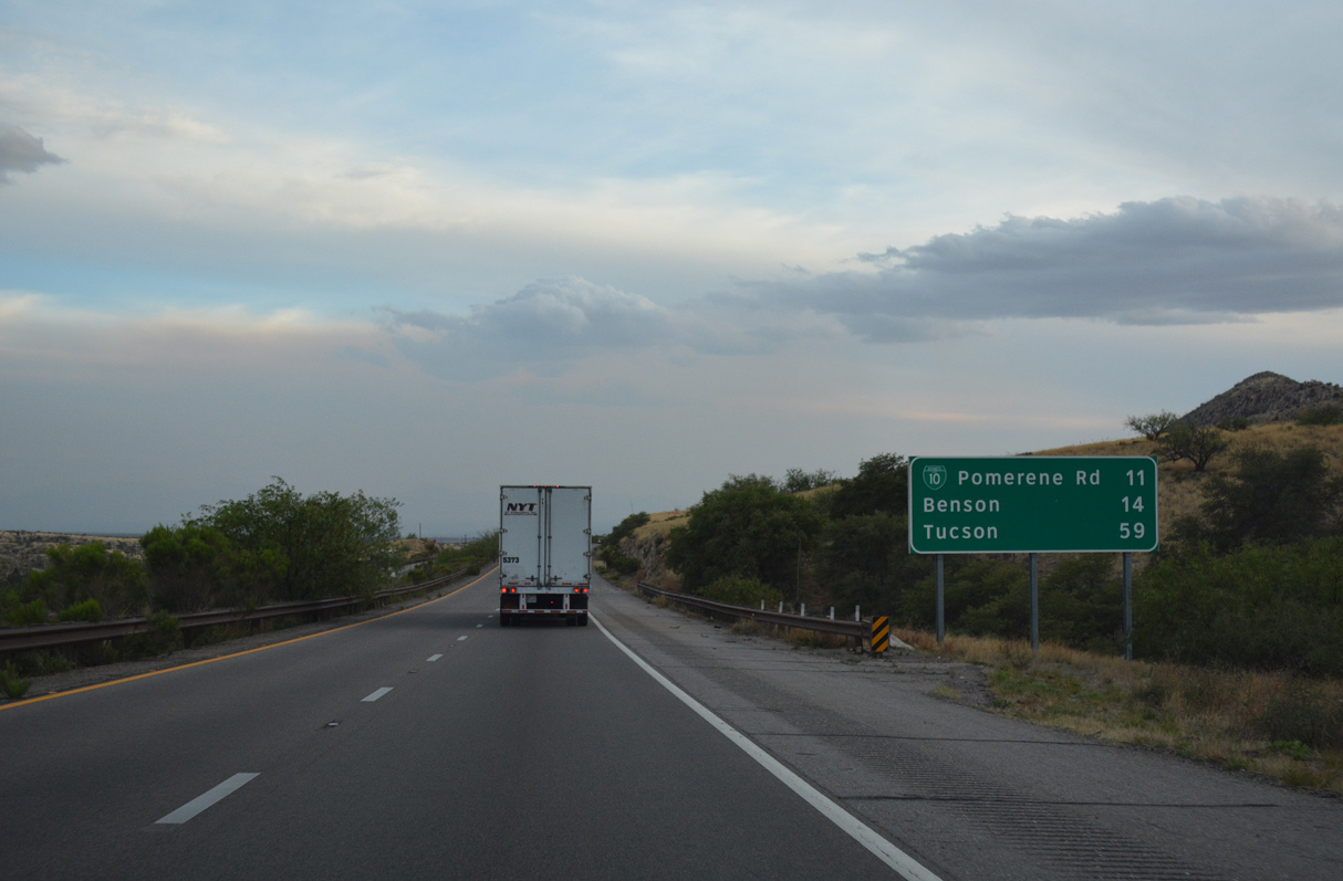
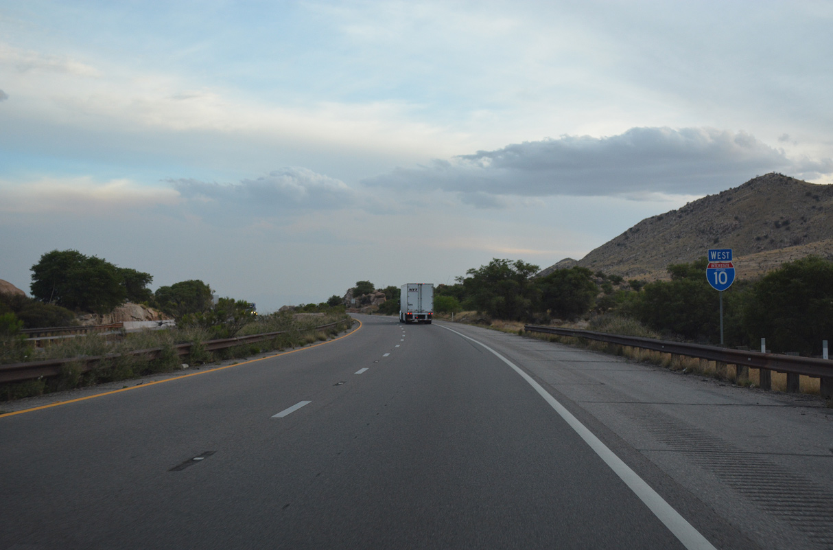
The first of four exits for Benson from Interstate 10 westbound is with Business Loop I-10 at Pomerene Road in 11 miles.
04/25/17
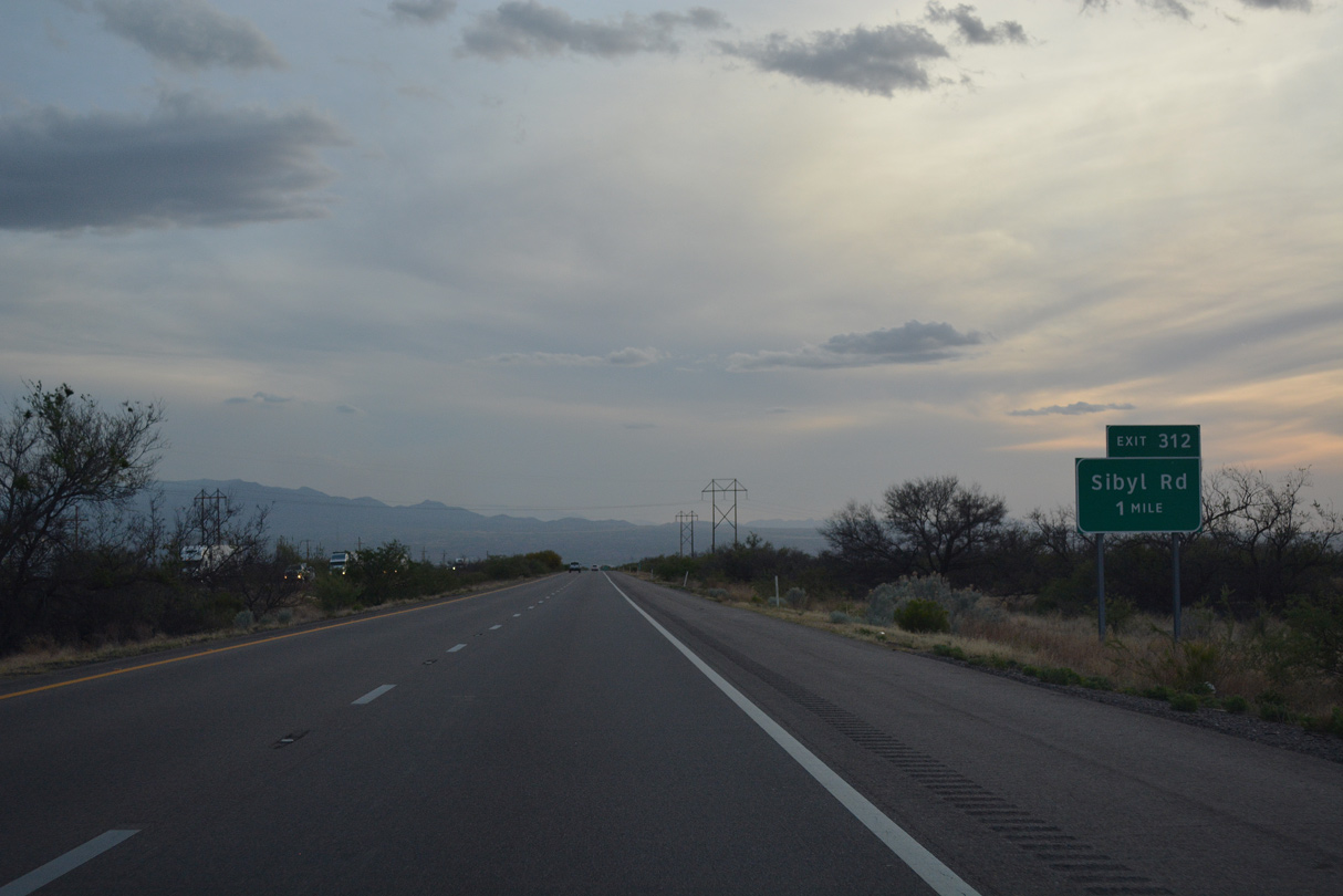
Leaving Texas Canyon, Interstate 10 advances southwest to a ranch exit at Sibyl Road.
04/25/17
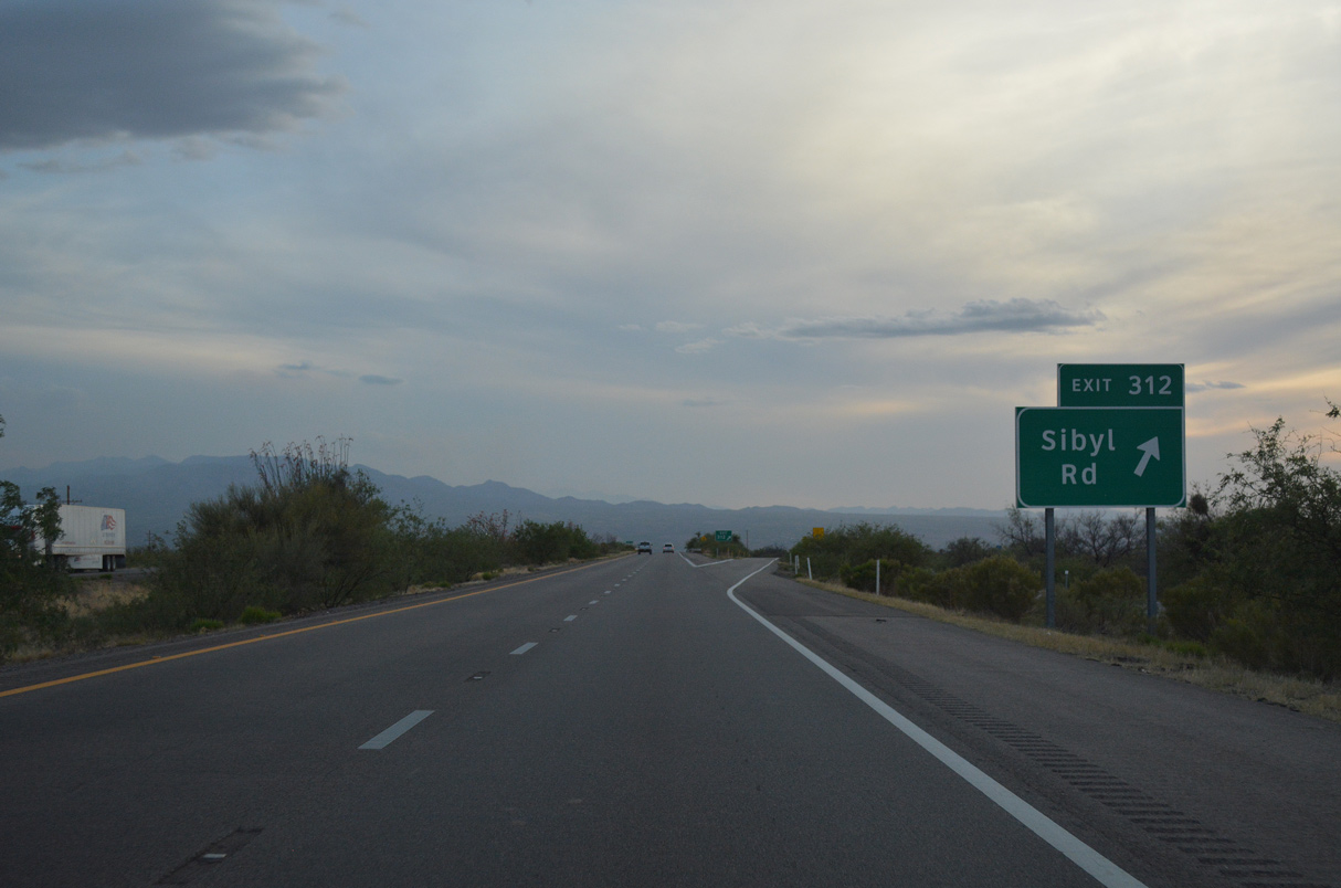
Interstate 10 west at the diamond interchange (Exit 312) with Sibyl Road. A Stuckeys was formerly located here.
04/25/17

Photo Credits:
- Kevin Trinkle: 06/15/08
- ABRoads: 04/25/17
Connect with:
Page Updated Tuesday April 12, 2022.