
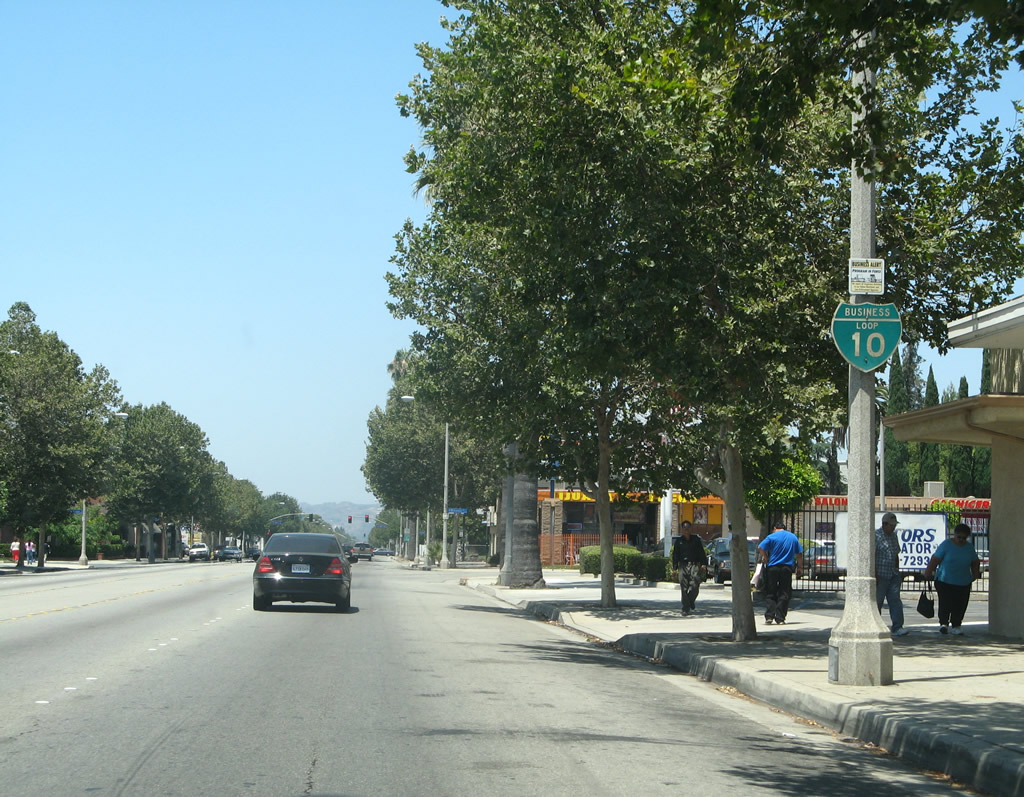
Business Loop I-10 - Pomona and Ontario

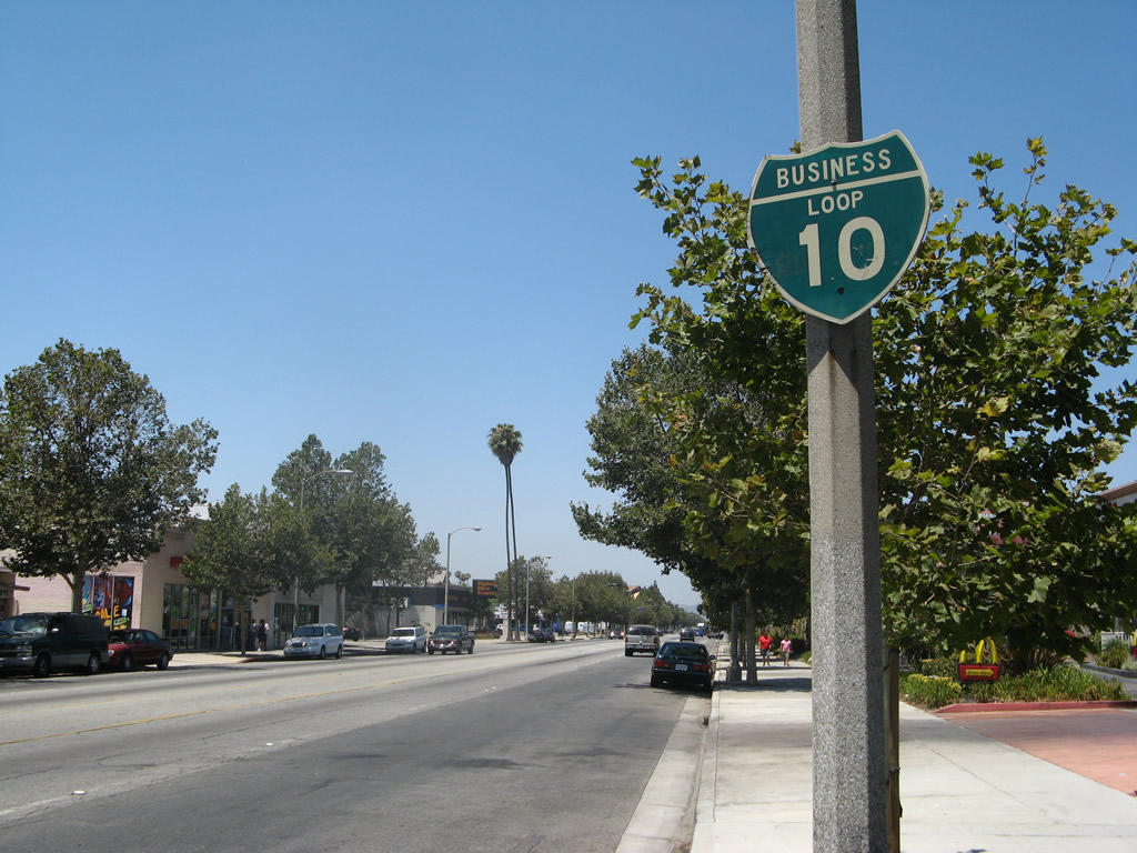
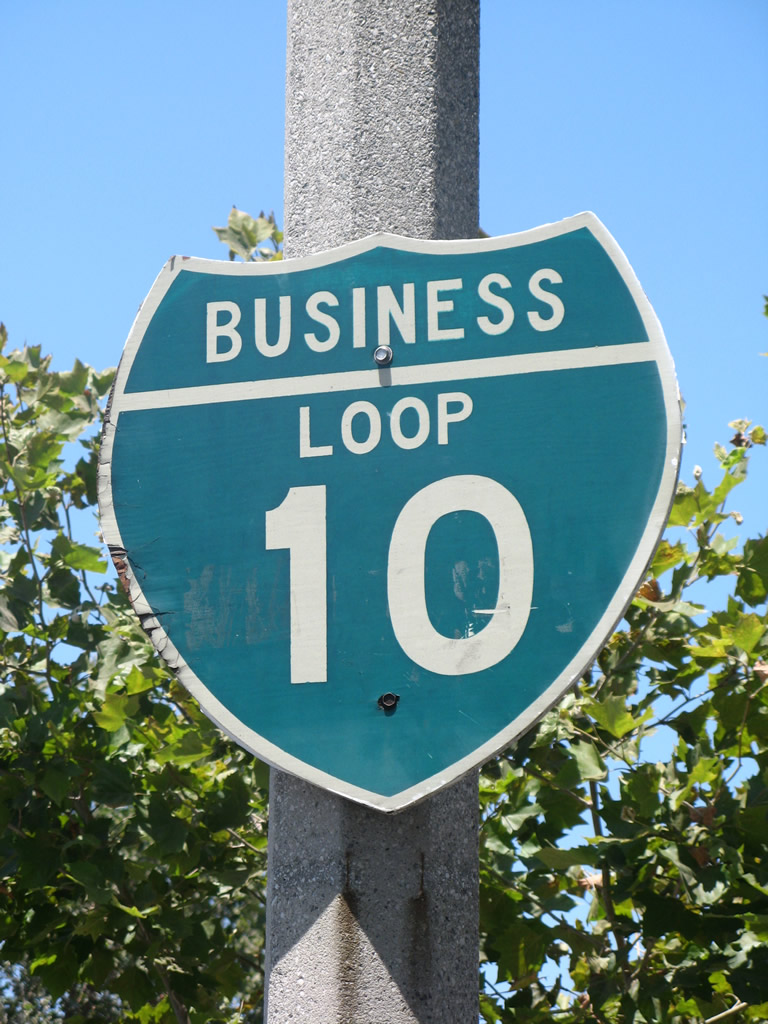
This loop for the most part does not exist anymore, although some remnant signs are still posted as of 2024. Signed as Business Loop I-10 in the 1960s along Holt Boulevard, the designation replace what was formerly U.S. 70-99 Business. The loop began at the Kellogg Interchange, where I-10, SR 57 and SR 71 converge in Pomona at the San Jose Hills. The route branched southeast from I-10 onto Holt Avenue, which runs east through Pomona to Montclair. Holt Boulevard continues the route across Montclair into Ontario. The loop returned to I-10 north of Ontario International Airport (ONT).
An email from May 1, 2001 from Ali Pezeshkpour adds more on remaining signage for Business Loop I-10:
The business shields are only found in Pomona, and even though I have desperately tried to find some sign that would point to a business route, I have found none on California 71 or Interstate 10. The interchanges with these freeways are not optimal, because first of all, only Westbound Interstate 10 can access Holt Boulevard, and only Eastbound Holt Boulevard can access Eastbound Interstate 10, which allows for minimum signage even for Holt Boulevard. [At] the California 71 interchange no signs are here for any loop either. The loop shields were continuous until California 71. The reason I suspect the shields are only in Pomona is because Pomona is Los Angeles County and Ontario and beyond is in San Bernardino County" or in a different city. There are no signs for this business route from mainline Interstate 10.
The city of Ontario had a population of 170,373 as of the 2000 Census and 175,265 as of the 2020 Census. The city is known for Ontario Mills, the largest shopping mall in Southern California. Many visitors to Ontario use the regional Ontario International Airport (ONT) which has nationwide service and can be a less stressful airport connection for people of the Inland Empire than using Los Angeles International Airport (LAX). Ontario has a warm climate (average median temperature is 83 degrees with 16 inches of precipitation annually) and low elevation (925 feet).
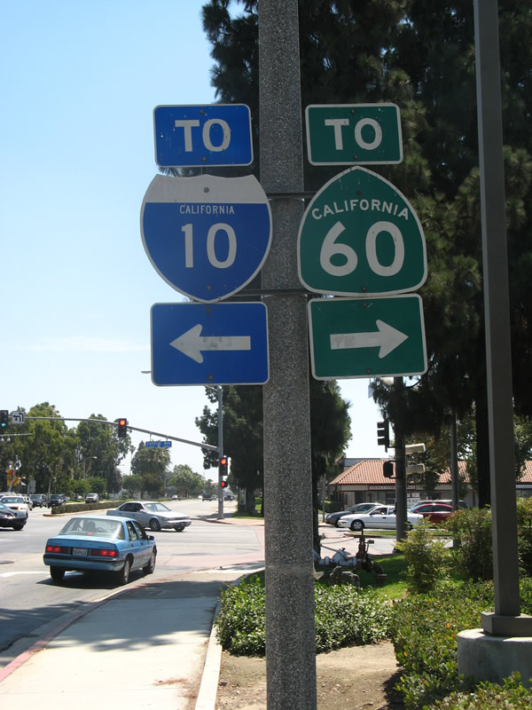
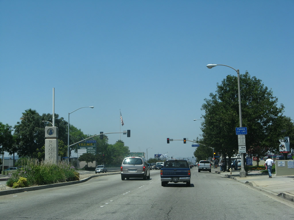
Pomona was home to 149,473 people as of the 2000 Census and 151,713 as of the 2020 Census. The city was incorporated on January 6, 1888. Pomona is one of the larger cities in Los Angeles County and is the convergence point of several freeways, including Interstate 10, SR 57, SR 60 and SR 71.
A major signalized intersection on Holt Boulevard east in Montclair is with Central Avenue. Central Avenue heads north to Interstate 10 at Exit 49 near Montclair Plaz and south to connect with SR 60 at Exit 33.
07/15/07
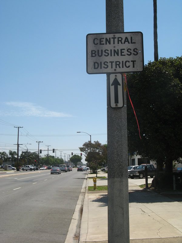
Replaced by 2011 and subsequently removed due to road construction in 2021, a "Central Business District" sign preceded Mountain Avenue along Holt Boulevard eastbound. Mountain Avenue crosses over the Union Pacific Railroad and State Street south of Brooks Street on a viaduct.
07/15/07
Holt Boulevard west of SR 83 (Euclid Avenue) in Downtown Ontario.
07/15/07
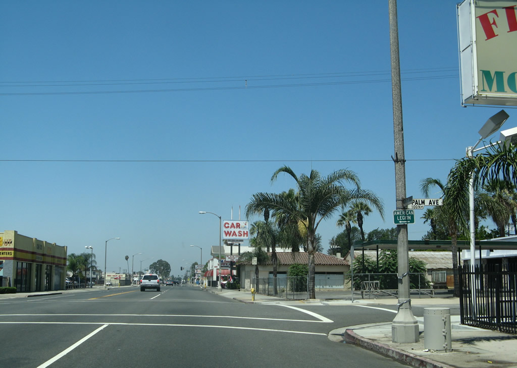
Westbound Holt Boulevard (Business Loop I-10 / old U.S. 70-99) at Palm Avenue.
07/15/07
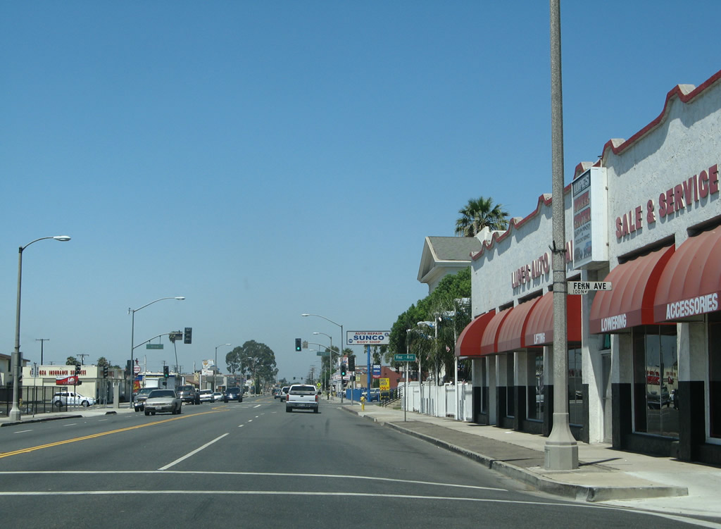
Passing Fern Avenue, Holt Boulevard accommodates four through lanes as well as parking and turn pockets.
07/15/07
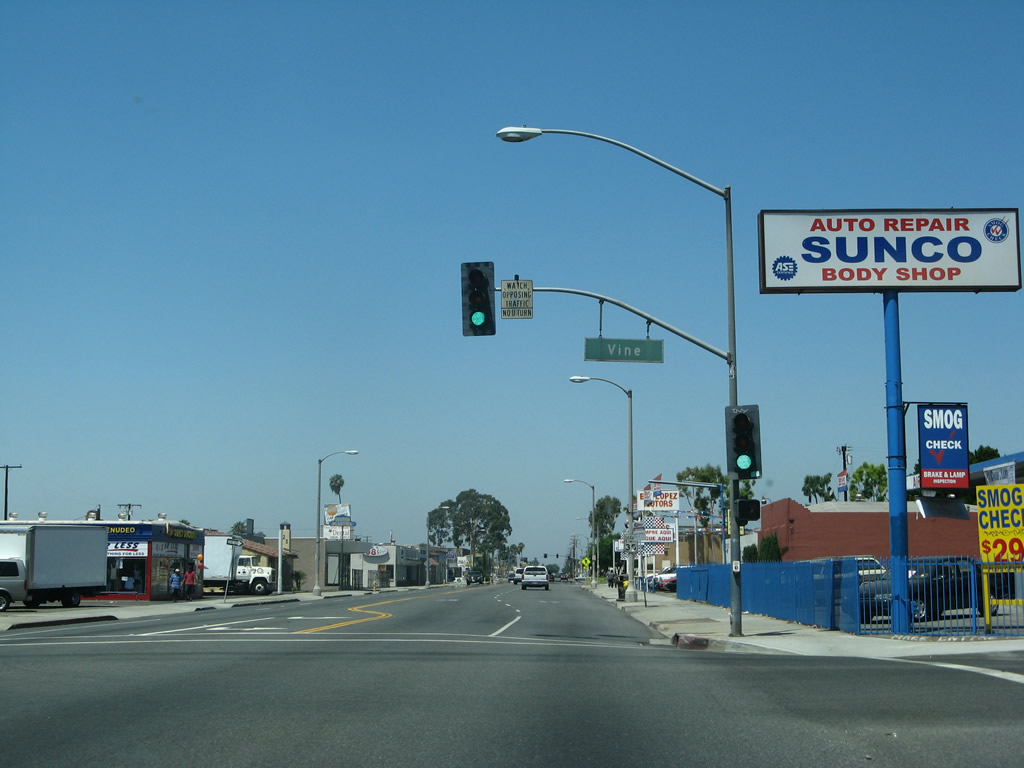
Westbound Business Loop I-10 (Holt Boulevard) intersects Vine Avenue at this traffic signal.
07/15/07
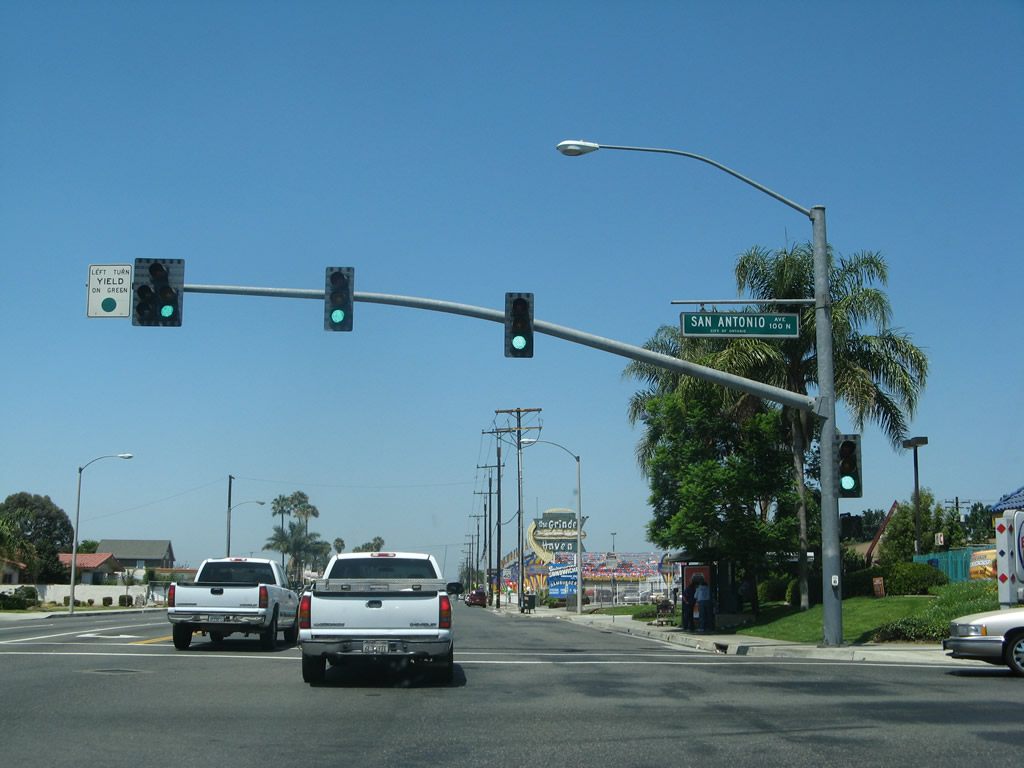
The next traffic signal along westbound Business Loop I-10 (Holt Boulevard) is with San Antonio Avenue. Ontario Village shopping plaza is located on the northeast corner of this intersection. South of Holt Boulevard, San Antonio Avenue crosses the Union Pacific Railroad ahead of residential areas to Francis Street east of Ontario High School.
07/15/07
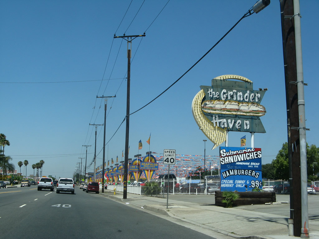
A vintage sign for what was the Grinder Haven restaurant west of San Antonio Avenue.
07/15/07
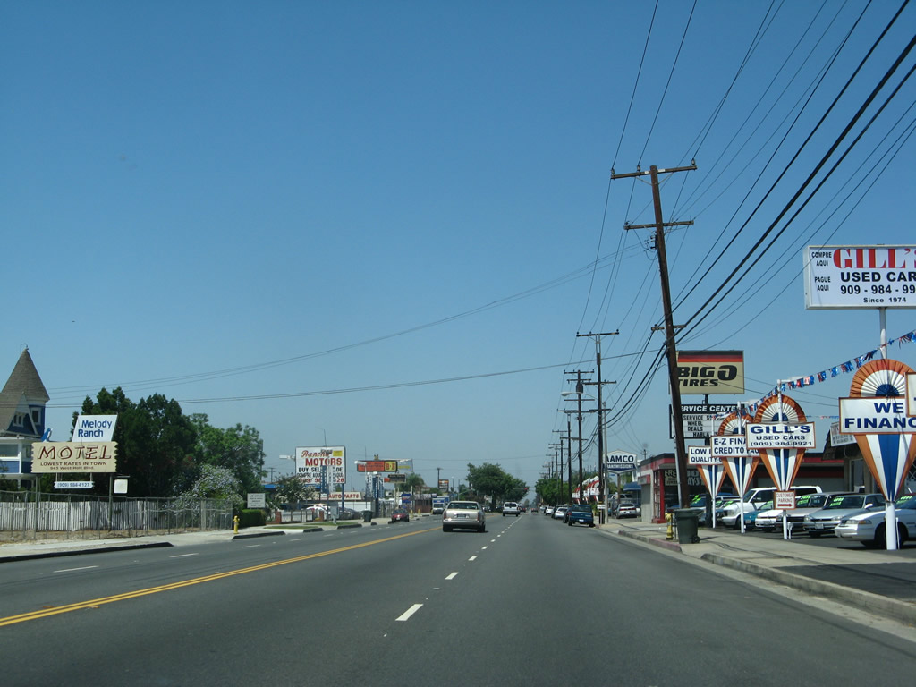
Car dealerships, auto parts stores, and strip malls line this stretch of Holt Boulevard.
07/15/07
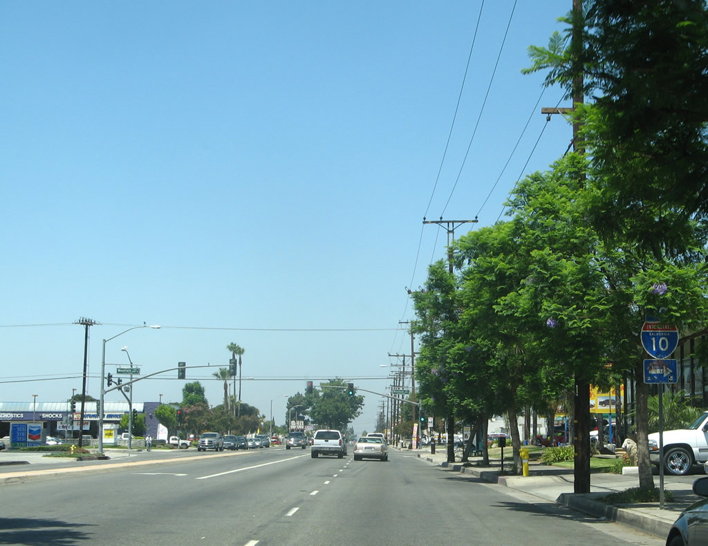
Forthcoming Mountain Avenue leads north to Interstate 10 (San Bernardino Freeway) and south to SR 60 (Pomona Freeway).
07/15/07
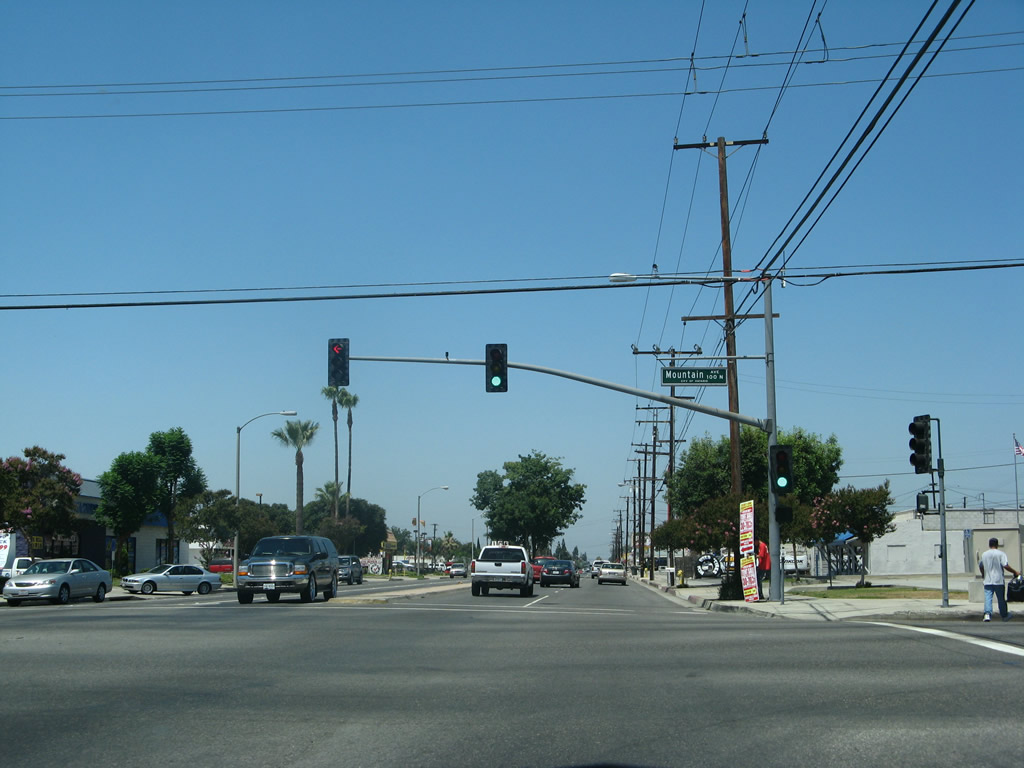
Westbound Business Loop I-10 (Holt Boulevard) intersect Mountain Avenue at this traffic signal.
07/15/07
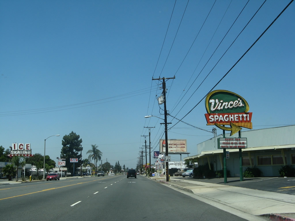
Holt Boulevard transitions into a five lane boulevard west of Mountain Avenue by Vince's Spaghetti and an ice skating rink, both of which are identified by older marquee signs.
07/15/07
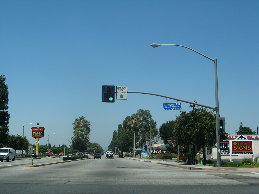
Westbound Business Loop I-10 (Holt Boulevard) leaves Ontario and enters the city of Montclair at Benson Avenue. The population of Montclair was 33,049 as of the 2000 Census, and the city incorporated on April 25, 1956.
07/15/07
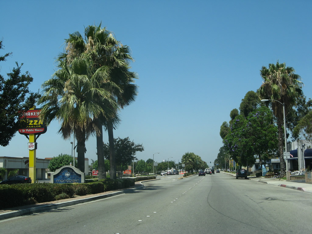
A Montclair welcome monument sign is placed in the planted and landscaped median. The business loop, which has no reassrance shields in Montclair, continues west along Holt Boulevard.
07/15/07
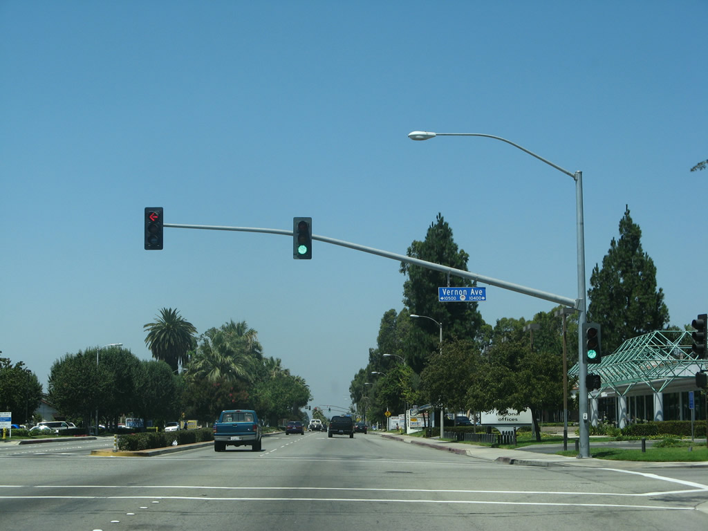
Westbound Business Loop I-10 (Holt Boulevard) meets Vernon Avenue at this traffic signal.
07/15/07
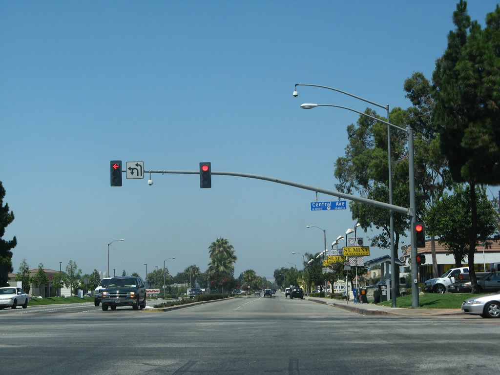
Central Avenue runs north from Holt Boulevard to Interstate 10 at Exit 49 near Montclair Plaza. Southward, Central Avenue connects with SR 60 at Exit 33.
07/15/07
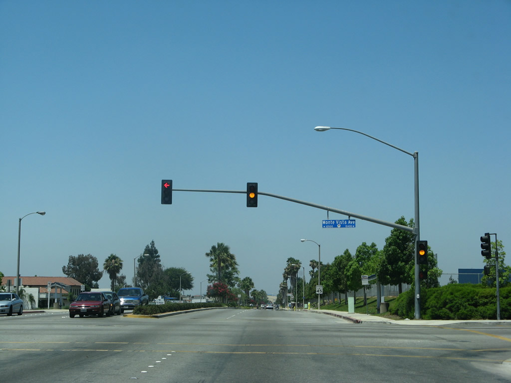
Westbound Business Loop I-10 (Holt Boulevard) meets Monte Vista Avenue at this intersection.
07/15/07
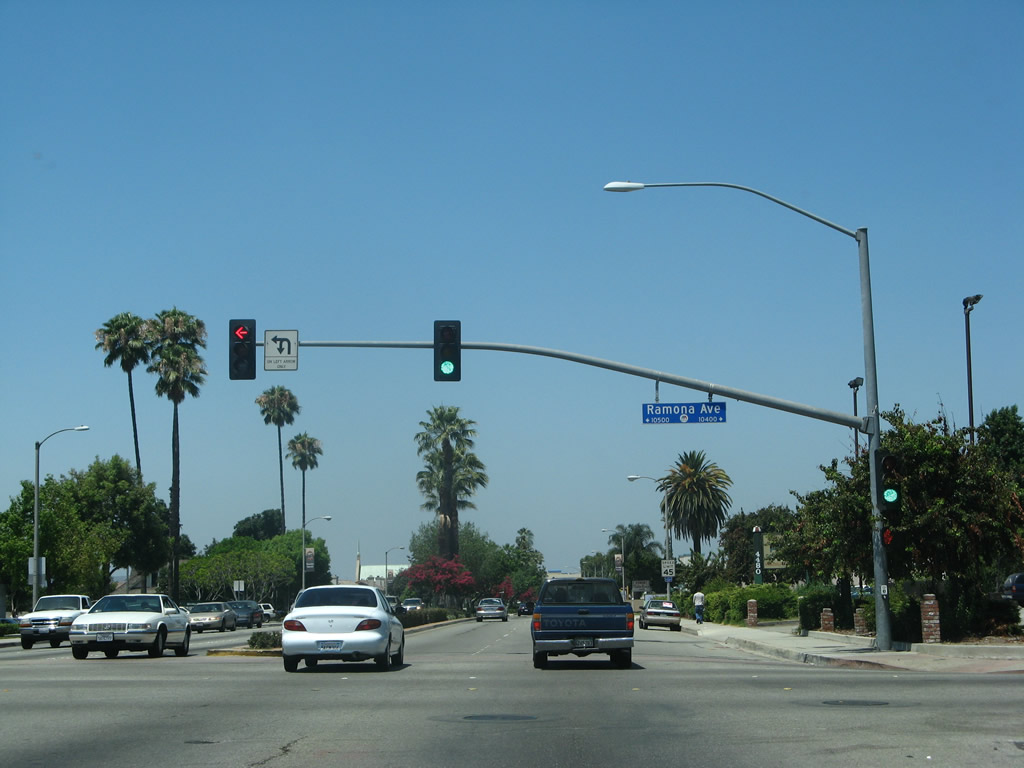
Ramona Avenue leads south from Holt Boulevard and Montclair to the city of Chino and SR 60 (Pomona Freeway) at Exit 32.
07/15/07
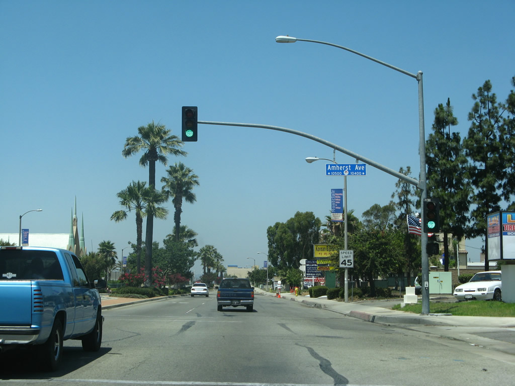
Westbound Business Loop I-10 (Holt Boulevard) meets Amherst Avenue at this intersection.
07/15/07
With divoted curbing and old concrete bridge rail, a 1939 bridge takes Business Loop I-10 (Holt Boulevard) over San Antonio Channel. This bridge was originally in service as part of U.S. 70-99.
07/15/07
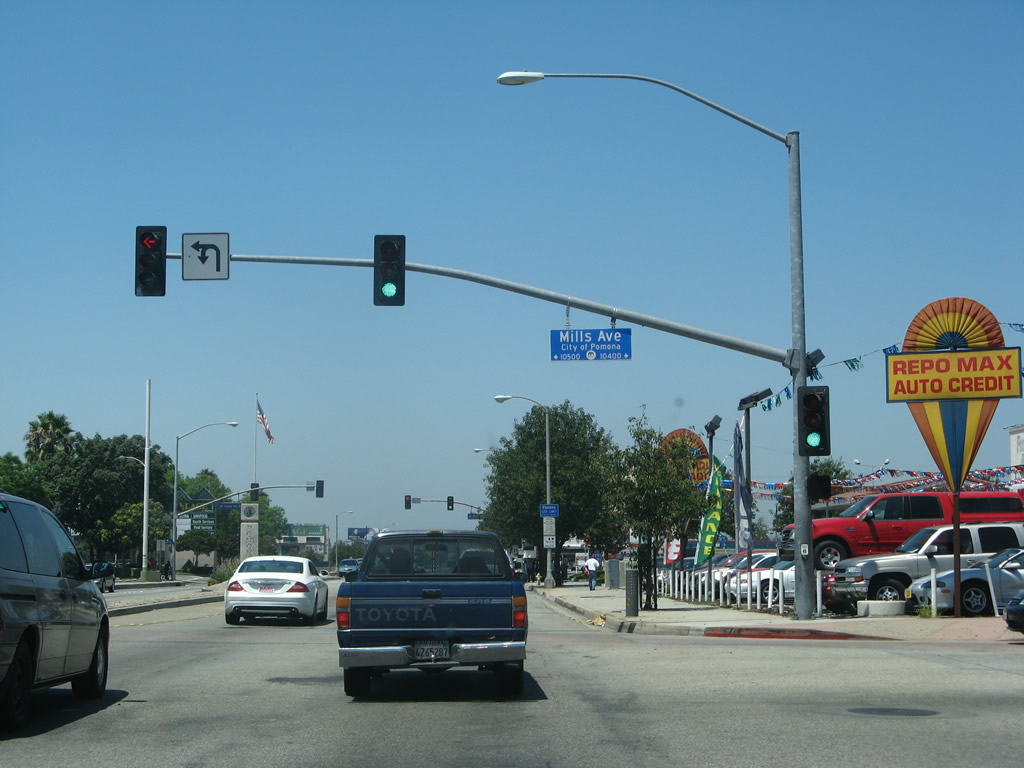
Holt Boulevard leaves Montclair and becomes Holt Avenue where the old route enters the city of Pomona in Los Angeles County. This intersection is with Mills Avenue, which travels north along the Los Angeles-San Bernardino County Line between Pomona/Claremont and Montclair.
07/15/07
Holt Avenue continues west into the Pomona business district.
07/15/07
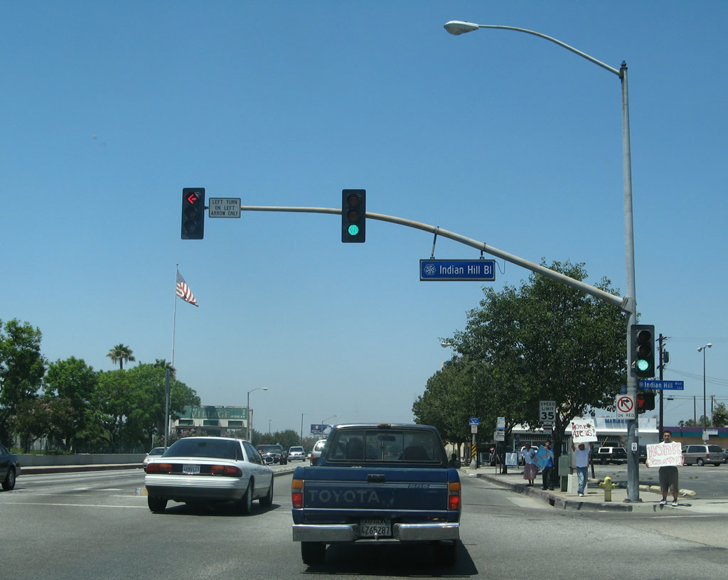
Westbound Business Loop I-10 meets Indian Hill Boulevard at this traffic signal. The city of Pomona uses a blue street sign design as compared to the green design found in Montclair.
07/15/07
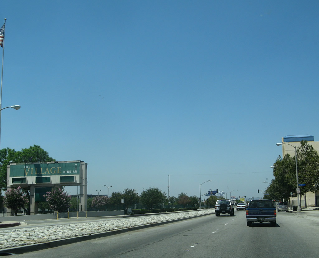
The Village at Indian Hill education conference center lines the south side of Holt Avenue along this stretch. The Village is described as "a specialized mixed-use facility designed to support K-12 teaching and learning, proessional development and parent education." This former mall was acquired by the school district in 1995 and recreated into a learning center.
07/15/07
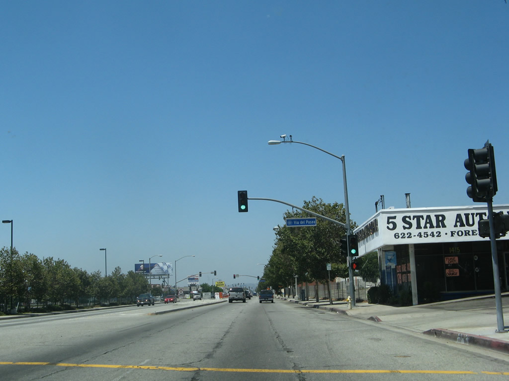
Westbound Business Loop I-10 (Holt Avenue) meets Via del Paseo at this traffic signal.
07/15/07

The next signalized intersection is with East End Avenue.
07/15/07
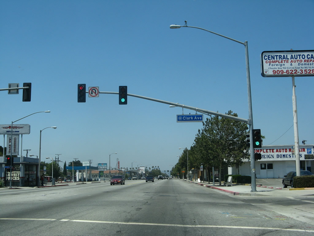
Westbound Business Loop I-10 (Holt Avenue) meets Clark Avenue at this traffic signal.
07/15/07
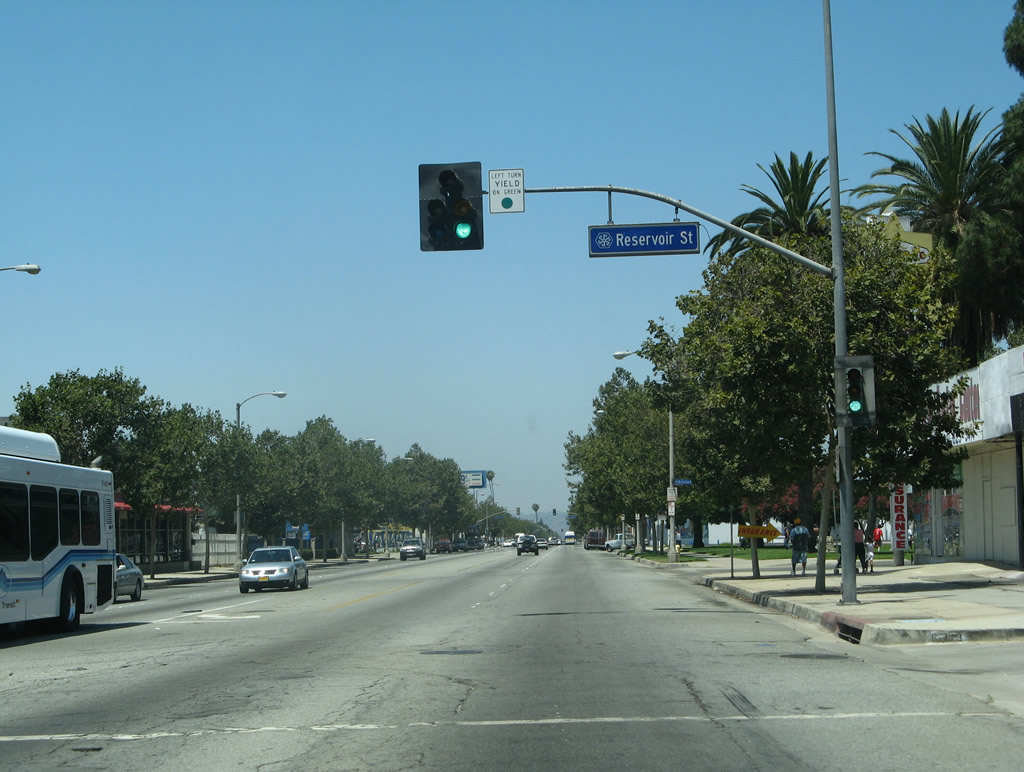
The next signalized intersection along westbound Business Loop I-10 (Holt Avenue) is with Reservoir Street.
07/15/07
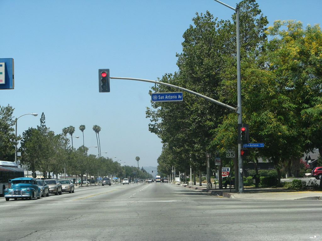
The succeeding traffic light on westbound Business Loop I-10 (Holt Avenue) is with San Antonio Avenue.
07/15/07
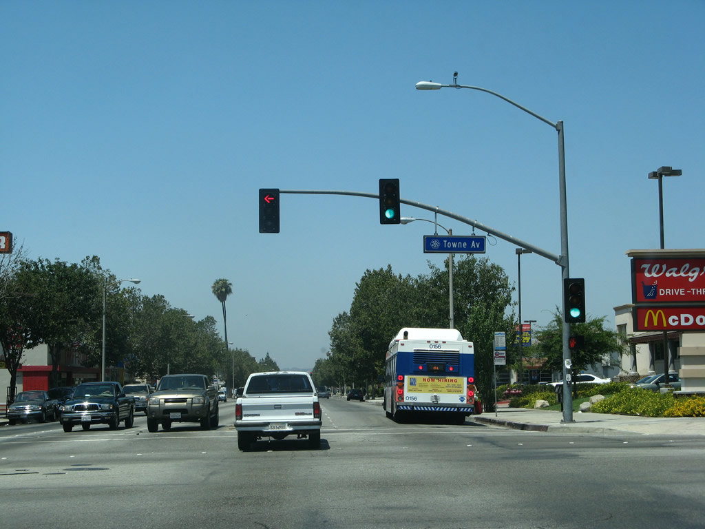
Holt Avenue advances west to Pomona's antique row, arts colony, transit center, Western University, and civic center. Towne Avenue runs south to SR 71 (Chino Valley Freeway) and north to Interstate 10 at Exit 48 and the city of Claremont.
07/15/07
The first reassurance shield for Business Loop I-10 west appears on westbound Holt Avenue after Towne Avenuen. This old sign is wooden, a rarity in California.
07/15/07
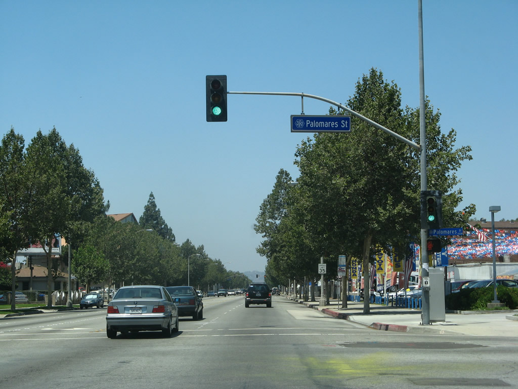
The next signalized intersection along westbound Business Loop I-10 (Holt Avenue) is with Palomares Street.
07/15/07
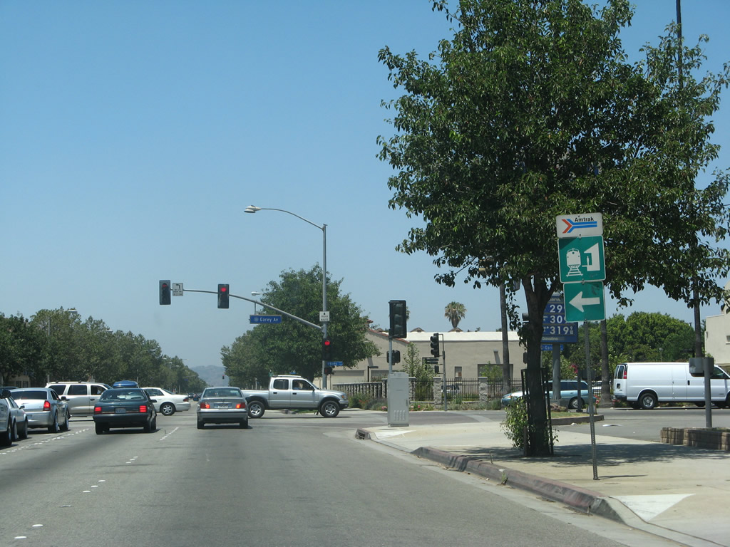
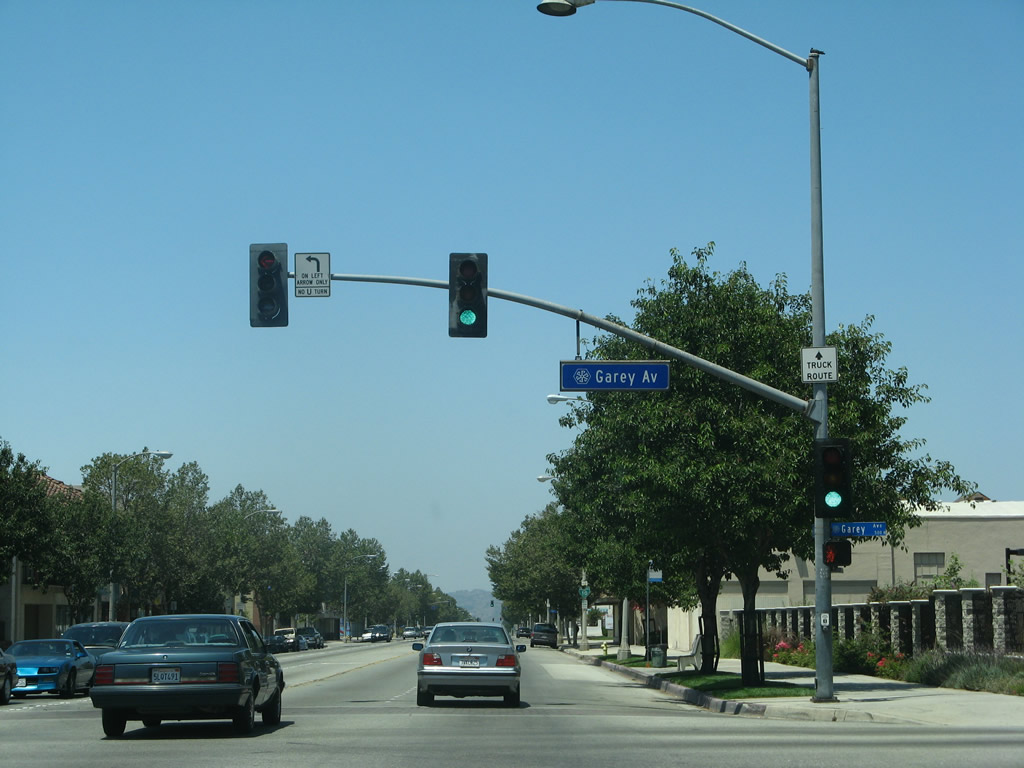
Garey Avenue leads to the Amtrak and Metrolink rail station. Both passenger rails run along the Union Pacific Railroad, which parallels Holt Avenue to the south.
07/15/07
Garey Avenue is the former alignment of SR 71. Garey Avenue south connects with SR 71 and north with Interstate 10 at Exit 46 B.
07/15/07
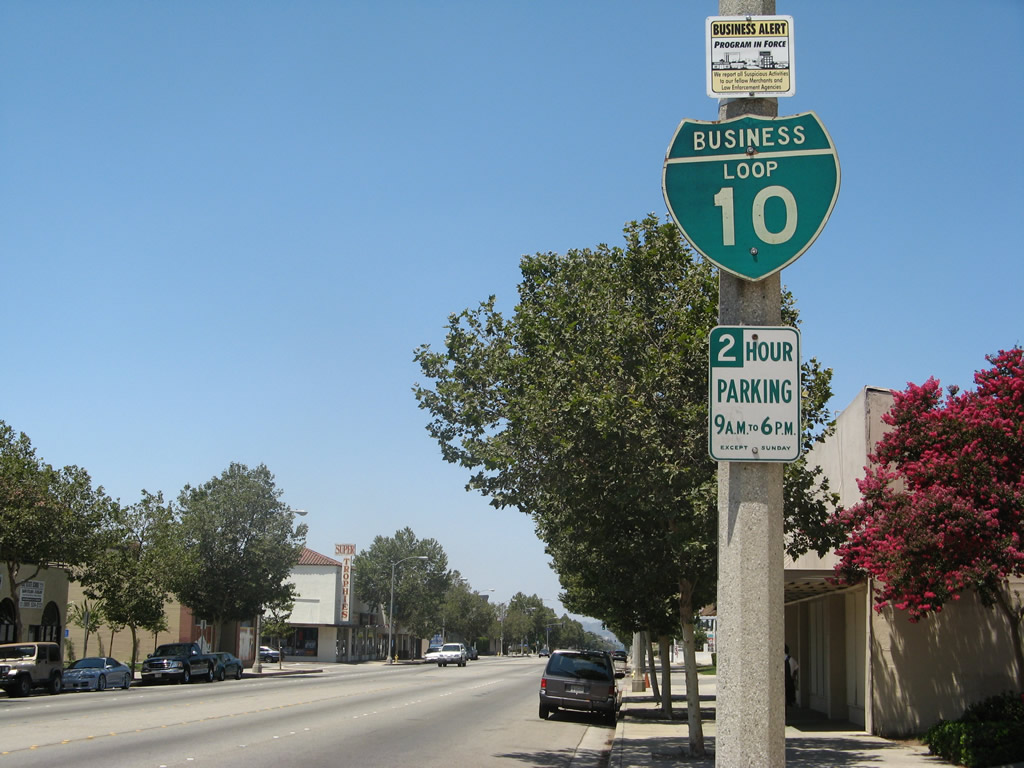
Removed by 2022, a second shield for Business Loop I-10 west was posted along Holt Avenue in Pomana after Garey Avenue.
07/15/07
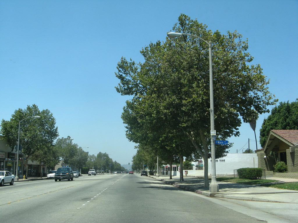
The intersection with Main Street in Downtown Pomona is not signalized.
07/15/07
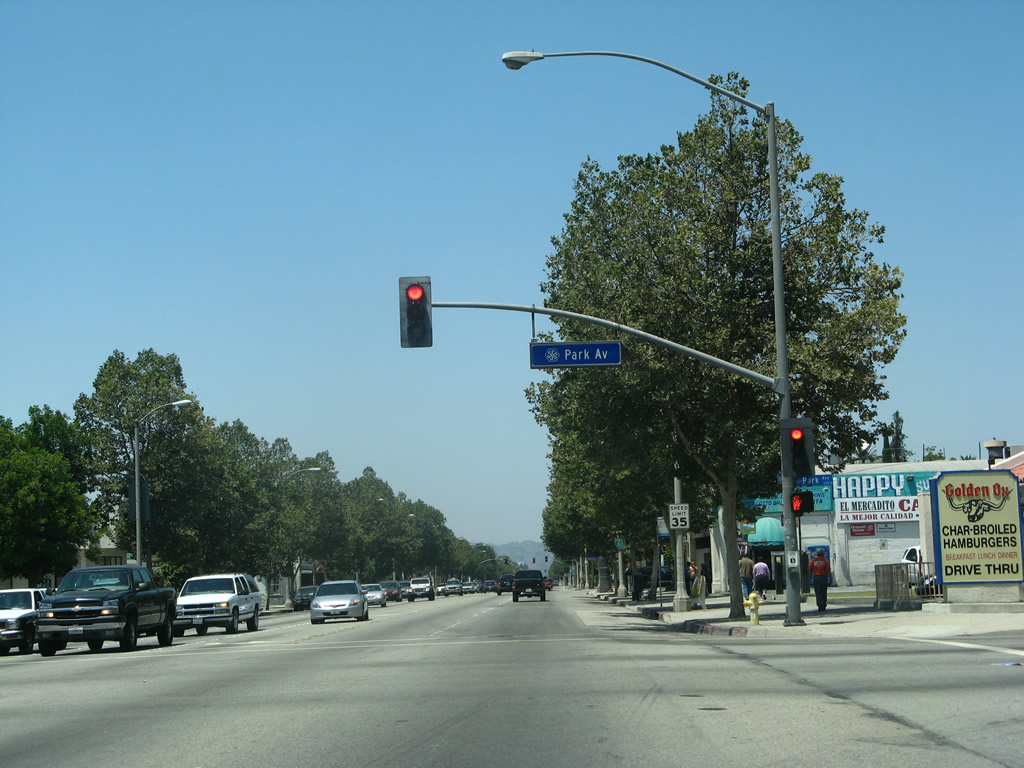
Westbound Business Loop I-10 (Holt Avenue) meets Park Avenue at this traffic signal.
07/15/07
Another Business Loop I-10 reassurance shield is posted prior to Wisconsin Street.
07/15/07
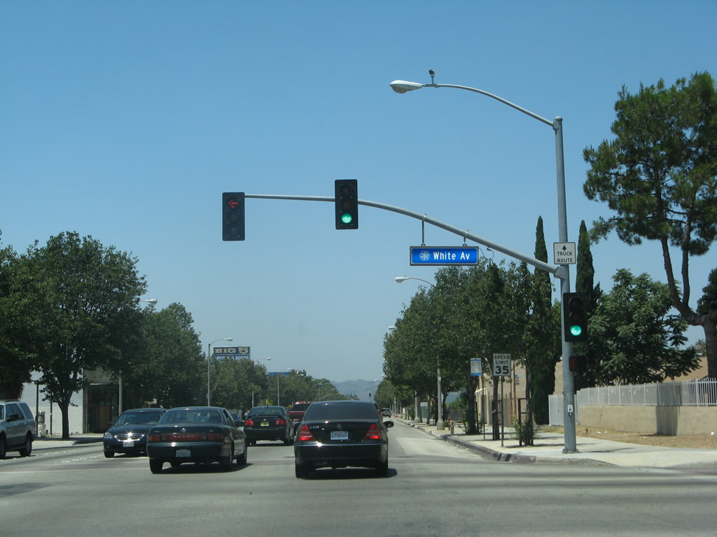
Westbound Business Loop I-10 (Holt Avenue) meets White Avenue at this traffic signal.
07/15/07
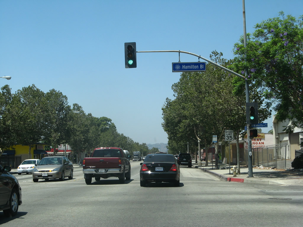
The business district continues along westbound Business Loop I-10 (Holt Avenue) to Hamilton Boulevard.
07/15/07
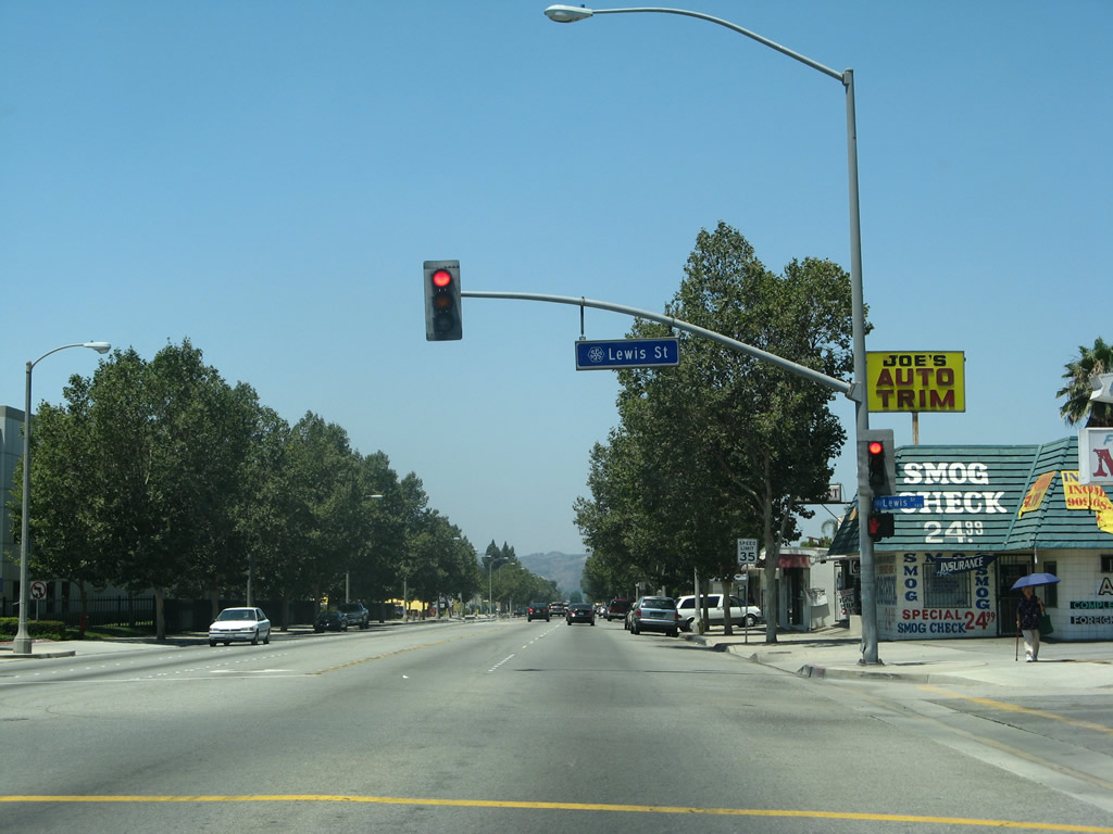
Westbound Business Loop I-10 (Holt Avenue) meets Lewis Street at this traffic signal.
07/15/07
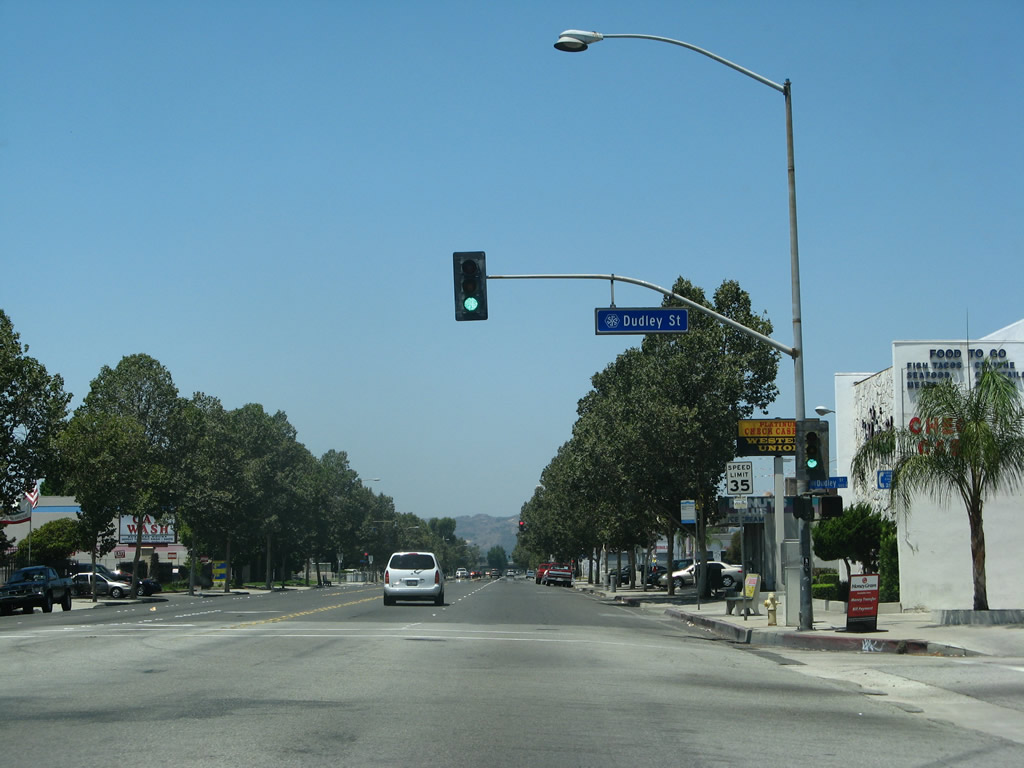
Dudley Street ties into Holt Avenue north of an industrial park area.
07/15/07
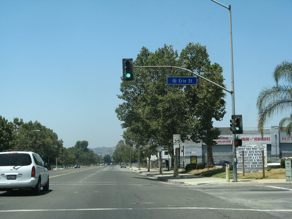
Westbound Business Loop I-10 (Holt Avenue) meets Erie Street at this traffic signal.
07/15/07
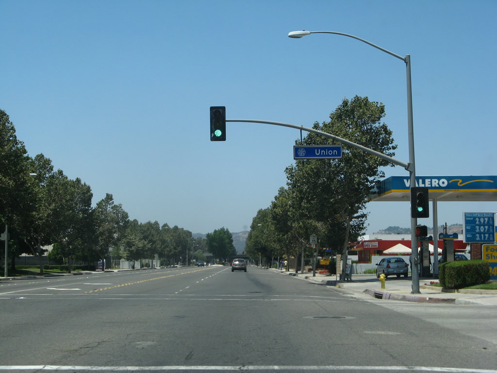
Union Avenue crosses Holt Avenue north from Mount Vernon Avenue to Orange Grove Avenue.
07/15/07
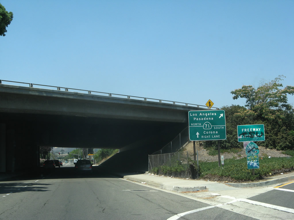
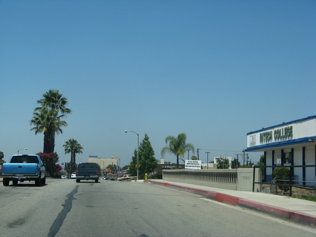
Fairplex Drive south intersects Business Loop I-10 across from ramps with SR 71 (Chino Valley Freeway) northbound. Left turns are restricted here, as Holt Avenue has a dedicated entrance ramp for SR 71 north.
07/15/07
Business Loop I-10 combined with SR 71 (Chino Valley Freeway) northwest to I-10 at the Kellogg Interchange.
07/15/07
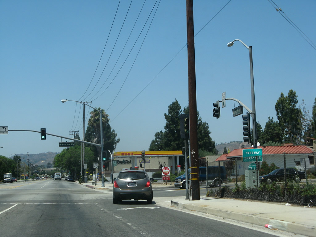
A loop ramps follows from Holt Avenue west for SR 71 (Chino Valley Freeway) southbound. Humane Way leads south from the signalized intersection to Mission Boulevard. Holt Avenue ends and Valley Boulevard begins at this point as well. Valley Boulevard is not an old U.S. highway alignment, but it offers an alternate route through western Pomona into Walnut and the City of Industry.
07/15/07
Photo Credits:
- Andy Field: 07/15/07
Connect with:
Page Updated Thursday March 14, 2013.