
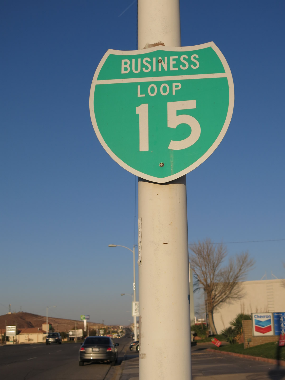
Business Loop I-15 - Barstow

Within Barstow, Business Loop I-15 follows portions of old U.S. 66 and old U.S. 91 north of Interstate 15. The route lines L Street north from Exit 181 to Main Street. Business Loop I-15 joins Historic U.S. 66 along Main Street east through Downtown Barstow, meeting I-15 again at Exit 184. The designation extends 0.59 miles southeast beyond I-15 to Interstate 40 at Exit 1 and Montara Road.
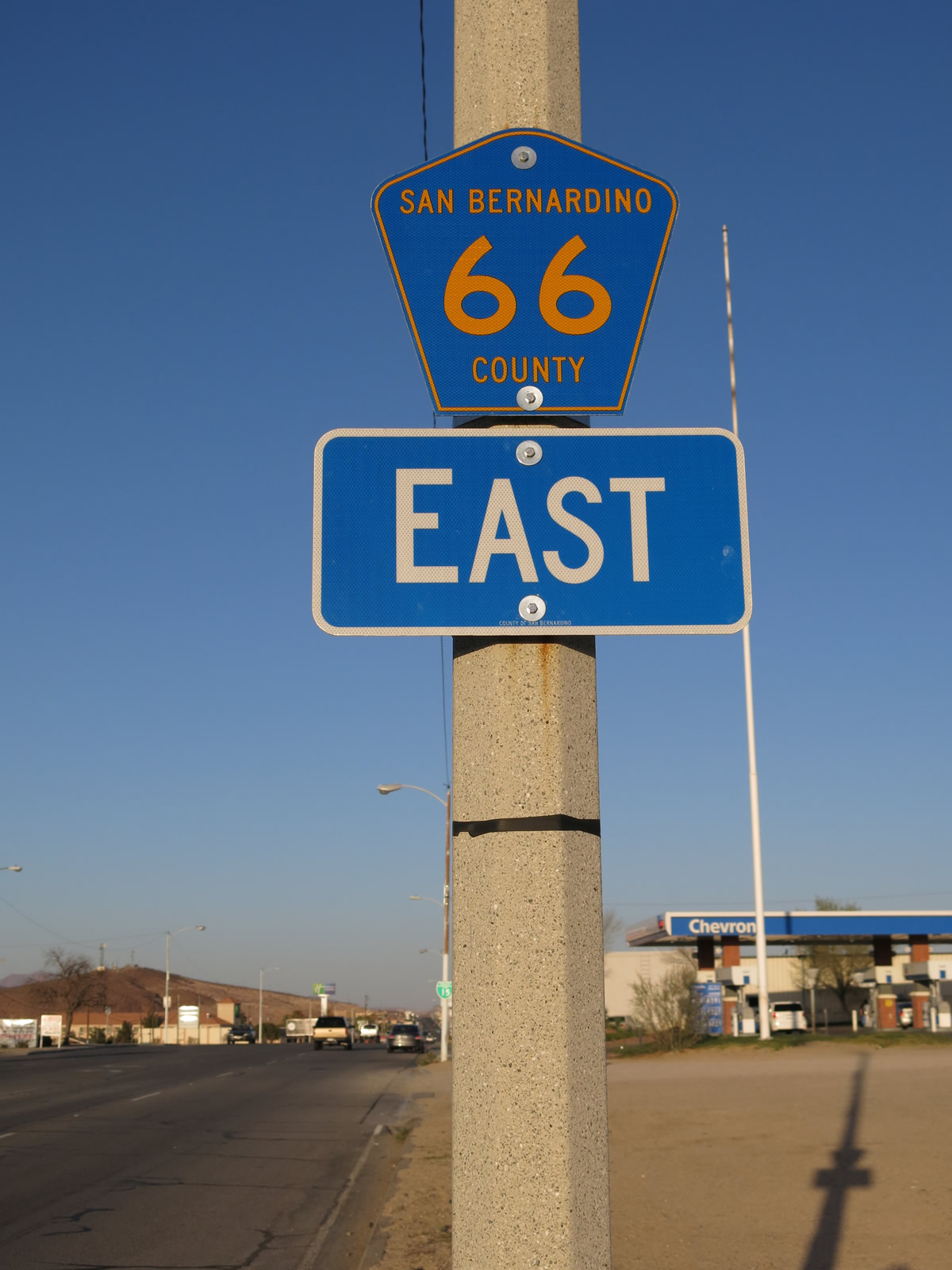
Coupled with signs for Historic U.S. 66, Business Loop I-15 is decently well signed across Barstow. The loop is also part of San Bernardino County Route 66 (National Trails Highway). Main Street between L Street and N 1st Avenue is also Historic U.S. 91, though the old route is not acknowledged alongside Historic U.S. 66.
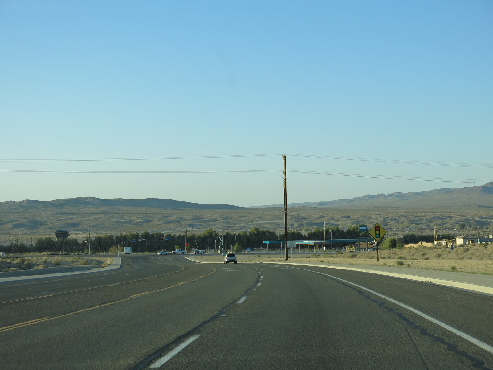
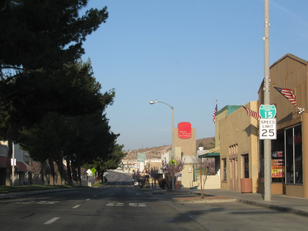
L Street expands to a five lane boulevard north from the diamond interchange (Exit 181) with Interstate 15 to Main Street. Mount General rises in the hills overlooking Barstow to the northwest.
03/24/13
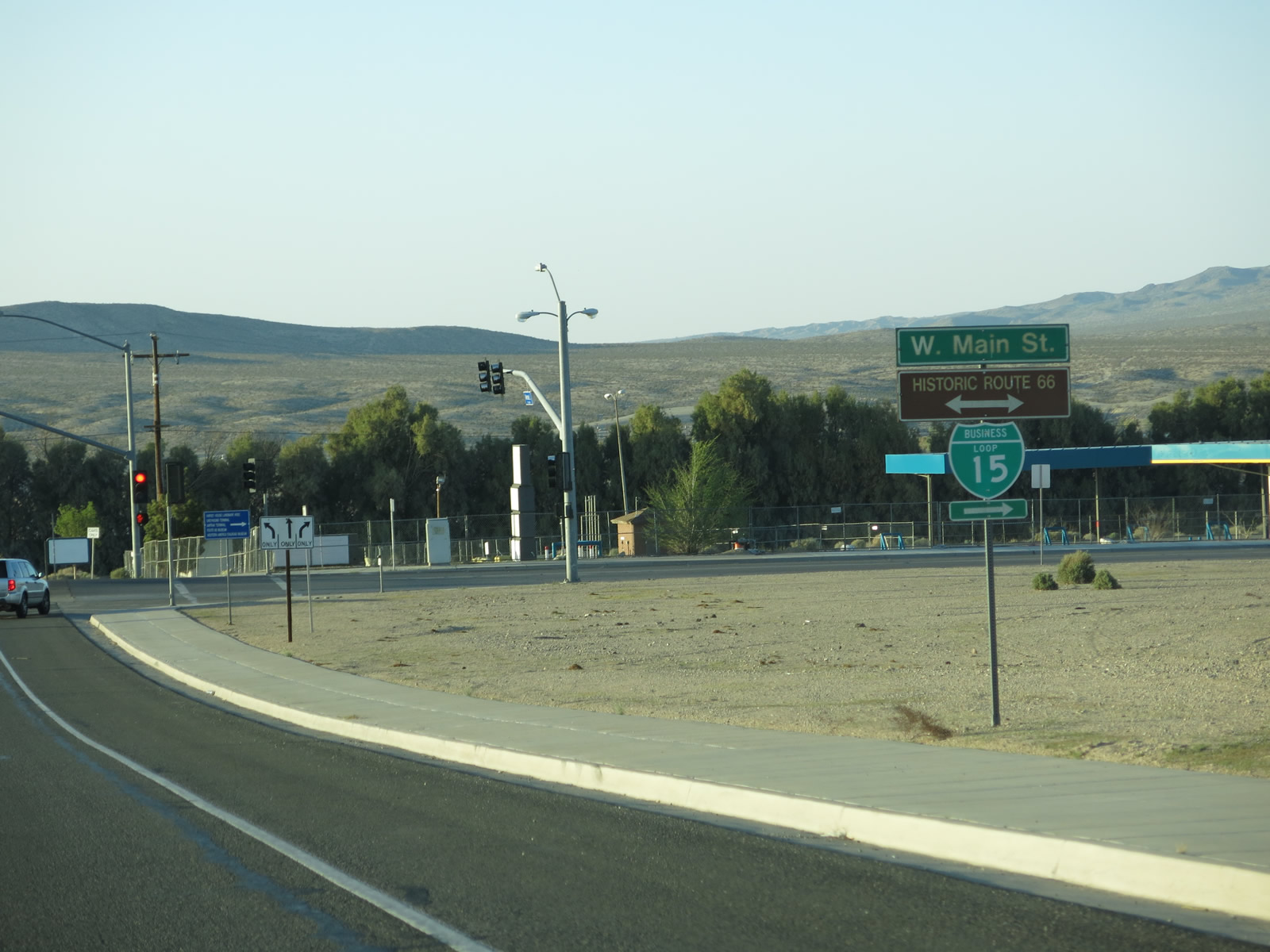
Business Loop I-15 turns east onto Main Street (Historic U.S. 66/91) from the north end of L Street. San Bernardino County Route 66 was established along Main Street through Barstow in 2011.
03/24/13
The San Bernardino County Route 66 marker posted along Main Street east of L Street was removed by 2019.
03/24/13
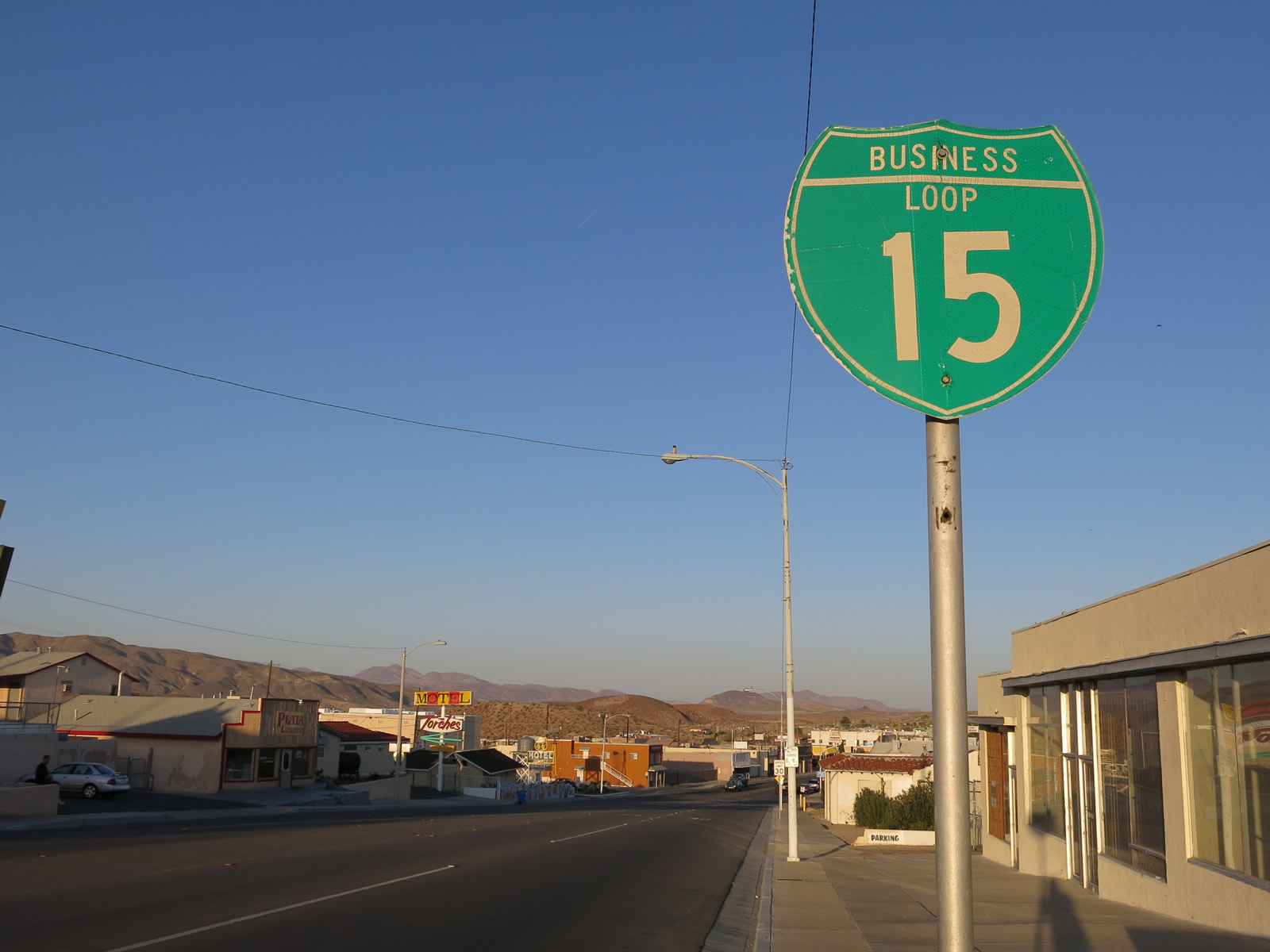
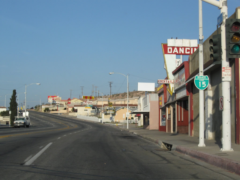
Business Loop I-15 reassurance marker posted along Main Street east of L Street.
03/24/13
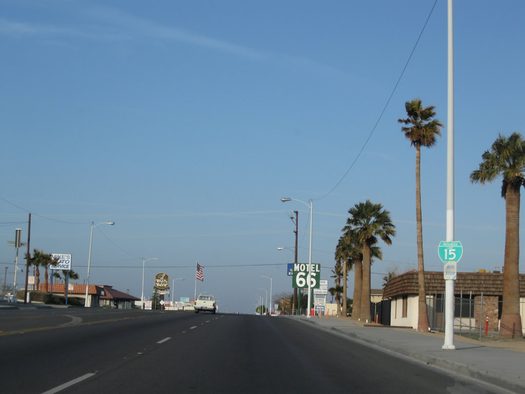
A Historic U.S. 66 shield precedes the intersection with Avenue J south along northbound Business Loop I-15 (Main Street). U.S. 91 is not signed as a historic route in California.
03/24/13
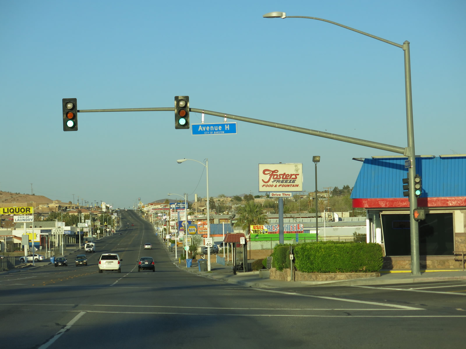
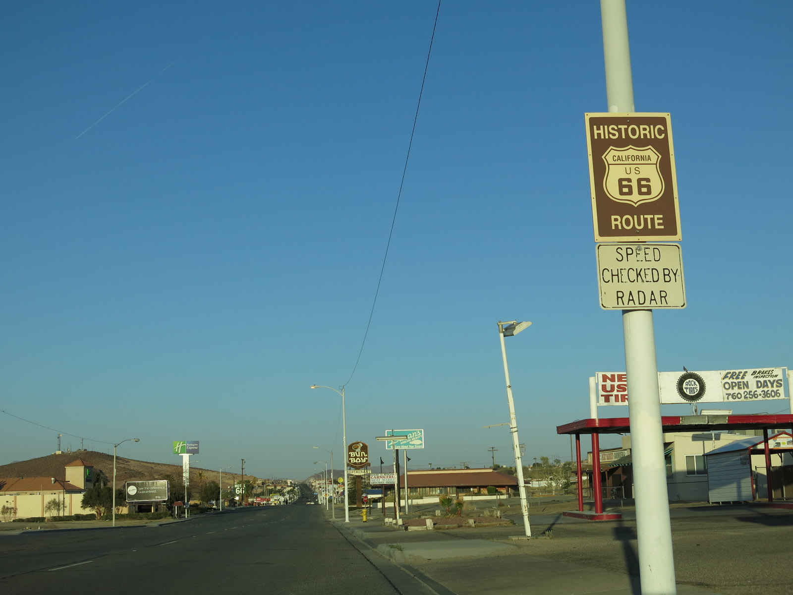
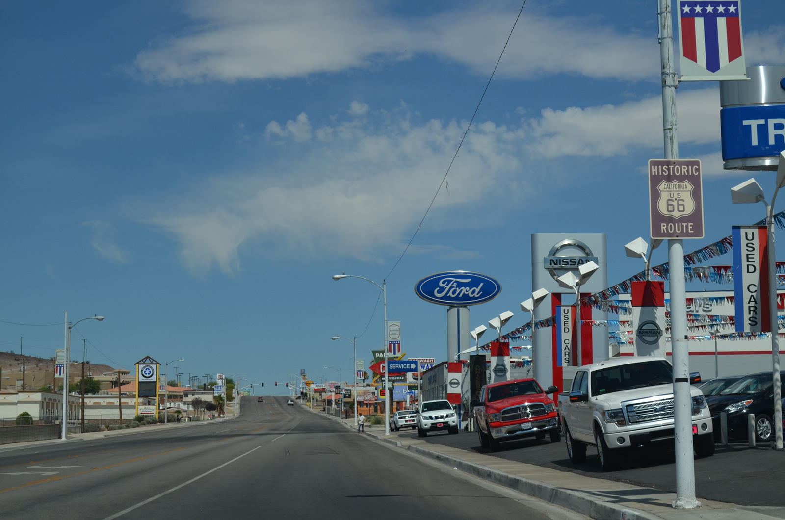
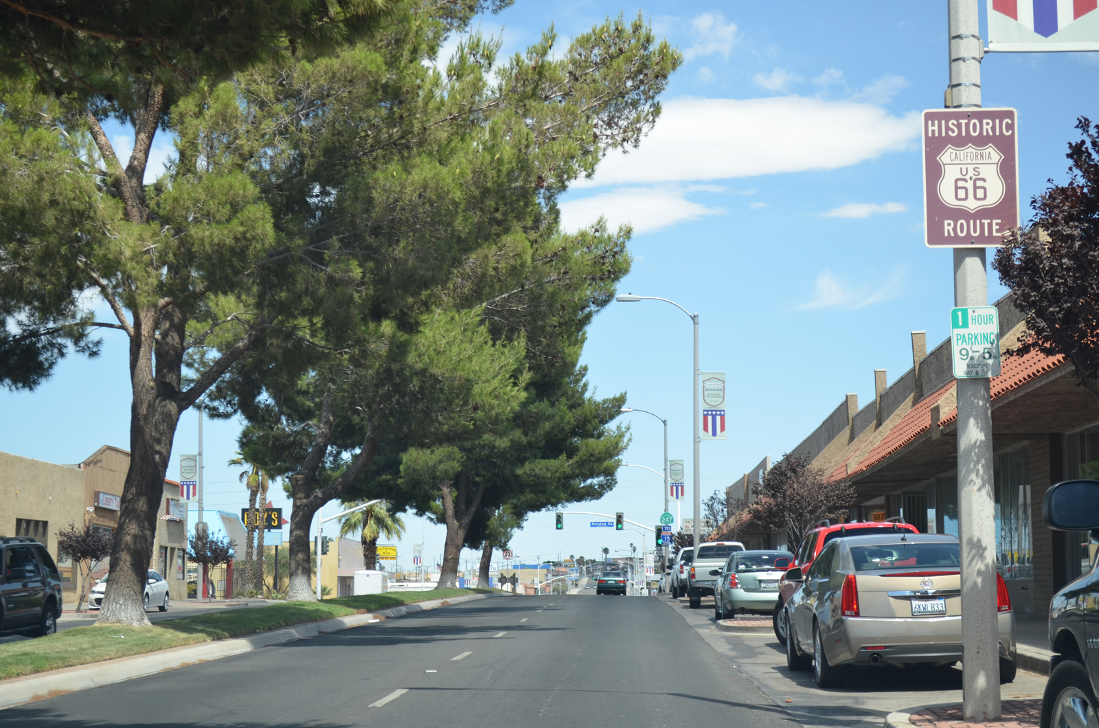
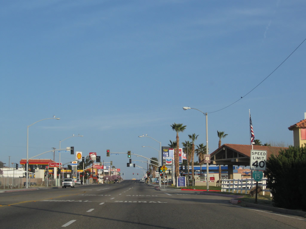
An array of traveler services line Main Street east across the west side of Barstow. Avenue H intersects Historic U.S. 66 south from the BNSF Barstow Railyard.
03/24/13
The light pole supporting the Business Loop I-15 shield east of Avenue H was taken down in 2025.
07/20/14
Historic U.S. 66 sign at Main Street and Avenue E.
07/20/14
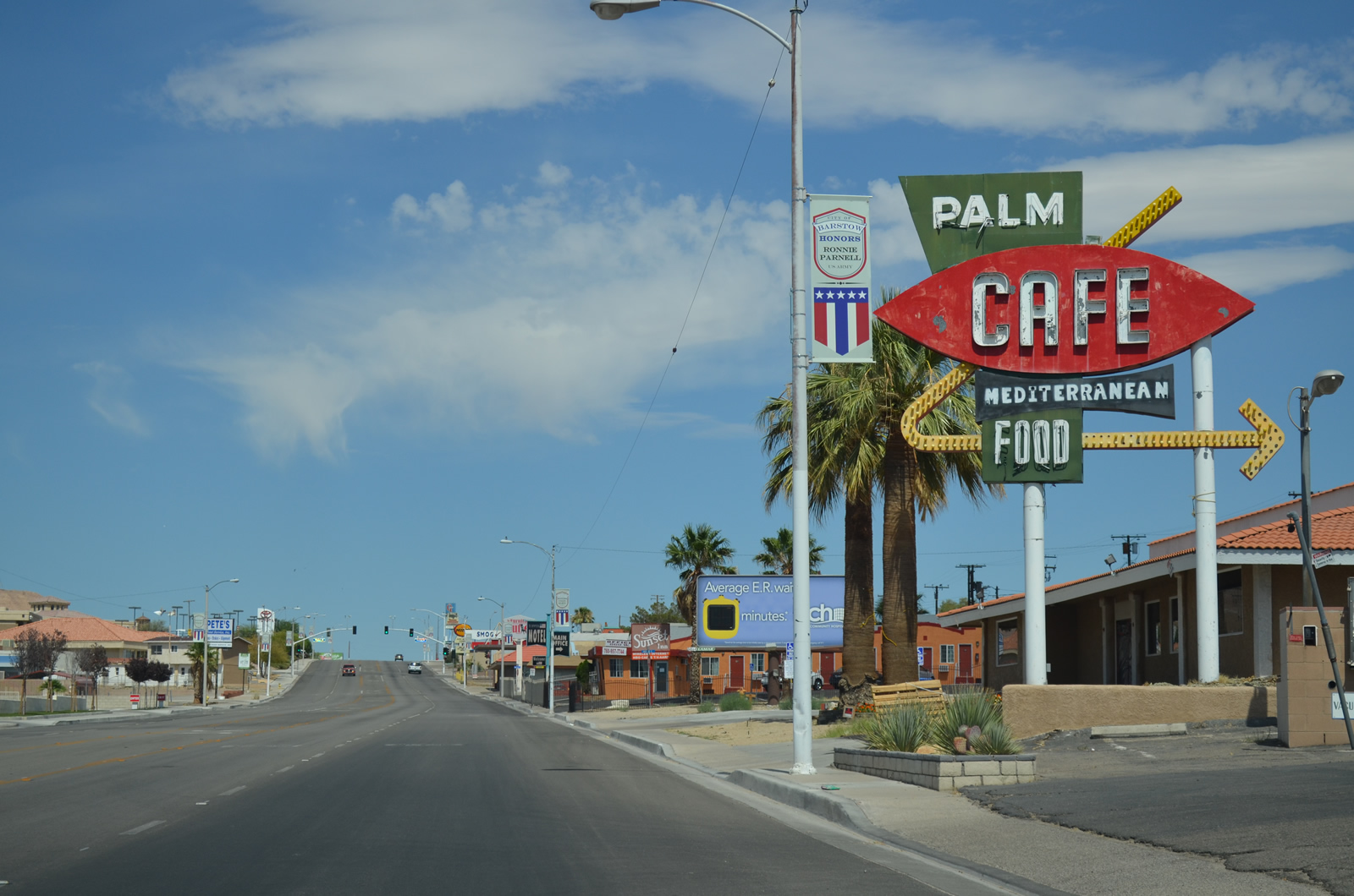
The vintage sign for the Palm Cafe appeared along Historic U.S. 66 at Avenue D. The restaurant was demolished by 2019.
07/20/14
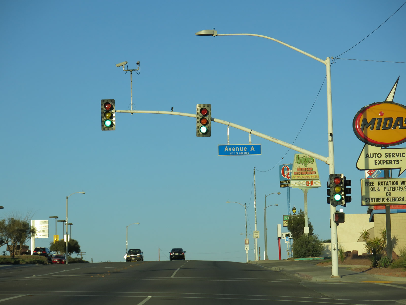
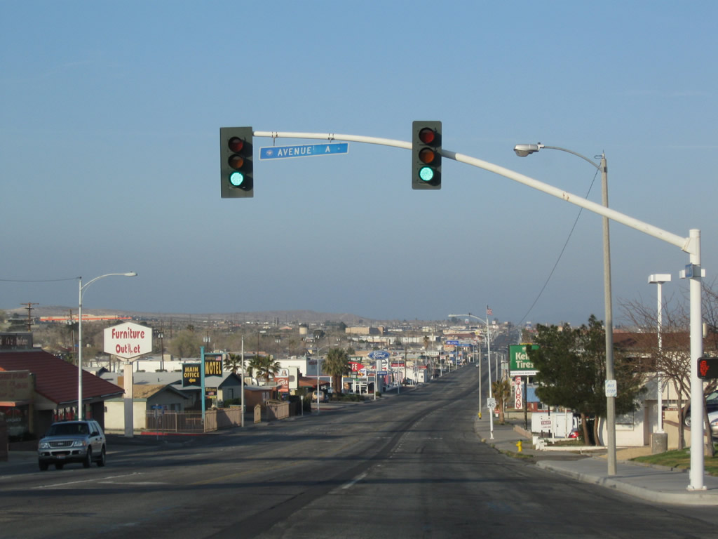
Business Loop I-15/Historic U.S. 66 (Main Street) ascend to 2,200 feet above sea level east by the signalized interection with Avenue A.
03/24/13
Another Historic U.S. 66 trailblazer appears along Main Street east at May Avenue in Barstow.
03/24/13
Main Street curves east toward Downtown Barstow beyond Otis Avenue.
03/24/13
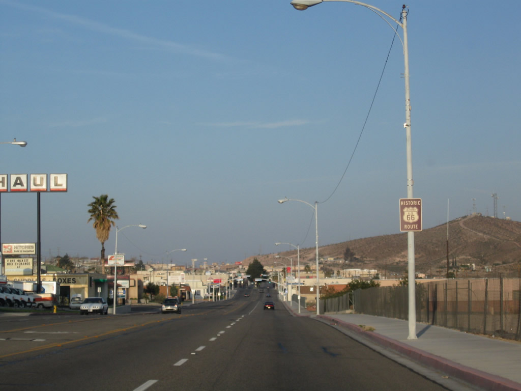
Old U.S. 91 turns north from Business Loop I-15/Historic U.S. 66 (Main Street) at First Avenue. First Avenue leads old U.S. 91 north past B Hill onto a viaduct spanning the BNSF Railyard. 1st Avenue turns northeast from the Western America Railroad Museum across the Mojave River to former U.S. 466 (Old Highway 58) in north Barstow.
07/20/14
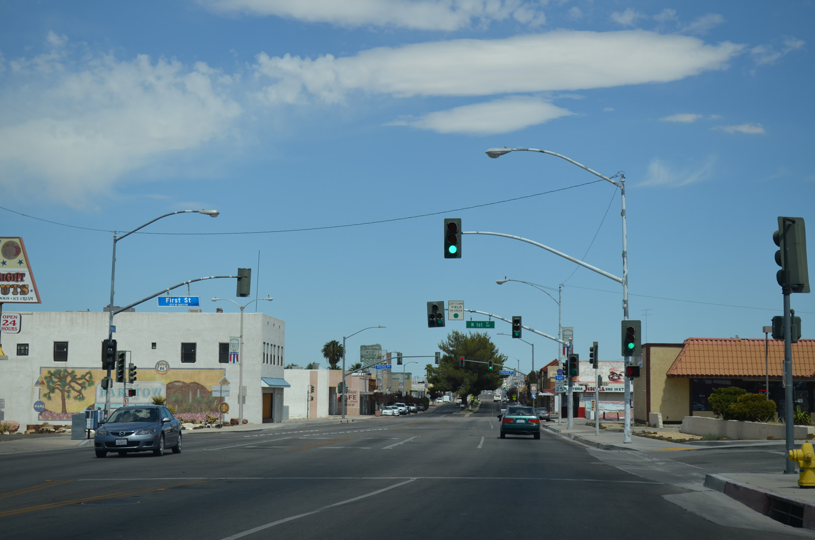
County Route 66 posted along eastbound Main Street between First Avenue and Second Avenue.
07/20/14
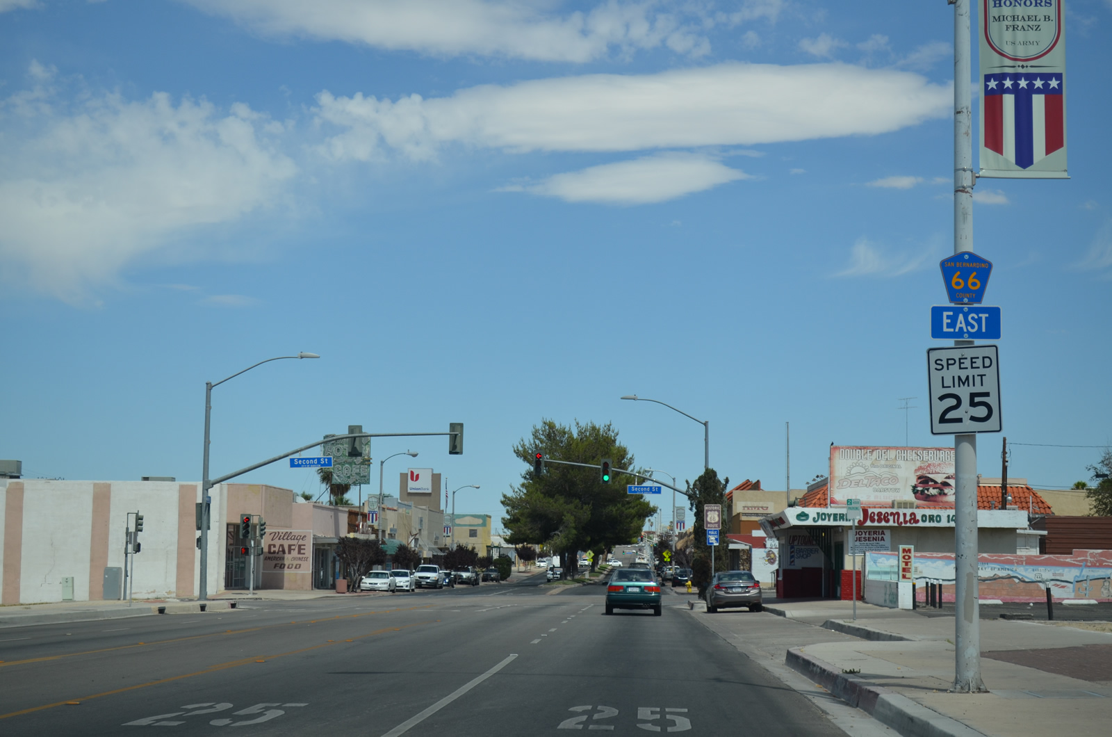
Historic U.S. 66 proceeds east into the Barstow business district from 2nd Avenue.
07/20/14
A tree lined median separates traffic along Main Street between 2nd Avenue and Barstow Road.
07/20/14
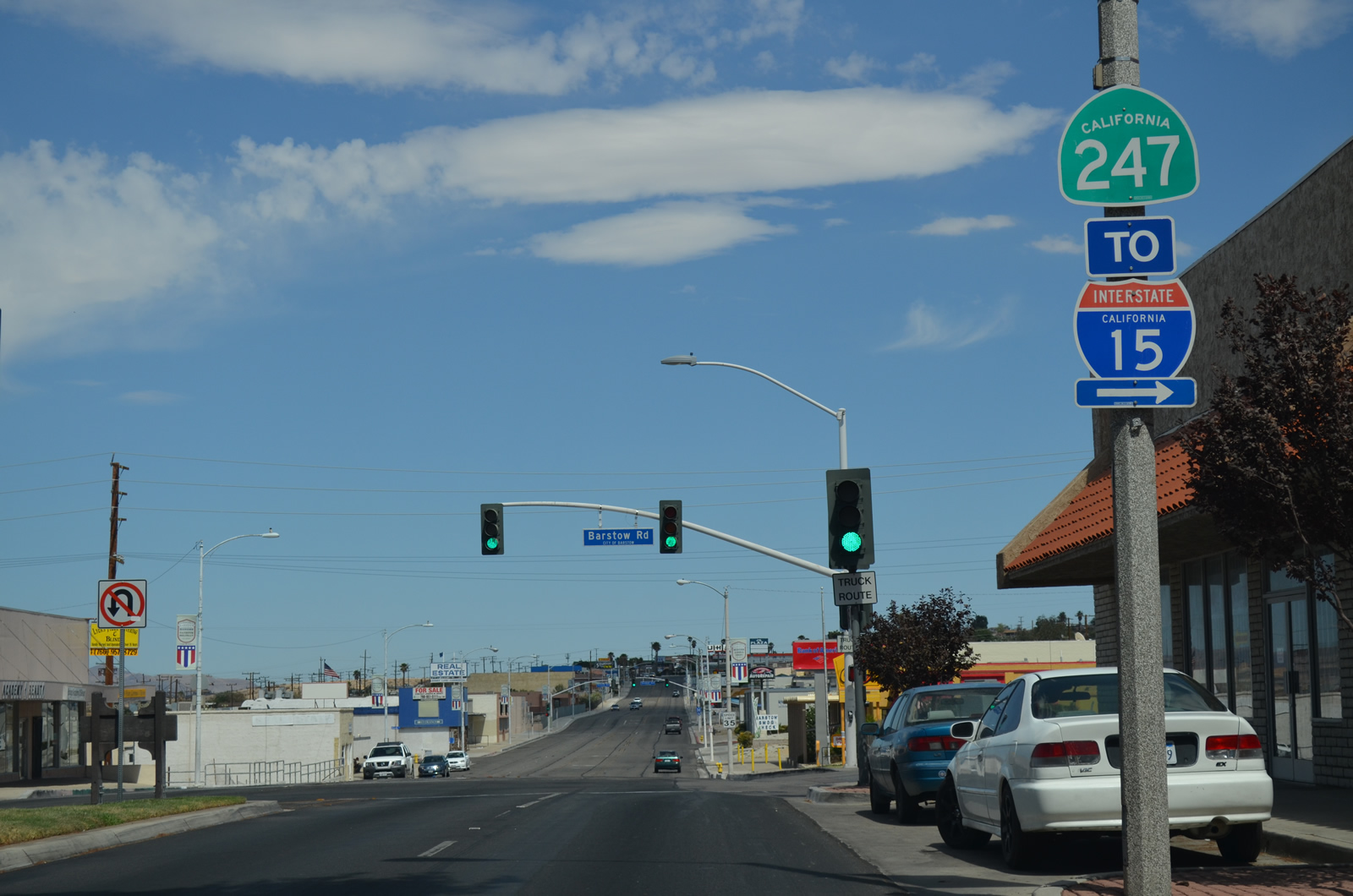
Barstow Road stems 0.75 miles south from Business Loop I-15 (Main Street) to Interstate 15 at Exit 183. SR 247 runs south along Barstow Road from I-15 to Barstow College, then onward to Lucerne Valley, Yucca Valley and Joshua Tree National Park.
07/20/14
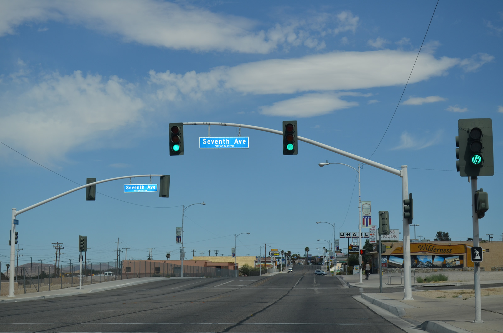
The succeeding traffic light along Business Loop I-15 (Main Street) northbound is at the staggered intersection with Seventh Avenue.
07/20/14
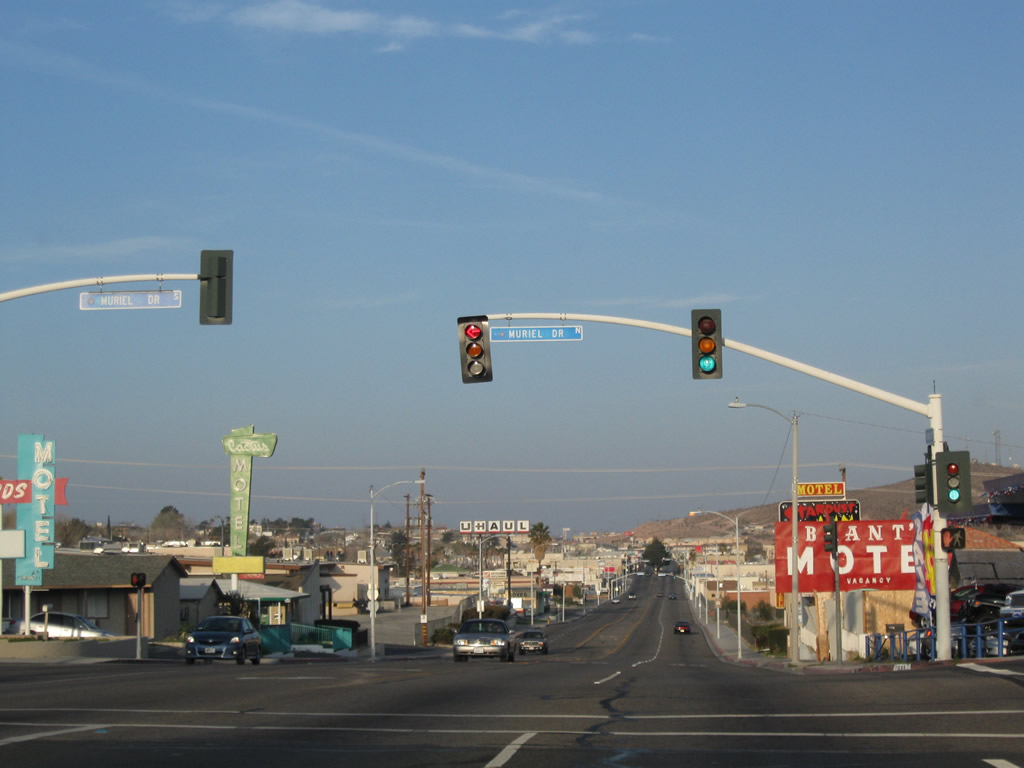
Main Street east ahead of Muriel Drive.
07/20/14
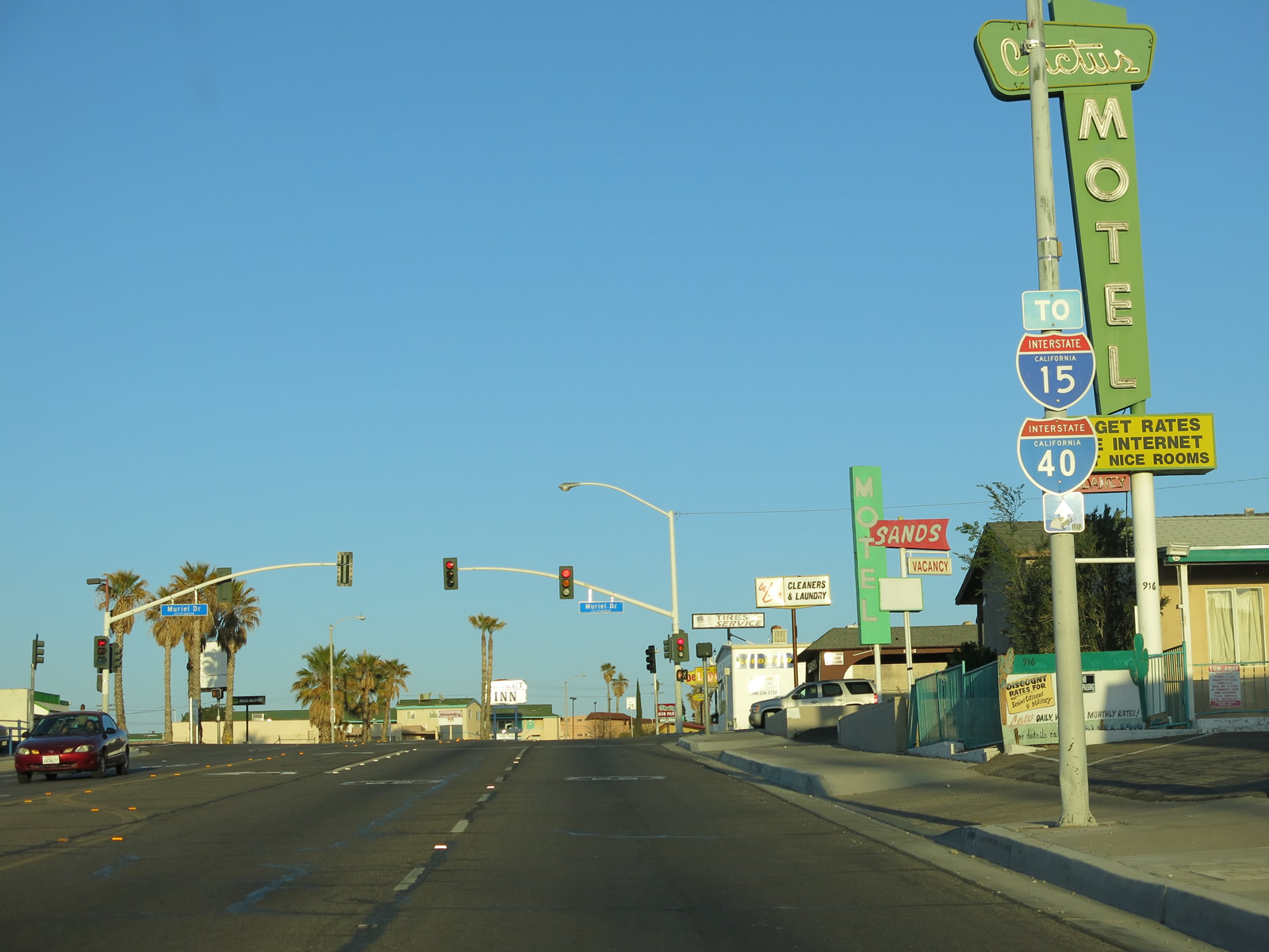
1.5 miles of Business Loop I-15 remain along Main Street southeast from Muriel Drive to Interstate 40.
03/24/13
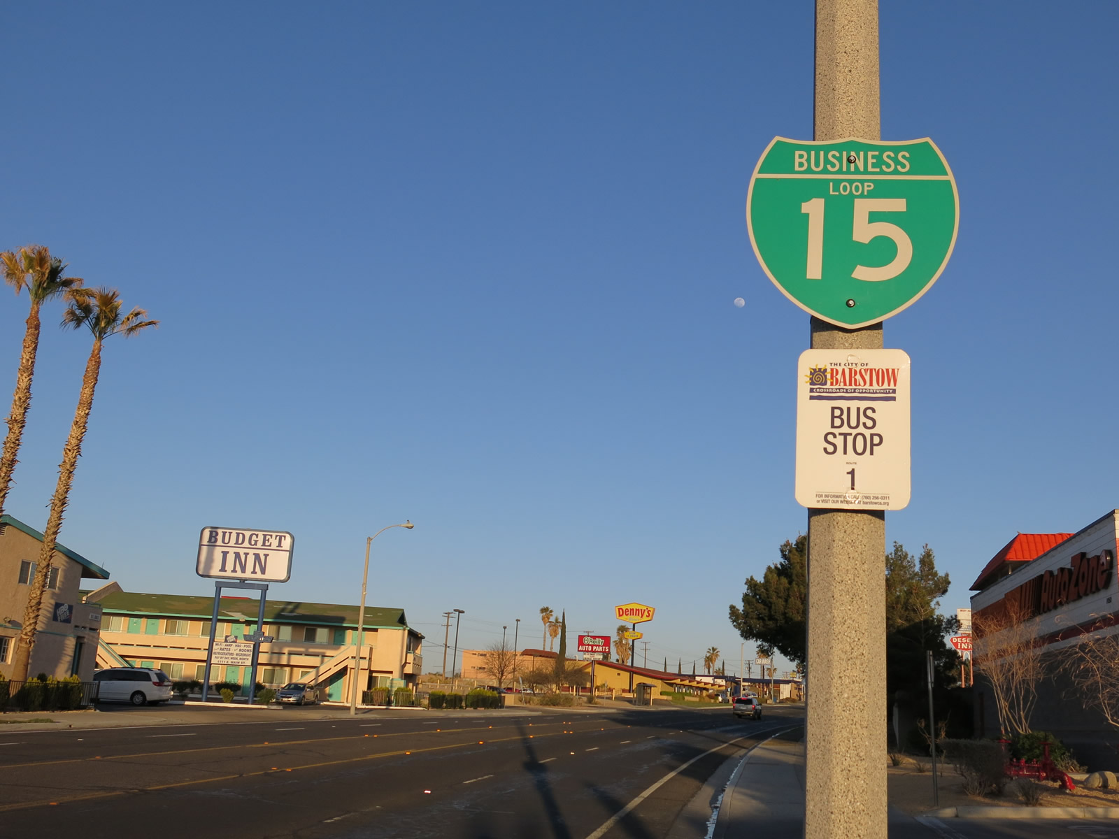
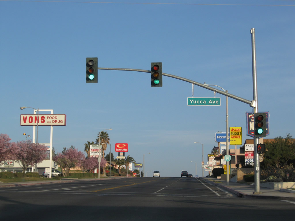
Business Loop I-15 curves southeast back to I-15 between Murial Drive and Yucca Avenue.
03/24/13
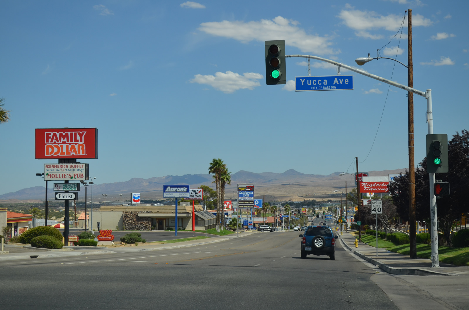
The commercialized intersection with Yucca Drive lies around around 2,200 feet above sea level. The ensuing stretch of Main Street to Interstate 15 lowers 80 feet.
03/24/13
The Business Loop I-15 shield posted east of Yucca Avenue along Main Street was removed by 2021.
07/20/14
The I-15 trailblazer at the parclo interchange with Interstate 15 was missing by 2025.
03/24/13
Intertate 15 converges with the west end of I-40 nearby. Southwest from Barstow, I-15 travels to Victorville, Hesperia and San Bernardino.
03/24/13
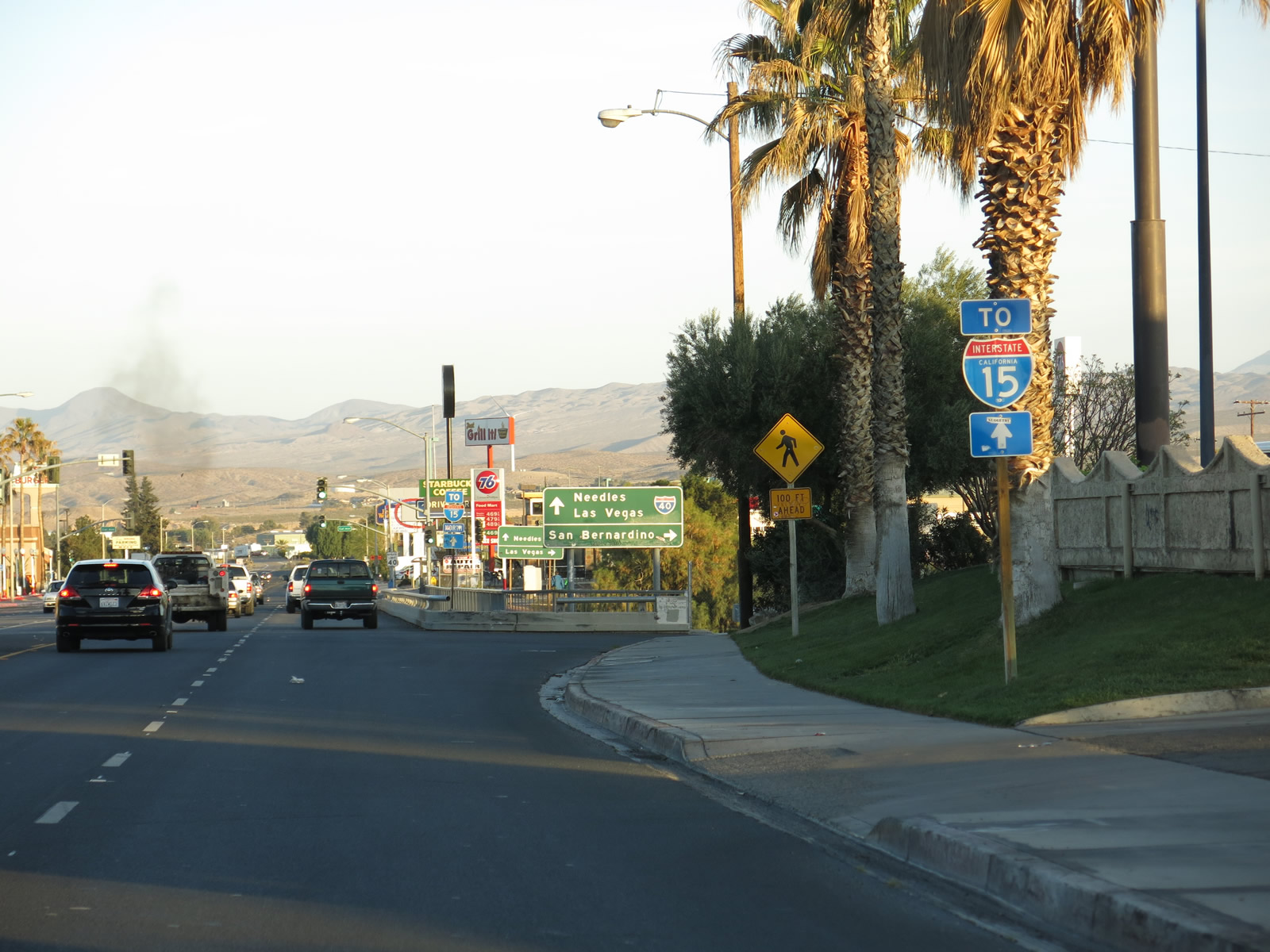
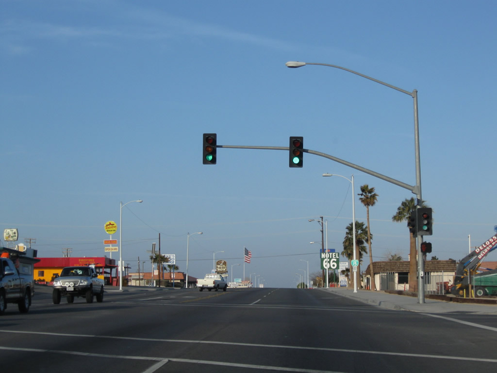
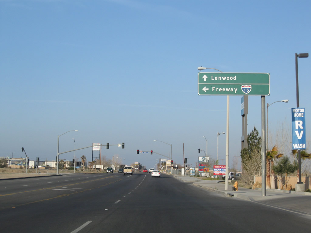
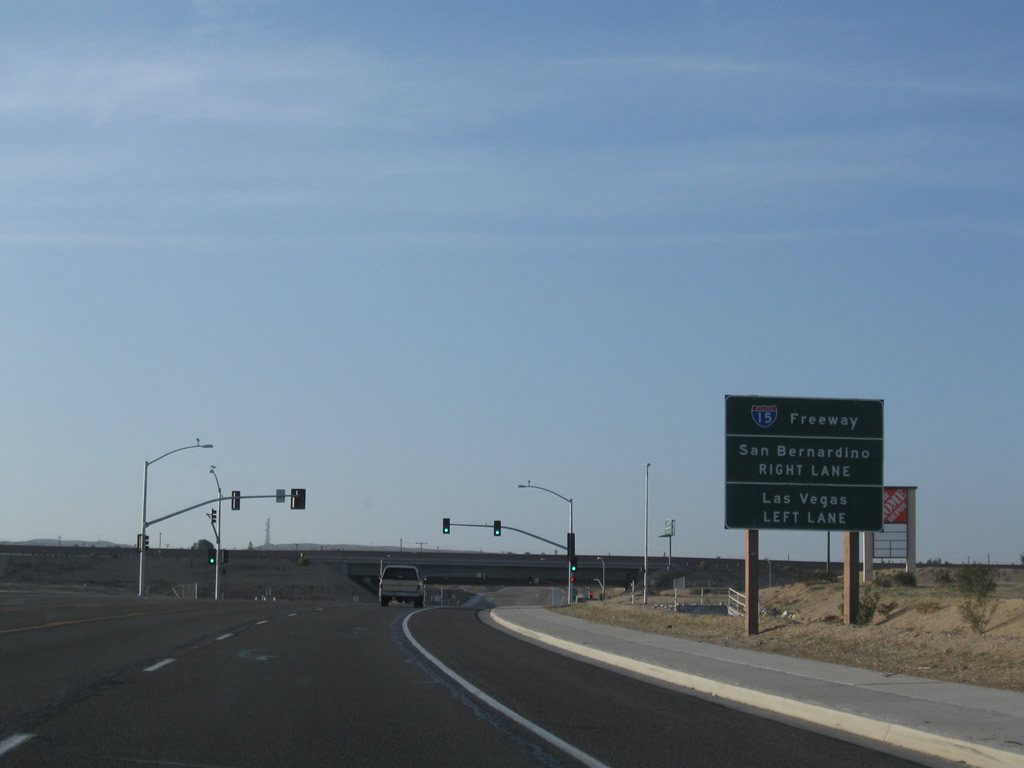
A loop ramp joins Business Loop I-15/Historic U.S. 66 eastbound with Interstate 15 north to Baker and Las Vegas. Main Street continues southeast to a parclo interchange with Interstate 40.
07/20/14
Main Street expands to a seven lane boulevard south of Cal Avenue by Barstow Mall.
03/24/13
E Main Street turns south beyond Barstow Mall into the exchange with Interstate 40.
07/20/14
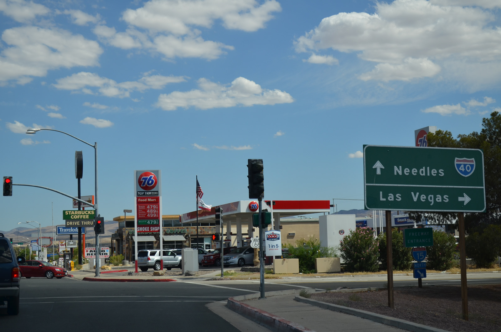
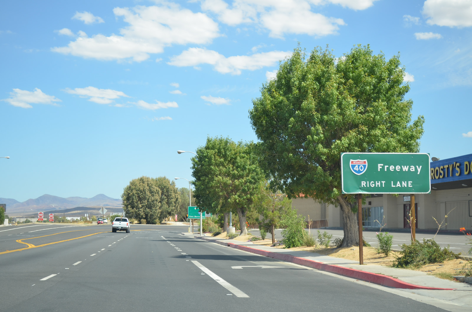
An entrance ramp joins the end of Business Loop I-15 with the final mile of Interstate 40 west.
07/20/14
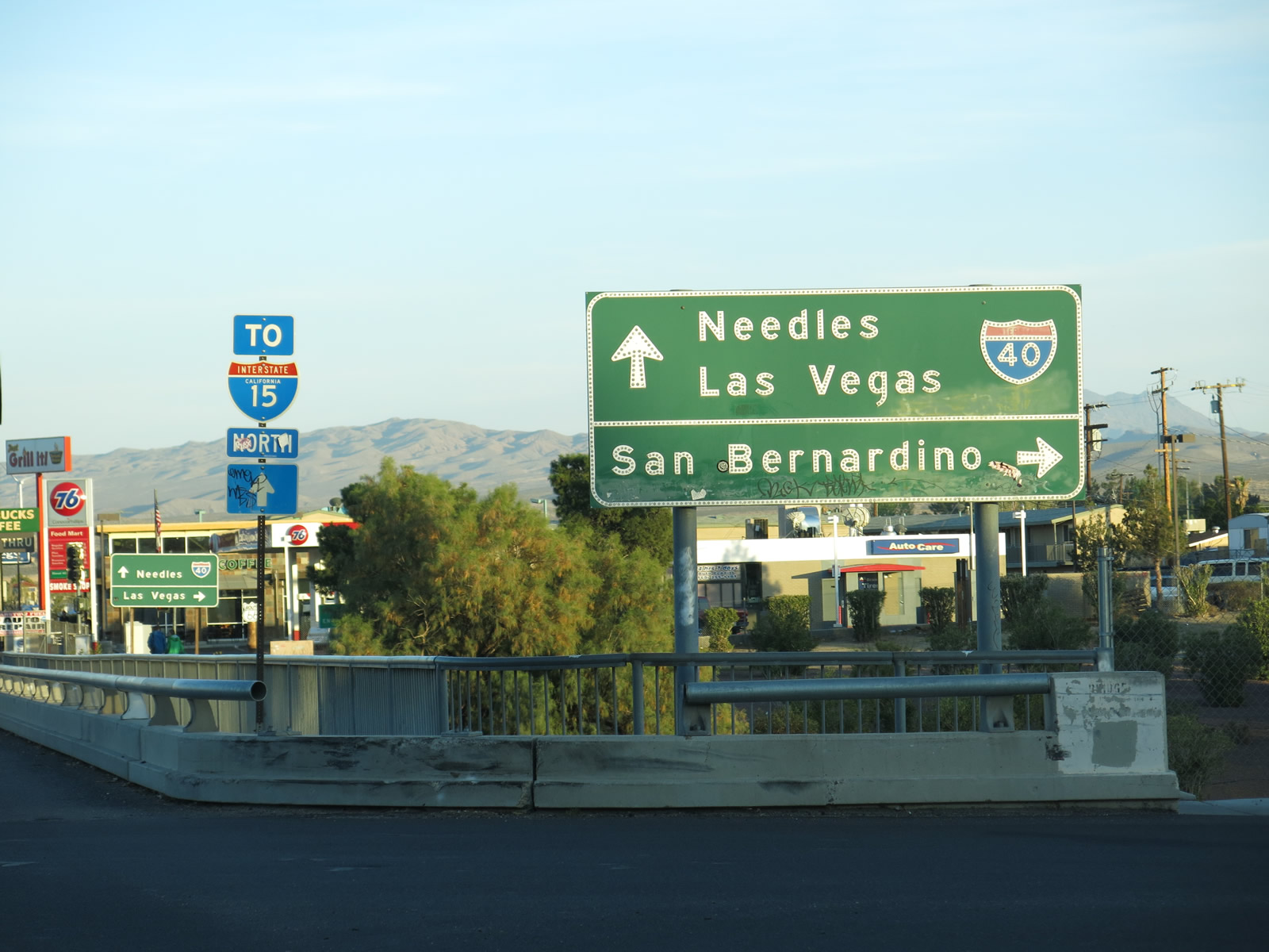
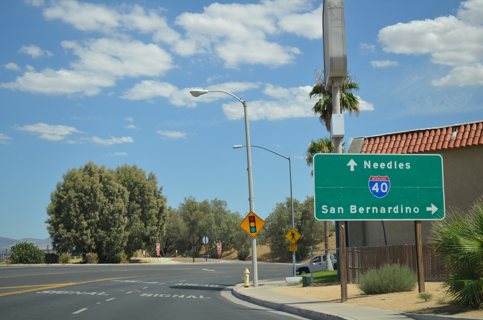
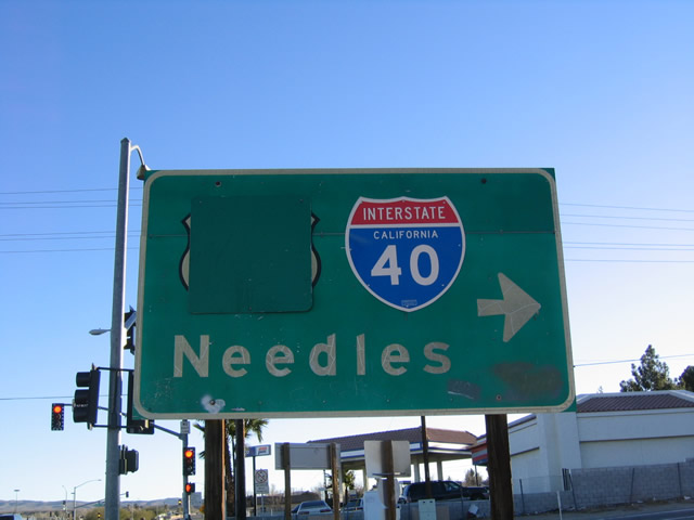
A loop ramp joins E Main Street and Montara Road with Interstate 40 east to Needles.
07/20/14
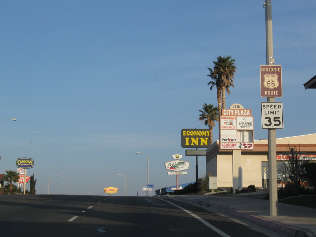
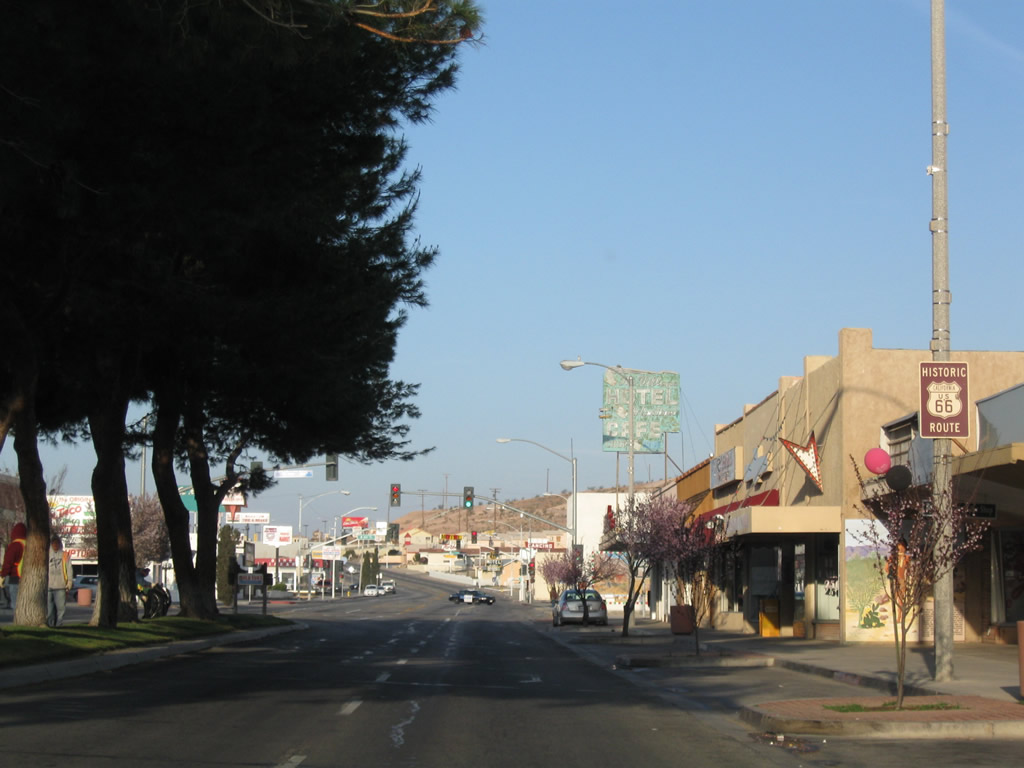
Historic U.S. 66 remains along E Main Street, which runs along the south side of Interstate 40 eastward to Exit 2. Montara Road extends south to Rimrock Road.
07/20/14
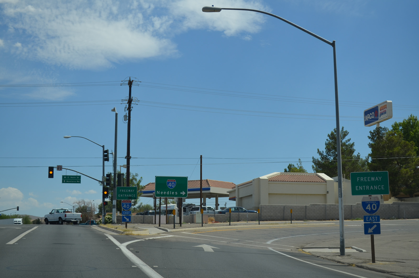
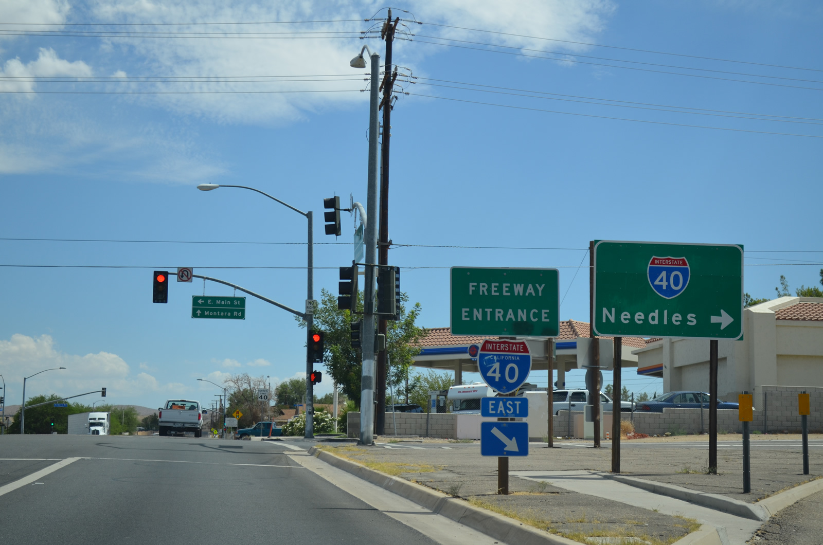
The previous guide sign at the entrance ramp for I-40 east from E Main Street (Business Loop I-15) was one of a handful of reflective signs placed in the 1960s. The sign was old enough that it originally displayed a U.S. 66 shield.
01/20/04
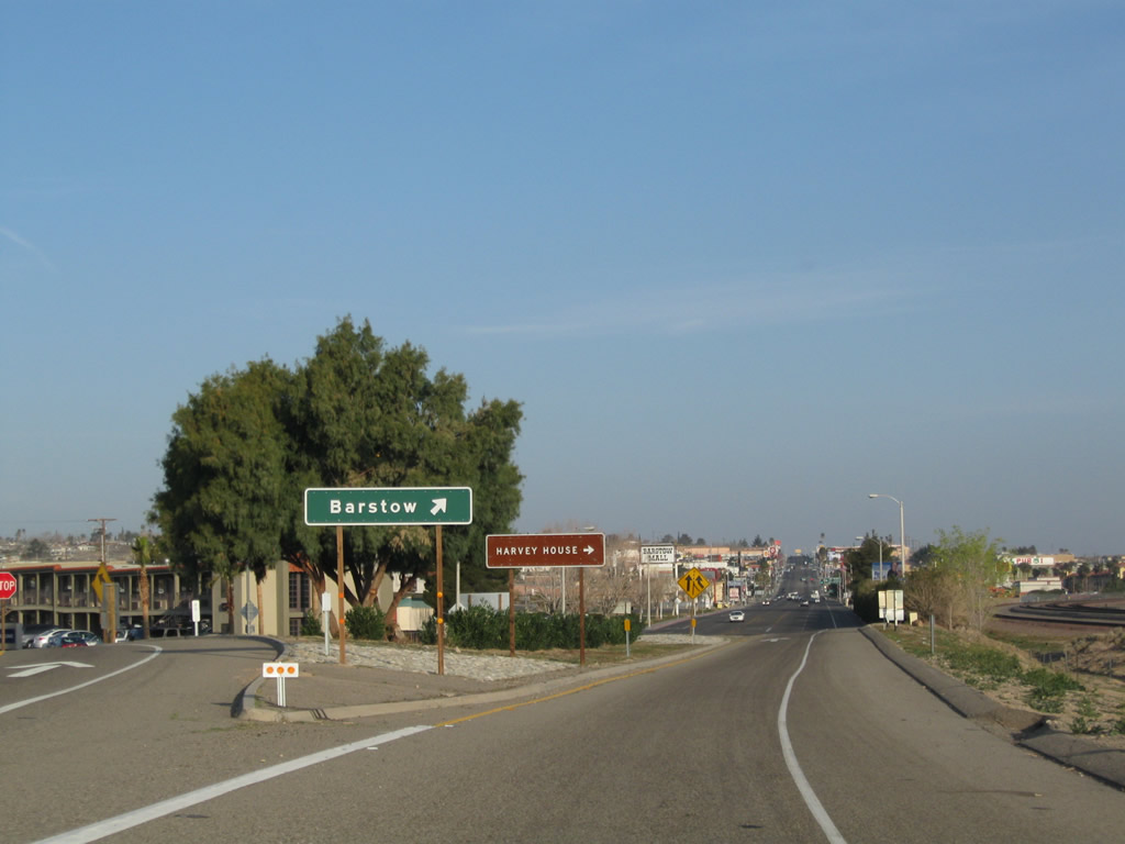
Business Loop I-15 commences northwest from the parclo interchange (Exit 1) joining Interstate 40 with E Main Street in east Barstow.
03/15/09
Business Loop I-15 overtakes E Main Street (Historic U.S. 66) west along a commercialized stretch anchored by Barstow Mall.
03/15/09
E Main Street proceeds northwest beyond Barstow Mall to a parclo interchange (Exit 184 B) with Interstate 15 at Roberta Street.
03/15/09
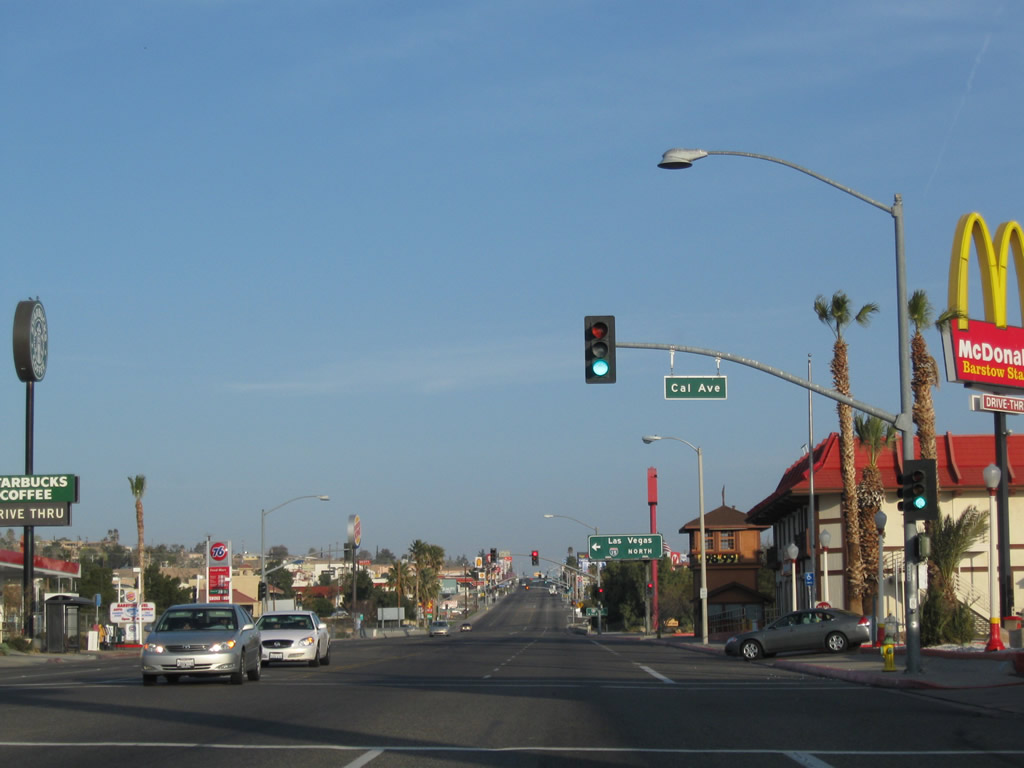
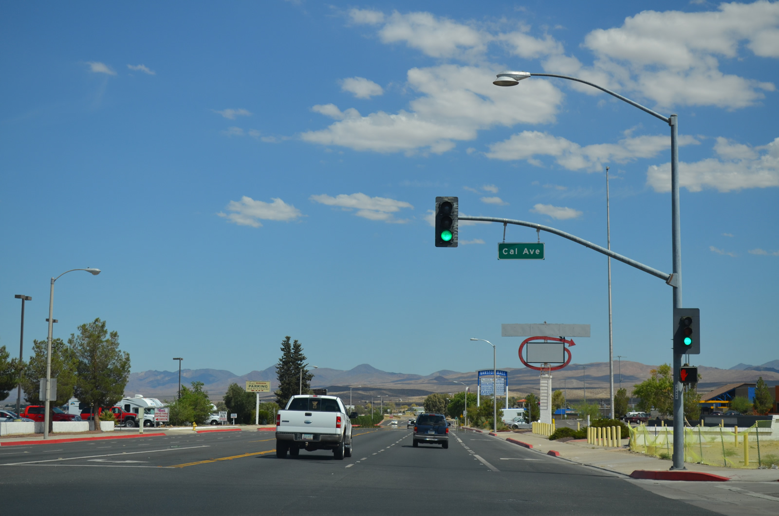
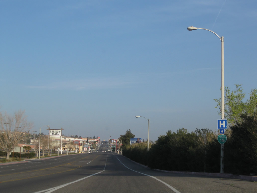
Cal Avenue ties into E Main Street north from an industrial park area east of I-15, north of I-40 and west of Barstow Mall.
03/15/09
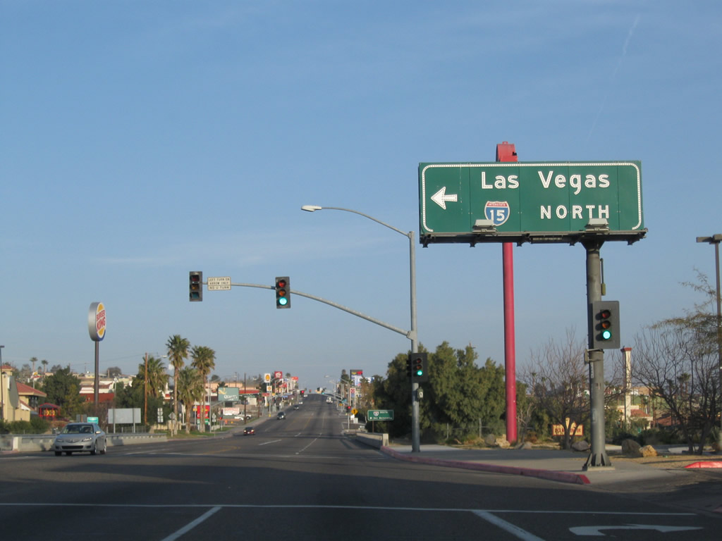
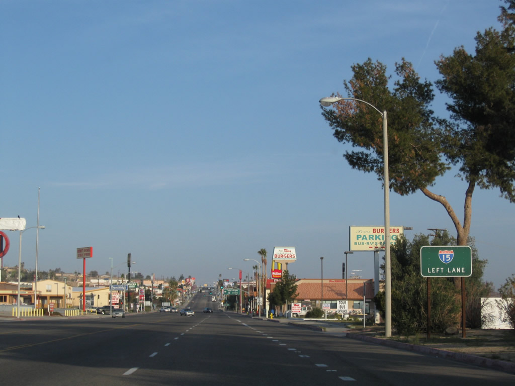
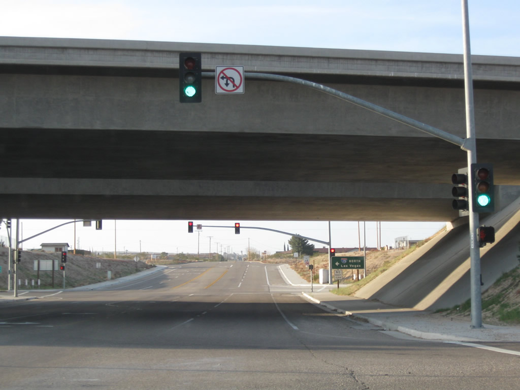
A loop ramp joins E Main Street with Interstate 15 north to Las Vegas, Nevada.
03/15/09
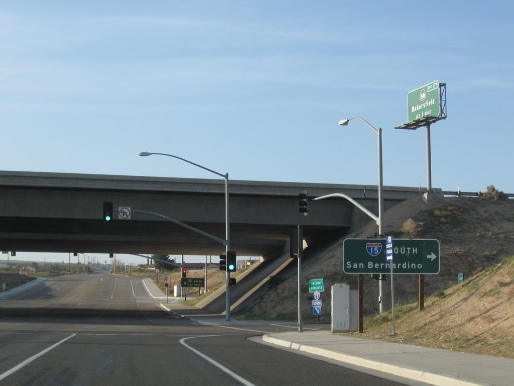
Business Loop I-15/Historic U.S. 66 (E Main Street) cross Interstate 15 ahead of the southbound entrance ramp to San Bernardino and Los Angeles.
03/15/09
The off-ramp from I-15 south at Exit 184 intersects E Main Street across from Roberta Street, a north side frontage road for the freeway.
03/15/09
A replacement of the speed limit sign made by 2012 along E Main Street north of Roberta Street did not include a new Business Loop I-15 shield.
03/15/09
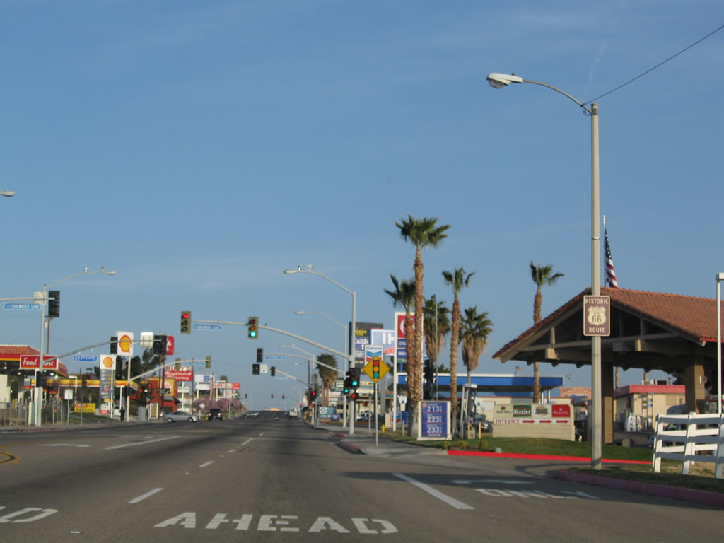
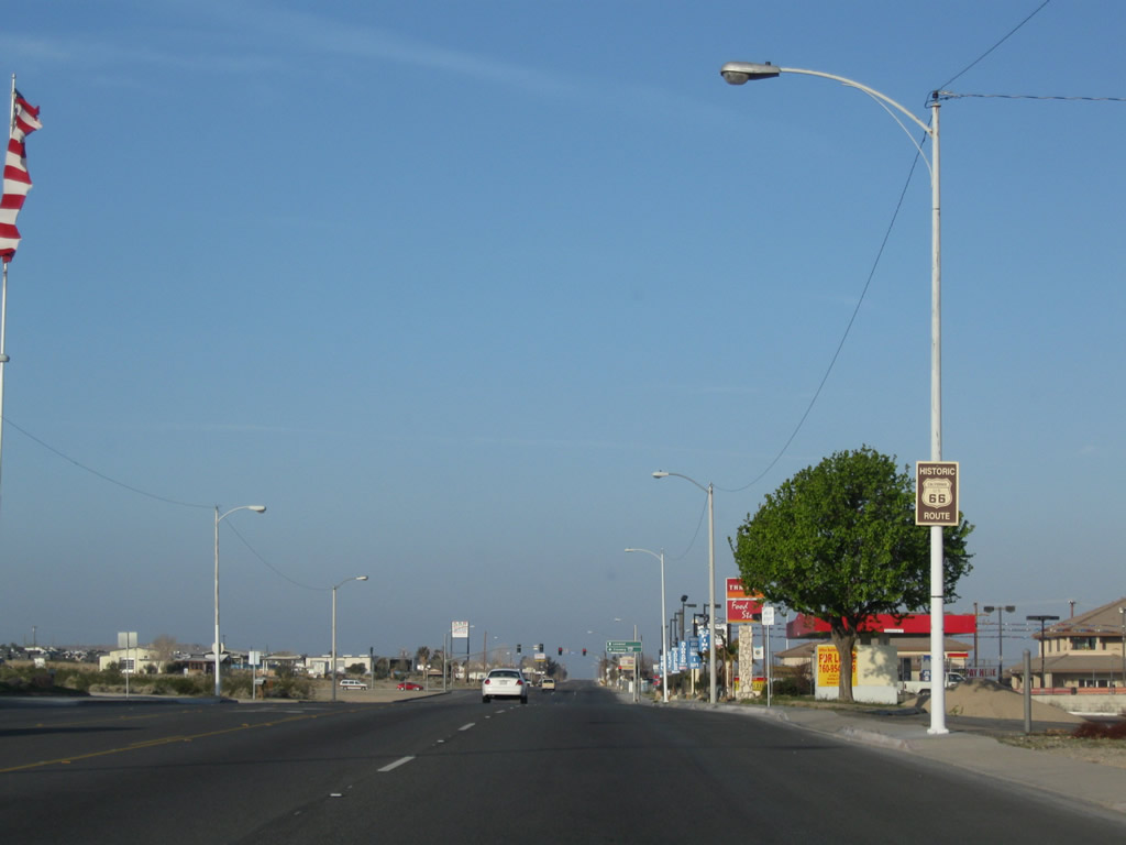
Historic U.S. 66 is fairly well signed through the city of Barstow.
03/15/09
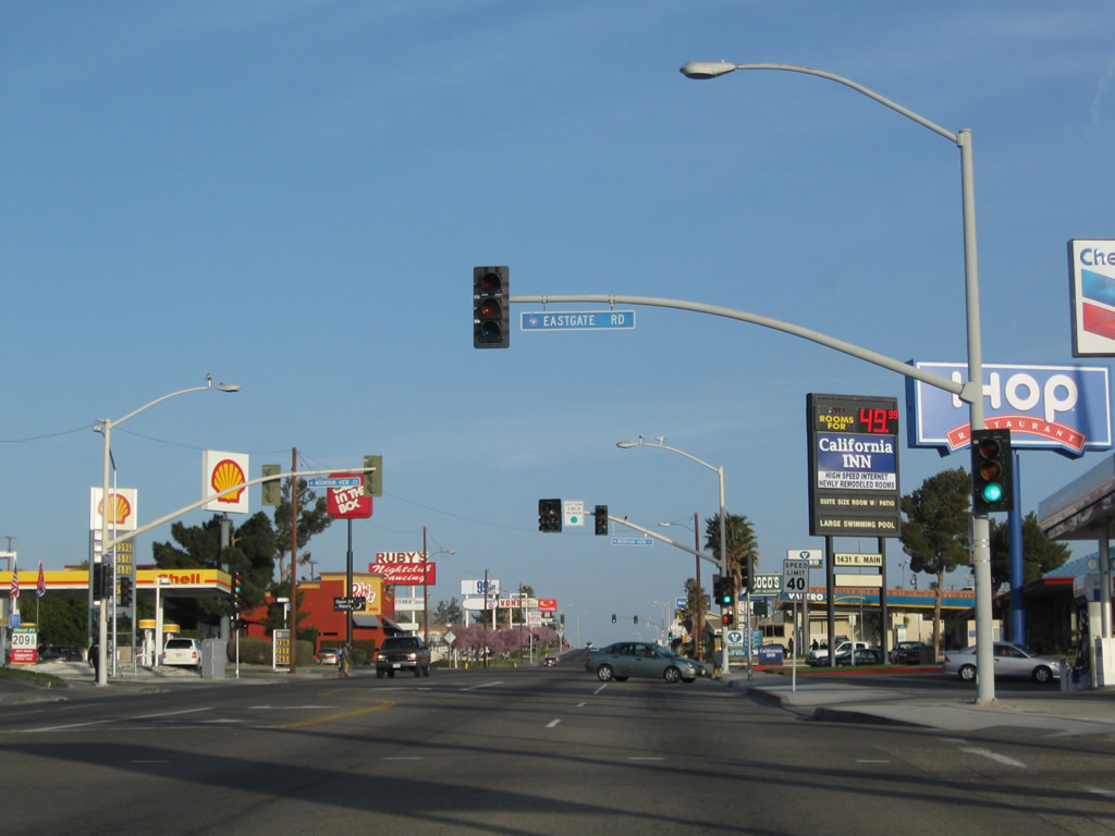
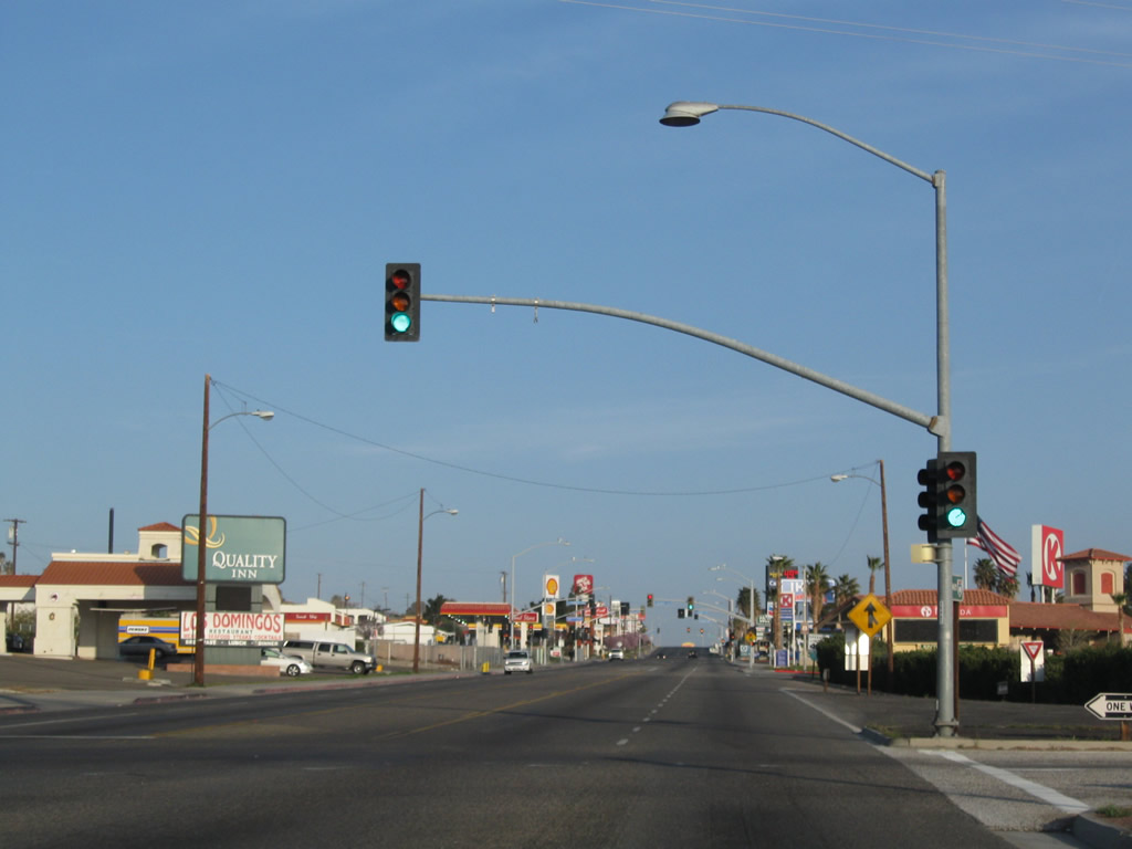
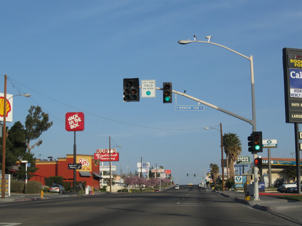
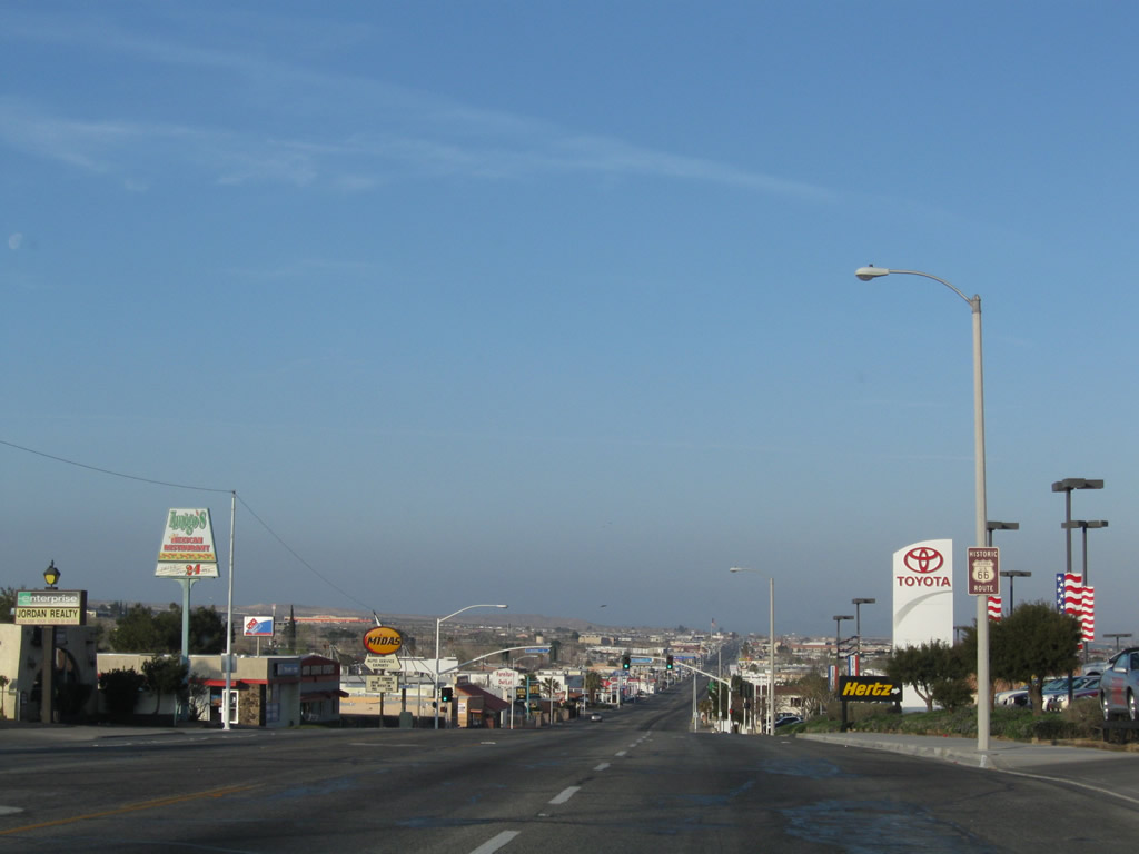
The confluence of signalized intersections with Coolwater Lane south, Eastgate Road east and Mountain View Street west line a commercialized stretch of E Main Street populated by traveler services.
03/15/09
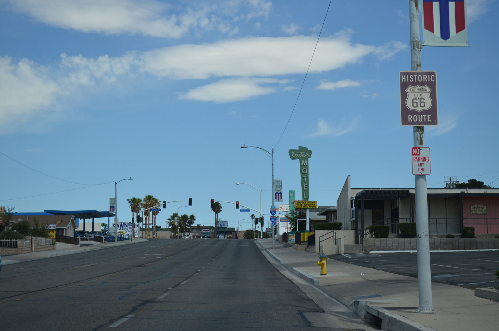
Westbound Business Loop I-15 and Historic U.S. 66 (Main Street) intersect Yucca Avenue by three shopping centers. Yucca Avenue runs north to connect with Riverside Drive west to the U.S. 66 Museum and historic train station.
03/15/09
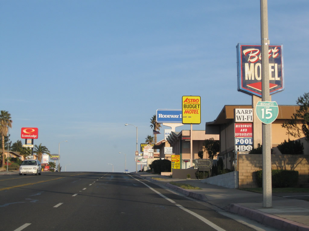
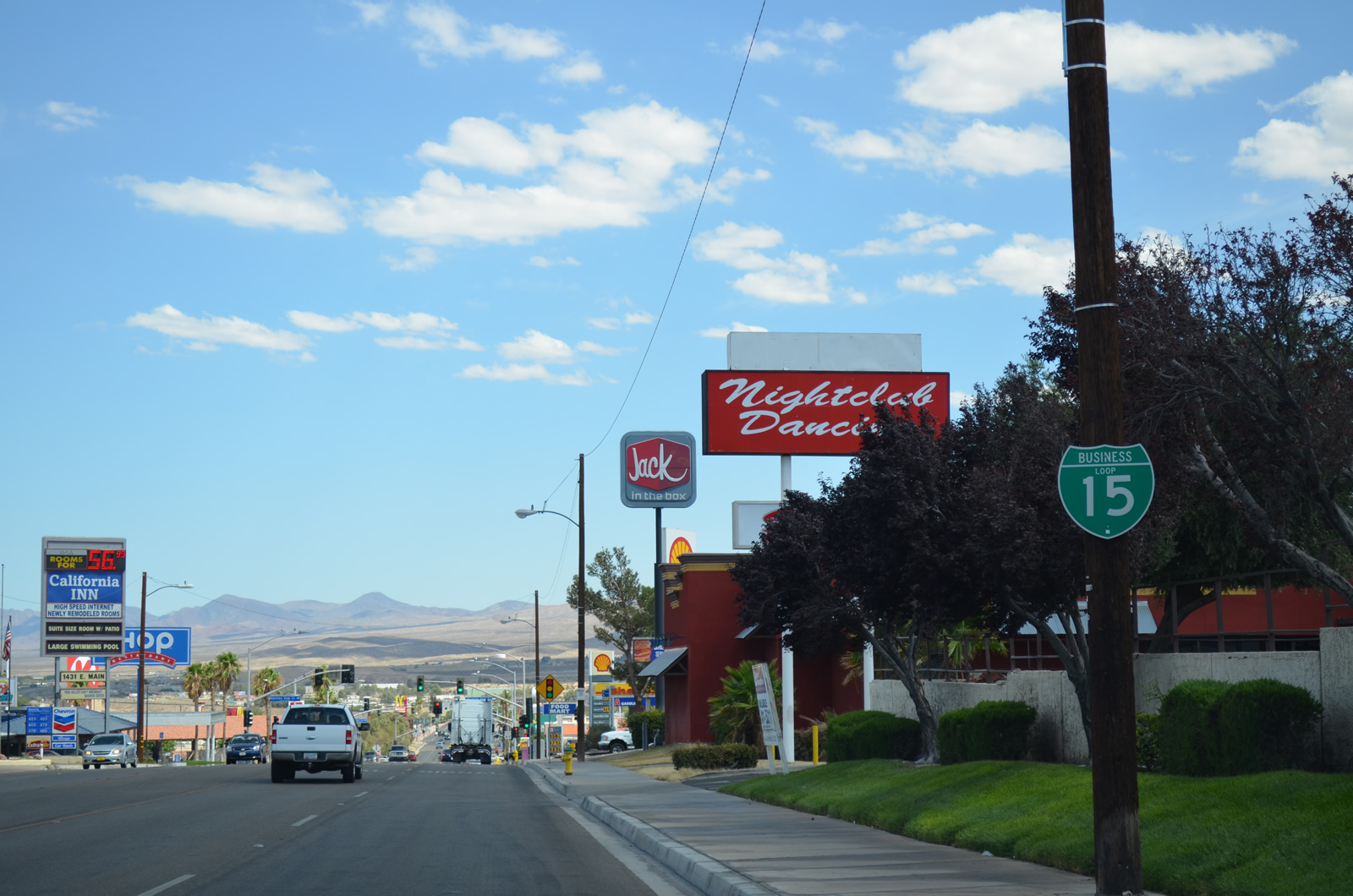
The Business Loop I-15 shield posted along westbound Main Street after Yucca Avenue was removed by 2022.
03/15/09
Curving west toward Downtown Barstow, Main Street rises to an elevation of 2,240 feet above sea level.
03/15/09
The Harvey House, Amtrak Station, Route 66 Museum, and Western America Railroad Museum lie north of Historic U.S. 66 along First Avenue (old U.S. 91), which ties into Main Street at the west end of Downtown Barstow.
03/15/09
B Street appears along the western horizon beyond the signalized intersection joining Main Streetand Muriel Drive.
03/15/09
Main Street constitutes a five lane commercial boulevard west to Barstow Road in Downtown Barstow.
03/15/09
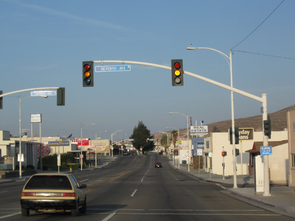
Westbound Business Loop I-15 and Historic U.S. 66 (Main Street) meet Seventh Avenue at this signalized intersection.
03/15/09
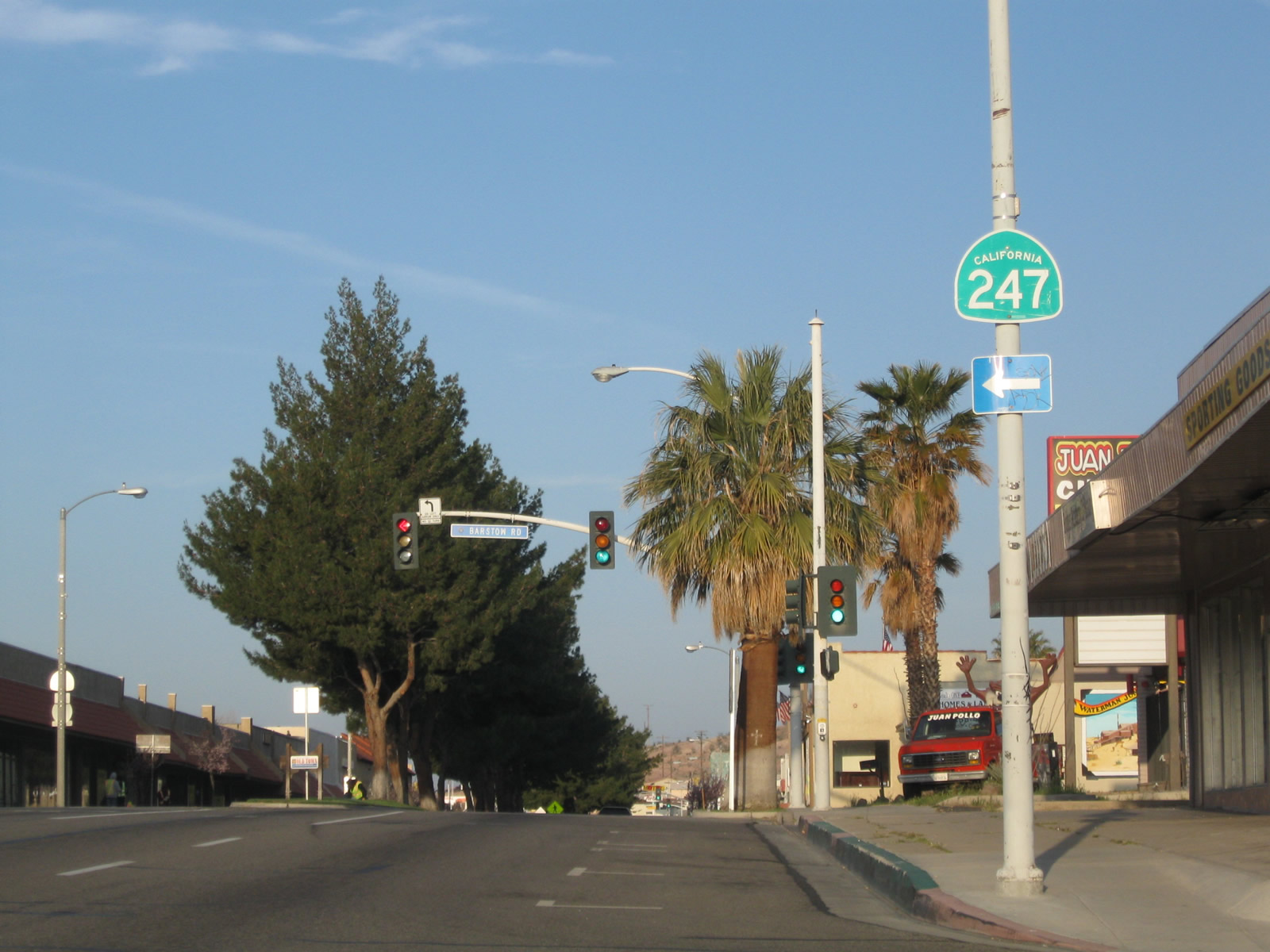
Barstow Road south connects to State Route 247 at Interstate 15, 0.75 miles south of Main Street. SR 247 travels south from Barstow to Lucerne Valley.
03/15/09
A tree lined median separates traffic along Main Street west between Barstow Road and 2nd Avenue through Downtown Barstow.
03/15/09
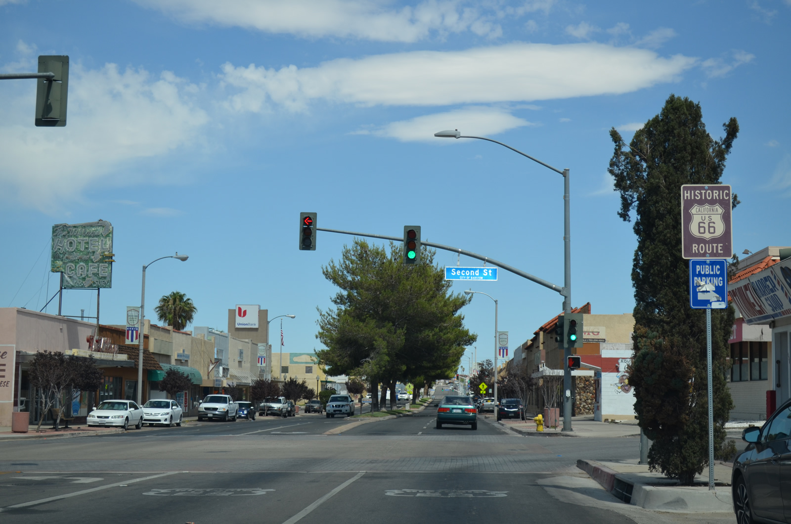
Historic U.S. 66 is signed along Main Street west of N 3rd Avenue in Downtown Barstow.
03/15/09
Business Loop I-15/Historic U.S. 66 (Main Street) continue west to the signalized intersection with N 2nd Avenue.
03/15/09
First Avenue is the old alignment of U.S. 91 north to the BNSF Railyard, Harvey House, which houses the Western American Railroad and Route 66 Mother Road Museums, and Old U.S. 466 (Old Highway 58) in north Barstow.
03/15/09
The historic route of U.S. 91 follows Historic U.S. 66 southwest to San Bernardino.
03/15/09
Passing south of B Hill, Historic U.S. 66 (Main Street) shifts southward ahead of Otis Avenue.T
03/15/09
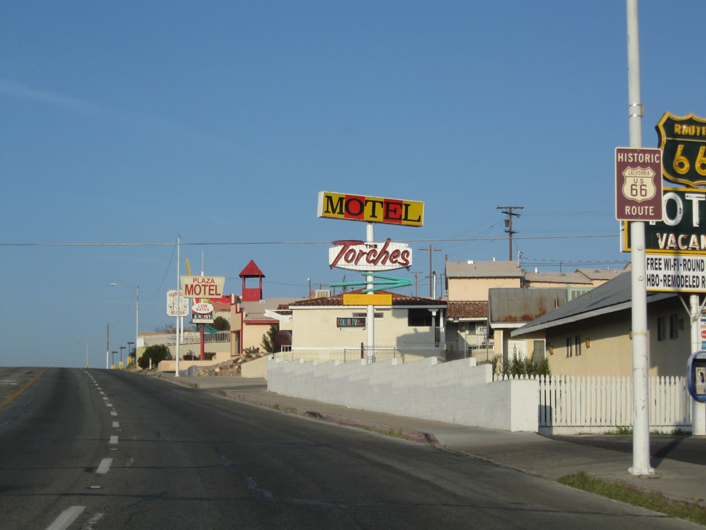
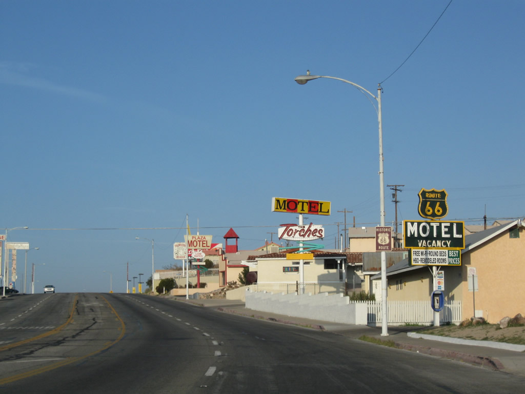
A vintage sign for the Route 66 Motel along Main Street westbound ahead of Dillingham Drive.
03/15/09
Historic U.S. 66 sign posted along Main Street west at May Avenue.
03/15/09
The next traffic signal along Business Loop I-15 and Historic U.S. 66-91 south is with Avenue A.
03/15/09
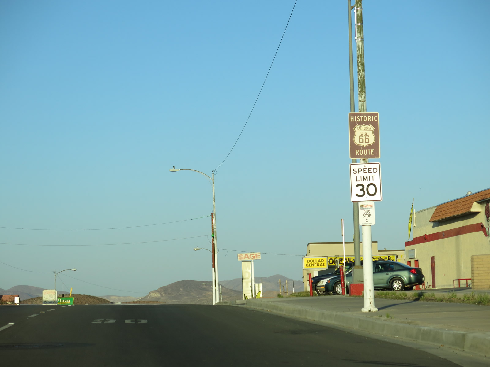
As Main Street proceeds southwest, intersecting streets increase in naming from Avenue A, Avenue B, Avenue C, etc. An I-15 trailblazer stands along Business Loop I-15 southbound by Bradshaw Drive.
03/15/09
The Historic U.S. 66 sign along Main Street west at Avenue E was removed by 2021.
03/15/09
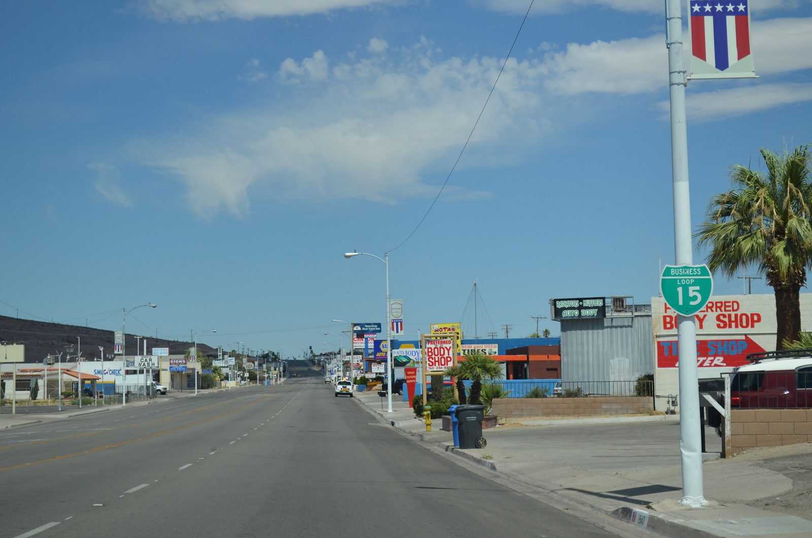
Avenue H intersects Historic U.S. 66 south from the BNSF Barstow Railyard and north from the Barstow Heights neighborhood.
03/15/09
The Business Loop I-15 reassurance shield posted after Avenue H was gone by 2023.
03/15/09
Historic U.S. 66 (Main Street) west of Avenue J.
03/15/09
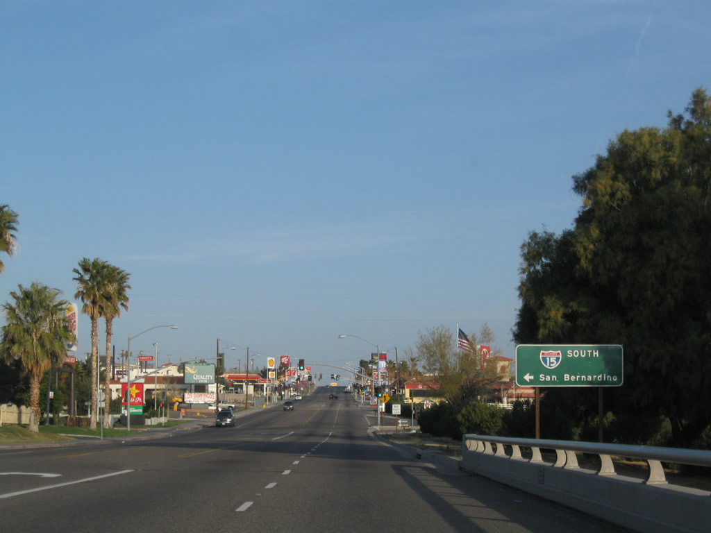
The overhead preceding the turn of Business Loop I-15 south onto L Street was removed after 2023. Historic U.S. 66-91 remain along Main Street south to the community of Lenwood en route to Oro Grande and Interstate 15 in Victorville.
03/15/09
Business Loop I-15 south is unmarked as the route separates from Historic U.S. 66/91 (Main Street) onto L Street south.
03/15/09
Southbound Business Loop I-15 continues 0.4 miles south along L Street to a diamond interchange (Exit 181) with Interstate 15 north to Las Vegas and south to Victorville and San Bernardino.
03/15/09
Originally a two-wye interchange connected the south end of Business Loop I-15 with Interstate 15 in west Barstow.
03/15/09
L Street extends south from the exchange joining Business Loop I-15 and I-15 into the Barstow Heights community.
03/15/09
Photo Credits:
- Andy Field: 01/20/04, 03/15/09, 03/24/13, 07/20/14
Connect with:
Page Updated Thursday August 07, 2025.