
Interstate 17 South - Camp Verde to Spring Valley
 South
South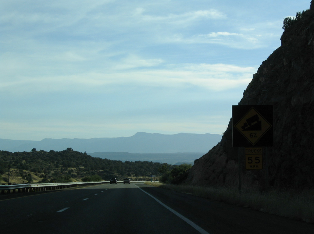
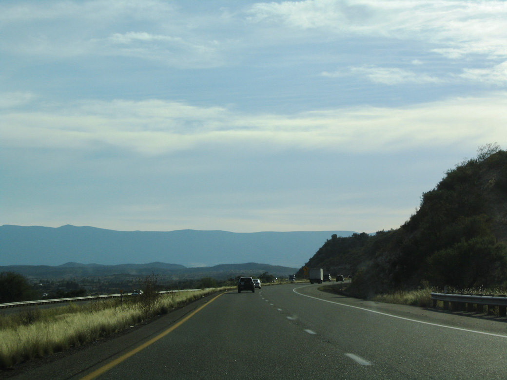
Interstate 17 advances southwest from Stoneman Lake Road into Hog Canyon.
10/27/03
10/27/03
Interstate 17 lowers from 4,800 feet above sea level ahead of Hog Canyon to below 3,900 feet at Exit 298 with the south end of SR 179.
10/27/03
10/27/03
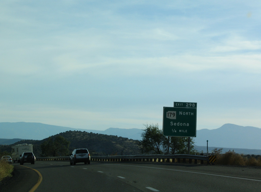
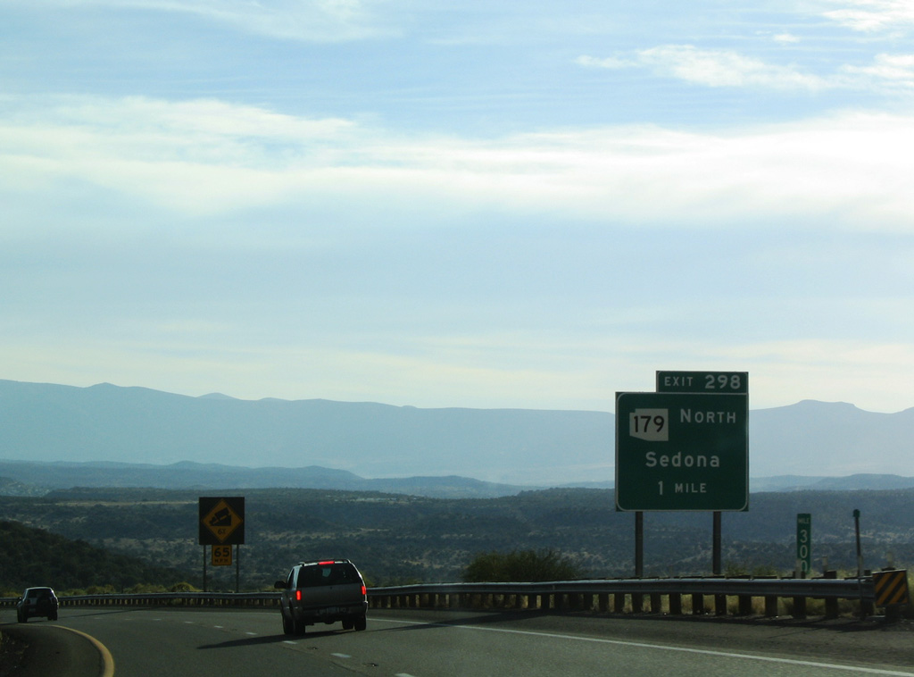
SR 179 travels 14.56 miles north from Interstate 17 to a roundabout with SR 89A in the town of Sedona.
10/27/03
10/27/03
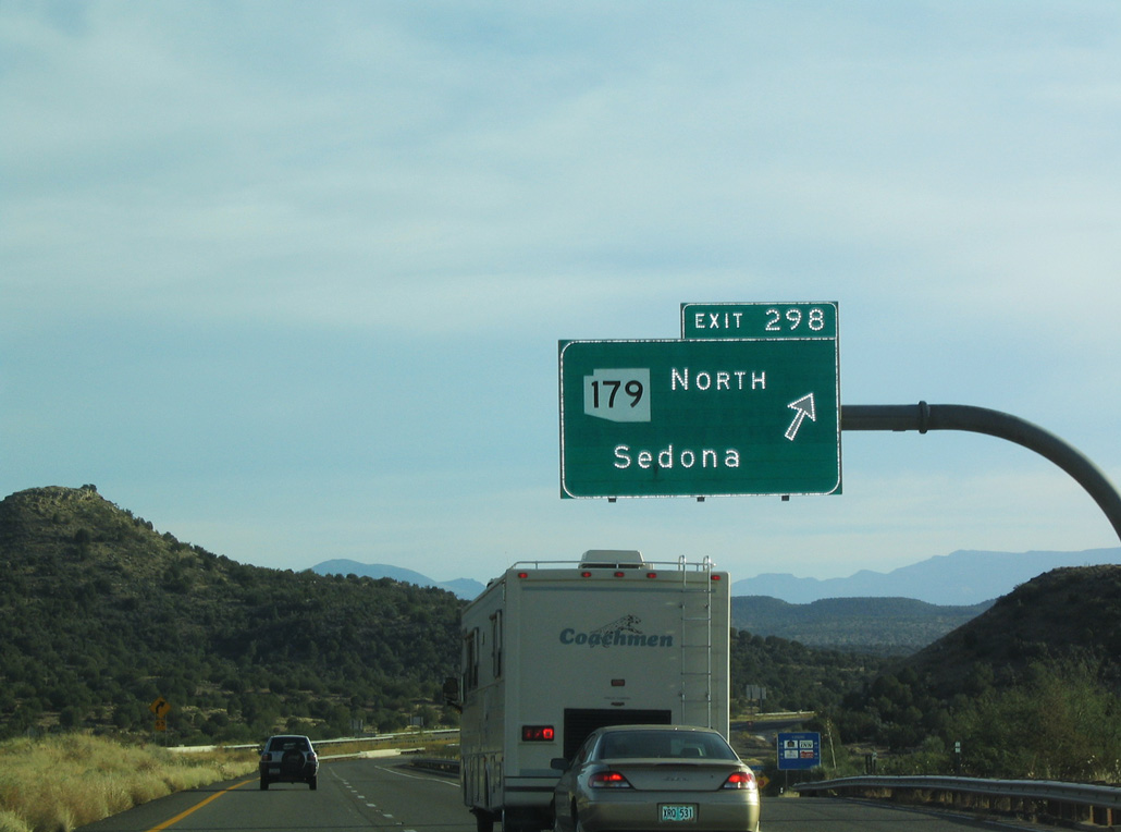
Exit 298 departs Interstate 17 south for SR 179 north to the Village of Oak Creek and Beaver Creek Road east into Coconino National Forest.
10/27/03
10/27/03
Continuing south, Interstate 17 next reaches the McGuireville Rest Area.
10/27/03
10/27/03
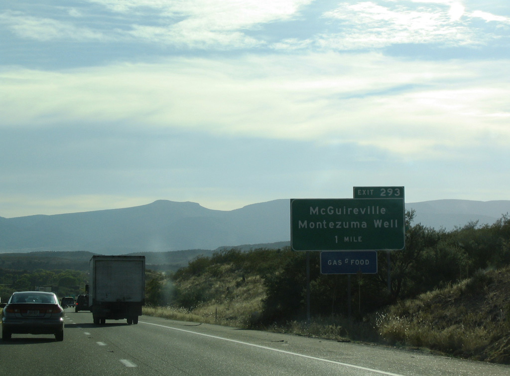
CR 30 (Cornville Road) south and E Beaver Creek Road west come together at Interstate 17 and McGuireville in one mile.
10/27/03
10/27/03
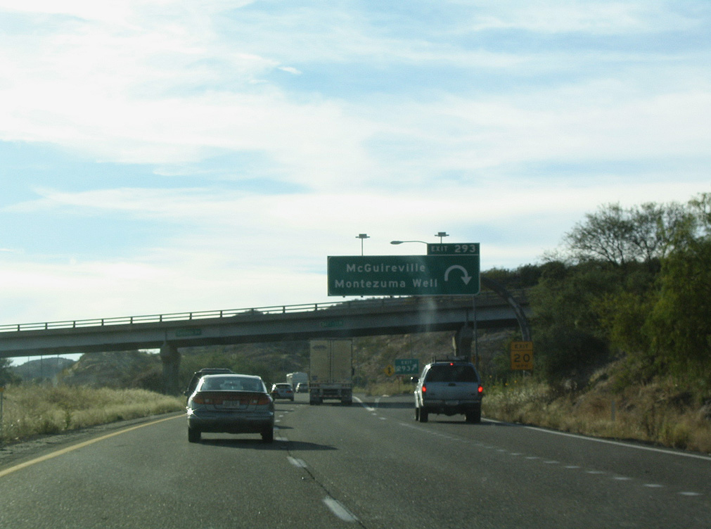
Beaver Creek Road heads east from the parclo interchange at Exit 293 to Rimrock and Lake Montezuma. CR 30 travels northwest to Cornville and SR 89A in the city of Cottonwood.
10/27/03
10/27/03
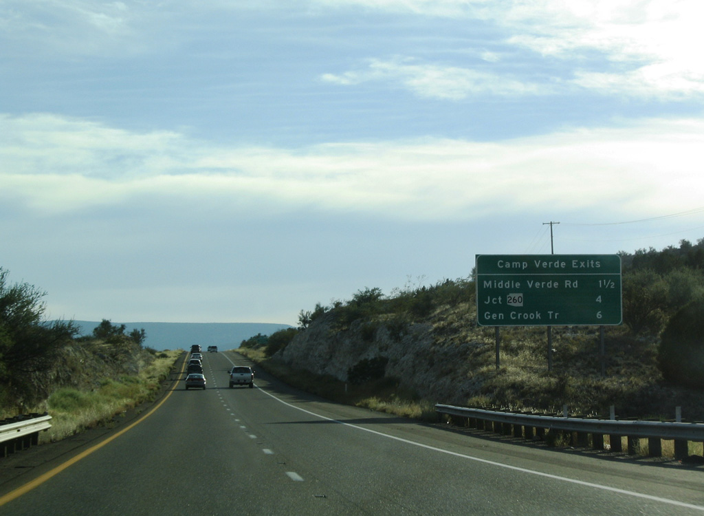
The next three exits from Interstate 17 south fall within the town of Camp Verde.
10/27/03
10/27/03
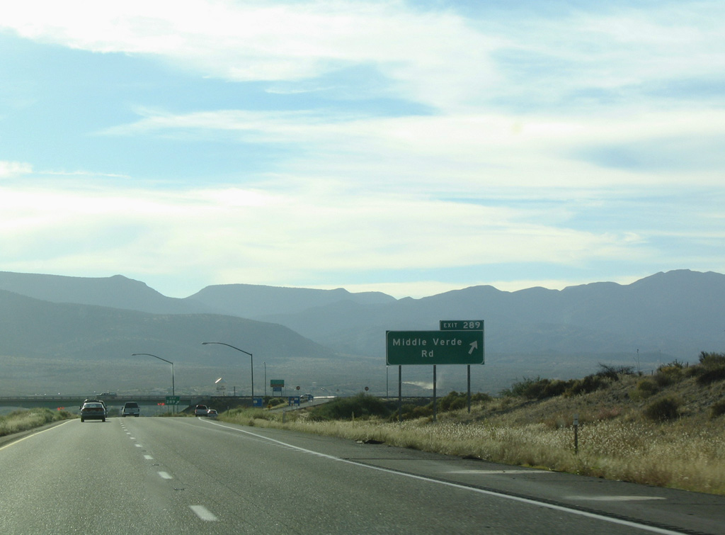
A dumbbell interchange (Exit 289) connects Interstate 17 with Middle Verde Road west of Montezuma Castle National Monument.
10/27/03
10/27/03
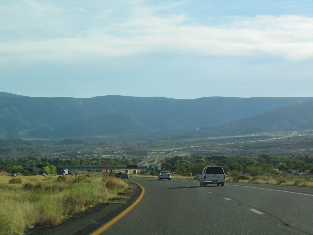
Interstate 17 lowers to cross the Verde River.
10/27/03
10/27/03
10/27/03
10/27/03
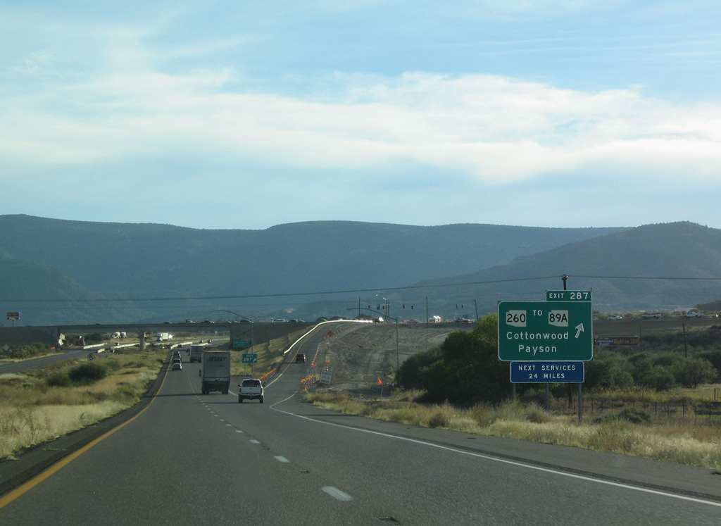
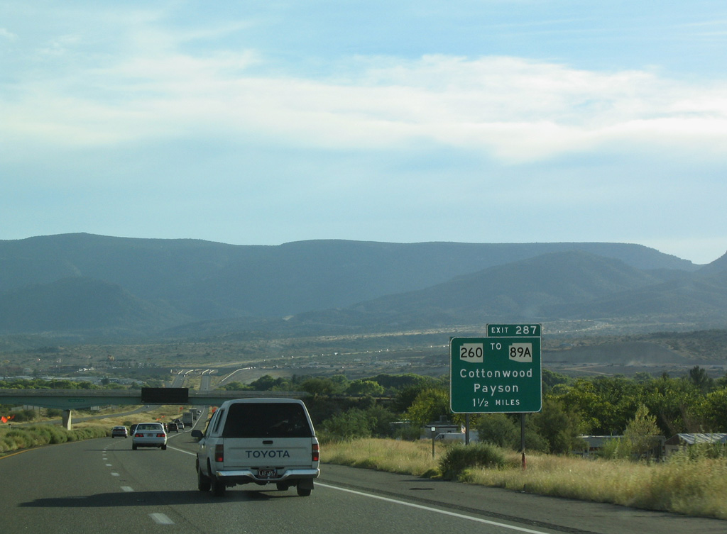
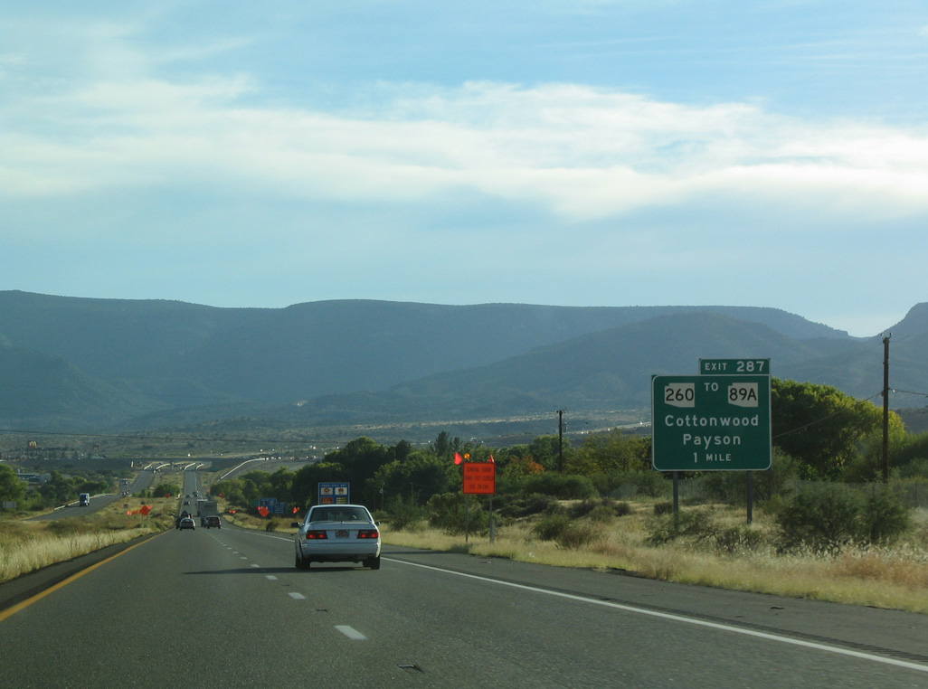
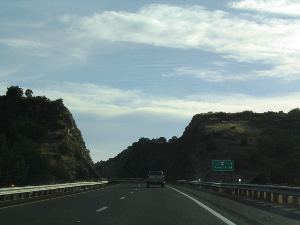
Exit 287 leaves I-17 south for SR 260 west to SR 89A south for Prescott and east around Camp Verde to SR 87 and Payson.
10/27/03
10/27/03
10/27/03
10/27/03
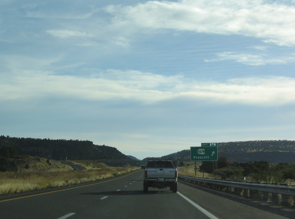
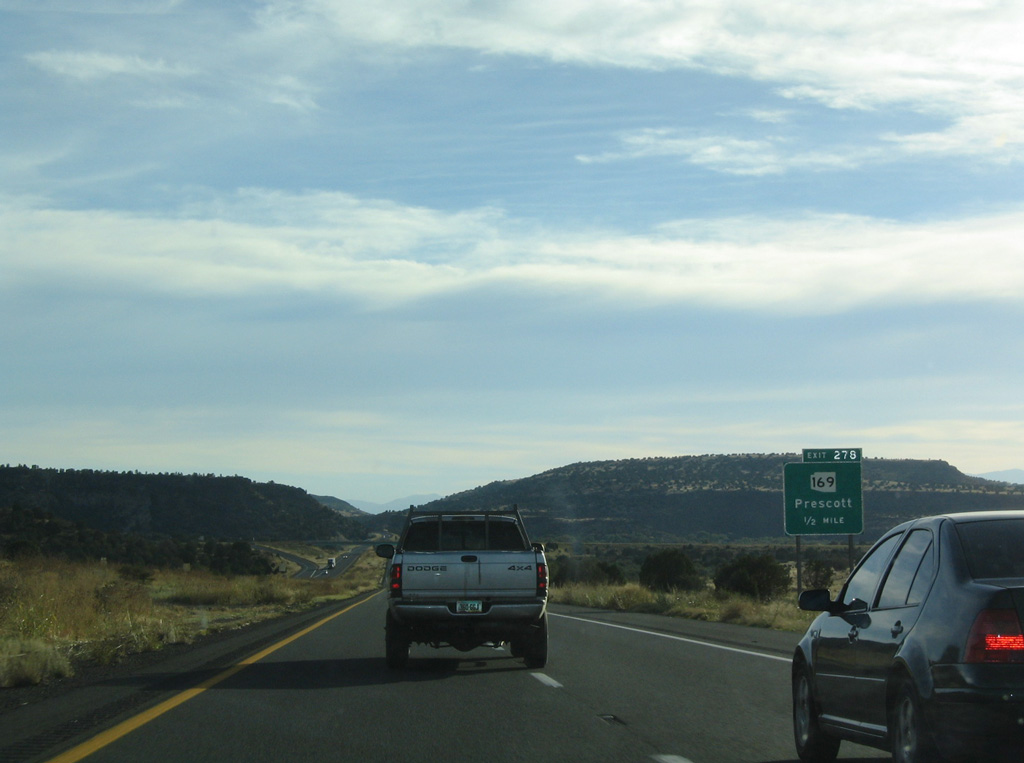
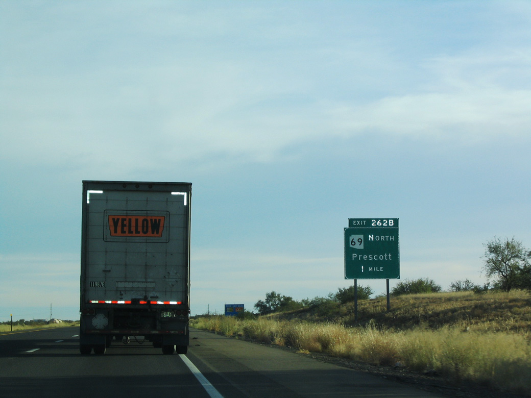
Southbound Interstate 17 at Exit 278 for SR 169 west to SR 69 and Prescott.
10/27/03
10/27/03
10/27/03
10/27/03
10/27/03
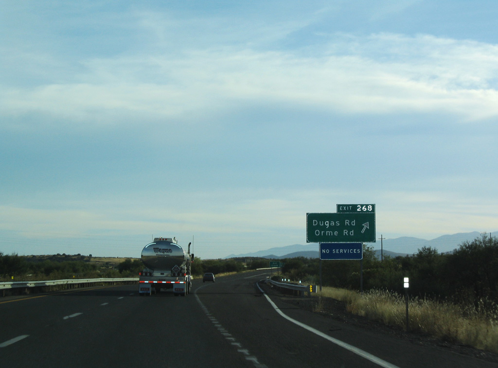
Dugas Road north and Orme Road south come together at a diamond interchange (Exit 268) with Interstate 17.
10/27/03
10/27/03
10/27/03
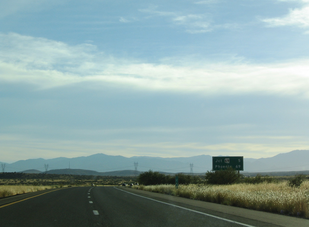
SR 69 travels 34.13 miles from I-17 at Cordes Lake and Spring Valley to SR 89 at Prescott.
10/27/03
10/27/03
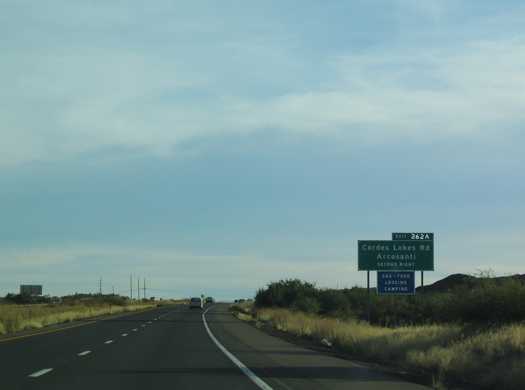
Arcosanti Road links I-17 at Exit 263 with S Cross L Road north to Arcosanti and Stagecoach Trail south into Cordes Lakes.
10/27/03
10/27/03
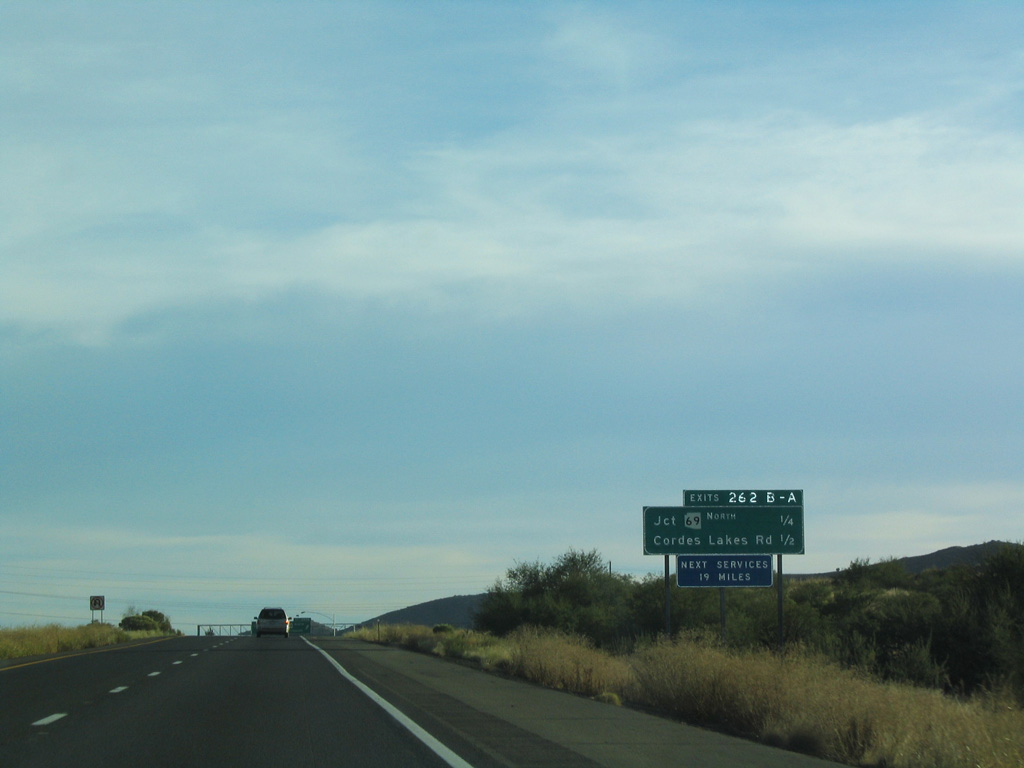
Construction in 2011-12 replaced the cloverleaf interchange (Exit 262) with SR 69 north with a diamond interchange (Exit 263) at Arcosanti Road and a separate wye with the south end of SR 69.
10/27/03
10/27/03
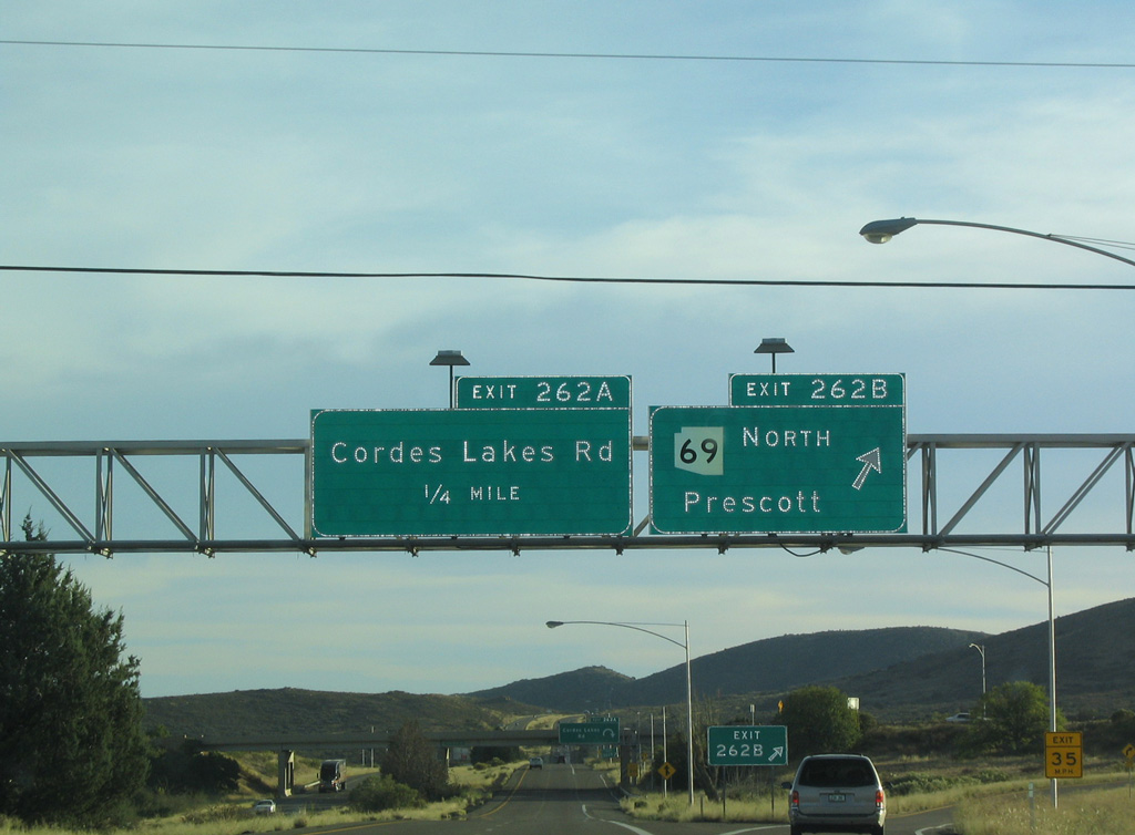
SR 69 constitutes a four lane, divided highway northwest 18 miles to Mayer and Dewey-Humboldt.
10/27/03
10/27/03
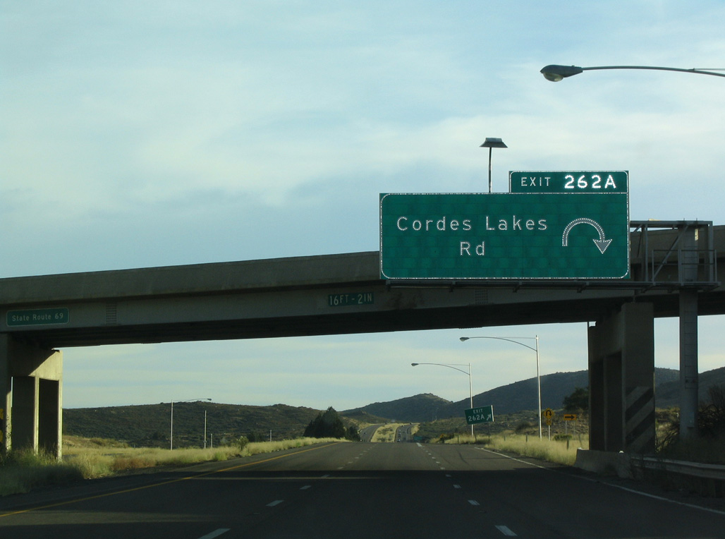
The former loop ramp (Exit 262A) for Cordes Lakes Road east to Stagecoach Trail and the Cordes Lakes community. Southward from this point, Interstate 17 overlays the historical route of SR 69.
10/27/03
10/27/03

Photo Credits:
- Andy Field: 10/27/03
Connect with:
Page Updated Saturday April 23, 2022.