
Interstate 24 East - Nashville
 East
East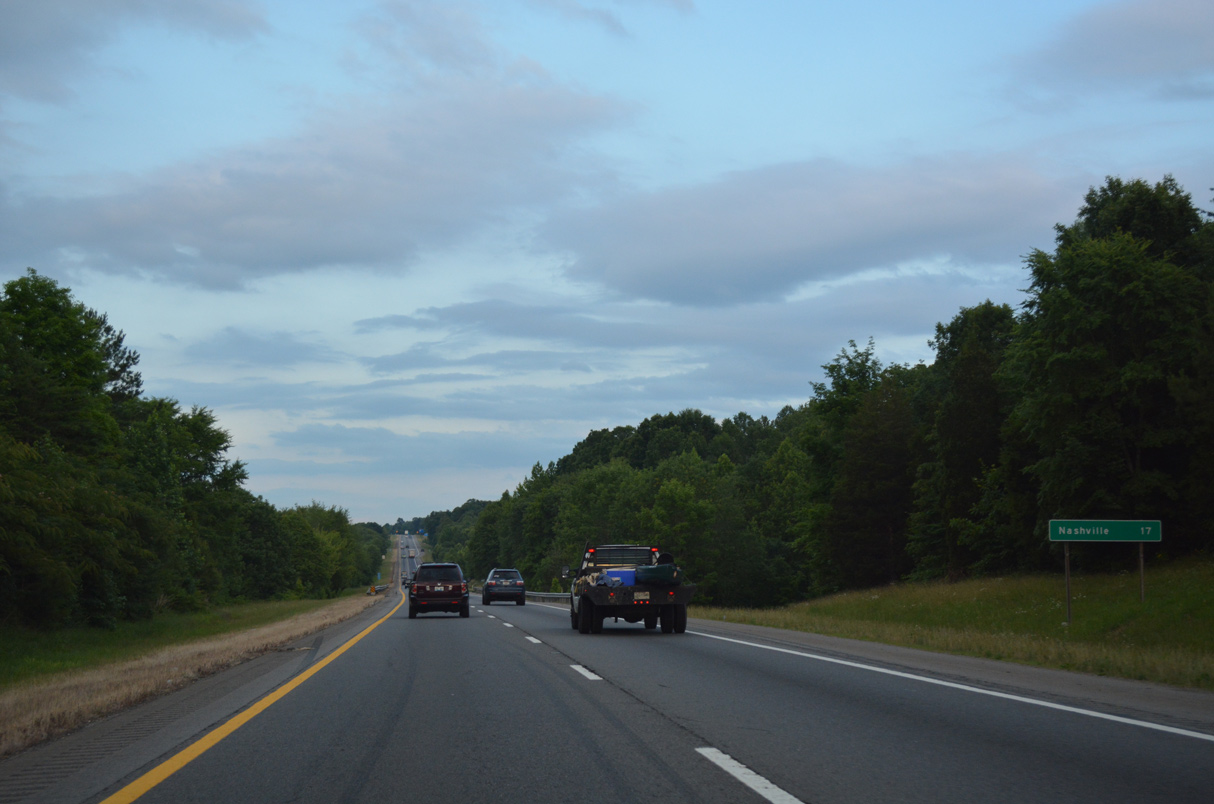
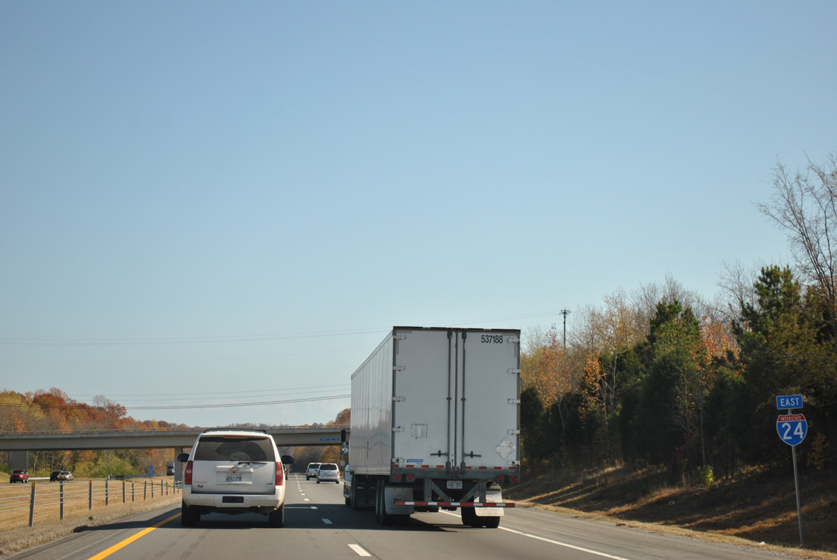
A series of ridges dominate northern areas of Nashville-Davidson County as Interstate 24 proceeds 17 miles southeast to Downtown.
06/11/17
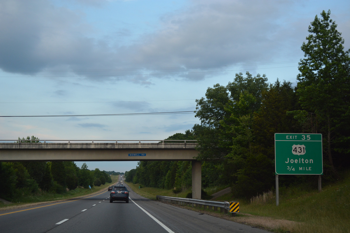
U.S. 431 (Whites Creek Pike) heads south from Springfield to enter Nashville-Davidson County ahead of Forest Grove. The rural route comes together with Interstate 24 at a parclo interchange (Exit 35) in one mile.
06/11/17
Exit 35 departs Interstate 24 east for U.S. 431 (Whites Creek Pike) south to the adjacent community of Joelton. U.S. 431 makes a hairpin curve at Devils Elbow from there and enters a valley leading south along Earthman Fork to Whites Creek. I-24 and U.S. 431 meet again in ten miles.
06/11/17
Union Hill Road spans Interstate 24 ahead of a scenic stretch parallel to Claylick Road.
11/07/11
Interstate 24 winds southeast toward Lickton through a valley fed by Claylick Creek. Adjacent hills top out over 800 feet above sea level while the freeway travels some 250 feet below.
06/11/17
11/07/11

SR 45 (Old Hickory Boulevard) stems east from U.S. 431 at Whites Creek to cross paths with Interstate 24 at a diamond interchange (Exit 40) in one mile.
06/11/17
I-24 cuts across a hill separating the White Creek valley with the Little Creek area and Exit 40.
06/11/17
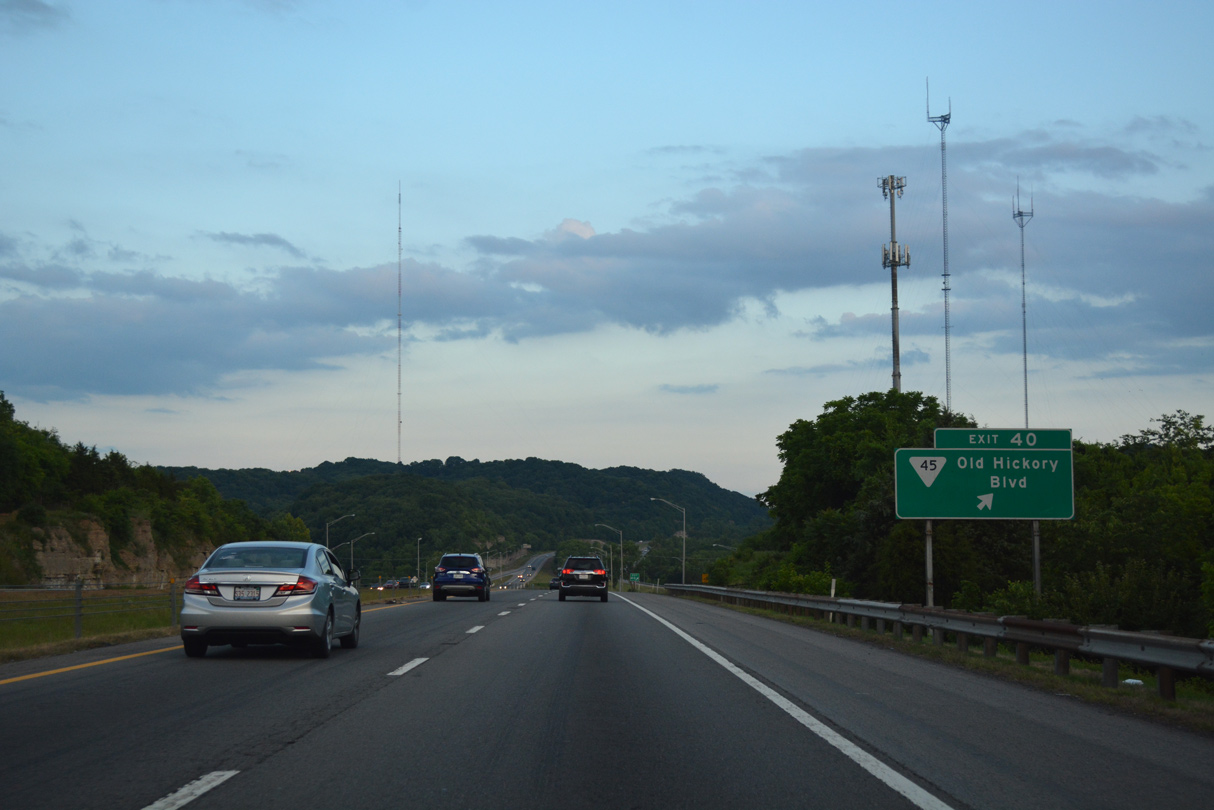
Exit 40 leaves Interstate 24 east for SR 45 (Old Hickory Boulevard). A number of transportation and distribution companies lie nearby. SR 45 otherwise arcs east from Little Creek through residential areas into Madison.
06/11/17

Limestone rock cuts are a common sight along Interstate freeways running through Nashville-Davidson County.
11/07/11
Climbing again, Interstate 24 traverses another array of hills east of Mackie Valley.
06/11/17
11/07/11
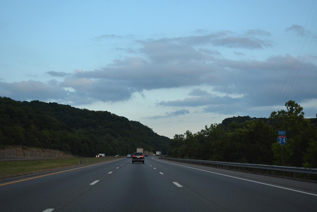
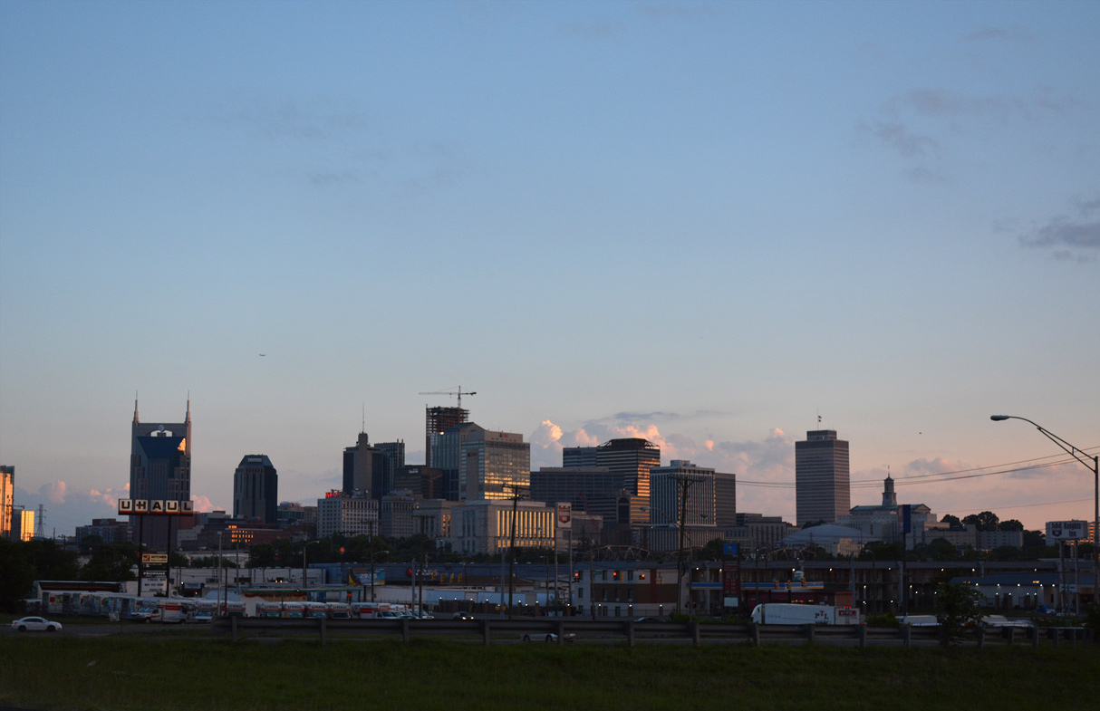
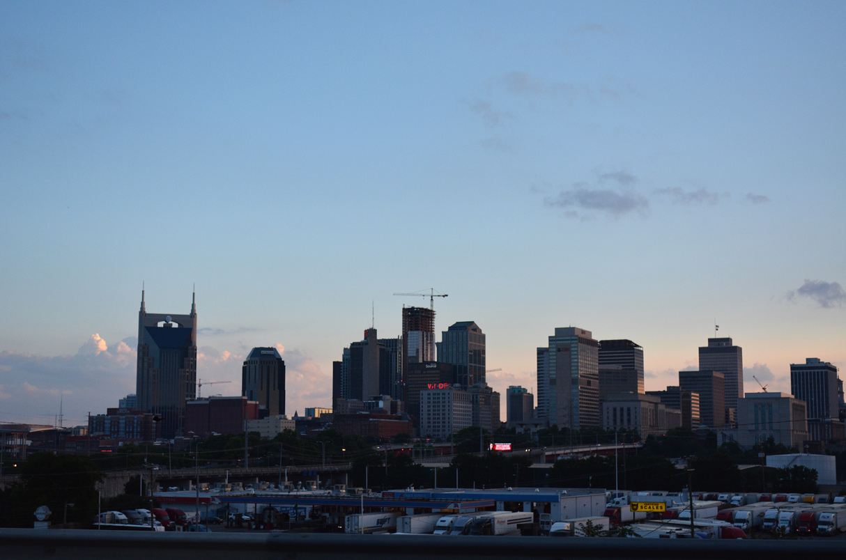
The Nashville central business district is eight miles to the south via I-24 and I-65.
06/11/17
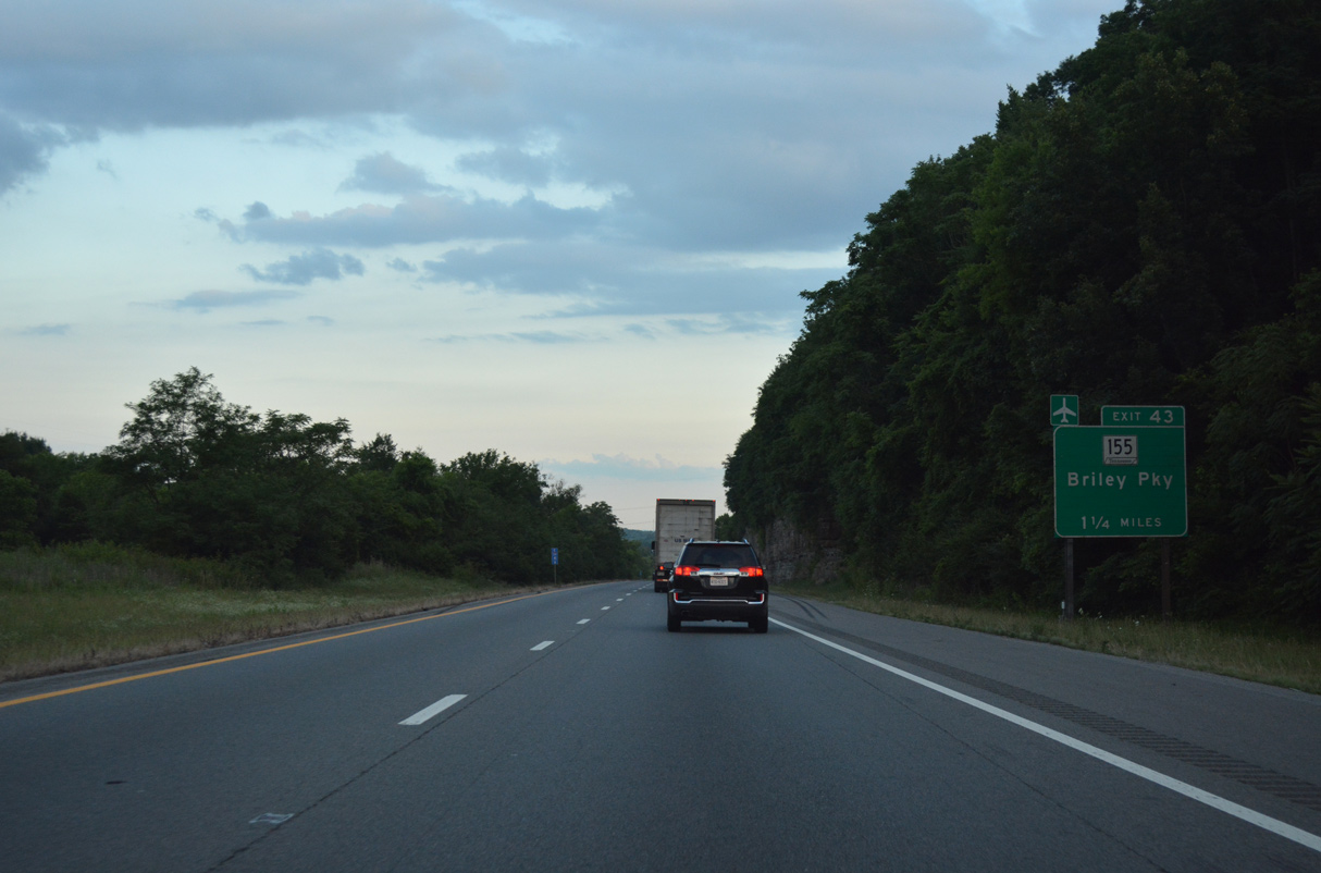
Interstate 24 becomes more urban once it reaches the cloverleaf interchange (Exit 43) with SR 155 (Briley Parkway).
06/11/17
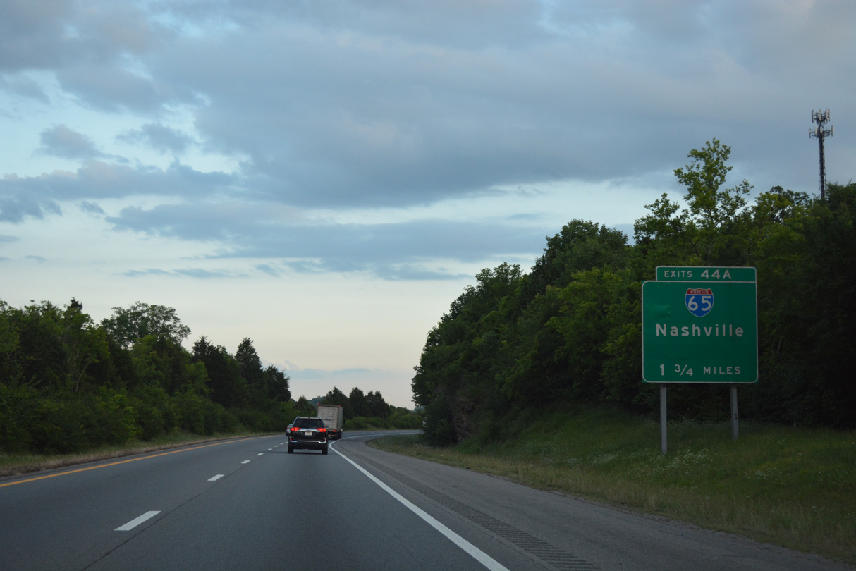
The three-wye interchange (Exits 44 A/B) joining I-24 east with Interstate 65 south lies a short distance beyond the exchange with SR 155 (Briley Parkway).
06/11/17
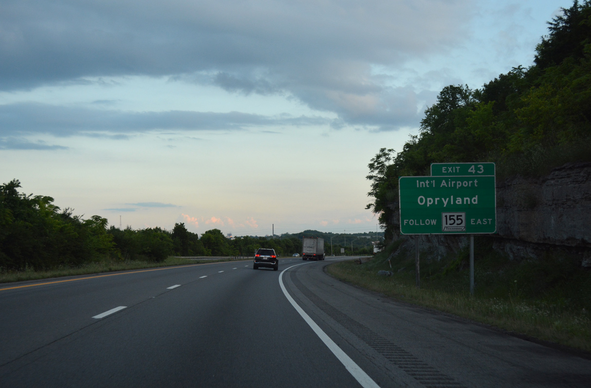
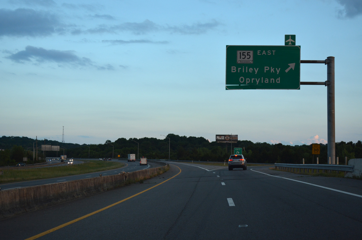
SR 155 is a freeway east to Madison, Haysboro, Opryland, Donelson and Interstate 40 west of Nashville International Airport (BNA).
06/11/17
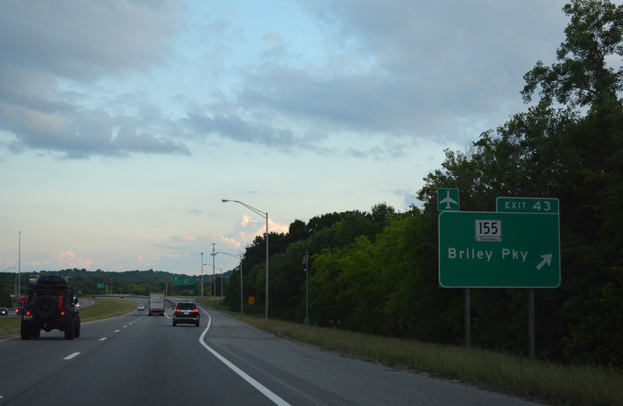
A single lane collector distributor roadway (Exit 43) links with SR 155 (Briley Parkway) from I-24 east.
06/11/17
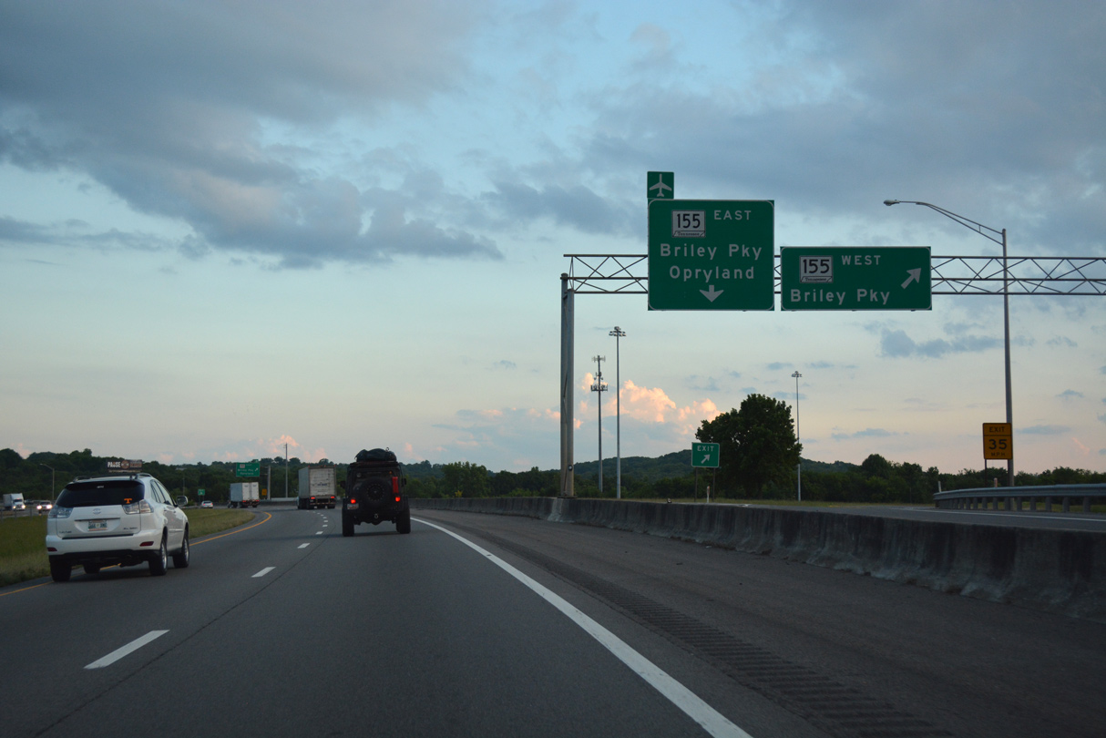
Briley Parkway arcs west to Jordonia, Bordeaux and Interstate 40 at west Nashville. The freeway along SR 155 ends at I-40, with White Bridge Road extending the route south to U.S. 70S (West End Avenue).
06/11/17
Traffic loops away from the c/d roadway (Exit 43) to SR 155 (Briley Parkway) east. The state route forms a 35 mile long beltway encircling central Nashville.
06/11/17
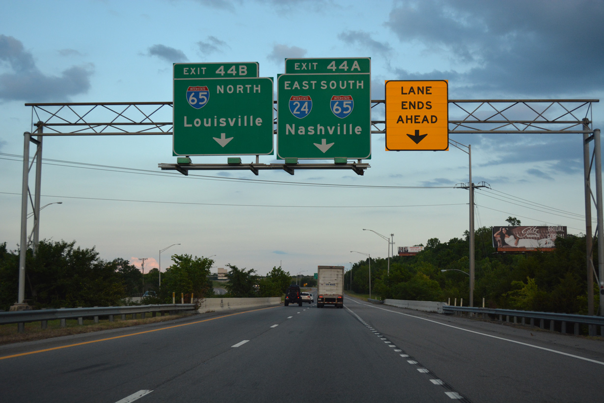
Exit 44 B provides access to I-65 north to Goodlettsville and the northeastern suburbs. Growing traffic demands on the corridor resulted in a $50 million expansion project between October 2012 and May 2016. Work widened I-65 to ten overall lanes from Trinity Lane, just south of Exit 44 A, to U.S. 31W/41 (Dickerson Pike) while two additional lanes were added to ramps with I-24.1
06/11/17
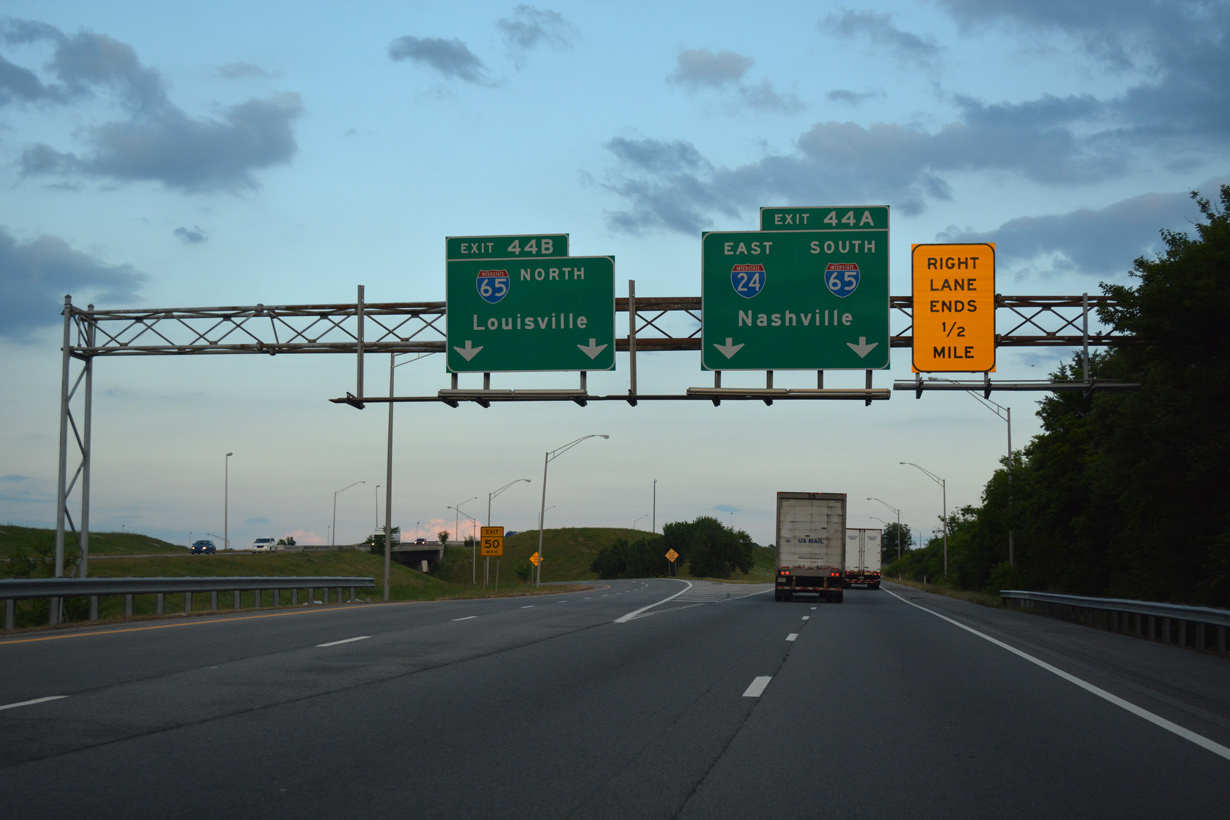
Interstate 65 north joins the Nashville area with Bowling Green, Elizabethtown and Louisville, Kentucky. Exit 44 A continues Interstate 24 east onto I-65 south toward Downtown Nashville.
06/11/17
East  South
South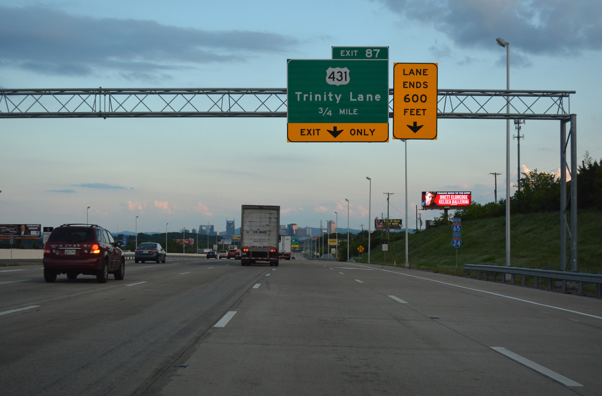
I-24/65 combine 0.75 miles north of Exit 87 to U.S. 431 (Trinity Lane). I-24 previously met U.S. 431 at Exit 35.
06/11/17
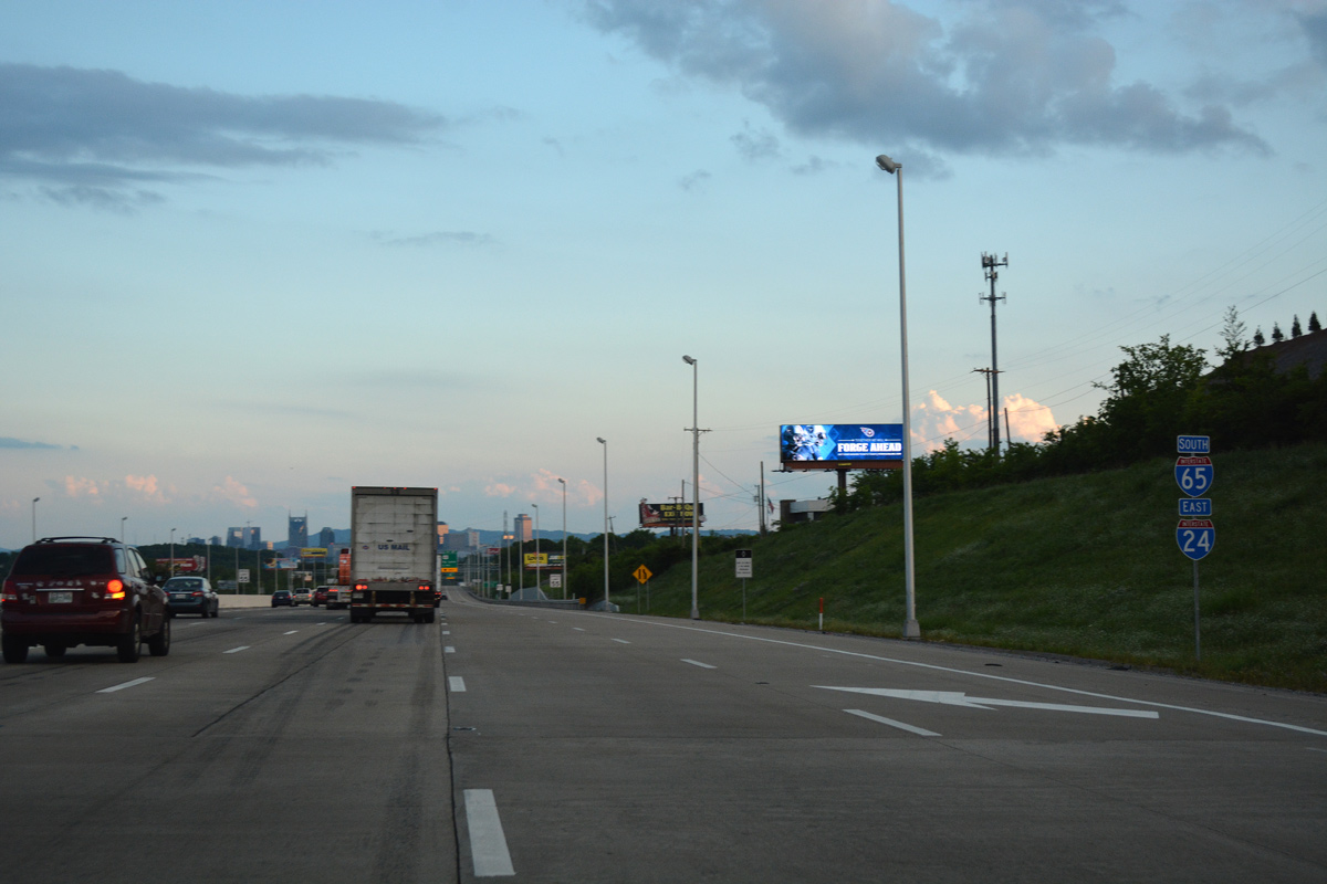
I-24 east and I-65 south overlap for 2.13 miles.
06/11/17
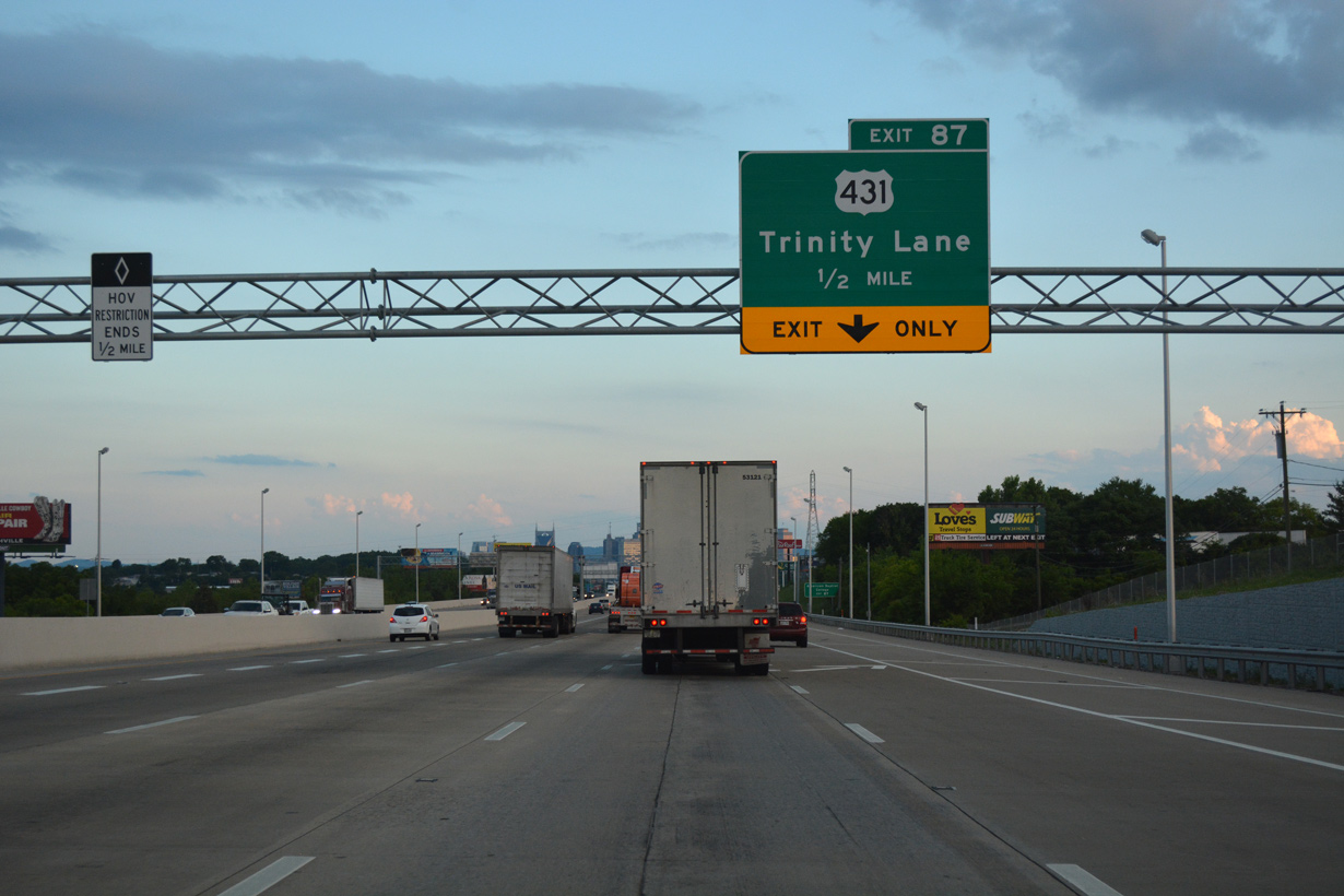
Exit 87 is a six-ramp parclo interchange. Loop ramps linking I-24/65 were previously removed to eliminate a weaving traffic pattern.
06/11/17
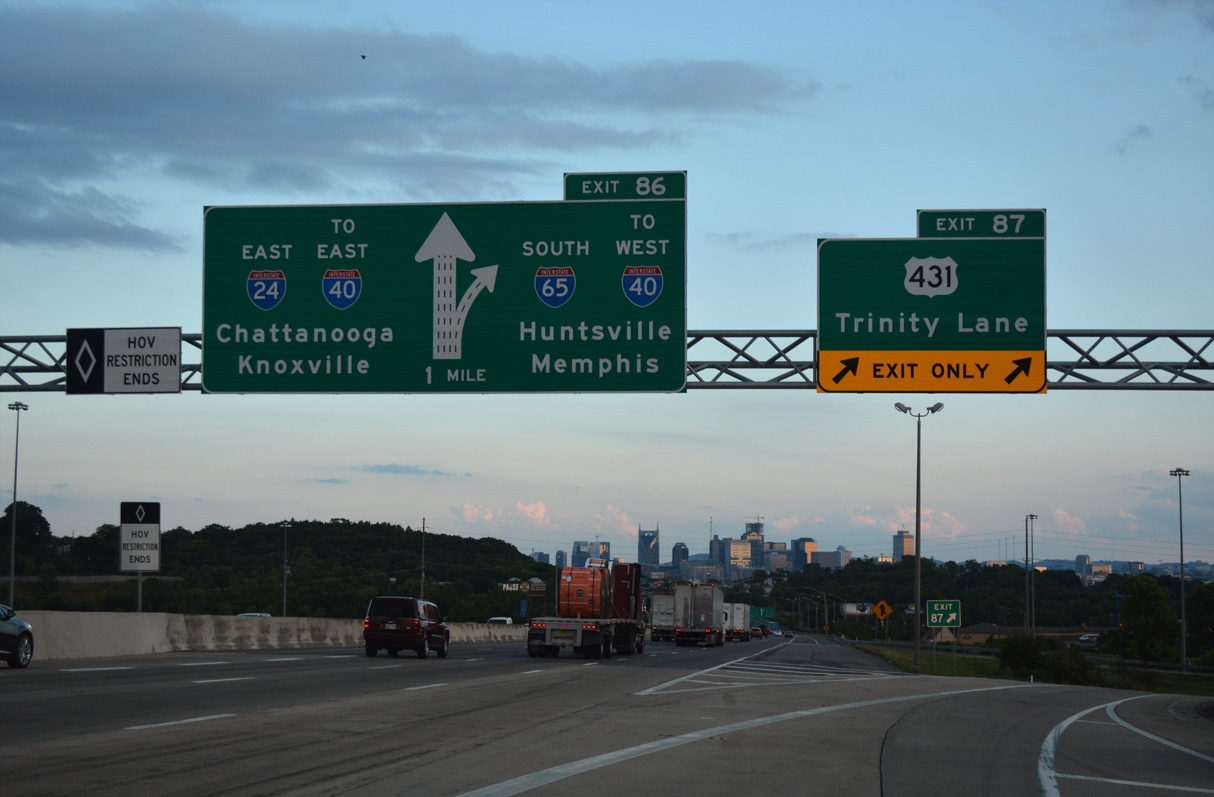
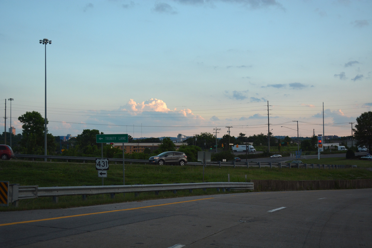
U.S. 431 follows Trinity Lane west to Whites Creek Pike north and east to an overlap with U.S. 31W/41 (Dickerson Pike) paralleling I-24/65 south to their separation at Exit 86.
06/11/17
Exit 87 connects with adjacent Brick Church Pike just north of U.S. 431 (Trinity Lane) at the Avondale neighborhood of Nashville.
06/11/17
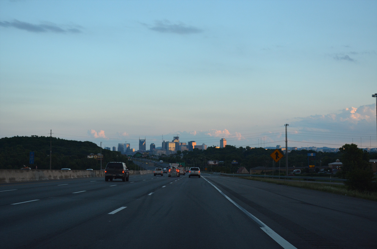
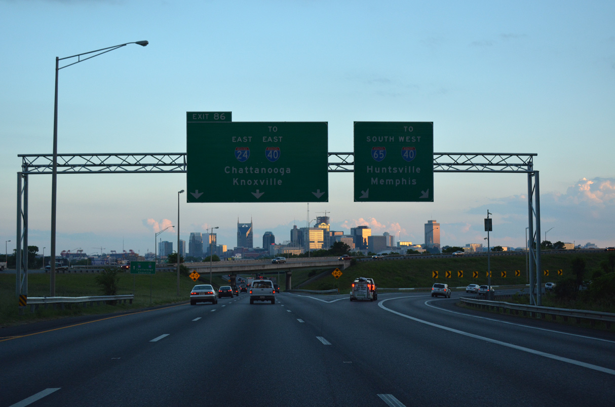
The Downtown Nashville skyline comes into view along I-24/65 south at Exit 87.
06/11/17
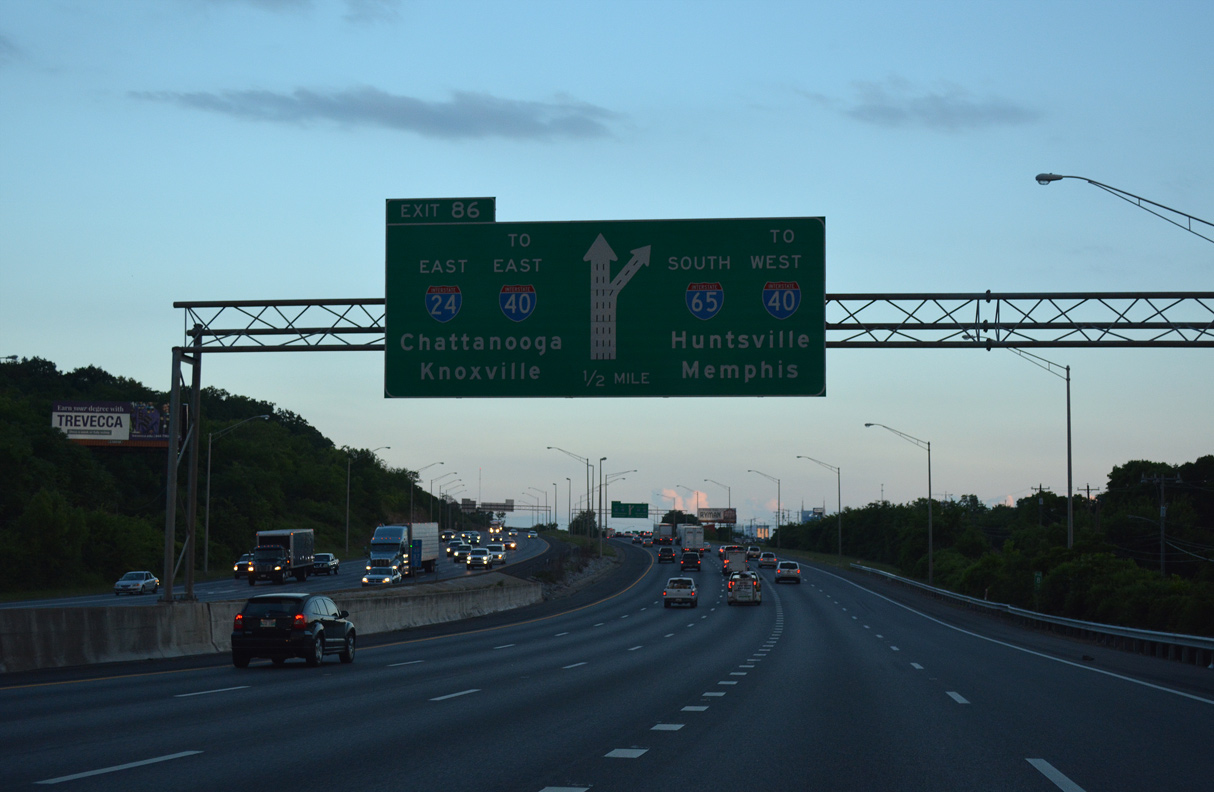
I-65 branches west from I-24 eastbound at a three-wye interchange (Exit 86) in a half mile.
06/11/17
I-65 encircles Downtown Nashville to the west from Germantown south to I-40. I-24 stays east of the central business district and Cumberland River to the Silliman Evans Bridge and I-40.
06/11/17
East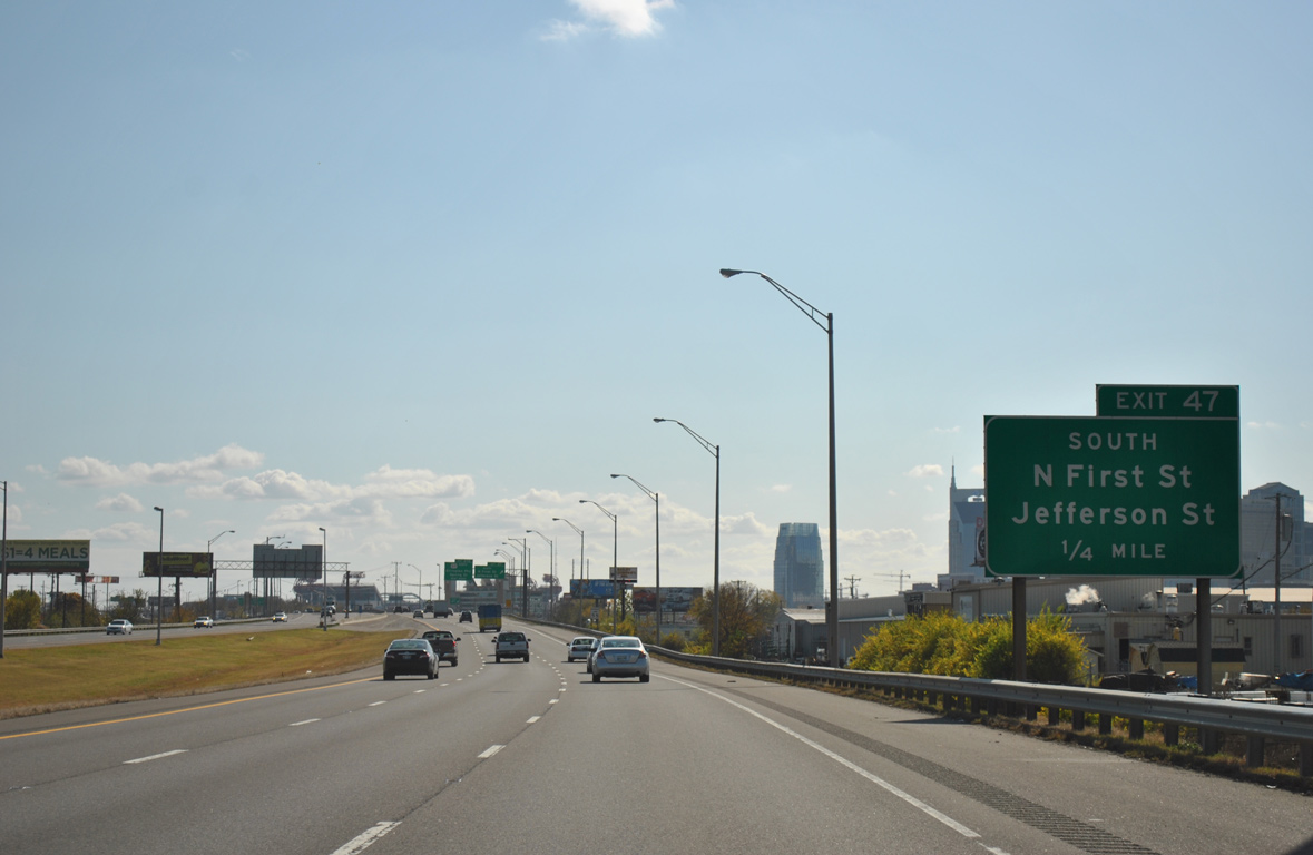
Interstate 24 passes between the industrial Cumberland Riverfront to the west and the Cleveland Park and McFerin Park communities to the east ahead of Exit 47 with 1st Street south to Spring and Jefferson Streets.
11/07/11
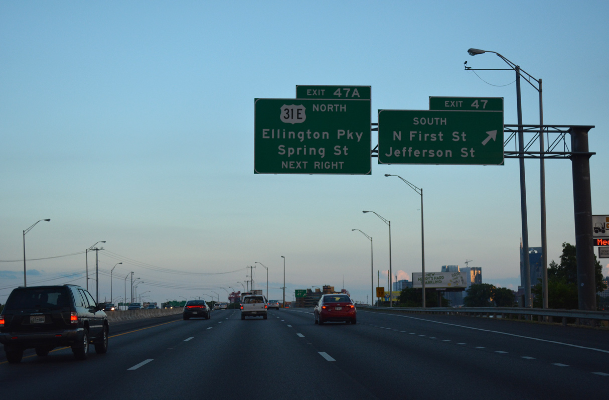
Jefferson Street spans the Cumberland River west to Germantown and Bicentennial Mall State Park while 1st Street continues south to Nissan Stadium. Exit 47 A follows at the cloverleaf interchange with Spring Street, which extends east from Jefferson Street to become a part of U.S. 31W-41-431 to U.S. 31E (Ellington Parkway).
06/11/17
Located on the north side of Downtown Nashville, the Tennessee State Capitol appears from Interstate 24 at Exit 47.
06/11/17
U.S. 31W and U.S. 31E combine to form U.S. 31 at the south end of Ellington Parkway. Ellington Parkway (U.S. 31E) constitutes a freeway leading north to SR 155 (Briley Parkway) at Walton while U.S. 31W takes Dickerson Pike to the west. U.S. 31E/31W partitioned at Louisville, Kentucky.
06/11/17
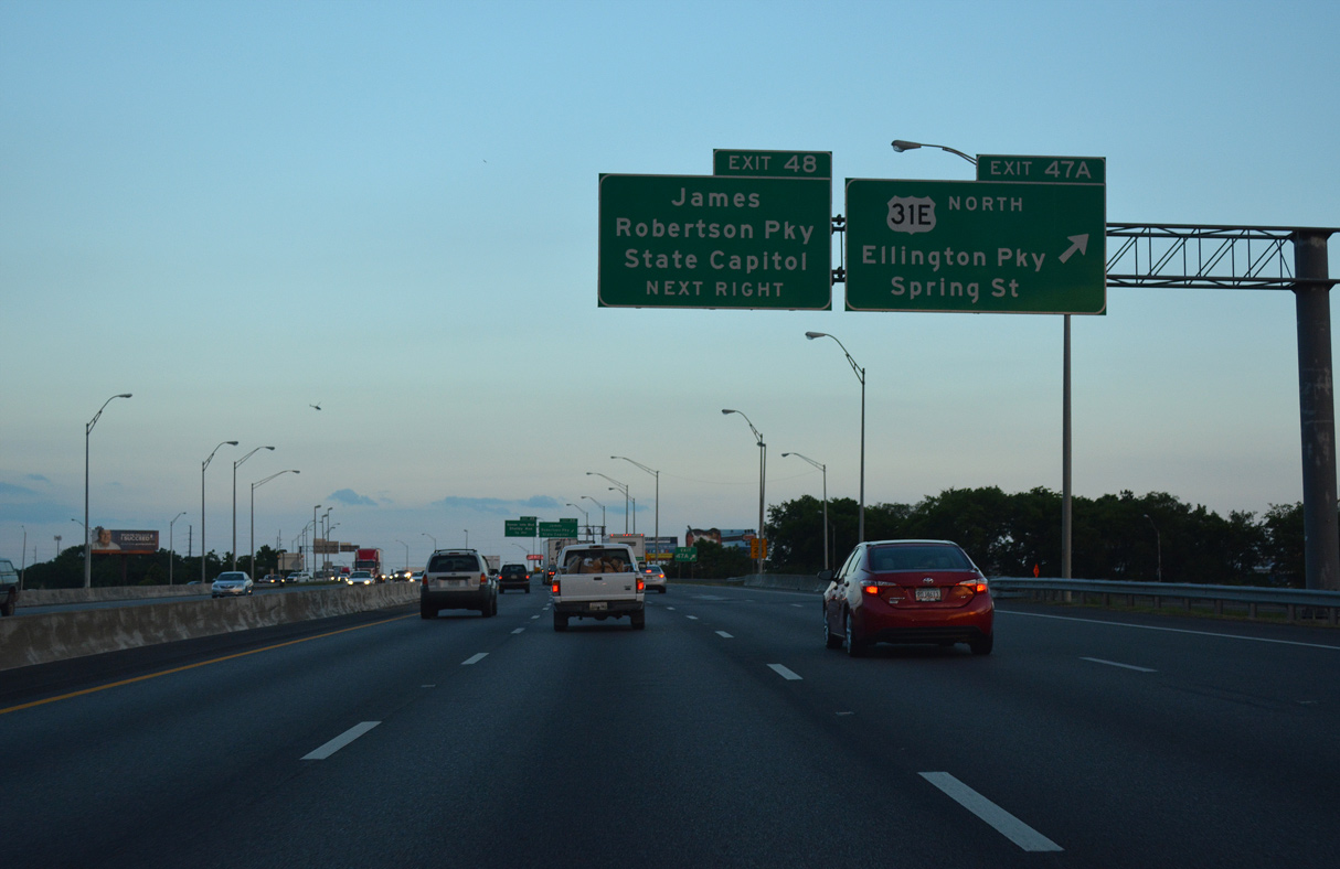
Exit 48 departs next for Interstate Drive south to James Robertson Parkway (U.S. 31-41-431) leading west to the Tennessee State Capitol and east to Ellington Parkway and 5th Street.
06/11/17
The viaduct taking U.S. 31-41-431 (James Robertson Parkway) across the Cumberland River comes into view. The bridge provides one of three routes across the Cumberland River into Downtown Nashville.
06/11/17
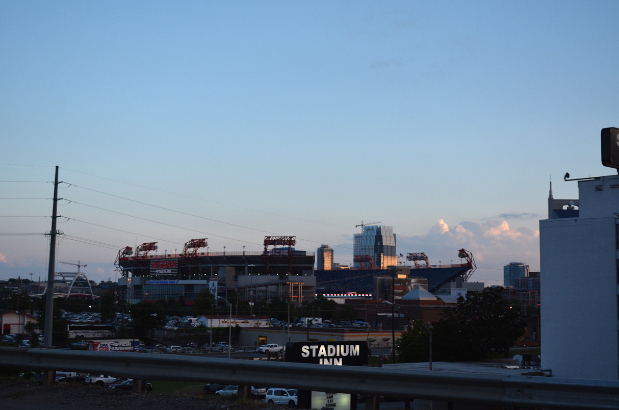
Named in 2015, Nissan Stadium lies just west of Interstate 24 at Russell Street. Opened in 1999, the nearly 70,000 seat stadium hosts football games for the Tennessee Titans, Tennessee State Tigers and the Music City NCAA Bowl game. The Titans will move into a new 60,000 seat enclosed stadium being built nearby in 2027.
06/11/17
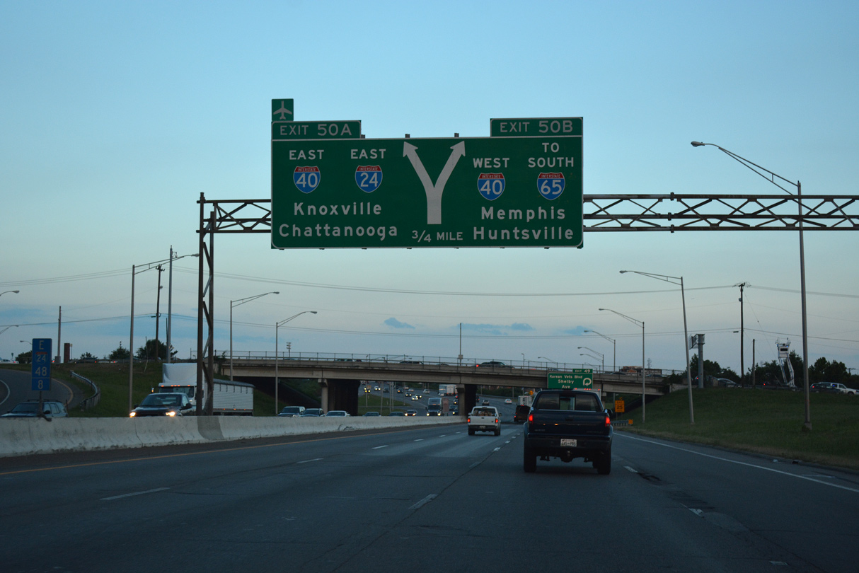
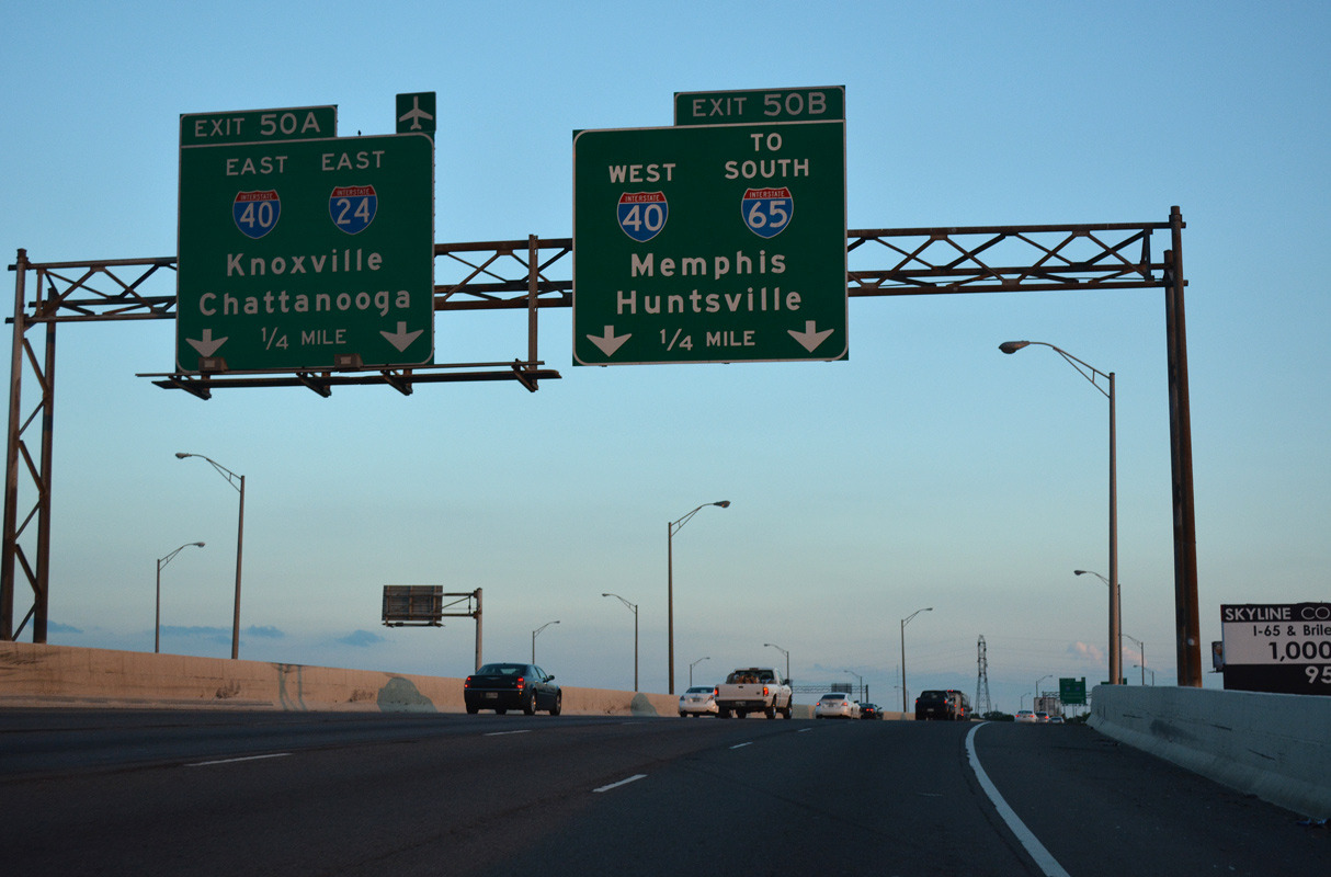
I-24 eastbound progresses south with four lanes to a three-wye interchange (Exits 50 A/B) with Interstate 40.
06/11/17
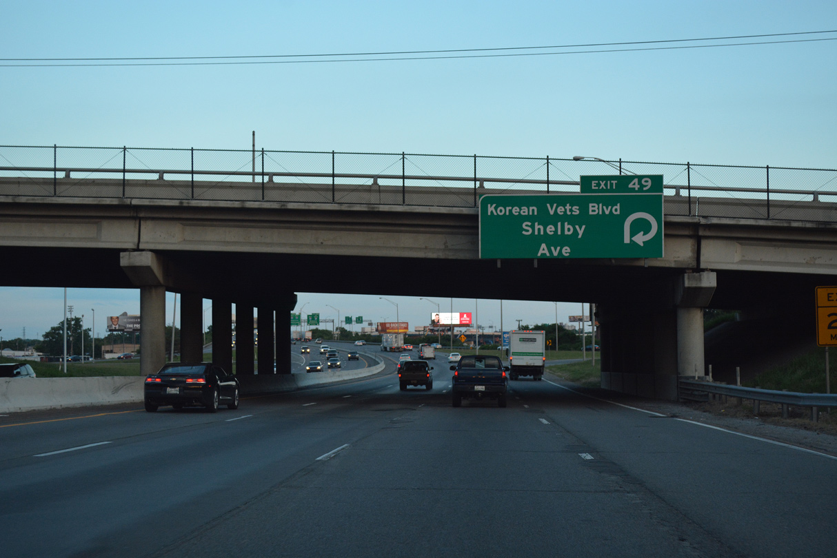
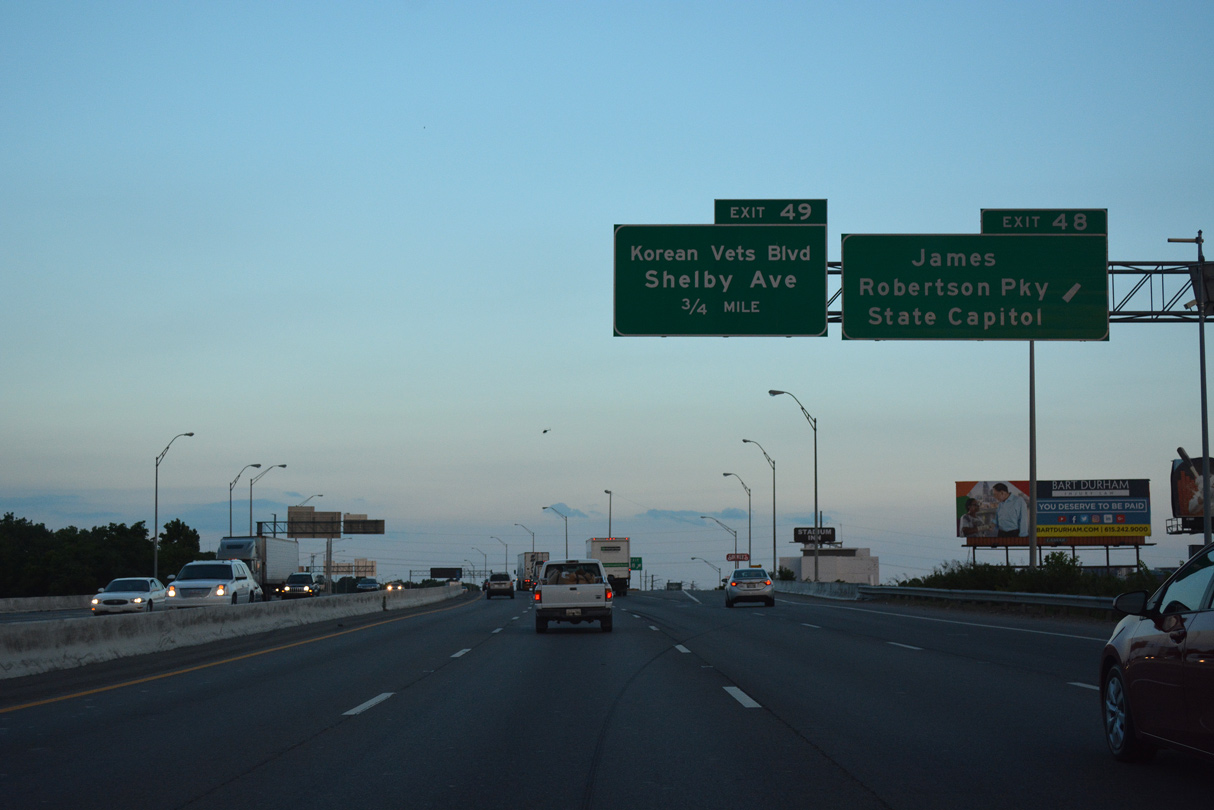
A parclo interchange (Exit 49) joins I-24 with Korean Veterans Boulevard west to Music City Center and a roundabout built in 2012 with U.S. 31-31A-41-41A-70 at Lafayette Street and 8th Avenue S. Shelby Avenue extends east from the boulevard to Historic Edgefield.
06/11/17
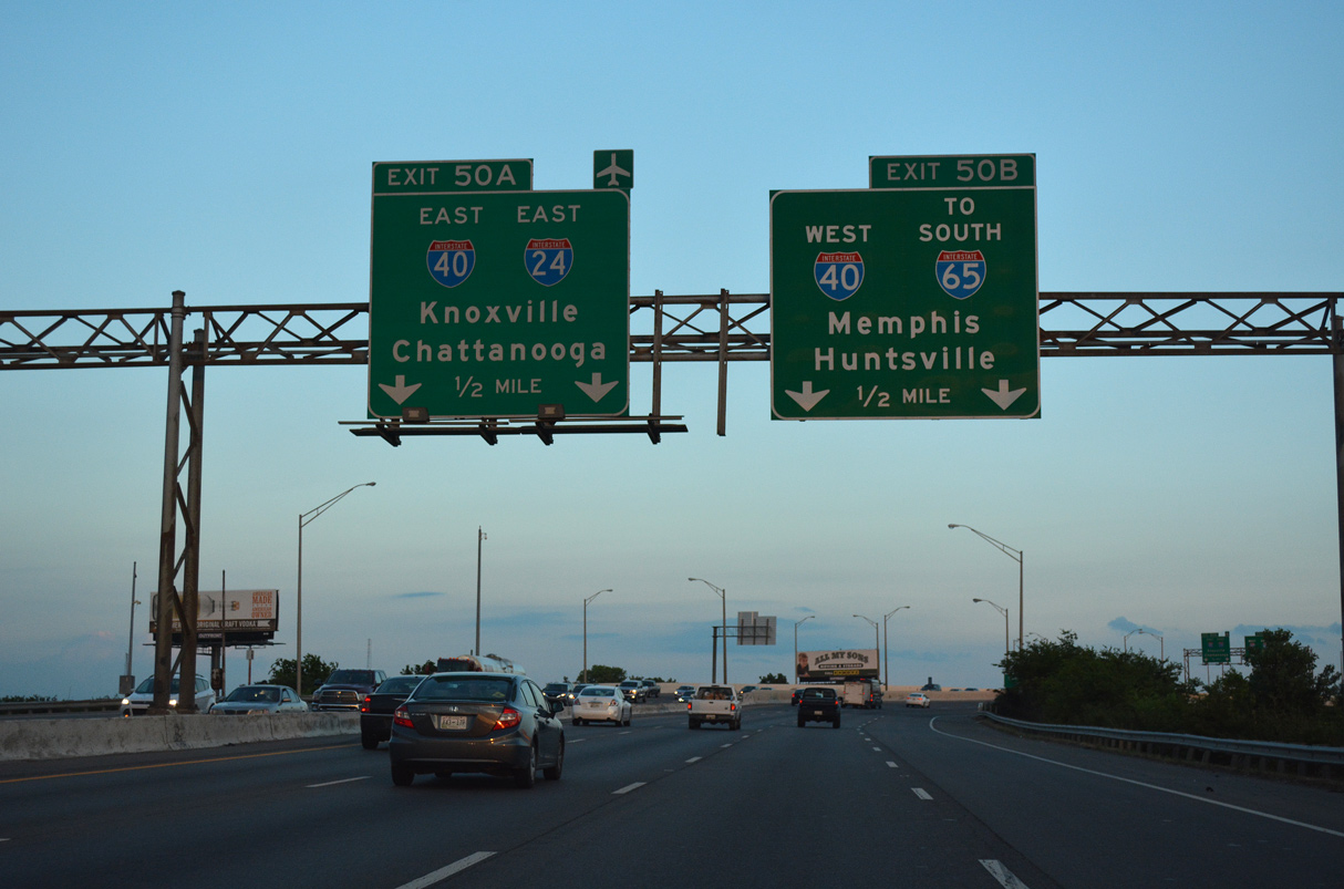
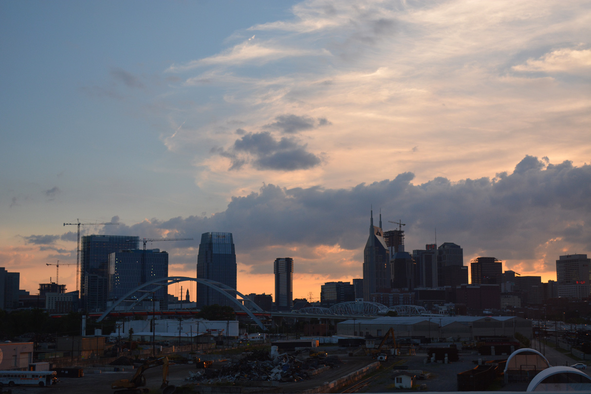
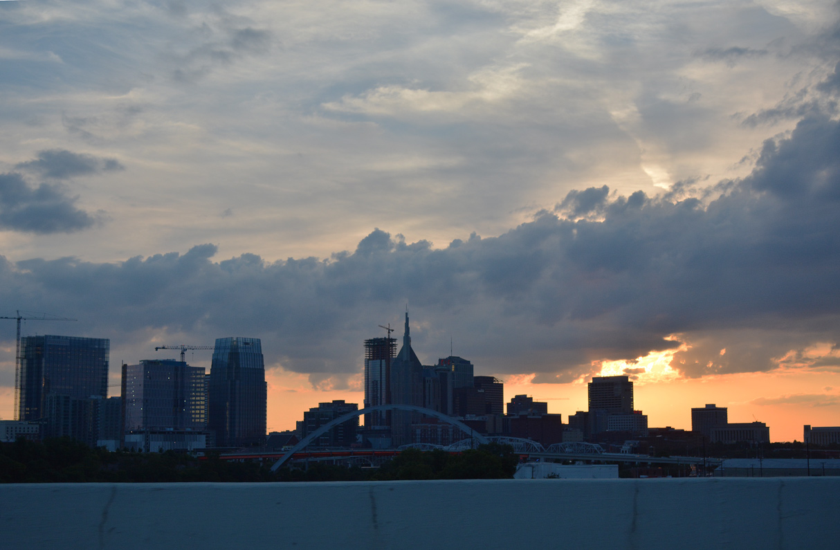
Interstate 24 west elevates to span the Cumberland River leading to the Exit 50 separation for I-40 west back to Downtown and Memphis and I-40 east to Nashville International Airport (BNA) and Knoxville.
06/11/17
Spanning the Cumberland River west from near Nissan Stadium, Korean Veterans Boulevard appears in the foreground. Built in 1909, the John Seigenthaler Pedestrian Bridge crosses in the distance.
06/11/17
I-24 and I-65 used to separate at Exit 50, with I-65 joining I-40 west for a 1.00 mile overlap to Edgehill. Interstate 65 leads south from Nashville to Spring Hill, Huntsville and ultimately Mobile, Alabama.
06/11/17
Interstate 24 elevates onto the Silliman Evans Bridge across the Cumberland River south of Historic Edgefield east of Downtown Nashville.
06/11/17
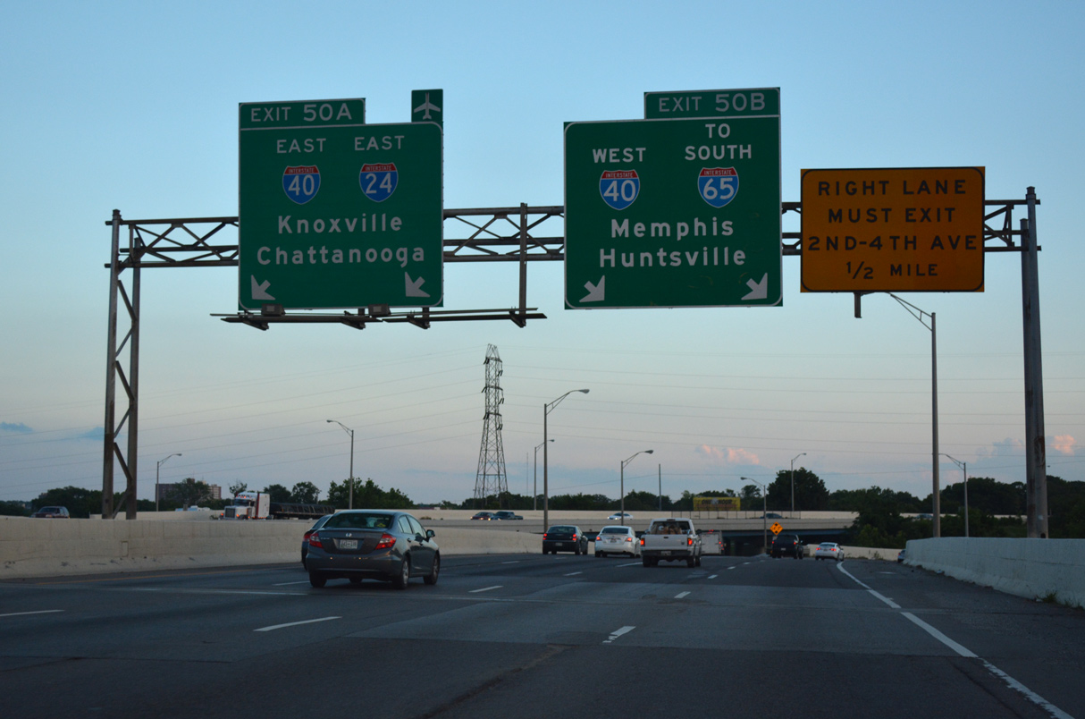
Exit 50 A turns Interstate 24 southeast alongside I-40 by the Napier Area 2.16 miles to I-440 near Woodbine.
06/11/17
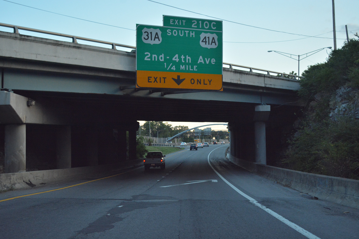
Two lanes join I-40 west via Exit 50 B just ahead of Exit 210 C for 2nd Avenue and U.S. 31A/41A (4th Avenue) at the Chestnut Hill neighborhood.
06/11/17
 East
East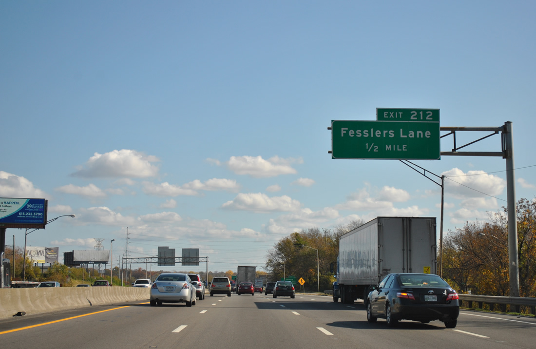
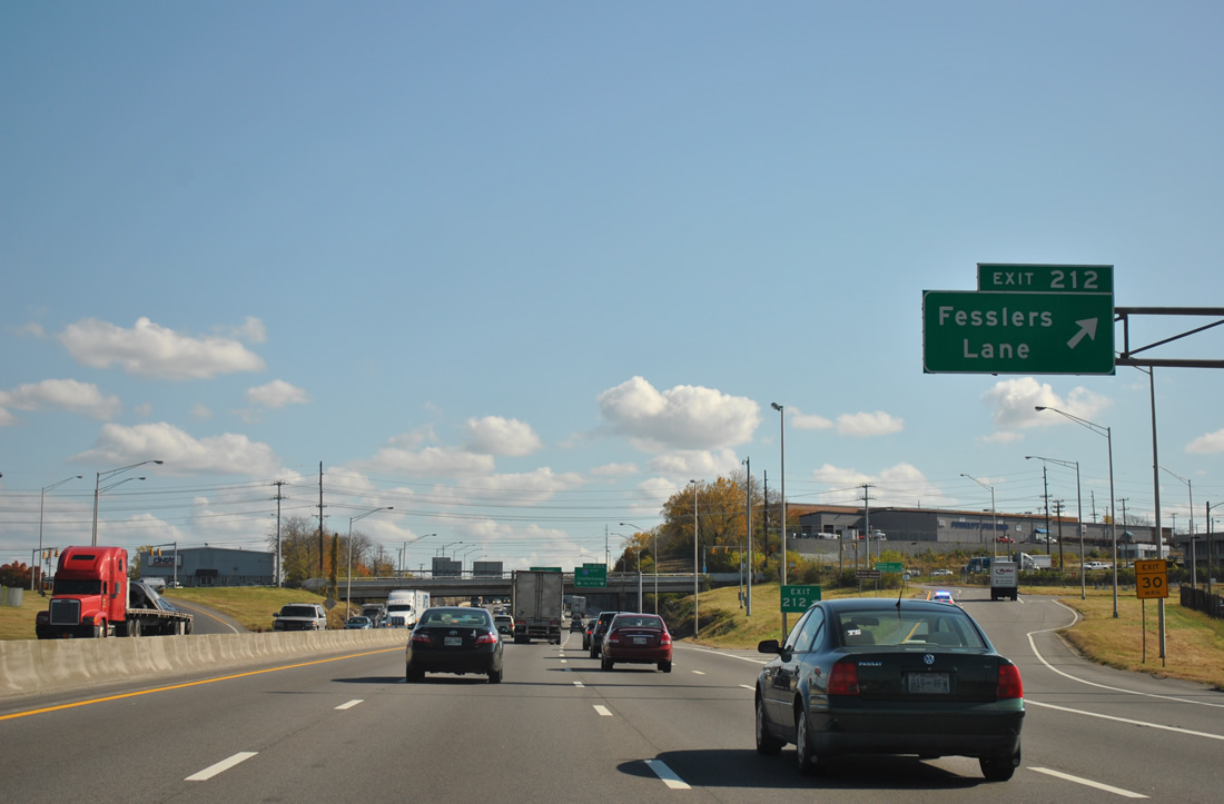
I-24/40 east pass through a half diamond interchange with Fairfield Avenue ahead of Browns Creek. A second half diamond interchange (Exit 212) joins eastbound traffic with Fesslers Lane in one half mile.
11/07/11

Fesslers Lane connects I-24/40 with parallel U.S. 70 (Lebanon Pike) to the north and U.S. 41/70S (Murfreesboro Pike) to the south.
11/07/11
The lone set of confirming markers for the I-24/40 overlap stands beyond the crossing of Browns Creek.
11/07/11
Fesslers Lane winds south from U.S. 41/70S through an industrial area to Polk Avenue and north by Mount Olivet Cemetery to another industrial area along the south banks of the Cumberland River.
11/07/11
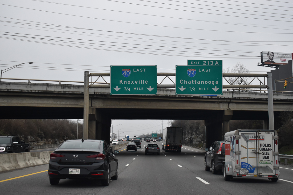
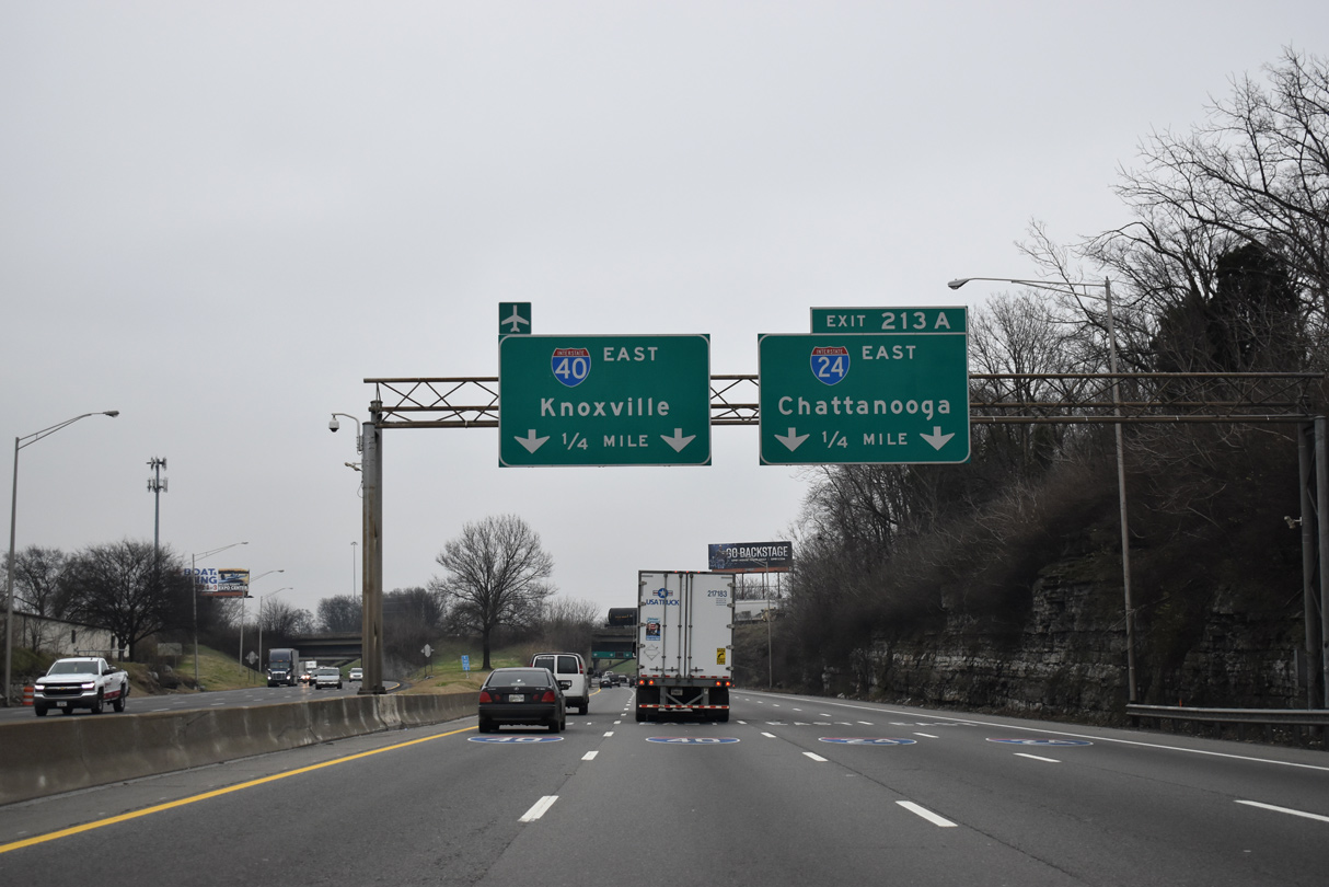
I-24/40 east continue 0.75 miles from the Fesslers Lane overpass to split at Exit 213A.
01/15/19
I-24 east connects I-40 with U.S. 41/70S (Murfreesboro Pike) and I-440 west nearby. I-440 loops westward to I-65 south at Berry Hill and I-40 near Tennessee State University. Murfreesboro Road angles southeast to the Glengarry neighborhood ahead of Briley Parkway (SR 155).
11/07/11
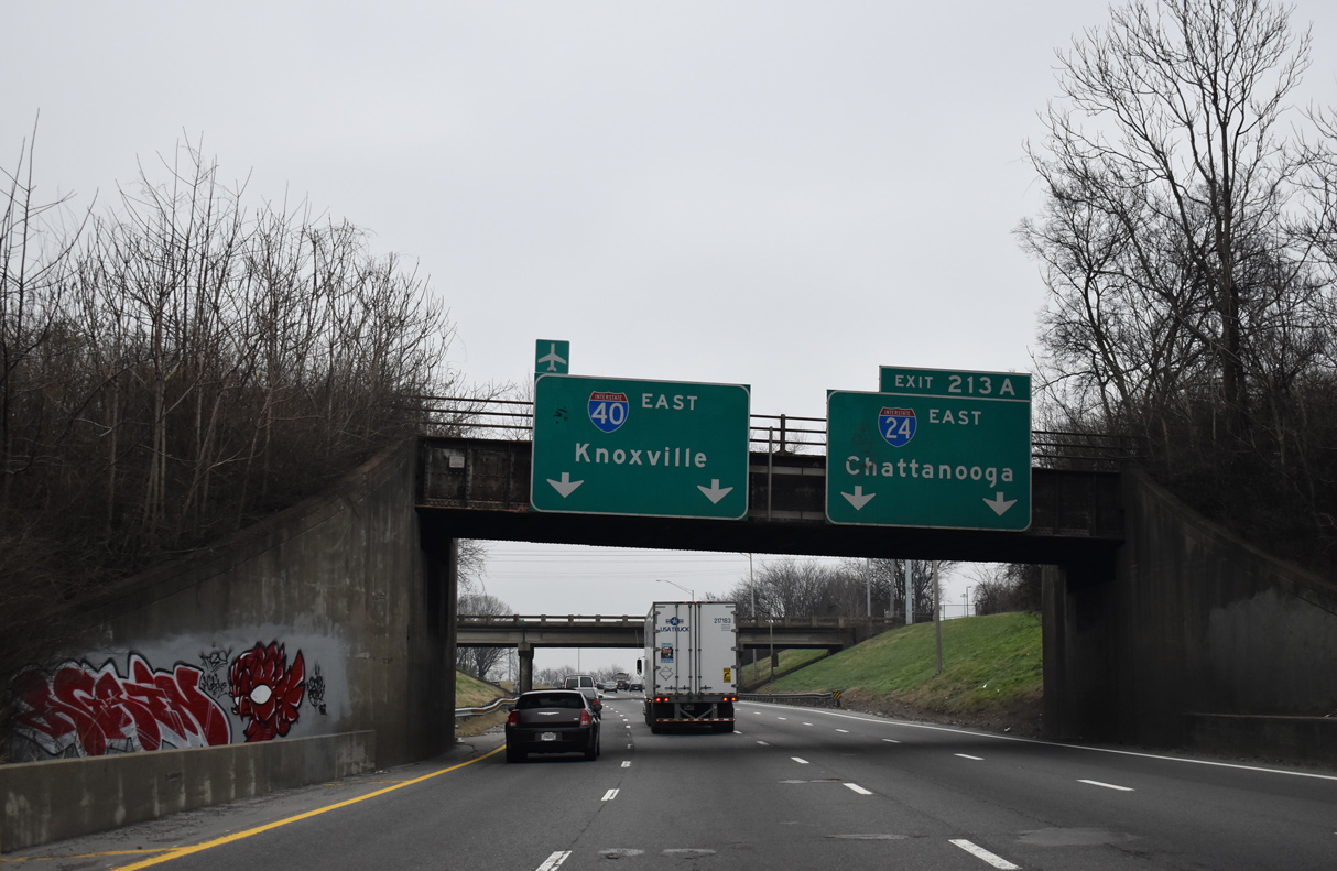
One quarter mile ahead of their separation at Exit 213A, three bridges pass over I-24/40: an abandoned railroad overpass, a CSX Railroad bridge, and an access road for a sanitation business. Southeast from Nashville, I-24 travels another 134 miles to I-75 in Chattanooga.
01/15/19
Interstate 24 branches southeast from I-40 beyond the Arlington Avenue overpass. I-24 continues with six to eight overall lanes through Antioch in southeast Nashville, Smyrna and Murfreesboro.
01/15/19
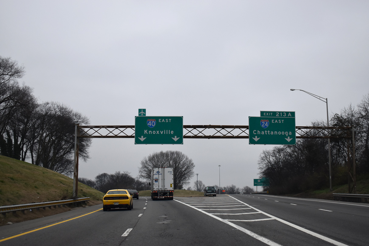
Two lanes continue for Interstate 40 east to nearby Nashville International Airport (BNA), Lebanon and Knoxville while Exit 213 A leads I-24 directly into a six-ramp parclo interchange with U.S. 41/70S (Murfreesboro Pike).
01/15/19


References:
- Interstate 65 Widening from Trinity Lane to Dickerson Pike.
http://www.tn.gov/tdot/topic/interstate-65-improvementsTennessee Department of Transportation (TDOT), project web site.
Photo Credits:
- Alex Nitzman, Carter Buchanan: 06/11/17
- ABRoads: 11/07/11
- Brent Ivy: 01/15/19
Connect with:
Page Updated Thursday December 14, 2023.