
Interstate 25 North - Cheyenne
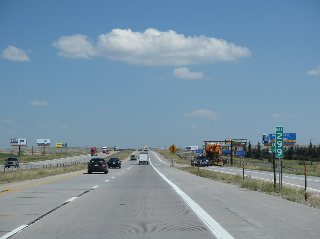
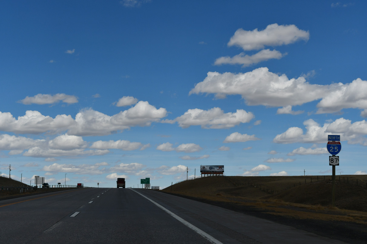
Interstate 25 and U.S. 87 north cross the state line at Colorado Milepost 299 / Wyoming Milepost 0.
08/11/14
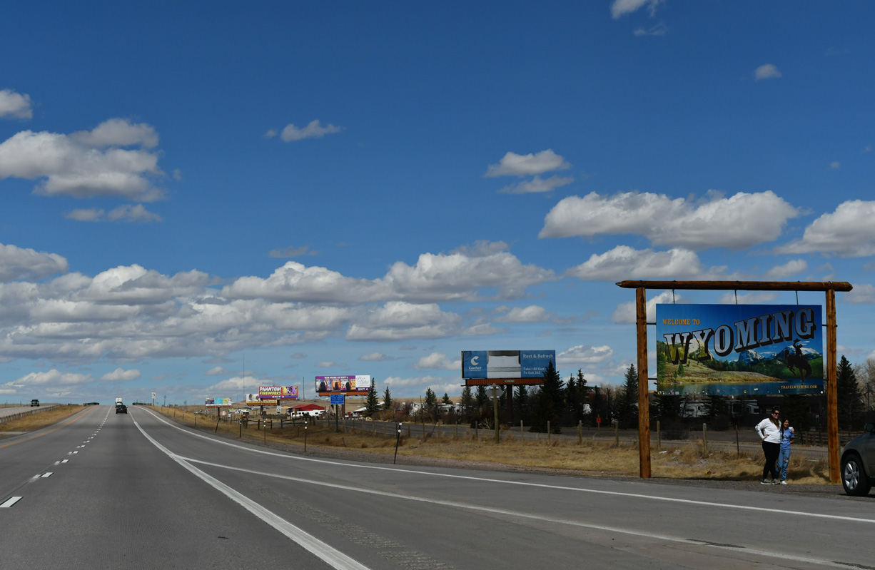
A small parking area was added next to the Wyoming welcome sign along I-25/U.S. 87 north by 2010. The turnout allows travelers to take pictures in front of the sign.
03/25/25
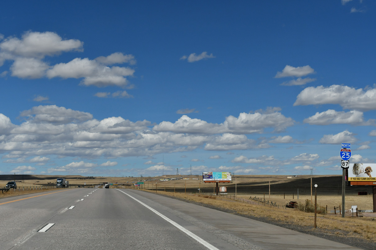
While almost entirely unsigned in Colorado, U.S. 87 is regularly marked along the overlap with Interstate 25 in Wyoming. U.S. 87 generally parallels I-25 throughout the state, with a deviation near Glenrock and Casper.
03/25/25
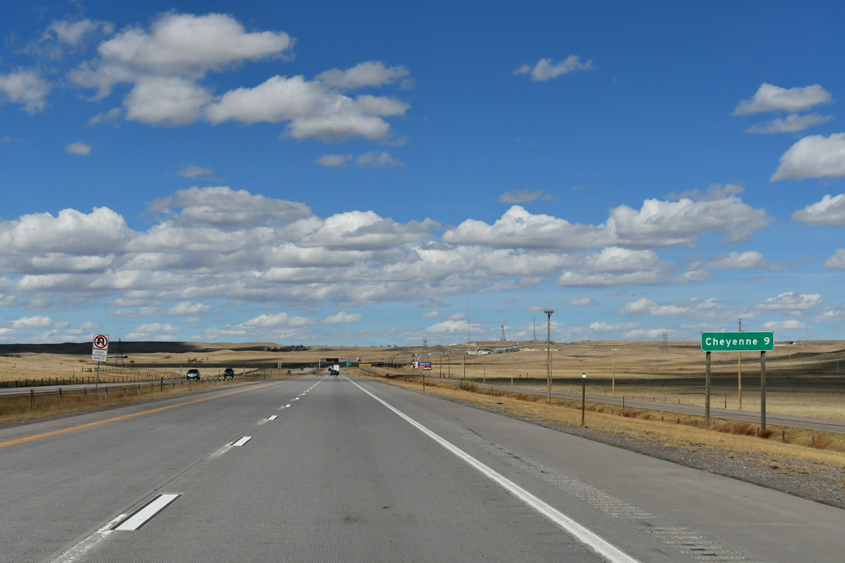
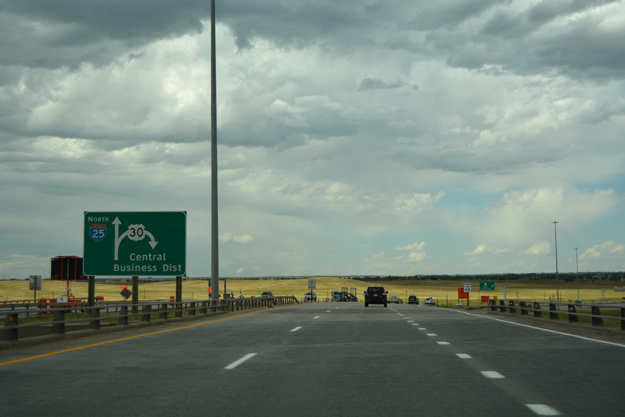
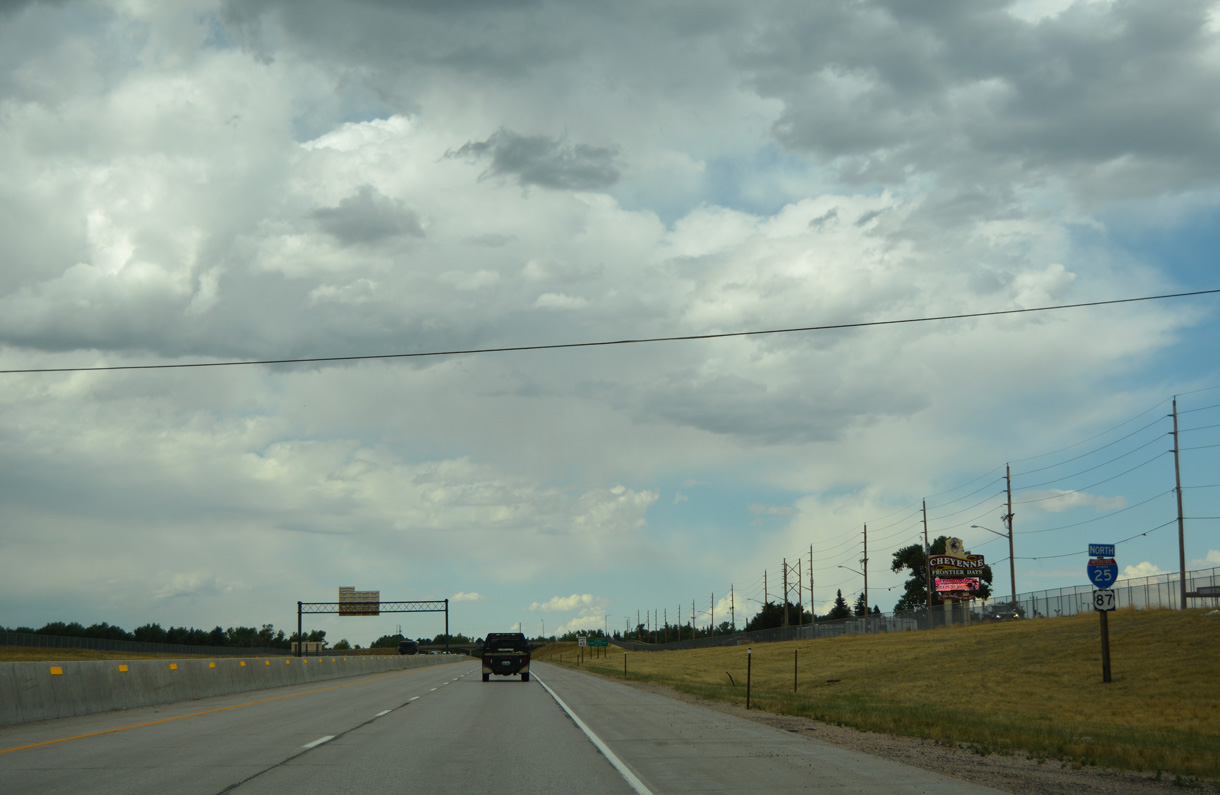
The capital city of Cheyenne is nine miles to the north along Interstate 25.
03/25/25
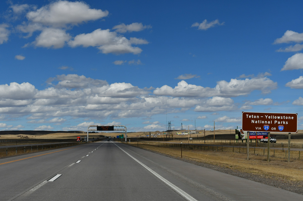
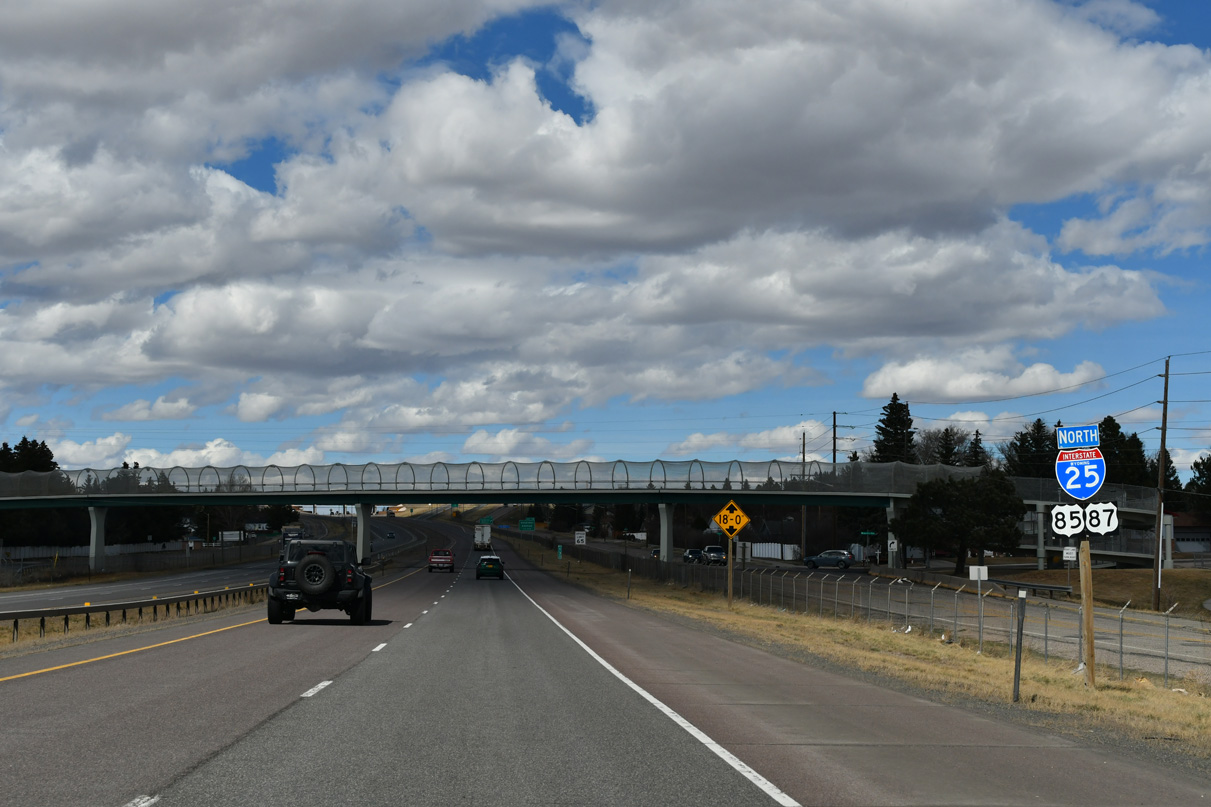
I-25 and I-80 are part of long distance routes to Yellowstone and Grand Teton National Parks.
03/25/25
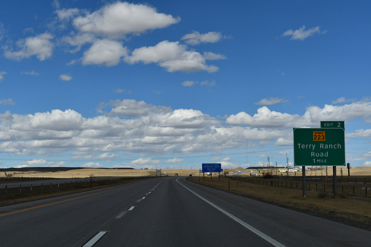
WY-223 (Terry Ranch Road) branches 5.70 miles east from Exit 2, by Valley Reservoir, to U.S. 85 (Greeley Highway). Terry Ranch Road is part of the old alignment of U.S. 87 into Cheyenne.
03/25/25
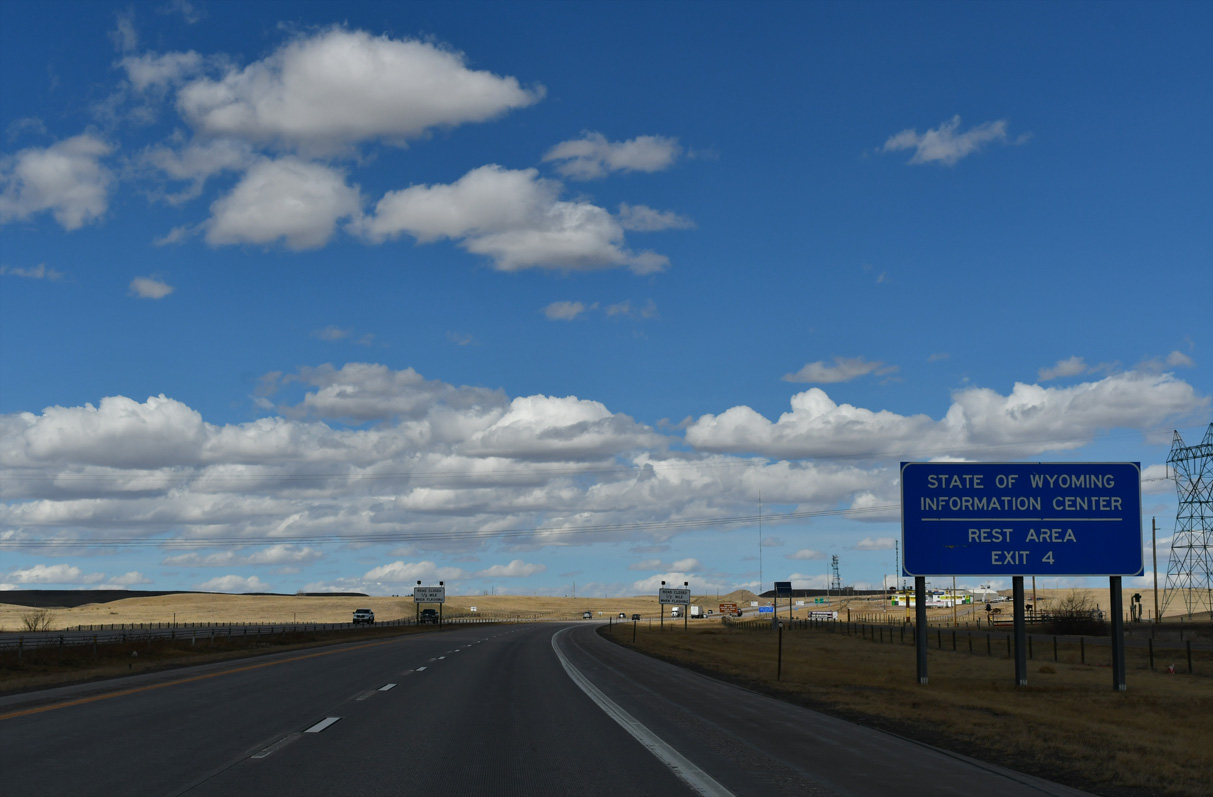
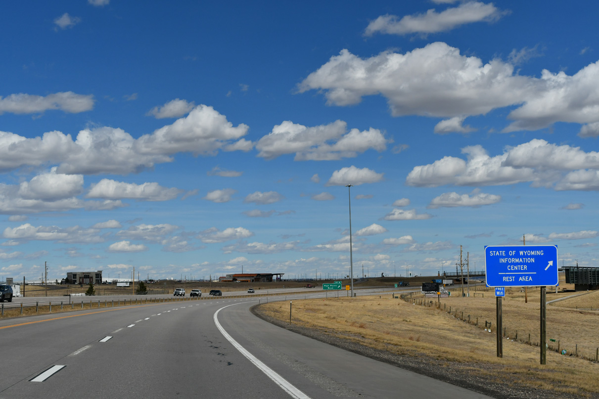
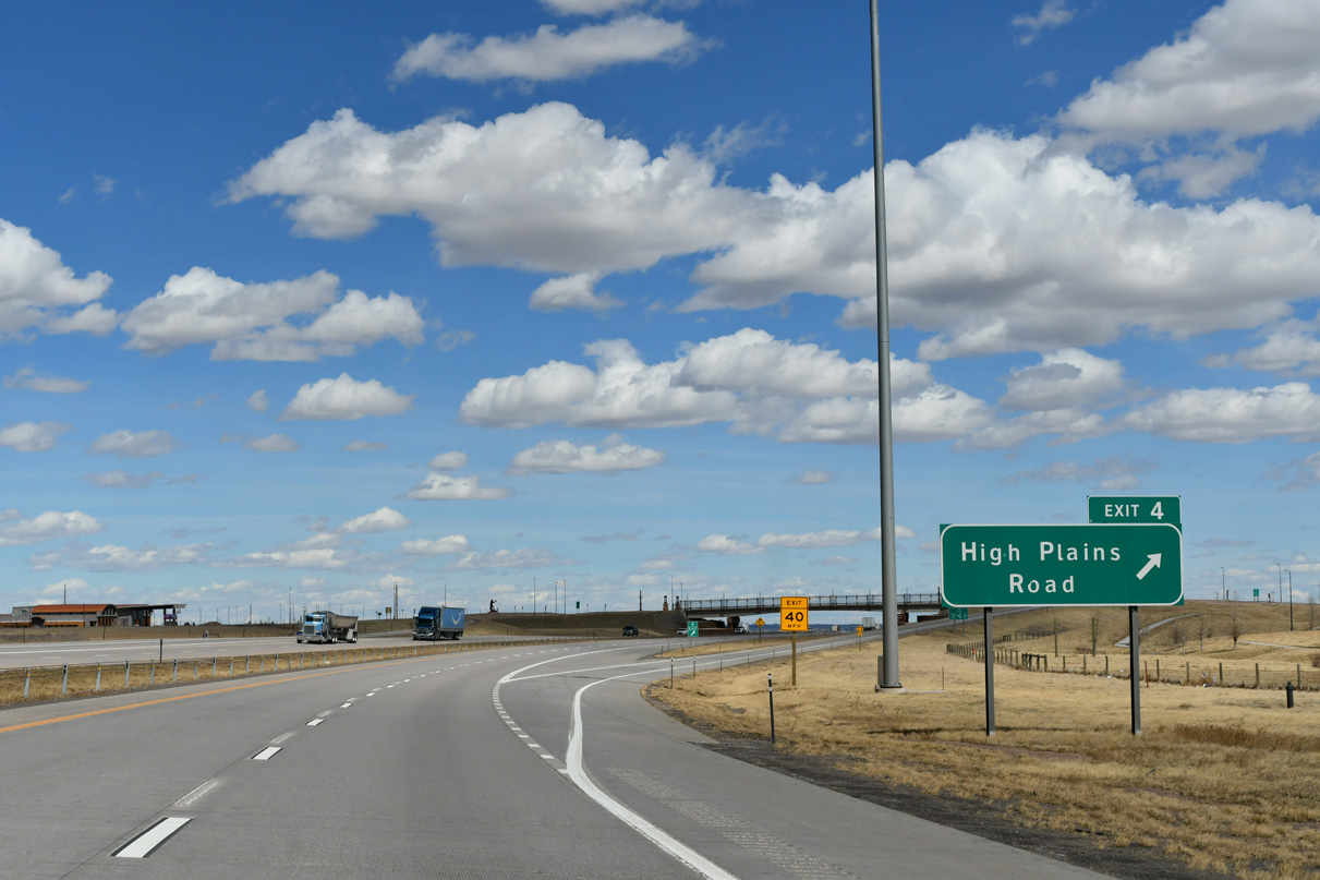
The State of Wyoming Information Center was relocated from College Drive at Exit 7 to the High Plains Road interchange (Exit 4) in 2010. The center features interactive displays of Wyoming's natural bounty as well as maps, brochures, and restrooms.
03/25/25
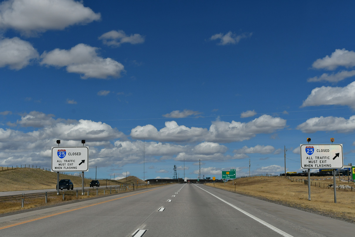
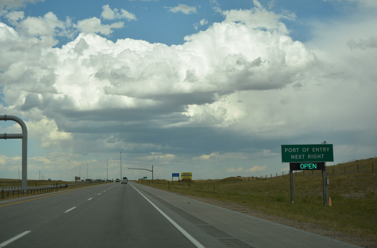
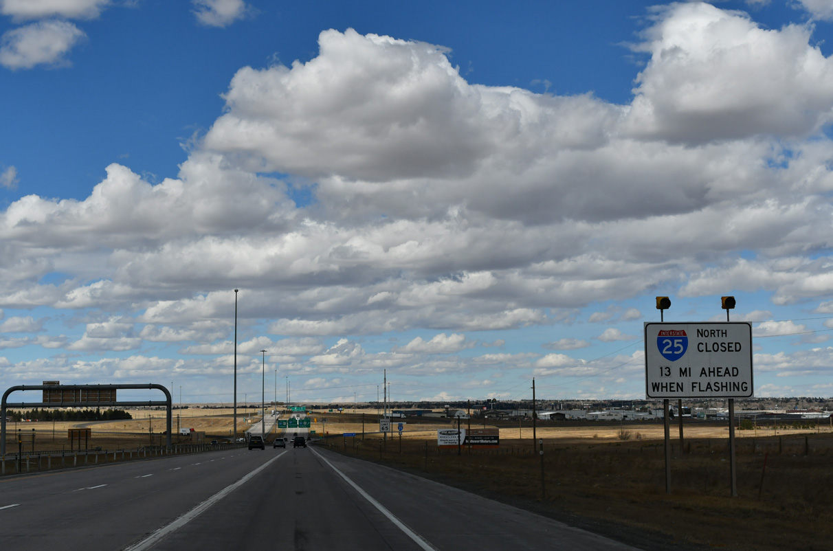
Signs such as this one advising whether a major highway is closed ahead due to weather or traffic issues appear at major interchanges in Wyoming.
08/11/16
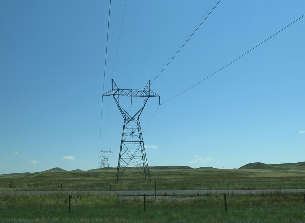
Linking a substation located near Archer, south of I-80 at Exit 370, with some power generating facilities to the southwest near Craig, Colorado, a single-circuit power line spans I-25/U.S. 87 near Lone Tree Creek.
08/11/14
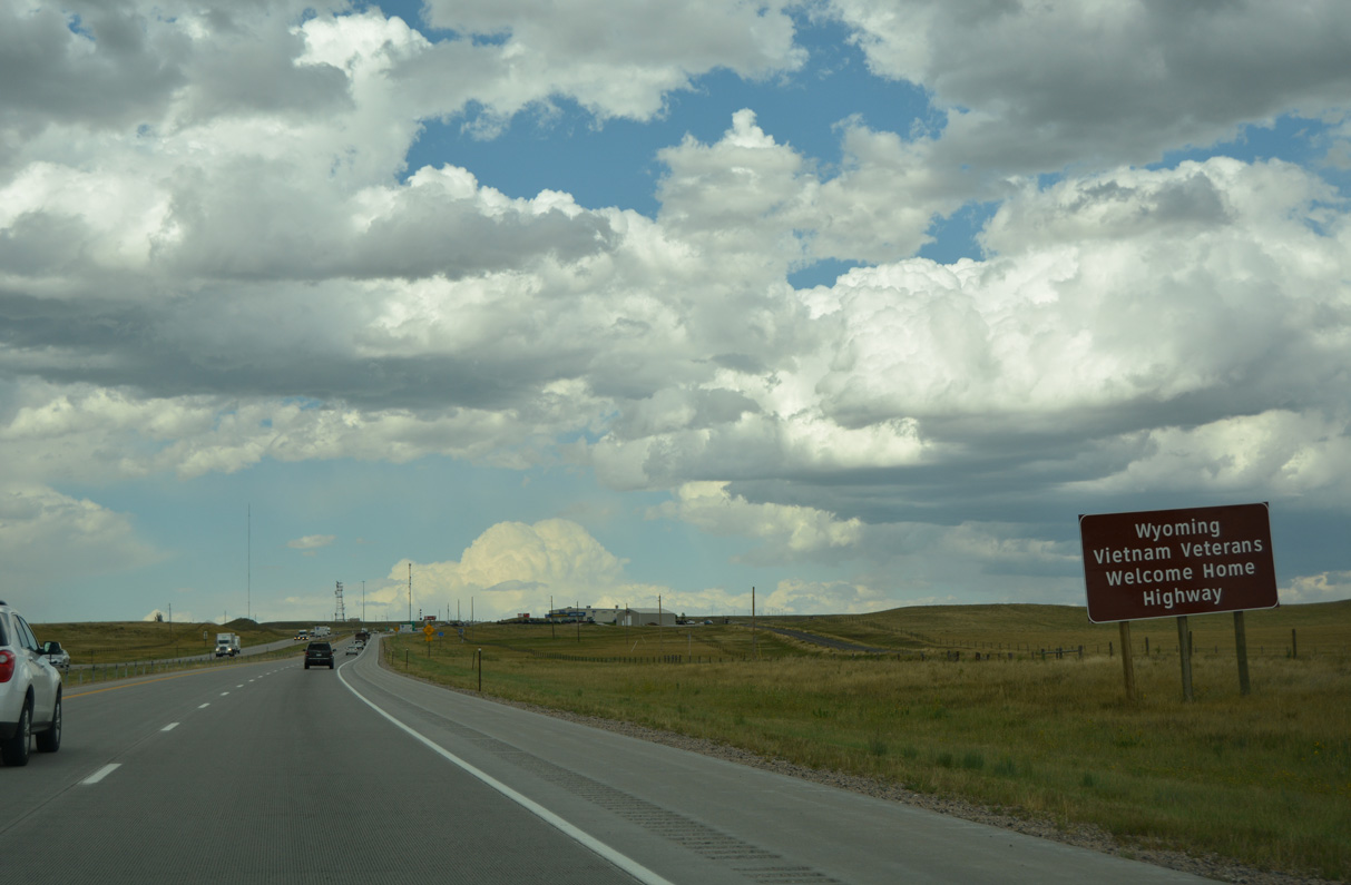
Interstate 25 is the Wyoming Vietnam Veterans Welcome Home Highway.
08/11/16
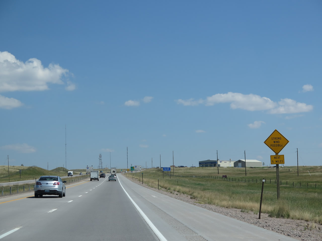
Strong wind is possible over I-25/U.S. 87 leading north toward Cheyenne. The Wyoming wind is well-known to locals and frequent travelers through the areas prone to strong wind gusts.
08/11/14
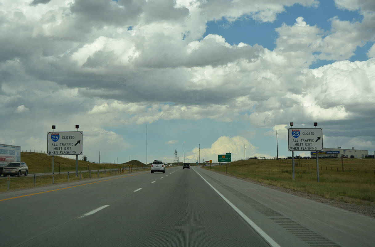
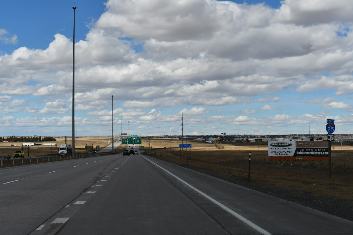
Another set of road closure signs precede Exit 2 along I-25/U.S. 87 northbound.
03/25/25
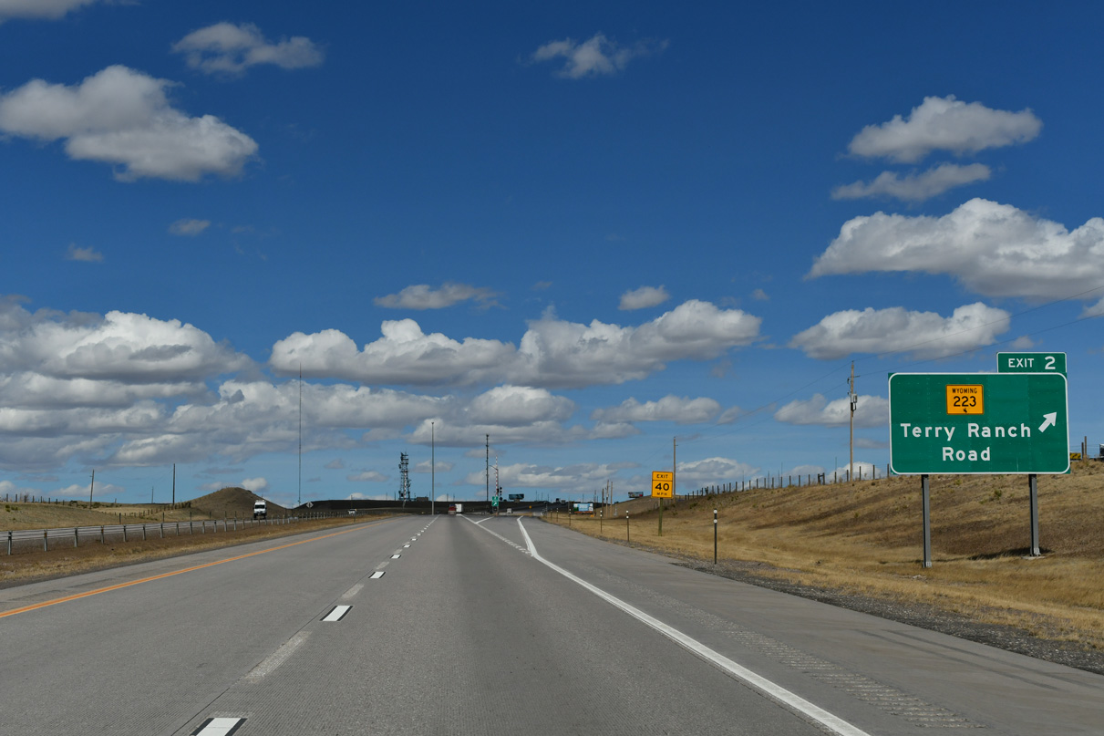
A diamond interchange joins I-25/U.S. 87 with WY-220 (Terry Bison Ranch Road) at Exit 2. The Terry Bison Ranch is a well known cattle and bison ranch located south of Cheyenne and west of I-25.
03/25/25
Interstate 25 rises gradually from the mile-high elevation of Denver to the 6,062-foot elevation of Cheyenne.
03/25/25
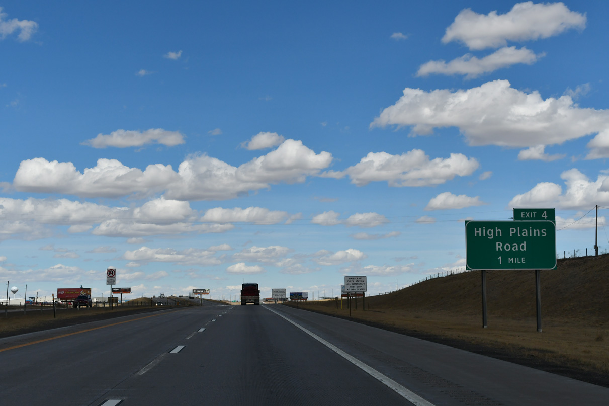
Underway in 2010, the High Plains Road project included constructing a dumbbell interchange (Exit 4) with High Plains Road. The roundabouts at the exchange were the first added into the Wyoming state highway system.1
03/25/25
The High Plains Road interchange was built also to serve Swan Ranch business park and new offices for the State Travel and Tourism Division in addition to the Southeast Wyoming Welcome Center.1
03/25/25
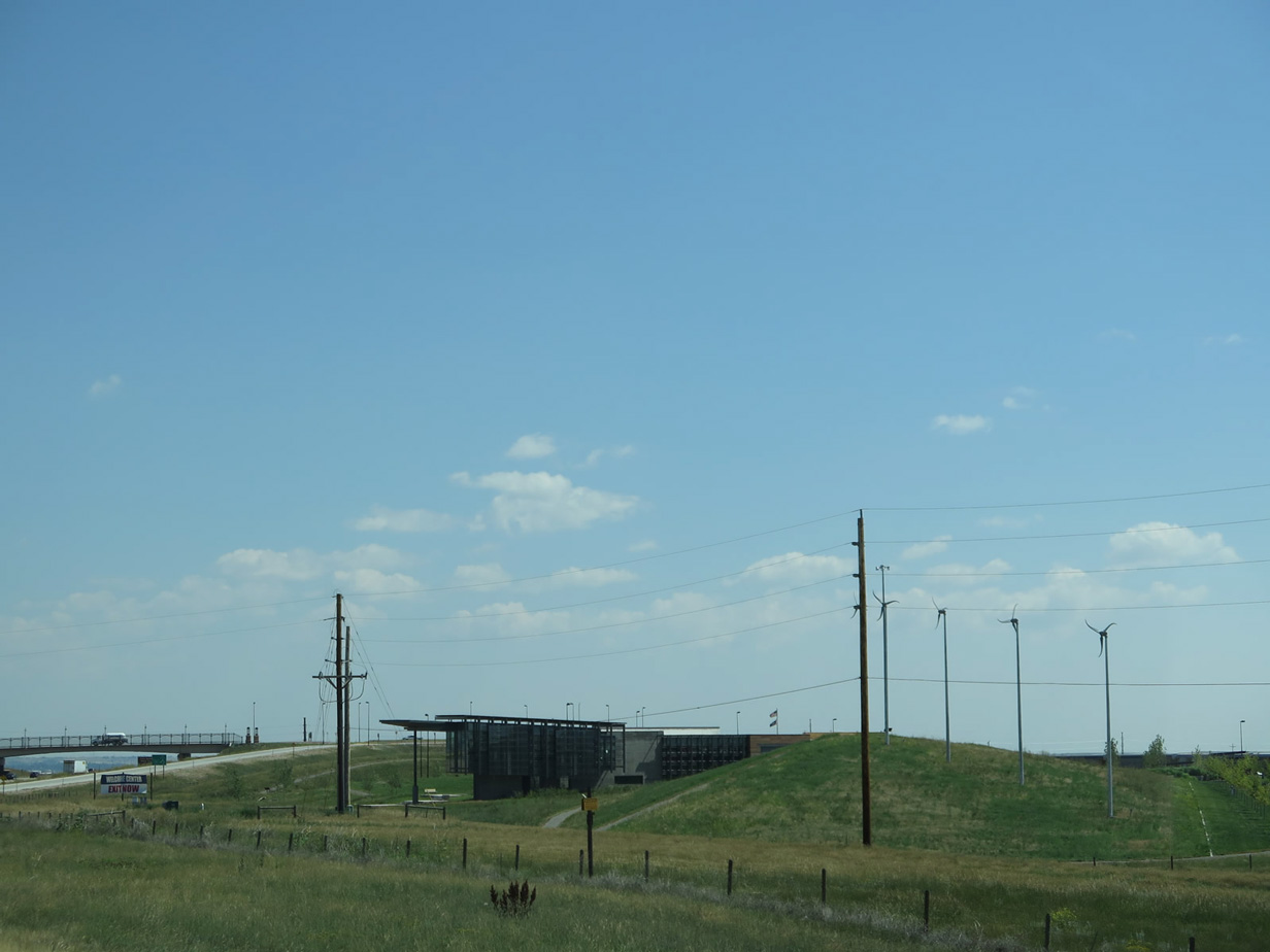
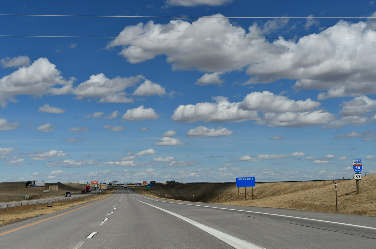
The Southeast Wyoming Information Center off High Plains Road replaced an older rest area located at Exit 7.
08/11/14
High Plains Road connects I-25/U.S. 87 with parallel Clear Creek Parkway north to Exit 7.
03/25/25
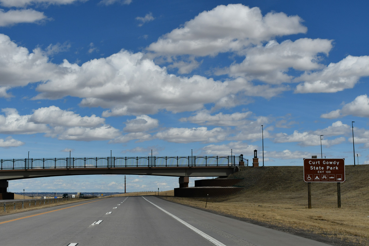
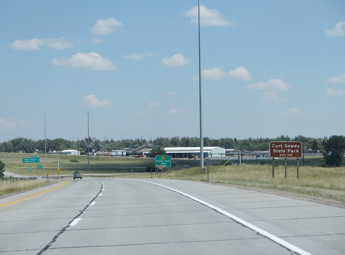
An advance sign references Exit 10 D for Curt Gowdy State Park. The park is located in the Laramie Mountains along WY-210.
03/25/25
I-25/U.S. 87 run alongside a BNSF Railroad line north from Exit 4.
03/25/25
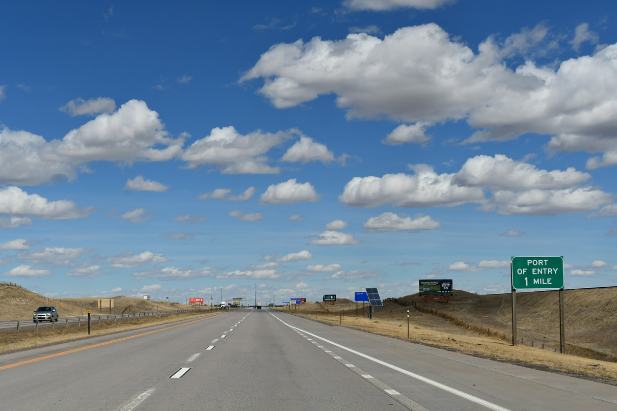
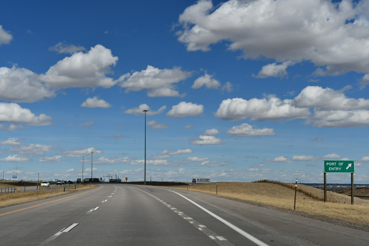
A port of entry / truck weigh station precedes Exit 7 along I-25/U.S. 87 northbound.
03/25/25
Every major entrance into the state of Wyoming has a port of entry, even two lane highways.
08/11/16
03/25/25
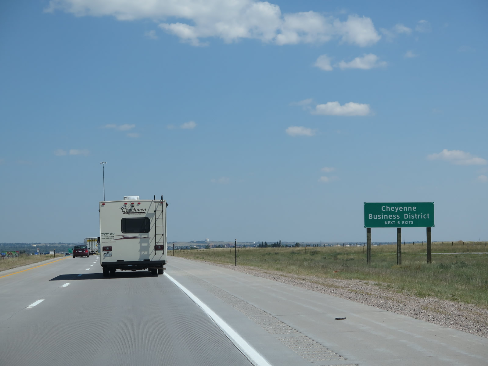
The next six exits from I-25/U.S. 87 northbound serve the Cheyenne metropolitan area.
08/11/14
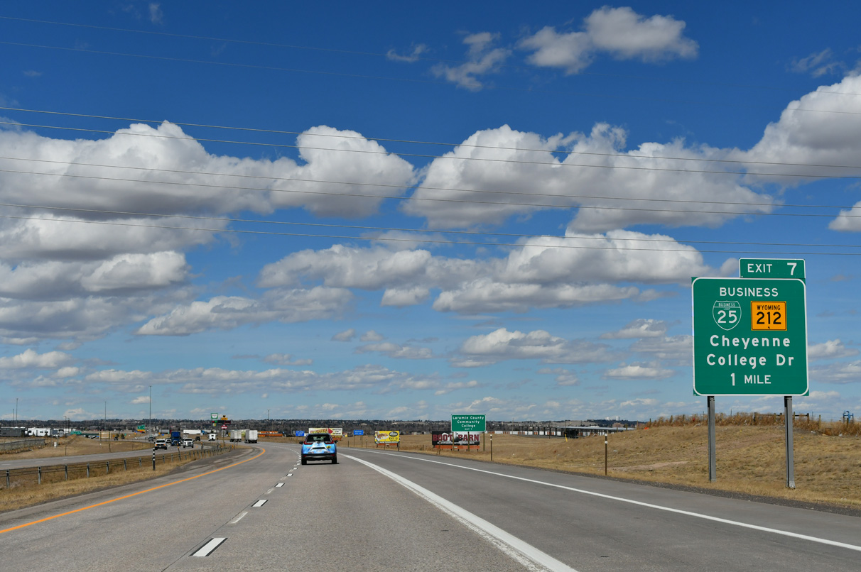
Business Loop I-25/U.S. 87 Business to the Cheyenne city center commences east along College Drive from Exit 7 at Clear Creek Parkway.
03/25/25

College Drive doubles as WY-212. WY-212 encircles the capital city east to Laramie County Community College and north to I-80 and U.S. 30. Business Loop I-25 overlaps with WY-212, 2.71 miles east to U.S. 85 (Greeley Highway). The business route joins U.S. 85 and I-180 north to Downtown.
03/25/25
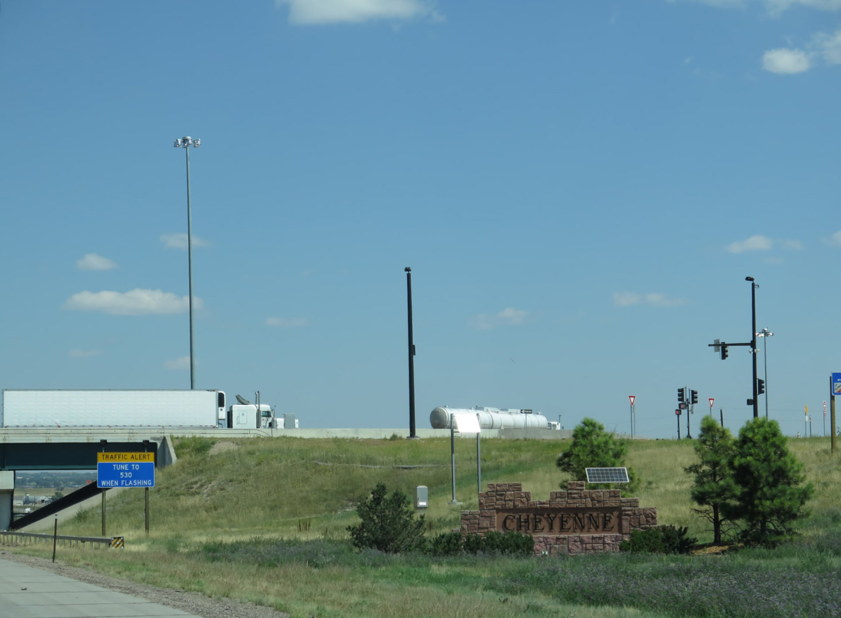
The city of Cheyenne welcome sign is located within the diverging diamond interchange (DDI) at Exit 7. Nicknamed the "Magic City of the Plains", Cheyenne is considered to be the northern end of the populous Front Range region, which extends south to Colorado Springs, Colorado.
08/11/14
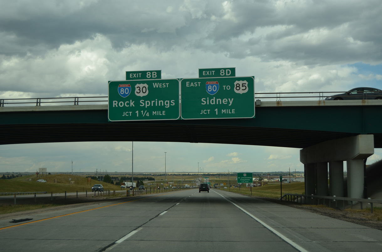
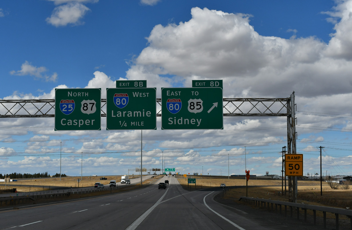
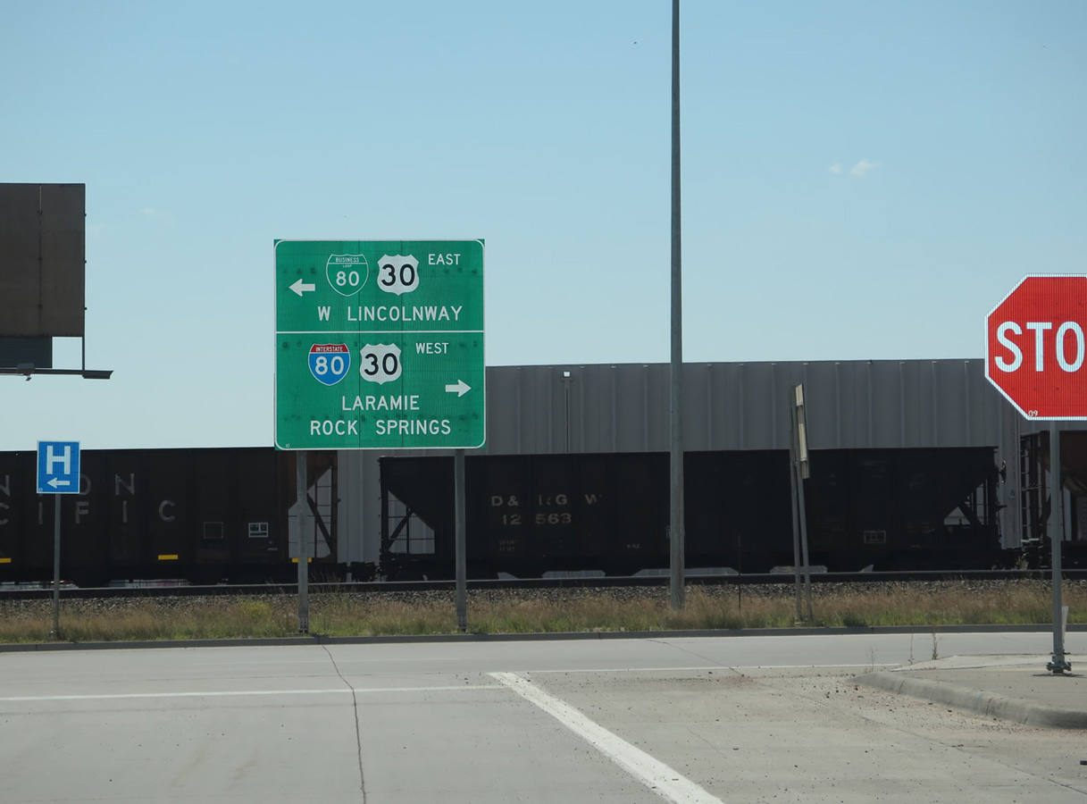
I-25/U.S. 87 and Interstate 80 meet at a cloverleaf interchange where each ramp is assigned a letter. The B an D suffixes are used along I-25 while A and C are assigned to ramps from I-80. This logic appears to be unique to WYDOT.
08/11/16
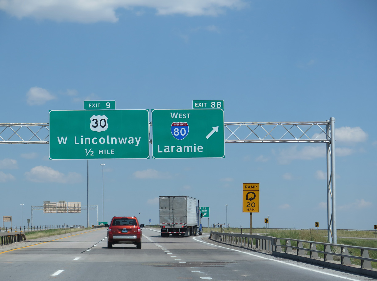
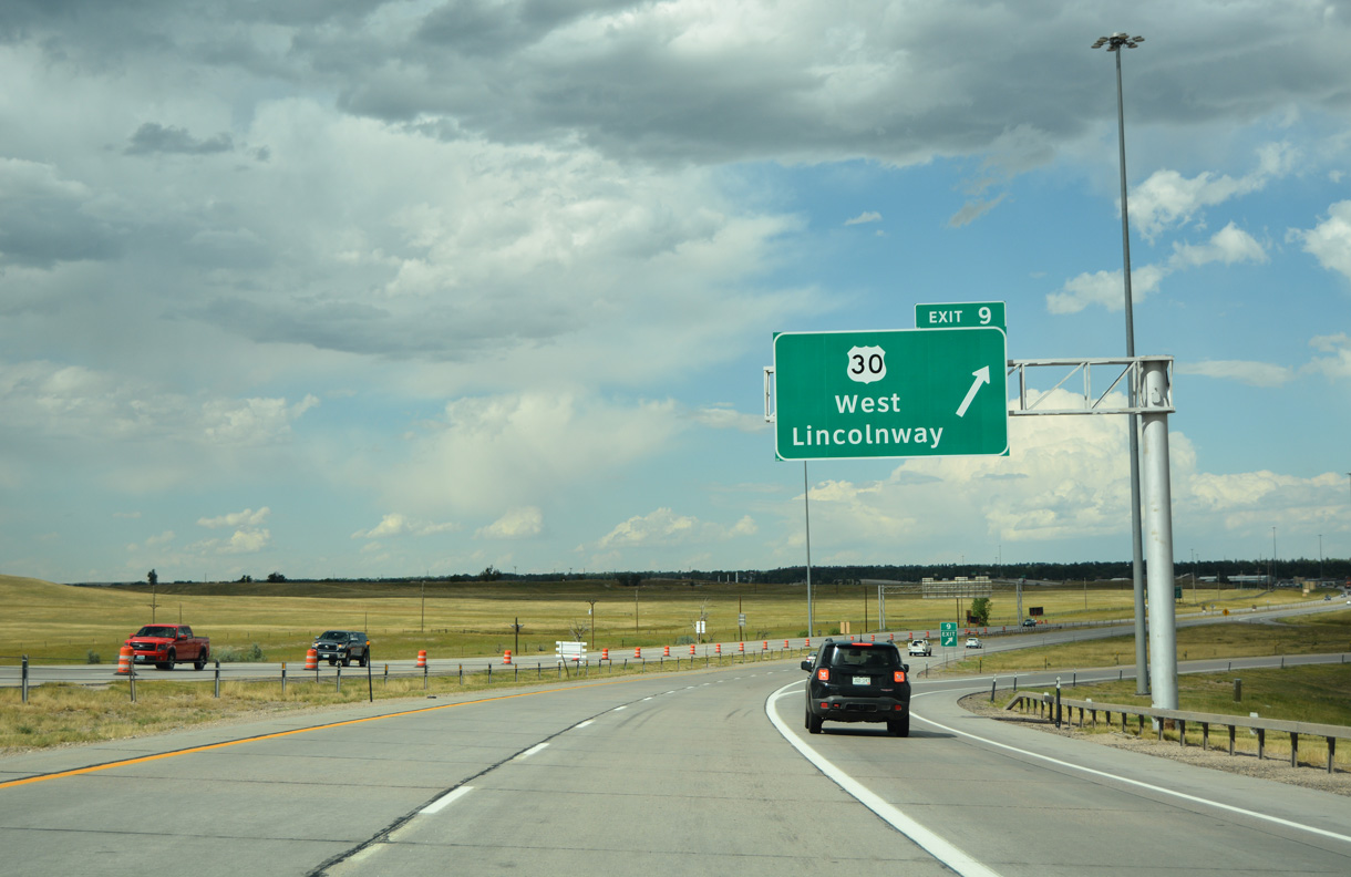
Exit 9 follows I-80 to the north with U.S. 30/Business Loop I-80 (W Lincolnway) east to Downtown Cheyenne and west to I-80 and WY-225 (Otto Road / Old Lincoln Highway).
08/11/16
Another advisory sign references the potential closure of I-25 north of Cheyenne due to inclement weather.
03/25/25
The city of Cheyenne comes into view to the northeast. The largest city in Wyoming was founded as Crow Creek Crossing during the state's territorial days in 1867. It became the state capital in 1890 when Wyoming achieved statehood.
03/25/25
I-80 continues another 45 miles east across Laramie County, Wyoming to the Nebraska state line at Pine Bluffs. The freeway continues to Kimball and Sidney and across the Cornhusker State to Omaha.
This sign was removed by 2025.
08/11/16
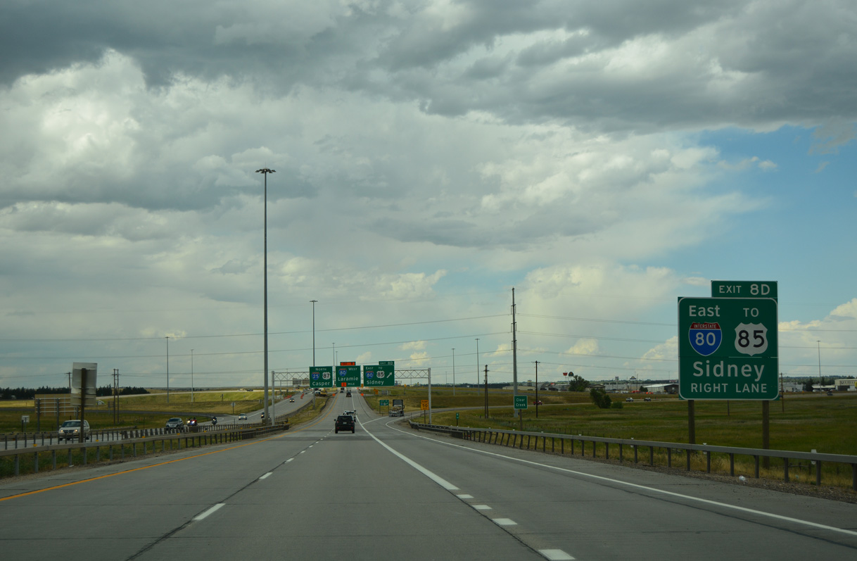
Guide signs for Exit 8 D reference U.S. 85, which coincides with I-180, Business Loop I-25 and U.S. 87 Business at the succeeding exit along Interstate 80 east. I-180 is an at-grade expressway spur north to Downtown Cheyenne.
03/25/25
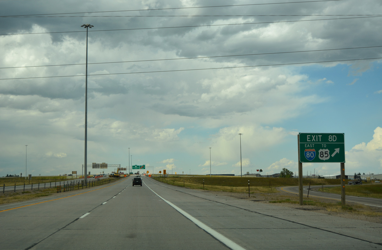
U.S. 85 continues north from Downtown Cheyenne to Interstate 25 at Exit 12. Considering that Exits 2 and 7 connect with routes leading to U.S. 85, references for U.S. 85 at Exit 8 D are superfluous.
08/11/16
Interstate 80 west connects Cheyenne with the cities along the southern tier of Wyoming, such as Laramie, Rawlins, Rock Springs, Green River and Evanston.
08/11/14
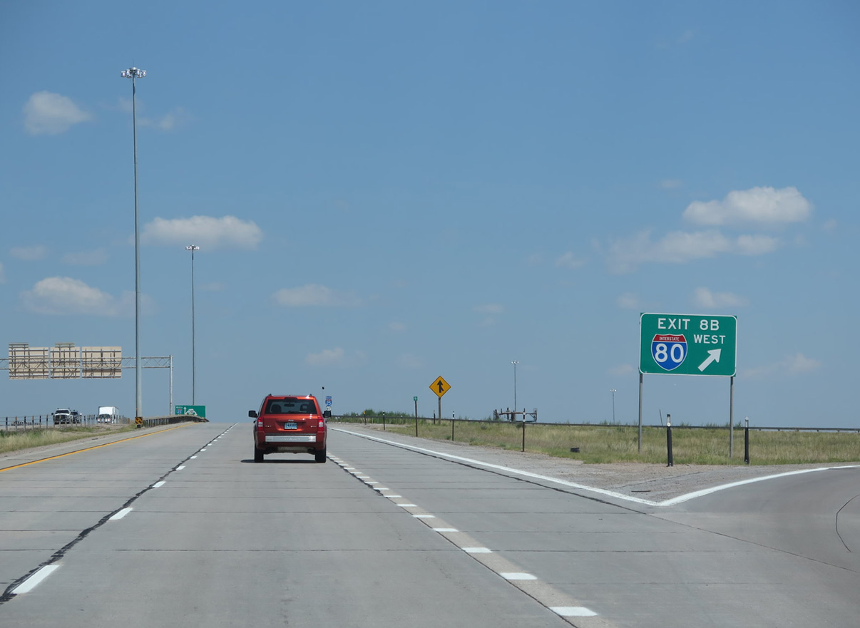
The cloverleaf interchange exit numbering system is even more counterintuitive as the ramp for I-80 west is 10 B instead of 10 D.
08/11/14
Confirming markers for I-25/U.S. 87 stand along the viaduct spanning the Union Pacific Railroad yard and adjacent U.S. 30 (Lincolnway).
08/11/16
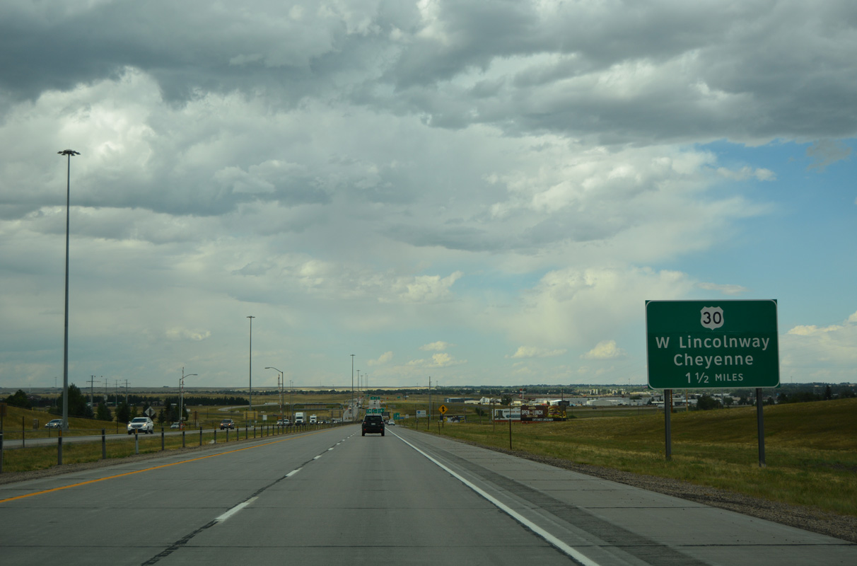
A folded diamond interchange links I-25/U.S. 87 with U.S. 30/Business Loop I-80 (Lincolnway) at Exit 9.
08/11/16
U.S. 30 overlaps with Business Loop I-80 east between I-80 at WY-225 (Otto Road) and WY-220 (College Drive). U.S. 30 east rejoins Interstate 80 at Archer.
08/11/16
08/11/14
Interstate 25 separates Cheyenne from Francis E. Warren Air Force Base on the ensuing stretch north to Exit 10.
08/11/16
Curt Gowdy State Park is named after the famous television sportscaster from Wyoming. The park is home to Crystal Lake and Granite Lake, reservoirs constructed along Crow Creek by 1910 to supply Cheyenne with a consistent water source. A pipeline built in the 1950s carries water from the reservoirs into the city.
08/11/14
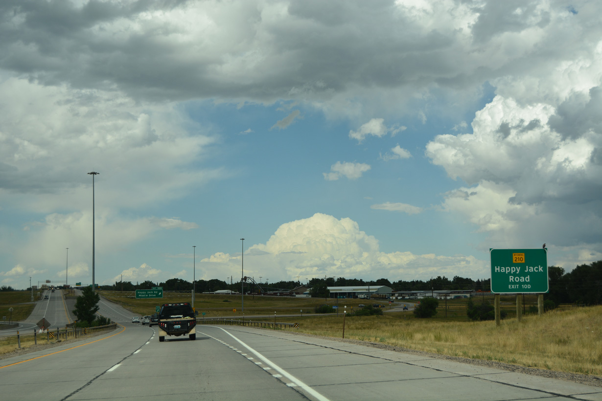
Wyoming Highway 210 follows Happy Jack Road west from Missile Drive to Carbon County as part of a 38-mile long course from Exit 10 D to the popular Vedauwoo area, the Pole Mountain Wilderness within the Medicine Bow-Routt National Forest, and I-80 at Exit 323.
08/11/16
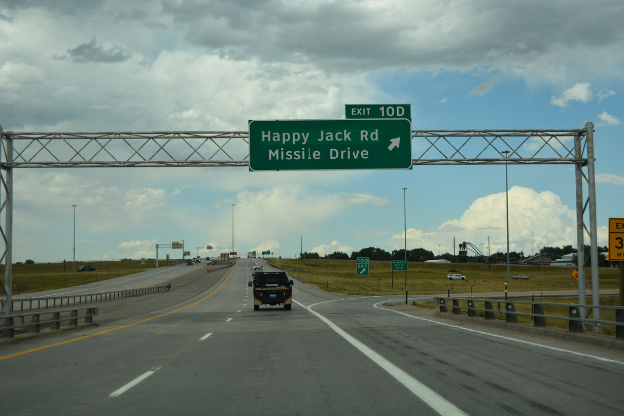
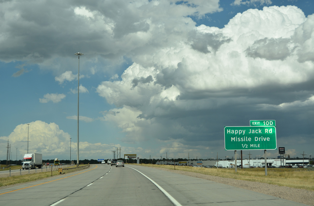
The exchange at Exit 10 was formerly a cloverleaf interchange, only the second in the entire state. Three of the four loop ramps were removed, but the odd exit suffix convention remains with the lone off-ramp from I-25 northbound as Exit 10 D.
08/11/16
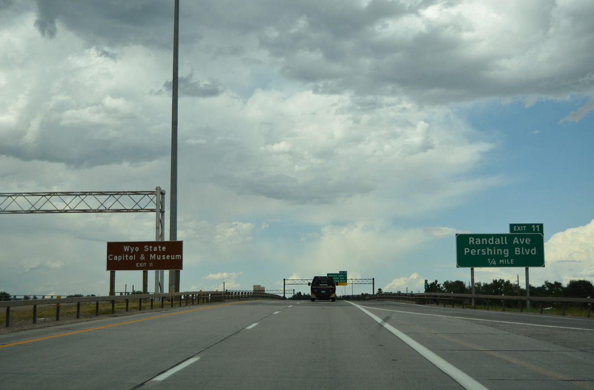
The second exit for F.E. Warren Air Force Base joins I-25/U.S. 87 north with Randall Avenue west into the military facility and east to the Wyoming State Capitol.
08/11/16
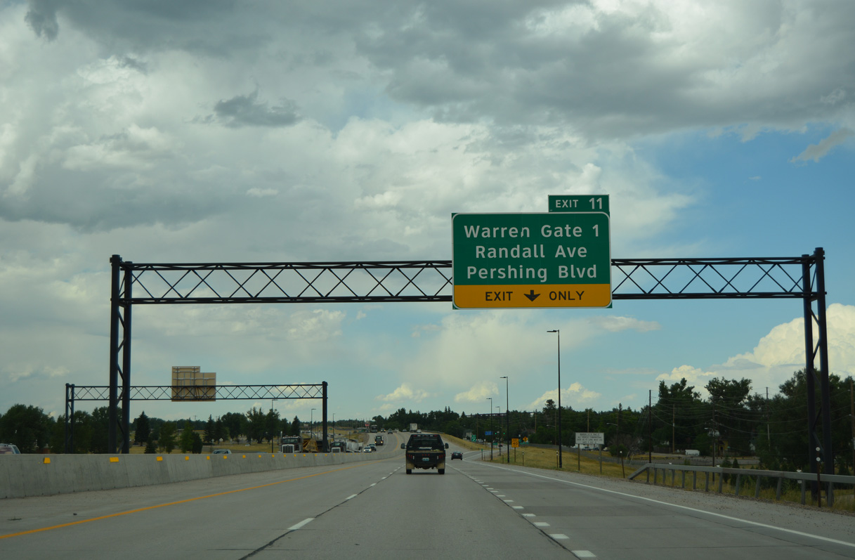
Pershing Boulevard branches east from Randall Avenue and I-25/U.S. 87 across Cheyenne to Lincolnway. Randall Avenue leads to F.E. Warren AFB Gate 1; Gate 2 is along Missile Drive west from Exit 10 D.
08/11/16
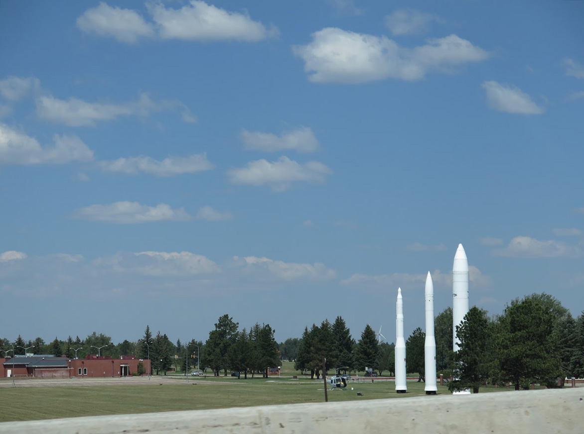
Missile Park at F.E. Warren Air Force Base lies just west of the modified diamond interchange (Exit 11) with Randall Avenue and Hynds Boulevard.
08/11/14
Business Loop I-25/U.S. 87 Business return to I-25/U.S. 87 northwest along Central Avenue to the diamond interchange at Exit 12.
08/11/16
A barrier median separates the roadways of Interstate 25 between F.E. Warren AFB and northwestern Cheyenne neighborhoods.
08/11/16
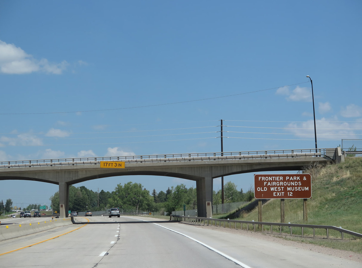
Held annually at adjacent Frontier Park, Cheyenne Frontier Days draws thousands to the Cheyenne area to partake in one of the country's largest rodeos and festivals. Lasting for several days in July, Cheyenne Frontier Days (CFD) often feature top entertainers and rodeo legends.
08/11/14
I-25 passes over a series of bridges over Lake Absarraca, which is also known as Country Club Lake within Frontier Park. The lake is part of the larger complex at Frontier Park that also includes an arena and concert venue.
08/11/14
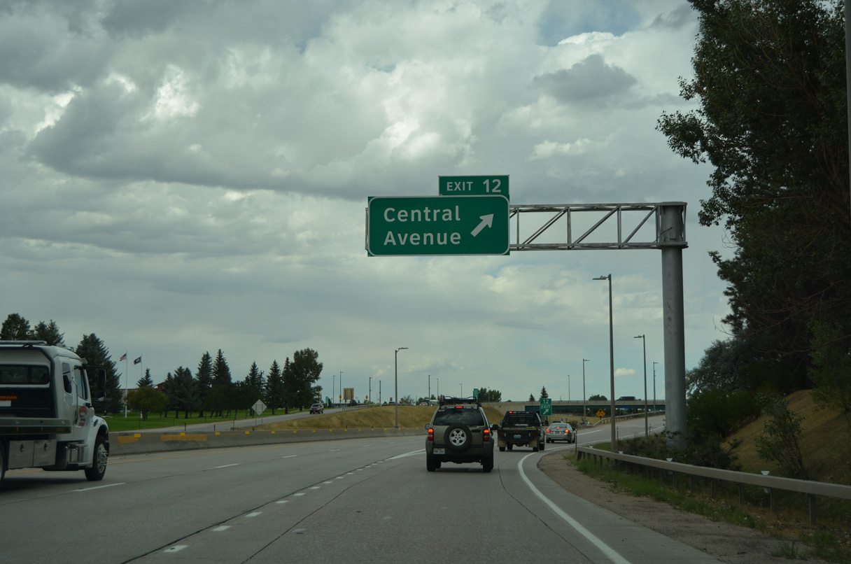
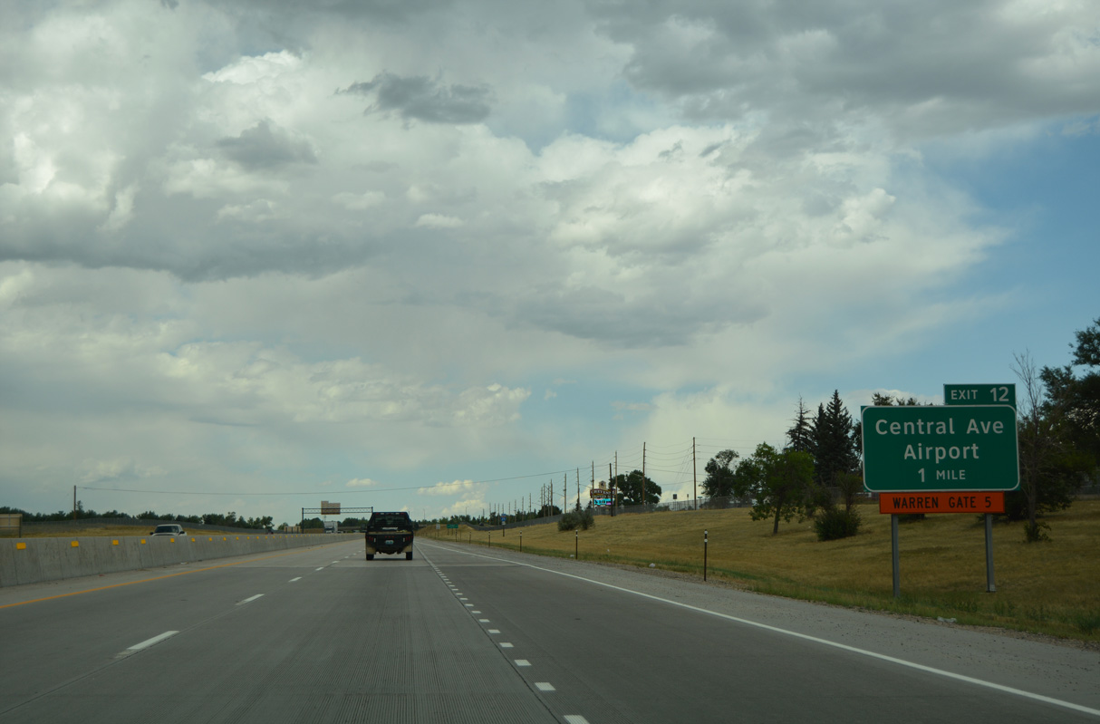
Exit 12 departs I-25/U.S. 87 north for Central Avenue. Central Avenue west to Bishop Boulevard and Francis E. Warren AFB Gate 5 is unsigned WY-224. The route connects I-25 with several governmental buildings, such as the Wyoming Department of Fish and Game and the Department of Transportation.
08/11/16
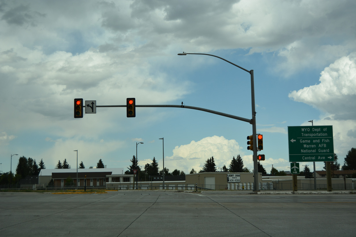
Business Loop I-25/U.S. 85/U.S. 87 Business (Central Avenue) south to WY-219 (Yellowstone Road) north leads to Dell Range Boulevard east for Cheyenne Regional Airport (Jerry Olson Field). The airport, along with the Wyoming National Guard offices, is located on the south side of Dell Range Boulevard.
08/11/16
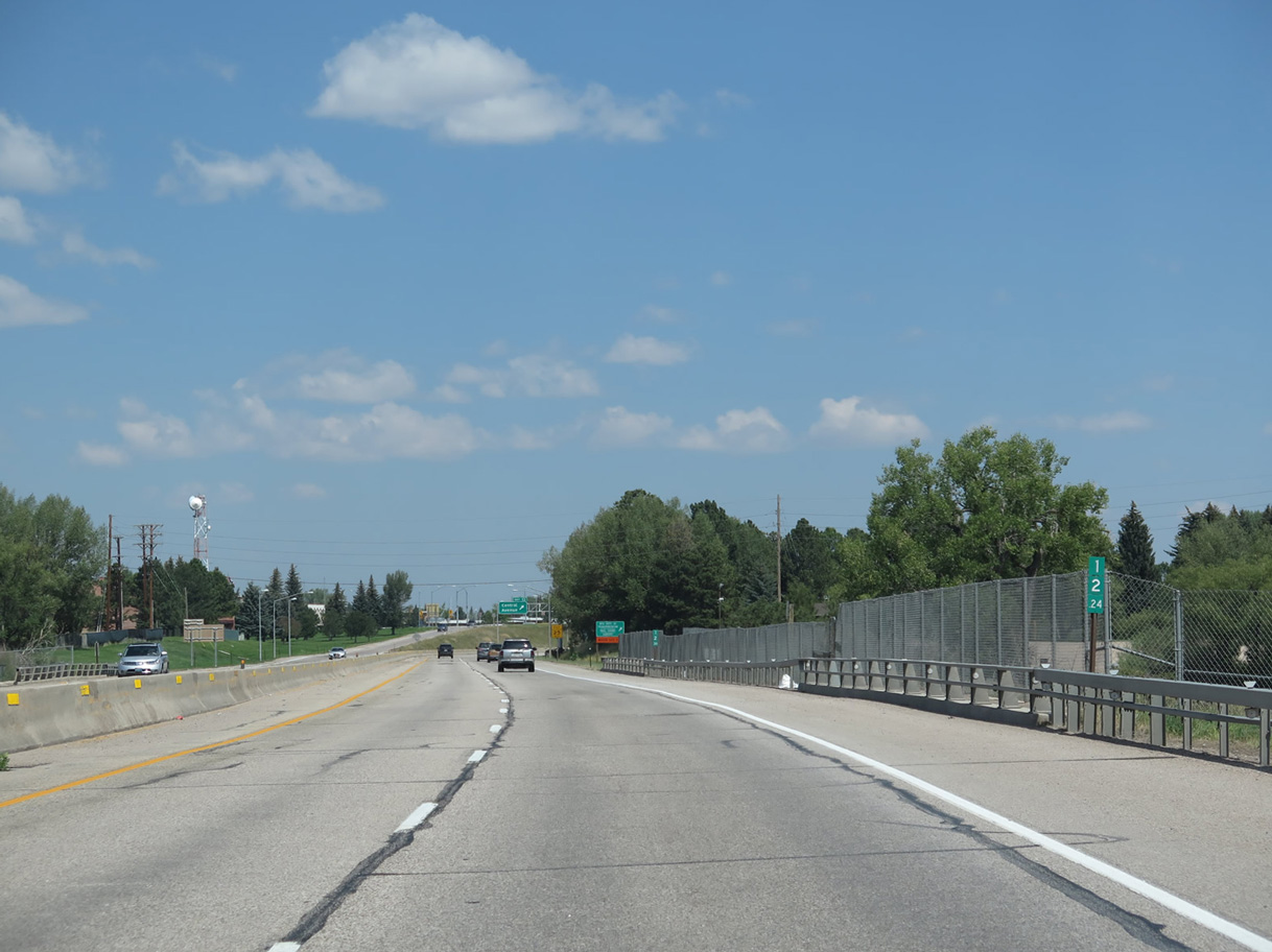
U.S. 85 joins I-25/U.S. 87 north from Central Avenue. Hynds Boulevard acts as the frontage road along the east side of Interstate 25 between Exit 12 and Exit 16.
03/25/25
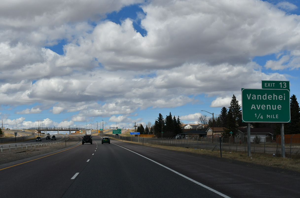
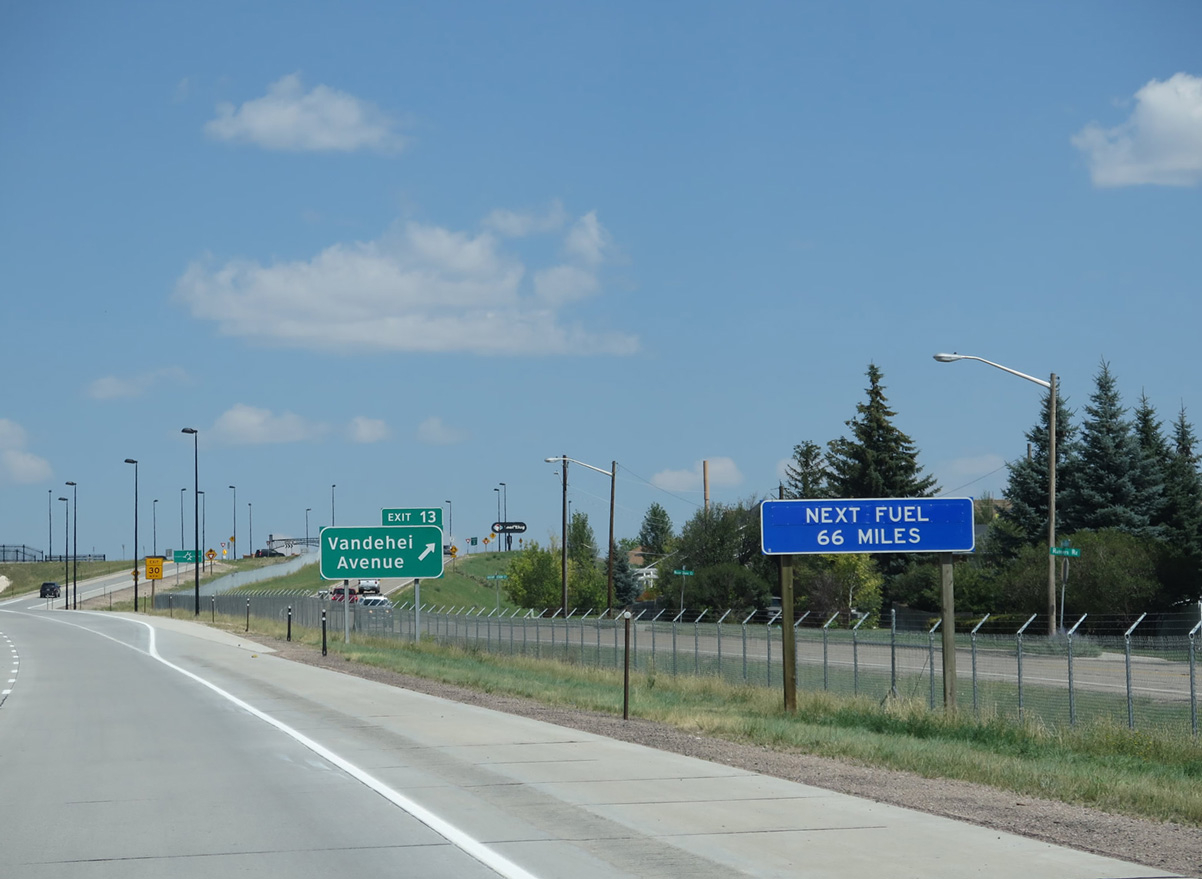
Exit 13 joins I-25/U.S. 85-87 with Vandehei Avenue in a quarter mile. Vandehei Avenue along with Gardenia Drive serve northern Cheyenne suburban developments.
03/25/25
Fuel service at Exit 13 is the last gas available along I-25 north for the next 42 miles. Signs were amended to display 66 miles after an accident destroyed Horton's Corner gas station at Chugwater on December 30, 2012. However, gas is again available at Chugwater.
08/11/14
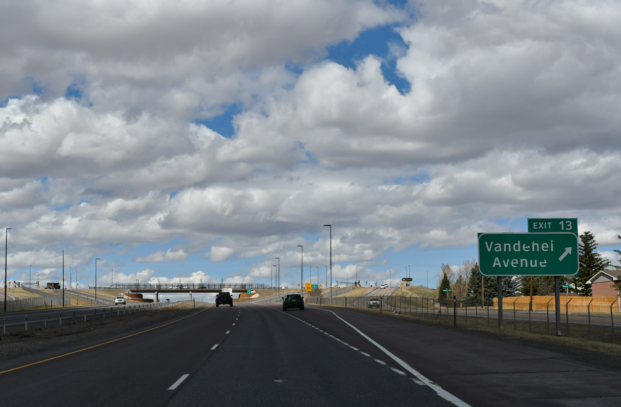
Exit 13 to Vandehei Avenue is the final urban Cheyenne exit from Interstate 25 northbound.
03/25/25
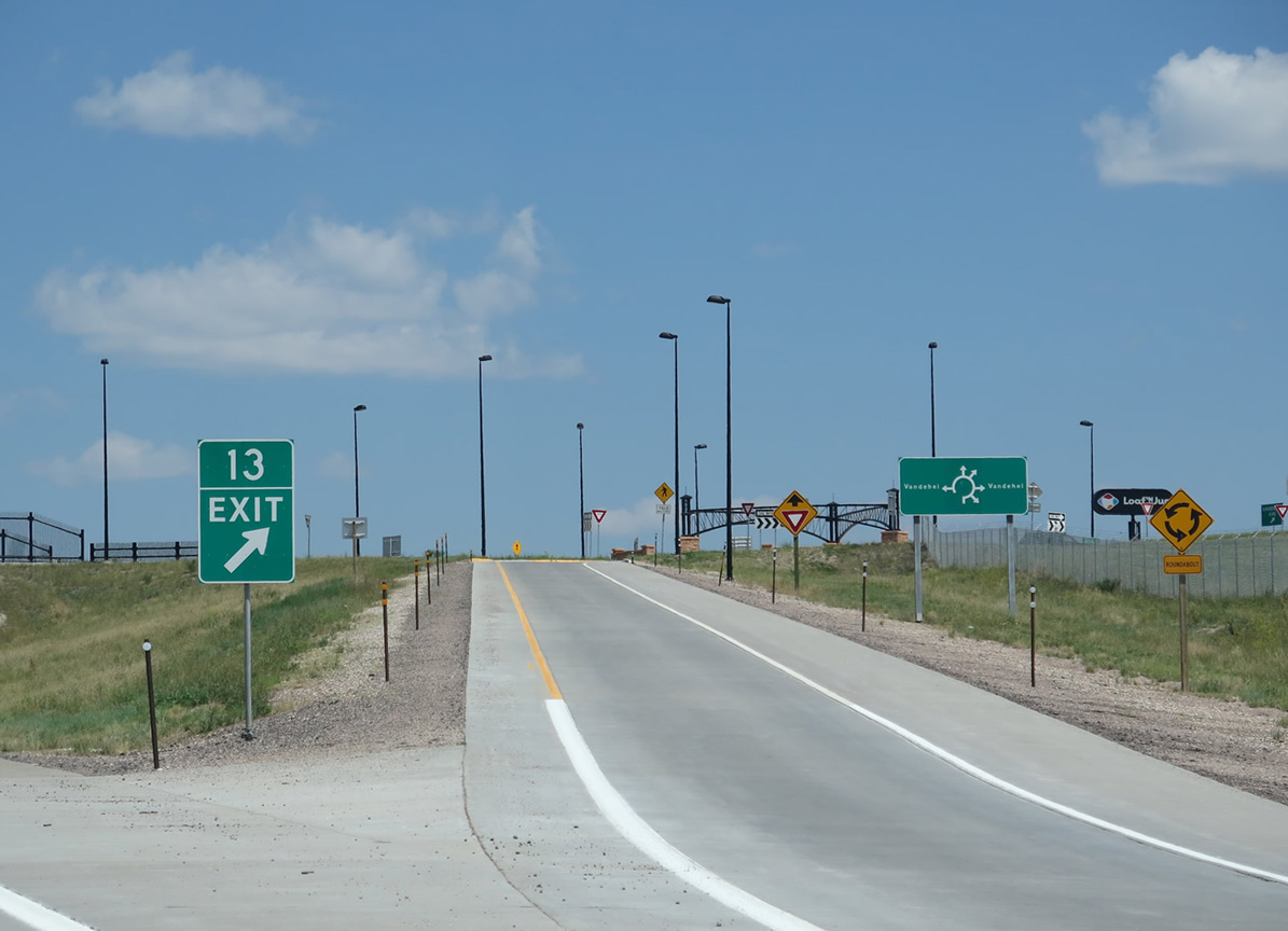
Construction in 2010 converted the exchange at Exit 13 into a dumbbell interchange with six-leg roundabouts added that also connect with parallel Bishop and Hynds Boulevards.
08/11/14
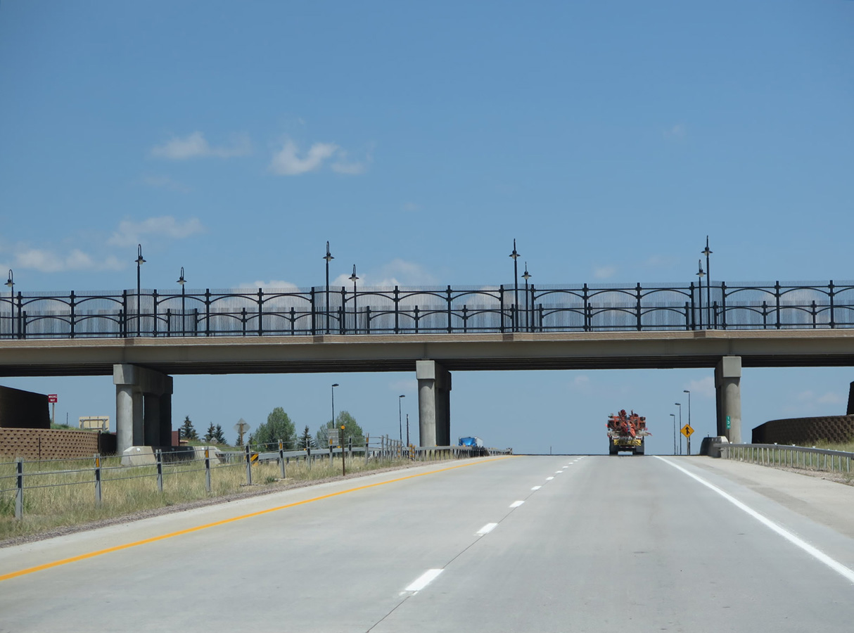
The decorative overpass for Vandehei Avenue was part of the reconstruction of Exit 13.
08/11/14
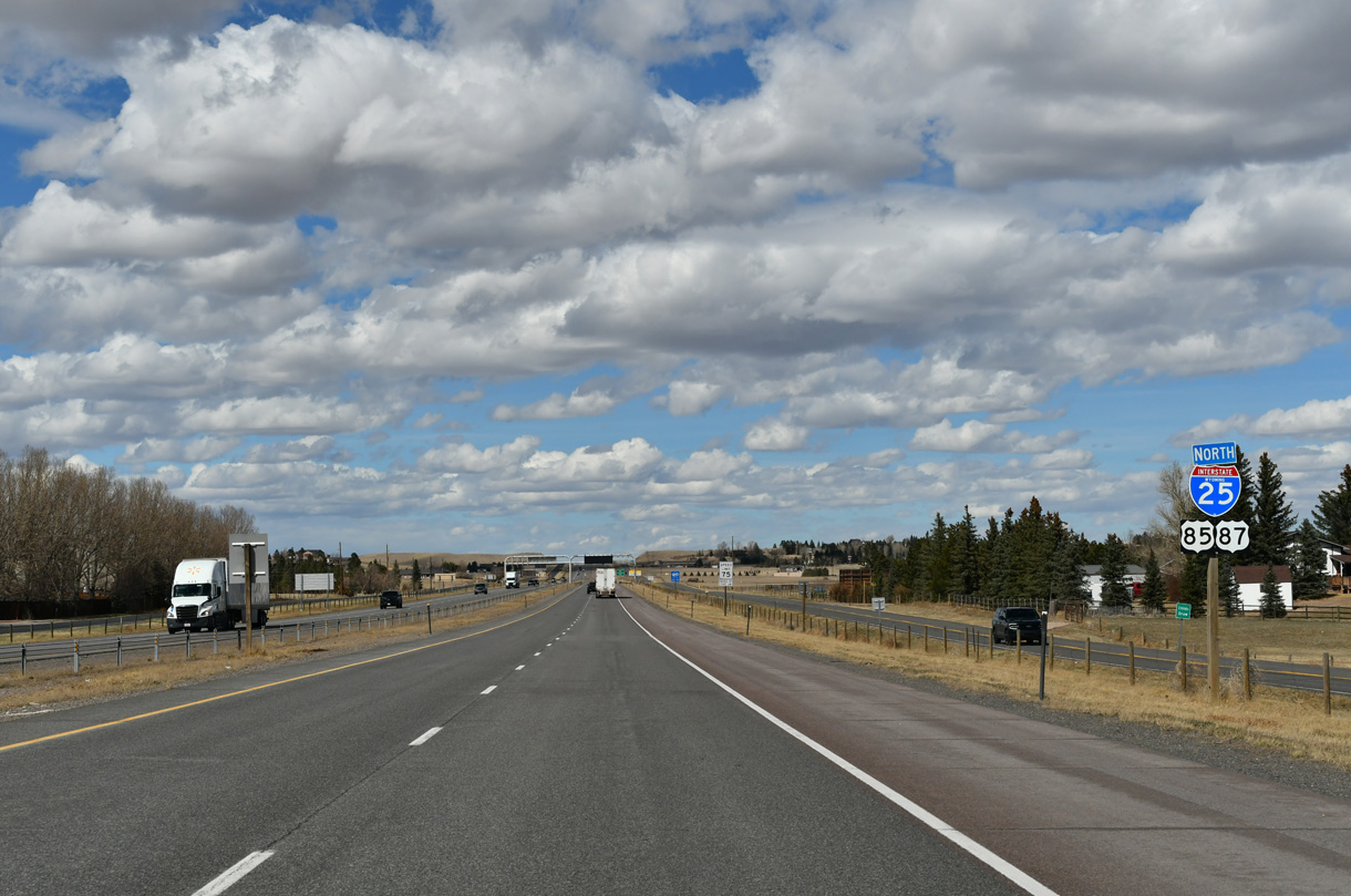
Suburban development extends northward along Interstate 25 to WY-211 (Horse Creek Road).
03/25/25
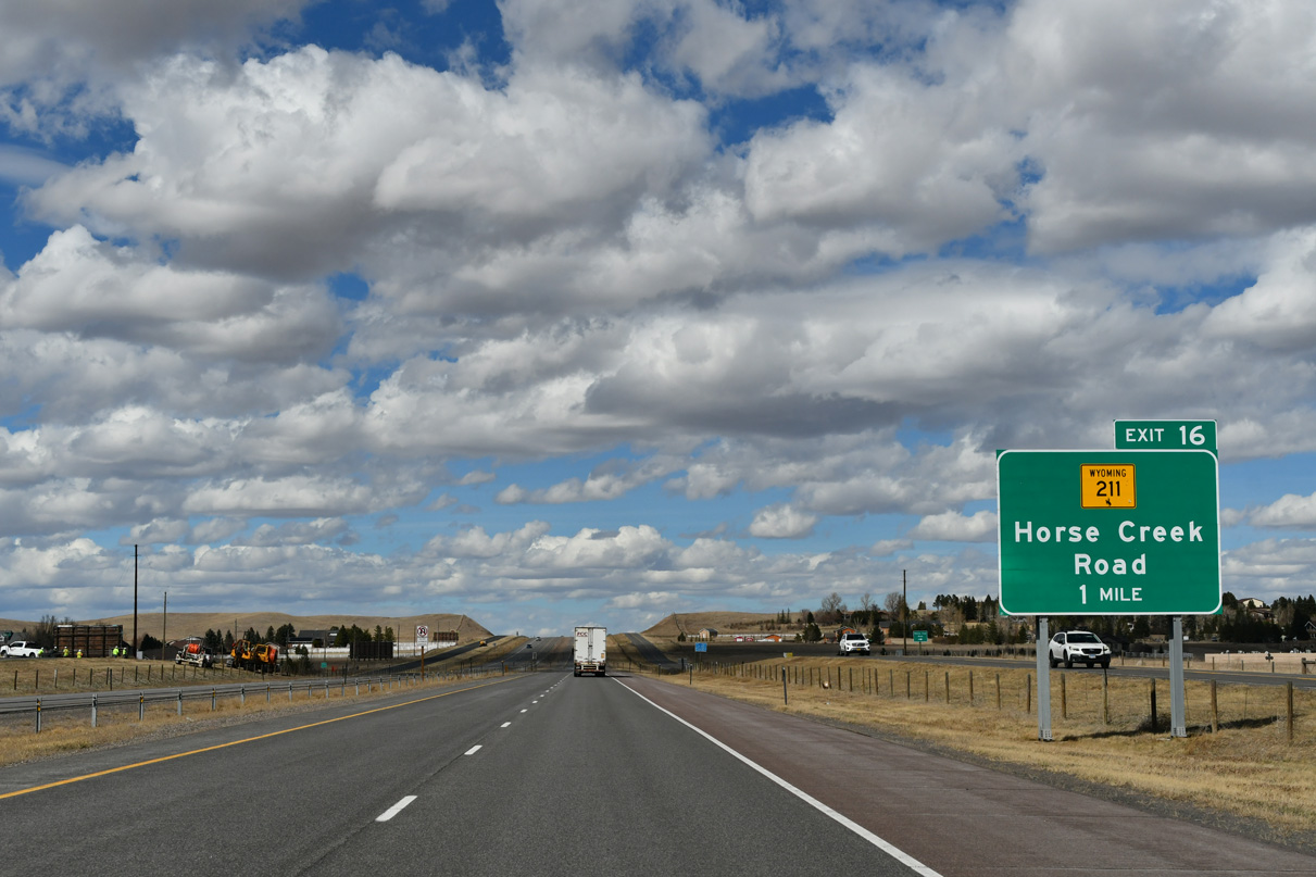
WY-211 (Horse Creek Road) stems west from parallel WY-219 (Yellowstone Road) to the diamond interchange at Exit 16.
03/25/25
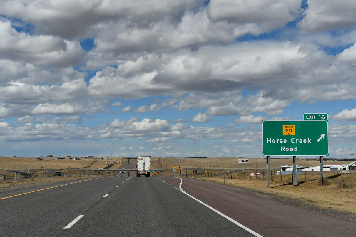
Traveling northwest from Exit 16, WY-211 (Horse Creek Road) eventually parallels a BNSF Railroad line to Federal, Horse Creek and Iron Mountain. The northern section of WY-211 ties into I-25/U.S. 87 at Exit 54 near Chugwater.
03/25/25
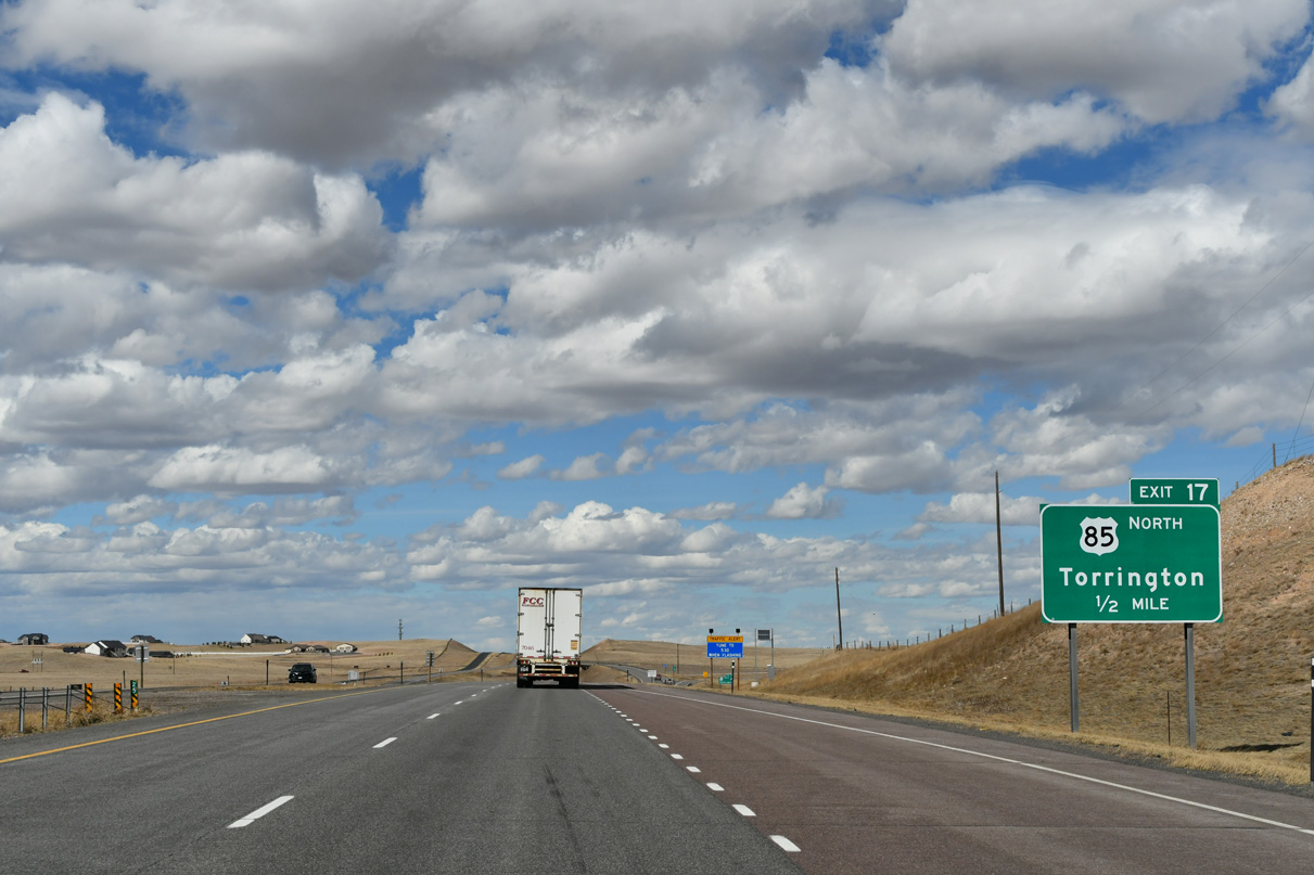
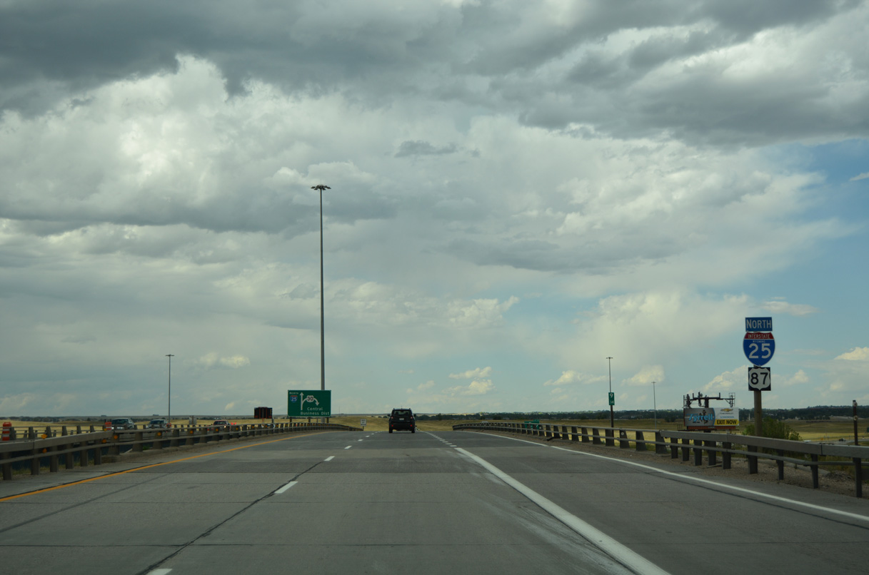
The next exit along northbound is the final separation between I-25/U.S. 87 and U.S. 85. The three routes intertwine to some degree northward from New Mexico. U.S. 85 angles northeast toward Torrington, then travels north along the eastern spine of Wyoming toward Lusk and the Black Hills region of South Dakota
03/25/25
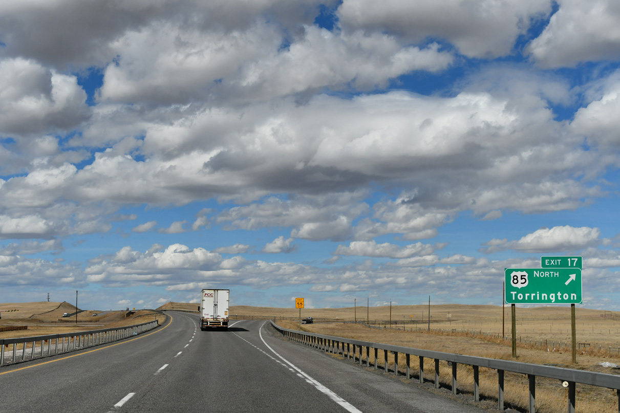
U.S. 85 departs I-25/U.S. 87 north at Exit 17 by the Ranchettes community. A long distance connection to Sundance and Devils Tower is afforded via U.S. 85 and Wyoming Highway 585 at Four Corners.
03/25/25
References:
- High Plains Road project webpage. http://www.ihcquality.com/ Project.asp?N=74D1DA5D-4902-46A7-AA0F-874942C50E66&C =A1B9C8D9-A44A-482C-A143-ED85426B0BCB.
- Curt Gowdy State Park. https://www.cheyenne.org/outdoors/hiking-parks-trails/curt-gowdy-state-park/ Visit Cheyenne web site.
Photo Credits:
- Andy Field: 08/11/14
- Brent Ivy: 03/25/25
- ABRoads: 08/11/16
Connect with:
Page Updated Tuesday July 08, 2025.