
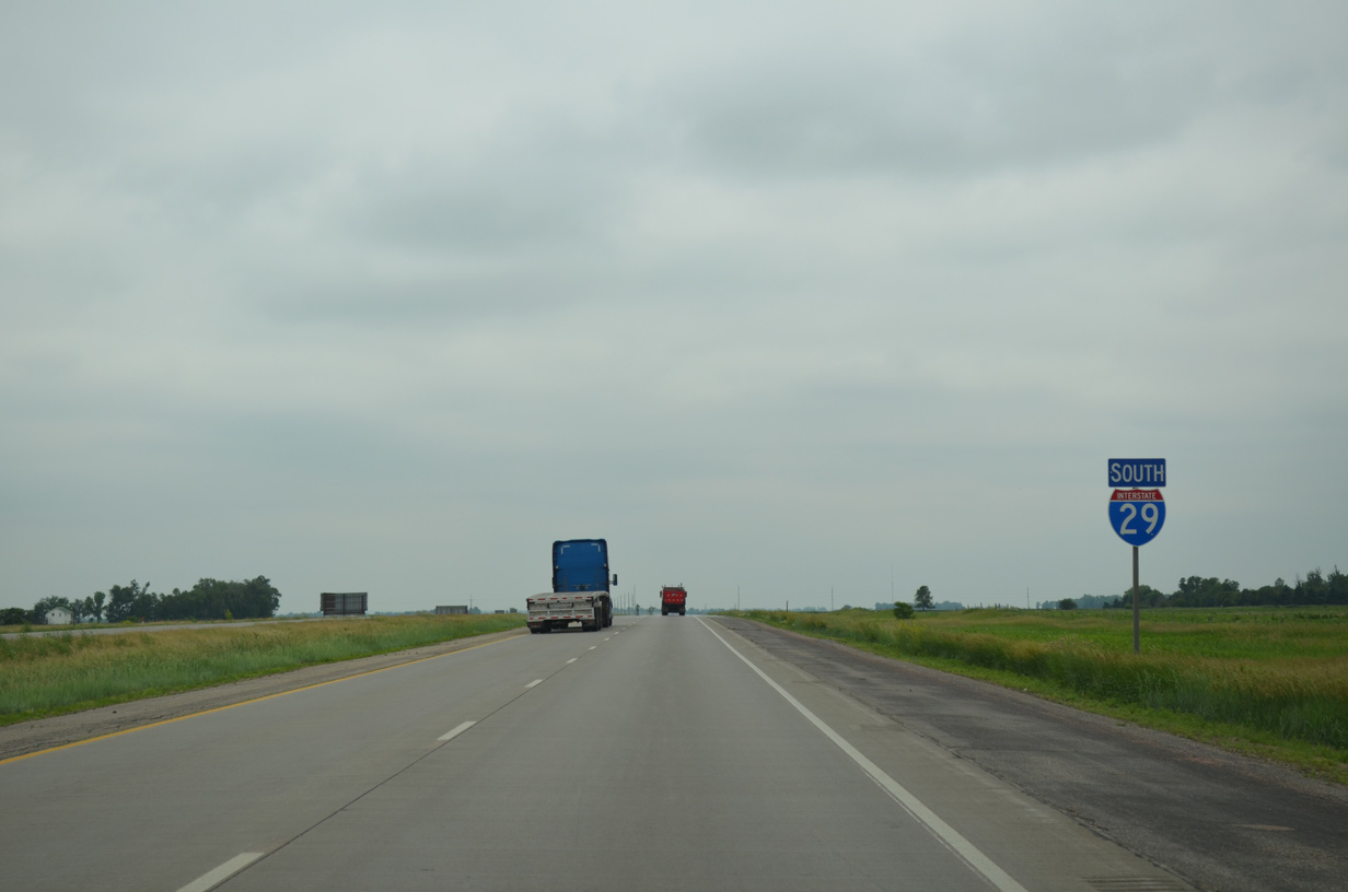
Interstate 29 South - Sioux Falls to Beresford
 South
South
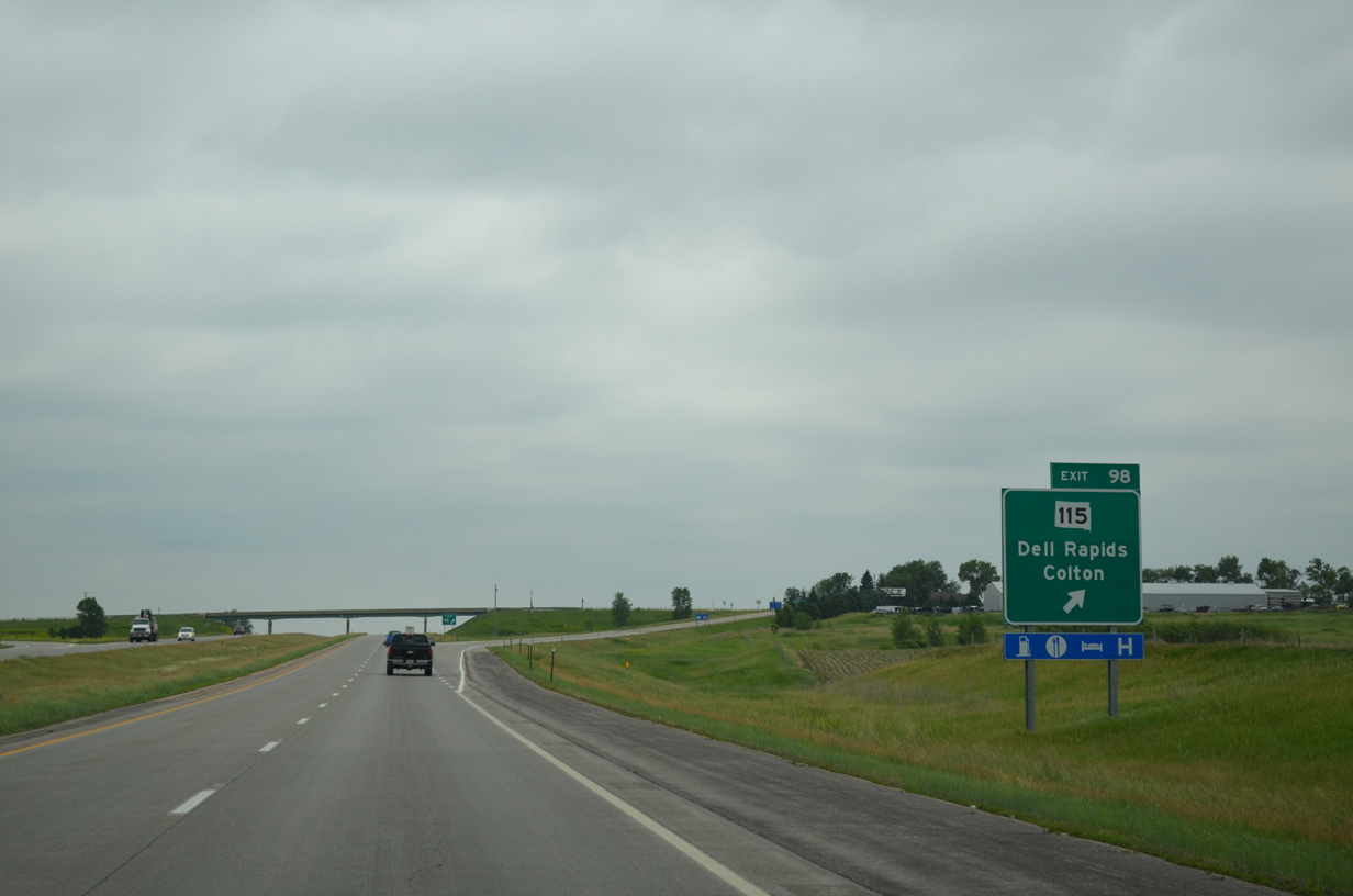
The northern segment of SD 115 begins at a diamond interchange (Exit 98) with Interstate 29 in one mile. The state highway ventures 2.5 miles east to the city of Dell Rapids.
06/17/15
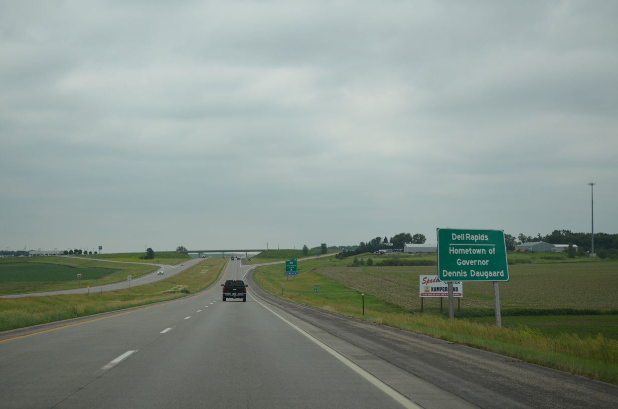
Dell Rapids, a city of over 3,600, is the hometown of South Dakota Governor Dennis Daugaard. Similar signs recognize the home towns of politicians currently serving office across the state.
06/17/15
SD 115 forms an L-shaped route between Exit 98 and 72nd Street N outside Sioux Falls. The 29.58 mile route follows old U.S. 77 south from Dell Rapids.
CR 104 stems 7.4 miles west from I-29 to CR 149 (464th Avenue) near the city of Colton.
06/17/15
Interstate 29 travels due south through eastern Burk township for the next four miles.
06/17/15
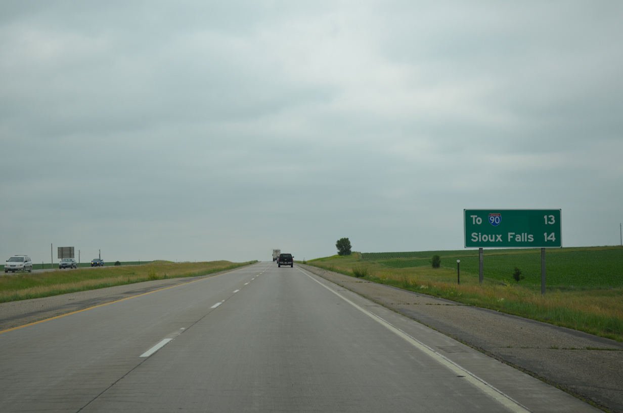
The freeway leading south to Sioux Falls is rural and sparsely populated. As such, the exchange with I-90 is highlighted at 13 miles out in lieu of a population center on this distance sign.
06/17/15
A diamond interchange lies one mile ahead on I-29 south with County Road 114 (250th Street), 2.2 miles west of the city of Baltic.
06/17/15

CR 114 straddles the Burk and Lyon township line west from adjacent 472nd Avenue.
06/17/15
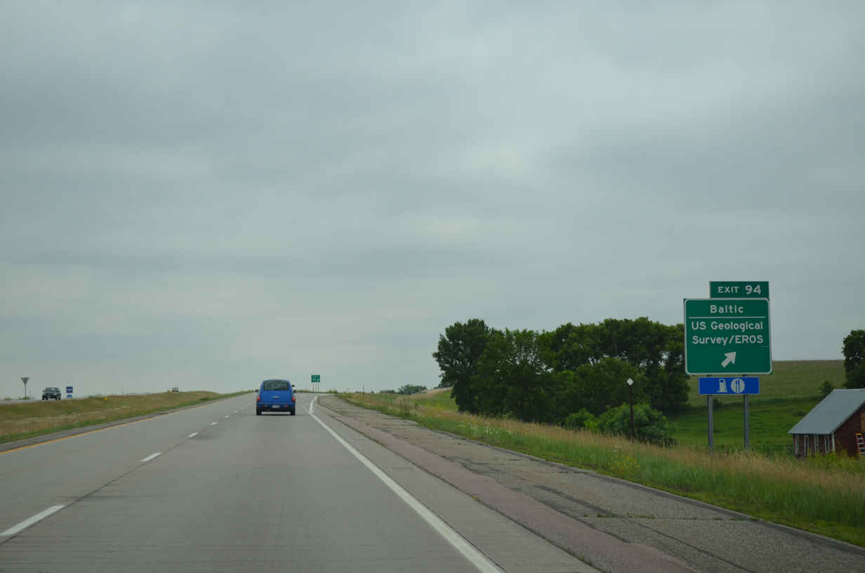
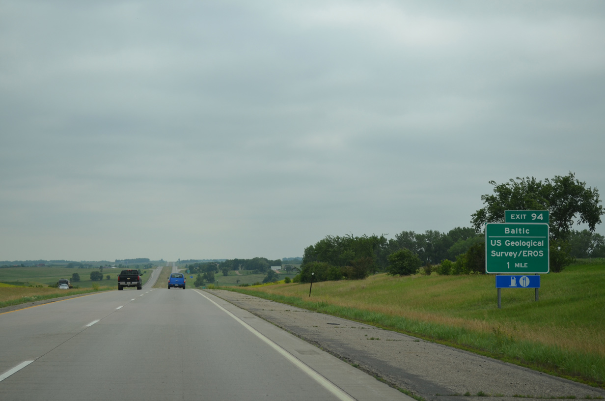
Exit 94 serves interests to the USGS Earth Resources Observation and Science (EROS) data center, located ten miles to the east via CR 114 and 121 (478th Avenue). CR 114 otherwise extends beyond Baltic to the town of Sherman near the Minnesota state line.
06/17/15
Advancing southward, Interstate 29 traverses a series of hills west of the Big Sioux River at a general elevation of 1,550 feet above sea level.
06/17/15
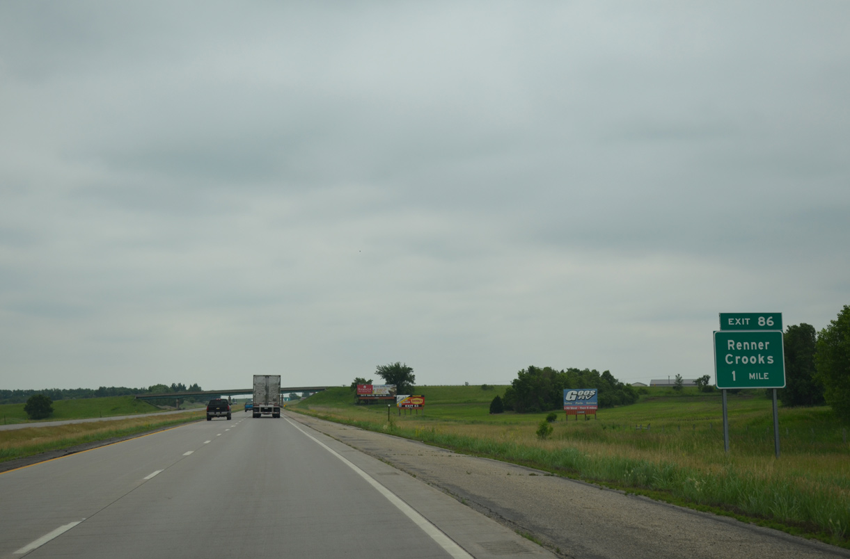
CR 130 (258th Street) crosses paths with Interstate 29 at a diamond interchange (Exit 86) in one mile.
06/17/15
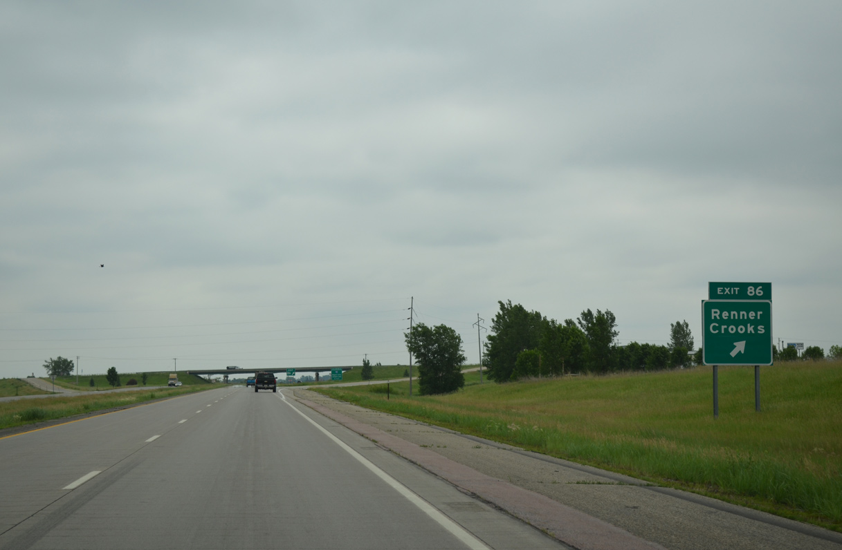
The city of Crooks is a 2.4 mile drive to the northwest via CR 130 and 137 (470th Avenue). Unincorporated Renner, home of Renner Ball Park, lies 2.2 miles to the east of Exit 86 ahead of SD 115 along 258th Street.
06/17/15
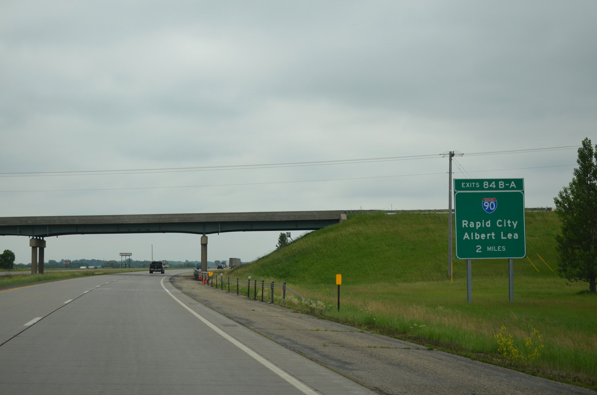
Motorists pass under County Road 130, two miles north of the cloverleaf interchange (Exits 84B/A) with Interstate 90.
06/17/15
Interstate 29 remains elevated along bluffs west of the Big Sioux River to Maple Street (Exit 81) in Sioux Falls.
06/17/15
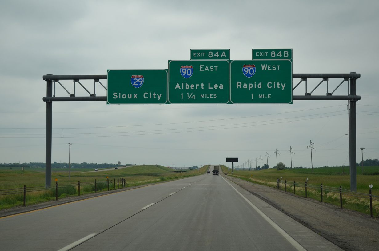
One mile north of Exit 84B for I-90 west to Mitchell and Pierre. The cross-state freeway replaced U.S. 16 from the Minnesota state line to Rapid City.
06/17/15
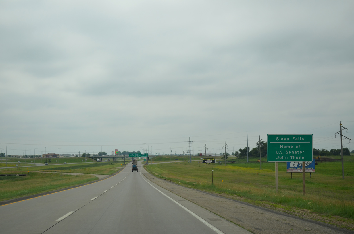
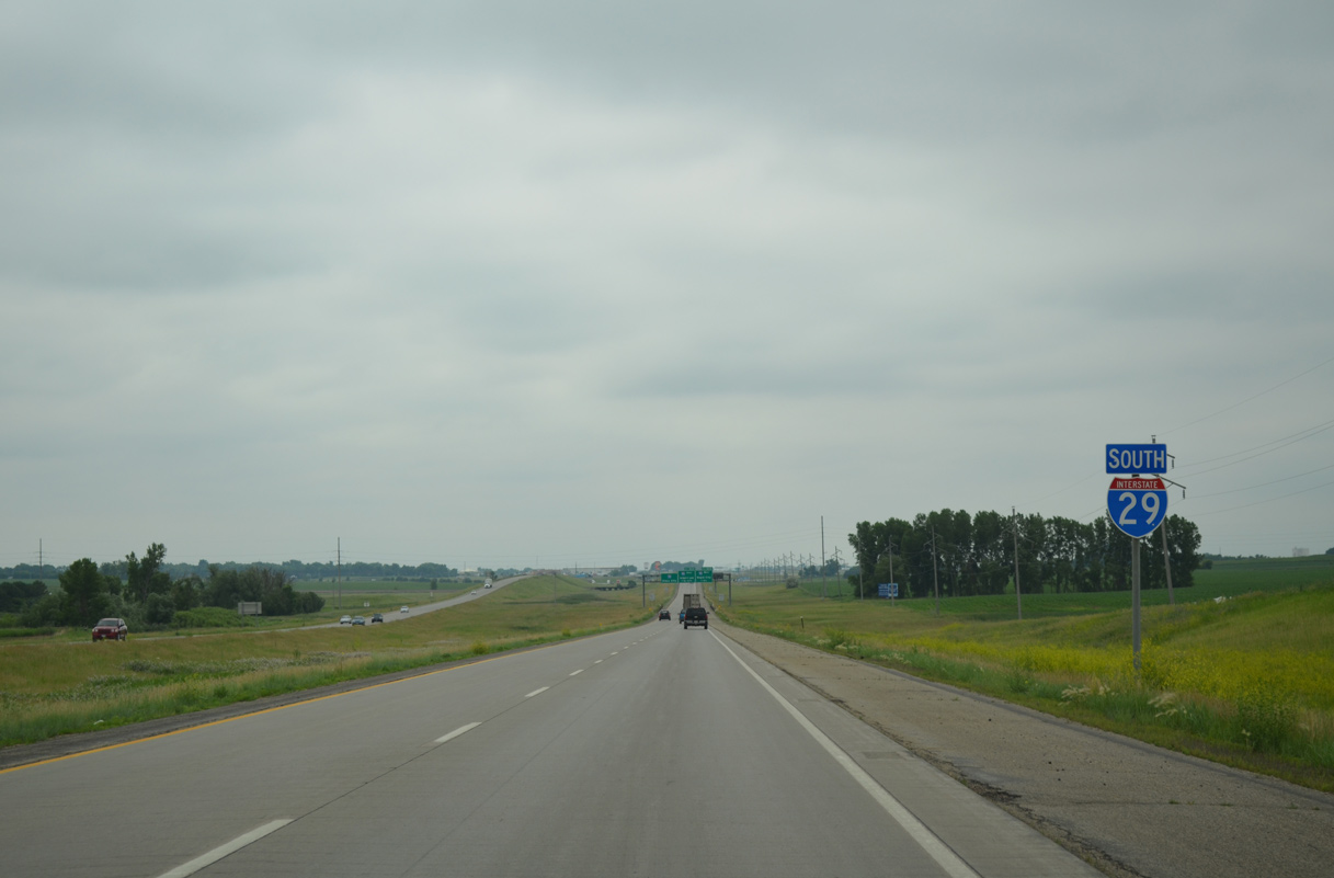
I-29 enters the city of Sioux Falls just beyond the exchange with I-90. The municipality is the largest within the state and home to U.S. Senator John Thune.
06/17/15
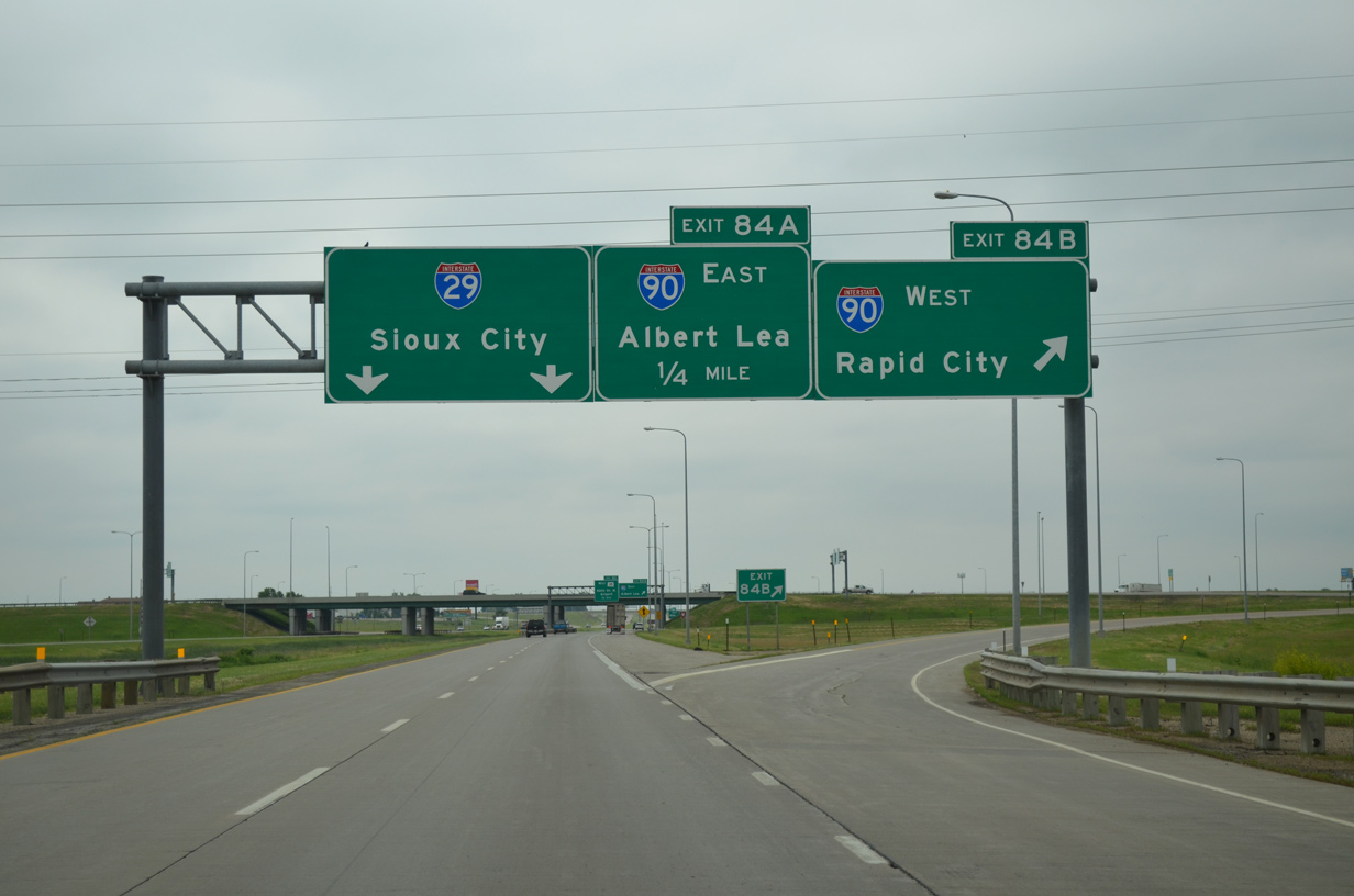
Exit 84B leaves Interstate 29 south for I-90 west. The freeway continues six miles to South Dakota 38 near Hartford and 336 miles to Rapid City.
06/17/15
Interstate 90 skims the north side of Sioux Falls from adjacent Marion Road (Exit 395) east to Timberline Avenue and the future SD 100 at Exit 402. Further east, I-90 continues to the suburb of Brandon and Luverne, Minnesota on the 175 mile drive to Albert Lea.
06/17/15
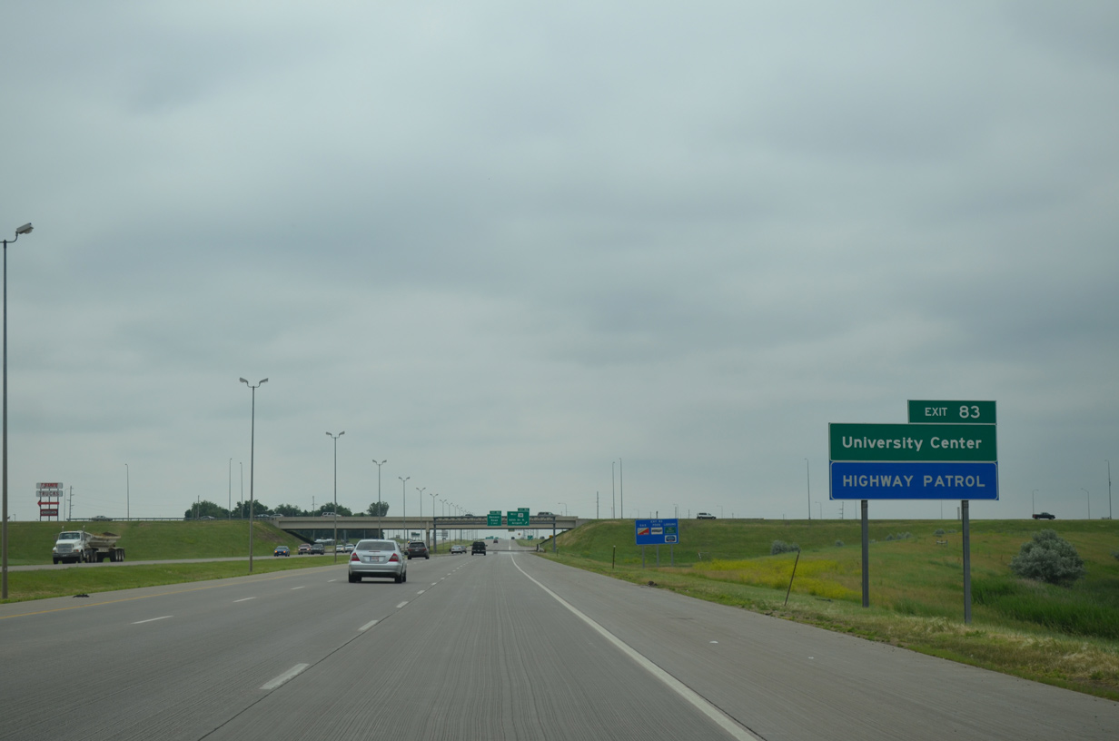
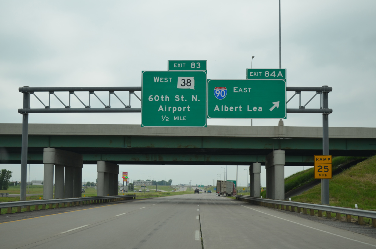
Forthcoming SD 38 begins at parallel Marion Road, just west of the University Center and 0.8 miles from Exit 83. The state highway parallels I-90 to Ellis Corner and the city of Hartford.
06/17/15
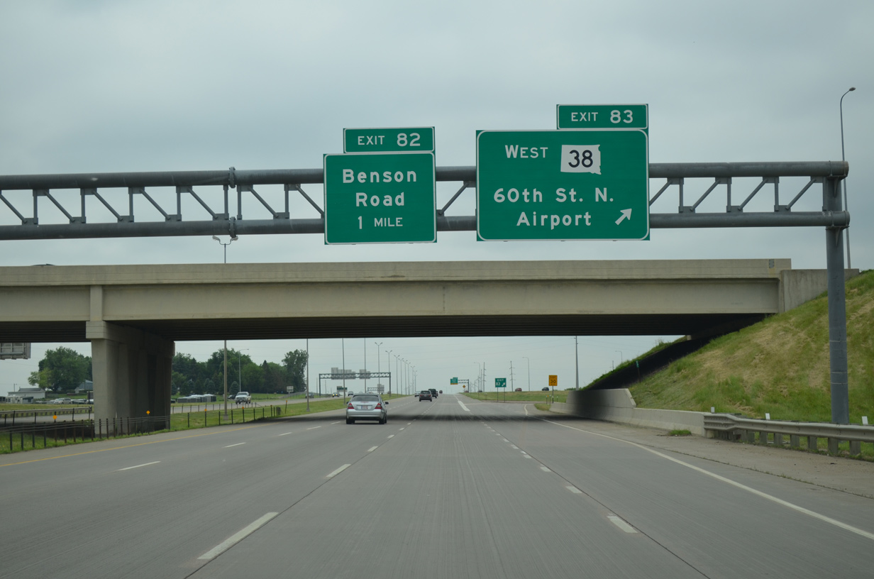
Entering the parclo interchange (Exit 83) with 60th Street N on I-29 south.
SD 38 totals 64.39 miles from Sioux Falls to Business Loop I-90 at Mitchell. The state trunk highway formerly ran south with I-29 to Russell Street and along Minnesota Street (old U.S. 77) to Downtown. The eastern segment of the route, from Six Mile Road to the Iowa State line, was renumbered as SD 42.
06/17/15

Continuing south, drivers along Interstate 29 quickly approach the single point urban interchange (SPUI) with Benson Road at Exit 83. Benson Road spurs east to the Sanford Sports Complex and west to exit the city beyond a number of town home communities and subdivisions.
06/17/15
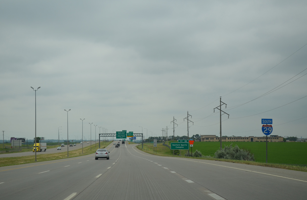
A two year project completed by September 1, 2003 reconstructed the split wye and half diamond interchange at upcoming Russell and Maple Streets into a six-ramp parclo interchange. Associated work widened I-29 from I-90 south to Madison Street, reconfigured the diamond interchange at Exit 83, and added a SPUI (Exit 82) with Benson Road.1
06/17/15
Exit 83 departs Interstate 29 south for Benson Road. This section of Benson Road is discontinuous from the stretch east of Sioux Falls International Airport (FSD).
06/17/15
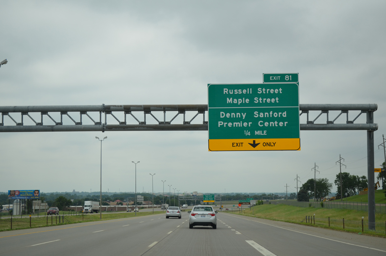
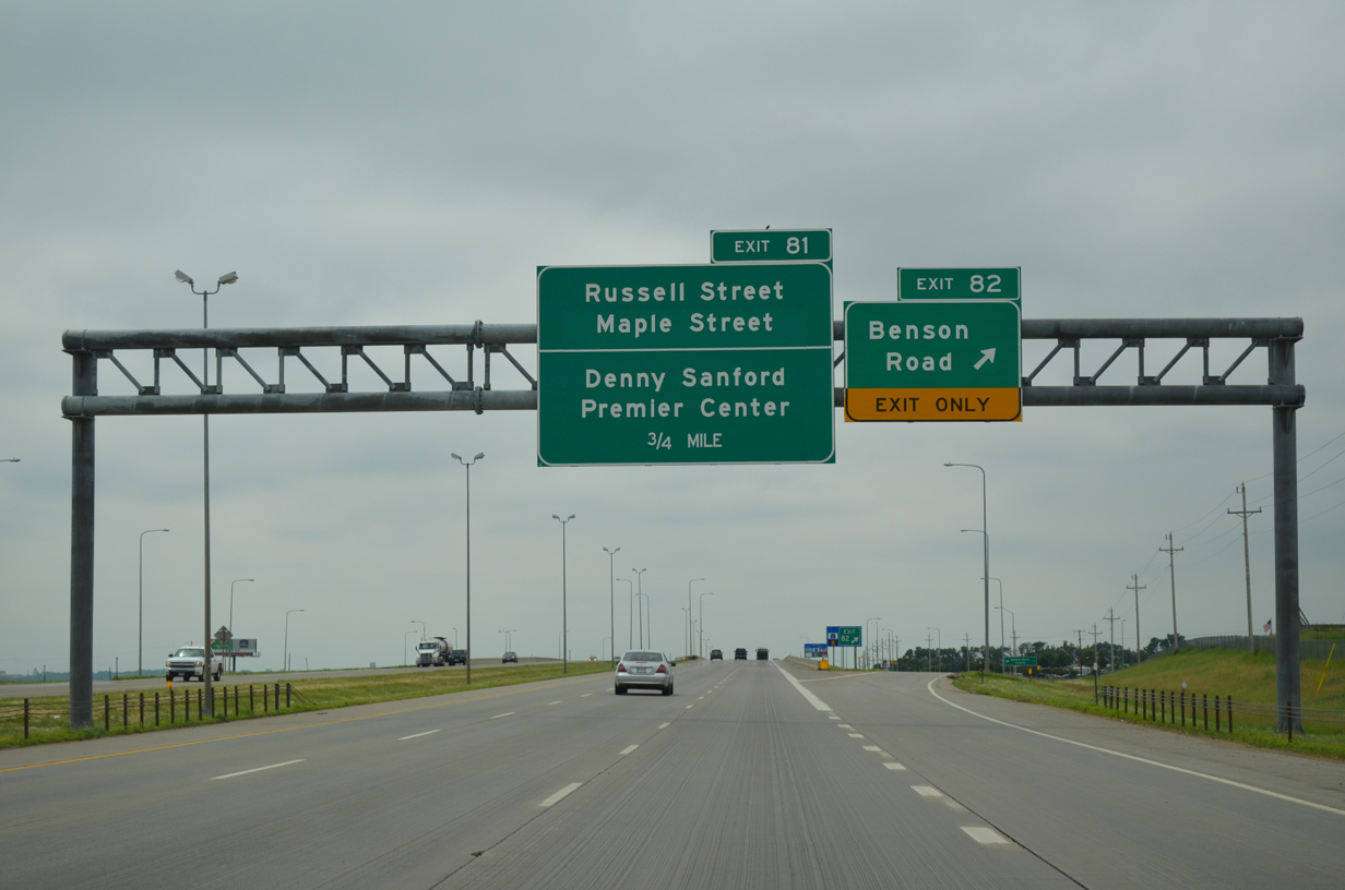
Maple Street east and Russell Street west come together at Interstate 29 in one quarter mile. Russell Street comprises a four to six lane arterial leading southeast to the Denny Sanford Premier Center (a 12,000 seat arena), Sioux Falls Convention Center and Minnesota Avenue (locally maintained SD 115/Business Spur I-90).
06/17/15
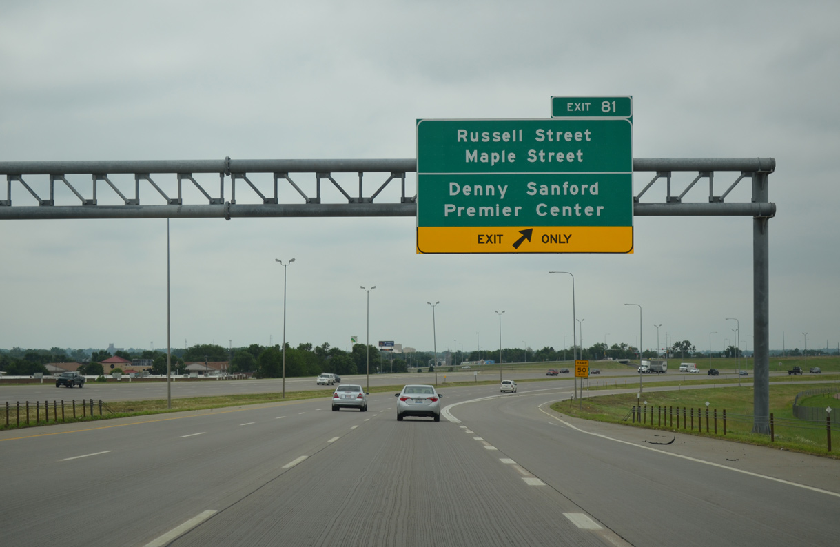
Formerly a left side ramp departed from I-29 south here for SD 38 (Russell Street) east. Aforementioned construction realigned Russell Street to tie directly into Maple Street, which extends west through nearby suburban areas to become CR 140 (263rd Street).
06/17/15
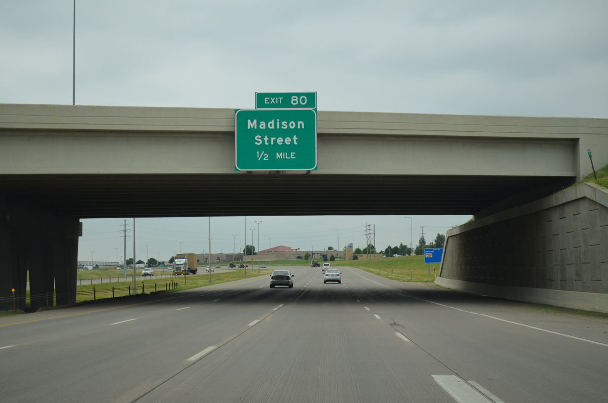
Auxiliary lanes expand Interstate 29 to eight overall lanes between Maple Street (Exit 81) and the SPUI (Exit 80) with Madison Street.
06/17/15

A pedestrian bridge spans Interstate 29 between Southeast Technical Institute and the Sioux Falls bike trail system. The bridge was recommended as part of the Russell Street interchange project and built in 2004 at a cost of $1.1 million.2
06/17/15
Madison Street heads east by the Concrete Materials production facility and quarry and W.H. Lyon County Fairgrounds to enter the West Sioux neighborhood east of the Big Sioux River. West of Exit 80, Madison Street serves the Aspen Heights subdivision and Ellis via 264th Street.
06/17/15
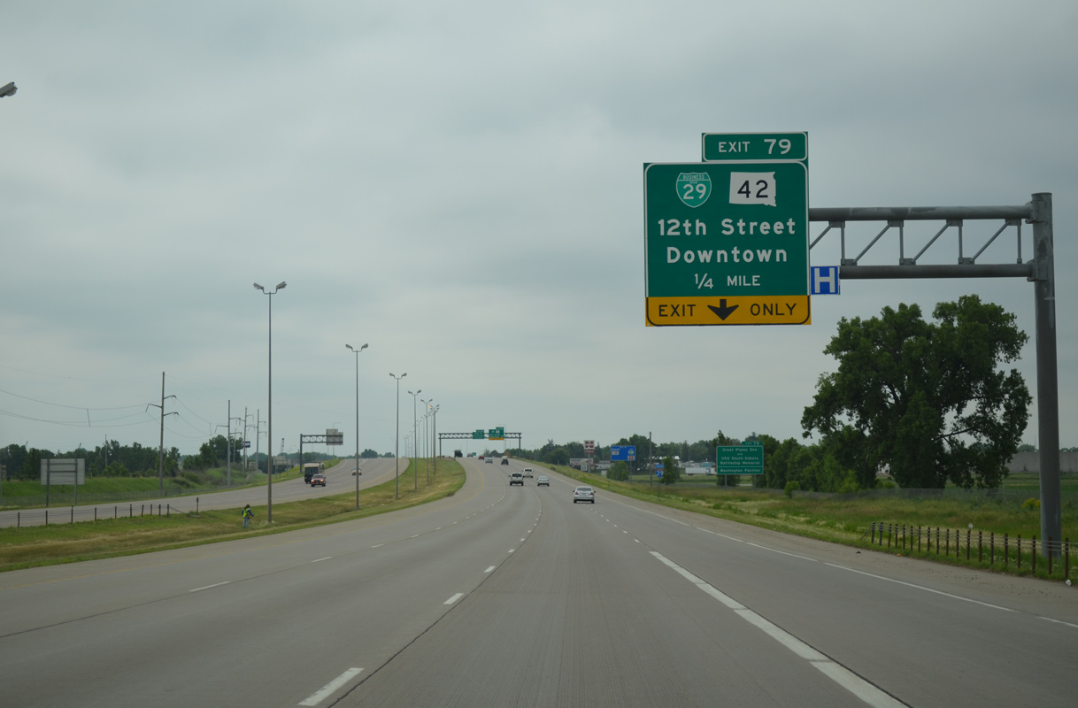
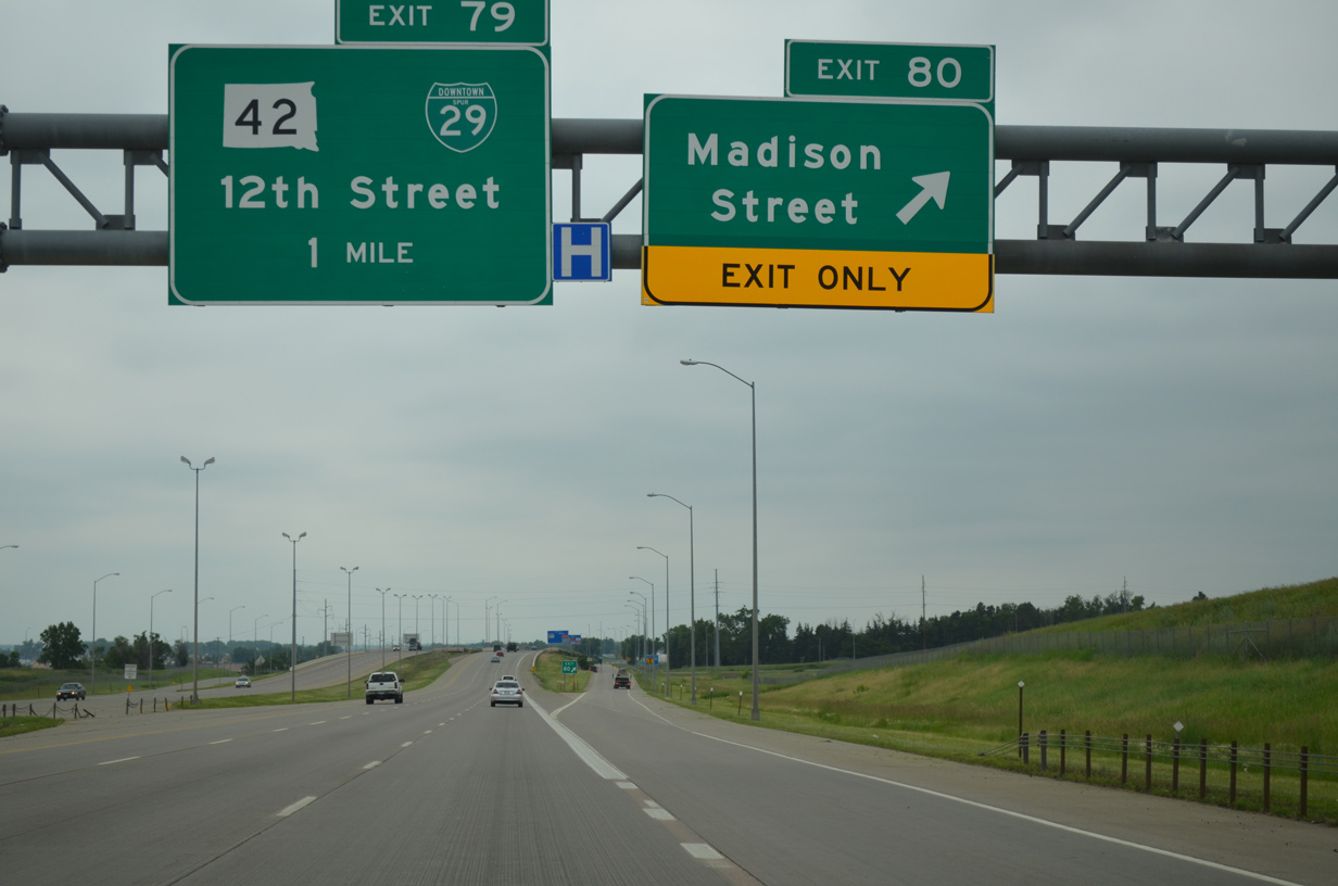
Another SPUI (Exit 79) along I-29 south lies just a quarter mile ahead with Business Spur I-29 east/SD 42 (12th Street). The locally maintained routes follow the historic alignment of U.S. 16, 2.5 miles east into Downtown Sioux Falls.
06/17/15
I-29 again carries eight lanes as it approaches Exit 79. Construction in 2006 reconfigured the exchange with Business Spur I-29/SD 42 (12th Street) from a diamond interchange.
06/17/15

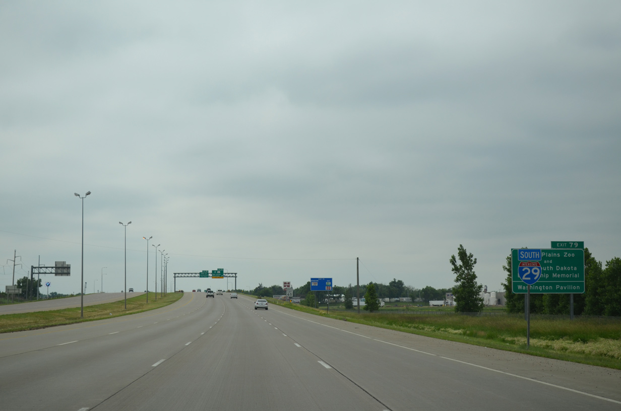
Exit 79 departs I-29 south for Business Spur I-29/SD 42 (12th Street) east by the Great Plains Zoo to the city center and Washington Pavilion. 12th Street west transitions into state-maintained SD 42 at Ellis Road. The middle of three segments takes old U.S. 16 west 59.23 miles to SD 37 at Ehan.
06/17/15
Traveling with eight lanes once more, Interstate 29 runs between a manufactured home community to the west and the Country Club at Sioux Falls golf course to the east.
06/17/15
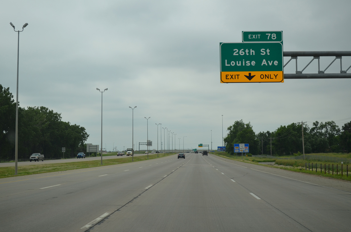
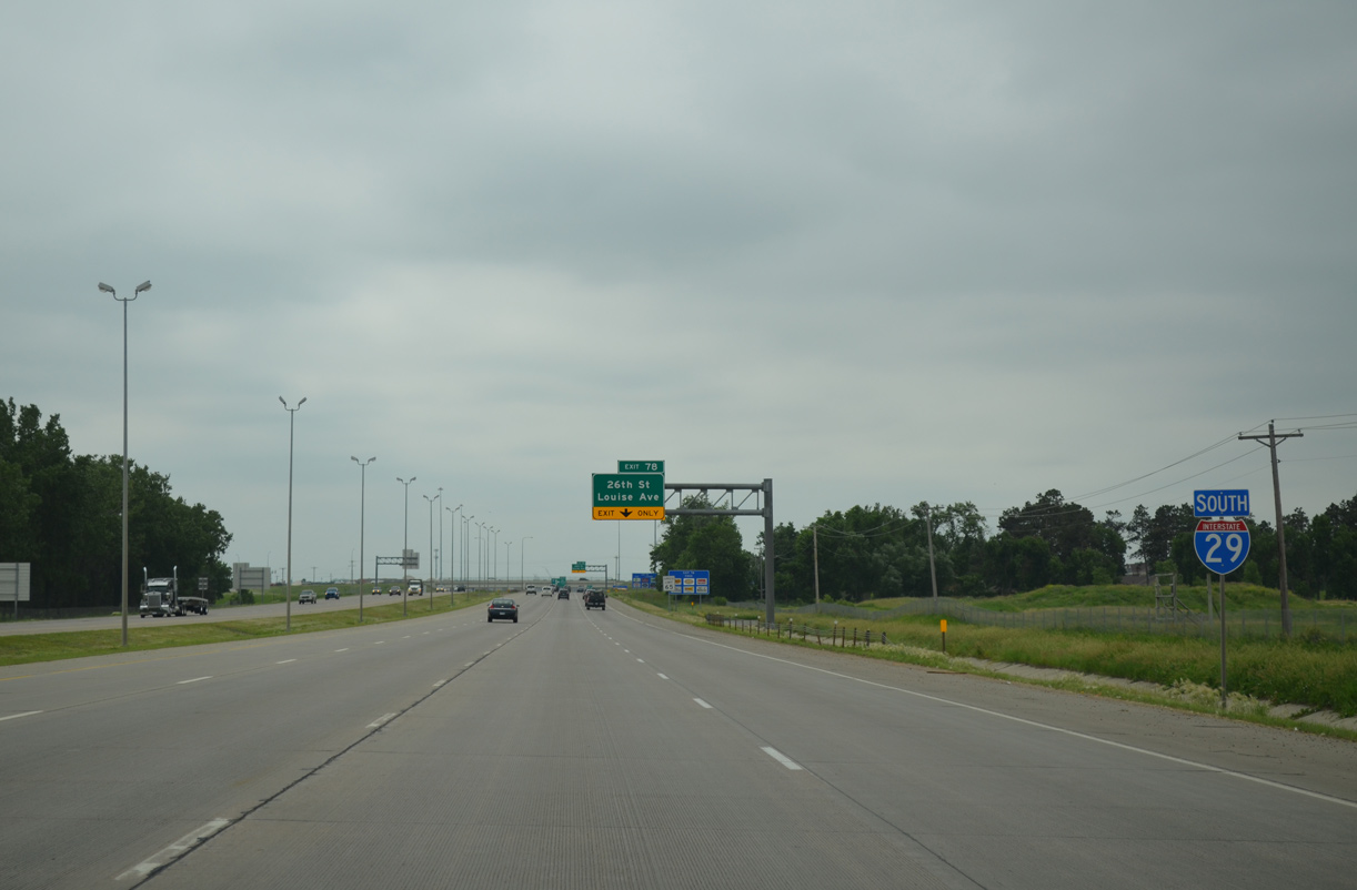
26th Street east transitions from residential areas west of Marion Road into a commercial arterial ahead of Exit 78. The arterial arcs southeast to become Louise Avenue at the nearby Meadows on the River retail complex.
06/17/15
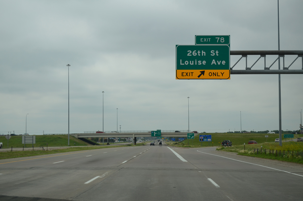
Interstate 29 south reaches the diamond interchange (Exit 78) with Louise Avenue just beyond the bridge over Skunk Creek. Louise Avenue travels south to The Empire Mall and additional retail centers to Interstate 229.
06/17/15
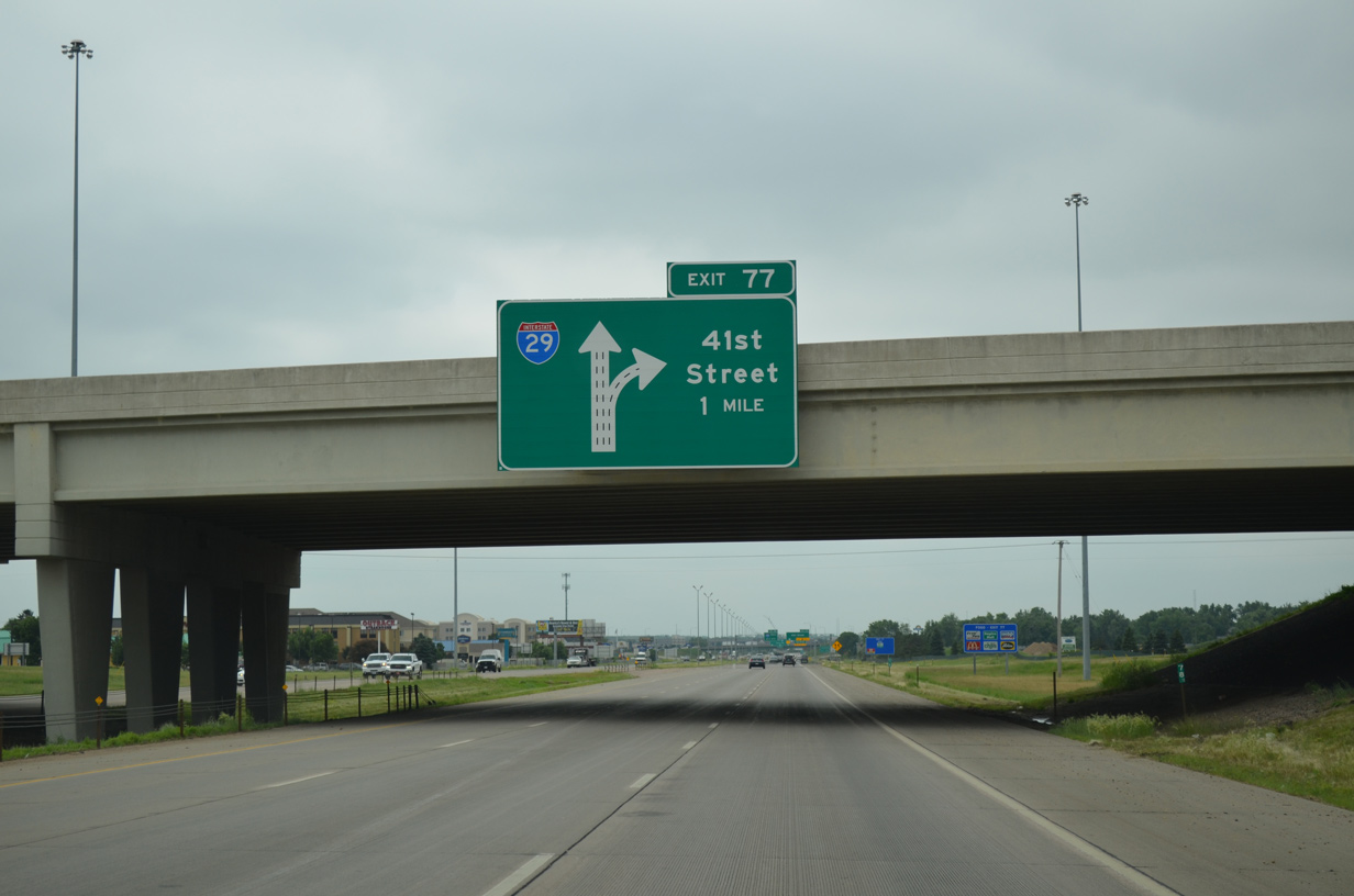
A diagrammatic sign outlines the two lane off-ramp (Exit 77) for 41st Street at the 26th Street overpass.
06/17/15
Interstate 229 angles southwest from the Big Sioux River to end at I-29 in 2.5 miles. Exit 77 departs next for 41st Street east to The Empire Mall and west to suburban areas of southwest Sioux Falls.
06/17/15
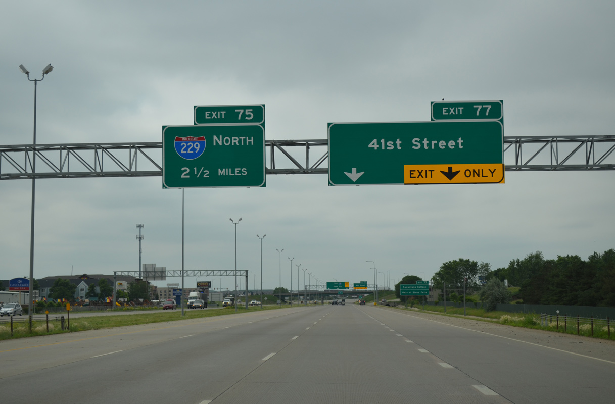
Entering the diamond interchange (Exit 77) with 41st Street. 41st Street comprises a commercial boulevard east to Business Loop I-229/SD 115 (Minnesota Avenue).
06/17/15

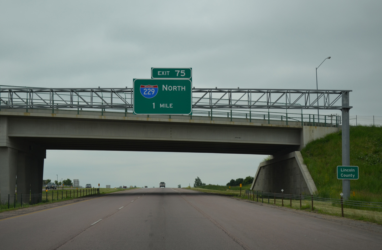
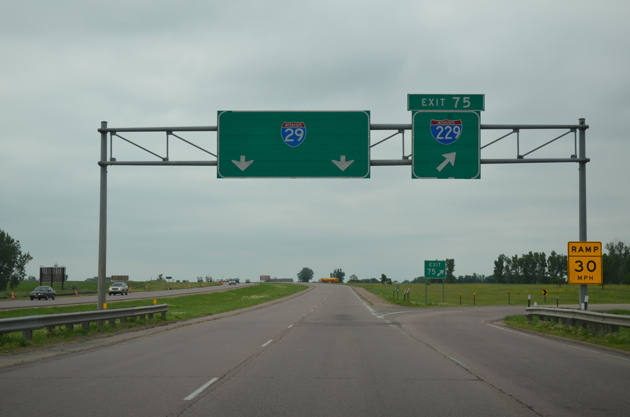
Interstate 29 angles southwest from 41st Street to the trumpet interchange (Exit 75) with I-229 north.
06/17/15
A third southbound lane was added to I-29 to the 57th Street overpass in 2011. Road work through November 17, 2016 extended the six lane section of I-29 to Exit 73.
06/17/15
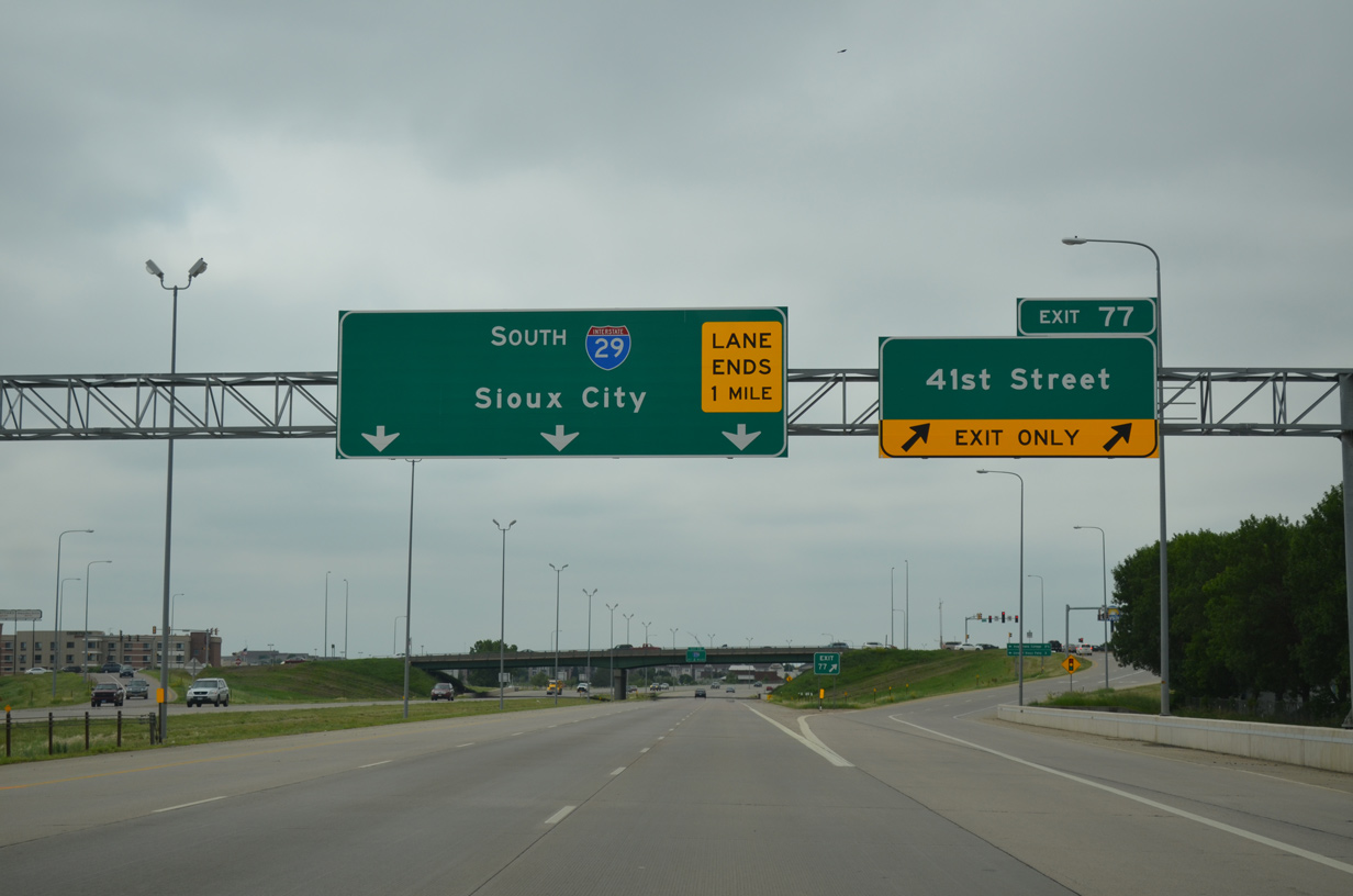
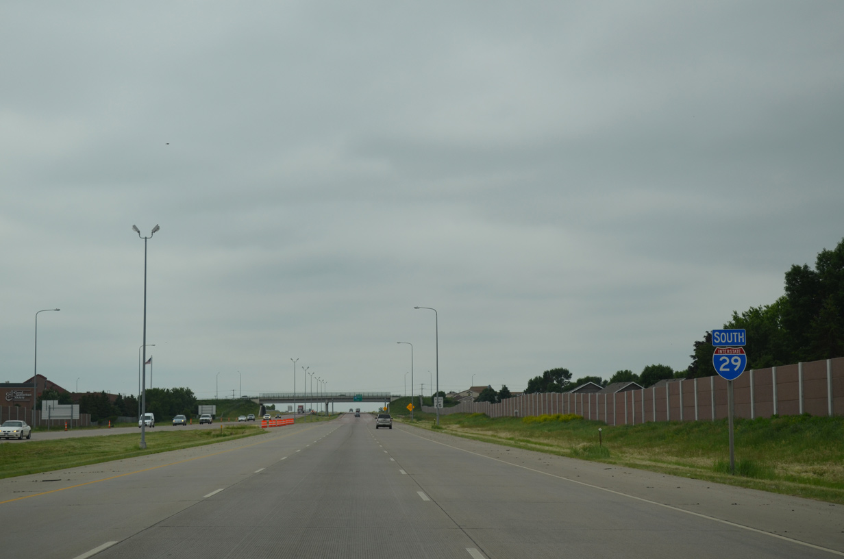
Still within the Sioux Falls city limits, motorists along I-29 south enter Lincoln County. Exit 75 joins the freeway with Interstate 229 north for return access to Downtown Sioux Falls.
06/17/15
I-229 heads northeast along the Big Sioux River toward Downtown, serving the south side of the city at Exits 1 through 4.
This sign bridge was removed by November 2015 during the I-29/229 construction project. Work replaced both bridges for I-29 above I-229 and the concrete road surface while realigning the southbound ramps. 6
06/17/15

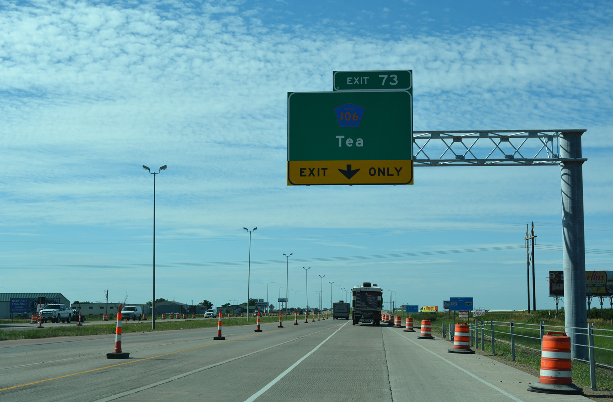
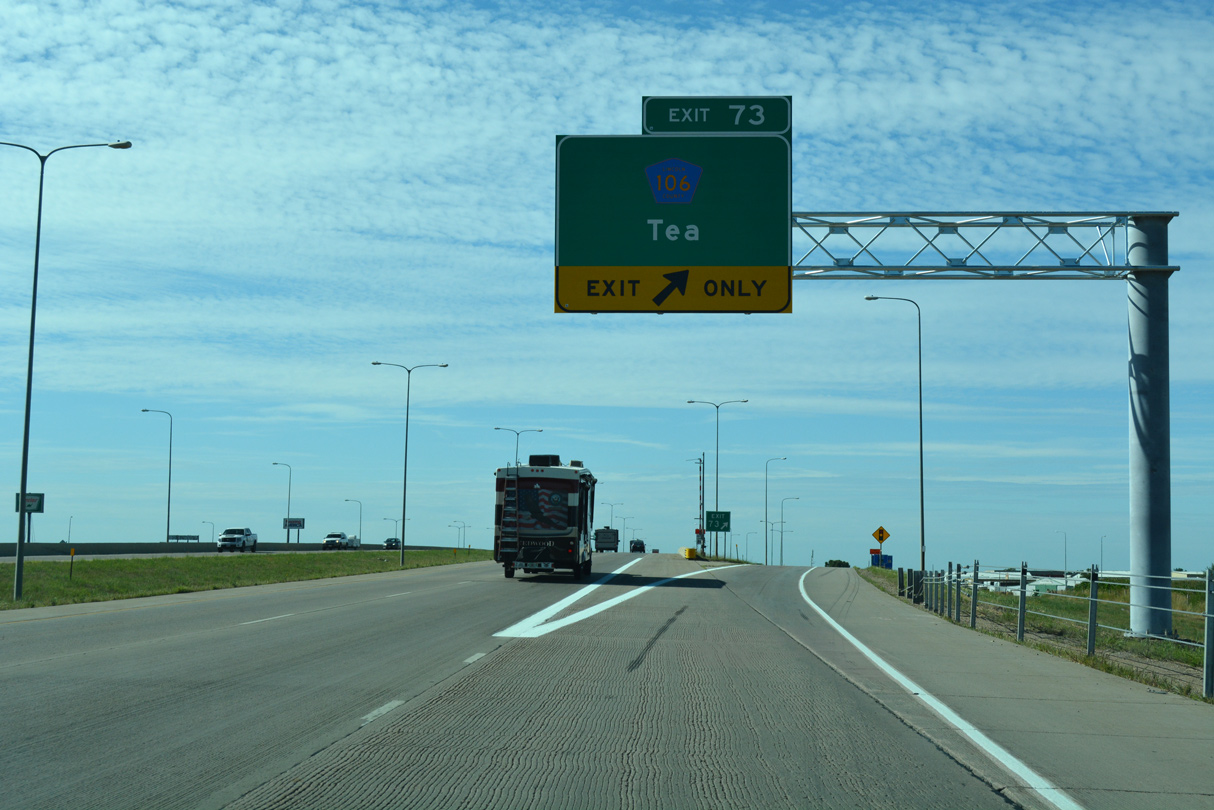
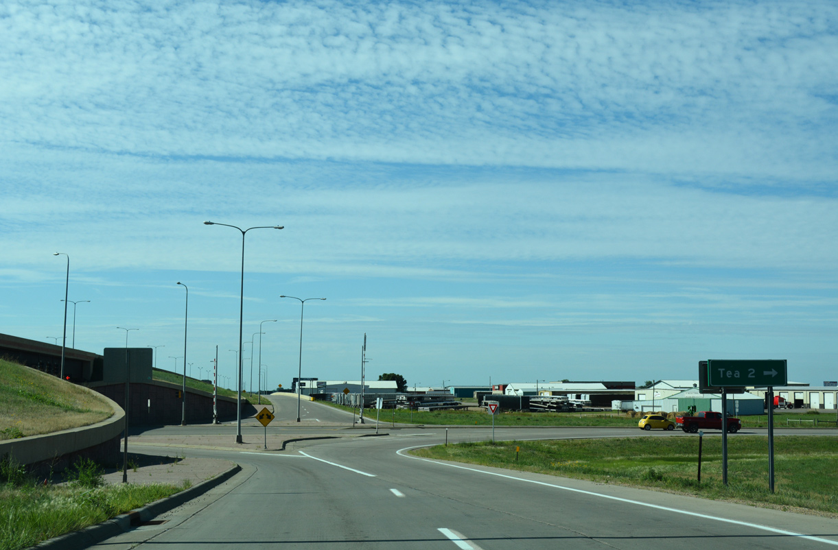
Exit 73 and County Road 106 (271st Street) connects Interstate 29 with the suburban city of Tea, 1.4 miles to the west.
08/06/16
Auxiliary lanes were added along both sides of I-29 between the south end of I-229 and the ramps with 271st Street.
08/06/16
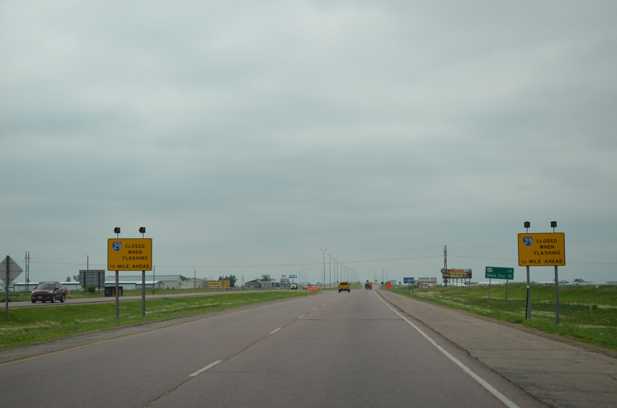
Interstate 29 will close during periods of inclement weather beyond the interchange (Exit 73) for Tea.
06/17/15
County Road 106 (271st Street) stretches across northern Lincoln County west from Tea and between 469th Avenue and CR 135 near Lake Alvin.
08/06/16
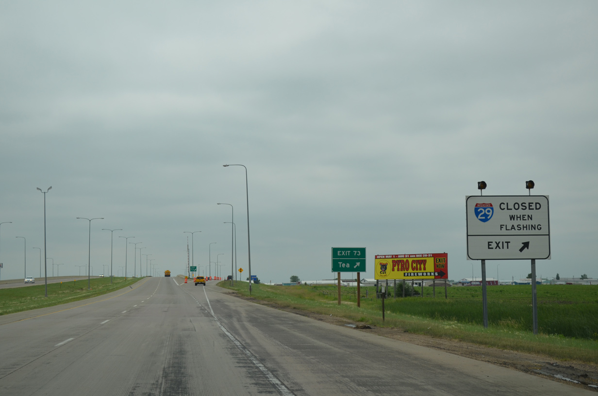
Barricades will force traffic off I-29 south at Exit 73 during snow closures.
06/17/15
The future SD 100 corridor, a 17 mile arterial beltway around the east and south sides of the Sioux Falls metro area, will supersede CR 106 (271st Street) east from I-29 for approximately 0.7 miles.
08/06/16
Work at Exit 73 starting on March 23, 2005 and finished on July 1, 2006 upgraded the diamond interchange into a SPUI. All ramps at the revised exchange were open to traffic on December 6, 2005.3
08/06/16
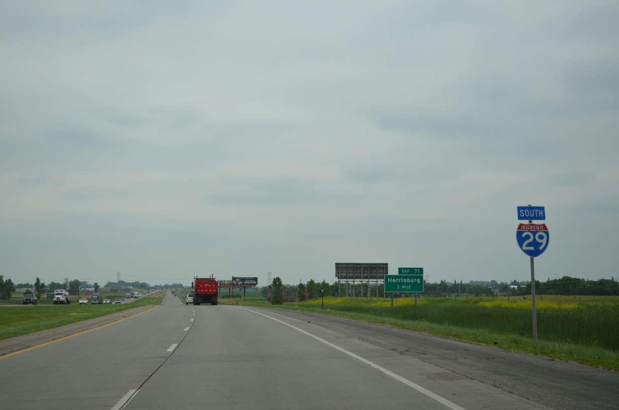
Confirming marker for Interstate 29 south posted one mile ahead of Exit 71.
06/17/15
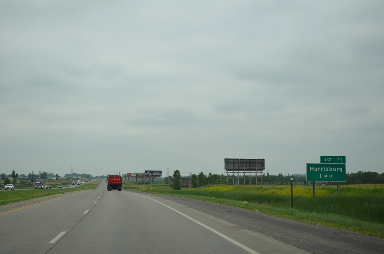
CR 110 (273rd Street) leads east 3.8 miles from Exit 71 to the city of Harrisburg. The fast growing suburb quadrupled in population from 2000 to 2010. Over 5,000 residents call the city home now.
06/17/15
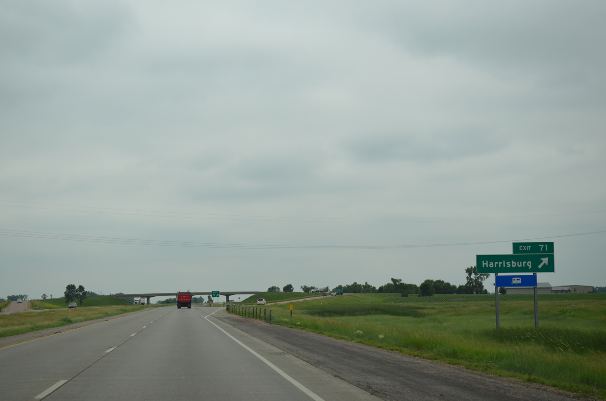
Southbound at the diamond interchange (Exit 71) with County Road 110 on Interstate 29. CR 110 ends 1.5 miles to the west at CR 110 to the south of Tea. The county road east extends beyond Harrisburg to CR 135 near Lake Alvin.
06/17/15
Interstate 29 traverses open agricultural areas through La Valley township over the next six miles.
06/17/15
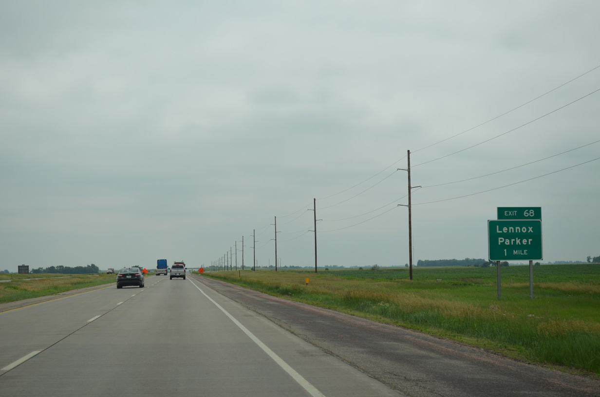
CR A20 in Iowa crosses the Big Sioux River to become CR 115 (276th Street), 13.7 miles to the east of the forthcoming diamond interchange (Exit 68) with I-29.
06/17/15
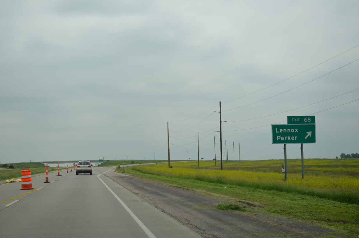
County Road 115 west from Exit 68 provides a cutoff to SD 44 to the Turner County seat of Parker. Connections with SD 17 also lead motorists south to the city of Lennox, located 5.5 miles to the southwest along SD 44.
06/17/15
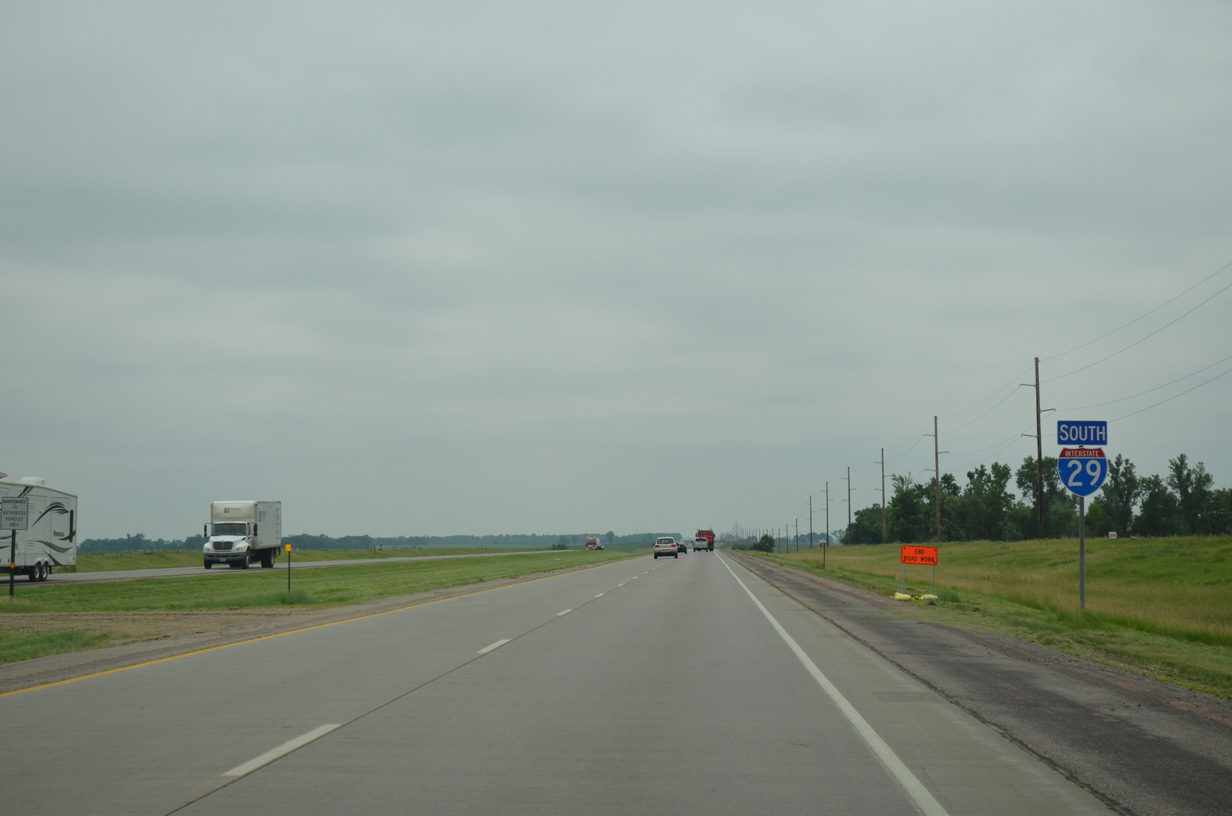
Southbound reassurance shield posted for Interstate 29 ahead of Beaver Creek.
06/17/15
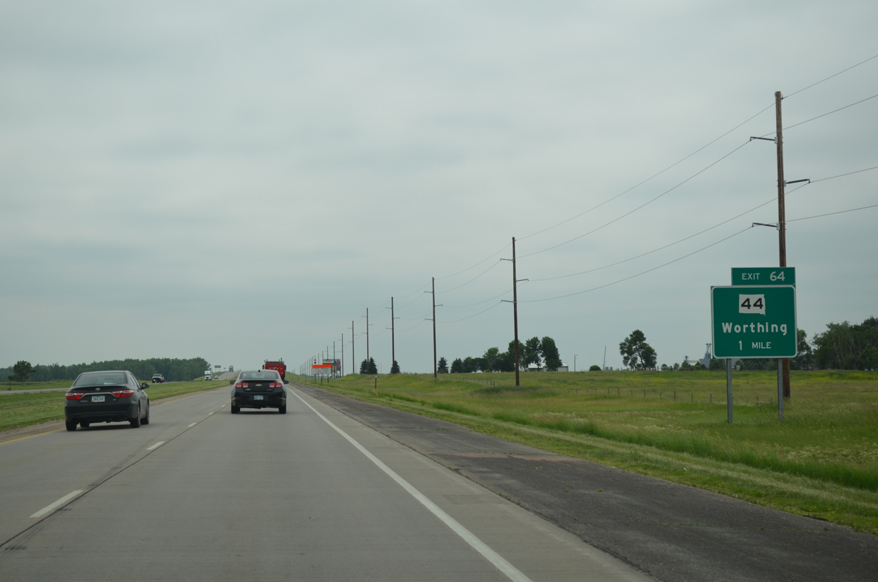
SD 44 forms a cross state route between U.S. 385 in Black Hills National Forest and I-29 at Exit 64. The trunk highway ends opposite County Road 114 (280th Street) and the city of Worthing.
06/17/15
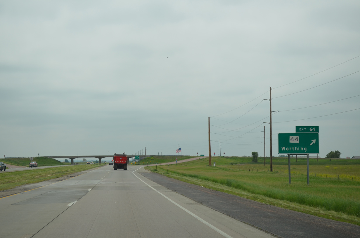
SD 44 travels five miles west from the diamond interchange (Exit 64) with I-29 to Lennox and ten miles to Chancellor. CR 124 ends 3.5 miles to the east at SD 115.
06/17/15
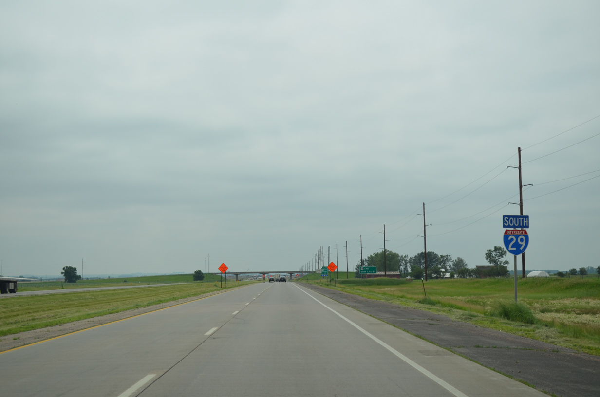
Two miles separate the interchanges of SD 44 and U.S. 18 east on Interstate 29.
06/17/15
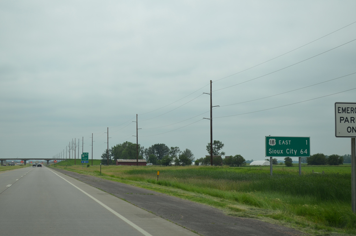
U.S. 18 combines with Interstate 29 south for a three mile overlap at Exit 62. Sioux City lies 60 miles south of the westbound split.
06/17/15
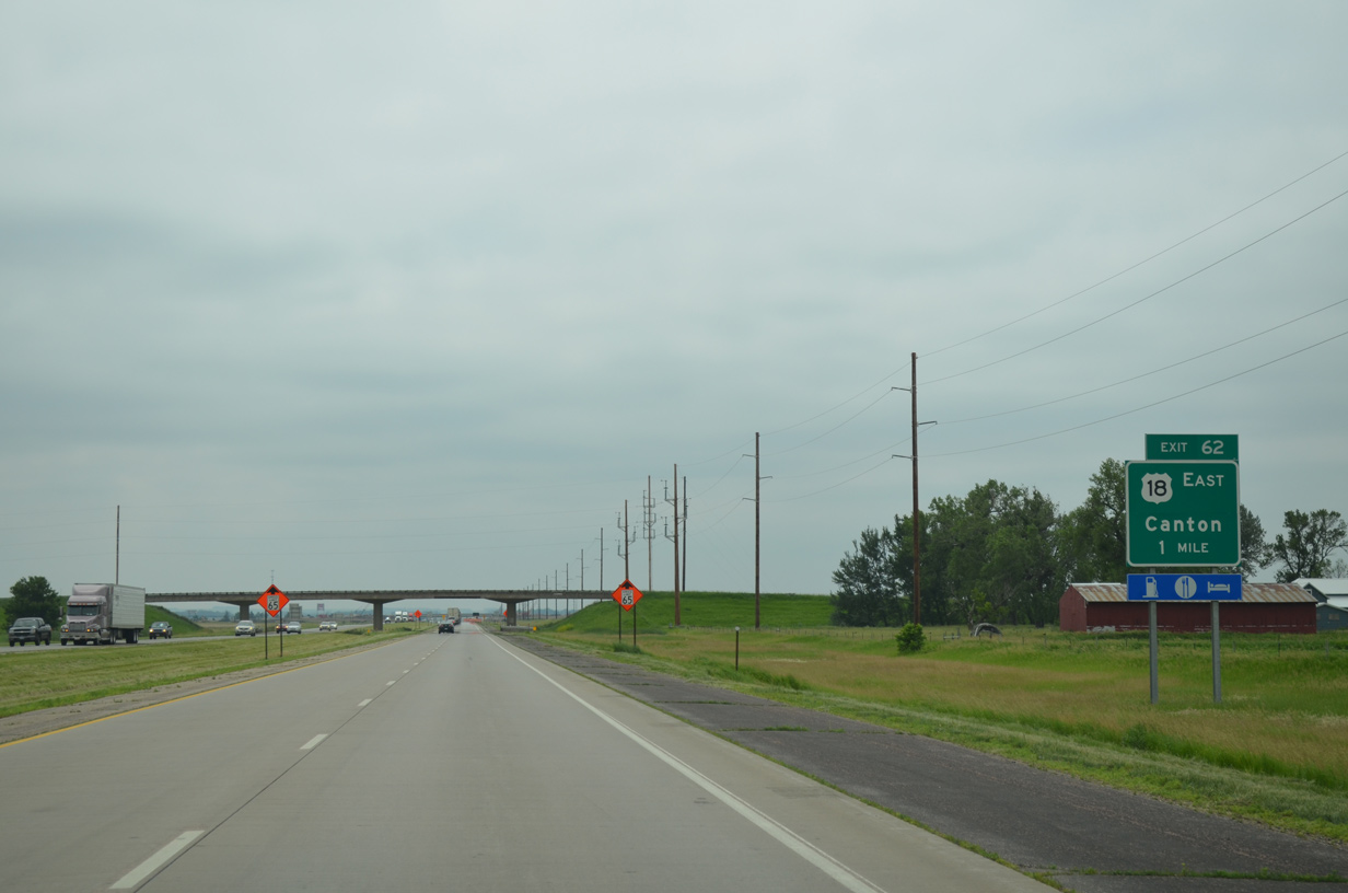
U.S. 18 bee lines 15.5 miles east from a diamond interchange (Exit 62) with I-29 to the city of Canton. The community of over 3,300 resides next to the Big Sioux River.
06/17/15
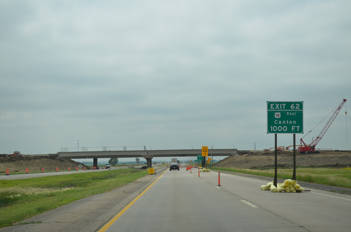
A $7.8 million project completed on June 17, 2016 replaced the box girder bridges carrying U.S. 18 over Interstate 29. The 1958-built spans provided insufficient vertical clearance above the I-29 mainline, resulting in a truck detour for vehicles exceeding 14 feet in height between Exits 59 and 64. Additionally ramps for the 1962-opened interchange were redesigned to improve geometric design standards.4,5
06/17/15
South  West
West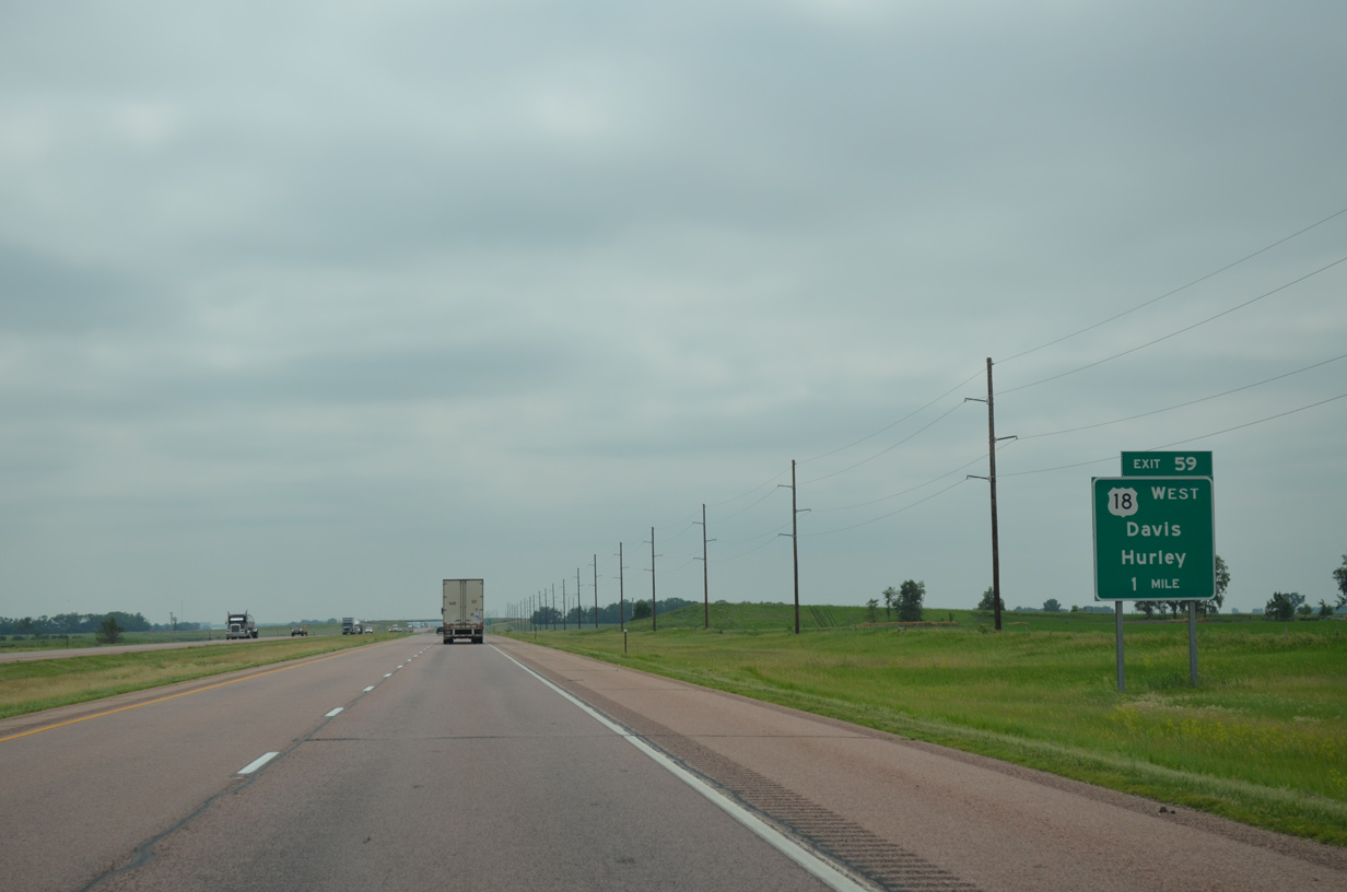
U.S. 18 resumes a westward heading in one mile. The US highway connects I-29 with the town of Davis in 11 miles and the city of Hurley (via SD 19) in 17 miles. U.S. 18 overall stretches 452 miles from Wyoming to Iowa across the state.
06/17/15
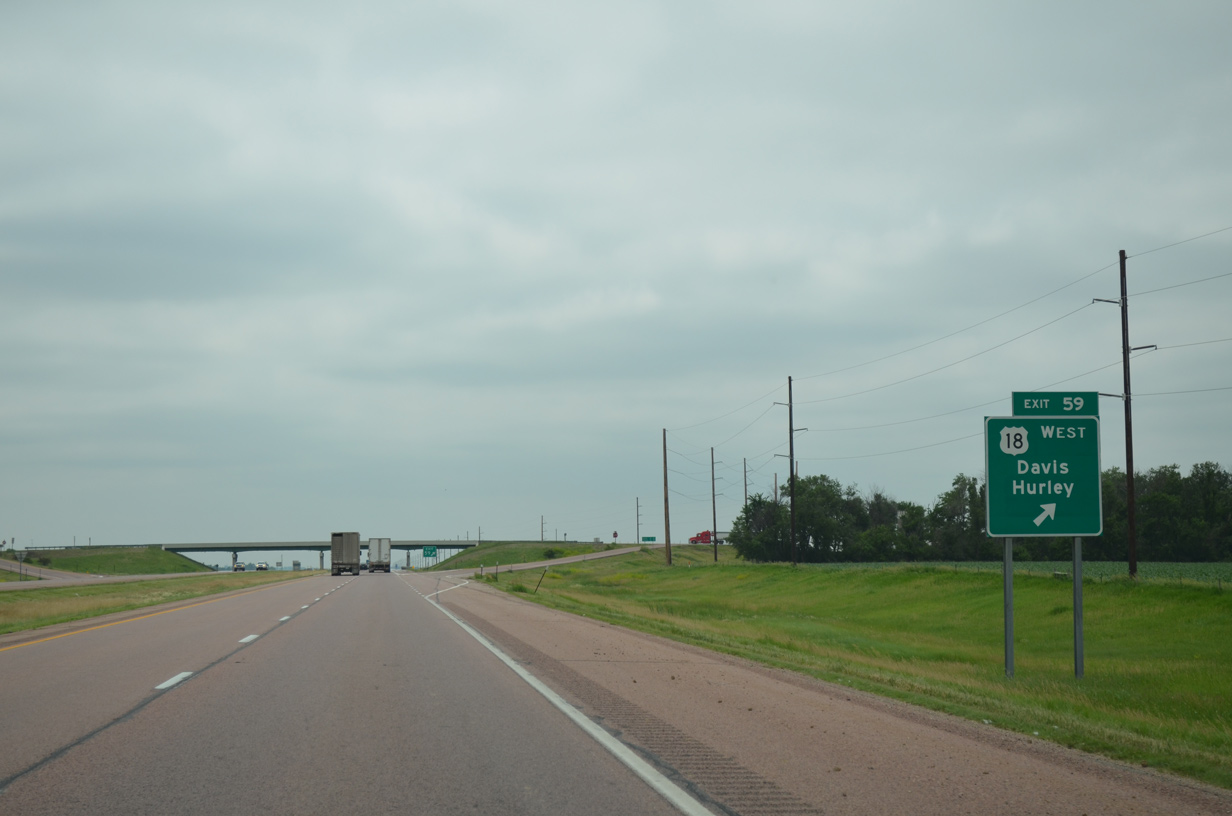
Drivers cross over Snake Creek just ahead of the U.S. 18 westbound off-ramp (Exit 59). Prior to the completion of Interstate 29, U.S. 18 overlapped with U.S. 77 for three miles along what is now County Road 117, 1.5 miles to the east.
06/17/15
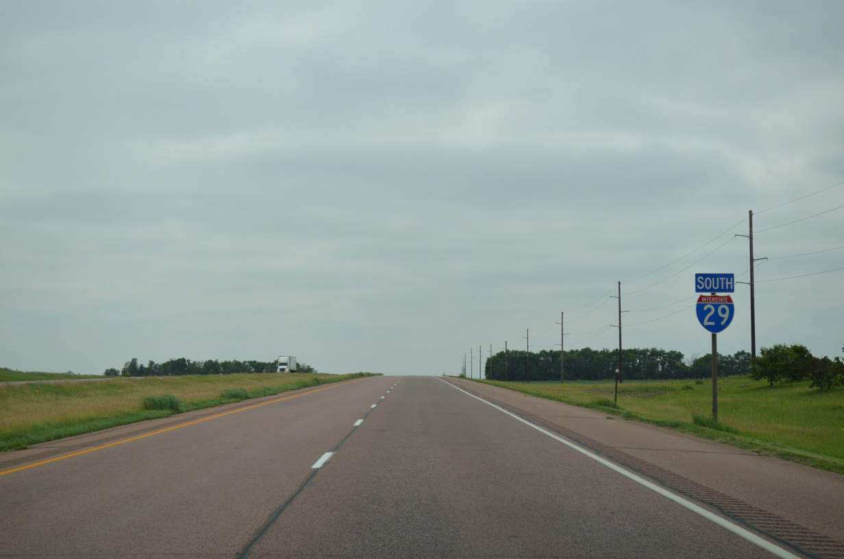
South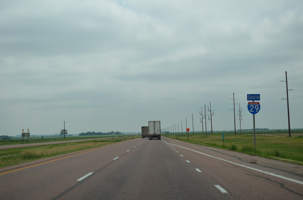
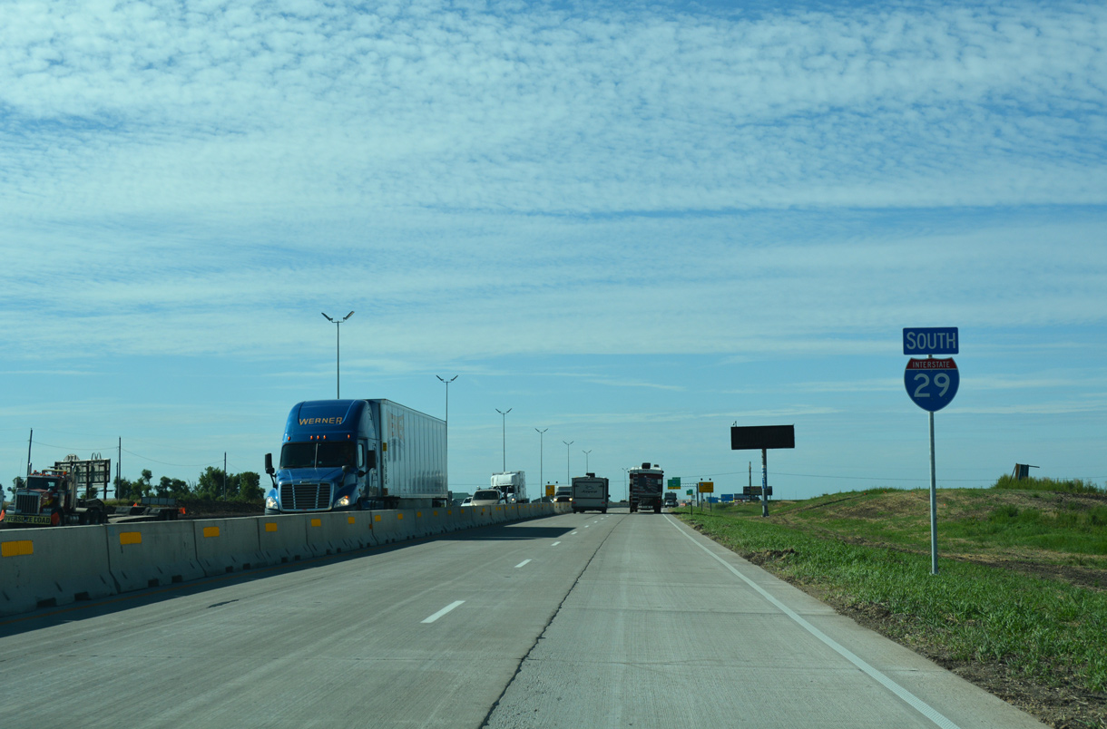
Interstate 29 travels solo again southward through Lincoln township.
06/17/15
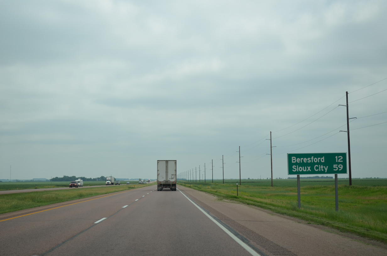
The Lincoln and Union County city of Beresford lies 12 miles ahead via Interstate 29 south. Sioux City, Iowa is 59 miles away.
06/17/15
A rural diamond interchange (Exit 56) joins Interstate 29 with Lincoln County Road 140 in one mile.
06/17/15

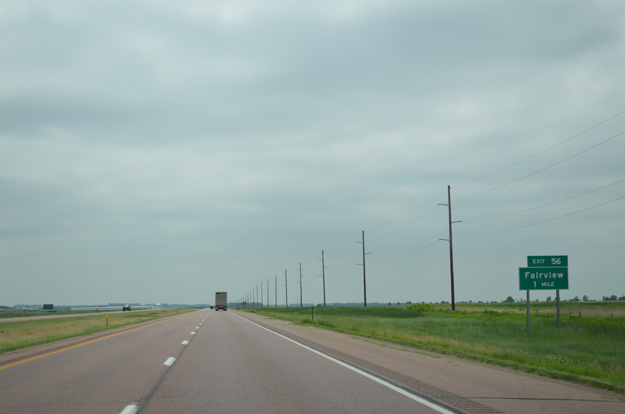
Exit 56 parts ways with I-29 south just beyond Saddle Creek. County Road 140 (288th Street) journeys east across Lincoln County to Newton Hills State Park, Lake Lakota and CR 143 by the small town of Fairview.
06/17/15

Interstate 29 advances south another three miles to the next exit.
06/17/15

291st Street ventures west along the township line 13.6 miles from Interstate 29 to the Turner County city of Viborg.
06/17/15

CR 146 extends east 5.5 miles from the diamond interchange (Exit 53) with Interstate 29 to CR 125 (476th Avenue). Old U.S. 77 (CR 117) remains parallel to I-29, 1.5 miles to the east.
06/17/15
The rural character of Interstate 29 stays the same as motorists progress south through Pleasant township.
06/17/15
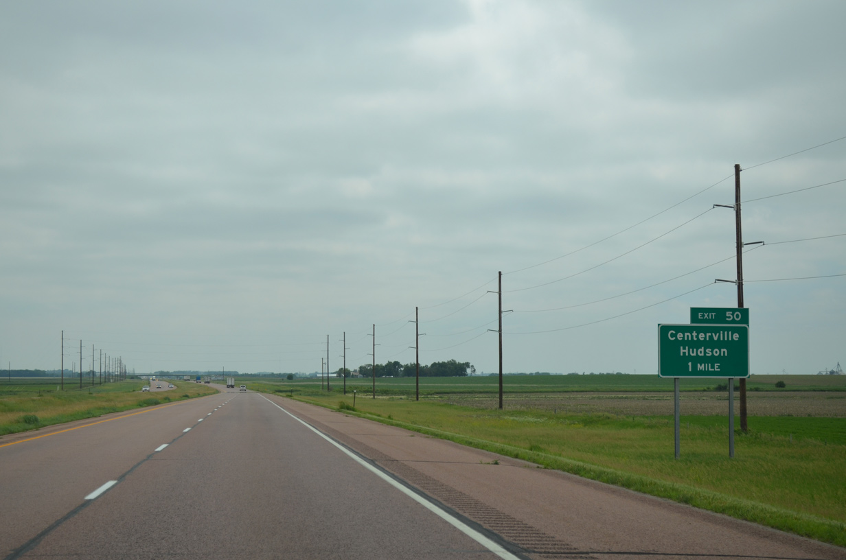
County Road 152 (294th Lane) and Interstate 29 come together at a diamond interchange (Exit 50) in one mile.
06/17/15
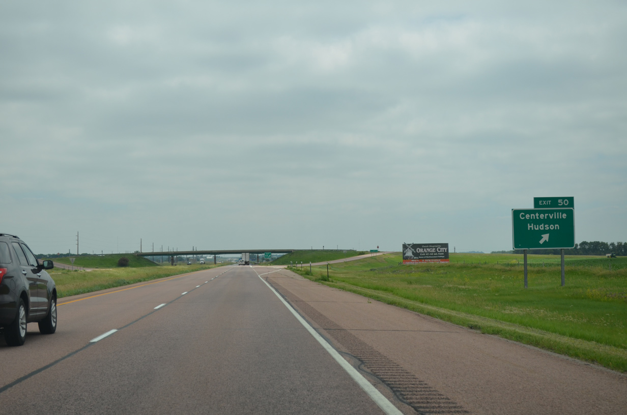
West from Exit 50, CR 152 takes motorists 8.1 miles to the Turner County city of Centerville. CR 152 east reaches Hudson, the easternmost town in South Dakota, in 17 miles.
06/17/15
14,070 vehicles per day (vpd) were recorded along Interstate 29 between Exits 50 and 47 in 2015.
06/17/15
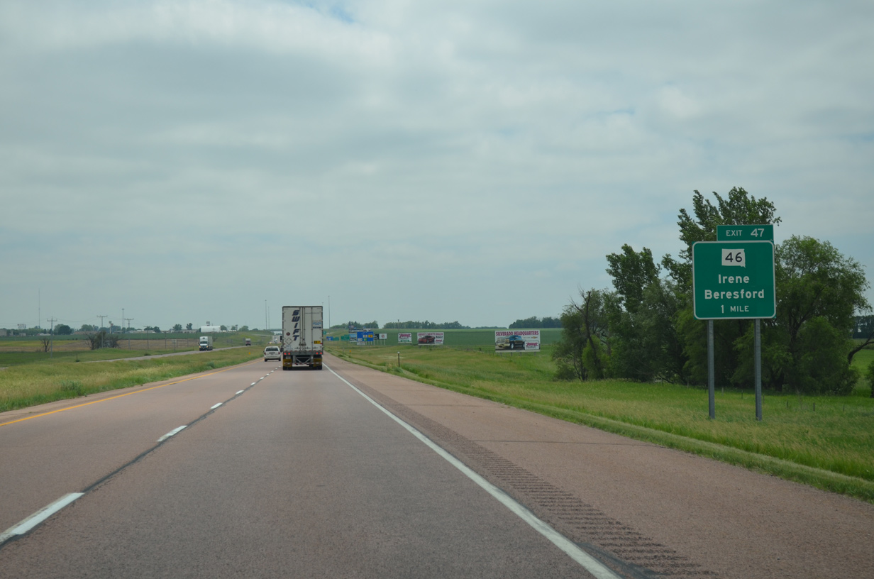
SD 46, a 105.54 mile route between Pickstown and Iowa 10 at the Big Sioux River, converges with Interstate 29 at the city of Beresford in one mile.
06/17/15

The Yankton Sioux Reservation is a 66 mile drive to the west along SD 66. The small city of Irene lines the highway 18 miles from I-29.
06/17/15
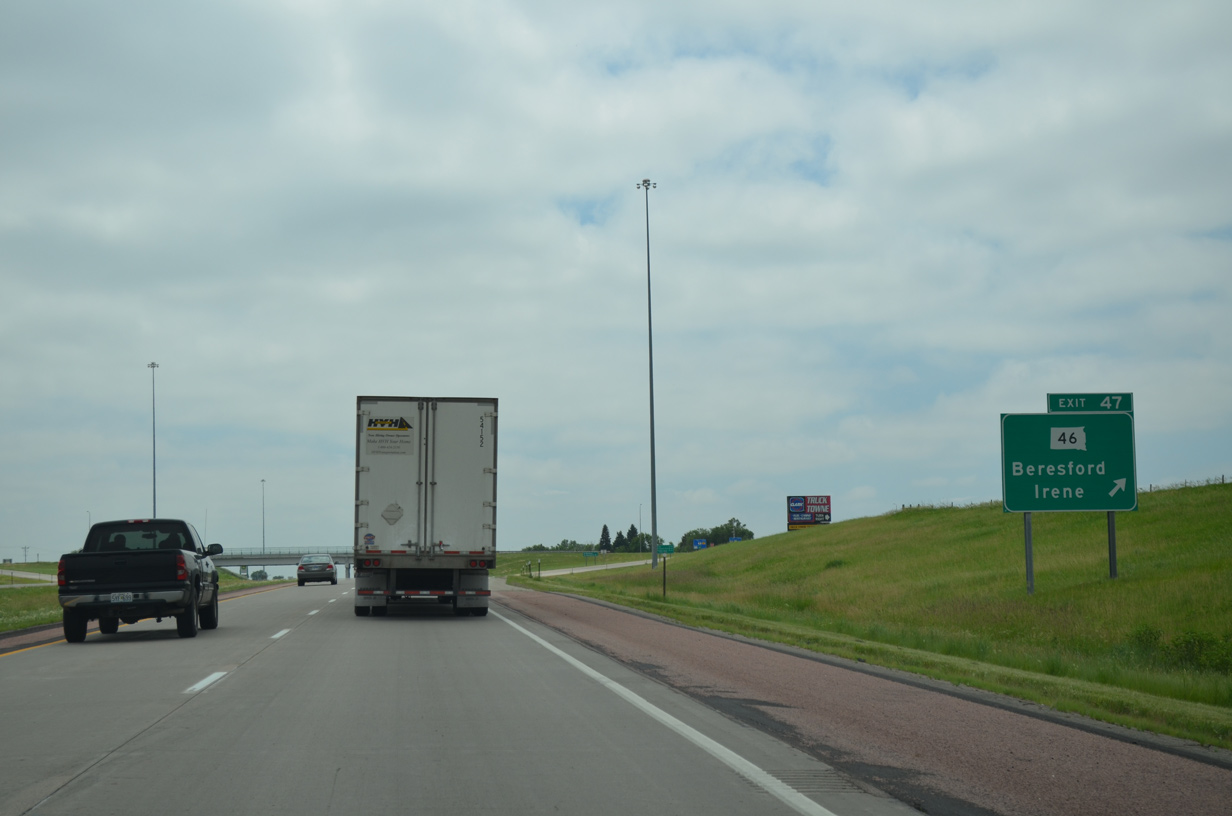
Southbound at the diamond interchange (Exit 47) with SD 46 (297th Street west / Cedar Street) east on I-29. Beresford provides an array of traveler services nearby.
06/17/15
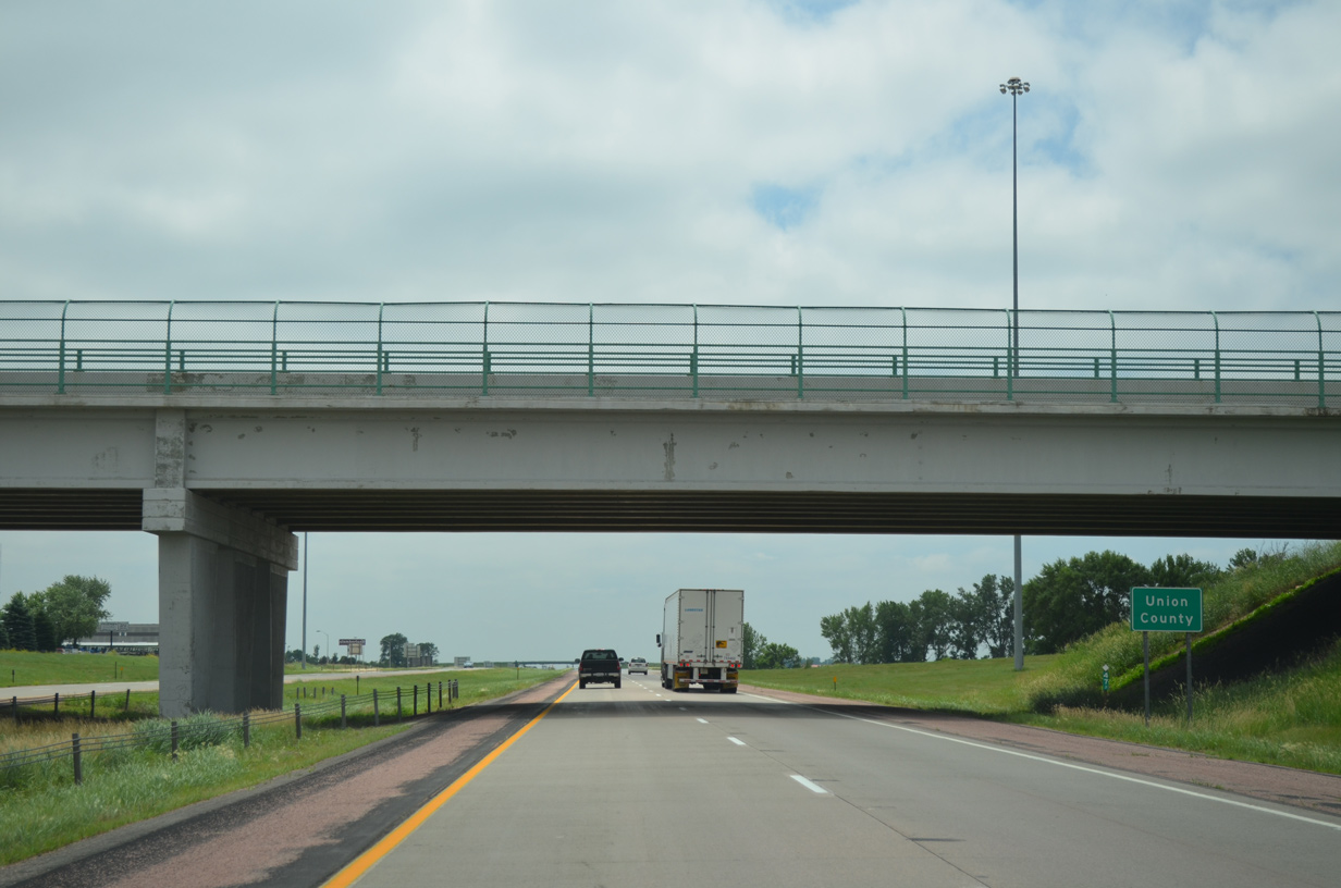
Interstate 29 straddles the west city limits of Beresford to north Union County.
06/17/15
References:
- "Russell Street/I-29 Interchange Slated for Reconstruction." South Dakota DOT, press release. February 22, 2002.
- "'Bridge to nowhere' designed for future growth." Argus Leader (Sioux Falls, SD), January 1, 2016.
- "Tea Interchange Opens To Traffic." South Dakota DOT, press release. December 8, 2005.
- "Interstate 29 and US-18 Interchange Reconstruction Exit 63 In Lincoln County."
http://sddot.com/travelers/projects/I29Canton/035ANewsletter1.pdfSDDOT, construction newsletter. - "Interstate 29 - Exit 62 - Interchange Modification Justification Report."
http://www.sddot.com/transportation/highways/planning/specialstudies/docs/I29-Exit62IMJR-Final.pdfSouth Dakota Department of Transportation, May 10, 2013. - I-29/229 construction project.
http://sddot.com/travelers/projects/I29I229SF/Default.aspx"
Photo Credits:
- ABRoads: 06/17/15, 08/06/16
Connect with:
Page Updated Tuesday February 18, 2020.